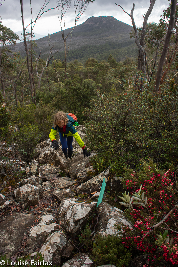
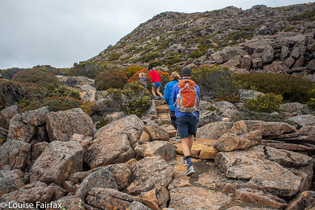
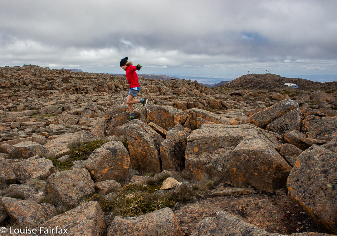
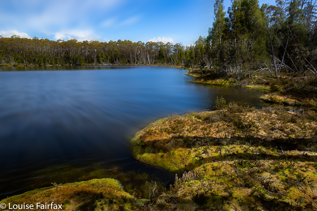
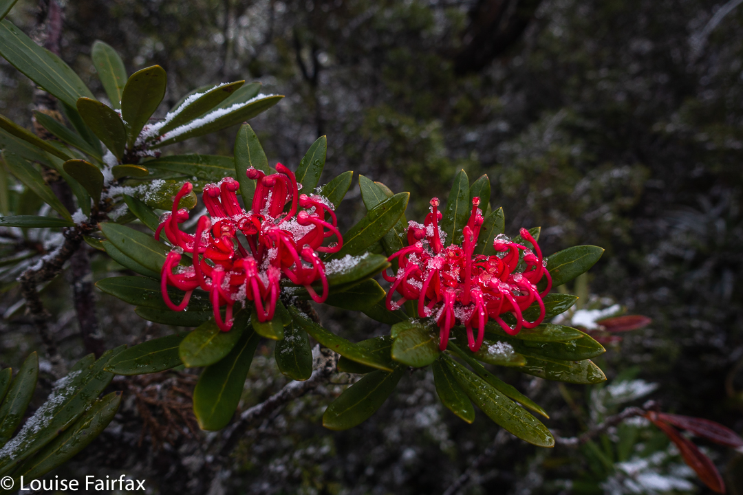
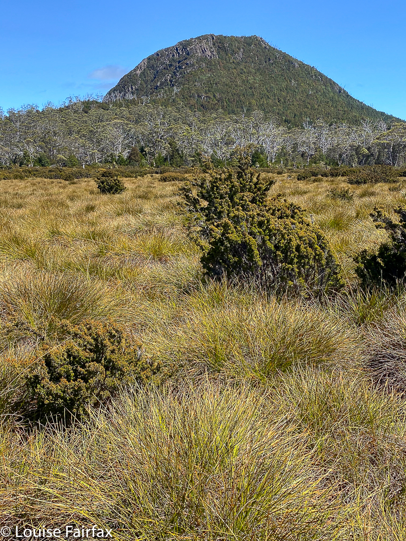
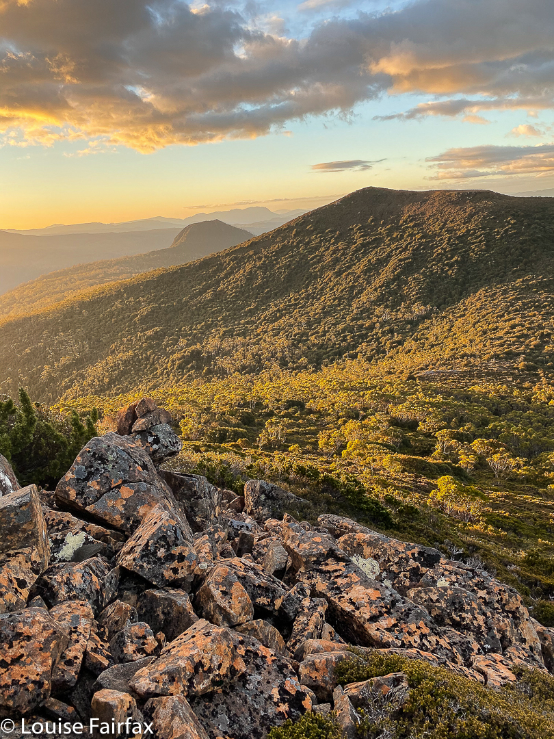
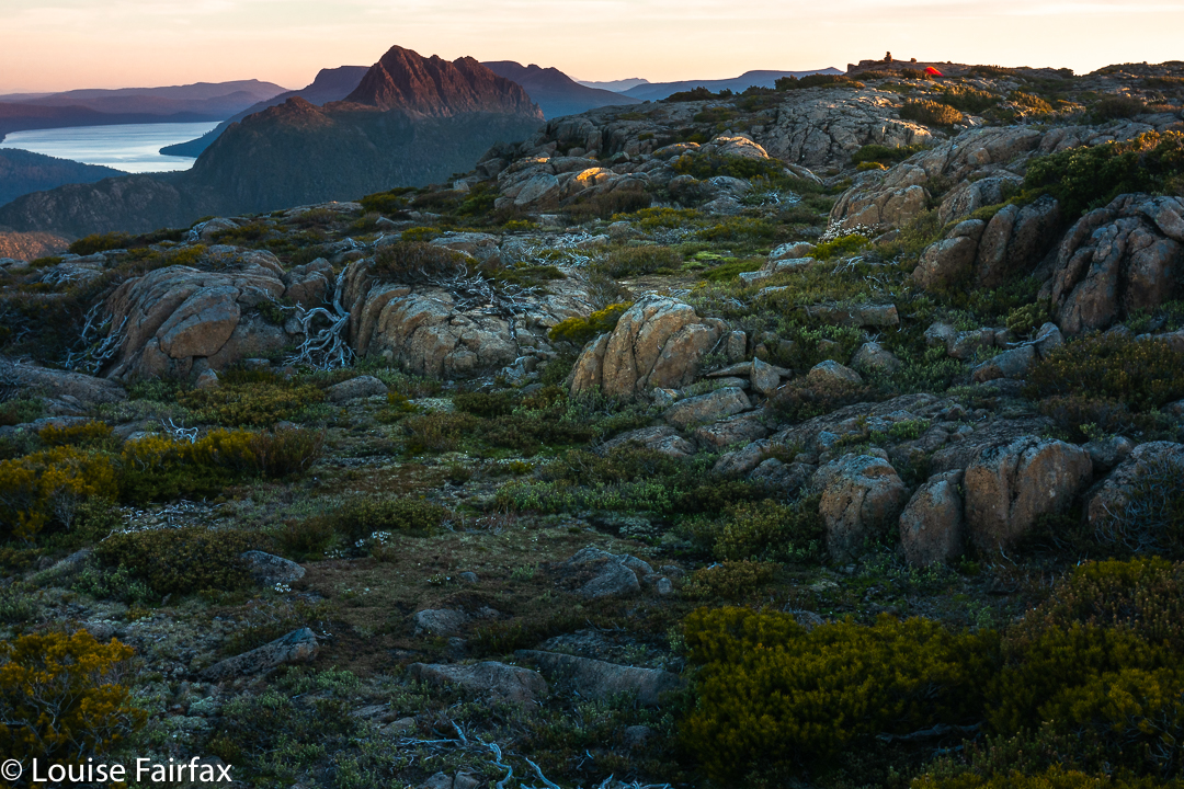
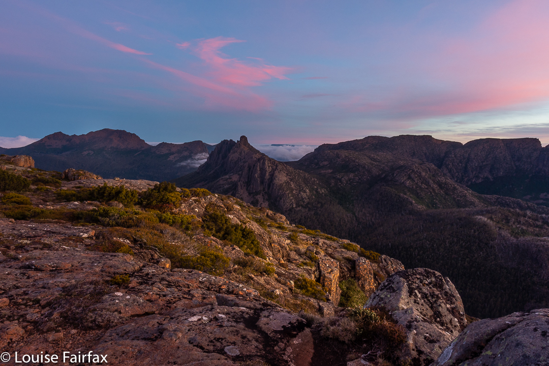
The forecast was horrendous: gales and sleet – not anyone much’s idea of fun. Gussy and I had hoped to climb Mt Mueller with HWC, as then we could get past the locked gate barring cars from a decent entry point, but, perhaps not surprisingly, we were the only two who turned up. The leader bailed out, and so I decided to take young Gus (9) to climb Trestle Mountain instead. We’d approach via the Mountain River track, which I find to be very beautiful: I love the mossy greenness of its path, and the fact that it is more a pad than a highway, which all too many Tassie paths are becoming these days. The forest would protect us from the wind right up until the final saddle, I decided. The light rain cum snow, we’d just take on board as we went.
Climbing Trestle
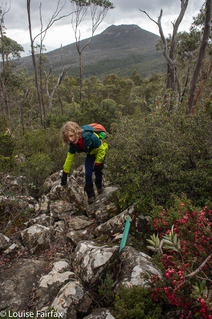
The other thing I like about this path is that it is very, very steep: almost unrelenting, and I just love the act of climbing. Perhaps the steepness is what has saved it from highway status. We would warm up nice and quickly. (The temperatures were not, at this stage, exactly appealing.) Looking up into the thick mist, I told Gus we only had about 20% chance of making the summit, but we’d at least have a workout.
Climbing Trestle
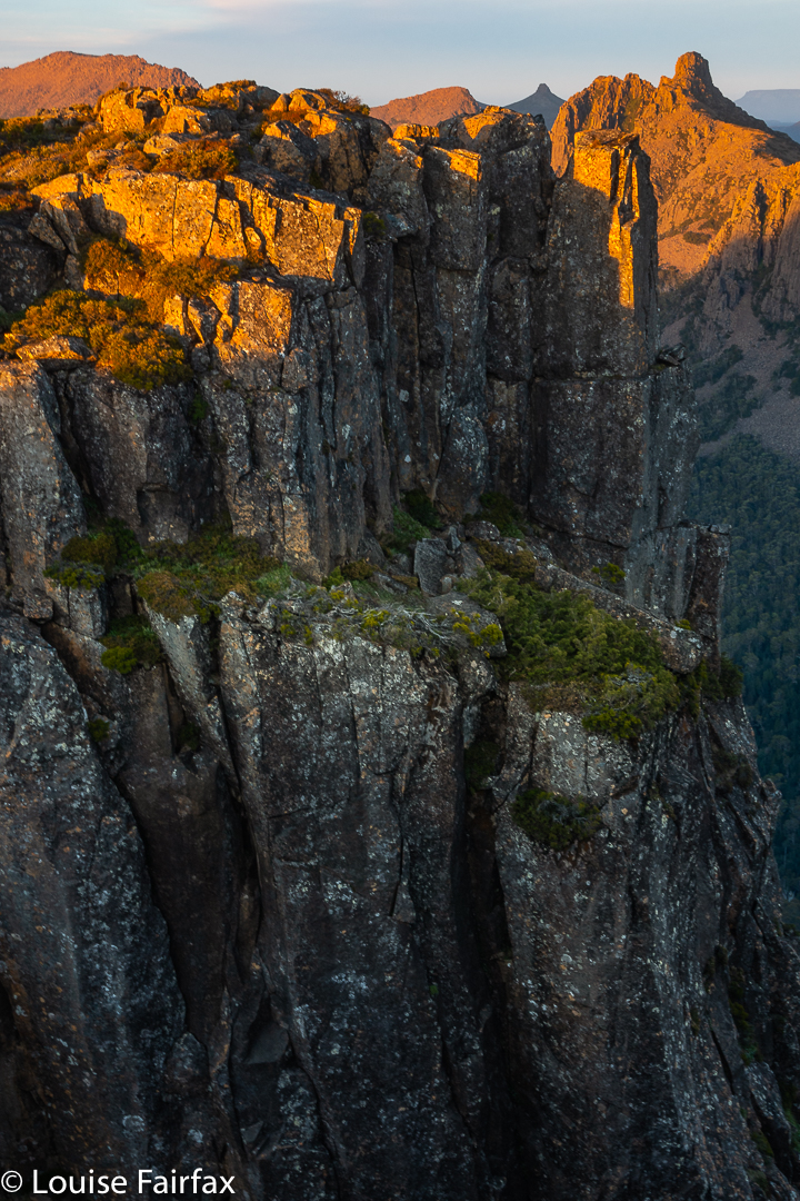
Up we climbed, Gussy doing very well indeed, and the saddle between Trestle and Collins Bonnet getting ever nearer. I had already increased our chances of summiting to 75%, but no higher, even though the summit was very near now, because I feared the blast across its wind-tunnel might be prohibitive, and we were only in this for enjoyment, so if Gussy found it unpleasant, we would immediately about-turn. He was, at this stage, worried about gusts and ice on top, which was another reason for the low percentage so high. I pointed out the rocks ahead that lie under the summit, and said if we made it that far, I’d increase our chances to 90%, but I wasn’t committing to a sure summit before I could see it close by.
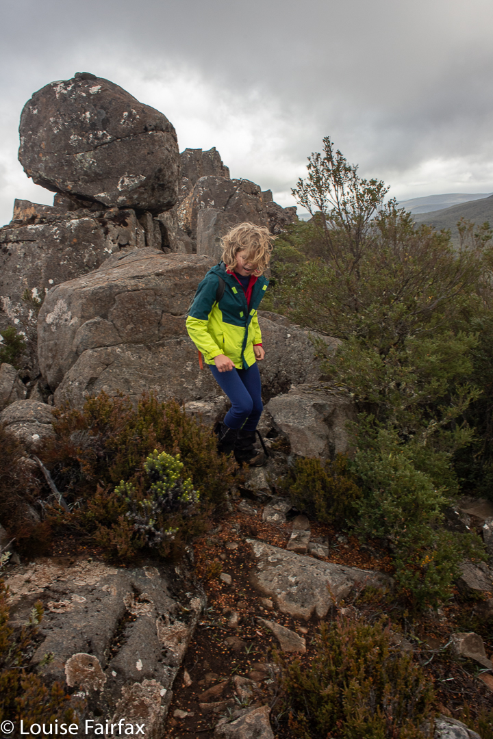
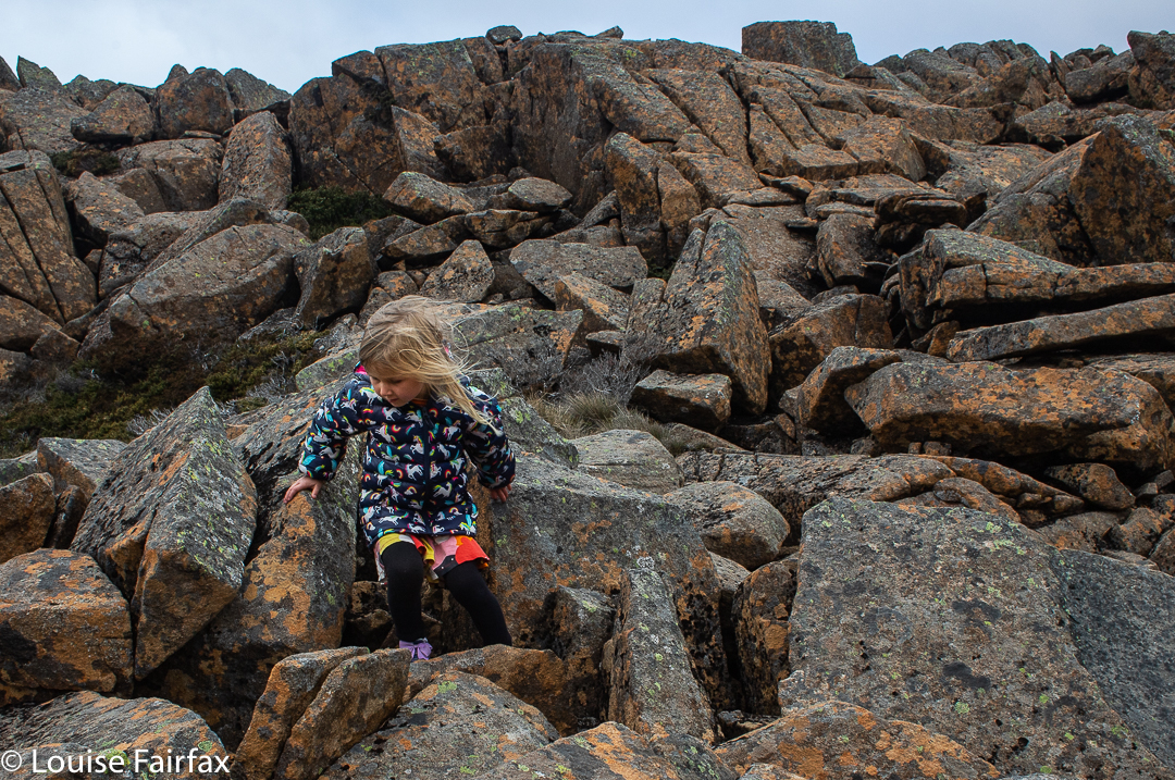
Descending
The day before, I had had a hard knock in the head with a soccer ball, playing goalie for five primary students who were shooting two balls at me (or the goal), and suddenly felt a little wave of slight, yet passing, dizziness. I asked Gus what he would do if I actually fainted. He said he would phone his parents using my phone (and rattled off their numbers), and, if he couldn’t raise them, then he’d call emergency. He thought his parents would deal better with authorities than a grade 4 student. Good answer Gussy. On we went.
Descending
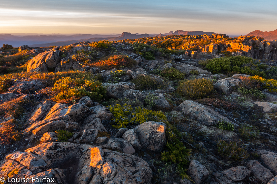
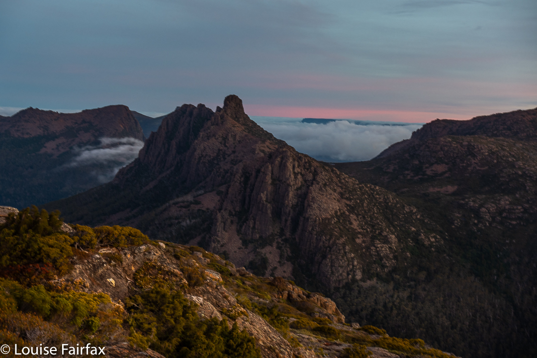
The conditions in the saddle were much milder than we had anticipated, but not pleasant for a rest. On we forged. I was delighted to see tree coverage going up the slope until quite near the summit. I thought we’d definitely get to the 95% point, but may yet be fouled out by gusts and ice on top. Gus liked our odds.
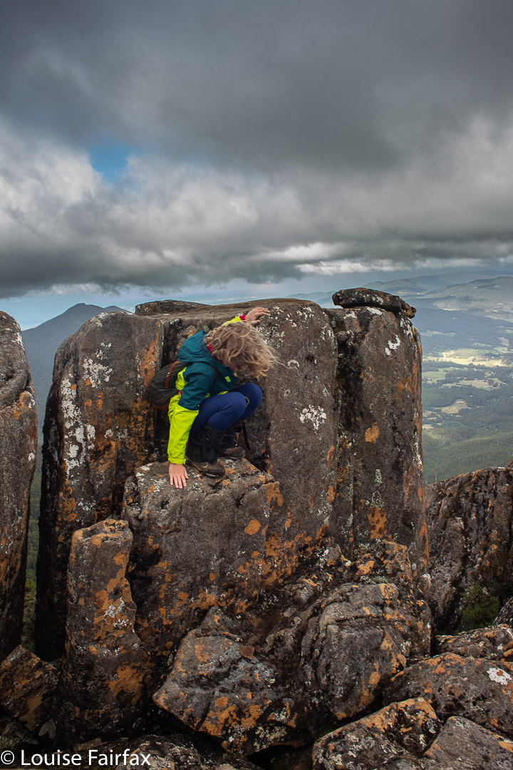
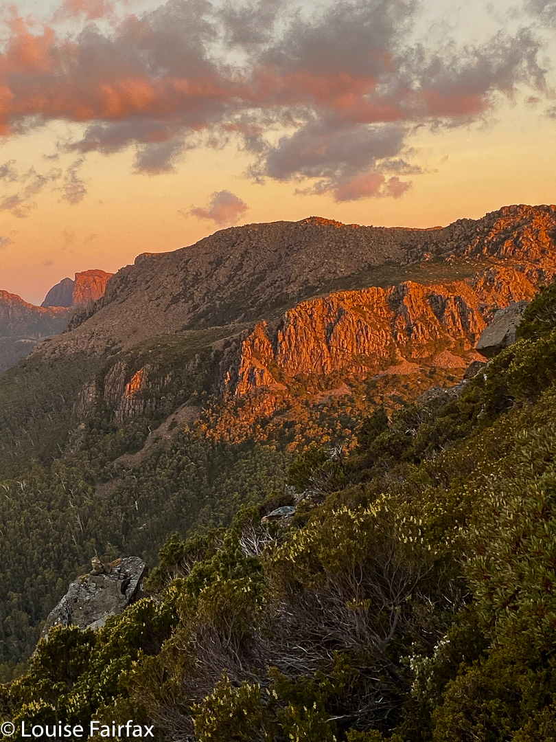
As it was, there was a brief lull in the fighting force of the wind, and we got to the summit, took a brief couple of shots and descended before the fury began again. Gus was not a scrap interested in snacking up there. In fact, he held off having food until we reached the car over two hours later. And there, we refuelled mightily! His mum had packed us a veritable feast, originally planned as a forest or summit one, but now had under more clement conditions down low. It was still lovely there.
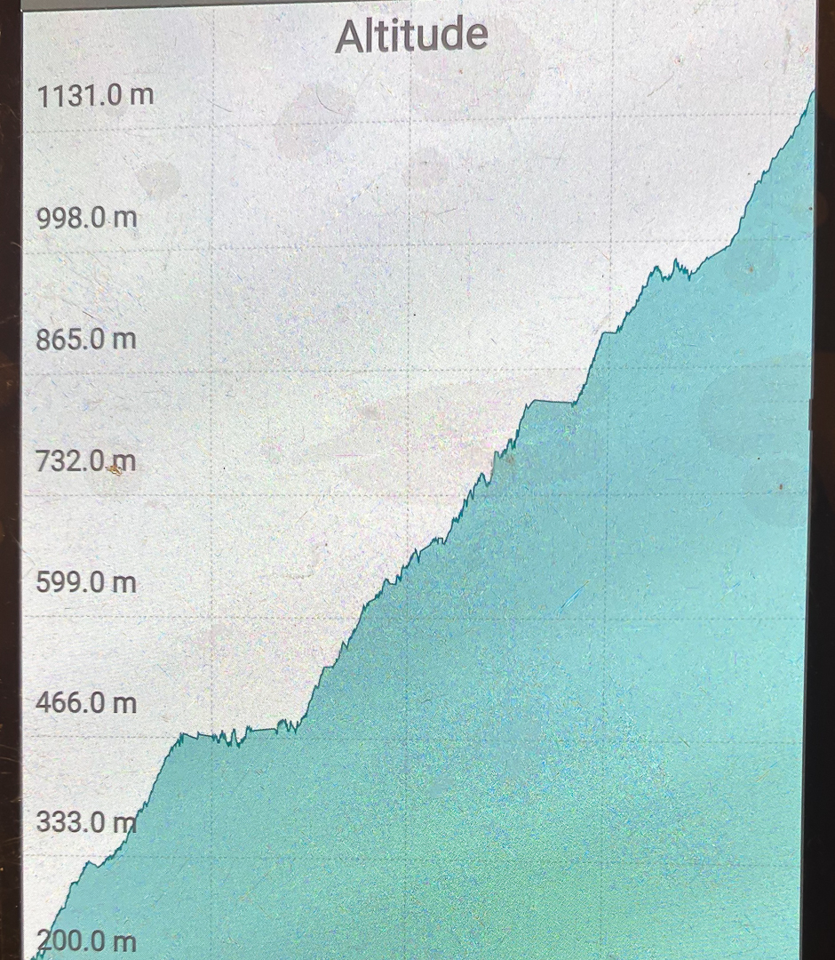
Data; 23.63 km equivalents, comprising 14.02 horizontal kms + 961 ms climb.
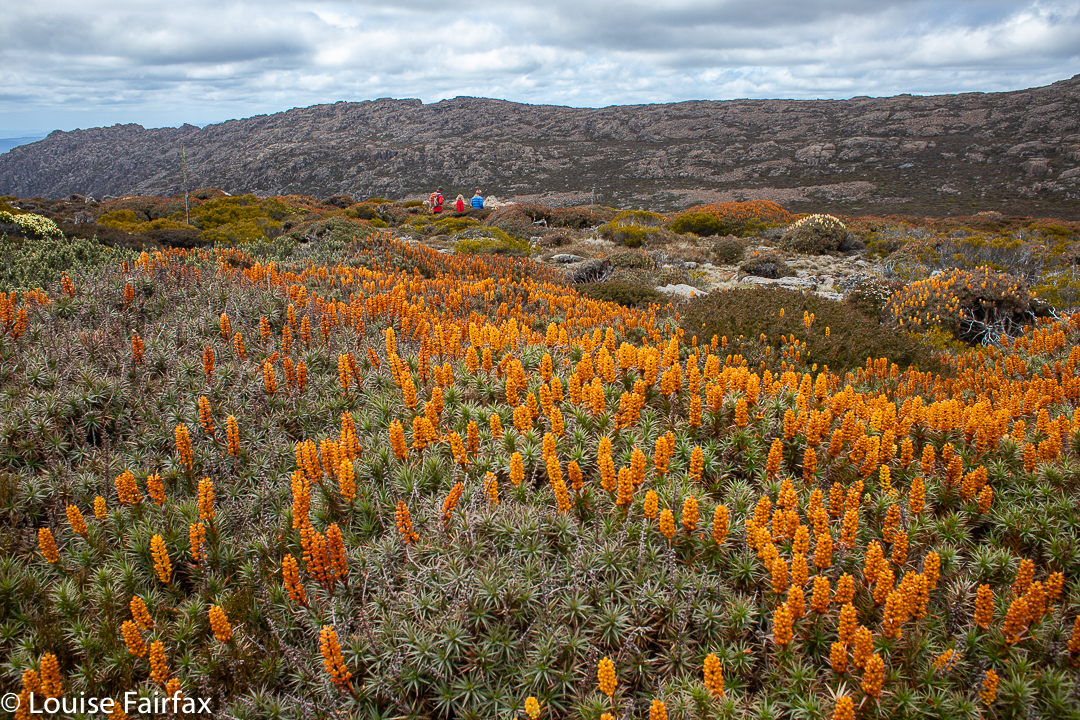
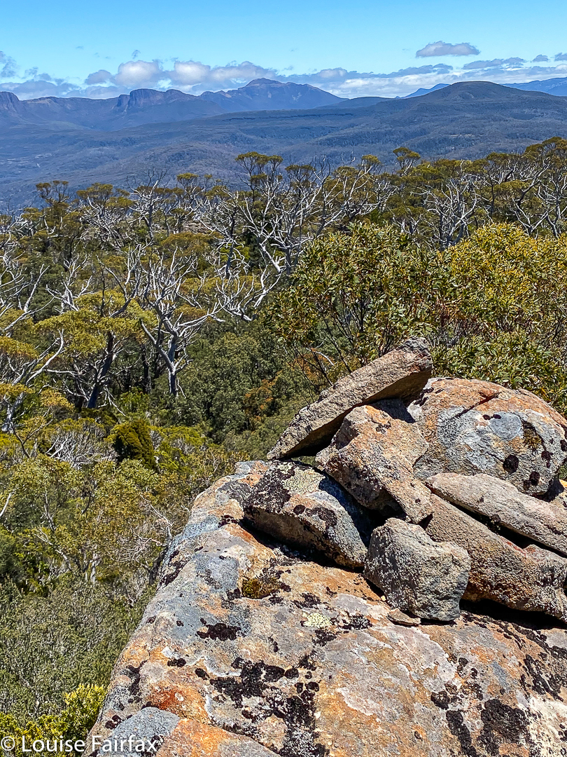
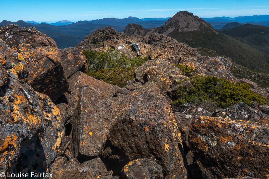
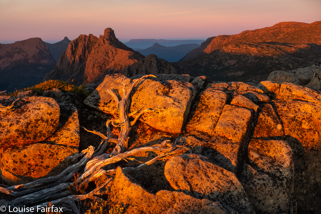
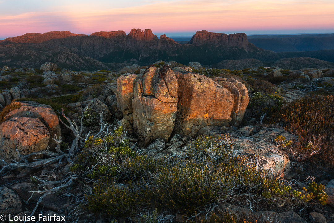
Having been rather effectively grounded by my broken wrist for two weeks now (which means I can’t handle a rucksack or tent), I was starting to get worried about losing long-haul type fitness, so I decided it would be good for me to undertake a long day, and visit Mt Field West, going over the Rodway Range, popping up Naturalist Peak whilst I was in the vicinity, and returning via the Newdegate Pass near the Watcher, and dropping down to Tarn Shelf to complete that circuit as well as doing the Big Fella. It looked nice and long on the map, but I didn’t know how long until my gps told me at the end. Using the rule that adds a km for every hundred vertical metres climbed, the route ended up being 32 km equivalents.
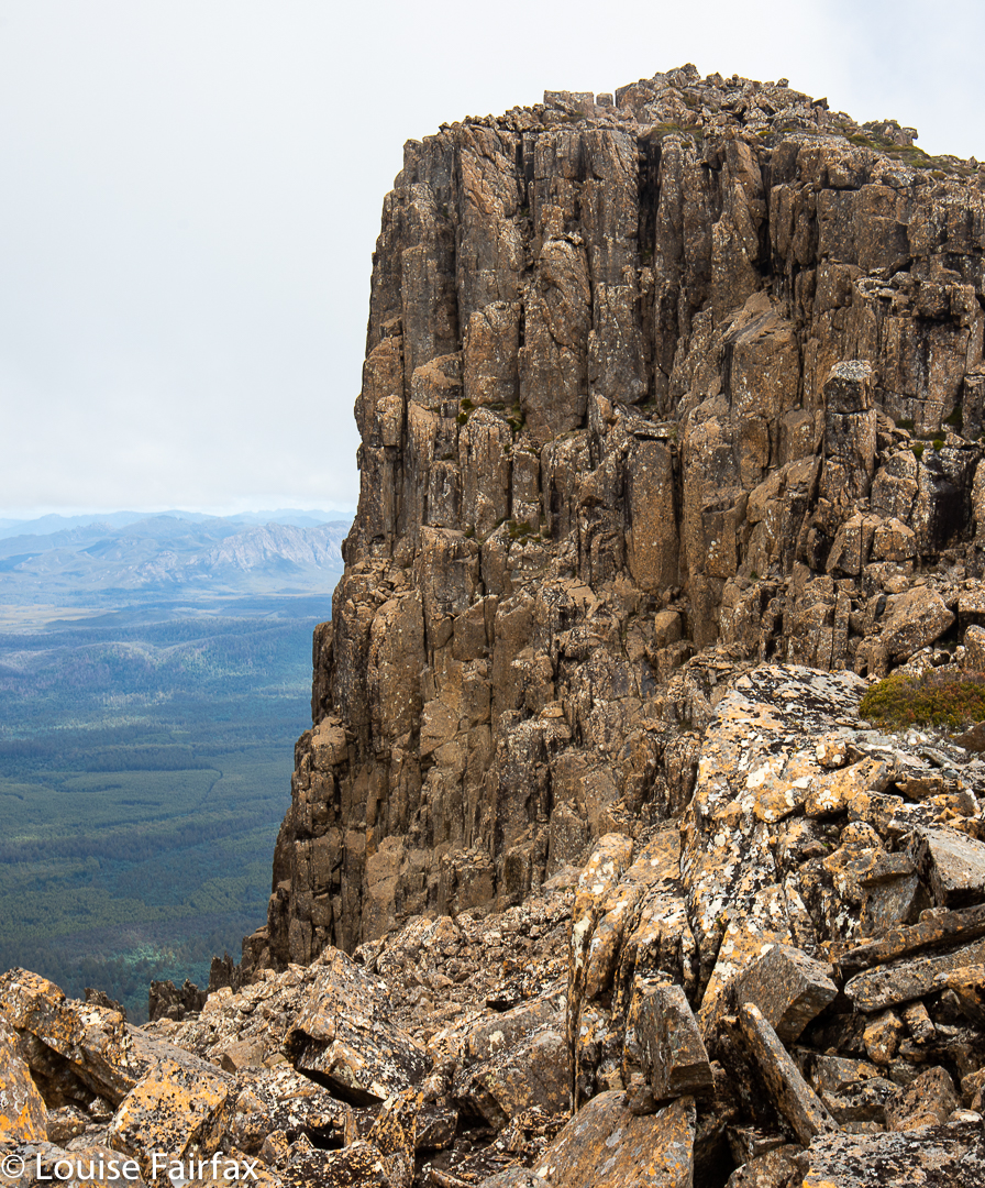
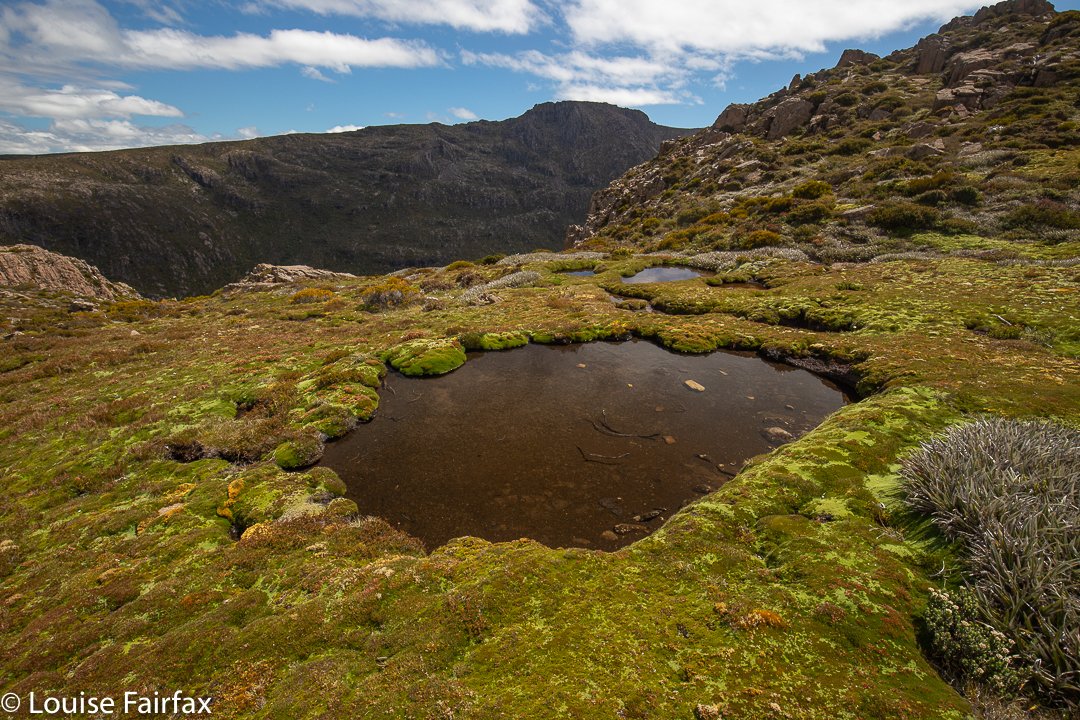
Looking to The Watcher from K-col
My dog was excessively jealous as she watched my preparations for leaving, so I had to begin the day by taking her for a walk (not counted in the overall tally, obviously). It isn’t fair to lock her up all day while I have fun without her. This meant that the carpark was nearly full when I arrived at Lake Dobson. Oh dear. “Everybody else” was already up enjoying the mist and clouds that were swirling around the lake, and I was only just setting out. I hoped there’d be some mist left up high for me if I hurried.
Clemes Tarn
As I trod the path beside the lake, I couldn’t help but greet the plants by name as I passed, happy that these friends were on close enough terms with me that they did have names and were not at the “Hey you bush” level. Many years ago I read a brilliant book by Anna Pavord, The Naming of Names, in which she points out that if you don’t know the names, you can’t differentiate, and you are just looking at bush or forest, an amorphous green mass, but once you know the names, individuality and the fascinating differences of each genus and its species become evident, a whole new world is opened to you. And naming, she argues, helps us feel less adrift in a world that can otherwise be hard to interpret or understand.
Hoorah. I wasn’t too late to catch some mist
Ursula le Guin is a writer who looks at this in an interpersonal level: once we know someone’s name, we have a certain power over them (and vice versa). She depicts the power of naming in a wonderful fantasy: The Wizard of Earthsea. Teachers try to learn the names of their students as quickly as possible, partly for this reason. Farmers don’t name the animals they intend to eat, as eating “Harriet” or “Daisy” is all but impossible. Naming connects the namer to the named. Maybe fewer deaths in war would take place if the enemy were personalised with names. The Nazis depersonalised the Jews by giving them numbers rather than using their names; it’s easier to gas a number.
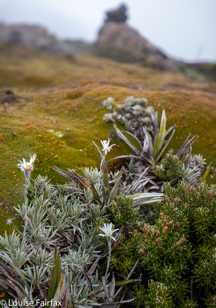
Celmisia saxifraga near Mt Field West
I once rescued plants from death by being able to name them. I heard a machine bulldozing every plant in our beautiful laneway. I grabbed my baby and ran with her on my hip down the road to plant us in front of the destructive machine. They told me they were just bulldozing weeds. I said: “They’re native plants that we in this lane treasure; that’s Hardenbergia violacea; that, a Hibbertia stricta”, and on I went. “God”, they said, “she knows the names of the weeds”; eventually they agreed to negotiate with me and the residents who cared enough about the plants to know what they were. It was fortunate that they didn’t kill us, really; that baby has grown into a beautiful person who studied botany at university amongst other subjects and who adores plants of all kinds.
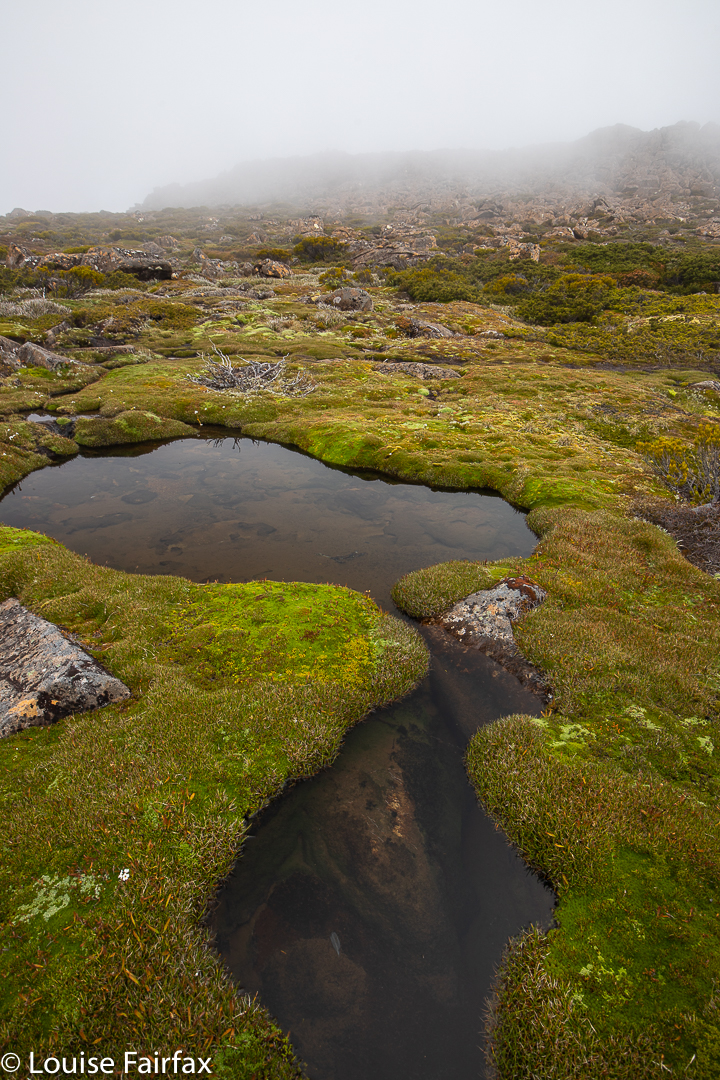
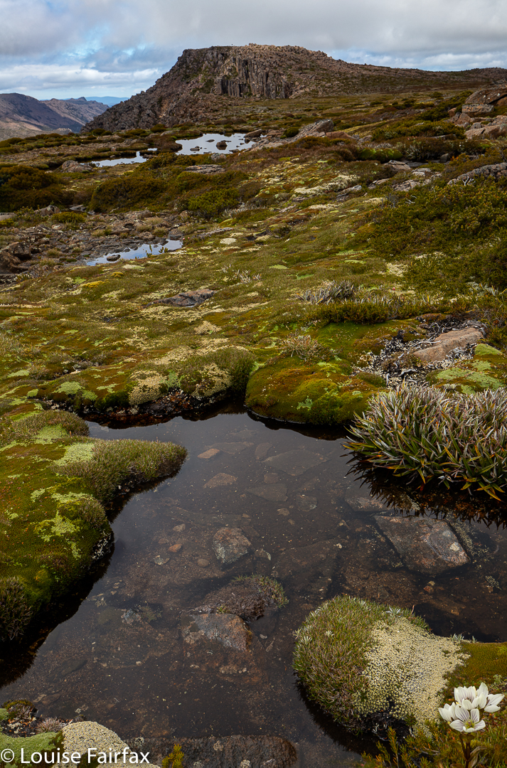
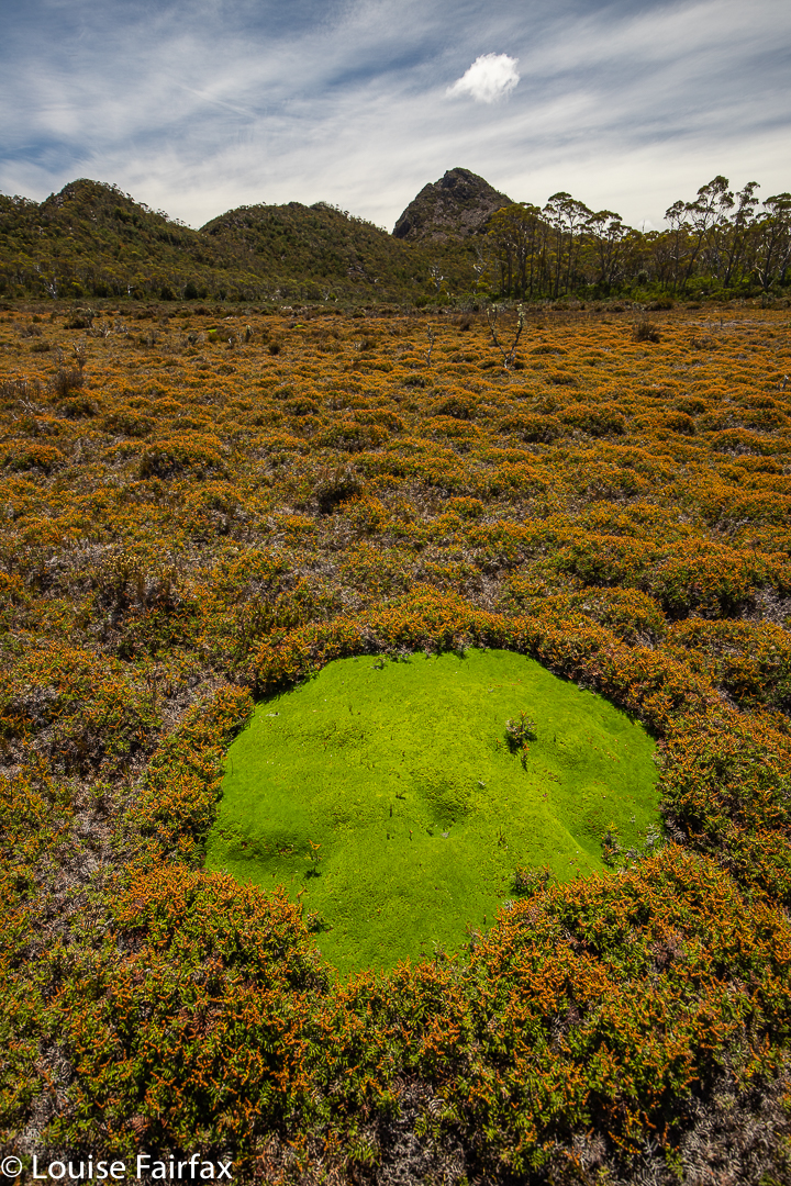
Cushionplants and tarns; Mt Field West
And so, thinking of Anna Pavord, Ursula le Guin and others who care about naming things (Theophrastus, 300BC, is another such, who intuited that the chaotic world of plants had an order to it, not just of function but also of structure, if only he could crack the code. He went a long way to developing the system of classification that Linnaeus eventually adopted two thousand years later), I worked my way up the hill, completing that relatively uninteresting section (I am not a fan of roads) in a much shorter time than when I have a full rucksack. Today I only had 5 kgs – enough to give me a little work, but not overburden me as I nurse this arm.
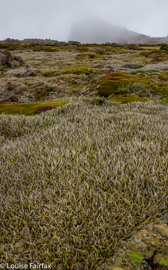
Astelia alpina Pineapple grass in abundance
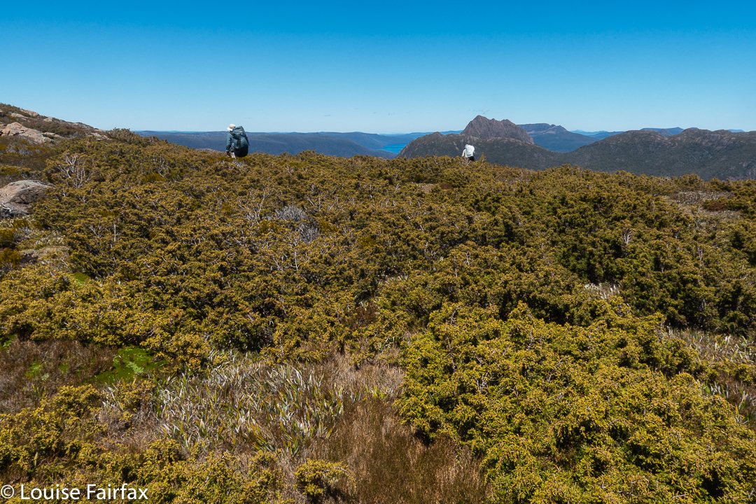
At last I was on the Tarn shelf track, smaller stuff, which one enjoys for about a quarter of an hour before peeling off and heading upwards to cross the rocky Rodway Range. That would test this one-handed, single-armed animal. I was clumsy and hesitant, but got there. The way down the other side to K-col was similar. I felt like a wooden toy. This trip was supposed to give me back a little confidence but, so far, it wasn’t happening.
Mt Field West
Two hours after starting I was having my first break, a drink by Clemes tarn and a bite to eat. Another hour and I was on the summit of Mt Field West, which interested me far less than the beautiful basin just below full of alpine plants, so I chose to have lunch down there rather than on high with its smudgy views in midday glare. Now that my main mission was accomplished, I could relax and enjoy the alpine plants for a while. This area is magic.
Gentianella diemensis Naturalist Peak
I did have a time limit, as I had agreed to have dinner with the ex-baby referred to above, and to babysit her children in Hobart, so I couldn’t do what I wanted to, and just stay up there, lingering until sunset. I did, however, have time to go home the long way.
Naturalist Peak from The Watcher
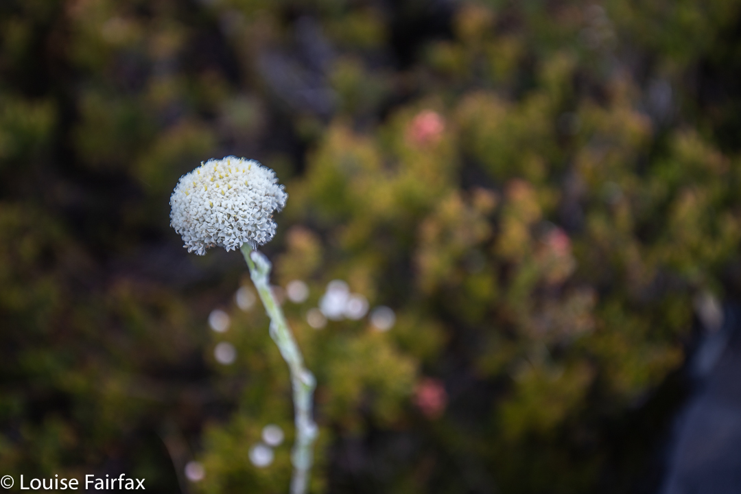
By the time I was back in the vicinity of K-col, and quite eager to photograph flowers, the wind was strong enough to have all of them waving merrily in the breeze, and the glare was enormous. Hardly conducive to good photography, so on I pressed, rather disappointed, especially at all the exemplars of Craspedia alpina = C. macrocephalia that nodded their greeting as I came by, but which were far too mobile for me to be bothered with – and far too white at this hour, as well.
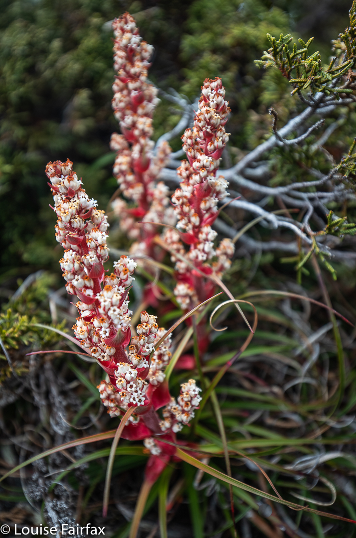
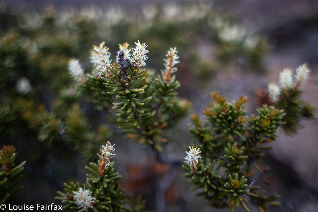
Dracophyllum milliganii Tarn shelf
It was similar around the Newdegate Pass and over the other side. Once down on Tarn Shelf, out of the worst of the breeze and with the sun slightly lower, I began my search anew. I only found one at this altitude, right near the end of the shelf, which I stopped for. By now, I was actually rather tired, and had enormous trouble unbuckling my rucksack to extract my camera.
Craspedia alpina = Craspedia macrocephalia (new name)
The rest of the trip was rather uneventful, as long as you don’t count meting a very pleasant Ranger right near the end; he was setting out to sleep on high so as to photograph the dawn next day, and, despite my dinner-in-Hobart deadline, we chatted for what felt like fifteen minutes. Anyway, surely I needed a break before undertaking that driving!
Perhaps you imagine Tasmania to be a nice gentle place to be in summer, with balmy temperatures. Perhaps you fancy swimming most days with a few gentle walks up friendly mountains. If this is what you want, well, I need to disappoint you. We are a bit far south for all that, although, of course, you can strike lucky.
Rugging up for a summer ascent.
But if you fancy something wild and rough and rugged; if you’re prepared for snow, gales and a drenching in summer; if you delight in the tempestuous side of weather and find it stimulating and thrilling, then Tassie has plenty to offer you.
Climbing
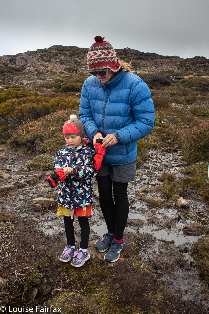
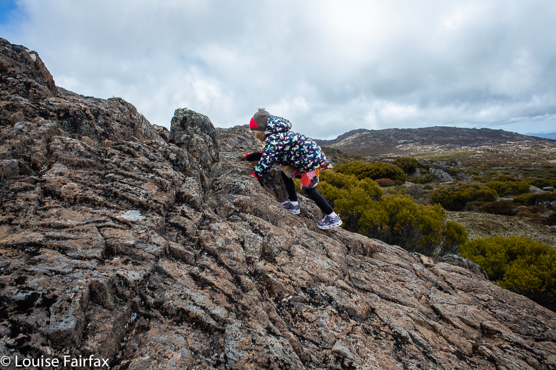
The Swedes have a saying that there is no such thing as bad weather, only bad clothing. My family agrees, and with that in mind, we donned our puffer jackets, beanies, mittens and anoraks (all of which were needed) and headed up for everybody else’s first ascent of Legges Tor in the famous Ben Lomond National Park, to stand upon Tasmania’s second highest point, which was a grand adventure for the children.
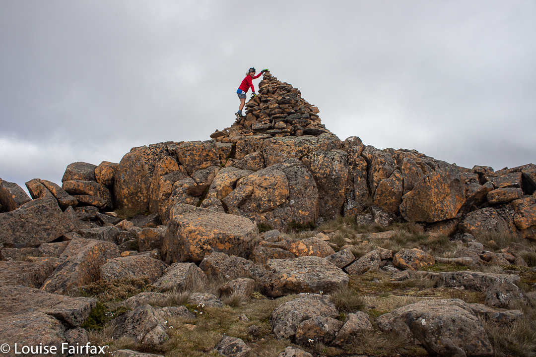
Gussy makes the impressive summit cairn. Another Abel for him.Rapid descent. Practising his orienteering skills. Gussy is in third class.
I think the photos tell their own story. You will see the hair blowing about the children’s faces, the warm jackets and ski gloves to fend off the cold. I hope the body language also suggests to you that they are enjoying themselves, which they are. It was bracing and enlivening. You will also see that the scoparia was nicely in flower, making the high area a mass of colour.
Pre-schooler Abby negotiates the rocks
I really love it up there … more so in winter when icy rime covers the rocks in a tracery of delicately laced patterns, or when snow like icing sugar decorates the bushes, but summer also has its own grandeur.
After lunch in a sheltered spot, we walk back through swathes of colourful scoparia.Orites revolutus. One of the many colourful and fragrant wildflowers up here.
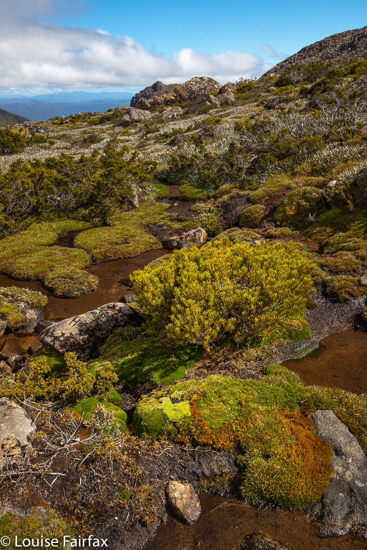
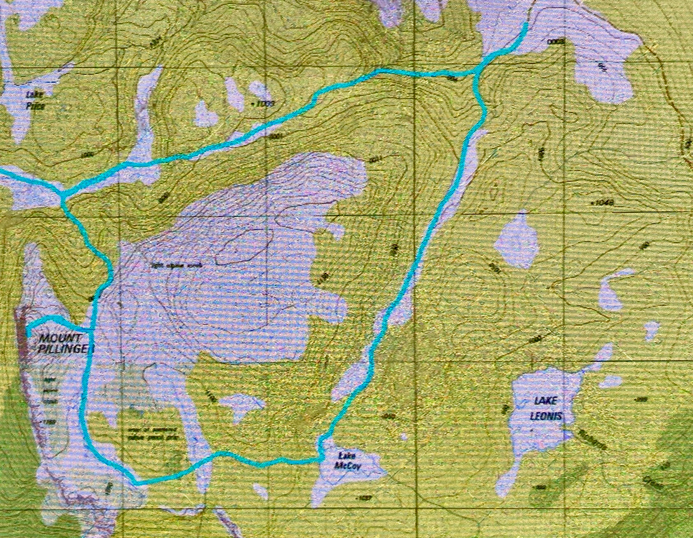
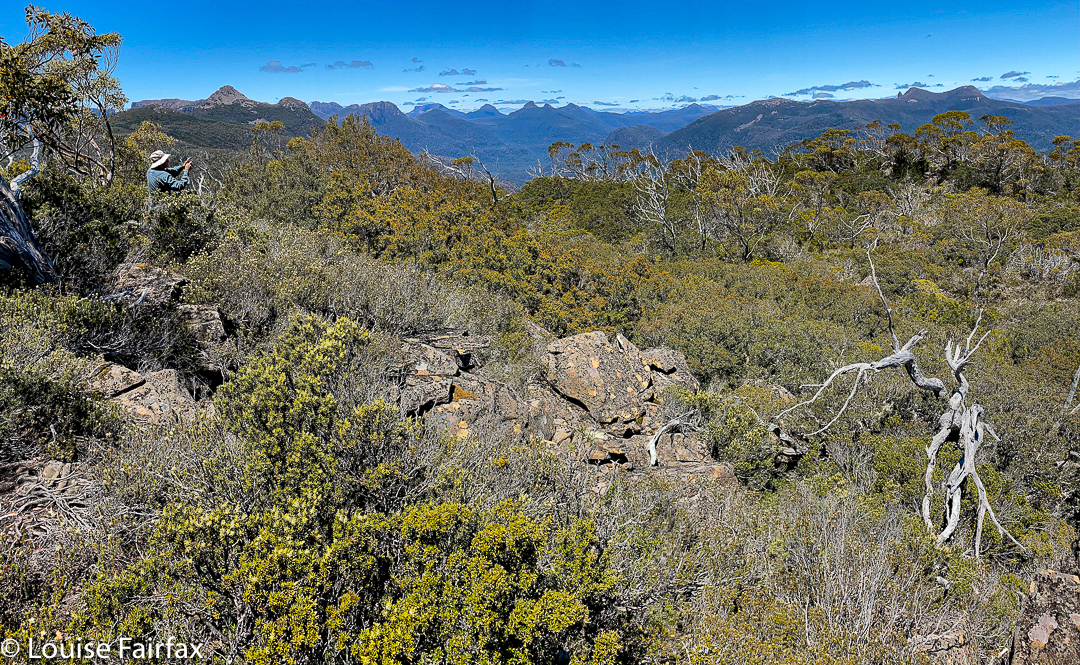
The Mt Pillinger-Lake McCoy circuit has something for everyone. On this day, the final Wednesday of 2020, a small group of us who either don’t work or have organised our lives to have Wednesday off, had an amazing tally of wonders to let us know that 2020 was not all bad.
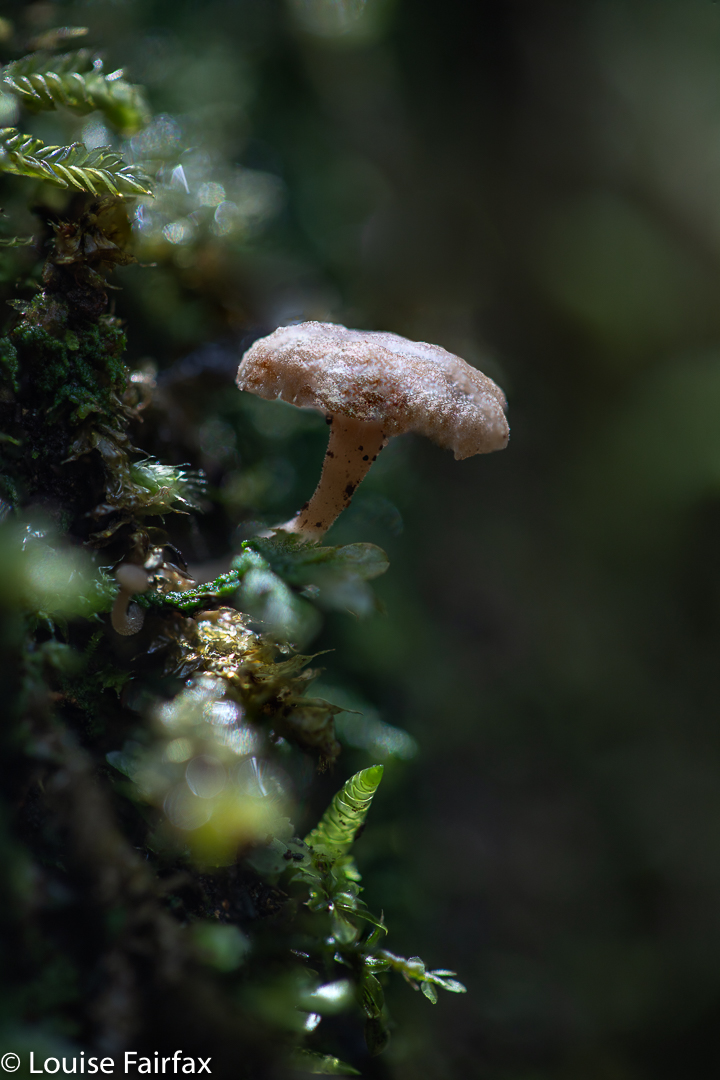
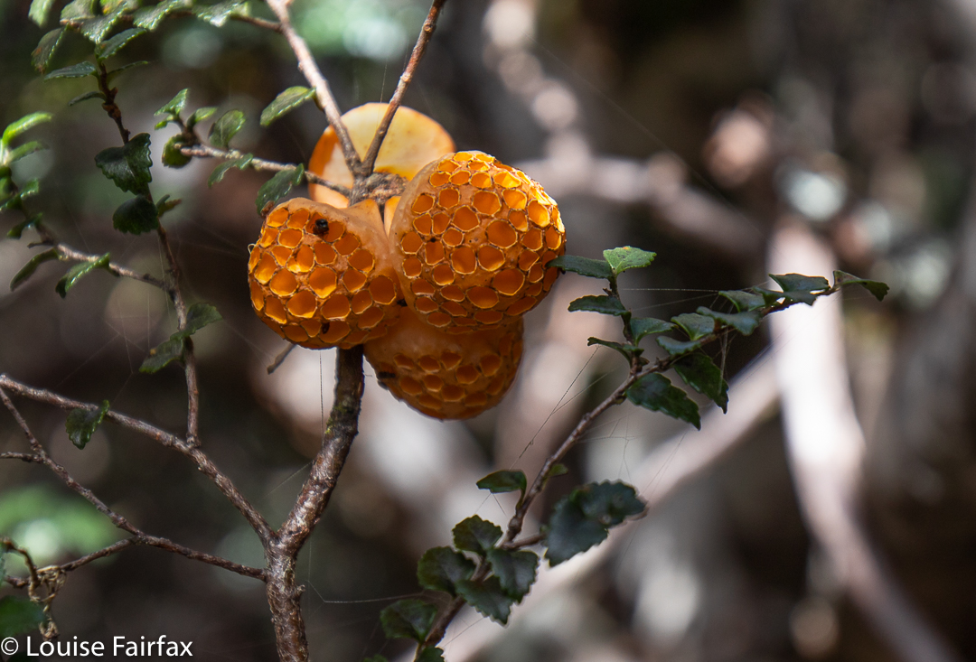
Mycena carmeliana was one of many fungi to make an appearance. This is an old one, but doubtless it had recently enjoyed the rain we have been having.
We saw two waterfalls, three wedge-tailed eagles (up very close; I think they liked my mauve parasol), several different kinds of fungi, masses of wildflowers, the view from the summit of Pillinger, several groves of magnificent Pencil Pines (Athrotaxis cupressoides), vast areas of bouncy and colourful sphagnum moss, a few wilderness valleys that we had not previously explored, and a new lake (Lake McCoy).
Arm R Tributary A Falls
This circuit can be done with equal enjoyment, I would think, either clockwise or anti-; we chose anti-.
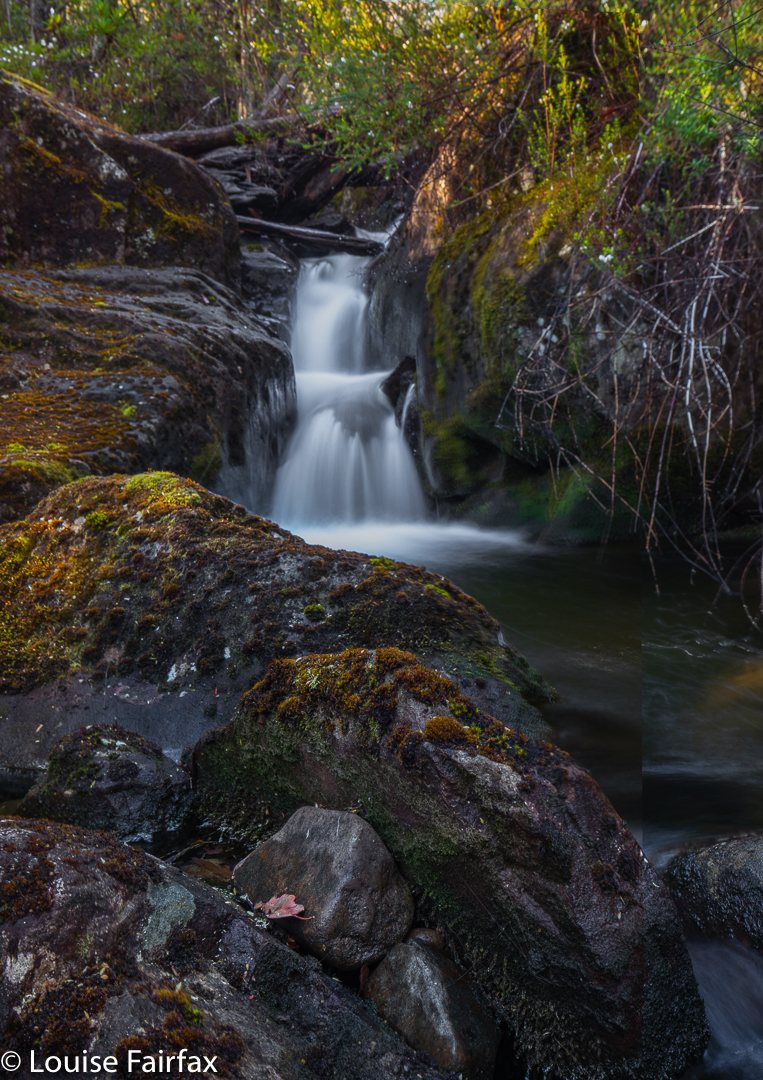
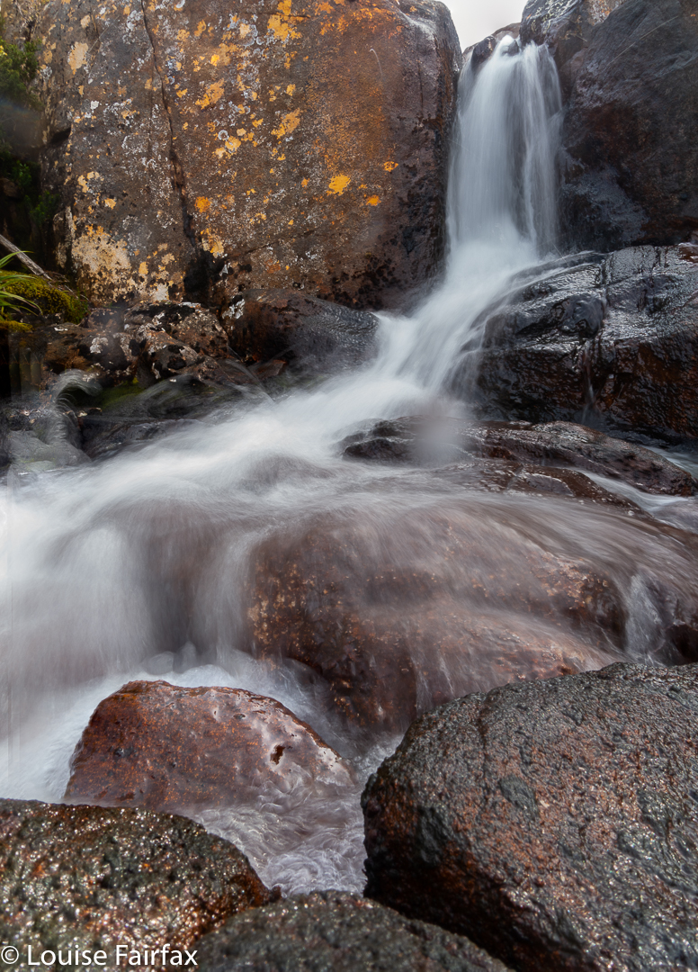
We parked our cars at the end of the Magges Spur 17 road, and set out down the pretty clear track. After only seven minutes, the track (which ultimately leads to Mt Pillinger or to the Arm River main track, or to any number of other enticing locations) crosses the first of many unnamed Arm R tributaries. As they are nameless, I have just called the first one A, and the second B. The third creek, which we didn’t cross on this route, bears the actual name Arm R; the fourth and fifth are even further west again, and are also unnamed. Tributary A has a pretty little waterfall, shown above.
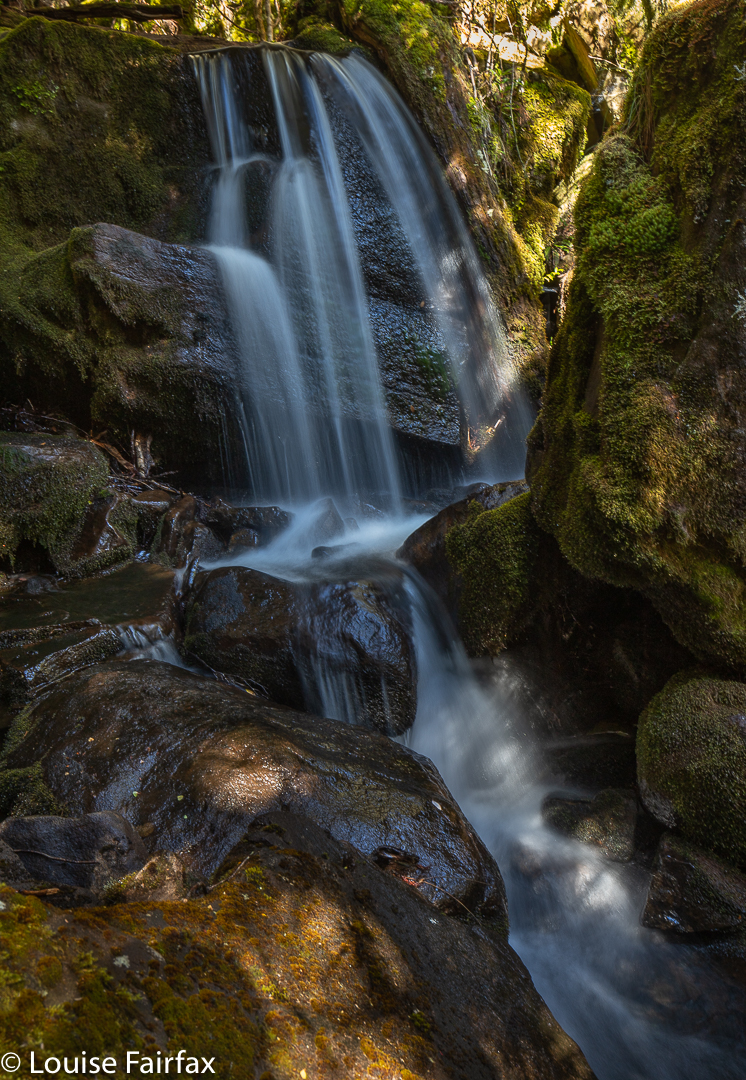
The second creek we crossed, I have with enormous imagination called Arm R Tributary B, also contains a waterfall worth photographing (see below). We were not getting anywhere fast, but that was never the purpose of the day.
Arm R Tributary B Falls
Once we had enjoyed the rainforest, fungi and waterfalls, we climbed slightly (often beside Trib B) out onto the plain that eventually passes under Mt Pillinger. This area has fabulous Pencil Pine groves.
Arm R tributary scenery
One follows Trib B westwards until there is a saddle so broad and flat that you need a map to tell you it is actually a saddle. Out the other side of the slight swamp and down imperceptibly, you briefly meet the actual Arm R before turning south and beginning the climb up the main Pillinger gully to a saddle before the summit. I have always fancied sleeping in this saddle, or even higher, as there are many flat, clear spots, but water would need to be carried from the tarns of the Arm R at the base if that is what you want to do.
Pencil Pine basePillinger summit
The view from the summit is pretty good, but I never actually enjoy summits in midday glare. The highlight up there for me was the appearance of three huge wedgies who kept circling us at close quarters. I take credit for this, as I’m sure it was the mauve parasol I was using to protect me from the sun that attracted their attention. Their eyes seemed quite focused on it, or so it seemed.
Pillinger summit
At last we were moving again, and this time, after the Pillinger saddle, in a different direction, south, to and then along a valley with calf-high alpine grass and colourful scoparia (nicely spaced, thanks), cushion plants, and a dainty creek with deep, clear water down the centre.
Along our second valleyCushion plant in the valley
Our desired lake was to the east of where we were, so we had a couple of unpronounced spurs and appealing valleys to cross before we reached it.
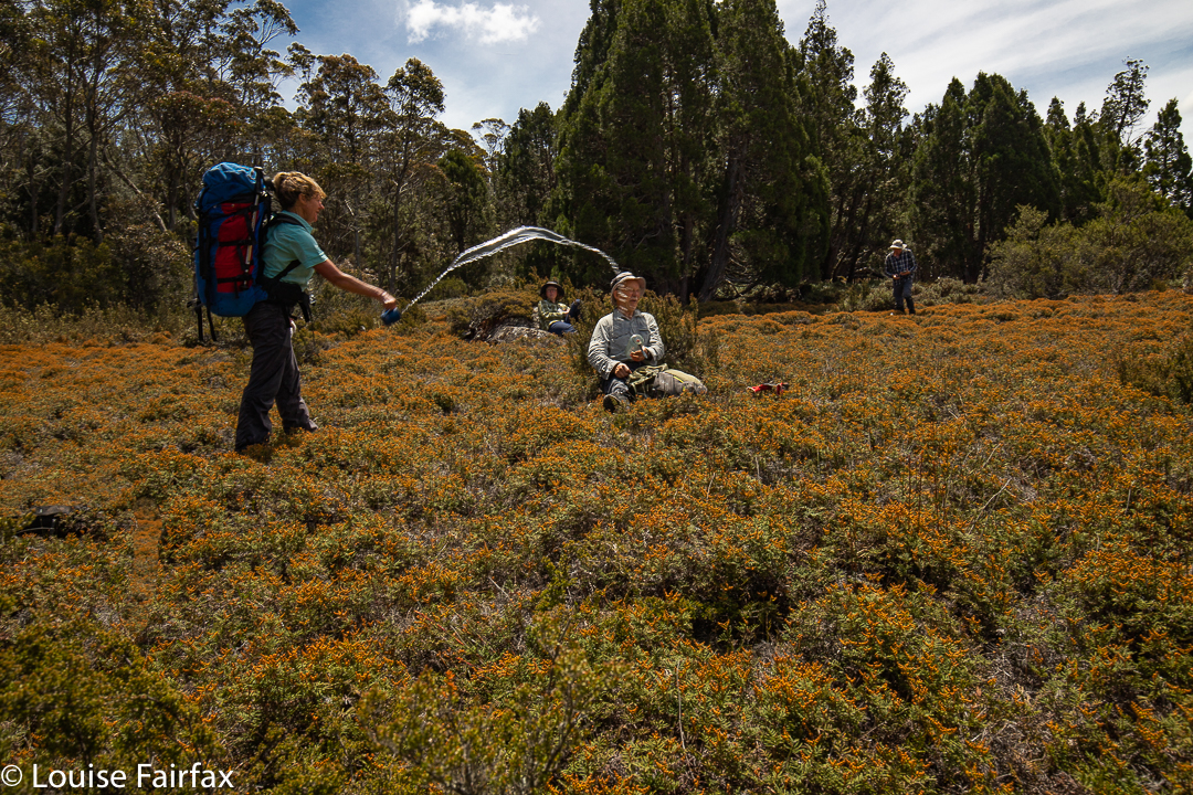
Cyttaria gunii in Pencil Pine forest near Lake McCoyThe day started at 4 degrees. It seems some of us thought it had warmed up enough in the early afternoon for a water fight.
At last we reached our lake; time for another afternoon tea.
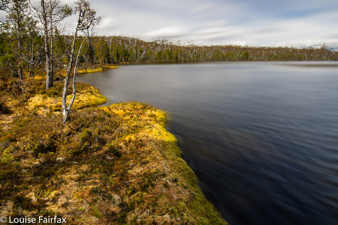
Lake McCoy
The stats are that we walked about 14 “horizontal” kilometres, climbed 382 metres, yielding 17.8 kilometre equivalents.
How our fates and destiny can change in the twinkling of an eye!
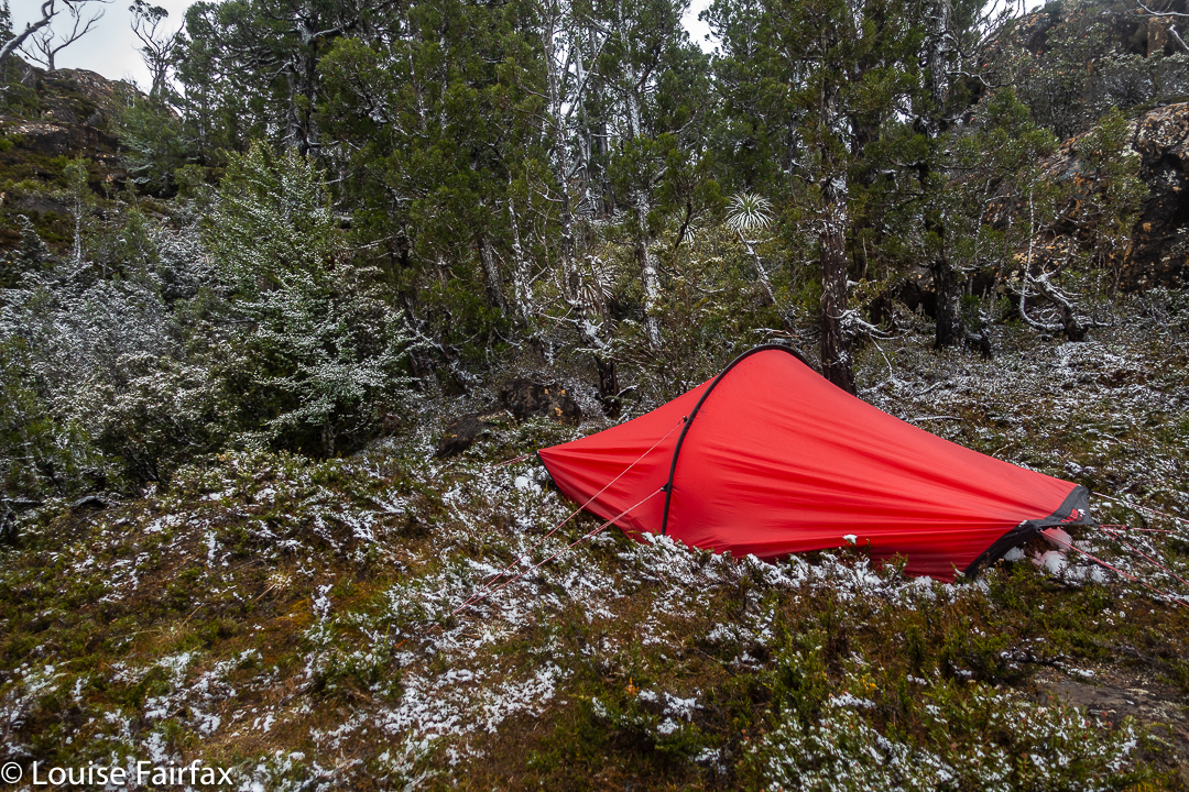
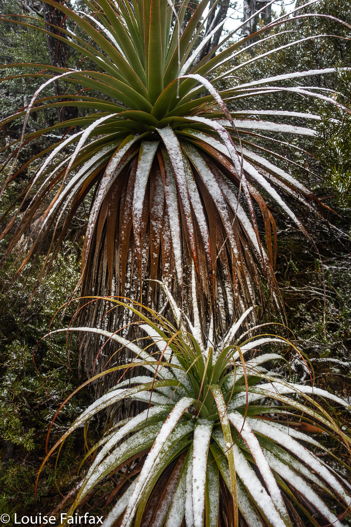
It had been snowing all night and morning (yes; this is Tasmania; yes, it is December. The snow had not been forecast). This was not the weather in which to climb something as hard as Nereus, so, sadly, we had cancelled our plans and formulated new ones to fill the five days we had allocated to this climb. I didn’t like plans B, C or D, so thought I might as well go home. I suggested we have an early lunch before we all packed up and headed back down the valley. (I am happy that my reliance on food is a contributing factor to the final success of our mission).
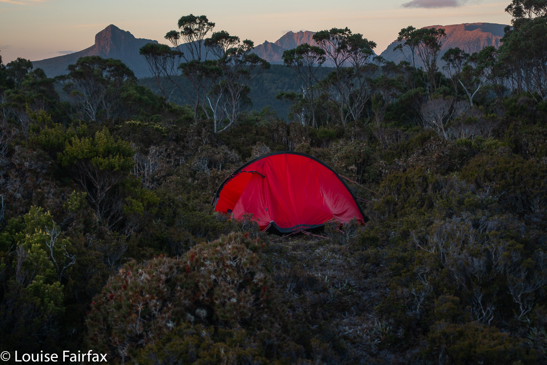
Nereus day 2. Tent in the snow.
We were packed. Rucksack on, I took a few steps in the homewards direction, but Andrew was fighting his Aarn pack’s front panniers, so didn’t immediately tuck in behind me. In the waiting time, Geoff said to me: “You know, those clouds are lifting a bit. If we got as far as the Mac’s saddle tonight and popped in a sixteen hour day tomorrow, we could still get that summit.”
Nereus Day 2 Richea pandanifolia
This seemed a much better use of time that going home. At least we’d have tried to do it and maybe failed. Walking out wasn’t even a try. “I’m happy to give it a crack”, I said. Andrew looked up from his wrestles and added his assent to the mission. I did a volte face and all of a sudden we were heading up the mountain, not down, and towards our goal, not away from it. Just like that.
Nereus Day 2 Telopea truncata
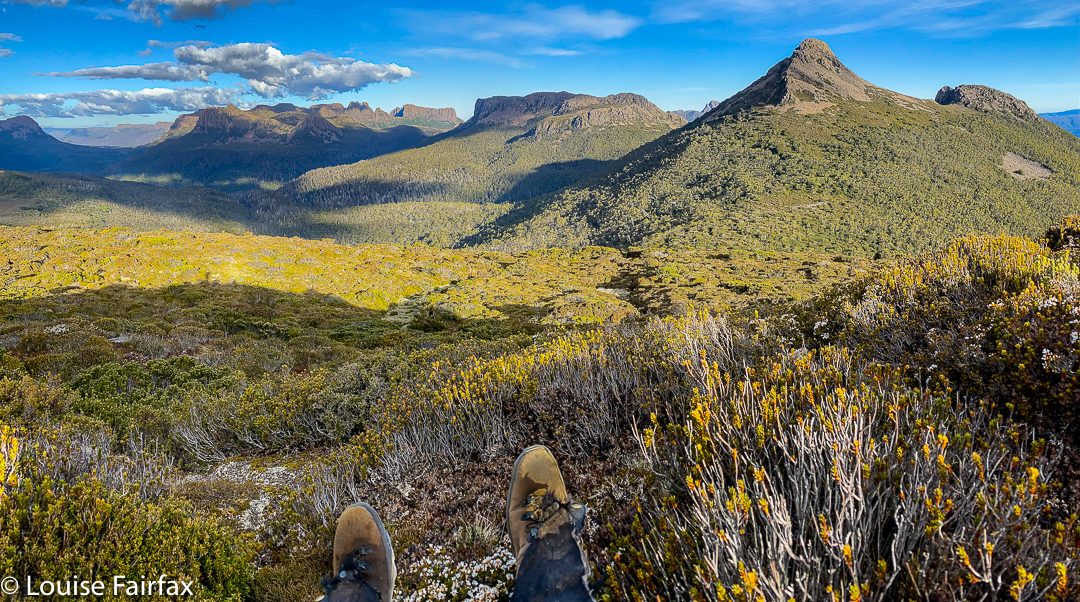
To climb Nereus, you have to go over Walled Mountain (five or so hours from the ferry terminal), nearly over Macs (the next mountain along that range), over Urquarts Messa (1272 ms high, so not entirely insignificant), down its cliffs at the halfway mark, along another ridge and then find a way up through the cliffs to Nereus with its unwelcoming palisade, not only of vertical, almost chuteless cliffs, but also of more scratchy scrub on top, climbing into trees until you finally make the summit. It is not a mountain that welcomes strangers (or even good friends), with its repulsion via cliffs and prickles being matched by its aloofness of distance from any possible source of water (and from any possible starting point). There is no quick route to this mountain. But I like that. I like challenges. I would be bored if it were easy. I don’t want life ‘easied’ up and dumbed down.
Nereus trip day 2. Sunset from Macs saddle
When you mention the name “Nereus”, those in the know regale you with horror stories of failure: of being repelled by strong winds, falling rocks, accidents, driving rain, deep snow or heat exhaustion and dry, waterless ground. Everybody knows a longish list of people who have been benighted out there, who have been delirious with dehydration, exhausted with all the bushbashing, or just something mild like looking like a pin cushion covered in scoparia jab wounds. Some just sigh, and tell you they’ve had three failed attempts, or five or seven … whatever.
Anyway, we were doing fine, and had made it to the Macs saddle with oodles of time. There is actually not a lot to do in this saddle once you’ve put up your tent. It’s not exactly inviting to go for a stroll – not without armour on and a machete to make life bearable. I looked at my watch and wandered just how early you could eat and legitimately call it dinner.
Nereus trip day 2. Sunset from Macs saddle
We killed some time with careful packing for the morrow: extra clothes and a bivvy bag in case we, too, got benighted; head torches for finishing after dark; stashes of food to fund such an extreme amount of exercise; and three litres of water to guard against dehydration.
I set my alarm for 4.55 a.m. In the gloaming we threw down breakfast, and while I did so, I fretted about the first section of the climb. When I had gone out to call Geoff, I noticed that my tent was covered in a carapace of pure white ice crystals. This was very attractive, but could mean that our first task after a bit of a climb – viz., working our way along a lengthy band of microwave-sized rocks that decorate the bulging belly of Macs Mountain – could be slippery and a bit dangerous, and thus slow us down. Would that consume so much time that our task became impossible?
Luckily, they weren’t too bad, and we made pretty good time to Urquarts saddle.
Nereus trip day 2. Sunset from Macs saddle
I had found a good lead on my previous visit to this area, so lead us up this slope. However, in the three years since I had last been there, the vigorous scoparia had claimed much extra territory, and the going was disappointingly slower than last time. I felt I had failed us somewhat.
From near the top of Urquarts, Geoff took over to lead us down the thick, resisting slope (cursing it at times) leading to a more open, flatter area at its base above a line of cliffs. In the distance, urging us through this junk, we could spot a patch of shine which we believed to be a small tarn. We didn’t need water, having brought heaps, but it was still nice to have it as a goal, and to eventually pause by its freshness in this mass of scrub. That flat part was some of the easiest walking of the day and a welcome respite. And then it was Andrew’s turn to lead the push and shove until we reached the button grass section. Now our goal was very visible. We were definitely going to reach it.
Mt Nereus: getting nearer
The buttongrass was, well, buttongrassish, with all the usual mud channels and small hillocks to negotiate, lifting legs high to avoid obstacles. This ceded to the worst crap of the day – a horrid marshy bit with cutting grass over our heads, zero visibility, and melaleucas that resisted my most earnest attempts at shoving them sideways. It was, unfortunately, my turn to lead, and I was not going well through this wall. Behind, Geoff was reading a line off a garmin screen and calling out “left”, or “right” according to the screen’s line. I had no goal, no visibility, no sense of any big picture or shape of the land (I could see absolutely nothing). In frustration, I stopped and got out my map. AH. There was different vegetation to the north, mapped as a darker green, which suggested to me, rainforest. I said I was taking us over there, and to my relief I discovered a wonderful area of rainforest, and got permission to actually navigate using the land and the map rather than a line on a screen. My route took us to the ridge leading eventually to the summit. The ridge was cluttered with many obstacles, but still not as difficult as the dry sclerophyll forest had been. I wanted to attack from the north, actually, but was outvoted (the screen route did not go that way), so we continued up this line until we reached impenetrable cliffs.
Nereus summit cairn
We lost quite a bit of time trying possible chutes that each ended up too difficult to use. We eventually got up, but were not impressed by the paucity of holds and the general drop below us, which is kind of good, as after we had reached the summit, I was allowed to use the northern route I had wanted all along to lead us out and back … but first, it was time to enjoy our hard-earned views and to dine on the summit.
Photographing near the summit
Was it really true that we were there, by the seemingly unreachable summit cairn? That we had summited the Inhospitable One, das Ungastfreundliche and repulser of all who seek its secrets. We sat by the unprepossessing cairn and, while we ate, enjoyed the unique views that none of us intended returning to ever see again. Did I feel victorious? Not really. Elated? No, not that either. I guess, more than anything, I was relieved, and each of us was very aware that we still had to get back. We joked, as people in this situation often do, that a heli ride home would be nice, but the reality was that we had taken 7.5 hours to get there (5.75 walking; 7.5 elapsed), and the homeward “half” would be the tough portion of our lot. Would we, like so many other accomplished bushwalkers, be benighted?
Views half way back
Time to begin to find out. I led us out by the northern route, as said above, through beautiful rainforest. I told the others my route would be longer than a straight line, but easier, as it would be through nicer terrain, and, dreading a meeting with the marsh or exhausting buttongrass, they agreed to my adding distance. It was lovely, and I landed us at the point where we had had a break on the outward journey, just below the nasty scrubby climb up to Urquarts Messa. I was pleased to have gained us some time, as this was much faster than in the opposite direction, and almost everything from here on would necessarily be slower … and tougher. Gulp.
Time for a break to enjoy sunset: Day 3
Another of sunset Day 3, mission accomplished
Geoff took over the lead. This was a really nasty bit – uphill, thick, resisting … TOUGH. It was hard work for all, but hardest for Geoff in the lead, bashing down the scrub as first strike, having to use his brain as well as his legs, while we behind could rest (relatively speaking) on his laurels. After the respite at the little tarn after the cliffs, it was Andrew’s turn to fight the uphill battle and punch some kind of hole in the scrub. We were tiring, but the scrub was not one patch exhausted, and continued to offer strong resistance in the skirmish.
Nereus trip. Rocks Day 4
But somehow, eventually, we landed on top of Urquarts Messa, and had a pretty quick slide down the other side. It was only late afternoon. We were definitely going to get back to camp. We rested a short while on a patch of bare rock before the last tough climb up to the rocks on Macs. This section had been quite quick with gravity to help us, but was anything but on the rebound. Meanwhile, I was dragging my feet. I thought I might be about to either vomit or faint or both. Andrew noticed and kindly offered to take on some of the weight of my pack. I said that wasn’t my problem. I felt I needed salt, but had none. He produced a gel with sodium that he insisted he didn’t need. Unbelievable. Even after the first mouthful, my stomach felt more settled. By the time I’d managed to get the lot down, I was back to bouncing vigour.
Underway Day 4Nereus trip. Sunset Day 4
Up the slope we continued until we reached the rocks that decorate the belly of Macs Mountain. By now, late afternoon had morphed into almost sunset, and the sky was taking on golden hues; the mountains becoming more mystical and hazy. It was beautiful. We were definitely going to make it to camp, so I asked if we could stop for ten or so to take in this beautiful sunset that was unfolding. What a wonderful vantage point. We sat and gazed as Walled went red; the clouds, pink. Everything was marvellous. When we started again, I felt as if I had drunk a draught of magical ambrosia. I glided over the next section of rocks, floating and upheld by beauty.
Nereus trip. Sunset Day 4
By the end of the rocks, darkness had gained its hold. The others got out their headtorches, but my night vision was fine, so I led us down through the last nasty patch of scrub until at last our campsite was gained. 10pm. Time for dinner!
The next day, for me, was very short, as I wanted to stay high, while the others wanted to retreat to the valley to be sure of making the 12.30 ferry in time on the morrow. I trusted myself to get from the summit to the ferry in time, and wanted to remain in the freedom and space of the truly wild high places, so we would part for a while after Walled, and meet at Narcissus Hut (hopefully) the following day.
Nereus trip. Sunset Day 4
And so, I spent the whole afternoon just wandering around the summit area, choosing my real estate for the night, poking my nose into various crannies and getting to know this beautiful part of nature at an intimate level. It was pretty breezy, but not too bad. I felt delightfully expansive up there; somehow my being extended to the vast realms around me and I was part of the wider universe. Nothing closed me in.
At last sunset came, and with it, stronger winds. I consulted my weather app. It said winds to 55 km/hr. That was OK. I went off to enjoy the colours and feel of the close of day.
Nereus trip. Sunset Day 4
My app seems to have got it wrong. Maybe 55km/hr was a kind of gentle base from which gusts of maybe 100 km/hr would then burst. The gusts became more frequent and fiercer as the night progressed. Sleeping was impossible with the noise of howling and the relentless bashing and cracking of the fabric as the wind whipped it. By 12.10, it was necessary (possibly not, but it felt reassuring to do this) to lie on my back with my feet in the air adding force and stability to my central pole … just in case. I did that until 3.10. While I did so, I thought about the storm scene in Goethe’s Die Leiden des jungen Werther, where Werther and Lotte, the two central characters, go out onto a balcony to revel in the wild fury of the storm, musing together on the wonders of the poet Ossian, who also loved a lashing storm and embraced rather than recoiled from a tempest.
Nereus trip. Sunset Day 4
I thought of a more modern hero, Robert Macfarlane, author of The Wild Places, labouring up a snowy ridge of England’s Lake District in a nighttime blizzard, in a desperate attempt to try to find wild places in his over-tamed country. And I thought about a favourite philosopher, Immanuel Kant and his treatise of 1764: Beobachtungen über das Gefühl des Schönen und Erhabenen (or Observations about the feeling of the beautiful and sublime). Kant postulates that when we go to the very edge of our fears and then retreat to safety, the process of fear followed by relief engenders a feeling of the sublime, which he relates to awe, terror, majesty and eternity.
Nereus trip. Sunset Day 4
Experiencing the sublime is important to my well being. I was at the far edge, -but not over – my fears as I pondered these matters. If we never approach the edge of our comfort zone, we do not experience the fulness of life. In the words of The Rose (which members of the Pandani club and I sang while we searched for my missing husband, and which we later sang at Bruce’s memorial service):
It’s the heart afraid of breaking That never learns to dance; It’s the dream afraid of waking That never takes the chance; It’s the one who won’t be taken Who cannot seem to give; And the soul, afraid of dying
That never learns to live.
Nereus trip. Sunset Day 4
Soma tablets, eat your heart out.
I don’t sing very well lying on my back, so I just thought the words, and especially the final two lines. When the greatest endurance athlete ever, Kilian Jornet, was asked why on earth he would run up and down the Matterhorn at such dangerous speeds (smashing the world record by over 15 minutes), he replied that he felt terribly alive when he did such things, pushing himself to the very edge of safety.
Nereus trip. Dawn Day 5
Well, with all that thinking and pole propping, I was pretty exhausted, and decided I needed to trust my excellent Hilleberg and lie down properly. As it was now 3.10, I noted as I lay my head on my clothes that my alarm for the dawn would go off in two hours. The next thing I knew was the sound of that alarm. At last I had fallen asleep.
Nereus trip. Dawn Day 5
I arose to welcome the day and to delight in the dawn colours and shapes, and later to enjoy breakfast on high, even though the wind was still pretty strong (my app said now 50 kms/hr).
Nereus trip. Dawn Day 5
It was a challenge later to manage to pack up my tent which bucked and kicked like a bull at a rodeo, but I managed, and slowly and reluctantly turned my face to the valley below and my journey back to “civilisation”.
Tree art. Labyrinth
(I made the 12.30 ferry with plenty of time, and was reunited with my two scrub buddies, without whom I would never have had the strength to get near the summit, so we could celebrate with a burger with the lot at The Hungry Wombat – a kind of bushwalkers’ ritual. This time it was not just a celebration of a single mountain, Nereus, but also of the fact that Geoff had now climbed all the Abels. What a one to leave until last!).
Oh. I nearly forgot to mention: on the way back to Narcissus, I took time to visit a waterfall I had heard about, issuing out of Lake Cyane, so I have called it here the Cyane Falls. They were worth the stop. Their context, with the Guardians in the downflow direction, and the Acropolis behind their head, was wonderful.