Emmett 2018 May

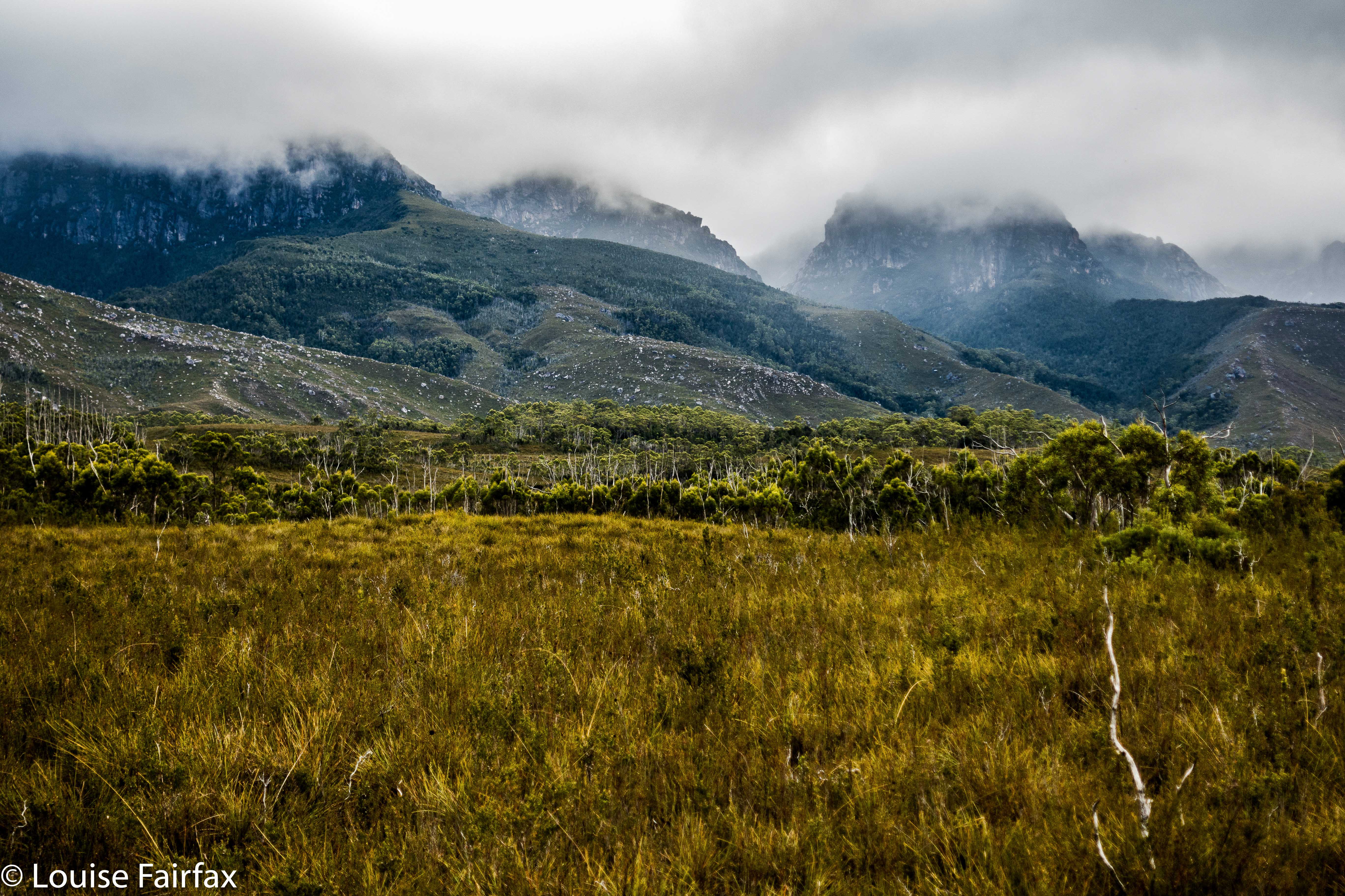
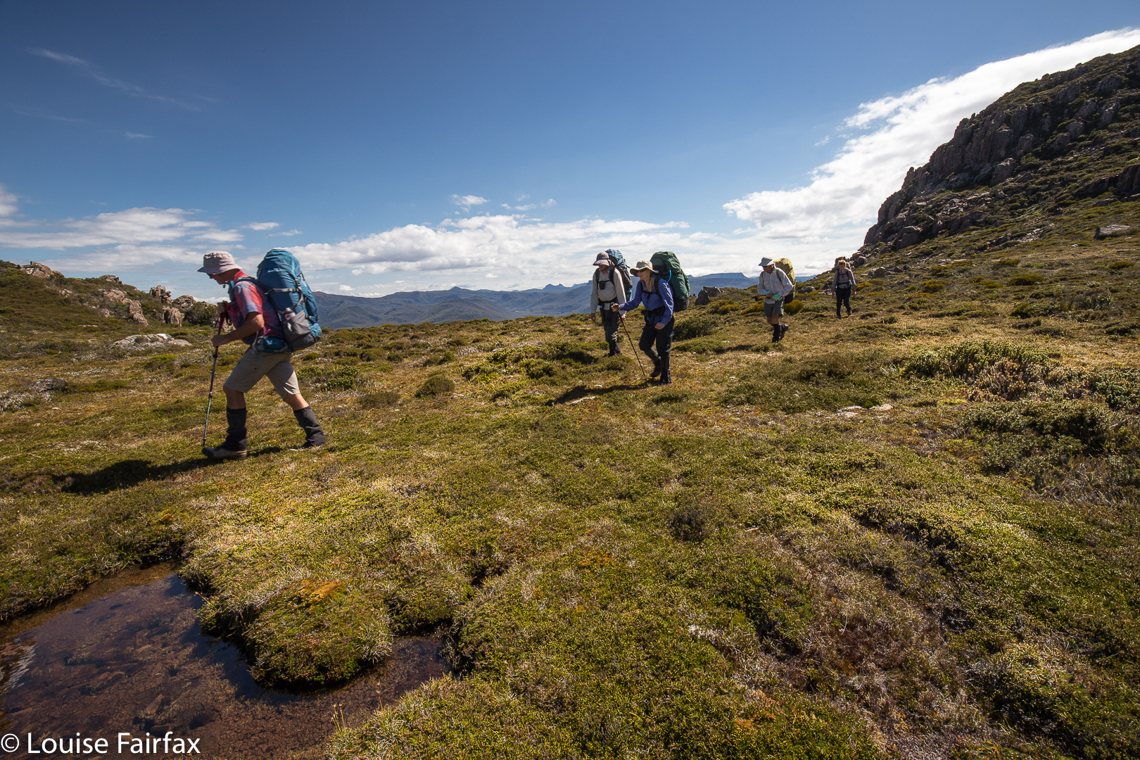
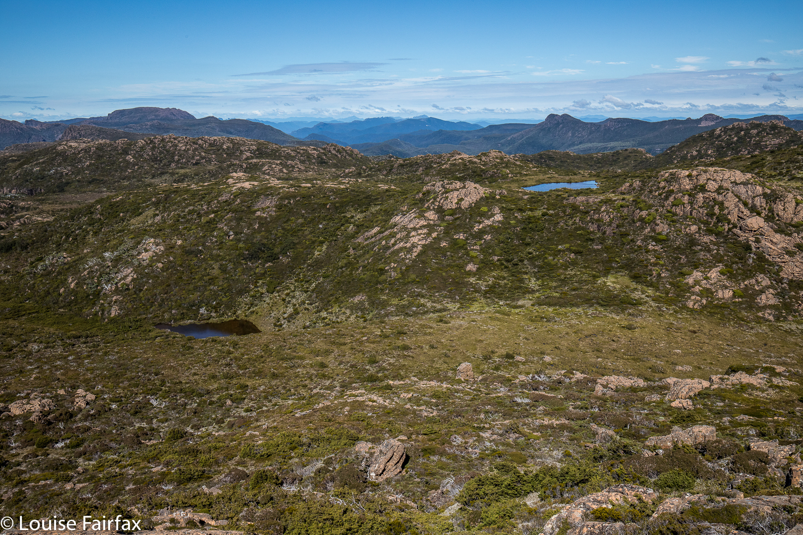
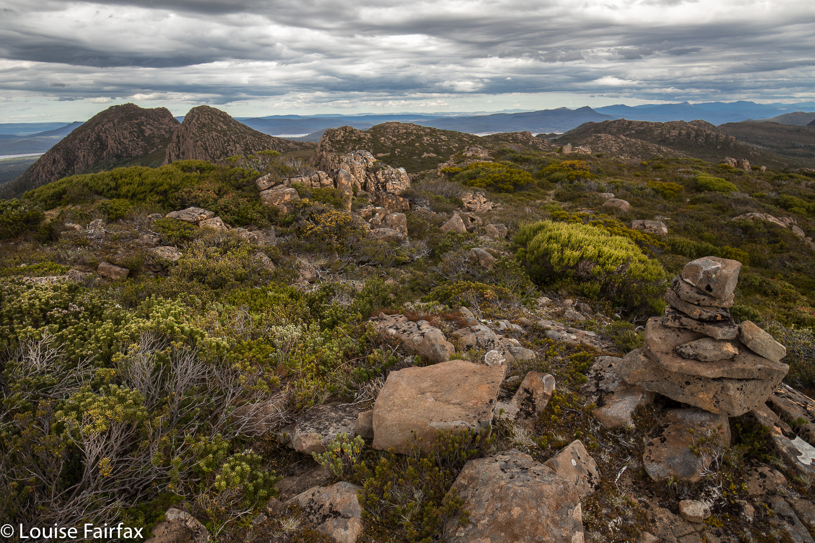
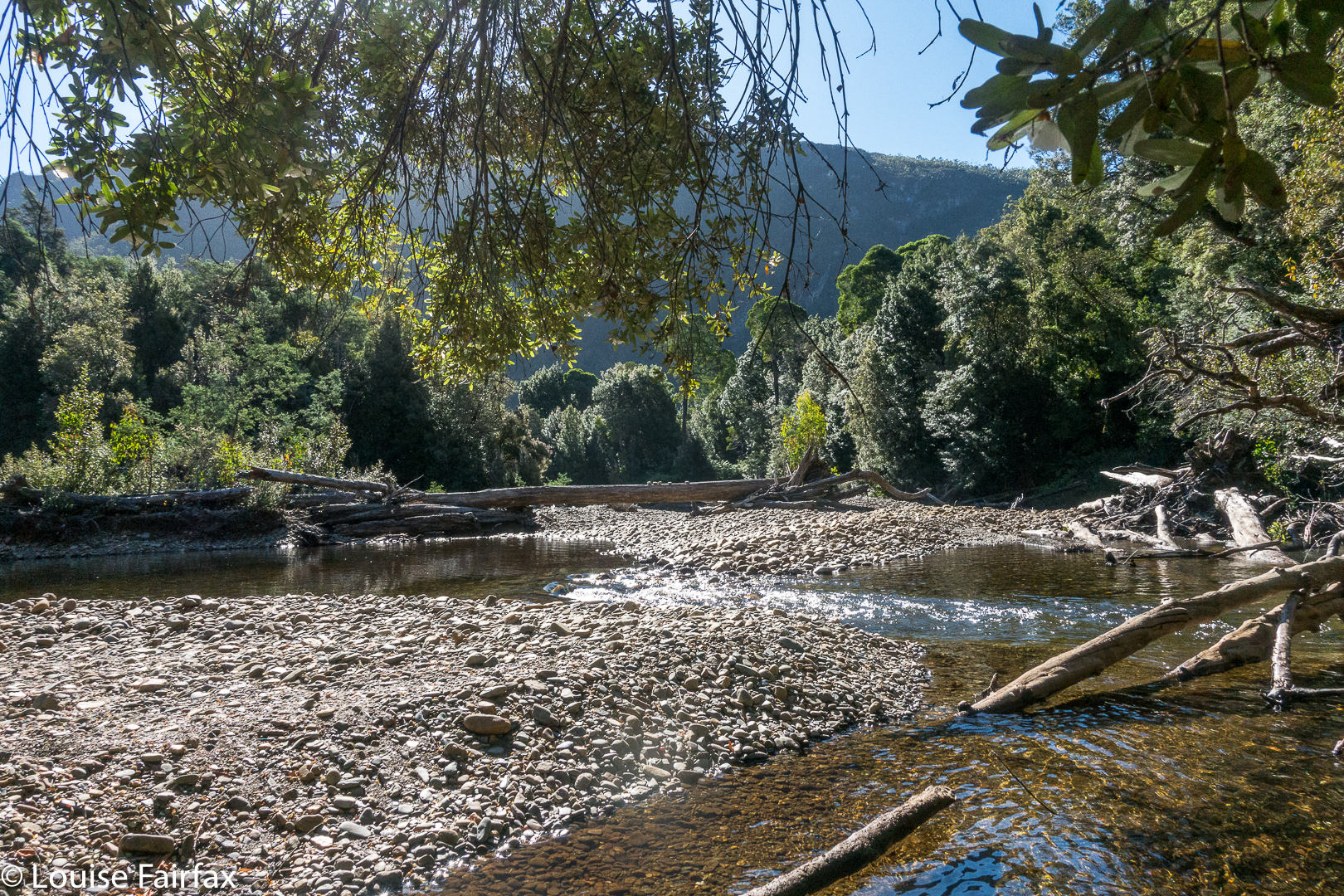
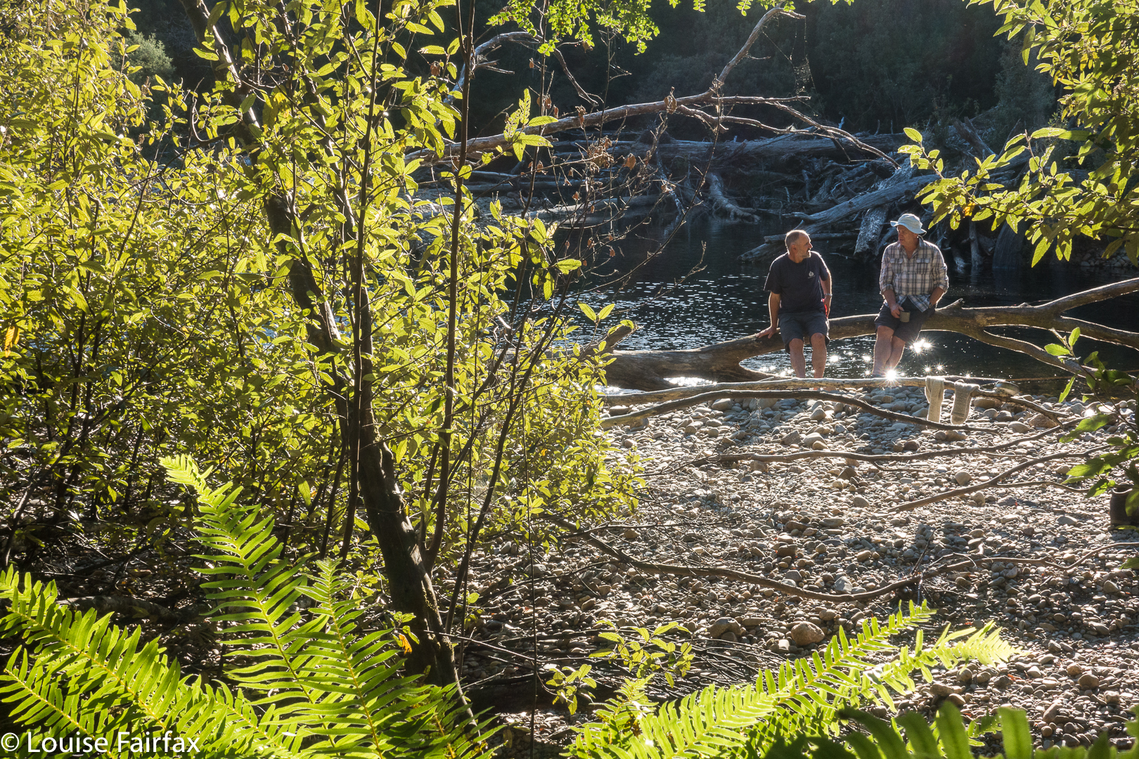
Mt Emmett revisited 2018 May


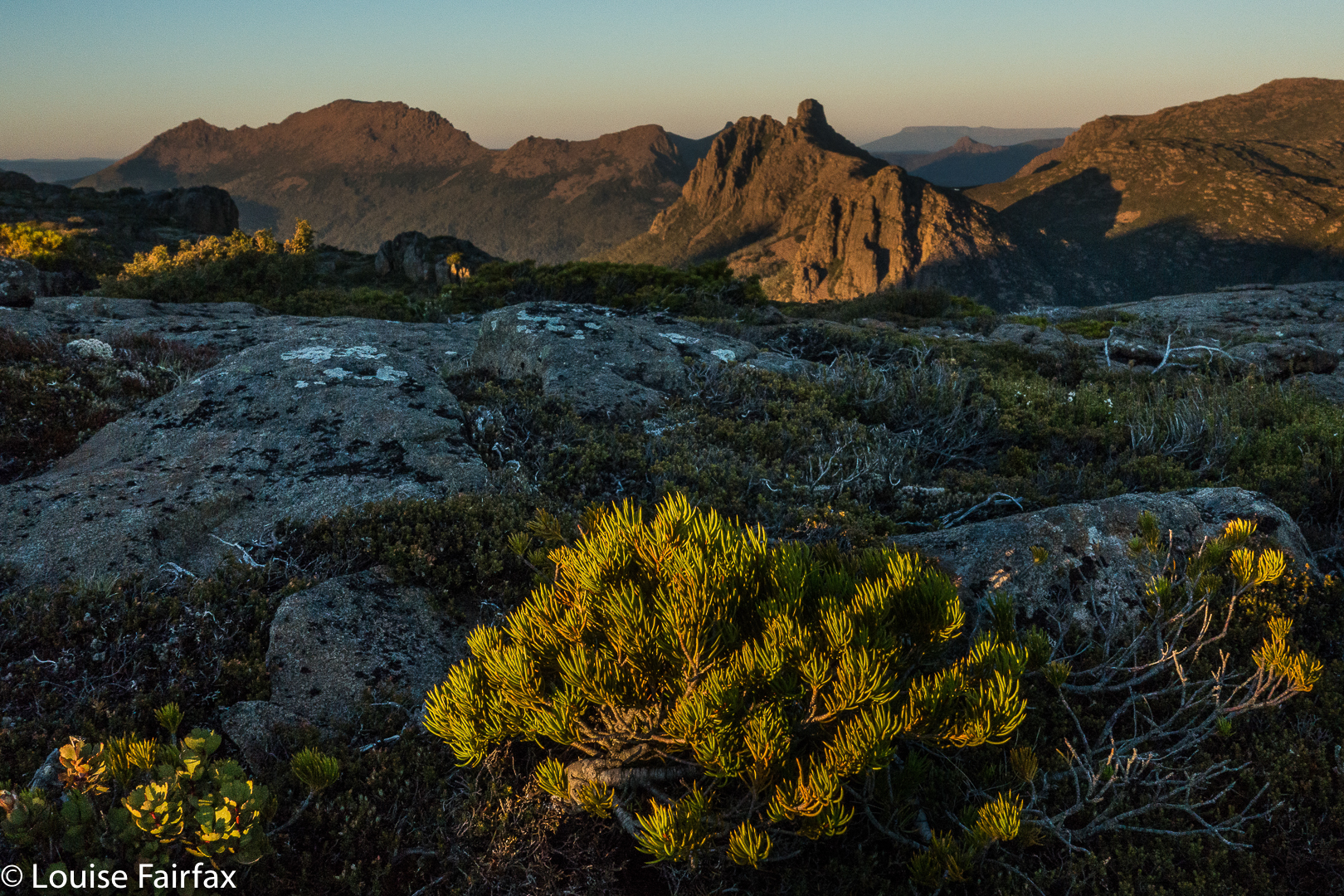
Even as we savoured our summit views on Mt Emmett five minutes before our absolute latest turnaround time, I knew that the light was already a little too golden; the shadows, marginally too long. We would be descending in the dark: not a good idea when the forecast was for negative five overnight, and when we had several patches of very thick scrub to negotiate before we reached a path. I sure hoped we could dispense with all the tricky sections before we completely lost visibility.

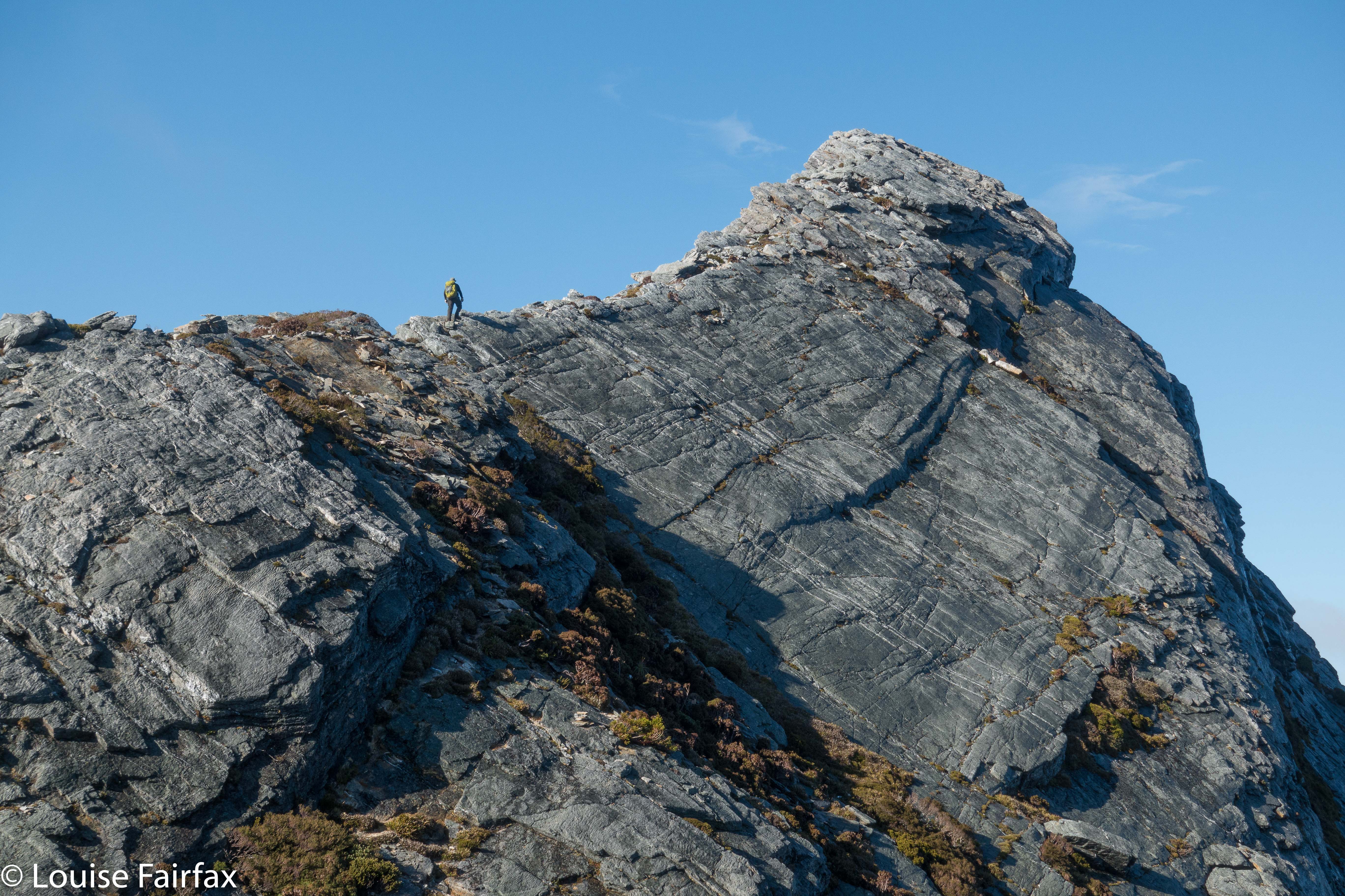
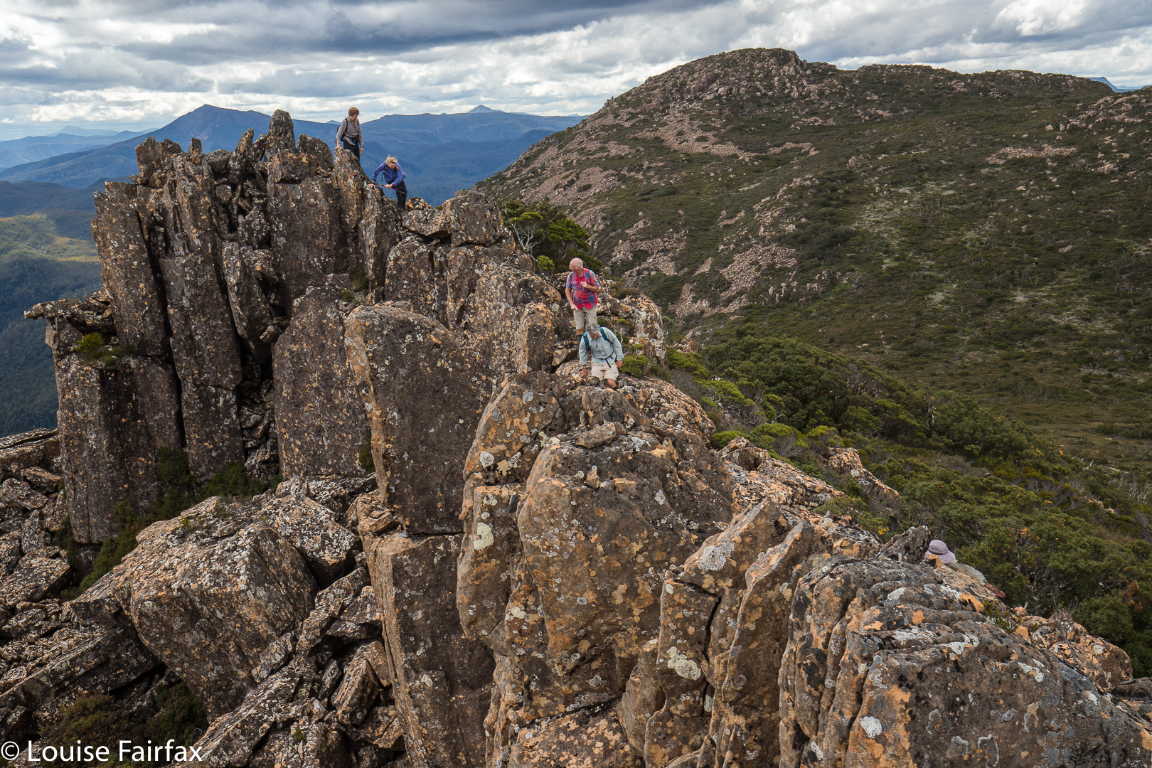
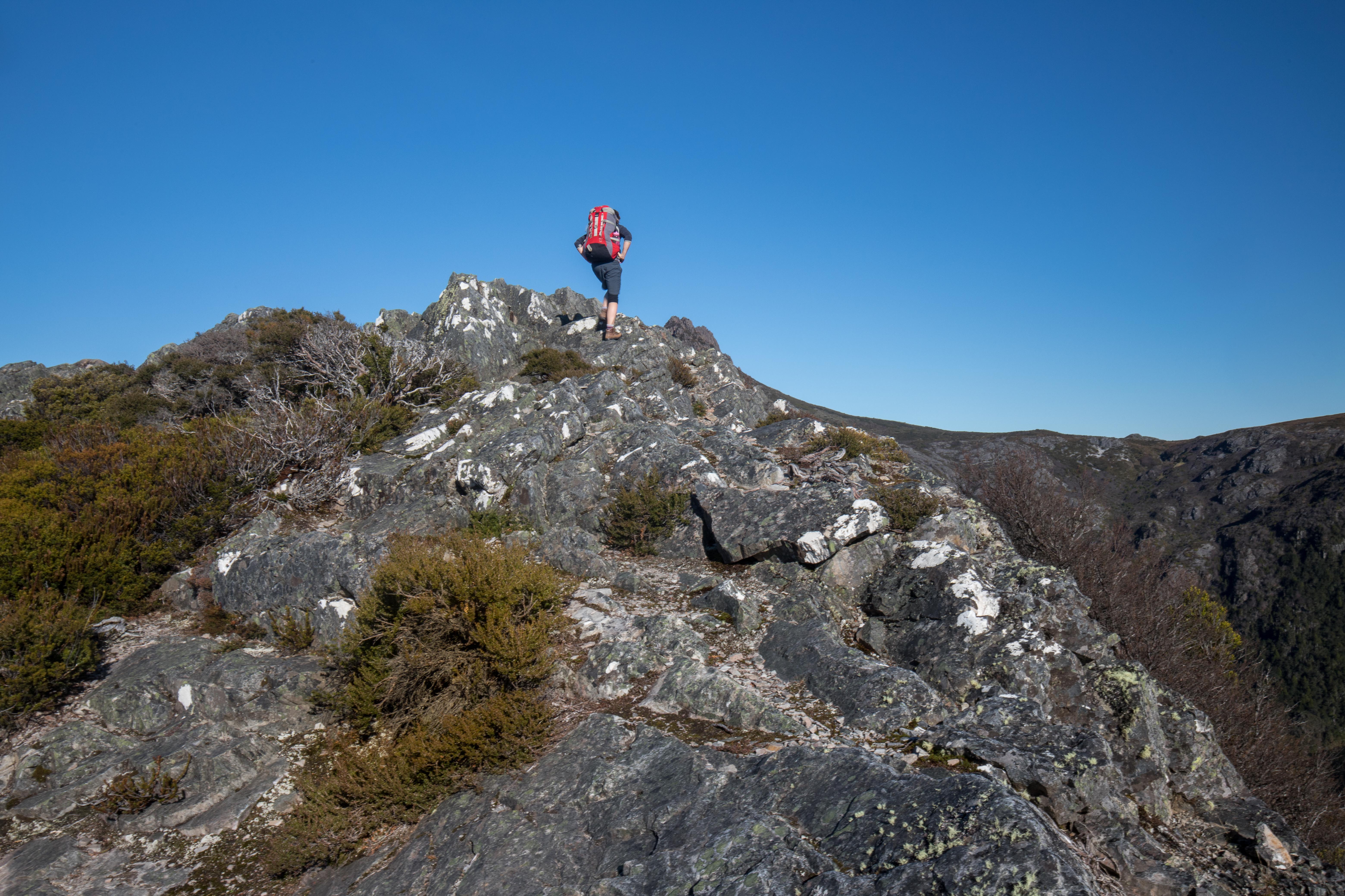
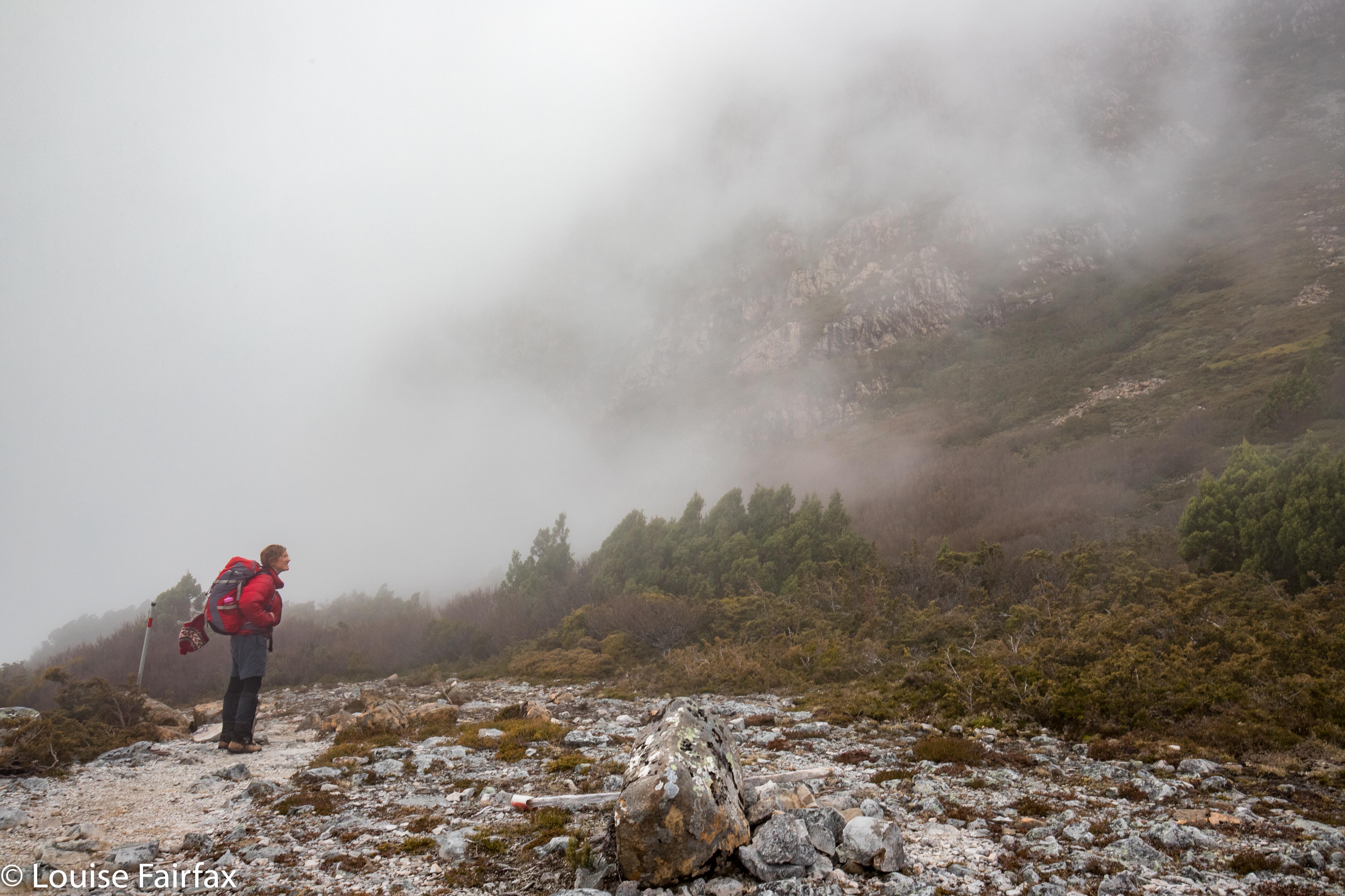
Can you see my daughter climbing? The light is already a bit too golden.
Down we climbed, trying to combine haste with care – the need to get out of here with the equally important requirement not to break a bone or damage a muscle needed for movement. (I was, a bit later, to skewer an eye with a twig, but that didn’t stop forward progress, fortunately. I bled and kept going).


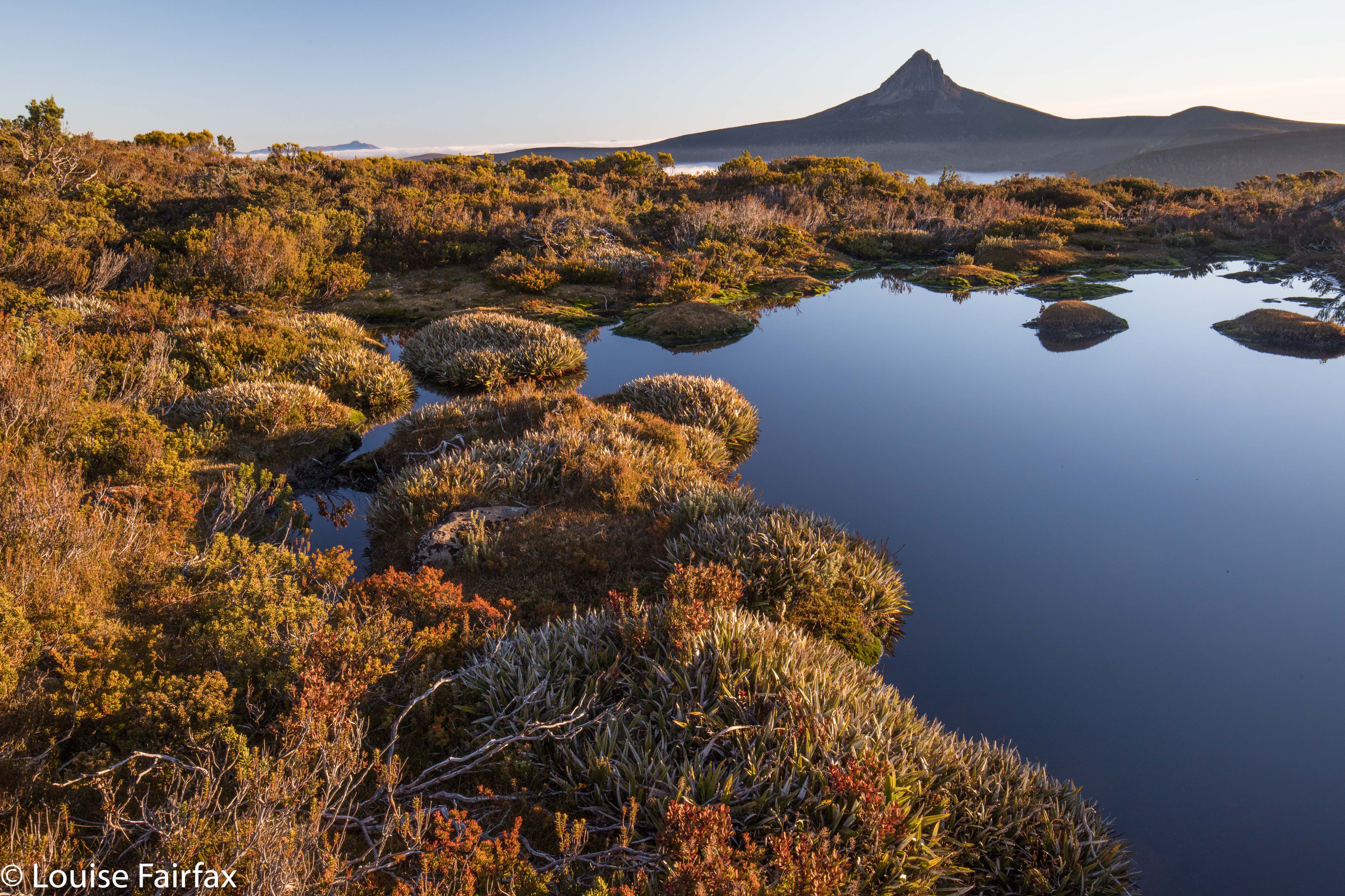
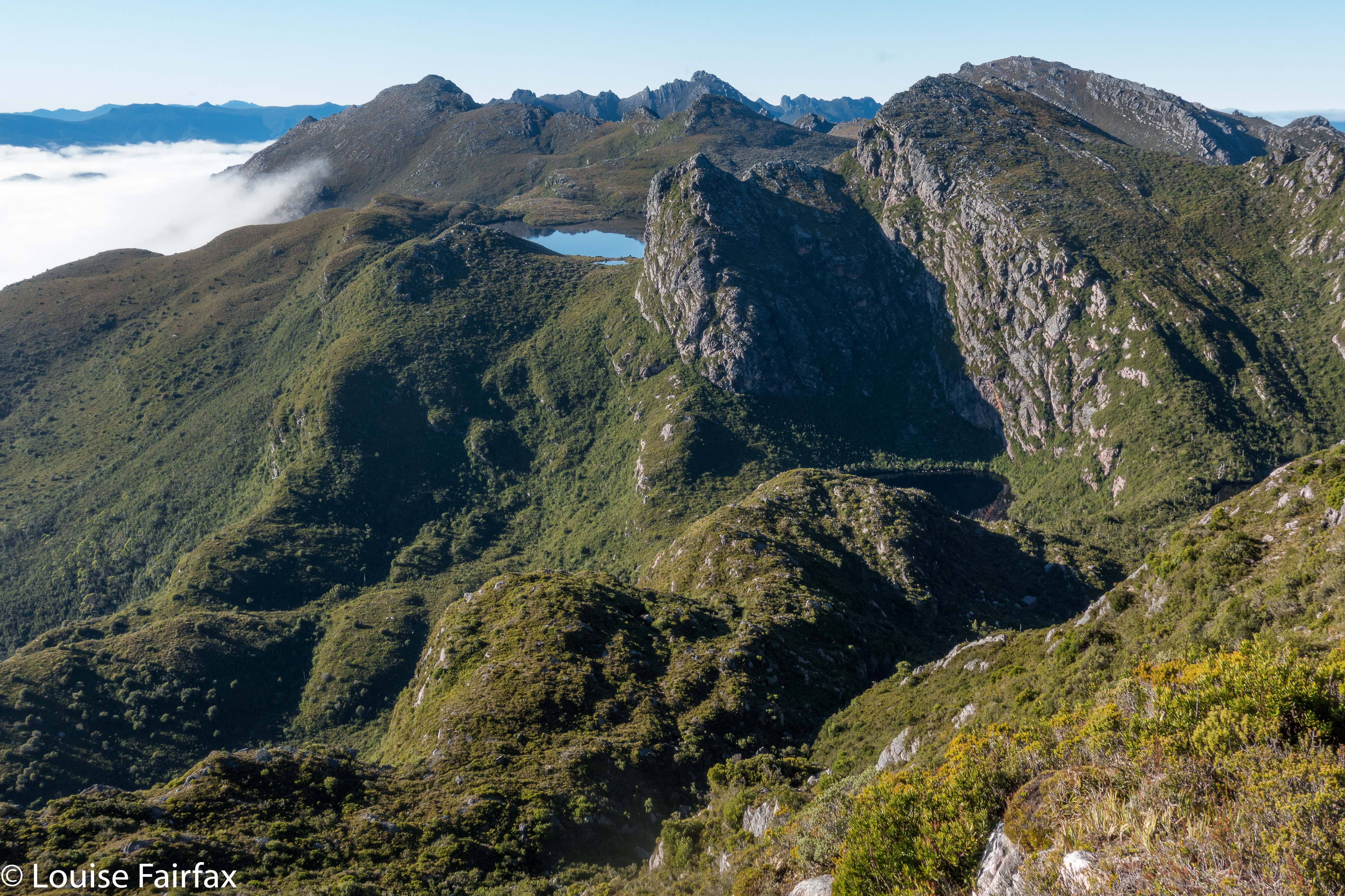
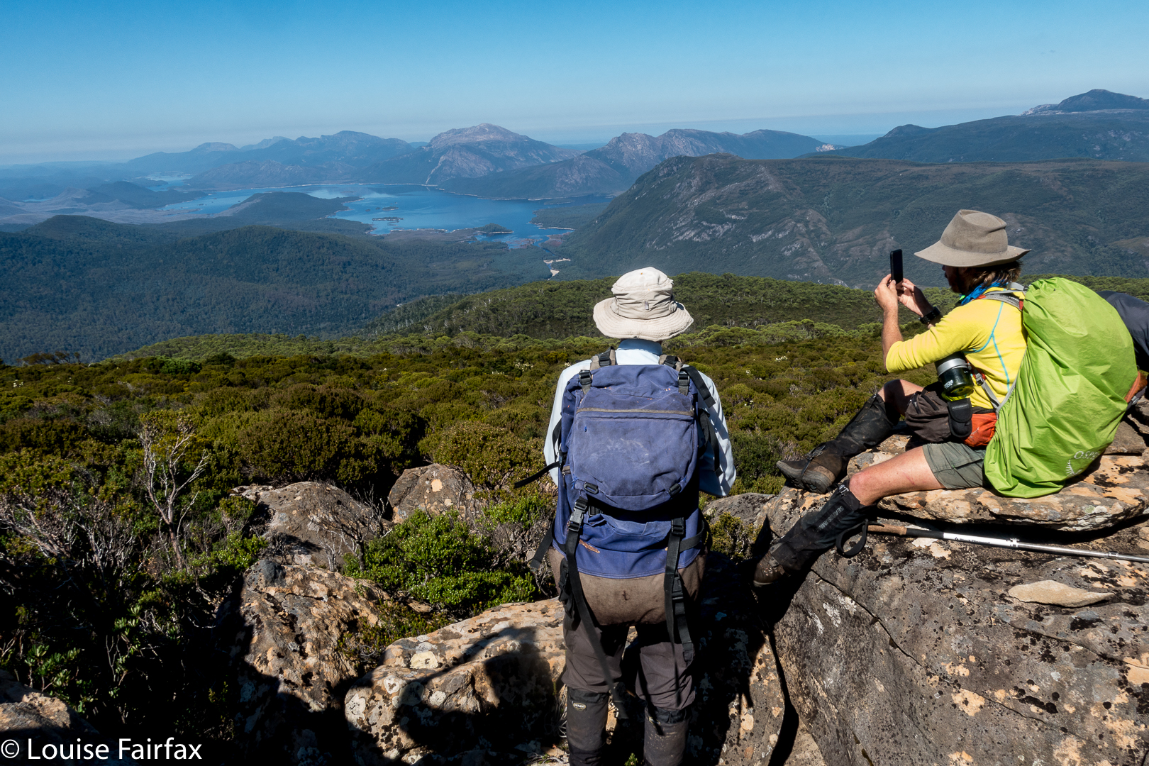
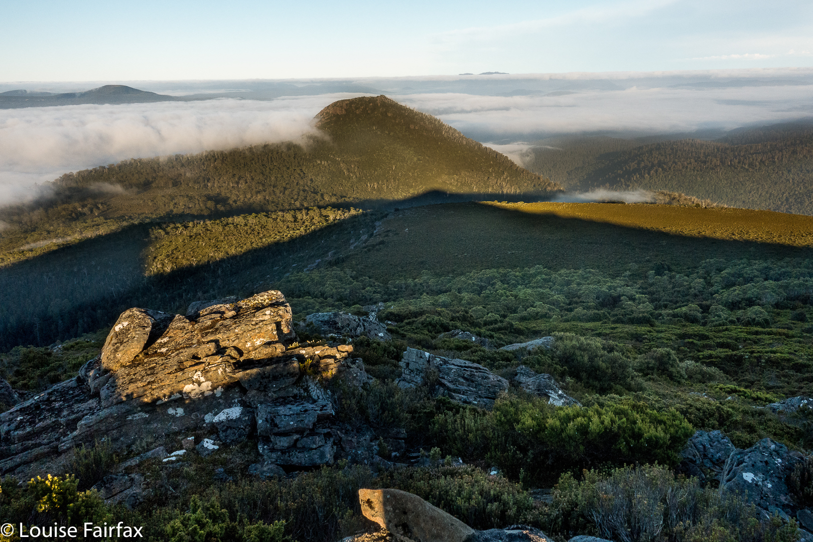
That’s Barn Bluff in the distance there.
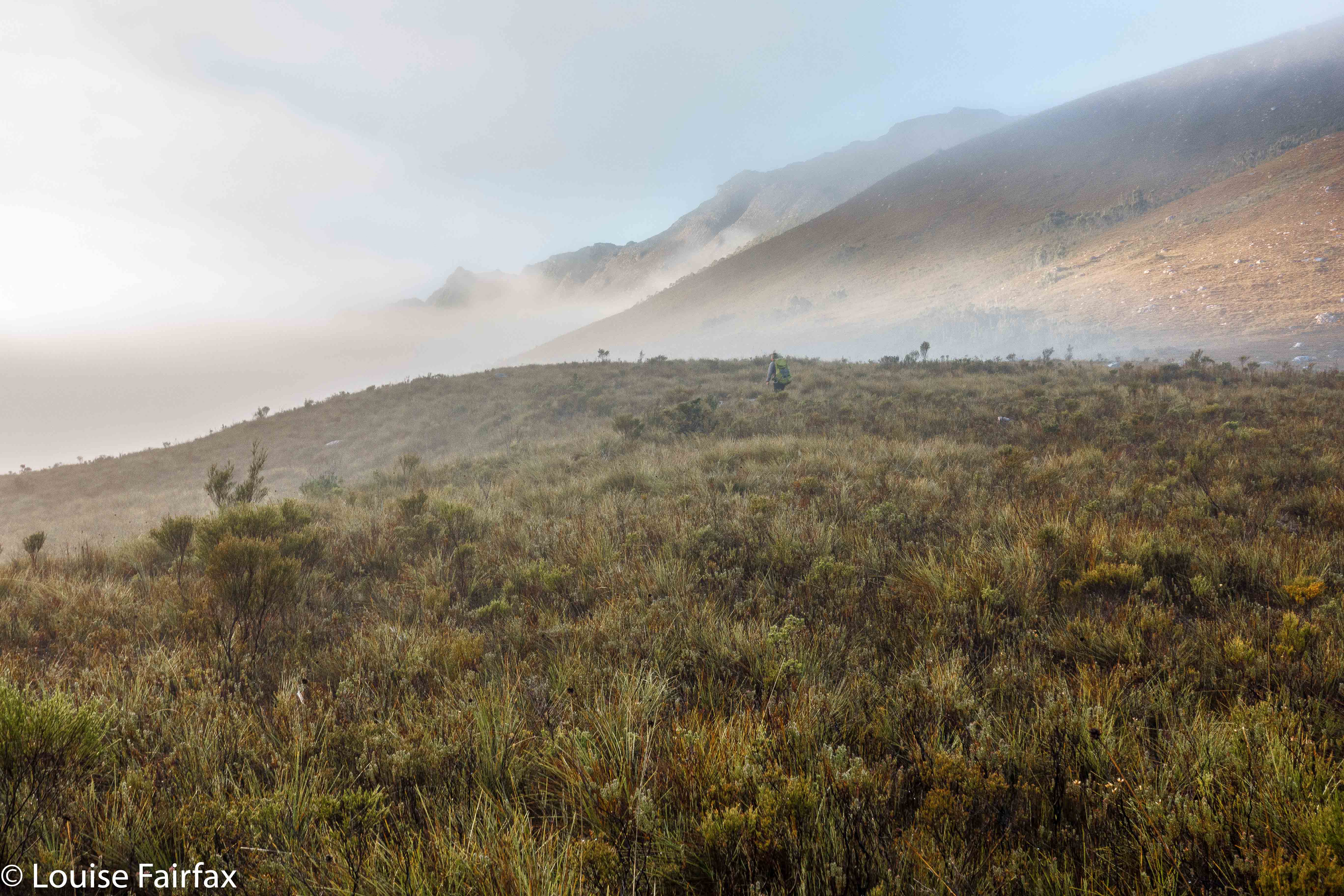
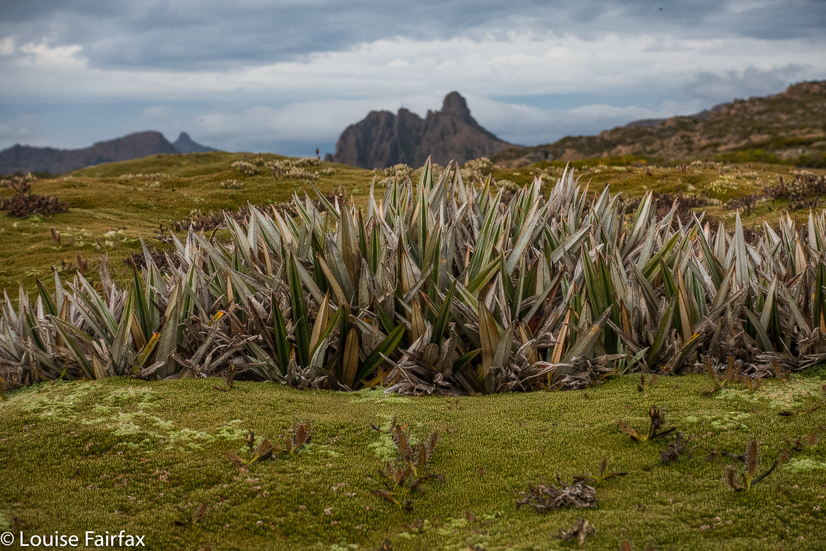
It wasn’t just that darkness was rapidly approaching. My anxiety lay in the fact that the “Emmett-Lump saddle” ahead was very thick indeed, with the barest hint of a pad that was almost impossible to detect even in good light. One metre to the side of that adumbrated pad, and you were in a fighting wall of bosky resistance from which you would not necessarily emerge that night. My other angst stemmed from the fact that, already, one could see ice crystals forming in slightly more open areas. It was not a night to be outside without the protection of tent, sleeping bag and insulating mats and so on. We just HAD to get out of here, and fast.


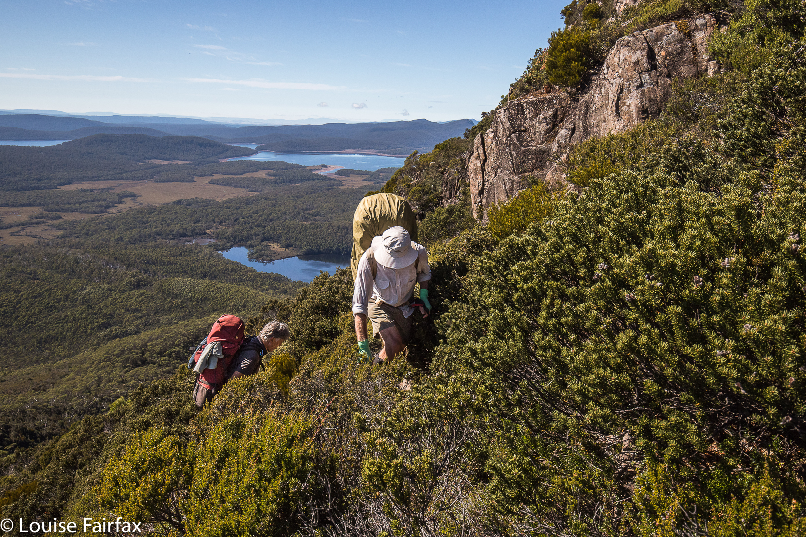
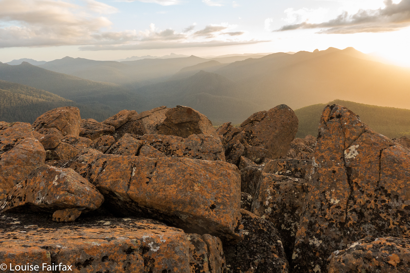
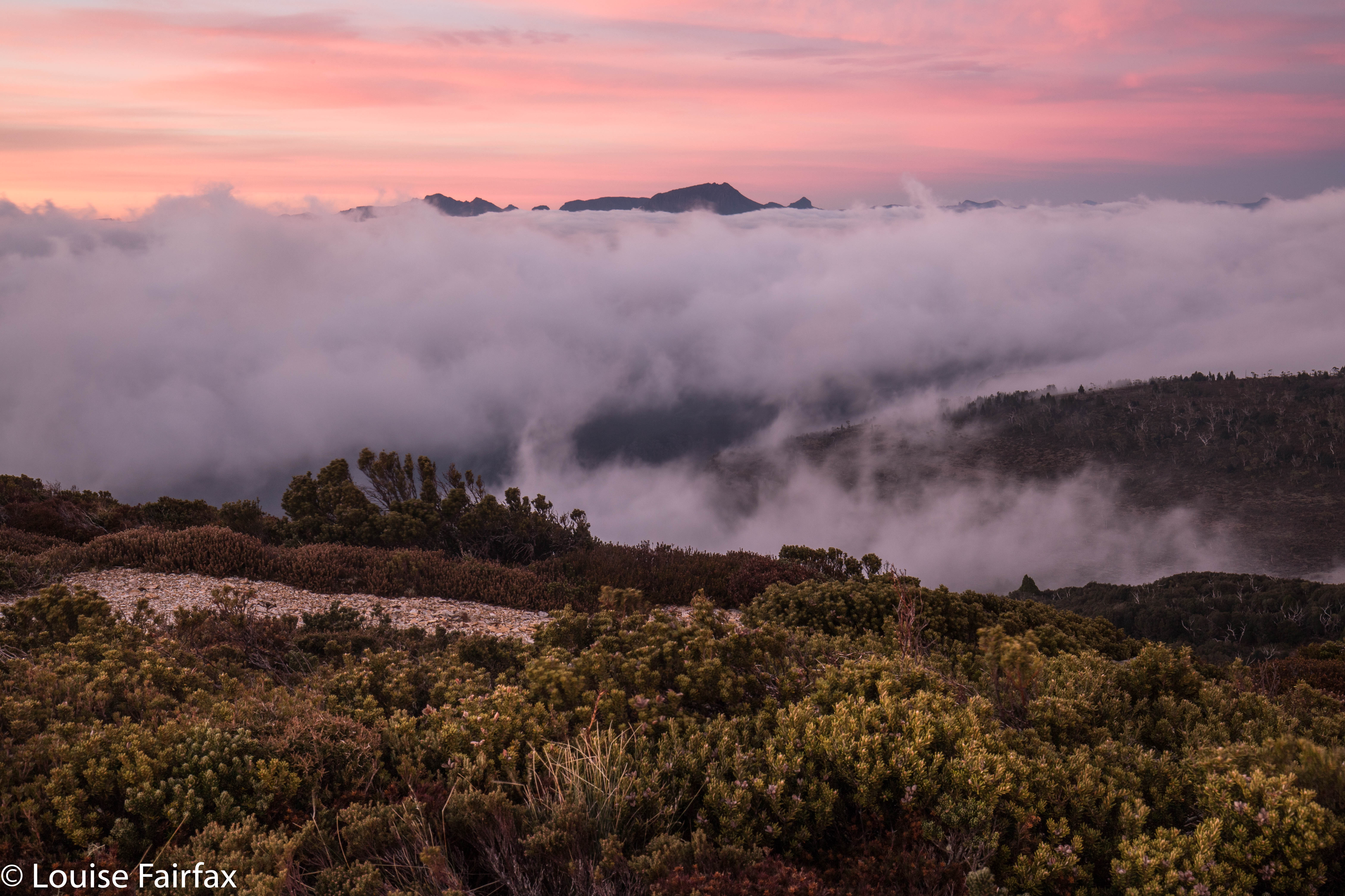
Oh oh. It’s getting dark, and we still have a big descent to do. But when it’s this beautiful, who cares about the time? Not us.
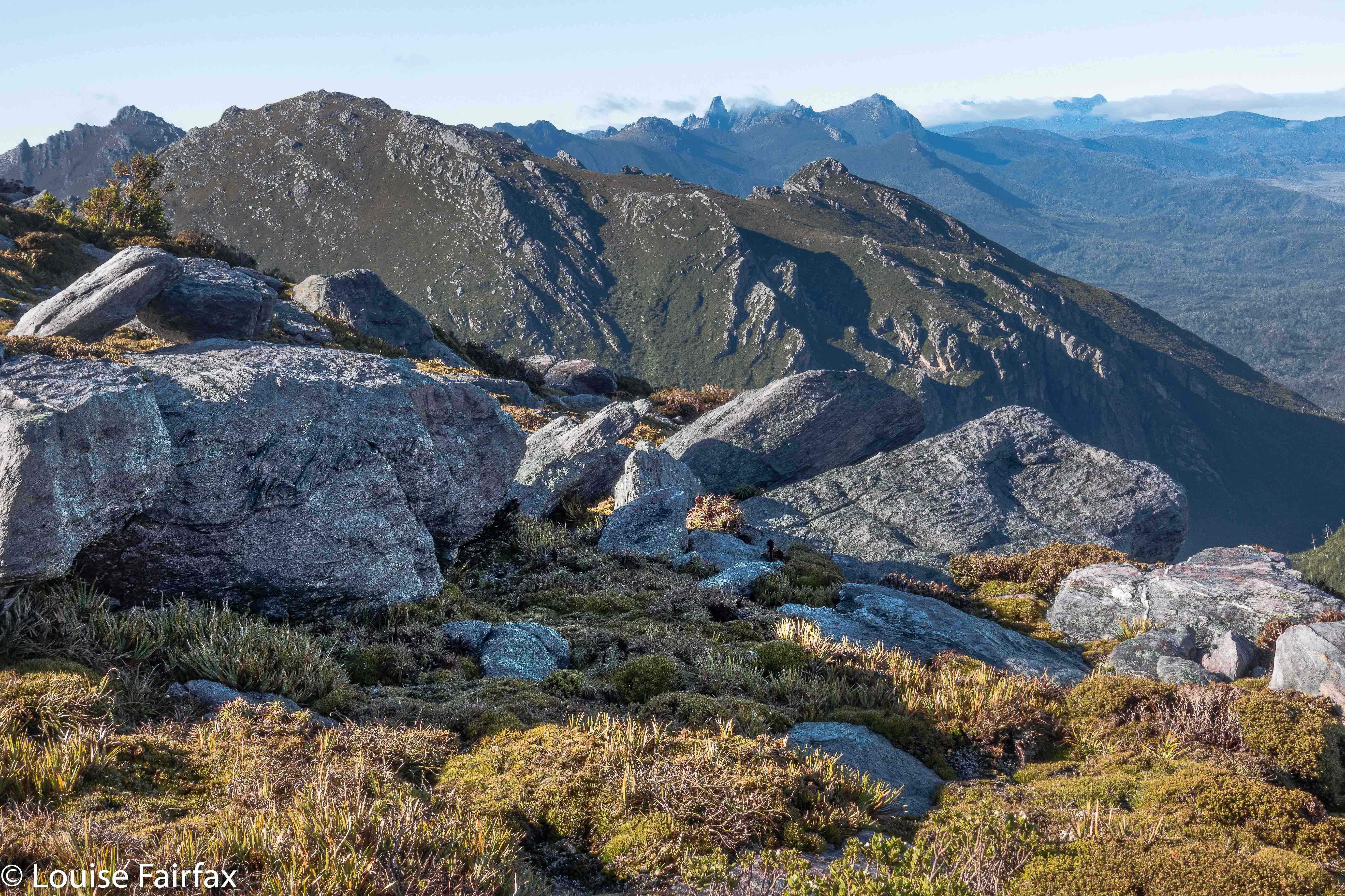
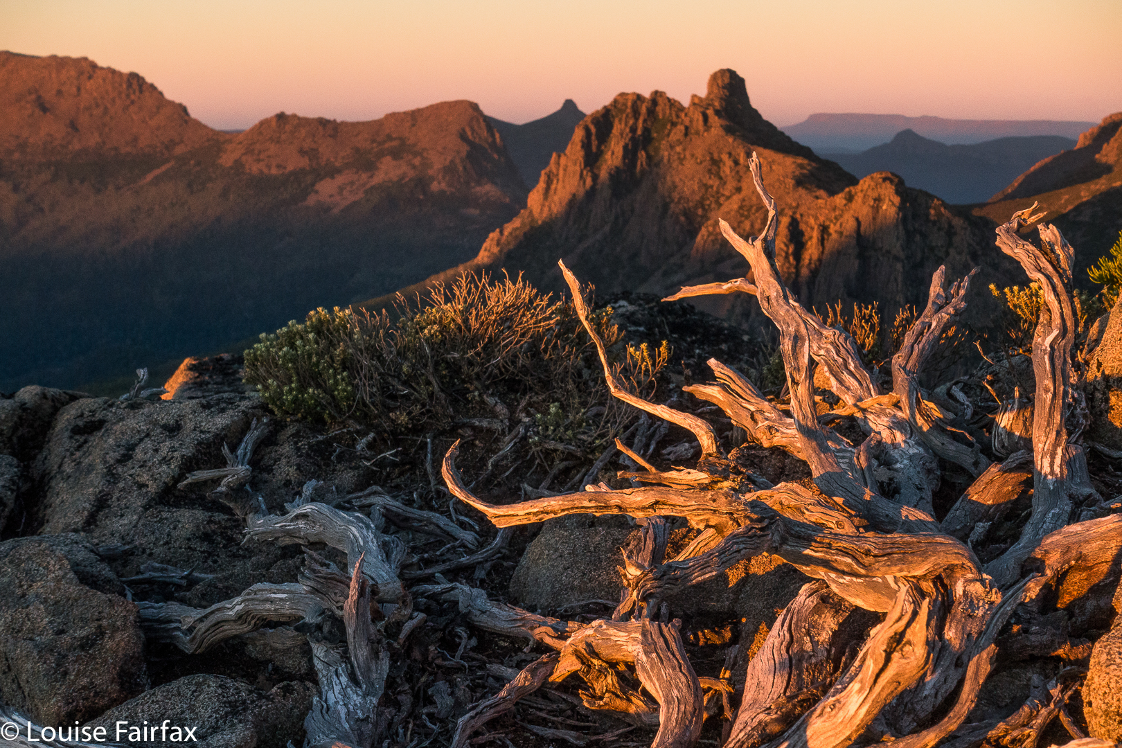
Out the other side of the thickest of the patches, we safely reached a brief band of alpine grass in between two scoparia swathes. I quickly grabbed a couple of photos, because all around, the scenery was beginning to look absolutely magical, but I still had too much sense of urgency for carefully constructed shots. We still had this last band to negotiate, and THEN we could relax. After this next part, the rest would be easy alpine terrain and then a track. It wouldn’t matter then if darkness took control.


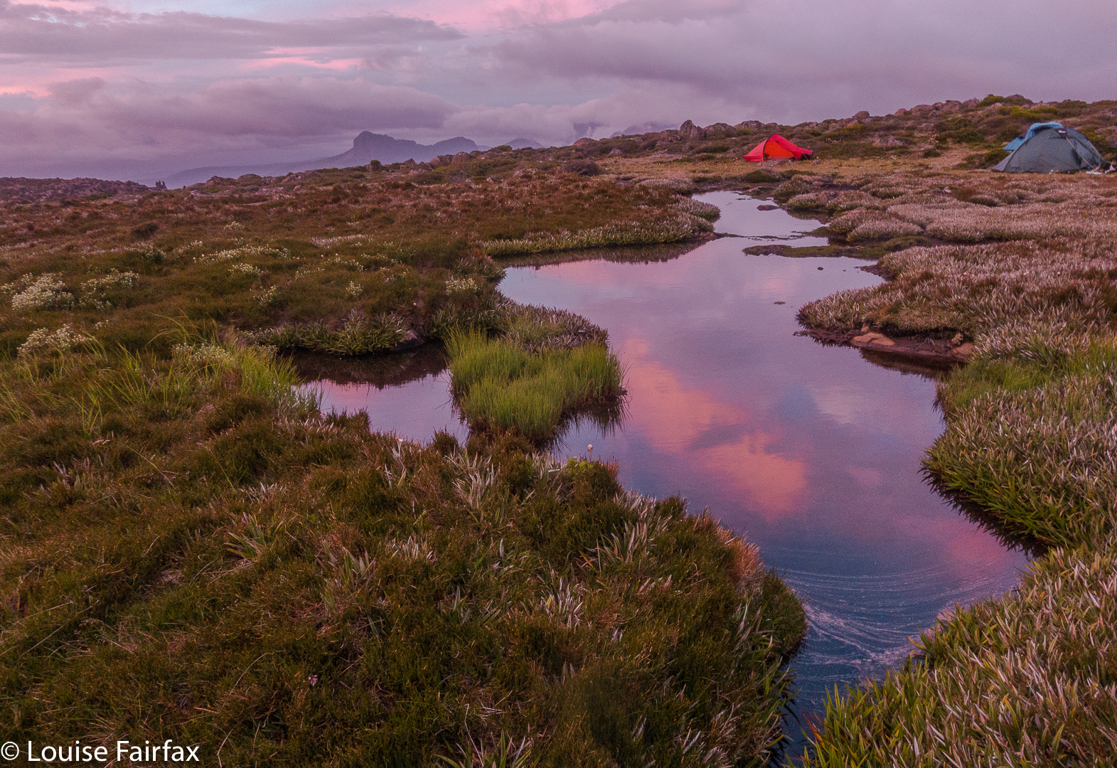
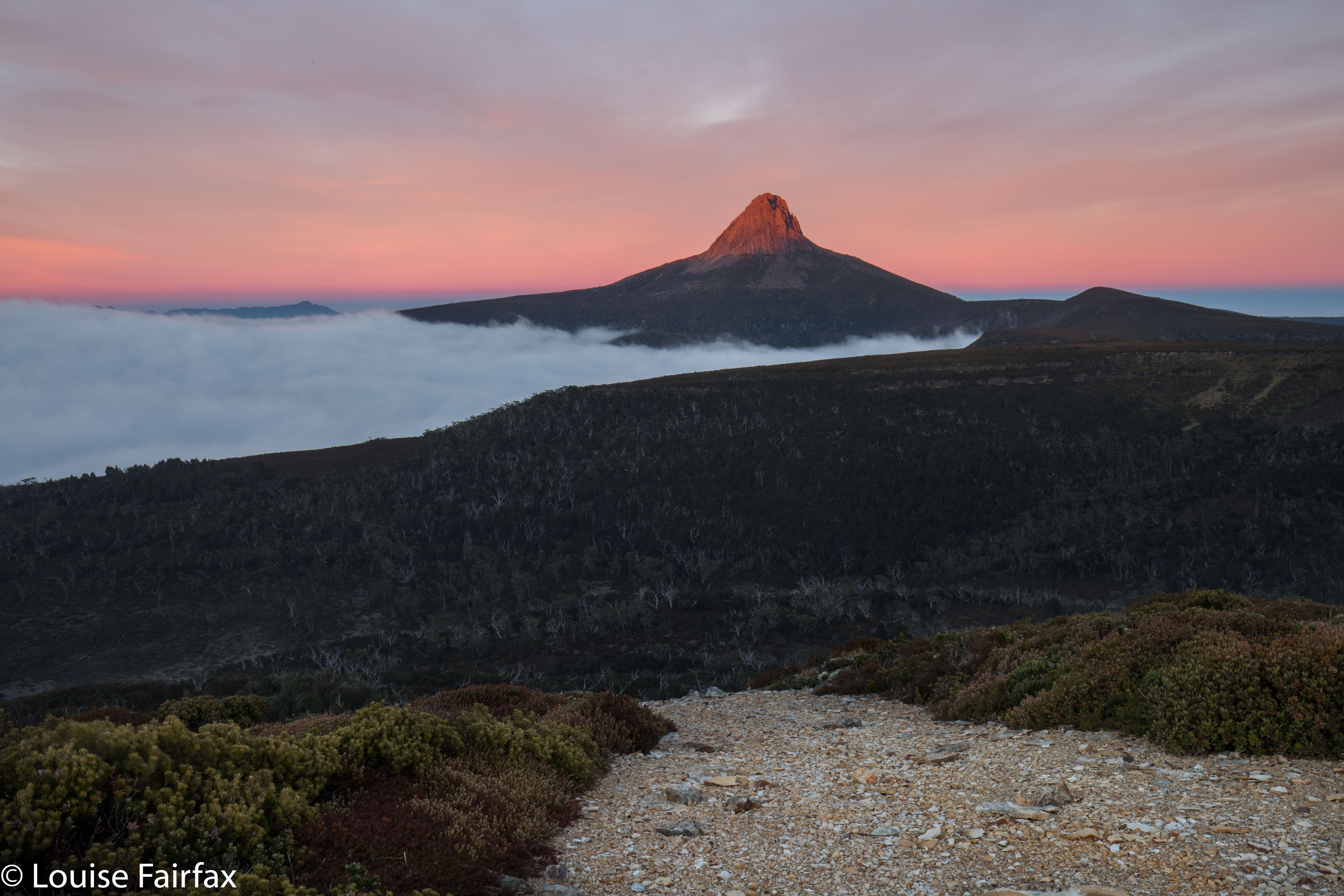
The dawn we climbed back up to see.
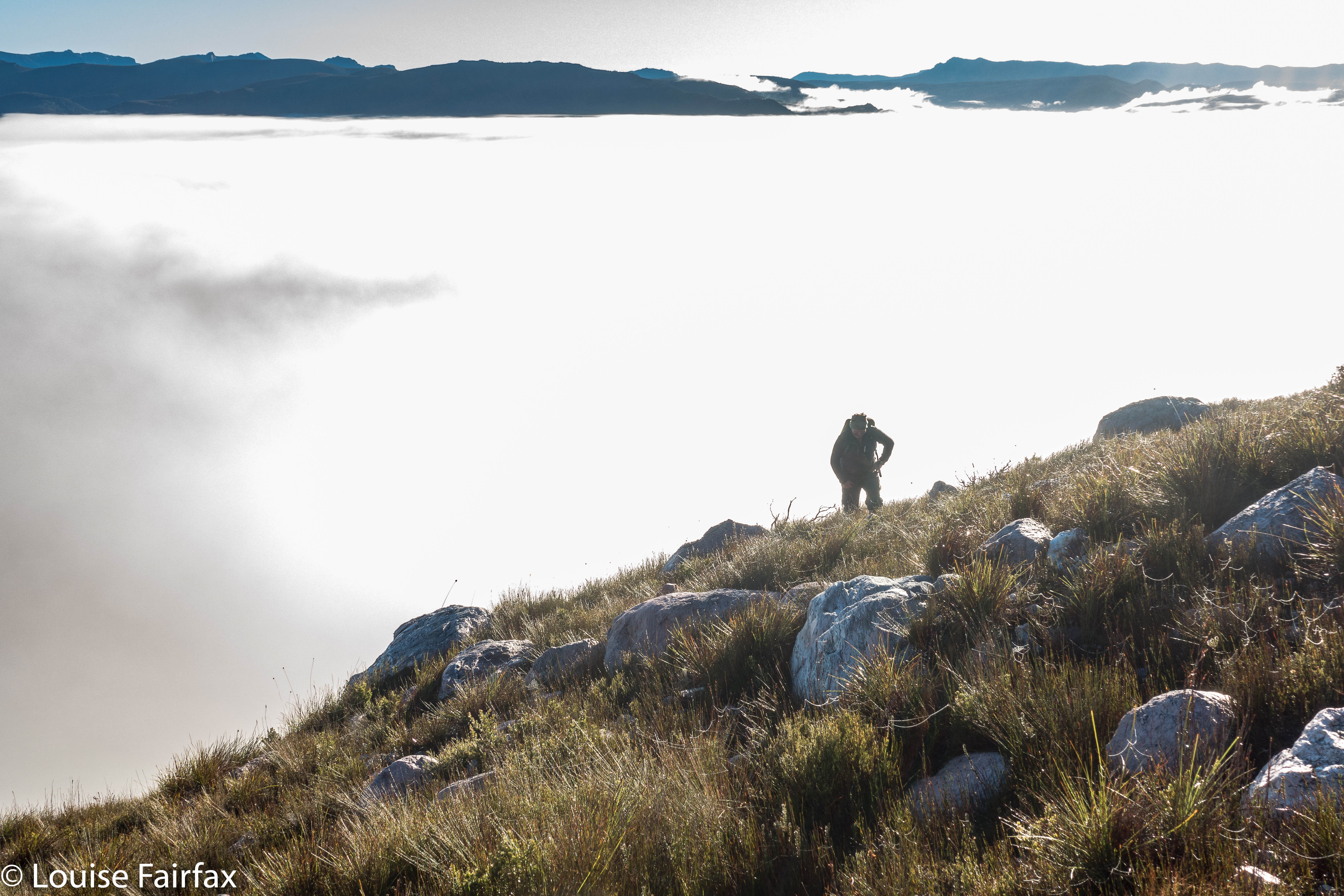
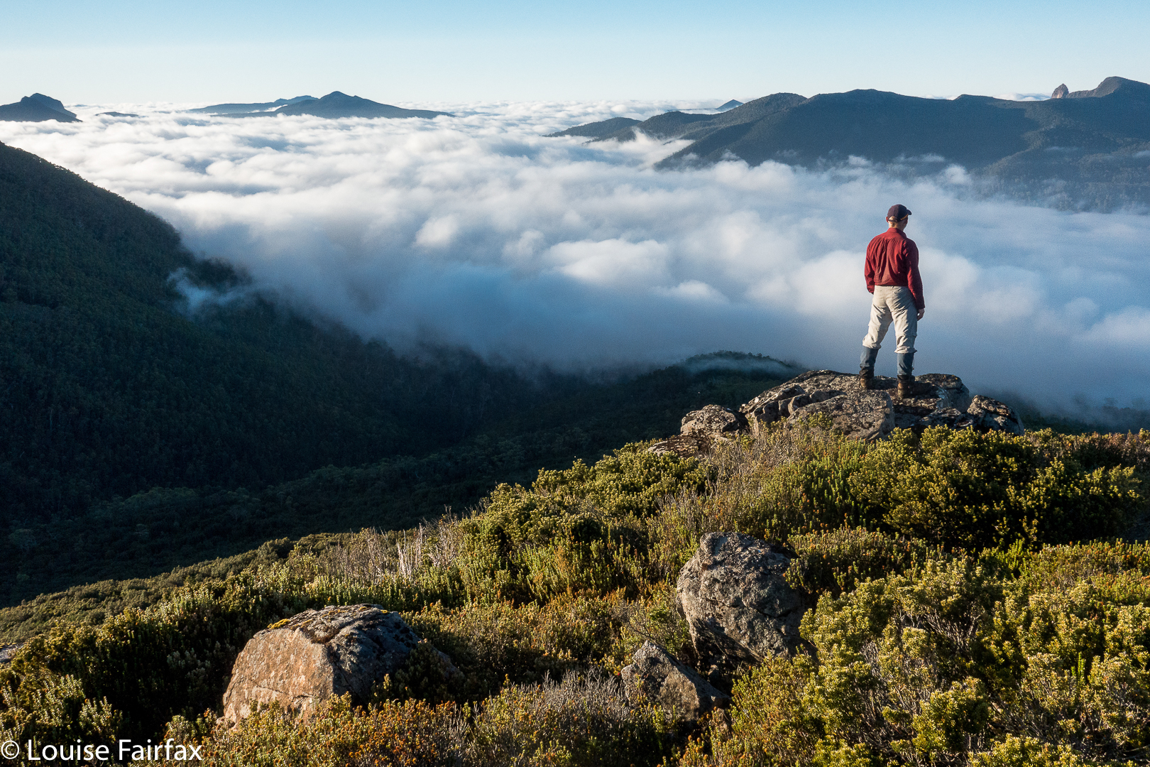
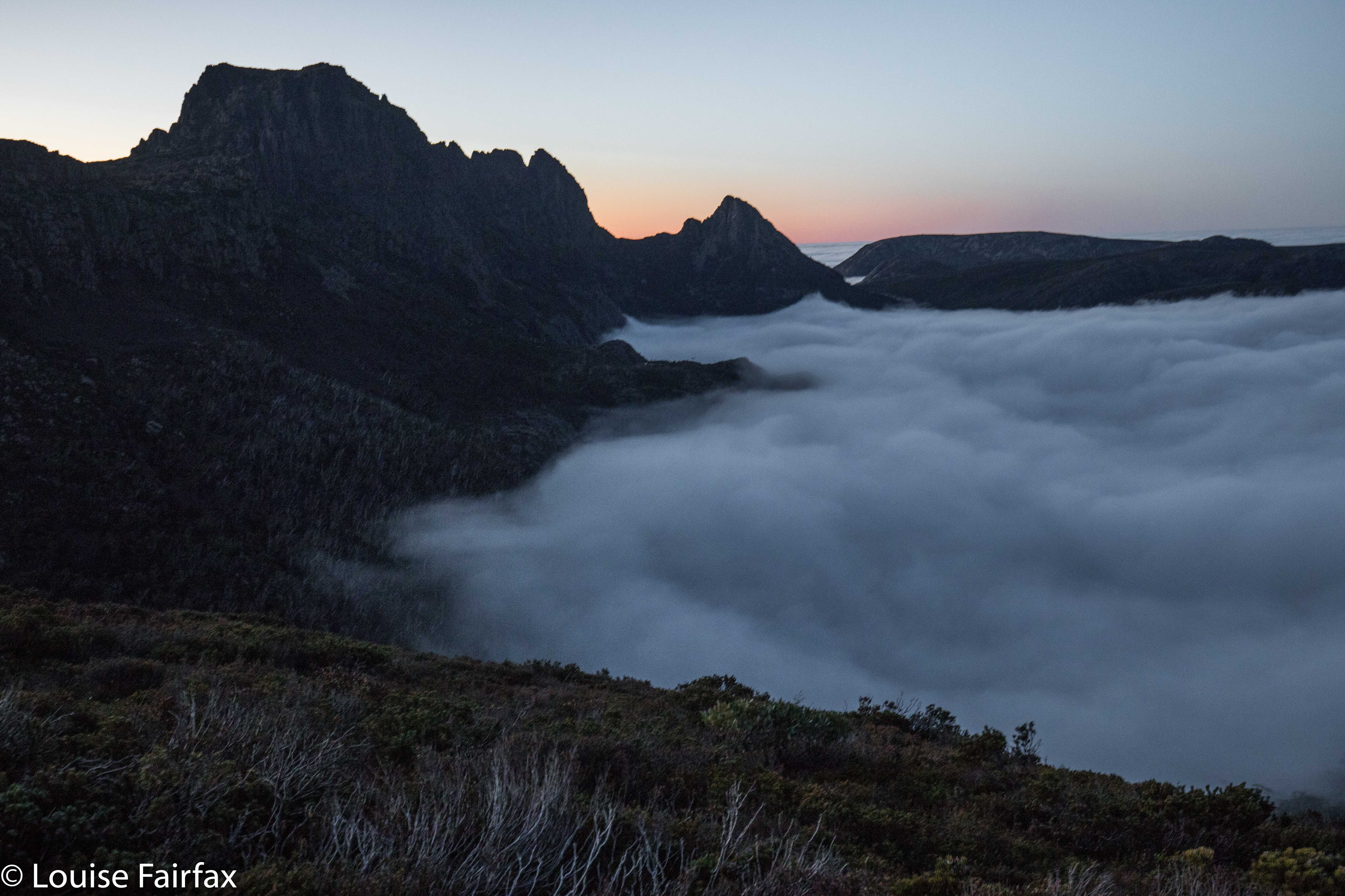
Mist rose to left and right in roseate, colourful swirls that chased each other across the slopes, obscuring and then revealing the mountains all around. Indelibly etched in my mind is the image of these wisps, my daughter’s silhouette and the setting sun behind Cradle Mountain just ahead. It took your breath away. At last, all the tricky parts were dispensed with.


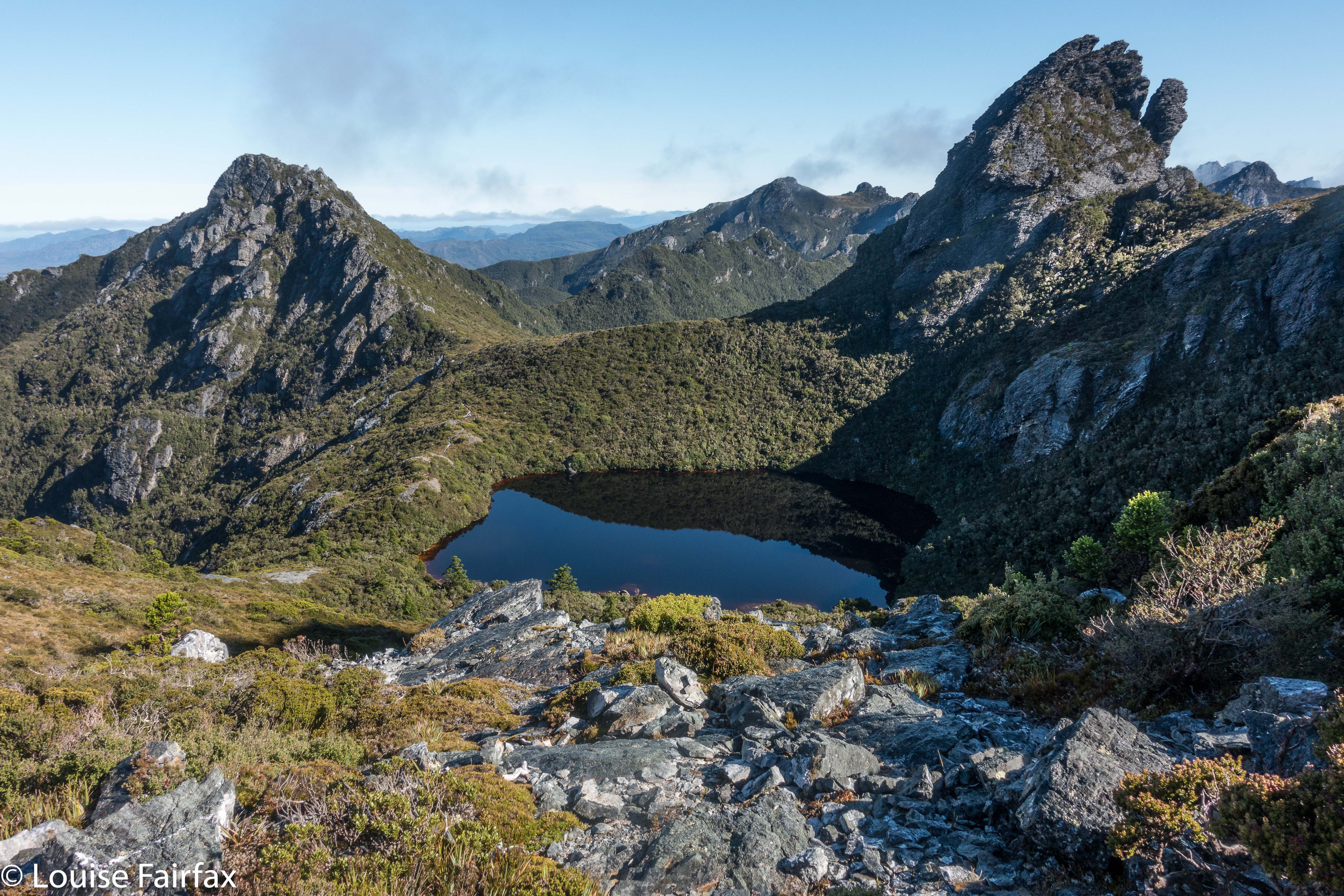
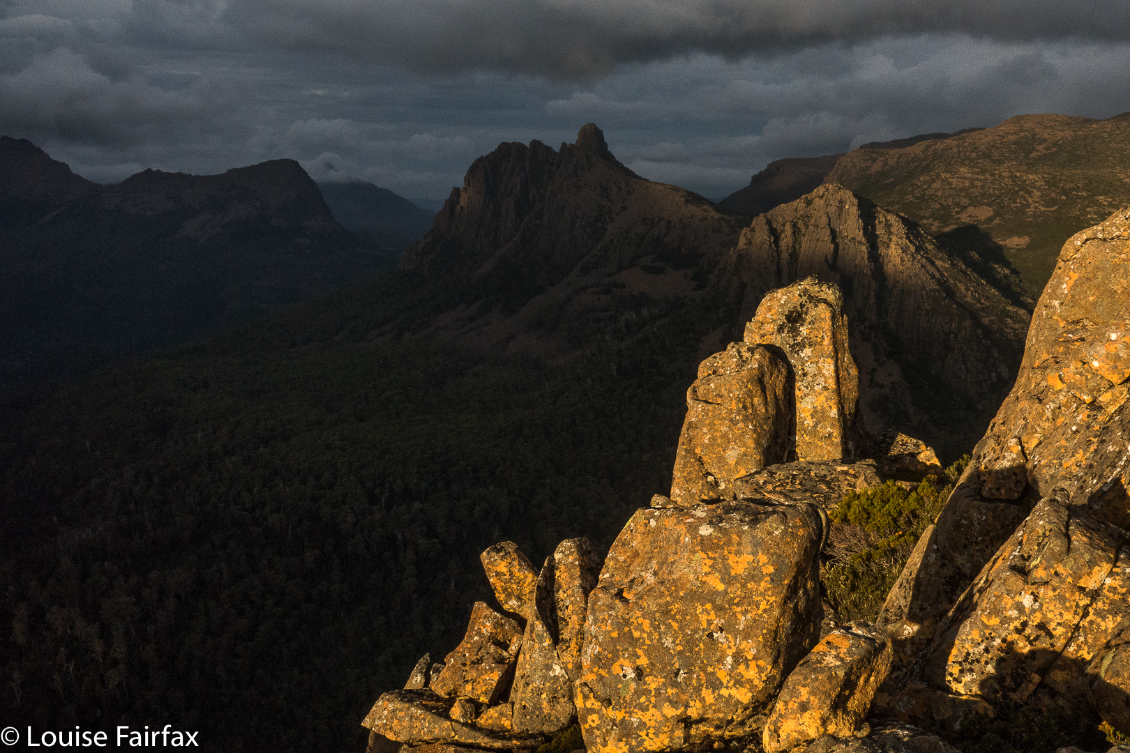
Now we could relax and photograph and enjoy. We’d missed the best light, but the remnants were still floating us up in waves of pleasure. Behind us lay the mountain of our quest, Mt Emmett, which had entered the “blue hour” tones; leaning over its shoulder was a nearly full moon, piercing the indigo sky. In front lay Cradle Mountain , which was still sporting alpenglow pinks, yellows and burnt orange.  The clouds swirled some more.


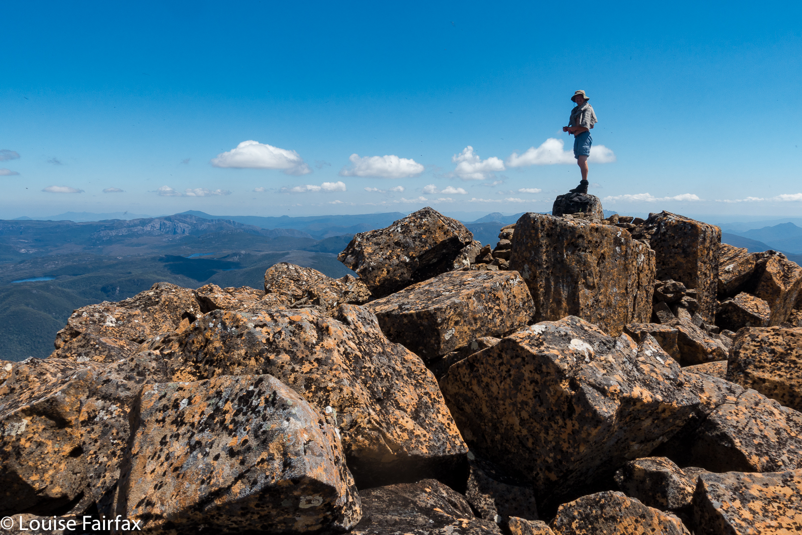
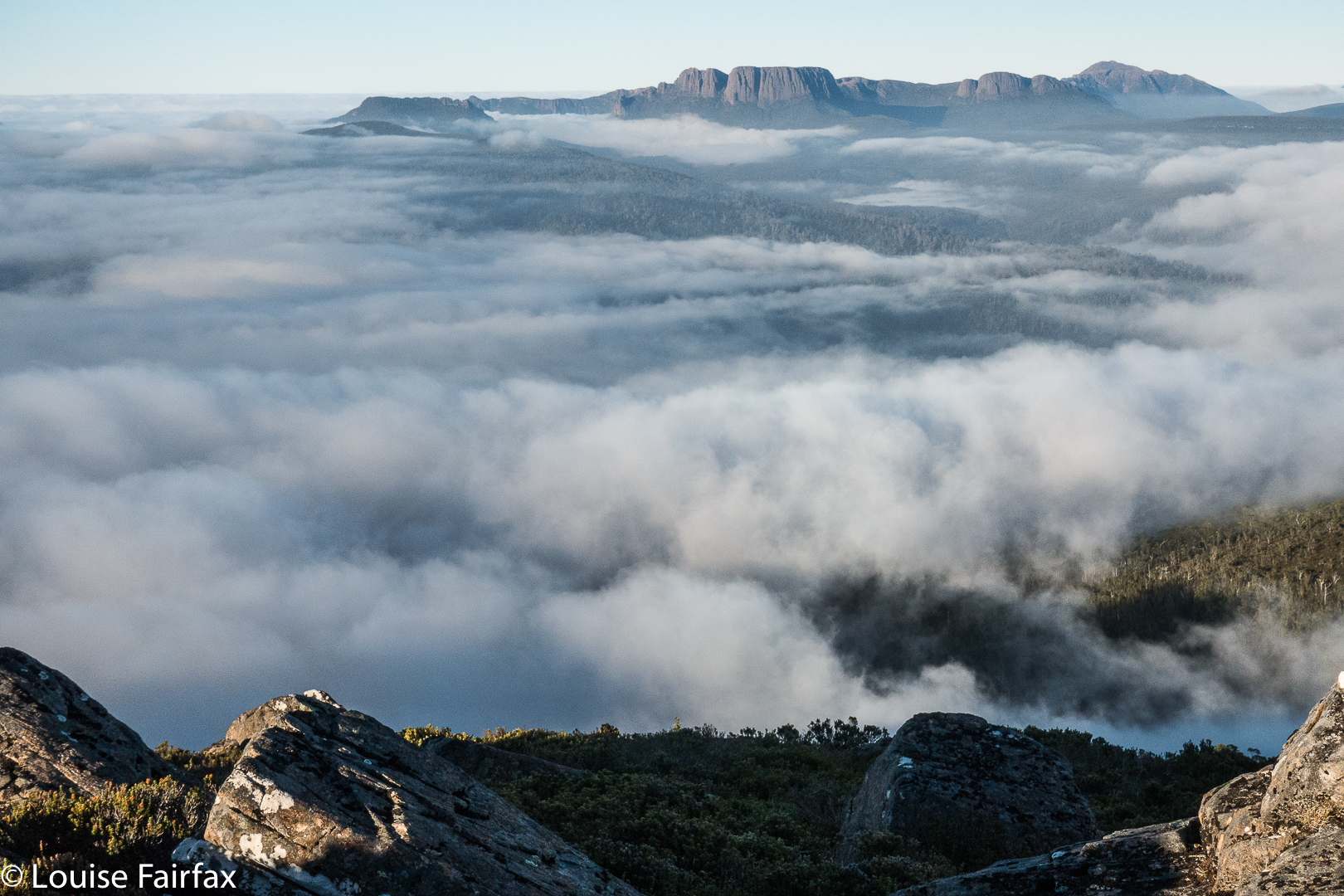
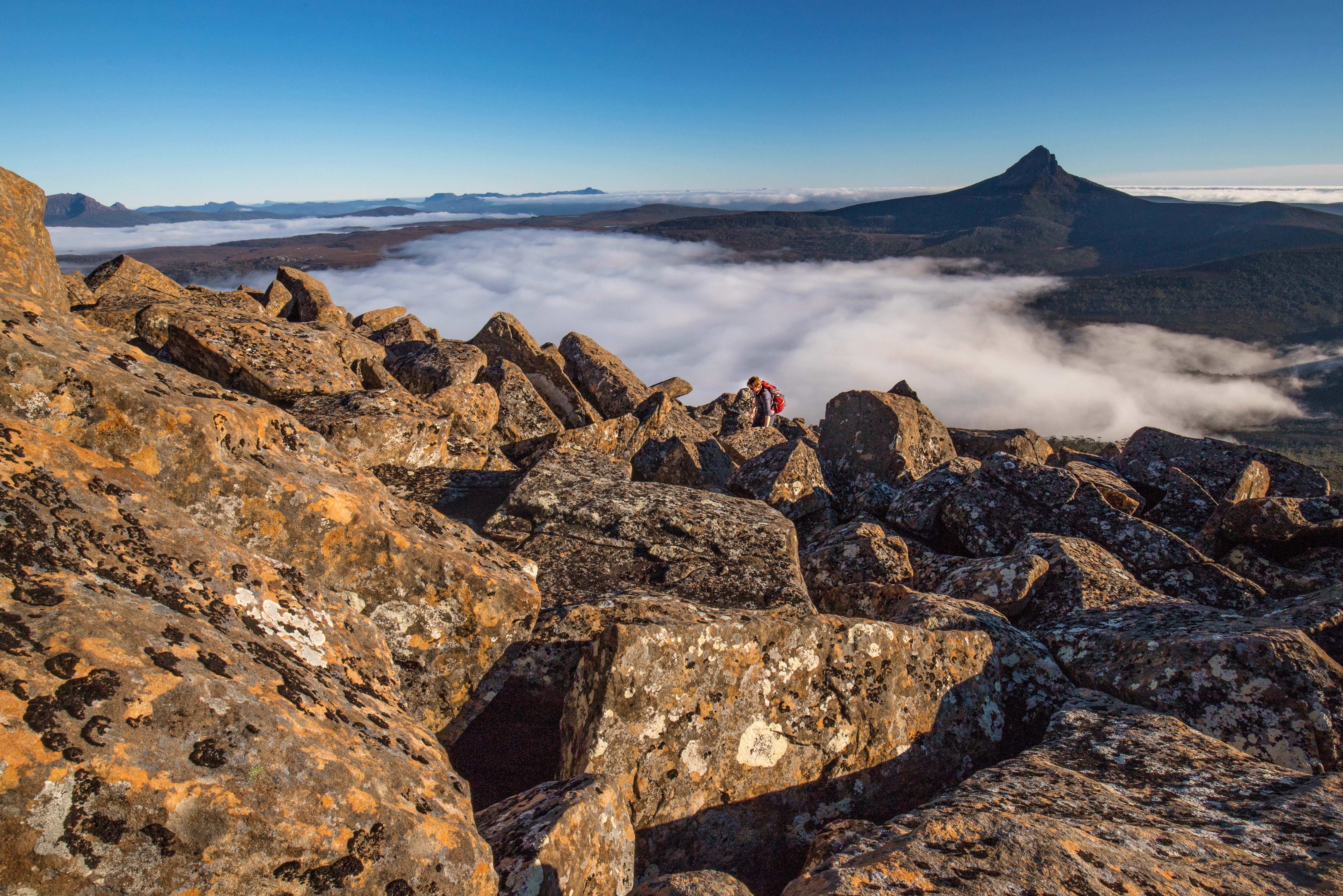
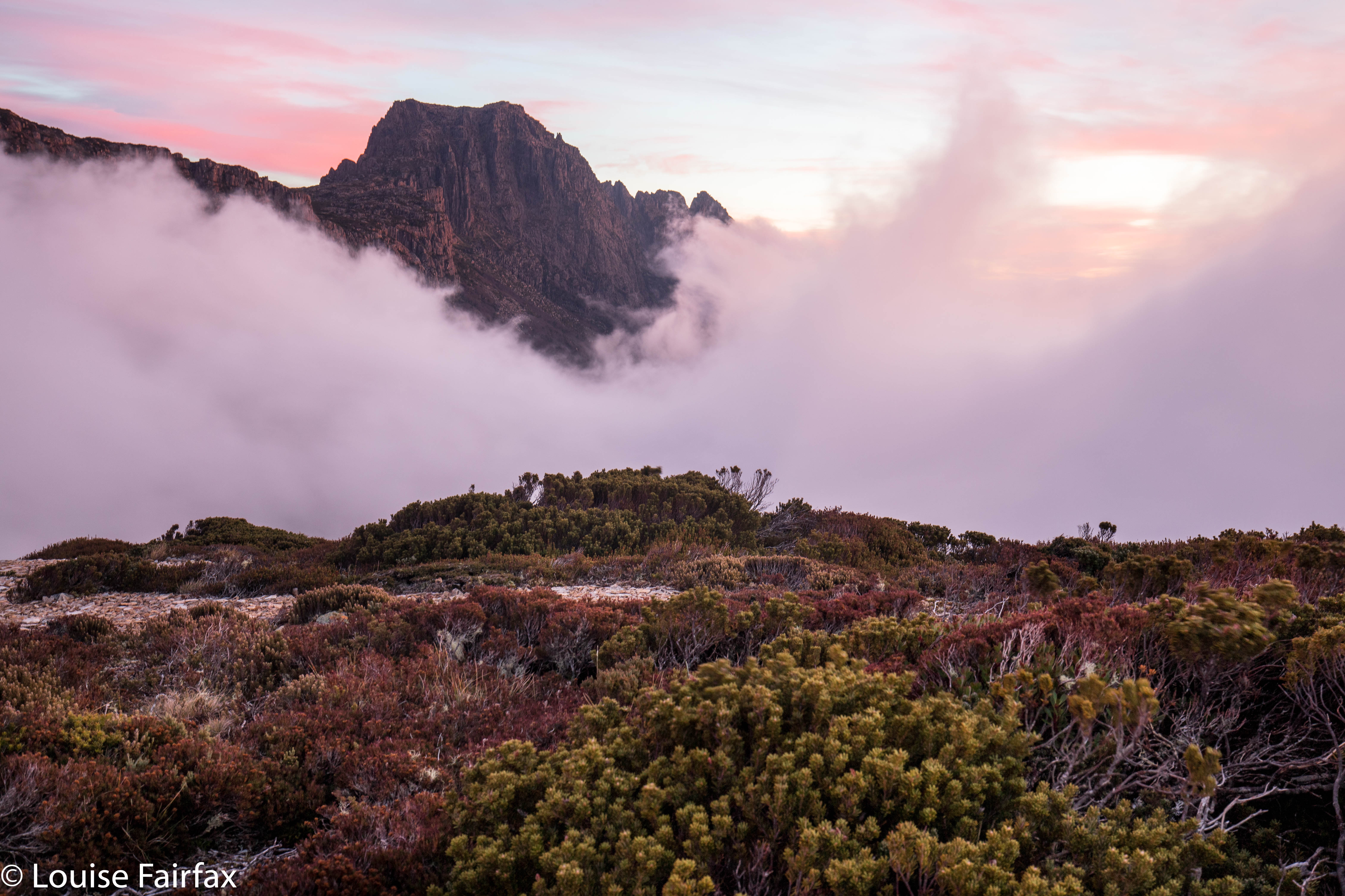
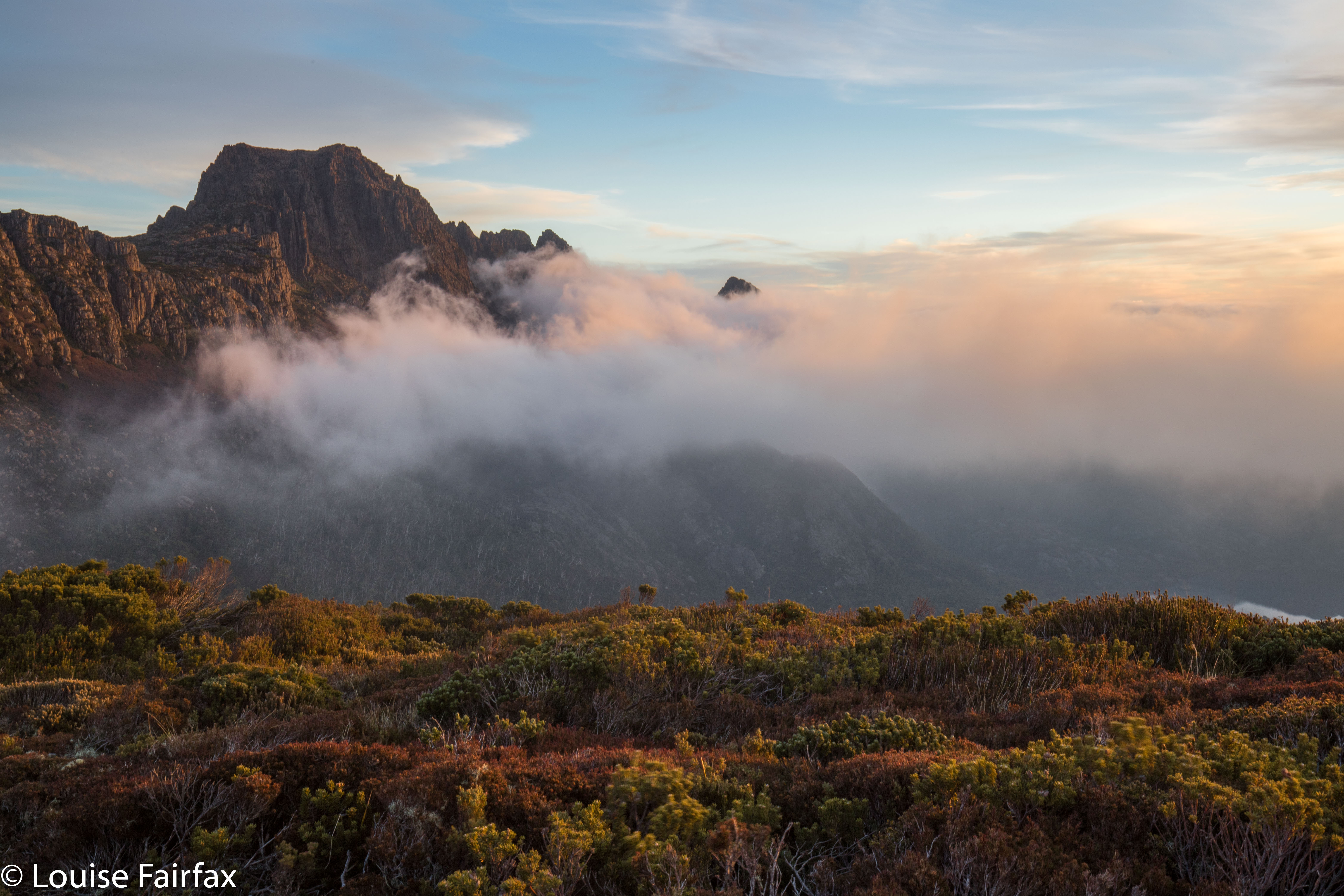
Pelion West and Ossa floating above the clouds.
“Hey mum”, said Kirsten, “Let’s climb down the mountain to our packs, eat, and then bring our stuff back up here to sleep.” (We’d left our packs at Rodway Hut far below.)
How I love my daughter!!!! I don’t know anyone else in the whole world who would say that to me. To say that, you need to love nature so much you’re willing to do it; you need to be fit enough for it to be a possibility (we’d already had a very full day, as you might imagine); and you have to be as zany as I am. Who else, but a daughter?
“Yes, yes. Fabulous idea”, I enthused.
Now, the job of descending from this realm of beauty was less depressing. We’d be back in a few hours.


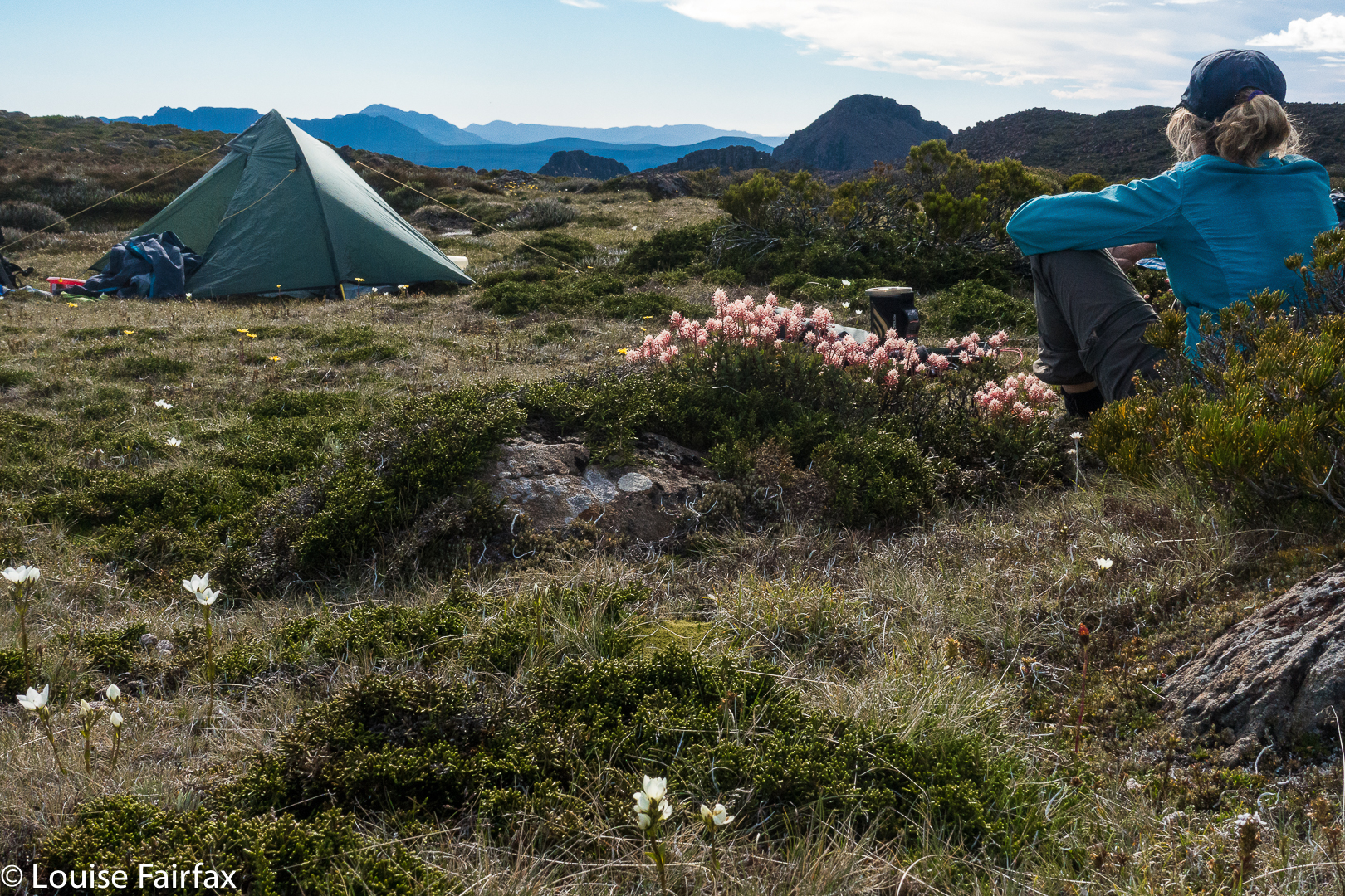
Back at Rodway Hut (where it was surprisingly cold inside), we cooked and ate dinner, packed our stuff back in the packs, and off we set up the mountain for the second time that day (having driven from Launceston that morning). We left the hut about 7.30, torches on and climbed through the moody rainforest, with patches of silvery moonlight casting shadows every now and then.


When we arrived back on top, despite now being much higher, we were a great deal warmer than when we’d left the hut. Climbing had warmed us up so nicely, we could pitch the tent without frozen hands (yet). It was so beautiful, with a star-studded sky, we barely had time to even ponder the extent of the chill enveloping us. As per our previous adventure together at Easter, (see my blog on Mt Sprent), we squished both of us into my solo Hilleberg tent. THAT warmed us up, definitely. We made sure we put our water under our sleeping bags so it couldn’t freeze overnight, had one last gaze at our starry environs, and turned in for the night. It was cosy, to say the least.
“You wouldn’t want to do this with someone you didn’t like”, I mused, before we closed our eyes to sleep.

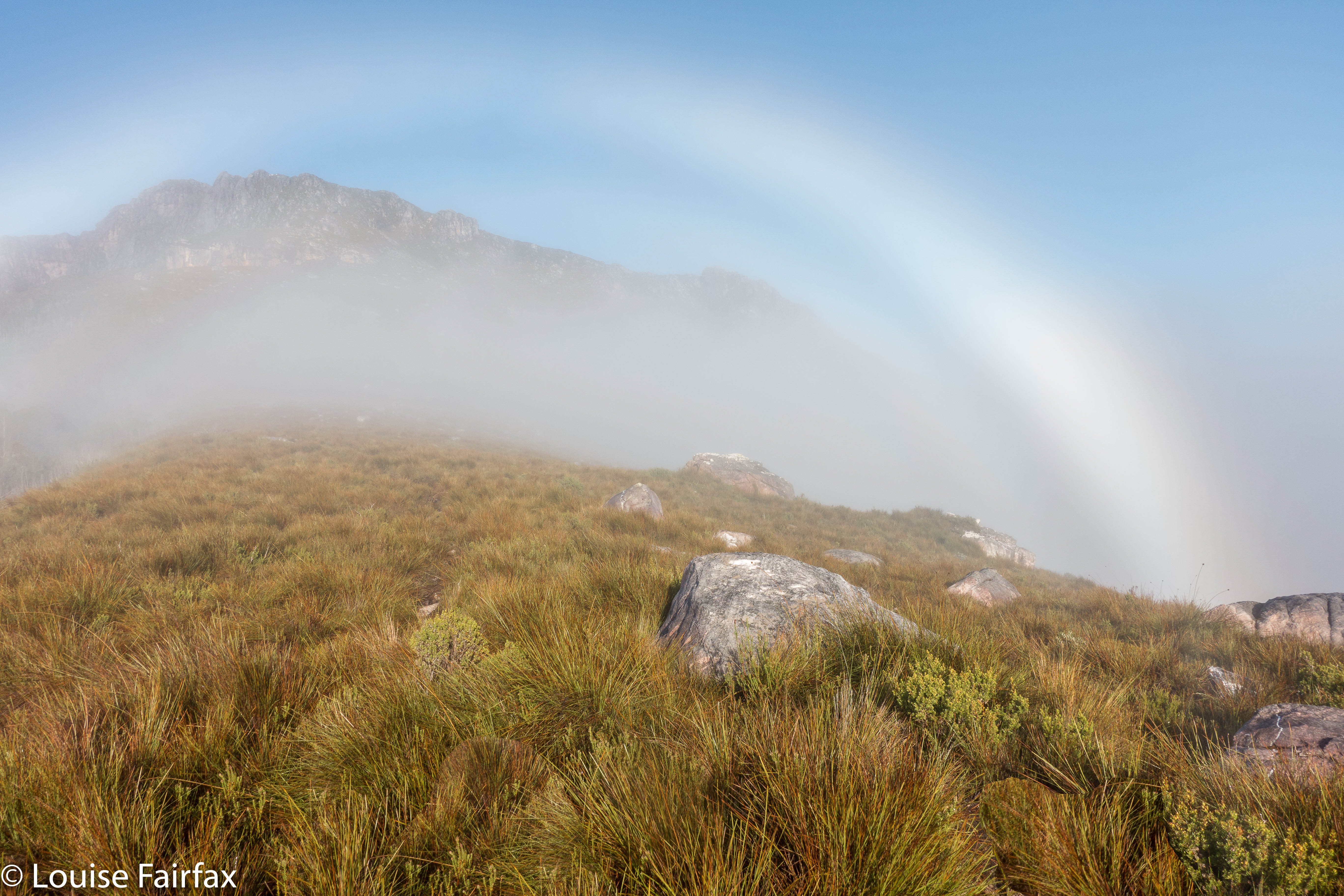
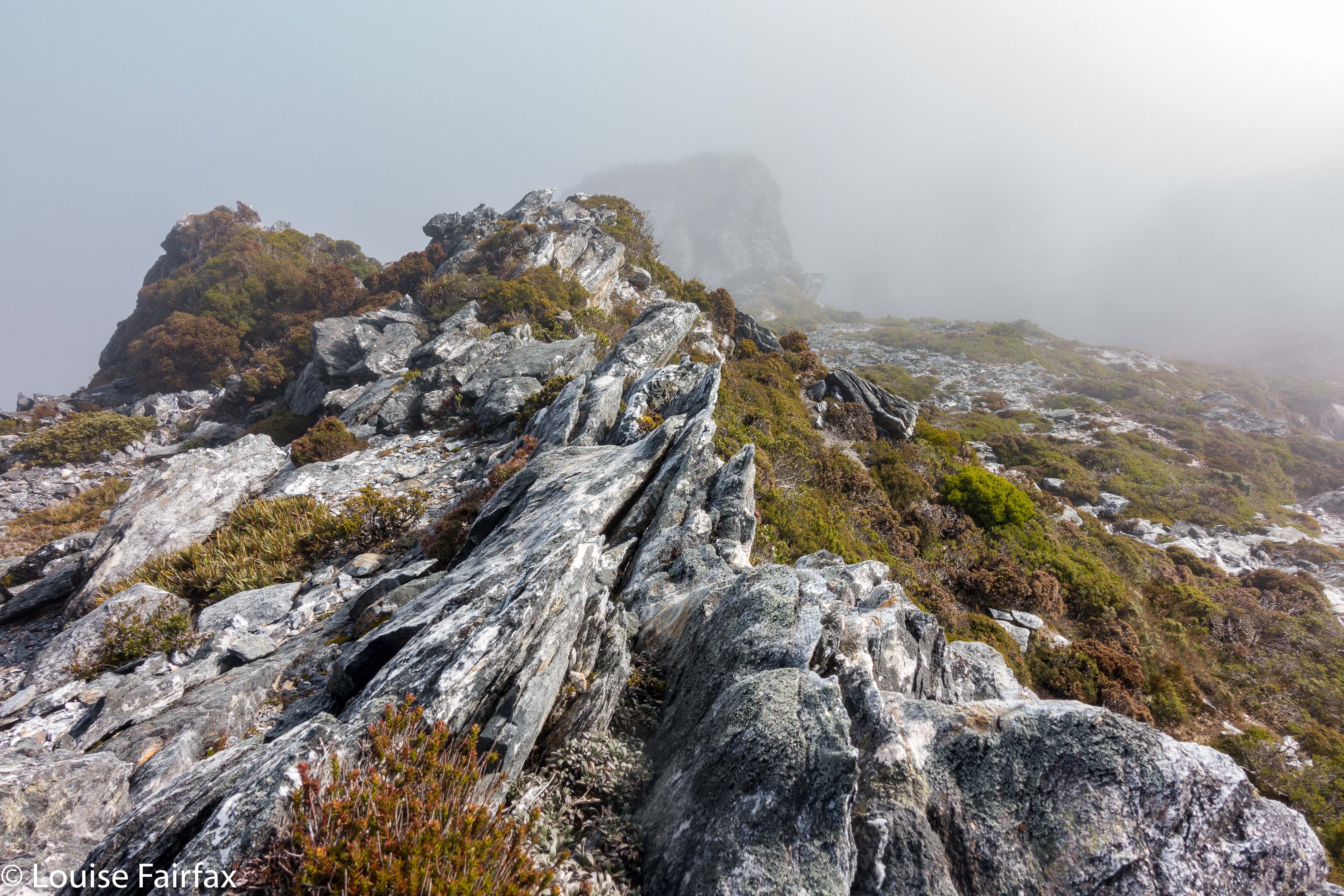
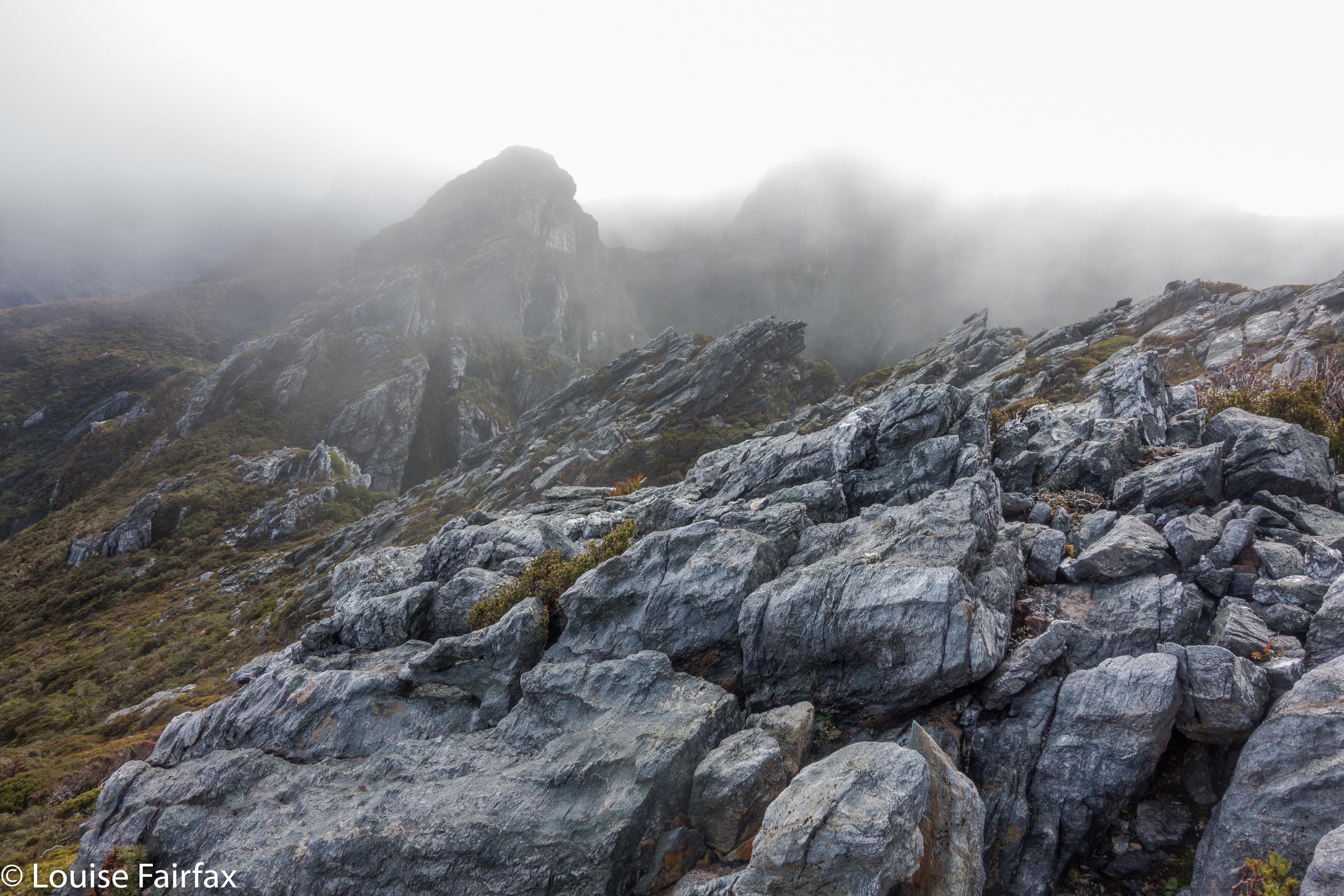
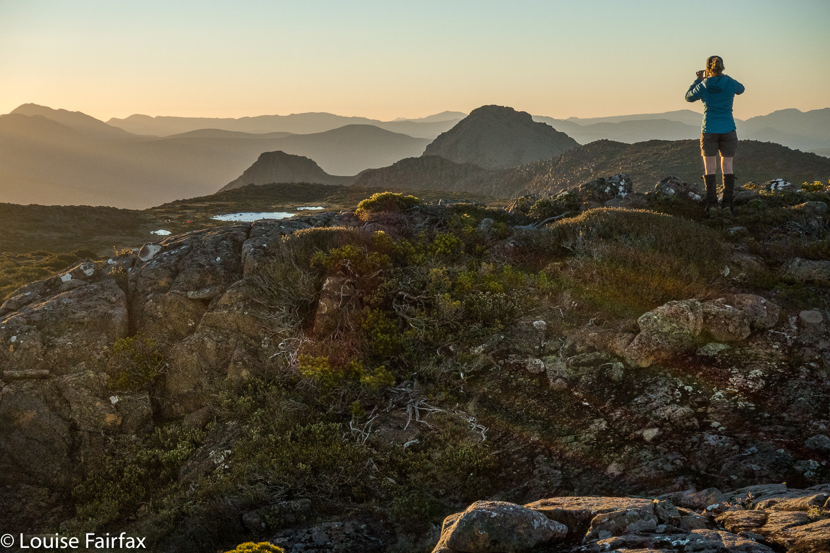
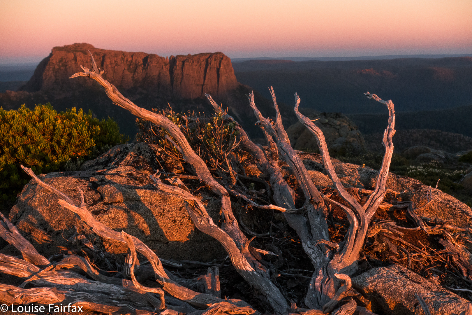
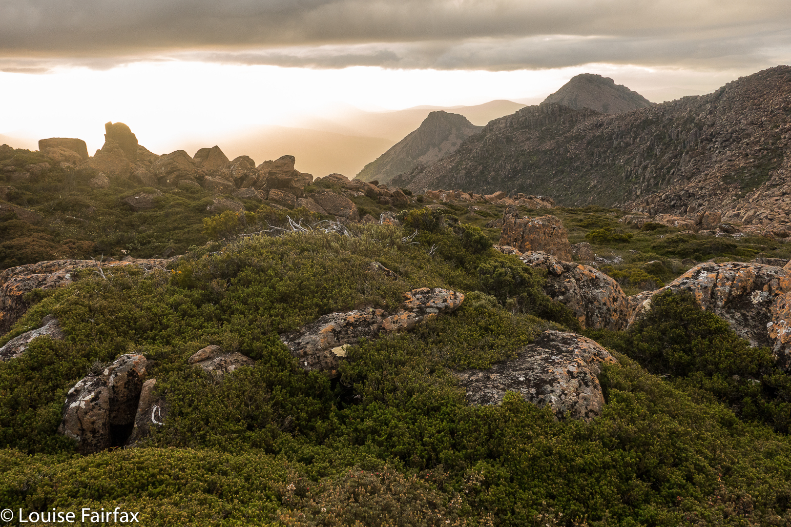
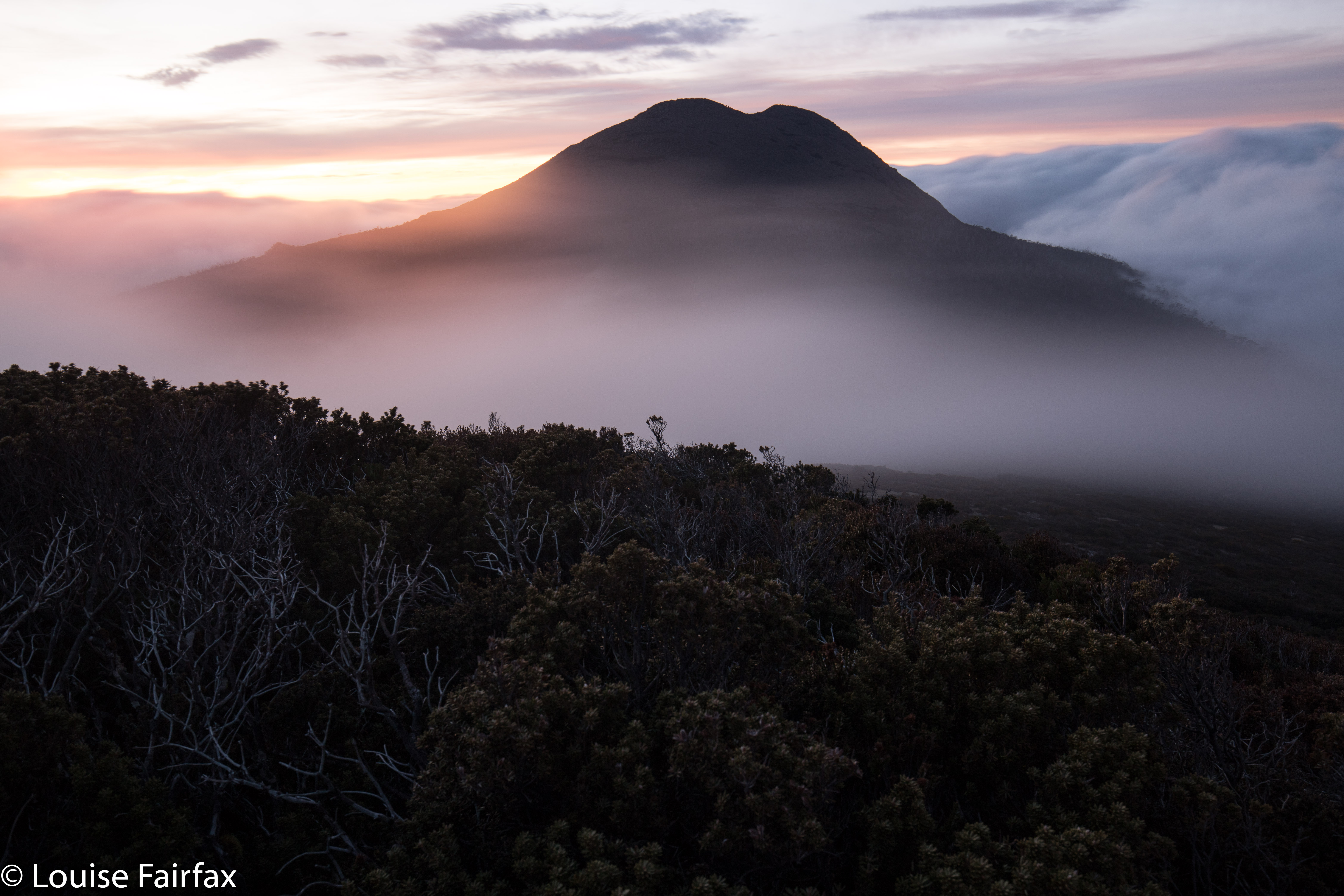
Sunrise was predictably lovely, although the cloud bank to the east prevented the rocks turning orange as the sun rose. Mist enveloped us completely from time to time.
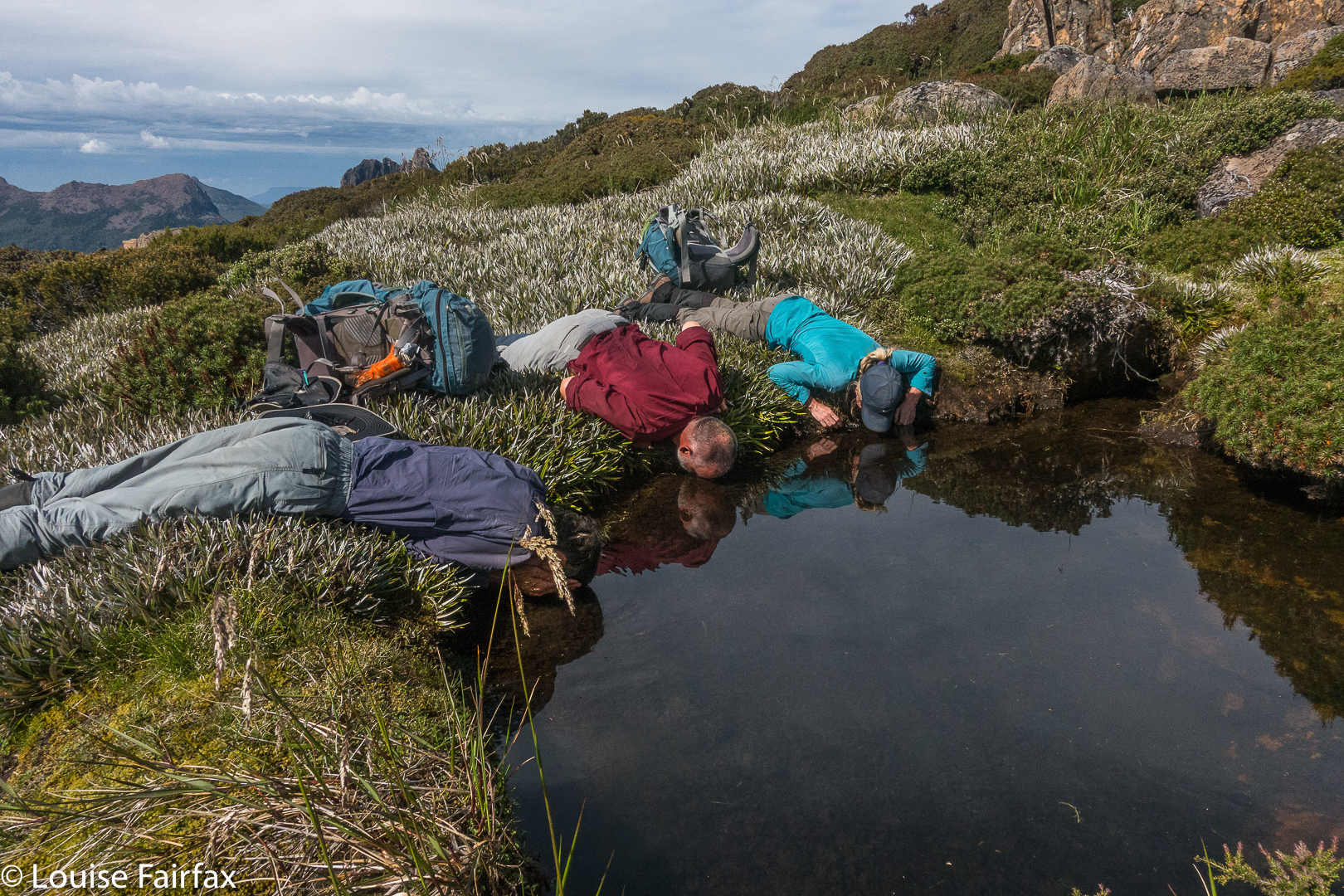
We were pretty cold after the photo session. My feet were numb, but that didn’t stop us breakfasting al fresco. The day morphed into a cold, moist one. We didn’t care. We were buoyed by the beauty of the preceding sixteen or so hours since sunset had begun, and by the wonderful feeling of having been in the wilderness together.

Aldebaran 2018 Apr

Mt Aldebaran, Apr 2018


Somewhere up there Mt Aldebaran is hiding. Looks inviting, huh?
I really wanted to climb Mt Aldebaran before the super cold set in, having missed my chance over the summer. I decided it needed to be a solo venture, but thought I’d like to do it in the school holidays, as maybe I’d accidentally meet someone up on the range, and that would feel nicer. I had my plan: early start on day one, use the Kappa moraine shortcut and continue up to Lake Sirona to sleep. I’d looked at my stats for what I’d done in the area before, and this seemed feasible. Day 2 would be a shorter, easier day, just climbing Aldebaran from Sirona and enjoying being high for what was left of the day. Day 3, I would begin my descent and climb Carina Peak, dropping just as far as Promontory Lake. Day 4, out. But then I got an email from a friend saying he’d like to join in. He lives in Hobart, so starting Thursday morning suited him (rather than sleeping in the carpark Wednesday night, as I had envisaged). That was fine, although it did make reaching Sirona unlikely, but having his company – a mud buddy – would be lovely, so I agreed.

If you look carefully you can find my friend heading off into the mist.
Day 1 did not go brilliantly. Our later start ended up very late indeed, and the track was very muddy and slow, We only made it to just past Seven Mile Creek before dark set in. I squandered half and hour at the tail end of the day trying to find a suitable crossing point for the creek that had now reached fast-river proportions. I kept going upstream until I found a fallen tree that I could hold on to. I didn’t trust myself not to be swept away otherwise. And now it was dark. Time to pitch the tents, collect water, eat and sleep. Boom. No mucking around at this end of the day. I reckon my eyes were closed by 8 pm, having got up at 4.30 to drive down to Hobart.

Up above the clouds already.
All night, it seemed, I pondered the dilemma of what to do with our shortened camping spot. My friend had struggled in the afternoon, and I thought getting his tent up the steep climb could take so long that we would be timetabled out of climbing Aldebaran, which would mean we had to do it on day 3, making day 4 too long. But, leaving the tents where they were and climbing up and down in a day was risky, as it would be a long day, and if we failed, then the trip failed, as there would not be enough time to then get the tents higher and start again. In the end, and with huge reservations, I decided to risk a long packless day, thinking that that would give the best chance of a summit.


A fog bow
Off we set at 7 a.m. Unfortunately, once we started on the steep section, our differences in speed became very noticeable. It was too early in the day to worry. At 9 a.m., my friend suggested I go on without him; he was not having a good day. I said I thought the worst of the climb was over, so let’s stay together longer, but at 10.40 a.m., I had to admit defeat. If we didn’t separate, I wouldn’t get my mountain, so, during the climb up out of Lake Sirona, we parted company, agreeing that I would catch him somewhere on my rebound. I hoped that’d work out.

From on Kappa moraine, looking towards Lake Promontory.
Now I had two big lumps to negotiate before the climb proper began. I was so time stressed by this stage that my memory of these bumps is a blur. My whole focus was on hurrying so as to get to the summit before my turnaround time. My haste meant I didn’t make considered choices, so lost time trying to get off a cliff that was too high to leap from, but had no way around. I gave up, but on the rebound, noted wear marks leading over the edge of a different cliff. Aha. A way down around the obstacle so the climb could continue. On I went, hoping I could remember all this on the way back, when I would be equally stressed for time so as to avoid being up there in the dark.

Weee. I can see Federation Peak – that fabulous fang in tiger distance.
Aldebaran has, it seems, four summits. Excitedly I climbed the first one, ready for jubilation, only to find two more bumps ahead, both of which seemed higher than this one. Grr. More wild dashing. At last, and getting tired now with all this frenzy, I crested the bump. It was 11.50. Oh NO. There was another, bigger bump up ahead, previously hidden behind other rocky mini-mounts. How long would it take to get there? My absolute latest turning around time was 12.30. More rushing. Hoorah. At 12.10 I stood on the summit and there were no more summits. I touched, took a few photos and thought I’d better go. To my horror, clouds, were now floating with a frenzy equal to my own, rising faster than I did up from the valley below and circling around me. I was about to lose my visibility. This was a complex mountain: i.e., this was very disconcerting news indeed. Meanwhile, it was very pretty, so I took a few more photos. Might as well die with attractive shots in the camera for my family to enjoy.

Still climbing. Looking down over Haven Lake to Mt Taurus.


Mist closing in on top.
On I went, over bumps and through more saddles, hoping I’d remember my route. At the last of the bumps, I found my friend, so we descended to Sirona together. I’d made OK time back, so the pressure was easing, although A wanted to climb Scorpio. Fair enough, He hadn’t got to climb Aldebaran. He set off while I did some eating, saying I’d give chase. I caught him at the saddle before the final climb, and had great fun photographing his ascent (see below).


The route ahead. Ahem.
It had been pretty quick, and we were making good progress, so we now had what I felt were heaps of breaks, and lovely long ones, sitting on rocks watching the shadows lengthen and the atmosphere take on aureate hues as the sun dropped. Next day my friend said he would have liked more, and longer, so I guess all things are relative. At least with my being a task-master and time bossy-boot, we got back to the tents with just enough light to gather water before we lost all visibility. It was a beautiful mild night, and we both enjoyed the light and the slivered moon before falling asleep. I closed my eyes even earlier that night. I heard my friend call something about the moon from his tent, but I was too tired to even answer. It had been a long day, and I was finished.

Climbing Scorpio. The mist cleared back again by Lake Sirona.
We were both exhausted on the third and final day, and the mud seemed even sloppier and deeper. Several times we were wallowing in it thigh deep. We both became covered in its ooze, but were at the cars by 2.30, which was great, although still, by the time we’d changed out of our black, smelly gear and got going, it was too late for our favourite food places. I drove my friend to Hobart, and decided I’d go back to Maydena and use day four for waterfall and fungi bagging and shooting. I might as well use being south while I was here, and had a doggy sitter for Tessa all lined up, so I should use the opportunity while it was available. It was a good decision, and next day I would visit Tolkien Falls, Regnans Falls and Growling Swallet before the big drive home.

King William circuit 2018

King William Circuit, comprising Mt King William I,  Milligans Peak, Mt Pitt, Mt Harold, Battle Ridge and Bayeux Bluff, and visiting Wessex, Odo and Pitt Tarns. March, 2018.

Climbing Mt King William I. Lakes George and King William in the distance.
I had just returned from a fabulous week with friends at the beach near Coffs Harbour, and felt terribly flat to be back home in my now lonely environment. I looked at the approaching weekend: apart from my darling daughters, no one would ring; no one would pop in; no one would invite me anywhere. Life seemed bleak. I could sit at home and sulk and weep some more for Bruce, or I could be proactive and invigorate my life by joining in a club bushwalking trip. I chose the latter, and phoned the coordinator of the LWC trip to King William Circuit. HIs plans sounded great. All of a sudden I had to pack my bags pronto. The expedition was leaving at 5.30 a.m. the next day, which meant a 4.30 awakening. Yawn, but it would be worth it.

From Mt King William I looking towards Milligans Peak and Mt Pitt. The  Frenchman is in the distance, as usual.
I had already climbed King William I, but in a whiteout, so this time I got to see the expansive views. With our nice early start, the day was not yet too glary. It was, nonetheless, the rest of the expedition that held my attention.

In the saddle between King William I and Milligans Peak.
Once we left King Will I, we were in more interesting and less-frequented off-track territory, moiling our way towards Milligans Peak, which was very quickly reached (12 down, 13 up) from our first peak. (Note please: my times never include stopping to remove packs, take photos, eat or whatever; they are “exercise minutes”, as I am interested only in how much exercise I’ve had. Have I been lazy, or have I had a good workout?)


View from Milligans Peak to Guelph Tarn (L) and Pitt Tarn (R).
Milligans Peak offered more great views of old friends such as Slatters Peak and King William II, the Loddon Range, Lake St Clair, Lake King William and our future destinations of Mt Pitt, Mt Harold and Bayeux Bluff. The day was sunny and warm; the weather forecast for rain, a joke. Off we set to be reunited with our packs below, to have lunch by a little pool down there, and to then proceed to our tent tarn underneath our next goal, Mt Pitt.

Mt Pitt summit, looking back to Milligans Peak (R) and Mt King William (L)
Tents erected, day packs loaded with goodies and anoraks, we noted the amassing clouds but were unfazed. Off we set to inspect the views of Mt Pitt, quickly reached in 21 minutes from our tents.

Mt Pitt summit view, looking directly to Mt Harold, which has Wessex Tarn to its L and Arrow Tarn to the R. In the distance, slightly left, is Bayeux Bluff.
The next mountain was the best one of the trip, and a memorable mountain under any and all circumstances, with its hedgehog spikes all over its spine that caught your attention from afar, and had you wondering how, actually, you were going to touch the high point. I plotted my intended route from Mt Pitt, and carried it out with no problems. Having been initially daunted by the rock spikes, it gave a special feeling of pleasure to be on top of both the false, and the slightly higher, real, summit. Drama was all around.

Looking from Mt Harold real summit towards Mt Harold false summit. Mt Pitt is back right.
We all voted it the highlight, and abused the people who haven’t even given it a point. In fact, not only is it not worth a peak baggers’ point; it is neither an Abelette, nor a “Point of Interest”; neither did it get a nod as a “Bob Brown”. It is totally ignored by the people who sit in offices (or, reputedly, at the dining table after a few wines), staring at maps deciding what is “of interest”. We who visited this mountain think it is of extreme interest, and we loved it dearly.

Wessex Tarn. Battle Ridge to the left.
Off the top of Harold, we lowered ourselves through the scrub until we reached the beautiful Wessex Tarn. Now, from even before we climbed Harold, we were in the Battle of Hastings territory, with Arrow and Wessex Tarns on either side of our spiky castle and Battle Ridge in front. Norman and Bayeux Bluffs were up ahead, as were Odo Tarn, Battle Creek which runs from it, and Doomsday Bluff, beyond Bayeux. (To refresh your memory, in case you’d like it, the Bayeux tapestry depicts the Battle of Hastings, in which the Normans, under William the Conquerer, invaded and defeated England – under the leadership of anglo-saxon king, Harold Godwinson, in 1066. The Odo of Odo Tarn refers to Bishop Odo, who is depicted holding a club – presumably not a nice one like LWC, but one with which to bop you off. He was William’s younger, half brother. Later, William, now King William, commissioned the Doomsday Book (1086), an assessment of the land he had conquered and its wealth, so he could raise the taxes). It was fun to be in this territory, and to have as our culmination Bayeux Bluff, which we would reach next day. I am very sad that we didn’t have time to climb Norman Bluff. But then, it’s nice to have a reason for coming back other than just a revisit of old territory.

Our trusty tents
Oddly, List Maps has nothing in the area called Hastings. Surely someone could have popped in a creek or tarn or bump … but they didn’t. There are plenty of unnamed features remaining. Adam Guelph, (from Salisbury), who helped William, gets a guernsey (with a tarn and a watercourse), but not Hastings itself. Godwin Tarn presumably stems from Harold’s full name. Of course, from most of our mountains we could see the huge Lake King William; we were on the King William Range. William won. He gets all the big stuff. The victor gets to write history and grab all the best mountains, ranges and lakes.

Meanwhile, with all this history and four mountains under our belts, we retreated to our tents, arriving about five minutes before the clouds that had been slowly accumulating while we checked out battles, decided to dump their contents with a vengeance. We filled in an hour, and then cooked in our vestibules to the sound of wind howling and rain pelting. My flap buffeted most of the night, and we awoke to pea-soup fog. That did not deter us, however. On our agenda were Battle Ridge, Odo Tarn, Battle Creek and, at last, Bayeux Bluff, from which we would gaze at Doomsday Bluff. This blog is already quite big. For day 2, see the blog entitled Bayeux Bluff
www.natureloverswalks.com/bayeux-bluff/

Route Day 1

Eldon Peak 2018 Jan

Eldon Peak, Jan 2018


Several times on the Eldon Peak adventure, I was reminded of an earlier trip I did to Mt Emmett. The two trips may well seem worlds apart, as one (this) was done in extremely hot temperatures, while the other (Emmett) was done in a blizzard. On the Emmett trip, only four turned up, so Bruce and I comprised half the number. We didn’t make the summit on that day, but it was one of the prettiest outings of my life, and we spent the whole time yelping like little dogs: “Wow, wow, wow”, as we wended our way through the white witch’s wonderland, taking myriad photos. Steve, who is ever fond of quoting an adage, noted, correctly: “You’ve got to be in it to win it”. We four had braved the elements, taken the chance, and had won. If you don’t turn up, you can’t luck in on wonder. Of course, you can be in it and not win it, like the time we took a friend to sleep on Walled Mountain and received nothing for our efforts but a view of close-range, very thick mist. But if you’re not there, you won’t ever luck in on the times nature grants you – sometimes unexpectedly, of you are a reader of forecasts – a magic evening. (And even on the Walled incident, Elin kept saying she could feel she was on a summit, and she was exhilarated by the sense of space she could feel.)


Fun times chatting and chilling out on this trip.
And as I sat on the pebbly beach beside the Eldon River, enjoying the fact that I was greatly refreshed from a wonderful swim in one of nature’s magic gifts – a three-metre deep, crystal-clear waterhole – and enjoying chatting to my fellow walkers, Steve’s words came back to me. All of us present were prepared to get out in the bush, not really knowing what it would bring on this scorching weekend, yet just being there brought rewards that filled us with joie de vivre. Not for the first time, I was so happy down there by that river that I didn’t care at all whether we made the summit – which was naughty of me, as this trip was a promise by Paul to help get me to that very summit. The year before I was supposed to be on the boat, bouncing my way to the end of Lake Burbury with the others when, literally as I was about to quit the house (all my gear was in the car), Bruce started acting very strangely and I had to call an ambulance. He had a temperature of 42 degrees, and had sudden onset pneumonia.  (Not a single cough did he make). He was in intensive care for the next six days and we were very lucky not to lose him in that episode. In the wilderness eight months later, doing what he loved doing, was a far, far kinder way to go. His whole body was failing him, but he fought on valiantly. Thanks so much Paul for keeping your promise. It means heaps to me. Without a boat, this mountain becomes a formidable task.


Half way up.
And so, the trip to the summit began with a journey by boat up Lake Burbury to its northern end, followed by a walk along an old road that was pure bliss, as this former route for wheels is now a bed of spongy moss that traverses an area that could be parkland. It reminded me of the Blue Gum Forest as it was when we all loved it, with pale-trunked silver wattles instead of blue gums.

As we had no intention of climbing that first day – this day was all about getting to the startline to be ready for an early departure the next morn – the rest of our time was spent swimming in the glorious pool mentioned and pictured above, or sitting around on the pebbly shore (or in the rainforest, for some) chatting and eating. It was a wonderful time to savour being in the wilderness.


Day Two, summit day, was scheduled to be very hot, so we were ready with our packs at 6.30 for a departure that would give us plenty of climbing time before the heat advanced. There were a lot of contours to get through this day. Although this mountain has a huge climb, it seemed to me that most of it was in wonderful rainforest that was a sheer delight to traverse. The patch of scrub above this line didn’t last long, and then the rocky final ascent was pretty quickly dispensed with. The three earliest to the top were there before midday.
I had the fastest “touch and race away” of my life (something I normally never do) at this summit, as it was aswarm with a black cloud of galvanised, flying Jack Jumpers, and I was terrified. There is no point telling me they’re not interested in me. I am very interested in them, and I don’t like pursuing that interest at such close range. (For mainlanders and foreigners, these ants sting with a mighty punch. It is impossible to be bitten and not yell violently with pain.) They do not always swarm this or any other summit; it just happens to be mating season right now, and they like a good view while they select their partners and secure the next generation. At least they have good taste.)


Standing near the summit of Eldon Peak, it seemed I was on a huge monster of a mountain that totally dwarfed surrounding, otherwise-impressive peaks. Mount Lyell, Marble Bluff, and Mount Owen all seemed quite dominating down at lake level, but were transformed into silly pimples from the top of this giant. Even in midday glare and with Jack Jumpers for company, it was a great place to be.
That said, it was so hot and glary up there I was pleased when we started our descent. A swim at the bottom was calling. Unfortunately, by the time we got back to camp, hunger was stronger than the need for a dip, so cooking dinner on the beach and paddling had superior claim on my priorities.


The boat trip back on the final day was magic, but unfortunately I can’t show my own photos, as my camera refused to open. I fear the heat of the day may have cooked it. (Because of the heat and climb and boat trip, I didn’t have my normal full frame DSLR). Once more we had an early start, so walked out in golden light. The water at that hour was pure mirror. I felt very lucky to have been part of the group.


Jonny’s photo; my edit. The walk out.

Nereus trip 2018 Jan

Nereus trip, on a shockingly hot clutch of days, late Jan 2018.


My mother taught me that if I don’t have anything nice to say, then I shouldn’t say anything at all. There are necessarily a lot of very “not nice” (mild understatement) things one could say about the whole Nereus area since the last fire wrought havoc on the forest and left us with thick, prickly, disgustingly uncomfortable scrub which occurs in tiring and lengthy bands. My legs stung from the scoparia injections, and I tore my boots, my gaiters, my gloves and my famous cow pants. (I also got the second flat tyre in seven days on the way home). Leading the gang through the bosky barricades was energy depleting.

We were not helped by the fact that the days were stinking hot and water was all but non-existent. Even the nice big tarns on Walled Mountain were dangerously – ominously – empty and murky. The yabby holes further on were mostly dried out. Whoops. I’m disobeying mum’s rule.

Nereus from Urquarts Messa.
Here are some photographic highlights. Now THESE are indeed worth talking about. Stifling days can be followed by evenings to die for, and we got them. Hoorah.


Tim and I climbed Urquarts Messa nice and early, so were on top by 6.45 a.m., a beautiful time of day to see what it had to offer.

A tarn with cool, deep water, found after a long, hot day on the way back. This was possibly the most physically pleasing moment of the trip. 
I love the way that memory gradually erases the bad bits, turning them into theoretical facts of little emotive weight. I am left with my photographic highlights ….. It is now a bit over a week since I was there, and already these photos have helped to mollify my negative reaction to the trip. I have realised that it was a very beautiful one, with some glorious moments.


And there were moments to sit outside the tent and reflect.


I find it interesting that social factors, however, are the ones that determine the extent to which I look back on a trip with delight or mere tolerance. When you have a good team on board, even scoparia and can be fun.