Leeaberra Track Douglas Apsley NP 2019 Feb

The Leeaberra Track: a golden opportunity that’s somehow missed the mark

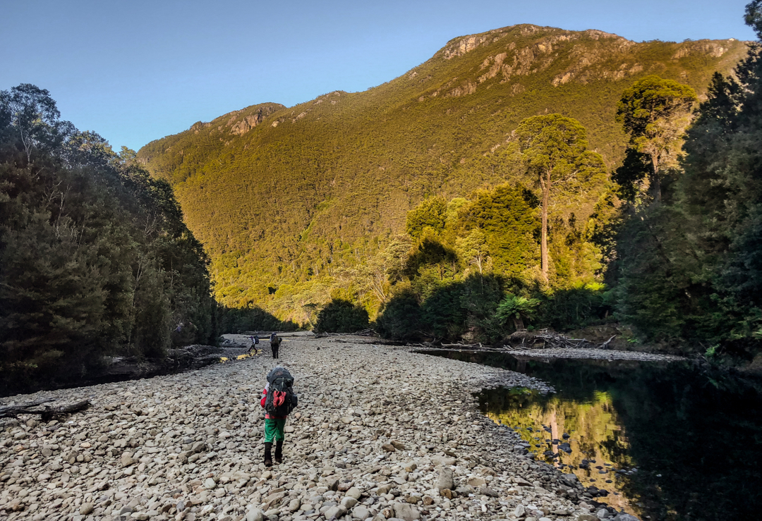
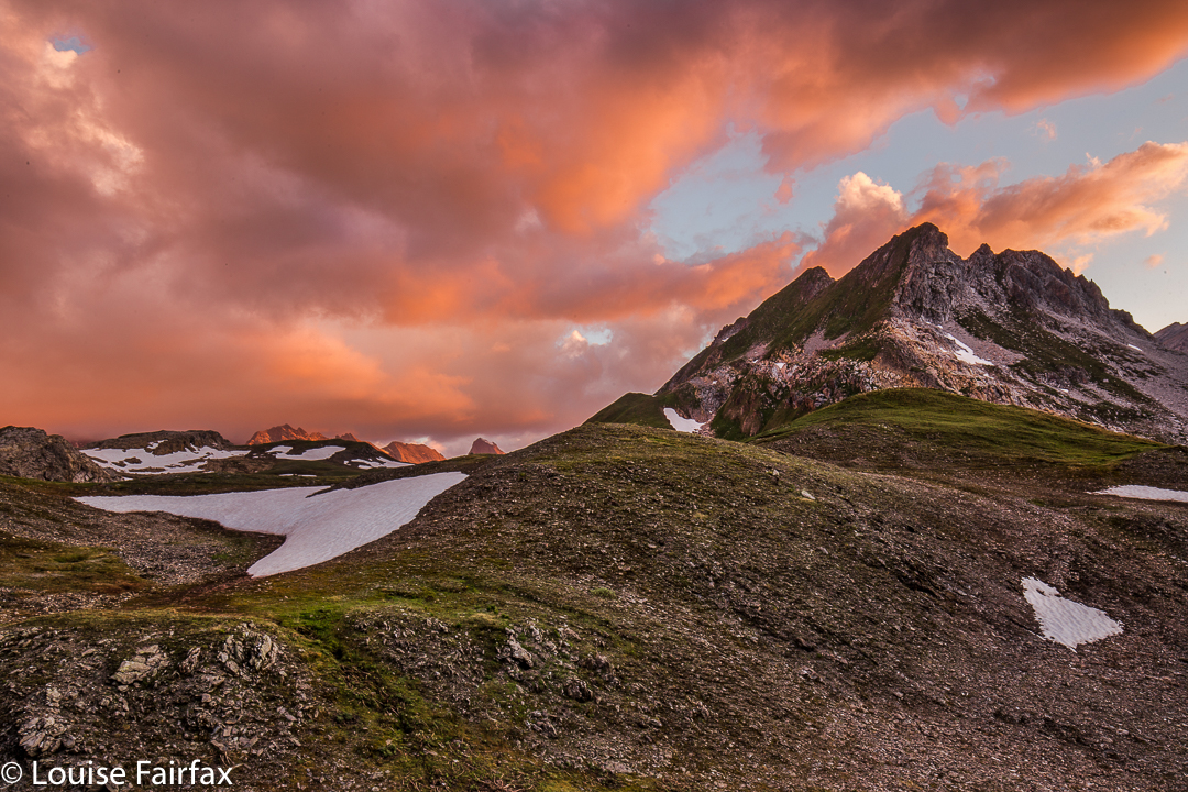
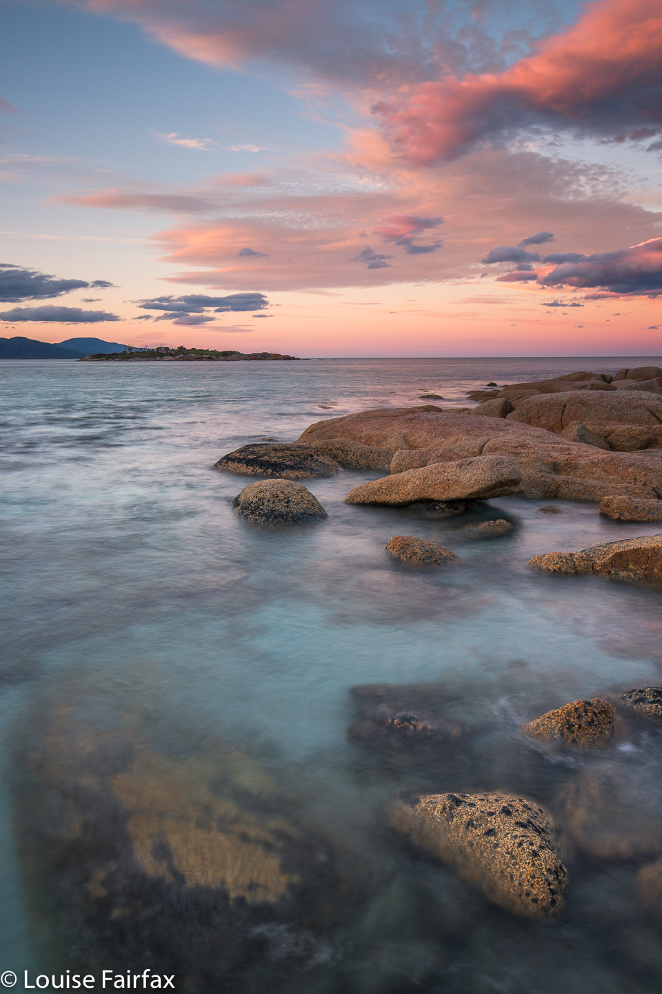
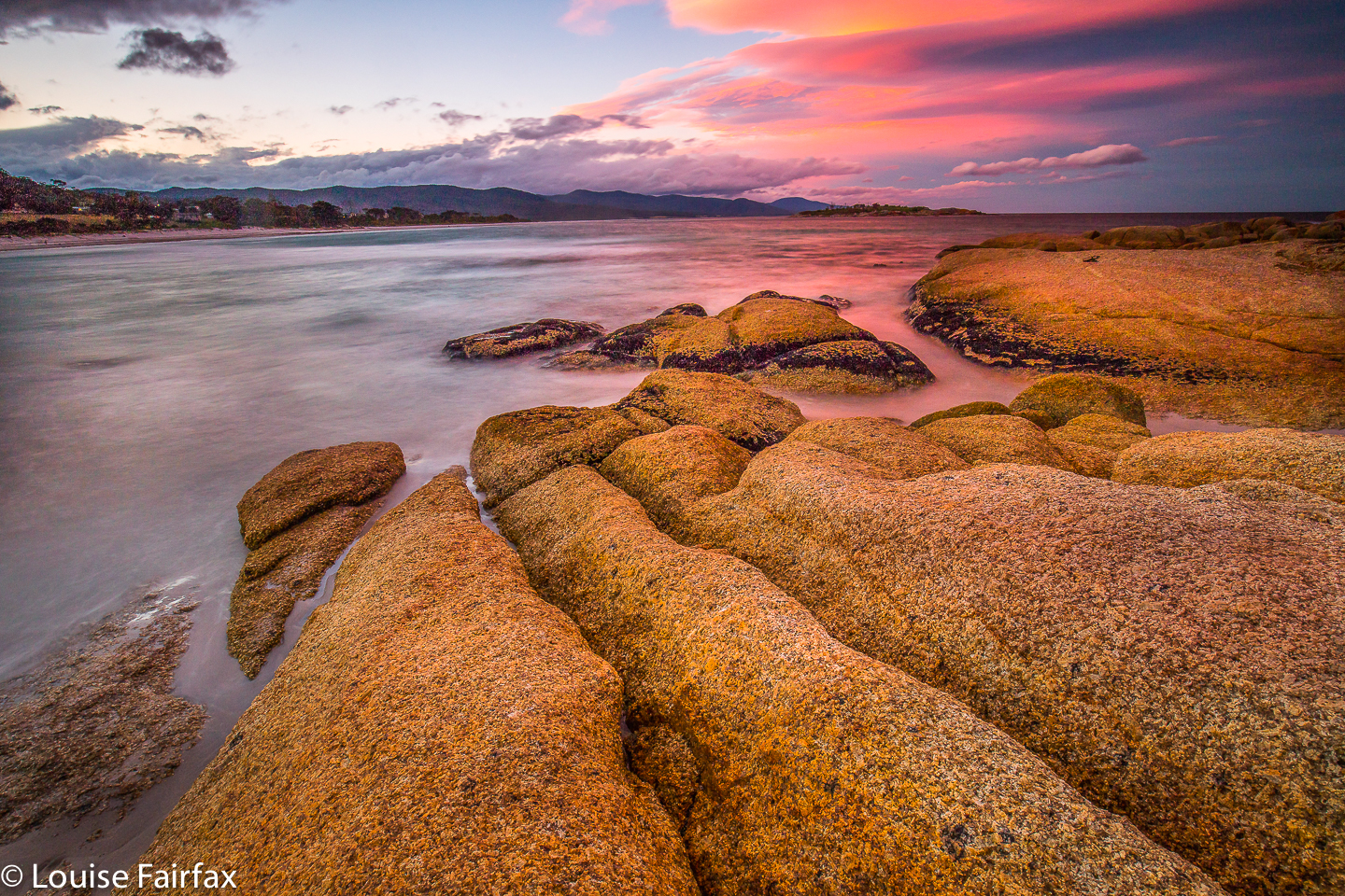
The idea of the Leeaberra Track is great: a pleasant walk along a low level range that runs parallel to the ocean (offering occasional glimpses of it), and which visits several beautiful waterfalls. It’s a fabulous alternative for times when the rest of the state is being drenched or burned, which was the situation this February, when Tasmania, having mostly been burned out and inaccessible, turned on massive storms with viciously spewing water. Douglas Apsley National Park looked clear of both fire and storm, and our group of four, sick of being soaked further west, retreated there for a more comfortable walk. (Photo: Bicheno the night before we began).

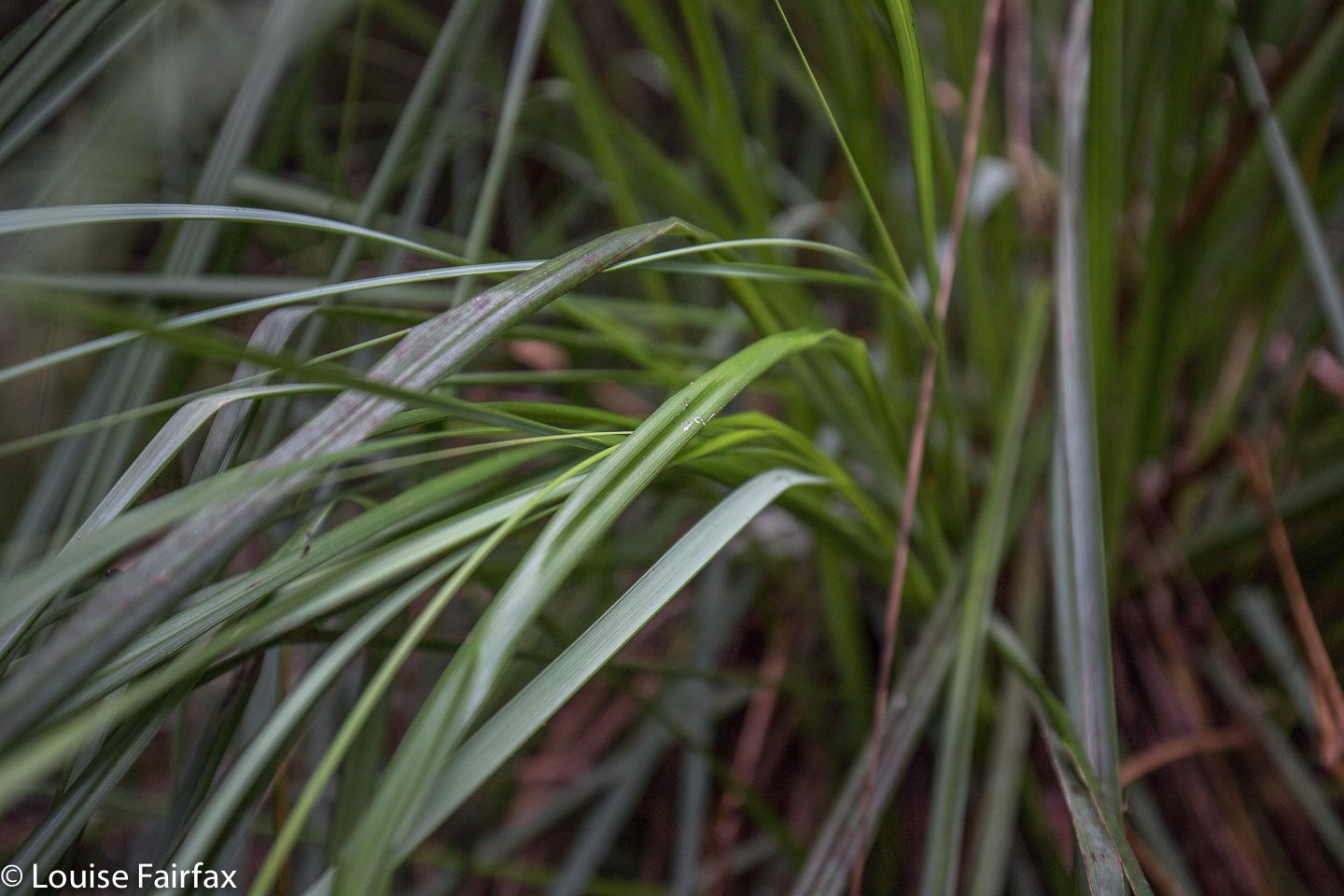
In your face cutting grass (Gahnia grands). We saw lots of this.
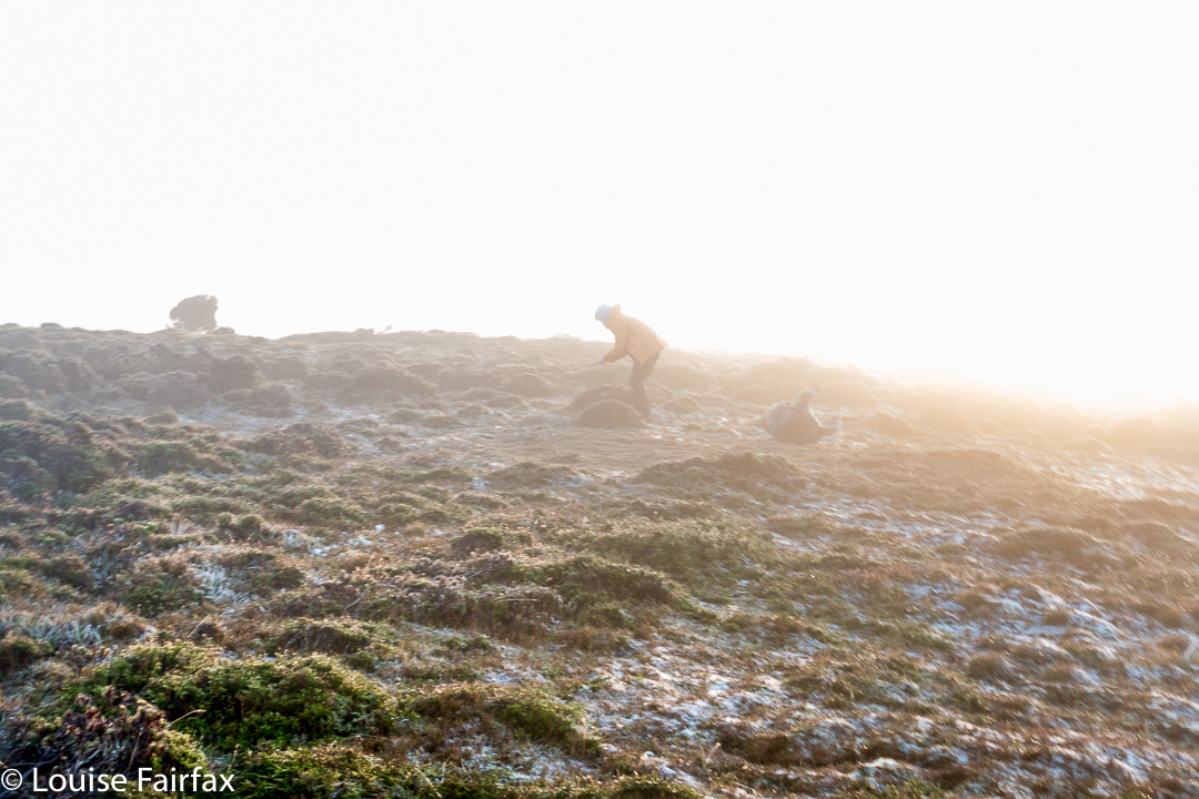
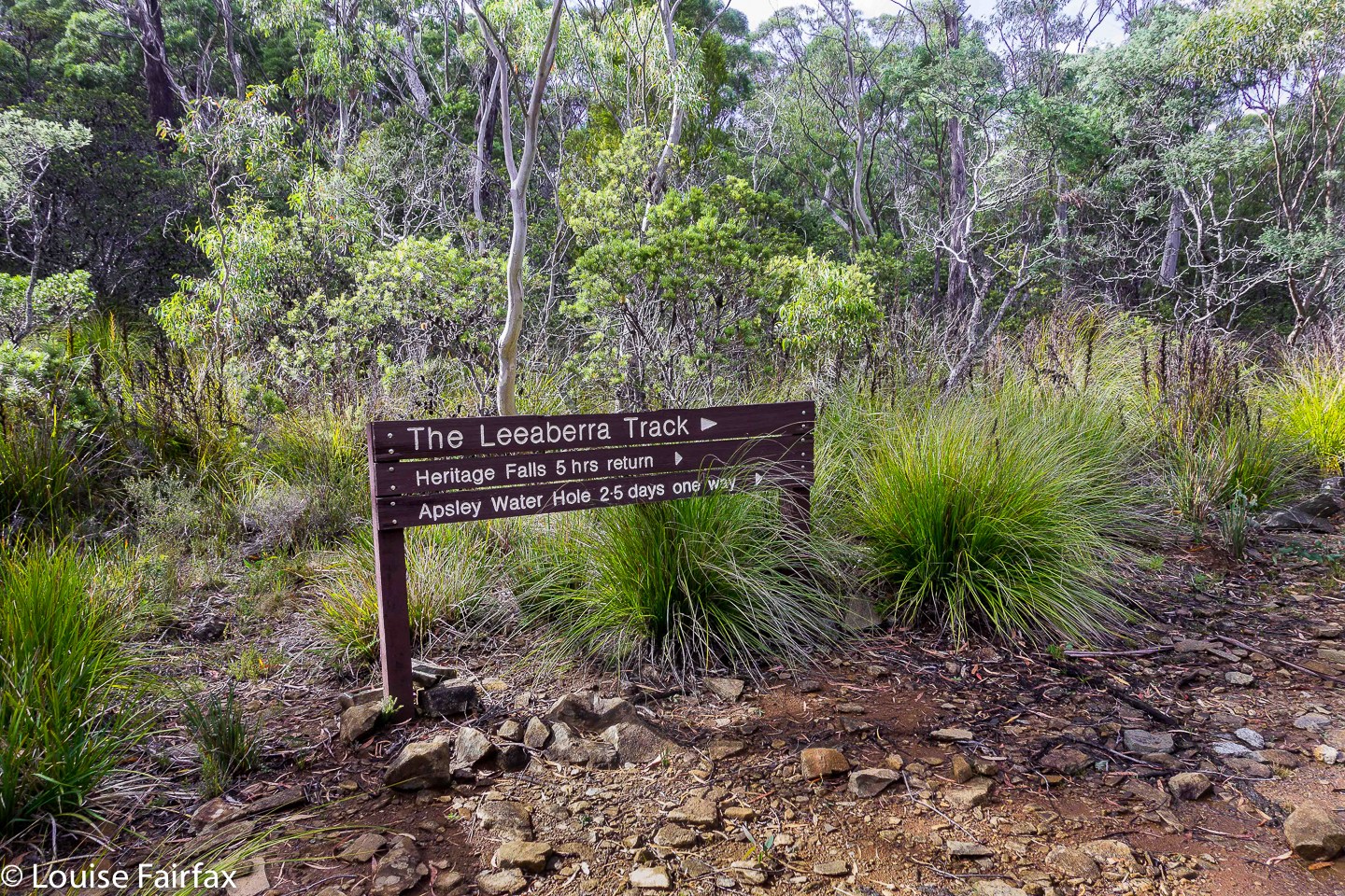
The Leeaberra Track’s first problem is the start, which is inaccessible for most tourists (unless they have rented a 4WD), or poses a logistical problem, as a car shuffle is needed at the end to retrieve the car abandoned at the start. The next problem is locating the minor dirt track you are supposed to drive along to get the said obscure start. With a carload of experienced people, we sailed past it the first time, as it is unsigned, bushed over, and looks like a track a farmer might use to deliver hay to his cattle. Hint: there is a pole with the number 063. That inauspicious piece of dirt is your road. It’s just past the first creek crossing south of Piccaninny Point. Only a few hundred metres in, you meet your first obstacle: a ditch that is sharp. On my own, I would never have driven across this ditch, even in my Subaru Forester. If you have a 2WD, forget it. Peter Grant’s excellent blog on this track reports that they parked here, and spent three and a half hours  walking up to the start. He writes: “We arrived at Thompsons Marshes late in the afternoon, thirsty, sweaty and feeling as though we had already done our day’s work. Welcome to the start of the walk!” Elsewhere he calls it “cruelly, sweatily tedious”. (See url at end).

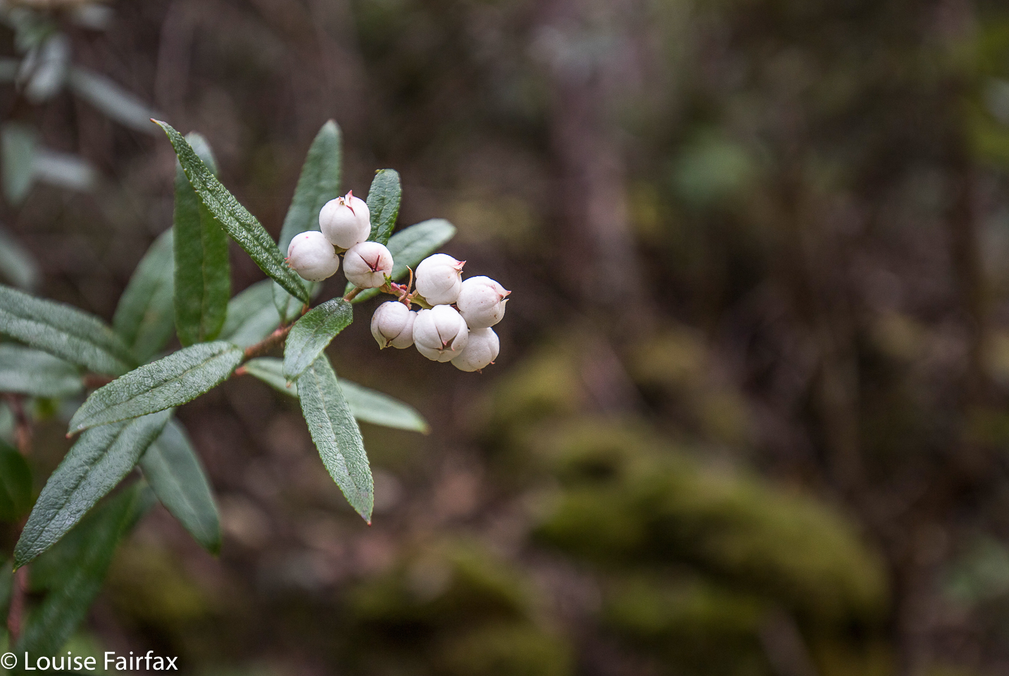
Snowberry (Gaulthiera hispid). We also saw plenty of this beauty.
We were not in my car at this stage, so progressed on to the second, even more foreboding, ditch, where we parked the car rather than risk needing a tow – not available – to get out. We then walked 48 minutes along a dirt road to the start. (Just in case you don’t know me, I consider walking on dirt roads to be a totally different ‘sport’ to bushwalking. It provides little pleasure, and a merely functional role.)

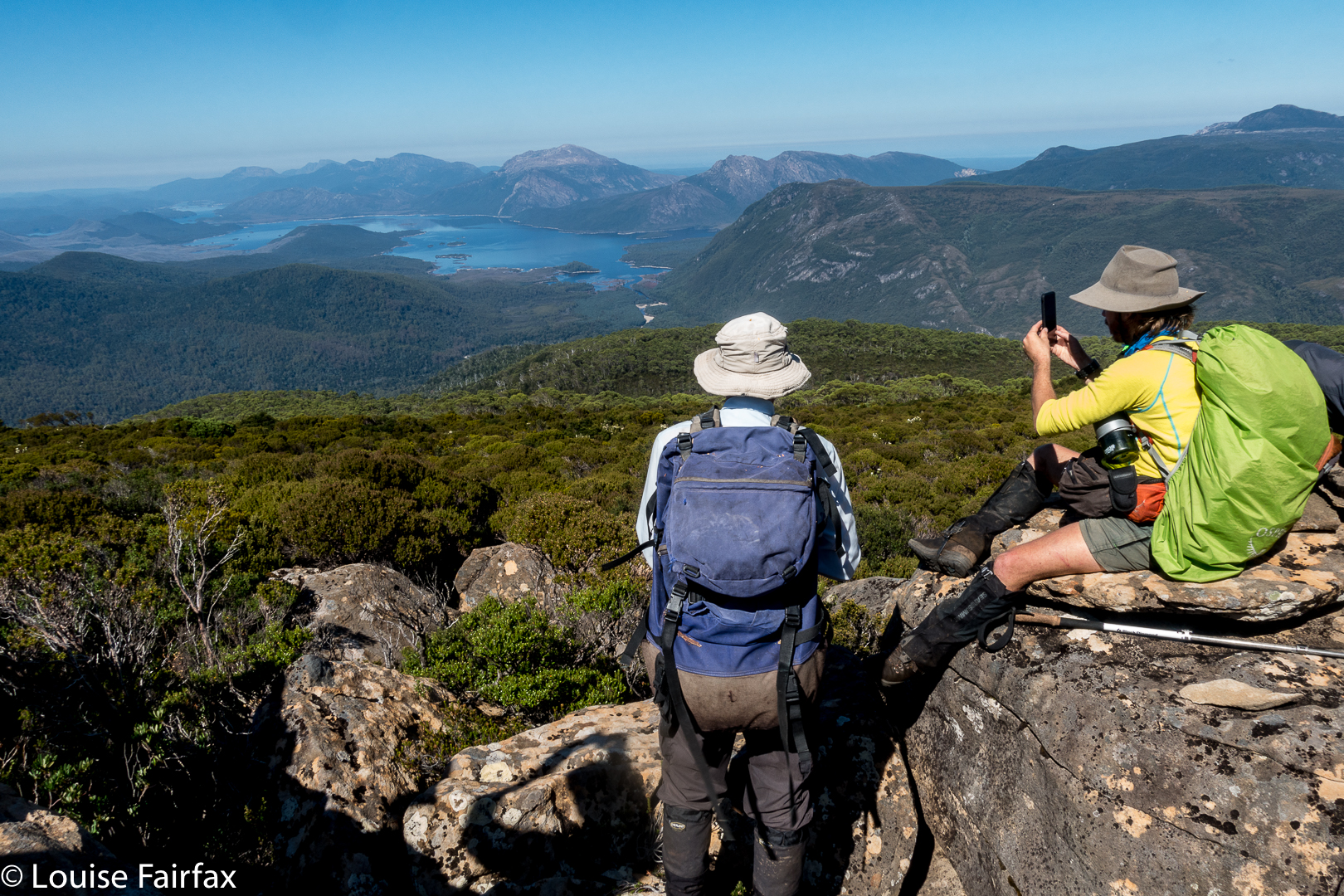
Let the track begin. It was fine if you like dry sclerophyll forest. This was, for me, a means to an end, and the end was the waterfalls that lay ahead. I was also curious to know what this track was like, so I guess that ‘means’ was also being satisfied. We were walking in nature, and, hey, that’s much better than most alternatives. The rangers I met at the end told me with voices warm with affection that the area is truly beautiful in December when it is alive with wildflowers. I can imagine that must be a great sight.

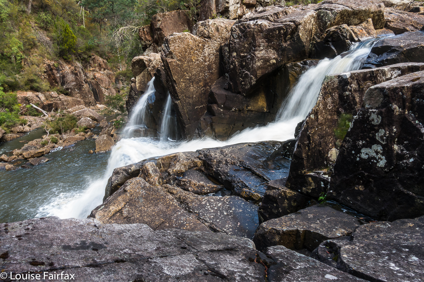
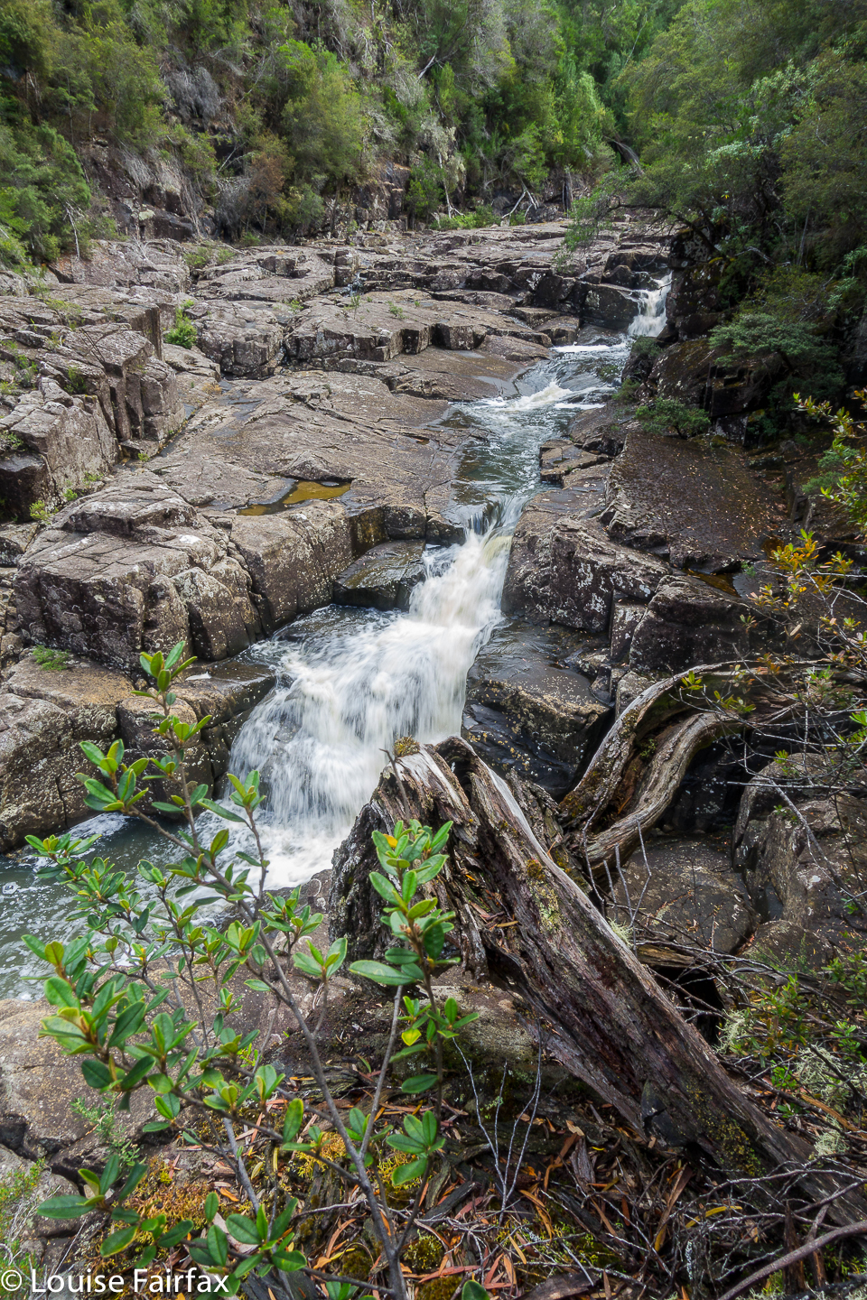
Heritage Falls from above. Apologies about quality. Read text for reason.
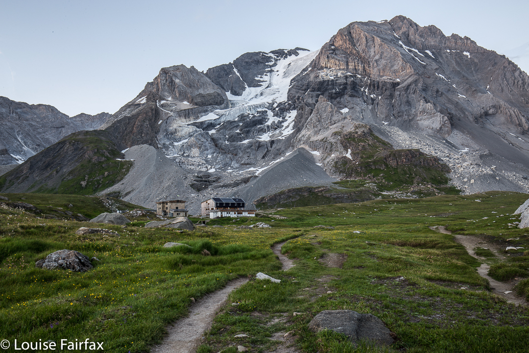
One hour twenty after the “actual”  start, we arrived at the first official camp of the walk, a clearing beside the Douglas River upstream from the Heritage and Leeaberra Falls, but one from which the river was not at all visible, as the cutting grass surrounded us on all sides, providing a thick green curtain, and a rather impenetrable barrier to the actual water, which I wanted to find so I could drink some, if nothing else. I felt closed in, claustrophobic. We ate, and then set out for the falls. The sign said “45 minutes return”. Joke. Laugh. I am not a slow mover, and I took 33 minutes to the TOP of the first falls. The base, and object of my quest, lay another six minutes beyond that. And then, of course, I also wanted to see Leeaberra Falls, further yet again. The route which once existed has been choked by flood debris and never cleared. Mostly, you can’t find where a route once was. The others made slow progress, and I began to be worried that I would be called back before I had seen my treasures, so dashed on to see and photograph before this happened. The others contented themselves with the top of Heritage, so I was right in my guessed need for haste. (Warning, do not use haste when descending to the base of Heritage Falls: it is almost vertical, and maybe half the rocks you might want to grab would come out at a touch. I descended with extreme care, testing everything before commitment was made.)

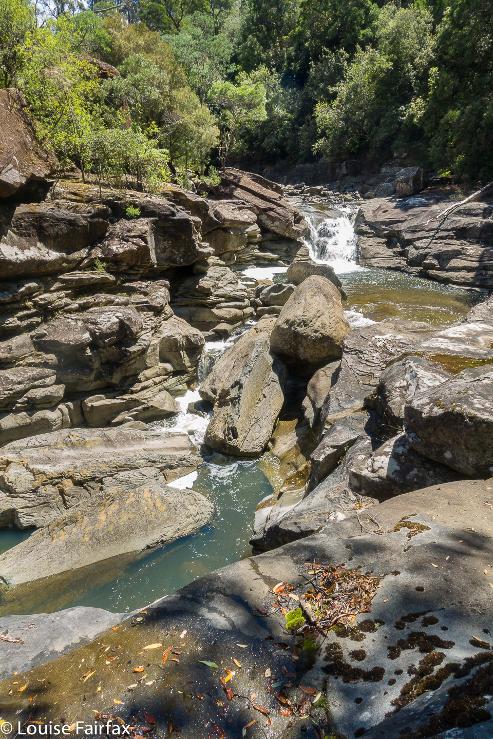
Heritage from the base. The edit is mine, but not the original shot. 
The falls were lovely, even in midday glare, and were flowing nicely. But horrors!!!! When I went to take my first shot, my camera announced that its battery was exhausted. How dare it be so weak. We’d only just begun. How unfit can one Sony battery be?? OK. No long exposures this trip. I hoped that with due rest between usages, with no LE or zooming, and with only one photo per falls, I may at least coax it to take a single shot of all five. I felt totally flat and devastated. I even considered running (tentless; packless) to the end to retrieve my trusty Canon from the boot of my car and running back again. Considering the thickness of later marshland, I’m glad I didn’t.

I got in a single 1/15th sec (erk) shot from the base, and then went along the rocks to the shapely Leeaberra Falls, whose twists and turns really appealed. Another 1/15 effort, oh the crime of it all. I will be back (and will replace these photos that have to do for now).

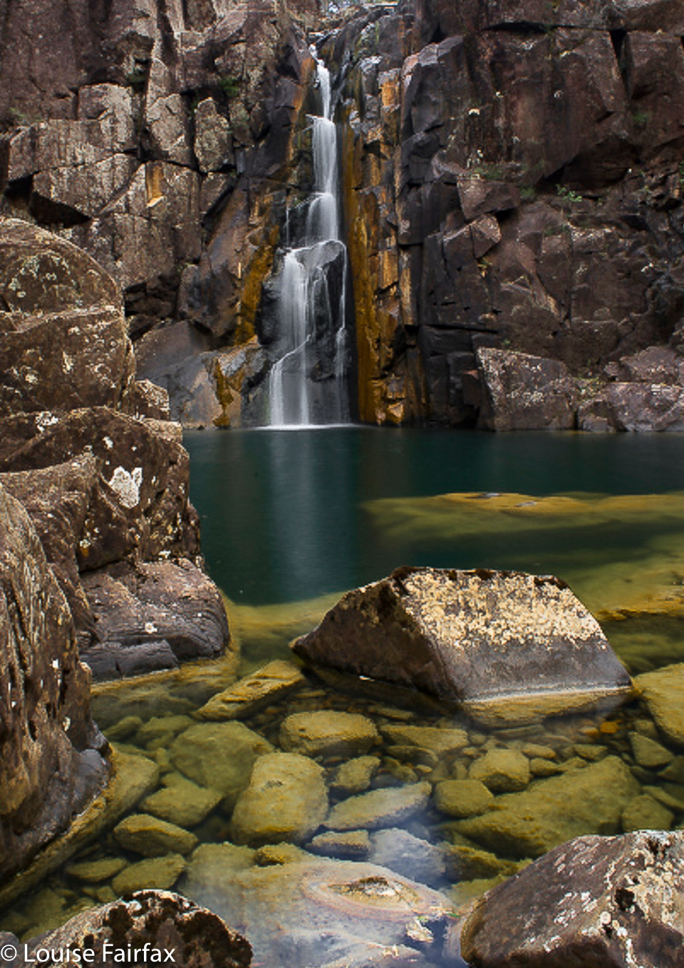
Leeaberra Falls. I loved the shape. I will be back.
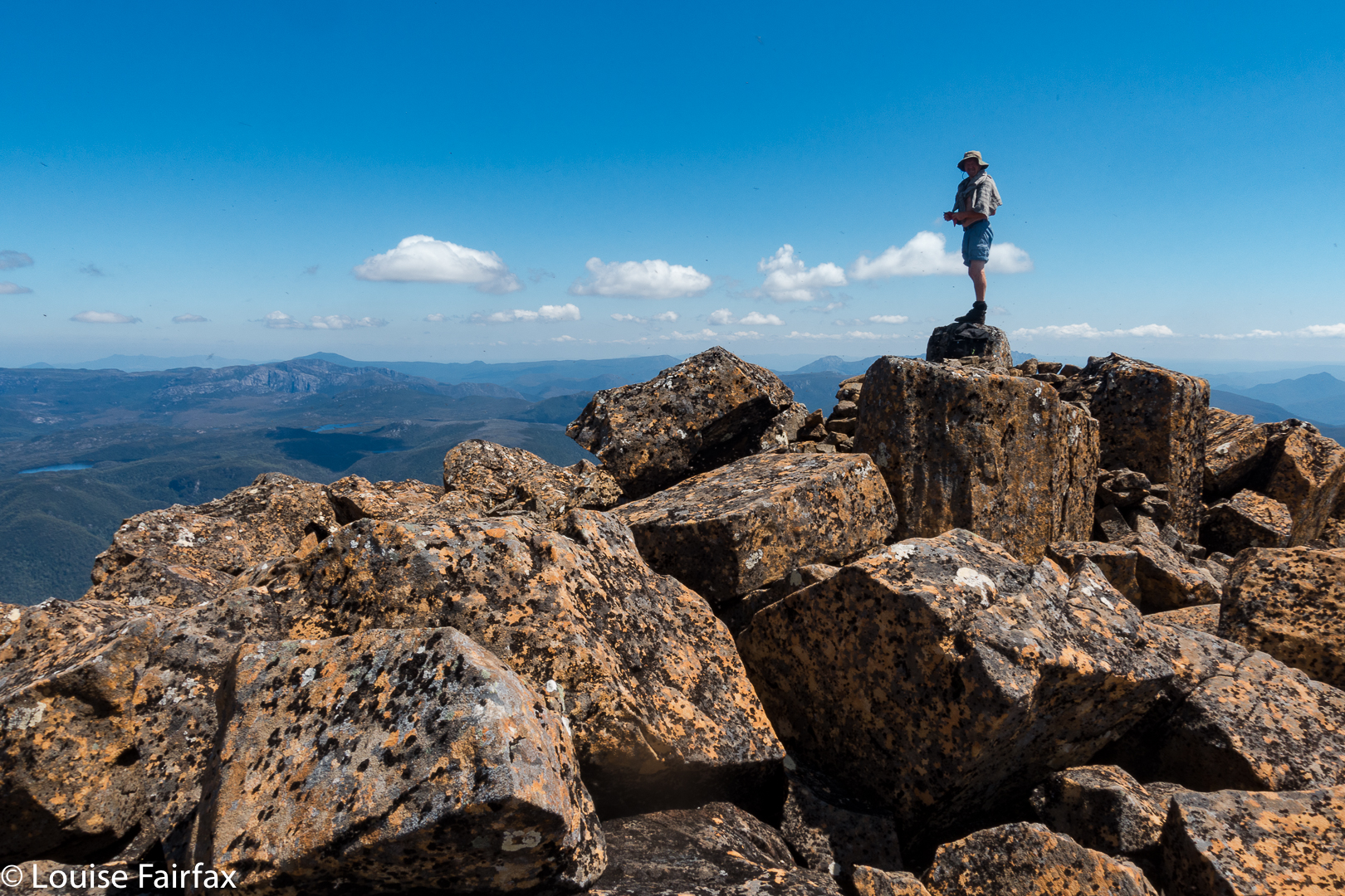
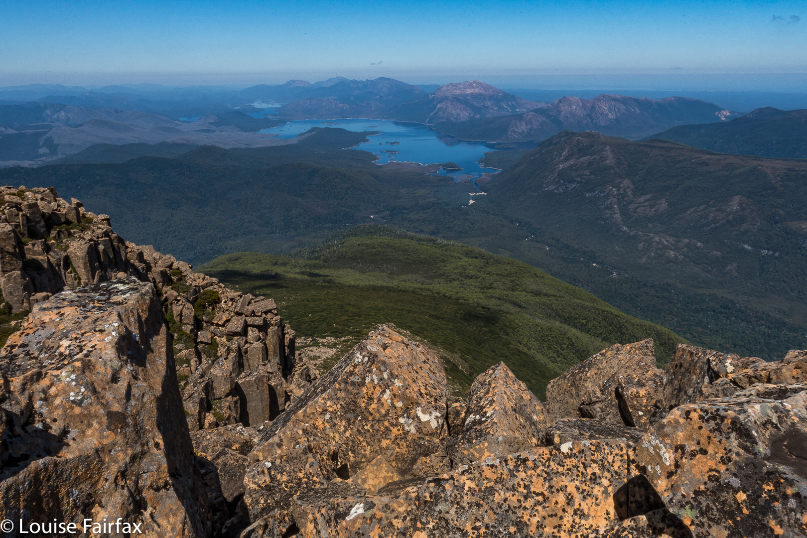
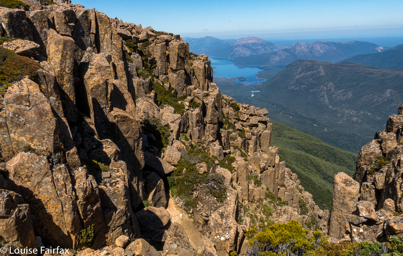
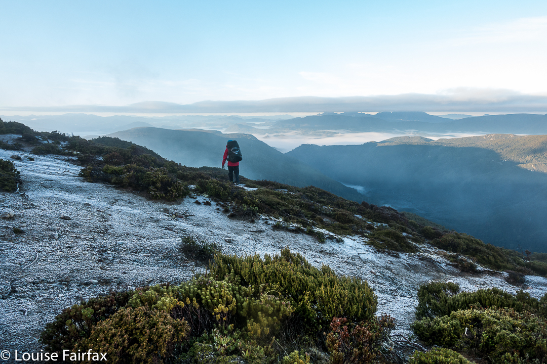
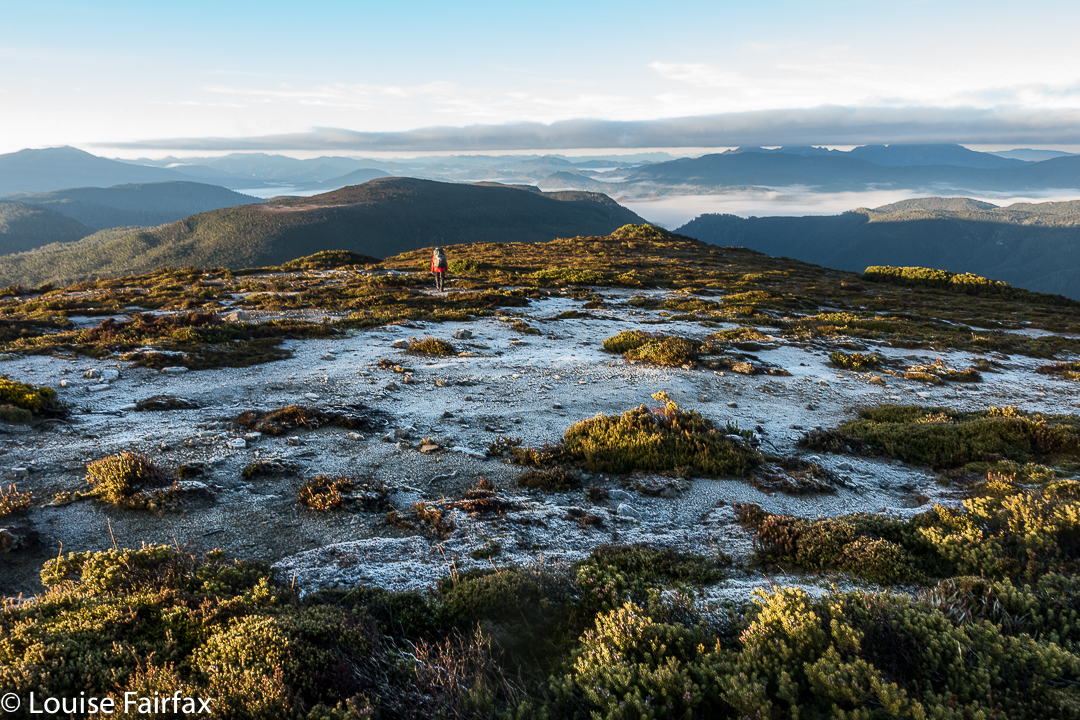
Not being anything like as exhausted as my lazy battery, I dashed back to the others at the top of Heritage, and went with them to collect our packs and proceed on, up the slope to Lookout Hill (640 ms asl), where we dumped our packs in the saddle (not much below the ‘summit’) and went to look out. The view was not to die for, but was a bit of variety from dry forest and cutting grass.

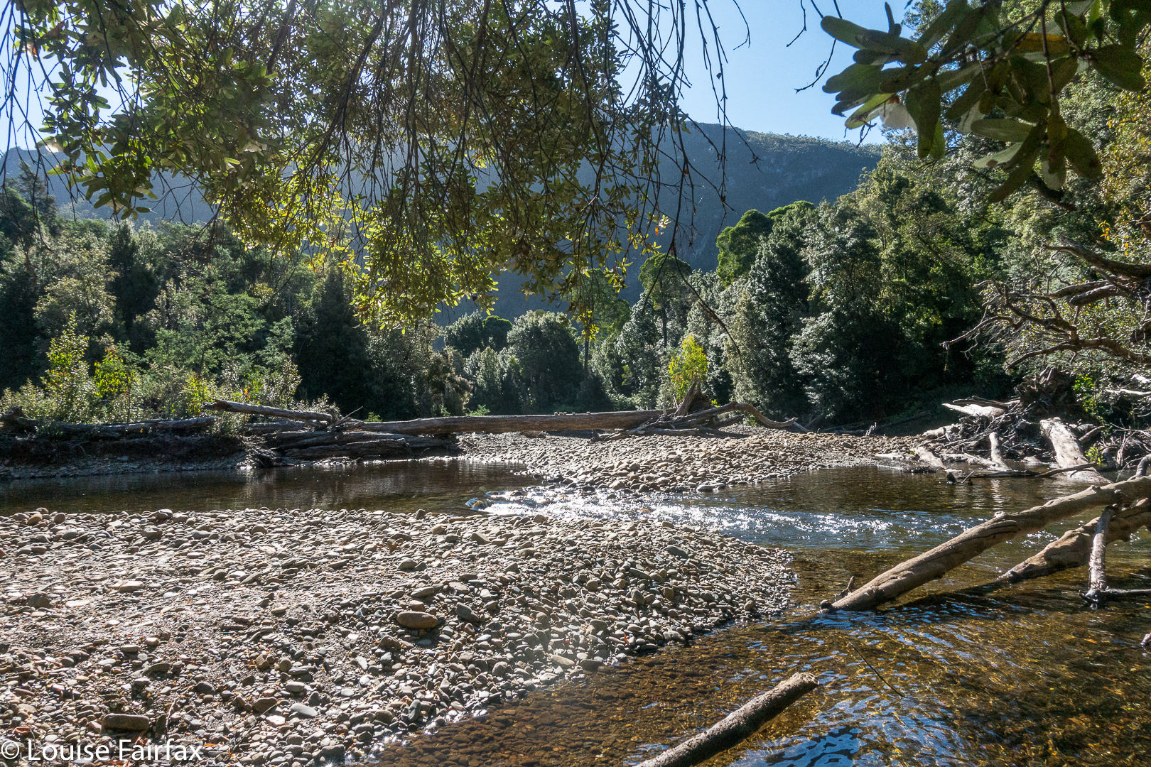
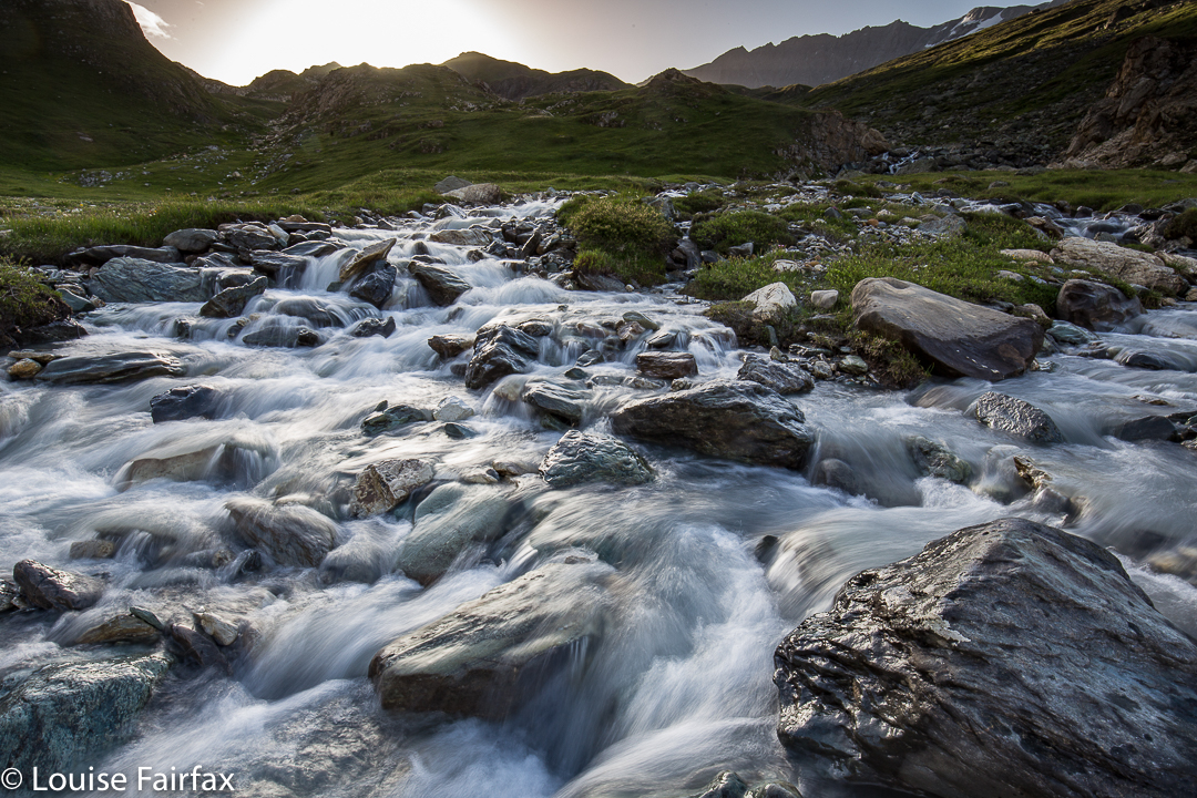
From there began the whopping and seemingly interminable drop to the Douglas River Campsite, number two on the list of possibilities along this track. Now, this one was a gem. I loved it. It was open, with views of Black Boys / Grass Trees ‘Xanthorrhoea australis’ to the river. The river itself had fabulously weathered rocks, which made kind of tiny islands you could perch on and sit in the middle of the river with water flowing past on all sides. It was cooling and restful. Later, as the sun entered its golden hour, a tunnel of aureate light drew our eyes upstream. Unfortunately, the mozzy population had not had visitors for a long time, and each mozz was starving. They found in me an excellent meal. Pity about my delusions of being too skinny to be tasty. Anyway, with bellies a bit satisfied, they were calmer the next night.

A blue line on the map indicating a waterfall. Upstream of the Douglas R crossing; bend in the river. I have imaginatively called it “Falls 1”.
On Day 2, we did not move camp, as we had “serious business” in this area. One of our number wanted to climb Mt Allen, so off all four of us set, up the very pleasant open forest leading to a higher saddle (a climb from 90 ms to 450 ms asl). At this saddle, the Leeaberra Track meets an emergency exit road heading down the coast. We walked along this uninteresting stretch of territory for 4 kms, until at last we were at the foot of Mt Allen, and could do the far more enjoyable 450 (horizontal) ms across bald patches of rock and through light scrub to its top (50 ms “climb”). I really can’t call that black dot a summit. It was merely the highest point on a pimply lump, and offered no views. We then had 450 ms of bush and a repeat 4 kms along the road back to the saddle. I had had enough of viewless, pointless pimples, I decided. I would not submit to the afternoon’s offering, as that would mean I would never get to see what I had come for: the waterfalls along the Douglas River in this stretch. Now, here was real beauty!! And I am a beauty hunter, not a list ticker. I returned to camp, ate lunch, and then set out on my quest.
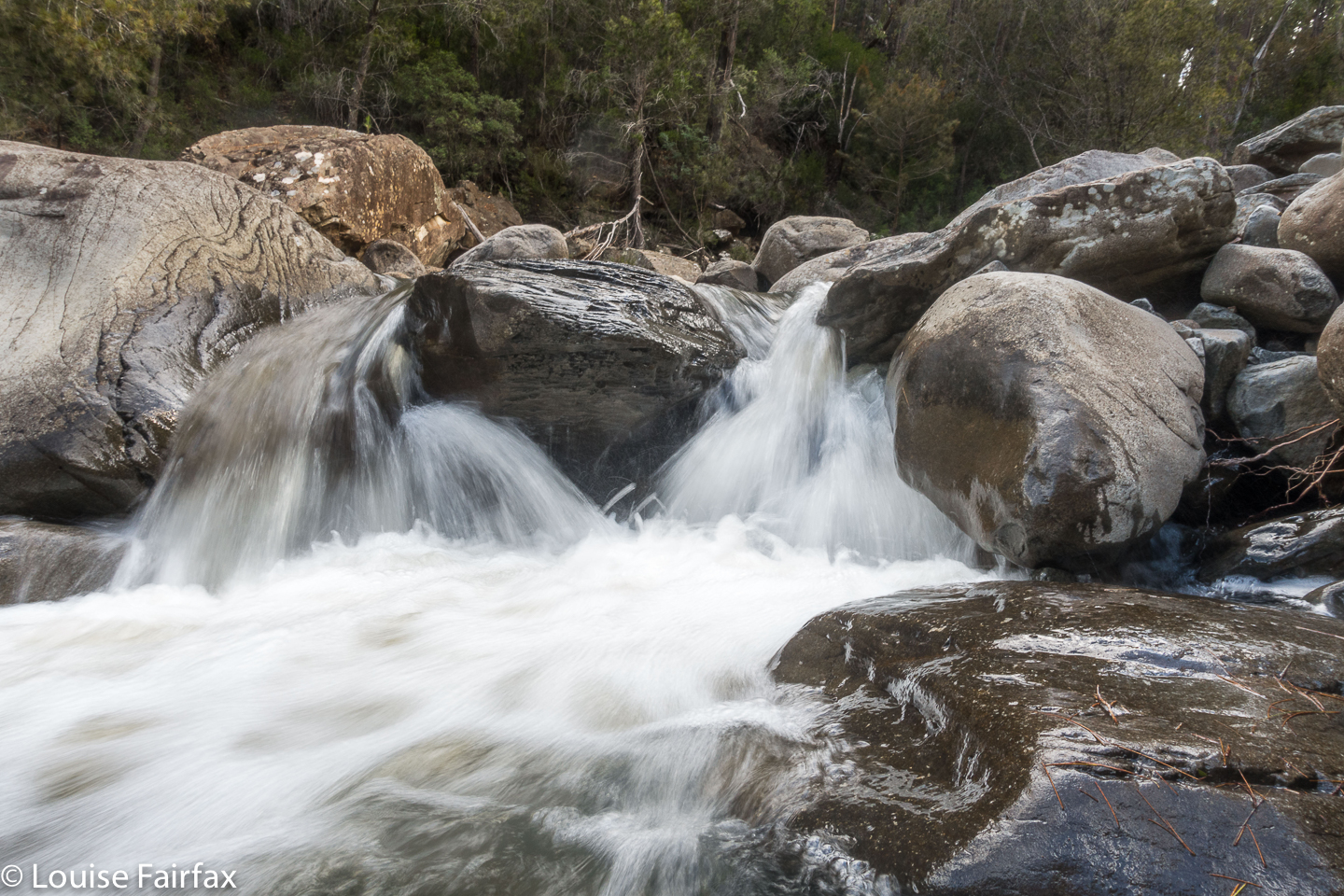
Tra la. Falls 2.


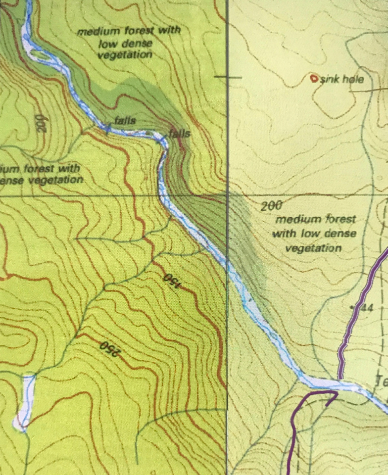
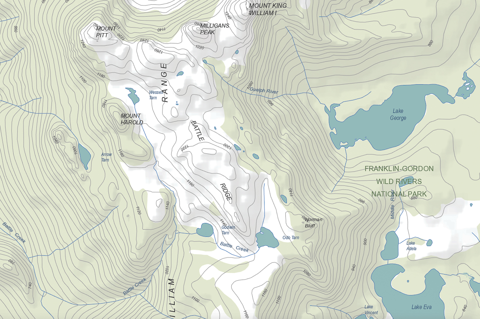
You can see the purple line where we crossed the river and camped to the east of the photo.  Then, if you follow the river upstream to the NW, you will see Falls 1 on a bend and Falls 2 further east of that. Dark green is rainforest.
I had the afternoon to myself: just me and a gurgling river and scenes of magical beauty. I decided the northern bank of the river offered the best chance of reaching the falls, so crossed at the campsite and then rockhopped for as long as possible upstream. For seven minutes, the hopping was great fun, but I then encountered the first of many obstacles: a cliffy bluff with steepish sides falling directly into rather deep water. The forest above was thick with needly bushes. I decided to grab roots and ease my way around the rock, swinging like Jane of the jungle – and having great fun while I was at it. The penalties for falling were not too great: I would wet my clothes and boots, and no doubt damage my electronic gear, but I would not, personally, suffer any great damage (other than to my pride). I took the risk and concentrated hard.

After maybe twenty minutes of this, I noted that the mapped rainforest above the bank had now materialised. I could thus abandon this swinging sport, and use the clearer, more pleasant forest to climb above any remaining bluffs. Fifty four minutes from camp, I arrived at “Falls 1”, situated on a bend of the river. This was a wonderful gurgling, frothy mass of pools and waterholes, of action and beauty. I managed to coax my camera into another wretched dash of a photo before proceeding upstream to “Falls 2”, which I could actually see from the first ones, but, in order to get a better view, had to do another stint of climbing. I am all eagerness to return to these two falls with a camera that works (and a tripod, CPL and other filters).

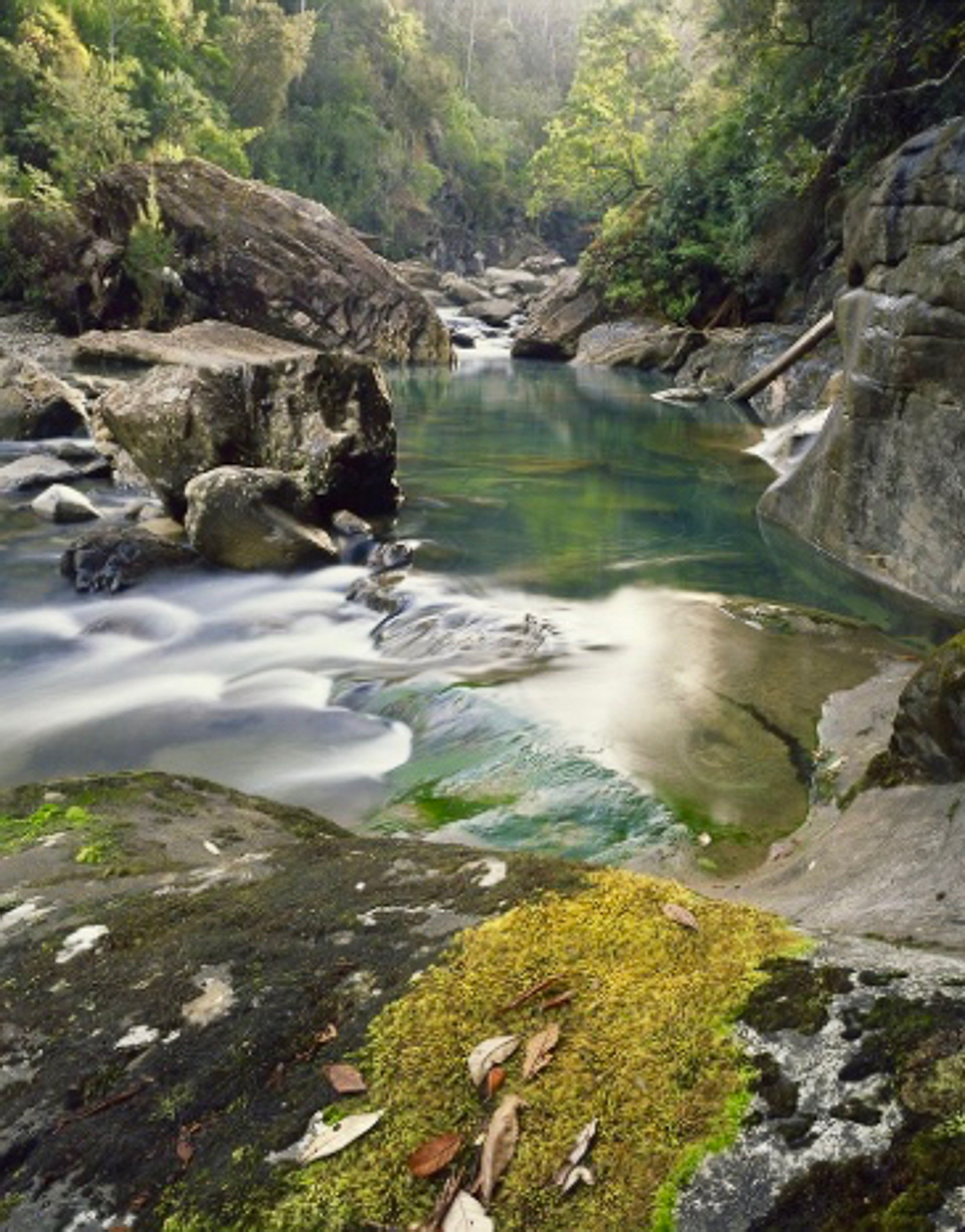
Douglas River as Dombrovskis saw it. Isn’t this inspiring! It’s part of the reason I was so upset at my camera situation. This is here to remind myself of why I’m returning (and because I love good photography, and don’t like publishing less than that).
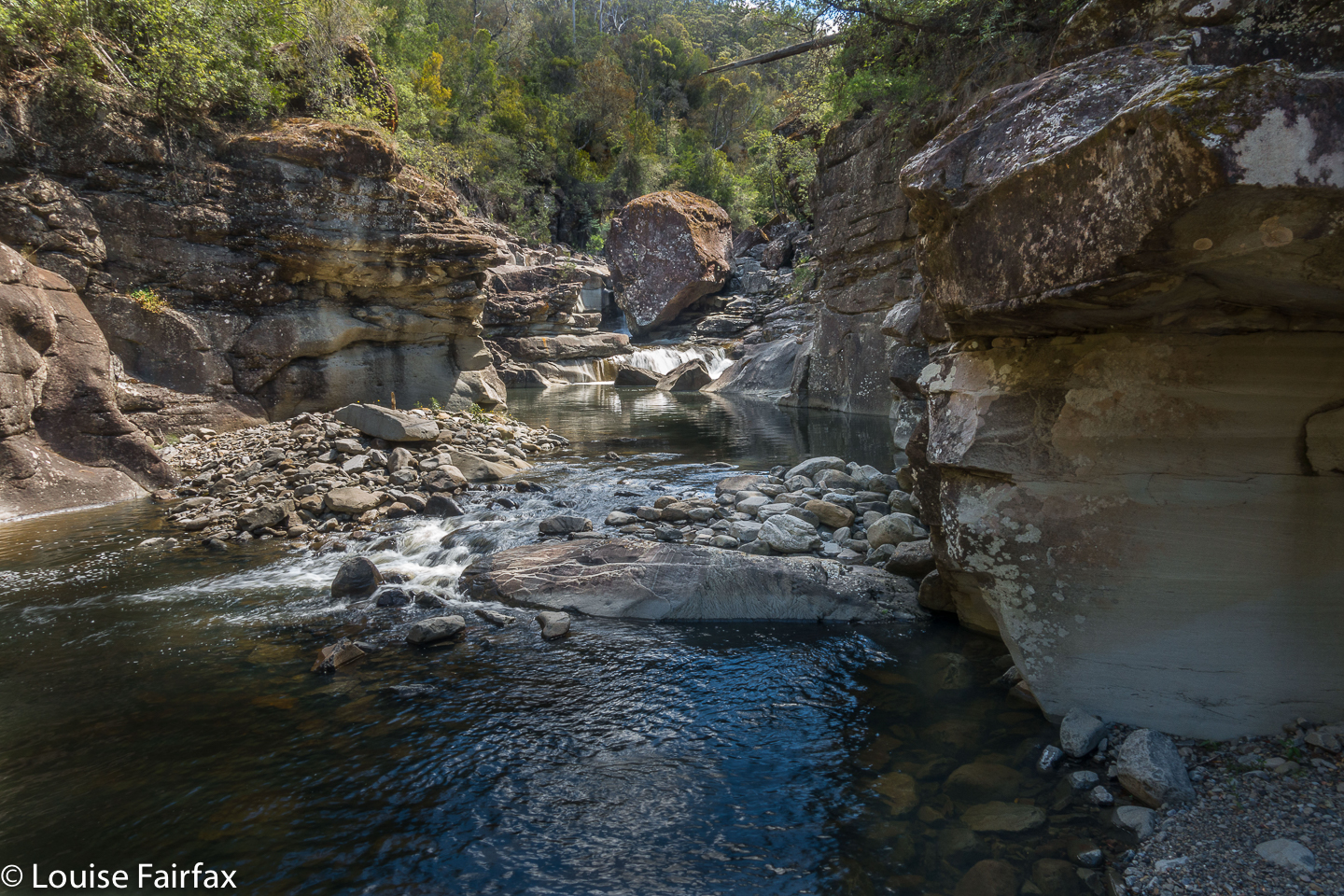
Back at camp, there was no sign of the others, so I set out for Tevelein Falls, supposedly a few hundred metres downstream. I went to where they were supposed to be on the map, but the cupboard was bare. There was a very nice gorge, and some sweet cascades, but not a waterfall. I thus continued for another five hundred metres, and found what is in the photo below – pretty nice, but not really a waterfall. Yes, the camera gave one final, choking and reluctant click (had I actually scored an image???) before signalling its desire for an urgent sleep.

There was nothing where the map said the Tevelein Falls should be. This is maybe 500 ms downstream of that. (See map directly below).

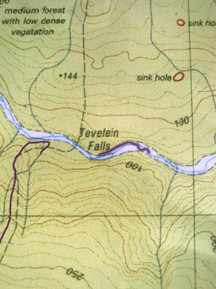
  I only plotted the part where Tevelein Falls should have been and the extension I did beyond that, looking for it, mismapped. I had come from our camp, purple line to the west of the supposed falls.
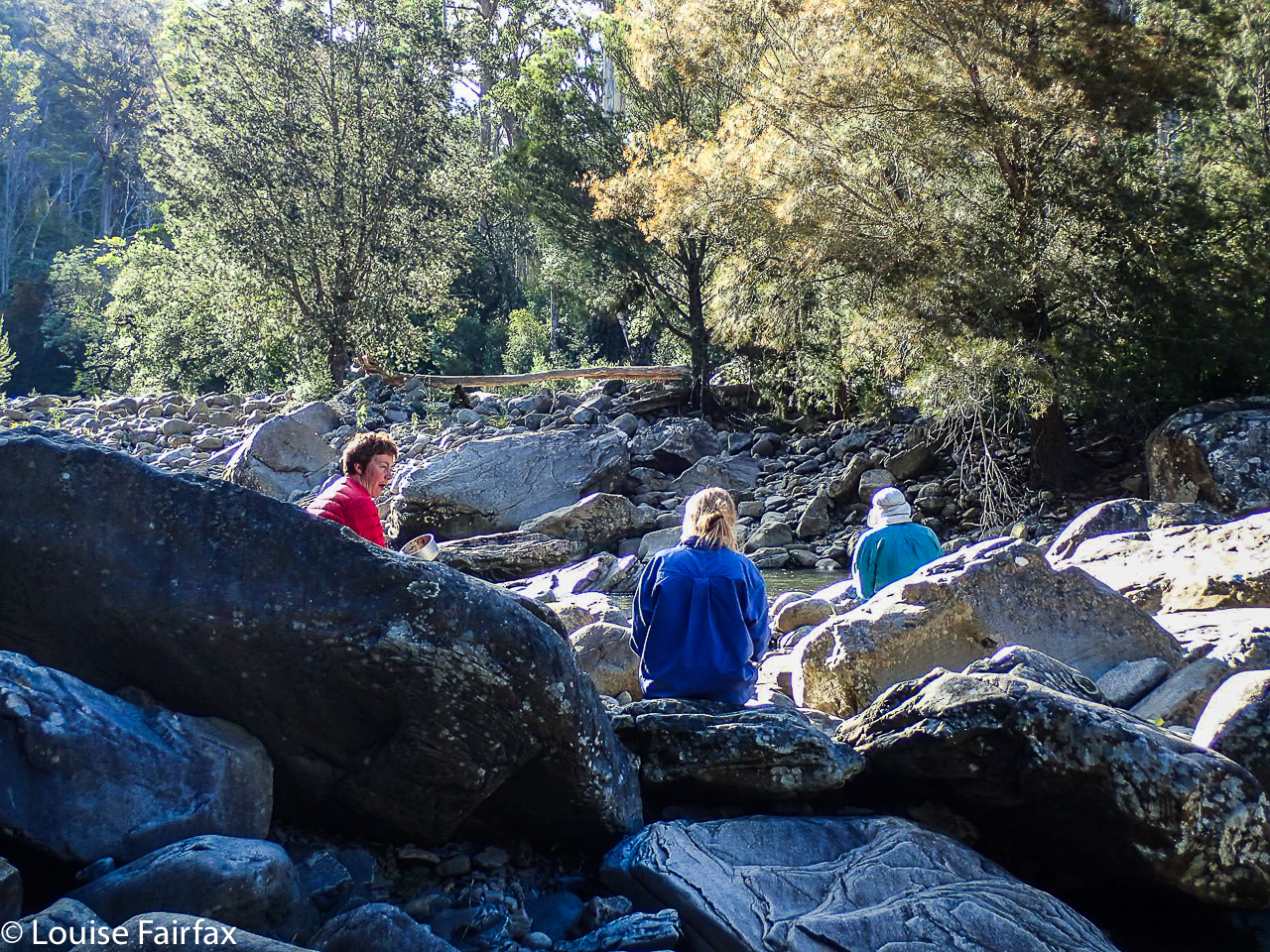
I returned to camp. It was 4.50. The others hadn’t returned, but I was starving. I cooked and ate in the river, and the others returned and joined me. It was beautiful there, watching the fading light and chewing cud.

Taken with a borrowed camera. Thanks Karin. Dinner on Douglas River.
On Day 3, the schedule was to climb more viewless pimples, and camp at the Douglas Marshes. Given the mozzy population, and the most inauspicious name, I had a deep sense of foreboding which was not ameliorated in the slightest by the reality we encountered. And I was quite over pimple picking.

We arrived in the stagnant, soggy area. Bzz, bzzz. The water did not seem drinkable. The air was foetid. No breeze could read a map to find its way here. The marsh vegetation (cutting grass, melaleucas) was way above my head, so there was no visibility.
“How far to this one?” Maybe  a very small number could persuade me to stay. “Six kms return”, came the answer. Na, sorry. Zu viel verlangt.
Two said they’d stay and wait the expected six hours for P to return. I said I would finish this trip off, and come back to collect them next morning to do the car shuffle. This track was not exciting me now there was no more beauty.

Off I set, shoving my way through thick, resisting and cutting marshland, a trackless waste of unappealing scrub. If there had once been a track, there was no longer one now. I navigated my way through the green jungle to the spur beyond on compass (the spur ahead was not visible to me). Even once on higher ground, the track was only intermittently visible. No matter; I can navigate. Every now and then I picked it up along my route, but it wasn’t worth searching for. Just going my own route was quicker. I did dump my pack to climb Mt Andrew, just because it was there and not too far off the track, even though it, too, was little more than a pimple. It provided a break for my shoulders.

At last I found myself finishing. I felt like yelling “Hoorah”. There, I found two rather sheepish-looking rangers, who tentatively asked me how I’d found it. I won’t tell you my answer in case you think I’m a polite and nicely spoken person. I smiled as I told them the truth, and they laughed at my answer, admitting that it was “rather overgrown”, and that they hadn’t had a chance to go in last winter and clear things up at all.  It’s not their fault. Perhaps if the government funded tracks that already exist instead of searching for new ways to desecrate the bush, the situation might be a lot better.

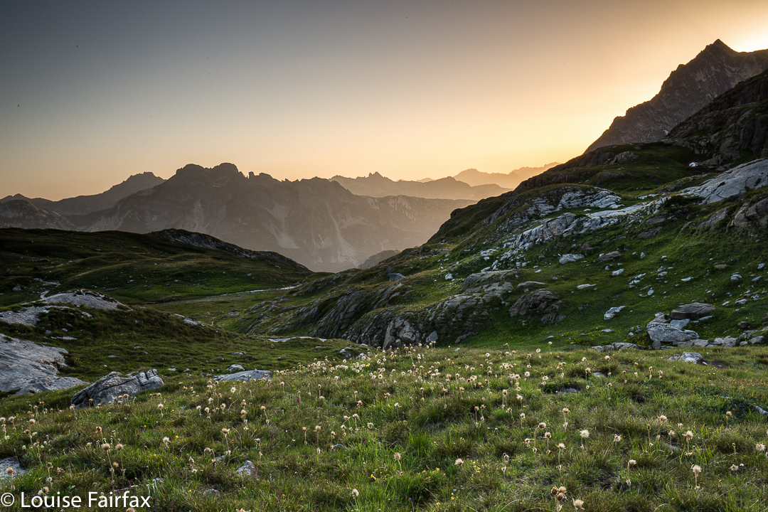
Conversation finished, I hurried to Bicheno for a delicious cafe lunch to cheer myself up. I was so hungry that I also went to the bakery mid afternoon for coffee and cake, and then paced beaches and read until I could go to the fish restaurant for the best seared tuna steak ever for dinner. And then, at last it was time for a beautiful Bicheno sunset, real photography, and, following that, hobnobbing with nice tourists who were waiting for penguins.

Next morning, our group was reunited for the completion of the car shuffle. With coaching and encouragement, this nervous driver made it across ditch 1, and even all the way up to P’s Jeep. Mission completed. Next time, I will leave by that boring exit road rather than face those marshes again. Besides, the finish area has no transport possibilities if you don’t have a second vehicle waiting for you. Whatever you do, your original car is miles away, hidden in forest en route to the start. I don’t believe a taxi would take you past ditch 1. I would love to tell you a different story about this track, full of possibilities, but, alas, I can’t. Not yet.

Some stats: Day 1, “Ditch 2 to Douglas River crossing”: 17 kms + 745 ms climb yields 24.5 km equivalents
Day 3 “Douglas Crossing to the end”: 15 kms + 690 ms climb yields 22 km equivalents.
Total (including the extra to get to the start): 32 kms with 1435 ms climb yields 46.4 km equivalents.

The URL for Peter’s blog is (and note its name):  www.naturescribe.com/2011/10/good-walk-spoiled.html

I have not put in the whole long gpx route of what we did, as it covers 4 more maps. If you want the gpx, please let me know and I can email it to you.

King William circuit 2018

King William Circuit, comprising Mt King William I,  Milligans Peak, Mt Pitt, Mt Harold, Battle Ridge and Bayeux Bluff, and visiting Wessex, Odo and Pitt Tarns. March, 2018.

Climbing Mt King William I. Lakes George and King William in the distance.
I had just returned from a fabulous week with friends at the beach near Coffs Harbour, and felt terribly flat to be back home in my now lonely environment. I looked at the approaching weekend: apart from my darling daughters, no one would ring; no one would pop in; no one would invite me anywhere. Life seemed bleak. I could sit at home and sulk and weep some more for Bruce, or I could be proactive and invigorate my life by joining in a club bushwalking trip. I chose the latter, and phoned the coordinator of the LWC trip to King William Circuit. HIs plans sounded great. All of a sudden I had to pack my bags pronto. The expedition was leaving at 5.30 a.m. the next day, which meant a 4.30 awakening. Yawn, but it would be worth it.

From Mt King William I looking towards Milligans Peak and Mt Pitt. The  Frenchman is in the distance, as usual.
I had already climbed King William I, but in a whiteout, so this time I got to see the expansive views. With our nice early start, the day was not yet too glary. It was, nonetheless, the rest of the expedition that held my attention.

In the saddle between King William I and Milligans Peak.
Once we left King Will I, we were in more interesting and less-frequented off-track territory, moiling our way towards Milligans Peak, which was very quickly reached (12 down, 13 up) from our first peak. (Note please: my times never include stopping to remove packs, take photos, eat or whatever; they are “exercise minutes”, as I am interested only in how much exercise I’ve had. Have I been lazy, or have I had a good workout?)


View from Milligans Peak to Guelph Tarn (L) and Pitt Tarn (R).
Milligans Peak offered more great views of old friends such as Slatters Peak and King William II, the Loddon Range, Lake St Clair, Lake King William and our future destinations of Mt Pitt, Mt Harold and Bayeux Bluff. The day was sunny and warm; the weather forecast for rain, a joke. Off we set to be reunited with our packs below, to have lunch by a little pool down there, and to then proceed to our tent tarn underneath our next goal, Mt Pitt.

Mt Pitt summit, looking back to Milligans Peak (R) and Mt King William (L)
Tents erected, day packs loaded with goodies and anoraks, we noted the amassing clouds but were unfazed. Off we set to inspect the views of Mt Pitt, quickly reached in 21 minutes from our tents.

Mt Pitt summit view, looking directly to Mt Harold, which has Wessex Tarn to its L and Arrow Tarn to the R. In the distance, slightly left, is Bayeux Bluff.
The next mountain was the best one of the trip, and a memorable mountain under any and all circumstances, with its hedgehog spikes all over its spine that caught your attention from afar, and had you wondering how, actually, you were going to touch the high point. I plotted my intended route from Mt Pitt, and carried it out with no problems. Having been initially daunted by the rock spikes, it gave a special feeling of pleasure to be on top of both the false, and the slightly higher, real, summit. Drama was all around.

Looking from Mt Harold real summit towards Mt Harold false summit. Mt Pitt is back right.
We all voted it the highlight, and abused the people who haven’t even given it a point. In fact, not only is it not worth a peak baggers’ point; it is neither an Abelette, nor a “Point of Interest”; neither did it get a nod as a “Bob Brown”. It is totally ignored by the people who sit in offices (or, reputedly, at the dining table after a few wines), staring at maps deciding what is “of interest”. We who visited this mountain think it is of extreme interest, and we loved it dearly.

Wessex Tarn. Battle Ridge to the left.
Off the top of Harold, we lowered ourselves through the scrub until we reached the beautiful Wessex Tarn. Now, from even before we climbed Harold, we were in the Battle of Hastings territory, with Arrow and Wessex Tarns on either side of our spiky castle and Battle Ridge in front. Norman and Bayeux Bluffs were up ahead, as were Odo Tarn, Battle Creek which runs from it, and Doomsday Bluff, beyond Bayeux. (To refresh your memory, in case you’d like it, the Bayeux tapestry depicts the Battle of Hastings, in which the Normans, under William the Conquerer, invaded and defeated England – under the leadership of anglo-saxon king, Harold Godwinson, in 1066. The Odo of Odo Tarn refers to Bishop Odo, who is depicted holding a club – presumably not a nice one like LWC, but one with which to bop you off. He was William’s younger, half brother. Later, William, now King William, commissioned the Doomsday Book (1086), an assessment of the land he had conquered and its wealth, so he could raise the taxes). It was fun to be in this territory, and to have as our culmination Bayeux Bluff, which we would reach next day. I am very sad that we didn’t have time to climb Norman Bluff. But then, it’s nice to have a reason for coming back other than just a revisit of old territory.

Our trusty tents
Oddly, List Maps has nothing in the area called Hastings. Surely someone could have popped in a creek or tarn or bump … but they didn’t. There are plenty of unnamed features remaining. Adam Guelph, (from Salisbury), who helped William, gets a guernsey (with a tarn and a watercourse), but not Hastings itself. Godwin Tarn presumably stems from Harold’s full name. Of course, from most of our mountains we could see the huge Lake King William; we were on the King William Range. William won. He gets all the big stuff. The victor gets to write history and grab all the best mountains, ranges and lakes.

Meanwhile, with all this history and four mountains under our belts, we retreated to our tents, arriving about five minutes before the clouds that had been slowly accumulating while we checked out battles, decided to dump their contents with a vengeance. We filled in an hour, and then cooked in our vestibules to the sound of wind howling and rain pelting. My flap buffeted most of the night, and we awoke to pea-soup fog. That did not deter us, however. On our agenda were Battle Ridge, Odo Tarn, Battle Creek and, at last, Bayeux Bluff, from which we would gaze at Doomsday Bluff. This blog is already quite big. For day 2, see the blog entitled Bayeux Bluff
www.natureloverswalks.com/bayeux-bluff/

Route Day 1

Eldon Peak 2018 Jan

Eldon Peak, Jan 2018


Several times on the Eldon Peak adventure, I was reminded of an earlier trip I did to Mt Emmett. The two trips may well seem worlds apart, as one (this) was done in extremely hot temperatures, while the other (Emmett) was done in a blizzard. On the Emmett trip, only four turned up, so Bruce and I comprised half the number. We didn’t make the summit on that day, but it was one of the prettiest outings of my life, and we spent the whole time yelping like little dogs: “Wow, wow, wow”, as we wended our way through the white witch’s wonderland, taking myriad photos. Steve, who is ever fond of quoting an adage, noted, correctly: “You’ve got to be in it to win it”. We four had braved the elements, taken the chance, and had won. If you don’t turn up, you can’t luck in on wonder. Of course, you can be in it and not win it, like the time we took a friend to sleep on Walled Mountain and received nothing for our efforts but a view of close-range, very thick mist. But if you’re not there, you won’t ever luck in on the times nature grants you – sometimes unexpectedly, of you are a reader of forecasts – a magic evening. (And even on the Walled incident, Elin kept saying she could feel she was on a summit, and she was exhilarated by the sense of space she could feel.)


Fun times chatting and chilling out on this trip.
And as I sat on the pebbly beach beside the Eldon River, enjoying the fact that I was greatly refreshed from a wonderful swim in one of nature’s magic gifts – a three-metre deep, crystal-clear waterhole – and enjoying chatting to my fellow walkers, Steve’s words came back to me. All of us present were prepared to get out in the bush, not really knowing what it would bring on this scorching weekend, yet just being there brought rewards that filled us with joie de vivre. Not for the first time, I was so happy down there by that river that I didn’t care at all whether we made the summit – which was naughty of me, as this trip was a promise by Paul to help get me to that very summit. The year before I was supposed to be on the boat, bouncing my way to the end of Lake Burbury with the others when, literally as I was about to quit the house (all my gear was in the car), Bruce started acting very strangely and I had to call an ambulance. He had a temperature of 42 degrees, and had sudden onset pneumonia.  (Not a single cough did he make). He was in intensive care for the next six days and we were very lucky not to lose him in that episode. In the wilderness eight months later, doing what he loved doing, was a far, far kinder way to go. His whole body was failing him, but he fought on valiantly. Thanks so much Paul for keeping your promise. It means heaps to me. Without a boat, this mountain becomes a formidable task.


Half way up.
And so, the trip to the summit began with a journey by boat up Lake Burbury to its northern end, followed by a walk along an old road that was pure bliss, as this former route for wheels is now a bed of spongy moss that traverses an area that could be parkland. It reminded me of the Blue Gum Forest as it was when we all loved it, with pale-trunked silver wattles instead of blue gums.

As we had no intention of climbing that first day – this day was all about getting to the startline to be ready for an early departure the next morn – the rest of our time was spent swimming in the glorious pool mentioned and pictured above, or sitting around on the pebbly shore (or in the rainforest, for some) chatting and eating. It was a wonderful time to savour being in the wilderness.


Day Two, summit day, was scheduled to be very hot, so we were ready with our packs at 6.30 for a departure that would give us plenty of climbing time before the heat advanced. There were a lot of contours to get through this day. Although this mountain has a huge climb, it seemed to me that most of it was in wonderful rainforest that was a sheer delight to traverse. The patch of scrub above this line didn’t last long, and then the rocky final ascent was pretty quickly dispensed with. The three earliest to the top were there before midday.
I had the fastest “touch and race away” of my life (something I normally never do) at this summit, as it was aswarm with a black cloud of galvanised, flying Jack Jumpers, and I was terrified. There is no point telling me they’re not interested in me. I am very interested in them, and I don’t like pursuing that interest at such close range. (For mainlanders and foreigners, these ants sting with a mighty punch. It is impossible to be bitten and not yell violently with pain.) They do not always swarm this or any other summit; it just happens to be mating season right now, and they like a good view while they select their partners and secure the next generation. At least they have good taste.)


Standing near the summit of Eldon Peak, it seemed I was on a huge monster of a mountain that totally dwarfed surrounding, otherwise-impressive peaks. Mount Lyell, Marble Bluff, and Mount Owen all seemed quite dominating down at lake level, but were transformed into silly pimples from the top of this giant. Even in midday glare and with Jack Jumpers for company, it was a great place to be.
That said, it was so hot and glary up there I was pleased when we started our descent. A swim at the bottom was calling. Unfortunately, by the time we got back to camp, hunger was stronger than the need for a dip, so cooking dinner on the beach and paddling had superior claim on my priorities.


The boat trip back on the final day was magic, but unfortunately I can’t show my own photos, as my camera refused to open. I fear the heat of the day may have cooked it. (Because of the heat and climb and boat trip, I didn’t have my normal full frame DSLR). Once more we had an early start, so walked out in golden light. The water at that hour was pure mirror. I felt very lucky to have been part of the group.


Jonny’s photo; my edit. The walk out.

FRANCE 2017 GR5

France. 2017. A repeat of the GR5 from Chamonix, heading south.

Now that my husband’s condition is worsening, I am restricted to four weeks in Europe, two of which I swallowed finishing the Wainwrights in England’s Lake District (http://www.natureloverswalks.com/lake-district-2017-1/). What delightful place should I choose for my other two weeks? Oh the agony of such a choice. France won out. I had walked the GR5 from Chamonix to Modane in 2015, and had been bitterly disappointed with my photos. I hadn’t brought the best lens, and had saved weight by not bringing a tripod. So stupid. Some weight savings are going too far. This time I was there to repeat this beautiful section of the walk, armed with better equipment. I had my lightweight, travel tripod (not nearly as sturdy as my home one, but much better than nothing); I left my stoppers behind, but had GND filters, remote shutter control and my favourite landscape lens (16-35mm).

I never mind repeating things I have done. The scenery is always different, the new weather offers alternate perspectives on a place. The exact lighting never reoccurs. My expectations and hopes for beauty were fulfilled. I must say, however, that it was not with the same feeling of freedom that I wandered.  All of a sudden, the mountains are becoming full of tour groups who fill up the huts and who don’t talk to independent walkers like me. On several occasions, I found myself the only “freedom walker” in the hut, and sat at table with people who talked and laughed amongst themselves, but didn’t want to meet or engage with an “outsider”. Fortunately, this didn’t happen in all the huts, but it is certainly a change in hut life that I do not welcome!

Some huts were so booked out with tours that I had to keep walking – on one day, ad infinitum, until I could find a hut that would accept me. When talking to the tour people, I did not meet one person who was actually carrying his or her own full pack, or who was walking the whole route. They are being offered dumbed down, attenuated versions of the route (buses for valley sections, transport vehicles to carry their luggage so they can dress up for dinner at night and not be burdened by their packs by day). These are not my kind of people, and we are not on the same pilgrimage, even when our paths do cross. Too many of them are ticking the “done that” box – Terry Eagleton’s “commodified experience” – whereby experiences are now for sale in our rapacious, grasping world where everything gains value only through its market price.

BUT, there are still some wonderful people to be met out there in the mountains. Let me tell you about two experiences, both begun on the same day, to furnish you with examples. The first was my meeting with Francois, with whom I had sat at table in the Refuge de la Valette. This had not been a pleasant refuge, despite its ideal location. It had been filled with screeching mobs of children who were using the beds as a gymnastic playground. I arrived exhausted after a big day, and needed a rest. I had to lie on a hard bench in the dining room to get some repose. I was not enjoying them. To make matters worse, after dinner, while shooting sunset, I had a bad fall that re-cracked my sternum – an old injury from four years ago. I was stunned that the fault line was still weak. Whenever I tried to use my arms, pushing or pulling, I was in agony, but had to have a top bunk to protect the children who had climbed up and were swinging from them in their spare time.

Next day, I has half an hour below the hut, and reached a flooded stream. The rocks were submerged and I hunted around for quite a while, trying to find a place where I could cross. I was feeling very vulnerable with no arms, and pain was tiring me. Along came Francois, and he helped me across. We walked along together for the next three hours, with him making sure that I had no trouble in the flooded sections. Eventually we parted. It was raining. He went down, and I turned my face to the Col d’Assois high above, my next goal.

I had now been going for three and a half hours without water. I wasn’t thirsty, but thought I should drink, and I also wanted to look at my map before I set out climbing. I saw a shepherd’s bothy ahead and hoped its awning might offer me a chance to both find a source of water and look at my map in shelter. Alas, it offered neither.

I had a tiny glug from a small stream nearby, but knew I shouldn’t. There were too many cows in the area. I was eyeing my bottle, telling myself not to be so stupid as to have another gulp when over the brow of the hill came three smiling, bouncing people: a woman, her husband and their grandchild. The woman, Chantal, offered me a cup of tea! Boiling, clean water. You bet. Not only did I get a cup of tea, but also two slices of heavenly, wicked (Hm. Do those two words go together? You  know what I mean) chocolate hazelnut cake. I was also offered lunch, but a look at the ever-worsening weather outside made me decline this generosity.

Off I set into the grey yonder, the clouds swirling, the col no longer visible, the rain now lashing down. The higher I went, the fiercer the wind became, so that near the top, I was being blown off the path. My memory of this col is that it has a long section up the top, which would act as a huge wind funnel in these conditions. I also remember that the other side had some sections where I would need to use my (now useless) arms. If I slipped and hurt myself in these conditions, no one would be there to rescue me. I’d die of hypothermia. The higher I climbed, the more aware I became of how silly it was to be up there alone when already injured. Eventually, I backed out. On the way down, I called in at the bothy to tell my friends I was safe, and retreating, and went on my way.

The first place I had hoped to stay at didn’t seem to have accommodation on offer. The second said he was full. By the time I got to the third, I was fed up. I had now walked so far I was back in the realm of cars and a road. I decided to hitch to a village and stay at a hotel, away from screaming children and snorers, to have a thick towel and a warm shower, and space to myself. Truite aux amandes did not go astray either! Neither did a real breakfast the next day – muesli, fruit, cappuccino (even if it was French style. Call me biased, but no one on earth other than the Italians can go near to equalling Melbourne coffee, and every traveller I met who has tasted the latter agreed).

Now begins phase two of this amazing new friendship. I was walking down the street of Pralognan next morning, and I heard my name called. It was my friends. They wanted me to have lunch with them, but I was not interested in food (What??? Is this Louise writing? I should have smelled a rat). But I wanted to spend time with them, so sat with them while they ate. At the end, Chantal gave me her contact number. That afternoon, I popped myself in bed and had a sleep. (BIG rat now). That night I didn’t want dinner, and the next day I booked into the hotel for another day, and didn’t eat again. On the third day, I saw a doctor, who said I had a high fever and a throat infection, and gave me antibiotics. Perhaps it was the empty stomach? They made me feel quite sick.

At 4.20 a.m next day, I awoke, feeling more than woozy. I decided I needed a probio tablet (acts like yoghurt). I had it, but then felt really dizzy. The next thing I knew it was 5.30, and my bed felt strangely cold and hard. I was lying on the unforgiving tiles of the bathroom floor. The soreness of my skull told me I’d crash-landed face first on said floor. It just didn’t seem like a good time for calling people, and my wifi-only phone wasn’t working anyway (they kept changing the code during the night), so I just went back to bed. When real morning came, I texted Chantal to tell her what had happened. “I am in my car and on my way to collect you. There in one and a half hours”, came the immediate reply. She was going to drive three hours to collect a stranger and take her home!

The psychological effect of her coming was wonderful. I managed to eat some breakfast, and by the time she’d given me lunch, I was heaps better. I presume I’d passed out due to lack of blood sugar (a talent I have), and that’s still the way I see it. By the next day, I was swimming with the children, walking in the mountains with Chantal and Guy, and on my way to recovery. I only opted for a brain scan because it was now time to fly home, and I feared that if there was swelling on the brain as a result of my crash-landing, it could swell further during the flight, and that this could be bad in the confined space of a skull. (My face was swollen and black on the outside). I looked awful.

Chantal took me to the hospital. Not surprisingly, they found a pinprick of haemorrhaging inside as well as out, so wanted to keep me in hospital for a week. They succeeded in an unwilling overnighter. Next morning, I phoned Chantal using a doctor’s phone and asked her to rescue me again, which she did, of course. The doctor was not pleased, forecasting all manner of dire consequences if my condition worsened, but why would my head start bleeding again if I didn’t go crashing it against more tiles? I felt the danger was minimal, and insisted on my right to take risks with my own body, so ran off with Chantal, and spent the next two days having lovely long (but gentle) walks in the mountains with her and Guy, and having fun meals with the family before flying back home. Chantal is my guardian angel, and we have each found a friend for life.

Pyramid Mountain 2017 May

Pyramid Mountain 14-16 May 2017.
(For Day one of this three-day hike, see natureloverswalks.com/Rocky-Hill/).


Summit day for climbing Pyramid Mountain dawned. A light fog surrounded us; the grass, of course, was icy, as were our tents. The sun was a kind of dispersed yellow glow to the east. Mountains like High Dome, Pyramid and Goulds Sugarloaf were beautiful silhouettes as we ate breakfast and prepared ourselves for our adventure. How would things play out? Could we do this in a day at this time of year?


We set a turnaround time of 12.30, given the now early time of sunset, which didn’t give us much room for hold-ups or errors should we land in highly-resistant scrub. Off we set, both curious and hopeful.


We were at “hill 1173” within 45 minutes; passing Mediation Hill in another 45; and topping the next hill after leaving the main Eldon Range route (Hill 1129) in a further 25 minutes. Things were going well so far. Pyramid looked pretty close by now, and we’d not quite been going two hours. And then the rot set in. After this hill that was a bit of a bulldog in lamb’s clothing, came a route that went first SE and then swung along a ridge that looked fine from a distance, but was like a duplicitous politician at close quarters: deceitful, barbing, and best avoided. Trouble is, we needed to traverse it all the way along its mean and nasty length until it started climbing to the next hill that was so uninspiring it didn’t even have a name or a height number. At least we didn’t need to go all the way to the top of this one, as there was a saving patch of rainforest if you contoured around to the next saddle, the (whew) last saddle before the bitch of a climb up Pyramid.


“I thought you liked climbing, Louise!” you say. Yes, you’re right. I love it, but not when the climb is in thick, dense, impenetrable, energy-sapping, defeating scrub, where you work and work and then look at a your map and realise you haven’t even covered a hundred horizontal metres and you can’t see the mountain, and you can’t even see a way of going forwards. You try left and right and retreat a bit, telling yourself retreat is often the best way to advance … but when you retreat all the way back to the start triangle it isn’t (well, bit of hyperbole there). After what seemed ages, we came to a spot where we could glimpse something. Ahead lay a gulch. Beyond that, cliffs and more bushy climb. We decided we needed to drop down and get on the spur above the cliffs. Somehow that went quite well (face-in-the-dirt steep), which is good as I was becoming increasingly despondent, fearing we’d come all this way to be locked out of the summit at the last minute. Once we were above those cliffs, we could see paths of erosion ahead that would lead us the rest of the small distance to the top without any hindrance other than good old gravity, and who cares about it? Not I. Well, not normally. I was feeling tired and hungry by this stage. One hour after leaving the saddle (a distressingly small distance below us), we were standing on the summit. I didn’t stand for long. It was 11.30 and I wanted lunch. NOW.


The return was faster, much faster. From above, a better line was easier to find, and what took us an hour up, only took thirty-three minutes down (and not just because down is faster than up). The ridge didn’t seem quite so inhospitable now we were in a buoyant mood, and we had a much better route from it to the summit of hill 1129. It was so great to curve around the summit of Mediation Hill and know that our bushbashing for the day was over. We just had to follow the ridge back to our waiting tents. There was no way we would not be there before dark. We even had time to have a drink or two and photograph the dramatic cliffs below our camp. Drinking was unpleasant, as the water was so cold it hurt.


It was a freezing night. Temperature-wise, it was by no means the coldest night I’ve had in a tent (it was probably about minus four; I’ve experienced minus ten and worse), and yet I swear this night holds my personal record for condensation. My sleeping bag became saturated, and ineffectual along with it. Everything got wet. I suspect it might have been because my utterly drenched socks (wrung out, but there was still a large amount of water left in) were inside the tent, along with my somewhat damp coat and long pants. These things were inside, as they might have turned to ice if left in the vestibule. I feared my boots would freeze, but only the laces did.


In the morning, the ice layer on the tent was a thick and heavy sheet that I had to prise off using my tent peg, it being the only implement I could think of that could do the job. Normally my ice is in cute white crystals. I took ages to pack up in the morning, probably because I was dreading the moment when I would have to put those frozen socks back on, and the pants and coat that were still damp from the moist bushes the previous day. There was no point in putting dry socks in sodden boots, and carrying wet, heavy ones in the pack. It had to be done, but was not a pleasure.


We stopped at “Stu-slept-here” Hill (1111) for a drink, but, as with other days, drinking hurt. By the time we reached the glorious rainforest section of Pigeon House Hill, we knew we would easily make it to the car in the light – it was not yet mid-afternoon, so we relaxed and started to examine and photograph darling fungi on the way along that section. They were there in their hundreds, so many delicate beauties.


I made sure the camera and phone were well sealed before the final river crossing. At least if I landed in the drink so close to the car I’d be freezing, but would not hurt my electronic gear or get hypothermia. The world was good. We’d done it.


crepidotus sp


Mycena clarkeana I think


Please don’t be fooled by the dark lines there into thinking they denote a track: they’re depicting National Park boundaries. The boundaries, and our route, follow the ridgeline. Please also note that I refer to Hill 1173″. It is that height on the 1:25,000 map that we used for the greater detail. Oddly, the 1:100,000 map, used here for greater clarity, it is marked as 1120. I guess more modern methods have resulted in a height revision. Not sure.