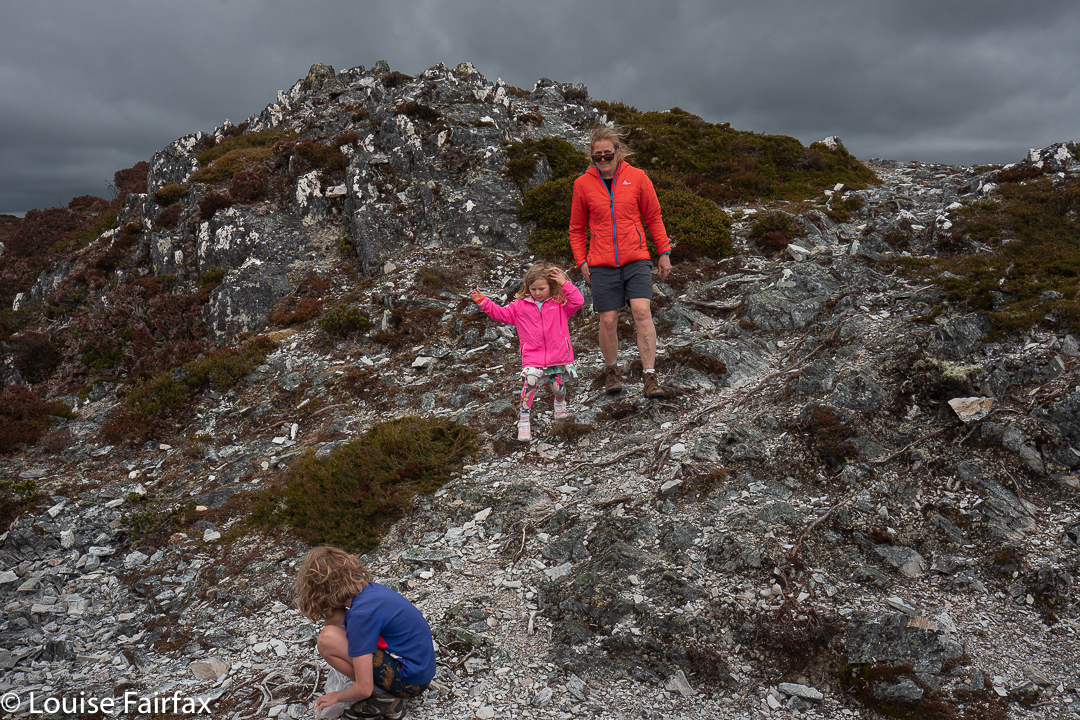
Koruna Peak? Never heard of it, but a guy for whom I have great respect was leading a walk there, so I signed up and then did some research on where it was. On the Wilmot Range; oh goody. Now I am definitely going. Three other guys also put their names on the list, so we would be a party of five: 4 males and Louise. Oh oh. Would I be able to keep up? Will I be a disgrace? Will the guys just disappear off into the distance? Oh well, I do a lot of solo walking these days, so if I do find myself left alone, it’s hardly a catastrophe, but I sure hoped I could keep up.
This member of our party selected a spot looking east over Wilmot Bay to Starfish HillWilmot Range: Exploring more as golden hour is approaching
This walk starts with an ascent of Mt Sprent, which has, as far as I am aware, the steepest track up any mountain in Tasmania. It is a track built by guys for guys, with each step so huge that for me it constitutes a climb in its own right. For every step, the height gain expressed as a percentage of my total height is so great that I can’t just step. Well, certainly not with a multi-day pack on. I have to find a sapling or tree root or some other object and haul myself up with a few animal noises to the next level. Thus I grunted and tugged my way up the mountain whilst the others gained height with less audible and visible effort. I was never actually last in the queue, but I could tell that that was merely because I was with guys who had manners, and I was very aware that I was holding everybody up.
Views to the east: very tempting
As a result, when we got to the summit of Sprent, I offered to withdraw from the group so they could make faster progress without me, and be more sure of reaching their goal. Dale (the leader), however, said I was fine, and then looked at me cheekily and said: “You do have a head torch, don’t you.” I smiled.
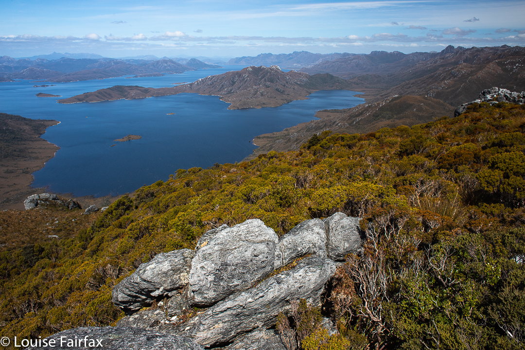
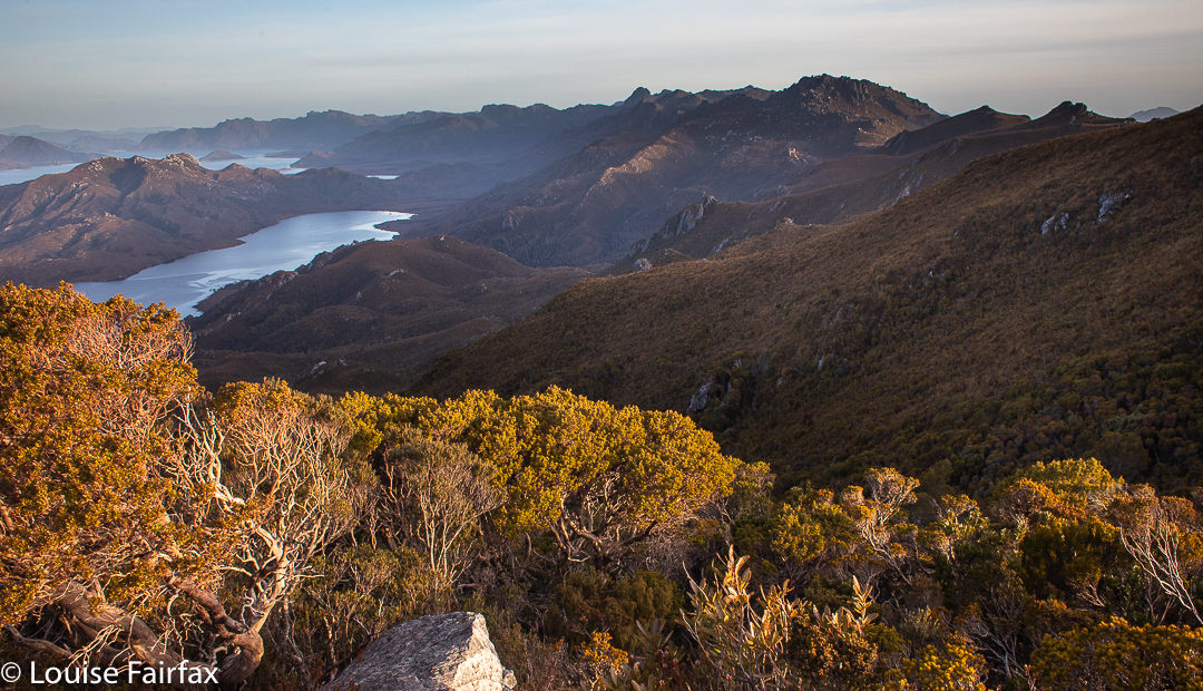
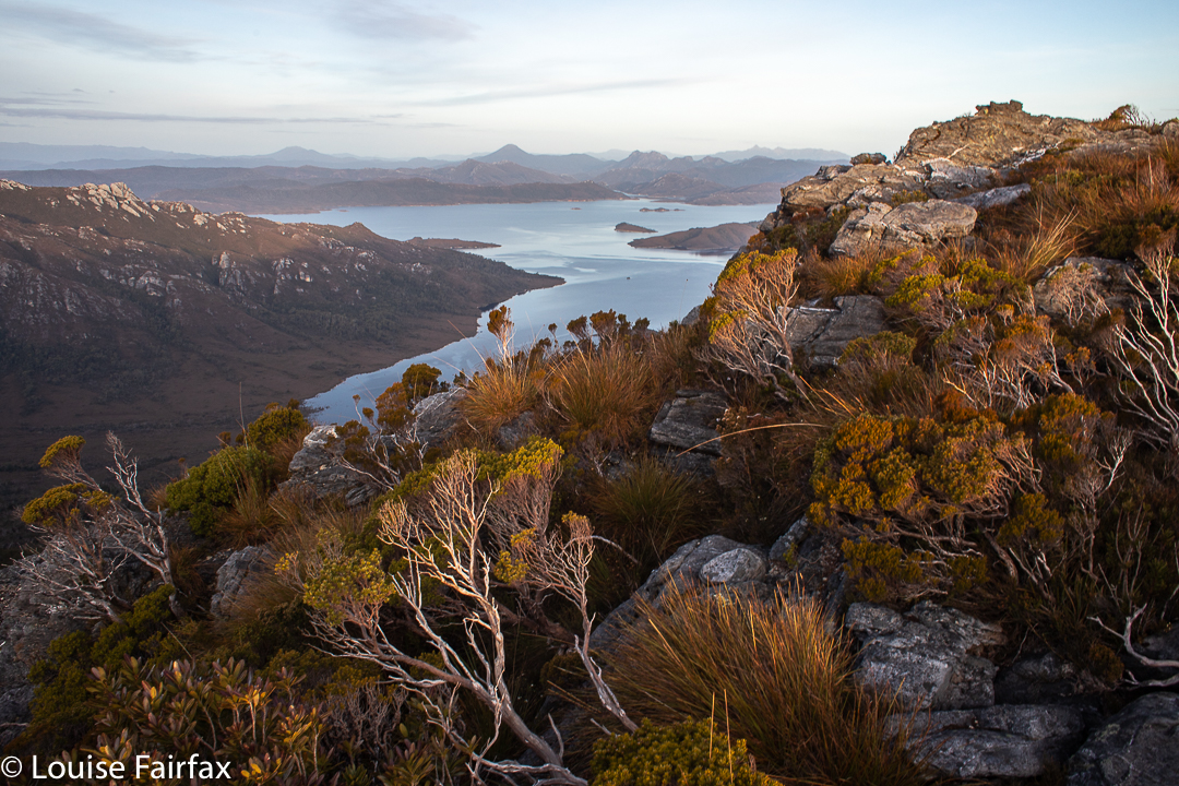
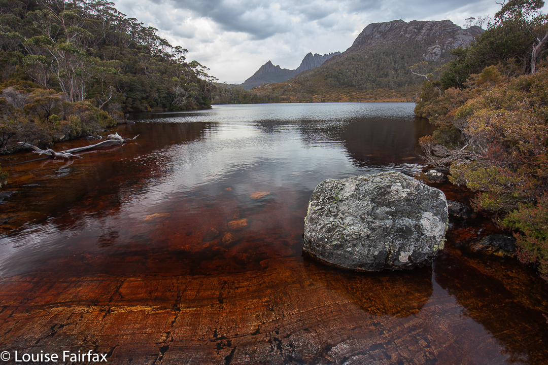
The view to the south. Koruna Peak stands quite tall in the distance
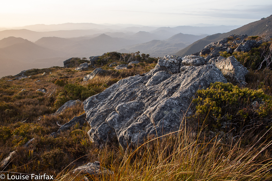
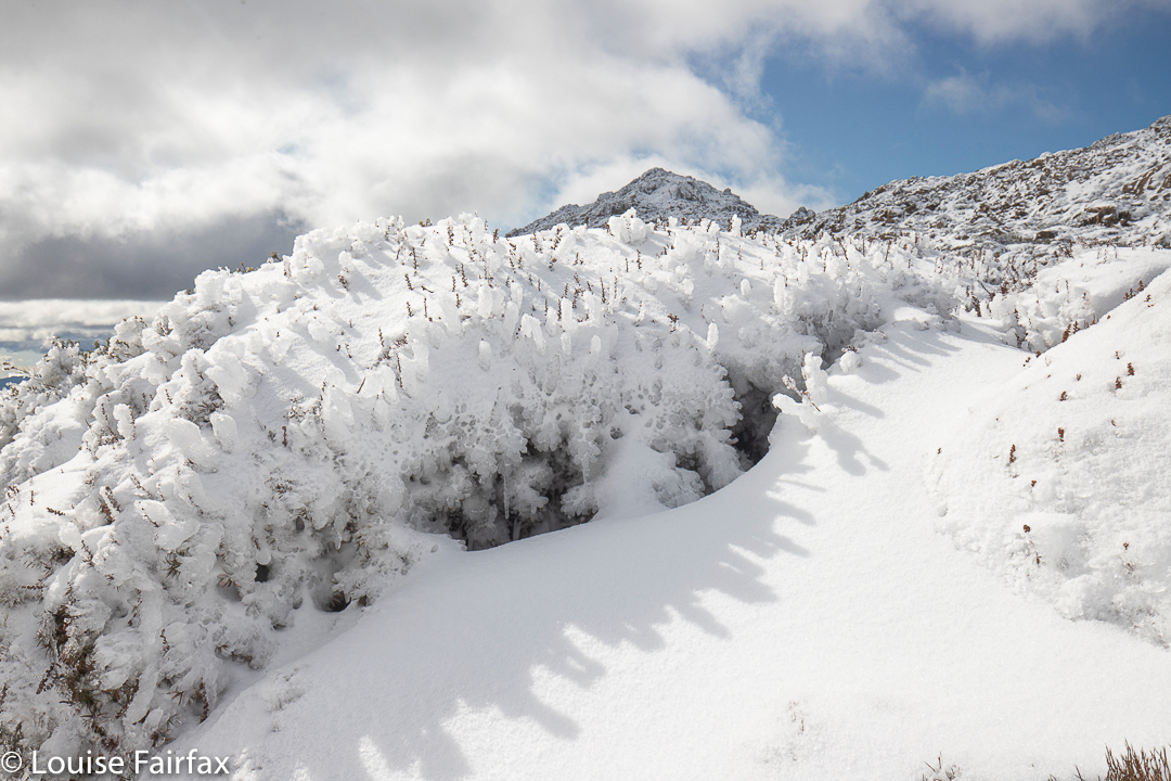
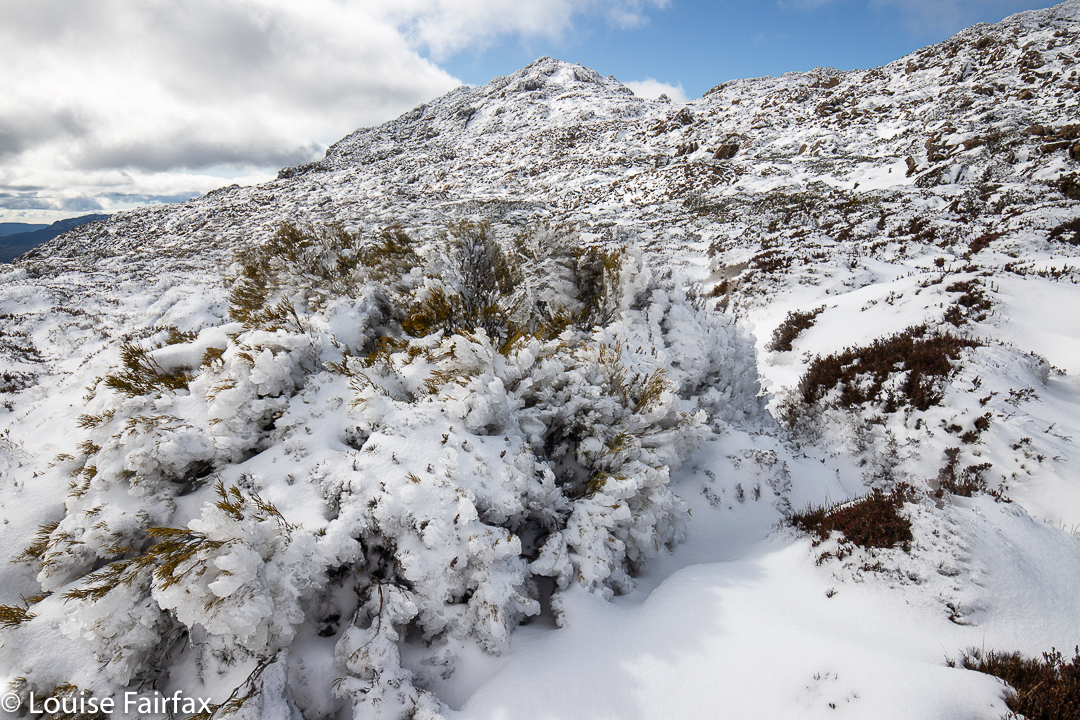
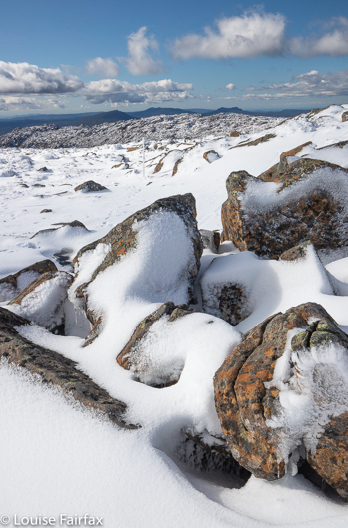
On we went, through the ice and snow on top of Sprent and then down the boulder cluster beyond to the slightly scrubby ridge below. Many of the rocks were decorated with rime – and there was a frozen sheet of water in one point – so everybody had to be careful, which greatly helped my cause of keeping up, and I managed to keep pace and even take a turn at leading once the scrub started. I was keen to try to pull my weight and contribute to the group, and not just be a parasite.
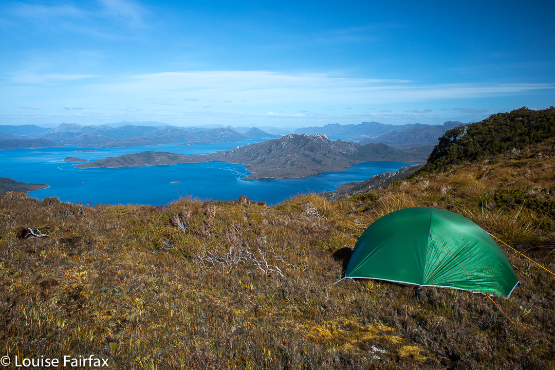
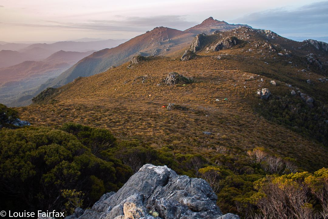
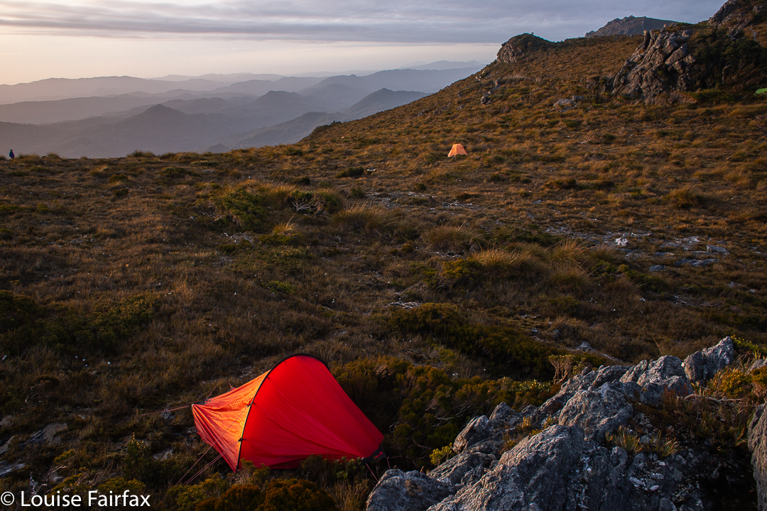
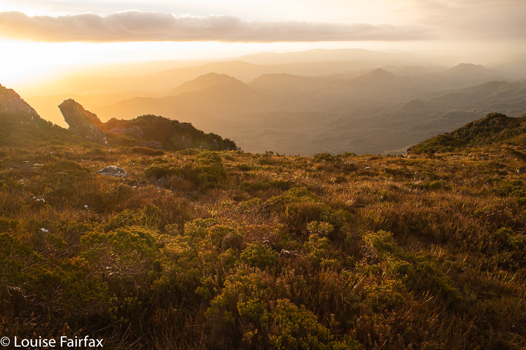
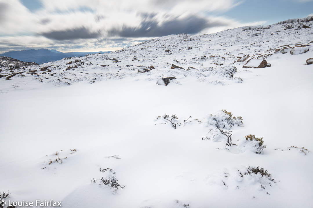
The view to the NW. You can see the dilemma about which place to position your tent.
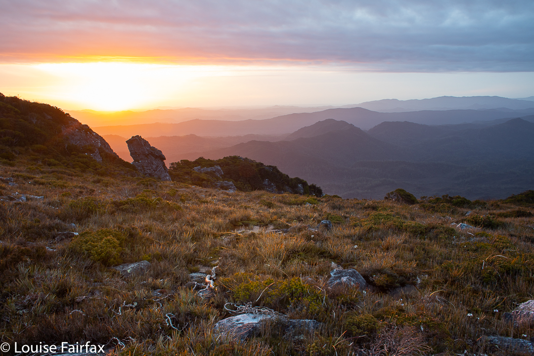
At all times we had fabulous views out to left and right as we walked, and in what seemed like a very short time, we had reached our camp spot. We had absolutely no need for head torches, and even had time to explore all over the place once we’d sorted out our real estate for the night. I put my tent in the shelter of a rock in case the wind came up, and then grabbed my tripod and camera and went exploring, climbing this and that interesting rock structure until it was time to cook dinner. Sunset offered a dilemma: should one go for the views to the west of mountainous silhouettes receding into the distance, or catch the eastern back glow with water views? I decided for west, and enjoyed the show greatly.
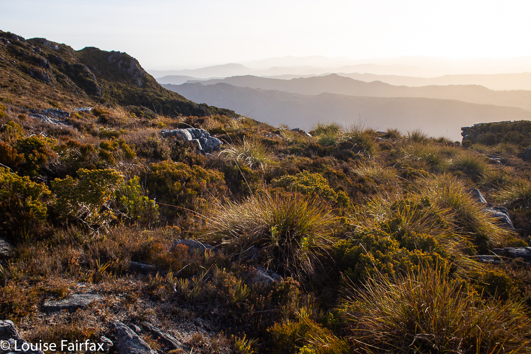
Climbing around for fun. This is the view back to the north with Sprent in the distance
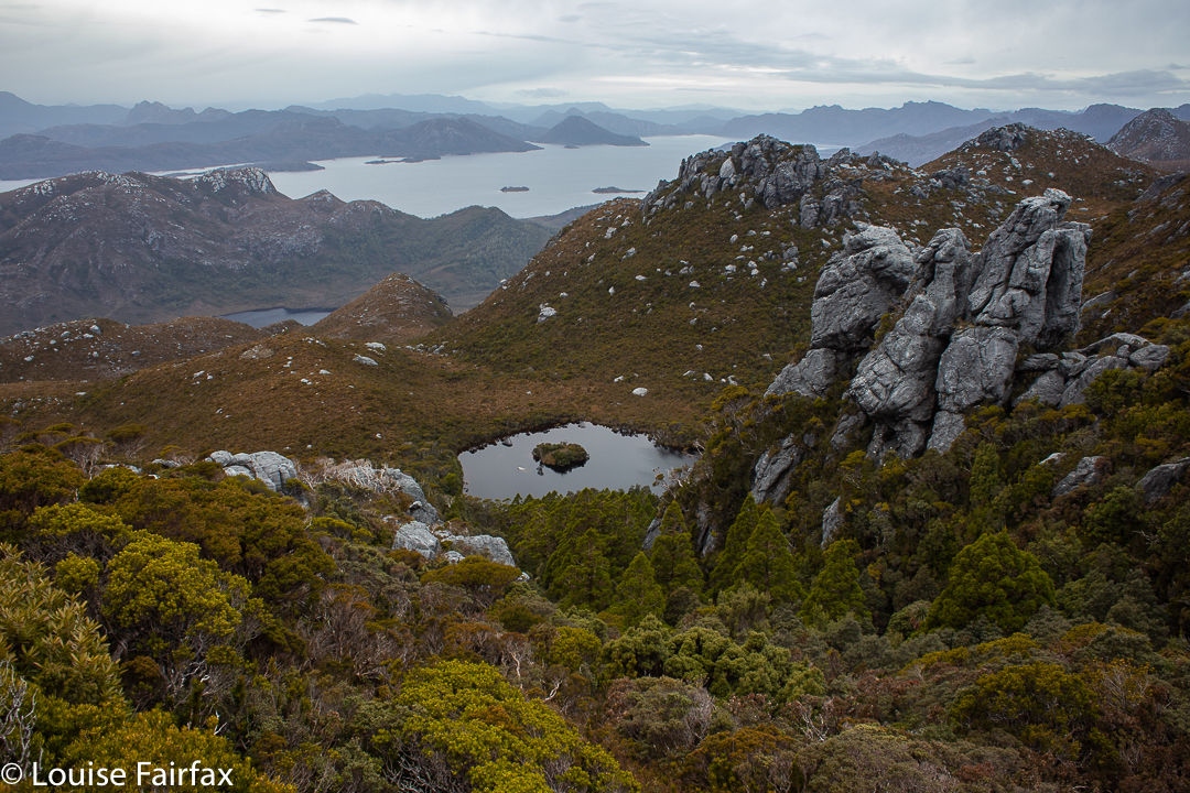
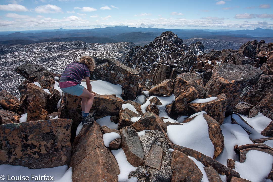
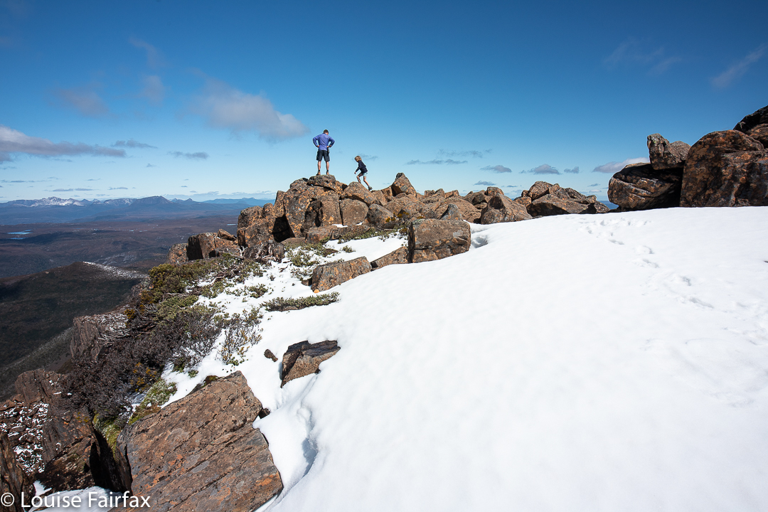
The middle day was just a daypack one, so I was as light as a feather and as free as a bird. I could even run over the hillside if I dropped back for photographic purposes, of which there were many. The fabulous views continued all day, and we enjoyed our climbs of the black dot of named Koruna Peak, and the high point of the same, which was actually further on, on a different peak. There were also other little structures of various challenge, so we filled our day with fun.
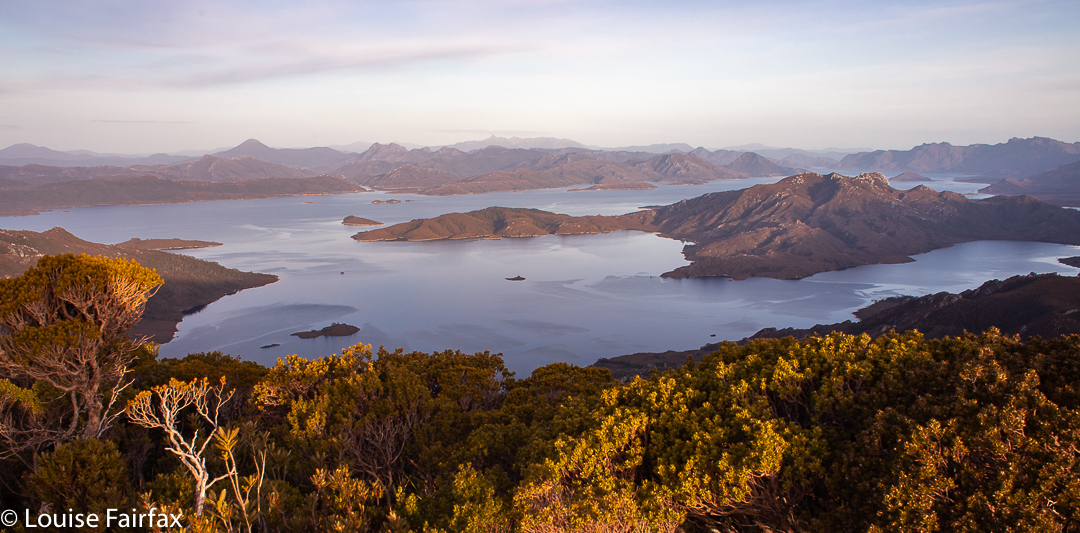
The setting sun illuminates the trees as I gaze eastMy little home away from home that gives me absolute freedomSunset on the first nightLooking down to Islet Lake from near Koruna Peak
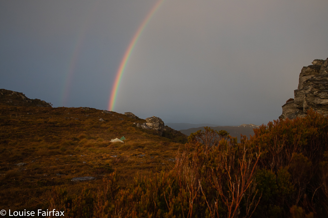
Rain arrived at some stage during our return journey, so once we were back at camp, we all disappeared into our tents. I did too, but kept a very watchful eye on the weather: I have been caught out before assuming a grey non-set, and been surprised by the sun finding a hole in the clouds. My watchfulness paid off: the sun did exactly that, but I had tripod and camera prepared, so raced out in the light shower to photograph the golden watery light as the sun lowered itself into the blurry horizon.
As the rain eased a bow formed near my friends’ tentsFinal sunset
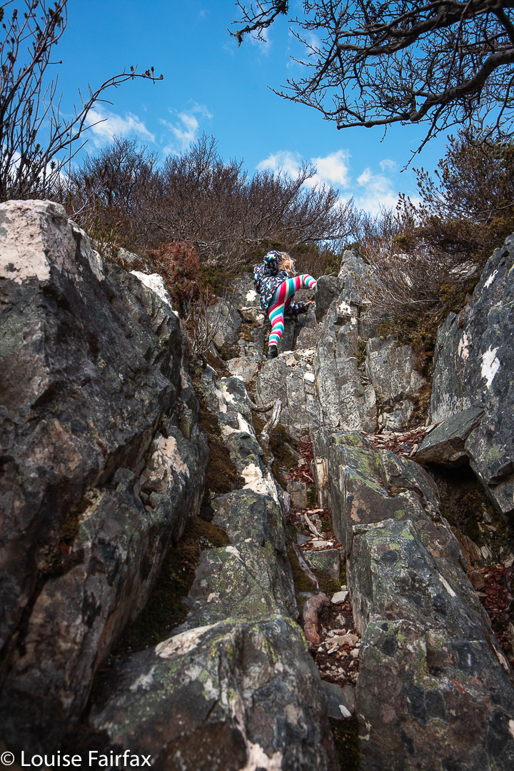
The last day was wet, but that didn’t matter, as we were on our way out and could put on dry clothes at the car. We merely had to reverse our steps of the first day, with a massively steep descent where trees came in handy to lower oneself to the next level. I swung like a little monkey, also using my arms against rocks on each side to lessen the demands on my knees and quadriceps.
Be that as it may, I have fallen helplessly in love with the Wilmot Range.
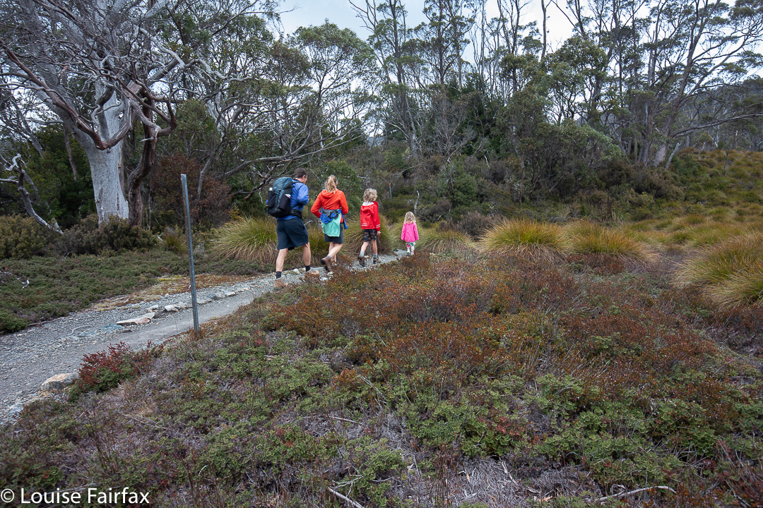
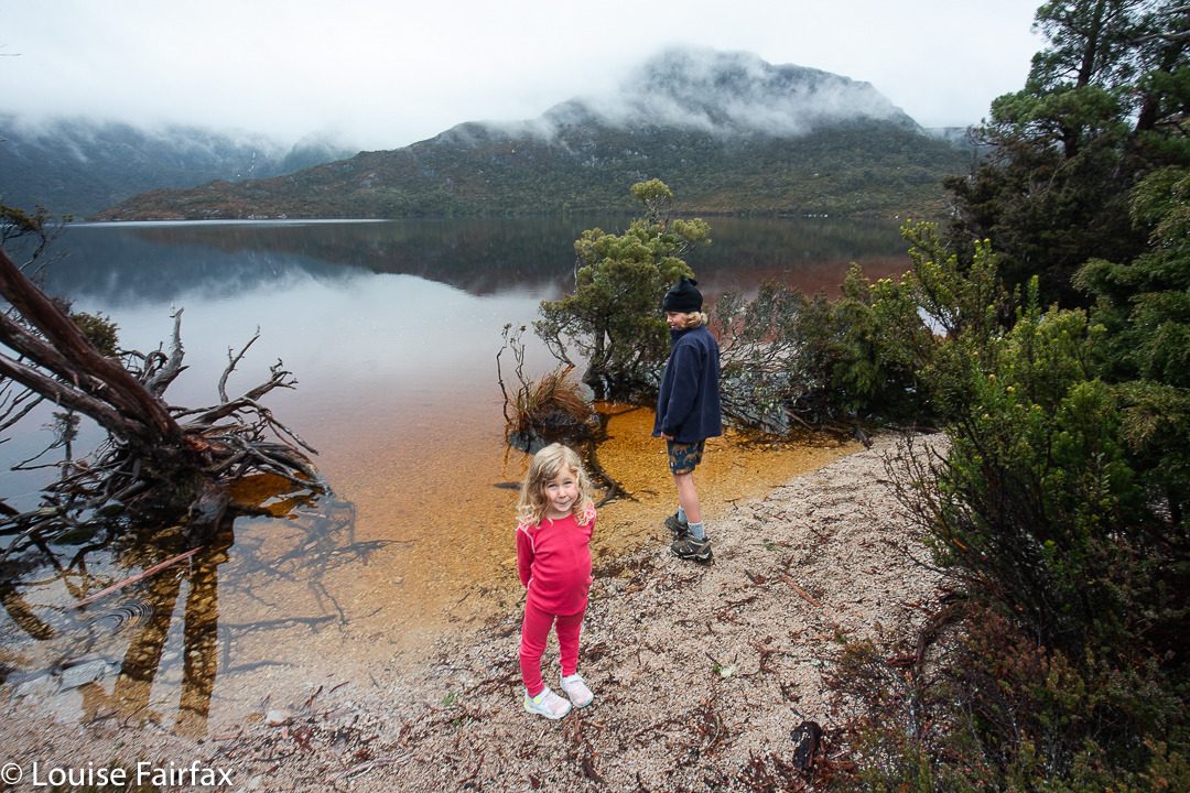
We have just finished the Tassie October school holidays, and, despite an inauspicious weather forecast of two days’ rain and two of snow for our four nights, we three adults and two children were excited. (Three generations are present). I packed four of everything that might be needed, just in case I got drenched each day, and as a result, hardly needed anything.
In case it is helpful to other families planning walks, I will outline our itinerary below. To help you contextualise activities, the children involved are in third class (boy) and preschool (girl). I think one is now supposed to call that Early Learning Centre. Whatever. Abby is 4, and will be in Prep next year. Both children are very fit and capable for their age.
Abby climbs Mt Campbell
Arrival day and night number one. We drove up from Launceston, arriving in time for a picnic lunch and an “Enchanted Forest Walk”. At 2 pm we could check in to our accommodation and clear protocol with the rangers, which we did, so that at 3pm we were on the bus heading for Dove Lake, wanting to climb Mt Campbell. I was somewhat worried about the time, but if we missed the last bus, we missed it, and any and all three of the adults were capable of running back to the car at the end if need be to then come and pick up the stranded children.
Off we set. Little Abby smashed out the first part, getting to the saddle below Mt Campbell in a mere 29 minutes, with the rest of us in tow. This boded very well for our time limits. We stopped in the biting wind and had muesli bars and lollies – well, we popped down the other side a bit in order to be out of the direct force of the wind.
Gussy descending Mt Campbell
Once we were climbing again, we became very exposed to the force of the buffeting blasts. I kept very close to Abby, as she was blown sideways several times, and was not comfortable with the conditions. She only weighs 14.5 kgs, so is easily knocked around by bullying winds. Bravely she continued climbing, handling “the notch” with aplomb. However, once we were on top and even more exposed to the brunt of the fury, she had had enough, and it was cuddle time. Kirsten (her mum / my daughter) carried her off to begin the descent while Gussy, his dad Keith and I “enjoyed” the summit area for a bit longer.
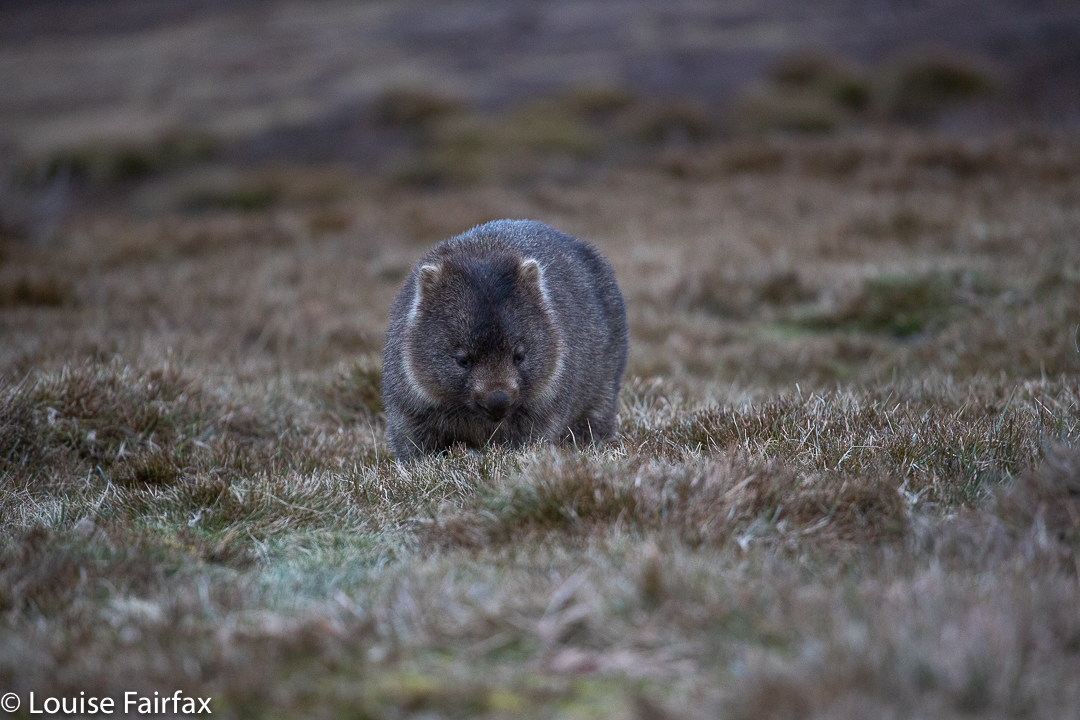
We all had to run for the bus at the end, and arrived in a big puff, to then discover this was the second last bus, not the final one. Ah well. The run was fun anyway. We returned to our lovely cabin at Waldheim and went hunting for grazing wombats before it got dark. We were still on winter time at this stage.
More wombat admiring that evening
Day 2. I woke early and was about to go off wombat watching when Kirsten joined me, so the two of us had a lovely long walk to Lake Lilla in the early golden light, returning in time for family breakfast.
Lake Lilla before breakfast
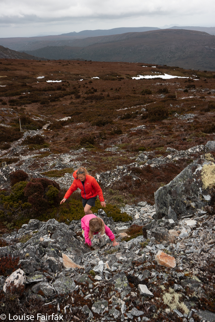
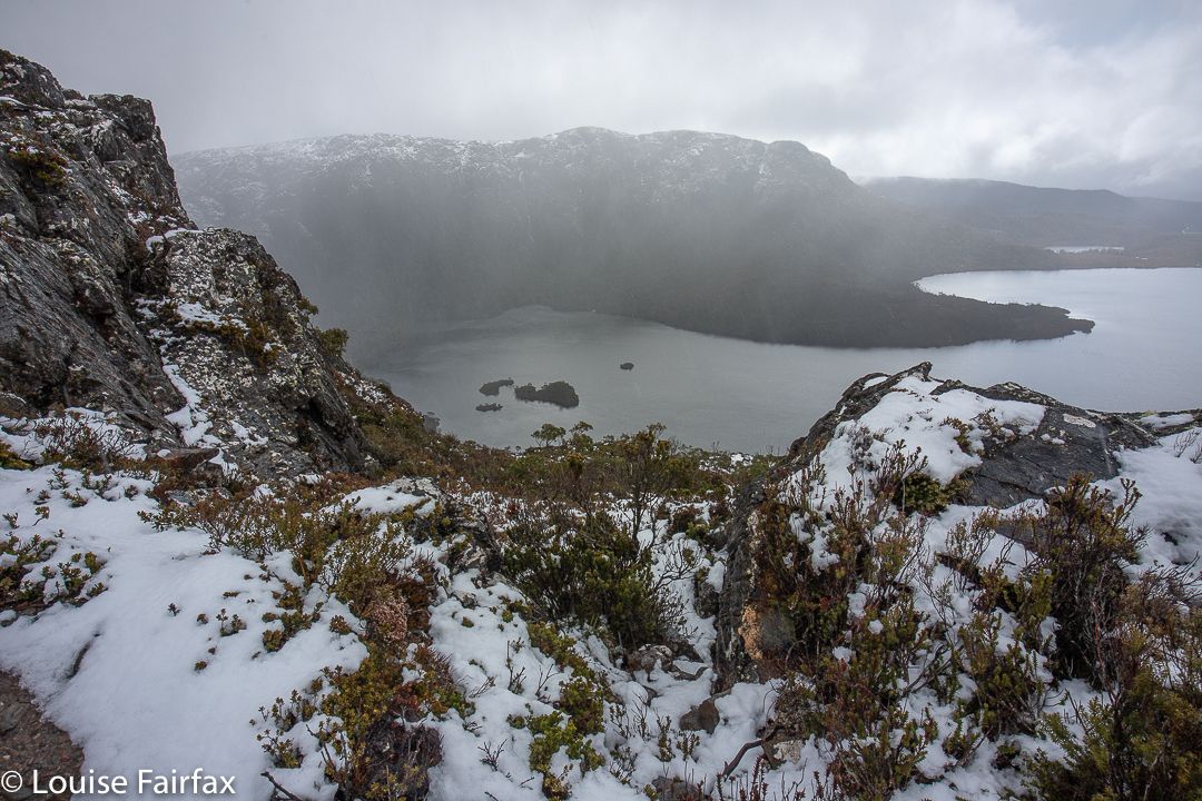
On this day, we had chosen to climb Crater Peak, despite the forecast for rain. It was a beautiful climb, and quite a dramatic little peak, with a massively sharp drop into Crater Lake way, way below. Abby climbed well, but, as with the day before, she had spent most of her energy in the climb, and wanted to be carried for the less engaging descent.
Abby leads us up Crater Peak
We came back using Marions Lookout, as Abby wanted a bus ride. (She thought the busses were great fun). A man who had seen us climbing, but who now approached from behind saw that Kirsten was carrying someone (who now appeared to be flopped unconscious across her shoulders).
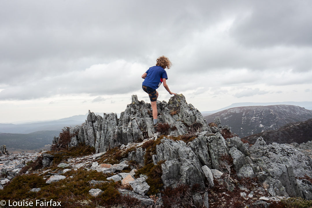
Gussy summits Crater Peak
“Oh no”, he said.
“What’s wrong?”, I asked.
“Someone must be injured; she’s being carried.”
“No. She’s four, and she’s climbed Mt Campbell and Crater Peak in the last twenty four hours. She’s just very tired.”
He smiled at the slumped form with a gentle look. “I’d want to be carried too”, he added.
Abby near the top, Crater Peak
While the others headed off on the path to Dove Lake and busses, Gussy and I hived off and went “home” via the route that sidles around Wombat Peak, follows Crater Creek and takes in Crater Falls before crossing Ronny Creek and ascending mildly to Waldheim. Wombats were grazing and the rain was now falling rather earnestly as we emerged from the forest, still dry, and dashed for our cabin in time for lunch.
Crater Falls
In the afternoon, I minded the children while the parents went running, and after they returned, I did a rainforest walk out the back of our cabin. Everything was shining with the raindroplets of the intermittent showers. Snow fell later.
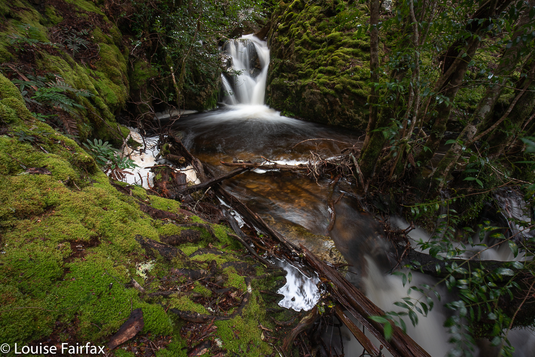
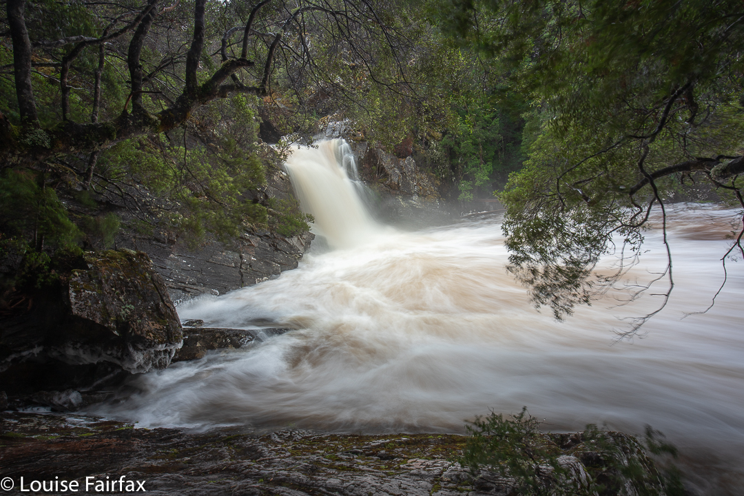
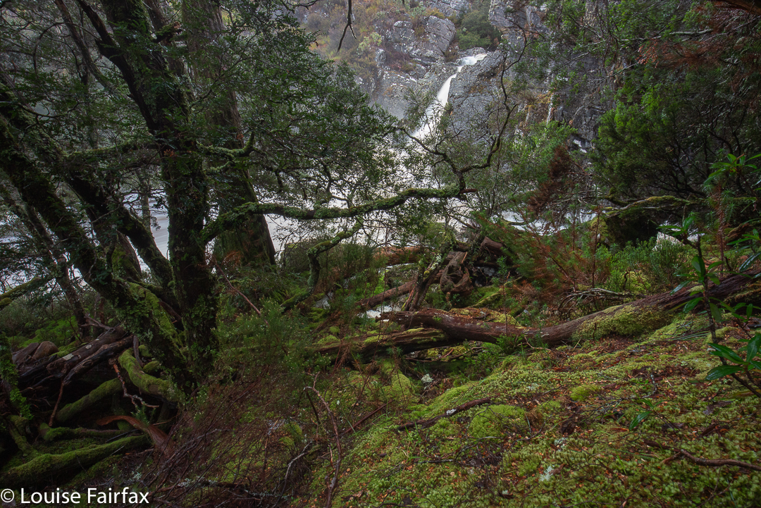
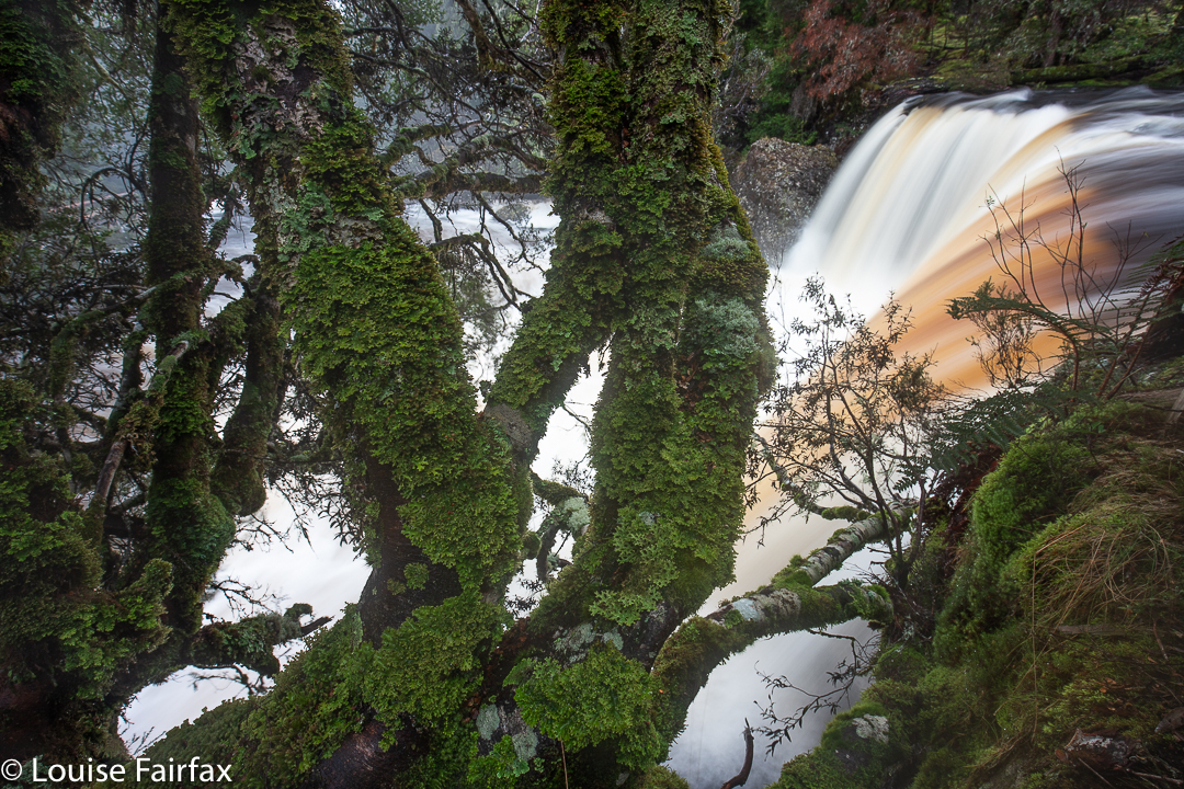
Day 3. On this day, the rain was fierce and the children a bit tired. While the parents ran, the children and I did two “7-minute workout”s, using muscles other than climbing ones. We turned it into fun. When the parents returned, it was my turn to go out, so I did the Dove Canyon track, taking my photographic gear, and shooting falls that I have not seen before, and discovering that Knyvet falls as named by the NP blue sign, are not the Knyvet Falls on the map (they are just an unnamed blue line) The falls named as Knyvet Falls on the map have no sign in the terrain, and are a double fall, skirting each side of a huge boulder. I have never seen a photo of these falls, and never heard that there is any discrepancy here. I just called them “Pencil Pine Falls 3”. I then went off to photograph “Pencil Pine Falls 4”, which are also a blue line on the map, but not named. They were PUMPING.
Pencil Pine Ck Falls 4Pencil Pine Ck Falls 3, called Knyvet on the map, but not in the bushPencil Pine Ck Falls 2, called Knyvet Falls by the blue sign, but unnamed on the map.
After lunch, I wanted the children to do some walking, mainly as I was babysitting while the parents ran again, and I didn’t want to be stuck in our room on a beautiful rainy day, so I persuaded them they’d like a walk around the lake and a BUS RIDE, Abby. The parents ran around the lake twice and then ran back while we just did a pleasant walk to the end and back, and then – do I confess?- the children had huge fun playing diving onto the bed in our new accommodation at the lodge. (Maybe I was hoping to be fired as a babysitter).
Playing during our walk around the lake
Day 4.
The morning of this day is a bit of a blur, if you don’t count the marvels of sitting in the dining room at the lodge, imbibing a beautiful breakfast, and watching great fat flakes of snow delicately ballet their way through the air to the ground. I think I played hangman’s noose with the children while their parents went running. Then, in the afternoon, came one of my favourite parts of the holiday. Now Keith minded the children (the three of them doing the Dove Canyon full circuit), while Kirsten and I went off into the clouds and snow and climbed Artillery Knob.
En route to Artillery Knob. Can you see the snow flakes?
It was magic up there. The snow continued to fall lightly while we walked and talked, revealing and concealing knobs and bluffs up high, and tarns below. It was so pleasant to have that time and space together.
When we returned, the children were full of stories about how awesome and amazing the waterfalls on their route were. Having seen them the previous day, I knew what they were talking about; they really were spectacular. so full of unadulterated power, thundering down the cliffs. Day 5.
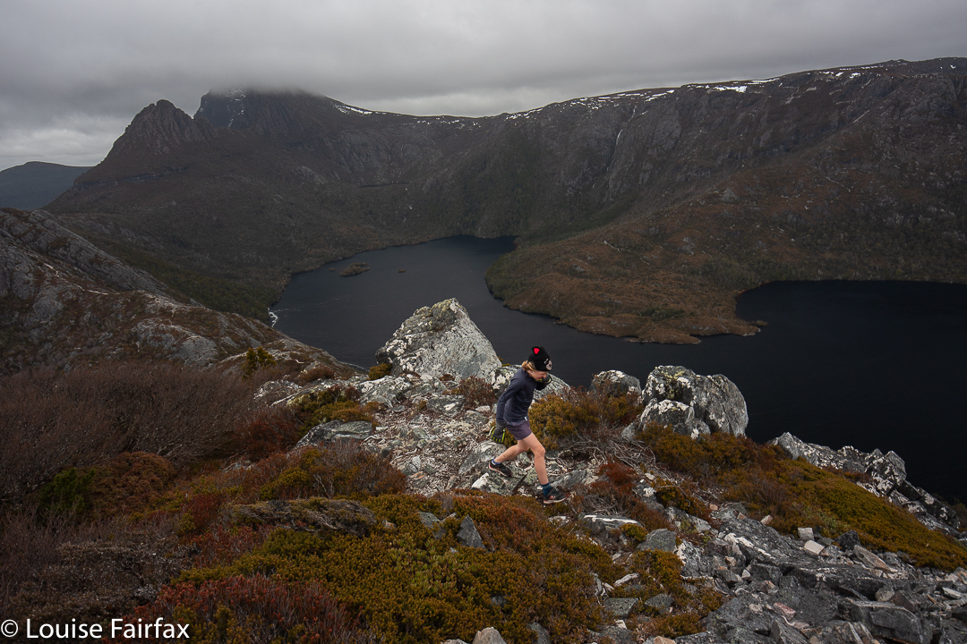
And sadly, as it marked the terminus of our holiday, day 5 dawned. We had another sumptuous breakfast, packed our bags and checked out, and headed for the last time this trip for the Lake. Today, Gussy, Keith and I would do a snow climb of Cradle; Abby and Kirsten would climb up to Lake Wilks at 1050 ms asl.
Gussy climbing Cradle
The morning was icy cold and the tarns and puddles en route frozen, so I began to doubt whether we could pull this one off. Where the ground had ice rather than snow, it was very slippery indeed. I gazed up at the mountain ahead, wondering what it would be like up there. We agreed in advance that I would lead to test conditions, Gussy would go in the middle, and Keith would be behind him to protect him from the rear should he slip. I had adaptable mini-crampons on board for him should they be needed.
Cradle Mountain summit area
The first bit of the steep part once you start the climb proper was easy for him, so we let him lead in the end. Only right near the big saddle did things become challenging, and he did do a bit of a nasty slide at one point. On the whole, he was very careful, and made great choices about which mini-route to take. Where he slipped, the snow just rushed out from under him.
After the saddle, we were very careful: Gus was a bit shaken by the slip, and there was no need for haste. The notch was a bit tricky in ice, but we got over it, and then it was not too bad along the snowy tops to the summit cairn.
By the time we had lingered to eat and enjoy the view, the sun had dried the wet rocks, and some of the ice had melted. This made the descent much easier than the ascent had been. Down the bottom, near the boatshed, Abby and Kirsten were waiting for us.
Abby was impatient to run with Gus to the finish, maybe a kilometre away. Off they set, with we three adoring adults smiling to see this tiny little pink-jacketed, blonde-haired darling flowing through the scenery in a running style to die for, pursued by big brother, who, being a total gentleman although only in third class, tucked in behind her, and allowed her the lead the whole way. Near the end, we adults also had to run, as the bus had come, and we feared it was the final one. Yet again, it was the second last, and we didn’t have to run seven and a half kilometres in addition to what we’d already done in the last few days.
Abby on the rocks
Every single person I spoke to on the mountain had shocking “bus angst”. Does that REALLY belong in a National Park??? Bushwalkers don’t want viewing platforms; they want to be allowed access to the wilderness so they can be immersed in it and benefit from its restorative powers. 7.5 kms extra walking on a sealed road at the end of a long day is not wilderness immersion. It is not wilderness at all. It is bowing down to the god of tourism – a false god that is already fat and greedy enough.
If you had told me even two years ago that I would be brave enough to climb Legges Tor from the back entrance in the middle of winter, solo, I would not have believed you. It would have seemed far too brave a task, especially with the risk of sub-zero temperatures and an icy wind to drop the thermometer even lower (both of which I got. The maximum temperature for the day was 3 degrees down in the valley, so I’m not sure what it was on the summit – something negative – and then subtract a bit more for the windchill factor).
Ben Lomond, Legges Tor trip
One slip in those sub-zero temperatures and it could be fatal. Of course I had my PLB with me, but, well, people can slip in ice and snow or accidentally fall down an unexpected hole and break a bone, and have a long, long wait for rescue to come (if weather permits). Anyway, I wanted to give it a go, and now I’ve done it, I have no idea what all my fear was about. I watched the snow clouds rolling in with total equanimity, sure that I could run out – even clad in my boots, as I was – faster than it could roll in. I was totally calm on the summit with the wind howling around me while I fiddled with my camera.
Ben Lomond, Legges Tor trip
It was a magic and delightfully silent world up there. There is something terribly special about snow coating rocks and bushes. Three wedgies circled above at intervals. There were quoll footprints making cute lines in the snow, but mostly, just huge expanses of white.
Ben Lomond, Legges Tor trip
I did try to time my journey, but I stopped so often for photographs that I gave up. It was nice to be alone and be able to stop for everything beautiful that snatched my attention and not have to feel guilty about inconveniencing someone else. Presumably I sang while I walked: I usually do.
Ben Lomond, Legges Tor trip
I met a guy who was finishing just as I was setting out; he had had two close family deaths in the last very short space of time, and wanted to be in the wilderness to help ground himself and connect with the greater universe; to find peace in nature. “This is my church”, he said, throwing his arms out wide.
Ben Lomond, Legges Tor icy summit
Governments and local councils who are grabbing our precious wilderness to squeeze every dollar they can out of it for the blessed god of tourism fail to consider that they are doing unfathomable spiritual damage to those of us who need the wilderness to connect ourselves to the eternal and the important spiritual aspects of being human. The story of worshipping the golden calf dates back several millennia, but is still happening.
Ben Lomond, Legges Tor trip
Those bureaucrats who are grounded in material gain and solely guided by market forces will, I guess, never understand humans who have a spiritual dimension, and value that over money. I wonder how many of the aboriginal suicides in incarceration have been caused because these people have been robbed of their necessary connection to nature and their tribe.
Ben Lomond, Legges Tor – beautiful end to the day
Such are the thoughts I am free to have while wandering along through the snow, following my icy markers to the summit, being distracted by beauty as I go.
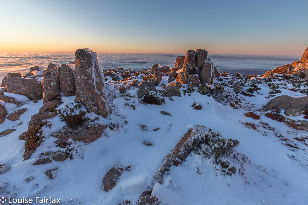
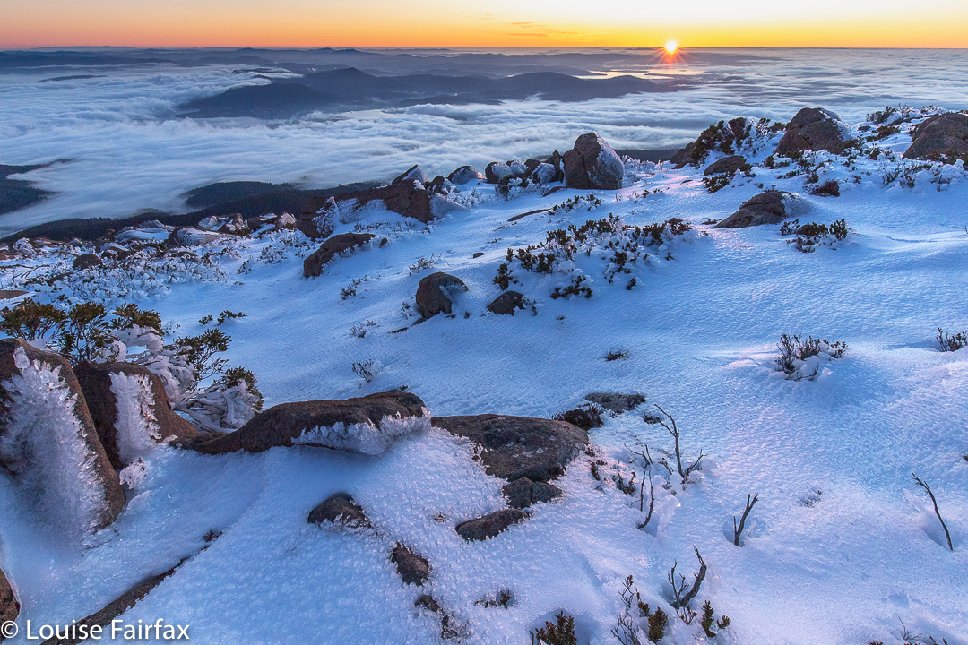
I had always wanted to climb Mt Wellington / kunanyi in the dark in winter with snow and photograph the dawn from on top, but never quite got around to it. I just needed a gentle shove.
This seemed to come in the form of my daughter giving me the encouragement I needed to set my alarm and just do it. I decided this was indeed the perfect opportunity: the snow was perfect; it was going to be a nice day. If I found an excuse this time, I would never do it.
It really helped that I’d climbed up the day before and had a glorious time on high. I knew the conditions of the track – I would definitely need my boot chains to prevent slipping on the ice. I knew the general layout, so felt confident. Once you’ve done it even one time, the rest is easy.
So, there I was an hour and a half before sunrise, headtorch in place, taking my first steps on the white, icy track. I felt exhilarated. Who knows what the temperature was – obviously below zero, but I neither knew nor cared how far below. The climb would keep me warm, and then the dawn would excite me, so I wouldn’t feel cold. I had three pairs of gloves on board just in case my fingers started dropping off while shooting.
My headtorch lit the tiny icicles, so that it was as if I were climbing into the stars: stars below and above and white-coated branches all around; just me and nature and serenity. I had no company, so could just go at my happy pace, which was a brisk and purposeful one.
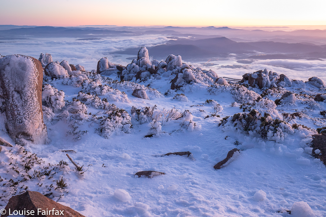
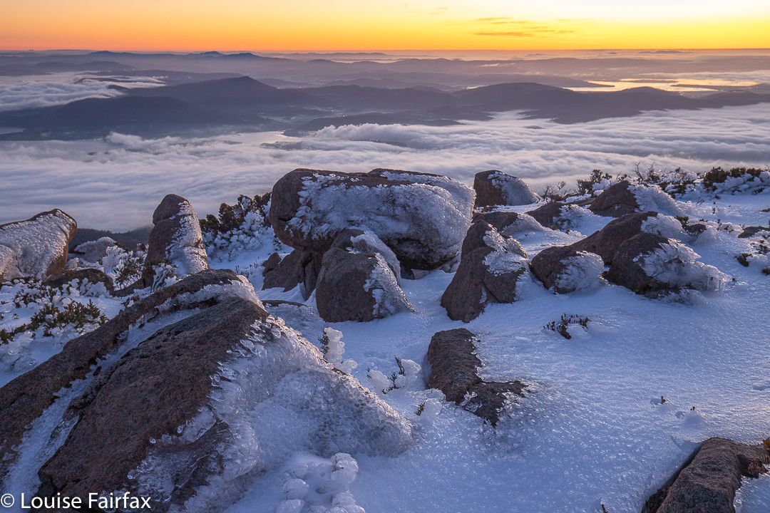
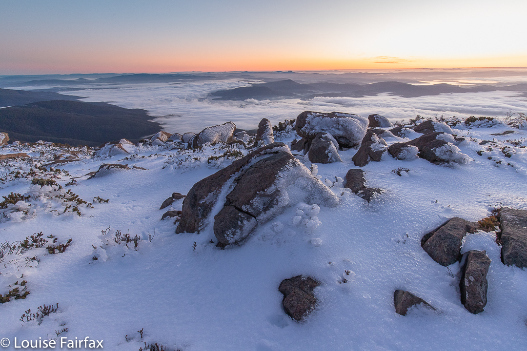
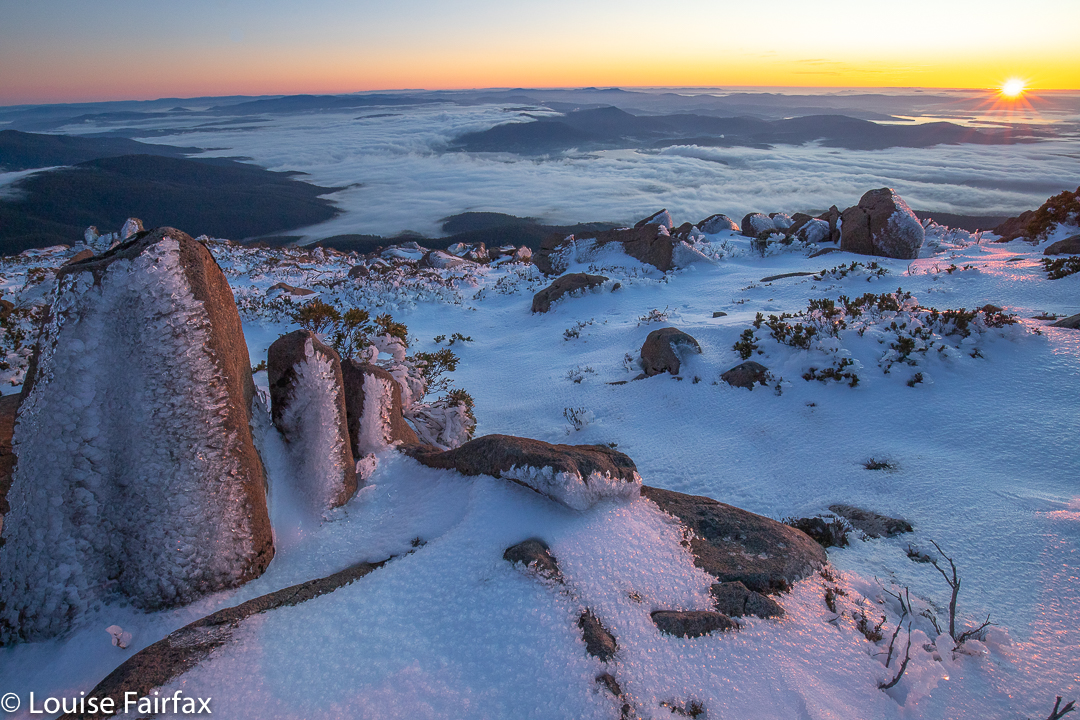
One hour after setting out I took my first shots of the city twinkling below me, white snow in front, the sky still dark but with a very bright orange glow on the horizon. I was at this stage only about five minutes from the summit, so took a quick shot or few before moving on. I was in plenty of time for the first beautiful light (seen above), and with masses of time to spare before actual sunrise (which interests me less than the pre-appearance colours. Given that I had plenty of time at this stage, I also took a shot or two of the full moon in the west, setting as the sun rose out the other side, before choosing my location for the main photos.
I had climbed alone, but there was another guy there who must have left earlier than I did. He was taking selfies off to my left, and apart from that, I had the world to myself.
And do you want to know something funny? I sent my two daughters a phone pic after I had done all the real shooting. It said: “My view, now”. I received back from my firstborn daughter a message that said “My view, now” – easily recognisable as the beautiful dolerite columns of South Wellington. We used our phones to meet each other and walk down the slope together.
That morning when she was running in the dark with friends, they said they’d drop her off if she wanted to run up the mountain and see if she could find me, so she took up their offer. This day is both a very happy and a poignantly sad day for me: it is young Gus’s birthday, but it is also Bruce and my wedding anniversary. Life and the memories of a beautiful marriage entwined in the same day. If Bruce were alive, he would be delighted that the morning was spent in this way, although he would not have tolerated being left out! He would have loved to climb up in the dark with me. We have climbed so many mountains together to watch the dawn from on top, but now I have to climb alone.
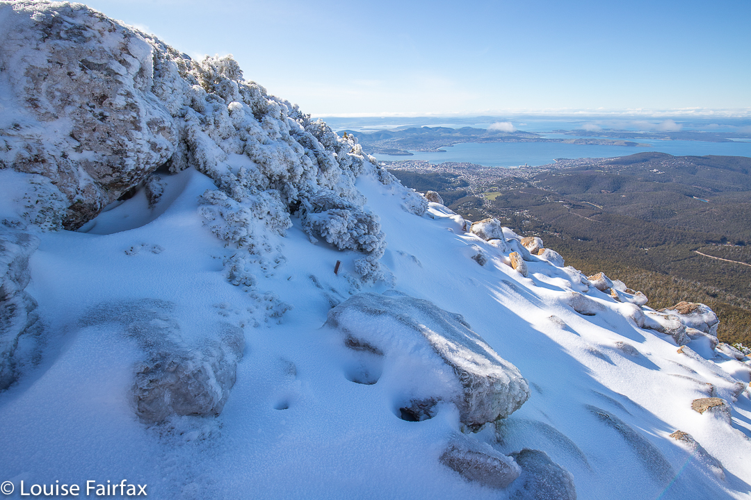
When a daughter says to come down south ’cause she’s free on Friday, and the two of you can ski on Mt Wellington, what quarter-sane mother would say: “No thanks”? Certainly not this one! I packed my skis and trappings and headed south on Thursday night, ready to begin nice and early on the Friday.
Mt Wellington, the top. Can you find the wallaby?
We dropped the children at school and drove straight to The Springs, where the road was (as expected) closed. With that nice early start, we had a good parking spot, right near the start of the climb. Let the fun begin.
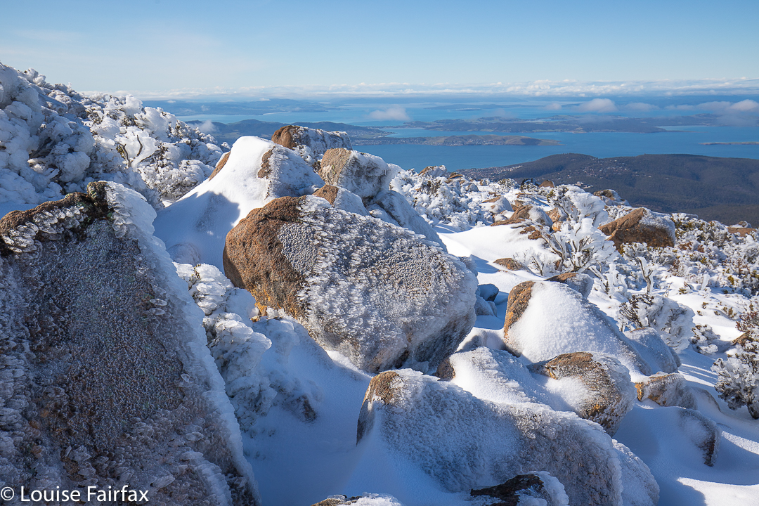
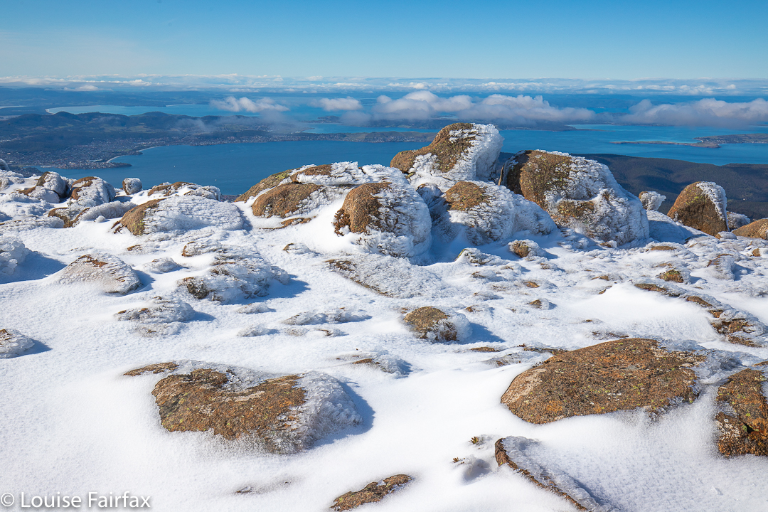
Wellington views to the ocean below
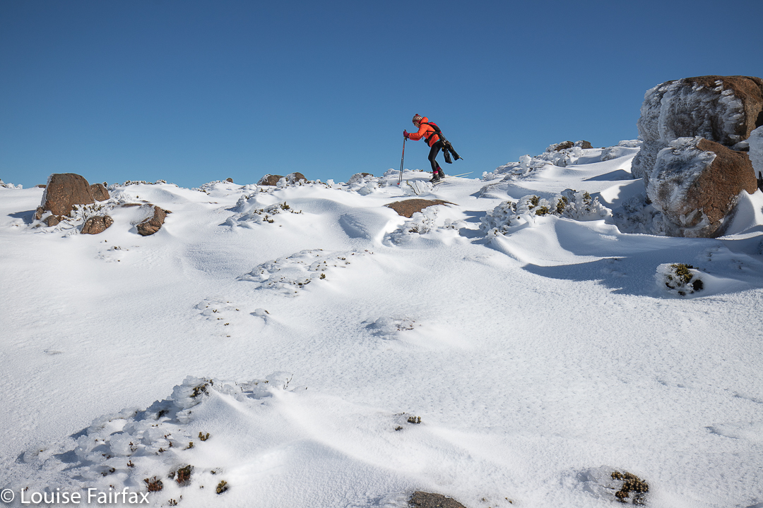
We were carrying “boot chains” and spiders (mini crampons) – utterly necessary – but had not yet attached them. However, the need arose quite quickly, and at the second icy patch, we stopped to put them on, after which the going was a lot better. My daughter kept eying up the terrain for ski possibilities, but the track was far too steep to even think about it. There would be no skiing until we were on top. I slowed things down with a few photos on the way (I just couldn’t help myself), but soon enough we were on top, and deciding which direction we wanted to pursue.
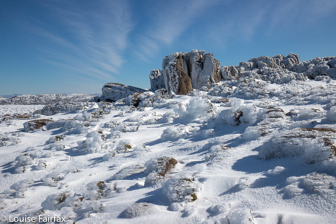
Mt Wellington summit area
South Wellington looked very tempting, and it eventually won the day, but, for me, not before briefly exploring the other direction first. There I met with heavy, noisy machinery squirting snow everywhere and ruining the pristine look of the environment so that cars could drive up there on the approaching weekend. Heck, we couldn’t ask the population to exercise their muscles a bit in order to see fairyland, could we. No. Far better to destroy it so they can all drive quickly up, take their snap and rush away again. I love it when the road is closed.
Wellington skiing
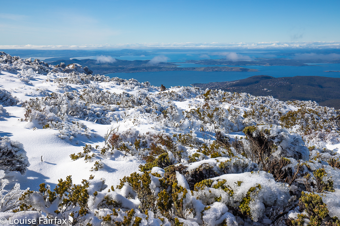
I turned my back on destruction and noise, and gave chase to my daughter, who’d gone off in the direction of the unspoiled fields to the south. Funnily, only one of the other people who’d walked up that morning ventured south, which meant we had this whole huge playground to ourselves.
Wellington scenery
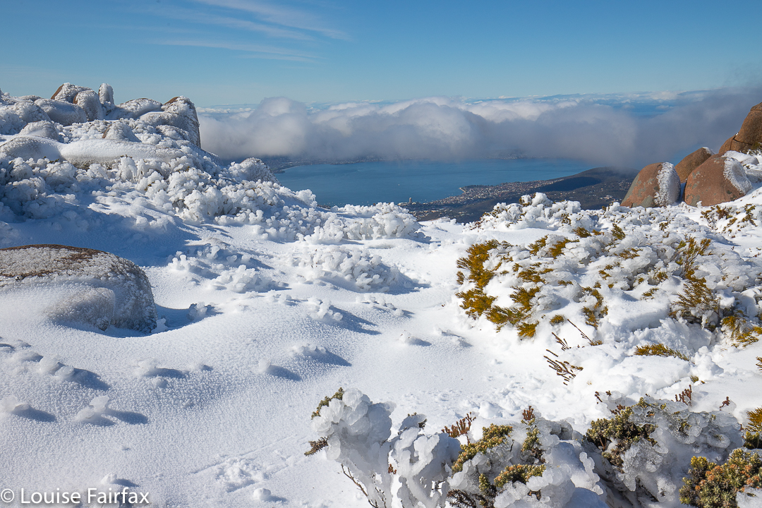
The pictures tell you of the extreme beauty we experienced that day. How incredible it was that right below us, admittedly nearly 1300 metres below, was the capital city of our state. We could see not only the city buildings and ocean, but even the sand of its beaches. But we were up above the clouds in a land of white (and blue). It felt like we’d accidentally arrived in heaven.