It was not actually our original intention to climb Mt Wedge this weekend. We were here for the long-awaited ascent of Mt Field West, a climb that is now assuming saga proportions. I announced last December that I wanted to climb Field West with young Gus. It would be a long day for him, so I thought we’d need to camp down by the river at the base to avoid driving from Hobart to add to the day’s length. But that long summer holiday period got filled with a large number of tennis camps and suddenly it was time to resume the new school year. Sometime or other it would happen, and now my daughter wanted to come too.
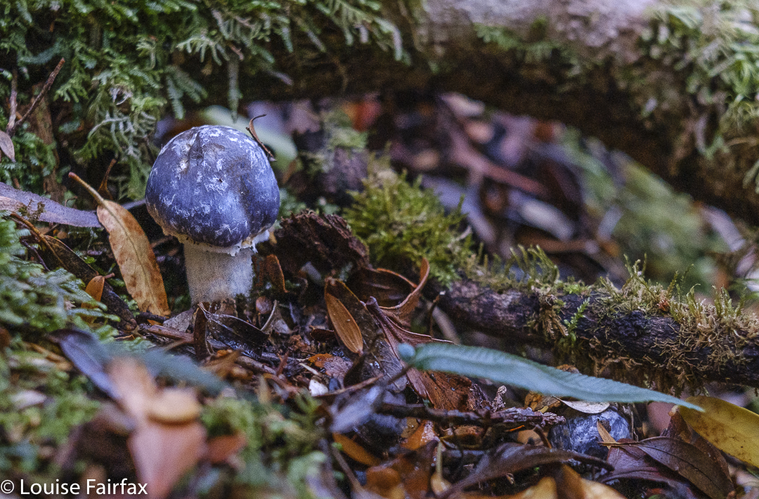
Entoloma sp Mt Wedge
Then she said we could all (five of us) stay at a cottage near the park as part of my birthday celebrations, and do Field West on one of the days. I phoned to make the booking. Full on my birthday. Full the weekend after. Full, actually, until after Anzac day. But then there was the problem of the school cross country race: he would be tired after doing Field West, so again the date got pushed back.
Cortinarius sp Mt Wedge
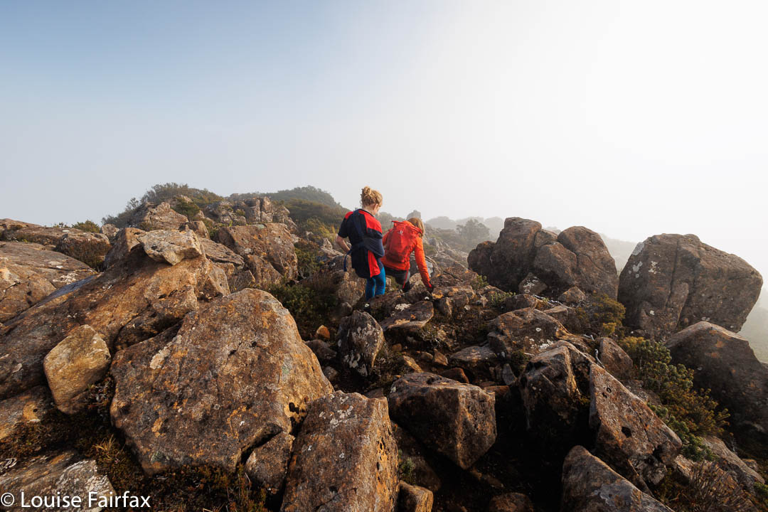
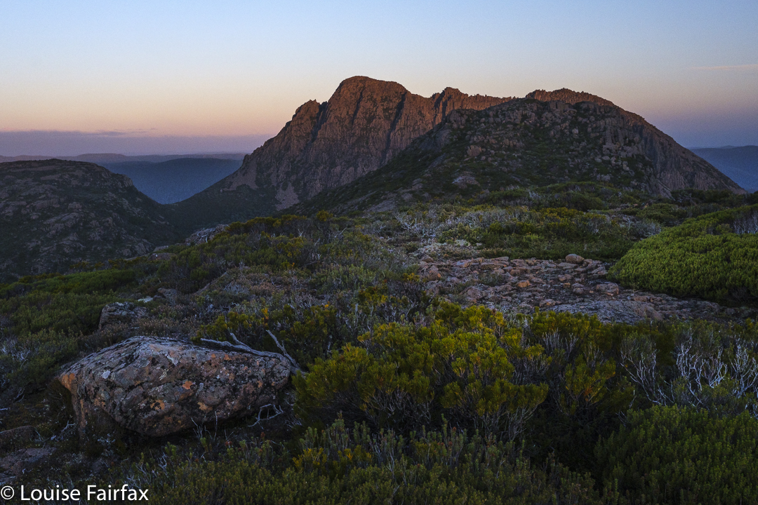
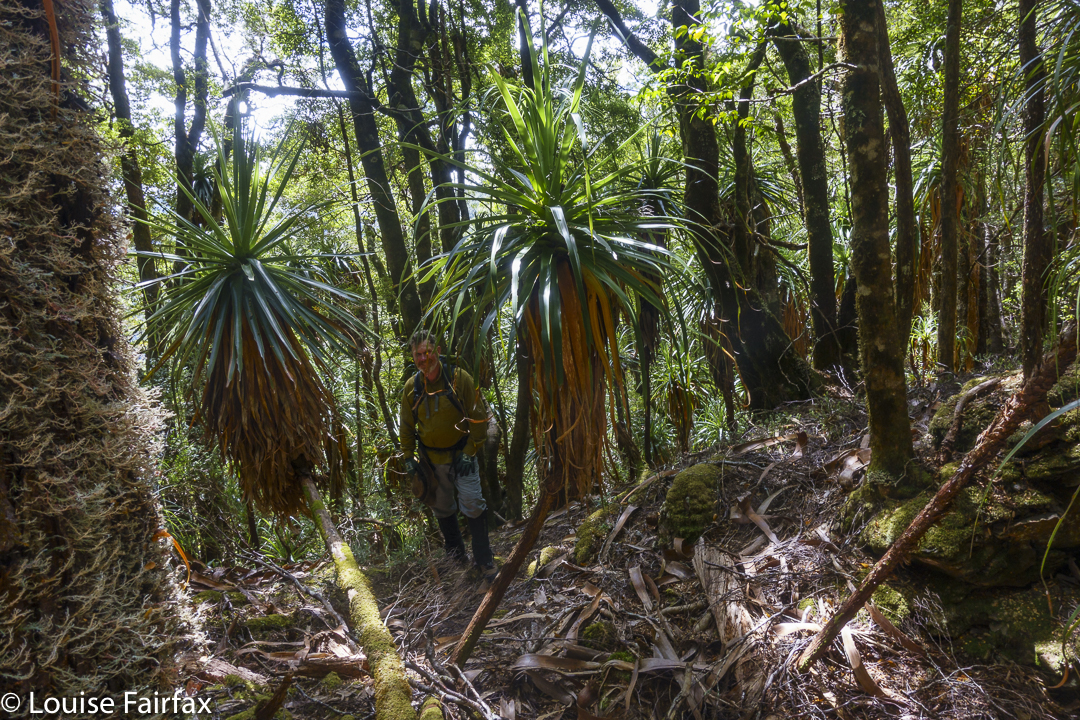
Tra la. It was to be last weekend, the one after the school XC. Trouble is, on the day the race should have taken place, at recess, Gus broke his arm, and was then in plaster from shoulder to finger tips. There was to be no race, and also, no Field West. He could not cross the icy, jagged rocks of the Rodway Range with a newly broken arm. We would need to settle for something less taxing. Mt Wedge was not too far away, and was definitely an easier climb, which wouldn’t involve him using his plastered arm. Wedge it was.
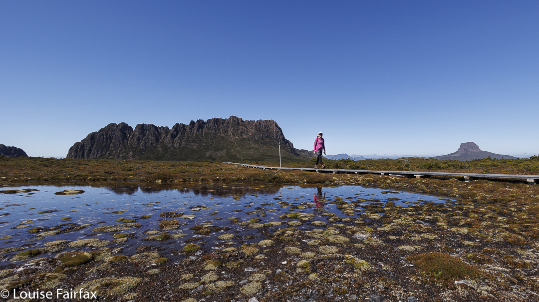
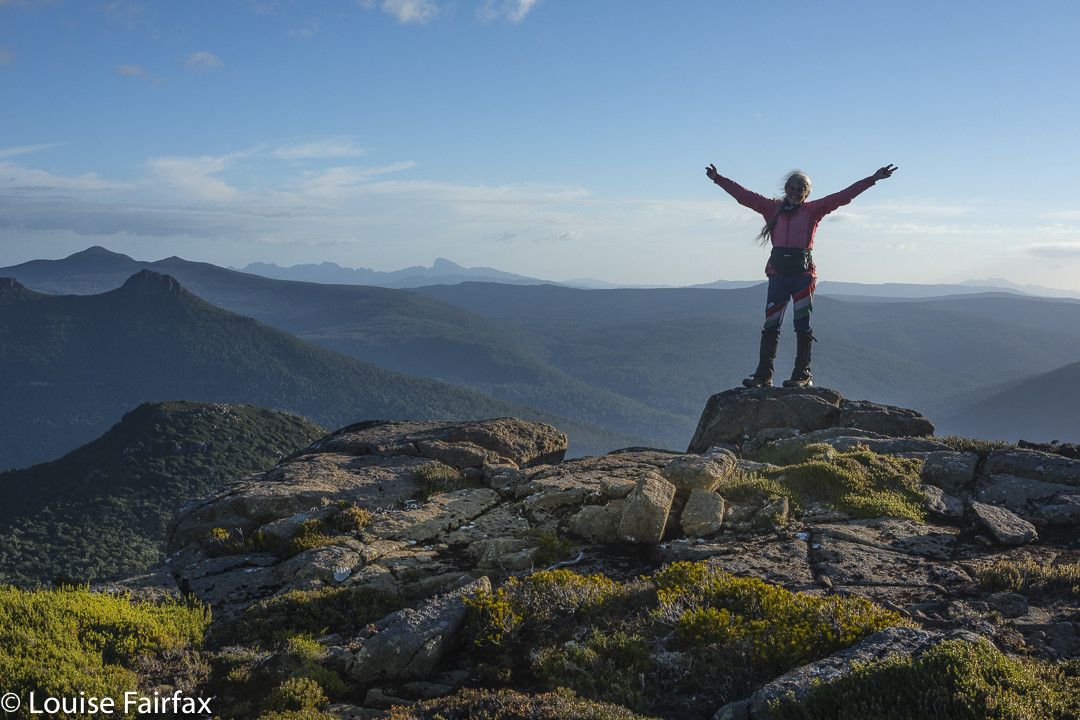
Cheerful one-armed climber
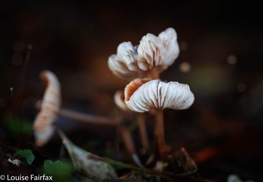
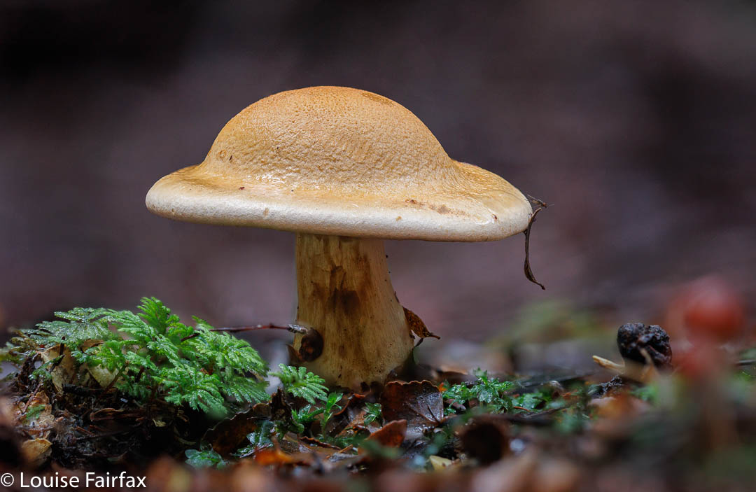
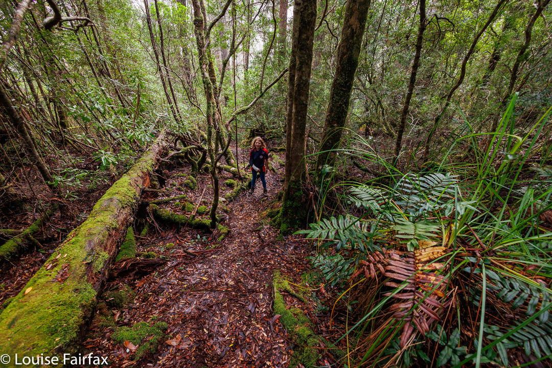
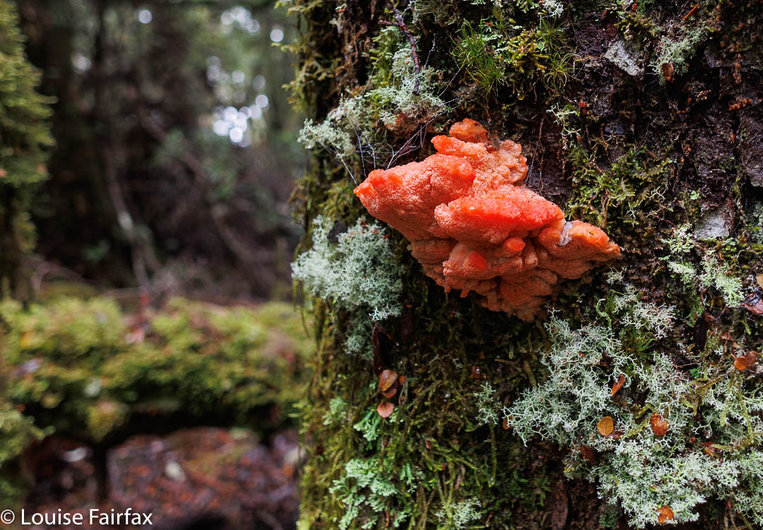
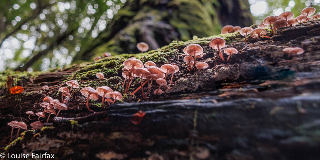
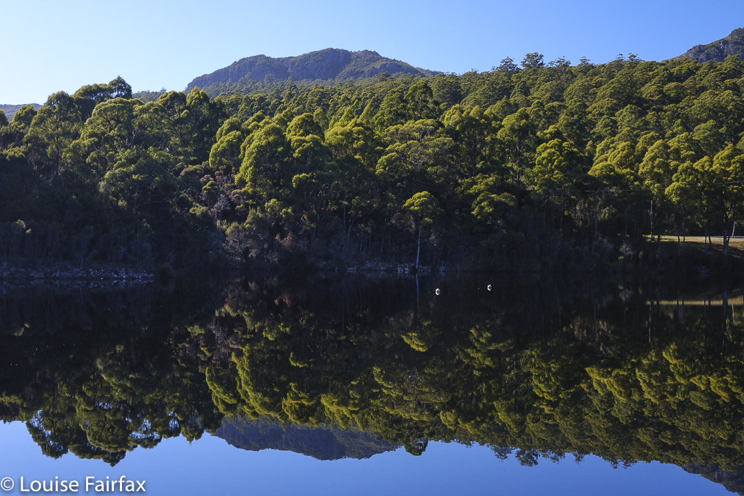
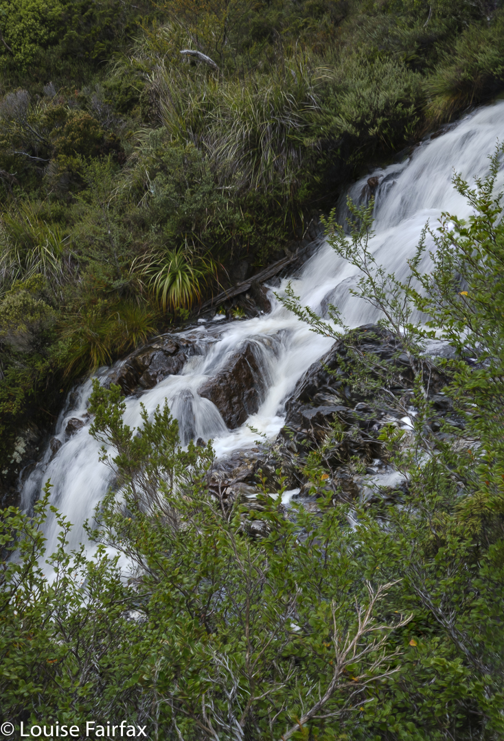
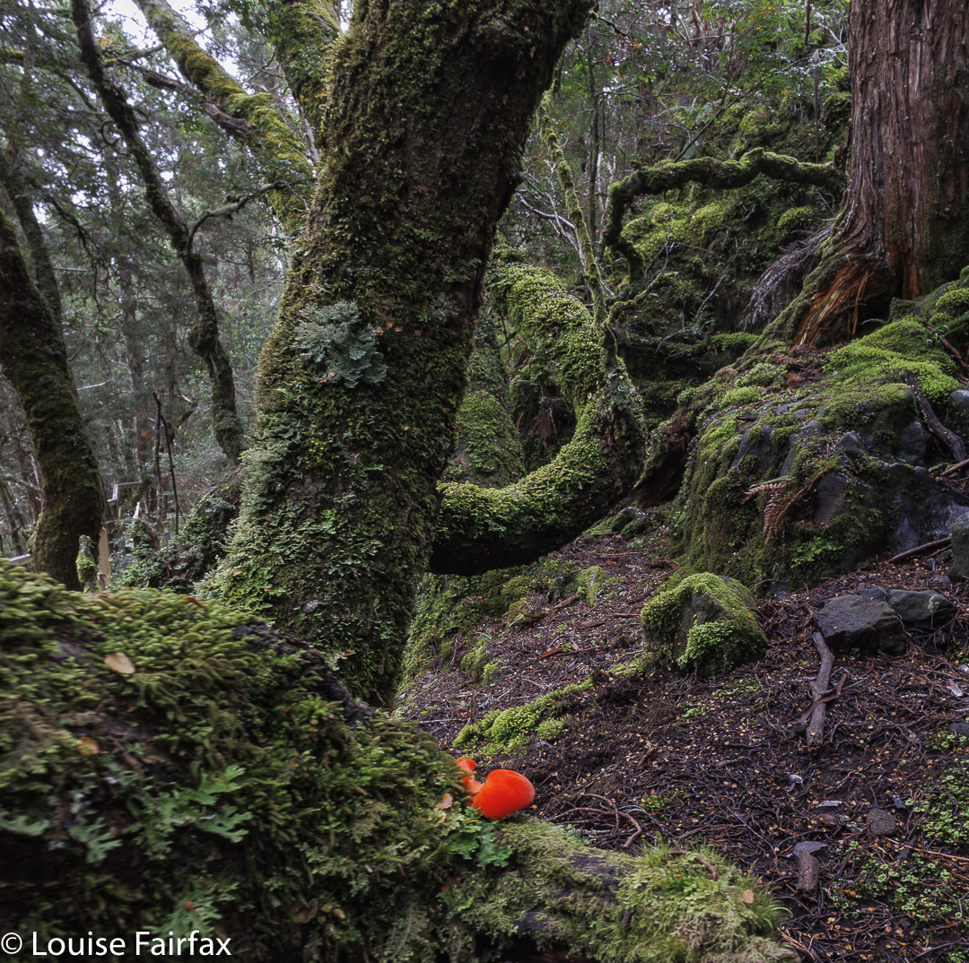
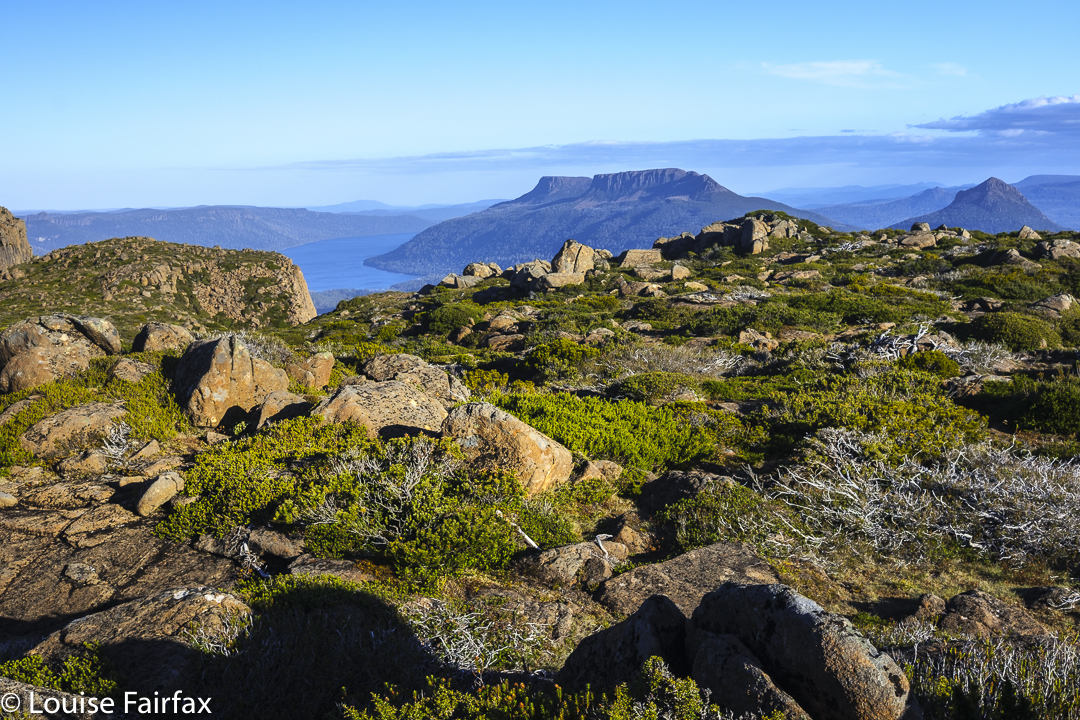
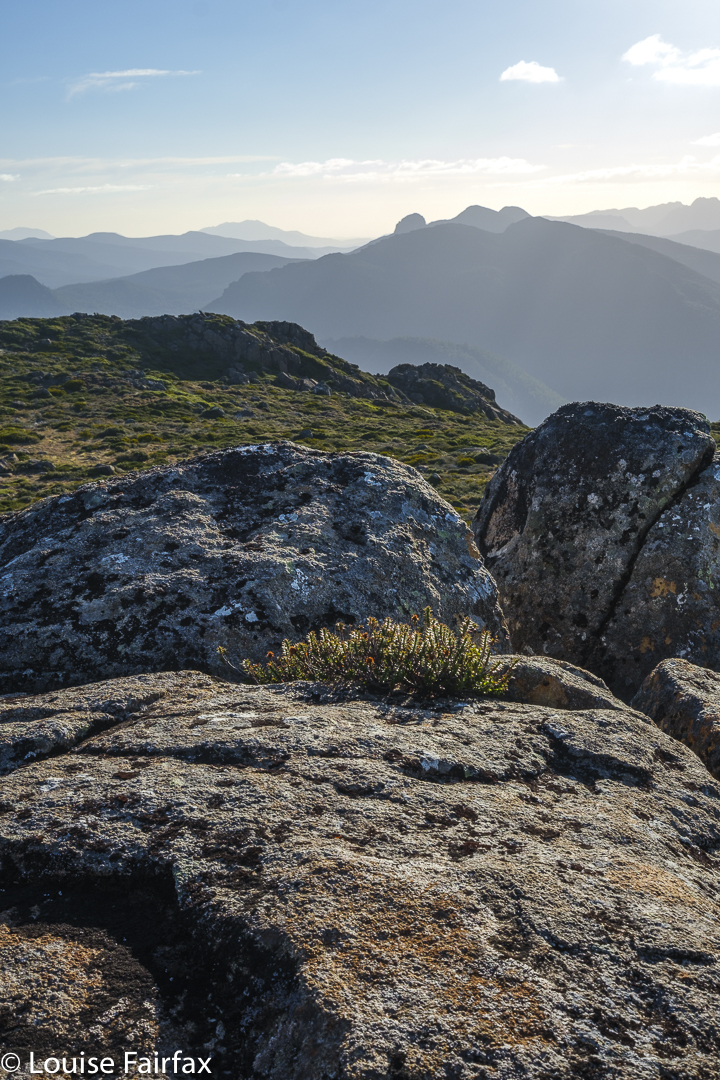
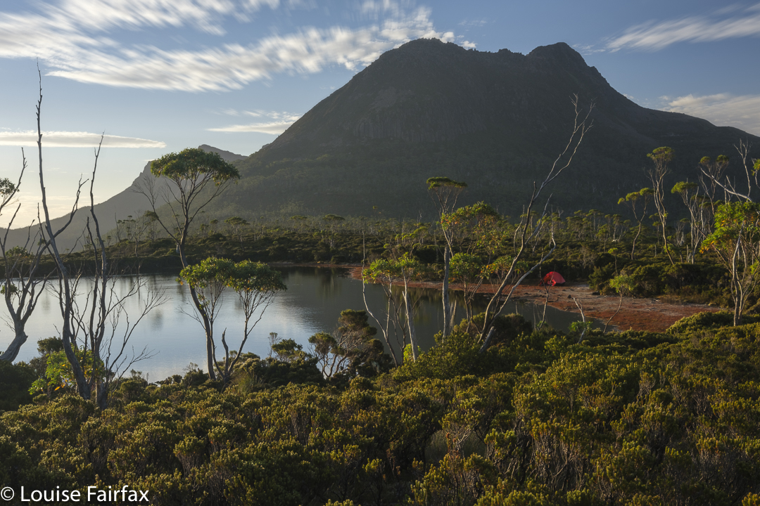
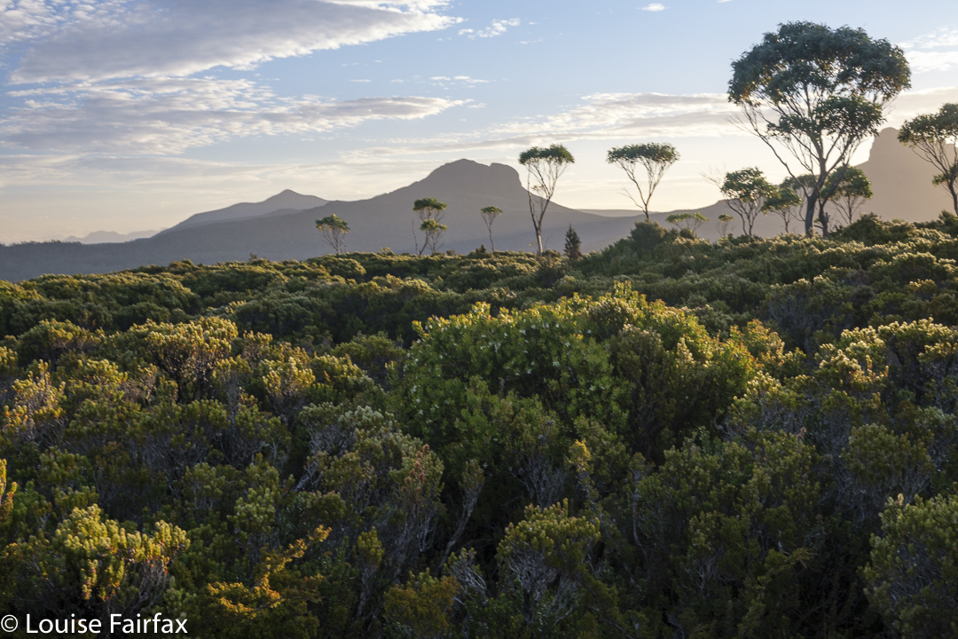
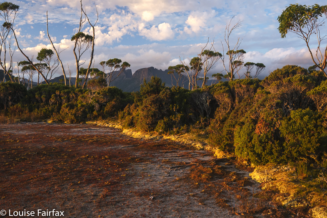
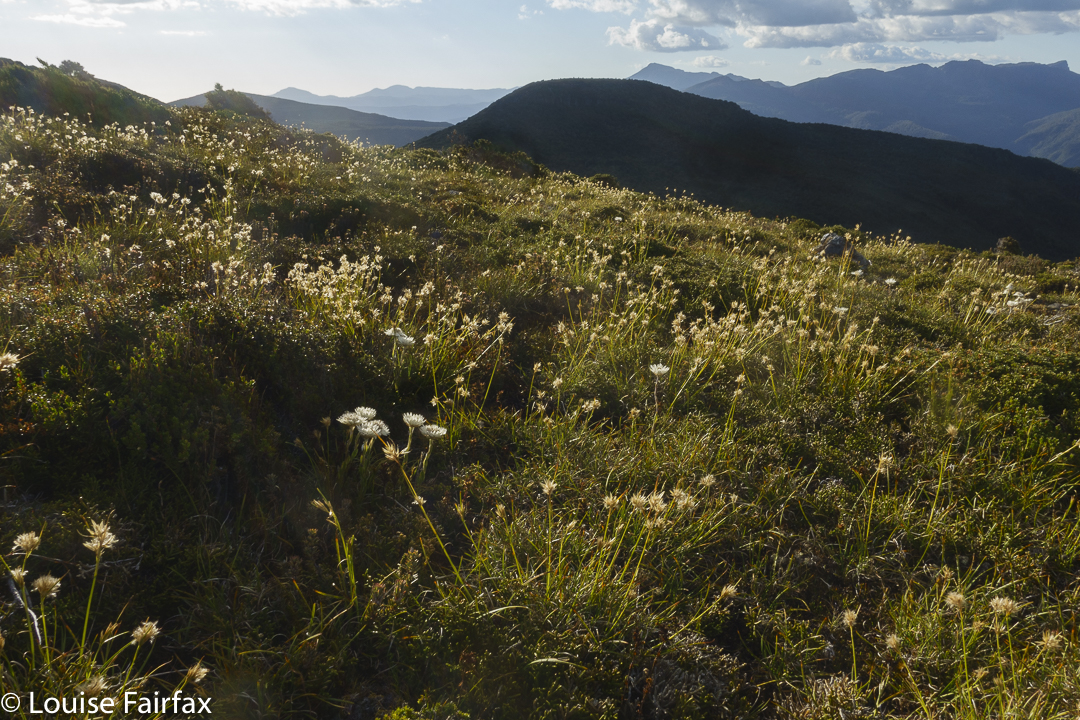
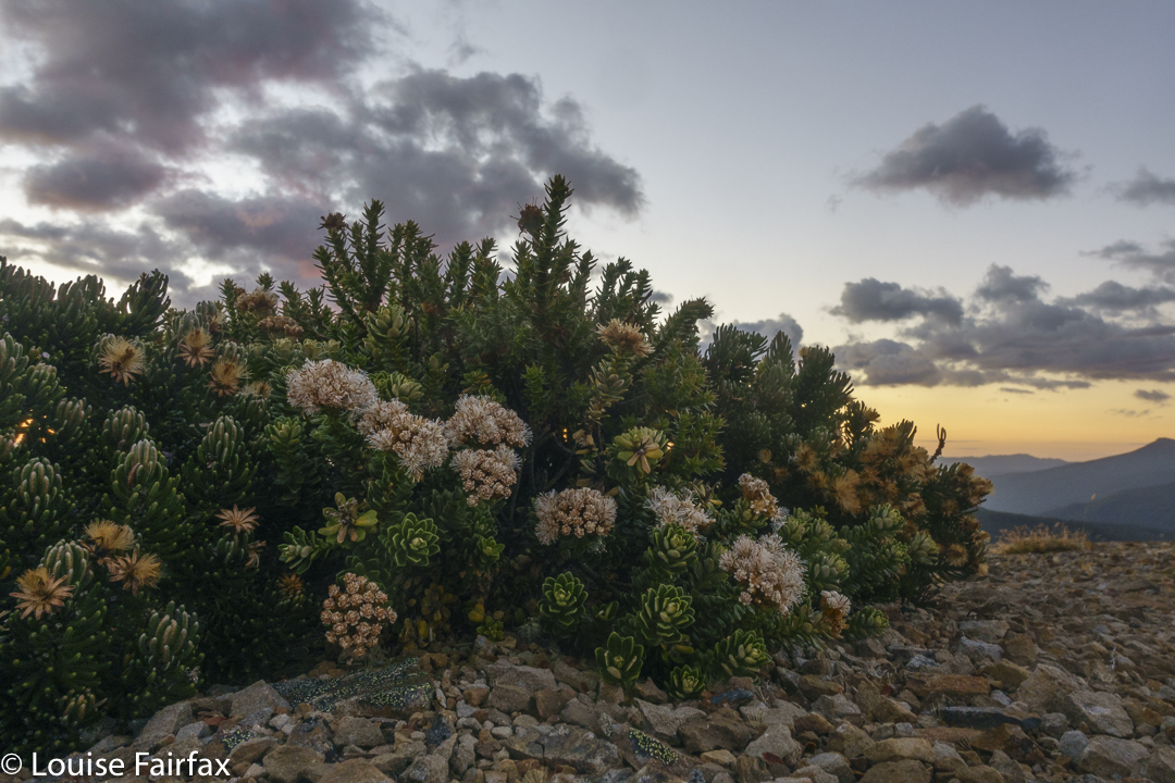
The last time I climbed Wedge was 2014. In the eight years since then, I have forgotten how absolutely beautiful the forest was. It was especially wonderful last weekend as there were more fungi than twigs decorating the forest floor. Everywhere you looked there were more, mostly in clusters. I wanted to have lunch on the summit, and we had not set out particularly early, so I disciplined myself to only take maybe five fungi photos on the way up.
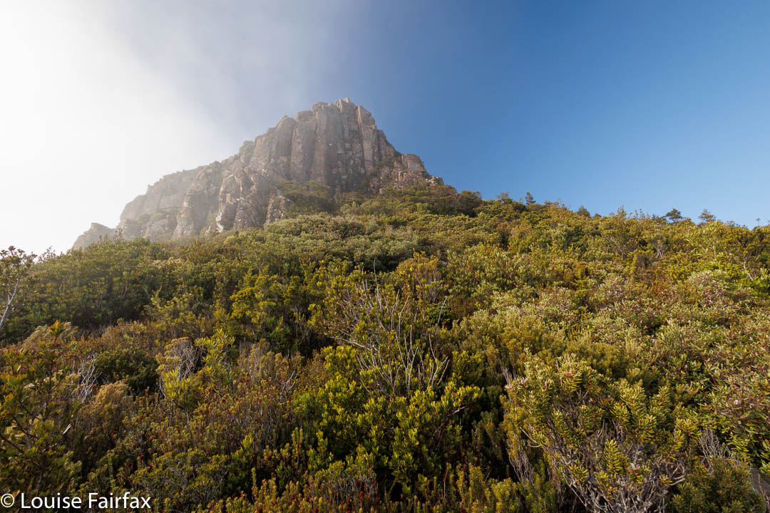
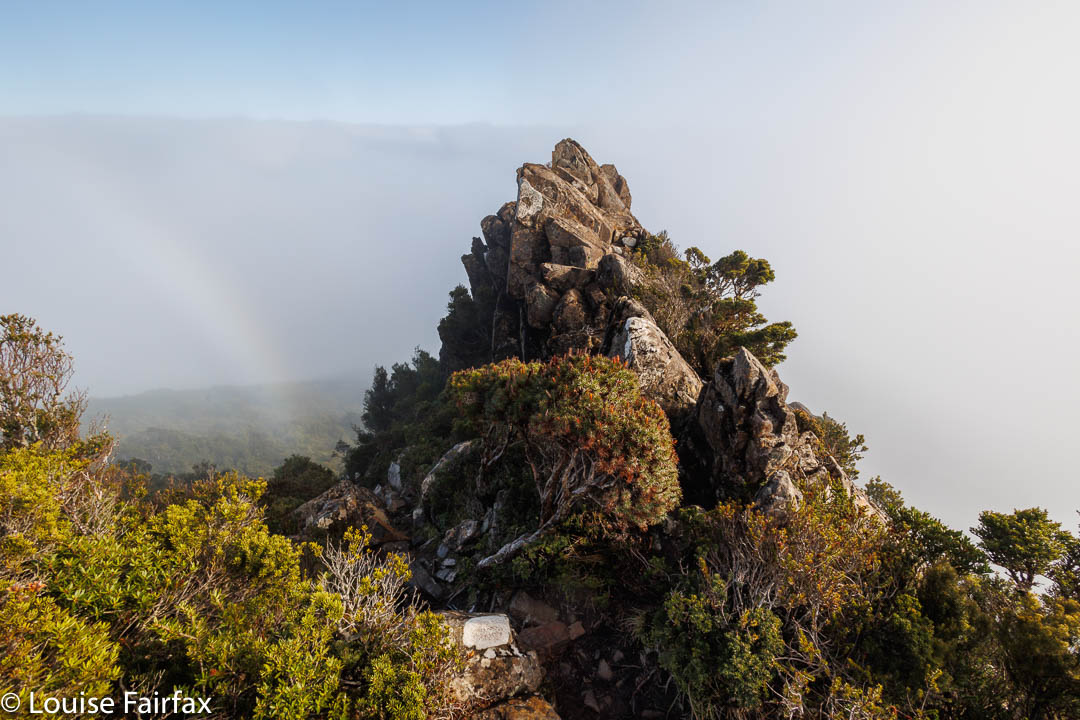
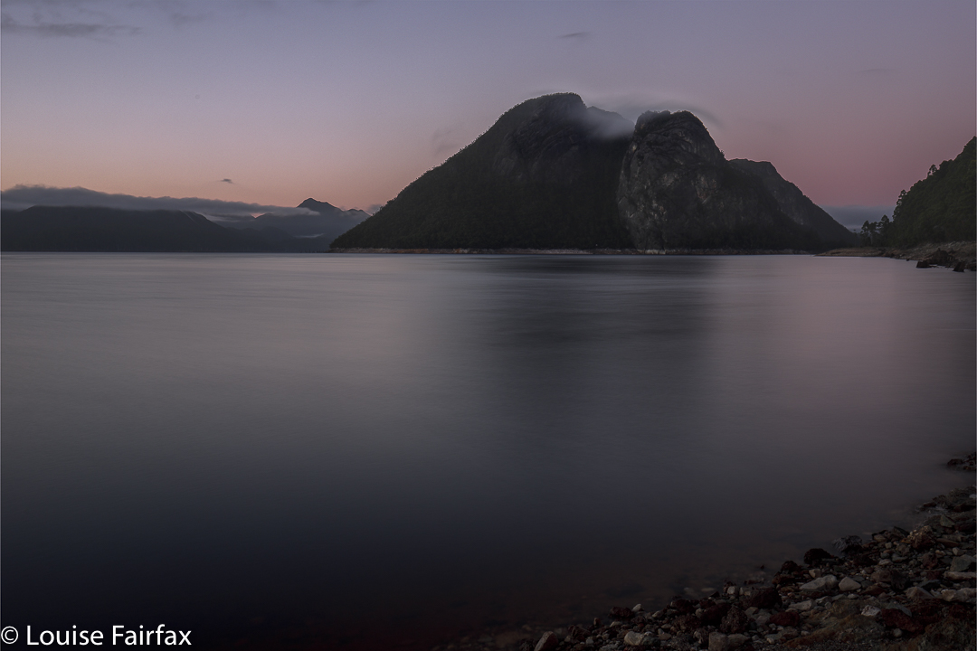
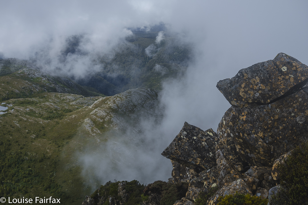
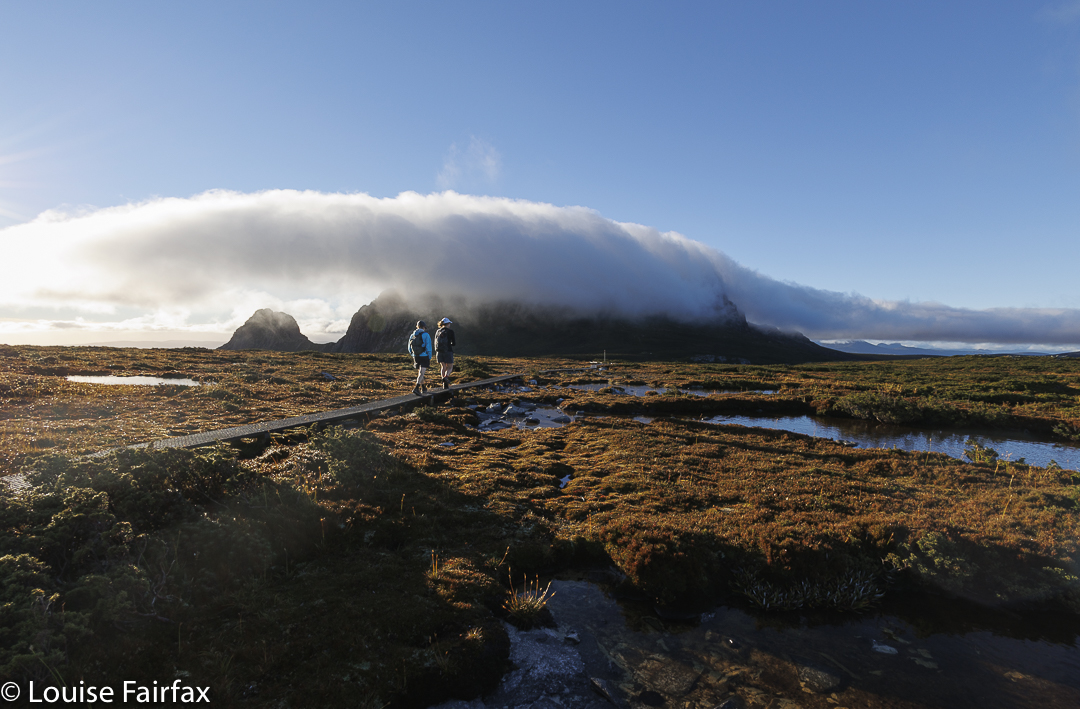
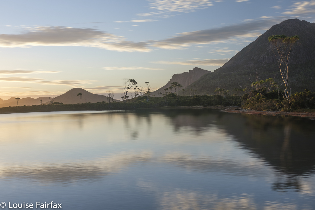
Mt Wedge: now we’re above the cloudsLooking at the sea of white puff
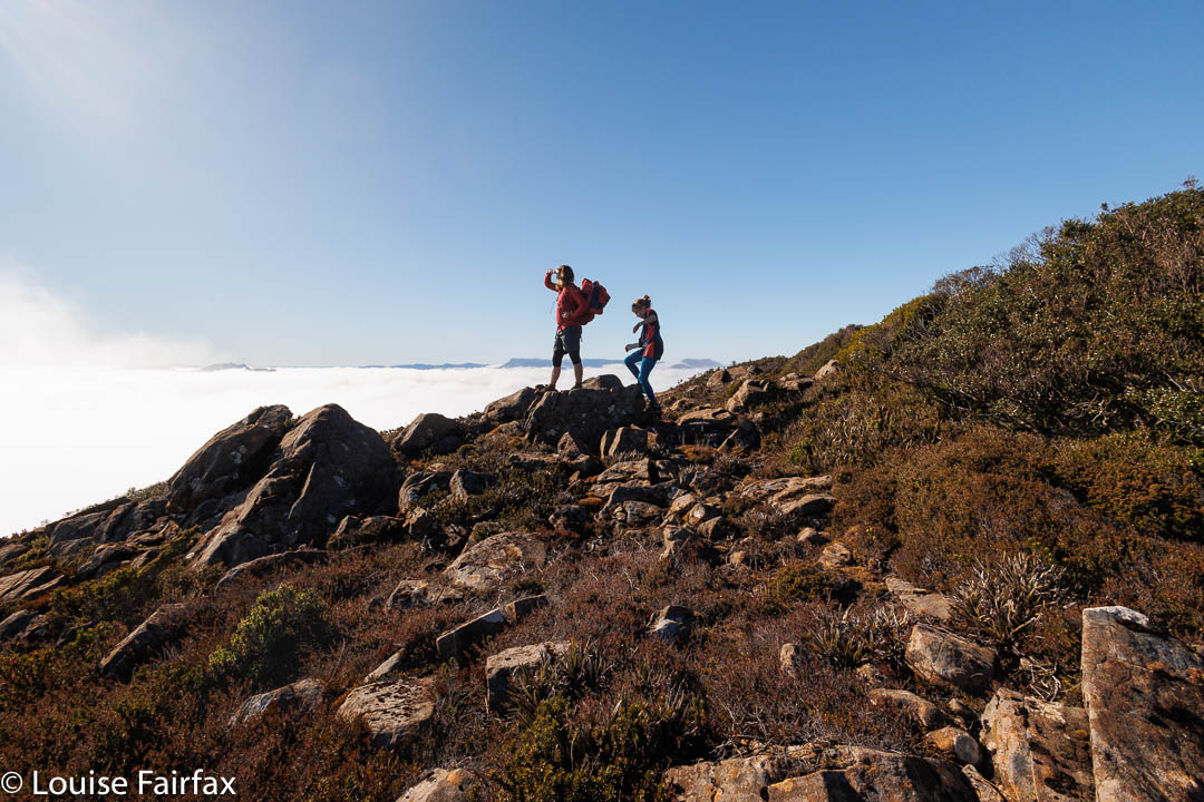
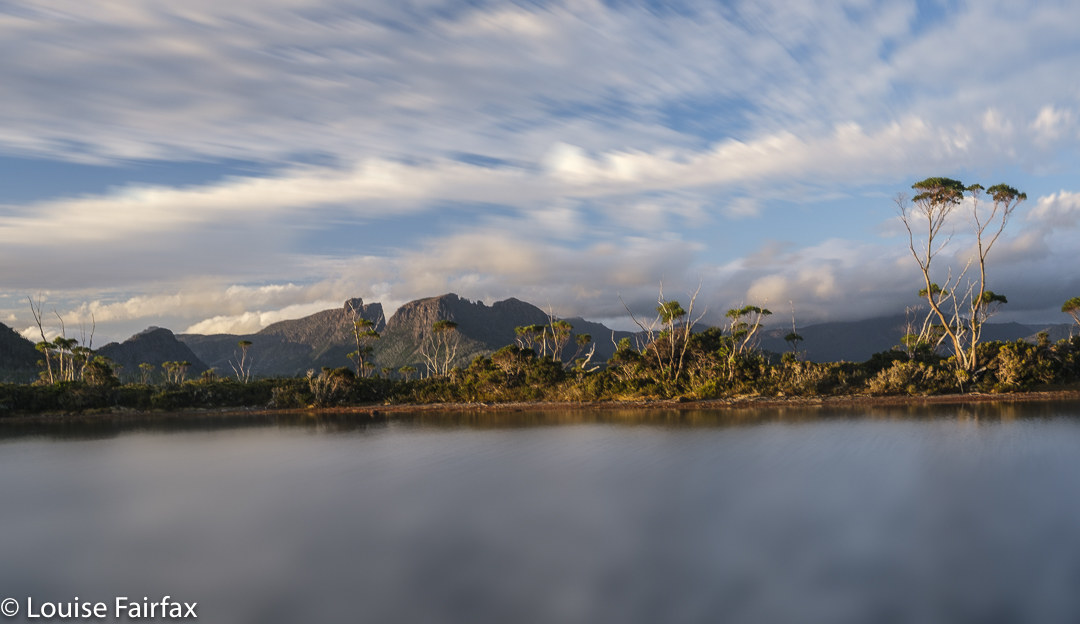
A special treat was in store for us when we burst out of the forest: we were already above the clouds. Gussy has never been up above the clouds like that before, and was suitably excited. Below, the valley was shrouded in mist, but up here, the sky was blue and the sun was shining. We could see the high peaks like Field West or Mt Anne poking as indigo and white silhouettes above, and the rest was a sea of pure white cotton wool below us, with occasional fog bows.
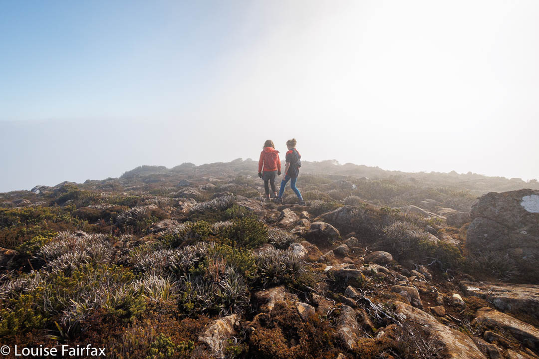
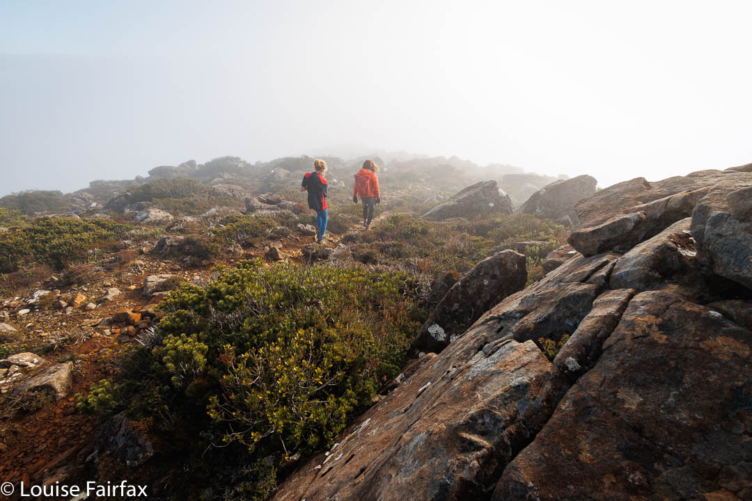
Descending into the mistDescending into the mist
It was even mild … or maybe we were just warm from the climb; there was no wind at all. The ground was a little damp, but we sat on rocks and used the heli pad as a table on which to spread out our goodies. We were even joined by a couple who had moved to Tassie from Melbourne in the last year, up there with their baby who toddled about the pad. It was a fun picnic.
There was no rush on the way down – quite the opposite, as Gus needed to take especial care of his arm going downhill. That gave me time to photograph a few more fungi. I think that makes it eleven Abels for him, aged ten.
And maybe one day we’ll get to do Mt Field West.
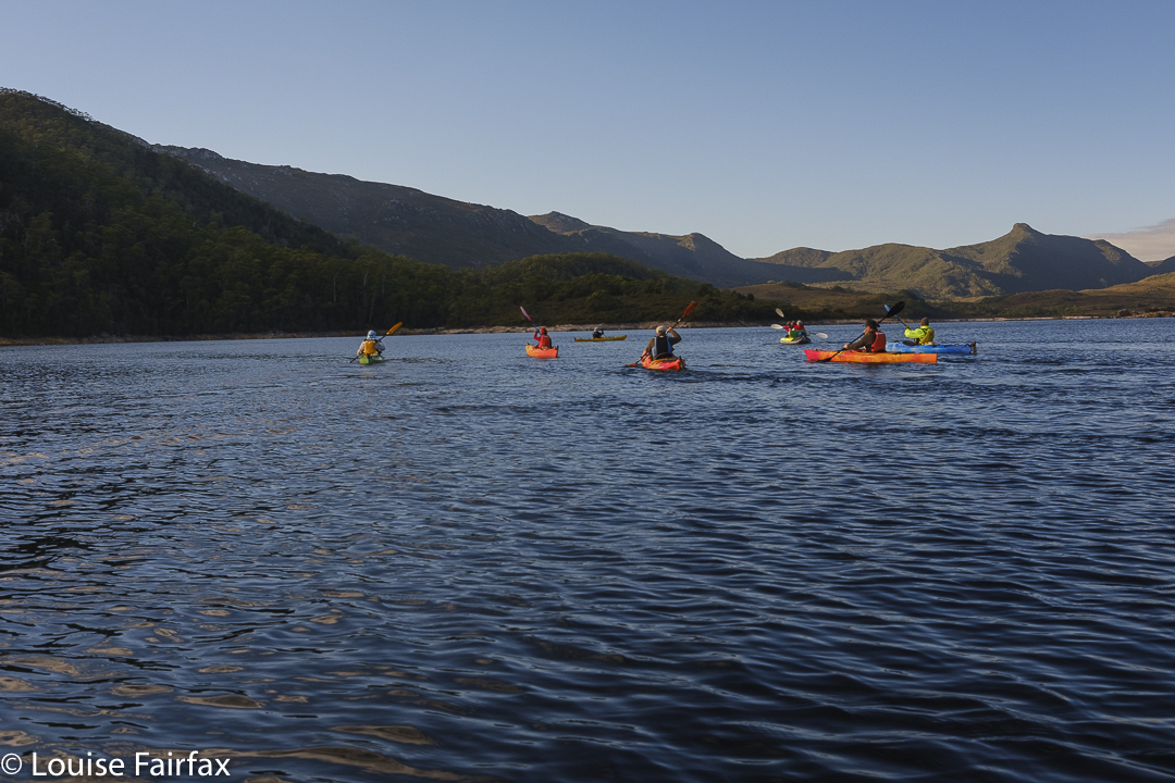
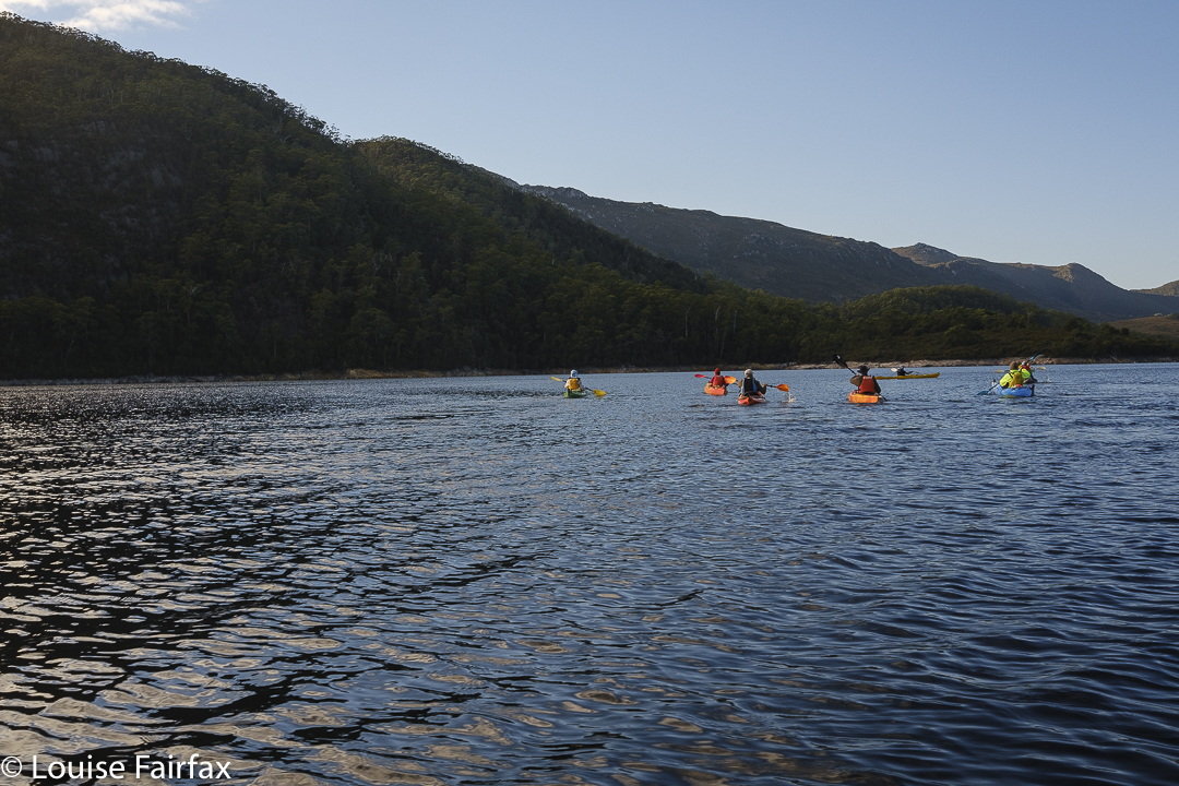
What is it that is so very alluring about having to kayak to the base of a mountain? I guess it makes the mountain that bit more inaccessible, more mysterious. There is more of a challenge, and therefore more enjoyment, as we have put more effort into the excursion. I am told that a veiled woman is more desirable than one who is stark naked, displaying all there is in a single hit. In that sense, a mountain that hides a part of itself behind a body of water adds to its own mystique and desirability.
Kayaking on Lake Plimsoll
Our brains do actually enjoy a little exercise (filling in the dots, as it were). Perhaps someone could tell that to the authorities who constantly try to dumb down our beautiful “wilderness”. Sure, tourists need some sacrificial pawns, but please, please leave the rest of us a little actual wilderness to explore and experience wildness and freedom.
Selina forest – rich and mossy
I had received an invitation to kayak to the base of Mt Selina, on Tassie’s west coast, somewhat near Tullah. For me, that is a long drive, and necessitated putting my dog in a kennel, so I decided to turn the snack into a feast, and stay two nights in Tullah surrounding the expedition. I was hoping to luck in on an aurora, photograph the Milky Way, capture a couple of beautiful sunrises and climb a few extra peaks. I might even see some nice fungi.
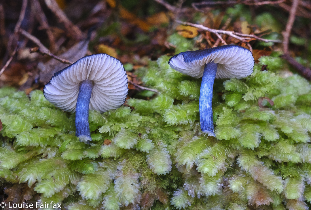
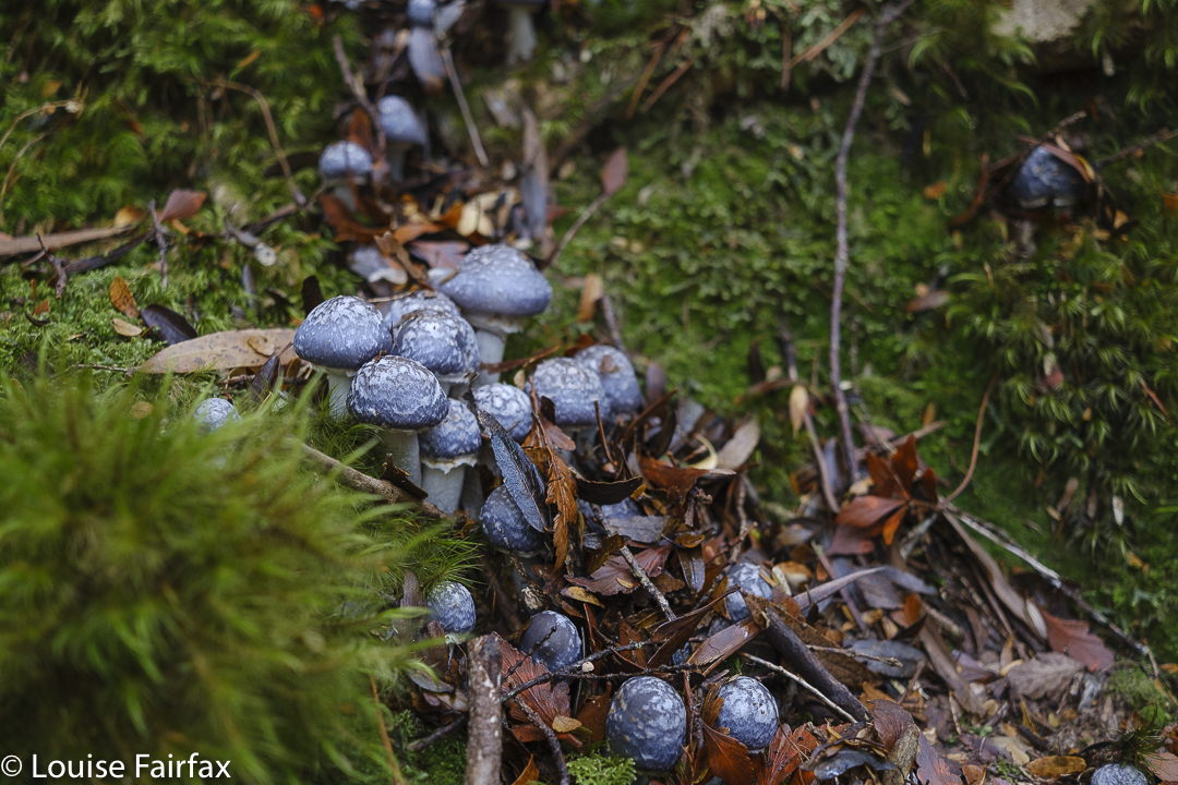
Entoloma sp, possibly panniculus, but this is a much nicer blue than normally sported by that species. (I did NOT pick this specimen. Someone with big boots trod on it. I capitalised on the decapitation.)Cortinarius metallicus en masseCortinarius metallicus. I could have stayed here all day photographing this crowd of beautiful specimens.
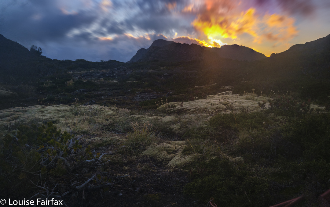
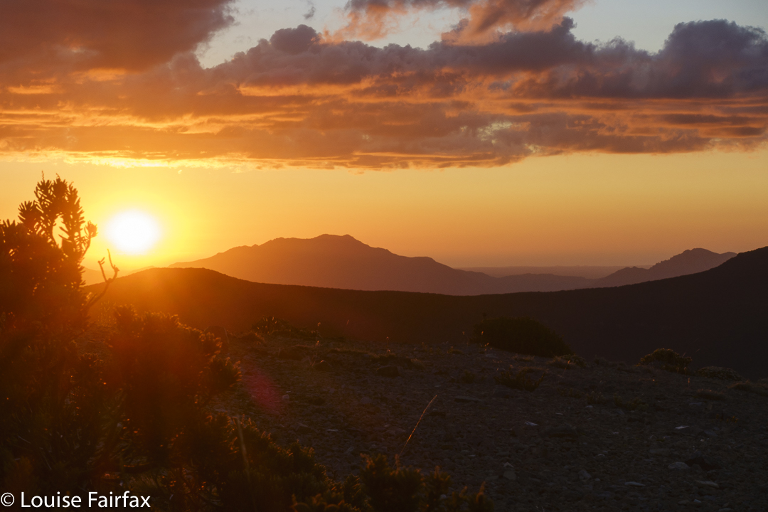
Full of anticipation, I arrived in location somewhat after 4pm, and sussed out my eventual sleeping spot before I did anything else. There was still an hour before legitimate dinner time, so I did a quick trip up Mt Farrell to catch a good view, but, alas, the sunset was a fizzer. There were too many clouds. The same fate awaited my astro aspirations later in the evening.
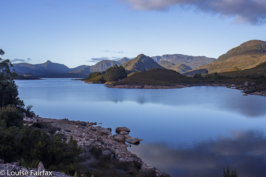
Lake Plimsoll, scene of our adventure, taken just before the others turned up.
Next morning I had much more luck, to the extent that I nearly ran late for our meeting time … but the others were running even later, so that is not a bad thing. Eventually we met, got the kayaks ready, and were out on the water, the sun still low enough in the sky to provide beautiful lighting for our short paddle. The sight of colourful boats traversing early-morning waters is such a wonderful thing, comprising a fabulous combination of beauty and adventure. I had fun photographing the group as it made its way to our designated landing beach.
Mt Farrell on Lake Mackintosh, sunrise next day
The distance to be covered to the first of the Mt Selinas was less than a kilometre, but it was very steep, and there were patches of Bauera, Cutting grass and other obstacles to hold us up. We were not in a hurry. As with the previous evening, I was disappointed in the sparsity of fungi (= none). This was to be more than atoned for in the gully between Selinas 1 and 2.
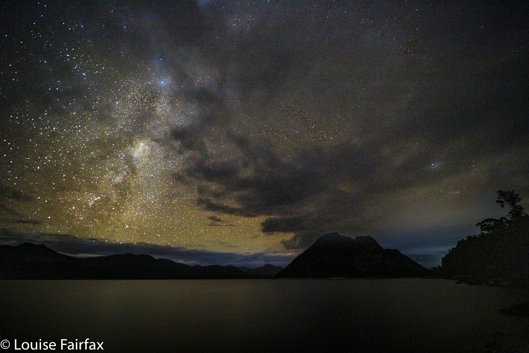
Astro to cap off a good day. I got in two shots or so before the clouds rolled in.
In case you are wondering about all these Mt Selinas, there are several knobs which have legitimate claim to be “the real one”. One of them is Mt Selina on the 1:25,000 map, while a different one is that which is named on the 1:100,000 version. A third knob needs visiting just in case it is higher. Listmaps is rather funny, as the position of the name “Mt Selina” changes as you zoom in and out, matching the discrepancy named above.
Mt Farrell Lake Mackintosh – predawn glow day 2
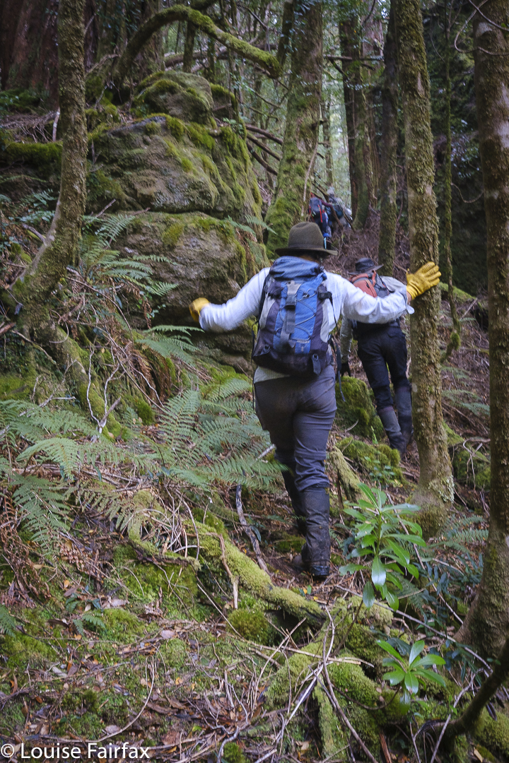
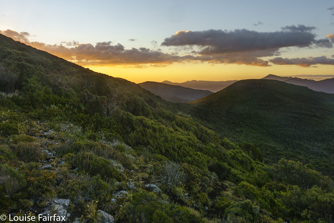
Anyway, it was a gorgeous place to be, so who cares if we had to stay in the area longer, climbing this and that, skirting around this and that sheer cliff, admiring this and that King Billy pine, a humungous old myrtle, or giant rocks clothed in a thick cloak of moss. We invented excuses to linger – morning tea 1, 2 and 3; lunch 1 and 2. And then … and THEN came the fungi!!!!!!!! Based on the lack thereof on Mt Farrell, I didn’t bother to include the macro lens that was in the car, so any images you see have been taken with my wide-angle 27mm lens. Given what it is actually designed for, I think it did a pretty sterling job. I didn’t even have a tripod. I thought I was just mountain climbing in the middle of a too-sunny day. Ha.
Arnold Peak to Mt Victoria, next day
Three Mt Selinas climbed, five thousand fungi photographed and we were on our way back down, having run out of excuses to linger. One gps says we took 8 hours to cover less than five kilometres. That will make an interesting entry in my training diary.
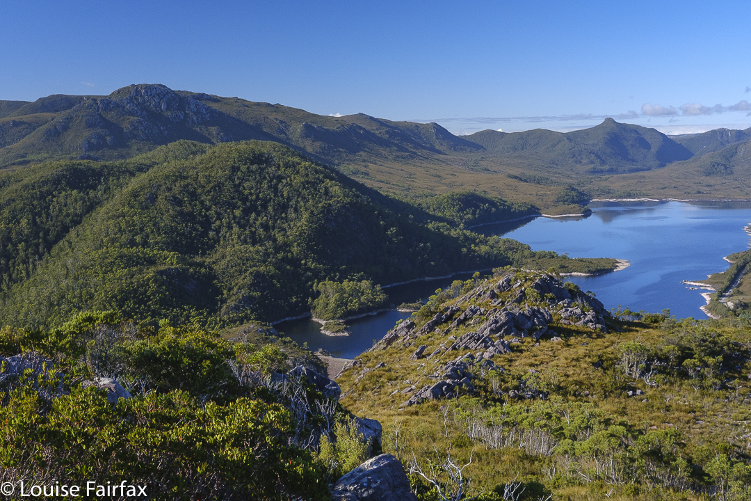
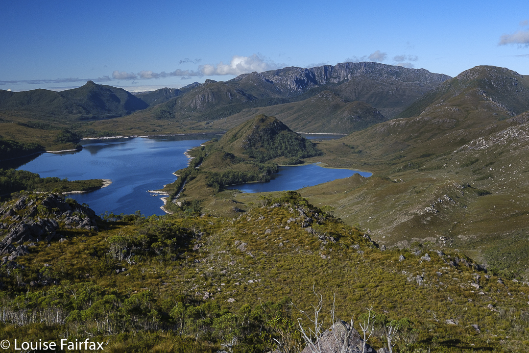
Arnold Peak view to Lake Plimsoll, and Mt Selina (inter alia).
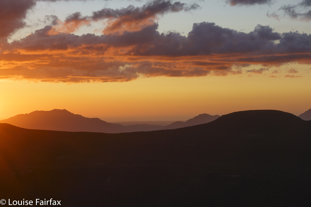
Next morning, there was a pleasant if undramatic sunrise, but fun to shoot anyway, and especially enjoyable as I found myself camped next to two other keen photographers (Jamie and Camilla), so we had fun chatting while we shot.
Arnold Peak view to Lake Plimsoll, Walford Peak and the Tyndalls
In order to have some exercise before I drove home, I climbed Arnold Peak (760 ms in height) after breakfast. I had been told it would be 30 minutes in each direction, so that would give me my desired hour’s exercise for the day. Unfortunately, it only took 13 up, 17 to photograph and about the same to get down, so I went under-exercised yesterday. Worse things can happen. It was a gorgeous little peak, and that will certainly not be the only time I climb it!
Reflections on Lake Rosebery for “dessert” before the long drive home. I floated on beauty the whole way and barely noticed the distance.
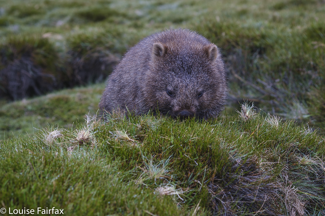
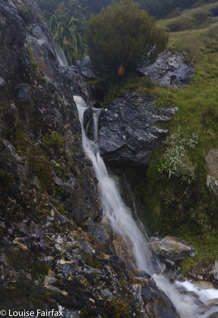
This weekend had so very much packed into it, it is extremely challenging to select less than twenty photos, so I have had to omit a great deal. There were wombats, mountains, of course, waterfalls – one of which is a blue line on the map with no name on an unnamed creek, so for reference I have called it Kirsten Falls. (It empties into Crater Lake, but Crater Falls already exist, down lower, with their own upper and lower versions.)
Wombat; Cradle. Always adore seeing them
There were sunsets and dawns, a visit to Sutton Tarn, which I have never previously sighted, a swim for my daughter Kirsten (in Crater Lake), and, perhaps ridiculously, I visited Wombat Pool for the first time, too. How can I have been in this area that used to be my almost weekly playground before the government handed it over to tourists and made it exceptionally difficult for Tasmanian residents to enjoy any more, and not been here?
Kirsten Falls that feed ultimately into Crater Lake. Crater Falls (Upper and Lower) are below the lake. These falls are just a blue line on the map.
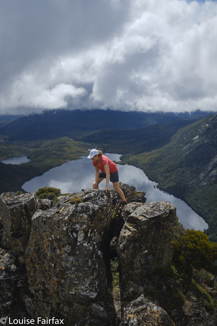
Does anyone else remember the good old days when you could scoot up here after work, have a quick bite by Dove Lake and then go up into the mountains before it got too dark to see? We used to regularly pop in to Waterfall Valley Hut for the weekend. I used to park at the lake and run repetitions up Marions Lookout for training for my mountain running. And so much for astro, sunset or dawn photography by the lake: all just events in the memory of those of us who lived before the tourist invasion. Before the government turned natural beauty into a saleable commodity, sucking out its soul in the process.
En route to Little Horn
The waterfall shots aren’t my favourites, but I do like documenting waterfalls I have visited, so you’ll have to humour me on that one. Only one fungus has made it into this small selection, although more were there to be seen.
Little Horn summitLittle Horn summit
It is a weekend present in my brain not in words, but rather in a series of images and feelings that I have not wanted to reify by reducing them to words. I will let the photographic images function as poetic images to hint to you at a wider whole that transcends its adumbrated representation here.
Little Horn
Our itinerary is as follows:
Friday evening: arrive; wait for the boom gate to open and then walk to our hut (almost in the dark).
Saturday: a loop that included Kirsten Falls, Sutton Tarn, Little Horn, Lake Wilks, Ballroom forest, Wombat Pool and Crater Lake.
16 horizontal kms + 600 ms climb which yields 22 km equivalents.
Climbing down to Lake WilksLake Wilks Falls Upper were flowing well today
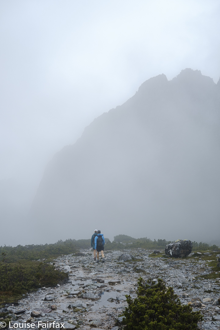
Sunday: unfortunately we only had half a day, so went towards Barn Bluff in freezing, fierce wind, and returned in beautiful sunshine with a crisp autumnal feel to the air. The light was beautiful. We rushed the first half, hoping to squeeze in the summit before our turn around time.
However, one of our trio was freezing and decided to turn back. Kirsten and I continued on, but we had lost too much time by then, so opted to give the summit a miss and just enjoy being up high on the Bluff Cirque and Cradle Plateau, and taking in the scenery at a more leisurely pace.
Moody Cradle Mountain
I have already climbed it three times, so didn’t really need a fourth – well, that will happen, but not today – and Kirsten summited it with me when we both ran up it several years ago. After lunch, she would have a huge drive to Hobart, needing to be back in time to have dinner with the children and get ready for work the next day, so it was better to have a relaxing morning than rush the summit.
19.1 horizontal kms + 230 ms climb yields 21.4 km equivalents.
Cradle Mountain. Sadly, it is time to descend for lunch …
What do you do when you’ve finished climbing all the Abels? Why, you go straight back to revisit your favourites, of course! Don’t you? Well, I did, and do.
Fast forward: Guardians summit
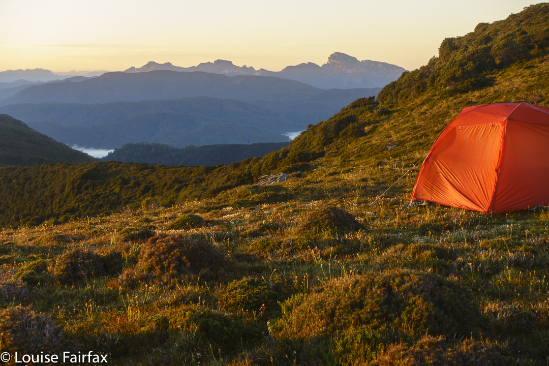
I had already begun on this delightful mission, as some favourites were a lot easier to reach than some of the ones I hadn’t yet climbed. This week I continued with favourites, and reclimbed Mt Gould and The Guardians. For at least ten years I have wanted to sleep by the tarn near the summit of The Guardians, and also on Gould Plateau. This would be my third summiting of Gould, and my second of The Guardians. All previous climbs had been far too fast. This time, I wanted to linger up high.
Guardians summit to leeawuleena and Mt Olympus
These two mountains are rather close to each other. My bash buddy and I had two full days and nights at our disposal, with a booking on the 9 a.m. ferry on day 3. The way to organise this dream then was to have a very long day 1, a super-cool and relaxed day 2 and a dash for the splash on day 3.
Guardians summit view
I got to enjoy a beautiful dawn at leeawuleena (Lake St Clair) before day 1 officially began with the ferry ride, so I was already floating with beauty (and had already taken far too many photos) by the 9 a.m. journey to the end of the lake with other excited walkers – all except us from interstate.
The first two splits were nice and quick, and we were at Pine Valley Hut after only 2 hrs 6 mins’ walking.
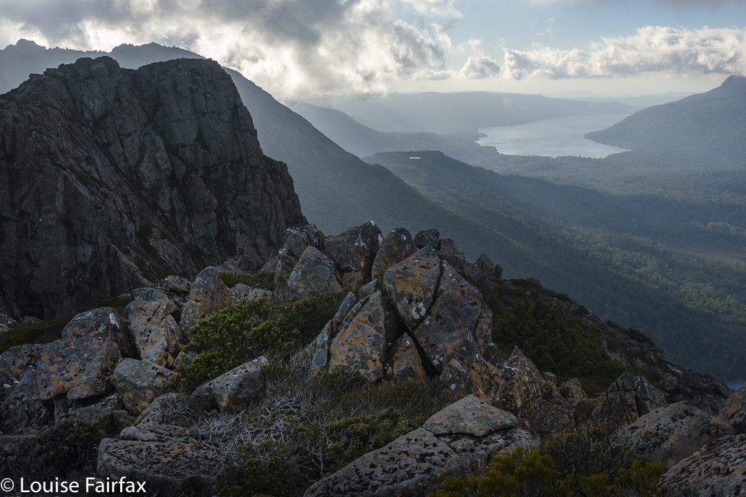
Guardians cliffs Louise
By the time we climbed to the Parthenon saddle, the day had started to warm up. I was still in my famous pink (now maliciously torn) coat, and overheated terribly, but we were setting a great pace and still had heaps of distance before us, so I didn’t feel like breaking the rhythm by stopping. I like doing climbs without interruption, so I sweated a fury and just put up with the heat. I was glad to breast the final bump to the saddle, throw off my nuisance pack and have a welcome drink. Were we half way yet? I fear not.
The day got hotter, so the going got tougher. We carried a lot of water for the next section over the Minotaur, knowing there would be none until we reached a basin beyond the summit, near the Minotaur-Gould saddle.
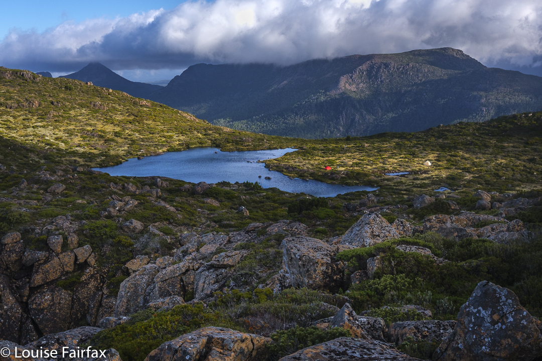
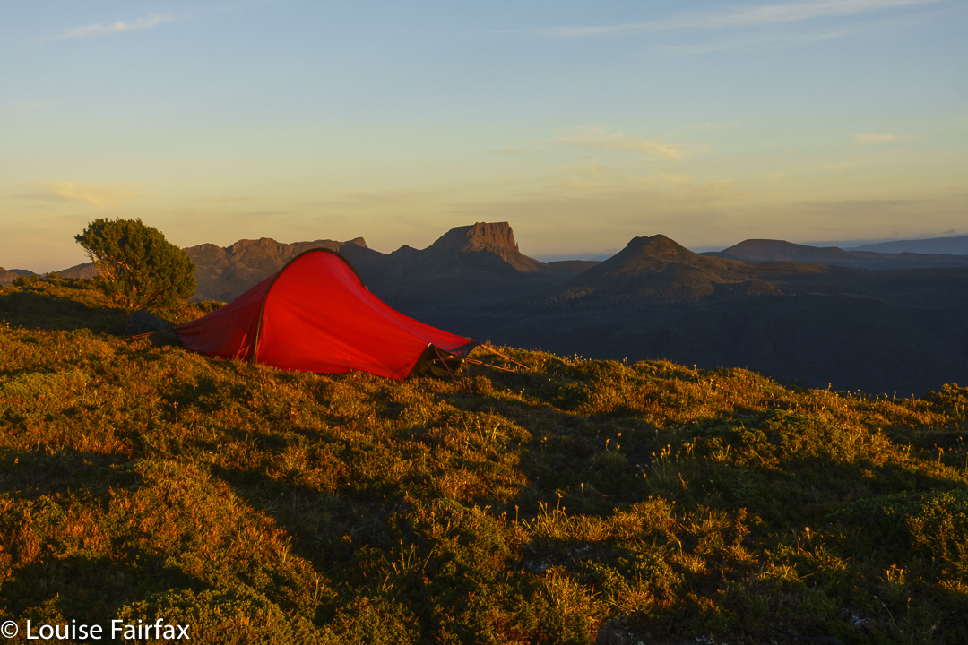
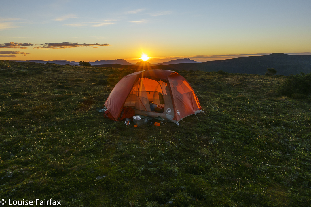
Tent spot evening
As we approached said basin, we saw rather a lot of tents down there in the middle of nowhere. It was a bunch of Victorians, most of whom were recovering from what they described as a horrendous bush bash the previous day around the belly of Gould – a patch I have done twice already, so know what they were talking about. Their voices and faces said more than their words about how they felt about that section of their trip. It can certainly be an unforgiving area, as we would re-experience next day.
Tent spot evening
Most of them were lying in the sun, relaxing and enjoying the calm while two of them were climbing The Guardians. They were nice people and there was water there, so we tossed off our packs and spent at least half an hour chatting to them. My watch said we now had oodles of time. All need for haste had long-since vanished. We reckoned it would only take another hour or so to reach the summit of The Guardians from there, so forgot the watches and enjoyed the company of fellow walkers with similar interests.
Dawn next day
Eventually we bid farewell and set off for the final section. Unfortunately this lasted a bit longer than expected, as my stomach started cramping and I felt very sick. Twice I needed to lie in the grass to alleviate the pain. We have decided the puddle in the Parthenon saddle wasn’t as pure as its clarity suggested. Anyway, I was sure glad to see the tarn, dump my pack, pitch my tent and be horizontal for long enough to soften the cramps. It all eased surprisingly quickly, so we decided to summit while the going was good, play around the cliff tops for a little and then have dinner as the final act of the day.
Tents from above
Of course, it wasn’t my final act, and after eating, I set back out to photograph, but I was glad our order of events had been what it was, as the temperature was already dropping to be near its promised minus one over night, and my hands were freezing; the wind was cold. Later, my tent would flap noisily for most of the night. I was too lazy and warm to go out and tighten the guy ropes until about 2 a.m., when I decided enough was enough, and left my warm and cosy aegis to attend to the noise.
Moody cliffs
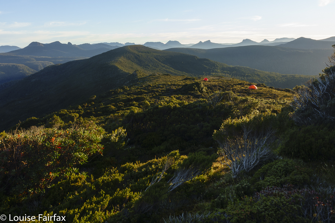
We had no busy agenda for day 2, and I am not sure that I’ve ever had such a slow first half of a day. I observed sunrise mostly from the comfort of my tent (it wasn’t magic) and then had breakfast cooked in the vestibule, looking out my peep holes to see how the day was progressing. It was time to depitch, but my tent was sopping, and so was Andrew’s, so we went for an explore along the cliffs not yet visited to give the tents time to rid themselves of heavy water.
New tent spot
Well. That coped with the problem of what to do with a long day and not too many kilometres to fill it. We didn’t reach the pack dump point on Gould until 11.30. I hate going uphill slowly, so we didn’t loiter on the “straight-up” climb, where I was in my element doing what I call a pussycat climb – all four limbs working like a feline. The trip down was more like a huge slide at the playground. Loved it. Nice and quick!
New tent spot
We still had a huge number of hours to fill in and even less distance to cover, so strung out lunch. It would have made much more sense to continue on to Narcissus, but I had my heart set on sleeping up high. I told Andrew to feel free to go down and I would join him on the morrow, but I really did want to sleep high.
Playing in the evening
Well; I managed to fill in at least one of those spare hours by landing us in a shocking patch of absolute, unadulterated YUK. All was going just fine. I’d led us around the belly in the bushes very nicely, and then we’d dropped down right on cue to a beautiful mossy gully area. Then along. And then we found two random pink tapes running perpendicular to our line of travel. I checked my map. No, we weren’t to go up or down here, as suggested by the tapes, but we explored both up and down on the off chance. Both led to blockades of scoparia. But, … so did straight ahead. There seemed to be no nice way to go anywhere. And why on earth were there two tapes here in the middle of nowhere, with no beginning and no end? Where was the taper going? It was very confusing.
Sunset arrives
We to’d and fro’d and up’d and down’d and were irretrievably stuck. I got out the gps where I had tracked the route the last time I had done this. We were on it. Oh. Yuk. We shoved and pushed, we climbed over the top of bushes, grunting and heaving our way to nowhere much. But, if you shove for long enough you kind of get somewhere, so eventually we got to the plateau below.
I was absolutely exhausted in a way I don’t often experience. My hip flexors and glutes were aching even without taking a step. I was absolutely done in, and very glad that my planned bed for the night was only a shortish distance away. Any snail on the planet would have beaten me as I inched my way to the tarn.
Sunset
Hoorah. There. Andrew didn’t like my tarn, so chose a spot that he felt was more sheltered and more comfortable and a tiny bit nearer to the next goal of the ferry. My spot was chosen for its photographic opportunities. I wandered and shot and had a lovely evening, singing seeing’s I had the freedom to do so.
Evening glow
The next morning involved an early start, as we still had what might possibly take two hours to do (it only took 1 hr 38, but you need to allow for emergencies). I passed Andrew’s tent spot, but he had left earlier (we had agreed to meet at the ferry and not at his spot), so it was a crisp business-like stride-out down the steep slope and along to the ferry. I only stopped for photos once, when a beautiful patch of Aurantiporus pulcherrimus specimens caught my eye. My legs seemed to have completely recovered from the previous day’s scoparia battle. I still have bruises and scratches to remind me that it wasn’t all easy, however.
“Camp Hill! Why on earth have you saved THAT until last? “, N asked.
“Well, why on earth would you do something like Camp Hill unless you absolutely had to,” was my response.
But when you are only one Abel short of a complete set, and that one is, you guessed, Camp Hill, then you have to do it if you want to complete, and I did, so that was that. Funnily, nobody much seemed to want to come too. Excuses were many and varied. In desperation, I resolved to go it alone. My bashbuddy, Andrew, perhaps fearing for my life as well as my sanity, agreed to come too, trying very hard to rationalise his stupidity to himself: “It will come in handy for later.” Good one Andrew.
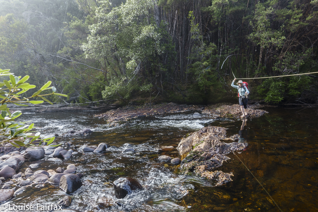
Collingwood River, where it all begins
Even more mysterious was the message from a friend, Rita, whom I had met in the wilderness, who said at the last minute that she was free to come as well. Did she know exactly what she was letting herself in for? Oh well; she does now. She loves adventures, and this was to be a double one. I did say – was it to one or both? – that if they had any ancestors who had been knights in yesteryear, then they should raid the relevant museum for the armour, just for the trip. It was not going to be a place to wear clothes they valued.
Rita crosses the Collingwood River
So, there we were at the startline: the magnificent Collingwood River, which is crossed before the big climb begins. The light was magic; the water, a honeyed colour, quietly wending its way over a wonderful collection of coloured boulders beneath.
Rocky Hill evening
That was to be our very last water for a very long time, so we carried plenty – enough to last for a long, hot, uphill haul with nothing available before we would scout around for something to enable dinner to take place. The skies were cloudless and already you could feel the heat. Much of our day would be out in the open, which makes for thirsty work. Well, here we were. What would be, would be. I was going to get to this summit even if I had to crawl there. Famous last words: I did (have to crawl, and snake, and waddle like a sick duck).
Rocky Hill sunset
The early forest was really beautiful , and we didn’t take it for granted. Before it was time for our second break, we had already left its shady greenness, exchanging it for scrubby melaleucas and then for buttongrass expanses.
We were gaily walking along, chatting away in the middle of very remote wilderness, and I hear a voice saying: “That must be Louise Fairfax.” It was Nick “weetbix” from the bushwalking forum, who knew from other friends that I wanted Camp Hill. There is no actual pad where we all were, and he was following a line below ours, but, hearing us, he came up to say “Hello”. It was a fun chance encounter. On our return, we labelled this bump “Weetbix Hill”. He was on his way out, and confirmed what we already knew: viz., that there was hardly any water out there.
Rocky Hill summit; sunset.
On we pressed. Soon enough, we were on a different high point, which I have always called Rocky South, from which both our goals were now visible – “both” being Rocky Hill, and our ultimate goal, Camp Hill. (Why is an Abel over 1100 metres high, with a drop of 150 ms all around given the insulting sobriquet “hill”??) We would spend the night on Rocky, and attack Camp next day.
Rocky Hill summit; sunset.
We enjoyed the summit of Rocky, pitched our tents just beneath it, and then needed to solve the water problem. Off we set with carrying equipment and all our water storage capabilities. I had a 6 litre bladder which would do me. We dropped off the mountain on a pretty direct route, being guided by a friend’s one from the past. Hm. It was @#$%* awful. We voted to not return by that line, and dismissed him as a creditable source of information. But first, we needed to locate water from the low area we were now in. The initial few creeks were now ex-creeks, so the search continued. We wanted water, not mud. Lots of water. All we found were puddles, but I tasted the drop in the deepest (still far too shallow), and it was sweet, so we filled up. Weetbix later told me that he was entertained with visions of us searching hundreds of yabby holes in endless succession up the top for kilometres, in a vain search for water.
Ozothamnus rodwayi Rocky Hill
Anyway, we now had some, and began to climb the mountain again, much heavier. The first part was easy and lovely, but then the pad ended abruptly. Hating the descent further east, we opted to try a somewhat more direct route up. Rita reckons this was the hardest part of the whole trip. Ultimately, we had to climb a cliff via the interwoven branches of a nothofagus gunnii (common name – Tanglefoot – for a reason) , and using that height, haul ourselves up by tree roots to breast the rise over the cliff that blocked us. We laughed about our adventure as we walked the final bit back to our tents. Now we had enough water to last at least 20 hours.
Rocky Hill campsite. Frenchman also visible
Sunset that night was wonderful. Rita and I sat together on the summit, taking in the loveliness of the first orange and then more pastel fading light. Only when there was basically no light left did we reluctantly lose a tiny bit of height to go to bed. Day 2. We knew this would be another hot day, and we also knew it would probably be a waterless one, so we left armed with what we would need to fund the day. For every step that was easy, I gave thanks, for I knew it would not, could not, last. The ease left kind of gradually, with the scrub getting thicker in small degrees as we progressed.
Rocky Hill. Morning light
Down we dropped off Rocky (very easy) and up the next nameless lump (not too bad), then, hm, down to a saddle of ill repute, with the scrub getting more vigorous in its lack of welcome with every step. The saddle was described by the book as “bushy”. Nothing else had been, so I feared the worst. Also, a friend had recounted horror stories, so when we veered every so lightly off the line of ridges and into a pandani forest, we were all very happy, and voted to stay there and go below the saddle. We loved it. This pandani forest was our favourite part of the route, and we all considered it well worth the extra distance and climb. Even in those desiccated conditions, you could still imagine the moss to be fresh and lush; the cliffs to drip soothing water. The pandani had marvellous shapes and we were cool and happy there.
More bush fighting took place, and at last we were staring at our summit, which was so very close, just “up there”, and I thought we were maybe twenty minutes away, max. Ha ha. I also thought we’d done the worst. Another ha ha. After a quick drink, we set out for the final push.
The tents below as we set out for Camp Hill
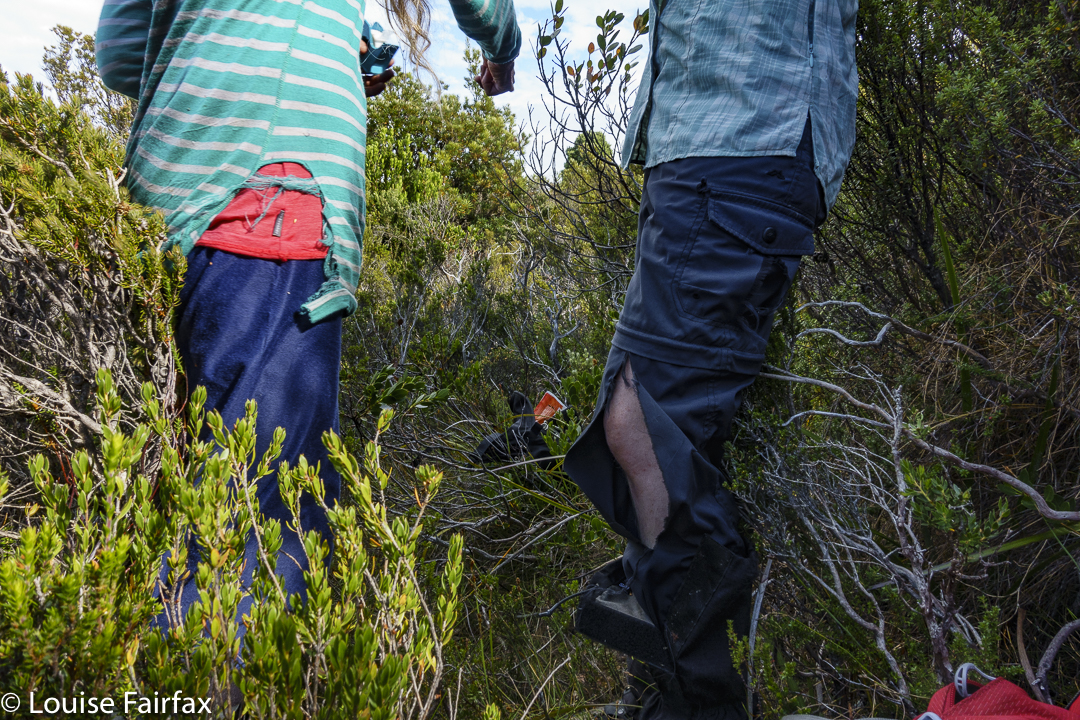
Forget the word “easy”. We were met with a total blockade of bush too high to go over, too dense to go around. Russian troops on the Ukrainian border, eat your hearts out. This bush knows how to repel invaders. Now, here we encountered a little problem: Rita and Louise are small. We found we could crawl like wombats, slither like snakes and waddle like demented ducks and with enough weaving, pushing and grunting, a way through could be achieved, as long as you didn’t mind forest getting in all your underclothes, filling your socks and tangling your hair. Andrew, being taller, did not quite have these options, so he chose a different route, and we met at the end of assorted tunnels. Andrew and Rita tore their pants. I ripped my famous pink jacket. My shoes lost some stitching. Our arms were scratched and pin-cushioned and mine now have purple bruises all over them. BUT, we got there.
Pandani forest under the saddle between a lump and Camp. We loved it there
That was it. I have now climbed all the Abels. I still don’t quite believe it. That was something other people did, not people the likes of little old me. We touched together, and then sat for absolute ages beside what would normally be a tarn, but was now a sort of lizard-skin pattern of dried, cracked ex-mud. We turned our backs to it and to the sun, and gazed out at the view to the west, snacking and drinking. Our day had no other big plans; there was no rush to be anywhere. We just sat and enjoyed.
Rita enjoying a late dinner in her tent. Rocky South
Back at camp later, we had a second lunch – for me, a feast of soup and some dip with biscuits, and a rest in stinking hot, march-fly attacking environs. My tent was unbearable but the flies were too bad if I remained outside. Luckily, Rita invited me to rest in her amazing tent that opens right up whilst having the netting remain closed to fly visitors. A breeze caressed my skin. It was beautiful.
The other two, being more normal drinkers than I am, did not have enough water left for us to stay here the night, so after resting, we packed up our tents, descended the mountain, collected water from a different puddle down below – enough water to last until the end of the trip (which is rather a lot), and then climbed Rocky South (1111 ms asl) to camp up there.
Torn clothes. Repair Knob
And from there, the rest was, as they say, downhill. Well, not quite. We had to undulate over Vague Hill, Weetbix Hill, Repair Knob and Pigeon House Hill before dropping back to the Collingwood River, mission complete. All of us will have to throw out most of the clothes we wore for this trip. My Kämpéla orienteering pants, however, stood firm. I have been wearing these same pants in orienteering competitions and bushwalks since the 1990s. Hoorah for Scandinavian fabric. I will keep wearing my torn pink jacket, however, as nobody might recognise me if I throw it away, and that would be sad. Old friends are good friends.