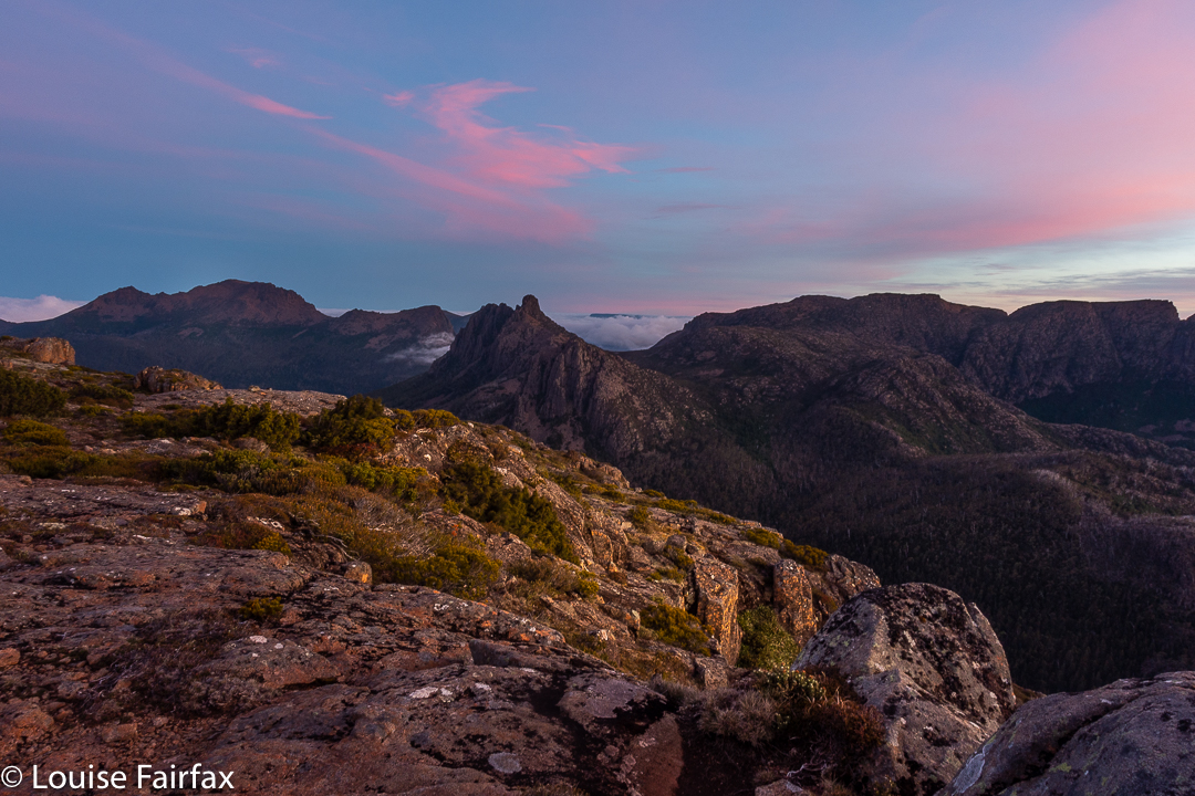
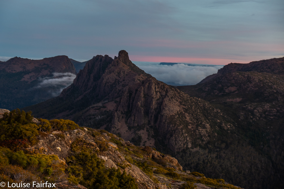
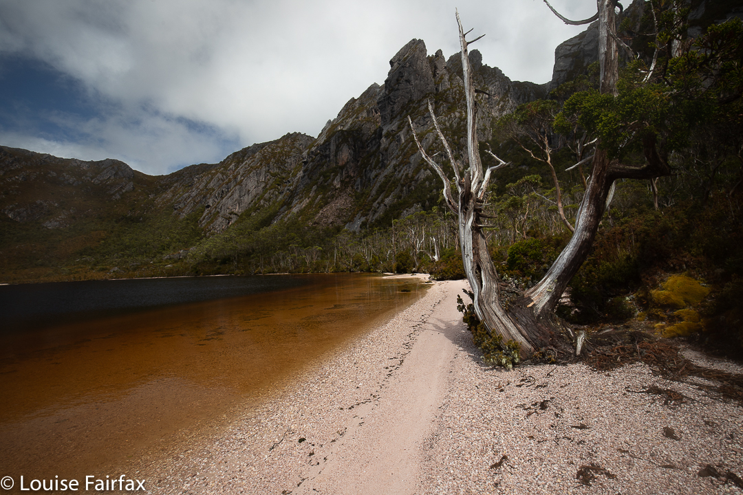
The Mt Pillinger-Lake McCoy circuit has something for everyone. On this day, the final Wednesday of 2020, a small group of us who either don’t work or have organised our lives to have Wednesday off, had an amazing tally of wonders to let us know that 2020 was not all bad.
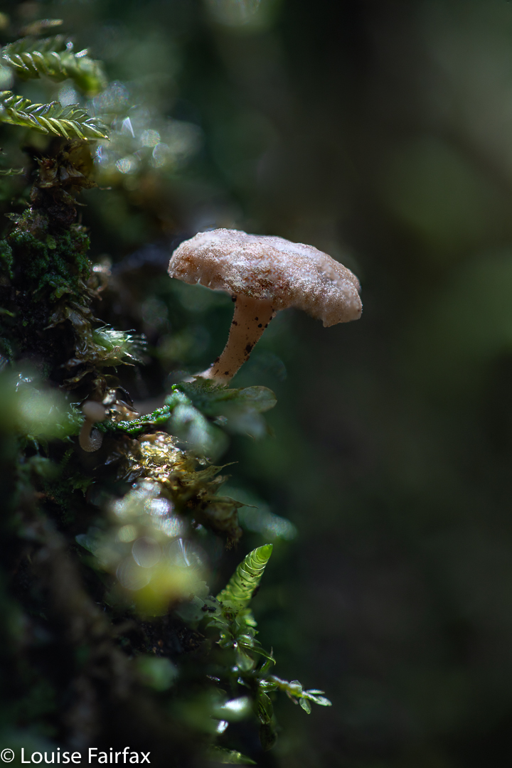
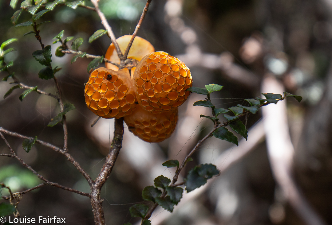
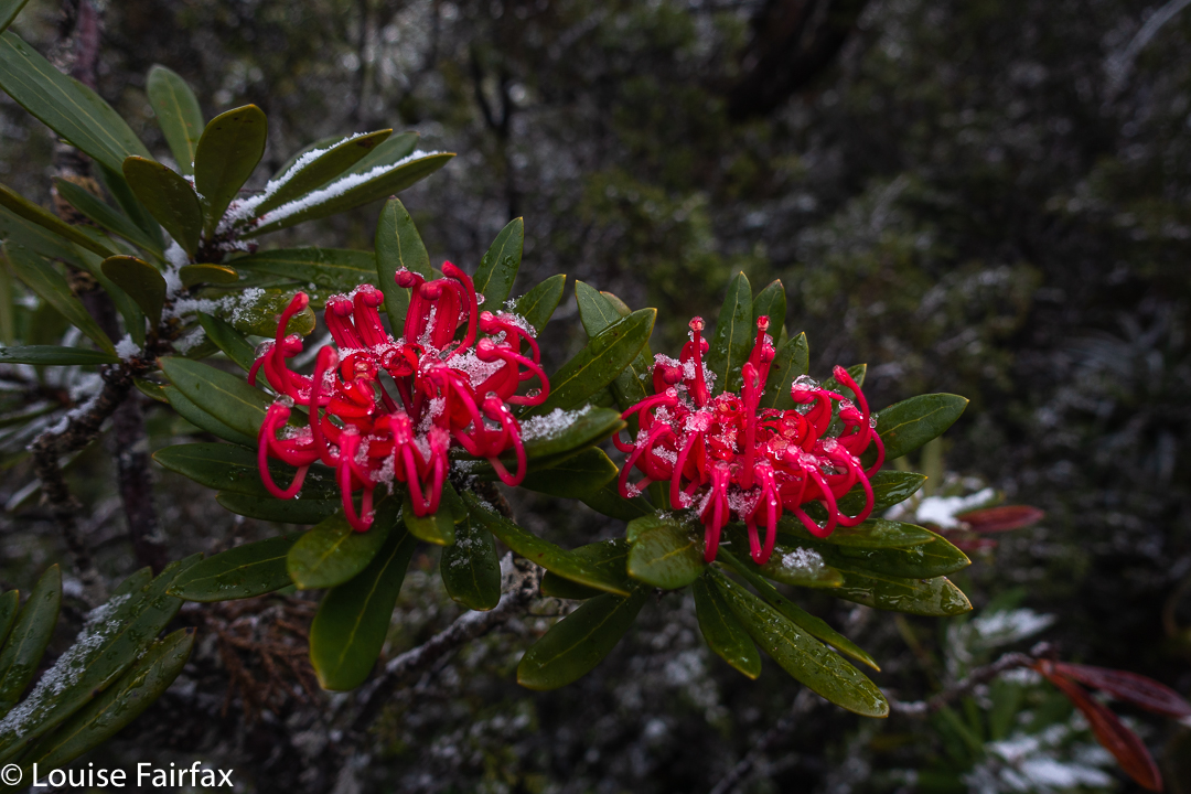
Mycena carmeliana was one of many fungi to make an appearance. This is an old one, but doubtless it had recently enjoyed the rain we have been having.
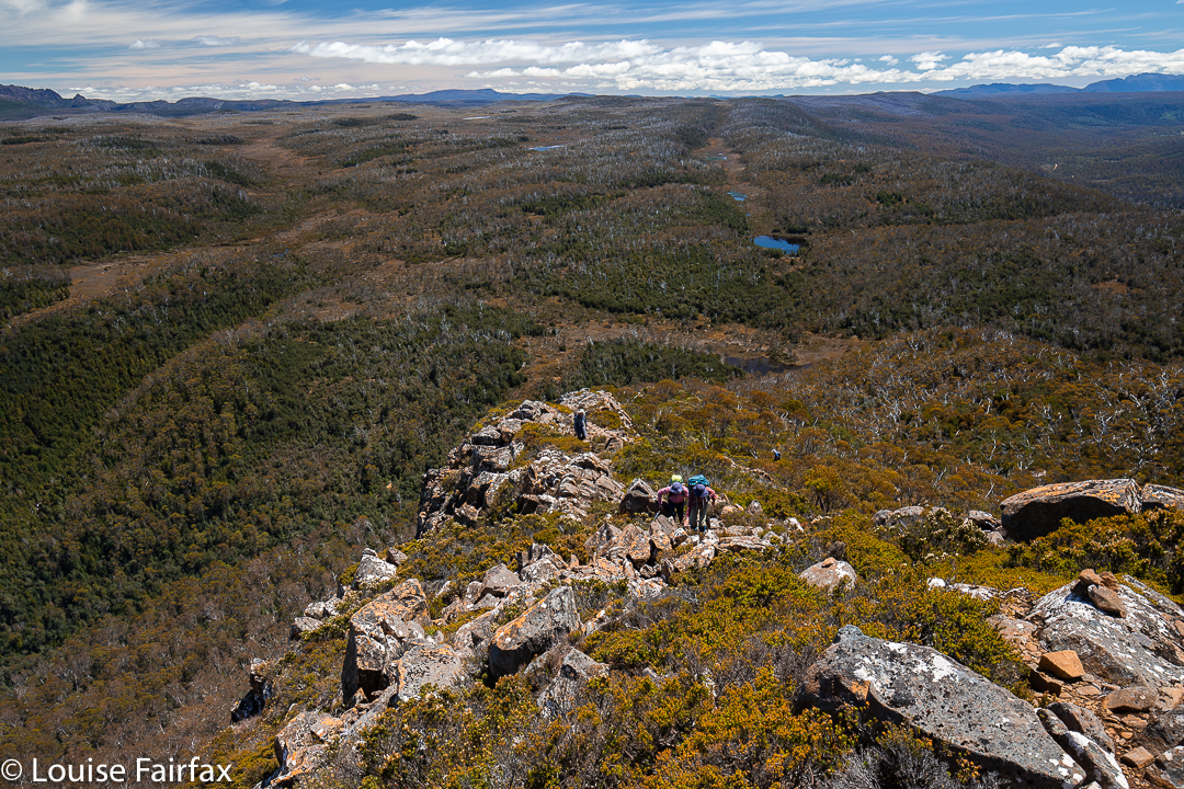
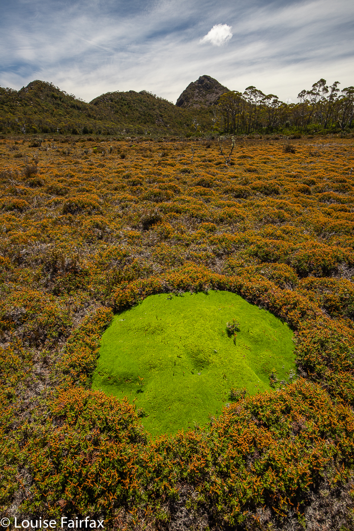
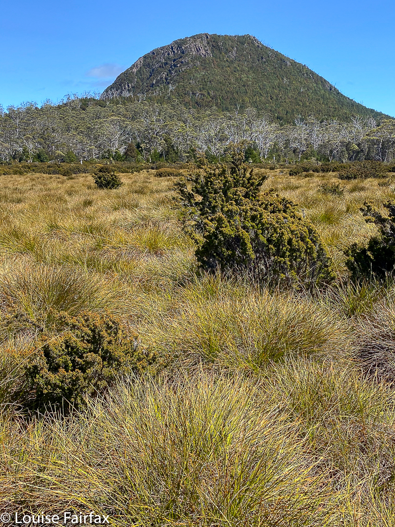
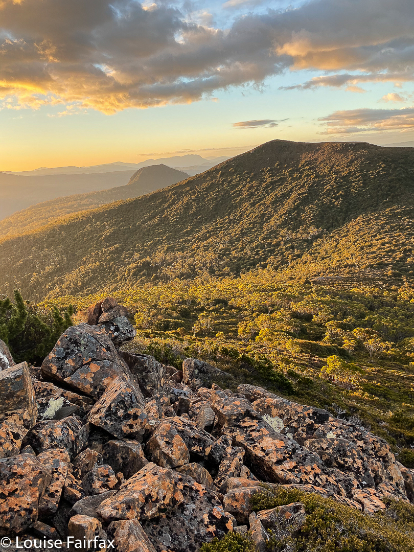
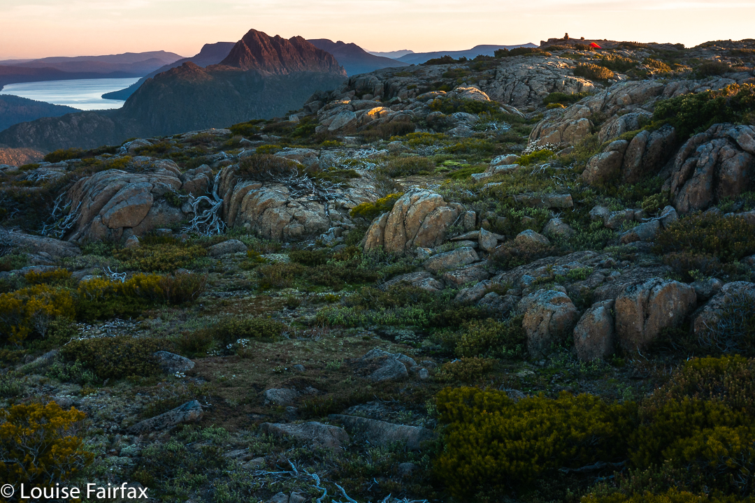
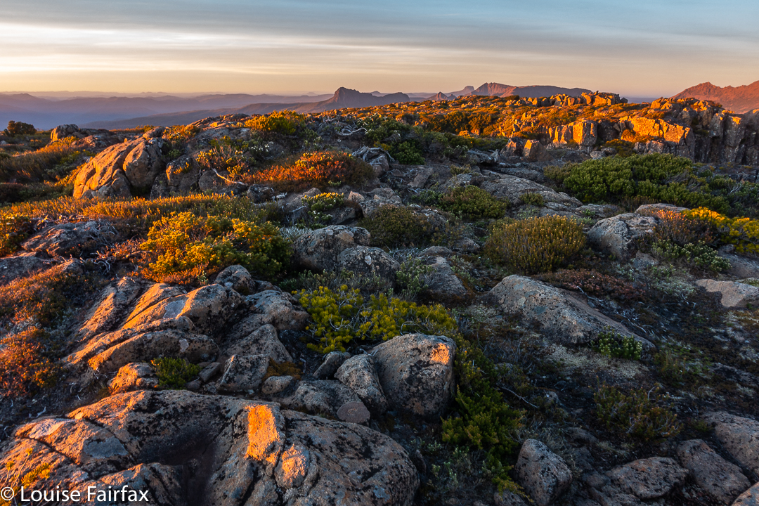
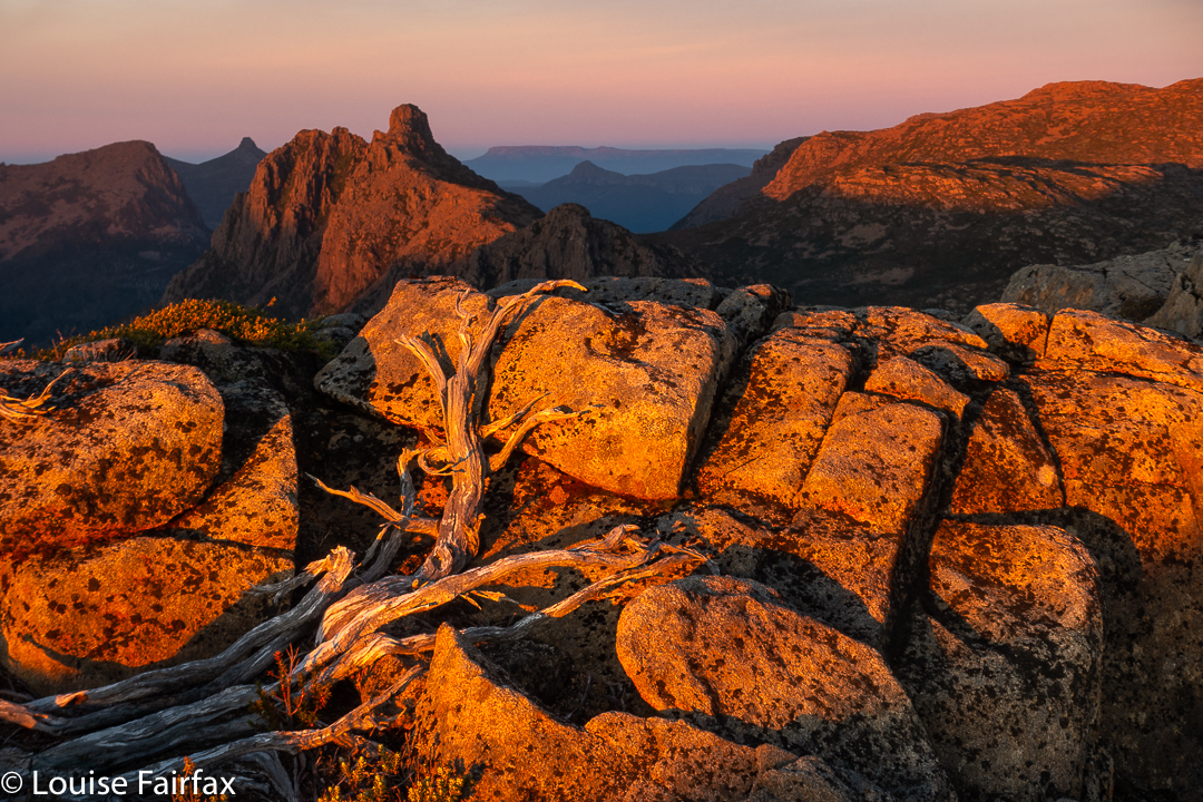
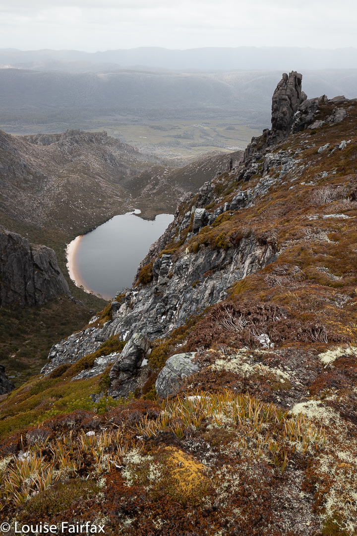
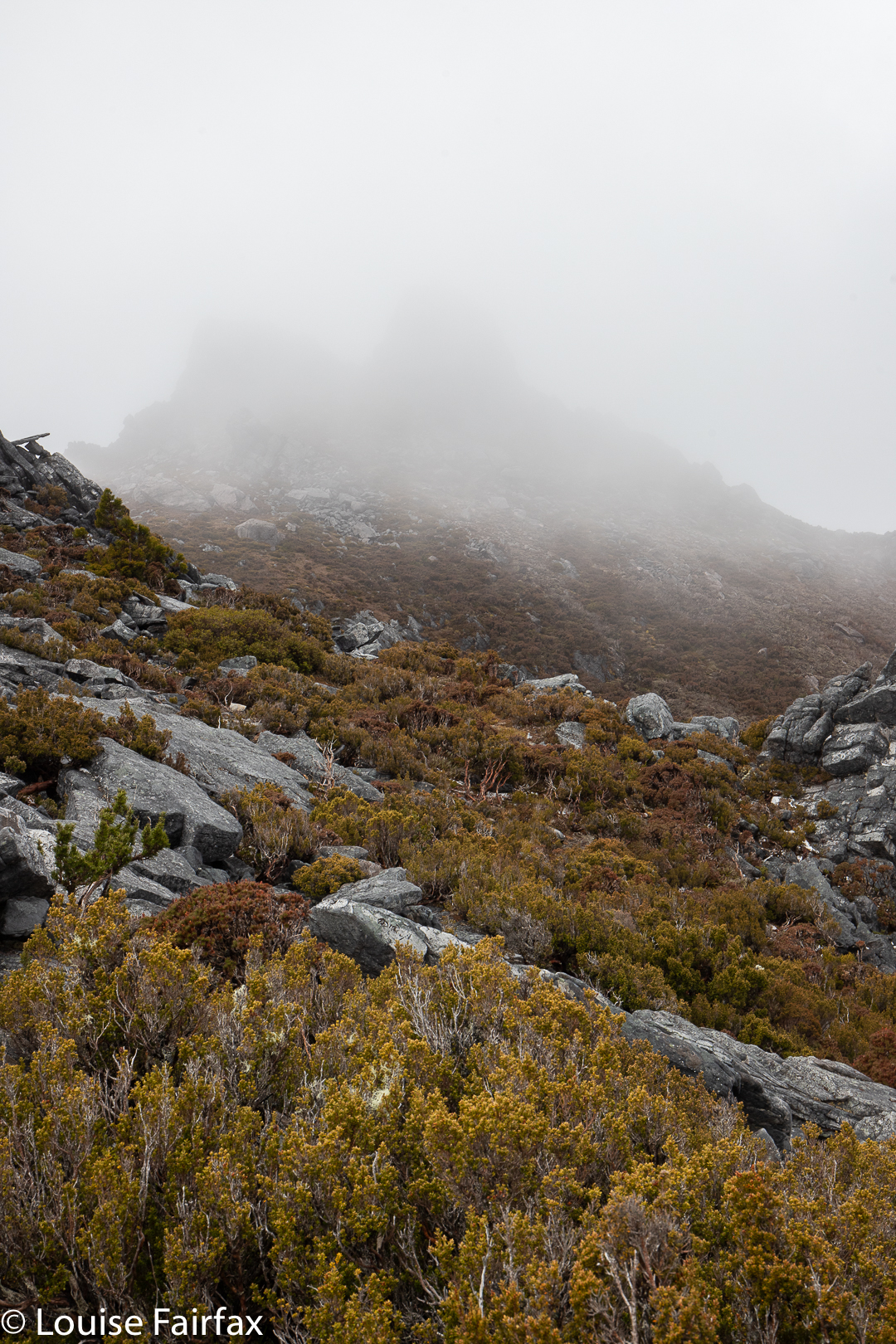
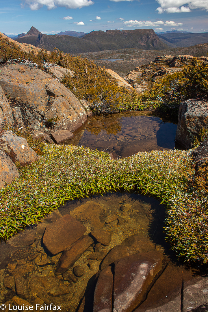
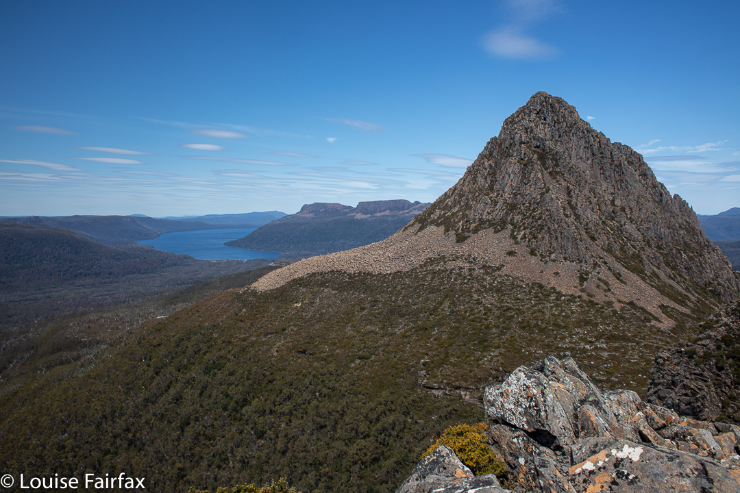
We saw two waterfalls, three wedge-tailed eagles (up very close; I think they liked my mauve parasol), several different kinds of fungi, masses of wildflowers, the view from the summit of Pillinger, several groves of magnificent Pencil Pines (Athrotaxis cupressoides), vast areas of bouncy and colourful sphagnum moss, a few wilderness valleys that we had not previously explored, and a new lake (Lake McCoy).
Arm R Tributary A Falls
This circuit can be done with equal enjoyment, I would think, either clockwise or anti-; we chose anti-.
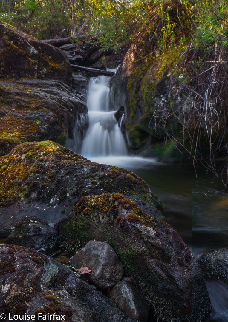
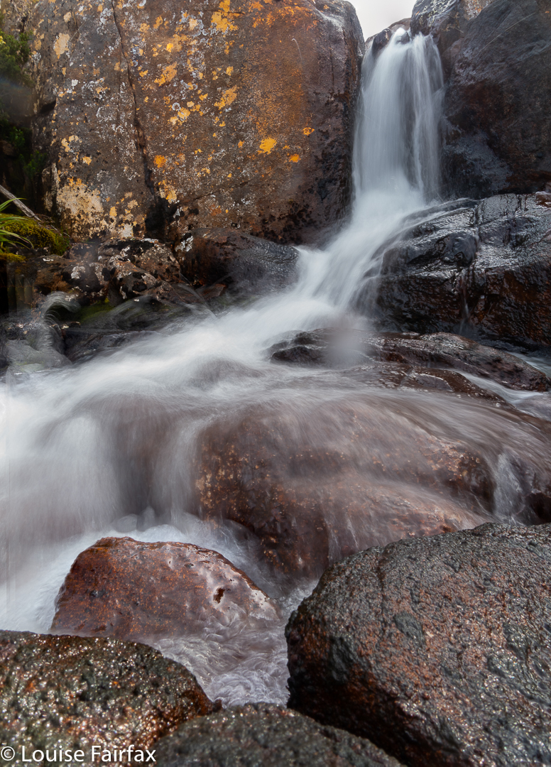
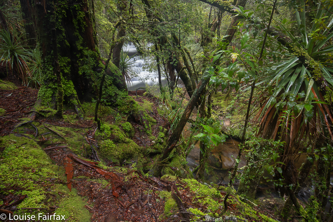
We parked our cars at the end of the Magges Spur 17 road, and set out down the pretty clear track. After only seven minutes, the track (which ultimately leads to Mt Pillinger or to the Arm River main track, or to any number of other enticing locations) crosses the first of many unnamed Arm R tributaries. As they are nameless, I have just called the first one A, and the second B. The third creek, which we didn’t cross on this route, bears the actual name Arm R; the fourth and fifth are even further west again, and are also unnamed. Tributary A has a pretty little waterfall, shown above.
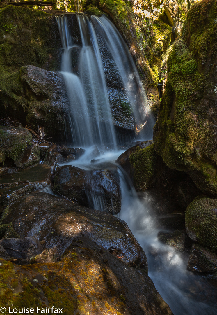
The second creek we crossed, I have with enormous imagination called Arm R Tributary B, also contains a waterfall worth photographing (see below). We were not getting anywhere fast, but that was never the purpose of the day.
Arm R Tributary B Falls
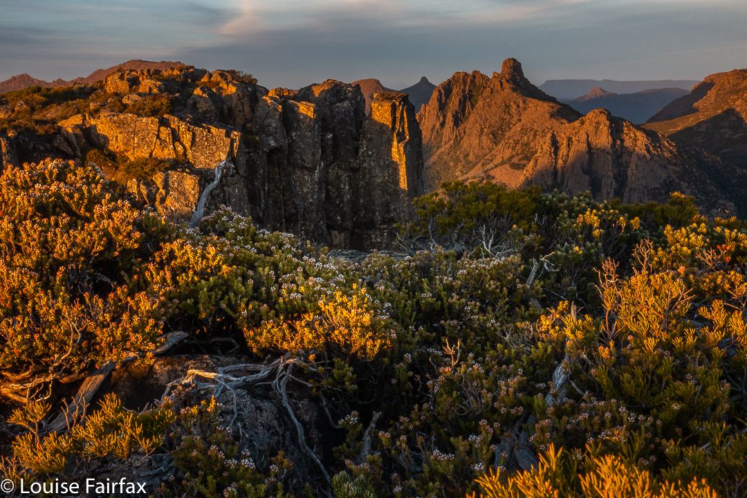
Once we had enjoyed the rainforest, fungi and waterfalls, we climbed slightly (often beside Trib B) out onto the plain that eventually passes under Mt Pillinger. This area has fabulous Pencil Pine groves.
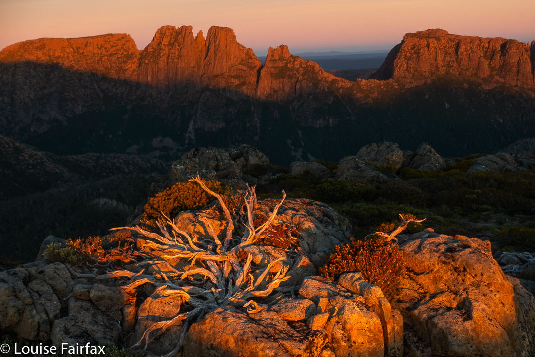
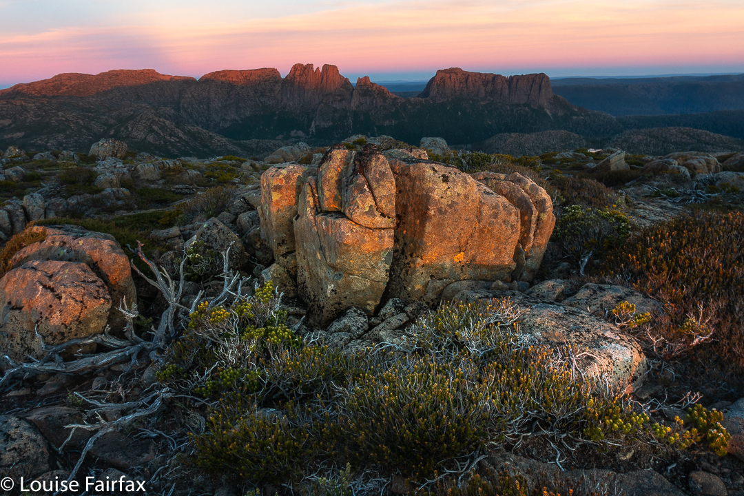
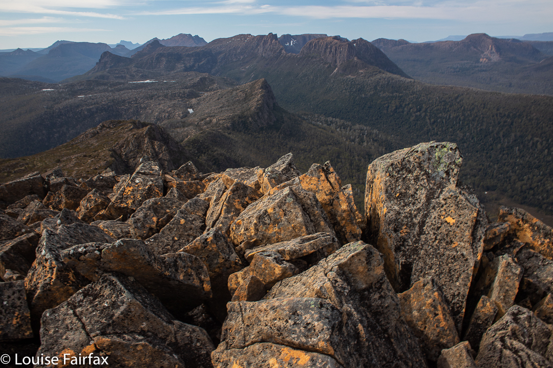
Arm R tributary scenery
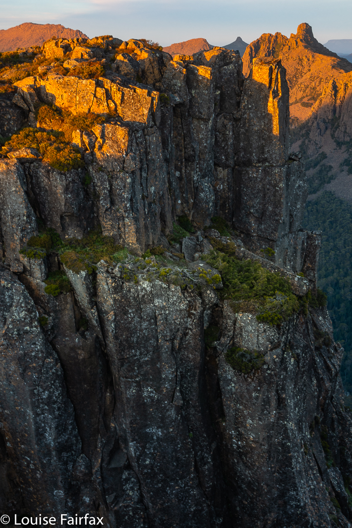
One follows Trib B westwards until there is a saddle so broad and flat that you need a map to tell you it is actually a saddle. Out the other side of the slight swamp and down imperceptibly, you briefly meet the actual Arm R before turning south and beginning the climb up the main Pillinger gully to a saddle before the summit. I have always fancied sleeping in this saddle, or even higher, as there are many flat, clear spots, but water would need to be carried from the tarns of the Arm R at the base if that is what you want to do.
Pencil Pine basePillinger summit
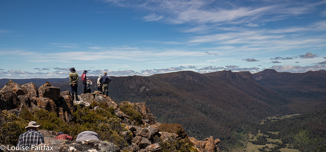
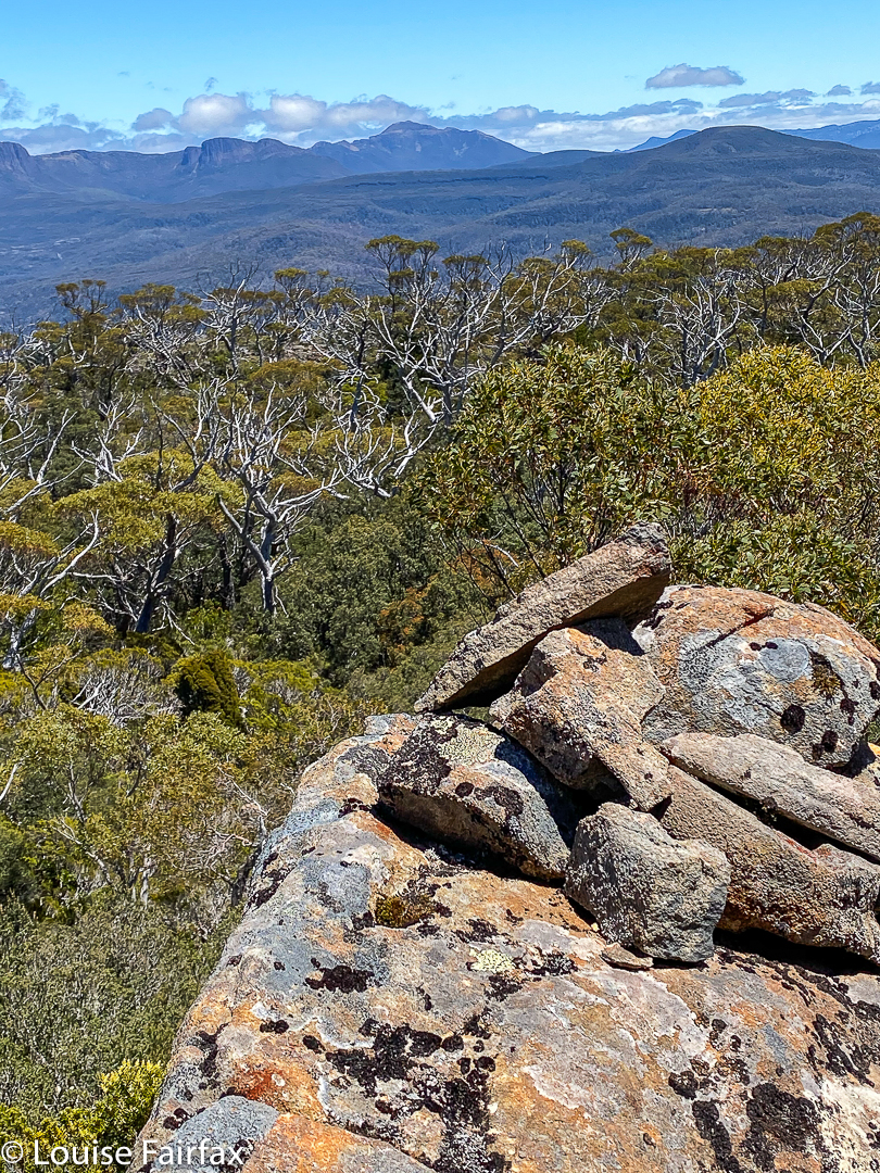
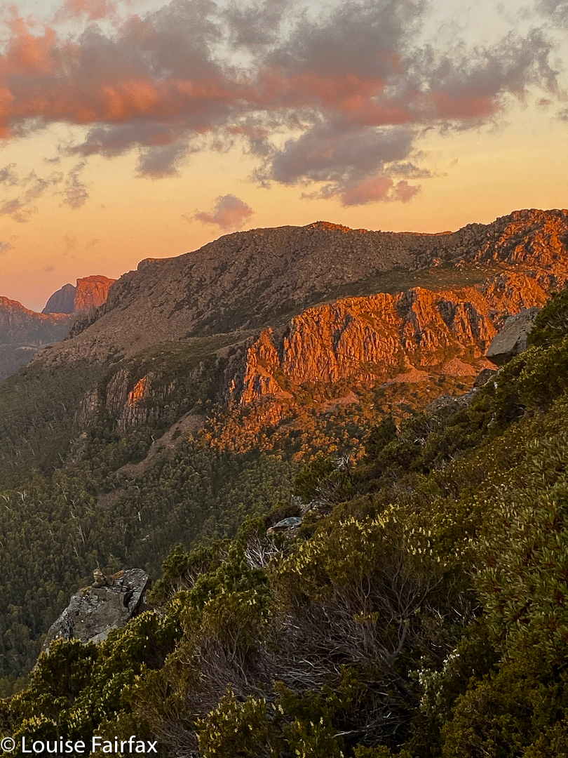
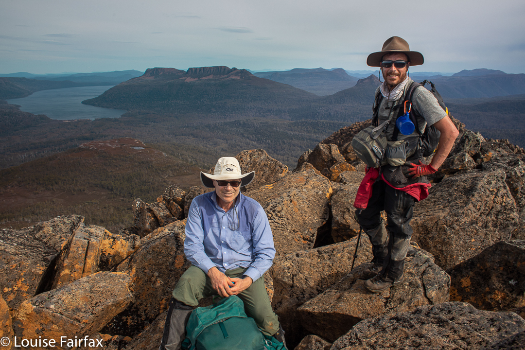
The view from the summit is pretty good, but I never actually enjoy summits in midday glare. The highlight up there for me was the appearance of three huge wedgies who kept circling us at close quarters. I take credit for this, as I’m sure it was the mauve parasol I was using to protect me from the sun that attracted their attention. Their eyes seemed quite focused on it, or so it seemed.
Pillinger summit
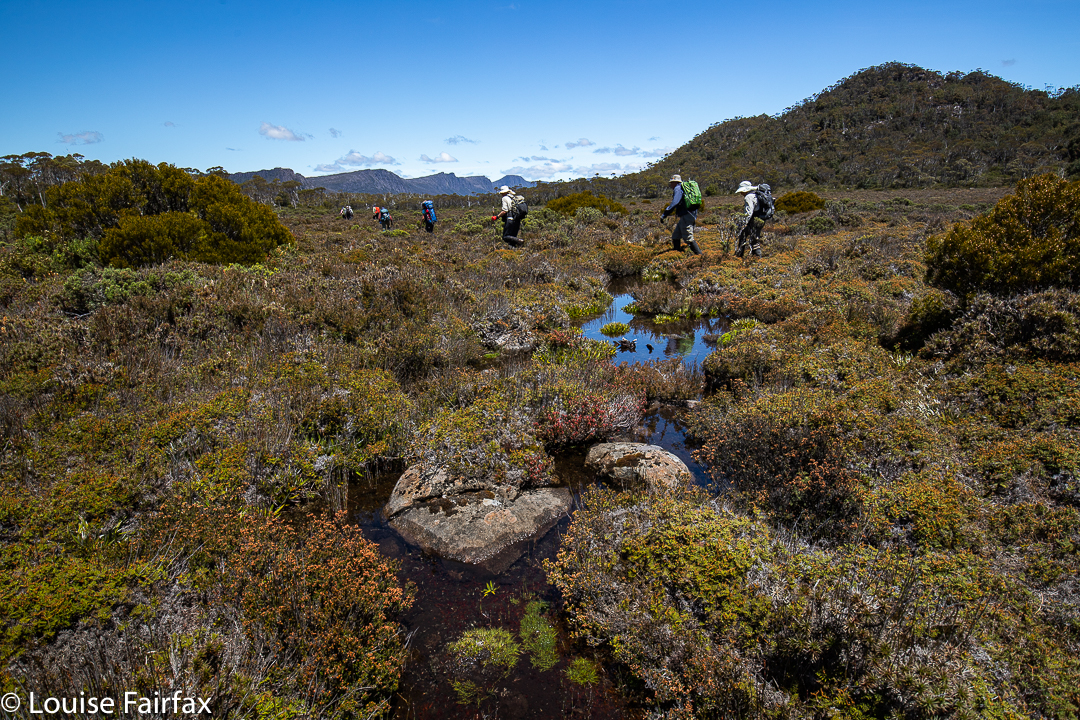
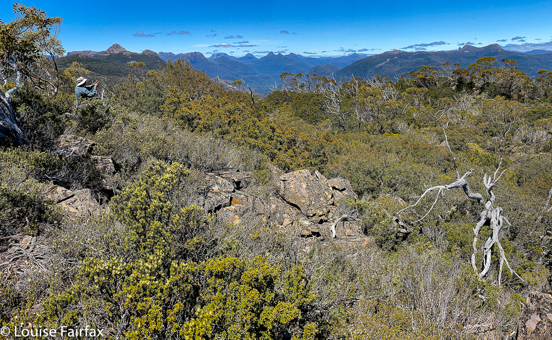
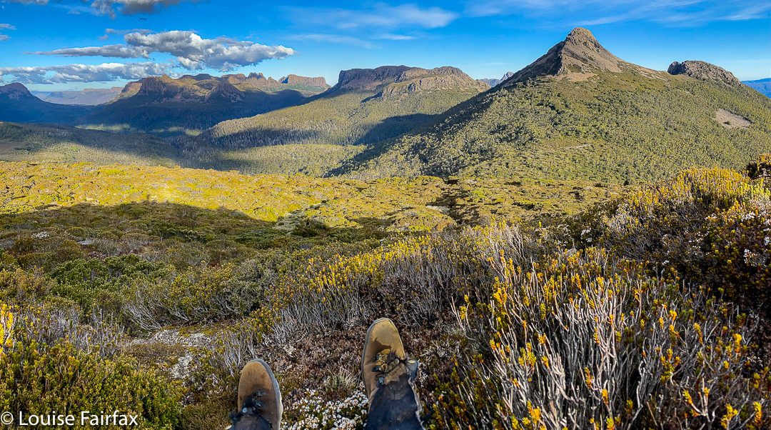
At last we were moving again, and this time, after the Pillinger saddle, in a different direction, south, to and then along a valley with calf-high alpine grass and colourful scoparia (nicely spaced, thanks), cushion plants, and a dainty creek with deep, clear water down the centre.
Along our second valleyCushion plant in the valley
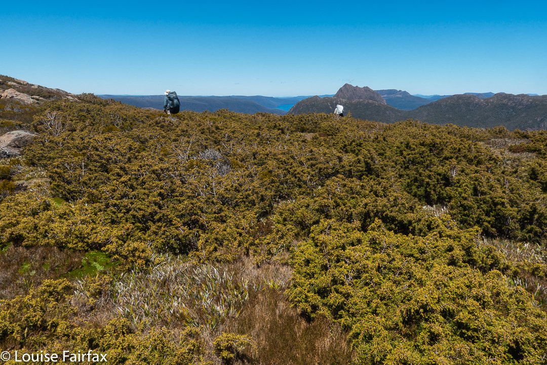
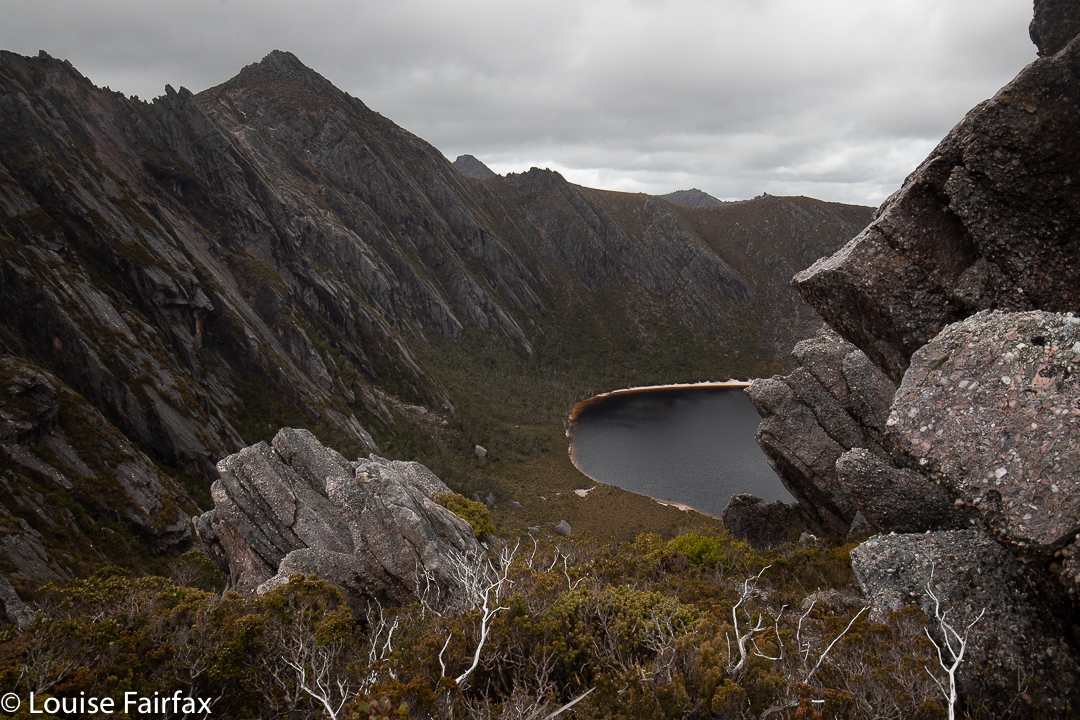
Our desired lake was to the east of where we were, so we had a couple of unpronounced spurs and appealing valleys to cross before we reached it.
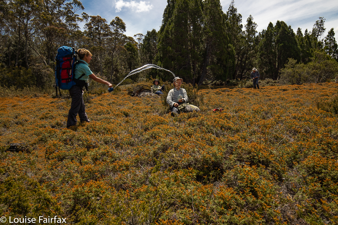
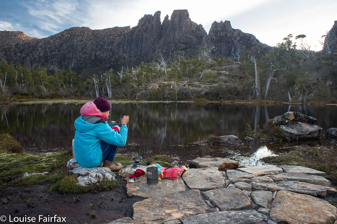
Cyttaria gunii in Pencil Pine forest near Lake McCoyThe day started at 4 degrees. It seems some of us thought it had warmed up enough in the early afternoon for a water fight.
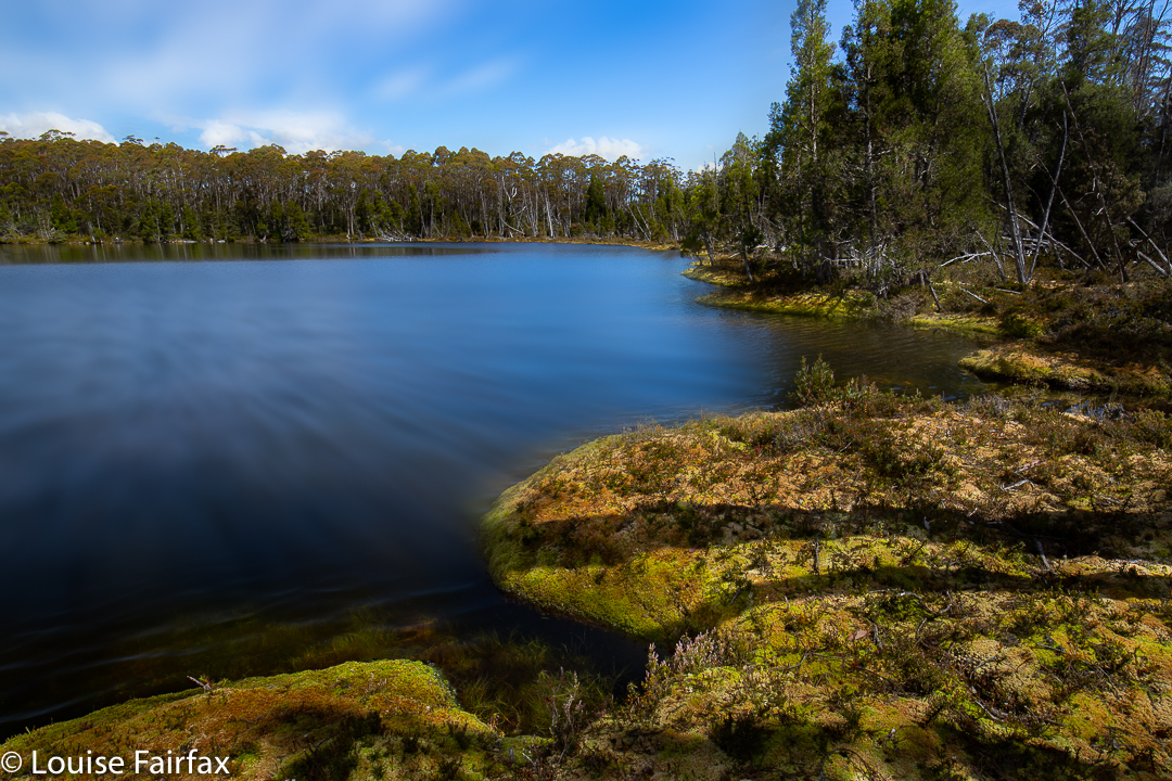
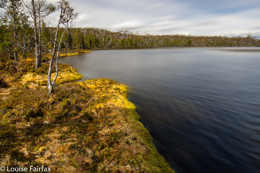
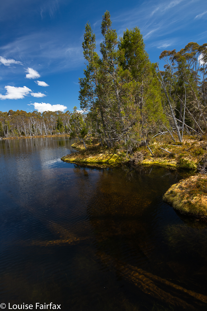
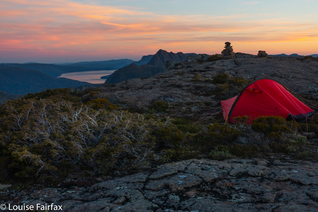
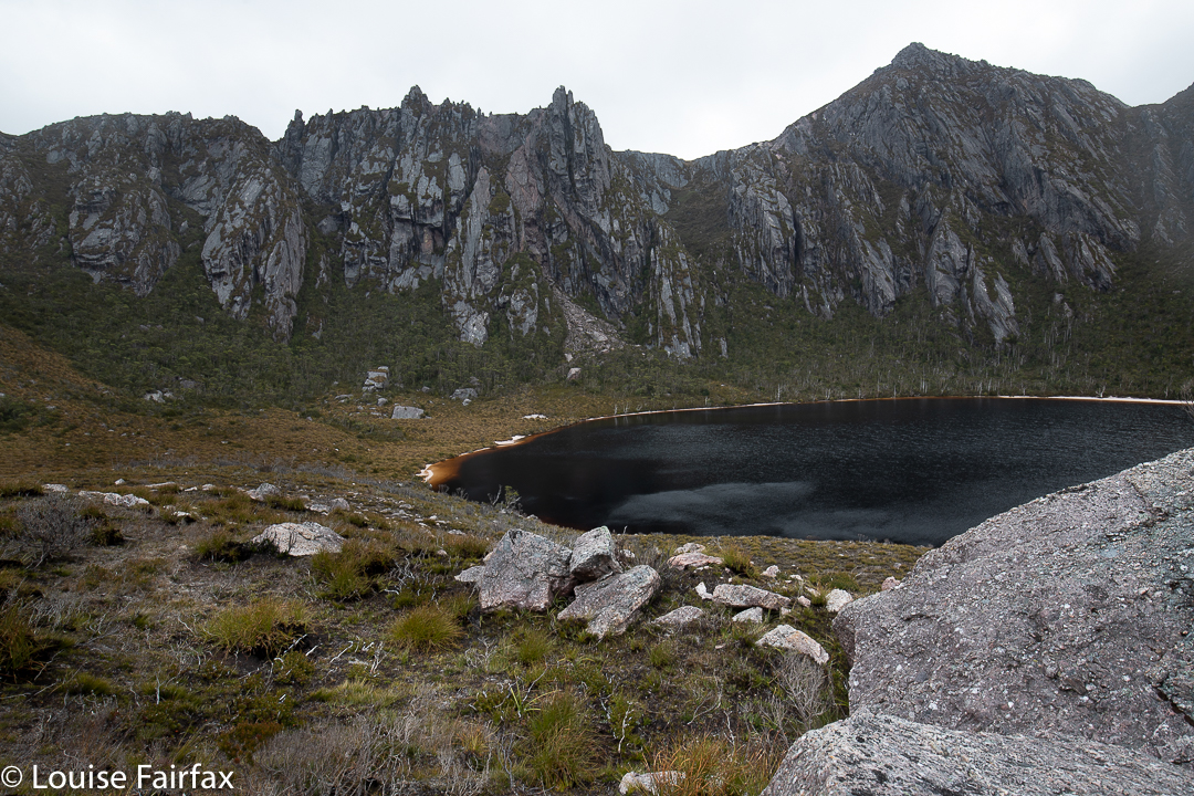
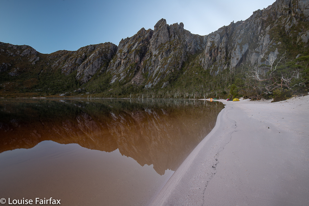
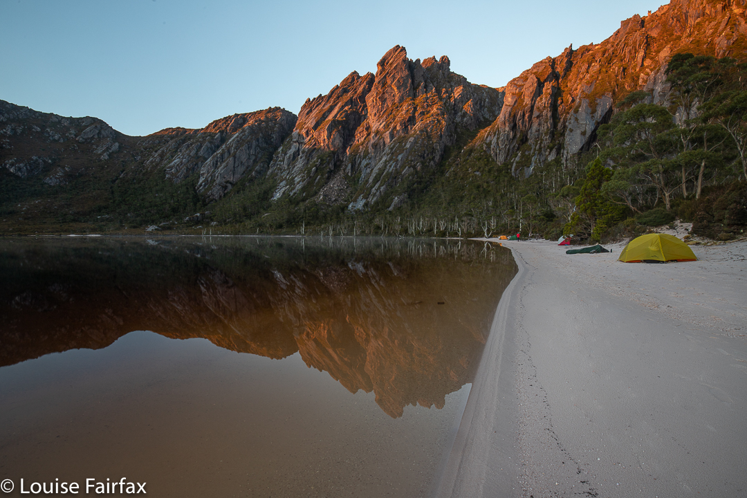
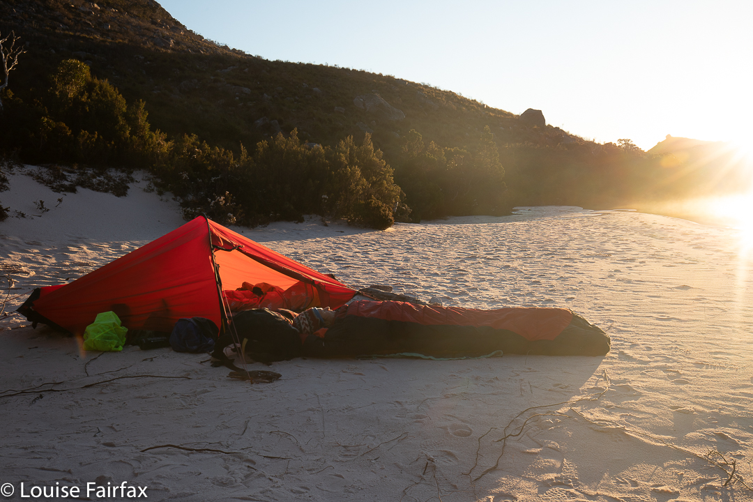
At last we reached our lake; time for another afternoon tea.
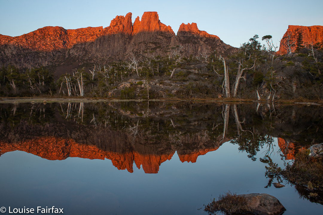
Lake McCoy
The stats are that we walked about 14 “horizontal” kilometres, climbed 382 metres, yielding 17.8 kilometre equivalents.
How our fates and destiny can change in the twinkling of an eye!
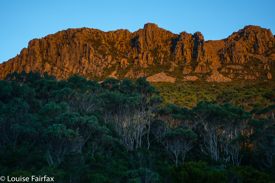
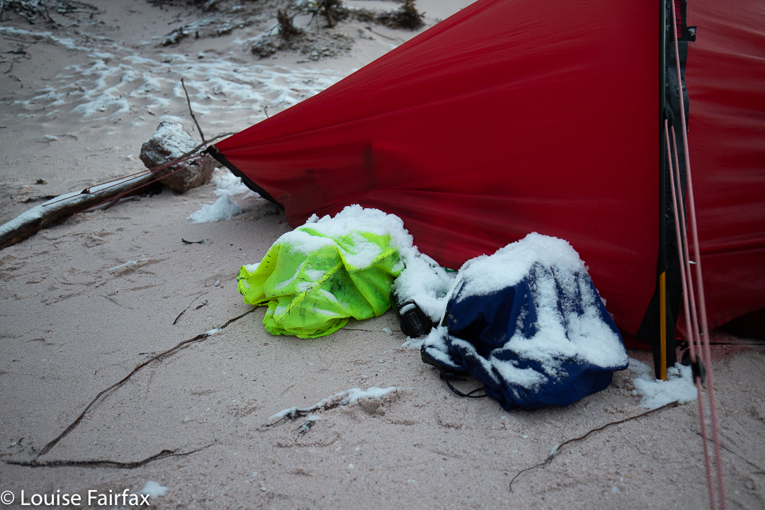
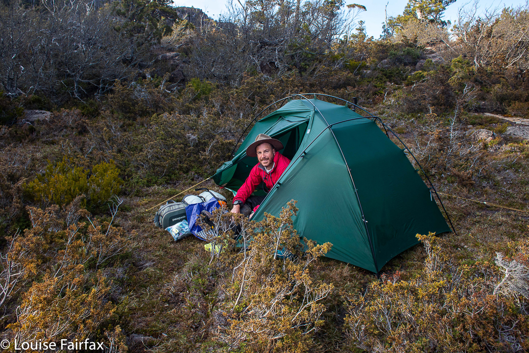
It had been snowing all night and morning (yes; this is Tasmania; yes, it is December. The snow had not been forecast). This was not the weather in which to climb something as hard as Nereus, so, sadly, we had cancelled our plans and formulated new ones to fill the five days we had allocated to this climb. I didn’t like plans B, C or D, so thought I might as well go home. I suggested we have an early lunch before we all packed up and headed back down the valley. (I am happy that my reliance on food is a contributing factor to the final success of our mission).
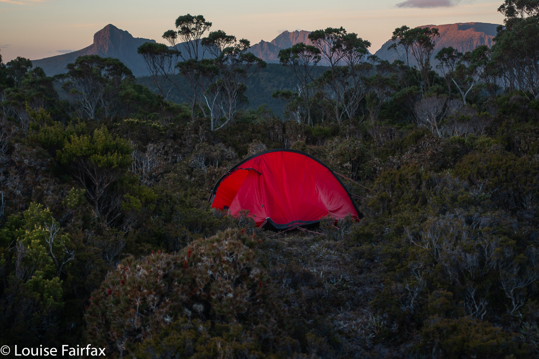
Nereus day 2. Tent in the snow.
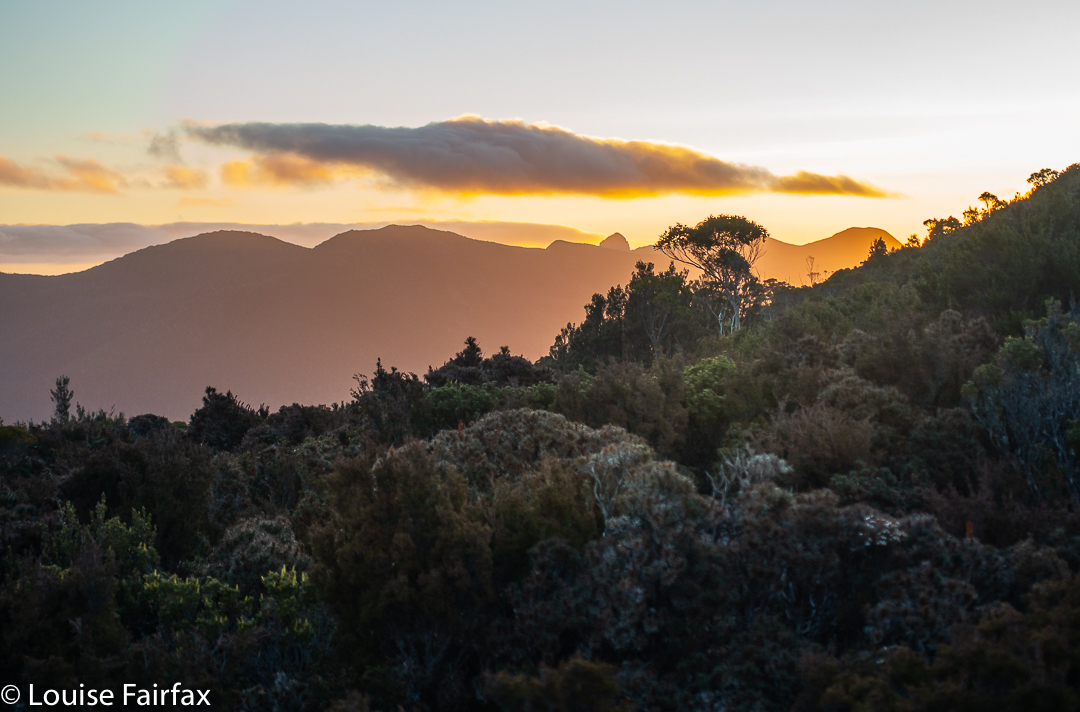
We were packed. Rucksack on, I took a few steps in the homewards direction, but Andrew was fighting his Aarn pack’s front panniers, so didn’t immediately tuck in behind me. In the waiting time, Geoff said to me: “You know, those clouds are lifting a bit. If we got as far as the Mac’s saddle tonight and popped in a sixteen hour day tomorrow, we could still get that summit.”
Nereus Day 2 Richea pandanifolia
This seemed a much better use of time that going home. At least we’d have tried to do it and maybe failed. Walking out wasn’t even a try. “I’m happy to give it a crack”, I said. Andrew looked up from his wrestles and added his assent to the mission. I did a volte face and all of a sudden we were heading up the mountain, not down, and towards our goal, not away from it. Just like that.
Nereus Day 2 Telopea truncata
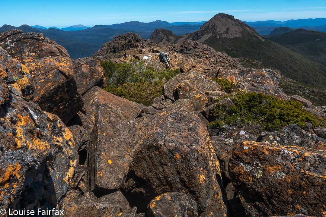
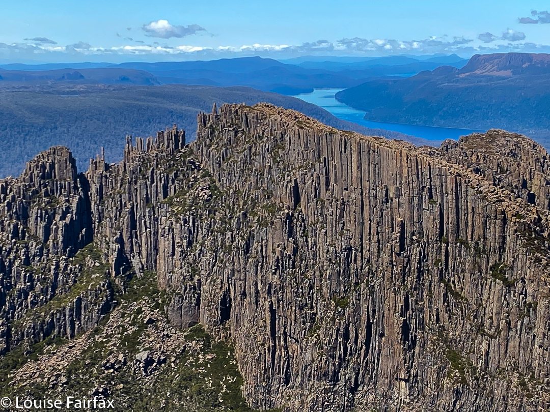
To climb Nereus, you have to go over Walled Mountain (five or so hours from the ferry terminal), nearly over Macs (the next mountain along that range), over Urquarts Messa (1272 ms high, so not entirely insignificant), down its cliffs at the halfway mark, along another ridge and then find a way up through the cliffs to Nereus with its unwelcoming palisade, not only of vertical, almost chuteless cliffs, but also of more scratchy scrub on top, climbing into trees until you finally make the summit. It is not a mountain that welcomes strangers (or even good friends), with its repulsion via cliffs and prickles being matched by its aloofness of distance from any possible source of water (and from any possible starting point). There is no quick route to this mountain. But I like that. I like challenges. I would be bored if it were easy. I don’t want life ‘easied’ up and dumbed down.
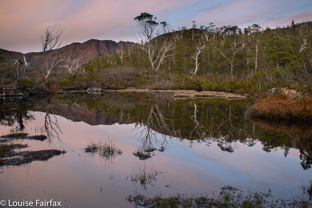
Nereus trip day 2. Sunset from Macs saddle
When you mention the name “Nereus”, those in the know regale you with horror stories of failure: of being repelled by strong winds, falling rocks, accidents, driving rain, deep snow or heat exhaustion and dry, waterless ground. Everybody knows a longish list of people who have been benighted out there, who have been delirious with dehydration, exhausted with all the bushbashing, or just something mild like looking like a pin cushion covered in scoparia jab wounds. Some just sigh, and tell you they’ve had three failed attempts, or five or seven … whatever.
Anyway, we were doing fine, and had made it to the Macs saddle with oodles of time. There is actually not a lot to do in this saddle once you’ve put up your tent. It’s not exactly inviting to go for a stroll – not without armour on and a machete to make life bearable. I looked at my watch and wandered just how early you could eat and legitimately call it dinner.
Nereus trip day 2. Sunset from Macs saddle
We killed some time with careful packing for the morrow: extra clothes and a bivvy bag in case we, too, got benighted; head torches for finishing after dark; stashes of food to fund such an extreme amount of exercise; and three litres of water to guard against dehydration.
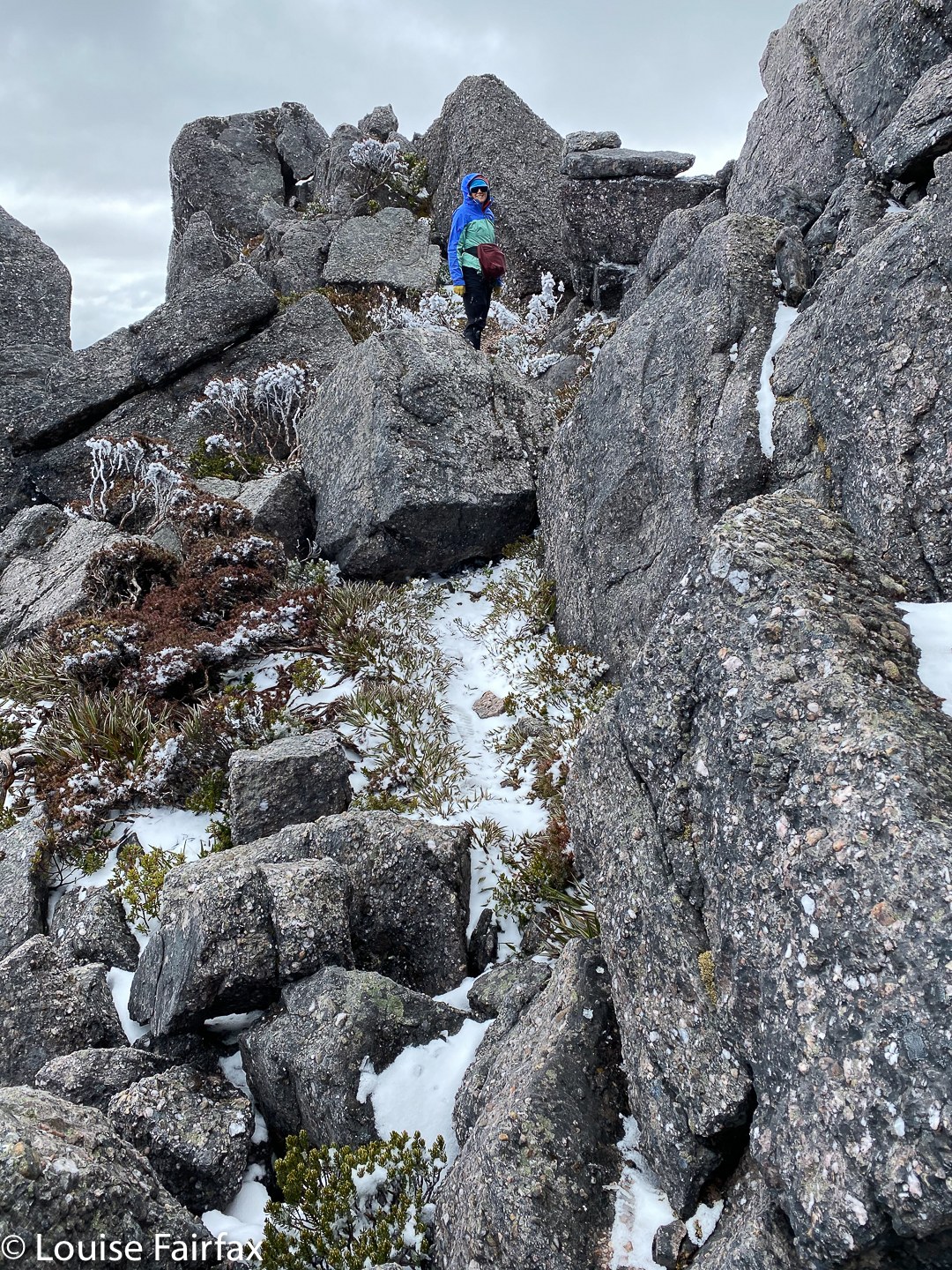
I set my alarm for 4.55 a.m. In the gloaming we threw down breakfast, and while I did so, I fretted about the first section of the climb. When I had gone out to call Geoff, I noticed that my tent was covered in a carapace of pure white ice crystals. This was very attractive, but could mean that our first task after a bit of a climb – viz., working our way along a lengthy band of microwave-sized rocks that decorate the bulging belly of Macs Mountain – could be slippery and a bit dangerous, and thus slow us down. Would that consume so much time that our task became impossible?
Luckily, they weren’t too bad, and we made pretty good time to Urquarts saddle.
Nereus trip day 2. Sunset from Macs saddle
I had found a good lead on my previous visit to this area, so lead us up this slope. However, in the three years since I had last been there, the vigorous scoparia had claimed much extra territory, and the going was disappointingly slower than last time. I felt I had failed us somewhat.
From near the top of Urquarts, Geoff took over to lead us down the thick, resisting slope (cursing it at times) leading to a more open, flatter area at its base above a line of cliffs. In the distance, urging us through this junk, we could spot a patch of shine which we believed to be a small tarn. We didn’t need water, having brought heaps, but it was still nice to have it as a goal, and to eventually pause by its freshness in this mass of scrub. That flat part was some of the easiest walking of the day and a welcome respite. And then it was Andrew’s turn to lead the push and shove until we reached the button grass section. Now our goal was very visible. We were definitely going to reach it.
Mt Nereus: getting nearer
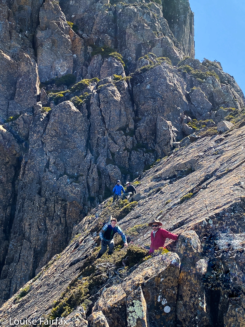
The buttongrass was, well, buttongrassish, with all the usual mud channels and small hillocks to negotiate, lifting legs high to avoid obstacles. This ceded to the worst crap of the day – a horrid marshy bit with cutting grass over our heads, zero visibility, and melaleucas that resisted my most earnest attempts at shoving them sideways. It was, unfortunately, my turn to lead, and I was not going well through this wall. Behind, Geoff was reading a line off a garmin screen and calling out “left”, or “right” according to the screen’s line. I had no goal, no visibility, no sense of any big picture or shape of the land (I could see absolutely nothing). In frustration, I stopped and got out my map. AH. There was different vegetation to the north, mapped as a darker green, which suggested to me, rainforest. I said I was taking us over there, and to my relief I discovered a wonderful area of rainforest, and got permission to actually navigate using the land and the map rather than a line on a screen. My route took us to the ridge leading eventually to the summit. The ridge was cluttered with many obstacles, but still not as difficult as the dry sclerophyll forest had been. I wanted to attack from the north, actually, but was outvoted (the screen route did not go that way), so we continued up this line until we reached impenetrable cliffs.
Nereus summit cairn
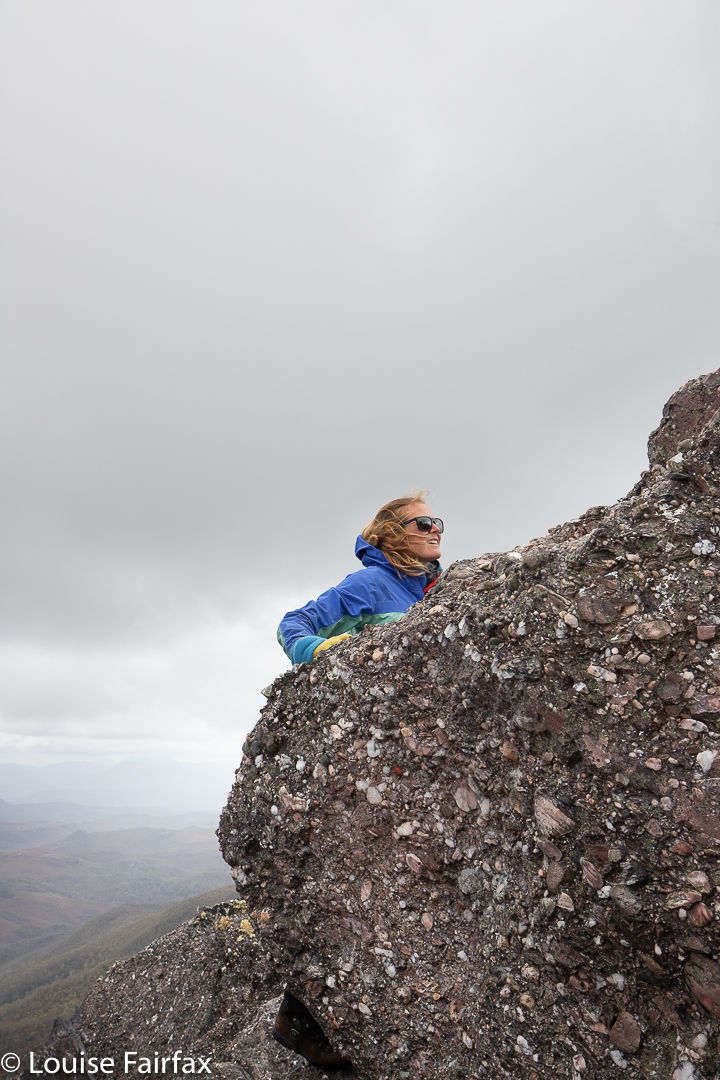
We lost quite a bit of time trying possible chutes that each ended up too difficult to use. We eventually got up, but were not impressed by the paucity of holds and the general drop below us, which is kind of good, as after we had reached the summit, I was allowed to use the northern route I had wanted all along to lead us out and back … but first, it was time to enjoy our hard-earned views and to dine on the summit.
Photographing near the summit
Was it really true that we were there, by the seemingly unreachable summit cairn? That we had summited the Inhospitable One, das Ungastfreundliche and repulser of all who seek its secrets. We sat by the unprepossessing cairn and, while we ate, enjoyed the unique views that none of us intended returning to ever see again. Did I feel victorious? Not really. Elated? No, not that either. I guess, more than anything, I was relieved, and each of us was very aware that we still had to get back. We joked, as people in this situation often do, that a heli ride home would be nice, but the reality was that we had taken 7.5 hours to get there (5.75 walking; 7.5 elapsed), and the homeward “half” would be the tough portion of our lot. Would we, like so many other accomplished bushwalkers, be benighted?
Views half way back
Time to begin to find out. I led us out by the northern route, as said above, through beautiful rainforest. I told the others my route would be longer than a straight line, but easier, as it would be through nicer terrain, and, dreading a meeting with the marsh or exhausting buttongrass, they agreed to my adding distance. It was lovely, and I landed us at the point where we had had a break on the outward journey, just below the nasty scrubby climb up to Urquarts Messa. I was pleased to have gained us some time, as this was much faster than in the opposite direction, and almost everything from here on would necessarily be slower … and tougher. Gulp.
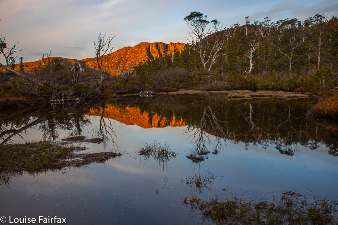
Time for a break to enjoy sunset: Day 3
Another of sunset Day 3, mission accomplished
Geoff took over the lead. This was a really nasty bit – uphill, thick, resisting … TOUGH. It was hard work for all, but hardest for Geoff in the lead, bashing down the scrub as first strike, having to use his brain as well as his legs, while we behind could rest (relatively speaking) on his laurels. After the respite at the little tarn after the cliffs, it was Andrew’s turn to fight the uphill battle and punch some kind of hole in the scrub. We were tiring, but the scrub was not one patch exhausted, and continued to offer strong resistance in the skirmish.
Nereus trip. Rocks Day 4
But somehow, eventually, we landed on top of Urquarts Messa, and had a pretty quick slide down the other side. It was only late afternoon. We were definitely going to get back to camp. We rested a short while on a patch of bare rock before the last tough climb up to the rocks on Macs. This section had been quite quick with gravity to help us, but was anything but on the rebound. Meanwhile, I was dragging my feet. I thought I might be about to either vomit or faint or both. Andrew noticed and kindly offered to take on some of the weight of my pack. I said that wasn’t my problem. I felt I needed salt, but had none. He produced a gel with sodium that he insisted he didn’t need. Unbelievable. Even after the first mouthful, my stomach felt more settled. By the time I’d managed to get the lot down, I was back to bouncing vigour.
Underway Day 4Nereus trip. Sunset Day 4
Up the slope we continued until we reached the rocks that decorate the belly of Macs Mountain. By now, late afternoon had morphed into almost sunset, and the sky was taking on golden hues; the mountains becoming more mystical and hazy. It was beautiful. We were definitely going to make it to camp, so I asked if we could stop for ten or so to take in this beautiful sunset that was unfolding. What a wonderful vantage point. We sat and gazed as Walled went red; the clouds, pink. Everything was marvellous. When we started again, I felt as if I had drunk a draught of magical ambrosia. I glided over the next section of rocks, floating and upheld by beauty.
Nereus trip. Sunset Day 4
By the end of the rocks, darkness had gained its hold. The others got out their headtorches, but my night vision was fine, so I led us down through the last nasty patch of scrub until at last our campsite was gained. 10pm. Time for dinner!
The next day, for me, was very short, as I wanted to stay high, while the others wanted to retreat to the valley to be sure of making the 12.30 ferry in time on the morrow. I trusted myself to get from the summit to the ferry in time, and wanted to remain in the freedom and space of the truly wild high places, so we would part for a while after Walled, and meet at Narcissus Hut (hopefully) the following day.
Nereus trip. Sunset Day 4
And so, I spent the whole afternoon just wandering around the summit area, choosing my real estate for the night, poking my nose into various crannies and getting to know this beautiful part of nature at an intimate level. It was pretty breezy, but not too bad. I felt delightfully expansive up there; somehow my being extended to the vast realms around me and I was part of the wider universe. Nothing closed me in.
At last sunset came, and with it, stronger winds. I consulted my weather app. It said winds to 55 km/hr. That was OK. I went off to enjoy the colours and feel of the close of day.
Nereus trip. Sunset Day 4
My app seems to have got it wrong. Maybe 55km/hr was a kind of gentle base from which gusts of maybe 100 km/hr would then burst. The gusts became more frequent and fiercer as the night progressed. Sleeping was impossible with the noise of howling and the relentless bashing and cracking of the fabric as the wind whipped it. By 12.10, it was necessary (possibly not, but it felt reassuring to do this) to lie on my back with my feet in the air adding force and stability to my central pole … just in case. I did that until 3.10. While I did so, I thought about the storm scene in Goethe’s Die Leiden des jungen Werther, where Werther and Lotte, the two central characters, go out onto a balcony to revel in the wild fury of the storm, musing together on the wonders of the poet Ossian, who also loved a lashing storm and embraced rather than recoiled from a tempest.
Nereus trip. Sunset Day 4
I thought of a more modern hero, Robert Macfarlane, author of The Wild Places, labouring up a snowy ridge of England’s Lake District in a nighttime blizzard, in a desperate attempt to try to find wild places in his over-tamed country. And I thought about a favourite philosopher, Immanuel Kant and his treatise of 1764: Beobachtungen über das Gefühl des Schönen und Erhabenen (or Observations about the feeling of the beautiful and sublime). Kant postulates that when we go to the very edge of our fears and then retreat to safety, the process of fear followed by relief engenders a feeling of the sublime, which he relates to awe, terror, majesty and eternity.
Nereus trip. Sunset Day 4
Experiencing the sublime is important to my well being. I was at the far edge, -but not over – my fears as I pondered these matters. If we never approach the edge of our comfort zone, we do not experience the fulness of life. In the words of The Rose (which members of the Pandani club and I sang while we searched for my missing husband, and which we later sang at Bruce’s memorial service):
It’s the heart afraid of breaking That never learns to dance; It’s the dream afraid of waking That never takes the chance; It’s the one who won’t be taken Who cannot seem to give; And the soul, afraid of dying
That never learns to live.
Nereus trip. Sunset Day 4
Soma tablets, eat your heart out.
I don’t sing very well lying on my back, so I just thought the words, and especially the final two lines. When the greatest endurance athlete ever, Kilian Jornet, was asked why on earth he would run up and down the Matterhorn at such dangerous speeds (smashing the world record by over 15 minutes), he replied that he felt terribly alive when he did such things, pushing himself to the very edge of safety.
Nereus trip. Dawn Day 5
Well, with all that thinking and pole propping, I was pretty exhausted, and decided I needed to trust my excellent Hilleberg and lie down properly. As it was now 3.10, I noted as I lay my head on my clothes that my alarm for the dawn would go off in two hours. The next thing I knew was the sound of that alarm. At last I had fallen asleep.
Nereus trip. Dawn Day 5
I arose to welcome the day and to delight in the dawn colours and shapes, and later to enjoy breakfast on high, even though the wind was still pretty strong (my app said now 50 kms/hr).
Nereus trip. Dawn Day 5
It was a challenge later to manage to pack up my tent which bucked and kicked like a bull at a rodeo, but I managed, and slowly and reluctantly turned my face to the valley below and my journey back to “civilisation”.
Tree art. Labyrinth
(I made the 12.30 ferry with plenty of time, and was reunited with my two scrub buddies, without whom I would never have had the strength to get near the summit, so we could celebrate with a burger with the lot at The Hungry Wombat – a kind of bushwalkers’ ritual. This time it was not just a celebration of a single mountain, Nereus, but also of the fact that Geoff had now climbed all the Abels. What a one to leave until last!).
Oh. I nearly forgot to mention: on the way back to Narcissus, I took time to visit a waterfall I had heard about, issuing out of Lake Cyane, so I have called it here the Cyane Falls. They were worth the stop. Their context, with the Guardians in the downflow direction, and the Acropolis behind their head, was wonderful.
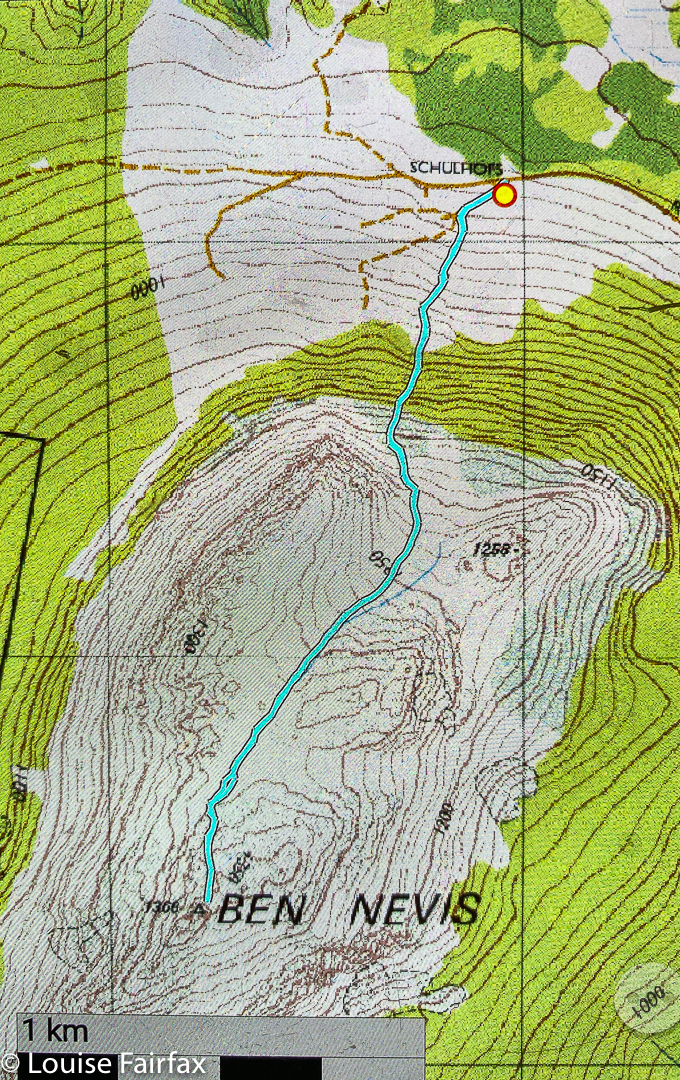
The last time I climbed Ben Nevis, it was in June (2013), and my report was pretty negative, as the memory of all the prickles we had to fight to get there dominated my thinking.
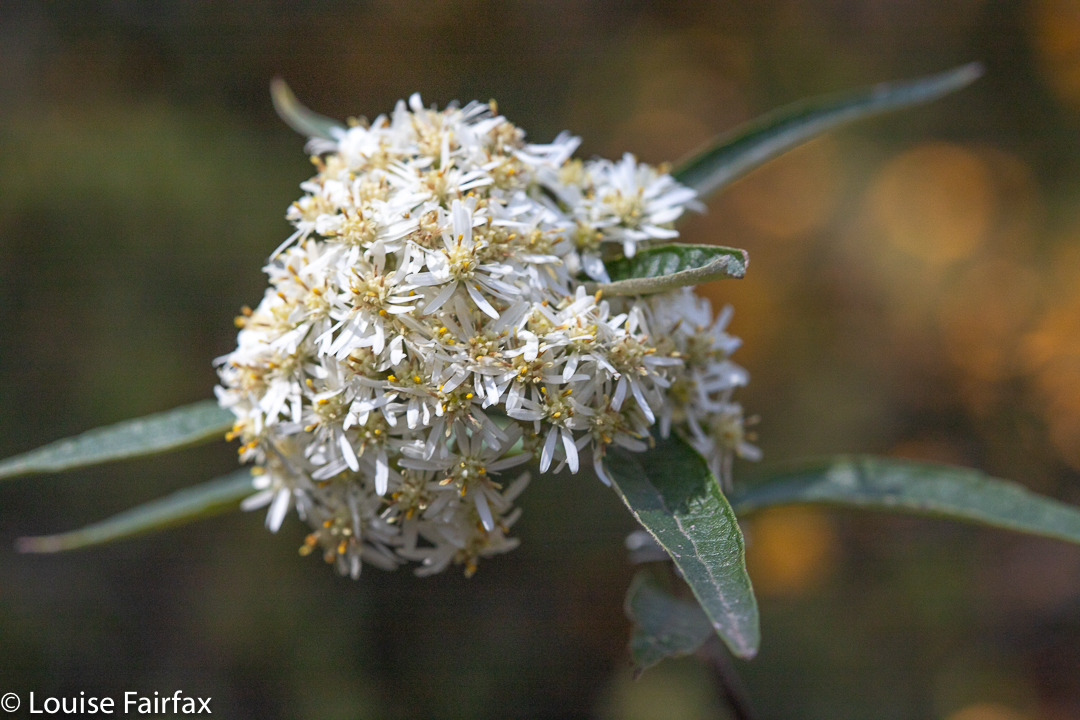
Olearia lirata Ben Nevis. This was one of three varieties of Olearia we saw this day. Down near where we parked, the tall, tree form, Olearia argophylla, filled the moist valleys. Up in the alpine zone, we encountered Olearia ledifolia. All have white daisies.
This year, my feelings are entirely different. It was December, and an abundance of colourful wildflowers decked our way: reds and yellows and creams and whites. The bush was a mass of waving colour. The temperature was quite possibly the same as in that June, as there had been snow down to 800 ms overnight, and the wind was strong and felt like it was straight off the snow. I had already seen a lovely photo of white Mt Wellington that morning.
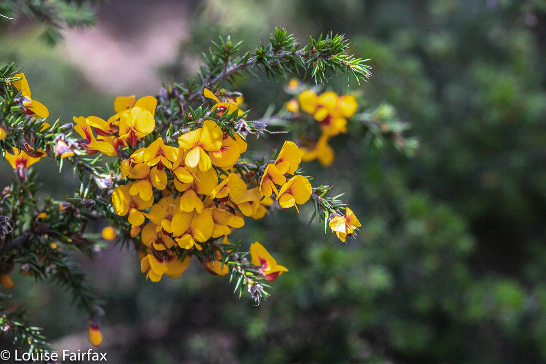
Pultenaea juniperina. The lower, drier section of the walk was a mass of yellow and white, the yellow being provided by this plant here.
However, although the wind was strong, we managed to find sheltered spots for a snack and then lunch, and enjoyed the views.
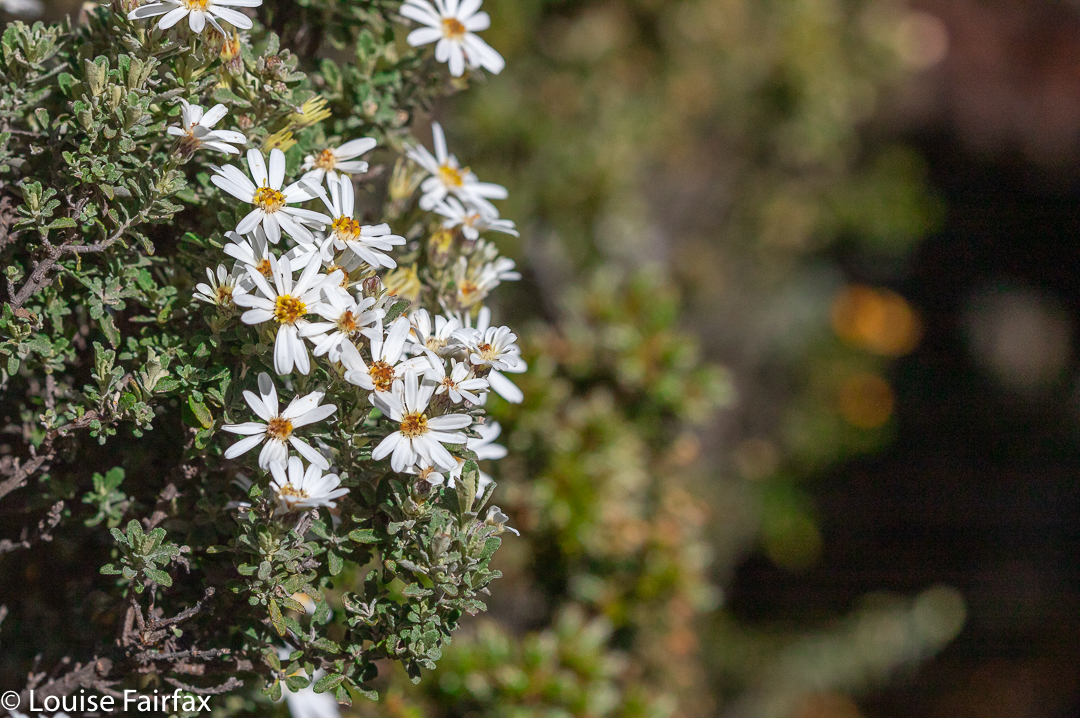
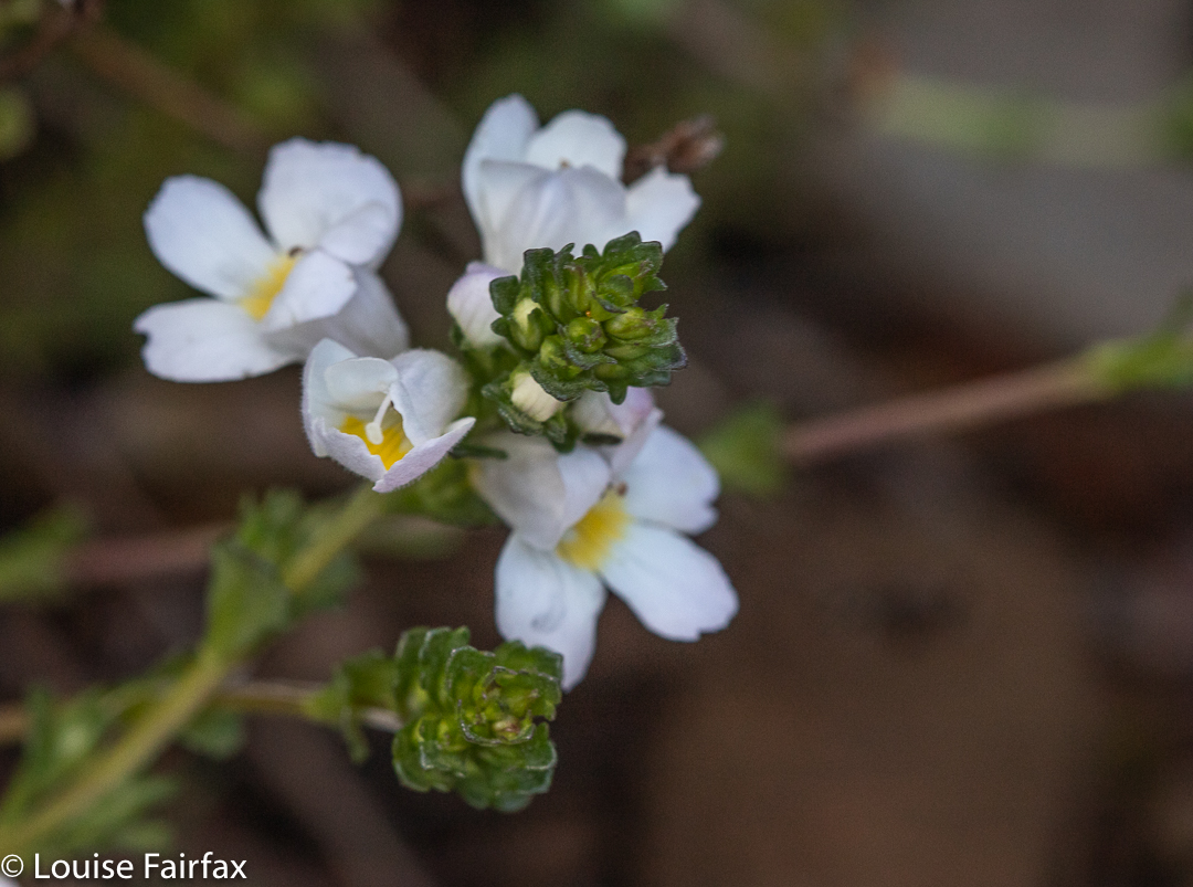
Olearia ledifolia Ben Nevis. This is the species of Olearia we encountered once we entered the alpine zone. It’s not even half the height of of the lirata.Euphrasia gibbsiae Ben Lomond. One web source I consulted said this is threatened. I am pleased to report we saw six or so bushes, just beside the track.Westringia rubiifolia Ben Lomond. This was also in the alpine zone.
The plants are just as prickly as they were seven years ago, but they are a tad taller and this makes them more comfortable to negotiate. In addition, kind people have thinned them somewhat. Even so, I would not take a small child up this pleasant mountain, as I fear the prickles would be at a child’s face level. For us, they were often chest high. In 2013, they hassled our thighs. The prickly offenders were mostly Pultenaea juniperina and Leptocophylla juniperina, with a few specimens of Hakea lissosperma and even fewer Richea scoparia along the track. One forgives them for being prickly when they are colourful.
Olearia ledifolia enjoys the summit viewsLichen Ben NevisHakea lissosperma Ben Nevis. Luckily, the prickly mountain Hakea did not protrude over the track, so its needles stayed where they belonged and didn’t attack us.Ben Nevis gpx route
The walking (as opposed to talking ) time of our ascent was a bit over an hour. This included a few photos where I forgot to stop my watch. My gps says we spent a lot less than that moving, but the gps is always quite insulting, accusing you of not moving when you are. Possibly more to the point is that the exercise, which included stopping for drinks, lunch on the summit and the odd bit of track clearing, took us 3 hrs 46 minutes. The day was thus still young, so I went off and bagged a waterfall on the way home, the Cornwall Falls. (Hm. Rather a circuitous way home, but the countryside was very beautiful.)
It was “third time lucky” for my desire to climb Reeds Peak and Bonds Craig, and to see the famous Lake Rhona.
The first time I tried, which I was going to do with my daughter, the weather was so foul that as we drove west and eyed up the torrential rain, we opted to stay that night at Strathgordon Lodge instead and to just have a single night on top of Mt Sprent as a substitute for the longer undertaking.
My second attempt was a solo one, but I was turned around because of the aborning bushfires. I spent that night on Tim Shea, watching on helplessly whilst huge tracts of land that I love fell under the doom of flame. The scorches were still in evidence this trip, and my face was black when I came out of the bush.
Rhona beach on arrival = pretty excited.
And here I was for attempt number three, once more with my daughter. It looked as if this trip would yield a similar fate to that of the first two attempts: the forecast was for gale force winds, snow and temperatures of a MAX of minus one by day and a minimum of minus four overnight. Of course, with the wind-chill factor, those temperatures would be even colder. Recipe for a glorious three days, huh? I wasn’t even sure if we would get over the Gordon River, which you have to cross using a fallen log. If the log was icy and slippery, we would not get far towards our goal. I had a few “Plan B”s in my head, just in case.
Arriving at Lake Rhona. Can you see the snow falling?
I was certainly not going to let myself get one bit excited about this trip before I inspected the river and the log, which is only about 30 minutes from the car. As it came into sight, we could see that the river was quite swollen, and only had about 10cms to go before it would cover the log and make it dangerous. But right now, we could cross, and in safety, so that we did, with me crossing twice: once with my rucksack, and once with my camera, just in case I met with catastrophe. If I fell in, I didn’t want to be taking care of too many things at once.
Poor boots
Over the other side, the former forest was very charred, but as we wended our way further towards Gordonvale, the amount of green increased. Signs of fire, however, stayed with us right up to, and including, the lake. There was a definite line visible from the lake where someone had paid to have sprinklers put in to protect his precious Lake Rhona. Thank you, whoever you are, for helping protect our magnificent wilderness from ravages brought about by climate change and humans’ selfish interference with the environment.
Rain began soon after we crossed the river: light at first, but with increasing determination. Kirsten called it “quietly achieving rain” – the achievement being to get us soaked, I assume. It was also successful in making me clumsy, as I had my big camera, gps and phone, all of which now needed to be transferred to drysacks, to be then tucked under my anorak before the pack straps got buckled. I made the Michelin man look skinny.
Rhona on the morning of day 2
There were many creeks after Gordonvale, normally nothing noticeable, but today they were raging, of unknown depth, and not offering any easy places to cross. Partly because of my electronic gear, and possibly also because I was still tired having only just finished my Geryon trip, I didn’t feel strong enough to trust my footing in water like that, so went up and down the banks of each creek looking for a place where I could be guaranteed to cross without mishap. The actual crossing of each one was slowly and carefully done, using sticks for stability. The rocks were slippery and the water strong. People and cameras stayed fine.
Climbing Reeds Peak on the afternoon of day 2
And so, inch by inch with the weary load, and by the power of the luring goad, the distant goal was won. Yes, we two kept moving on … and finally up, until, at last, we peeped over the edge of a small rising and there was the famous Lake Rhona; no mistaking it. Photo time for sure, although I later threw these ones out. They were mere photos of excitement.
In the bowl-shaped depression of the lake, there was shelter from the blast, which had been spearing us with icicles for quite a while. Now, it was “just” snowing with gentle, fat flakes, and the wind could be heard higher up, but it was not buffeting us where we were. Nonetheless, we chose our spot carefully, as we would be pitching on sand, so the pegs wouldn’t stand for too much force.
Climbing Reeds Peak on the afternoon of day 2
It was squashy with two in a solo tent, but at least it’s a Hilleberg, so pretty spacious for one. Our packs went in the vestibule after dinner, and our poor shoes got relegated to the outside world to be covered in snow during the night. (We popped a pack cover over them). Luckily no one needed the toilet during the night.
Morning, however, meant we did have to use said questionable “facility”, which was no easy matter. (For non-Taswegians who don’t know these things, there is no roof over your head). The lid on the seat was covered in a 3cm-thick layer of solid ice. Turning the knob to undo the lid was out of the question. Kirsten discovered she could lift the entire toilet off its hinges, so moved it away in order to access the hole. I later had to do the same, and thought whilst squatting in the snow over a small hole with wind blowing the flakes around my face and the toilet itself upended behind me, that the situation was possibly not to everyone’s liking.
Getting higher
It snowed on and off all morning, teasing us. Each time we thought it had cleared and went for a tiny walk along the beach preparatory to packing for the climb we wanted to do, the snow and wind freshened their efforts. At about 11.30, I said I wanted to do a proper walk anyway; these bits of walks weren’t doing it for me, and I knew Kirsten would be in total agreement, so we went back, ate an early lunch and at about 12.30 set out upwards, with no special goal other than having some exercise in mind. BUT, we were, of course, setting off in the direction of Reeds Peak. Should the weather improve, then we’d be ready for the climb.
Nearly on the summit Reeds Peak
It was still snowing as we summitted, but only lightly. What made the final ascent dangerous was not the snow, or the wind, but the thick rime coating the rocks, making them very slippery indeed. I was not one scrap comfortable up there. I touched and said I wanted to go down straight away. I would not relax before we got out of the rocks and back onto the grassy ledge at the base of the final climb.
Reeds Peak summit. Two steps to go
On the way down, we noticed a kind of lead which Kirsten felt compelled to examine. It was kind of a back door entrance to the mountain which would have made a much easier climb than the one we had just done, and now made an excellent route for the descent. It was heading in the direction of Bonds Craig. I was not one bit committed to this mountain, but we both wanted more exercise than we’d had so far (only 1.5 hrs at this stage), so off we set.
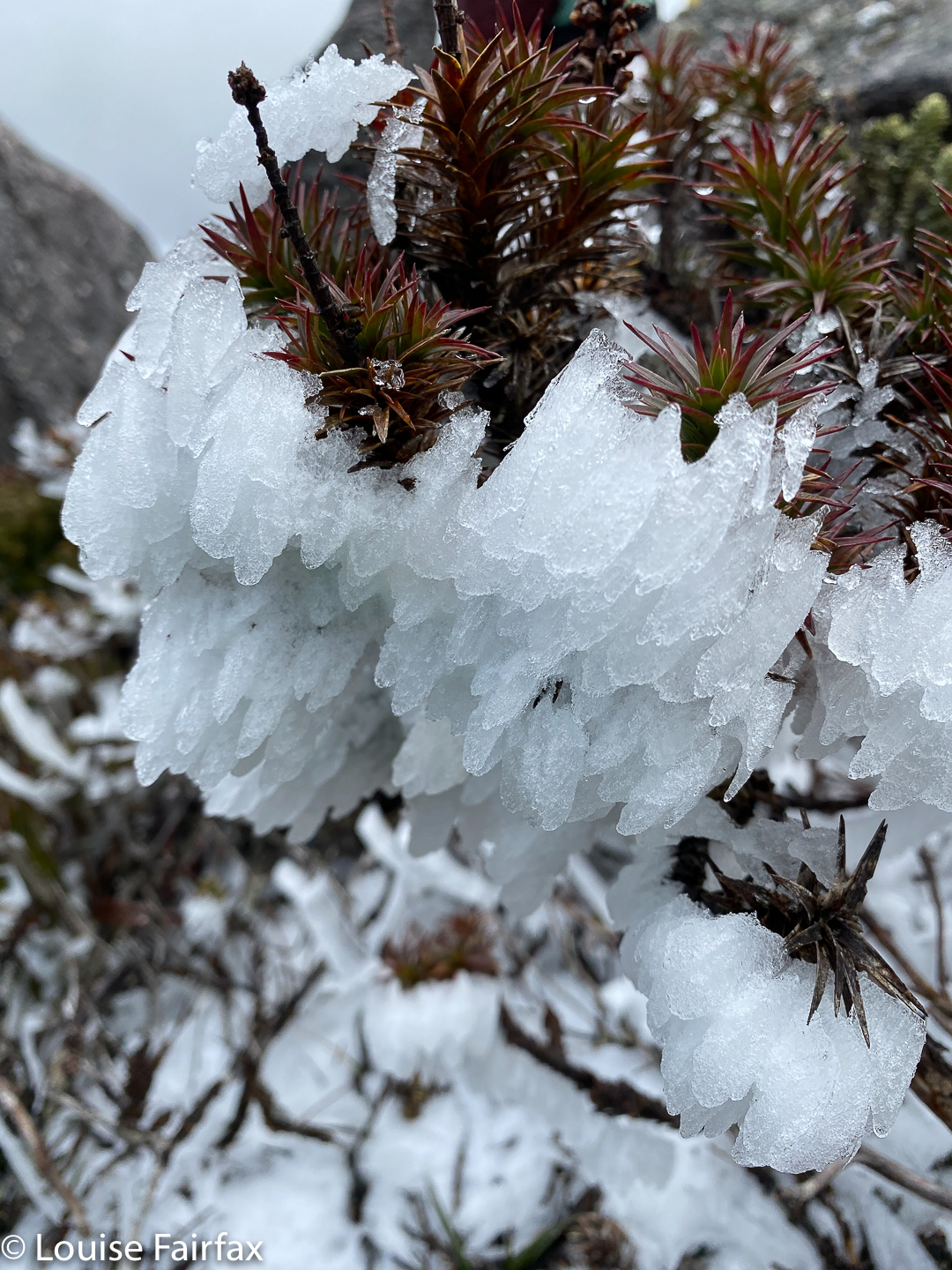
Reeds Peak icy vegetation
The terrain is beautiful up high, with moist alpine meadows. The section between Reeds and Bonds was less fertile, but we still enjoyed it, although the wind was starting to get at me. Bonds Craig was nothing more than a slightly darker shadow in the thick mist, but we strode purposefully towards it. We’d at least inspect the base and initial climb. It gained in form as we drew nearer. It even stopped snowing for a bit. Once faced with the beasty itself, we both felt fine about summitting, even though it was very misty on top, with no views to speak of. The small area in between the summit rock and a false summit offered some protection.
Bonds Craig ahead
Be that as it may, however, I wanted a proper rest out of the wind, so not long into our return journey, we dropped over the edge to a sheltered area at the top of the steep but leeward side, and had a snack. The book had said it was feasible to take a short and steep route back to Rhona, but we had really enjoyed being up high and feeling the space and seeing the views and the alpine vegetation and were in no particular hurry to sit in the tent again, so we voted for returning the way we’d come and enjoying the experience of the ascent in reverse. Somewhere and when in there, the snow stopped and the wind began to abate.
Pre-dawn light, day 3
The next morning, the skies were so clear Kirsten muttered from the comfort of her sleeping bag about a swim. She announced once she’d been outside that perhaps she needed to rethink this matter. Meanwhile, we had the important job of photographing the dawn, and meeting some of the people who’d arrived while we were having dinner the night before, camped at the far end of the beach.
Rhona Sunrise
By 11 am, the swim became a reality. We were not in a rush, as the newcomers brought with them the news that the river was now over the log. If we delayed a bit, it might decrease sufficiently to let us back over. By 5 pm, it had gone down enough to kind of let us across … crawling for safety. Not for the first time this trip, my daughter took the camera for me. She does some pretty scary stuff holding her kids, so I trust her with my camera far more than I trust myself. The log was very slippery indeed. Ever crawled in 25 cms of water on a log over a strong, wide river? Such fun. We are both strong swimmers, but if you go in the drink over your head, you must release the pack, and you might never see it again if you do that. That knowledge adds pressure.
“Warming up” in the sun before having a swim
Also, I have never swum in bushwalking boots, and was not keen for a first experience of that one, either.
But having successfully crossed the danger, Kirsten then stripped off and had a quick swim in a protected backwater …. just ’cause it’s the famous Gordon River, just ’cause it’s the wilderness … just ’cause she could. Isn’t that sort of thing part of what being in the wilderness is all about? I have pictures of this daughter swimming with icebergs. There is a lot of her beloved dad in her. :-). Her mum’s a wuss.
(If you are not experienced in these matters, please note that before you ever begin crossing a deep river, you must release all buckles, as if you are submerged, they will probably be pretty impossible to undo, and you will drown if you don’t. Undoing buckles is not the first thing people think of, but it is essential.)
Last week I’d been worried about being the only female in a group of five. This week, I was the only one in a ten-name list of expeditioners. Oh dear. “Tough, experienced mountain men”, they got called ….. and then there was Louise. Here we go again.
By the start line, ten had become nine, as A had hurt his leg.
Off we set. The pace was fine. Phew. I didn’t struggle, but was nonetheless glad when we arrived at the Geryon base camp and were thus finished for the day. I was sad to have bypassed a couple of waterfalls I hoped to return to, but my watch said they were too far back, and I just wanted to pitch my tent and chat with the others. We were a very pleasant group, and socialising was fun. The rainforest was glorious and lush, and we admired the greens while boiling our billies and rehydrating our dehydrated dinners, which all bore a remarkable similarity. Although the setting was lovely, I still feel closed-in camping in a forest. It seems dark and restricting, and I was looking forward to the rest of the nights when we would be camped high.
Pine Valley, below the Geryon Climbers’ Camp where we pitched our tents
Day 2. Please note: I m about to tell the story of an accident. This event is nobody’s fault: it is one of the risks we all take when we go into the wilderness, and we venture in, perfectly content in the knowledge that something we don’t want may befall us; but that is nature, and we are prepared to take what comes. There were nine of us there, which means there are at least nine possible tellings of this story. This is the event from my perspective, and mine alone. Each of us brings his / her own perceptions and ‘imaginings’ (Vorstellungen, to use Kant’s word) to any event, and this one is no exception. This is how I experienced it. Geryon South, which we were to climb this day, is, in my mind, Tasmania’s second most dangerous mountain. I was intent on treating it with respect, and with concentrating on the task at hand, even in the early stages. I was not the only one who was uncharacteristically quiet this morning. Lucky that. My concentration and extra alertness, I believe, saved my life.
Views to the Acropolis Days 2 and 3
Our first break was in the middle of steep rock scree – a former landslide. Already we had spread out a bit, so that when the last three arrived, the fastest person bounced up and began to bound up the slope. As a former athlete, I know too well the effects of lack of oxygen in the brain. I could hear these late arrivals breathing heavily. This would endanger their decisions later and that could have negative effects on the group. We needed all of us to have good judgement with well-oxygenated brains, so I called out to The Bounder and pointed this out as politely as I could. I felt rude doing this, but safety was at stake, and I was grateful when the leader thanked me for speaking up.
Once everyone was breathing normally, we set out again. Upwards, ever upwards. Soon enough we were up very high … just short of what is “affectionately” called Death Slab. Is that name there to torment the nervous? Just before we reached said inviting slab, however, we had to clear a very steep chute.
Geryon South: negotiating ‘Death Slab’
Here is where (and when) we ran into trouble. Three had gone on ahead to the extent that number 4 didn’t see exactly what their route was. I assume they thought it was obvious. However, it wasn’t so to number 4 (part of the earlier heavy-breathing group). He went straight up as he could see their forms higher above and missed a tiny pad off to the left. Number 5 also missed it, no doubt tucked in at that stage quite close to 4. I had been hanging back slightly so as to never raise my pulse, so was a couple of metres behind (now as number 6).
When I looked up, as one does, I saw 4 straddled over a boulder. His limbs and general body language suggested struggling and straining. He was, in fact, reaching very far forward trying to get a hold of the next rock so he could proceed. If he fell backwards off this rock, there was a long way to fall and nothing nice to land on. He was not in a good spot. I didn’t like the obvious struggle I was witnessing, so looked to my side and saw there a hint of a pad. Number 7 also saw it and we simultaneously decided to take it: it must surely be easier than what we were witnessing. 4 was taking what seemed like quite a long time to overcome the difficulties presented by his rock. I nodded 7 to go first. Meanwhile, number 5 didn’t like what he was seeing either (soil getting very loose) and pressed himself hard against the rock beside him. Good move; that saved his life.
I had taken one single step when the loudest imaginable crash echoed in our narrow chamber and the huge rock that number 4 had been on (1 x 1 x 1.3 mts in dimensions), accompanied by a mass of debris, came hurtling past less than a metre from my shoulder. Had I not taken that step onto the pad, I would not be here to write this story.
But now my attention turned to number 8, who was now first in line. I also didn’t know the fate of 4 or 5, both good friends. Well, everyone there was a good friend, and I had no idea at this stage how many of us were still alive. Had 4 gone with the rock? What about 5? Were 1, 2 or 3 on it when it fell, helping 4? My stomach heaved with ugly possibilities, but my first concern was 8. I was too scared to look down at possible death, but had to in case he needed help. He was alive, hoorah, but on his back and upside down in a bush. Doubtless, scoparia saved the day again.
However, being upside down and on his back with a now injured arm, he was struggling in a way I imagine Gregor the metamorphosed beetle in Kafka’s famous short story flailed when he awoke to find he was on his back with many tiny helpless limbs. He didn’t reply to my calls, but was definitely alive. I was now in trauma-shock myself, and have a kind of amnesia about the next fifteen or so minutes. All I can tell you is I wanted to vomit. (Well, didn’t “want”; I guess “need” is a more appropriate word).
Jonny in his tent up high
The outcome is that we all sat with 8 (and 5 who was also shaken and grazed) for a while to see how they felt after a rest. At the end of that time, 8, manifestly hurt, said he’d just stay there, but he was fine to wait while others climbed; I said I’d stay with him, and the rest, after a bit more deliberation and reassurance that it was fine, went on. While they were away, however, 8 started shaking quite badly. Shock was setting in. I have no idea how he eventually got himself down that mountain with one very injured arm and aching ribs, but he is astonishingly capable and resilient and somehow managed. He needed to be helicoptered out the next day when his injuries were even worse. One of us escorted him down to Pine Valley. Now we were seven.
Pool of Memories: cooking
The rest of us, however, continued on that afternoon, and packed up our tents and climbed up to the Pool of Memories. This was such a fun climb, requiring us to pack haul at one stage and access the next level of rock using some pretty strenuous climbing and upper body work, some kind of in trees. I enjoyed the challenge and I think it helped me to forget a bit of the earlier drama for a while.
And just to make sure we all rejoiced in the fact that we ourselves, and all our friends, were alive, we were treated to an almost balmy evening with a magnificent sunset. We took our stoves and food down by the lake and cooked and ate down there. There are some times when beauty and peace in the wilderness quite overwhelm you and fill you with great joy, and this was one night when it was so.
Mt Geryon from the Pool of Memories; sunset
Just as he was going to bed, Pete looked at his boots and commented: “Guess maybe I should put these under cover.” I looked up at the clear sky. “Yes, Pete, we could easily get a frost tonight.” We did. White tents and rising mist off the lake greeted us next morning. Day 3. I fought rocks all night, so was a little tired next morning, but otherwise fine. Jonny, however, had sore and swollen knees, partly as a result of kissing (or being kissed by) rocks, and decided to sit this day out, despite the presence of FOMO.
Scenes as we climbed higher towards Geryon North
Now we were six as we set out for today’s goal, Geryon North. I have climbed this mountain before, and really love it, partly because you actually have to climb it as opposed to “walk uphill”. Some of the manoeuvres are a bit tricky, but I never felt particularly endangered here, even though you do have to be careful, as you could easily maim – or even kill – yourself if you fell at the wrong time.
It was a beautiful, clear day; the air was crisp and the vistas enormous. The cliffs near Geryon are vertical and the drops, infinite and dramatic, and it is a total pleasure to be in their presence. Oh, life is sooo good, and what a day on which to celebrate that fact.
View from Geryon to Massif
I was so happy being up high with the space, the views to infinity and a gentle breeze to refresh me that I suddenly resisted the fact that we were going back down to camp and losing our height. I asked our leader if hew minded if I dropped back for a while and just sat up there, and he was cool with that. I sat and stared / meditated for quite a while, then sang a bit, photographed some more and just enjoyed the state of being. At last, full of existential joy, I rejoined the others.
Du Cane Range: just sitting and staring
Sunset that night was a bit of a fizzer, but after such a perfect day, I didn’t really care, and it was nice just to chat with the others for a change rather than go off and photograph. Both activities are pleasant. It was time to stand around and enjoy the evening sociably tonight. Day 4. As our start for this day was not at all early, I had time to get up and ‘shoot’ the dawn in a leisurely manner, choosing an unnamed tarn beside which to set up my tripod and enjoy the moment photographing. As with the other day, despite the zero temperature, I later cooked my porridge by the lake so I could enjoy the scenery better.
Labyrinth pink hour
I was shocked to find one less tent in our cluster. I hadn’t realised that Nigel’s nod as he passed my tent window at 5.30 a.m., just as I was rising, was a farewell one: he is a teacher and had to rush out early to catch the midday ferry so he could work next day. Poor fellow. Now we were really six.
And then the rising sun turns the rocks to fire
We packed and walked and then climbed out of the labyrinth. For two of our gang, that climb was kind of the last straw after a lot of strenuous work over the last few days. By the time we reached the Parthenon saddle, they announced they’d go back the short way, and meet us next day for the ferry.
And now we were four.
Lake Elysia and Mt Gould on the way to the Parthenon saddle
The day was warming up greatly, and the climb up the Minotaur was thus a bit taxing. Number 4 began to tire. By the time we dumped our packs at the side of Gould on a beautiful shelf that had some water, he was finished for the day. We Remainers pitched our tents and packed our daypacks ready for the final climb. Yes, now we were three.
Mt Gould from the Minotaur. Soon we’ll climb her
I have climbed this one before, solo, using a rocky scree to the left as you stare at the mountain. Kent led us up further to the right this time, using fun grassy slopes (very steep, but everything on Gould is steep). I like using new routes. And in around 40 minutes, we three were feeling very satisfied on the summit, staring out at mountain friends far and wide.
There was no sunset this night, which is a shame, as part of the reason I wanted to be part of this expedition was to sleep high and have beautiful sunsets and sunrises, but with nature you take what it gives you, and the whole adventure, even counting our nearly fatal accident, was totally enjoyable, even without achieving my sign-up reasons. I just love being in the wilderness and camping high, whatever the weather. And I did not lug my tripod and full-frame heavy camera in vain: sunset on day 2 and sunrise days 3 and 4 ensured that! Magic would no doubt be taken for granted and only appreciated half as much if it were not so fugacious.
Two of the three on the summit of Gould. The third is your trusty photographer.
Day 5 was all about making the ferry on time. We had to skirt the rest of the way around Gould, do battle with a bit of scrub in the process, and finally walk along the Gould Plateau, descend by the steep track through the rainforest and then do the final tiny stretch to Narcissus Hut and the ferry wharf.
Gould summit view
Jonny was so keen for his hamburger with the lot that he phoned ahead to the Hungry Wombat to tell them we were coming, and with a request that they thus don’t close the kitchen early. He promised we’d eat a great deal, … and kept his word. Hamburger with the lot seems to be an integral part of bushwalking in Tassie. It’s filled with fabulous fresh vegetables and has the salt and fat that your body needs after a few days of rehydrated formerly dehydrated food. Three had now grown with our merging at the ferry to eight. We sat around the table talking and laughing and stuffing our faces before our adventure was finished and we went our separate ways.
I was still so filled with the joy of the gift of life that I played the happiest music I know to keep me awake: yodelling – folk music from the alps. I sang along, happy scenes from the past five days flashing through my mind as I drove towards my family and dog.


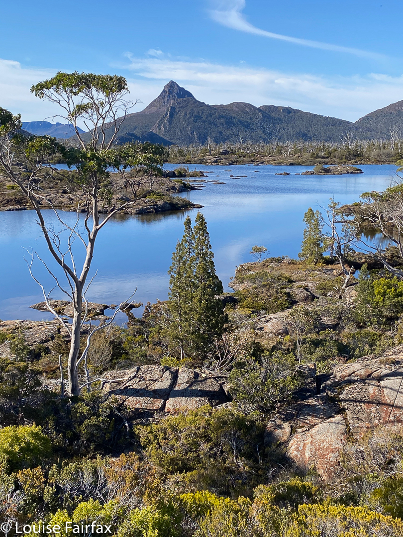
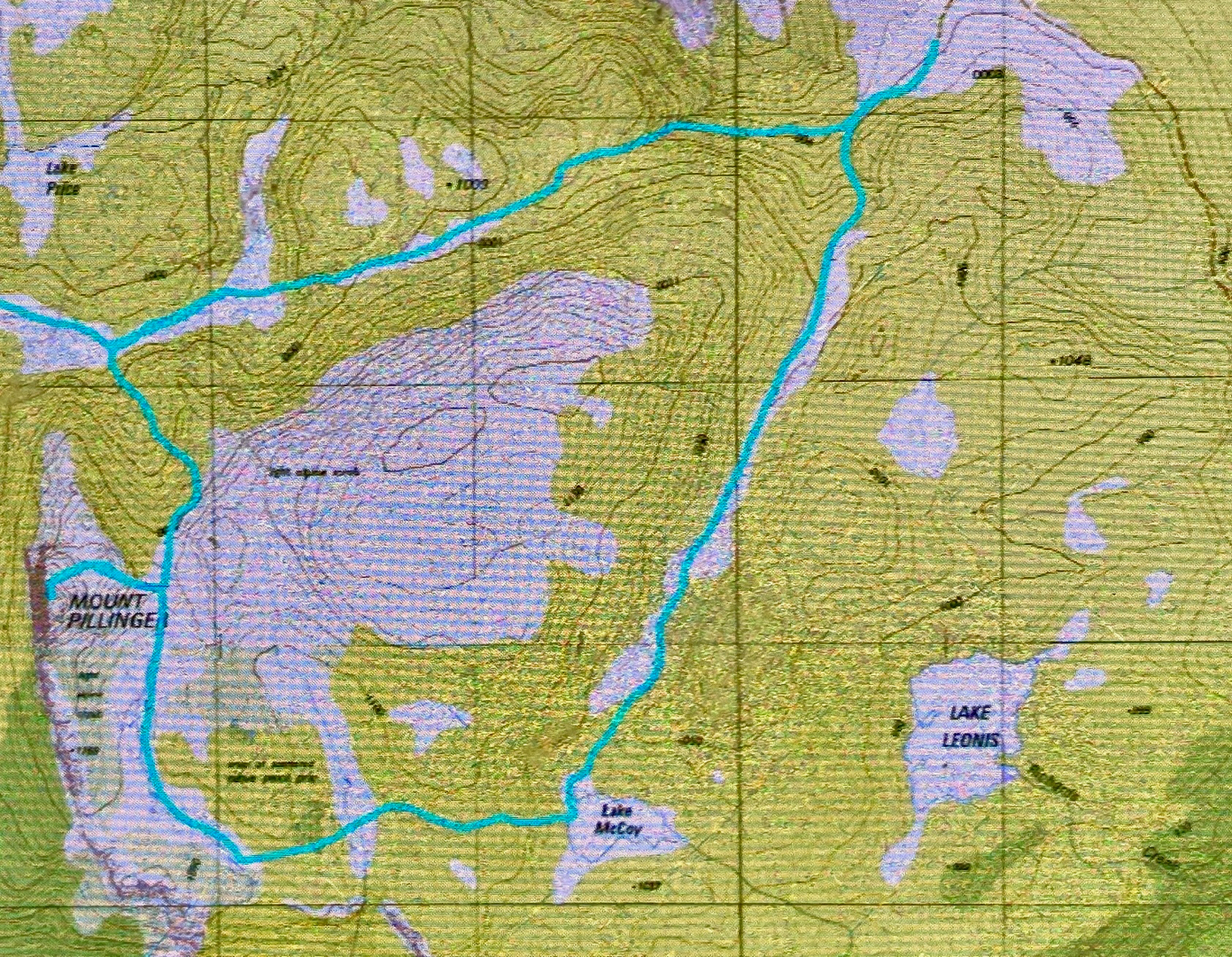 Lake McCoy route.
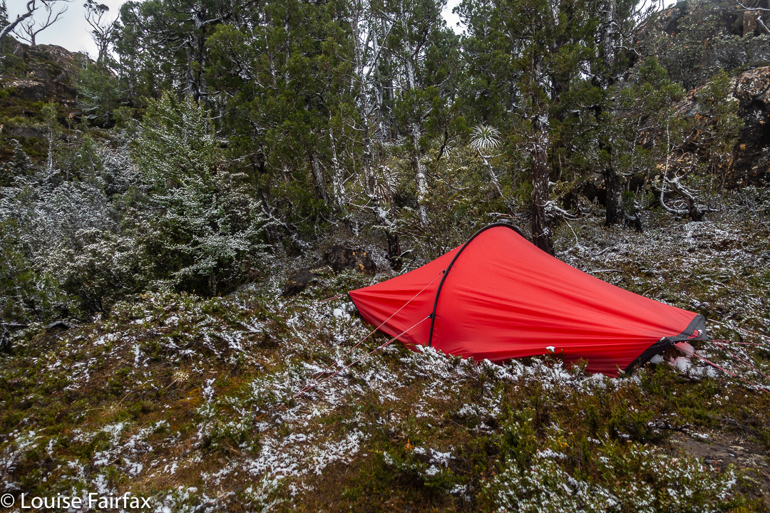

