Bruny weekend 2022 May

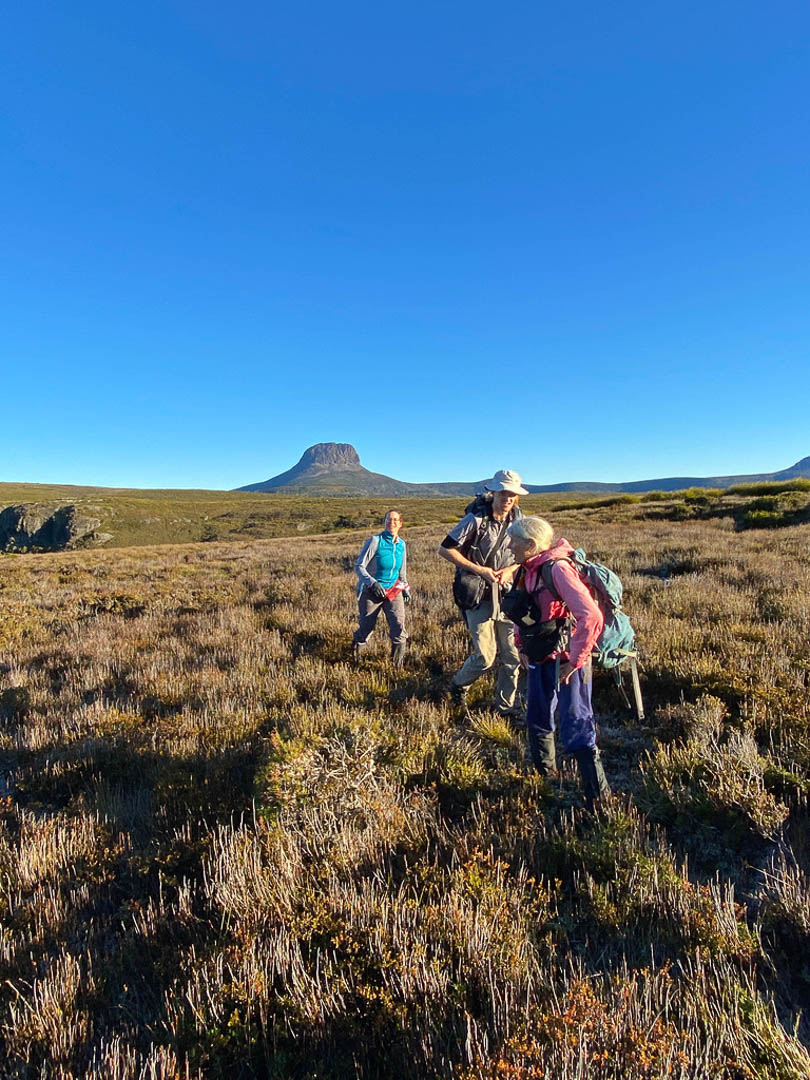
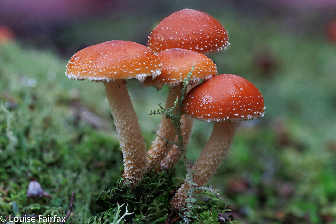
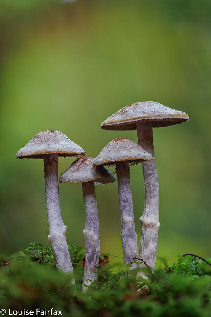
I had had a glorious day on Bruny, shooting coastal scenes and fungi hunting on Mt Mangana, and now made my way towards my accommodation. My hopes were high. When you pay $650 for one person for two nights, you expect to be really treating yourself. Well; I do. My companions agreed. I am not usually so extravagant, and regard this as a large amount of money to splash out on myself just for two nights, but decided to do it anyway. I have stayed at several places – even on Bruny – that were more in the $230/night zone, and have had very comfortable and quasi luxurious stays. I was expecting something pretty wonderful for this amount of money.

Neck Beach Bruny. My first morning. Holiday off to a great start.

Google implied it was at the end of the Cloudy Bay road, so I drove along, waiting for a sign. I found none, and arrived at the breach. Luckily some locals were there, and they told me to backtrack and I would find, tucked away, a somewhat obscured driveway. With the extra advice, I found it. Not for the first time, I was VERY glad I was not arriving after dark!

Lycoperdon perfotum Puff Ball – such an interesting texture

I found the lock marked for my accommodation, and applied the code. The thing fell apart as it collapsed onto the sand. I grabbed my key, but didn’t dare put it back into the broken lock box. There were many padlocks on this gate, none marked. I needed to try every single padlock before the key fitted something. Good old Murphy.

Lepista fuliginosa Mt Mangana

The old gate was heavy, and its own weight pulled it back to the centre the whole time. I was faced with the problem of keeping it open while I drove through. I searched around for a rock or a stick to aid me, again happy that I was arriving in the light, which I don’t always do, being a photographer who shoots the sunset and then goes to her accommodation. I found neither rock nor stick. My best aid was a fern frond. These are not very strong, so I was nervous, but made it.

Bakers Beach Bruny

On I drove on the sandy, windy road. B had said ten minutes, but I was sure I would be slower than he was, but as twenty minutes approached with still no sight of my cabin, I realised that my rendez-vous with my friends in the pub for dinner was going to be impossible. I could not do this in the dark. Besides, there were endless turnoffs and choices to be made. Maybe later, but on my first night I needed to get a bit used to this place and its driveway. That was a good decision. In the morning I got lost trying to get out, and landed up under someone else’s bedroom – a someone else who had rented a beautiful cabin made of glass, so I and my car would have been very visible as I approached their bed at 8 a.m.. We were possibly both as shocked as each other.

My view

Anyway, at last my cabin materialised. Marvelling that anyone with a mere two-wheel drive car could make that journey, I headed to look through “my” windows at the grand place I had hired. Oh. The curtains were aged and drab. The mock wood of the kitchen cupboards had been tossed out of most places in the 1960s. It looked tired as well as old.
I approached the next coded lock to get in. Hm. It, too, fell apart in my hands, and I couldn’t put it together either. Oh well; problem for later. I’d keep the house key in my pocket. In I went. The place smelled old to match its look. I examined the books near the couch: I often like to browse at such things. 2006 National Geographic. Oh; thanks. I went to examine the coffee making facilities. None. There was ONE sachet of instant coffee and a Bushels teabag in an old saucer on the bench. WHO drinks instant coffee? I haven’t done that in decades.

Sunset over Cloudy Bay

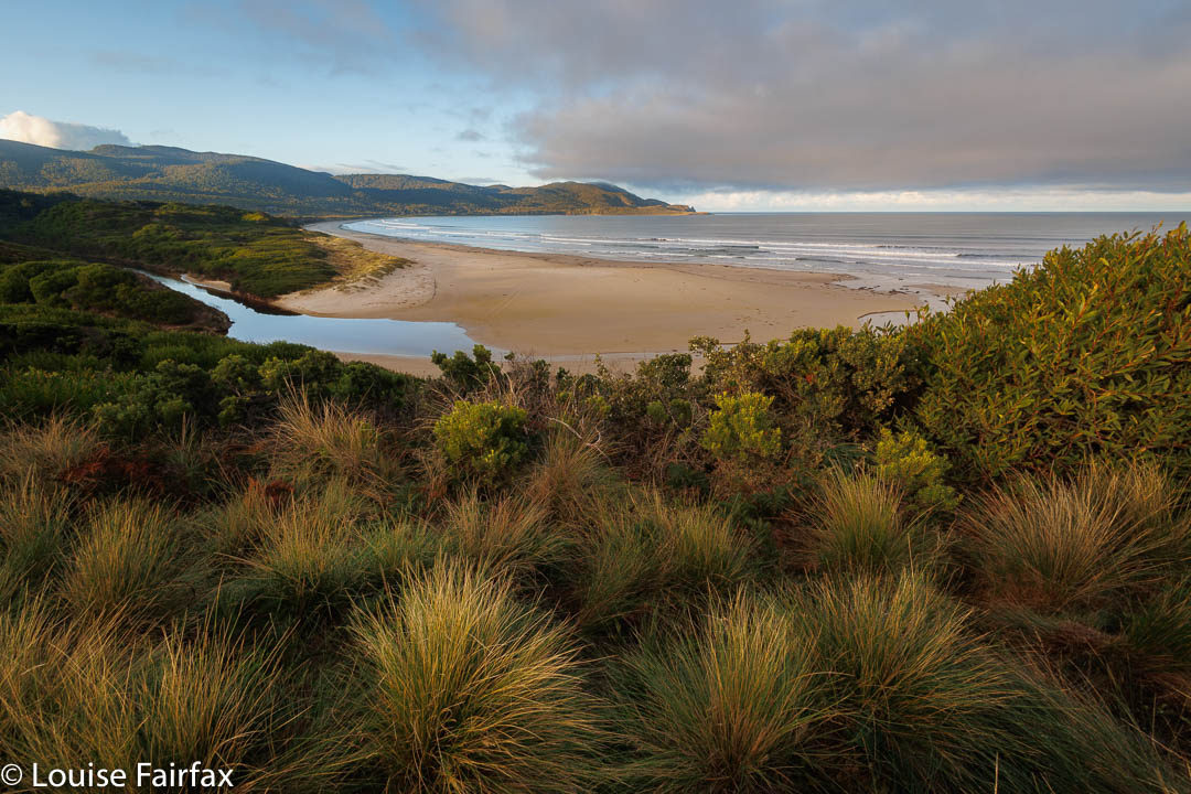
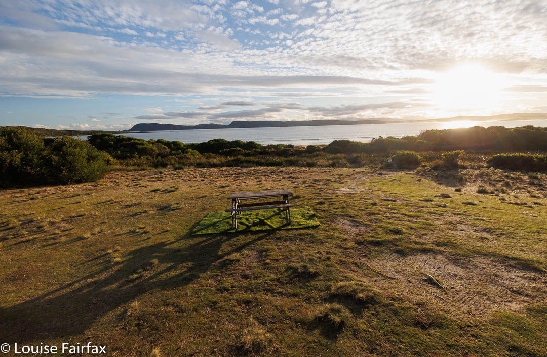
Oh well. At least the location was good. I didn’t want to waste beautiful daylight hours mourning that I had just tossed a lot of money away on not very much. I quickly grabbed my camera and set off to go to East Cloudy Head, to see what could be seen there. It was, unfortunately, 4 p.m. by this stage, but I have confidence in my speed, so packed nothing other than my photographic gear and house key. I luckily did have my phone so I could send a view pic to friends and relatives.

Bruny forest

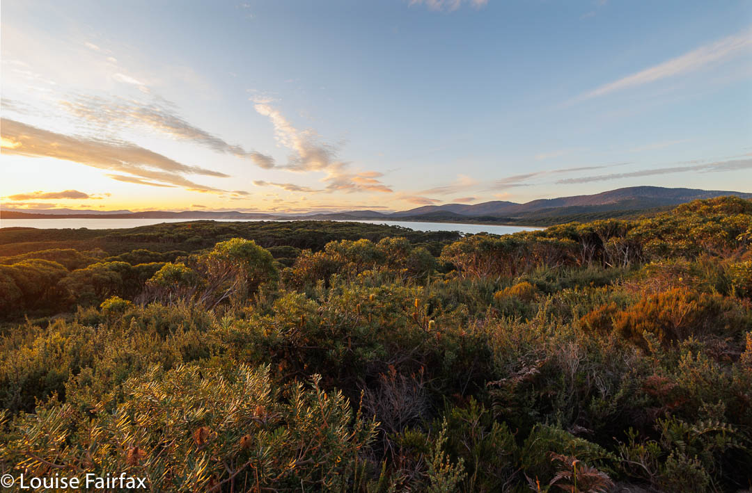
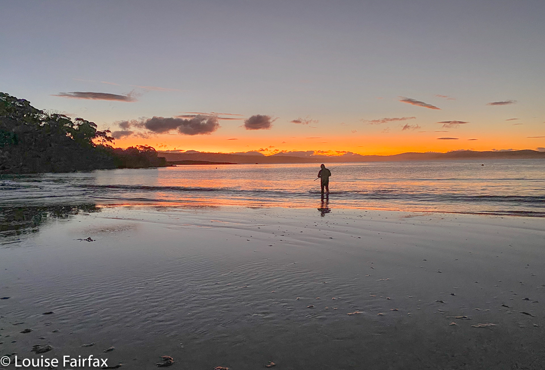
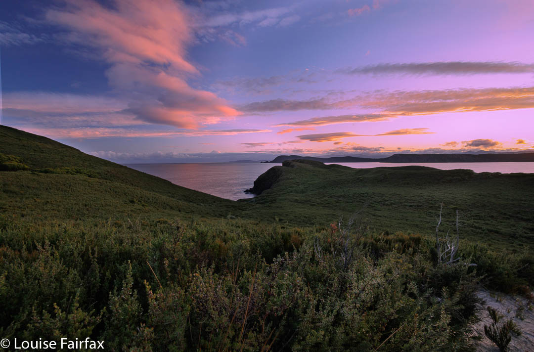
The view from up high was wonderful; the sunset, pink and pretty. The track was sandy, so the fact that it was sunset and I was up high with a walk back did not deter me in the slightest. The white sand would reflect any ambient light – although I did know the moon would not be rising to aid my cause. No problems. Down I went easily, and along the beach, stopping to chat to some fishermen who plied me with many questions, thus delaying me so it was now totally dark with absolutely no ambient light. Along the shore I went.

Fisherman Cloudy Bay

Oh oh. Um … where was my shack? How would I find it in the dark? I had left no lights on, and the shack itself would, in the dark, no doubt be totally obscured by the dunes and shrubbery. Whoops. I wandered along for what seemed a very long time (time goes slowly when you’re not having fun – but actually; I was. This was an adventure, so long as it turned out well. If it didn’t go so well, this was a huge amount of money to spend sleeping on the sand in almost mid-winter).
To and fro. To and fro. How can you be so stupid Louise? I thought of my photographer friend Marley, trapped out once overnight. Hm. Keep trying. Then I got a bright idea: I used google maps on my phone to locate the shack, and my own position in space. Ah ha. I had not gone quite far enough. When the device said I was parallel to the hut, I searched for a gap in the bushes and found my way home. A good adventure livens life up. I phoned my friends to say dinner was impossible. I looked at the emergency provisions I’d packed. Soup for dinner. Fine. I like soup.

Sunset over Cloudy Bay

But, meanwhile, I was freezing. I had already worked out that I didn’t know how to open the fridge, which lacked a metal casing, so perhaps it didn’t work at all. Nothing was going to go off in a place this cold anyway. I really needed to light the gas fire. I tried everything and failed. In the end I phoned the number I had been given. I was coached over the phone, but that failed too. Eventually someone came to help me. The heater was broken, but he fixed it. While I had been waiting (an hour, wrapped in blankets), I tried to recharge my camera battery using the plug that had been put in especially for me, but it didn’t work. Maybe the person who was coming could fix that too. (He did). Had he not fixed it, I would have been really stuck, as I need to recharge my battery every day.
I had also tried to get hot water and failed, and, as so many things were broken or not working, I decided the gas failure had meant no hot water either. However, there was hot water, but by the time that was ascertained, I and the house were so cold that the idea of stripping off to shower was intolerable. The bathroom would have kept the beer cold, but not Louise warm. Gradually, as the heater did its work, I warmed up enough to go to bed, but without using the bathroom. I was too cold to try the astro photography that I was actually there for.

Cortinarius tasmocamphoratus Bruny

Normally for breakfast, I have porridge, followed by espresso coffee and a bun or pastry heated in the oven. The porridge bit was fine, although there were only four bowls in a place that says it sleeps eight. The nicest bowl, shape-wise, was made of plastic, so I chose a cheap, thick, crockery one. Then came the problem of second course. I had brought my own espresso coffee, so boiled water on the stove (there being no electric kettle; fine). I poured hot water on the grains and waited for the grinds to sink. Not exactly the luxury I had been anticipating. The oven didn’t work. I pointed the fire gun at every single hole available, but nothing happened. I had old cold bun with my coffee. I thought a place charging that amount might have bought a modern stove that self-ignited, but I was wrong.

Below Mavista Falls

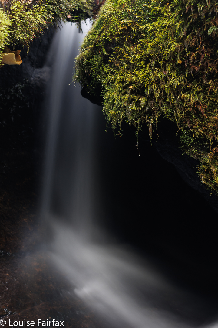
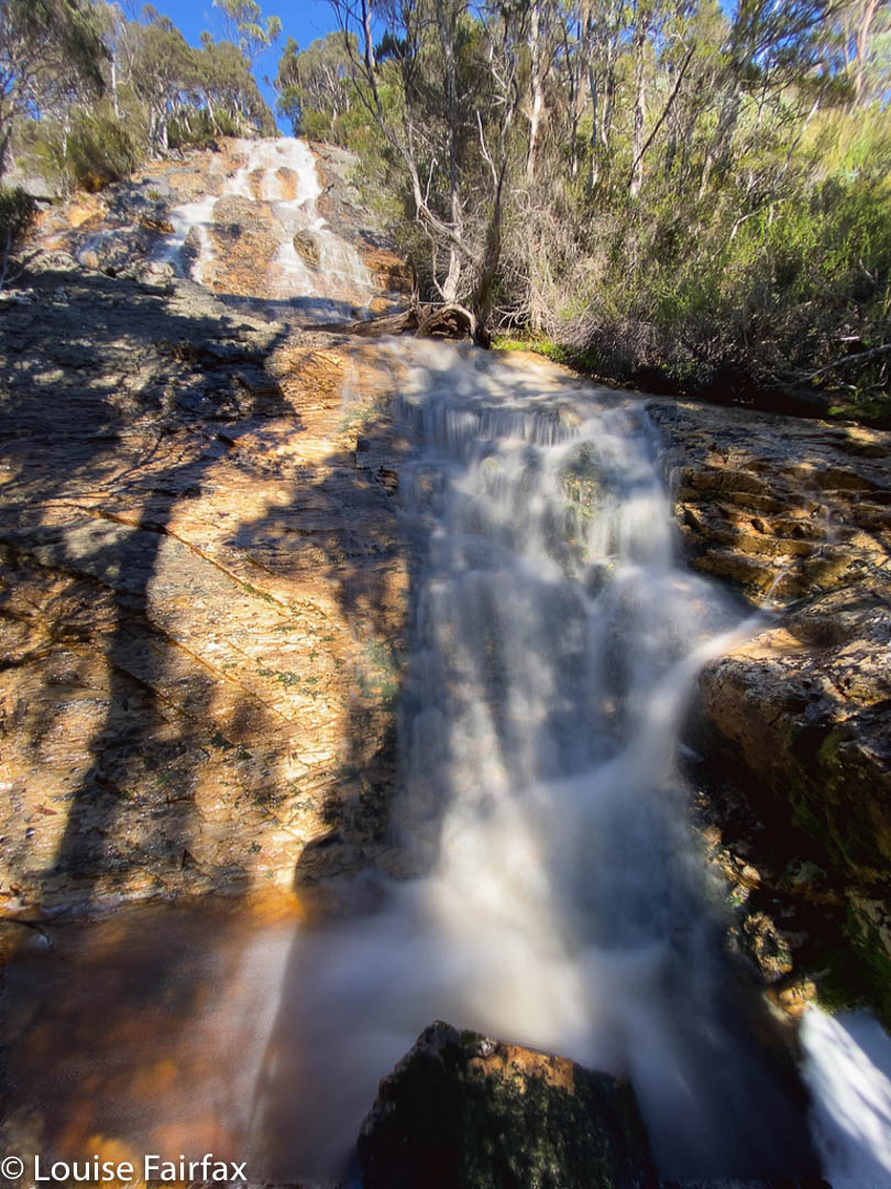
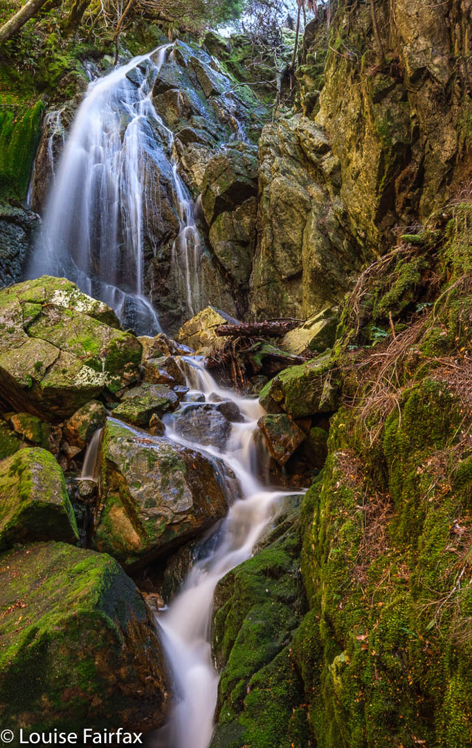
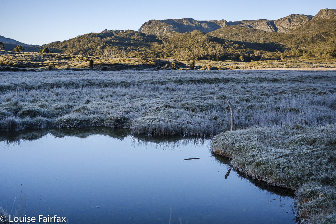
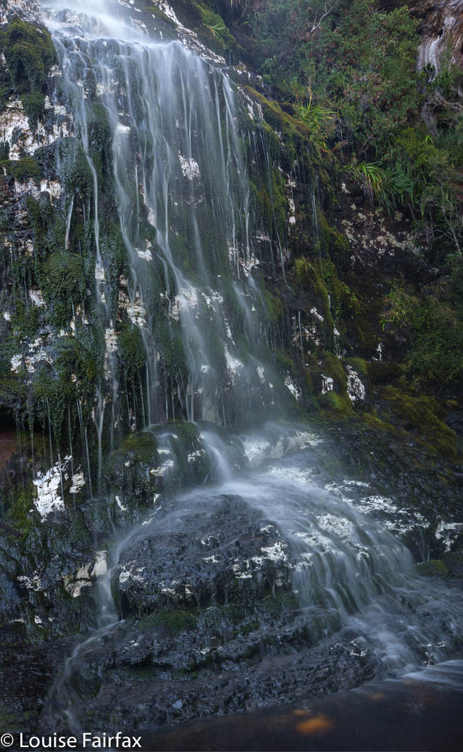
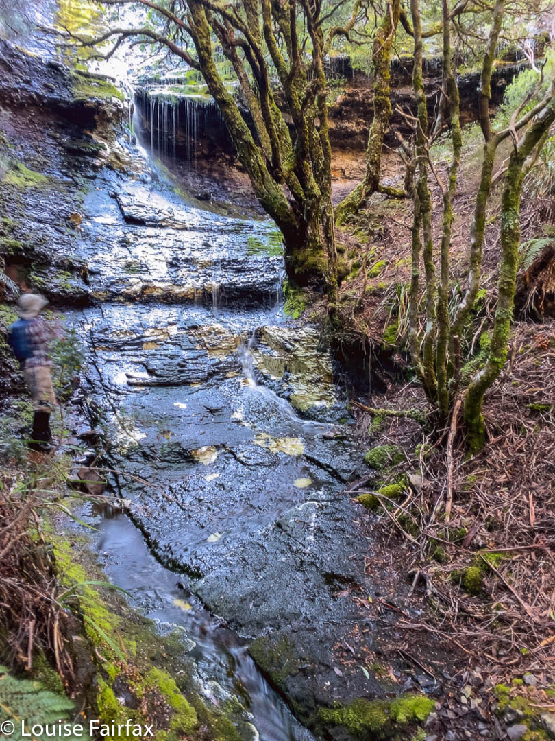
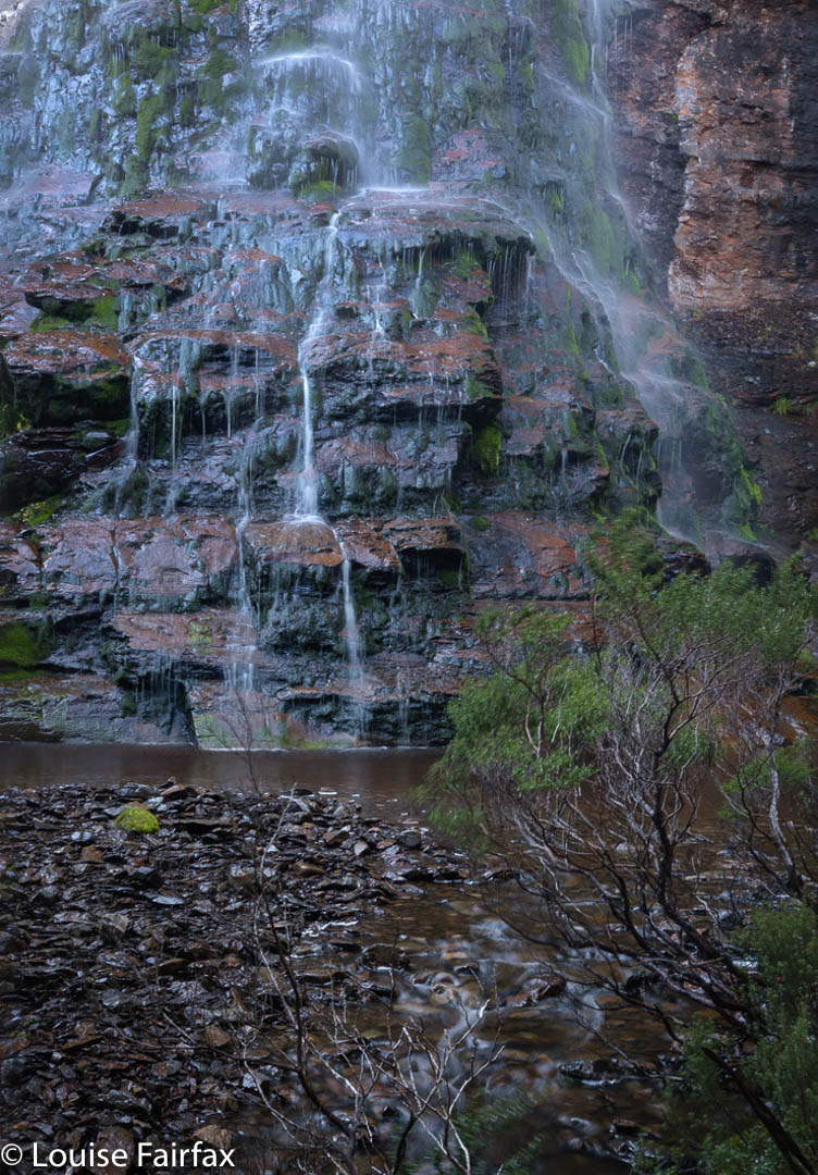
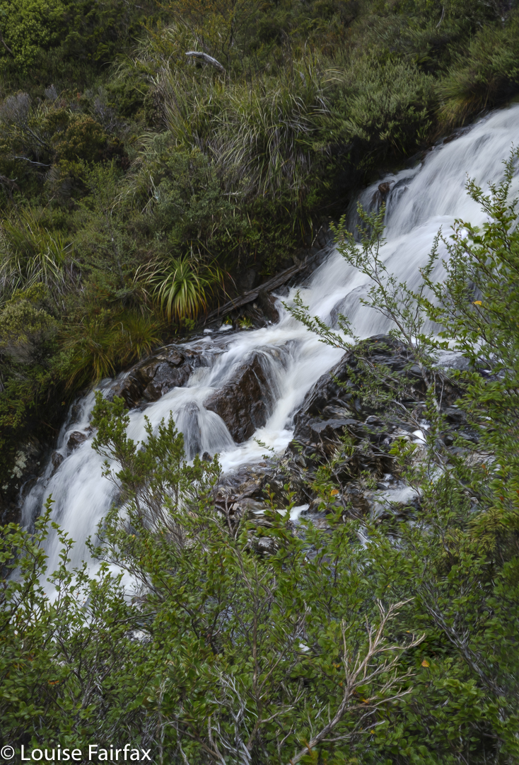
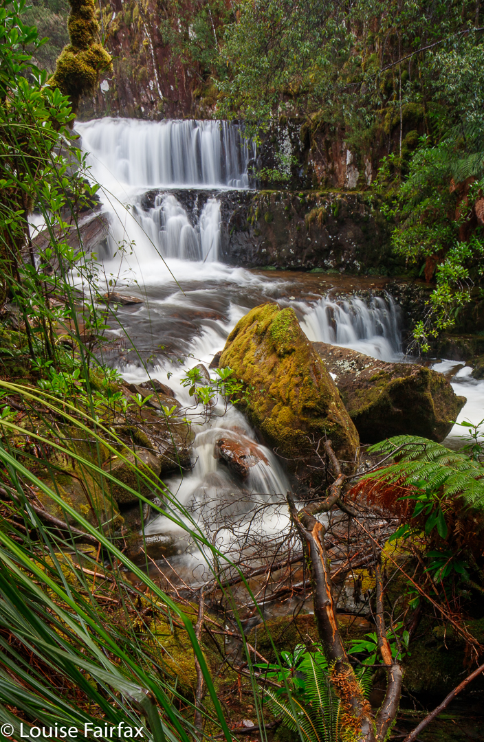
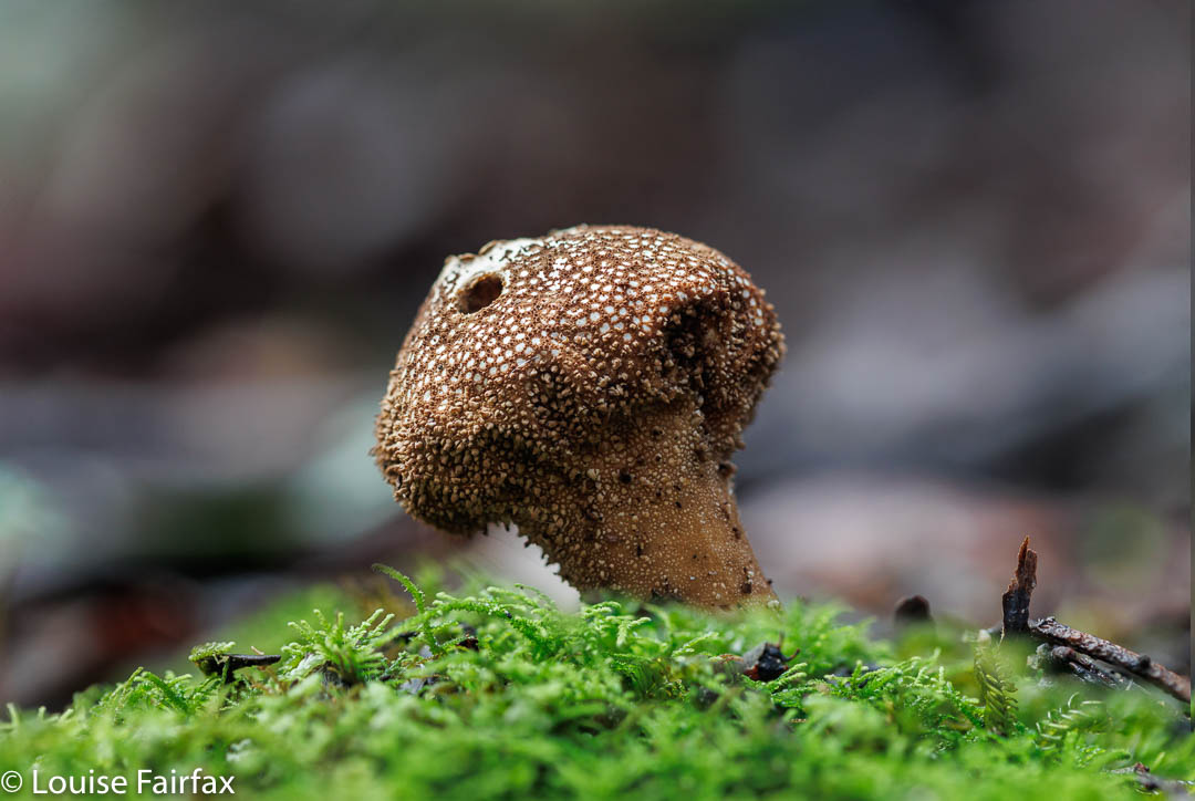
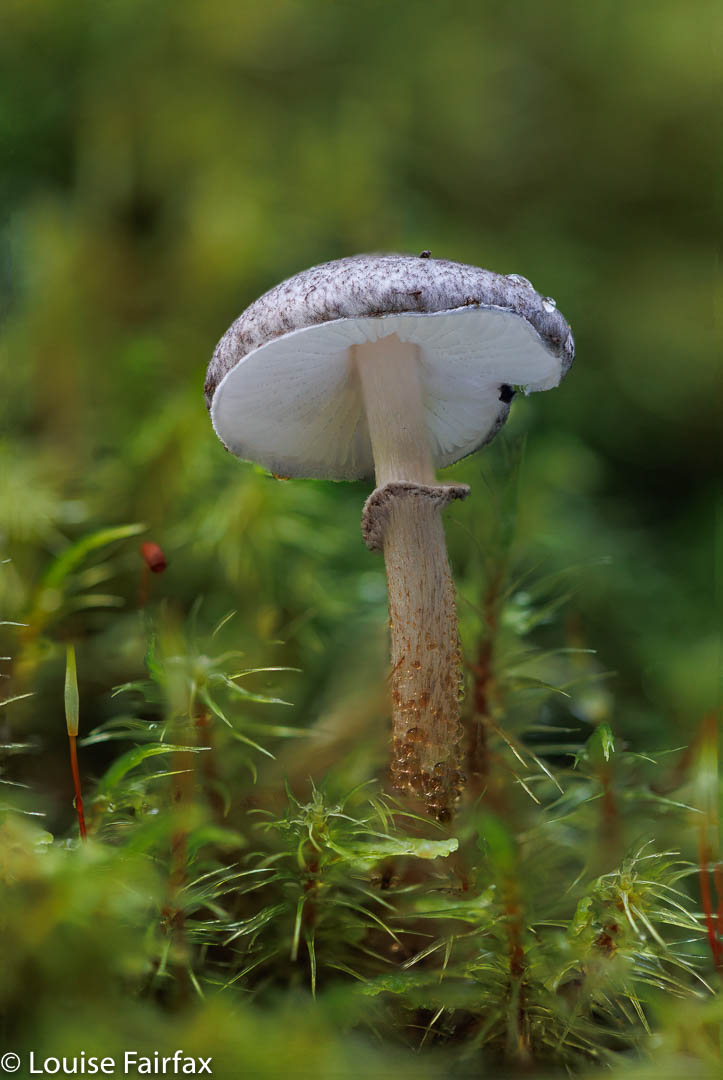
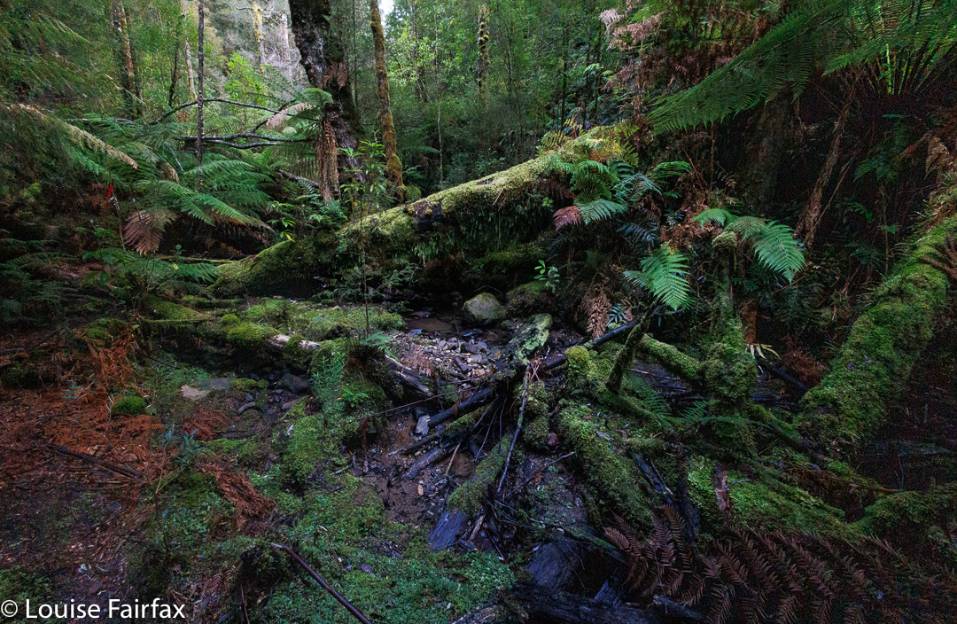
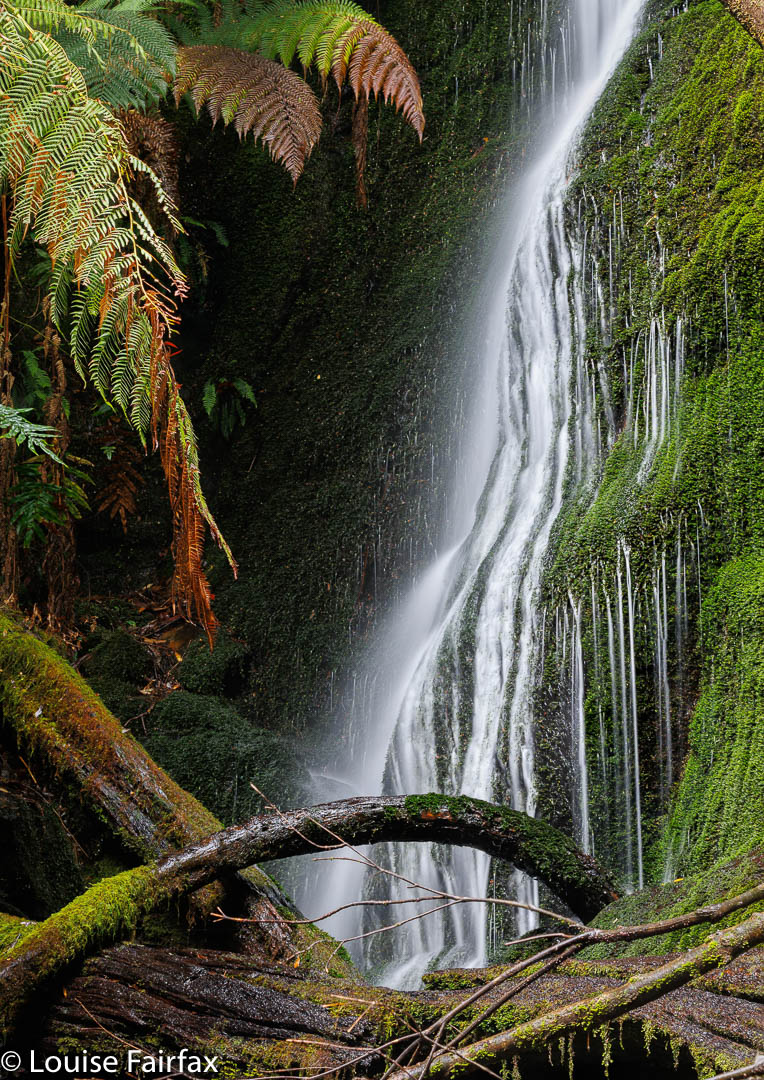
Ah well. Off I set for more fun and adventure, today selecting Mavista Falls on the east of the island for my fungi hunt, returning shortly after lunch to then go exploring above the house again in the afternoon. I left the house at 2.30. Why would you pack a torch at 2.30?
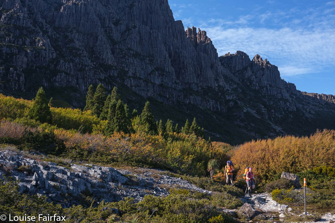
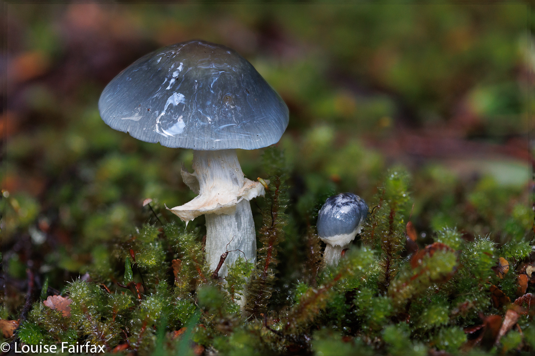
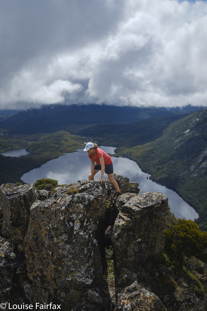
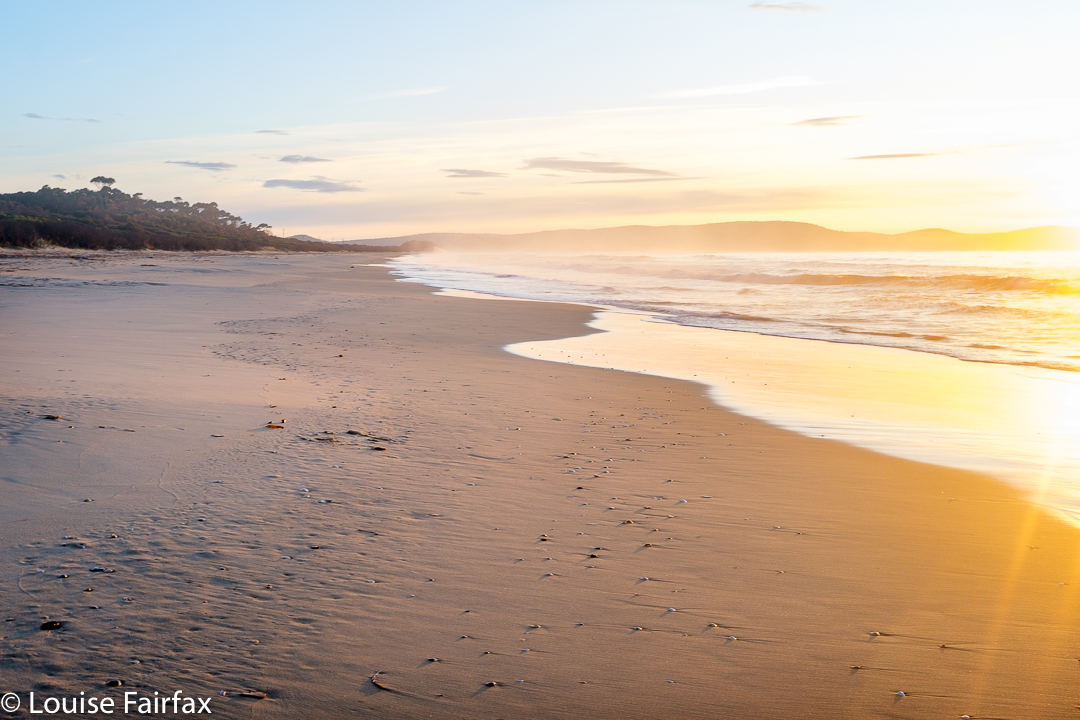
I climbed the headland again, chatting to nice people I met along the way, photographing a few fungi and the scenery. I had made excellent time, so decided to go offtrack and explore the enticing cliffs that I had eyed up the day before. Perhaps there were some dramatic shots to be had. (There were.) It was glorious and I was afloat, unaware of almost everything in a world of beauty. The sunset was red but brief, not really worth photographing, as the bank up of clouds obscured the horizon … and made it get dark much more quickly.
I was off track, and could see no hint of a path that would take me from where I was back to the main track. It was safer to follow the treacherous cliff line than bushbash and get stuck, so backwards I went. Fine; I am bush-capable, and found the pad that led to the track and followed it in the dark, which was now proper dark and not just a hint of darkness. But I am confident in the bush. On I pressed and got to the beach without incident.

Mavista Falls Bruny

I followed the shoreline along. I heard the sound of splosh, splosh. Oh. I was in water. Hm. It must be very dark. I went up higher, onto the rocks, treading carefully now. Could I find the tell-tale sign I had left for myself, just in case it was dark again? Of course not. Anyway, I did find my shack. I didn’t have time to get changed, so went to the hotel to meet my friends in my walking gear, with boots and gaiters.
It was a fun meal. Everyone had had a great day exploring, and all had tales to tell; snaps to show. “We” on this occasion were my camera club, NTCC, and although all of us shoot with proper cameras and tripods, most of us also take phone shots for messaging family and friends, for dinner show and tells etc. But meanwhile, we are also all looking forward to seeing what everyone else managed to capture later, when we post on the club site.

Bruny Forest

As if I hadn’t had enough of an adventure by this stage, I felt what seemed to be a tick on my head during dinner. A big one! Friends doused me and Mr Tick in pure alcohol. He was reported missing, but nobody knew where. I envisaged him just changing spots in my hair, but anyway, life went on. I was so very grateful to have discovered his presence during dinner when I could get help and not later, when alone and inaccessible. I am also, of course, grateful to the army of alcohol dousers and searchers who got rid of my intruder.
As the night was cloudy and the forecast bad, the Astro shoot at the lighthouse was cancelled. Home we all went.
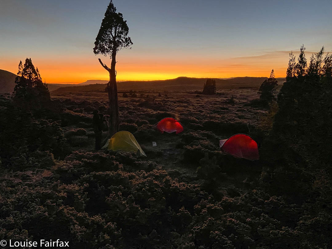
Now my little cabin was very warm and cosy, as the helper-guy had said not to turn the heater off. Not wanting to burden him with a two-hour journey again, I had obeyed. I read a bit and, because I was now operating from a warm base, I decided to take a night shot of the cabin in the dark. Maybe I’d get in a few stars. It didn’t seem to be as cloudy as it had been earlier.

Aurora Cloudy Bay

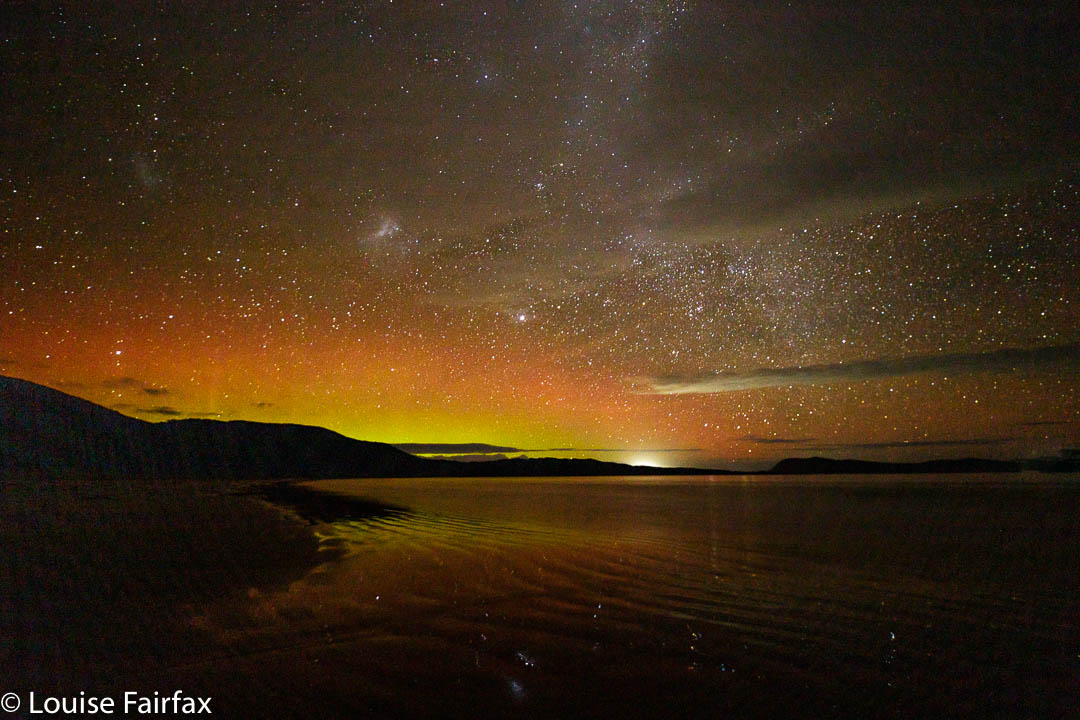
I went out and shot, looking east. But then I looked south. It was clear, and I could detect, not quite subliminally, beams. I almost yelled. I actually ran down to the beach through the bushes in the dark along the sand track with camera and tripod (yes, again neglecting anything else helpful, such was my sense of urgency) and shot south. BINGO. An aurora. A BEAUTIFUL aurora. Oh; I can’t tell you how happy I was. I messaged two friends from the club to alert them, and then spent until 11 pm shooting. I just couldn’t stop. Auroras do that to you.
Meanwhile, I have forgotten to mention the drive to and from the Hotel. Maybe driving along a sand track with more paddymelons on it than blowflies at a midsummer barbecue is not your idea of fun. It certainly meant I didn’t dare go more than 15 kph, but I absolutely loved it. These cute chubby bottoms hopping away and towards, across left and right while I tried to inch forward … I loved them all (especially as they are not eating my garden). I said “Goodnight” to them as I finally went to bed, leaving them nibbling the grass in front of my lodgings.

Mavista Falls Bruny

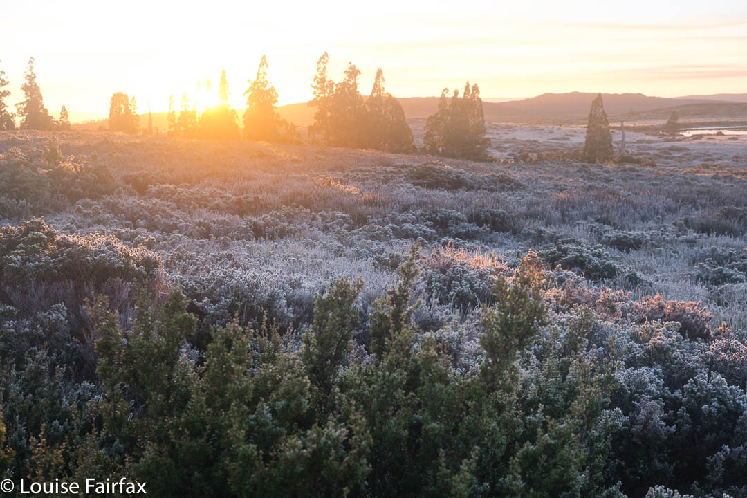
Next morning I awoke at 5.30 a.m. and looked out my bedroom window. The sun wouldn’t even think about rising for another hour and a half; it was still pitch back. The stars twinkled in the window, just like they used to at home before the gottverdammt Health and Safety maniacs who pollute the planet ruined my view by lighting up the place next door, just in case an octogenarian felt like a 3 a.m trot around her place and tripped in the dark.
But meanwhile, I realised as I gazed at the stars that I was warming to this little shack, now that it had warmed up enough to allow such a change in attitude. However, I did think the owner was greedy charging so much, but spending so little. How much would new curtains or blinds, some slightly nice crockery, a modern stove that self-ignited, and a heater that worked really cost?

Bye bye, Cloudy Bay

Such criticisms aside, I was sad as I drove that sandy track for the last time. I went to Cloudy Bay Beach to bid it farewell from that side, and drove to meet my club friend for another fungi and waterfall shoot. I had had a great holiday. Life needs adventures.

Cradle Area Waterfalls Days 3, 4

Day 3 dawned, as cloudless as the preceding two clear days, which meant another dusting of white ice on all the bushes, and pink hues on the horizon at dawn. As on the other two days, we would set out just before sunrise, which meant I ate my porridge at 6 a.m. to a view of dark silhouetted pencil pines against a backdrop of red glow. Sunrise itself – later (7 a.m.) – was a far more pastel affair.

Straight into the sun they go

This day we would explore an area to the east, heading into the rising sun with its golden hues. The backside of Cradle was on our left. To our right as we made our way across the button grass plains, were glimpses of Mts Oakleigh, Pelion East, Ossa, Paddys Nut, Thetis and Pelion West, with others playing more insignificant roles. Barn and Inglis were behind us if we looked back. Emmett was a lump between us and Cradle. These are all my old friends, and just as seeing the spine of a favourite book helps you to recapture the feeling of reading it, so seeing these old friends sparks many happy memories of other trips.

Around the top of Lake Agnew we go

Our first goal that had any significance other than “broad expanse of alpine scrub dotted with pencil pines and tarns” was Lake Agnew. So large was the seemingly featureless route in between us and this lake that, when I thought I was going to be doing this solo, I had marked a waypoint on my map, just to have something to head for. We said “Hello” to my waypoint en passant. I hadn’t any information on Agnew other than that people who crossed it on its outlet stream side had trouble finding a good spot to do so.  Adrian and Caedence were all for passing it on the uphill side, which gave us two streams to cross, but as they were more uphill, they were merely passages of water to jump over. Meanwhile, we had the added bonus of walking along dramatic cliff tops overlooking the lake, with views later to Lake McRae further north. I loved those cliffs.

Leandra having fun on Spine Ridge

We had to drop down from the cliffs in order to cross the first stream, but that was also problem free. Up we headed to a feature I have called Spine Ridge for obvious reasons. Here the view was so fantastic we stopped to have a snack and just enjoy the vista for  a short while.
Now, Caedence gets a little antsy when he sniffs that he is near a waterfall, and so urged us to take a straight line for the first falls of the day, labelled Razorback on the map. He felt that would be the fastest way there. I did mention a good route from the hut to the falls below (not these, but nearby), but my arguments fell on deaf ears. I also pointed out that the shortest route is not always the fastest. What do I say? I merely advise you to listen to what I said, and don’t take the “short cut” unless you feel like a really engaging bush bash where the forest will throw everything it can at you to retard your progress. Of course, we didn’t know that at the time, and Caedence was so eager to at last see water falling we all took the hypotenuse … and lost a bit of time. The day was still long. It was only 10.10.

Mt Oakleigh, Pelion East and more (+ nameless tarn) from Spine Ridge

These falls are actually interesting, as, although they are labelled Razorback on the map, they do not match Stephen Spurling’s photo of falls he calls Razor Back.

Scene along the way. Thanks Adrian. I really do think this was that pink jacket’s very last long trip. It now has so many holes it no longer keeps me warm.

In case you don’t know your early Tasmanian explorer and photographic history, Stephen Spurling III, 1876-1962, stands out as a glorious photographer of his era. His photos form the earliest extensive record of the Cradle Mountain and Western Tiers area. (He was quite an explorer, and now that we have seen some of the falls he shot, I can add he was an excellent bushman. The falls are not in easy terrain.) He took the first known shots of the Gordon and Franklin Rivers, as well as the earliest known aerial photos in Tasmania from 1919. Although many of his photos remain, some are unlabelled, or unclearly labelled, so we are left to guess some things, and join some of the dots. It seems to us, however, that the waterfall labelled Razorback on the map (the first ones we visited) were not the ones labelled Razor Back in his photo.

Myra labelled Razorback Falls on the map

The others believe the first waterfall we visited (above here), labelled as indicated in that last sentence, was therefore Myra Falls, not Razorback, and that the second falls we visited, near the old mine downstream, match the photo labelled “Razor Back”, and hence my caption of the first waterfall as “Myra labelled Razorback on the map”. The second waterfall, which we feel strongly is his one labelled Razor Back, is merely a blue, unlabelled line on the map. I have labelled it “Real Razorback Falls”. I guess there was a transcription error by a clerk in an office somewhere when maps were being made. It is not the first and will not be the last such error.

Real Razorback Falls, as judged by Spurling’s photos rather than map labels

Having had a big bushfight to get to these falls, we were not entirely lusting after more of the same to reach the next. Luckily, it wasn’t as bad, and we knew the next falls would lie in rainforest. We longed for mossy green after that dry, thick scrub, and we got it. My first shot was taken at 11.09; my last around 11,30, so it wasn’t quite lunchtime, but breakfast had been early, and this place was very beautiful (also having many fungi), so we sat by the cool stream and had lunch before climbing up to the high land above and Hydrographers Hut that we wanted to see.

Hydrographers Hut. Sorry for the lack of apostrophe. That is official nomenclature.

Although still a student, poor Caedence also has this awful thing called a job, and, worse still, the pay for Anzac day was going to be just what he needed to amass some savings, so he left us at Hydrographers Hut to make a dash for the tent and an early depitch and exit. But, it was a truly magnificent day, and we remaining three had no pressing commitments for Anzac Day (the morrow), so we chose to enjoy the lake around the hut and the scenery on the way back at a more leisurely pace. We had thought of moving the tents nearer to the cars, but decided we would stay put another night in the end. Adrian had another swim. Louise stayed dirty.

Afternoon light. Looking towards Lake McRae (and Cradle and Emmett).

For the third night in a row, there were no clouds, and ice decked the ground and our tents in the morning. We enjoy our early departures, but on this day it was a mild problem in that the tents were absolutely sopping with the condensation from our moist breath during the night. Drying them out would take hours and a massive effort, so we popped the weighty wet lumps in our packs and just put up with the extra kilo or so of water.

Fagus display as we head back north

As ever, it felt weird to land back in the area of masses of people on the trails once we got near to Cradle. We stopped at Marions to marvel at the Overlanders, sweating and grumpy of face, dressed in black to make them hotter than necessary. It was only maybe the fifth group that actually said “Hello” to us and looked a bit cheerful. I hope their enjoyment of the wilderness increased as they went along.

For Days 1 and 2, see http://www.natureloverswalks.com/cradle-area-waterfalls-days-1-2/

Cradle Area Waterfalls Days 1, 2

I had trouble deciding what to call this blog, for, although it had its provenance in the idea of seeing as many waterfalls as we could in the area south of Cradle – and although we did, indeed, do that – in my mind, both in anticipation and whilst I did it, it was all about far more – or was it far less? – than that, for I kept “just” seeing it as a time in the wilderness with friends, where we would just happen to spend that time seeing water flowing in its various positions and manifestations about the place.

We had to have a brief stop for this (Crater Lake).

But I cannot pretend to deny being a list ticker, a person driven by curiosity to know what that little unnamed blue stroke on a river or creek actually looks like in “the flesh”. I like to see as many of the things I love as possible, be they mountains, fungi or waterfalls. So, there we were, four of us, gathered on the start line with white crunchily iced bushes around us, ready to set off on the next adventure together. With Caedence’s cricket schedule, it took two years to organise, and I had decided I needed to do it solo, but here we were: we had actually managed to settle on a date and pull the arrangements off. Hoorah.

Hypholoma australe. There were fungi everywhere.

I was a bit worried about my four-day pack. It had now been over two months since I had carried a full pack, and this one had my tripod on board, which, of course, adds to the weight. However, we all love beauty, and everyone wanted to have a brief beauty stop at Crater Lake, and another at Marions Lookout, so my shoulders coped fine. Once we got past Waterfall Valley Hut, we began the earnest business of visiting waterfalls, for which I only carried my camera and tripod, so all was well by the time I had to shoulder the combined weight again.

A washed out Gliophorus chromolimoneus

On day 1, we visited falls that I had for the most part already seen: Branigan Falls in its Upper, Middle and Lowest manifestations (all quite separate from each other – several hundred metres apart), and then a waterfall that was lower still, which I have called here Hartnet Rivulet Falls, and which we actually had to observe from across the valley. I found these ones very disappointing, for, although they are very tall, they were more cascadey in structure than I was anticipating. Be that as it may, they were definitely a waterfall.

Branigan Falls. Confessions of a sinner: this was a shot I took last year. I prefer it to this year’s effort.

More disappointing in terms of capturing flow, but for some reason I found them to be fabulous, were “No Fall Falls” Upper and Lower. These were overlooking the Hartnet Rivulet Falls, and were supposed to have their own water falling, but, although a very deep gorge was present, obvious sign that water did once rush through, there was no water at all on this day. If you look at the map, you will see that the catchment for these falls is tiny. They issue from a small, unnamed tarn that debouches into an unnamed stream with two blue dashes (indicating waterfalls) across it. We had had a week of rain, but I guess that tarn up above us was empty.  The orange cliffs, however, were massive, and the fagus was several shades of yellow and orange, with a few mightily tall pandani here and there. It was a beautiful place to be, and felt deliciously remote. I was sadder about having no opportunity to quench my now severe thirst than I was about not being able to photograph another waterfall.

Middle Branigan Falls
Lowest Branigan Falls from above
Hartnet Rivulet Falls, taken from near No Falls Falls (Lower and Upper).

Eventually we had visited all we wanted to see in the time we had, and off we set further south to our planned camping spot, in the shelter of pencil pines away from the track. The skies were pretty clear, which made for a freezing night. Luckily I had come armed with all my winter camping equipment, including warm booties for bed and an extra SoL bivvy bag to add 5 degrees to my down bag. The tent flap was stiff and white next morning, and the ground, a fairyland of white sparkling crystals.

Predawn glow. Photo credit: Adrian Bol, who was much braver about getting out of his warm sleeping bag than I was.
Sunrise Day 2. I am up and about now. We are underway. This one is mine.

On Day 2, our faces turned  to the west rather than the east of the track, and in the glorious dawn we set out west for our first rendez-vous: Innes Falls. We had been told the track around Lake Will was very muddy, but, well, it was still frozen, so I guess that helped. It was no big deal on this day. My big disappointment was that the fagus was still green in that protected amphitheatre. At this time of year, we thought we’d be guaranteed of yellow. Now I want to return this week, but it is raining all week, and I am not sure what that will do to the leaves.

Innes Falls

Innes was one of many. We stayed there only twenty minutes, and then moved on in our big circle. The distances between waterfalls got smaller, but the times got longer as the vegetational resistance grew. It was not horrific or anything, but you sure don’t cover ground as quickly as you do if you are on a track. And lifting your legs high over bushes naturally slows you down.

Upper Tumbledown Falls

Our next port of call was Upper Tumbledown Falls, which were nice enough, albeit nothing extraordinary.  There were odd exudations of white all down the rock (calcareous deposits??), which reflected glare making a good angle hard to achieve. I settled for a 4-shot panorama to get near to what I wanted.

Cave Falls

Climbing out of these, I got poked in the eye with a sharp stick, but luckily the effect and blur wore off as the day continued, and we wended our way on towards the next nameless waterfall in our circle. On getting to the bottom of this one, we dubbed it Cave Falls so we could all refer to the same thing. This name came from a kind of cave structure in the rocks in the upper part of the falls. These, too, had white deposits in/on the rock.

Veil Falls. I am not one scrap happy with this photo, but have included it for the sake of being comprehensive.

The next were also nameless, and the sobriquet Veil Falls was an obvious contender to an unofficial title, as they flowed in a beautiful Veil down a long expanse of partly mossy rock. There were countless aged Cortinarius metallicus here – so many it was hard to find a place to put your feet. Adrian grew worried. There was still a great distance left to cover, and he feared I was about to be irretrievably diverted by my other hobby: fungi hunting.

Cortinarius metallicus. Sorry, but the idea of inclusion has its limits. Maybe next visit I can take a photo of Tumbledown Falls that I am not ashamed to post. There were hundreds of these fungi to be seen this trip. Most were old and brown, but there were enough that still had colour for me to want to photograph them.

On we pressed. I assured him my focus this trip would remain on waterfalls. At 11.15 we arrived down lower, at Tumbledown Falls, having had no particular trouble finding a feasible route. These, although named on the map unlike Veil, were not actually as aesthetically pleasing as the former, but, of course, we photographed them to record their presence anyway. (That said, my photo does not pass my own standards, so is not included. Sorry.)

Tomahawk Falls Middle Tier. Adrian supplied this photo of this very dramatic drop (and his magnificent legs). I like it as it captures the sense of extreme height. The water in this part of Bluff River had the most wonderful rich tannin colour that you can also detect.

Now began a slightly longer march across button grass plains in the direction of Tomahawk Falls, which, we could tell from the map, would be protected by a bushy palisade, and would involve skirting steep cliffs, if possible. Because the northern side of Bluff River is ultimately steeper and bushier than the southern, we went on the latter side, but thereby added two creek crossings which proved a challenge to this person who did not want to get her feet blistered later by covering big distances in sopping shoes. I got around, but only after searching. On the rebound, Leandra and I took the northern side, and returned home with dry footwear. It was much faster.

Tomahawk Cascades, above the three tiers. Thanks again A

The position of these falls is slightly different in Listmaps from on my highly-contoured navigational map, which has an extra gully marked in (that is on the ground but not in Listmaps). The bush was stunningly thick and steep, so we weren’t sure of the best approach or how to actually gain access to these falls. We slid several metres down massive drops, to the point where I began to have serious misgivings about whether I would be able to get up again. Leandra was comfy stopping where she was, from which position we could see the flowing water, but had no access to a clear shot.

Bluff River in low light

The boys wanted to climb further. I was nervous about my ability to stay with them in terrain like that, and didn’t like leaving one person alone, so I opted to stay with Leandra while the boys searched. We heard loud screaming. Were they screaming at each other or us? Was one of them in trouble? Had something happened? Our optimal turnaround time had by now well and truly gone by. In the end, we decided if someone had been in trouble there would have been more yelling, so we set out for home, knowing the boys would catch us later. Maybe the yells were to tell us to move on. I stayed very near the cliff face to get photos from afar, even if not the lovely ones the guys got, which they have been kind enough to give me for this blog.

Icy environs. I love icy landscapes even better than waterfalls. Sorry.

Leandra and I adored the cascades of the Bluff River as we followed its journey from its source above. They were such a honeyed tannin colour we delighted in them, and agreed we wanted to camp there one day. The light was now a little too strong for good photography, and the day not long enough to linger, so we stored the treasure for another time, and headed back towards Tumbledown Falls, from near which we climbed up to the top of the falls. From up there, we could see the guys below us, so we all knew the others were safe, allowing each gender to pursue its own route choice. Ours was longer but involved less button grass and, one thing and another considered, was the faster route. We followed cliff lines with magnificent views back to Innes Falls, and then the normal Lake Will path from there.
The sky was clear. It was already getting cold and we were hungry by the time we reached our tents. Adrian, brave soul, went swimming. Brrrr. I stayed dirty and cooked an early dinner while I still had light to see. I like eating my dinner and looking at the scenery. I was also very keen to close the tent up to keep in my body warmth once the dubious feast was over.

Cradle weekend 2022

This weekend had so very much packed into it, it is extremely challenging to select less than twenty photos, so I have had to omit a great deal. There were wombats, mountains, of course, waterfalls – one of which is a blue line on the map with no name on an unnamed creek, so for reference I have called it Kirsten Falls. (It empties into Crater Lake, but Crater Falls already exist, down lower, with their own upper and lower versions.)

Wombat; Cradle. Always adore seeing them

There were sunsets and dawns, a visit to Sutton Tarn, which I have never previously sighted, a swim for my daughter Kirsten (in Crater Lake), and, perhaps ridiculously, I visited Wombat Pool for the first time, too. How can I have been in this area that used to be my almost weekly playground before the government handed it over to tourists and made it exceptionally difficult for Tasmanian residents to enjoy any more, and not been here?

Kirsten Falls that feed ultimately into Crater Lake. Crater Falls (Upper and Lower) are below the lake. These falls are just a blue line on the map.

Does anyone else remember the good old days when you could scoot up here after work, have a quick bite by Dove Lake and then go up into the mountains before it got too dark to see? We used to regularly pop in to Waterfall Valley Hut for the weekend. I used to park at the lake and run repetitions up Marions Lookout for training for my mountain running. And so much for astro, sunset or dawn photography by the lake: all just events in the memory of those of us who lived before the tourist invasion. Before the government turned natural beauty into a saleable commodity, sucking out its soul in the process.

En route to Little Horn

The waterfall shots aren’t my favourites, but I do like documenting waterfalls I have visited, so you’ll have to humour me on that one. Only one fungus has made it into this small selection, although more were there to be seen.

Little Horn summit
Little Horn summit

It is a weekend present in my brain not in words, but rather in a series of images and feelings that I have not wanted to reify by reducing them to words. I will let the photographic images function as poetic images to hint to you at a wider whole that transcends its adumbrated representation here.

Little Horn

Our itinerary is as follows:
Friday evening: arrive; wait for the boom gate to open and then walk to our hut (almost in the dark).
Saturday: a loop that included Kirsten Falls, Sutton Tarn, Little Horn, Lake Wilks, Ballroom forest, Wombat Pool and Crater Lake.
16 horizontal kms + 600 ms climb which yields 22 km equivalents.

Climbing down to Lake Wilks
Lake Wilks Falls Upper were flowing well today

Sunday: unfortunately we only had half a day, so went towards Barn Bluff in freezing, fierce wind, and returned in beautiful sunshine with a crisp autumnal feel to the air. The light was beautiful. We rushed the first half, hoping to squeeze in the summit before our turn around time.

Aurantiporus pulcherrimus
Evening light Saturday
Sunrise, Sunday

However, one of our trio was freezing and decided to turn back. Kirsten and I continued on, but we had lost too much time by then, so opted to give the summit a miss and just enjoy being up high on the Bluff Cirque and Cradle Plateau, and taking in the scenery at a more leisurely pace.

Moody Cradle Mountain

I have already climbed it three times, so didn’t really need a fourth – well, that will happen, but not today – and Kirsten summited it with me when we both ran up it several years ago. After lunch, she would have a huge drive to Hobart, needing to be back in time to have dinner with the children and get ready for work the next day, so it was better to have a relaxing morning than rush the summit.
19.1 horizontal kms + 230 ms climb yields 21.4 km equivalents.

Cradle Mountain. Sadly, it is time to descend for lunch …

Robbies Falls

Robbies Falls are situated on the beautiful Falls Rivulet, which issues out of Lake Skinner, nestling under Mt Snowy South (an Abel). From the lake, the picturesque rivulet tumbles down over cliffs and skirts obstacles until it loses its identity as it merges with the Little Denison River further east.

Robbies Falls

Because the closest access is McDougalls Rd, we early visitors called it McDougalls Falls, but were later informed that another person (“Robbie”) had discovered it, and used to frequent it, and it was known by his friends as Robbies Falls.
Visiting it now (as opposed to when “Robbie” visited, yesteryear), there is a daunting palisade of cutting grass that has opportunistically used the available light following logging. It mounts a mighty defence to ward off visitors. A different Rob, who had worked out it should be there, plus Caedence and I, bashed through this dreadful stuff for a long time, and then gave up. I vowed I would never return. Rob was more persistent, however, and went back using a better – in his words, smarter – route, and he and two other friends got there. I couldn’t go that weekend, but once I saw the shots, I had terrible FOMO. (Do I confess, envy?) Grr. Why had I not cancelled other obligations and gone too?

Falls Rivulet, below Robbies Falls

This weekend, Adrian said he’d show me the new route, so I got to finish the unfinished business. Using Rob’s improved route, it was pretty easy. Warning: it is still very possible to get enmeshed in cutting grass if you are not careful! Standard contour maps don’t tell you where the cutting grass lies, so you need more than just a traditional map.

Lower Robbies Falls

Pictured above are Lower Robbie Falls, which are not as high as the main falls, but, in my opinion,  are more photogenic.
The other – also magnificent – waterfall that also lies on this rivulet, although higher up, and accessed from the northern side rather than the southern, is Compton Falls, which have their own blog. If you are a competent and experienced bushwalker, then both falls are a total delight.
http://www.natureloverswalks.com/compton-falls/

Further directional information: Falls Rivulet lies under the Snowy Range, west of Judbury (which, in turn, is west of Huonville). when exiting Judbury, take the Lonnavale Rd, then Denison Rd, and finally, McDougalls Rd. From it, you head north to the falls.