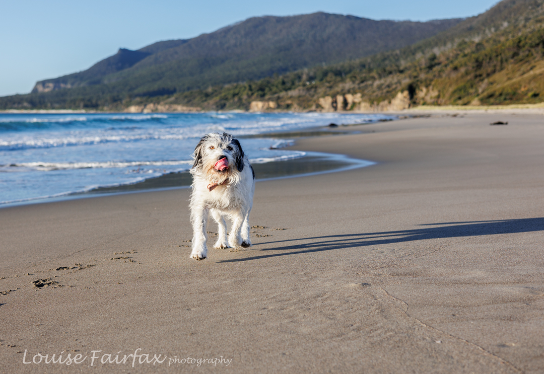
I’m not sure when the name Larapinta Trail came into my awareness, or when it changed from “thing other people did” to “track I want to do”. I do know that by the time Covid came along in 2020, I was already formulating plans, but, like every other travel plan made in 2020, this one got ditched in favour of local, smaller jaunts.
This year things changed, however, as, not for the first time, an exciting email from my friends Alex and Nitya arrived in my inbox, this time telling me they were doing the Larapinta Trail in July, and inviting me to join them. Apparently I first responded with the intention to do a section or a week, but with the tiniest bit of research, I saw the light and announced I wanted to do the whole lot. I am so very glad I came to my senses. I saw companies that offered sections — but how on earth do you choose which one? To do what is considered the best is like having dessert with no main course – sickly sweet and unsatisfying. I wanted the whole deal.
And the last thing on earth I wanted was to do it some easy way, not carrying a pack, or not doing it what I consider “properly”. I know there are some people who just can’t do it this way, and who have to content themselves with an attenuated version, but I can do it properly, and thought anything less than the real deal would be cheating myself of a valuable and wonderful experience.
Meanwhile, I had very serious doubts about my ability to carry this through. I have completed masses of long distance trails – far longer than this mere 230 kms – but they have all been in Europe, where mountain huts are plentiful, real food (not carried) is in the huts, power points exist for recharging batteries, and objects run out of can be bought in a passing village. One’s pack is thus very light.
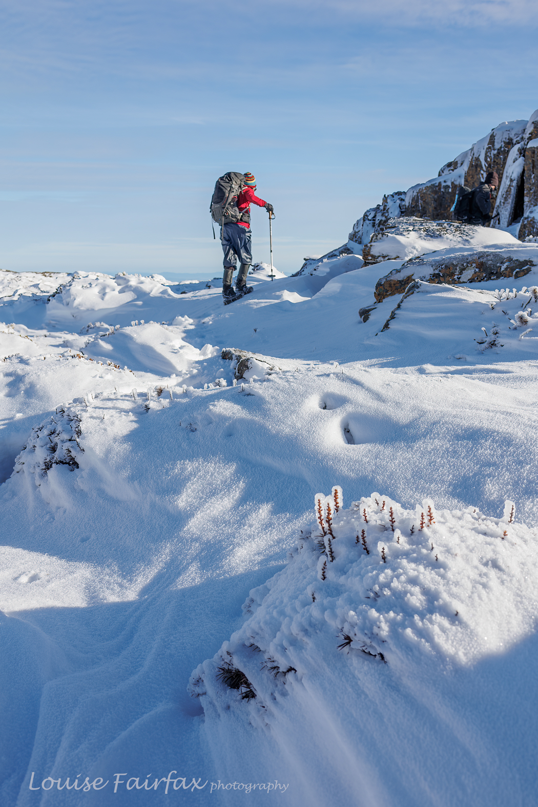
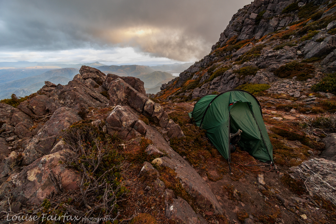
This time I would have to think really, REALLY carefully about food, electrical needs, and, on top of an already heavy pack, have the facility and capability of carrying at least 4 litres of water beyond my normal daily tally. We would have five dry camps on top of mountains, and therein lay my greatest challenge. I can report now that my pack on those mountain-climbing days weighed only just off half my body weight. That is huge, and absolutely not recommended anywhere. Could I pull it off? And if not, what on earth would I do? I’d cope with solution when the failure occurred, but I was very nervous about the first day that would test me out.
My other big area that took up a lot of time in the planning was to decide exactly what photographic gear I wanted to take. I am so grateful to photographer friends Grant Dixon and Marley Butler, both of whom spent a generous amount of time on the phone talking to me about my plans and giving me tips. Thanks to advice, I took on the challenge of carrying my good camera, three prime lenses (16, 35 and 50), one ND filter, and my tripod. I am glad I brought them all. They gave me flexibility. My 50 got the most use. My tripod had a great workout.
Believing that the USB ports at the drinking stops would be enough to charge batteries, I only took a small power bank. That was a big mistake: next time I will take a much bigger one. Next time, I will also take a 3-pronged power plug. I didn’t realise there would be a possibility to use these, and they were far faster than the solar-powered USB ports which were singularly unreliable. Luckily for me, Alex is a generous friend who was carrying a more substantial power bank than I was, so he rescued me a couple of times.
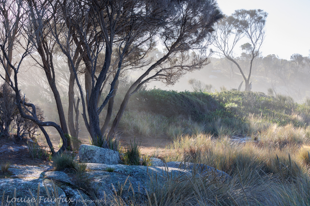
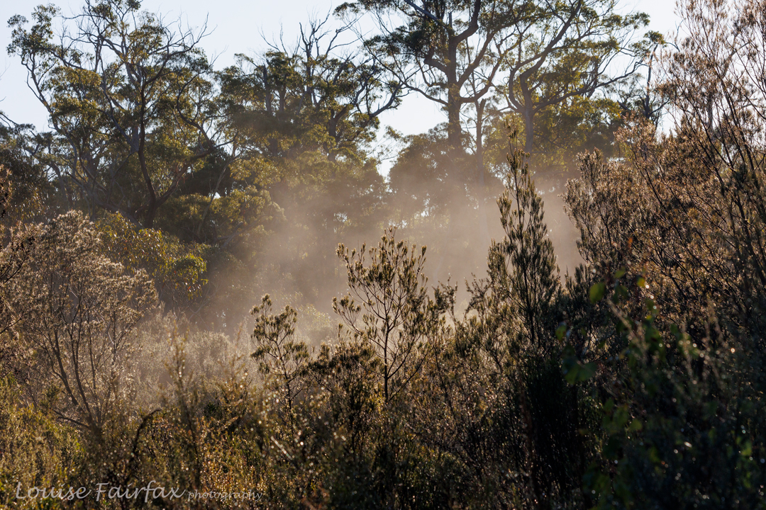
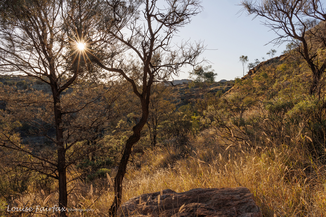
Enough about practical hints; let us proceed to my experience of the trail, which kind of begins on the aeroplane, staring down with excitement at all that flat red land beneath. What was a mountain girl of lush green forest filled with moss and lichen doing here in red dust? The difference was invigorating.
And at last we were away, with a small send-off troop of Alex and Nitya’s friends, ringing cow bells as we departed. It gave our exit a huge sense of excitement. Well, I had managed to get my overloaded pack onto my back and take the necessary steps, so … so far so good. It was happening. What did the future hold?
The pace was fine: I was lucky, as my fit, fast friends were carrying little baby Adi, now aged 14 months, and so were necessarily slowed down somewhat. Alex’s pack was of huge Empire State dimensions, in order to accommodate Adi’s needs along with their own, and Nitya had the weight of a moving object (who pulled her hair) on her back. This was a perfect pace for the laden Louise.
All went well until some time after lunch when the day got very, very hot. Alex and Nitya needed to keep moving as Adi was now asleep. The heat was really getting to me, as was the weight of my pack, so I elected to have a short rest and meet them at camp which we were not far from at that stage. I had wilted and was about to melt.
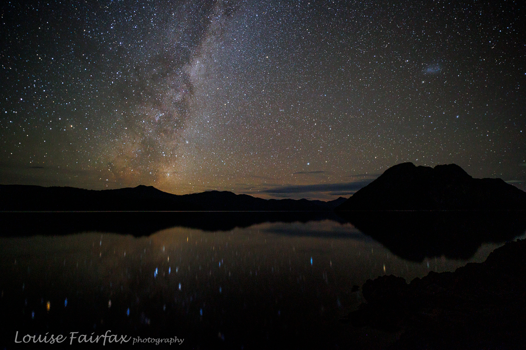
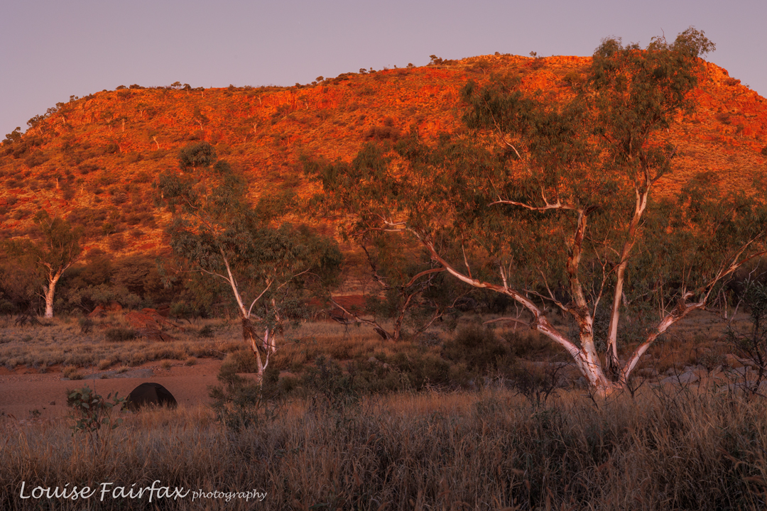
After the break and drink, I was soon enough giving chase, and we all joined back again once we were at Wallaby Flats, chosen location for our first night. Some say this place is boring. This was the first night of our adventure. Although we had left pretty late, we were here in good time to explore around before it got dark, and for me to choose a sunset location for photography. After dinner, we all went to this spot and totally enjoyed our first sunset of many in this unique adventure. Even little Adi came to watch and appreciate.
Day 2. Wallaby Flats to Bond Gap Junction.
I did not take many photos this day, but can report that the visual highlight was definitely Simpsons Gap. For the rest, my memory is a blur. My greatest concern had become my camera: my battery was only half full after last night’s shoot. This was a disaster. There were no recharge possibilities until Hugh Gorge, a very long way away, and only that if Alex’s dad could locate the charger I left in “my” room at their house, and bring it to me when he came to visit. All of a sudden, I became very abstemious in the matter of what deserved photographic representation. I am not a fan of phone shots. I began to save my camera for dawn and dusk until further notice.
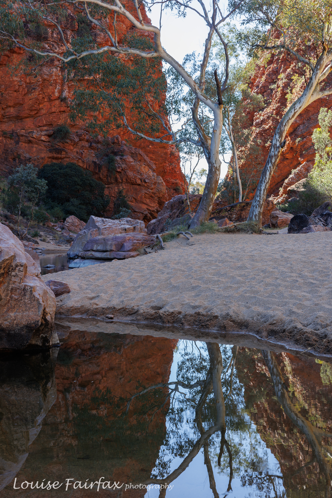
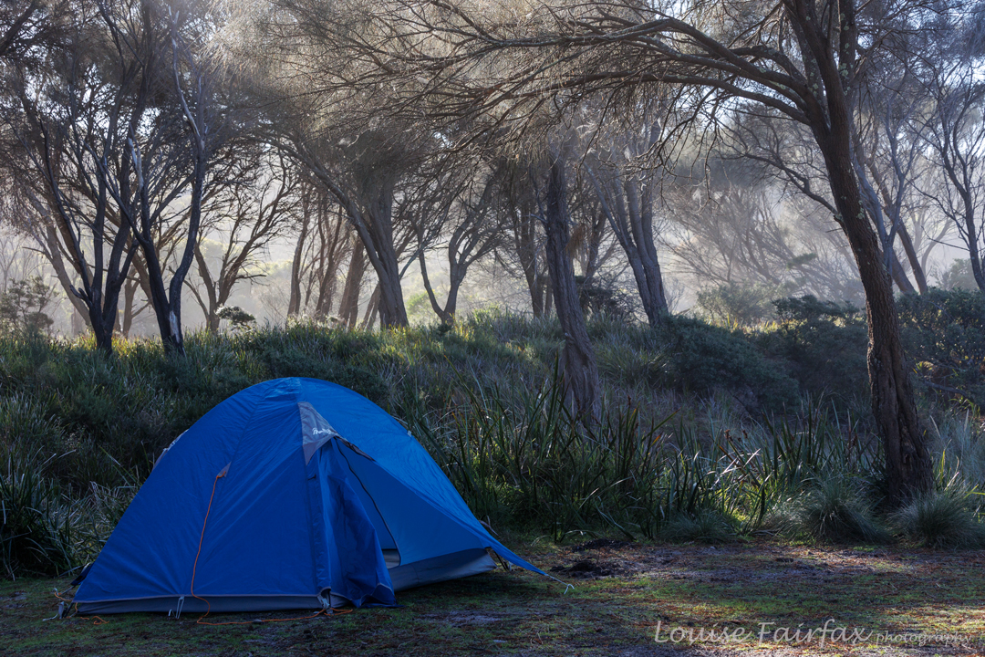
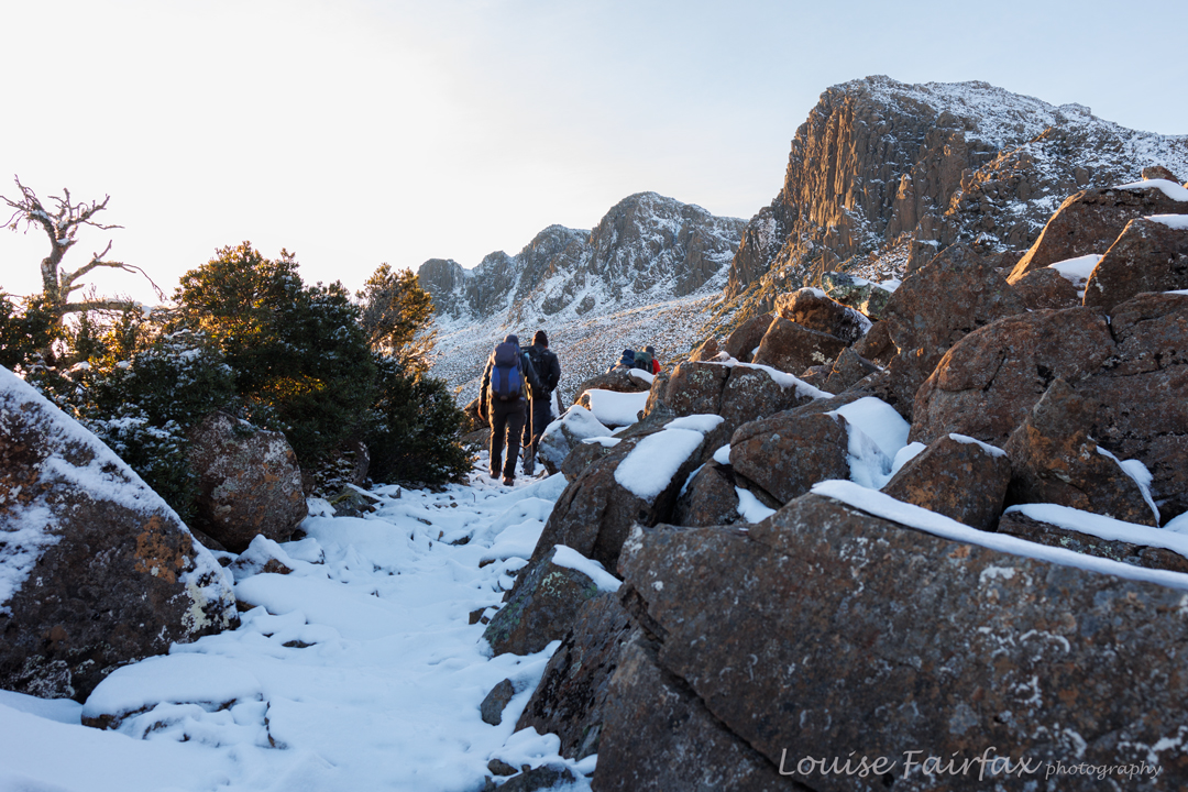
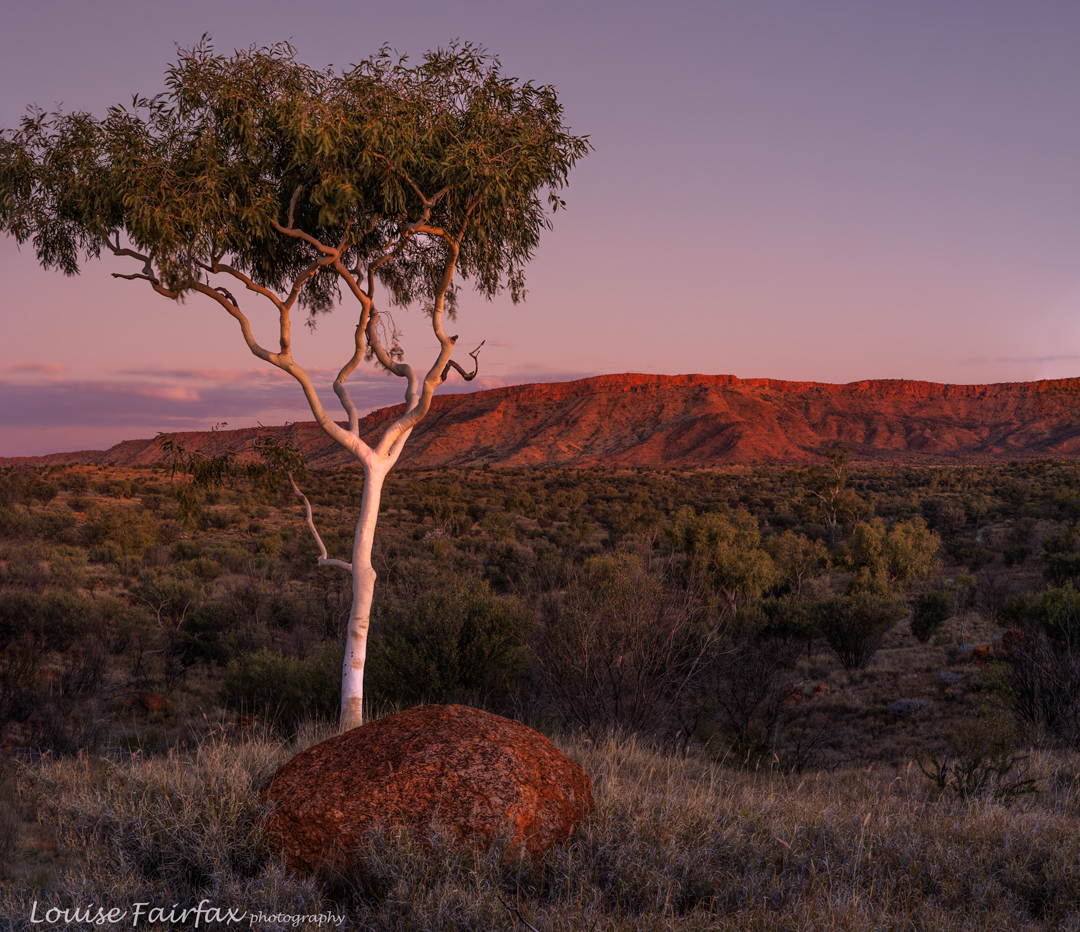
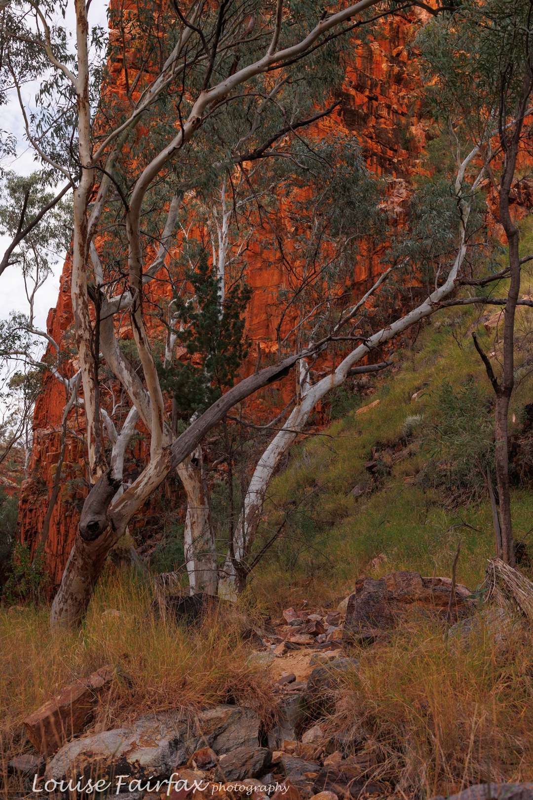
There is no camping at Bond Gap itself, and thus we did not camp there, but we did find a spot downstream where it was allowed, and this spot was very beautiful. I visited the gap in the gloaming and loved it as well. Mostly I remember really being filled with an enormous sense of tranquility and peace, pitching my little tent in the sand of a sometime creek, listening to the birds, enjoying the spectacle of white River Red Gum trunks against red rock and white sandy soil from Heavitree Quartzite. I could think of no place on earth that I would rather be. Little Adi played with wattle flowers and helped his dad pitch their tent by carrying pegs around the place and bashing them together.
Again today I wilted from the heat around lunch time. Alas, I was going to have to start earlier on future days to get more distance covered before the day got too hot. I was not as capable of heat-walking as my friends were. They couldn’t start as early as I needed, as their day must necessarily accommodate itself to Adi’s particular needs, such as breast feeding, nappy changes and out-of-pack time. By now Alex was carrying two full days’ worth of wet, heavy nappies along with the normal supplies. These two are so very strong!!
Day 3. Bond Gap Junction to Jay Creek.
Jay Creek has a shelter with water, but to get the water, of course, you have to walk the day’s distance first. This time I set out early, so was there in time for a late lunch. This meant the sacrifice of sharing the journey with my friends, but had the advantage that I arrived in much better shape than the preceding days. We could still enjoy the afternoon and evenings together.
Arising early had been lovely. I breakfasted in the dark whilst the red to the east got lighter as I ate, shot the dawn, packed my gear and was away by maybe 8.30 – not as early as many manage, but I felt unhurried, and it was still early enough for me to get in at least two hour-long stints before the day got hot. I was on a schedule that had me stopping every four kms and drinking 250 mls water. No doubt that is not enough for you, normal person, but it is enough for this little camel, and I felt fully hydrated on that schedule. I seemed to be walking at about 4 kms per hour. Knowing this was good, as I could plan my water needs for the day, and make sure I had enough to fund each stretch between water possibilities (which are on the map).
Jay Creek did not thrill me, but that is my fault. I should have camped in the river bed further along, but instead chose to be near the shelter, which suited Alex and Nitya with the baby. The wind was very, very strong that night, and many of us elected to not pitch at all, but rather sleep on the kind of benches that are there. This made an early departure the next day even easier to achieve. I was on a mission the next day. I was going to really zoom along so as to get to the cafe before it closed, allowing me to order hamburgers for everyone. (It was closing at 2pm that day).
Day 4. Jay Creek to Standley Chasm.
There were no photos at all this day – not even sunrise. I achieved my goal, and arrived at the cafe by 12.30, an hour earlier than we thought needed. I asked when I should order for my friends, and was told 1pm, so sat and enjoyed the truly delicious Chasm Burger whilst waiting for that time. Up I went and ordered:
“No madam. We’ve shut down the kitchen”.
“But you said to order by 1 and here I am”
“We’ve turned everything off.”
I was devastated. My poor friends. I was allowed to get them toasties, and luckily I had left nearly all my chips. A stack of sweating, exhausted people arrived in time for the 1.30 pm order we all expected, and all of them had to settle for a wretched ice cream. Everyone was pretty gutted.
Standley was not enjoyable at the time: there was huge noise pollution, lights were on all night, and the toilet block reeked of some sweet cleaning agent. In my chagrin, I failed then to appreciate the wonderful warm shower, the chance to get more food and throw away rubbish, to recharge my batteries and wash clothes, and the astonishing luxury of having grass to lay out my new food (from the food drop). Later I looked back on Standley with kindness.
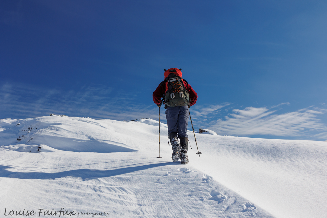
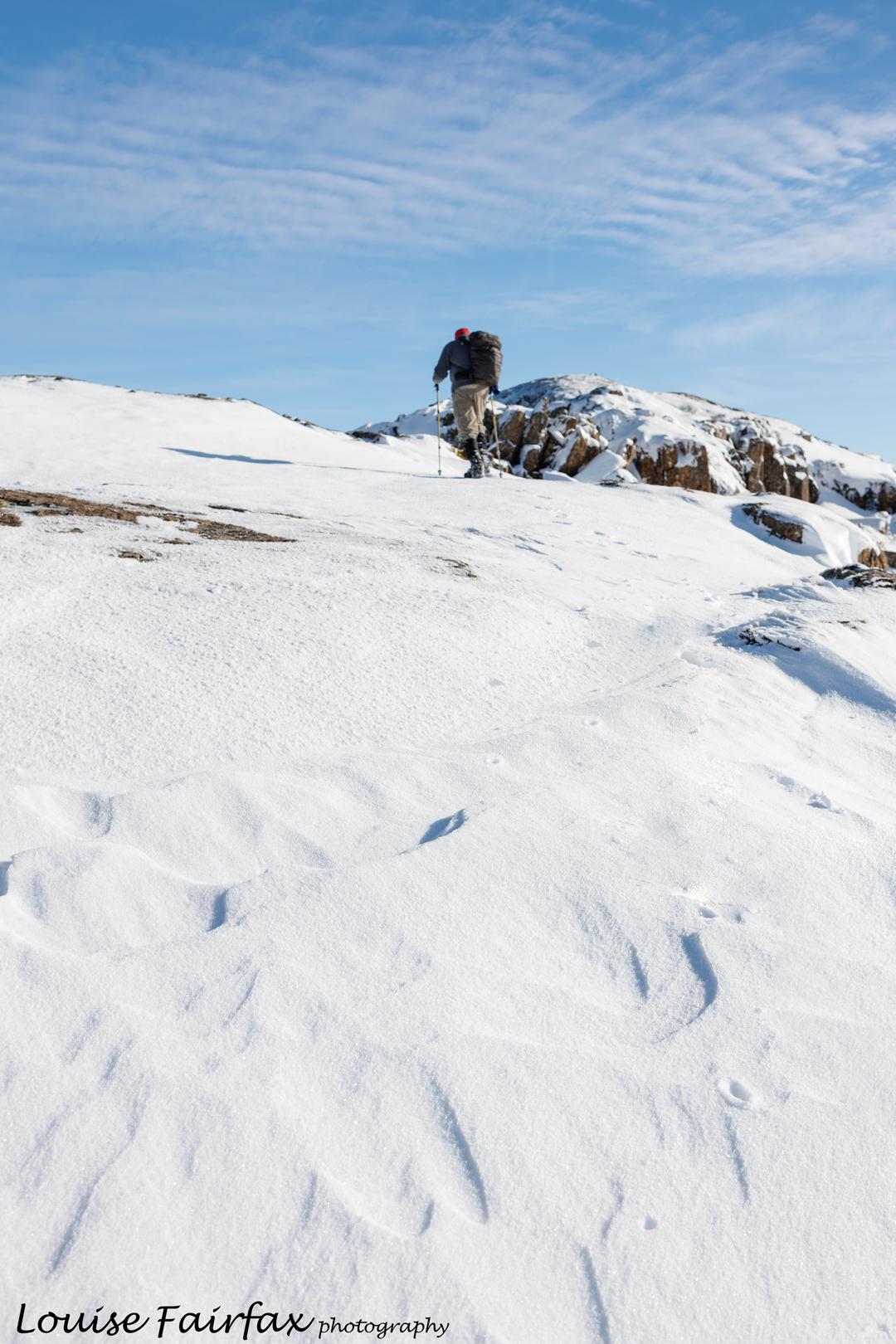
Standley will also always feature strongly in my memory as this was our first experience of a food drop. We had made new friends on the track, and all of us now sat outside our tents, staring at mounds of food spread out before us. Not one person could see a way of getting all this new food into her already full pack. Nobody had finished the old food, yet all of us were too scared to throw food away in case we needed it later. I resolved to tie a whole lot of stuff to the outside of my pack, along with the water I was about to carry. Climbing Brinkley Bluff was about to be a farce.
I visited the actual chasm in the dark, being turned off by all the tourists earlier in the day, and being preoccupied with showering, washing and food sorting later. It was lovely in the dark: a special experience.
Maybe I need a photo of a hamburger here? That seemed to be the focus of the day.