Gell, Hippogriff, Chimera 2015 Nov

Mt Gell as seen from a previous trip (with better weather) : from the Loddon Ranges. Ah yes, see those rocky knolls on the ridge line?

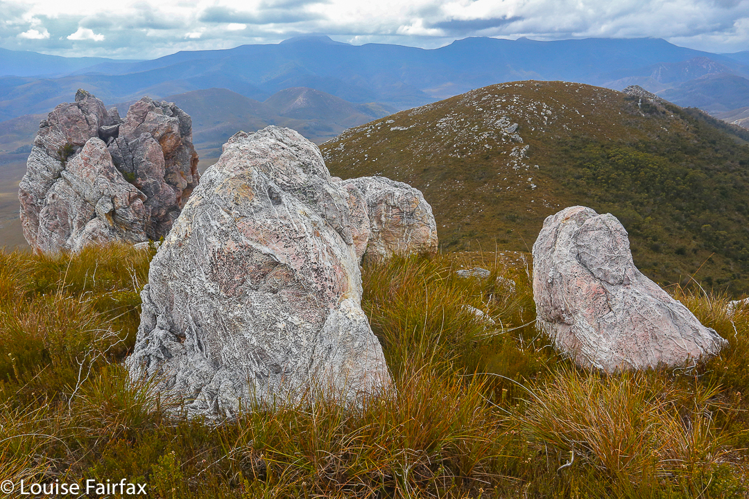
Veni, vidi, vici? No way. We came, indeed. We saw? Never, neither from afar nor from up close. I have had to use pictures from other trips. We conquered? The gps and bit of a cairn both agreed we were at the summit, but it sure didn’t feel like “conquer”. To me it felt as if Gell just couldn’t be bothered fighting us silly ants any longer, so lay down so we could pretend to be victorious. Perhaps in deference to my feeling that I had in no way “won” this mountain, but rather floundered to the top, I never actually stood on her (or, not that I recall. Don’t worry pedants; I did touch the cairn). My lack of standing was, in reality, due to the howling wind, my frozen hands and fear of incipient hypothermia. I crouched on top, a most unvictorious pose. There were no photos: not from me; not from anyone. We all had survival on our minds. Perhaps we all own enough photos of summits in thick mist and drizzle.  We all know we did it. A few gps devices no doubt recorded our presence.

Gell from the Loddon Ranges, putting her best foot forward on that occasion.

From there, we made a hasty retreat to escape the wind. There was no evading the rain. I eventually ate out of duty rather than desire: I was not hungry, but I also know that eating peps up the metabolic rate, thus helping in the fight against hypothermia, so I did my duty. The thought of removing my protective shield, namely, my pack that was keeping my back a little warmer and dryer than otherwise, had no appeal. Shedding my gloves to hold my food was almost intolerable. Give me nice, dry ice and snow any day.

One of the few nice sections along the Franklin. I was bitterly disappointed, imaging in advance that the whole way would be like this.

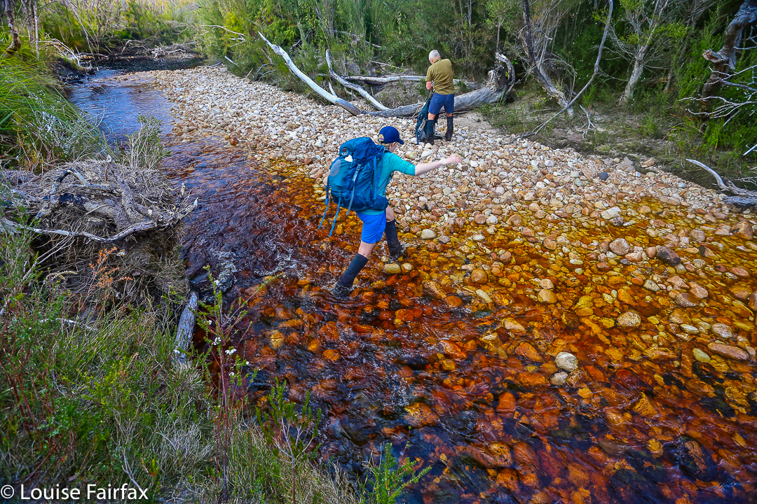
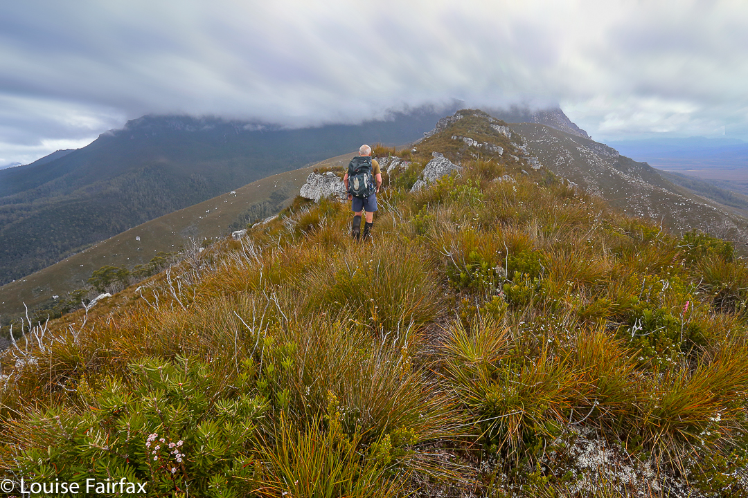
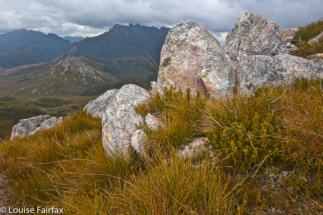
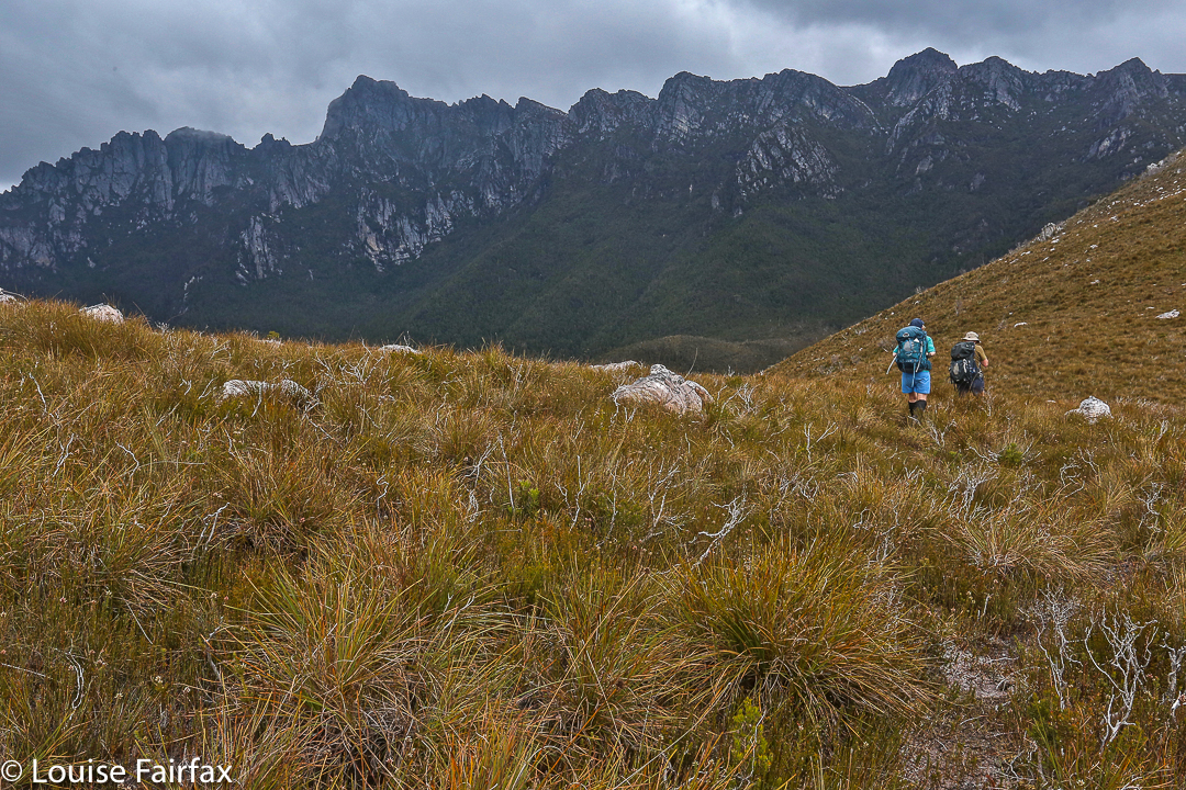
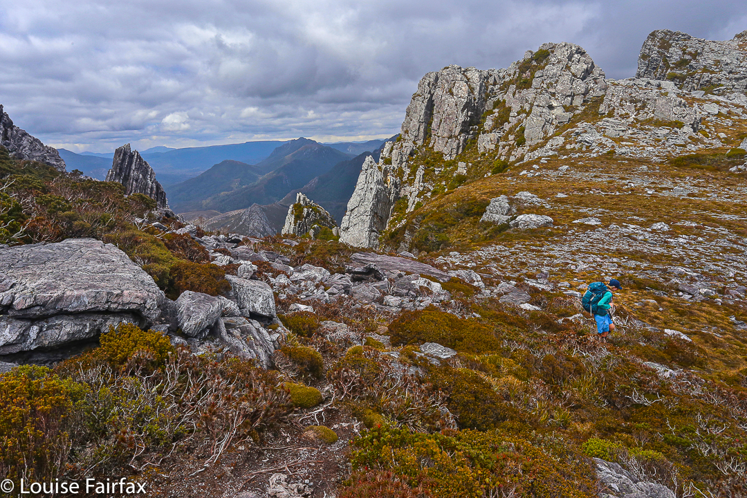
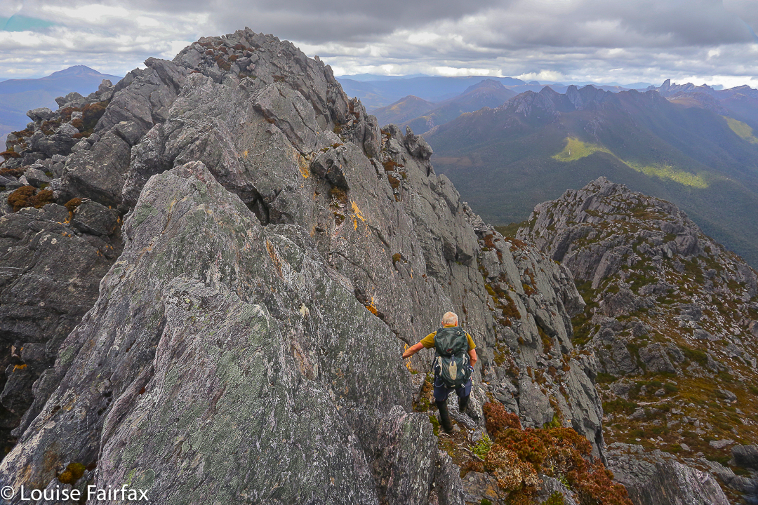
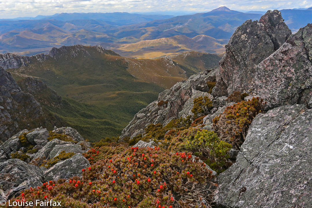
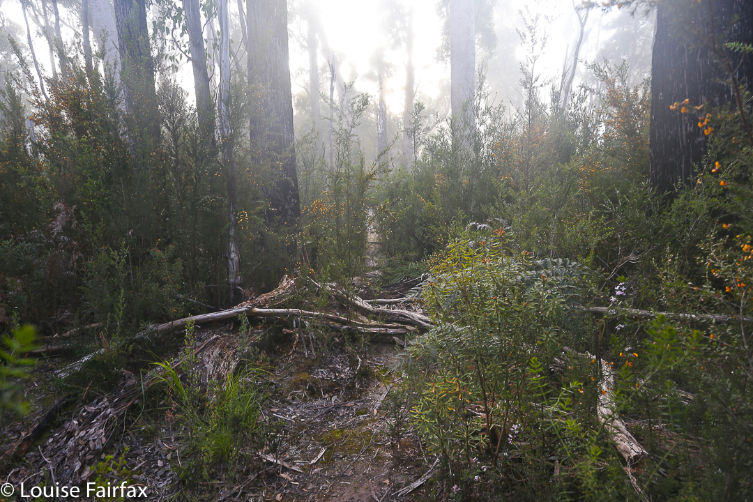
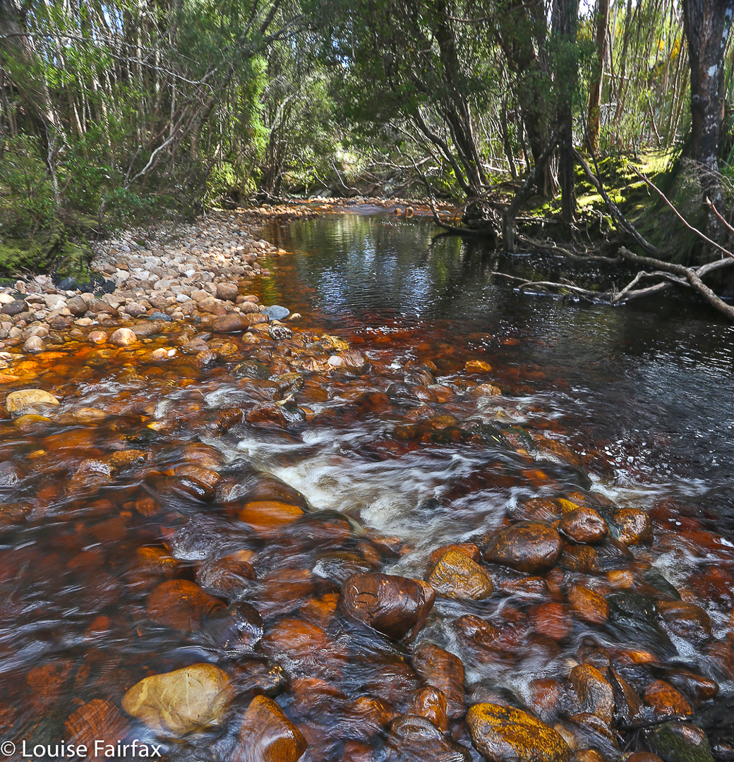
I had totally underestimated Mt Gell, and had only done it the courtesy of reading the report in the Abels II book, which made it sound quite a friendly jaunt. The article made no mention of the marshy web of stubborn melaleucas that guard the flanks of Lake Dixon, nor of the endless kilometres of unpleasant scrub lining both sides of the Franklin River. Not a word was said about the many cliffs that need to be avoided or climbed, which lie between the Franklin and the summit of the Hippogriff (front quarters of an eagle; hindquarters of a horse. Hm). These cliffs were actually fun on both our ascent and, quite different, descent routes, but I do think they deserve a mention.

Another glorious moment beside this famous river.

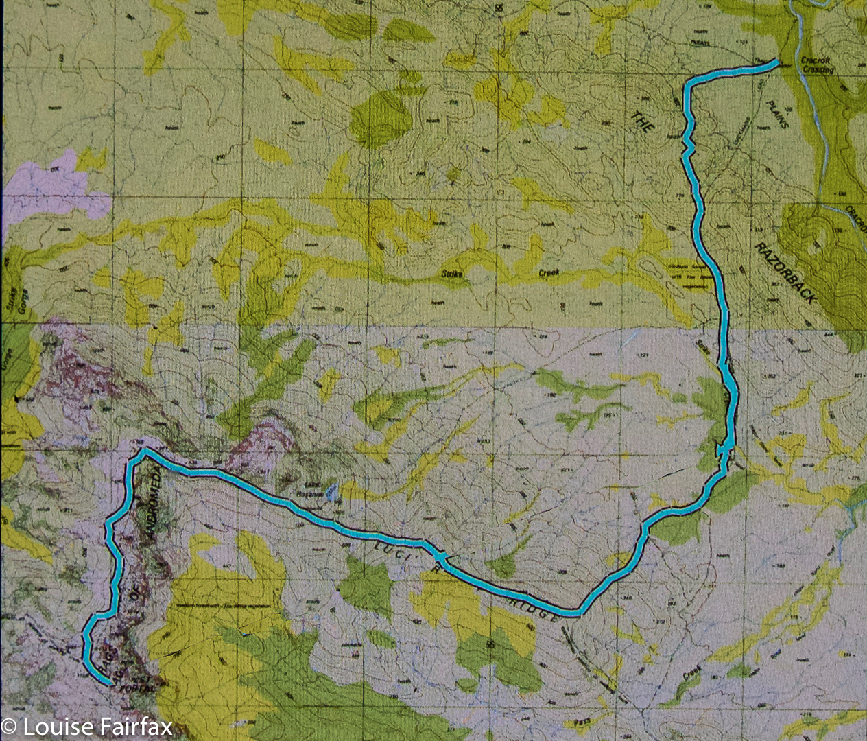
It took our group 1.5 hours just to get from the car to the crossing of the Franklin (“walk … along a track … until more open terrain is reached”. This is definitely not our experience). It took an additional 5 hrs 13 from the river crossing to the summit of the Hippogriff. It is to be admitted that our coordinator had a very interesting navigational technique, but still, this 6 hrs 45 total is very different from the 3 hrs stated by the book as the time needed from the carpark to this point. The tarn where we camped, a nameless wonder below the summit – and easily visible from there – was a half hour’s gentle stroll downhill, making it a 7 hours 18 mins day. We pitched in the rain. I did unceasing tent exercises (crunches, sit ups, glute and quad contractions) in order to try and warm up from about 7 pm until 10.30, by which time I felt I’d got my core temperature high enough to relax and allow sleep.

Our wonderful tarn, as seen on the last morning when the weather improved.

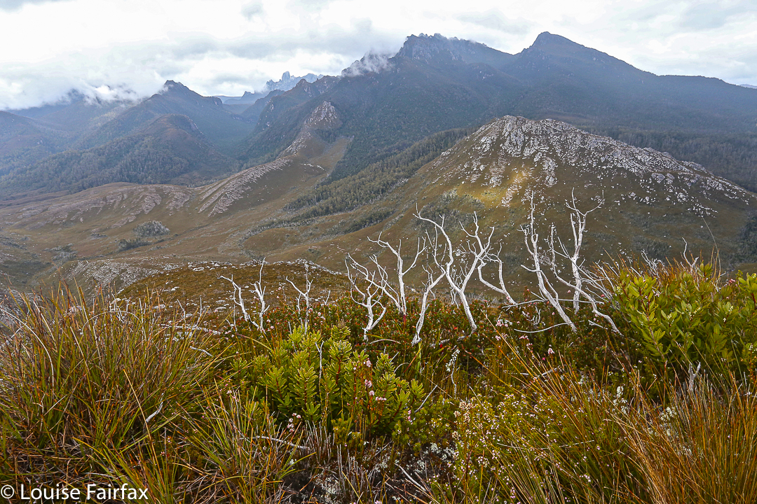
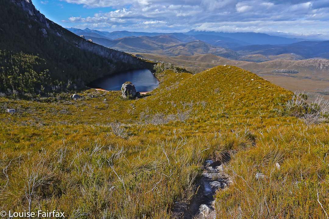
The book seemed to me even more deceptive when it came to the next day, when it says: “(A)n open vale leads down towards Australia Tarn”: whoops. It forgot the thick scrub (drenched for us). “The lake edge offers camping areas”: luckily, we were not in need of one of these as we sure never saw anything that might tempt us to pitch a tent. Our glorious unnamed tarn was far superior.  “An obvious ridge is followed … through scrub which decreases in density”. Now, it is true that the sodden, dense scrub eventually ceded to glorious alpine meadows with a series of transparent ponds and streams that I would adore to visit on a nice day (preferably arriving by helicopter), but there is not the vaguest hint of, or allusion to, the series of rocky knolls that are encountered along the way, one of which took us 30 minutes to get around – admittedly in mist, rain and driving, chilling wind. The book says to allow two hours from Australia Tarn to the summit. Due to our “knoll” problems (and more), we took nearly four. Luckily, our way down was much faster: less than two to Australia Tarn, and one more from there to our own tarn. My gloomy midday fears of our being benighted were thus averted.

At last we find a crossing point.

So far, our mountain had claimed nearly sixteen hours’ hard labour, all of which was done in wet clothing with a wind chill factor that was not inconsiderable. Whether it was raining or not was almost immaterial, as the dense scrub was so full of drenching droplets that further precipitation from above could hardly make us any wetter.

Climbing the Hippogriff

The final day brought a hole in the thick grey above that ceded to sunshine by lunchtime. We made good time up and down the Chimera (Χίμαιρα: a mythical beast made of various animal parts), and cut the 5 hrs 15 mins taken from Franklin to Hippogriff down to 3 hours (not including the Chimera climb) in the reverse direction. When one incorporates that climb, this was a 7 hr 20 day, food stops not included.

Gell from the Hippogriff.

All up, it took us 23 hours 17 to climb these three mountains. This was a club trip, so was naturally much slower than when one goes with handpicked friends, but I did think the times were worth mentioning to give an alternative agenda to those offered by the book, in case people are like me, and fail to realise that climbing Gell is a more serious undertaking than might otherwise appear.

Another view from the Hippogriff summit.

I can’t resist including this photo, which is part of the trip, although not part of the climb. I deliberately ran early so as to dash down to Lake St Clair before I was scheduled to meet the others. Here is a shot of the approaching storm that greeted us an hour later as we began our journey.

Stepped Hills 2015 ii Nov

Stepped Hills 2015 Nov.

The first hurdle between us and our quest: Mt Wright from down below
I looked ahead at the mossy rock on another rock, and could, for the moment, see no other higher ground. Could this be? Dare I hope? I called to Mark directly behind me (It was my turn to lead):
“Mark, I don’t want to make assumptions, but …”
“I’m making the same assumptions, Louise, but I don’t want to name them, just in case.”
“We’re running out of higher ground possibilities.”

The mossy rock posing as a cairn seemed almost an anticlimax. But there was nothing else on the mountain higher than we were at that moment. This was it. We’d reached another summit.

A tranquil patch of the Gordon River

Excitedly, we gave each other a congratulations hug and together ceremoniously touched the rock. It had felt like hard work, involving a double climb as the most popular route to reach Stepped Hills is by summiting Mt Wright along the way and then losing most of your precious height before embarking on the mount of your quest, and also because we’d only just done a massive effort to summit West Portal a few days before. I had only two days at home in between the two – just enough time to get the mud out of my gear for the next venture. A general lack of water possibly also contributed to the perceived effort: there was no running water in between the Gordon River and the stream that flowed at the base of Stepped – these two separated by four hours fifteen minutes walking with packs, and about eight hundred metres’ climbing and dropping; the day was hot and we were sweating quite a bit.

That mossy rectangular rock there is the best this mountain can do for a summit cairn.

Crossing the Gordon River at the start of the day had been quite tricky: the fallen tree that provides a bridge thanks to one of nature’s more generous accidental acts was wet and covered in moss from the winter moisture (it had rained during the night). It was extremely slippery, and we could see marks where someone had tumbled into the fairly deep river below. Scared by this, I rode it like a horse rather than doing my usual careful walk across. It was a long, fat horse, but I managed. Mark crawled.

The view from the summit in the other direction, looking over Stepped part Two and beyond to Reeds Peak, Bonds Crag and more. The Spires lie over there: a goal for the near future.
The steep climb with mountain in your face over Wright had gone well, apart from surprise and disappointment that the creek normally flowing at this time of year was dry already. We had full waterbottles, but had hoped to have a good drink there so as not to dip into supplies. The “creek” was just an erosion scar now.

The trip down the other side was, as I remembered it from before, perilous due to the array of moving boulders. These rounded rocks do not stack neatly, and were a mobile kitchen-set under our feet: microwave-, refrigerator- and dishwasher-sized rocks (with a few toasters thrown in) all moved underfoot as we placed weight on them.

Mark with his foot on the summit

Down and along we went, stopping about half way between the two mountains near a tarn to pitch our tents and have some lunch before we continued. One can drink from the tarn, but Mark had his heart set on running water that lay about a half an hour away, and as I was not good friends with the resident tiger snake that prowls the long grass surrounding the tarn, that suited me well. We had enough water for lunch.

My wonderful room with a view: in this case, of Reeds Peak and Bonds Crag.
Stepped Hills seemed scrubbier than my memory had it, fondly harbouring as I did the idea of a short-grassed uphill stroll. In reality the “grass” was dense, thigh-high tufts of button grass, accompanied by visiting patches of squat melaleucas. Rocky runs gave faster movement. It was steep and kept on going, but was not as steep as Wright. I was just tired from all I have been doing lately. It was not really Stepped Hills’ fault.

We reached the top by early afternoon and, having nothing better to do with our day than sit outside our tents, we elected to sit on the summit instead, so had a very enjoyable hour up there surveying our momentary and hard-one kingdom, eating snacks and drinking the heavenly water that comes from the stream down the bottom. It was lovely to relax up there.

Mark on the summit of Wright, with ten fingers raised to symbolise the ten Abels left to climb for a full collection of 158.

Day Two’s special moment was scheduled to be (and, indeed, was) lunch at the Possum Shed to celebrate, but before we could do that, we needed to climb back up over Mt Wright, touch its summit cairn, go back through its fascinating arch and negotiate the Gordon River (walking this time; the log had dried). I was near Oatlands on the return drive when the predicted afternoon showers materialised. As usual when this happens, I felt smug for missing a dunking.

Wright’s summit rock and its view to the north.
Track data: We walked 23.33 kms and climbed 1700 ms (this is “only” the absolute climb from peak to peak and does not include all the incidental ups and downs along the way. My gps doesn’t measure them, unfortunately). This yields 40 kilometre equivalents – and it felt like it.

West Portal in Three Days 2015 Oct

“West Portal in three days Mark? You’ve got to be kidding.”
“Oh well, we’ll pack for four, but hope for three. I reckon we can do it.”
I’m glad he was confident. I’d try my best. Let the tale begin …….
Day One.
“We’re here,” I heard Mark say up ahead. Apart from hearing my husband or daughters say “I love you”, these felt like some of the best words I have ever heard in my life. Electric shock tingles were coursing across my left shoulder from the weight of my pack; the ball of my right foot felt bruised; my socks had bunched up at the front of both my boots causing discomfort; my hips felt very tender and I was, quite frankly, tired.
We’d walked 27.4 muddy kilometres in 8 hrs 52 mins, within a total ten hour timespan. That’s a lot of work and not much rest; but at last Mark’s words meant it was over for the day. It was still nice and light. It actually hurt to remove my pack from my aching shoulders, I was so stiff. Like wooden dolls we tottered down to the Cracroft River at the crossing where we were camped to admire its beauty and collect water for the next few meals. It was time to relax.

West Portal trip Day 2. Crossing Strike Ck

I pitched my tent, slowly, partly because I could barely move, and partly to try to accustom myself to its little ways (it’s relatively new), before joining the other two for soup. Oddly enough, at a mere 8.15 pm I thought the idea of turning in for sleep was exceptionally appealing. You don’t often find me in bed at that hour. I impressed the other two with the size of the two large pink swollen lumps I had – one for each hip bone – before I disappeared. Sleep would be like a divine ambrosia.

Day Two.
This was to be the day on which we attempted the summit. I wasn’t confident of my own ability to do this, but it made me feel better to hear the other two say they were tired too. At least we’d be in a similar situation. However each of us felt as individuals, we were there to give this our best shot. I set small goals: it would be great to see Lake Rosanne; marvellous to reach the high point on Lucifer Ridge; amazing to walk across the Crags of Andromeda; and, well, let’s not get disappointed by thinking about that far-off, hideously high summit, buried in the clouds right now. One step at a time.

Lucifer Ridge is gained

We still had another hour and a half along the flats before we began our climb proper. Over the Razorback Range we went, dropping into the squelching, muddy Arthur Plains, which we followed until beyond Strike Creek. We took the hypotenuse shortly after crossing it, heading up to the first high bump on the Lucifer Ridge, which jeered at us from above, as its namesake would also no doubt do. The gradient was so steep that the land was almost in our faces. We pulled on tufts of grass to yank ourselves up. Once my body started screaming, I led us on a kind of slaloming zigzag to lessen the severity a bit.

Lucifer Ridge view

With relief we crested a mini bump on the way to the one we wanted – some rocky wart – and took a two-minute breather before continuing on to meet the point where the vague pad from the longer ridge rose up to meet us. Every down was resented as it meant a loss of hard-earned altitude; every up endured with pain until we gave ourselves another tiny break to enjoy the view. We couldn’t rest for long, however, as our goal, although getting easier to see, was still a long way off. However, when the delightful Lake Rosanne appeared below us, we had to stop and admire her. We had a drink and muesli bar and took a time split at this point, as a pad came in on our right, coming to us from the lake. We’d done nearly two hours’ climbing since leaving Strike Ck.

On Lucifer Ridge

For yet another hour we climbed steadily (except when the wretched pad dropped to get around cliff lines) and steeply. We were nearly at the top, but we found a puddle of water, and I was starving, so we called another break and had a drink and snack before continuing. I stole some savoury food from my lunch rations, as muesli bars were not doing it for me. All of a sudden I had energy again. Let’s go!

West Portal from Lucifer Ridge. Oh dear. It still looks a long way away and we have already been working for hours.

We “topped out” a mere eight minutes later, entering delightful “sound of music country”: a wide, open ridge with short grass and expansive vistas in all directions. We could see the Western and Eastern Arthurs, the Mt Anne Range, Lake Pedder, Mt Picton and more. It felt like we could see everything. I dropped momentarily behind to take a few photos and hastened to catch up. Today was about the summit, not about photography, and too much of the latter could scupper our chances of the former.

Topping out at the Crags of Andromeda

On we hastened – if rushing snails can ‘hasten’ – for another hour and a half (nearly), travelling over the Crags of Andromeda and via the first, false summit (excitedly assuming it was “the one” until we saw the challenger to the throne a bit further on) to that glorious cairn that was ours. At some point in there as I traversed the Crags, chasing the others as I’d been indulging in a little more photography, I realised we were actually going to make it. A tear trickled down my cheek, I was so overwhelmed. The only other two mountains I’ve cried on have been Ossa because the view was so beautiful at sunset, and Mont Blanc, which I’d circumambulated, because I was – and still am – madly in love with her huge white magnificence, and I was grieved to leave her.

That’s her, the summit of West Portal: the highest thing you can see ahead. At last we’re closing in – but there’s an impassable gulch between summit B that we’ve just visited and the one we want. We need to go down to get up.

This mountain here has a special aura for me, and I had not conceived of success. People who have climbed her have always seemed to me to be “real” bush people: accomplished traversers of the challenging Tasmanian wilderness, and mostly (but not always) males. I couldn’t believe that I was going to stand on such a summit. I know there are much harder mountains to climb that lie in wait for me (they seem to me right now to be impossible), and I am not trying to claim anything for myself here; I am just saying the effect this particular icon had on me.

West Portal Summit. Richea scoparia enjoys some of the best views scoparia can have anywhere.

We ate our lunch on top, oggling at the wonderful view in every direction around us. This is the highest peak in the Western Arthurs, and it commands a vista commensurate with its title. I particularly loved the rugged Crags of Andromeda with their dramatic weathering patterns; of course, we delighted in the cornucopia of peaks with jagged edges bespeaking nature’s infinite power and fury. It had taken us 6 hours (and four minutes) to summit. We’d now relaxed on top whilst eating. Mathematics said it was time to turn our heads concertedly for home.

Lake Rosanne seen from the way down

Luckily, we descended more quickly than we had climbed, having ironed out a few of the glitches in our approach. Angela had brought her jetboil, so once the pressure was off – near Razorback saddle – we all had a cup of soup to fortify us for the last leg home. We arrived at the tents as darkness fell. Any later and we would have needed those headlamps we’d been carrying all day. The climb had taken us a total of 11 hours 40 mins’ walking plus food breaks added on. We’d covered 27 kms again, only this day we’d also climbed 1,000 ms (= 37 km equivalents) in tough terrain. Three exceptionally satisfied friends sat in a circle cooking and eating dinner. We were not looking forward to the long day on the morrow, but we all had four days’ gear with us, so if we couldn’t manage, it didn’t matter; we’d just camp at one of the many creeks along our 27.4 km path.
Day Three.

Cracroft Crossing campsite on the morning of day three. A nice misty day to begin with, but it became clear and hot later.

We didn’t need the extra day. We took fifteen minutes more walking time to reach the car on the rebound, and our breaks were longer, mostly to please me. My shoulders would not have gone the distance otherwise. We cooked soup to make lunch more interesting and relaxing, and had a cup of tea before the final long leg from Junction Creek to the car. I even went wading. It was wonderful sitting beside amber creeks in green groves with the friends with whom I’d just shared so much, soaking in the bush with the satisfaction of having achieved our goal. This is the life.

Seven Mile Creek, a refreshing food stop place

The route. Overall,  we covered 91.8 km equivalents, in three very tough days.

Parson and Clerk 2015 Oct

This is typical of the scenery we walked through – here, glorious cushion plants.

We giggled as we jaunted along. This was funny. We were supposedly climbing a mountain (Parson and Clerk) – one that one friend had failed to reach, and others had taken a very long time and over double our height gain to summit (hating the hakea spikes while they did so) – but here we were on flat, open, prickle-free land, having a pleasant Sunday stroll (well, Saturday, actually), yet steadily progressing towards our goal. Whilst the Abels book has you moiling up countless contours, our route would involve a mere 261 metres “climb” between the car and the summit, and a tidy 2 hrs 20 in each direction. Lest you think I’m bragging originality for this route, it is now time to give credit to “north-north-west” from the bushwalking forum, who suggested it to me. Brilliant, thanks.

summit cairn

 The only scrub we had to negotiate was in the final hour of ascent, and really, as far as scrub goes, it was not too bad. It was possible to connect boulder lines that avoided most of it.

Angela at the summit

The only negative factor was the view from the top, which was about as enormous as the climb had been. My husband was not having a good day, so we had left him at the top of the first rise, giving him time to rest while we finished the mountain off, and he had enjoyed a much better view from there than we had from the peak. Angela and I agreed we’d rather be down in the south west, but you can’t be there every weekend. That said, it’s good to experience all the different mountains that Tasmania has to offer – that’s precisely why we keep enjoying this fantastic smorgasbord of possible mountains rather than climbing some favourite one every single weekend. Variety is the spice, as the old saying acknowledges.

Bruce and Angela returning from the mountain whose lower slopes are there behind them

 As with a food smorgasbord, you taste everything once (well, I do) and return for seconds of the dishes that most pleased you. This is what I propose to do with mountains: try each one once, and then spend my remaining mountain life returning over and again to my favourites (I have already, of course, begun on the second half of that programme whilst undertaking the first).

One of two cute fishing sheds that lie along the way

We won’t bother re-climbing that summit, but I think you may well find us camping one day near one of the two little huts in the plains. There was a lovely sense of space and peace out there.

Sorry, this screen shot has not turned out at all well. This at least gives you the general direction – head SSW and then SE, following jeep tracks from where the Gunns Marsh Rd ends at the boom gate, under the huge transmission lines. 

Snowy North 2015 Oct

Myrtle forest

A mountain may well stand as an objective piece of reality, but our relationship to a mountain is a very subjective thing. Unfortunately I was not feeling well yesterday when I climbed Mt Snowy North, and this feeling has coloured my experience of the mountain. I try to look at it dispassionately, but the dulled mood brought about by a less than healthy body somehow infuses every impression.

One of the many grand old gents of the forest complete with a stick that many people have seen the need to tape for some reason better known to them than to me.

Attempting to view it without my nausea, what do I see? I see magnificent myrtle forest in the lower reaches through which we climbed, not abruptly, to a point where we actually descended for a tiny bit in order to traverse for over a kilometre. I was thrilled to have the chance to remain in the forest longer that this traverse enabled. When looking at the route we were following, provided for me by my friend Murph who had taped it afresh not so very long ago,  I had feared this traverse would be in the scrub band, so was pleasantly surprised. In this section there were some very grand old myrtles with huge bellies, ancient drunkards, bulging. Everything was covered in moss; lush green was the dominant colour. At the end of the traverse, it was, of course, time to climb again. At this point, we noticed a ribboned trail going steeply downhill to our right – the other route up the mountain that is shorter (more direct) and steeper than our route. As I love myrtle forest, I was glad to have spent more time in it than that other route would have allowed.

 Up we climbed, out of the glorious green into the expected protective band of bauera and scoparia and other prickly bushes – a band that fiercely guards most mountains for about a hundred vertical metres. The pad  continued, although it was tricky to locate in places, as the bushes crowded over the track to hide it. As one friend wryly noted, this was nothing a good dose of napalm couldn’t fix. The gradient was such that you actually had to grab these thorns to pull yourself up. It felt like about eighty degrees, but it was probably only sixty. The contours were very crowded on the map in this section (of course). Grabbing the thorns was a real treat. Anyway, all parties eventually finish, and this one did too. We crested the rise, chose a spot that gave us a little shelter from the blast that greeted us in the open spaces above, and enjoyed a quick lunch in the light rain and mist. Views were not on offer.

The summit was still over a kilometre away (33 minutes from where we were), and this was, luckily, enough time to allow a few of the more energetic of the surrounding clouds to move away and give us a rather attenuated view. We could see that mountains were around us, but they were rather blurry and smudgy. I had the feeling that, even on a good day, we were not exactly enough in the centre of action on this mountain to get superb views anyway. Perhaps I’m just jaded.

David admires what there is of a view near the summit

The trip up having been quite steep, the trip down was good and fast. I got good practice in reuniting myself with my orangutang past, swinging gaily from limb to limb as I descended. Several of the party had rather filthy derrières, having chosen a different method of descent.

Our walking route from the cairn to the top

Should you want to do this trip in a hurry, I can report that, thanks to the efforts of our group, the road to the start is now clear of all the many fallen trees that blocked it until yesterday. Thanks to bushwalkers, our forest roads are remaining kind of open. Below is a map of the route we drove in past Maydena to get to the start. We parked at the locked gate on the map (so, a bit further than the line below would imply), and then walked no more than 300ms to the cairn that marks the start of the taped route in. Tapes in the first few hundred metres are not frequently placed. There are some triangular bits of orange plastic early on.

The road route in from just past Maydena, where you turn right to go left under the main road, which is the dark line running roughly east-west.