Sedgwick 2015 May

Mt Sedgwick, May 2015

Hoorah. The summit of Sedgwick.
“Look, there she is. Would you like to stop for a photo?” Mark’s voice was hopeful. I saw the dull, undelineated shape, the murky veil that still robbed the rocks of detail, and lack of foreground interest. Surely there would be a better view of our mountain than this.
“Na. I’ve got summit angst”, I said as I pressed on. “I promise not to have summit angst on the way back down. We can stop if we see the mountain then.” Poor Mark. We never did see the mountain again, but really, we never did see it the first time either.

More summit – I didn’t stop to take photos on the way up, such was my determination to actually get there before the weather got any worse.

I would love to say that climbing Mt Sedgwick was a case of veni vidi vici. That was certainly our intention. However, the actuality is that the veni bit was very easy; vidi was just about impossible all day; and as for vici … well, after a bit of stuffing around in the first hour, yes, vici took place, but was not at any point assumed before the trig loomed nice and close in the thick mist that enshrouded the mountain that day.

Summit again – various angles. I’m sure there is a view out there

Before I begin, I must say that we are indebted to LWC for doing the spadework of negotiating with John, who drove us through CMT property at Queenstown, and to the General Manager of CMT who allowed it. We wish John the very best of luck in his continuing establishment of a Tour company in the region. It was our intention to attack Sedgwick from the south, and we had permission to do it: a huge bonus. Even with making a couple of errors getting started, and walking an extra 1.3 kms, some of which was in thick bush, we were at the top in three hours’ elapsed time – about 2 hrs 40 walking – and descended, knowing what we were doing, in two hours (walking time, with one photo stop extra).

Luckily I love rocks in mist 🙂

Unfortunately, I had a few stray waypoints on my map that made it confusing to know where the best point to leave the track and forge a way up the spur was. (On the way back down it was patently obvious.) Things didn’t quite match what we had been led to believe, but once we were on the quite narrow ridgeline, everything fell into place. Then, the only perceived difficulty that could arise was the fact that we could see nothing, so might possibly choose an unsatisfactory route up the top that would land us in a cul-de-sac cliff face. It didn’t happen, but neither of us counted this mountain as bagged until we saw the cairn.

This was the nearest we got to a view all day. Mark was very excited by it. It hints at possibilities.

It was very cold on top, and it was a bit early for lunch anyway, so I only ate half a meal so we could get out before even worse weather closed in. The clouds were on the move, and rain was forecast for the afternoon. The wind had gained in force. Down we went, hoping to pick up our route from the ascent pretty quickly. We wavered a bit but then found it, along with a helpful wire that we had found on the way up (forewarned about this by LWC). Once the wire finished, we kept on the point of the spur and the going was pretty good, all things considered. When the bush thickened up further down and the ridge became less defined, we actually found a very old pad, with faded and sun-damaged pink markers, and a definite tread line on the ground. This pad was not quite on the spur, but ever so lightly to its east. We followed it until it emerged onto a road which is not on the map. Below is a map of our descent route. I wiped the ascent one, as it would not be helpful to anyone planning a route.

Man (Mark) and his views.

If you get permission to go this way, head up the spur (north) on the unmapped road. When it finishes, you’ll find a cairn, and to the right (we hung a bit of old pink tape there – if it lasts) you’ll find the narrowest of former pads. Small it may be, but being on it saves heaps of time and bush bashing!! I hope you get the view that we failed to see.

The whole route, from where we were dropped off to the summit, first following an old boggy former road of a deteriorated sort and then the spur (more detail below).


Map showing the route from where we left the road to go up the spur. The waypoint is the end of the unmapped road and the start of the tiny pad to the right of that.


Western Bluff 2015 May

Western Bluff: or, the mystery of the runaway summit. May 2015

The beauty of the dawn that held us up

Never has a summit seemed quite so elusive, quite so just-within-reach and yet forever-over-the-next-rise as this one. Mind you, when I saw that we had taken an hour to crest the first rise, and that the car was still in sight, I knew we were in for trouble. Hopefully the next part, now that we were on the tops, would be faster, would be lovely alpine walking. Yes? It was described in the Bushwalk Australia forum as “very easy and very enjoyable” by one, “delightfully open and easy” by another. I was expecting a joyous ramble, like at the back of Coalmine Crag. Would we need to take lunch? If we set out at 8 we’d be at the summit by about 10, and back at the car by 12. Oh well, salad rolls from ETC are delicious; let’s take one anyway and have a silly, super-early lunch on the summit, followed by a second lunch at Mole Creek, and a photographic shoot at a few waterfalls on the way home – maybe the one behind Marakoopa Caves and Liffey Falls. A great day was planned.

Beautiful conditions on top

Well, the first problem was the beauty of the frost as we drove to our destination. It was magical and required a great deal of stopping, which meant that the 8am start became a 9.30 one. No problem, this was just a cute easy-catch pleasure jaunt. It was such a pity we couldn’t use the route I wanted – the nice steep one from Urks track, but the forum said that if you love your car at all you will not use this track and will go by the route we were now undertaking. It neglected to say that the way up the ridge to the first nobble was fortified by an excellently equipped army of thick scrub and rocks that were not so very easy for a man with Parkinson’s disease to climb. No matter. I found a Parkinson’s-friendly route and here we were at the top, ready to race our way to the summit. Ha.

There’s our goal; just there. Here’s where we stopped for an 11.30 lunch after 2 hours’ moving.


Looking in the other direction from our lunch spot. That’s Ossa and Pelion East you can see sticking up there. Pelion West was also visible (as were Cradle and Barn Bluff further north).

The tops were not pleasant alpine walking, but contained lots of thigh-high scoparia that we had to weave around. This would have been fine had we been expecting it, but I had not gained the impression that this was the case. There was no water up there – well, there was plenty, but it was all in the form of pure (and very attractive) ice. No problem. We were carrying some, and could break some ice if necessary later. (It was. The tarns never melted). On we went, over rock screes covered in sparkling rime and through endless patches of scoparia (and other bushes). I was hungry. I looked at my watch. 11.30.

Patchy snow on top as well as wonderful ice

Surely that was an excuse for lunch number one, even though the map said we’d gone a distressingly short distance. I couldn’t imagine getting my husband to the summit at this rate. Maybe he’d be happy to sit there while I summited? We ate. No, he said, he wanted to summit too. I looked across to where our goal lay. Absurdly I said it could take at least a half hour in each direction yet. He said he was up for that. It took 50 in each from there. Every time I sighed with relief that we were closing in, that wretched trig ran away again, tormenting us cruelly. It was only 1pm, but I was already panicking about the time. I just couldn’t install in my husband the need to hasten, that we would turn into frozen pumpkins if we dallied at all; that this mountain with its frozen pools and ice rime would be treacherous by 4.45 and I wanted him in the car by then.

Looking east from the summit – not altogether inspiring, but nice enough

I hoped in vain that our return journey would be quicker, that we would chose a slightly faster route or that confidence would produce a better return time, but alas, our return splits were matching our outgoing ones exactly, but my husband needed more breaks added in to the walking time. I was now totally nauseous with anxiety as the watch kept ticking but very little progress was made. The sun got lower … and lower, and more and more golden in its hue – very beautiful under normal conditions, but not when you have a man with Parkinson’s on a frozen mountain.  I knew by now that darkness was going to arrive before our return to the car. The question was merely: to what extent? How dangerous would this mountain with all its rocks be once the sun got any lower. Already the rocks were whitening up, the bushes gaining a very pretty dusting of icing sugar. I decided that even though speed was essential, I needed to rest B and feed him. It would not be safe to stop once the temperature was any more below zero than it already was. We ate and continued.

Bruce sets out on the epic journey back to the car

Just as the summit had run away from us, teasing mercilessly, so did the road that announced the end of my woes. The gps kept saying we were nearly there. We kept descending but kept bashing against more thickets of hard work. The forest got very, very dark. B stumbled and fell a bit but managed not to injure himself. He’s too big for me to carry. Helicopters don’t operate in the dark. My nausea increased. I was far more concerned than he was, but at least he kept himself injury free as he blurted through the bush and over slippery rocks in pursuit of his wife. I kept about 10 metres ahead so that if my route was not Parkinson’s-friendly, I could backtrack without wasting his energy (which happened quite a few times).

On of the last photos I took – from the cliff edge looking west towards the mountains of the Overland Trail. Our car goal is out of sight to the left of the picture, but the nobble that preceded it was visible to us; the goal of our completed quest was also visible to us to our right, but out of this picture. At this stage we were still on target to make it in the light … just.

Never have I been so relieved to see a road in my life. Yes, we would live through this adventure. He was out with safety. The beads of ice on the road glistened in the moonlight. “Oh glorious sight, big red car”, says naturelover. We didn’t stop at any waterfalls on the way home.

Our route. We approached using the more easterly one, and returned via a view from the cliffs

Mensa Moor (and Magnet Crag) 2015 May

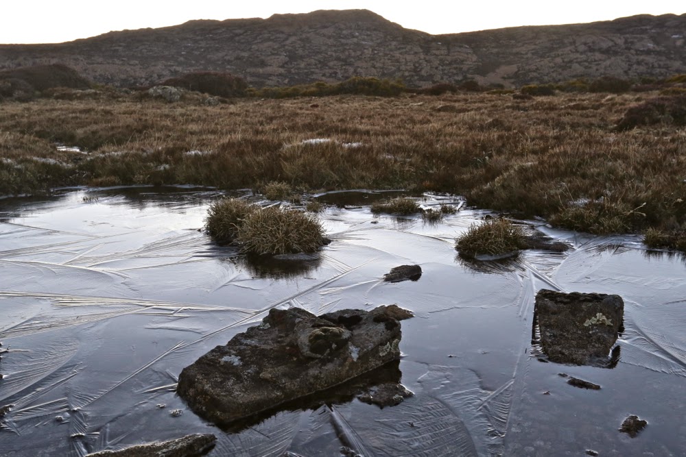
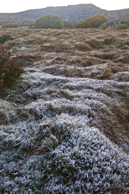
The rich colours of a frosty morning.

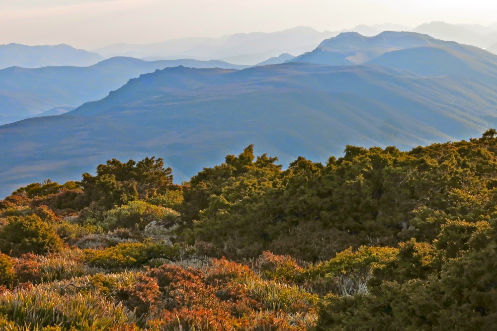
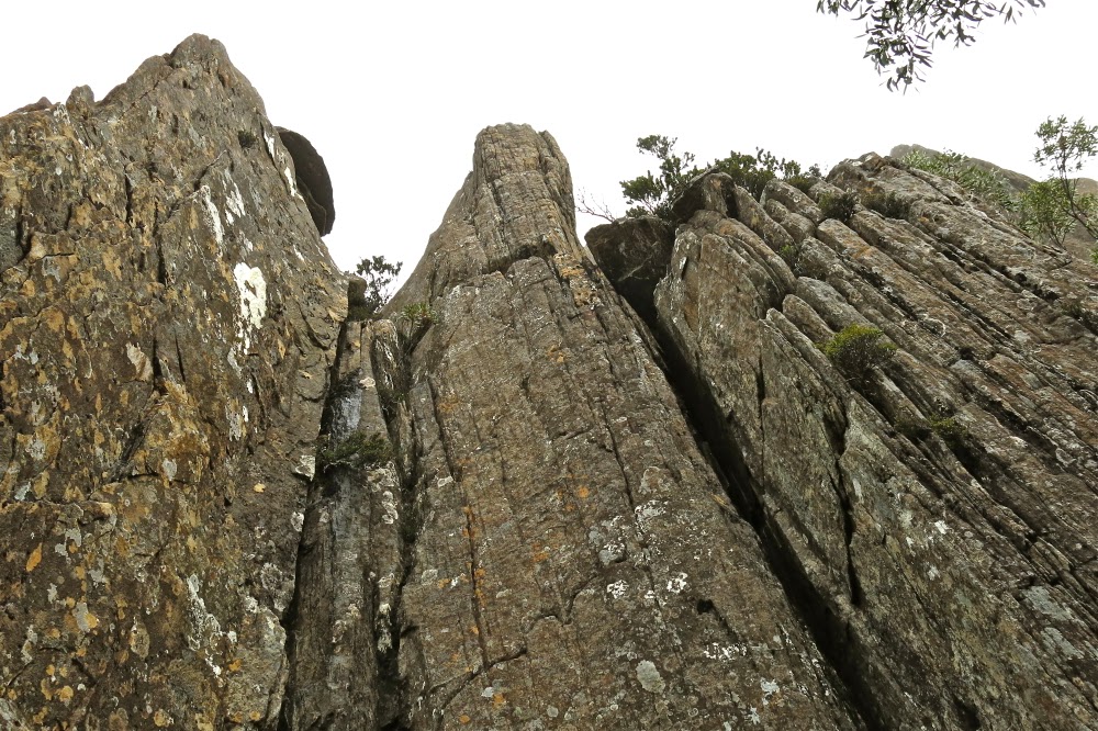
Mensa Moor. We gazed out at the spur opposite that lead to what appeared to be the summit of Magnet Crag, lavishly decorated in shining sheets of ice, but punctuated with patches of green that could provide a passageway. It was a gamble. If it worked, it could be faster than the rather horrific route a few hours ago. But if we failed, it could spell disaster. We didn’t really have time for failure with the overnight temperature said to be minus 5. We both knew how rapidly temperatures could drop once the sun set, and even though it was only an hour and a half since we’d lunched on the summit,  the rays of the sun seemed disturbingly low – seemed to have adopted already the aureate tones of late afternoon.
“What do you reckon?”
“I’m game if you are.”
“Yep. Let’s give it a go, but back out quickly if it’s not working, and if we meet obstacles, take them to the right, nearer to the way we came down.”
I felt a little nauseous with the risk, but if we pulled it off, everything could go much better than it had done in the morning.

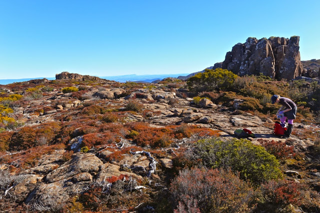
The scene that greeted us soon after we popped out onto Mensa Moor. We liked that castle structure behind

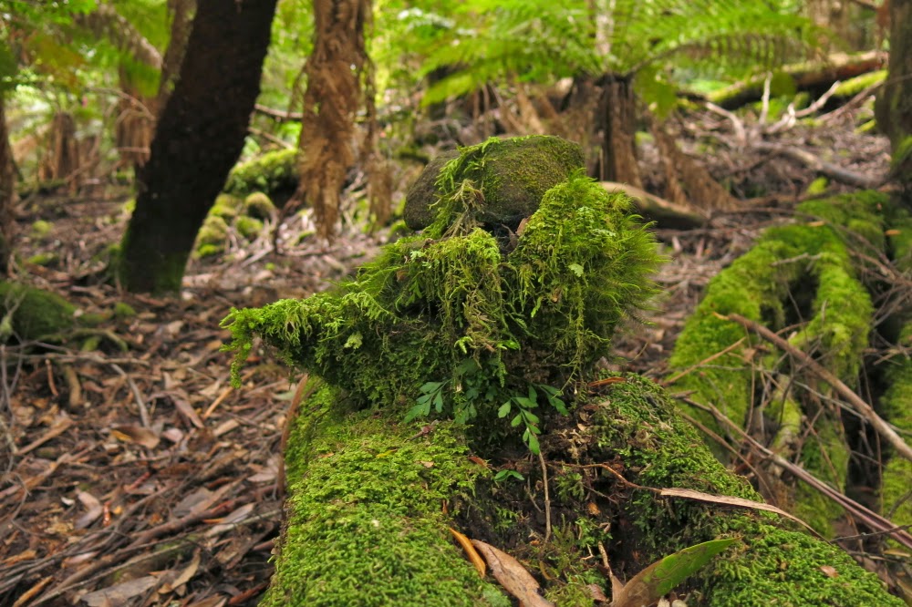
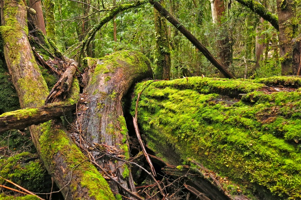
But let me begin at the beginning, when we set out excited to be on another adventure. So excited that I failed to turn off the lights of my car which didn’t have the courtesy to bleat at me and tell me so. That would be a problem for later. The beauty of our surroundings covered in a layer of white rime, and the crispness of the air captivated us. The ski poles led us onwards to higher ground. The creeks were ribbons of white ice with water flowing underneath. Icy pools were everywhere, and the rocks we were supposed to walk on were treacherous. We chose the bushes beside them, wondering what lay ahead.

The summit area, looking across to Stacks Bluff

Once it became time to descend into the valley of Borrowdale (Rafferty Creek), our pace slowed from cautious to downright slow. This route was pure rock, and that translated to pure ice. Not for the first time, I was excessively grateful that we had elected to travel with our full packs rather than be daring and try to do the whole thing in a day (which we would have happily done had it been summer; but it wasn’t). We had the luxury of time and leisure on our hand. No time-induced panic need drive us into lack of caution today. Neither of us was in the mood for broken bones, so we maintained four or even five points of contact on this uneven slippery slide as we made our way to the valley.

Looking back to Mensa Moor from the ridge leading up to Magnet Crag once I’d decided we were going to make it.

Even with all that care, we were up on the flat ridge to the north of Coalmine Crag by just over an hour, and I had allowed an hour and a half for this section. Things were going well. Even so, I didn’t want to waste daylight erecting tents, so we dumped the packs with reflective tape over them and set out with minimum delay (apart from my normal need to have a tiny snack). The going was delightful. Everything had crisp outlines and saturated colours; the ice shone all around us. We were having a ball, and the dance continued all the way to the “left hand summit” (E) of Magnet Crag, from which our descent began, as per the black line route on the old 1:100,000 map.

Summit cairn on Magnet Crag, looking out over Mensa Moor below and Stacks Bluff beyond.

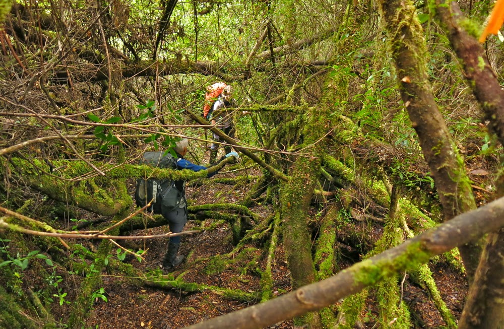
This started out fairly scrubby and descended into a nightmare of prickles-in-your-face scoparia. We slid down some sizeable drops. It was fine enough, but we were both thinking the same thoughts about how unpleasant (and difficult) climbing back up was going to be. Down the bottom we steered for broken ground which seemed faster than detouring around the myriad tarns and surrounding scrub. Going was not rapid. My watch kept recording the passage of passing time to an extent that did not please.

A happy Angela relaxes on the western summit of Magnet Crag.

The climb up to Mensa Moor was the part that had the bad reputation. What was it going to be like? We dared not think, but continued along to where the spur off Magnet Crag met the valley, the point where I wanted us to change direction. We both then eyed up some broken ground on the flanks of the northern lump of Mensa and aimed for it. It offered us a wonderful free (of scrub) ride that gained us a great deal of trouble-free height, and left us with not much climbing to do to reach the saddle between the two parts of our goal. We were both very happy, as we’d been told that the top of Mensa Moor had pleasant alpine walking, so our trials were nearly over …. we thought. We decided that our informants’ information was very dated. The top of Mensa was scrubby, but compared to what we’d been through on the flanks of Magnet, we were fine. It’s just that we expected the kind of glorious walking we’d had on Coalmine Crag.

Looking in a more easterly direction from the western summit of Magnet

Be that as it may, we had our goal in reach, so walked purposefully along past the old black-dot-on-the-map summit to the new fancy-equipment-determined one where we had lunch watching the sheets of ice lining the dolerite columns opposite calving off from time to time. The total walking time thus far had been 3 hrs 33. OK, but slower than the Abels‘ book’s 3 hours. Again, we were glad of our plan to camp on Coalmine.

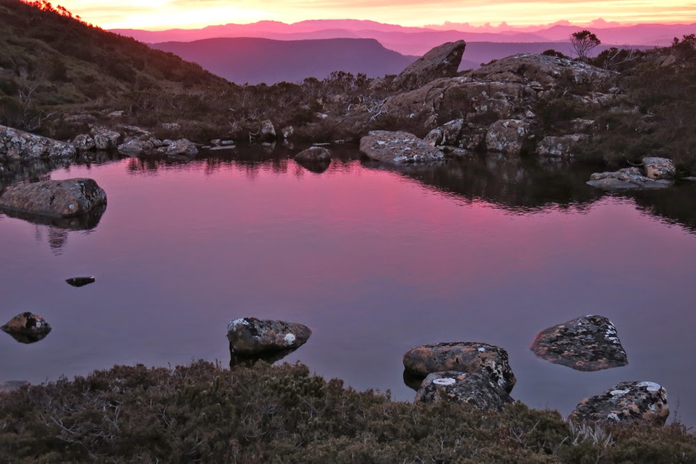
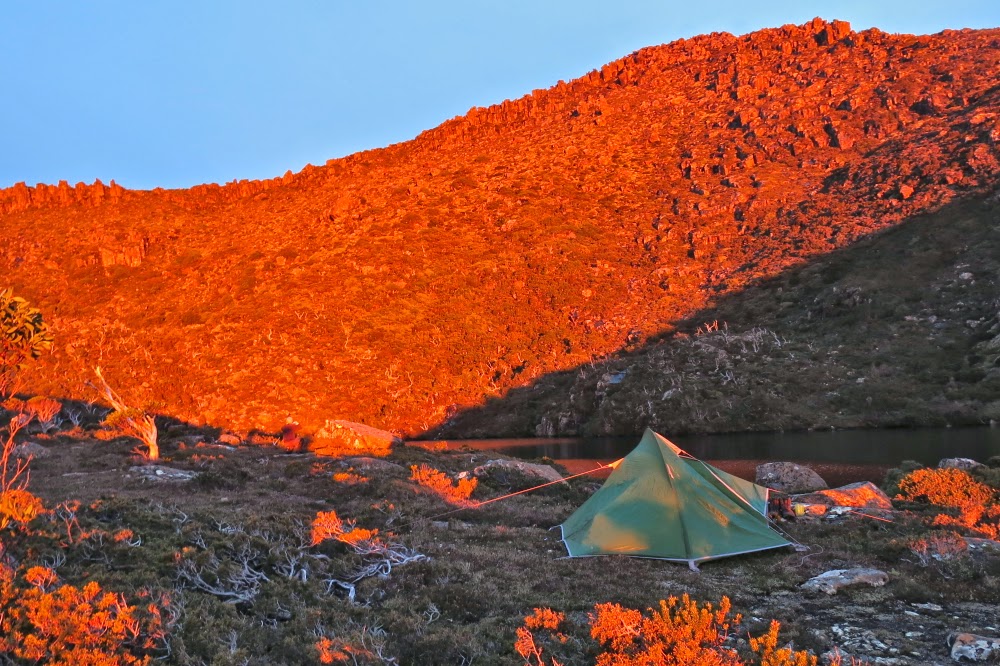
The tents are pitched, the sky adopts roseate hues. Time to gather water and make some soup.

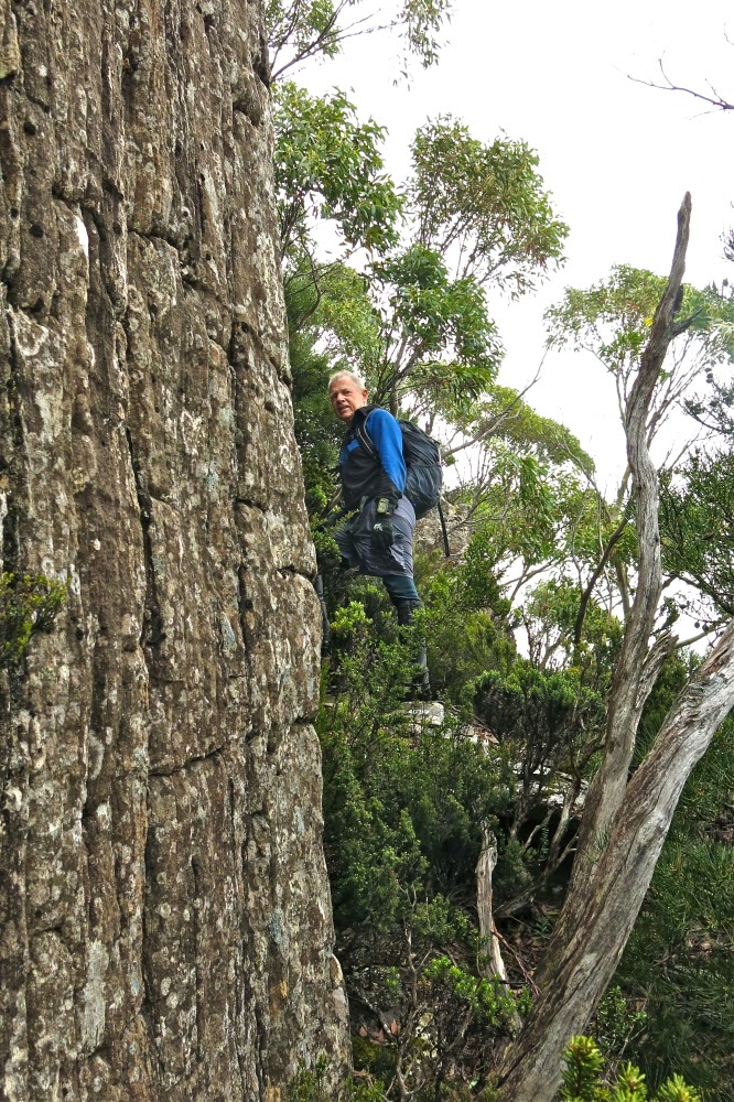
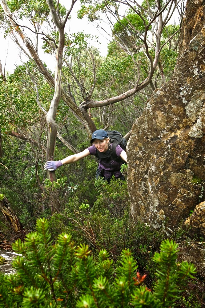
… And this takes us to the opening paragraph and the fact that one and a half hours after lunch, we were willing to risk a route which was totally unknown yet held out the possibility of being more pleasant. As we climbed, however, I felt nauseous with anxiety. The cost of failure at this point could be extreme. Did we still have time to do a different attack if this didn’t come off? Things were going well. I believed we hadn’t wasted too much time even if we landed in a cul-de-sac, yet still I couldn’t relax. At one point, about two thirds of the way up, Angela went left and I went right of an obstacle. Suddenly I heard a cry. An excited cry. Angela had found a cairn. That meant someone else had at some time done this route. That meant this route WAS possible. That meant that we were going to make it back to the packs and it also meant we were going to live. A huge weight lifted from my shoulders. My chains fell off; my heart was free. My nausea vanished in a flash. I laughed. We could relax and enjoy the superb scenery. The sheets of ice were fun and we continued to find passageways between them, climbing well all the way. Oh what fun it is to climb in a duo on such a day, hey. I relaxed enough to even take some photos. We could now afford the time for this luxury.

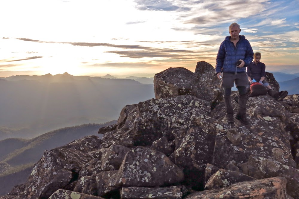
Dawn heralds another wonderful day.

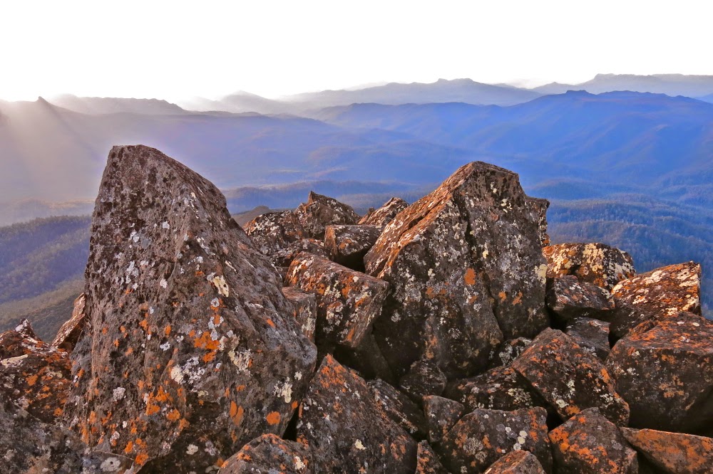
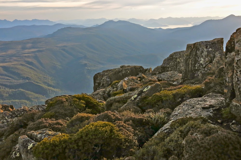
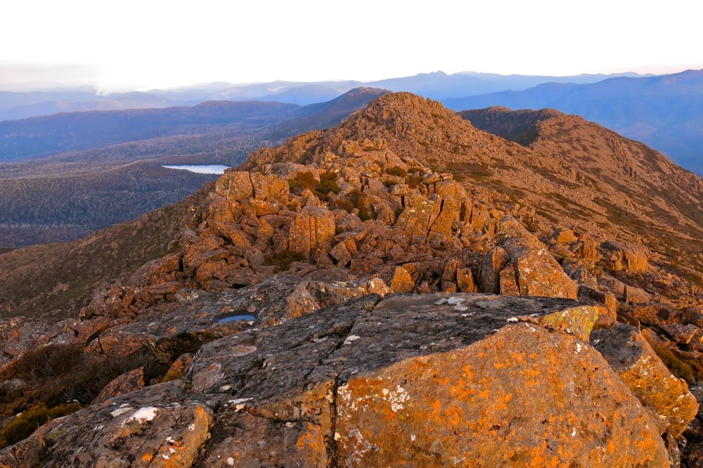
When we breasted the top, we decided we had enough time to summit the lump of rocks to our left, climbing to a very attractive cairn and enjoying the views it offered over the area we’d just come from (and more). Now we could delight in the long shadows and yellowing light, as they were no longer a threat to our survival. Happily we sauntered back along the crag, down to Borrowdale and up to the broad ridge where our packs (and tents) awaited us. As light faded and temperatures plummeted to an alarming degree, we pitched tents and gathered water, each then retreating to her aegis of relative warmth. The sky was a beautiful soft pink as we disappeared to boil our billies.

Morning glory. Looking towards Legges Tor; waiting for the sun to rise

Next morning, we rid the tents of the stalactites of ice lining the ceiling, put on our frozen boots, struggled with the fact that our water had become ice inside the tent, under our sleeping bags, and set out to explore our white, icy world. I was already sad that this glorious adventure was almost over. Everything had been so superbly beautiful. It was a marvellous world up there. Despite the minus five degree temperature, I had breakfast outside where I could appreciate the coming of the sun to the rocks around, and its kiss of warmth as it arrived at our tent site. Life is a wonderful gift.

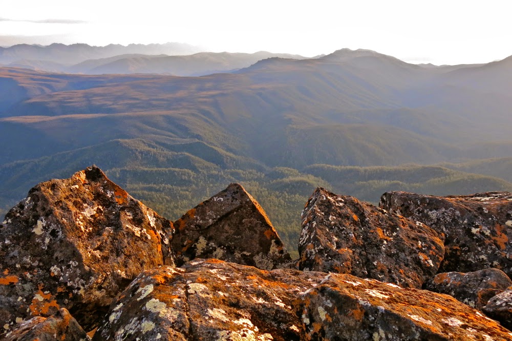
The sun arrives. Taken from a high point on Coalmine Crag, looking towards to Magnet Crag, Mensa Moor and Stacks and Wilmot Bluffs.
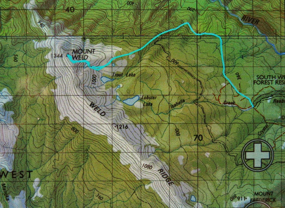
Our route. Yellow waypoints represent my rough guide of where we might want to go. Cyan lines represent where we did go. We dropped off Magnet Crag on the more easterly route but climbed up it using the spur (as per story. This was easily the preferable route). On top we went straight for the summit, but on the way back we followed the cliff lines, partly for the view and partly because the scrub was less dense there and the tiny tarns and pools less numerous. We didn’t have to dodge so much. The way up onto the Moor (more westerly route) was fantastic; the way down, less so.
Track data: 16.6 kms on day one in about 6 hrs 30. On day two, 3.2 kms in one hour. All up, just short of 20  kms in 7.5 hrs. This does not include lunch (short) or snacks (very few indeed). It does include deliberation time and other sundry small stops to navigate etc.
 

Weld 2015 May

Mt Weld 2015, May

Angela crosses the creek that marks an end to the cutting grass section of the walk to Mt Weld.
Our chosen mountain for this weekend was Mt Weld. Like a well-trained bicycle pursuit team we purposefully made our way forward.
“Hm. It’s getting vague here … not sure that we’re on track,” the leader of the moment would say. Three pairs of eyes scanned; one left, one right, one middle. Within seconds one of us would spot signs of wear or, better, some tape, and that one would take over the lead until the next moment of uncertainty.

Young Cortinarius levendulensis responding to autumn and the moisture in the air

Efficient, resolute – certainly “no nonsense” – are words that can describe our attitude to Weld. Having been fouled out by mist, thick bush and time last weekend on Hobhouse, we were very, very determined about the summit this week. Defeat was not on our agenda. Meanwhile, we were having a ball.

The forest shortly after the creek

Thanks to reports by others, our expectations of the cutting grass were very bad indeed, and we were accordingly armed in full battle gear – and so we were delighted by how much nicer it was than our grim imaginings. The grass was a lovely colour, the passage was very clear indeed and, well, cutting grass cuts. We treated it with respect and it left us alone. The totem pole (start of the track) to the “big creek” section took us 1 hr 54: slower than the 1 hr 45 of one report, faster than the often said 2 hrs. We were on track for the summit and happy. We grabbed a quick drink at the creek and I surreptitiously threw down a few handfuls of snack (my two super-human friends never seemed to need food). Now it was time to climb.

An ancient cairn, now covered in moss. Green on green is not exactly effective. Pink tapes suited us better.

Again, expectations of this section were not sanguine. We expected massive sliding backwards, energy-sapping climbing under and over logs that were too long, wide and low to get around, over or under, a pad characterised by vagueness, and lots of time wastage. What we found was magnificent forest that thrilled by its lush mossiness, its abundance of colourful fungi, its openness, and the easy passage it offered. Only very infrequently did we waste thirty seconds or so searching for the pad. Yes, down lower there was some climbing over and under logs, but not nearly as much as we feared and well, yes, we were climbing a mountain. Mountains go up. Steepness is expected and thus ignored. Besides, we love climbing. My only regret or “complaint” during the 1 hr 36 mins we spent in this rainforest was that I had neglected to bring my macro lens. I was entranced left and right by colourful delicacy but furnished with no means to do it justice. However, this trip was not about photography: it was about the summit. We had no time to waste. Lunch was thrown down in this section.

The view from the saddle between summits A and B of Weld (looking east)
Same, but looking SW.
The next phase of vegetation, from the first noticeable bauera bush to where we emerged in open alpine grass, took us exactly an hour. The bauera and scoparia had been, well, bauera and scoparia – you don’t mess with them – but the pad was clear enough, and at last my fungi-distraction had come to an end. As we emerged onto the welcome and welcoming pineapple grass, we had our third break of the trip: five minutes, while I turned on my gps. We were happy with progress to here.
Summit rock

The gps indicated we had about a kilometre to go to the intended tarn of our campsite for the night. The grass was short. We could see the spot up and around the corner of the ridge ahead where the tarn must lie. I expected it would take 20-30 minutes. It took us 46, as we enthusiastically climbed too quickly too soon and got ambushed in scrub. For once, the creek was faster than the ridge. No matter. We were pitching tents by 3pm. The summit was in our sights. People said an hour to the top from here. We couldn’t imagine anything going wrong at this stage, but neither were we willing to relax our guard. We spent about half an hour pitching tents and organising daypacks for the top (the latter, mostly me: I took my little pantry to the top – a bag of treats and goodies that the others, not quite so food dependent, didn’t think necessary for themselves) and off we set, full of excitement and anticipation. This was, at last, the end game.

I found it very exciting to see Lake Pedder and Mt Solitary. I hadn’t realised we’d be so close.
As instructed by Abels Vol 2, we headed north from the tarn (actually, a bit west thereof) to a little shelf where camping would have been nice (better view, but no tarn) and then up through a mixture of scrub and rocks, aiming for the saddle between summits north and south. The real one (north) was reached in under an hour. We were elated: first, because we had reached our goal, but mostly by the amazing view spread out before us. It helped our euphoria that we could also, at last, relax. Our work was done. Now we could play and stare and reap the rewards of our labour, losing the self in the sublime infinitude that surrounded us. The pressure of time was gone. The lighting was perfect. Life was wonderful. We enjoyed our summit and only left when the mood finally took us. We had head torches; we knew our way back to the tents. There was no more need for haste.
Looking south along the very long ridgeline of Weld
Eventually, we dawdled back in the gloaming, delighting in the rising moon and emerging stars, yet with still enough light to see all the way. I was unwilling to finish off this perfect day.
Mark and Angela relaxing on the summit
As near to the setting sun as I could get without lens flare.

The temperature was not below freezing. We cooked outside together enjoying the stars, the tarn and the moonlight while we ate and chatted, ultimately only being driven inside when we became aware that our core temperatures had dropped to shiver point.

Sunrise
 

On the way out next day, we cut all our splits from the way in, due more to confidence and familiarity than the fact that we were descending. To our delight, we were back at the car by 2 pm, having taken 4 hrs 45 from tent to totem pole. The road walk to the car added another 14 mins. We all loved Weld and agreed we’d return with very little provocation. Rain started falling as we arrived at the car. It pelted down while we drove away. We felt smug and warm inside.

Our route. I’m amazed to see how little difference there is between the higher route to the tent site tarn and the much faster, lower one that stuck more to the actual creek – 10 mins difference!

Hobhouse 2015 Apr

Mt Hobhouse failure
Probably the easiest bit of forest all day. You could actually see ahead to take a photo of something

I pulled off my clothes (luckily I was standing in the bathroom) and half a ton of leaf litter and general forest debris fell to the floor (no wonder I’d been feeling prickles on my back). I couldn’t pull the huge twigs that were entwined in my plait out; they’d have to await the help of shampoo and conditioner, although I wasn’t even sure those items could do the trick. Three leeches dropped to the floor and began squirming around. My husband brought up the salt shaker and we got childish but sweet revenge on these slimy monsters, although they have had the last word. I write this two days later and I am still scratching where they bit.

The way ahead – again, an easy bit, the moment for photography wrested from our progress thanks to a toilet stop.

“So;” you say, “that was a pretty horrid trip.” No. Wrong.
“Oh then, at least you got to the top and got a point or two.” No, wrong.
“You had some nice views along the way?” No. It was cloudy nearly the whole way, and raining for the second half. The views were of my two companions and some rocks on top.
“You had a good workout then,” you’re getting desperate to find a positive at this point. I doubt even that. The bush was so very thick that we didn’t move fast enough to get the heart pumping. We fought (with greenery, not with each other) nearly the whole way.
“OK, so what on earth can you find that was positive in a day where you fought a battle against the bush that you lost, didn’t get a view, got very wet and filthy and bitten by leeches?”

The way ahead. Hm. Don’t think we’ll go on compass here.

I had a grand adventure with two really fun companions who, like me, never gave up until absolutely forced to. We still haven’t given up. All three of us are absolutely determined to return as soon as possible, correct the error we made of being on the bombardier track for too long so that the bush we had to fight was a formidable and well-equipped foe, and get to the tippy top of our peak. We might even get a view next time. You never know your luck. Das Gehen its das Ziel (the going, or journey, is the goal). We had a great journey full of chatter, and the forest was sometimes very beautiful when it wasn’t a blockade of challenge. It is cliché to call it “character building”, but it was. I would stand there, feeling defeated by the fact that I couldn’t see a way forward, and yet somehow I forced a tiny few metres of progress before the next bosky cul-de-sac.

Climbing up

The other aspect that I call positive is that we now know Hobhouse’s “dark side”, its wild parts. I agree with Robert MacFarlane that you don’t truly know a mountain unless you’ve slept on it. We didn’t put our tents up, but we did experience our mountain in a temper; we saw it dressed in rags rather than just in party clothes. I feel much better acquainted with it than if we’d had a fast and trouble-free run, and I have far more respect for it than I would have if I’d just had a dash for cash.

We worked hard with only a single, minuscule drink stop until we had crested the top of the ridge and stood on the final part of the ascent route. My gps said we only had 17 vertical metres remaining to climb. We were at a lump that was “false summit number one”. We knew the real one was number three, but it was a myth in the clag. The only clear thing about the way forward, like everything that day, was that there was no obvious route and that the going would be slow. You don’t need to be Einstein to work out that we had already run out of time. We threw down a very late lunch and turned our backs on our quest. Our mountain will wait for us, and by being sensible, we’ll be there for it sometime soon too. We hit the bombardier track just as dusk was turning into night, and it was dark before we hit the registration book that is 15 mins from the dam. The night shadows and silence added to the sense of our adventure as we completed our journey, satisfied and happy.