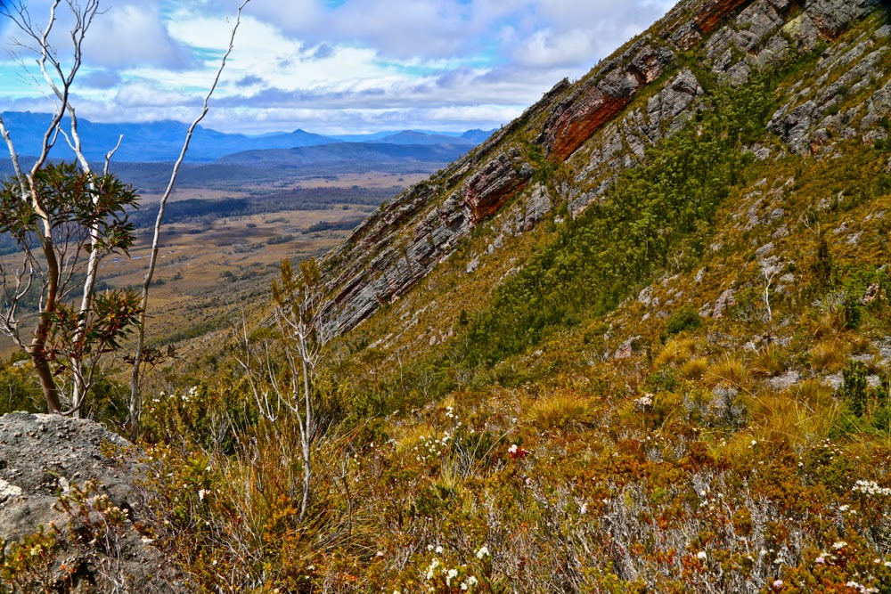
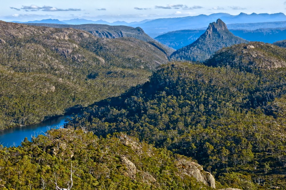
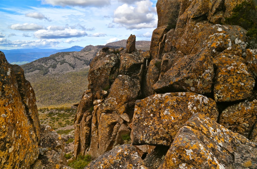
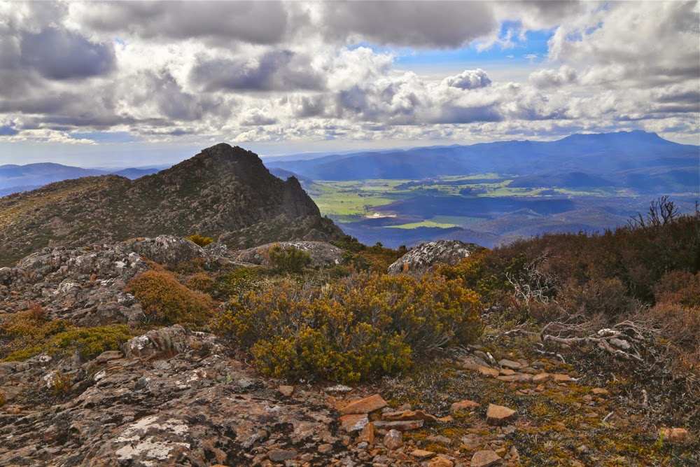
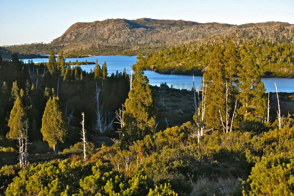
View from near the summit of The Gatepost, Day 1.
Travellers Range, a six-day expedition. 2014 Nov
Never have I received so much ‘well wishing’ before a walk: the staff of two different supermarkets who helped me with food choices, the instagram community, the battery man, sundry other shop assistants, email friends, my daughters and my students all wished me good luck and offered snippets of advice. You’d think I was off on a solo expedition to the antarctic for six weeks. It felt like I was! I had never been in the wilderness for so long before.
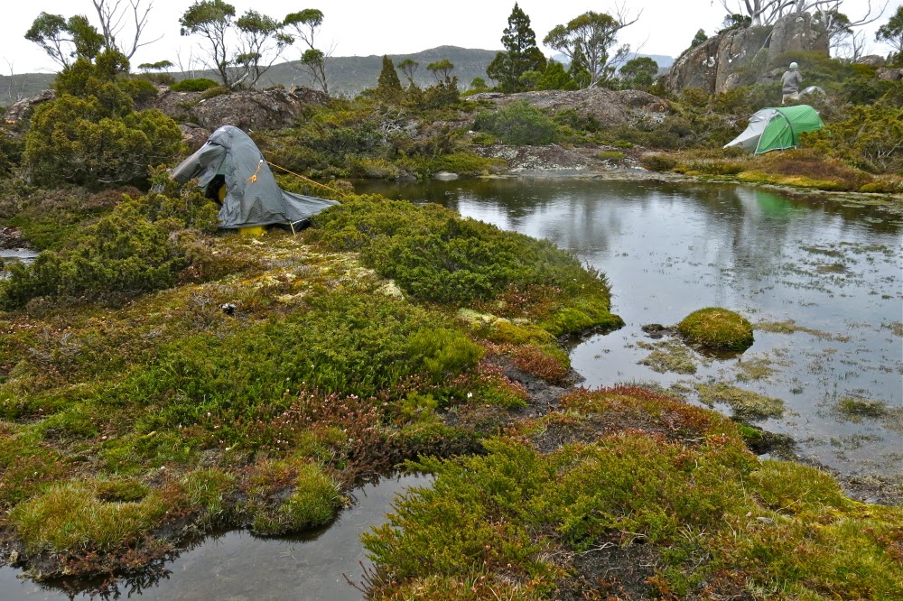
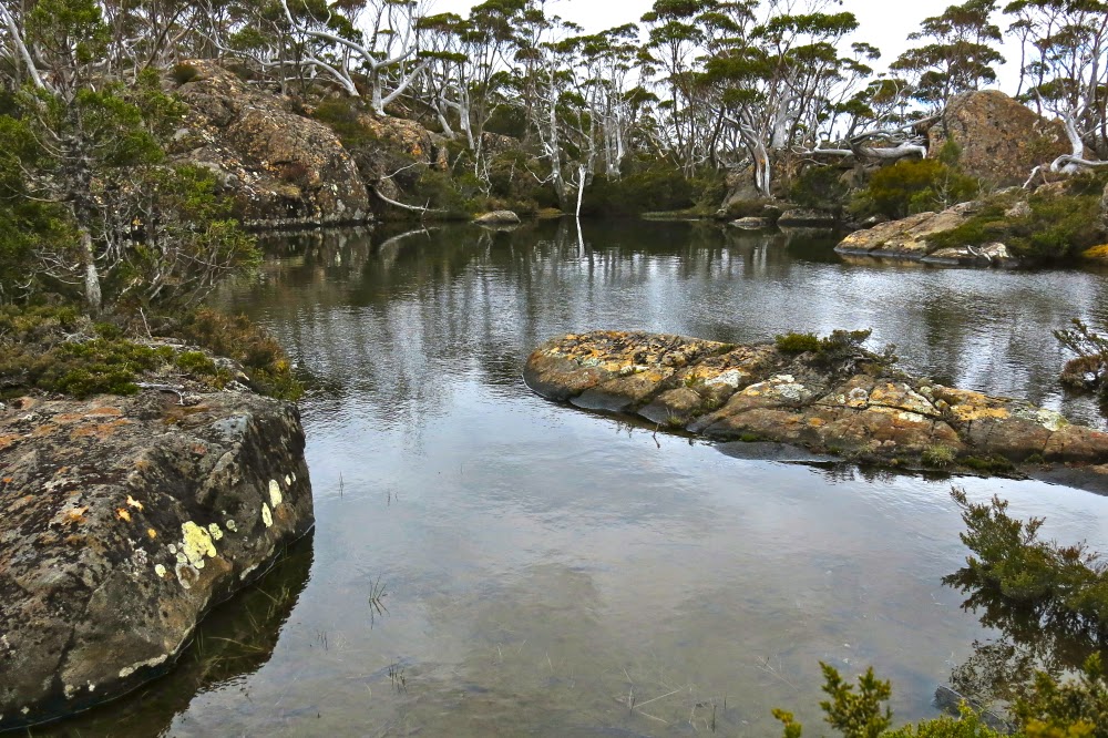
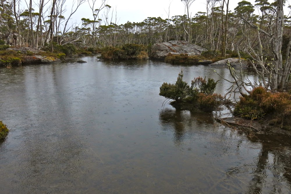
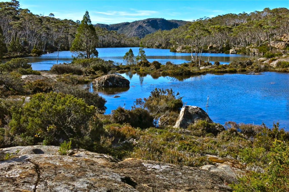
Tentsite near Lake Orion. Travellers Range Day1 draws to a close (in the rain).
I loaded my clothes and equipment into my pack, but could not squash the food in without help. First, I had way too much gear, it seemed, and second (but of less importance) I was operating with only one hand and a lot of force was needed for this job. The pack seemed to be full without any food in it. Bruce came to the rescue, loading all the food that was beside the pack, and announcing proudly that he’d completed the task for me. The trouble is, all the lunches were still on the kitchen table. I took him downstairs to show him what remained. At first he chuckled lightly, but this developed into a full bodied roar of a laugh, and soon enough we were both clutching our sides with mirth. This was impossible.
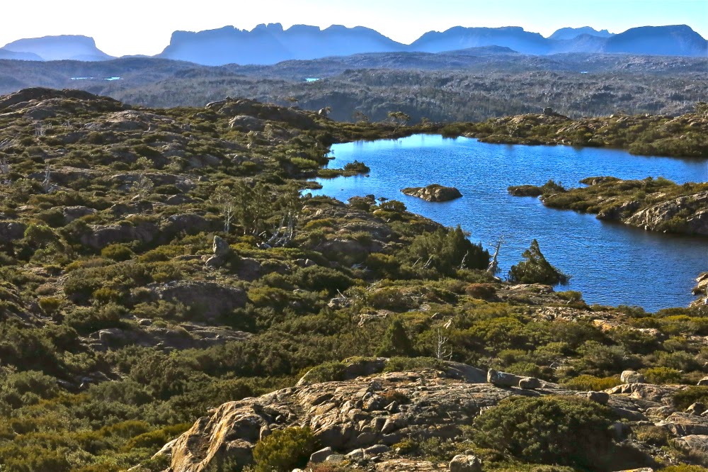
View from the Mountains of Jupiter, day 2. Mt Ida says “Hello, and looking forward to seeing you soon.”
This was not the time to ponder the problem, however; we were due at the theatre any minute to hear the great John Bell talk about producing Shakespeare. The stimulating evening finished, we returned home for coffee and cake with my students who had come to the theatre with us. They, too, found the pile of lunch food hilarious, whilst at the same time expressing concern that that amount might not keep me going for six days. “We know your appetite,” they said solicitously. Gracey inspected my lunchbox, muttering approval that I’d included a wedge of wasabi camembert and a packet of prosciutto, as well as vegetables and five packs of ham. Meanwhile Jess set about the marvellous challenge of condensing much into zero space. She loves to pit her wit against a formidable opponent, and repackaged, and rearranged and in no time announced success. Now we could eat cake and chat. All awaited with interest to see if I could actually lift this load and march it to the car. I staggered forwards with attenuated success.
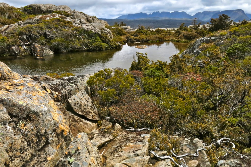
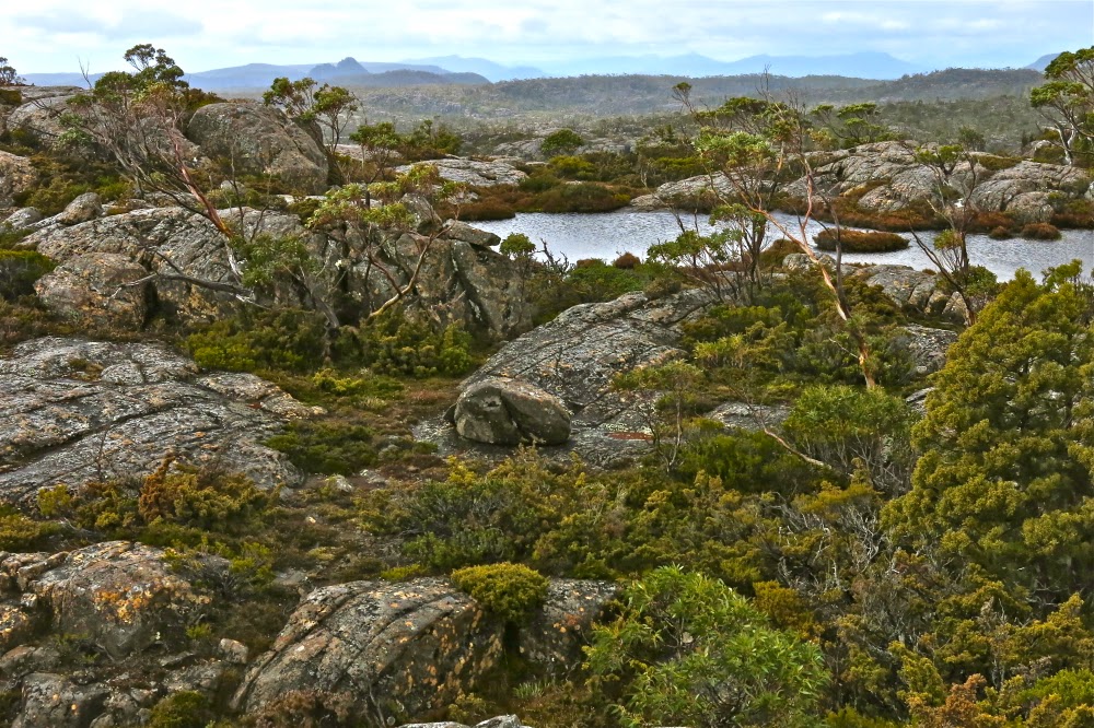
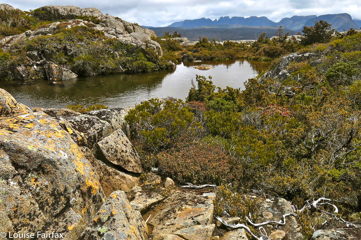
A pool near the summit of the Mountains of Jupiter. There were tarns everywhere.
Fortunately, I like to arrive at places early. That Big Morning, I arrived with a bang. Tony likes to describe it as a squealing of brakes with dust flying as I pulled in 15 minutes early to the terminus of our car shuffle. We loaded my car with packs (with me panicking as I couldn’t thread the laces into my newly polished boots) and we were …. no; not away. I turned the key and nothing happened, and as King Lear would tell us, nothing comes of nothing. We tried a few times, but had a ferry to catch, and no time for fooling around, so loaded Tony’s car instead and abandoned mine to be dealt with later.
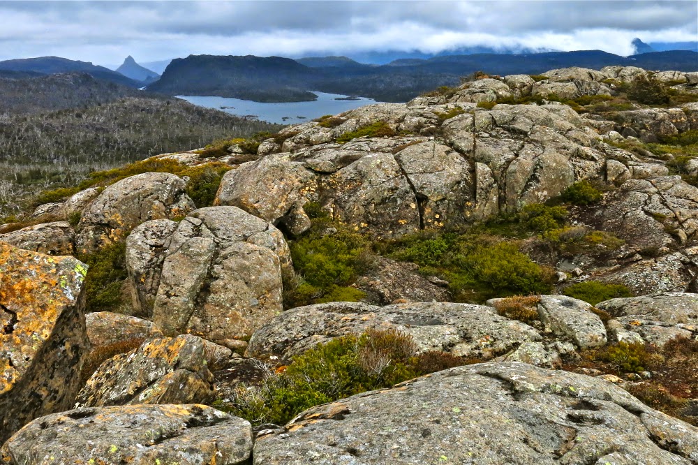
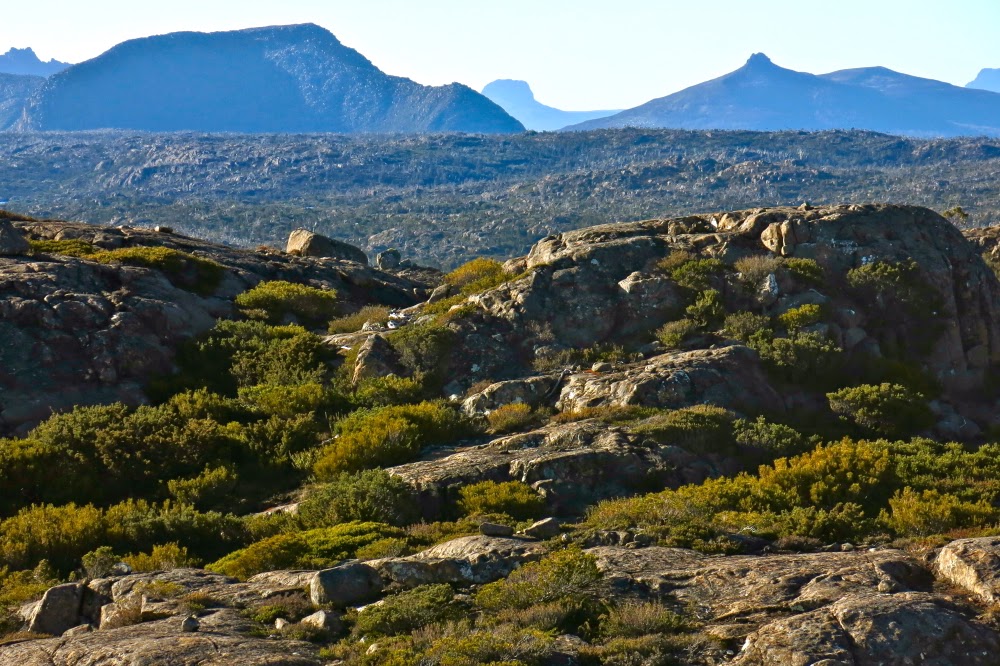
Mt Ida, as seen from Mt Spurling, day 2; late afternoon.
If you know my reputation, it will not surprise that it began raining lightly as the ferry pulled in to Narcissus Hut. No matter. We can do rain. 2 hours 20 minutes later, we were ensconced in Windy Ridge ‘Hut’ (Is ‘hut’ really a suitable word for barracks such as that?) and having lunch. 35 minutes more (of walking, not eating) we had climbed many contours (they looked rather formidable on the map considering the weight I had on my back) and were at the first clearing on the right, fractionally before Du Cane Gap, and were inspecting what appeared to be a wombat travel route but which morphed into a pad for humans that led onto the Travellers Range above. Up we went.
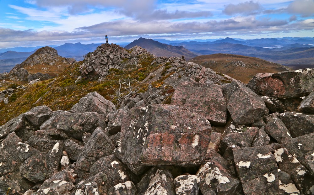
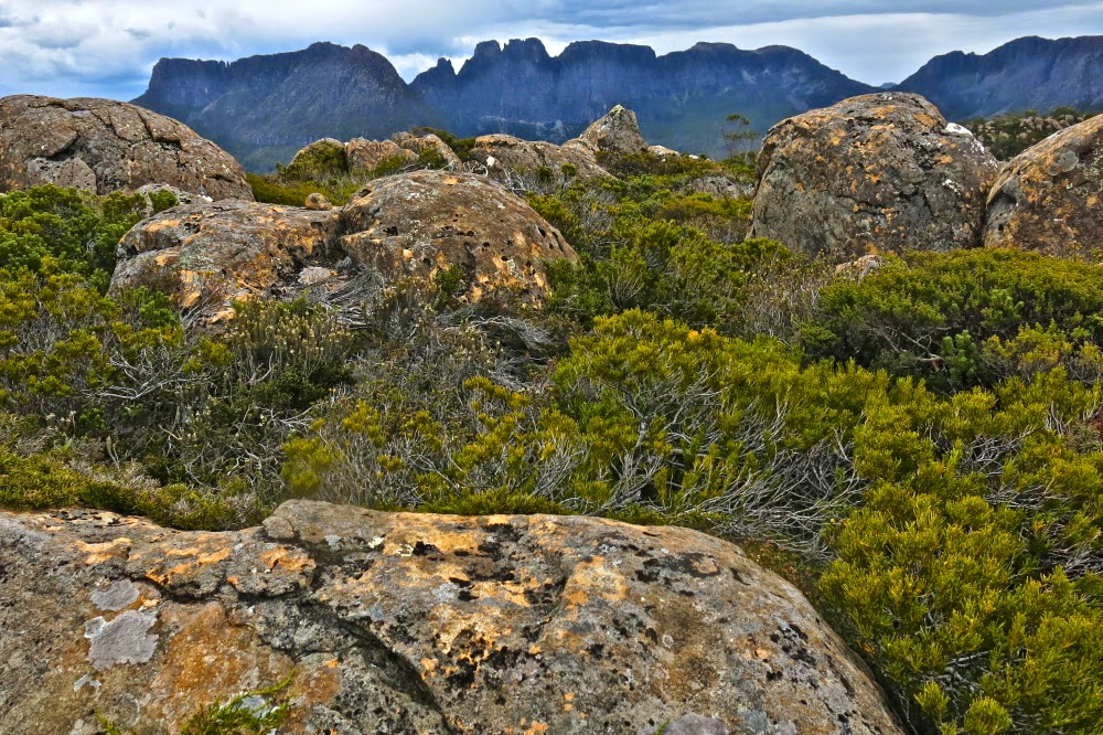
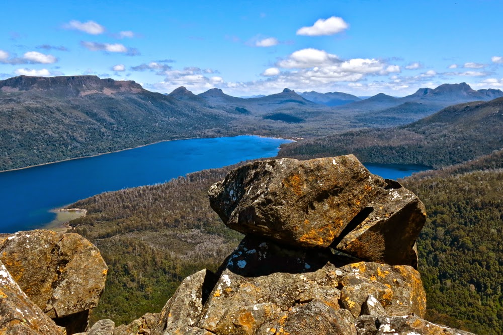
View from Spurling. So many old friends in this photo! Great to see them from a new angle.
Here I encountered a sobering fact: I am used to being amongst the fastest in any group I walk with (very often, the fastest). While I wait for others I usually have plenty of time for photography or to survey the beauty around me. Here, I was the slowest (of three). As such, I had set the pace along the flats, but had hoped that as we ascended, I might relinquish the Ping post. But there was no puffing behind me; no one dropped back. The other two slotted right in at my back all the way. I was impressed, but also disappointed. I was to have six days where I was the one lagging. However, I reasoned philosophically, it would be good for me – salutary – to see life from this new perspective. I might learn valuable lessons. I would be the one who had to ask for any rests, who called a halt to the day’s progress, who held them up each time I encountered an obstacle and who operated as the brakes on the machine instead of the engine driving it. At least I was with two really nice people who didn’t seem to see things that way. This was the way I felt, not the way they acted. I knew that each day Tony wanted to go further than we went, but he never said: “We have to stop here because you look stuffed Louise.” Instead he’d say something like: “I think we might stop here. What do you reckon?” But I knew perfectly well that if I said I could go further, then we would have done so.
Another shot from high on Spurling. It was so great to have views and no drizzle for a change!
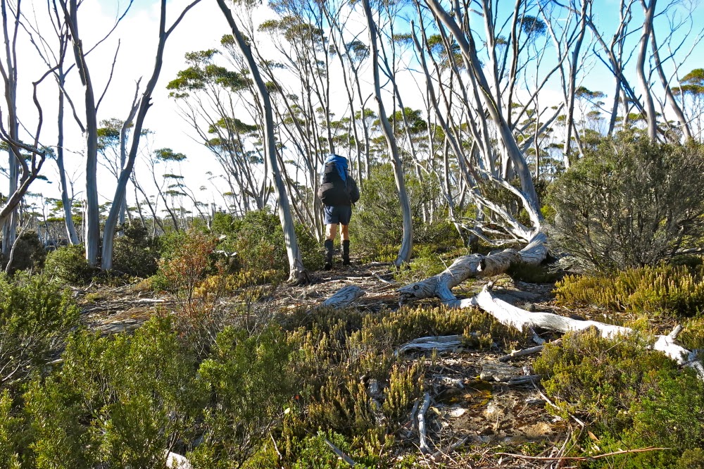
Our pattern of operation was basically the same each day: we began marching at 7.30, or 8 at the latest, put in 3 to 4.5 hours’ work before lunch – goose-stepping through thigh-high shrubbery, climbing over and under logs, dropping off cliffs, negotiating mossy, angled rocks or pushing through thick, taller bush. (These times do not include breaks – but we only snatched moments of break anyway, although we did pause for a quick snack of maybe nearly ten minutes duration late morning). Other pauses occurred when Tony needed to consult the gps or map. I loved it when he needed to do that. After lunch, we put in a few more hours, stopping at 5 or maybe 6pm to erect our tents, have dinner and go to sleep. The other two were utterly unchallenged by this workload, so again, I was the weak link in the chain.
Still delighting in the view from Spurling. I was quite excited to see Barn Bluff, Pelion East and Cradle (just disappearing out of the picture top right) from this perspective.
Tony was expert in his navigation, yet did us the courtesy of taking our suggestions of routes seriously, often following them through so we all felt we had a say in where and how we went. It is nice to feel you have some directing power in the route, and to feel trusted as a navigator. He also didn’t require that we tread in his footsteps, so we had the pleasant feeling of independence over mini routes, staying in contact with each other, of course. I sometimes enjoyed walking a different, parallel route. If I managed even to keep pace with this long legged warrior, then I figured it was a good route choice. Marcel, the quintessential gentleman, nearly always stayed behind me so I couldn’t drop out of sight, and so he could help if I disappeared into yet another wombat hole, or tumbled down another cliff, or hung by my hair from another branch or bashed or bruised myself yet again. Agonised by my efforts and grunts lifting my own pack, he aided my cause and warded off injury by lifting it for me each time I needed to shoulder it. And he kept me thoroughly entertained with stimulating conversation.
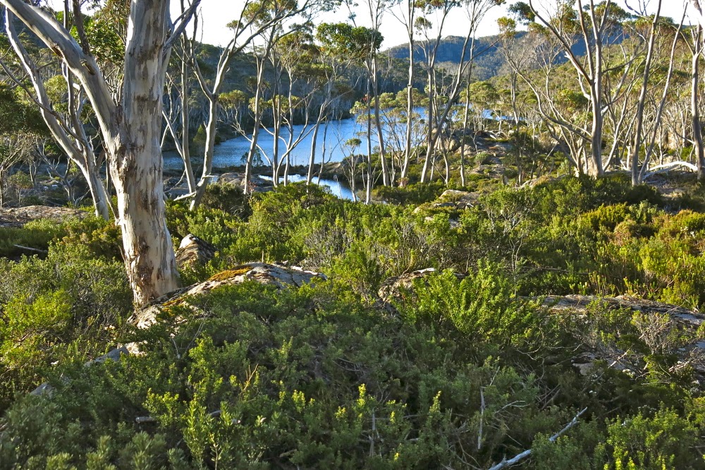
This is our campsite on day 2, under Spurling. After dinner I wandered off to take photos.
Each day we climbed something of note, saw many wonderful tarns and (with one exception) got rained on with varying ferocity. We pitched and depitched in the rain, and walked and ate in the rain – but don’t fret. We did have some blissful moments of sunshine, particularly appreciated because of the contrast factor. Warmth and a view were not things we took for granted.
Day 3. Back to drizzle and murk. This is on the Travellers Range High Point.
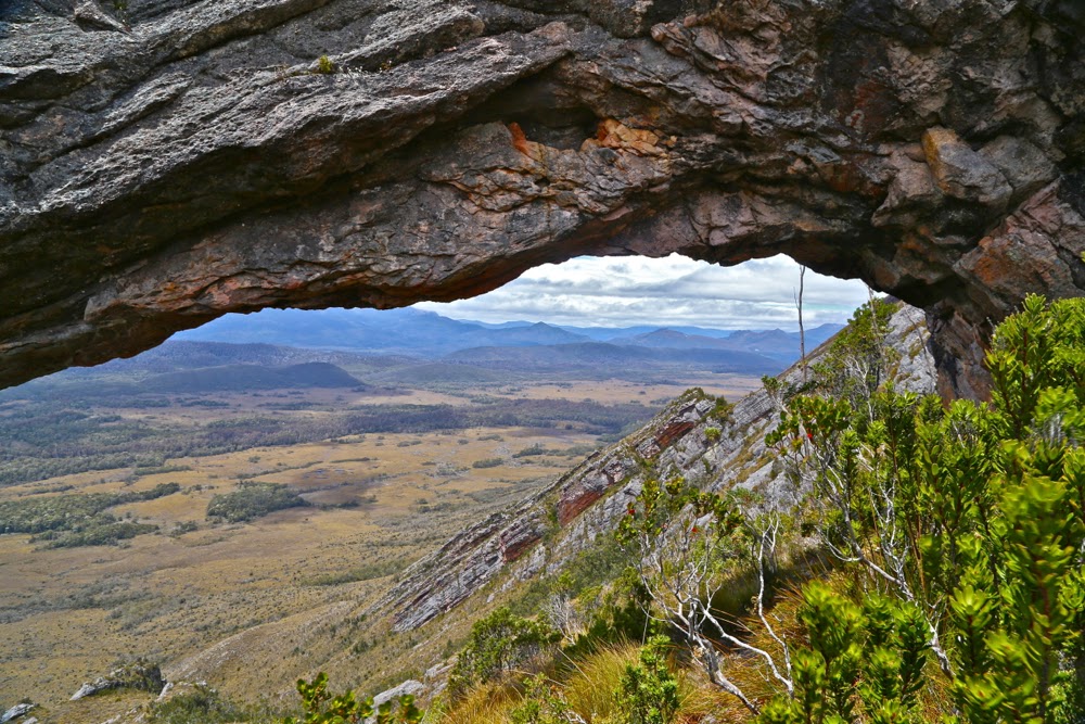
Day 1 had the biggest climb of all – from Leeawuleena (Lake St Clair) onto the Travellers Range, but that didn’t count. That was the springboard from which we would leap. The Gatepost, the first named point of climbing, was negligible in comparison. The views would no doubt be stupendous on a fine day. I will return. We camped that night near Lake Orion.
Mt Spurling, as seen from the Travellers Range High Point side during our return to camp (Day 3). Don’t be fooled by the appearance of sun. We were. BUT … It’s about to rain again.
On the second day, we climbed the Mountains of Jupiter (attacking, obviously, from the east). The actual climbing part was, for me, the second easiest part of the day, being without packs and without significant scrub (climbing Spurling was the easiest). The view was a bit murky, but good to have anyway. I have wanted to climb this particular peak for a while now. As we had lunch afterwards (back below), an unprecedented event happened: the sun came out and we felt warm. Our clothes dried off a bit. It felt grand. On we continued to the base of Mt Spurling, to drop our packs and do the second climb of the day. Tony then wanted (I could tell) to continue into infinity, but realised that his charges had limited capacities, so settled for pitching the tents there, climbing packless and calling it a day after that.
One of many random tarns (in the rain, of course) on Day 3, after we had left our Spurling campsite. Not complaining. I think tarns are actually very atmospheric in the drizzle.
Now this mountain did excite me. The sun was still shining, casting interesting shadows. Once past the early band of scrub, the way was over fast moving stone. Hoorah. My spirits picked up and I even ran some sections of the climb, I was so happy to be able to move unmanacled by pack or scrub. My chains fell off; my heart was free; I rose, went forth and climbed swiftly.
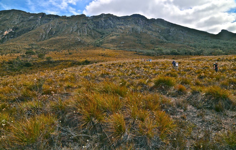
Some of the easiest bush we got to travel through. And look, Tony is still in sight; I can nearly keep up. This is on the way to Rim Lake. Day 4.
On the third day, we headed off (in the rain) to conquer the high point of the Travellers Range. Once more, the views were of beautiful mountains, but were marred by the lack of clear outlines and interesting light. The sun made a brief appearance near the end of our return, lending us a false sense of security, as it ceded to rain just as we finished eating lunch and before we’d depitched the tents. I struggled this day with injuries incurred the previous day when sliding uncontrollably down a small cliff, skewering a rib with a jutting broken branch and whacking the front of my leg against something. Leg and rib caned, so it was with great effort and even greater slowness that I tried to keep up with a disappearing Tony in the final section of the day. He realised I was dropping back, and kindly offered to stop short of his goal of Rim Lake. Whew. I was most grateful.
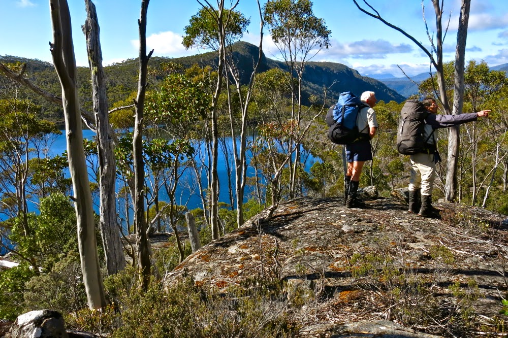
Tony and Marcel discuss how we’re to get off the cliffs and down to Rim lake. I used navigational pauses as rare photo-taking opportunities (or chances to shove more food into my face). I needed to snack far more than the other two.
Day four brought the sun. Wow. We were out of practice at depitching without haste and angst at our gear being soaked during the loading process. The sun lasted all the way to Rim Lake, down to the saddle, up the eastern flank of Ida, along the sidling process under the cliffs as we worked our way around to the north, and even as we climbed the famous chute to the top and took photos. We returned to Rim Lake unaccustomedly hot and sweaty.
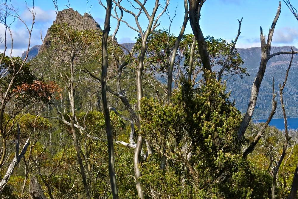
The wonderful Mt Ida, as seen from behind a light veil of eucalypts at Rim Lake.
I loved this lake and its wonderfully framed view of Ida, a mountain that I’d always admired, but for which I now had a deep affection. I wanted to stare at her more and ponder her. I also wanted to wash in the not-too-cold water and maybe even paddle. Most of all, I wanted to watch what the changing evening light did to “my” mountain. I wanted to witness her new mood in the new conditions and spend the night with her. However, I was informed that to sit around in such a manner was boring, and that we needed to move on while there was light. I had made assumptions about where we were sleeping that were inaccurate, and found it doubly hard – both to leave the place I had fallen in love with, and to change key in that manner. I was also challenged in that I am a person who likes and sets goals, and I had thought our goal for the end of this day was Rim Lake (having climbed Ida). I realised we had no daily goal. We just went until time ran out or I faded so badly that cessation was the inevitable conclusion. On I went, but my spirit felt temporarily crushed. I was Shakespeare’s schoolboy, creeping like a snail unwillingly to school as I dragged myself from the place I had fallen in love with. Suddenly I was very tired and didn’t feel well.
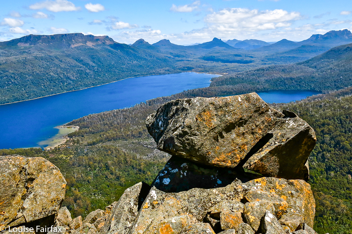
The reward of a climb that had one very scary moment if you’re only small (Mt Ida summit). Countless old friends out there. I couldn’t entirely relax and enjoy this view, as I had no confidence I would live through the descent.
The next day (day 5 + 6) was totally different in every respect. The light clouds that amassed at the end of day four managed to transmogrify into very earnest rain by breakfast time. It continued to rain with varying intensities all day. There were no longer any wonderful vistas, and even the number of attractive tarns diminished; we were already so high that I barely noticed the “climb” of that day (a stray Bob Brown mountain of 1198 ms – no real view). Huge fallen trees of slippery wood obstructed our path, drenching me as I sat on them to get over, each one putting extra distance between me and the long-legged object of my pursuit. I managed to fall in an astonishing number of concealed wombat holes. (I kept thinking of Pooh paying Rabbit an unwelcome visit). I felt like a walking disaster. Normally quite sure footed, my injuries made me ridiculously cautious lest I slip again – although I never have trusted wet wood, and there was wet wood everywhere. I had no power to resist toppling and hurting myself. Tony was all patience as I struggled my way forward, and Marcel continued on as helpful as ever, digging me out of holes and making sure I didn’t vanish beneath the surface.
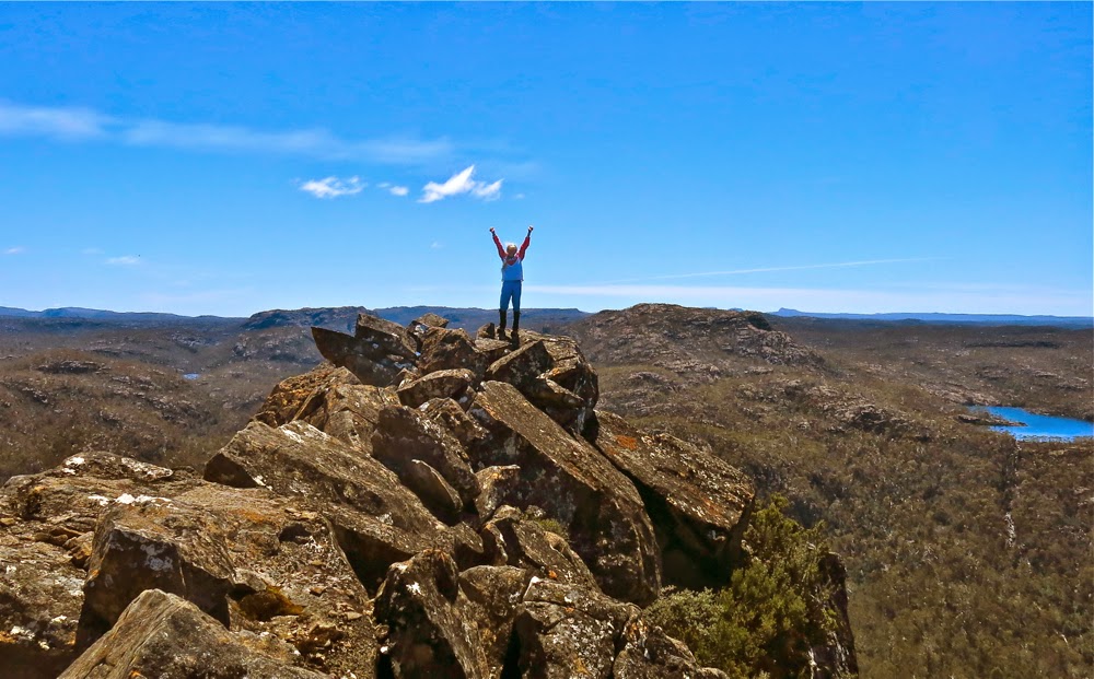
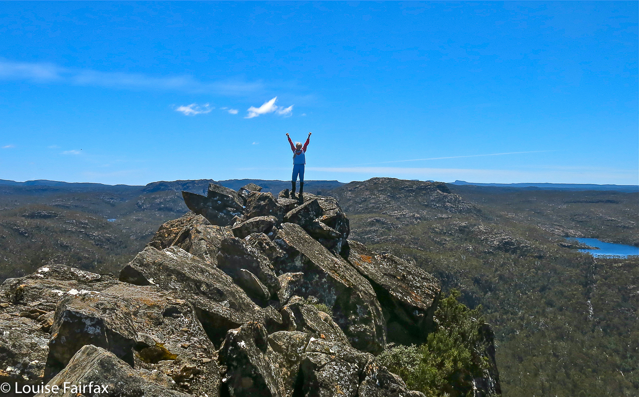
Can’t resist including a summit shot in traditional pose taken by Tony. I did feel victorious, even if apprehensive (more than) about the return downwards. Can you see that my hair is in a tangle from all the wild scrub? It took me hours to get the bands out when it was all over.
At last we hit the Travellers Rest Lagoon; however, there no rest for these travellers (too wet to sit). We had no password to cross the magic flooded river, so had to go back into the forest and circumambulate the swollen mud slide until we hit the river at the far end to see if it was crossable there. It was narrower than the one the other end, but fast moving with rocks under the surface that looked slippery. I imagined myself toppling for sure and being carried downstream, having a choice of death methods, most of them involving some form of hypothermia from being thoroughly drenched after a topple. I regretted that my camera would be ruined so that my family couldn’t even see what I saw before I died so dramatically and pointlessly. Tony could see that I was ready to drop my bundle here. He held my hand to steady me as I went across packless; Marcel brought my pack by doing a generous double trip. I hated being so helpless, but helpless I was, so I had to admit it. My weight is only half Tony’s at the nearest round fraction, which makes me rather vulnerable in the face of strong forces of nature.
Evening light near the tent, day 4.
Tony was greatly relieved when we all stood on the other bank. Magnanimously he offered to set up camp there, now that the dangerous part was behind us. We had already been underway for over seven hours with minimal breaks. Would I like to stop? “No”, I said. Both guys looked hugely relieved. I sure appreciated the offer, but this time there was a definite goal – the end, the car – and I was psyched up to reach it. It was a long day – two for the price of one – but after eight and a quarter hours’ walking, spread over ten hours, we reached that goal. With the help of jumper leads we even got my car started. I did not dare stop for anything on the journey back home.
Light scrub above the tent, day 4.
Bruce weighed the food that I returned with. Three kilos. I could probably panic a little less about running out next time. I had taken more than enough for eight days, not six. At least I now know I can do a really long haul :-).
Quick shot grabbed in a brief moment (Day 5+6) when the rain was light enough to dare having the camera out of its protective bag. A random tarn on the way to Lake Sappho.

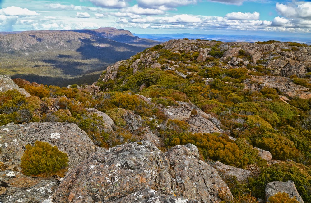
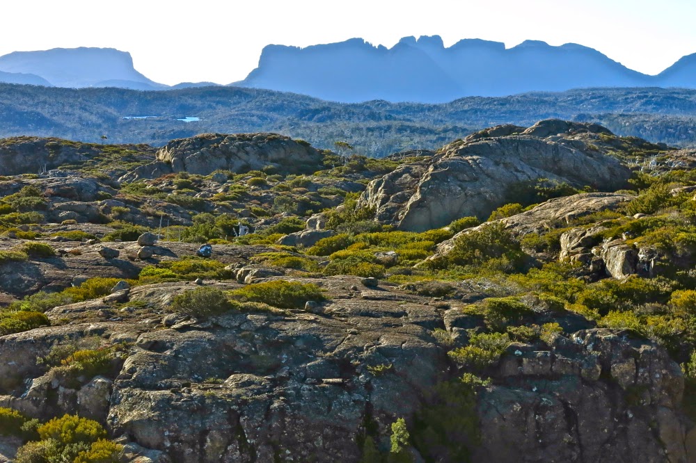
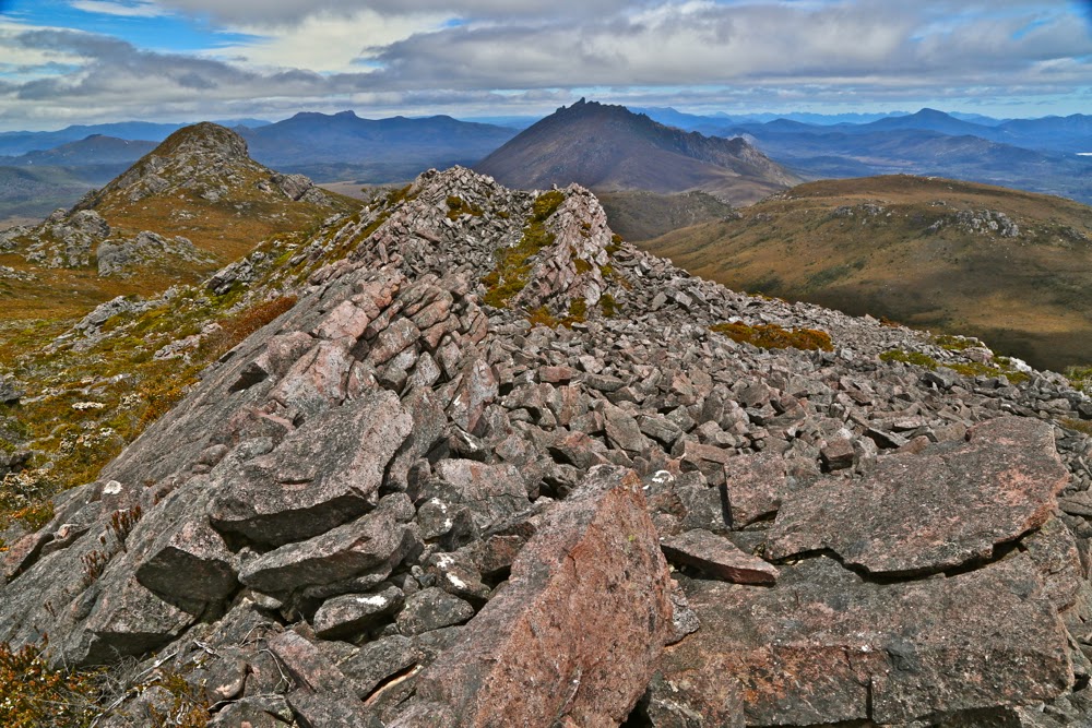 From the top ridge, looking back towards both the southern summit and The Thumbs.