Ossa 2017 Dec

Mt Ossa Dec 2017.

I was mesmerised by my visit to Mt Ossa back in December 2013, when I took a Swedish friend up there to sleep on the summit. What astonished me, amongst other things, was the beauty of the flowers along the way. (I was also captivated by the brilliant views, of course.) I hadn’t realised December was such a magic month in that area, and vowed I’d return with a better camera and a tripod for mach 2 some day. Unfortunately, it’s taken four years to find the opportunity.

This time, there was to be no Elin, and, worse, no Bruce. Off I set anyway, not sure how things would be. I can’t predict my moods these days.

The first part went pretty well, and I was in at Pelion Hut in under three hours, despite my heavy camera gear, and definitely ready for lunch. I hadn’t got away from the carpark until 10 o’clock, so it was not an early lunch. Light drizzle had meant that stops along the way were not really wanted, so I was in need of a good rest as well as a decent feed. I ate my salad roll with gusto. Drizzle changed to steady rain. The world turned dark grey. My spirits are not buoyant enough to deal with that at present. I decided I should turn around and go home, and count this as a good training exercise. I didn’t want anything in this weather other than sulking chez moi with my dog.

I set out for home, but then decided that was silly. Set out for the pass and decided I really didn’t want that either. Such vacillation. To and fro I went with each change off mind, trying to imitate a laden yoyo. In the end, I decided that I should start climbing Pelion Gap, to stop looking so stupid, and to try to warm up with the height gain before I made any big decisions (I was by now freezing with all that sitting around). Once I was underway, I talked myself into believing that I should at least go as far as the pass, even if not the summit, and maybe tomorrow would be more inspiring than today.

I slowed down the pace and ambled up the slope, enjoying the mossy banks beside the little creeklets, flowing happily no doubt due to the rain. The lush forest was pleasant in the misty conditions. Right near the top, just before one bursts out into the more open area, I had the pleasure of encountering a group of six LWC (Launceston Walking Club) members who had camped the previous night at the hut, and had that day climbed Ossa in the mist. In answer to my query about flowers, they reported that if I went high enough, I would find some (I had been deeply disappointed by the lack of them lower down – part of my general despondence). It was lovely to see people I know and to get warm hugs – and inspiriting to be told the flowers I wanted were to be found after all.

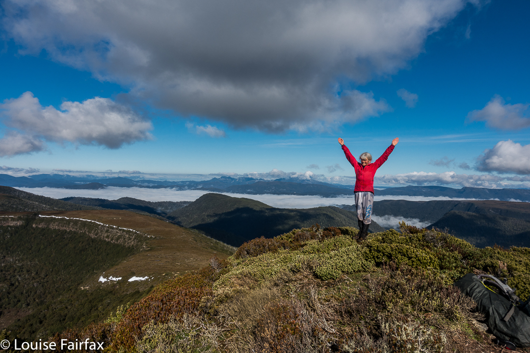
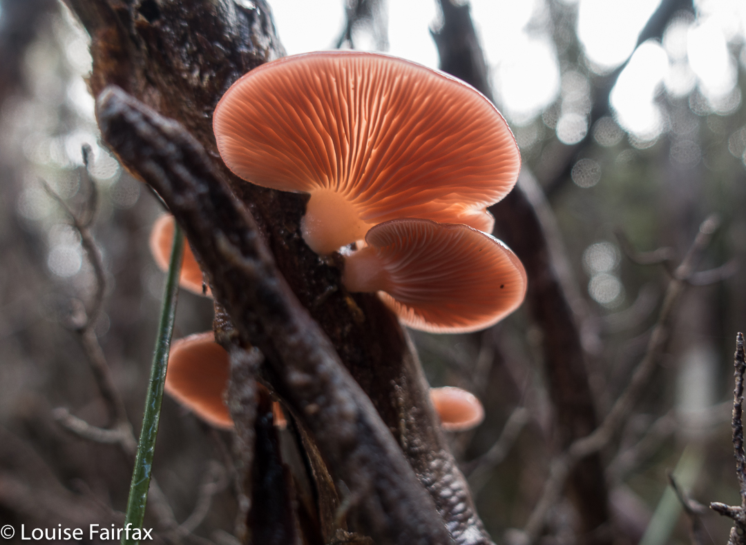
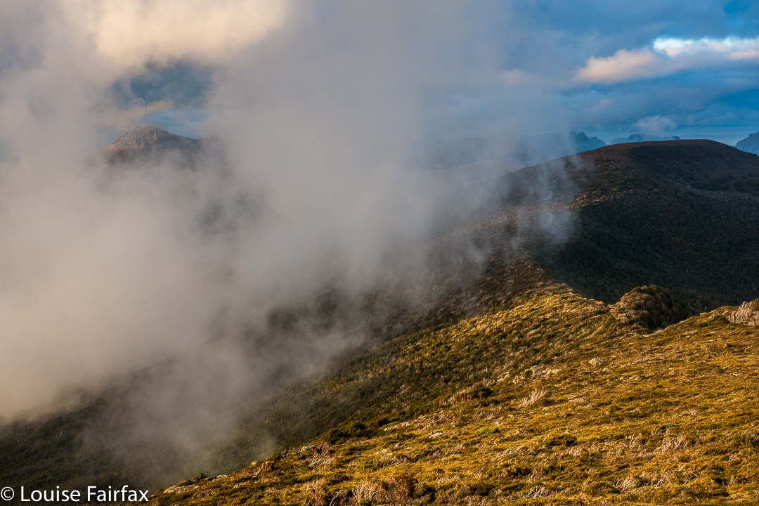
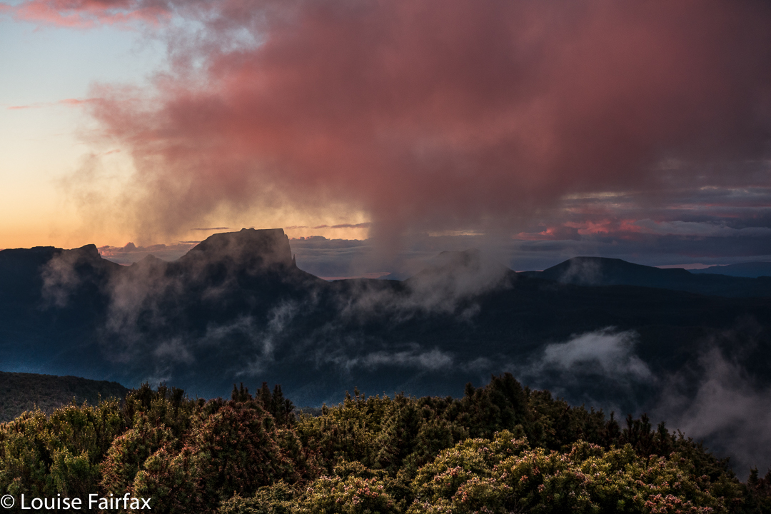
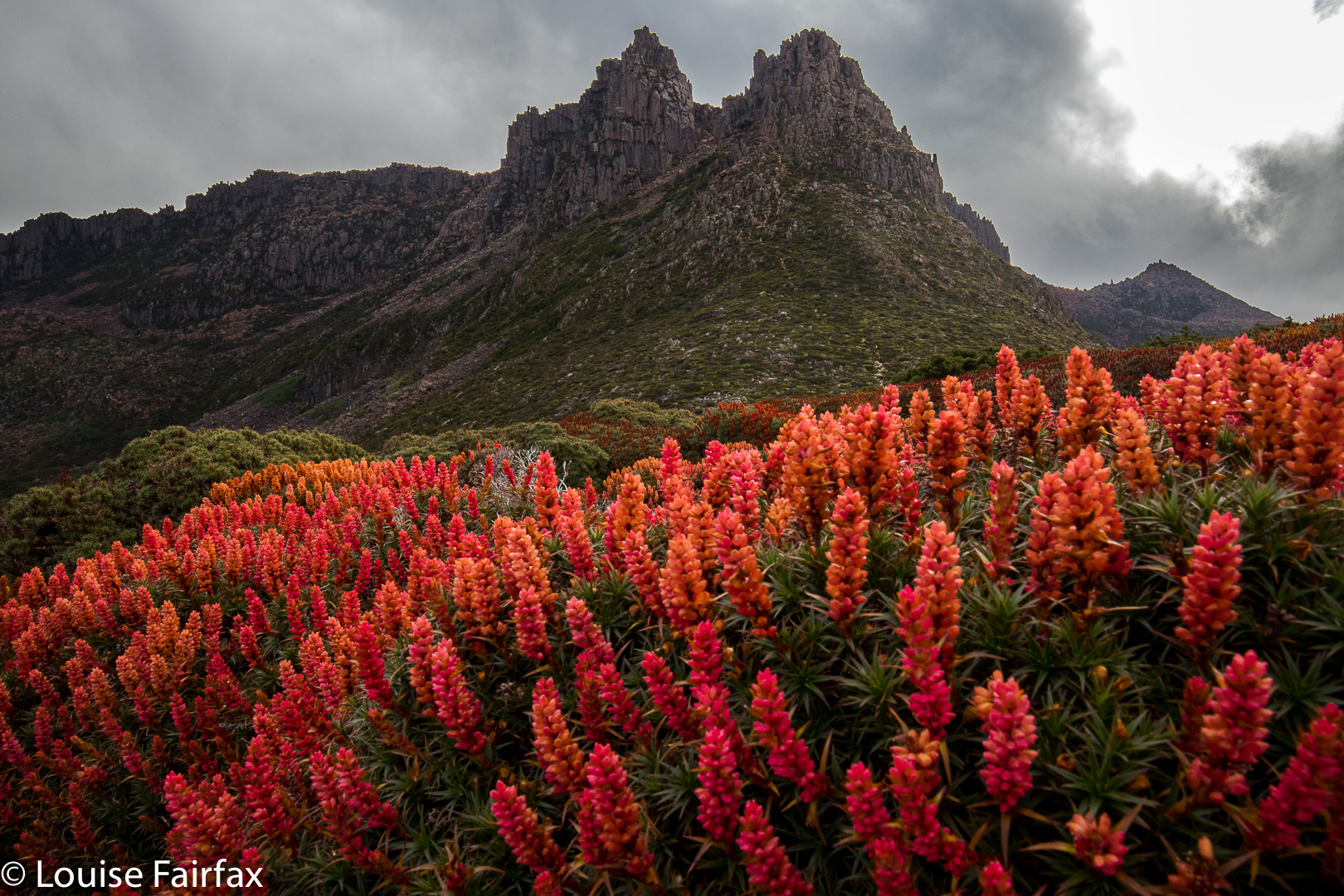
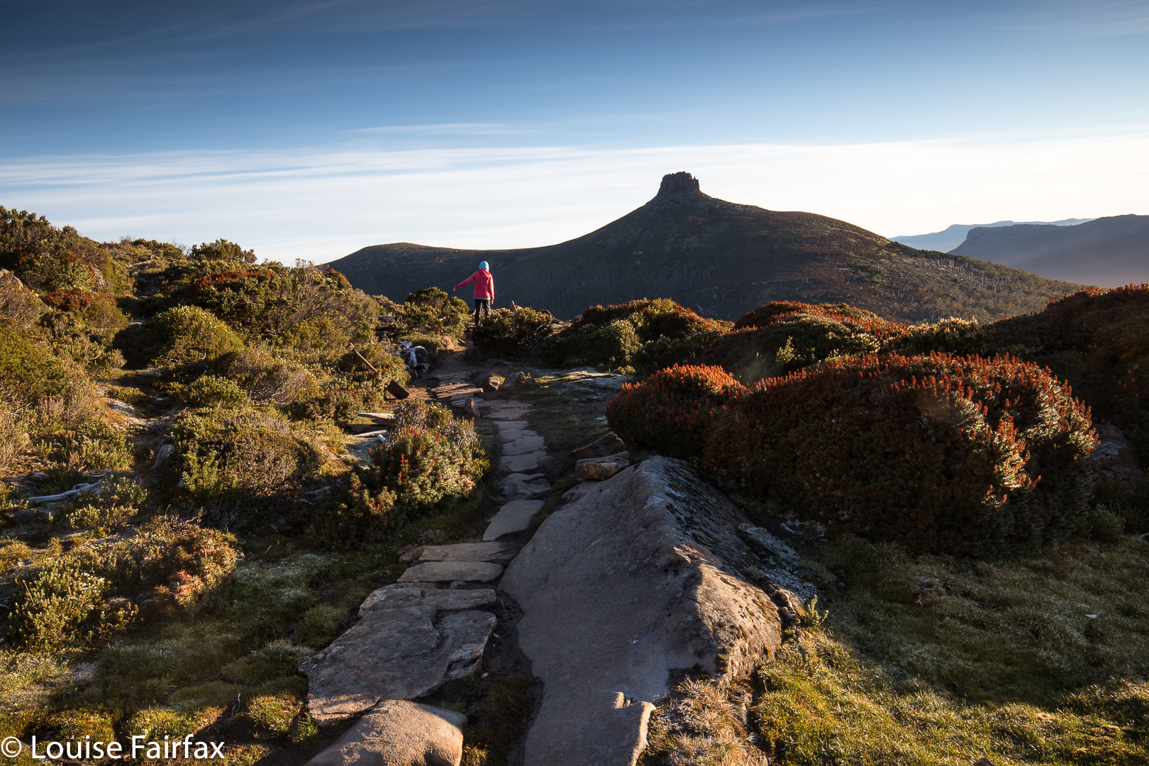
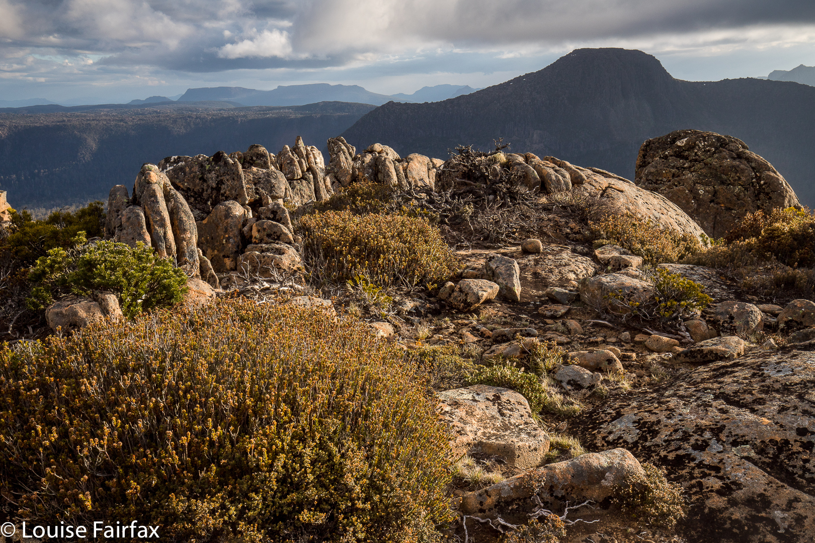
I didn’t stop at the gap, but kept climbing through the drizzle, in search of flowers. I found, I saw, I photographed. A strong wind joined the rain, and it was far from pleasant – and my socks and shoes were pretty sodden – but I was completely happy once I saw the colours of the scoparia flowers I had come for. I managed to find a sheltered spot for my tent – not easy when you’re so high with wind gusting from every direction, or so it seemed – and, in between photographing flowers and sunset, cooked and ate dinner in the protection of my tent.

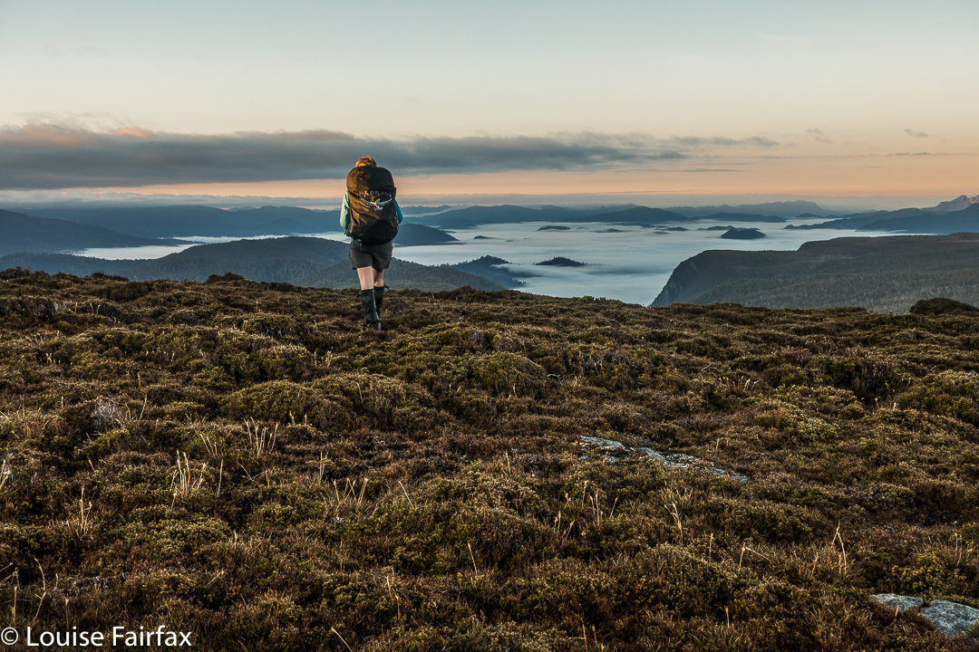
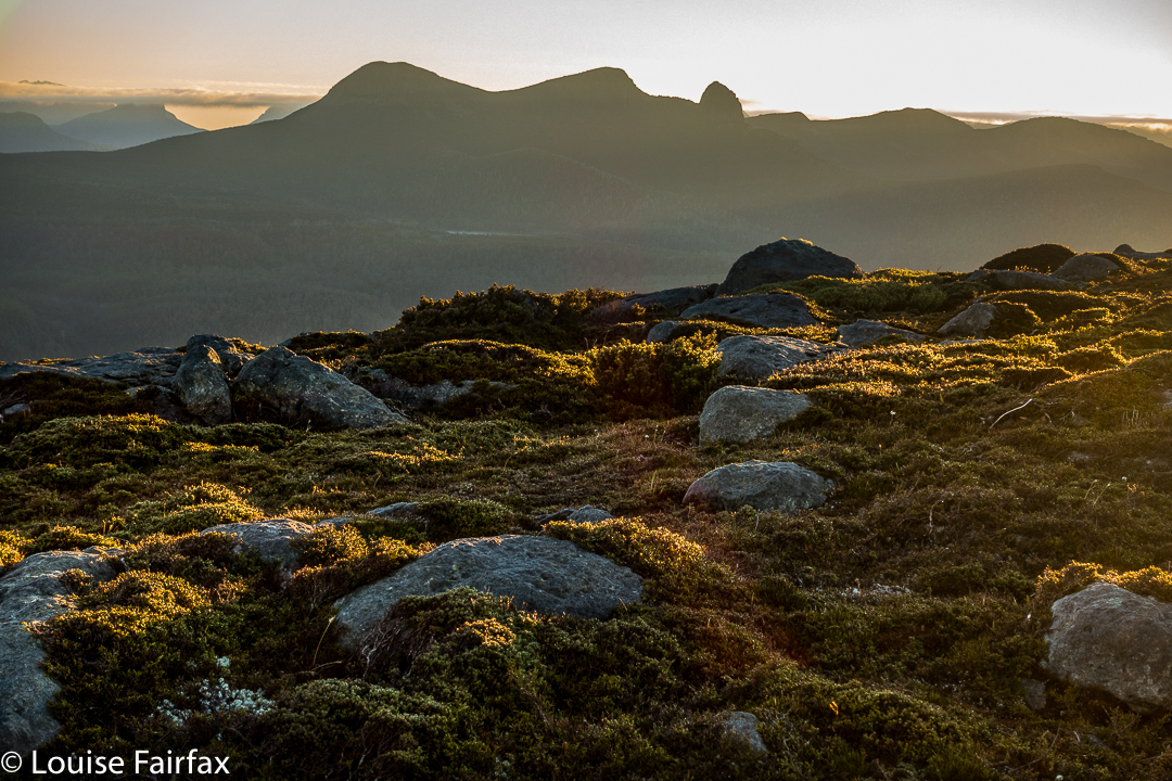
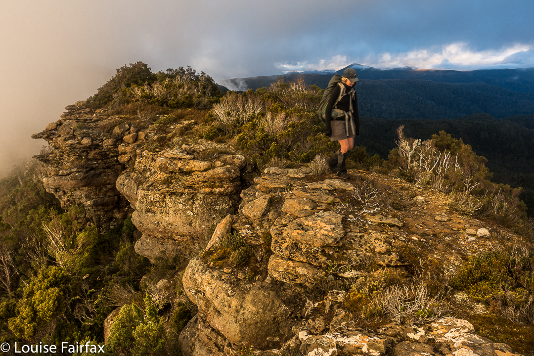
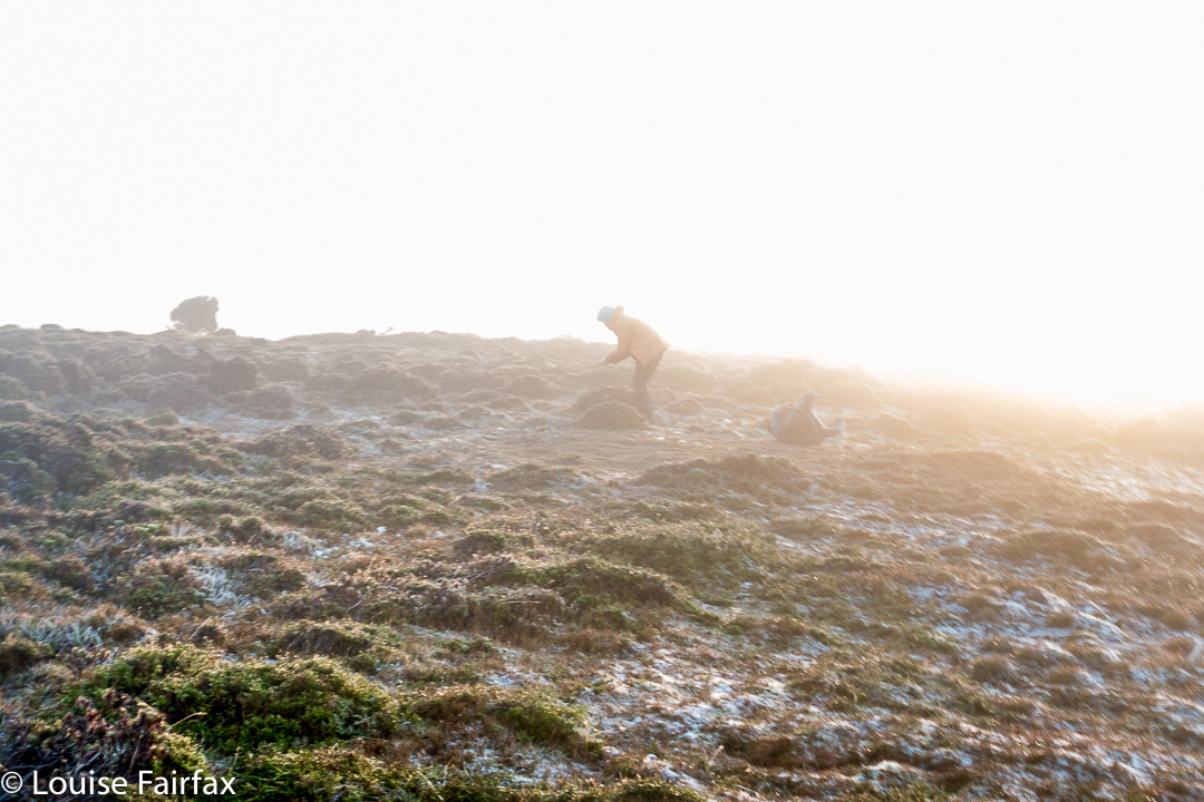
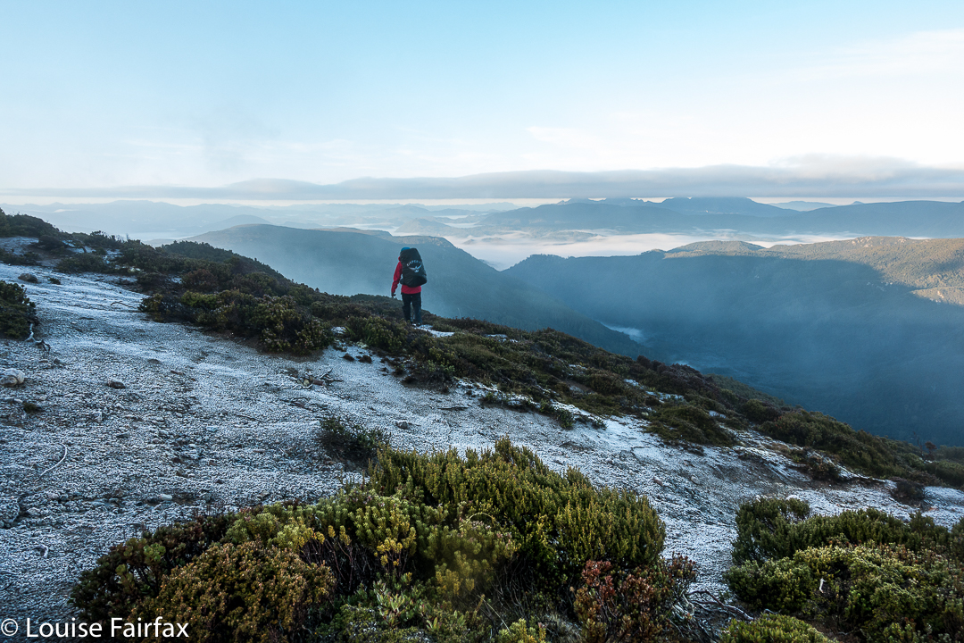
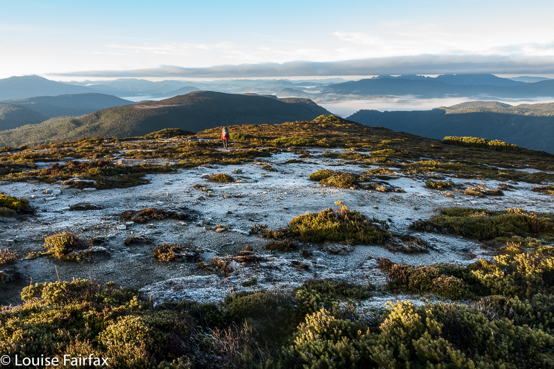
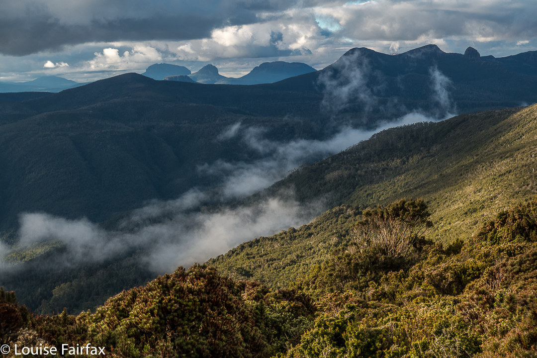
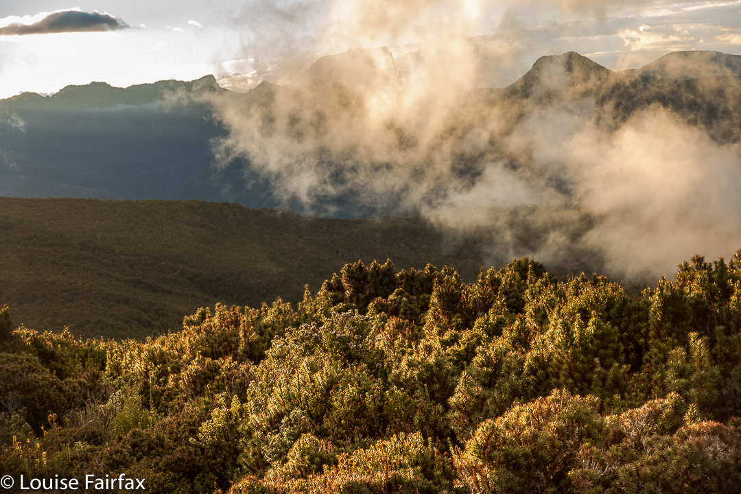
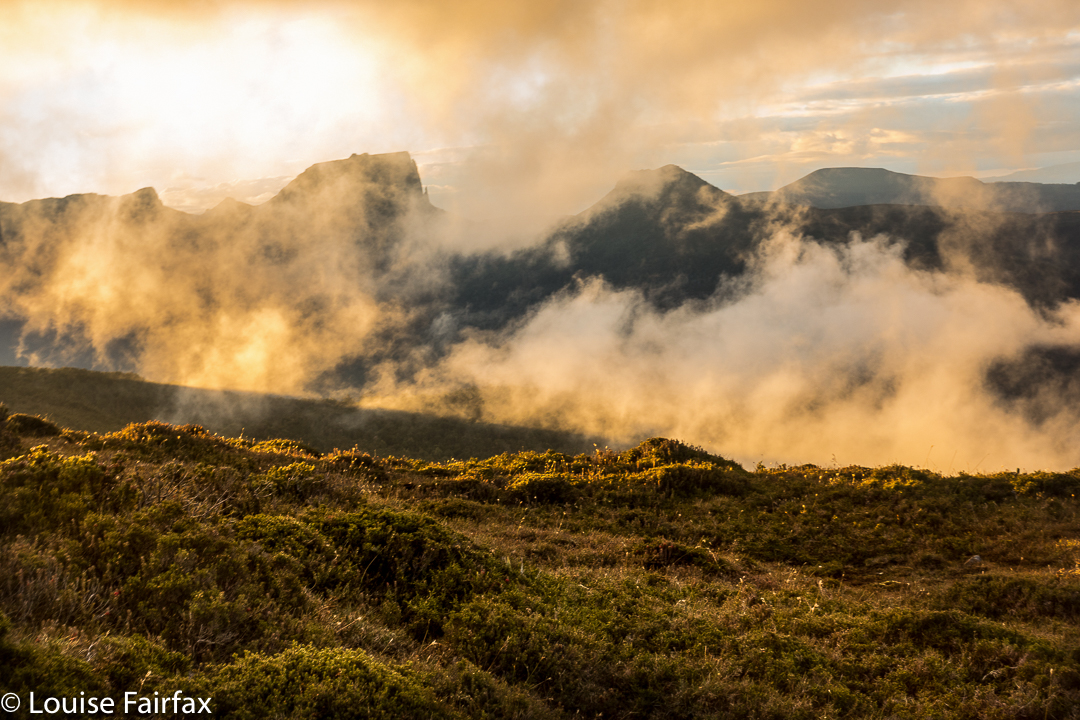
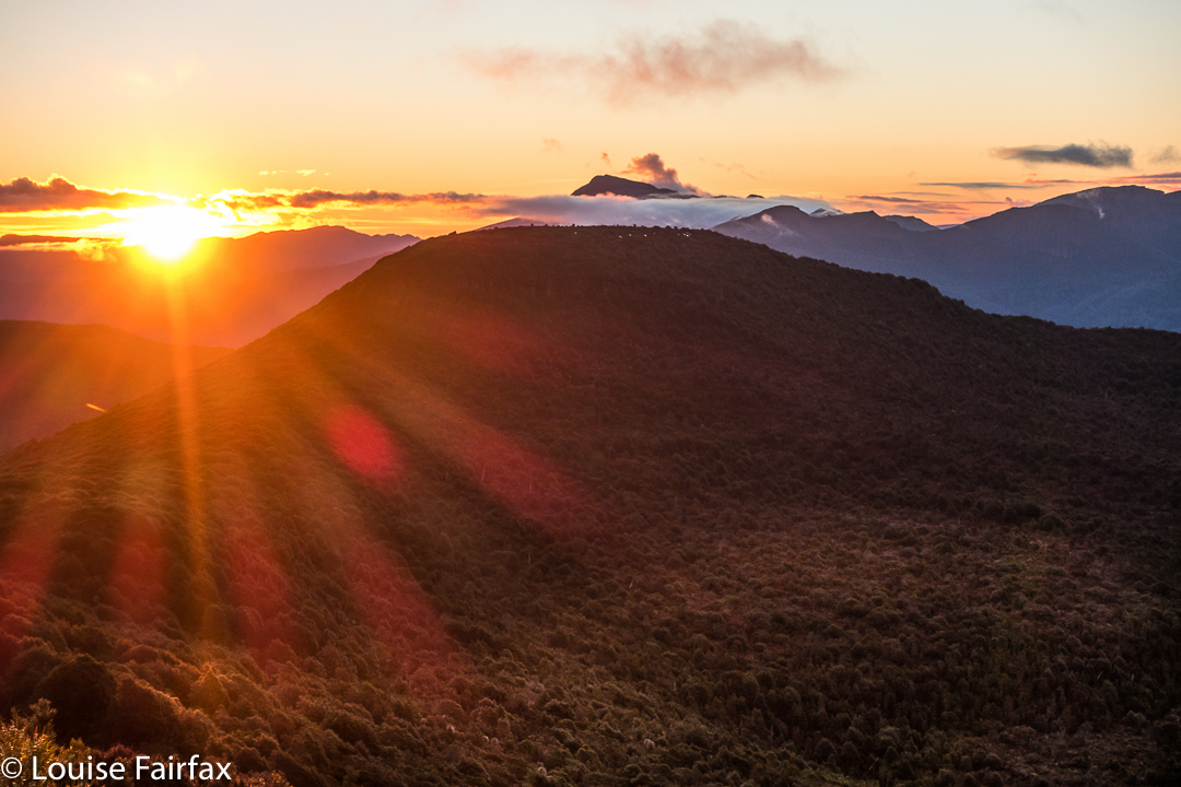
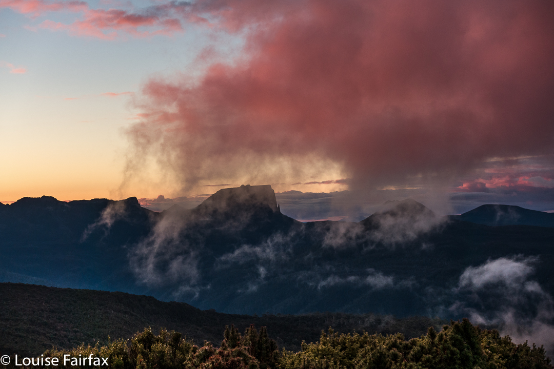
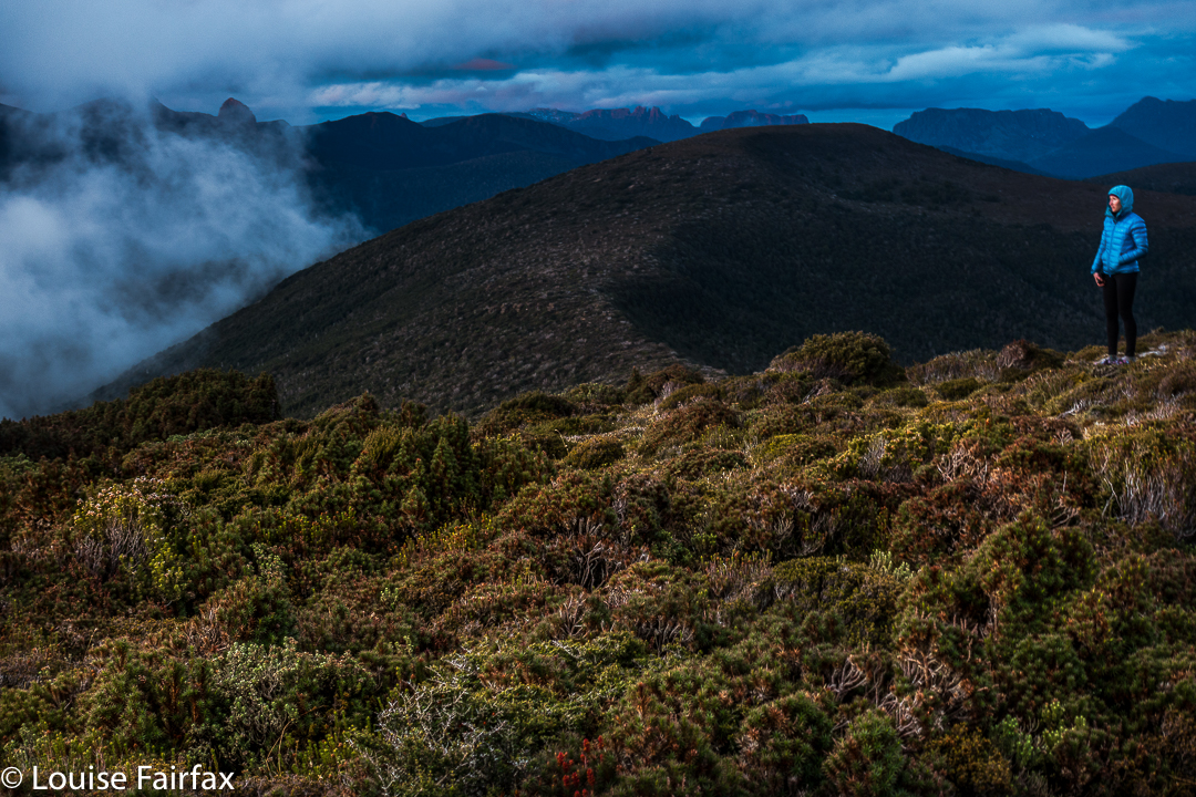
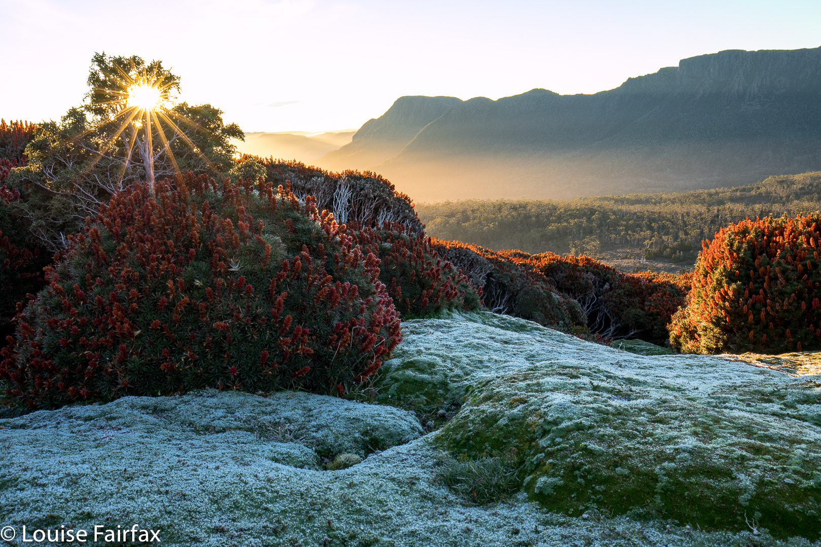
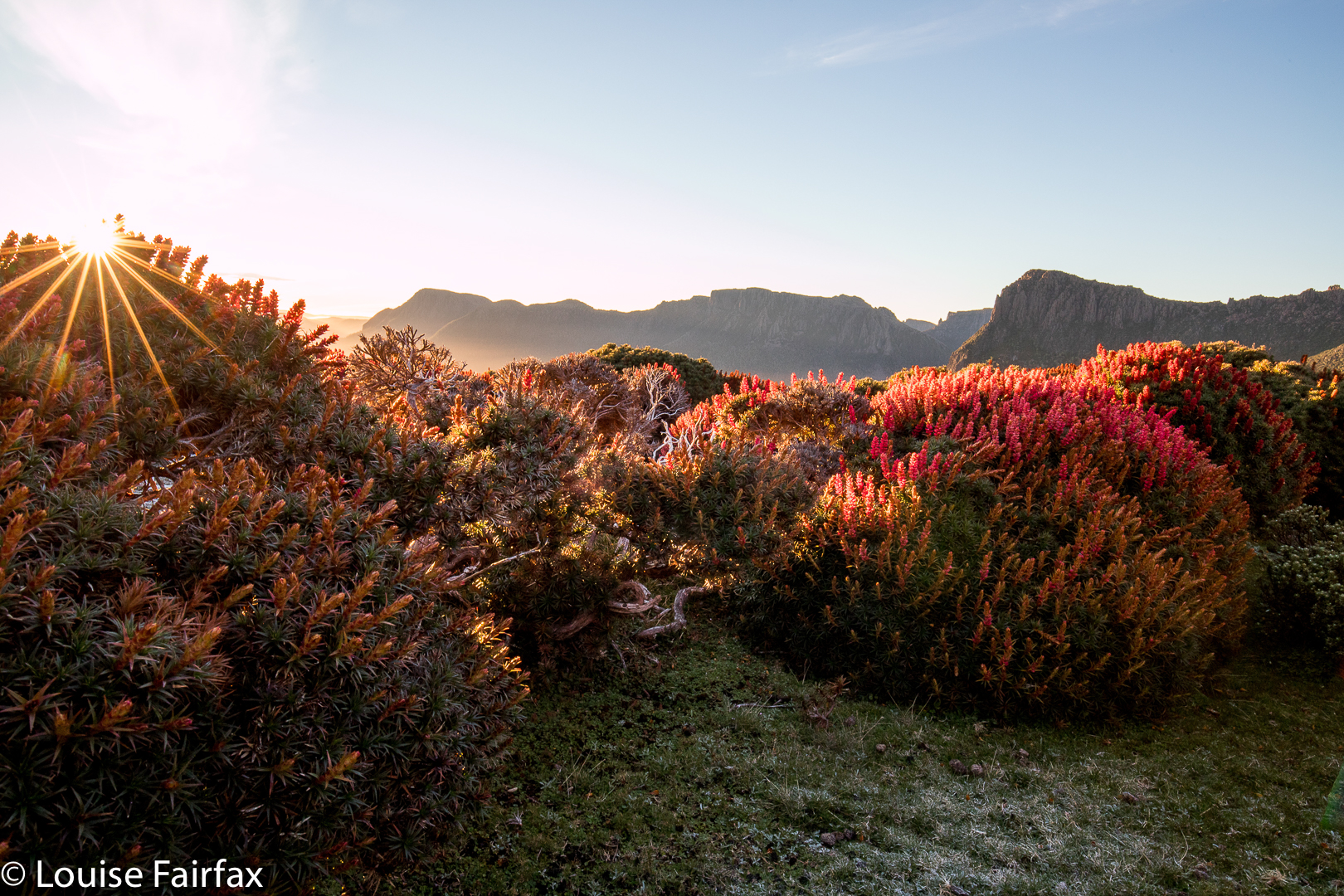
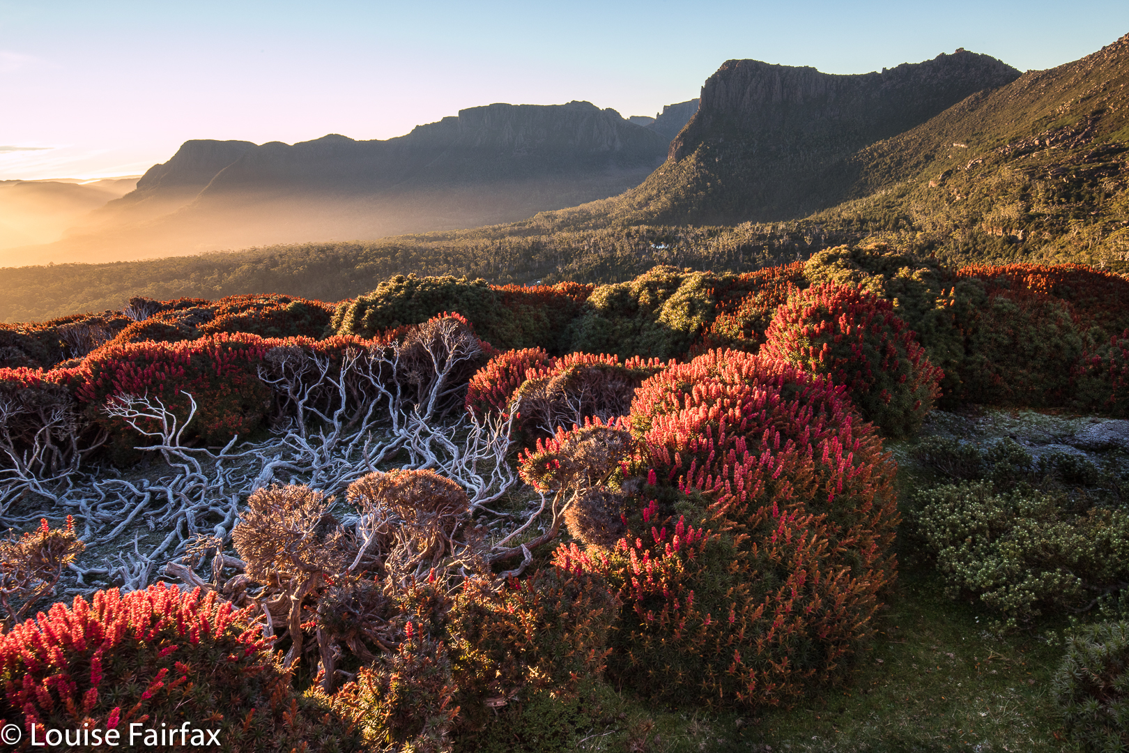
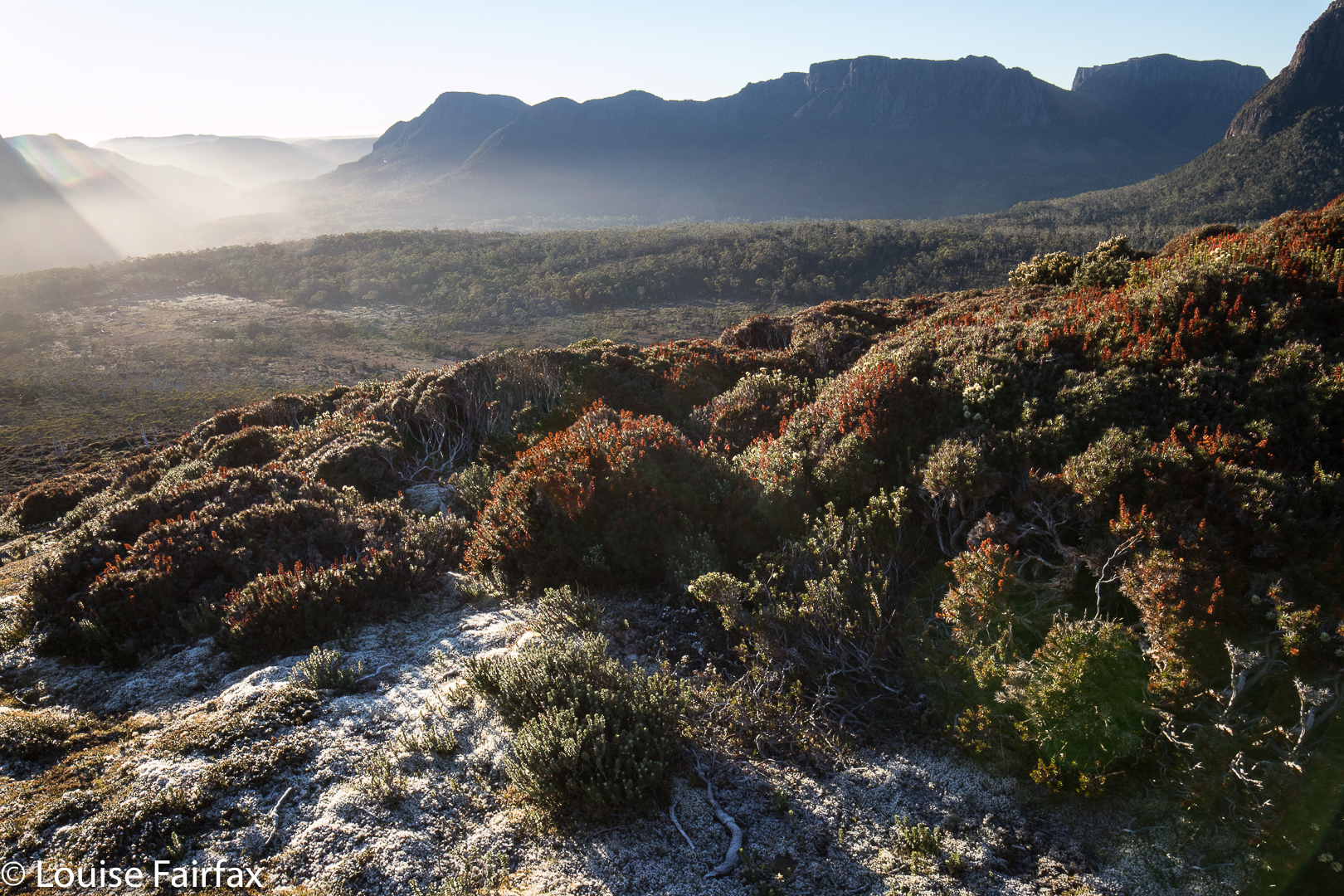
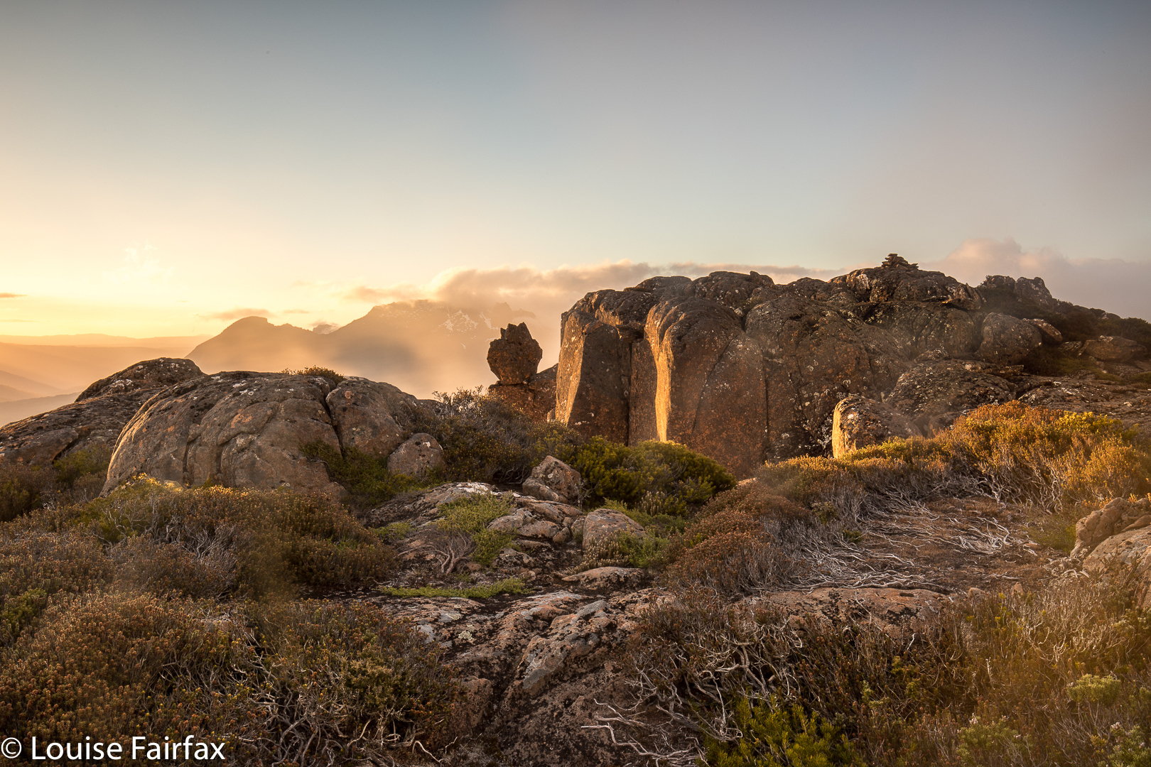
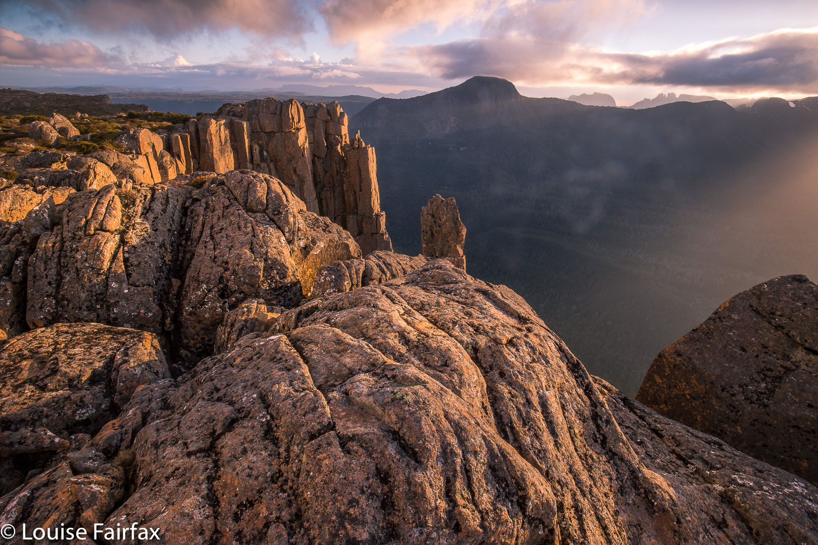
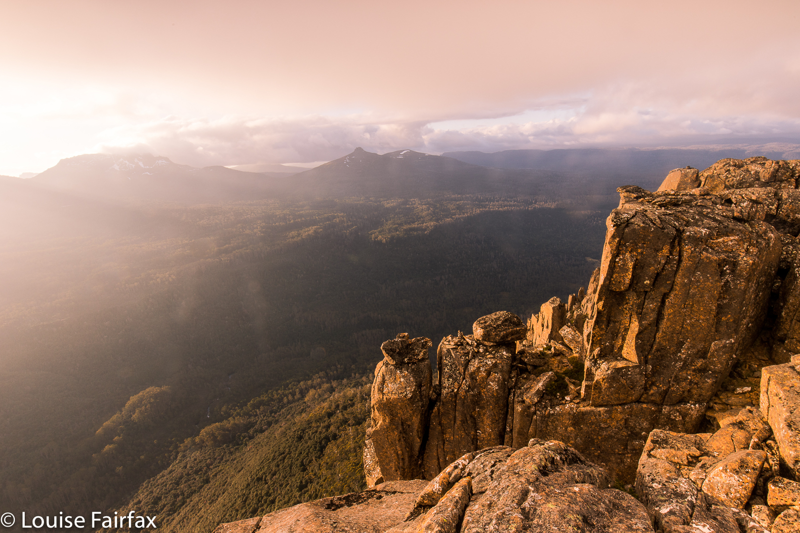
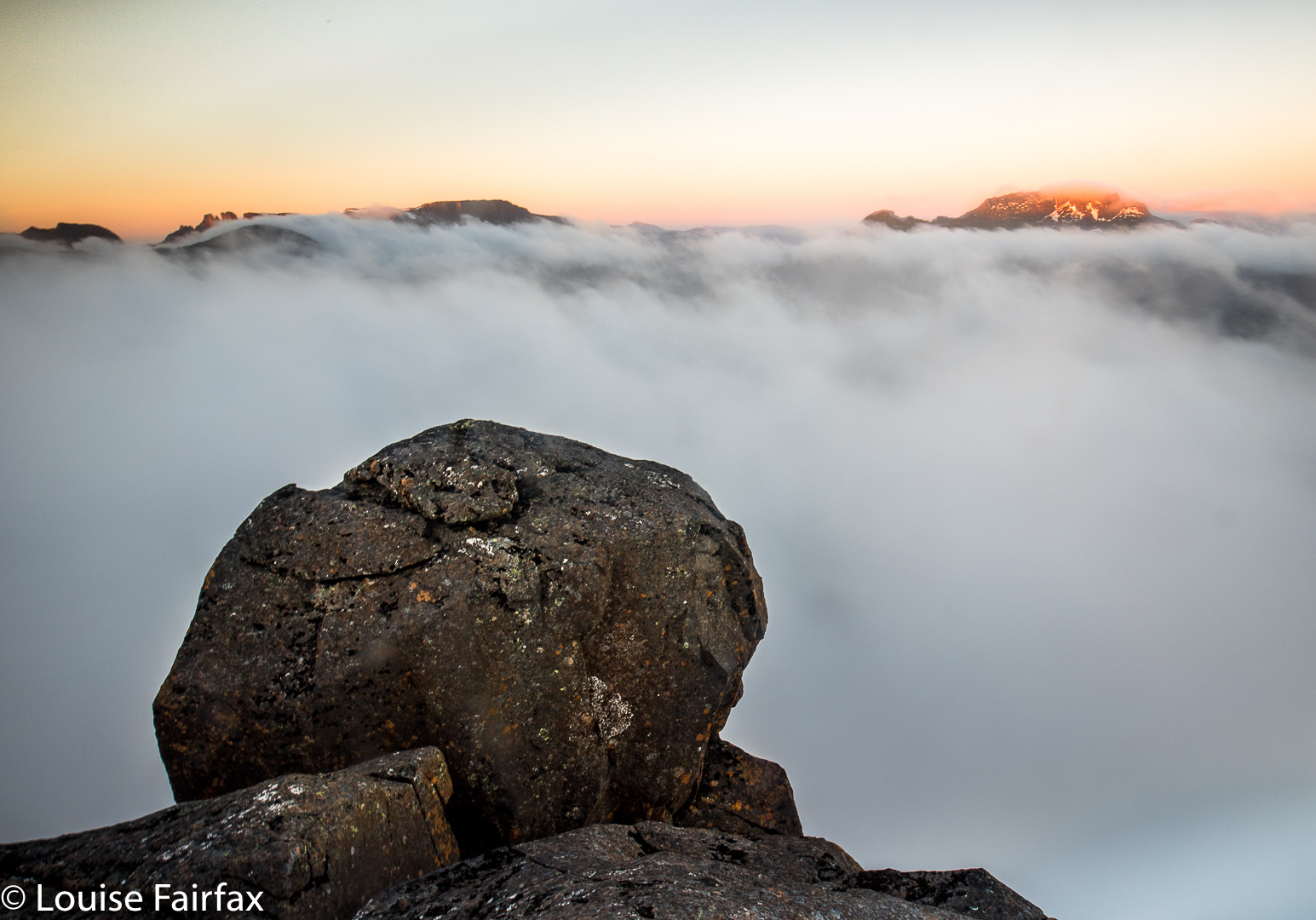
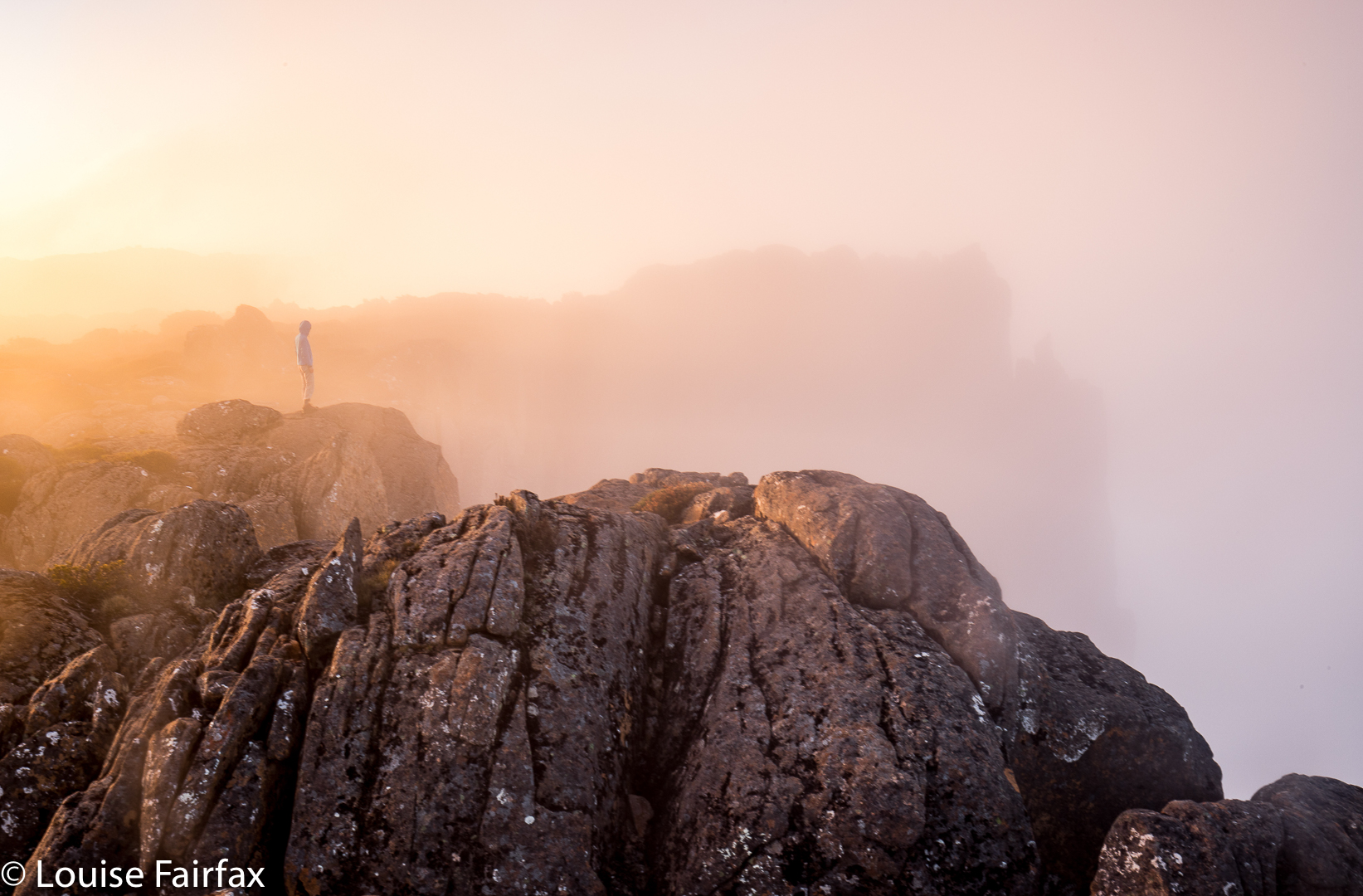
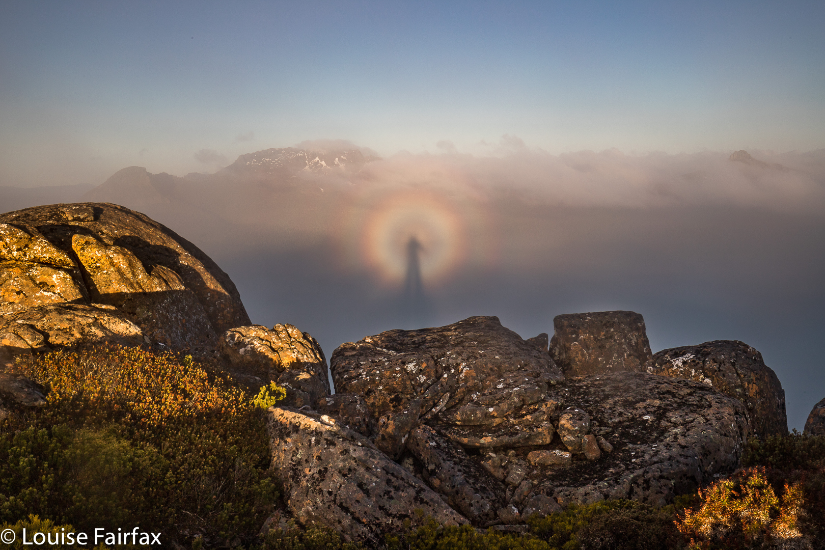
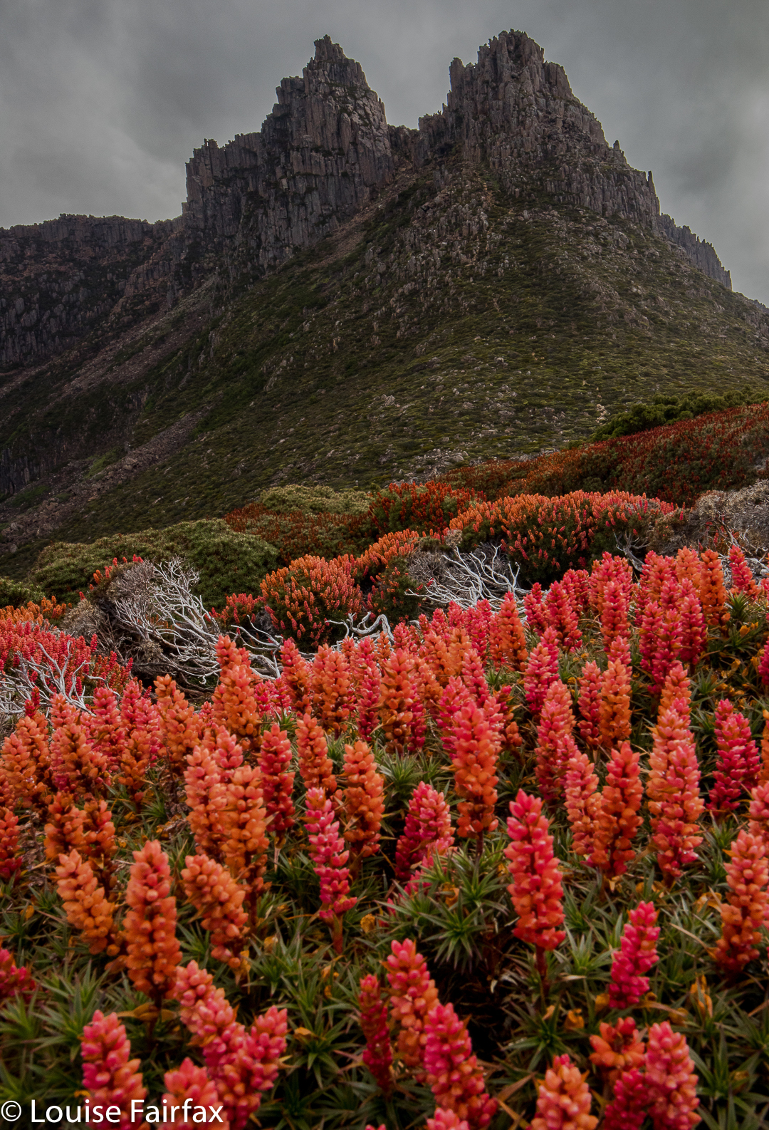
The sky was not colourful at sunrise (or sunset), although the golden rays of dawn lit the flowers beautifully. I have to admit I was SORELY tempted to stay in my warm sleeping bag and not venture into the frost outside, donning wet socks and shoes to do so, but I told myself I’d gone to a lot of effort to be here, and that really, it would be dumb to stay in my tent. I begrudgingly roused myself and put on every layer of clothing I possessed, wiped away the coating of frost on the tent, and got on with the day’s business. Of course, I was glad I did. One can stay in a warm bed almost any time, but one can only get up and witness sunrise on Tasmania’s highest mountain on very few occasions of one’s whole life. And life, I know, is a privilege not to be squandered.

Twin Spires 2017 Nov

Twin Spires Nov 2017


Twin Spires as seen from Cathedral Mountain.
The mountain called Twin Spires is right next door to Cathedral Mountain, and it would thus be pretty odd to climb one without the other. Twin Spires is the Abel, so I guess if you only had time for one, it would be the one you’d do. I am biased, as I camped on Cathedral and enjoyed the golden hours of sunrise and sunset there, so prefer those views, but Twin Spires was still a very wonderful peak. It is just a fraction less in the thick of the drama than its friend. It does have a tarn very near the summit, so would be worth seeing if it had great views for sunrise at some later date.

For general directions on how to get here, see the post on Cathedral Mountain (www.natureloverswalks.com/cathedral-mountain/). I have reposted the map below.

Cathedral Mountain 2017 Nov

Cathedral Mountain Nov 2017

I have wanted to sleep on Cathedral Mountain for years, and am very pleased to have done it, and yet my venture caused me to question the assumed power of the wilderness to heal our sorrows and / or our soul.
Can wilderness do this? The wilderness presents to us infinite sublimity that we can use to transport our being outwards to the universe, but it is not a force with a mind. It can only heal us if we let it, and allow that infinitude to bring us peace.
Wilderness exists as an objective and real part of our environment, indeed, but the value of that thing and its meaning for us depends on what we bring to it. For the wilderness to offer me healing, I need to meet it half way, as it were, and permit the expectations and connotations I give it to do their  work. I need to lose myself in that beauty – to allow it to overwhelm me so I can lose myself. On the weekend, I could perceive the wondrous sublimity, I loved my little tarn and my magic view, but I still felt empty. I couldn’t lose myself at all or join a wider universe. I was stuck in my own misery.

A long time ago, back when I was an international athlete, I thought that nature had the power to completely satisfy me. I remember clearly the day that debunked this theory: I sat on a rock up very high above the dramatic and impressive Aletschgletcher and looked out at infinite space. This was the quintessence of sublimity, and yet all I wanted at that moment was to have Bruce beside me, sharing that magnificence – not necessarily saying anything at all, just being there, sharing. And so I realised that it is not nature per se, but nature in the context of meaningful relationships that I find to be so wonderful.

And so it is hardly surprising that there, on top of Cathedral Mountain last weekend, witnessing a beautiful display of, first, a golden sunset and, next morning, a thrilling sunrise with pink mountains above white cottonball fluff, I felt far less moved by nature’s wonder than is normally the case. I have lost half of who I am, the person who defined how I saw myself for most of my life and who helped mould who I became; the person who gave me incredible freedom by granting me his love.

In seeing our relationships as the most important aspect of our lives, I am hardly alone. I am reminded of Goethe’s Faust, who sought fulfilment in a variety of sources (learning, magic, nature and more) and yet, who found it in the simplest of solutions: in the love of Gretchen. In a similar yet very different vein, C.S. Lewis whose whole life revolved around reading and writing, found no solace after his wife’s death in the act of reading. Our relationships are like a taste-enhancer, lending flavour and zang to anything we devour. Lose a meaningful relationship, and everything becomes bland and uninteresting. The view from on top of Cathedral Mountain was hardly bland or uninteresting, but, for once, it could not pull me wholly out of myself and give me that enjoyable feeling of merging with nature I so often enjoy on a summit. I am fighting to retain my self in the presence of huge forces; it is hardly surprising that I can’t give to nature right now. And if I can’t give, then neither, of course, can I receive.


And so And so it was that with the deep sorrow of losing Bruce operating below the surface of everything I do, the extreme beauty of Cathedral Mountain, although it moved me, failed to heal my sorrow or to transport me to infinite places where I could feel soothed. Not now.


Only family and close people can soothe me right now. Later, things will change. I am still glad I went.

 The problem, I guess, is that in the past, when up a mountain, even when solo, my solitude has occurred within the wider context of a waiting Bruce at home, who would be pleased to see me on my return, would want to hear stories of my adventures and to share in my photos.
The great poet, John Donne, used the image of a protractor to describe how it was between him and his wife: one partner stayed at the centre while the other one roamed; both were joined while apparently separated. This is also a fitting image to describe the way it was for us. I climbed while Bruce stayed at home, joined in spirit whilst prevented physically by his illness. I guess you could say I was only ever carrying out a pretended solo. Now, for the first time, my summits are truly alone.

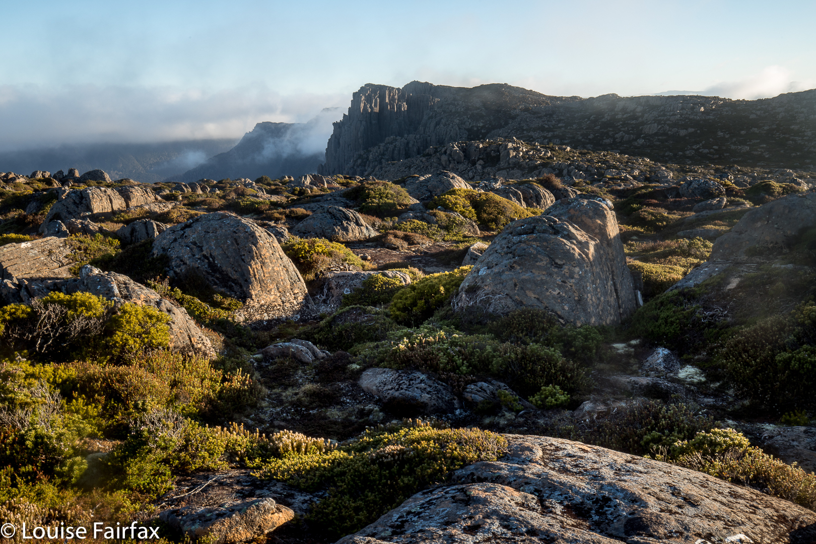
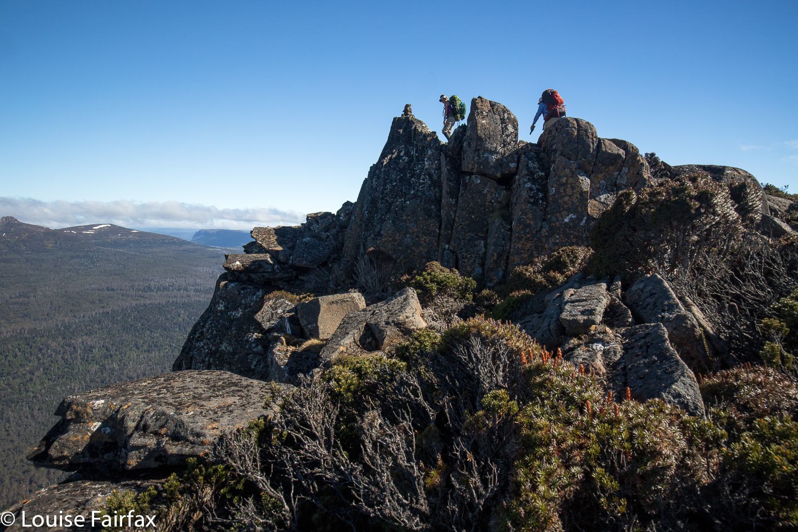
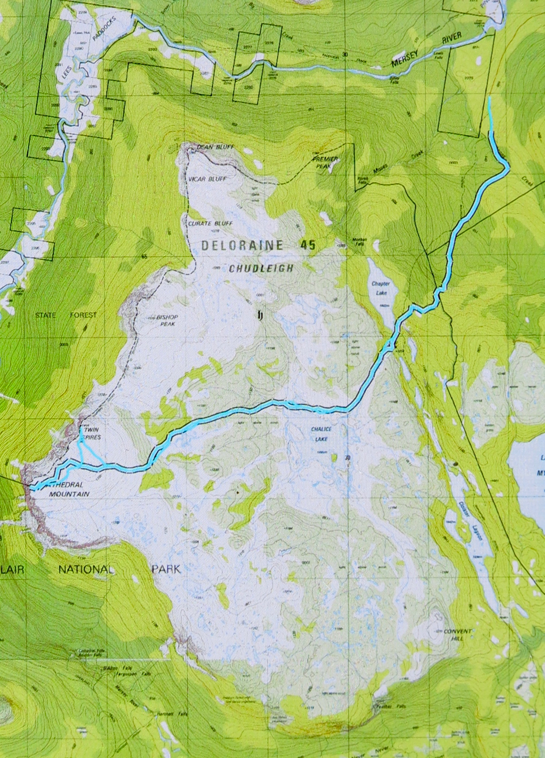
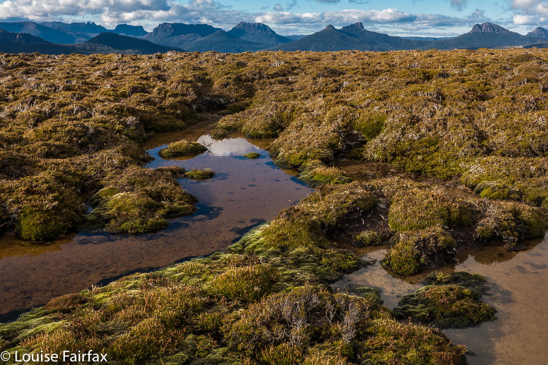
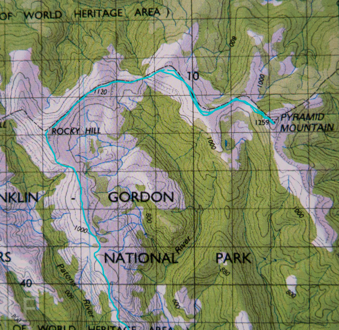
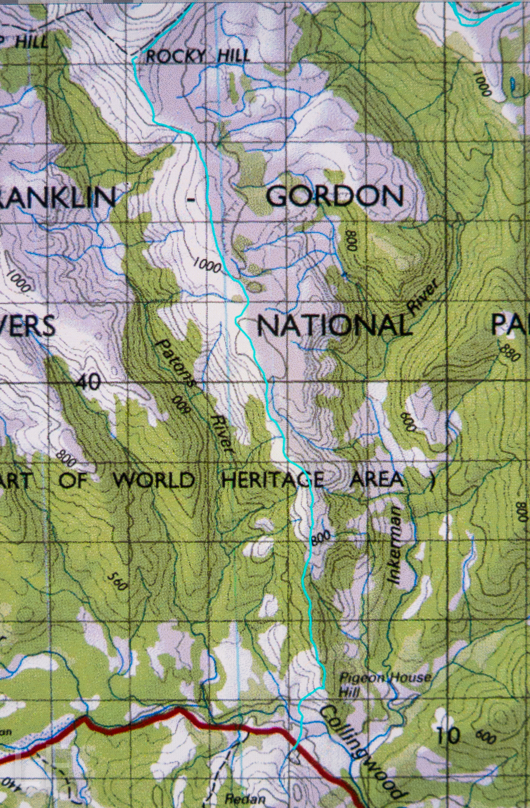
But you, lucky reader, can presumably visit this wonderful summit without these cares, and the majesty will have more power to impress you. Getting to the top involves a combination of track following and navigation. A rough (and not always distinct) path leads from the carpark at the end of the Lake Rowallan Road to the beautiful Grail Falls, after which a cairned route takes over, getting you as far as Tent Tarn. If you are not a confident navigator, you should stop here (or even earlier, by one of the other beautiful lakes). From Tent Tarn to the top, there is a route which is cairned, but the cairns are not always as close together as you might like and you do need to know what you’re doing in between their guidance. You need to be happy about branching out and not caring if you don’t find any more cairns today. (For the climb of the next day, Twin Spires, see separate post,viz:
www.natureloverswalks.com/twin-spires/).


Pyramid Mountain 2017 May

Pyramid Mountain 14-16 May 2017.
(For Day one of this three-day hike, see natureloverswalks.com/Rocky-Hill/).


Summit day for climbing Pyramid Mountain dawned. A light fog surrounded us; the grass, of course, was icy, as were our tents. The sun was a kind of dispersed yellow glow to the east. Mountains like High Dome, Pyramid and Goulds Sugarloaf were beautiful silhouettes as we ate breakfast and prepared ourselves for our adventure. How would things play out? Could we do this in a day at this time of year?


We set a turnaround time of 12.30, given the now early time of sunset, which didn’t give us much room for hold-ups or errors should we land in highly-resistant scrub. Off we set, both curious and hopeful.


We were at “hill 1173” within 45 minutes; passing Mediation Hill in another 45; and topping the next hill after leaving the main Eldon Range route (Hill 1129) in a further 25 minutes. Things were going well so far. Pyramid looked pretty close by now, and we’d not quite been going two hours. And then the rot set in. After this hill that was a bit of a bulldog in lamb’s clothing, came a route that went first SE and then swung along a ridge that looked fine from a distance, but was like a duplicitous politician at close quarters: deceitful, barbing, and best avoided. Trouble is, we needed to traverse it all the way along its mean and nasty length until it started climbing to the next hill that was so uninspiring it didn’t even have a name or a height number. At least we didn’t need to go all the way to the top of this one, as there was a saving patch of rainforest if you contoured around to the next saddle, the (whew) last saddle before the bitch of a climb up Pyramid.


“I thought you liked climbing, Louise!” you say. Yes, you’re right. I love it, but not when the climb is in thick, dense, impenetrable, energy-sapping, defeating scrub, where you work and work and then look at a your map and realise you haven’t even covered a hundred horizontal metres and you can’t see the mountain, and you can’t even see a way of going forwards. You try left and right and retreat a bit, telling yourself retreat is often the best way to advance … but when you retreat all the way back to the start triangle it isn’t (well, bit of hyperbole there). After what seemed ages, we came to a spot where we could glimpse something. Ahead lay a gulch. Beyond that, cliffs and more bushy climb. We decided we needed to drop down and get on the spur above the cliffs. Somehow that went quite well (face-in-the-dirt steep), which is good as I was becoming increasingly despondent, fearing we’d come all this way to be locked out of the summit at the last minute. Once we were above those cliffs, we could see paths of erosion ahead that would lead us the rest of the small distance to the top without any hindrance other than good old gravity, and who cares about it? Not I. Well, not normally. I was feeling tired and hungry by this stage. One hour after leaving the saddle (a distressingly small distance below us), we were standing on the summit. I didn’t stand for long. It was 11.30 and I wanted lunch. NOW.


The return was faster, much faster. From above, a better line was easier to find, and what took us an hour up, only took thirty-three minutes down (and not just because down is faster than up). The ridge didn’t seem quite so inhospitable now we were in a buoyant mood, and we had a much better route from it to the summit of hill 1129. It was so great to curve around the summit of Mediation Hill and know that our bushbashing for the day was over. We just had to follow the ridge back to our waiting tents. There was no way we would not be there before dark. We even had time to have a drink or two and photograph the dramatic cliffs below our camp. Drinking was unpleasant, as the water was so cold it hurt.


It was a freezing night. Temperature-wise, it was by no means the coldest night I’ve had in a tent (it was probably about minus four; I’ve experienced minus ten and worse), and yet I swear this night holds my personal record for condensation. My sleeping bag became saturated, and ineffectual along with it. Everything got wet. I suspect it might have been because my utterly drenched socks (wrung out, but there was still a large amount of water left in) were inside the tent, along with my somewhat damp coat and long pants. These things were inside, as they might have turned to ice if left in the vestibule. I feared my boots would freeze, but only the laces did.


In the morning, the ice layer on the tent was a thick and heavy sheet that I had to prise off using my tent peg, it being the only implement I could think of that could do the job. Normally my ice is in cute white crystals. I took ages to pack up in the morning, probably because I was dreading the moment when I would have to put those frozen socks back on, and the pants and coat that were still damp from the moist bushes the previous day. There was no point in putting dry socks in sodden boots, and carrying wet, heavy ones in the pack. It had to be done, but was not a pleasure.


We stopped at “Stu-slept-here” Hill (1111) for a drink, but, as with other days, drinking hurt. By the time we reached the glorious rainforest section of Pigeon House Hill, we knew we would easily make it to the car in the light – it was not yet mid-afternoon, so we relaxed and started to examine and photograph darling fungi on the way along that section. They were there in their hundreds, so many delicate beauties.


I made sure the camera and phone were well sealed before the final river crossing. At least if I landed in the drink so close to the car I’d be freezing, but would not hurt my electronic gear or get hypothermia. The world was good. We’d done it.


crepidotus sp


Mycena clarkeana I think


Please don’t be fooled by the dark lines there into thinking they denote a track: they’re depicting National Park boundaries. The boundaries, and our route, follow the ridgeline. Please also note that I refer to Hill 1173″. It is that height on the 1:25,000 map that we used for the greater detail. Oddly, the 1:100,000 map, used here for greater clarity, it is marked as 1120. I guess more modern methods have resulted in a height revision. Not sure.

Rocky Hill 2017 May

Rocky Hill 14-16 May 2017


We never doubted that we’d make it, but it was still an enormous relief to crest the final rise that led irrevocably to the summit of Rocky Hill. This was the second time the two of us had climbed Rocky, but was the first time we’d seen its rather elusive view. Clouds seem to enjoy Rocky Hill just as much as we do, and it pleases them to tease would-be view seekers.

It was so worth the day’s effort to see what we were now seeing: viz, a vast array of magnificent mountain friends, almost all of which we’d climbed, although not all of which we could readily name from that angle. In particular, we adored the different perspective on Eldon Crag and Peak; it was also amazing to see the seemingly ubiquitous Frenchmans Cap, which must be the “most seen” mountain in Tasmania. Way to the north east, we could see as far as Cradle, Barn Bluff and Emmett, as well as Pelion West, Ossa, Thetis, Manfred, Cuvier, Byron, Geryon, Acropolis and Olympus – in fact, the bulk of the mountains that line the famous Overland Track. This was not a view that you just noticed and then departed from. You had to stay for a long time. We bounced around with delight, and stayed all night. Well, in fact, we stayed two nights, so good was the view. The fact that we’d arrived up there by 3 pm meant we certainly had time to progress further along the ridge as far as Mediation Hill, but we were in love with this spot, and we stayed put. We thought we could make it to Pyramid Mountain (our next day’s objective) and back from there, although it was a slight gamble given the short days at this time of year.


It being so delightfully early, we had the luxury of exploring our little demesne for the night, to suss out snow drifts as a source of water and hunt for the best yabby holes. We spent a whole hour just gathering water for the next two days so that if we got back in the dark the following day, we wouldn’t have to go searching for liquid in order to cook, but could collapse straight into our tents. Our fabulous grassy patch was just below the summit, but, unlike the summit, was soft and lush.


As we slowly pitched and did all the activities associated with turning our chosen bit of mountain real estate into “home”, the clouds rose up in drifts from the valley below, turning more and more golden as the hour advanced. They were soft, wispy clouds that only partly veiled the mountain silhouettes around. Right at the peak of the drama, the ones above turned quite a strong dusky pink; it was a beautiful scene that I will never forget.


I don’t know why I had been so scared about crossing the Collingwood River at the start of the day. I guess I knew in advance that the temperature would be sub-zero, and that the river would not be summertime-low. It was, in fact, minus one, and upper-thigh high. Brrr. My main fear, of course, was slipping on the mossy rocks due to the force of the water, and falling in and getting hypothermic. I very sweetly let Angela go first to give me courage. It didn’t look easy as I watched her steadying herself, both arms out for balance. I grabbed a stick to help, took a huge gulp, and followed. I went in deeper than she did, mainly to keep on rocks that didn’t look as slippery. I made it, but my bottom half was frozen. Off we set up the very steep Pigeon House Hill. Surely that climb would warm us up. It warmed up everything but our feet; they took a little longer. By lunchtime they’d thawed, but, of course, they remained wet for all three days.


We found some random tapes on Pigeon House. We couldn’t work out where the person who put them there was going, but fortunately there weren’t too many. They took one onto the thickest part of the ridge, whereas the pad of least resistance, and the old route, skirts around the top at that early stage. We backtracked to find old cuts and used the old line instead. It was much easier going. If you are new to bushwalking, please don’t interpret that as “Oh goody, there’s a track up there. Let’s go.” Unfortunately, what I am referring to is small traces of where people have gone on some distant past occasion; you use broken or cut branches or other signs of humans passing (disturbed bark) to pick your line, and you have to have a very good idea of where you want to be going in order to gain from these signs. Please only venture into this untracked territory if you know what you’re doing and have a lot of experience. It is not for novices, or even for intermediate-standard walkers.


Once we gained the ridge past that early topping out, the going was easy for a little while, until our second “top out”, about an hour later, when we emerged from the beautiful forest onto a scrubby hill. From then on, for what seemed a long time, we had to lift our legs very high in a goose-step and at times force our way through higher patches of scrub: nothing too bad, but it does sap your energy anyway.


We concentrated on choosing a good line, and worked hard through the scrubby bits, and eventually we got there. If you don’t know Rocky Hill, don’t be fooled by its deceptive name. It is not a hill at all. It is an Abel, which means it is higher than 1100 ms (1194 to be exact), with a significant drop all around. Already snow drifts were building up with winter on the way. Some tarns were iced over. And the views, as said, were magic.


Next day, we’d climb Pyramid Mountain if all went well (and it did. See natureloverswalks.com/pyramid-mountain/). It was a big ask, so close to winter with the shortened days, but we’d give it a go. Just in case we weren’t quite as successful as we hoped, we packed bivvy bags, torches and a warm jacket beyond the many bundles of clothes we were already wearing. I thought that if we were stuck out overnight with wet gear, a bivvy and extra jacket would not be enough to save me, but I took them anyway. As it transpired, we were back well before our curfew, and had time to play on, and photograph, the rocks on the ridge with our tents in sight, as the mist once more rose up the valley.