Cherry Falls Humphreys Rivulet

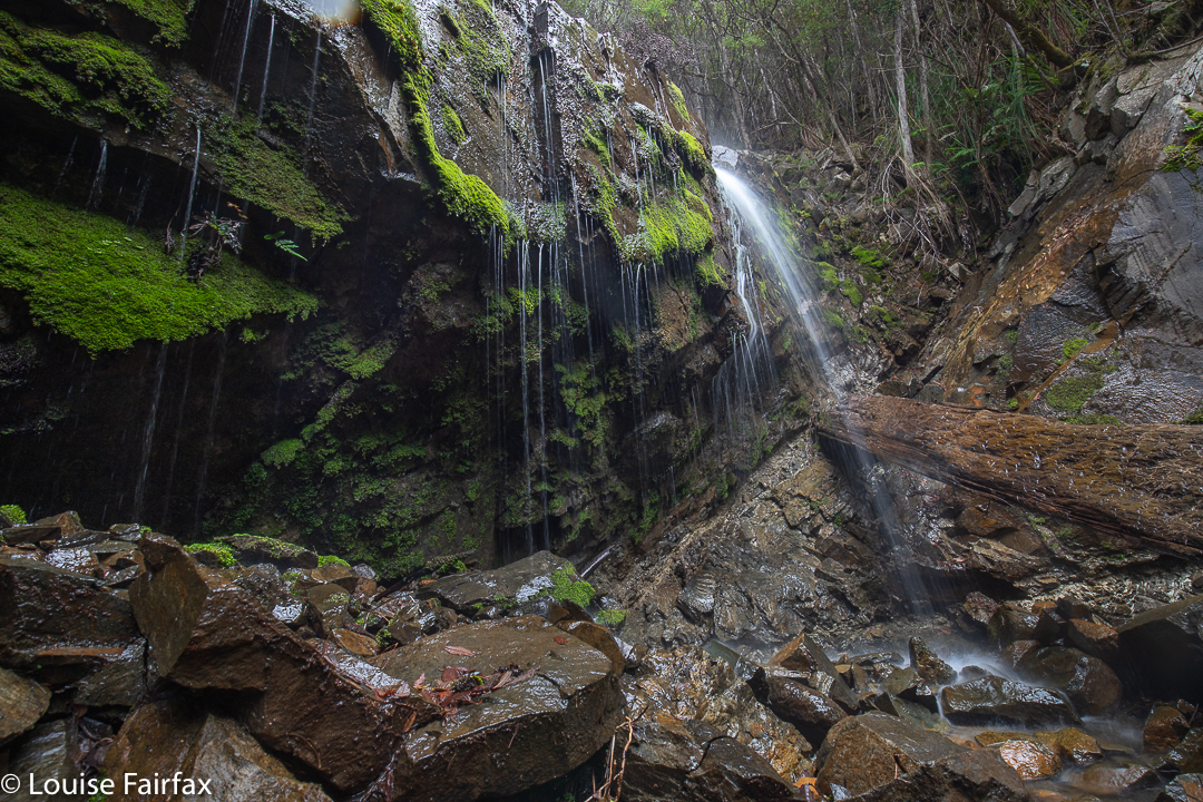
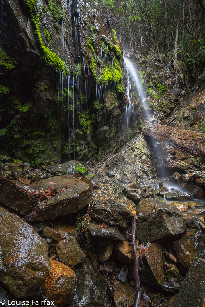
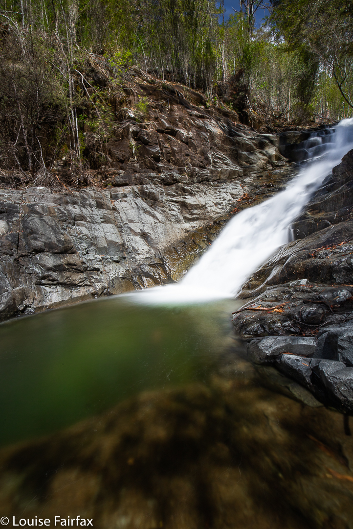
I have called this blog Cherry Falls, but this is actually a “work in progress”, as I have found three lovely Cascades on the Humphreys Rivulet (as well as Bear Falls higher up), but I didn’t go far enough to reach Cherry Falls. So, I will show you the three Cascades I got this time, as I rather like them, and once I have been back and reached the actual Cherry Falls, I will update the blog.

Humphrey middle Cascades

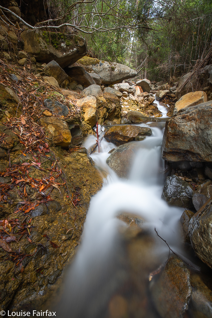
I parked the car at Tolosa Mountain Bike Track parking area, and followed the trail now called Tolosa Fire Trail for a while (that’s what the signs say. My map calls it Native Cherry Fire Trail). After that, you go down to the Rivulet, and bushbash your way up it. There are some lovely sections, but there are also some rather horrid stretches, crammed with cutting grass, so it required some perseverance.

Humphreys Rivulet highest Cascades

I had started later than intended, and was, as usual, worried about being on time to pick up little Abby after pre-school, so needed to be out by 2pm to ensure no mishaps there. I had enjoyed being beside the creek and unhurriedly photographing, so stopped at the highest of the cascades on this occasion. I will take in the Falls themselves next time. The excursion is a nice blend of brisk track walking and concerted bushbashing.
See also http://www.natureloverswalks.com/bear-falls/

Bear Falls Feb 2020

The descent to, and then climb back out from, Bear Falls is exceptionally steep. The first 700 ms are flat, on a fire trail (Mt Wellington), after which you dive head first down a landslide (which I presume is the shocking 1872 “Glenorchy landslide”). In this plummet, you drop 440 ms in about a kilometre. That is whopping!!! Not only is it steep, but also, much of it is of dubious stability, that being the nature of a landslide. I personally treat landslide rocks with a great deal of respect. Sometimes the whole land can feel like it’s running away from you.

Bear Falls

As a result, I took far longer to descend (1 hr 38 mins) than I took to come back up again (1 hr 20 mins). I love climbing, and if you stumble going up, you don’t do nearly as much damage, so I feel free to exercise less care. On the way down, I tested every single rock before committing to it, and had three points of contact the whole way. Coming back up, I climbed like a bear on all fours, as required by the slope, and had fun and went as fast as I wished, which was actually pretty fast, as I was under time pressure: I wanted to get changed and have lunch before picking Abby up from Kindy. Relaxing before the onslaught of an exhausted four-year-old just released from the rigours of newly-imposed educational demands was also appealing. A tantrum is far more demanding than a steep slope.
Bear Falls are not marked on the map, let alone named. The tributary they are on is also not named – or not up that high, before it has amassed all its tributaries to become a rivulet. There are two mapped, and many unmapped tributaries. As most people don’t like ascending at the rate I do, I would allow far more time for this excursion, should you attempt it, than I did. I was squeezing it in between other demands on my life.