Owen Brook Falls

Owen Brook Falls 2017 Aug.
Our trip to the Owen Brook Falls (south of Burnie in the Ridgley area) began with a trip to the Upper Cam Falls (route details in the blog of that name, viz.: www.natureloverswalks.com/upper-cam-falls


From these, we returned to the C103 and continued northish until that road intersected with the C101. At this stage I was a little unsure as to what to do next, but there was a very nice man nearby, a local, and I was wondering if he might be the person I needed to ask to get permission from to go to these falls (or might at least know whom I should ask), so I asked him about the finer details. He was very helpful, muttered nothing about private property or keep out, and told me exactly where to go, which was to turn left onto that branch of the C101, and to drive 3 kms to the end of the bitumen.
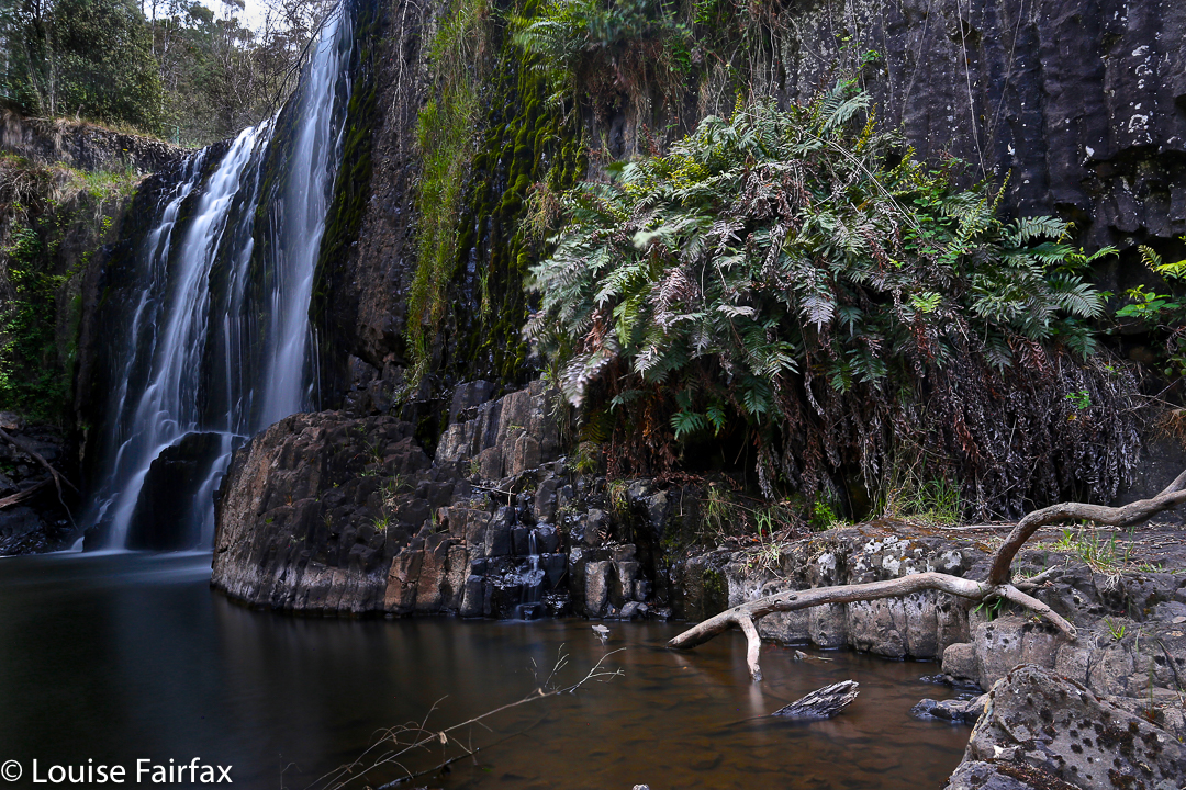
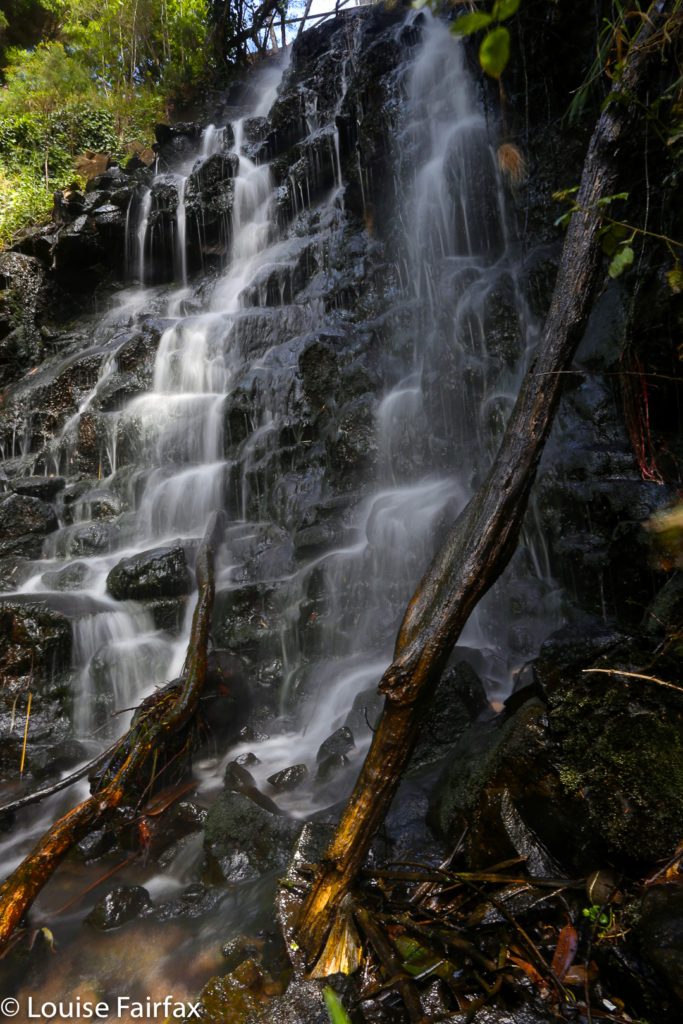
At this point there is a very rundown ex-house, where one used to ask permission. With no-one there, I just went across the paddock behind said “building” and headed for the falls, which were, as you can see below, rather hard to get a good view of. You would be mad to not take in the Cam Falls along with Owen Brook, as they are very close to each other, in gorges that meet just below each fall. (The Cam Falls were on the East Cam River. The Owen Brook Falls are on Owen Brook, which joins the East Cam just below both falls. ) Take your lunch, and then you can explore the gorges more than I did. Hunger pulled me away.
This is the base of the Owen Brook Falls from as near as I was game to go in the slippery conditions of the day. I was unwilling to climb any of the mossy, near-vertical rocks on offer to try for a better shot of the falls, which are huge, and whose base part A can be seen at the top of the image. I was also hungry, and if you haven’t yet worked it out, my stomach rules. This was as good as it was going to get this day, and this is the only web image of the Owen Brook Falls I can find, so you are not allowed to complain. 🙂


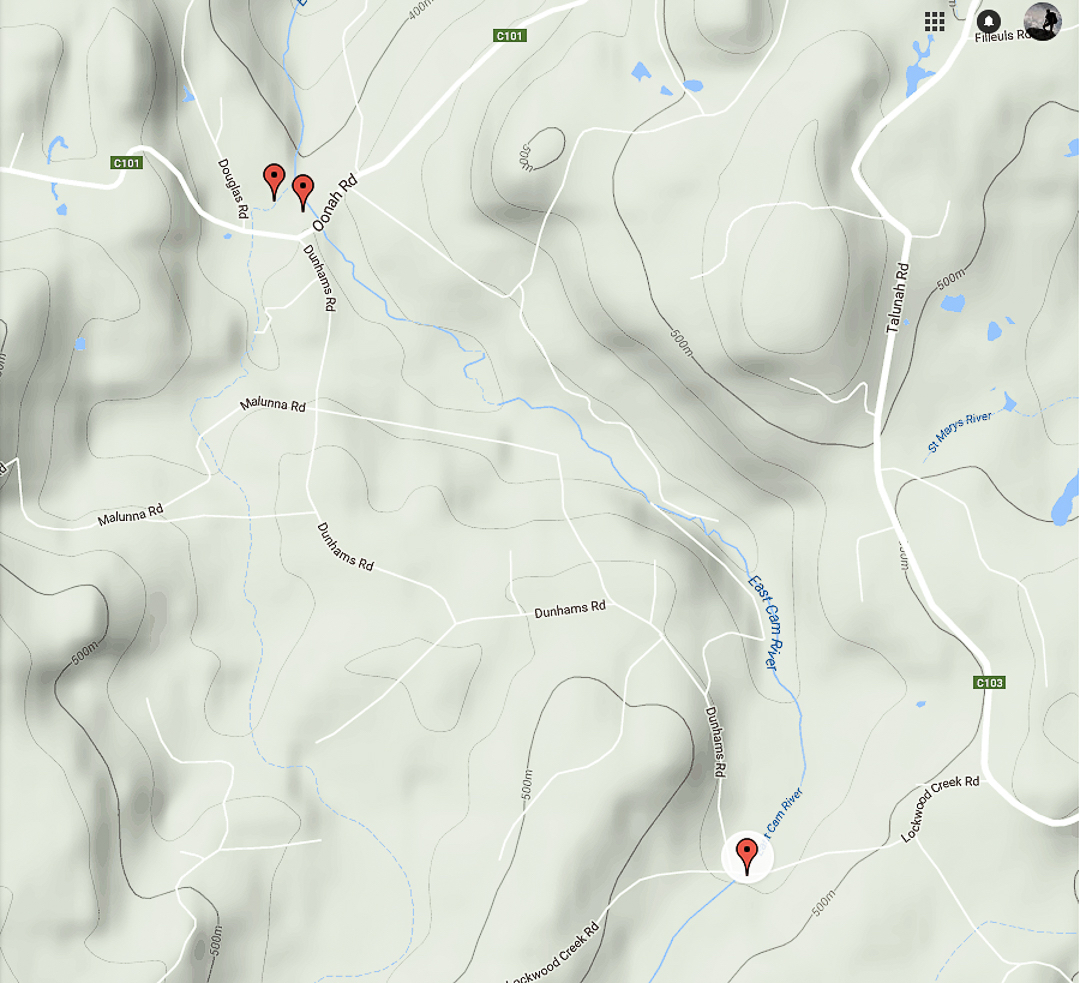
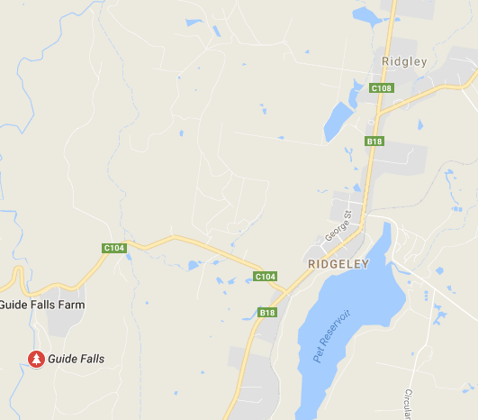
The top two pins are the Cam (R) and Owen Brook (L) Falls. The bottom pin locates the Upper Cam Falls.
See also www.natureloverswalks.com/cam-falls/

Guide Falls 2015 Dec

The Guide Falls are only a short distance from Burnie. Head south on the B18 towards Ridgley, after which you’ll see a clear sign pointing you in the right direction (initially, on the C104). These Falls were delightful, although I hated seeing the old-fashioned wire and steel railing to keep me from falling off the edge.

Guide Falls, near Burnie

Oldaker Falls 2015 Dec

The Oldaker Falls are situated in the upper section of Burnie Park, right in the centre of town (kind of) – there for all the locals to enjoy if they move their feet just a little. There was an unfortunate amount of rubbish at the base, which somewhat marred their impact. It seemed odd that council would build paths to the falls, yet fail to clear the base of debris. They’re still worth a visit, especially if combined with one or two of the many other waterfalls on offer in this region, such as the Guide Falls or Upper Cam Falls (see separate blog posts).


Oldaker Falls, Burnie Park

Gnomon, Dial and Montgomery 2014 Jan

Mts Gnomon, Dial and Montgomery, 1 Jan 2014.

Path to The Gnomon

What a great way to start the new year: with a walk. Whilst it seemed from listening to the radio that the rest of Australia was on fire, we gathered our coats, rain jackets, Helly longs (top and bottom) and more, and set out for the coastal town of Penguin. Alas, I neglected to bring my waterproof pants and gloves, as this was summer, so I was in beach mode. I froze. Luckily my husband had a spare pseudo-down jacket he could lend me. It was all on tracks, so we could move quite quickly to keep warm (which is part of the reason I had not brought as much cold-weather gear with me).

Gnomon summit rock (which I climbed, of course)

As I walked along the pleasant track listening to the birds, I reflected on the fact that I would much rather be doing this beautiful three-mountain walk in these drizzly conditions than in the summer heat. The greens and browns glistened, and although we couldn’t see the nearby sea, we had wonderful vistas out into the atmospheric wilderness below that hinted of hidden beauty behind the low lying clouds. Mist swirled around the moist, mossy rocks. Stylidiums, goodenias, hakeas and hibbertias, inter alia, coloured our route.

Dial Range Ridge track connecting the mountains

Although none of our mountains was high in any absolute terms, each had a nice little pinch to get to the top, so we had the feeling of well-earned times at the summits, followed in each case by an enjoyable ridge line connecting these mountains of the Dial Range.


Originally, a car shuffle of sorts had been planned (using deposited bikes), but we made such good progress that we’d finished all three mountains before lunch, so after we dined under dripping eucalypts half way down Mt Montgomery, to the accompaniment of several types of bird for dinner music, it was agreed that we should return to the cars via a lower route through lush forest, and just pick up the bikes on the way out, thus turning a shorter straight through walk into a longer and more beautiful loop, dropping down to Keddles Creek, following its ferny banks for a while, and then climbing back up to the car at the Gnomon Car Park.

Dial summit


Lunchspot below Montgomery

We did get to see the sea, but that was from inside the cafe afterwards while we had cake and cappuccino and watched the rain ruining the swimmers’ plans.

(For peak baggers, two of the three peaks were worth points).