In the Peter, Paul and Mary song, “Well, well, well”, they sing: “God said a fire not a flood next time”. With regard to my attempts at Mt Nereus, it was the reverse, … with a twist. The first time, we were “droughted” out, with not enough water in the single yabby hole to fund our starters (albeit only two of us) on a long, hot day. We were scorched and parched.
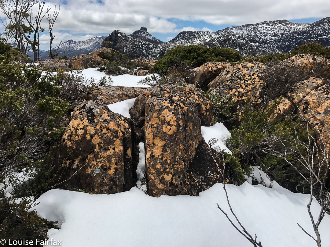
Snow on Walled
This time, we had so much snow and rain that we failed to make the distance we needed on day two, thus making day 3, summit day, impossible. Ah well. Third time lucky?
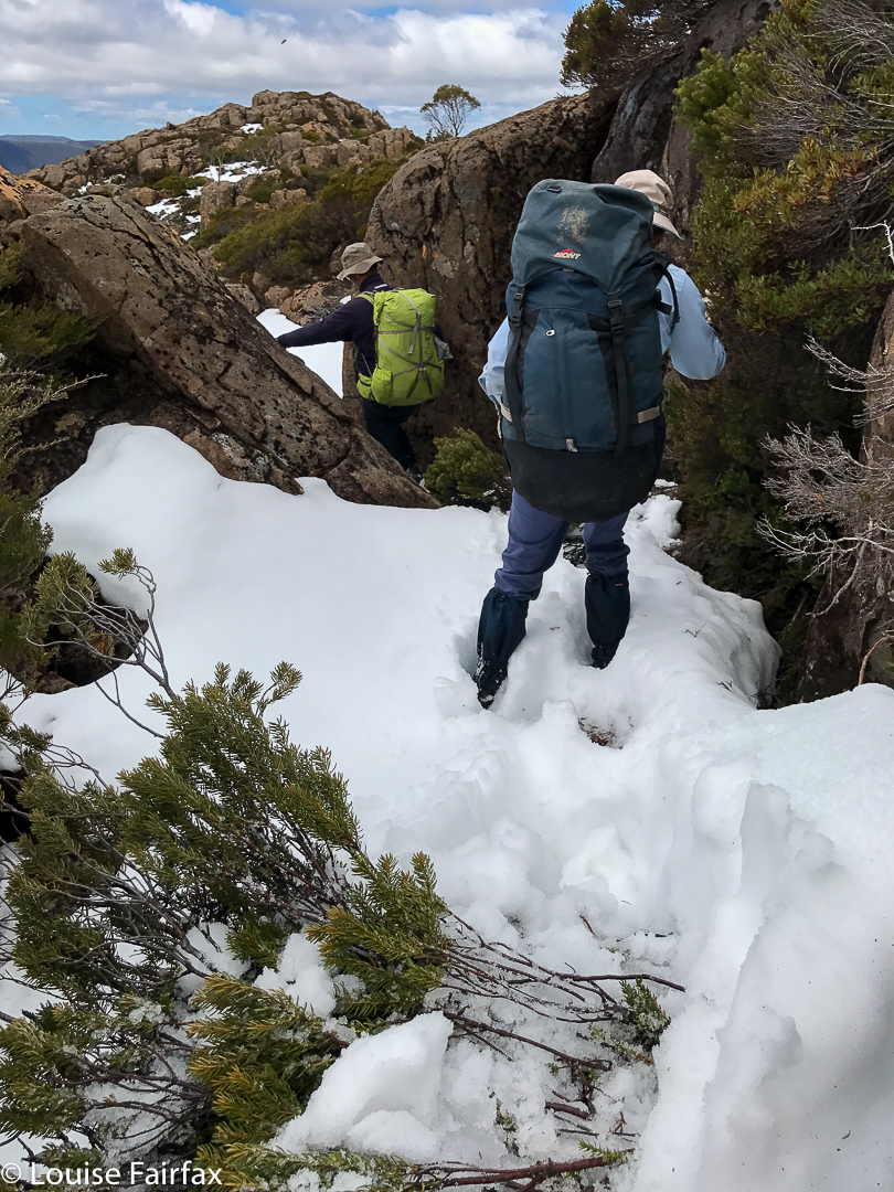
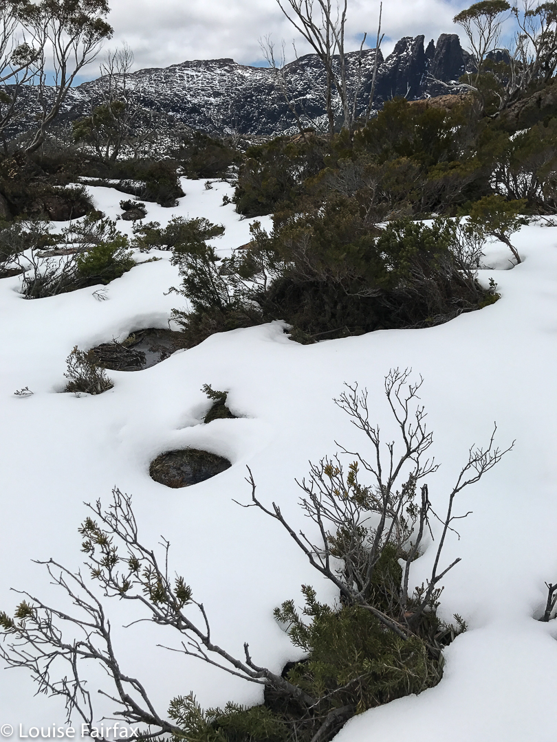
Snow on Walled
It was a beautiful trip, and I’m really glad I had that time in the wilderness. I love seeing my mountain friends in the snow. Here are some shots of day 2, and our climb up Walled Mountain. Sorry, but they are just phone photos. My intent this trip was summiting, and I didn’t want to slow myself down with my heavy camera gear.
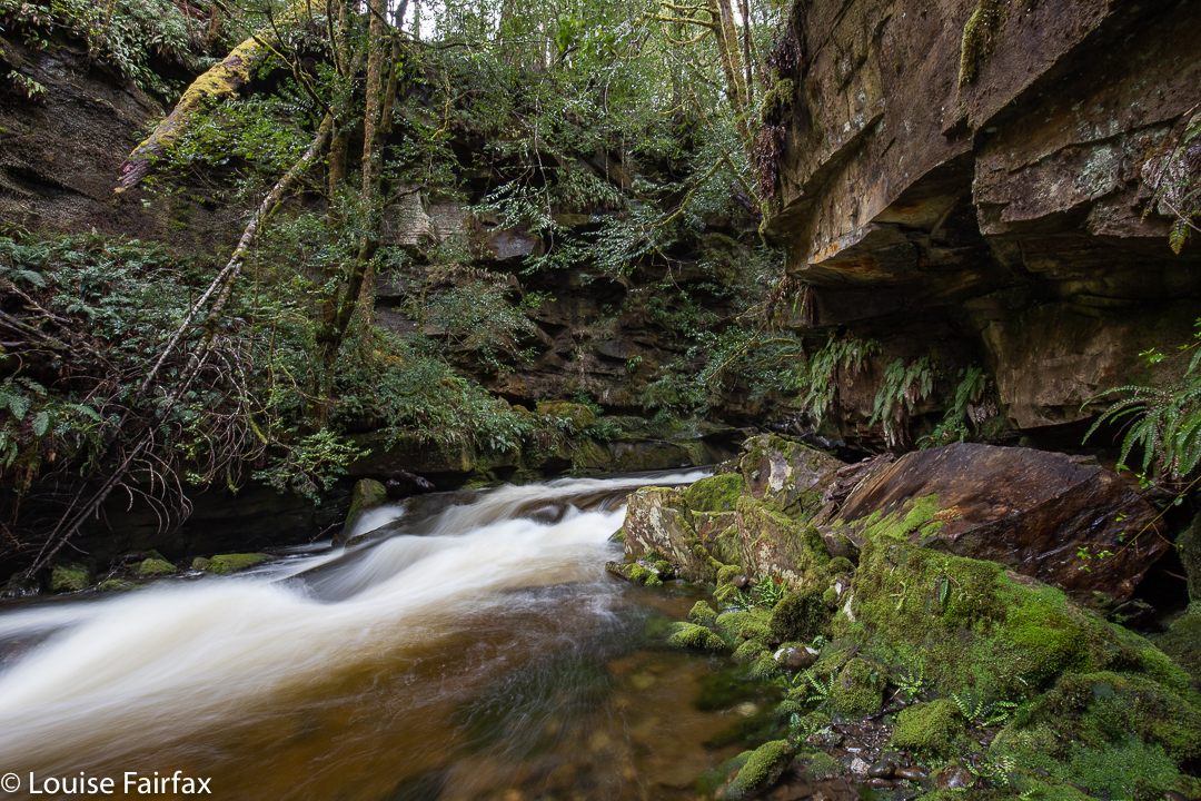
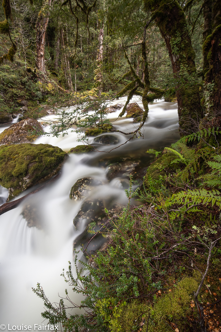
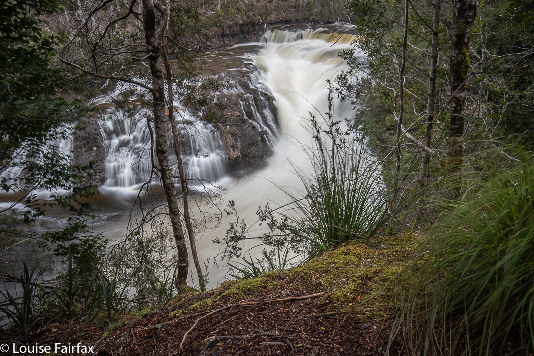
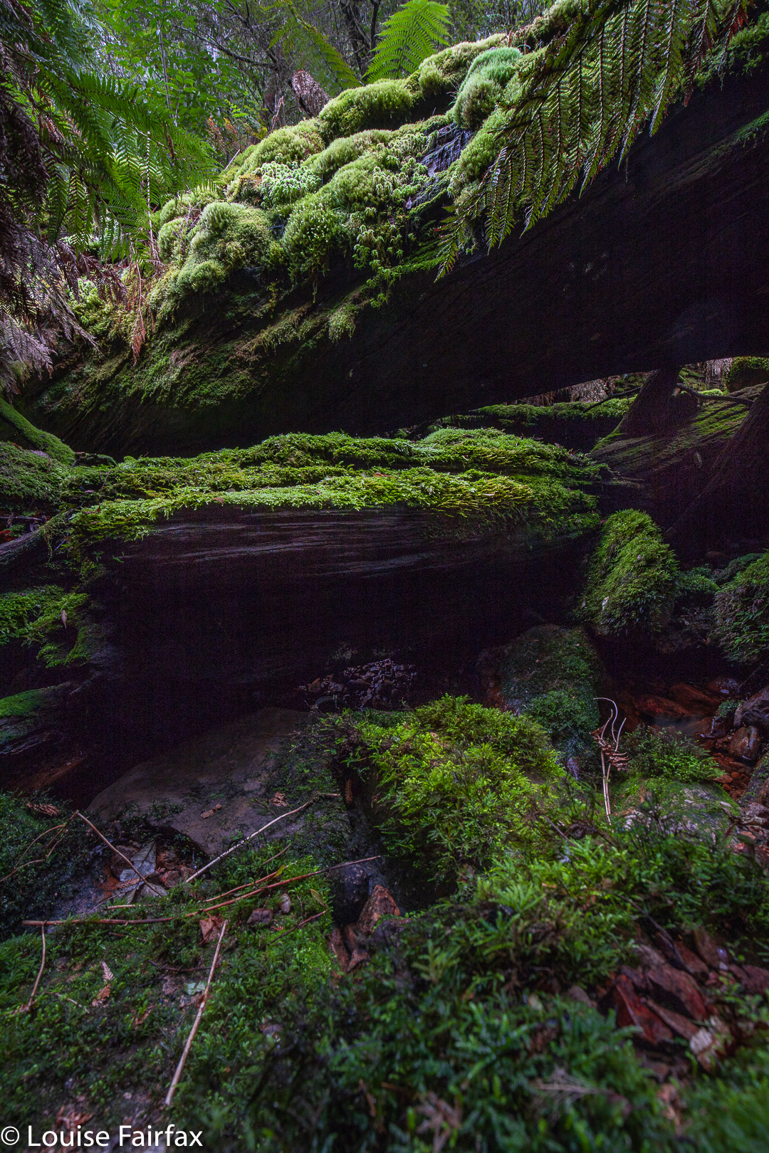
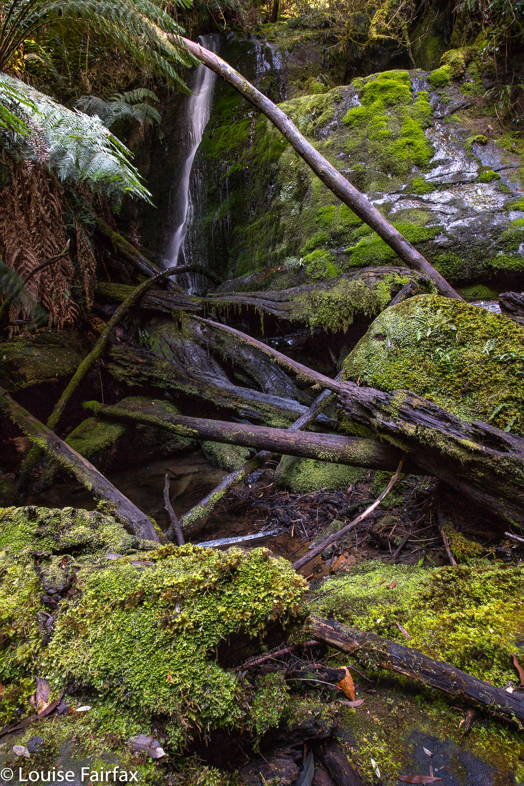
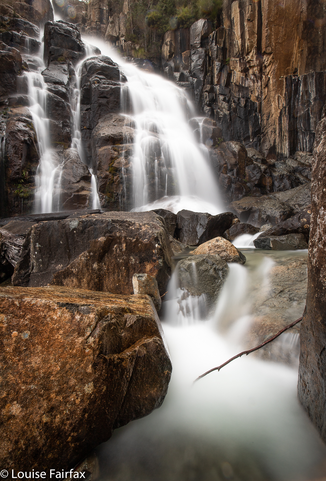
Tasmania’s Devils Cauldron (in Lees Paddocks, Cradle Mountain National Park) is well named, and certainly on Sunday it resembled its namesake in Africa rather well … except for the snow that decked all the surrounding mountains. If you don’t conjure up myths like Faust’s (well, Goethe’s) Walpurgisnacht (or Shakespeare’s hags in Macbeth) with devilish witches stirring bubbling pots of fuming brew, doubtless noxious, and wish to turn to river metaphors named after the idea of satan with a spumous pot, then you will need to look to the original African version, in which the Nile squeezes its way through a gorge of approximately 7 meters width, to burst with a thunderous roar into the “pot” below. The Wurragarra River had only what seemed like three metres width in which to force its flooded way through, and it was carrying all the melted snow and runoff from the many mountains above. Its force was impressive!
Devils Cauldron
One begins one’s journey to this spectacle in a humble carpark, fit for maybe five cars, advances through an open green boom gate, and encounters the first swimming pool in the track not too far down. In the end, I was to clock up 20 kms today, so was in no mood for wetting my feet so early. I found a way around through the bush. I was to repeat this little chassé dance many times. After 8 or so minutes, one reaches a swinging bridge, and gets a first glimpse of how the Mersey is faring today. Big, wide, had a bad night’s sleep and is not in the best of moods. Treat with caution.
Cauldron environs
On the other side, the creeks come thick and fast. I spent a while at each one searching out two poles to balance myself on the slippery submerged rocks. Sometimes there was a wood option, but I don’t trust wet wood, so sought out other alternatives. My feet were dry at the end of the day, thanks to quality Scarpa leather, and dodgy pussyfooting (and, probably, the poles, which I refused to cross without).
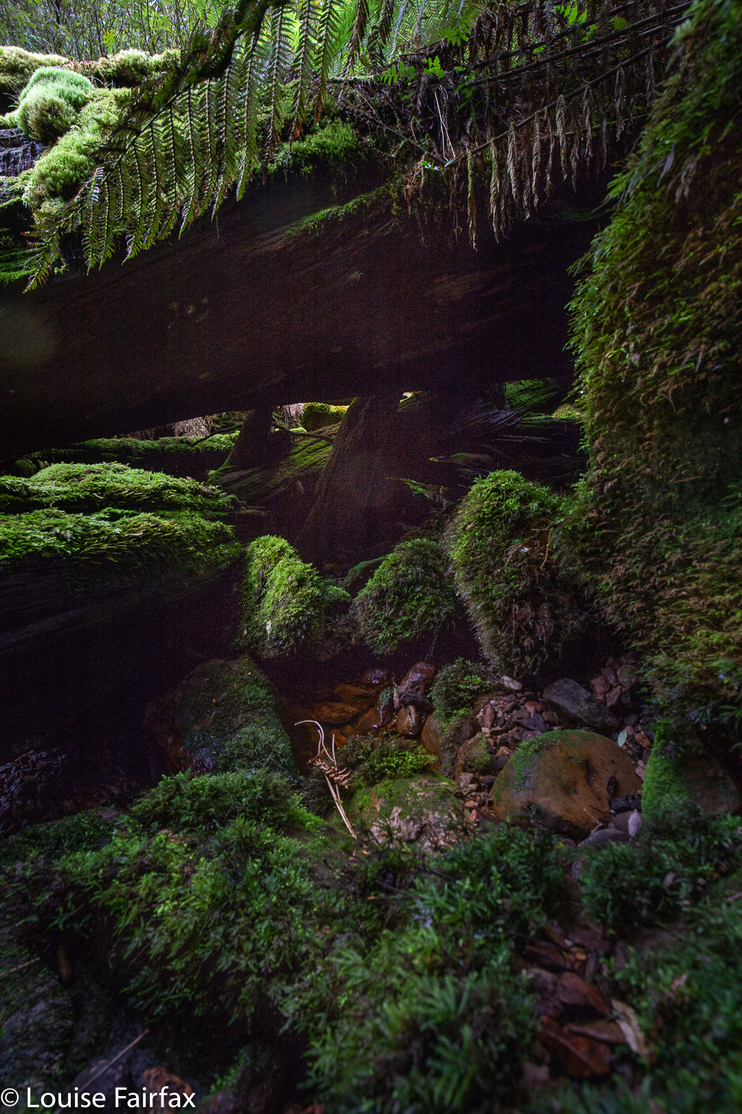
Devils Cauldron
Forty-four minutes after beginning my journey, I was at the turnoff to Oxley Falls (having passed the Lewis turnoff a bit before). This section of the forest had been beautiful, as was the early paddocked area beside the river, with white mountains closing in to left and right, and light drizzle falling. I was not to be tempted sidewards right now, however. On I pressed.
Gorge of the Devils Cauldron
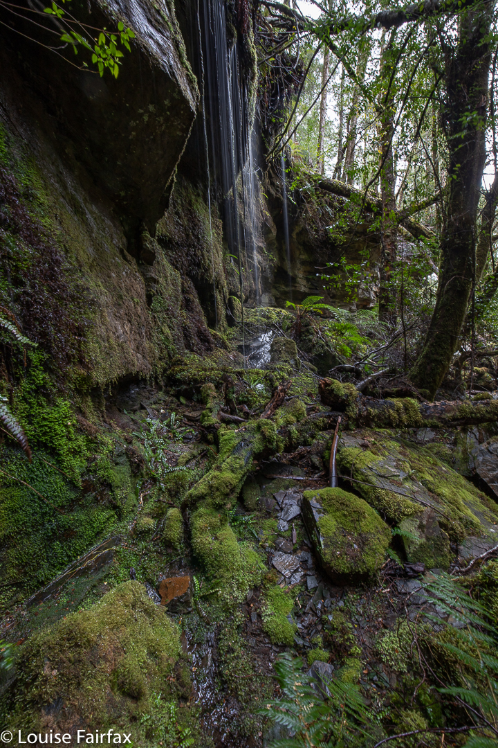
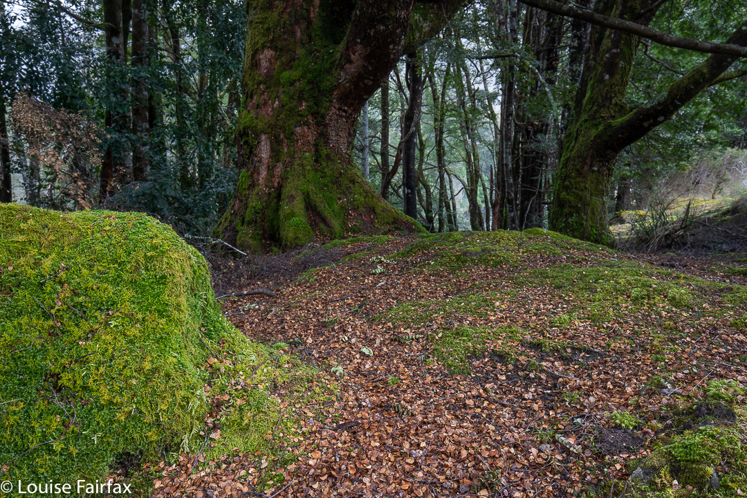
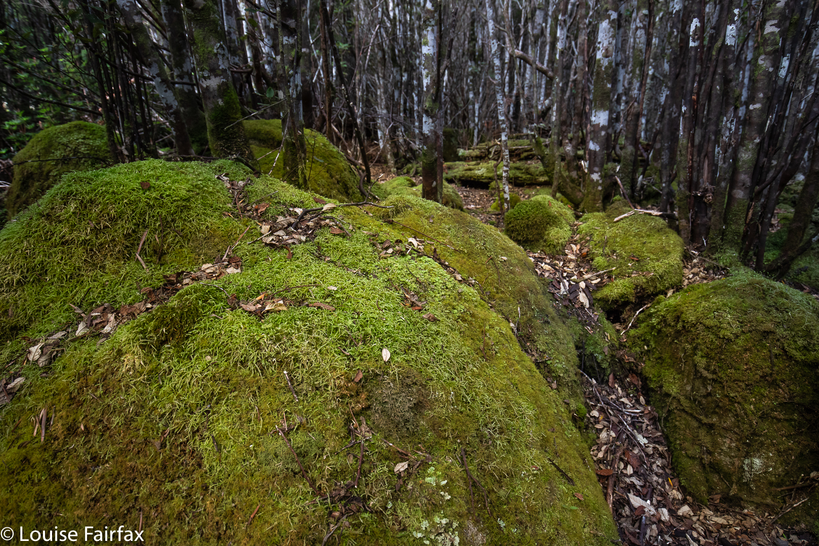
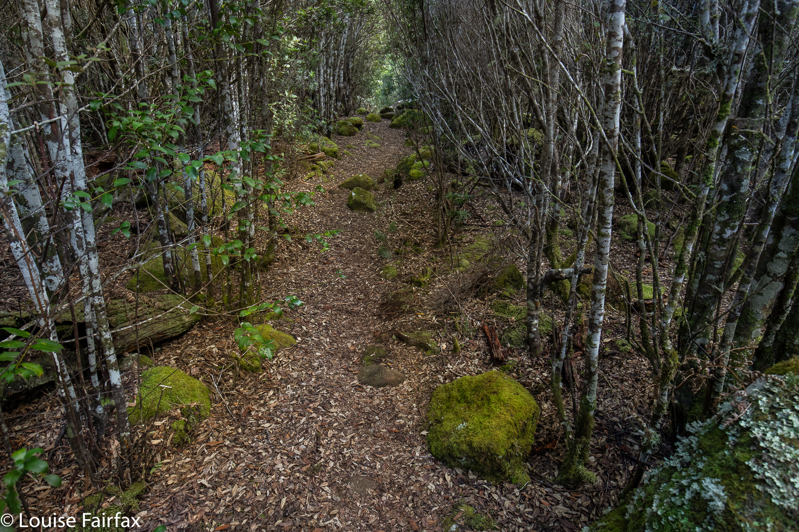
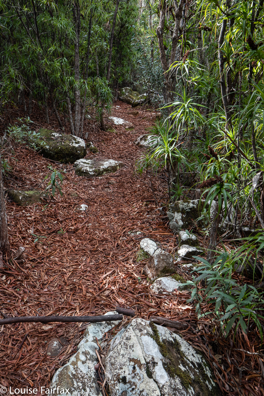
The moss, myrtle and sassafras not only looked wonderful in its lush greens, it also formed a protective canopy which soaked up the rain before it hit me. It did, however, rob the surroundings of light, so that 9 a.m. had the feel and look of 7.30 p,m.: gloomy, dour, no lighthearted jokes tolerated.
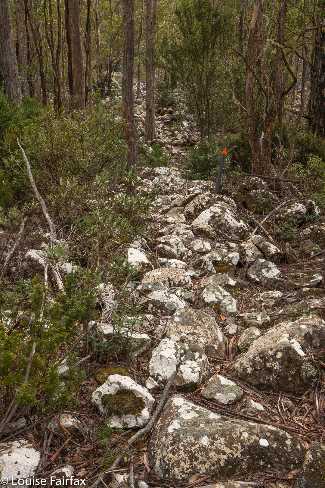
An hour after I left the car, the forest opens up a bit, letting in light (and rain), and allowing the growth of bracken and lower ferns for a while until it closed back in. Not knowing the area, I thought I’d reached Lees Paddocks, but I had to wait another 30 minutes before I was reading a sign announcing I was there, and that I was to close the gate. I climbed it instead. I am light and it was heavy. (Ie, 1 hr 32 to this sign from the car, in case you want that feedback).
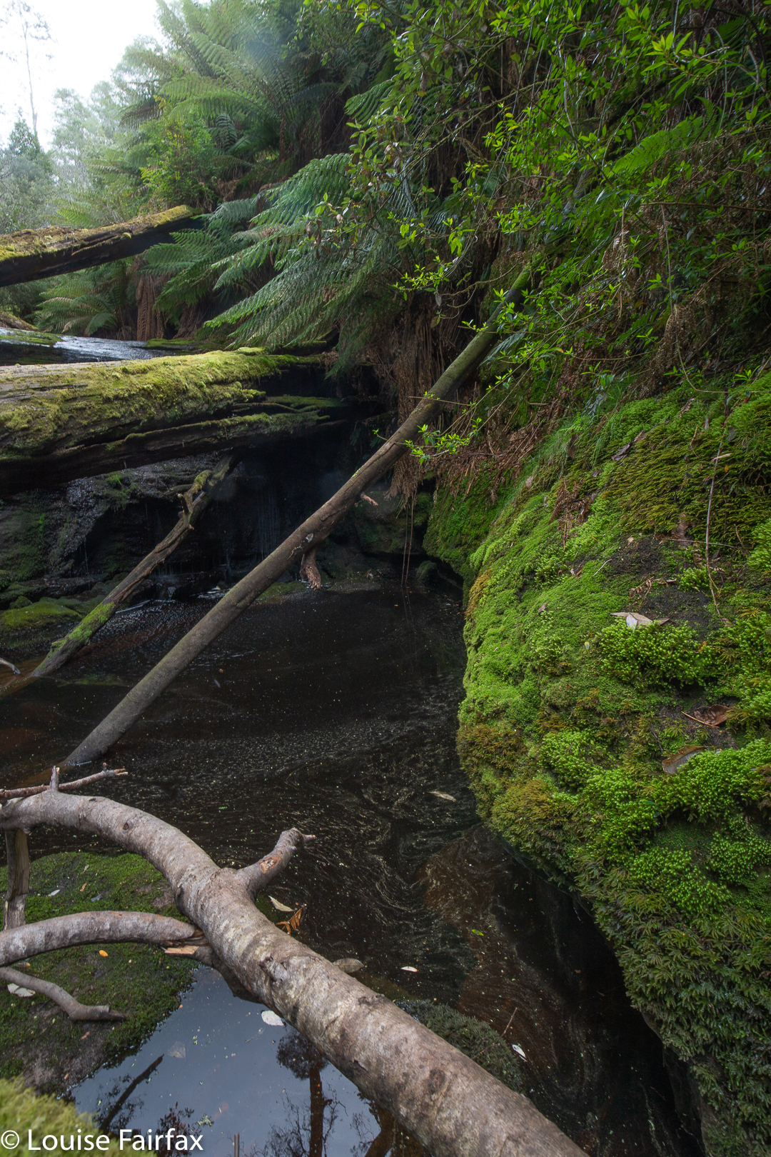
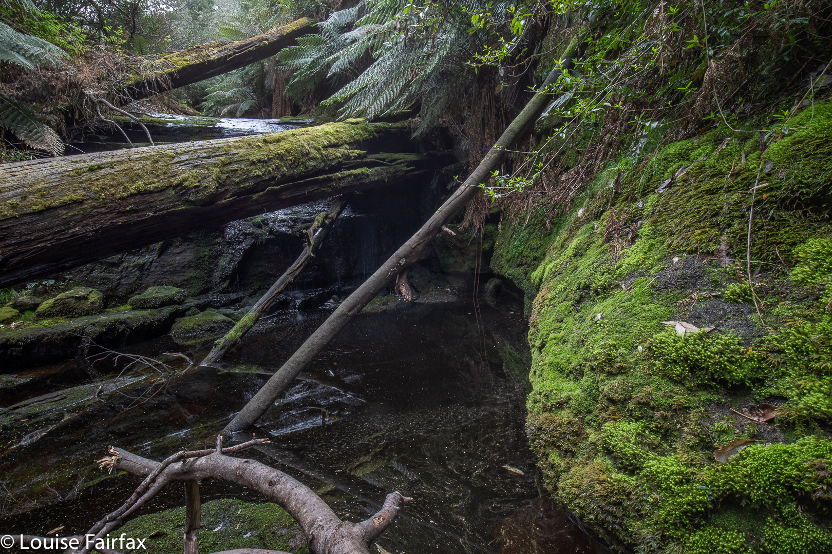
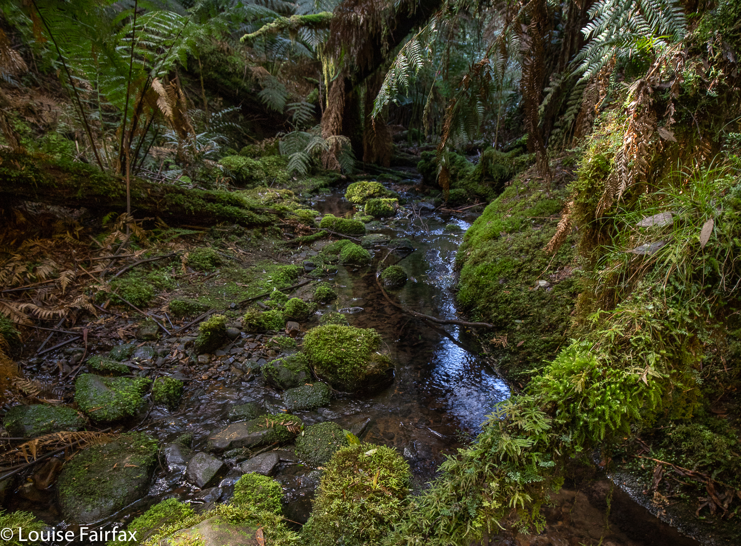
Playing upstream
The button grass of the paddocks was the slowest part of the hike (isn’t it always?). I was just negotiating my way from lump to lump as I approached the Wurragarra River, when I heard a non-owl call my name. I turned to see Shane, a web friend and fellow waterfalls aficionado. He had started 10 minutes after me and caught me from behind. How lovely. We walked over the lumpy clumps together, wending our way to the forest edge, and proceeding together to our infernal pot.
(Google SEO: that = Devils Cauldron. Is there anyone else in the world who cares about the fact that google’s search engines are ruining good style by demanding the relentless repetition of words for the dumb, mindless SEO rather than encouraging pleasant-to-read and stimulating good writing, which avoids boring repetition. I refuse to succumb to American notions of what I should be doing with my language, which means the myopic search-engines have trouble locating me. I treasure good writing over being found).
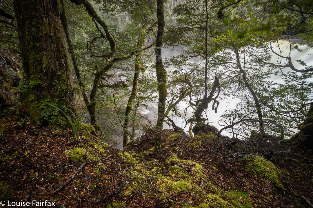
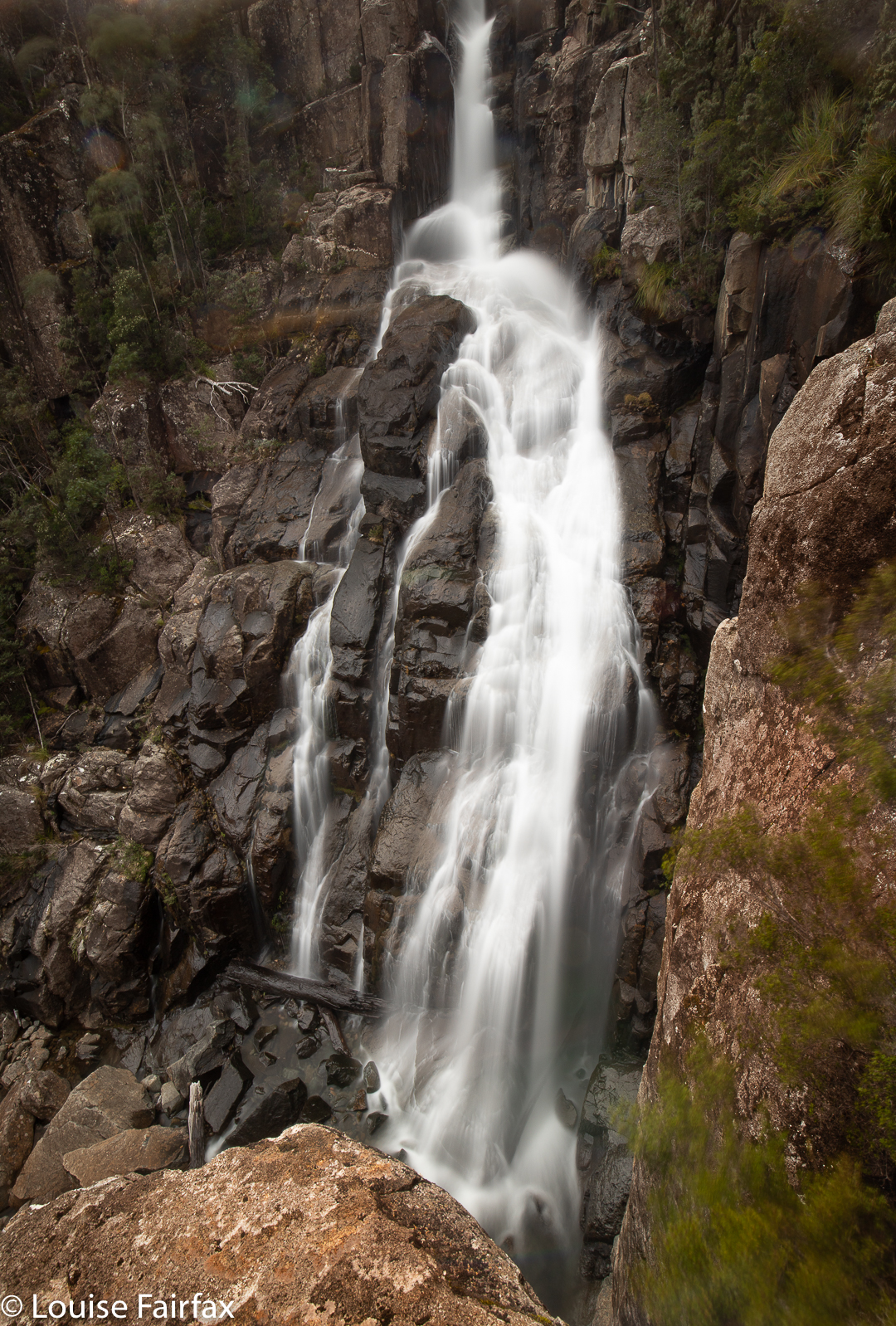
Devils Cauldron from above
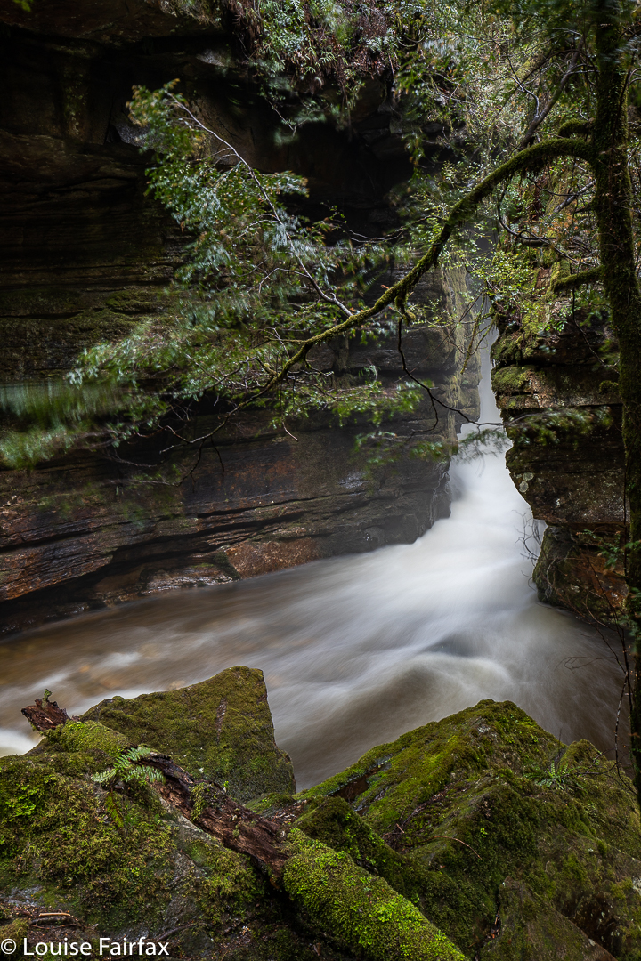
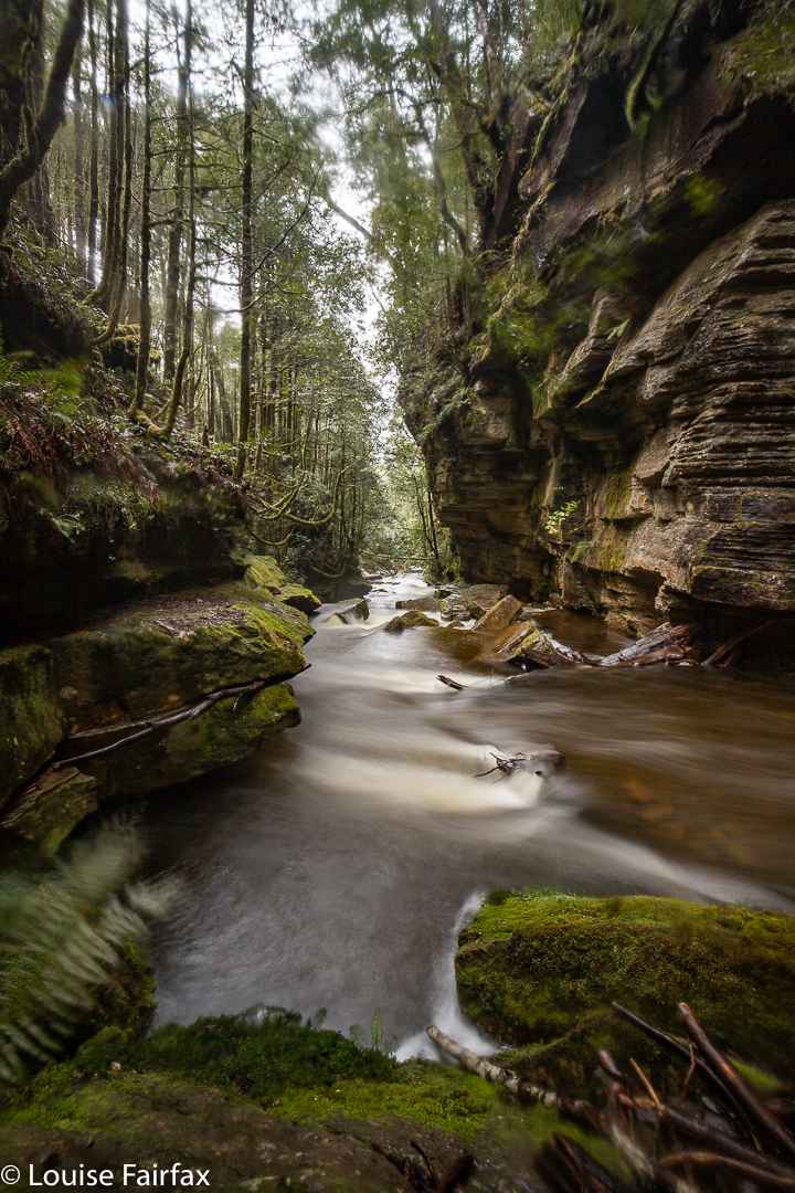
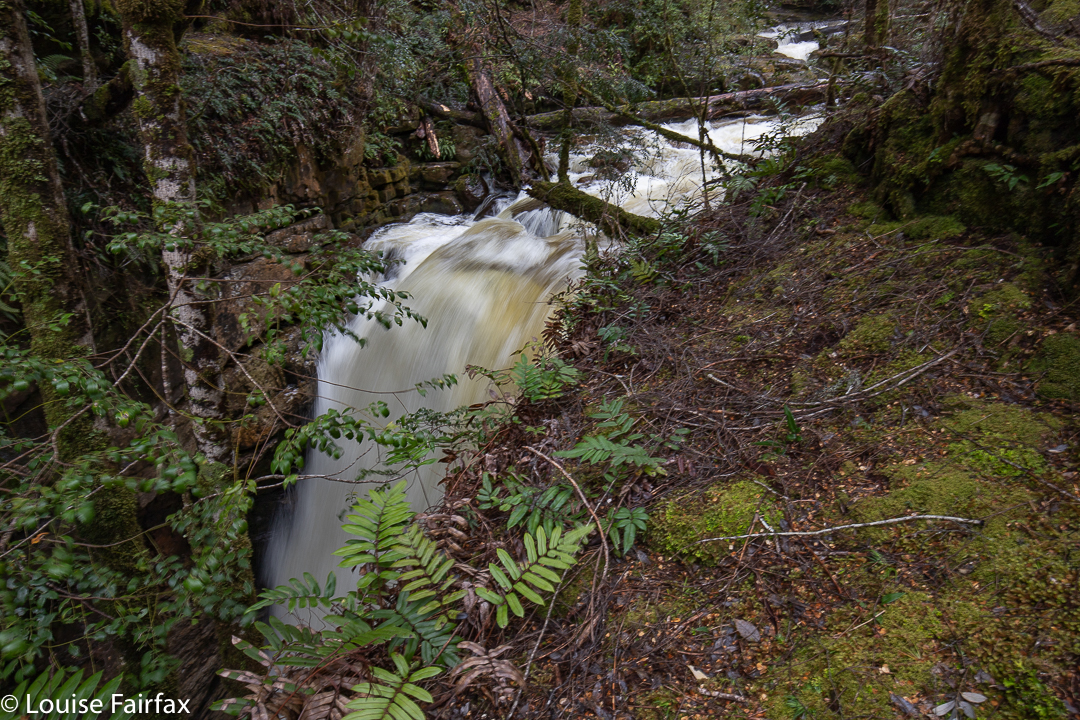
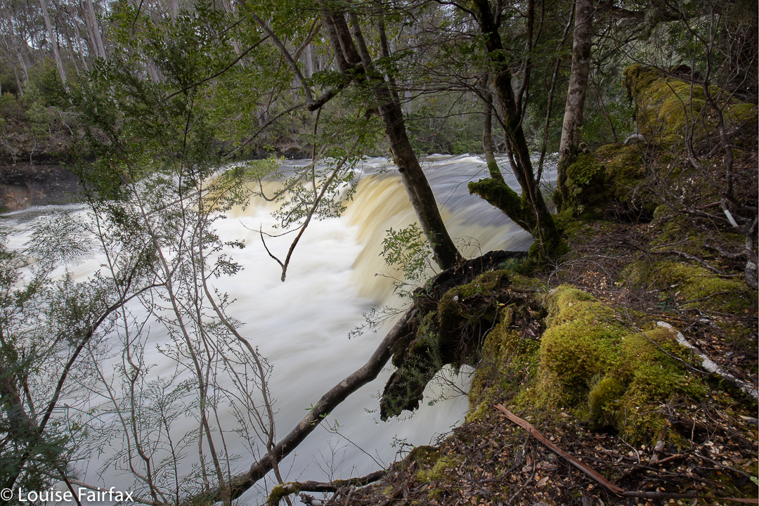
Together we climbed up the creek until the lion’s roar warned us that the devil was cooking his stew, and he must be nearby. The pot was blasting over. Neither of us had any information on how to actually reach the base of the falls, and in conditions like today, any suggestions would have probably been drowned anyway. We went as far as we could at river level, delighted in what we saw of the high, striated cliffs and rumbling, foaming water, the dripping ferns and singing moss, and then tried other creative ways to reach our goal. Success. Kind of. There was so much spume that my lens misted over before the 2-second self-timer had set off the start button of my camera. Long exposures produced a nice shot of the innards of a cloud. Furious wiping, cut exposures down to 10 seconds, change the angles … I got something, but not the shots I came for. I’ll be back.
Forest scene
What with setting up my tripod and filters and so on, I was taking a lot longer than Shane. Besides, I wanted to stay and play for a few more hours, and explore the river up higher, whilst he had to get back, so we parted, although I climbed back to safety before he left, and he kindly stayed to see that I had emerged alive before we went our separate ways. It’s amazing how you can flit away several hours, just moseying around and exploring. Well, I can.
Oxley Falls
On the rebound, I had time for Oxley and Lewis Falls. It was only early afternoon. I made my way towards the first, being shocked that I could feel the ground vibrating before I heard the sonic booms of the voluminous water rushing over the edge and slamming into the territory below. I could see the river in the distance, so walked beside it, waiting for the actual falls to happen, and noting the the Upper Oxley Falls were just swallowed up into insignificance in a context like today’s.
Lewis Falls
I didn’t return to the track after Oxley, but chose to remain by the river and proceed pathless to the next waterfall (Lewis). From there, it was a mere 2 minutes back to the track, and a further 32 minutes to the car.
Lewis Falls
My photos don’t indicate the shape of Oxley falls. The fat lady had eaten too much dinner for any shape to be evident. Besides, my photos are not “record shots” to show what something looks like. They are my artistic response to the beauty I have witnessed in that place. Sometimes that shows what it looks like as a side perk, but that is not my objective in shooting, whether we are talking waterfalls or mountains. Nature is amazing, beautiful and various. Each waterfall and mountain evokes a different mood and response, which, of course, relates to the stimulus, but it is not all about the fact of the object that is there, but the personal and creative response to that object. Mostly, I am taking photos of the same thing, every location, every time, and I have been doing so for as long as I remember: Light. Goethe’s “reines, einfaches, helles Licht”. How he loved it. And how do I!!!
Why on earth was I so apprehensive as I almost reluctantly picked my way down the path to Snug Falls, my first base for the bigger catch of the day: Cataract Falls, higher up? Was it just because Caedence had said it was the toughest hike he’d ever done, or was it some sub-conscious misgiving about my health following the latest virus? Certainly, also, with the warm weather arriving, I was worried about snakes in bush that thick, and about the fact that I was diving solo into unwelcoming scrub where the ground would not be visible, and the opportunities for mishap, many. Oh well. Here I was at Snug Falls. Easy part finished. Now it was time for business.
A cool Pool 35 minutes past the top of Snug Falls
En route to my courtesy pop-in to Snug F, I eyed up potential “dive in” points for my initial climb to the top of the falls, stage one of my venture. I saw an interesting cave with a possible route to continue higher beside it, so returned to that point, and headed up. It worked. I climbed happily, and 19 minutes after leaving Snug Falls, I was at a high point, looking down to my right on the yawning gap that shaped the falls, and the land that sloped to the Snug River straight ahead. Sad to lose my precious height, but the direction I needed was down, dropping to the creek. After a further 11 minutes, I’d reached the first intersection of two creeks above the falls. Now, I had actually been going pretty well (30 mins since the falls, plus 20 to get to the first falls). However, the fact that my watch said “50” and I’d only kind of just begun on my quest disheartened me for some reason. I guess ’cause I knew the hard work had only just begun. The bush had not thus far been exactly friendly, and had a reputation for hostility. Better get on with it.
The easiest way forward is to go straight up the river bed. Good luck.
I didn’t even stop for a drink. After all, I’d be now working my way upstream, and Caedence advised to keep in the river. But Caedence: the river is slippery as ice, and blocked by countless trees of various sizes. Moving up it was not possible (besides, I now had to climb a small cascade with steeply sloping sides). No. I’d need to backtrack and use the bush. It shoved me up the hill as I tried to get around huge fallen trunks. I played this game of being forced up, traversing a bit, making my way back to water level only to be repelled by choked and cluttered conditions for what seemed like an eternity. I should add, though, that there were some sections of forest that were more open and thus very beautiful, and some magic pools along the way. However, I was feeling so much “goal angst” that I didn’t even get out my tripod for photography, but used trunks and logs for stability. I was lugging, as ever, my usual heavy tripod, filters, and even cleaning liquid and materials today.
The path ahead. Sigh.
I started to become mentally tired: this felt like a university exam, where maximum, uninterrupted concentration for a prolonged period of time was required. I was on edge. It was all so blocked, slippery and difficult I couldn’t relax my guard for a second. I felt the strain of having to rely solely on my own mental reserves. Having someone else there somehow takes the pressure off and shares the load. Doubtless this was character building.
A different “path ahead”.
After about 35 minutes, but possibly only 6-700 metres progress, I arrived at a pool that was pretty, so decided to photograph it to give me a break. A further 35 mins, and similar distance again, (so I had now been going 1 hr 40 since Snug Falls), I saw a 6-metre-high waterfall. “Hoorah” I yelled in my head. Somehow I didn’t feel like actually yelling; I was already too subdued for that. This must be the bottom tier of Cascade Falls. At last!! I checked my gps.
Hoorah Falls. 6 ms high
Oh no. I am not nearly there. The falls are still maybe 300 metres or even more away, and in this terrain, that could take me half an hour. Things were violently junky here, so it could even be an hour. I sighed and continued, but when I hit a wood and rock wall that completely defeated me after 30 minutes, when the distance I had made since Hoorah Falls was to be measured in double rather than triple figures, I felt I’d lost the battle. I had now been going 2 hrs 10 mins since the falls. If I quit now, I might get back to the car in reasonable shape; if I continued, I may or may not get my grail, but I might be so spent it would be a pyrrhic victory, won at too great a cost to my own general good. I didn’t actually debate this out with myself, or consciously decide to give up: merely, one minute I was struggling against the rubble upstream, and the next, I had done a cute 180 degree pirouette and was jauntily making my way downstream, light of heart.
Hoorah Falls close-up (sitting high on a fallen branch to shoot). I had to climb up the falls in order to proceed, as the sides were perpendicular.
I covered the 30 mins upstream since Hoorah Falls in 14 down, and stopped for a drink and a snack and a map stare at a pool before the water cascaded over the lip. High, high above me was a 4W-D track on the map. My map is very old; would it still be there? At least where it used to be should be visible. I’d risk it. It was a long way around, but I had had enough battling with the creek. 28 minutes was all it took to reach the end of the road. Oh joy. I climbed like a pussy cat, so happy to be going up rather than along. 52 minutes later, I was at my car. The track was also impassible (you couldn’t walk on it at all, there was so much storm fall), but it was still better than what I had been enduring. Eventually it turned into Snug Tier Rd, which offers fantastic views out over the harbour to Bruny Island on the right, with views of the Wellington Range ahead and left. And you could walk, just walk; oh it was great.
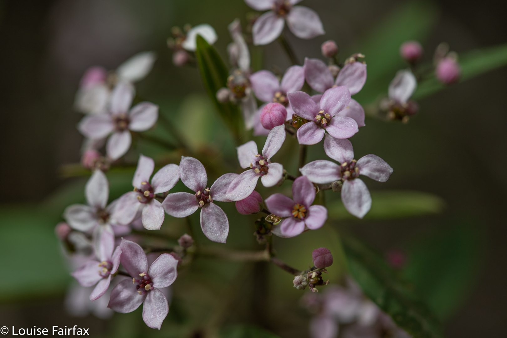
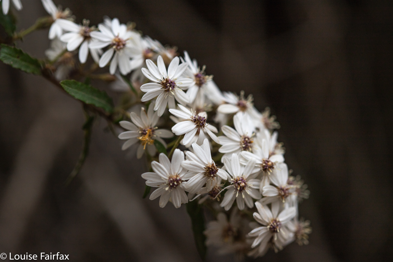
Zieria arborescens ssp arborescensOlearia sp
Back at the car, the wildflowers nodded their colourful heads in the quickening breeze. I hadn’t seen one snake all day, hadn’t injured myself, and had found Hoorah Falls. Hoorah. I’ll try Cataract again later, in a better frame of mind, and hopefully with some company to offer moral support.
My daughter and I only had a day and a half on Bruny in which to enjoy the light, but managed to squeeze in quite a lot of walks, including bagging the only waterfall on the island (Mavista Falls) as well as the only mountain worth points (Mt Mangana), plus doing a couple of other popular walks, like Fluted Cape and Cape Queen Elizabeth. I love exercise, so enjoyed the walking. Lena had work to do, so combined sitting at the dining table of our fabulous air bnb (Baywatch) editing, with joining me for most of the walks.
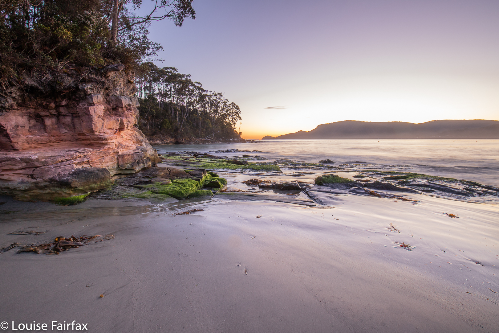
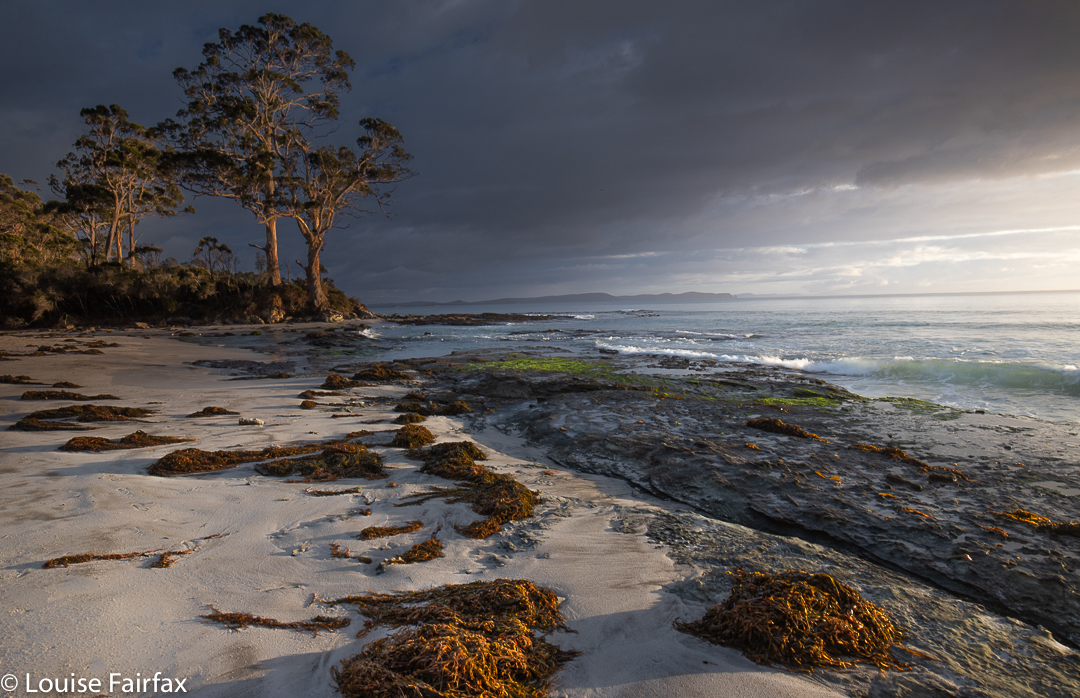
Adventure Bay, Bruny Island
Much as I love walking, however, I think my favourite part of being on Bruny was shooting the dawn. I really do love the early hours of the day: the light and colours thrill me; I like having the landscape to myself; and I love hearing the dawn chorus, which is far too early for actual sunrise, but I like to arrive about 40 minutes or so before the sun comes up, so I get to hear the ornithological choir practising.
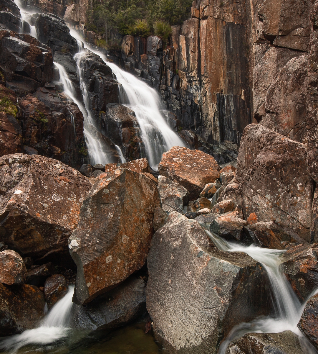
Mavista Falls, Bruny Island
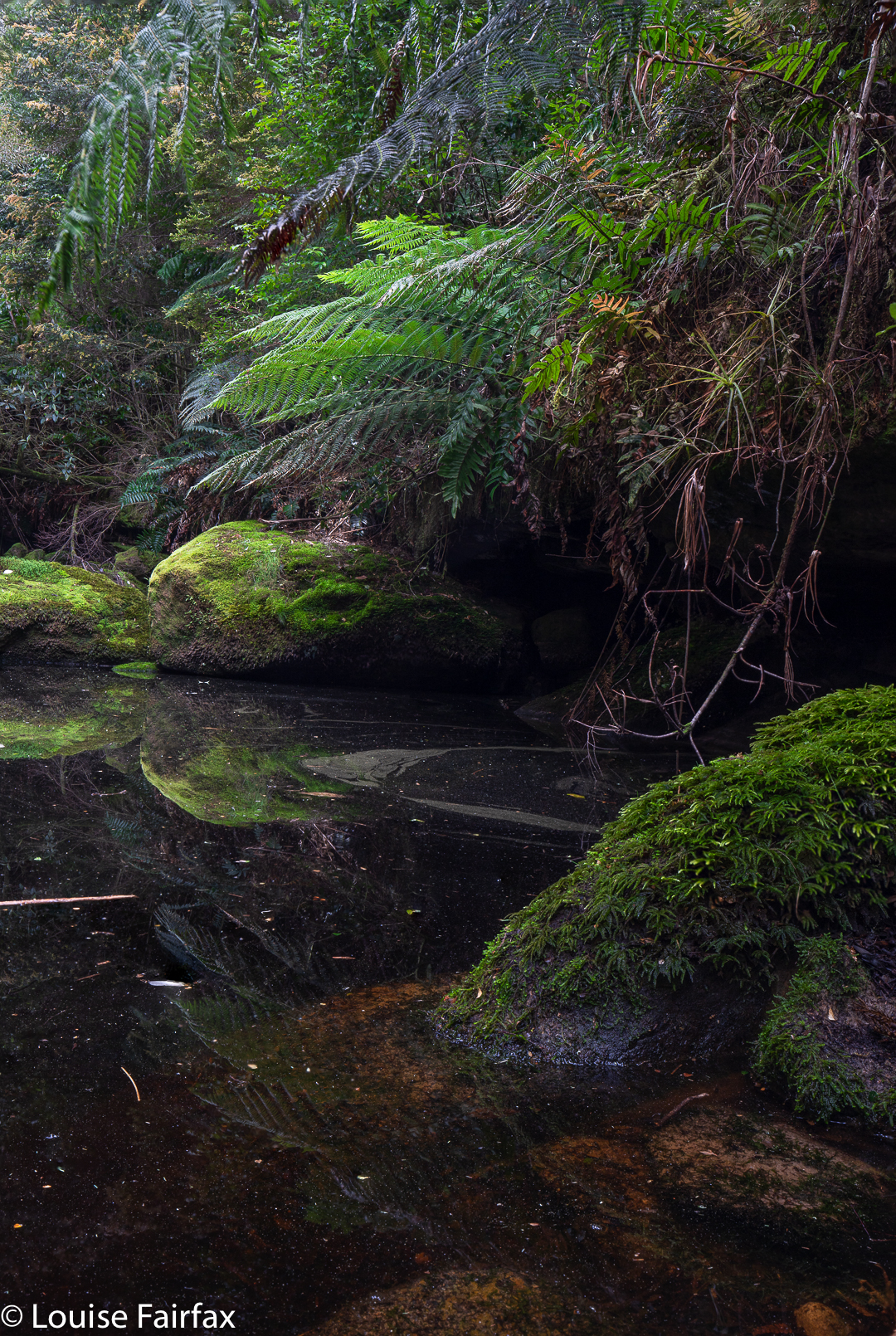
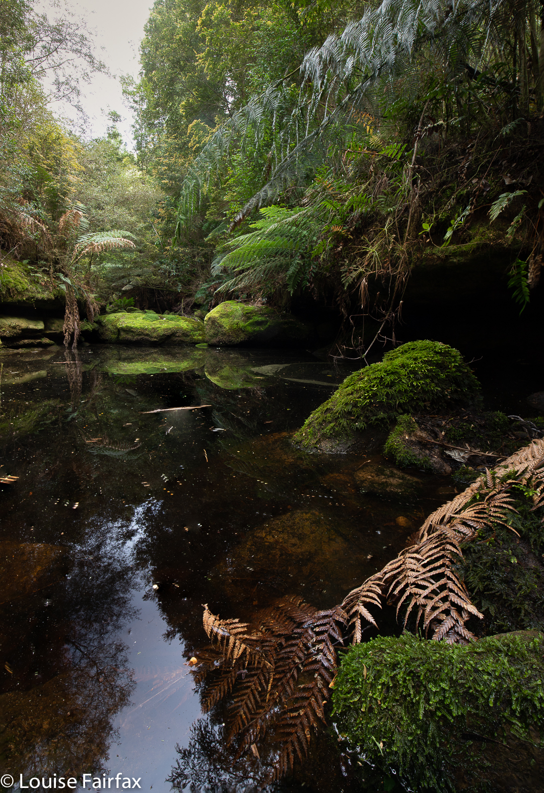
As I really love seeing waterfalls, whilst Lenie prefers other types of walks (she doesn’t enjoy bushbashing), I visited Mavista Falls alone, whilst she used my absence to knock off some of her work that was pressing. I find that each waterfall I visit engenders a certain feeling connected uniquely to it. And what is the lingering aura connected to my short walk to Mavista Falls? As usual, I guess, part of what resonates is the actual process of movement through place, of negotiating my way through that particular environment of lush greens and rich, muddy browns – similar in type to many such places in Tasmania, and yet with its own individual characteristics that make it different: under, over, around fallen logs; through the creek many times as this side, then that side was easier; trying hard to leave no trace, as the moss was so beautiful yet greatly and noticeably compromised by people who were careless of where they trod, and did not respect the place or the right of others to see it in its pristine condition.
Mavista Falls forest, Bruny Island
The creek was wonderfully clear as it ran its course under the mossy logs. This should have aroused sheer pleasure, but I couldn’t help being disappointed at the way moss had been trodden on unnecessarily, and I was rather alarmed at the amount of mud under foot. It looked as if a pack of elephants had been to see Mavista Falls. Perhaps some teacher had taken in a school group? Why do these people have to tread on rather than over a log that is a mere 30 cms high? Why do they have to tread on mossy rocks when other options are available? And why on earth do they go to such a beautiful place – hallowed ground – and leave behind drink bottles, tissues and pink plastic? Is it really so very hard to treat nature with respect?
Adventure Bay Cliffs
The falls themselves teased me. The map said I was there, as did my gps, and the 7 metre drop in front of me was the right height; however, the October output was significantly less than that of the only photo I have seen of the falls, taken in enthusiastic winter flow, and I became uncertain that I was really there. One thing is sure, however: I must return when Bruny has had some really good rain. What I saw was still lovely, but I know it can look even more wonderful in the right conditions.
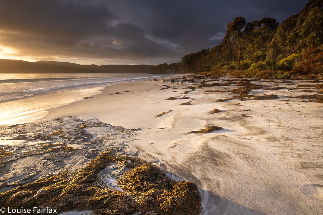
Storm brewing, Bruny Island
Besides, I need to return for other reasons. Bruny was fabulous, and I have not nearly tasted all she has to offer. I actually did rather a lot of the other kind of tasting: enjoying coffee and scones at the Penguin and Pardalote Cafe in Adventure Bay, oysters at Get Shucked and dinner at the Bruny Hotel, where the whisky mouse was maybe even better than the fish. But … er … I wasn’t really there to eat. That was just to fund the exercise.
Mt Mangana scenery
Before I went to the waterfall, we “climbed” Mt Mangana, which was a nice little excursion (30 minutes exactly in each direction), although not much of a workout, as you drove almost to the top, and so just enjoyed a fairly flat walk along a quaint path through very lovely green and mossy forest until we arrived at the rather non-event of a summit, the only unappealing part of the walk. The forest had been cleared and a tower erected, but there was no view, and you were not allowed to climb the tower (and were prevented physically from doing so). I longingly eyed up the kind of short trunks going up the pole, but there were none at my kind of height. I guess workers bring a ladder.
Mt Mangana path
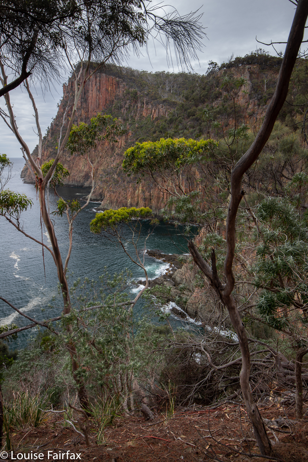
Two walks that did have a view were (i) Truganini’s Lookout near The Neck, a fun little climb for an expansive glance over a large length of beach, although it takes no time at all to reach the highest point; and (ii) the Fluted Cape circuit.
Fluted Cape, Bruny Island
I did both of these with Lena. The Fluted Cape walk begins with a flat 23 minutes to Grass Point, before climbing nice and steeply for another 32 minutes to reach the summit of the cape (272 ms asl). The views along the way are very dramatic, even on a day like the one on offer, which was rather dull and flat. I thoroughly recommend doing this clockwise, as I think that makes for the best views and drama. (It took 34 minutes to get back from the summit to the car, making for a round trip of nearly 1 hr 30).
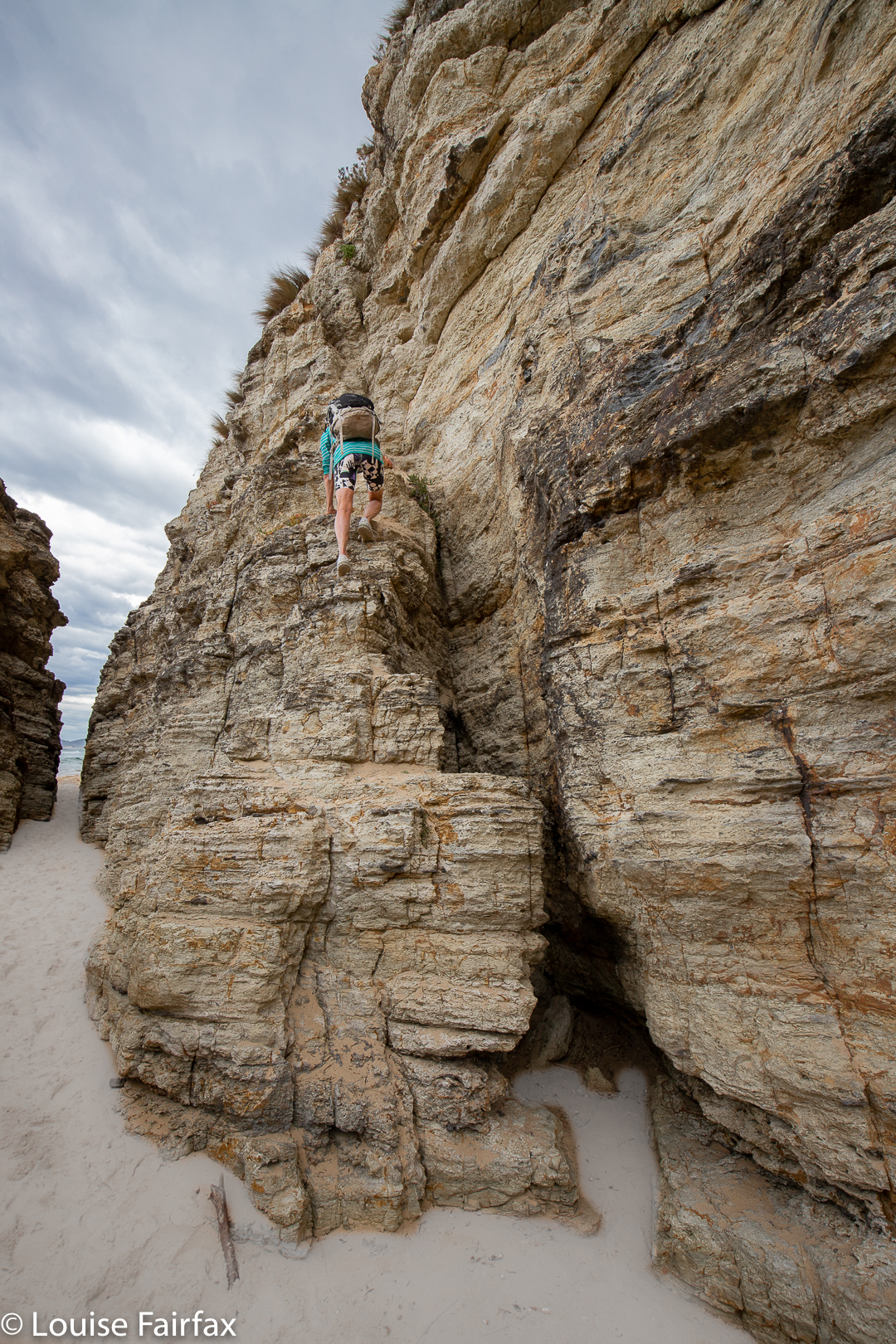
Enjoying a bit of a climb on the beach of the Cape Queen Elizabeth walk
The other walk we did on this 1.5 day visit to the island was to the beach at Cape Queen Elisabeth. There were fabulous rock crevices and caves that were fun to explore. We took 30 minutes in each direction to the beach, and then spent maybe 20 minutes exploring rock formations. We haven’t nearly explored all the possibilities of this walk, or of Bruny Island. I can’t wait to go back.
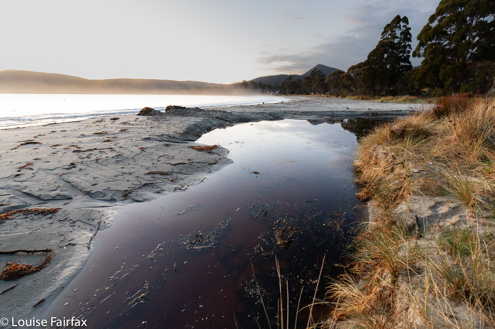
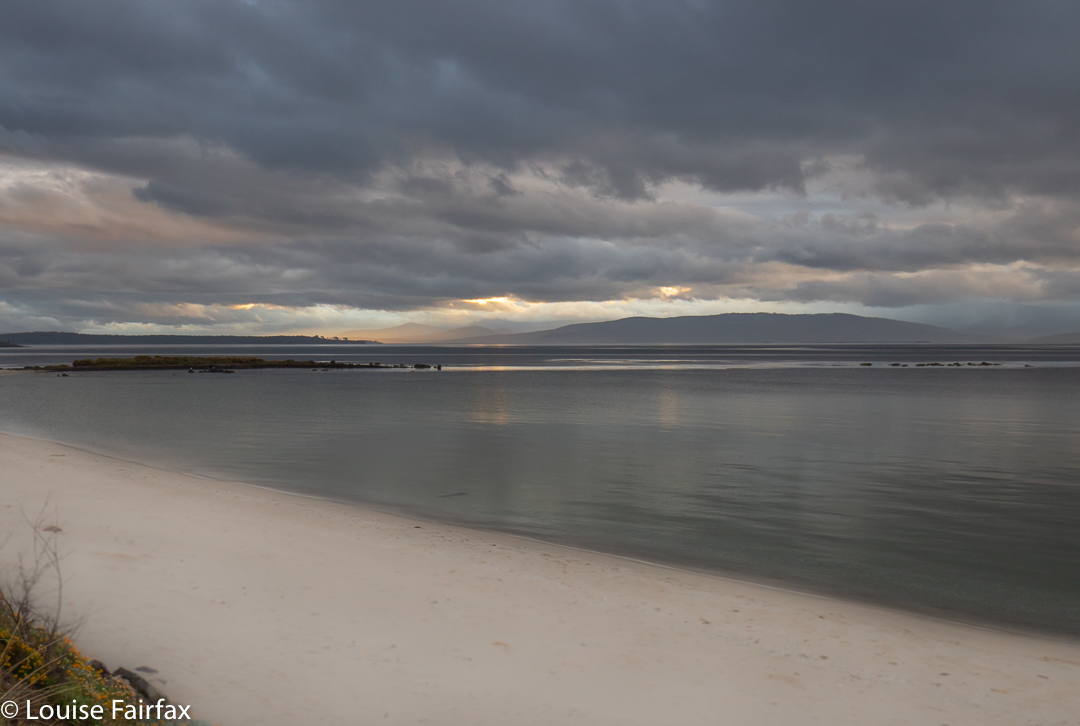
Storm on the morn of our departure
Please note: not one of the places mentioned here knew who I was, or that I have a blog. My good opinion is not bought, but I like to support small businesses, so when I have enjoyed what they have to offer, I try to give them a good word.
Stormy sunrise, BrunyMavista Falls + Mt Mangana Bruny Is Map
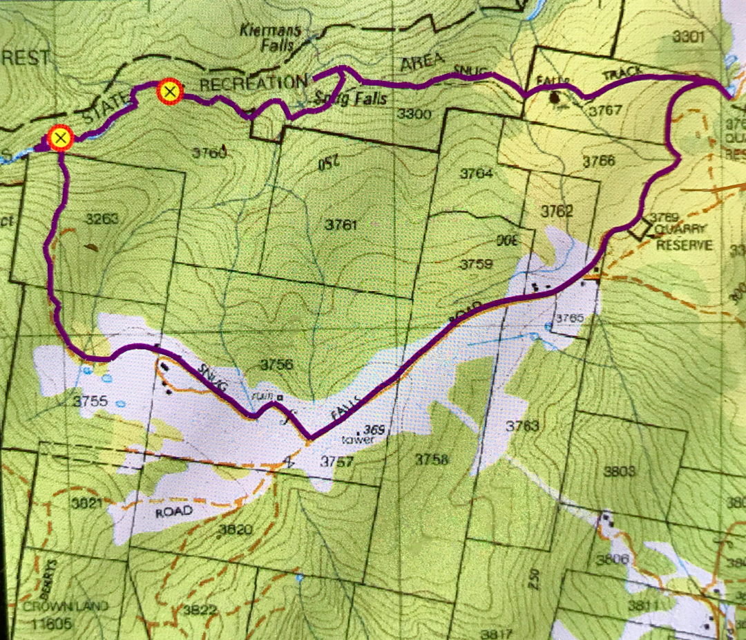
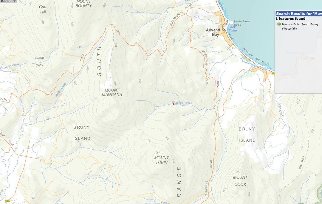
The red dot on Waterfall Creek (centre, above) is the location of Mavista Falls, which you approach from Adventure Bay. Google maps will take you to the start anyway. After that, follow a nature trail for a while, and then either call it quits, or follow the creek to the falls. Mt Mangana is also on this map, and you will see you also approach it from Adventure Bay (just north thereof). Again, Google maps will take you to the car park, where you will see the start of the walk.
Prior to a few months ago, I had not seen or heard anything to tempt me to make the long and not-very-comfortable trip to Wellington Falls, on the “rear” slopes of Mt Wellington. However, a few months ago, I saw a lovely image by Bjorn Baklien that showed me the falls could look appealing. I awaited the opportunity for a day when I had a lot of time and felt like a very long walk, as I took into consideration the fact that the advertised signage indicates that this is a 7-hour trek. The distance looked big on the map, and I knew from my visit to Disappearing Tarn (en route) that the footy-sized and shaped boulders that litter the way are not “marching” territory, and have to be treated with respect if one doesn’t want to twist an ankle.
Wellington Falls
Luckily, the reality was way, way better than my expectations. Firstly, I took a shade less than 1 hr 45 in each direction, thus halving the time I had allocated. Secondly, I didn’t know in advance, but by Disappearing Tarn, I had essentially done all the footy-stones bit. The actual Potato Fields, which I was NOT looking forward to, were easy in comparison, as the rocks were larger, and very stable. In fact, today everything was easy, as the rocks were dry, and none of them moved under me. Possibly the worst aspect was that I saw my first snake of the season, underfoot where I was about to tread. I informed Mr Snake that it was only September and he should go back into hibernation. I guess he had come up from Snake Plains, as he was just after that turn off.
Wellington Falls Track
So, here’s how it all took shape: Having driven down from Launceston that morning, I went straight to The Springs, and parked at the “higher” carpark, the one just after the road divides in that area. I walked on the Pinnacle Track steeply uphill for a mere 2 minutes, after which it was time to turn onto the pretty flat Milles Track, which I followed to the left (initially SSW but then swinging nearer west) for 28 minutes, when the Snake Plain track joined the path from the left (south). Along that Milles Track section, I enjoyed fabulous views (although a little hazy, so not worth photographing, but definitely worth imbibing) out over Hobart City far below to the expansive blue waters and hills beyond.
Wellington Falls Track after the Potato Fields
A further 26 minutes of the worst part of the track – through dry forest with the footy stones underneath – saw me arrive at Disappearing Tarn, from whence the track climbed upwards through the equally dry Potato Fields (but totally firm and easy underfoot), and then entered a delightful grove of Richea dracophylla, with masses of rich brown leaves underfoot and mossy rocks. The final few minutes involved a steep descent to an intersection below, above Wellington falls with tracks coming in from other directions (one from the Pipeline Track, well below on that side, and the other from the Cathedral Rock area in that circuit, across the river). Not far from there is a side track to a lookout over the falls. I stopped my watch (1 hr 44), and then just took my time, descending to the very base of the falls, and inspecting various rocky outcrops for photographic possibilities.
Wellington Falls – half way down
The way back took in total the same amount of time as the way there, although the splits had different values due to different inclinations in the opposite direction. I had lunch in the Tavern at Fern Tree, coffee down lower at Ginger Brown, and was finished everything (i.e., all the eating) by exactly 3pm, school pick up time.