Cape Pillar Tasman Peninsula 2019

Cape Pillar

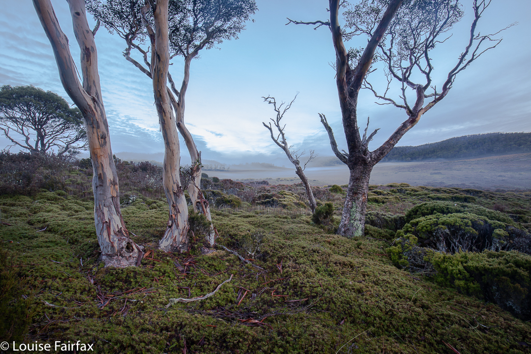
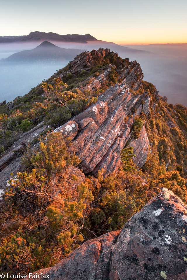
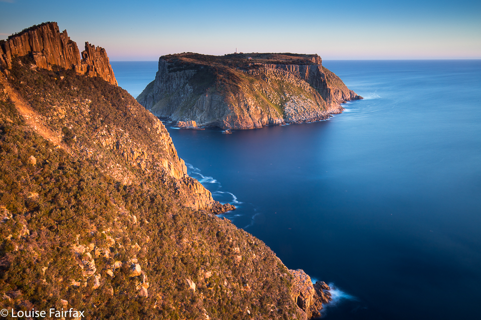
For as long as I can remember (but at least since 2011), I have wanted to sleep at Cape Pillar, to photograph sunset and sunrise there, and to climb The Blade, whose very name reeks of drama and consequence. At last, on the weekend just gone by, I had my chance. Tessa could be minded for a day and a half in Hobart. The weather looked reasonable. I could go.

sunset Cape Pillar
Cape Pillar

I drove down, delighting in the countryside of that part of our state, bought myself a salad roll in Dunally, and was soon enough in the carpark poking stuff haphazardly into my pack. This was a last minute outing, and I had no idea how many things I had forgotten. Surely, whatever they were (as long as the list did not include anything to do with photography), I could live without it for twenty eight hours.

The Blade

I met two guys in the carpark before I’d begun packing, but passed them after an hour, and from then on had no one I knew of ahead of me. After exactly two hours’ walking, I had reached the Munro Hut, and stopped there for a hearty drink and some food. My pace had been good to this point, but I was now about to fill up my bottles with water to fund the next few meals. From here on, I was a slow old cart horse, lugging not only overnight equipment and masses of weighty photographic gear, but also heavy water. I couldn’t believe the difference a few extra kilos made to my pace. Suddenly everything hurt. I took a lot more breaks, albeit it tiny ones, just to rest my shoulders and back for a minute or two before the next stint. I think it was 1 hr 36 mins’ walking from the hut before I reached the base of The Blade. Hoorah.

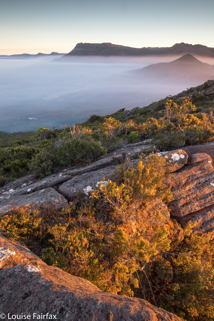
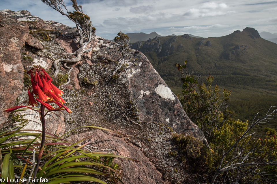
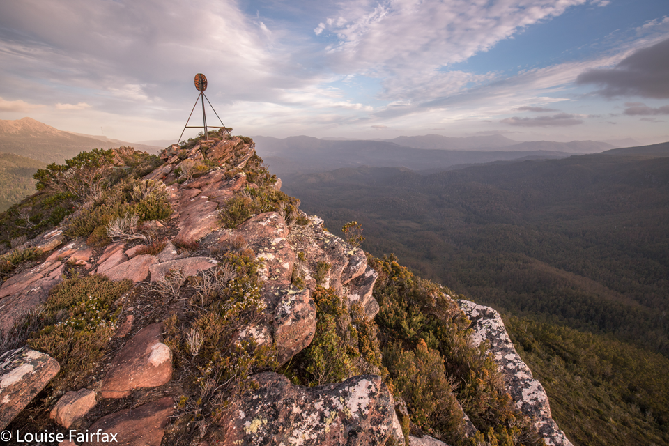
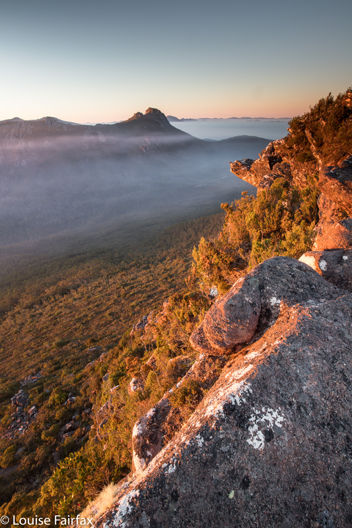
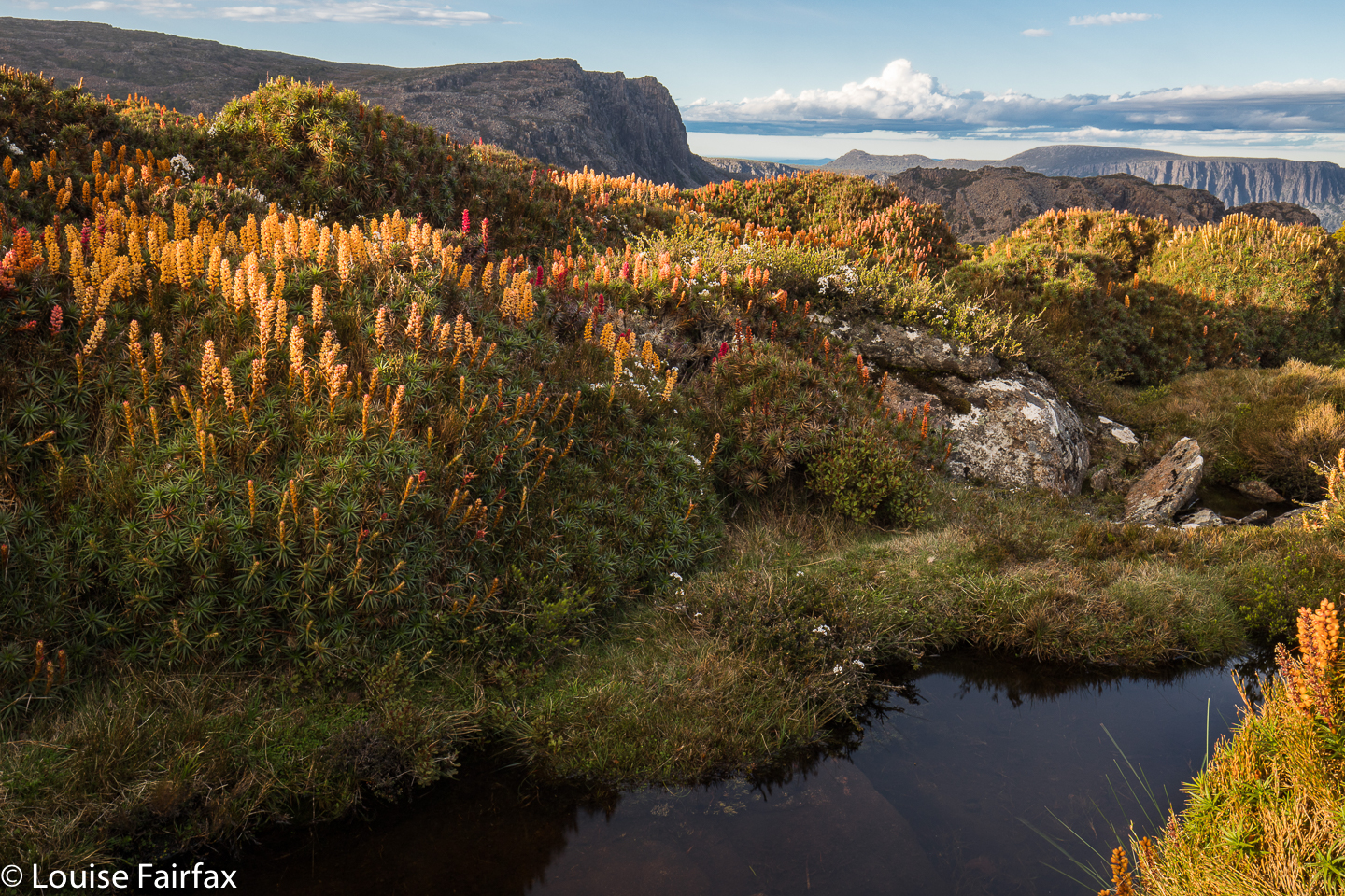
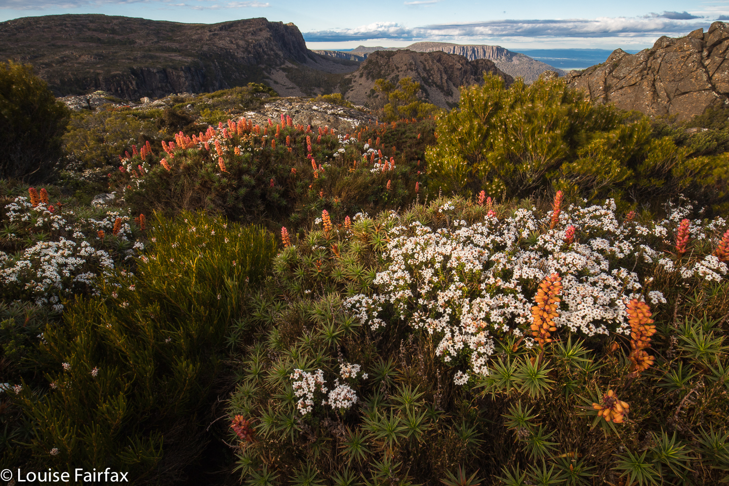
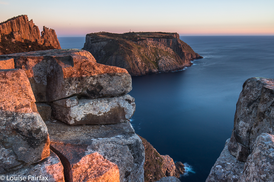
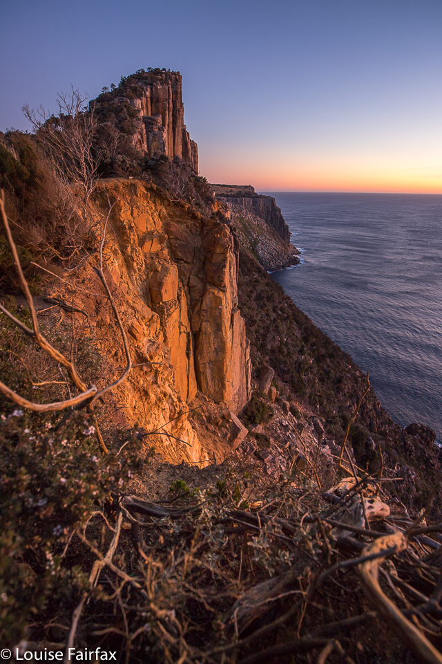
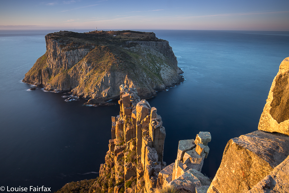
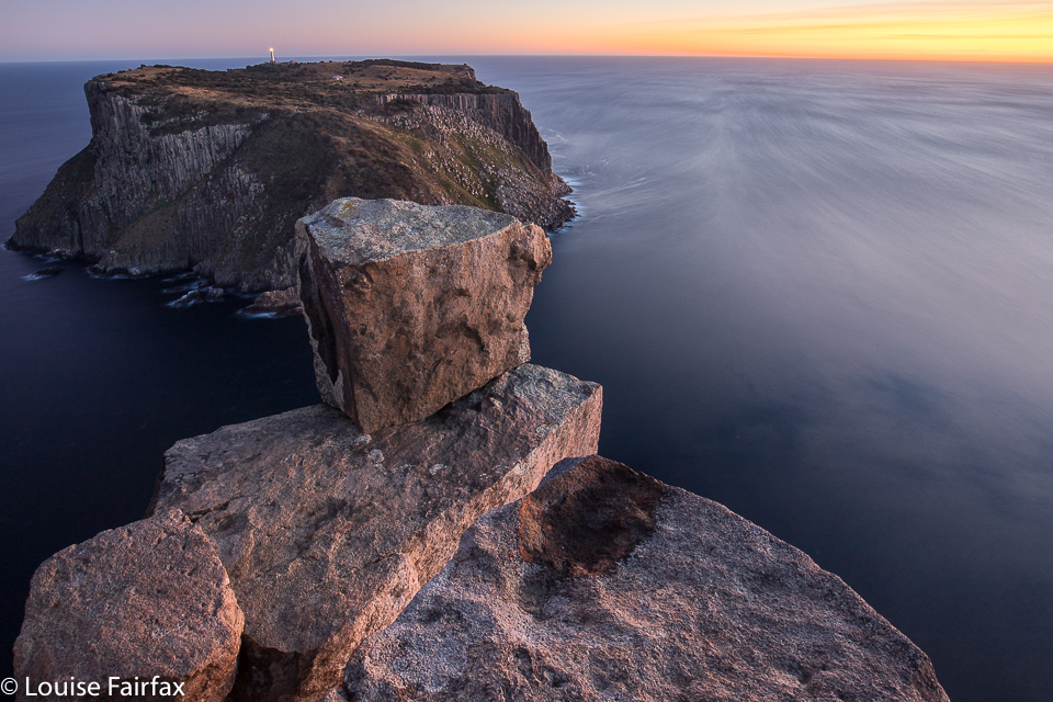
Here I could dump my pack in the shade before exploring further, light and free. I climbed the Blade and Cape Pillar, enjoying the views and pondering where to take my later shots. I climbed the Blade two more times for the heck of it (and to check on details of angle, sun, what I was game to climb, etc). I then climbed it again at sunset, and again in the middle the night by moonlight. (And yes, again at dawn. I am now well acquainted with The Blade.) My gps said I covered 22 km equivalents that day.

tent

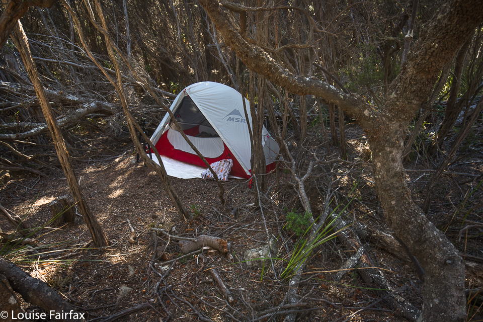
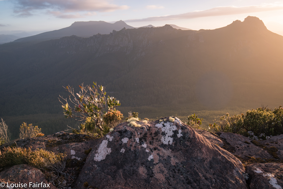
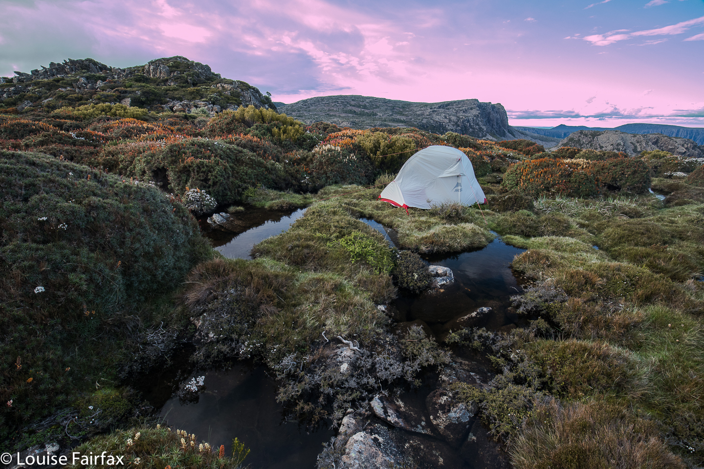
I had arrived shortly after 2 pm, so that gave me time, not only for the above exploration, but also for a well-earned lie down, back in the shade in my trusty tent, hidden by bushes and listening to birds and feeling the space around me. That was a lovely time. Sunset was quite busy, as I used three different locations, separated from each other by ten minutes’ walking, trying to catch rays on rocks before they hid behind the mountain’s shadow.

Cape Pillar

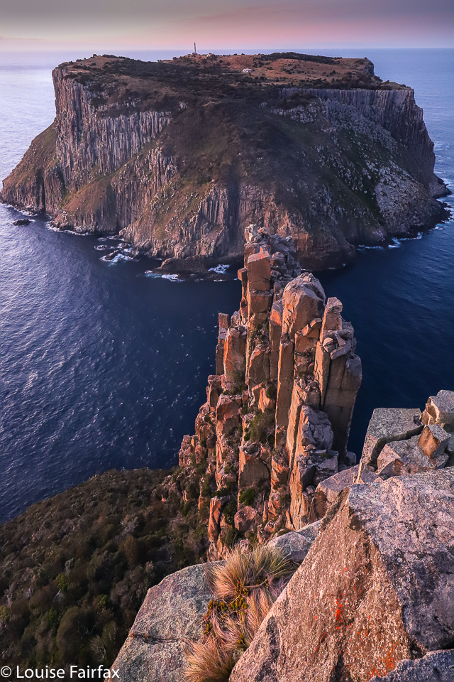
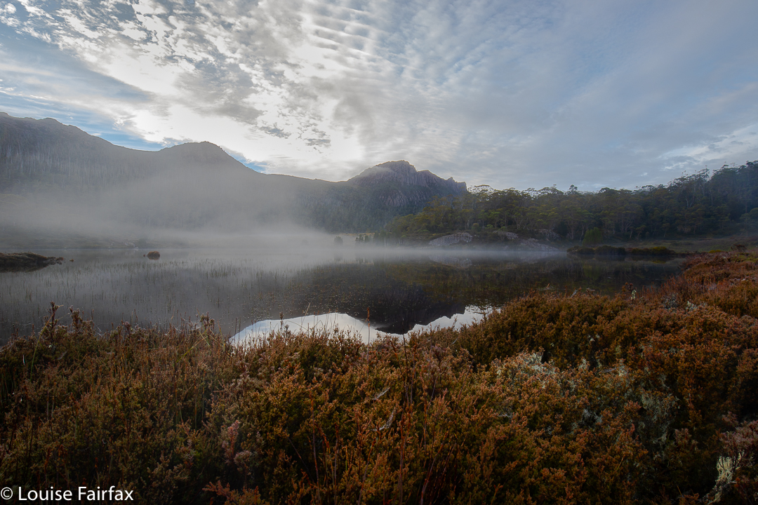
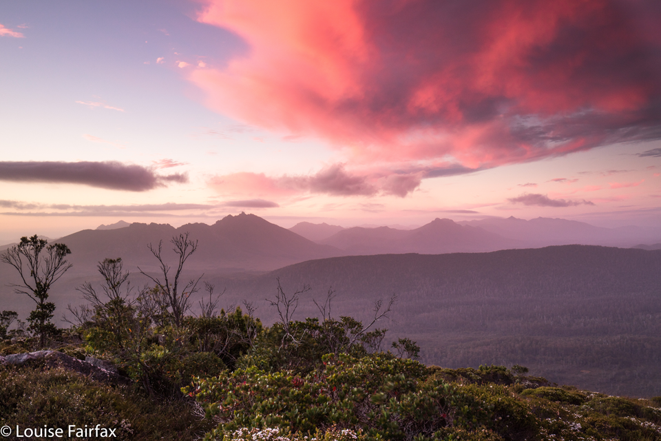
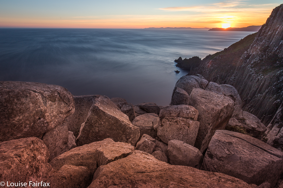
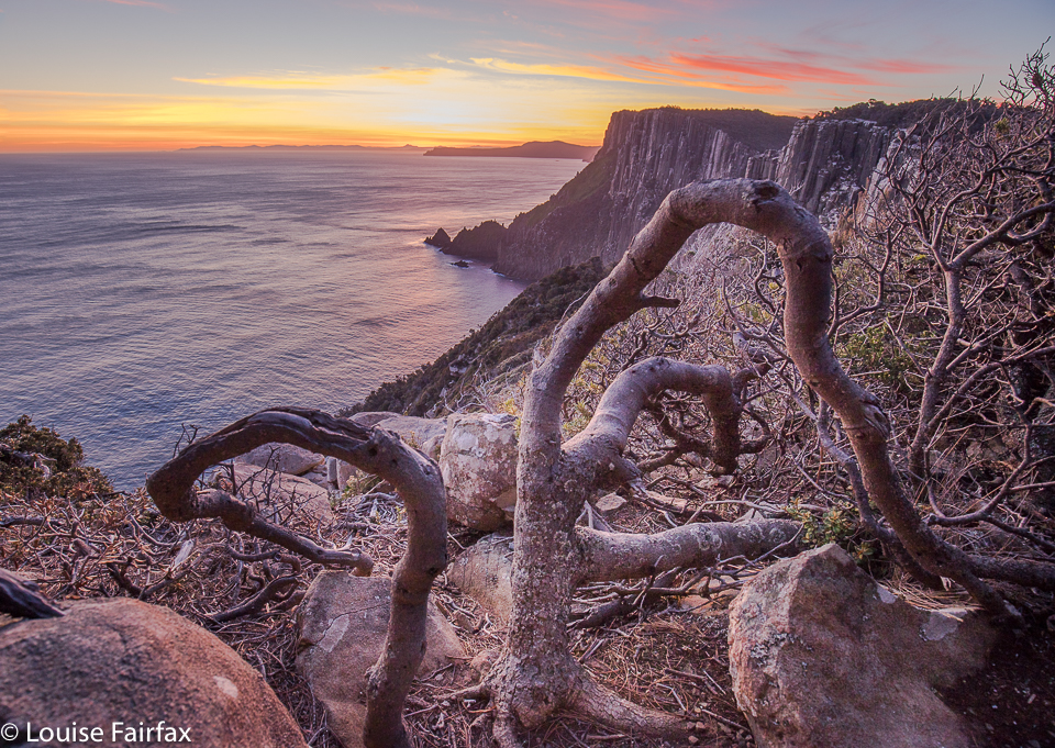
After an excellent sleep (punctuated, however, by my rude alarm waking me at 1 a.m. to climb and do a spot of astro photography), I woke to the alarm again, in the dark again, to get into position for sunrise. Both sunset and sunrise (and 1 a.m. astro) were compromised somewhat by clouds on the horizon, stealing some colour at the important angles, but I still had a lovely time perched up there on my pinhead, listening to the barks and squeals of seals several hundred metres below.

Cape Pillar

I arrived back at the car at midday, but … oh no. I had a flat tyre, and my key was missing. That took two hours to solve – a solution achieved by the help of several fabulous Good Samaritans, notably (but not only) Henry and Cynthia. People helped lift and push things I am not strong enough to lift or push, and others offered or joined in. Others still minded my gear while I went to the Rangers’ Office. I was absolutely starving by the time I got out of there after that delay, but luckily there is nice food at a Lavender Farm not far from the main road, so that made me feel heaps better. I didn’t make it back to Launceston that night, as I could only go at 80 kph, and had lost two hours. I bunked down in Hobart instead. I’d had enough, and had had insufficient sleep with all that odd-hour photography. Two capes down; one to go. I’m enjoying Cape bagging.

Orites Falls 2019

My friend Craig called to discuss my route to Orites Falls in 2016, and mentioned in the process that I was welcome to join the small group that was about to go. Would I like to join them? Do children like chocolate? How wonderful to have an excuse to revisit an area that I loved the first time around. The territory at the back of Mt Hugel is wild and somewhat unfriendly to those who would like to pop in for a chat, but it is wonderful once you’ve got past the bristly facade.

Orites Falls trip

It is so lovely to be walking with a handful of likeminded people: fellow bushwalkers and nature lovers, bonded more by that than a passion for waterfalls, but all willing to embrace the beauty of Orites Falls nonetheless. I loved these falls so much that the first time I was there, I couldn’t wait to come back with my tripod and a few filters to slow the water down.

Orites Falls trip. Tentsite.

Of course, the section to Shadow Lake from Lake St Clair Lodge was easy and spent in pleasant chatting through wonderful lush rainforest with heaps of fungi beginning to colour the landscape. Fagus also added colour (nothofagus gunii). We had a snack at a small beach by a giant pencil pine and continued on our way, along past Forgotten Lake and to the rock slide providing the approach up to Little Hugel. Once you’ve gained the ridge, you’re on your own, with occasional pads to help you, but not often, and only while your route intersects with that taken by people climbing “big” Mt Hugel. There are some little tarns under the Hugel ridge (at about 1245 ms asl), and the shelter from the quite strong wind afforded by a little copse of Pencil Pines provided the ideal spot for our lunch. The ground was soggy, so I squatted instead of sat to keep drier.

Orites Falls trip. Lake Hermione dawn

After lunch, we climbed up to 1330 ms to a knob that is unnamed on the map, but which was christened on day 3 “Craigs Curse”. On day 1, however, it was no curse, and offered us lovely cloudy views to Lake Hermione, our destination for the night, about 385 ms below. That is 385 vertical metres. The horizontal measurement is not all that great either, but it took us two and a half hours’ walking to negotiate the protective palisade of bush between us and the water. Eagles have it easy.

The others agreed to my vote for the ridge running NW from the knob, as I had used it before and found it better than a more direct route, especially on the way up, but the others thought it would be good to use it on the way down as well. The clouds rolled in and down we dropped, hopping across boulders with scoparia traps underneath, and down into general scrub and some exceptionally steep rocky bits. But it was a devil I knew, and I knew it would work, so on we pushed. What a glorious moment it was when we burst into the band of rainforest with its relatively easy passage and rich greens, and swung more in the direction of our goal.

Orites Falls trip. Eucalyptus pauciflora.

The final button grass drag was tiresome, as it felt like time to arrive, but arrive we eventually did, and chose our glorious real estate for the night. Dinner at the marvellous al fresco restaurant was a wide choice of dehydrated-now-rehydrated fare with different names on our packets, but not a huge difference au fond. We compared notes on flavours, as one always does bushwalking. By the time we erected our tents, photographed the beautiful lake, collected water and had a general explore, it was getting dark and cold, as is the norm for this time of year.

Day 2.

Orites Falls trip. Underway day 2.

This was the day for the goal of most in the group – those who had a finite, concrete goal rather than the more abstract one of enjoying being in a beautiful wilderness area. We did have a focus, and that was Orites Falls. As I had been there before, I was given the helm again, and led us up to the rainforest band on the other side of the river to follow it along until it was time to drop to the falls. Even though we were camped not far from the general source of the Franklin River (a tiny bit to the NW of our spot), it was still quite tricky to cross, but I knew it was possible near the lake, so we went to where it issues from the wider area in a magic bunch of pencil pines – how old? a thousand years? Who knows?

Orites Falls trip. Lake Hermione

The photos say all that needs to be said about the falls. We loved being there, and stayed a nice long time, only returning in time for lunch. It was about an hour and a half each way and the rest was taken up in photography.

Orites Falls

In the afternoon, we each did our own thing, with the three waterfall-fanatics visiting what I decided to christen the Franklin Tarn Falls (they not having a name on the map, and needing one so we can refer to them). I had also already been to these ones, but they were dry last time. This time, I left my camera accidentally in the tent. HOW does a lover of photography do THAT???

Orites Falls

Craig and Caedence have both promised me a photo to commemorate our visit. On the approach, I took the route I had used last time. While there, I spotted a lead in the forest on the other side of the stream and the others agreed to test it out. This northerly route was a heap more pleasant, even if a bit longer, and three minutes faster: 23 minutes there from our tents; 20 minutes back. Meanwhile, Adrian explored the Franklin source area to the north, and Leandra intended some quiet reading in the tent, but she did mention some quiet involuntary snoozing instead.

Day 3.

Dermocybe canaria

I always think it’s good when you have bad nightmares about something, as the reality can never be as bad, and then you have a pleasant surprise. My worst-case scenario for this day was not a pleasant dream. All night, the wind howled like a demented monster, and the rain lashed at the tent. Some of us didn’t have the right clothes for such weather. Should I really lead them up to the exposed rocks on top? Craig was all for going further around, and I thought the protection that route offered could come in handy. We’d set out and decide later. Meanwhile, I’d done the lion’s share of leading on the past two days and was mentally tired, and was also physically weary as my monstrously heavy camera was now in my pack to protect it from rain, instead of around my neck where the weight wasn’t all placed on my poor shoulders. I needed pain killers to cope. Luckily, Adrian took over the job of leading through the scrub, steered by Craig who had plotted our route from day 1. It was nice and relaxing not to have to make decisions for a while.

Orites Falls trip. Leandra looks happy

At one particularly difficult spot on the way up, which challenged one of our group with the exposure involved, I thought we weren’t going to make it, but my worst fears were faced, defanged, and then not realised anyway. At lunch by the same tarn we’d dined at on our way up, I was, apparently, grinning like the proverbial cheshire cat. Now we were in the land of easy walking, and there was no way we wouldn’t make it out. We were a happy group. I even allowed myself time for a little fungi photography on the final leg of the journey.

Tim Shea 2019 Jan

Mt Tim Shea: a sad substitute for the Denison Ranges 2019 Jan

It is really hard for me to get away these days, but I had booked my dog into a kennel for four days and was ready to climb onto the Denison Range, sleeping on Great Dome night one, climbing Bonds Craig and more day two, and maybe out or maybe more climbing for the remainder. I had Tessie booked in for the extra in case I was out late or felt like an extra day. The web said the Rhona track was open. Off I set.

It’s a long drive down south to the start beyond Maydena, and just as I neared my goal, keen to be underway at last, I got turned around. Fires had become reinvigorated near Lake Rhona, so I couldn’t proceed further. It was, by this time, about 3.30. So, I had driven all this way; what was I to do? I had never been up Mt Tim Shea (opposite The Needles) before, and it was nearby. I had had enough of driving: decision made. I repacked my bag, and up I went.

The map didn’t indicate that any water would be available, so I took plenty, and, as it wasn’t all that far, I lugged my heaviest tripod. Luckily I was on top in less than an hour. I was, nonetheless, very hot indeed, and glad to be finished.

Although the views were excellent, it was heartbreaking to see how very close the fires were to Bonds Craig and Lake Rhona. I could smell the smoke from where I was, and could see it billowing from the mountains all too close to the fragile area of my original destination.

 My darling second-born daughter phoned while I was in range on top to check up on me, and was most anxious as to my well-being, but I promised her the wind was not blowing in exactly my direction (I tested that one at regular intervals), and that if I felt in any danger at all, I would rush down (much faster than I’d ascended, as I’d throw the water out first).

Despite the fires, I had a fabulous time photographing, given that clouds of a delicate pink were floating all around. I pondered the next few nights: I still had two remaining after this one, so was wondering how to spend them. It has been a very long time since I have visited Mt Field West, and I have never slept actually on this mountain (only on nearby k-col), so I decided to check in at Mt Field NP next morning to find out the state of play for my new plan B. I was told there that almost everything I wanted to do was either out of bounds or “not advised”, as they feared, for example, that if I went to Mt Anne (Plan C) or the Western Arthurs (Plan D), I’d need to be evacuated. They’d prefer to save themselves the bother.

Plan E it was; I decided I had little choice but to drive the long haul to Lake St Clair, and sleep on the Mt Hugel shelf. As it turned out, I was so hot and bothered I just camped at Shadow Lake. A total fire ban meant I couldn’t cook dinner; the wind was unpleasantly strong, and temperatures were uncomfortable. Next morning I gave up and returned home a day early. Tessa was delighted.

Scoparia hunting 2018

Scoparia hunting 2018 Dec

My photo collection for 2018 has a disproportionate number of images of beautiful waterfalls, and a sad shortage of mountains. As I love mountains even more than waterfalls, I decided I’d better use my single chance before Christmas to get myself high and hunt for scoparia while I was at it.

It is now very hard for me to get into the mountains, as Tessa (my dog) misses Bruce as much as I do, so I feel terribly guilty any time I leave her, and most mountains are in National Parks, so she has to miss out. Into the kennel she went in the early afternoon on Monday, and I promised her I’d be back before twenty-four hours had elapsed.

By mid-afternoon I’d parked at the Meander Falls carpark, and was ready to do the climb. Hm. All this waterfall bagging, even though I do it with an 8 kg pack of camera gear, is still no apt practice for a real pack. I guess it doesn’t help that I’ve been laid low with a virus in the last three or more weeks. Every time I run, I take several steps backwards in overall recovery …. and I keep on running.
And so the walk into the actual falls felt unusually steep and lasted far longer than I expected (1 hr 48 instead of under 1 hr 20). I feared the climb up high would take double my 30 minutes of last time (packless), but luckily I was wrong, and it took the same. I was pitching my tent by 5.30, with plenty of time to sort out shooting locations.

Actually, I took far longer to choose a tent site than to choose anything else. The wind was fierce up there, and I only had my light three-season tent, so I wanted shelter from the west. I keep ducking to the leeward side of scoparia shrubs of a decent size, but the wind just dashed around them. I needed a big clump, or a rock. On and on I went , searching but not finding. In the end, I got a spot bang in the middle of a multi-coloured scoparia thicket, almost completely surrounded by water, and, well, the shelter was about as good as it was going to get. And now that it was time to pitch, it started raining lightly. The wind picked up. The clouds amassed. So much for photography.

Pitching was a challenge in that wind. I haven’t pitched this little tent before in anything but ideal conditions. Every time I attached the fly to one side and dashed around to attach it to the other, the wind whipped it up and threatened to send it back down to Meander Falls. I decided it was lucky it was only 5.30. If that happened, I could still easily retreat with safety, even if not with dignity. Somehow I broke the rotten cycle, and she was up, and the inside hadn’t got too wet with all my bumbling.

It was not good lighting for photography, but I feared it was as good as it was going to get, and I had carried my pack for two and a half hours to be here. I wanted some bang for my buck, so went out and shot anyway. Hm. Problem. The ground was so spongy that the tripod moved during long exposures. Hand held it was, which made using GND filters challenging (as they require longer exposures), so all the early ones have skies that are too light. I thought that was “it” for the night, so retreated to my tent for “dinner”. (The food was NOT a highlight of the trip.)

Once when I was in the Western Arthurs and had grey, drizzling weather, I was sitting in my tent sulking at the injustice of it all, facing east, and nearly missed one of the most beautiful sunsets of my entire life. It lasted only maybe five minutes, but the sun found a spot to pierce through the heavy cloud, and illuminated the whole world in pinks and purples of a wonderful hue. I wasn’t going to make that mistake again, so kept checking for the possibility of a sunset. Proper sulks are not a good idea. Luck was with my vigilance. For about five minutes, the sky cleared enough to allow golden shafts of light to streak across my field and turn the distant clouds pink. I was almost panicking, as I knew it wouldn’t last. Some shots were hand held, just in case, with monster ISOs, and then I risked long exposures on wobbling, unstable terrain.

Next day, I was very tired, as I had set my alarm for 4.40 to get the beautiful dawn I’d planned on. The world was dark, dull, fuscous. Reset the alarm for 5.10. The world was still utterly uninviting. Set the alarm for 5.30. As you can see, i was scared of dozing off and missing out should something eventuate. It didn’t. At 6 o’clock I breakfasted in the rain, on a day on which BoM had promised none, and then depitched my home, trying not to get things too wet. I am much faster and more efficient using my Hilleberg in the rain, but I had been promised none, so brought the lighter MSR. Oh well. Climbing down the steep rock scree now that the moss was slippery and my pack heavier was slow, careful work. I will be well-practised if I get to be a crab at some stage in my future.

I wasn’t going to photograph Meander Falls, having already done so several times (and not finding it life’s most photogenic waterfall), but it was flowing so much stronger than I have ever seen it do that I decided I needed to. Besides, my arms were actually weary from all the four-points-of-contact work I’d just done lowering myself down the cliffs. The waterfall made a nice excuse to rest a bit before I continued on the wide tourist track to the car. I picked Tessa up before lunch, as promised. She yelped and danced and sang and bounced. What a greeting. I promised them I wouldn’t stay away three years next time.


Meander Falls.

Cathedral Rock 2018 Nov

Cathedral Rock Nov 2018

A good stride-out up Cathedral Rock is a very pleasant slice of exercise, and I decided to indulge. I was down south for two days, so thought I would use my location to see what could be seen from the top of this vantage point. I chose the Betts Track, starting from near Neika.

As my heavy camera equipment was bulging my backpack, I had to walk briskly rather than run. And because I didn’t take all that long to reach the top (1 hr 07 from the carpark to the base of the rock, via Betts Track; 18 more minutes from there to the top, i.e., 1 hr 25 from carpark to top), I added on a return journey to the Mountain River end of the track, which made an excellent diversion, and turned it into a three and three quarter hour ramble. I loved the flat, broad valley after Betts Head, although I didn’t like the way that the Melaleucas were taller than I was, so I walked for quite some time in a tunnel with no view and close walls.

Richea dracophylla up high
The day was murky, so my views were not to die for, and the wind at the top was rather unpleasant, which is why I elected not to progress on to Mt Montague along the tops. I nonetheless felt I’d earned all the wicked things I ate for lunch afterwards at my favourite Daci and Daci. In fact, I seem to have worked up a good appetite, as I also needed pastries from Jackman and McRoss a couple of hours later. In the afternoon, Tessa and I did rounds of the streets of Battery Point, having a wonderful time smelling the roses in other people’s gardens, wafting on clouds of magnificent perfume – quite a civilised end to a wilderness morning.


Cathedral Rock – the route down. STEEP.