Weld 2015 May

Mt Weld 2015, May

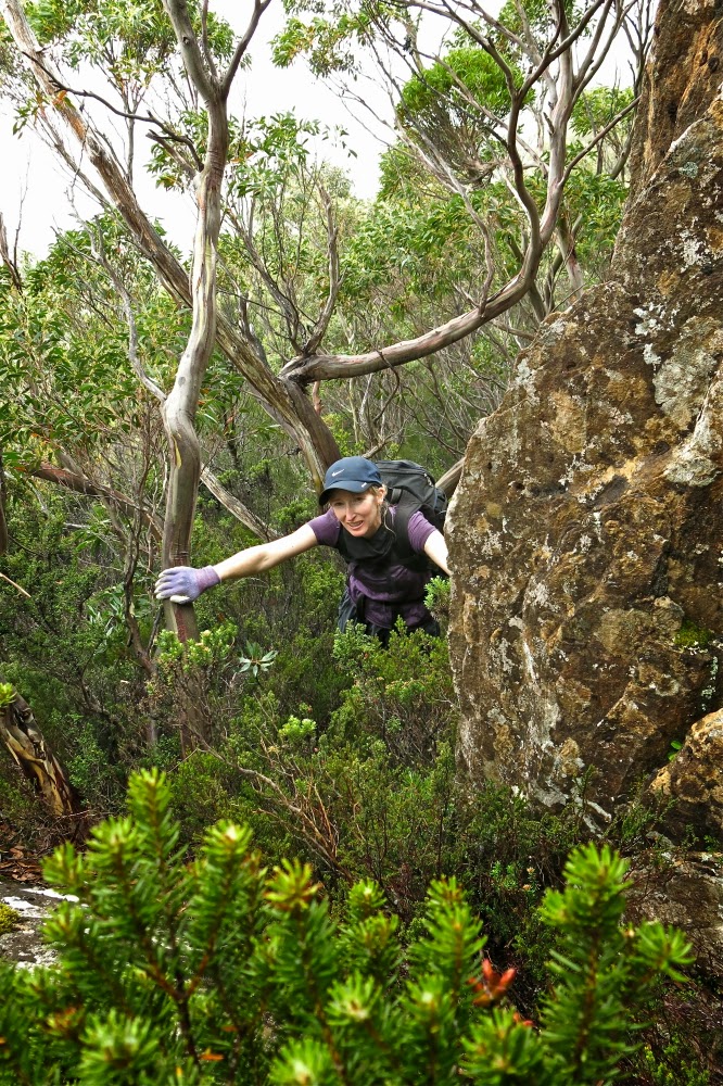
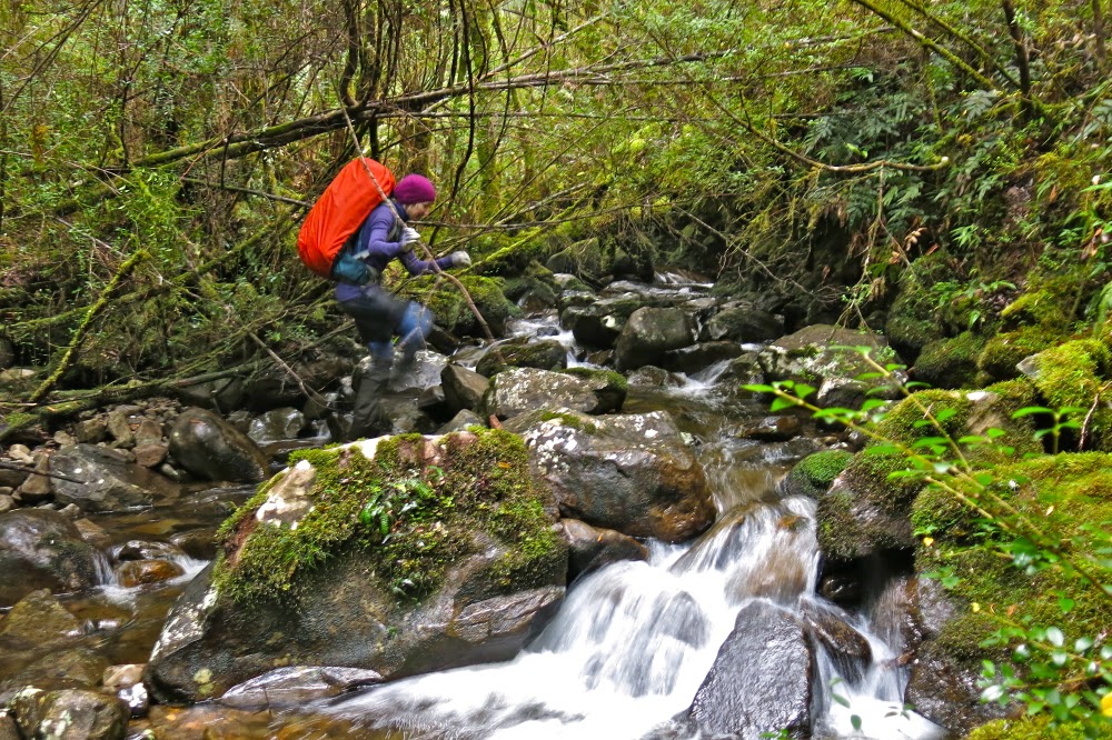
Angela crosses the creek that marks an end to the cutting grass section of the walk to Mt Weld.
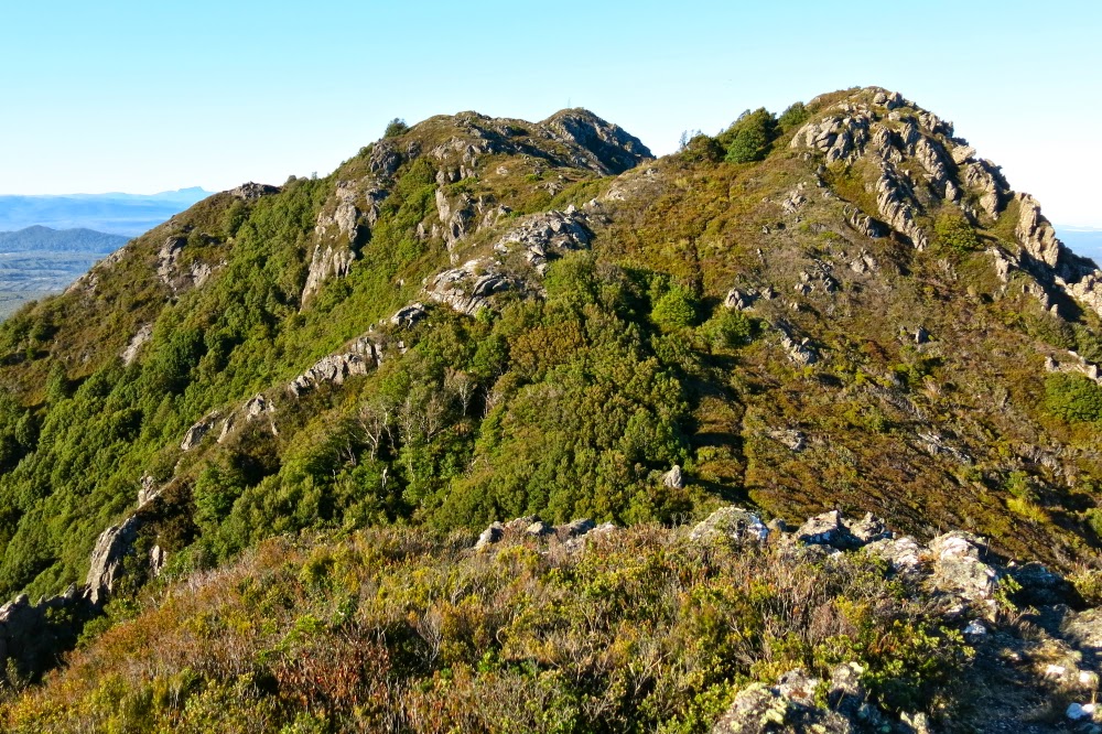
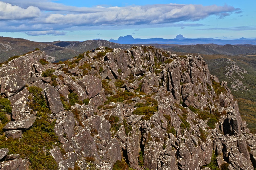
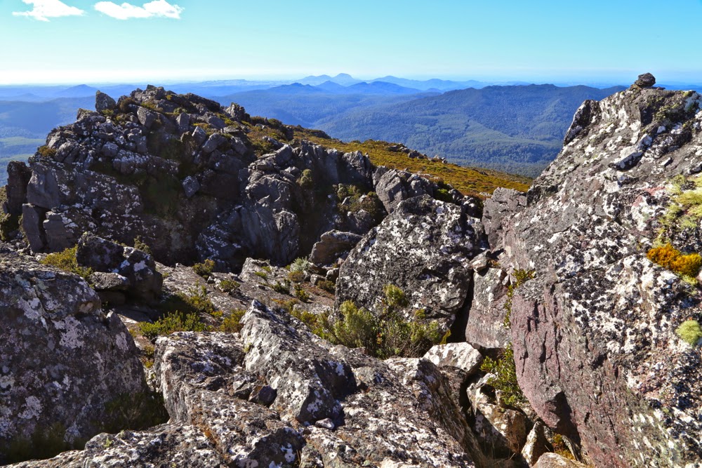
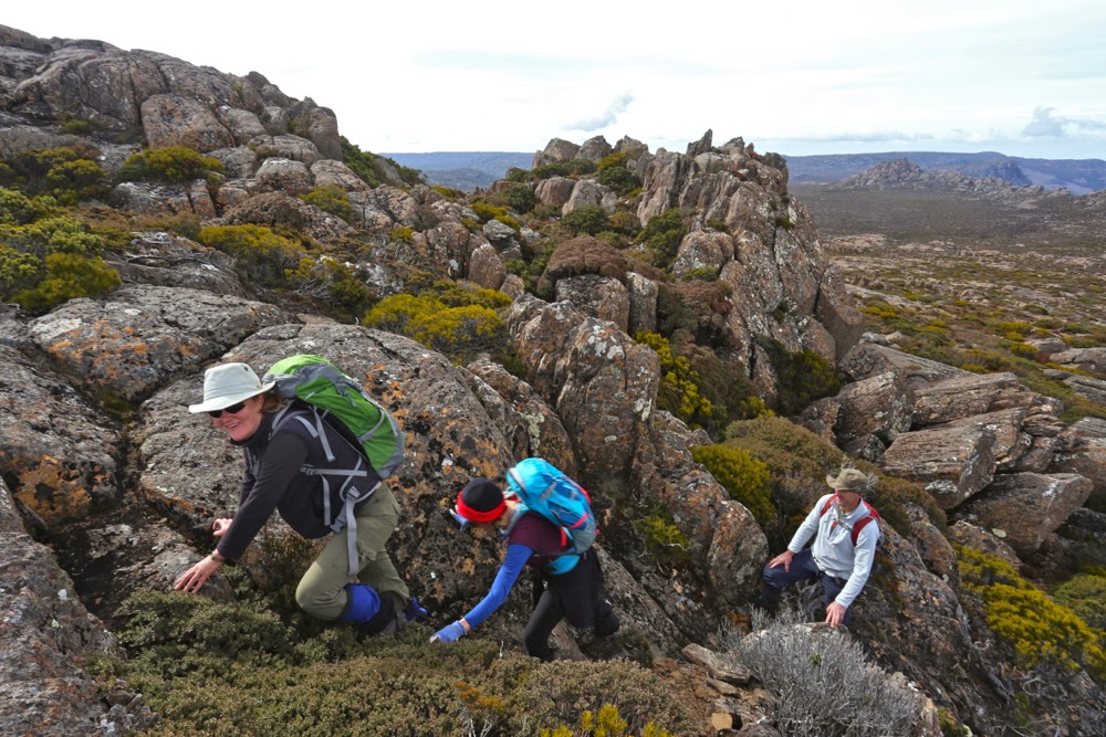
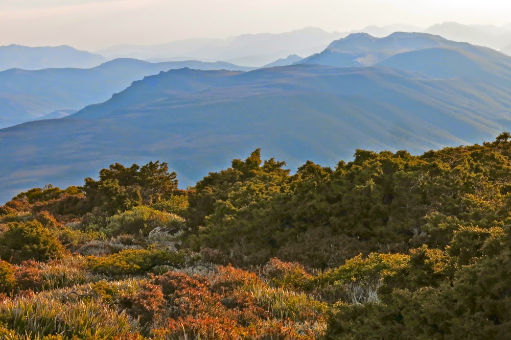
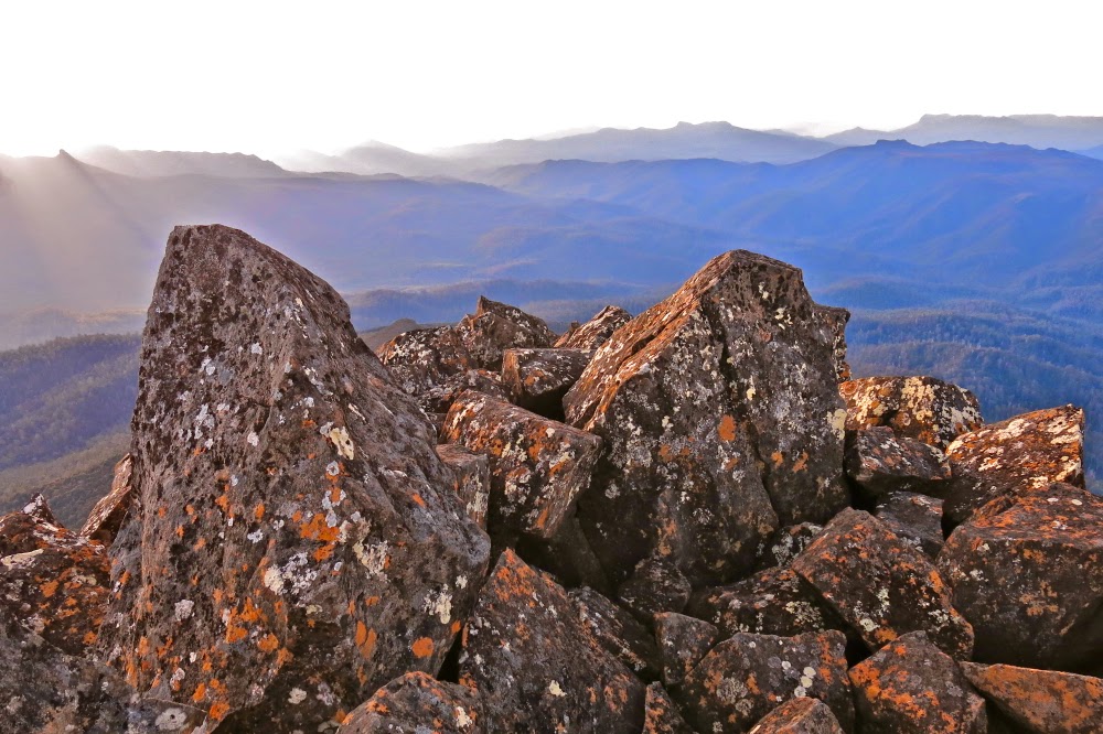
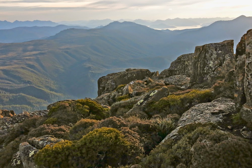
Our chosen mountain for this weekend was Mt Weld. Like a well-trained bicycle pursuit team we purposefully made our way forward.
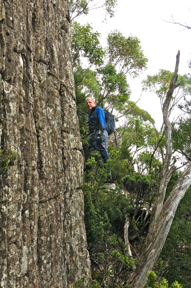
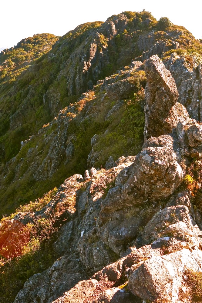
“Hm. It’s getting vague here … not sure that we’re on track,” the leader of the moment would say. Three pairs of eyes scanned; one left, one right, one middle. Within seconds one of us would spot signs of wear or, better, some tape, and that one would take over the lead until the next moment of uncertainty.

Young Cortinarius levendulensis responding to autumn and the moisture in the air

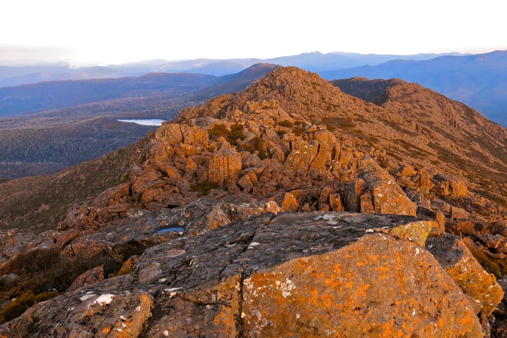
Efficient, resolute – certainly “no nonsense” – are words that can describe our attitude to Weld. Having been fouled out by mist, thick bush and time last weekend on Hobhouse, we were very, very determined about the summit this week. Defeat was not on our agenda. Meanwhile, we were having a ball.

The forest shortly after the creek

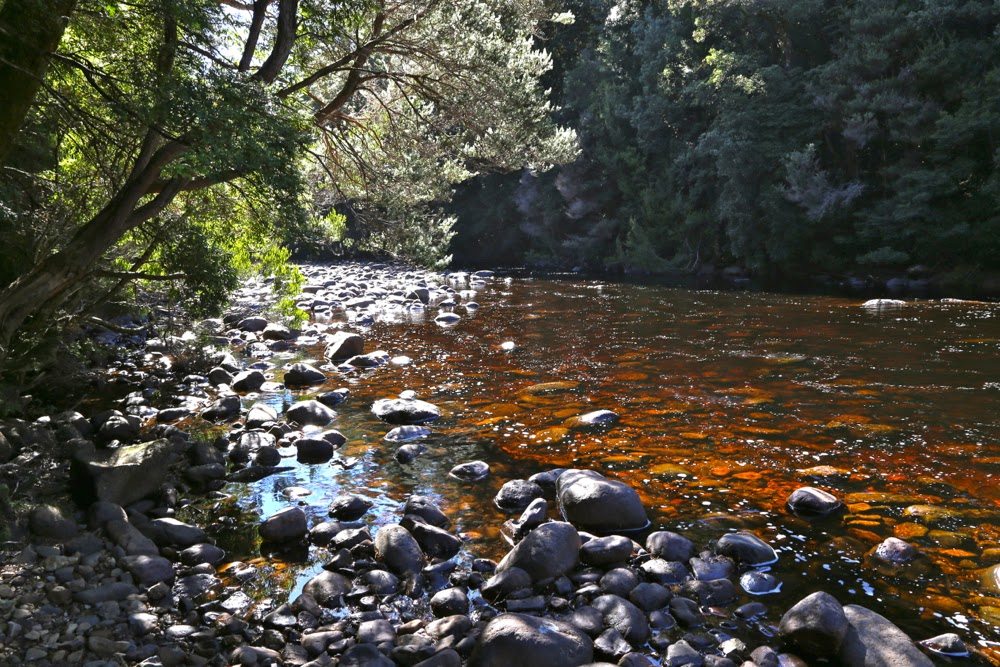
Thanks to reports by others, our expectations of the cutting grass were very bad indeed, and we were accordingly armed in full battle gear – and so we were delighted by how much nicer it was than our grim imaginings. The grass was a lovely colour, the passage was very clear indeed and, well, cutting grass cuts. We treated it with respect and it left us alone. The totem pole (start of the track) to the “big creek” section took us 1 hr 54: slower than the 1 hr 45 of one report, faster than the often said 2 hrs. We were on track for the summit and happy. We grabbed a quick drink at the creek and I surreptitiously threw down a few handfuls of snack (my two super-human friends never seemed to need food). Now it was time to climb.

An ancient cairn, now covered in moss. Green on green is not exactly effective. Pink tapes suited us better.

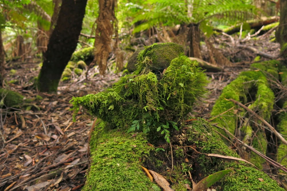
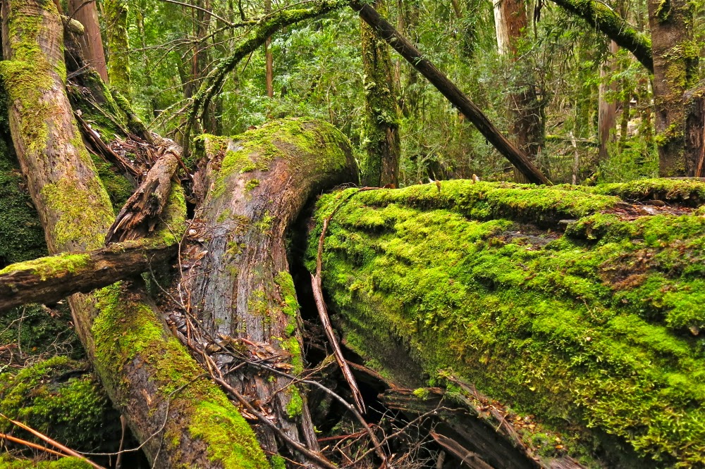
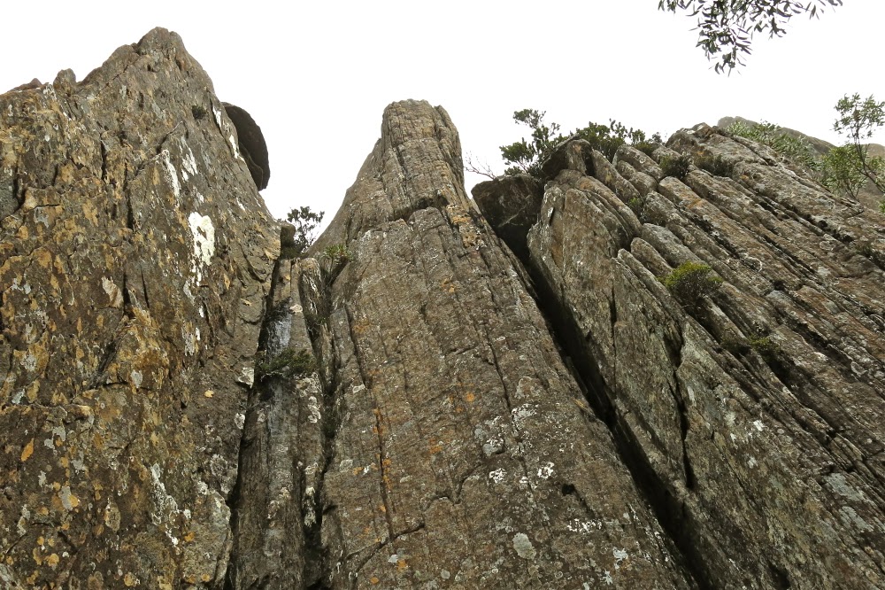
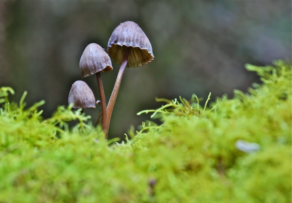
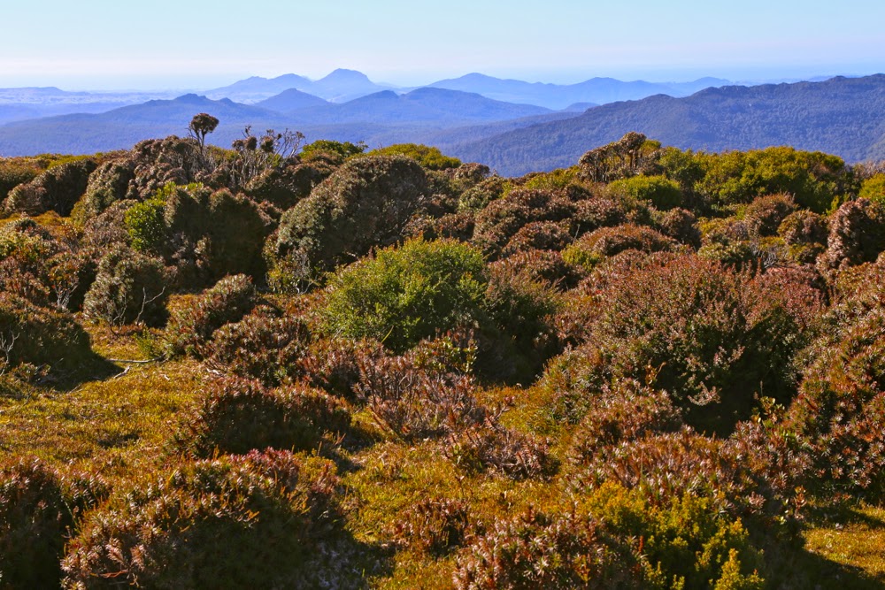
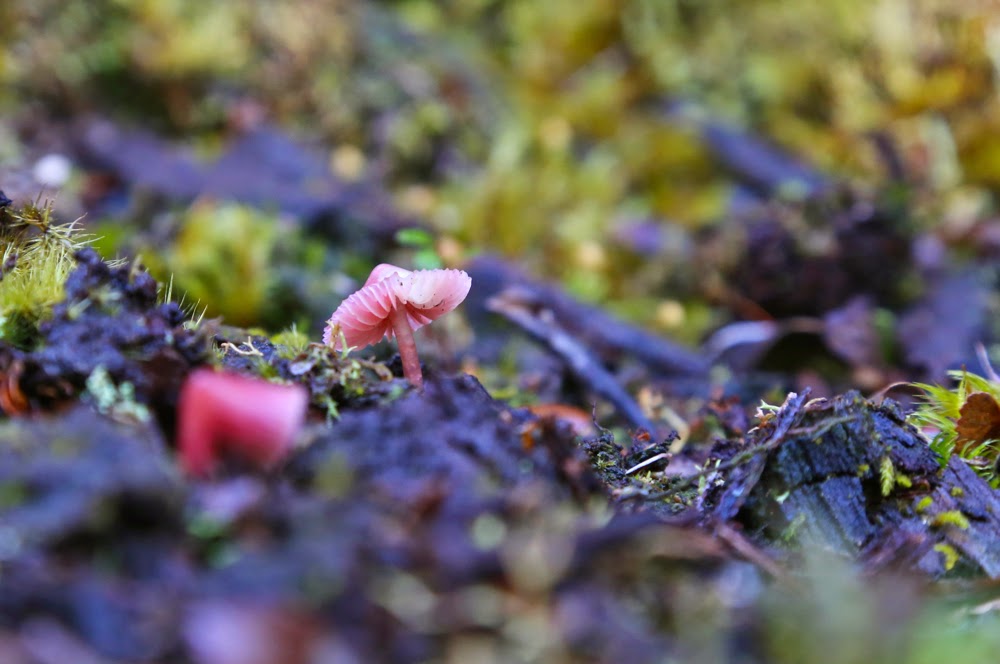
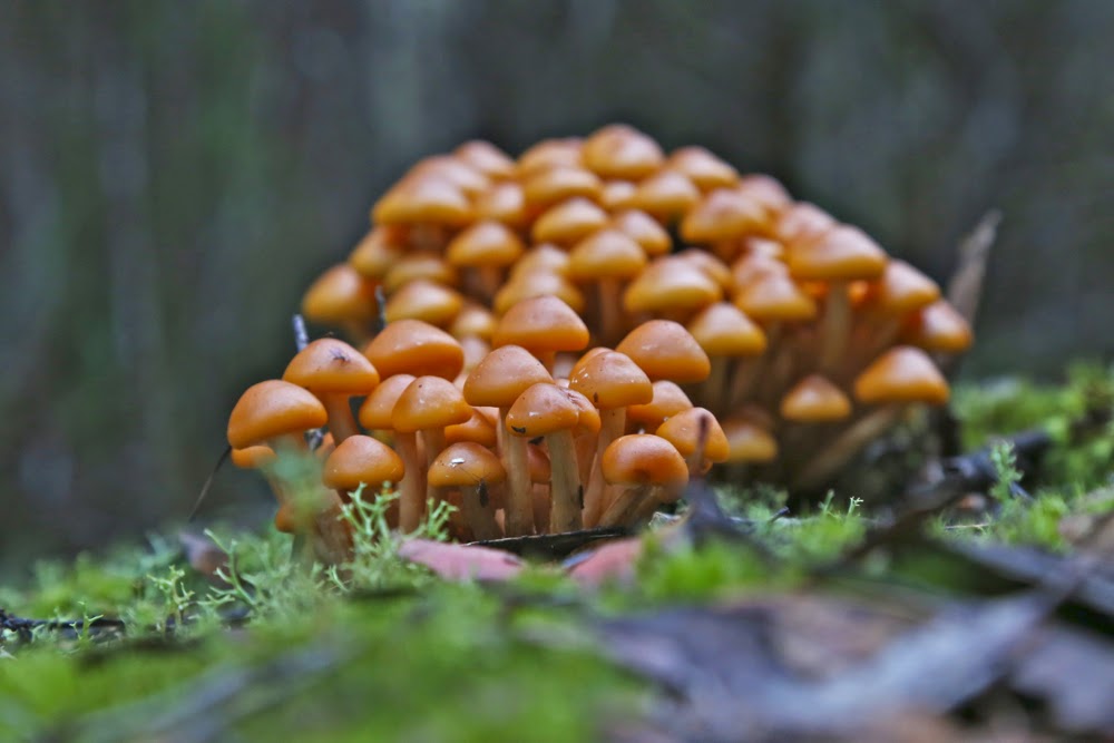
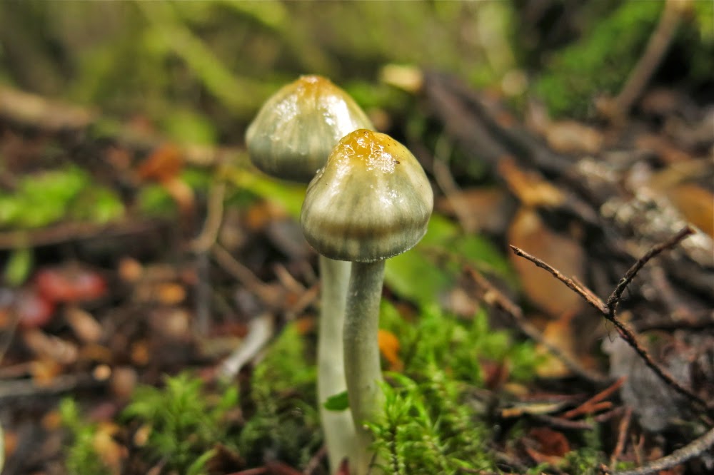
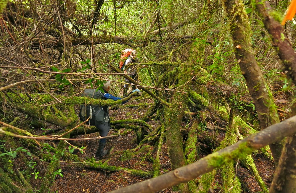
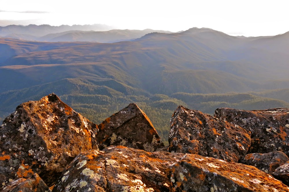
Again, expectations of this section were not sanguine. We expected massive sliding backwards, energy-sapping climbing under and over logs that were too long, wide and low to get around, over or under, a pad characterised by vagueness, and lots of time wastage. What we found was magnificent forest that thrilled by its lush mossiness, its abundance of colourful fungi, its openness, and the easy passage it offered. Only very infrequently did we waste thirty seconds or so searching for the pad. Yes, down lower there was some climbing over and under logs, but not nearly as much as we feared and well, yes, we were climbing a mountain. Mountains go up. Steepness is expected and thus ignored. Besides, we love climbing. My only regret or “complaint” during the 1 hr 36 mins we spent in this rainforest was that I had neglected to bring my macro lens. I was entranced left and right by colourful delicacy but furnished with no means to do it justice. However, this trip was not about photography: it was about the summit. We had no time to waste. Lunch was thrown down in this section.

The view from the saddle between summits A and B of Weld (looking east)
Same, but looking SW.
The next phase of vegetation, from the first noticeable bauera bush to where we emerged in open alpine grass, took us exactly an hour. The bauera and scoparia had been, well, bauera and scoparia – you don’t mess with them – but the pad was clear enough, and at last my fungi-distraction had come to an end. As we emerged onto the welcome and welcoming pineapple grass, we had our third break of the trip: five minutes, while I turned on my gps. We were happy with progress to here.
Summit rock

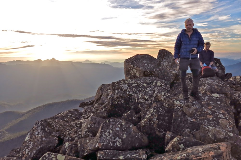
The gps indicated we had about a kilometre to go to the intended tarn of our campsite for the night. The grass was short. We could see the spot up and around the corner of the ridge ahead where the tarn must lie. I expected it would take 20-30 minutes. It took us 46, as we enthusiastically climbed too quickly too soon and got ambushed in scrub. For once, the creek was faster than the ridge. No matter. We were pitching tents by 3pm. The summit was in our sights. People said an hour to the top from here. We couldn’t imagine anything going wrong at this stage, but neither were we willing to relax our guard. We spent about half an hour pitching tents and organising daypacks for the top (the latter, mostly me: I took my little pantry to the top – a bag of treats and goodies that the others, not quite so food dependent, didn’t think necessary for themselves) and off we set, full of excitement and anticipation. This was, at last, the end game.

I found it very exciting to see Lake Pedder and Mt Solitary. I hadn’t realised we’d be so close.
As instructed by Abels Vol 2, we headed north from the tarn (actually, a bit west thereof) to a little shelf where camping would have been nice (better view, but no tarn) and then up through a mixture of scrub and rocks, aiming for the saddle between summits north and south. The real one (north) was reached in under an hour. We were elated: first, because we had reached our goal, but mostly by the amazing view spread out before us. It helped our euphoria that we could also, at last, relax. Our work was done. Now we could play and stare and reap the rewards of our labour, losing the self in the sublime infinitude that surrounded us. The pressure of time was gone. The lighting was perfect. Life was wonderful. We enjoyed our summit and only left when the mood finally took us. We had head torches; we knew our way back to the tents. There was no more need for haste.
Looking south along the very long ridgeline of Weld
Eventually, we dawdled back in the gloaming, delighting in the rising moon and emerging stars, yet with still enough light to see all the way. I was unwilling to finish off this perfect day.
Mark and Angela relaxing on the summit
As near to the setting sun as I could get without lens flare.

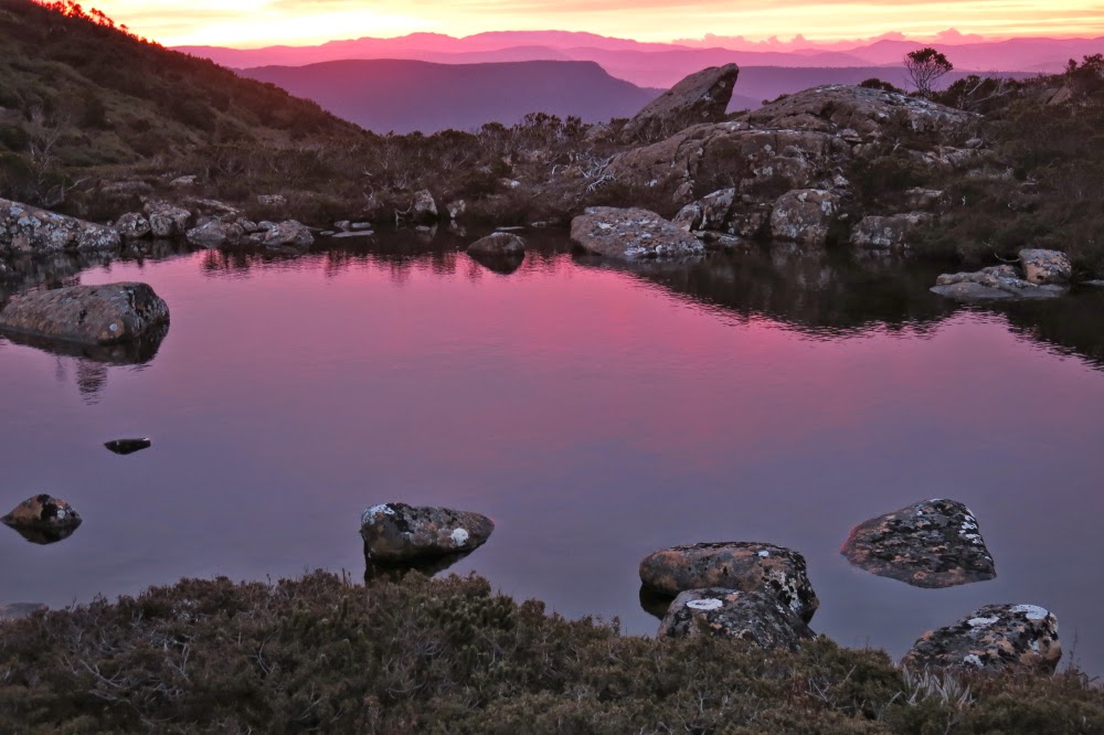
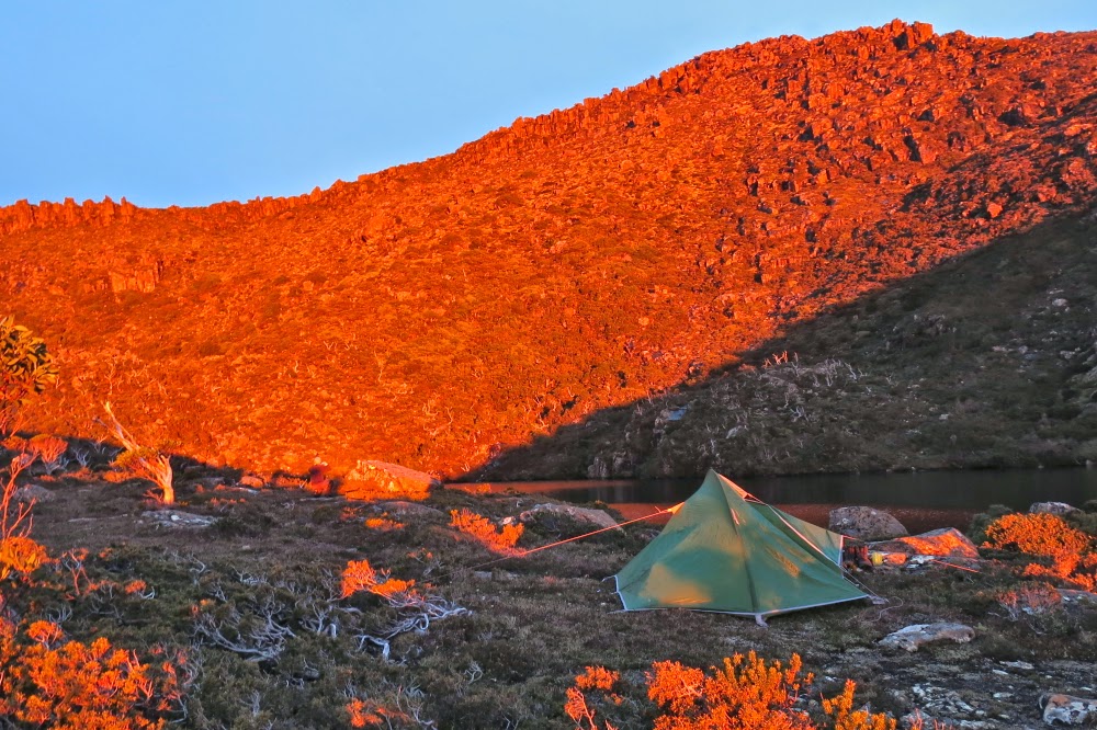
The temperature was not below freezing. We cooked outside together enjoying the stars, the tarn and the moonlight while we ate and chatted, ultimately only being driven inside when we became aware that our core temperatures had dropped to shiver point.

Sunrise
 

On the way out next day, we cut all our splits from the way in, due more to confidence and familiarity than the fact that we were descending. To our delight, we were back at the car by 2 pm, having taken 4 hrs 45 from tent to totem pole. The road walk to the car added another 14 mins. We all loved Weld and agreed we’d return with very little provocation. Rain started falling as we arrived at the car. It pelted down while we drove away. We felt smug and warm inside.

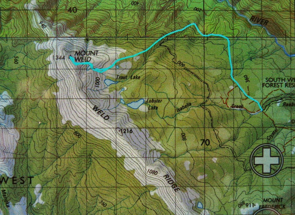
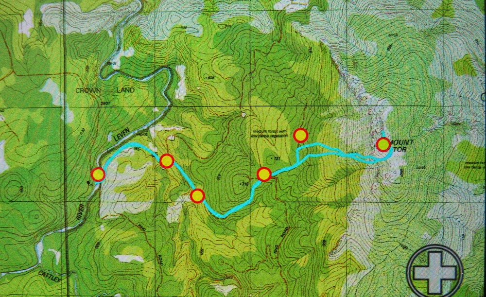
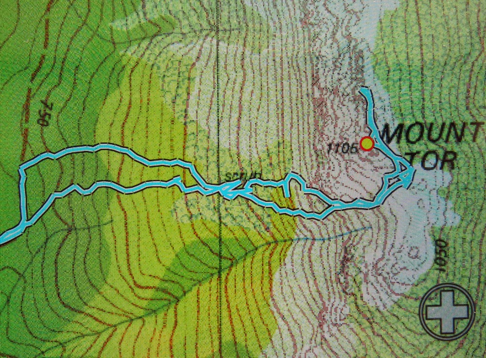
Our route. I’m amazed to see how little difference there is between the higher route to the tent site tarn and the much faster, lower one that stuck more to the actual creek – 10 mins difference!

Hobhouse 2015 Apr

Mt Hobhouse failure
Probably the easiest bit of forest all day. You could actually see ahead to take a photo of something

I pulled off my clothes (luckily I was standing in the bathroom) and half a ton of leaf litter and general forest debris fell to the floor (no wonder I’d been feeling prickles on my back). I couldn’t pull the huge twigs that were entwined in my plait out; they’d have to await the help of shampoo and conditioner, although I wasn’t even sure those items could do the trick. Three leeches dropped to the floor and began squirming around. My husband brought up the salt shaker and we got childish but sweet revenge on these slimy monsters, although they have had the last word. I write this two days later and I am still scratching where they bit.

The way ahead – again, an easy bit, the moment for photography wrested from our progress thanks to a toilet stop.

“So;” you say, “that was a pretty horrid trip.” No. Wrong.
“Oh then, at least you got to the top and got a point or two.” No, wrong.
“You had some nice views along the way?” No. It was cloudy nearly the whole way, and raining for the second half. The views were of my two companions and some rocks on top.
“You had a good workout then,” you’re getting desperate to find a positive at this point. I doubt even that. The bush was so very thick that we didn’t move fast enough to get the heart pumping. We fought (with greenery, not with each other) nearly the whole way.
“OK, so what on earth can you find that was positive in a day where you fought a battle against the bush that you lost, didn’t get a view, got very wet and filthy and bitten by leeches?”

The way ahead. Hm. Don’t think we’ll go on compass here.

I had a grand adventure with two really fun companions who, like me, never gave up until absolutely forced to. We still haven’t given up. All three of us are absolutely determined to return as soon as possible, correct the error we made of being on the bombardier track for too long so that the bush we had to fight was a formidable and well-equipped foe, and get to the tippy top of our peak. We might even get a view next time. You never know your luck. Das Gehen its das Ziel (the going, or journey, is the goal). We had a great journey full of chatter, and the forest was sometimes very beautiful when it wasn’t a blockade of challenge. It is cliché to call it “character building”, but it was. I would stand there, feeling defeated by the fact that I couldn’t see a way forward, and yet somehow I forced a tiny few metres of progress before the next bosky cul-de-sac.

Climbing up

The other aspect that I call positive is that we now know Hobhouse’s “dark side”, its wild parts. I agree with Robert MacFarlane that you don’t truly know a mountain unless you’ve slept on it. We didn’t put our tents up, but we did experience our mountain in a temper; we saw it dressed in rags rather than just in party clothes. I feel much better acquainted with it than if we’d had a fast and trouble-free run, and I have far more respect for it than I would have if I’d just had a dash for cash.

We worked hard with only a single, minuscule drink stop until we had crested the top of the ridge and stood on the final part of the ascent route. My gps said we only had 17 vertical metres remaining to climb. We were at a lump that was “false summit number one”. We knew the real one was number three, but it was a myth in the clag. The only clear thing about the way forward, like everything that day, was that there was no obvious route and that the going would be slow. You don’t need to be Einstein to work out that we had already run out of time. We threw down a very late lunch and turned our backs on our quest. Our mountain will wait for us, and by being sensible, we’ll be there for it sometime soon too. We hit the bombardier track just as dusk was turning into night, and it was dark before we hit the registration book that is 15 mins from the dam. The night shadows and silence added to the sense of our adventure as we completed our journey, satisfied and happy.

St Valentines Peak 2015 Apr

Sun rises behind St Valentines Peak as I drive up from the south, having spent the night at Guildford.
As I expected, the thrills that St Valentines Peak had to offer me were the fun of the climb and the beauty of the rainforest rather than the view from the top – but that’s a personal thing. I’m just not a lover of a vast vista over a huge flattish area. I like looking out at other mountains. That said, the dragon-spine ridge line at the top was great fun.

Looking at the bumps on the ridgeline
I had toyed with the idea of doing the Abels Vol 1 route, but decided against it as the path might be faint after so many years of not being used during Gunns’ reign. I thus opted for the longer Vol 2 route that would definitely be there. I liked it, as I was surprised by how much of the total journey was through wonderful rainforest. I had expected large tracts of uninteresting scrub. The myrtle forest with mossy logs and fungi in abundance kept me company for most of the way. In fact, of the nearly an hour it took to summit the first high bump on the ridge, only six minutes were not in rainforest.
Fun on the ridge

Once up, I lingered and dawdled my way along the ridge, enjoying being on a narrow band like that. The shapes and textures of the rocks entertained me far more than the hazy views out below (hazy despite its being really quite early. I was disappointed).

One of many beautiful fungi (Mycena sp).
Ridge enjoyed, photos taken, it was time to descend and drive home, with a stop for lunch at ETC in Elizabeth Town to refill my tank. I was hungry.
Track data: 9.73 kms. 1002 ms vertical climb. Really surprised to see that there was so much vertical gain (I hadn’t bothered adding contours before I left, and didn’t particularly notice that the number was huge while climbing).

Tor 2015 Apr

Mt Tor, Apr 2015

The Leven River, start of our journey

Mt Tor doesn’t always get good street cred, with some vicious rumours floating around about thick bauera and leptospermum that are not a pleasure. Meanwhile, more generous folk maintain the bushy barricades are not too bad. After our experience yesterday, I’d have to agree with those who say the going was better than expected. The views from the top are certainly well worth any effort put in.

Cradle and Barn Bluff form the summit

My climbing partners for the day, Mark and Jo, had to drive from Hobart, so we didn’t exactly get an early start having also negotiated all those forestry roads, chatted to the guys at the gate and more. At last, however, we were off, crossing the beautiful Leven River from a not insignificant height on logs that had, at least, had the rounded tops flattened, so were not threatening as long as you weren’t drunk.

Looking slightly north of east from summit area

The roads as described in the Abels Vol 1 were all intact, although the final one was quite overgrown, albeit still very distinct. The instructions in the book were to go to the highest point on the final road, but just as we were due to turn left, I spotted the hint of an old lead heading straight up, and we all agreed to take it. I kept an eye on east on my compass, but it was much better just to follow these linked leads through the glorious rainforest and correct later, and that worked well. I knew a creek and the big gully that leads to the top were to my right, but didn’t go searching for them whilst the way was so good where I was. Every now and then a sawn-off tree trunk confirmed that activity had once taken place where we were.

Tiny summit cairn to the right, although the black dot is a tad further south. We visited both.

Once we hit the rocks the rainforest ceded to head-high scrub. Time to go find this gully, as the rocks themselves were much too slippery to climb. Using a mixture of climbing and contouring, heading up (east) and right (south) as the terrain dictated, we eventually hit the broad gully, after which the going was very easy with abundant pads heading up to the ridgeline which I loved with all its bumps and rocky knolls. The view was glorious, and we enjoyed it greatly while we ate our lunch. It had been under two hours’ walking time to the top.

The trip down was not as speedy. We had seen what looked like a track going up, so decided to follow it, but it dumped us in a tangled mass that was above my head. I was grunting with the effort of clearing a way through it and was very happy when Mark offered to take over the lead at this point. I’d loved leading through the rainforest, and didn’t mind the chest-high stuff at all, but I was feeling rather smothered by this wall of twigs that resisted movement and that was so high that I was invisible in its mix. With Mark going ahead of me, I could use the slightly bent branches to make better progress following in his wake. Back in the rainforest, I took over again, leaving Mark to concentrate on helping his wife, for whom this was a debut Abel summit.

Hypholoma fasciculare var. armenicum
Why was Jo given Tor as her first taste and not something easier, you ask?  The answer is simple: Mark is on the final countdown to completing all the Ables and wanted Jo to climb one with him before he was finished. Tor was the easiest of the ones left. Whilst I am telling you it was much easier than expected and a bit of a breeze really, that is from the perspective of someone who’s done battle with some pretty fierce scoparia. I think it’s amazing that Jo managed to climb this mountain.

“Are they all like this?”, she asked.
“Well, some are easier, but …. er …. mostly, yes,” confessed Mark, “and some are much worse.”

Our route from carpark (old picnic area) to summit (both ‘summits’). (Waypoints put in in advance)


Larger version of the bit that involves navigation. The track that begins at the road bend and is more southerly at the start is our route up, which worked well. It becomes the more northerly at about half way. Once we hit the rocks / cliffs, you can see we head SE to the gully along the path of least resistance. The loops at the top are because I had fun dashing about taking photos. The extension beyond the marked summit is in case the tiny cairn we could see to the north was the real summit, so we were covered. Somewhere near that contour cluster on the way down lies treacherous, plotting and masterful bauera. It had the victory over little Louise. The blue line does not tell this tale. 
Track data: 11.65 kms, with 610 ms ascent. As with Valentine, really surprised to see the climb. When you’re busy negotiating greenery you just don’t notice that you’re climbing at the same time.


Stacks Bluff, Wilmot Bluff, Denison Crag 2015 Apr

Stacks Bluff, Wilmot Bluff, Denison Crag, all in Ben Lomond National Park. 2015 Apr

Climbing Wilmot, the second of our mountains
I could tell this was going to be a great day from the moment people emerged from their cars. Everyone seemed very jovial and keen to get going. This was a Hobart Walking Club walk, and I was leading, so, after chatting a bit to the guy who was setting the pace, I dropped back to the tail end, not that there was a big difference between the two, but I was taught a very long time ago by my husband, who imparted to me nearly all the bushcraft I know, to lead from the rear if the path is clear.
The view from Denison Crag back to Stacks, the first of our mountains.

Our first objective was Stacks Bluff, which involves quite a big climb (over 700 ms straight up over huge rocks). About half way through the steepest and trickiest section I offered them a break, but all agreed they wanted to get this steep part finished. I admired them. On we continued until we popped out onto the plateau at the top, the base from which the rest of Stacks would then rise. Although we had to climb to its summit, we had done the hard work by this stage. Up here, coats, gloves and beanies were needed, and off we set again, rising far more gently now, until the summit was reached. The wind was biting, but the summit has what I call a sheep pen on it: a place where you can climb inside and have shelter. We all got in and sat in a holy huddle to enjoy eating our own food and the shared food from others’ gardens that was offered around.

Peeps over the edge were a tad dangerous

There is no path to Wilmot, which makes it a bit more fun, and I enjoyed finding our own way through the rocky challenges, first off Stacks to the saddle below, and then following shelves of rock up to the top of Wilmot. We climbed it very quickly indeed, but still used being at the summit to celebrate in the normal way – by eating a bit more. Sweet stuff this time.

Denison Crag was fun! Just look at the scale of human to rock

People were now very relaxed, the hard work of the day was done, and we had ample time to get back to the car. I killed some of that time by offering a third mountain, and all but one opted to do it with me. This one was the highlight for me – partly because I hadn’t climbed it before, but also because I could tell from afar that its cliffs would offer very dramatic views, and I was right.

Dancing on the top

We rounded the day off beautifully by driving to Zeps for coffee and cakes before splitting into north and southbound cars to return home. Again, food sharing was the order of the day, which I totally approved of, as I got to taste not only my own yummy raspberry tart, but a cake called “Ivory” which came straight out of heaven.

Last view back