Schnells Ridge 24 Aug 2013
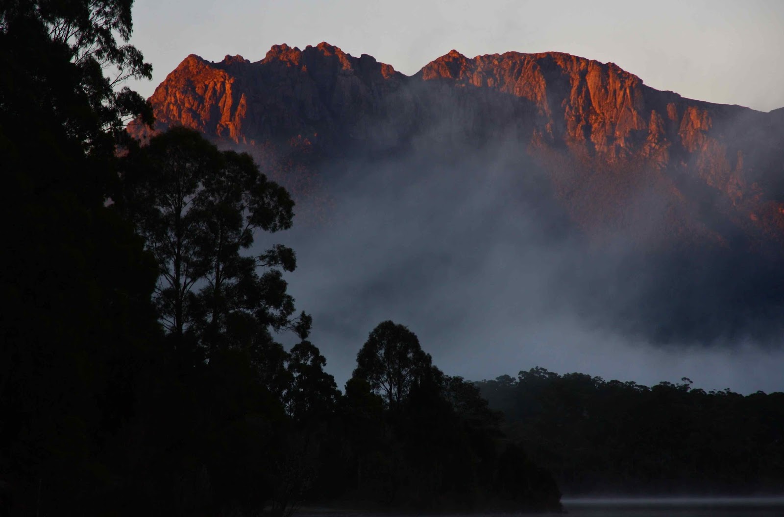
Ever since the moment I first saw images of Schnells Ridge, over a year ago, going there and camping on top have been high on my wish list. The forecast for last weekend was perfect. It had been snowing all week, but the weekend’s prediction was for intermittent sunshine mingled with more snow. Perfect. I imagined my little tent up high, surrounded by white ridges, shining tarns below, and in the distance, the blue waters of Lake Pedder. The only thing wrong was that I would probably have to take up my compact rather than my SLR camera, as the weight of spare winter clothing, tent, 2 mats, sleeping bag, food, fuel, stove and more might break this camel’s back. If the weather was absolutely perfect when we arrived, then I’d carry the good camera around my neck, but there was just no room inside my pack for it if there was even a hint of rain or snow.
Unfortunately, the noble forecasters had changed their tune without consulting me. As we set out, I heard the forecast was now for rain. Both days. Oh well. We’d see when we got there. Out we set from Launceston for the big drive south.
The forecast was unfortunately accurate. The big camera stayed in the car. Off we set into the clouds, drizzle threatening to break into fully-fledged rain at any second. We were about to climb, so I resisted wearing my anorak.
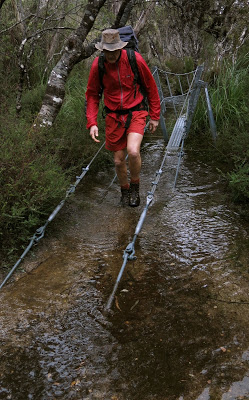
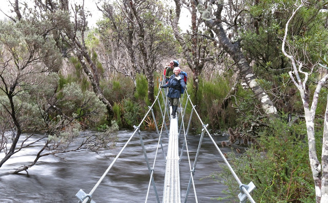
The track was a pathway of water, across the windswept moor, and a group of us went walking, sliding, paddling, and a group of us went walking, up to the Schnells Ridge door. Before we reached that “portal” (a high point on the track where a sub-ridge emanating from Schnell’s main ridge connects with the Judd Lake track), we had to cross the Anne River. Luckily there is now a suspension bridge there. The water gurgled along about five centimetres below the steel hatching. With more rain and snowmelt, I wondered what the level would be like tomorrow, and how strong the water that should be covering the bridge by then would be. I practised for the worst-case scenario at the end of the bridge by climbing the railing so that my feet were on the first handrail, my hands on the second. It worked well. My technique was needed anyway, as the river had burst its banks, and we had quite deep water to wade through on the other side. By climbing up onto the handrails I was able to ward off the evil moment of submersion for a few seconds longer.
We were obviously quite precious about our feet on the way out, as the split for the car to end-of-path was nearly twenty minutes longer than the split for the same section on the way back, when we were arguably tired. Before we left the path, we grabbed a quick bite, as the ground on the path was relatively dry, and it was not raining just then. It was far too early for lunch, but we had driven from Launceston, so were on a special kind of adapted time-zone arrangement. I had eaten breakfast at 5 a.m., so that justified an early meal.
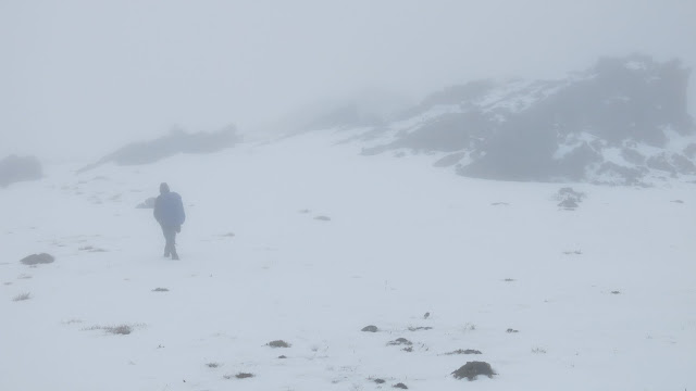
Reports I had read about the ridge leading onto the main ridge always made it sound thick and difficult. I found it very easy going, with hardly any resistance from vegetation (a bit of mud slipping every now and then). As it was now raining properly, I had my anorak on, so tried not to move at a pace that would have me sweating. No problems. I was lucky: while waiting a bit for the others so we could regroup before disappearing altogether into the thick grey gloom, a brief moment of vision flashed into the sky. I quickly grabbed the opportunity to shoot the monochrome scene on my compact. Mt Solitary disappeared as quickly as it had come into view. The others had missed it, as their eyes were turned forwards and upwards. On into the now darker mist and up into the area above the snowline. Loose snow. We sank into it, thigh deep, goose stepping our way forward to the top.
There were now two of us at the front, and we waited for the others behind another rock, sheltering from the now very strong wind. We had reached the top of the ridge. Off we set to touch the high point, and then continue our way along the ridge to eventually circle around and drop down again in about two kilometres’ time.
We could barely see each other through the thick mist; we were also very wet by this stage, and the wind was whacking into us, driving the snow into our faces. One of our party had already been dropping back; now he started stumbling a bit. We hid behind the next rock to discuss what we should do. It was way too early to set up camp (it was only about 2 p.m. at this stage). We didn’t think this struggling member could hack another two kms of goose stepping through soft snow with wind mercilessly attacking him. Setting up camp at the other end had decidedly lost all appeal (whilst waiting, I had run the video through my head of struggling with the tent pole while the wind tried to blow my tent straight down to Judd below; stripping off my wet clothes in that restricted space; dealing with the high levels of moisture at ground level, and more. Not one scenario sniffed of pleasure). Camping at Judd Lake was not an option – pitching in the middle of a mud swamp. We all agreed to retrace our steps and descend.
It was a great training exercise, carrying all the gear for a full winter sleepout up that incline. The whole exercise took five and a half hours’ walking, with nearly seven hours of having our heavy packs on our backs (it was just too wet to put them down apart from the brief lunch break and an even briefer afternoon tea. The other non-walking time was spent in photography and waiting for the others. There was no scenery to admire, and it was too cold to be stationary, resting.)
We drove back to Launie, with enough time left for hot showers before bed.
So, now I have seen Schnells ridge, but have yet to see the view. Next time, hopefully.


 The day for this summit attempt began with a chilling wade through a swollen creek, after which I really needed to be allowed to move at a pace that kept me warm, whereas the others wanted to take the incline at a pace that would have had me shivering to death. The leader agreed to let me do my own thing so I could keep warm. As a result, the first day of this trip, which included, at last, a summitting of Mt Tyndal, was done solo. Luckily I had my gps for the summit, as there was a total white-out, with snow blowing all around me, and only it could confirm that I was standing in the right spot (and only it could guide me to the spot, as I could see nothing but snowflakes).