
Clear Hill 8 Dec 2012
There is a cairned track up Clear Hill from the Clear Hill Road, so there is nothing much to do other than follow it to the top. We had superb weather, and, as it was a club trip, the good fortune to have a terrific leader who let us climb at our own pace rather than demanding uniformity. As a result, three of us had a lovely long time on the top taking in the magnificent surroundings and the feeling of space and peace whilst waiting to be joined. I had gone up the Sentinels before breakfast while the others slept (see separate entry), so it was a terrific day for me.
Turrana Bluff 2012 Nov
Turrana Bluff 24 Nov 2012
A photo story

great rock

view out towards Ossa

happy diners at the top

Walls of Jerusalem 2012
Walls of Jerusalem 10-11 November 2012
This was a grand trip – one of my favourites ever. The weather was absolutely brilliant, which helped, of course. We camped up high, ate with our legs virtually dangling over the western wall, and had a superlative sunset.
The next day we climbed Mt Moriah, Solomon’s Throne and King David’s Peak with crisp air giving clarity to the scenes. The colours of the sky war part of the huge appeal for me, as my photos show.


Photos below are from day 2 (Sunday).


Pillinger 2012 Nov
Mt Pillinger 5 Nov 2012
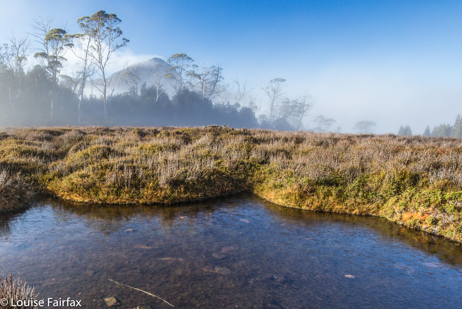
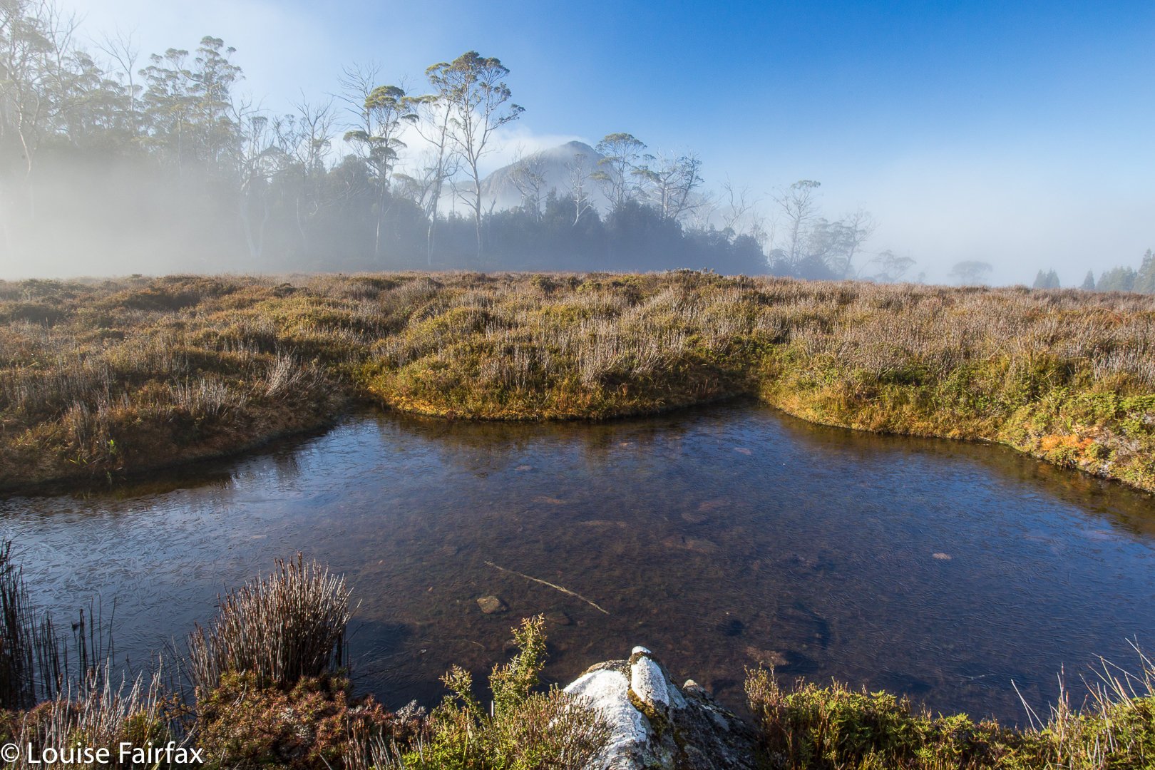 Mt Pillinger peeping shyly from mist. Photo from a later trip.
I am reworking my old posts, and see that this original one on Mt Pillinger told you nothing. So. I must go on memory, which has it that we went in on a nameless track that I duly dubbed the “Mt Pillinger Track”, which came off Maggs Spur 17.2, which is to the south of the Arm River Track (2 tracks earlier than its better known friend. See map below). It does not climb nearly as much as the Arm River one does, and deposits you closer to this goal. That said, I cannot vouch that, after the floods of two winters ago, it is still drivable. If not, use the Arm River Track, and just take a bit longer. If anyone has more recent information on the state of this approach road, I would love to hear.
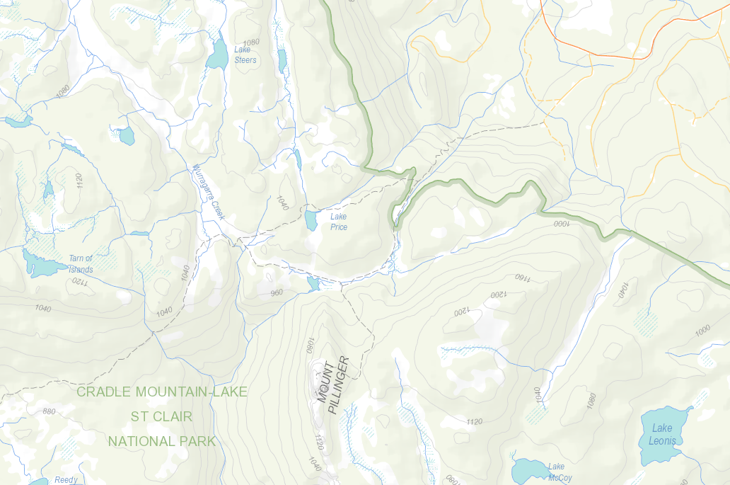
We followed this track (which eventually joins the Arm River one – again, see map below) until we were at the base of Pillinger (to its north). When the big gully of that map was to our left (i.e., due south), we climbed up to that gully, although slightly on its eastern side (if my memory serves me correctly) to the flat area between two highpoints. From there, I definitely remember seeing cairns. They may have been present earlier – or perhaps we followed tapes. I need to reclimb this mountain. There is a track marked on the List map, which I have also included below. It seems to follow what my memory has just described.
 Mt Pillinger as seen from the saddle below the Twin Spires, further south again. Those are Lees Paddocks below left. The Mersey River and beautiful waterfalls are hidden in there.

View from Mt Pillinger, looking towards Pelion West and Mt Achilles. That would be Lake Ayr below.

Descending

The rainforest down lower was magnificent

… with many beautiful cascades

Bassion thrush
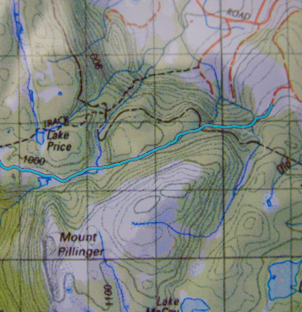
Here is a gpx of a route I did a year later, which shows the track we took in. The Arm River track is the dashed line to the north. You can see that it commences at a higher contour than the Arm River one. I found our track to be quite pleasant.
Below is the List Map version of the area.
Cameron 2012 Oct
Mt Cameron 28 Oct 2012

Here is a section of photos from Mt Cameron, climbed a long time ago in a club group. I need to re-climb it under better conditions, and with a proper camera. This is the best I can offer at this stage.


Mt Cameron lies ahead

wonderful rock maze