Western Bluff 2015 May

Western Bluff: or, the mystery of the runaway summit. May 2015

The beauty of the dawn that held us up

Never has a summit seemed quite so elusive, quite so just-within-reach and yet forever-over-the-next-rise as this one. Mind you, when I saw that we had taken an hour to crest the first rise, and that the car was still in sight, I knew we were in for trouble. Hopefully the next part, now that we were on the tops, would be faster, would be lovely alpine walking. Yes? It was described in the Bushwalk Australia forum as “very easy and very enjoyable” by one, “delightfully open and easy” by another. I was expecting a joyous ramble, like at the back of Coalmine Crag. Would we need to take lunch? If we set out at 8 we’d be at the summit by about 10, and back at the car by 12. Oh well, salad rolls from ETC are delicious; let’s take one anyway and have a silly, super-early lunch on the summit, followed by a second lunch at Mole Creek, and a photographic shoot at a few waterfalls on the way home – maybe the one behind Marakoopa Caves and Liffey Falls. A great day was planned.

Beautiful conditions on top

Well, the first problem was the beauty of the frost as we drove to our destination. It was magical and required a great deal of stopping, which meant that the 8am start became a 9.30 one. No problem, this was just a cute easy-catch pleasure jaunt. It was such a pity we couldn’t use the route I wanted – the nice steep one from Urks track, but the forum said that if you love your car at all you will not use this track and will go by the route we were now undertaking. It neglected to say that the way up the ridge to the first nobble was fortified by an excellently equipped army of thick scrub and rocks that were not so very easy for a man with Parkinson’s disease to climb. No matter. I found a Parkinson’s-friendly route and here we were at the top, ready to race our way to the summit. Ha.

There’s our goal; just there. Here’s where we stopped for an 11.30 lunch after 2 hours’ moving.


Looking in the other direction from our lunch spot. That’s Ossa and Pelion East you can see sticking up there. Pelion West was also visible (as were Cradle and Barn Bluff further north).

The tops were not pleasant alpine walking, but contained lots of thigh-high scoparia that we had to weave around. This would have been fine had we been expecting it, but I had not gained the impression that this was the case. There was no water up there – well, there was plenty, but it was all in the form of pure (and very attractive) ice. No problem. We were carrying some, and could break some ice if necessary later. (It was. The tarns never melted). On we went, over rock screes covered in sparkling rime and through endless patches of scoparia (and other bushes). I was hungry. I looked at my watch. 11.30.

Patchy snow on top as well as wonderful ice

Surely that was an excuse for lunch number one, even though the map said we’d gone a distressingly short distance. I couldn’t imagine getting my husband to the summit at this rate. Maybe he’d be happy to sit there while I summited? We ate. No, he said, he wanted to summit too. I looked across to where our goal lay. Absurdly I said it could take at least a half hour in each direction yet. He said he was up for that. It took 50 in each from there. Every time I sighed with relief that we were closing in, that wretched trig ran away again, tormenting us cruelly. It was only 1pm, but I was already panicking about the time. I just couldn’t install in my husband the need to hasten, that we would turn into frozen pumpkins if we dallied at all; that this mountain with its frozen pools and ice rime would be treacherous by 4.45 and I wanted him in the car by then.

Looking east from the summit – not altogether inspiring, but nice enough

I hoped in vain that our return journey would be quicker, that we would chose a slightly faster route or that confidence would produce a better return time, but alas, our return splits were matching our outgoing ones exactly, but my husband needed more breaks added in to the walking time. I was now totally nauseous with anxiety as the watch kept ticking but very little progress was made. The sun got lower … and lower, and more and more golden in its hue – very beautiful under normal conditions, but not when you have a man with Parkinson’s on a frozen mountain.  I knew by now that darkness was going to arrive before our return to the car. The question was merely: to what extent? How dangerous would this mountain with all its rocks be once the sun got any lower. Already the rocks were whitening up, the bushes gaining a very pretty dusting of icing sugar. I decided that even though speed was essential, I needed to rest B and feed him. It would not be safe to stop once the temperature was any more below zero than it already was. We ate and continued.

Bruce sets out on the epic journey back to the car

Just as the summit had run away from us, teasing mercilessly, so did the road that announced the end of my woes. The gps kept saying we were nearly there. We kept descending but kept bashing against more thickets of hard work. The forest got very, very dark. B stumbled and fell a bit but managed not to injure himself. He’s too big for me to carry. Helicopters don’t operate in the dark. My nausea increased. I was far more concerned than he was, but at least he kept himself injury free as he blurted through the bush and over slippery rocks in pursuit of his wife. I kept about 10 metres ahead so that if my route was not Parkinson’s-friendly, I could backtrack without wasting his energy (which happened quite a few times).

On of the last photos I took – from the cliff edge looking west towards the mountains of the Overland Trail. Our car goal is out of sight to the left of the picture, but the nobble that preceded it was visible to us; the goal of our completed quest was also visible to us to our right, but out of this picture. At this stage we were still on target to make it in the light … just.

Never have I been so relieved to see a road in my life. Yes, we would live through this adventure. He was out with safety. The beads of ice on the road glistened in the moonlight. “Oh glorious sight, big red car”, says naturelover. We didn’t stop at any waterfalls on the way home.

Our route. We approached using the more easterly one, and returned via a view from the cliffs

Blue Tier, Handley Peak, Mt Littlechild 2015 May

Blue Tier, otherwise known in some circles as Handley Peak, and in others, as Mt Littlechild (if you listen to the locals or read the old maps) is obviously a mountain with an identity crisis. Well, I think it’s fine: it’s the humans naming it who seem to have the problems. The peak I climbed is called Mt Littlechild on the map (see below), but there is another black dot on the map without a name, and peak baggers insist that it is called Mt Littlechild.  If you go to natureloverswalks.com/mt-littlechild/ you will find the extension of this walk that encompasses that black dot.

The first part of the “false route” – delightful fern forest.
It’s ridiculous, how excited I was as we packed for Mt Littlechild. You’d think I hadn’t been out climbing a mountain for weeks – and yet the pleasant memories of Mt Weld were still resonating happily around my core. There were two reasons for this possibly absurd excitement: (i) my normal love of being in the forest and up a mountain, and (ii) this was to be my husband’s first walk since he got injured in December. Some eras are good to end, and this was one of them.

But then we landed in this. Time to retreat.

Mt Littlechild also had its own excitement. For a long time I had been wanting to see the Blue Tier, the preservation of which was fought for so thoroughly by those who know and love it. I have also seen many images of the fungi that can be found there, and hoped to be a happy hunter myself. In addition, I was curious to see the much-feted Welbdborough Pub, which was to be our post-walk reward.

The “good route” – wonderful forest, complete with goblins.

Being a diligent little researcher, I had done my homework and written to a member of the Save the Blue Tier society, asking about the best way up this mountain, as there is no track on the map. Perhaps a new one had been created, and if so, I should use it. She kindly wrote back giving me instructions and confirming that there is still no track, but told me to start at the junction of the A3 and Little Plain roads. However, when we got there, what we saw was a farmer’s paddock, and the map showed that this was in no way the shortest distance between road and summit. I decided to try and straight line it from further on; no need to prolong the fight if the forest was thick.

Hygrocybe mavis, White splitting waxcap.
The sides were so steep that our first opportunity for going “straight up” came further along the road than we wanted but it seemed, with respect to contours, a reasonable route. So it was. We climbed quickly and easily to the 600ms asl mark, after which we landed in a tangled and impenetrable wall of muck. My map said “dense low scrub”. Maps don’t often oblige with this information. I hadn’t noticed it before setting out. We reasoned that there must be a nicer way up this mountain, and descended, deciding to actually obey the instructions we had so kindly been furnished with, park where our informant had suggested, and stop the fancy shortcuts.  Good move.

I adore tiny mycena interrupta

We entered the paddock that had at first looked somehow foreboding and walked up the indentations made by a heavy farm vehicle. Up, up we easily climbed, following the tyre marks past the first broad flat section of the spur and up the next steeper spur towards a rocky outcrop which had a height mark (787 ms) on the map. The whole thing felt more like a Lake District ramble than a Tassie bushwalk. This is a very cheap way of travelling to England. We loved it. The tyre marks had petered out by this stage but the contours were perfectly clear. On we went to the saddle that now separated us from our Littlechild goal, and then, for the final climb, we entered a patch of myrtle forest. After the experience of earlier in the morning, I was wondering how much of a fight this would be. It was a magic fairyland with no fight at all. Just pure moss and beauty (and fungi).


Panellus longinquus
The summit itself was clear enough to give us a view, and I was excited to be able to see the sea, as well as many other mountain friends around. The exercise was amazingly short. We took 26 minutes to reach the myrtle forest, and 12 more to reach the summit. The splits were the same on the way down. There was nothing taxing or arduous in this walk (we only climbed 276 ms) and I can thus thoroughly recommend our final route to families. As we walked 5.4 kms, I guess the youngest child should be four or five, as the advised daily kilometres are supposed to be no more than the child’s age, and I think that’s a good rule of thumb for tiny growing bones and muscles.

 For the second week in a row, the forecasted rain began just as we reached the car. We watched it falling, once more snug and warm, while we ate our lunch at the famous Weldborough pub.  It is my personal belief that if we don’t want people destroying forests of beauty in order to make a living, we need to support them in their endeavours to earn money in a less destructive manner. We always try to eat at pubs and cafes in places like this, to support local alternative initiatives. This one did not disappoint. Unfortunately the beers and ciders for which they are famous were not tried, as they do not suit the fact that I had to drive home, but don’t worry: there was still plenty left on the menu.

Why the odd blotches? Because there are numbers on the map that correspond to trig numbers and not to the heights. They make matters confusing.
Please also note that although the map says this is Mt Littlechild, it apparently is not, and if you search Littlechild in my alphabetical index, you’ll see the story of the real one and not this imposter. The real one, the highest point on the Blue Tier, lies just off this map, past the saddle to the E-NE of this summit. There are tapes to lead you into that summit, after which you need a compass. It is not hard.

Marian and Trestle Mountain 2015 Apr

Mt Marian and Trestle Mountain  April 2015.

I rather liked this view of Collins Bonnet that presented itself to me as I passed by – an old friend.

People climb mountains for many reasons. Some climbers, when asked why they did it, merely respond: “Because it was there”, which is not altogether helpful. Perhaps if I may attempt to articulate the unarticulated, I think they probably mean that the very presence of the mountain issues a challenge that they just couldn’t resist. Possibly at the other extreme are people who maintain that they only ever go up a mountain to have “a lovely day out” and that they don’t care which mountain it is, or whether or not they reach the summit. My first born daughter used to refuse to stop climbing anything until she had reached the top – and that was when she was still in nappies. I decided watching her that a drive to the summit was a genetic thing, as I had never taught her to behave like that.

Leptecophylla juniperina adds colour, especially when doing combat with the white snowberries of Gaultheria hispida 
I like to think I have a huge mixture of reasons for climbing, and that different ones may dominate on different days. Sure, on some days, like yesterday, I can be happy just to be there on the mountain, enjoying things from on high. On other days, I slip back into athlete mode, and am very business-like about getting to the top. Today was such a day. I had decided that I wanted to summit Mt Marian and Trestle Mountain (both Abels), and that I wanted it to be more of a workout than a pleasure jaunt (except that, for me, workouts are highly pleasurable). That’s probably because (i) I don’t like fire trails and (ii) I am feeling guilty that the dogs haven’t had enough of my company of late, so was in a rush to get home. This was to be a no fuss trip, and as fast as possible.

I set out after breakfast, and was ready to roll at Myrtle Forest Picnic area by 10. (For those from the north and foreign visitors, if you head for Collinsvale, there is very clear signposting after that.)

Exciting vistas opened up as I neared the summit of Mt Marian

The first part of the track was glorious, beside a ferny creek with, hardly surprisingly, myrtles here and there. However, my eyes were decidedly groundwards, as there were many colourful fungi popping their cute umbrella heads out from wood and moss, and I was enjoying them. All too soon the track split, and my route, the right hand one, turned away from the creek and the forest became drier until, 35 minutes after leaving the car, I bumped rather unexpectedly into the Collins Cap track start. However, this was like the sirens tempting Odysseus. My goal was Mt Marian, not this one, and I would not be turned off my course. On I marched, happy with the unexpectedly short time for this section. Business-mode was working well.

Summit cairn (Mt Marian)

Mist started gathering as I approached the under girth of Trestle Mountain. Should I do this one first whilst there was still maybe the possibility of a view? No. If I do, I might not do the further one. Hardest, furthest first was my self-made rule. All my eggs were now in the Marian basket. If the weather closed right in and it poured with rain maybe I would get no mountains for my drive. “No”, I told myself, “You’re summiting two mountains today, whatever the weather”, and on I went. No wussing allowed for people in business-mode.

I loved the rocks on Mt Marian
In not much over an hour I was at the turn-off to Mt Marian, very pleased. I was going to get a mountain today after all. A shade under half an hour more saw me on the top. As I had met a Belgian in the carpark who told me my intentions could take 7 hours and asked me if I had a torch, I was pleased. This was my furthest point. I would not need a head torch. Given the scant time this had taken, I may not even need lunch – which was good, as it was absolutely freezing, and I had no intention of sitting still for a long while yet. I had only done half the job I had set out to do, and didn’t even stop for morning tea.
Summit rock of trestle Mountain – defended by sneaky patches of treacherous black moss. I was very careful up there.

Back down I went , through the glorious patches of pineapple grass, and past countless bushes of  berries (Leptecophylla juniperina – red – and snowberries: Gaultheria hispida – white). We could have had a modern-day Aussie-variety House of Lancaster vs York up there. The road was festooned in red and white. On I strode, continuing on 100 ms past where I had originally joined this East-West highway to the narrow path that said it led to Trestle Mountain. Up I climbed, still making excellent time. By now I was a bit peckish, but it wasn’t quite lunchtime, and besides, the wind was nasty up there, and my hands were aching with the cold, despite my relatively fast movement. I retreated back to the fire trail and began my return trip to the car, my work intentions satisfied.

Looking along the spine of Trestle Mountain from the summit

Because I had now completed my mission, I was more relaxed, so when I spotted a nice creek on the descent, I plopped down beside it, and got out my food, enjoying the little grove of richea dracophylla that surrounded me. It’s good that the nearby minutiae pleased, as there had been no grand vistas on offer today (even minor vistas were absent).

A fungus posing as a cancan dancer revealing its petticoats.
I was tempted enough by Collins Cap on the way back to even begin on that trail, but decided that it could wait. It was only just after 2pm at this stage. If I ignored it, I would be home in the light, in time to play a bit with the dogs in the garden, even if I indulged in cake and coffee at Zeps in Campbelltown for afternoon tea on the way through, which I fully intended doing.

Perhaps that kind of “efficiency” in mountain climbing is some people’s idea of hell, but I enjoyed myself greatly. I like both kinds of climbing. The former athlete in me still delights in a good workout; it’s a hard habit to break.

Note, there is no track on the map underneath all those blue lines, but there is a path or road (dirt) underneath all. Neither the gps nor the paper map has all of the roads marked. I felt pretty cheated having bought the paper map of Wellington Ranges especially for the purpose of not getting lost, only to find it hadn’t done me the courtesy of putting the useful information on the map, yet feeling quite at home with charging me money for it. If you want to go there, I suggest you print off a larger version of this and have it in your pocket.
Total climb, 1000 ms. horizontal distance 18.4 kms. Km equivalents: 28.4 kms.
Another useful source of information in helping me work out what was feasible given my timeframe, and providing a map similar to this one with his route on it was at http://hikinginsetasmania.blogspot.com.au/

South West Cape Trail 2015 Mt Karamu, New Harbour Range, Smoke Signal Hill

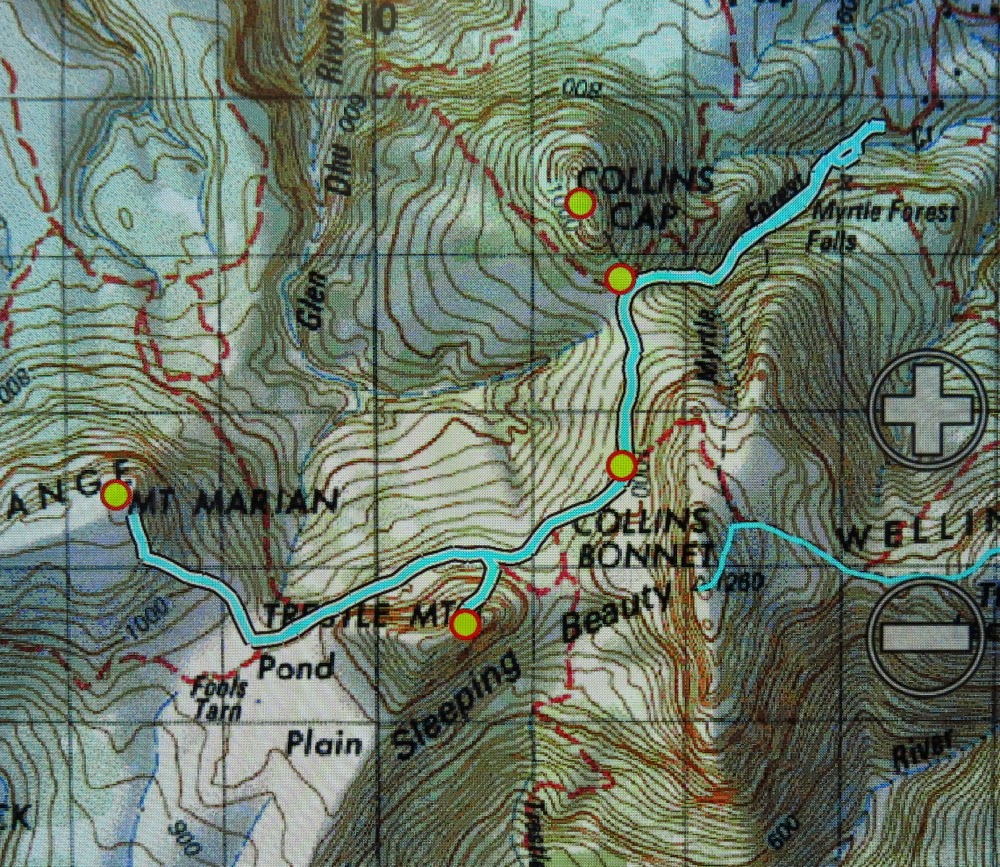
South West Cape Track.

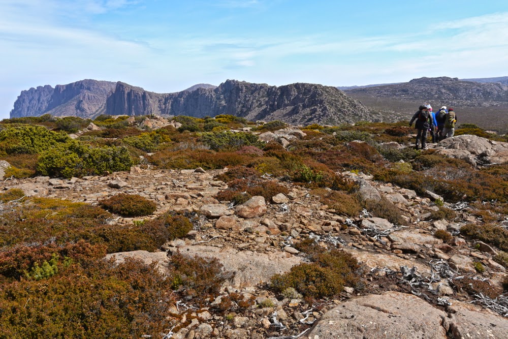
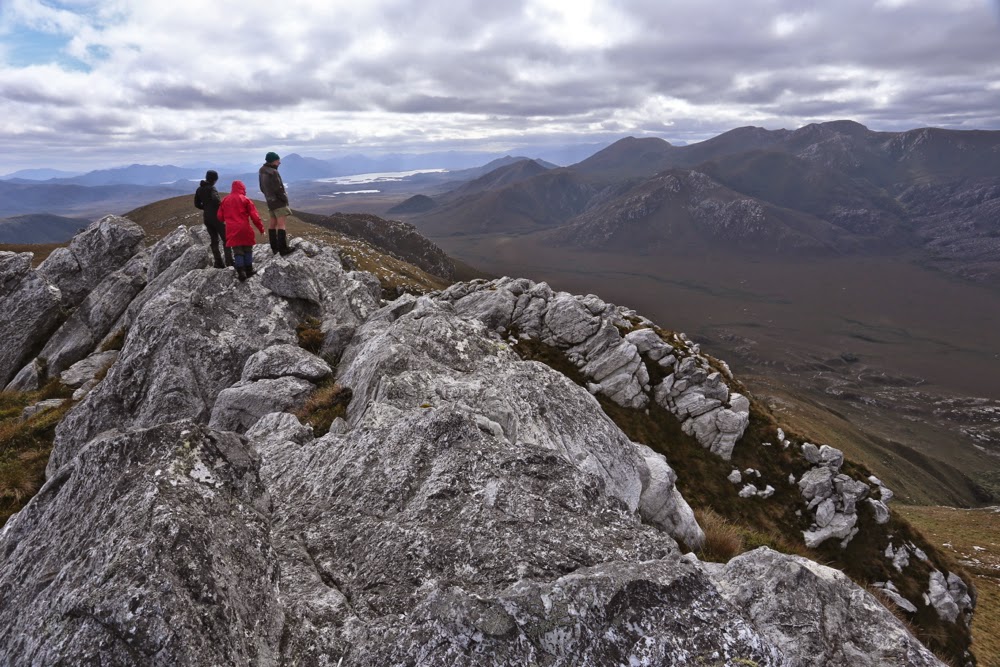
South West Cape Track: hard or easy? It depends on your expectations as created by your experience and the context within which the word is used. Pictured are the others walking along the path that most found easy. I added challenge by climbing little thises and thats along the way.  Warning: the blog this week is not easy :-).

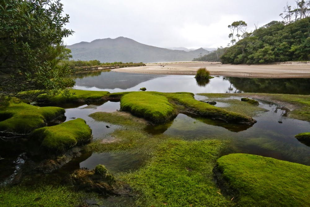
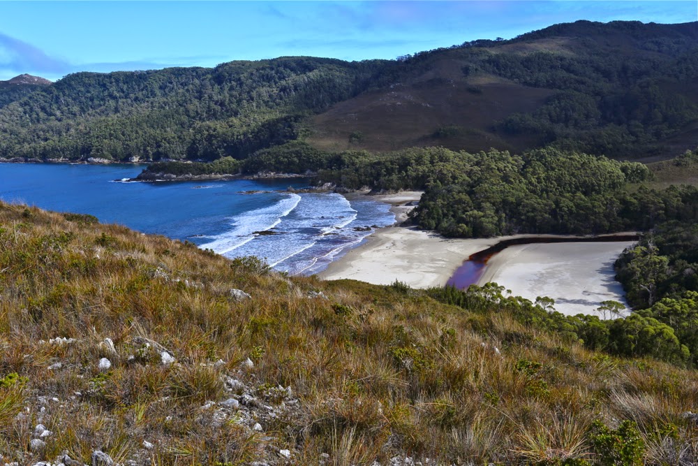
The entrance to New Harbour
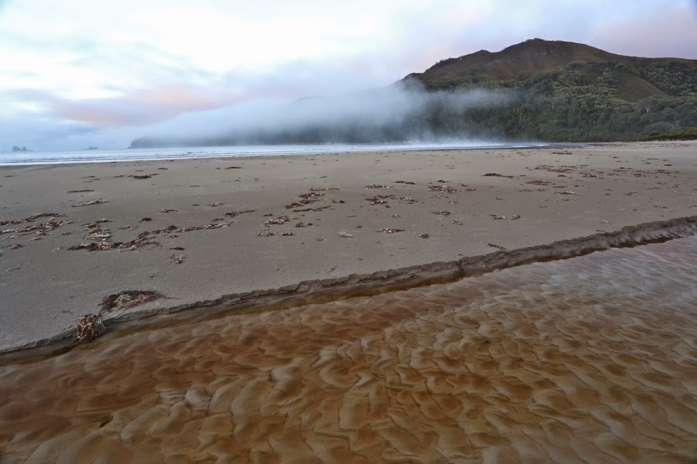
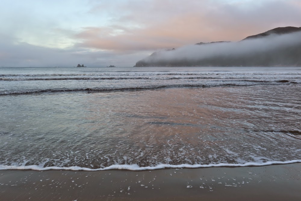
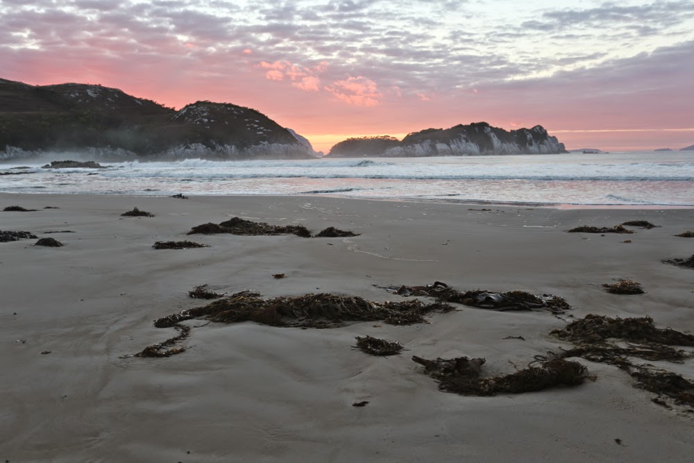
Dawn on Day 2, New Harbour. 
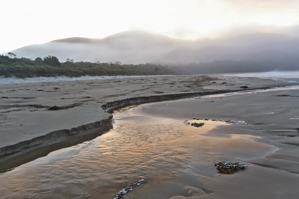
Same, looking in the other direction (east)
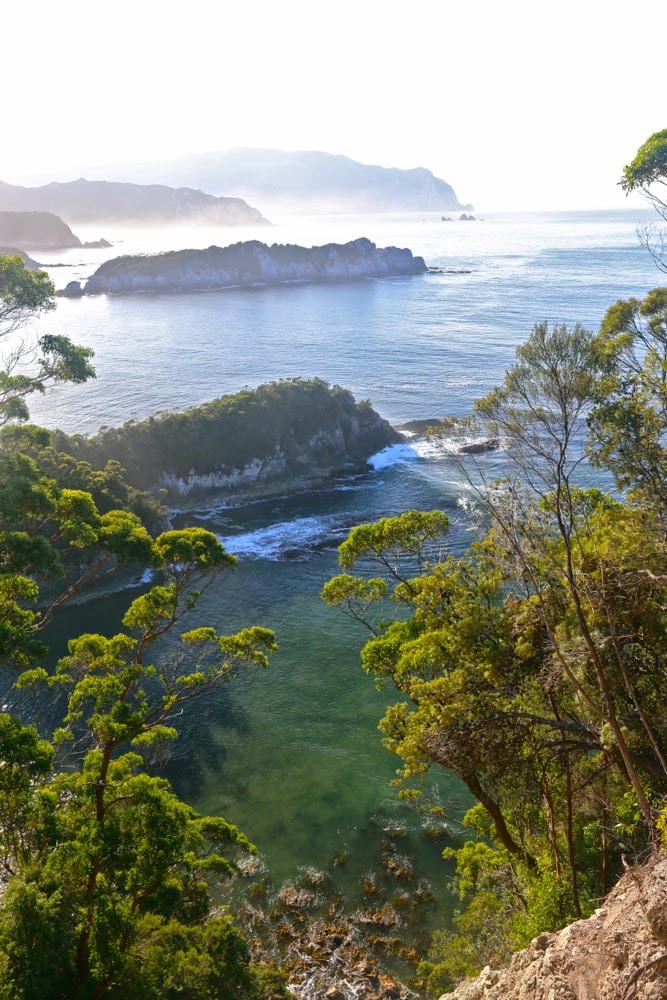
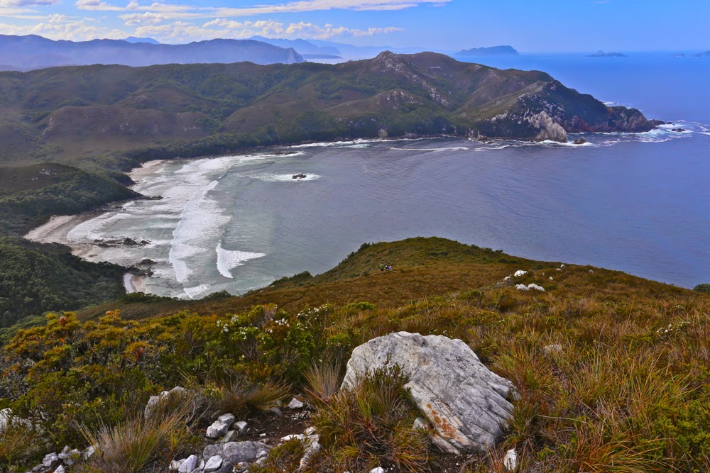
Looking mostly south. This is also the view out my tent on the final evening / morning

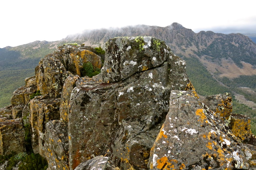
I stood on the summit of New Harbour Range, mesmerised by the view, my spirit reaching out towards Antarctica to the south, South America to the West, New Zealand to the east. Infinite space; infinite glory; infinite peace. My being was no longer coterminous with my epidermal layer but transcended to a space beyond, which could not be numbered. One of the three companions who had climbed with me turned to me and said, most aptly: “You know, I’m  not a religious person, Louise, but this here is the nearest I get to a religious experience.”

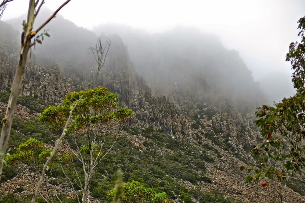
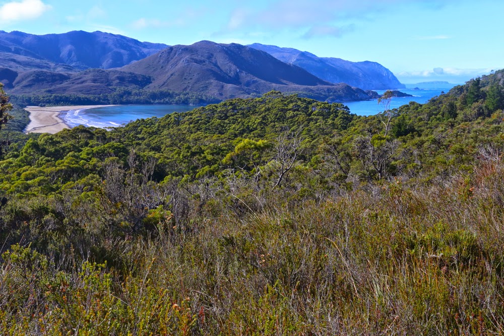
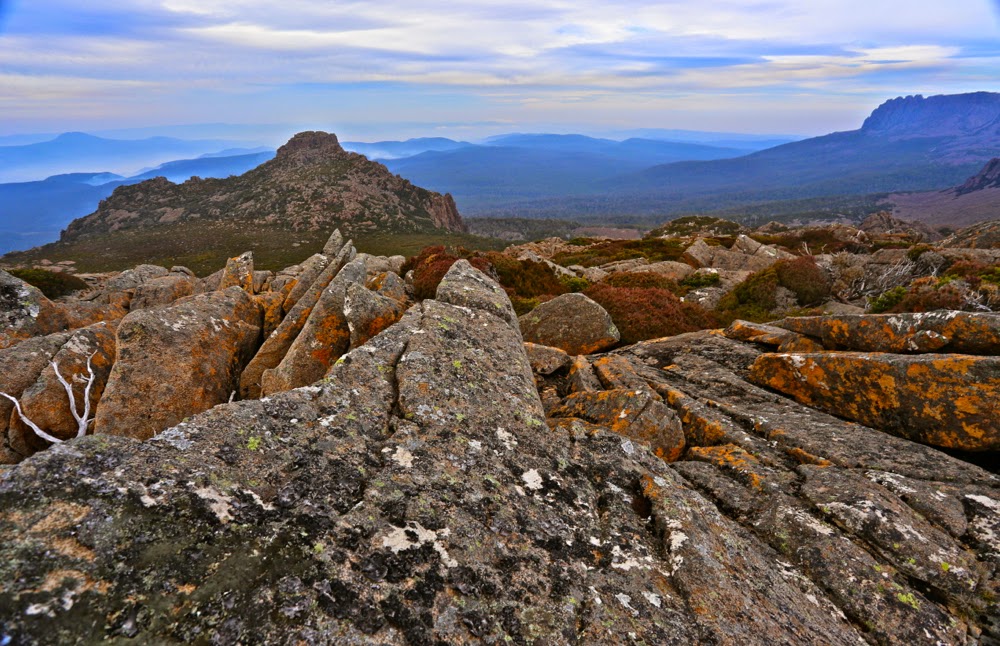
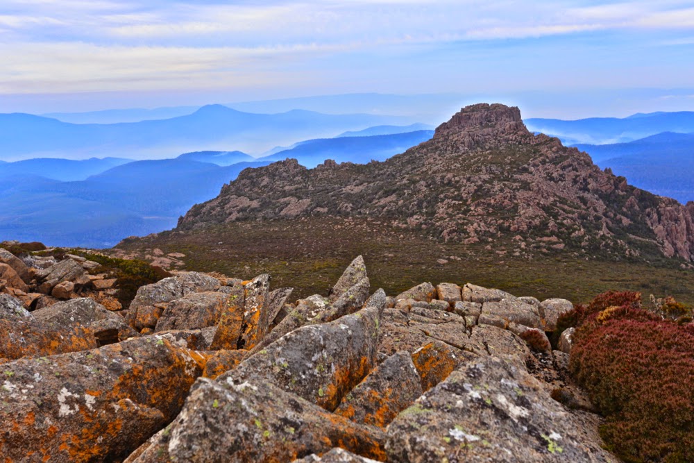
Day 2. Rising above New Harbour (en route to Hidden Bay, then Ketchem Bay), and looking back to Smoke Signal Hill and the New Harbour Range behind. Both of these would be climbed by four of us on our return leg.

He is, of course, so right, but his words had a bitter sting in our current political context, as we bushwalkers are, basically, fighting for our right to have experiences like this in this area we called wilderness, to keep these areas accessible yet untarnished by the sound of jet skis, the sight of grand luxury tourist hotels and cable cars. Liberal governments, both state and federal, make the assumption that spiritual connection to the land – a transcendental experience that is prompted by place – is something that only indigenous people can experience, and that if a non-indigenous person has what might be called a soul, then they should go off to a dark and musty church building made by human hands in order to connect with the eternal. I am sure there must be somewhere bushwalkers who are only there because it’s “sport” and a challenge to be had in nature, but the ones I mix with are there in the wild places because it is precisely in such infinite beauty that we find freedom and peace, and that these are things we need to keep happy and sane.

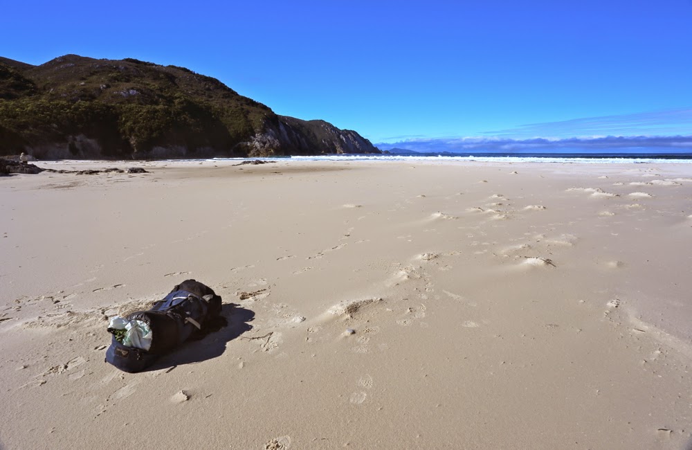
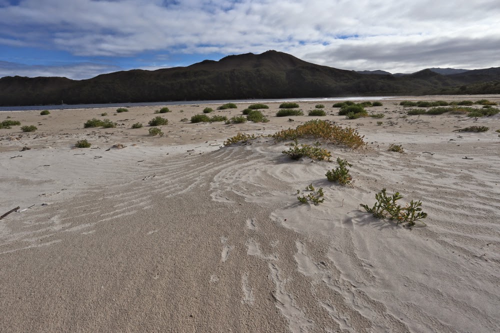
A pack. A wild beach. Does it get any better than that? (Hidden Bay).


Further along Hidden Bay, where we had an early lunch having inspected the elephant seal that we hoped was just exhausted but that we feared was dead.
 But let me begin at the beginning, which I guess is when I read “Mt Karamu” on the Hobart Walking Club trip list, checked out the coordinates of this peak, and signed up with record-breaking speed, hoping I hadn’t delayed too long to be given a place. And several months later, there we stood on the

Denny King airstrip at Melaleuca, ready to venture into this part of the state that I have long coveted but never had the opportunity to explore.

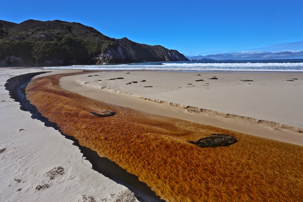
Same Day. Now we’re above Hidden Bay and about to get our first glimpse of Ketchem.
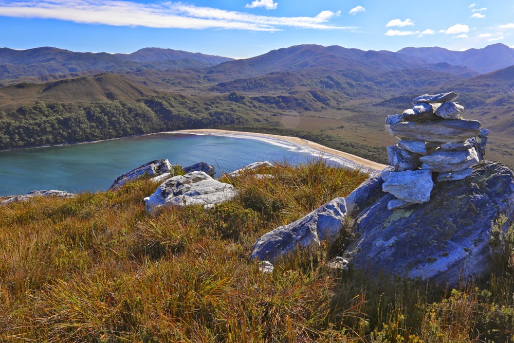
First sighting of the fabulous Ketchem Bay with its rocky islands and caves, nooks and crannies: our camping spot for the night.
What does the word “wilderness” mean to you, I wonder. To me, it suggests vastness, ruggedness, remoteness, and ruthless nature with no attempt to be tamed by audacious and pretentious humans. If this exposure to the unleashed forces of nature in all its sublimity is what you desire, then the ne plus ultra in a Tasmanian context must surely be the South West Cape of Tasmania. Even the flight in to utterly isolated Melaleuca, perilously near to rocky faces that can kill you with a single kiss, fills you with a frisson of delight. 
Ketchem Island from Ketchem Bay. Dawn breaks on Day 3.

As I reclined in my tent on the final evening, gazing out past rainforest trees at the endless variety of the patterns of force as the waves crashed on the sand about 120 metres from my bed, I thought about our governments and their concept of luxury, for to me there is no greater luxury than the liberty to have this sight. I let my eyes wander in the direction of Antarctica to the south, a place that I could not see, but just knowing that it was the next expanse of land was enough to thrill – like reading on a menu the process of marination and the herbs and spices that have gone into the dish you’re about to eat. The very knowledge adds flavour that you would not otherwise experience.

Day 3. So far, we are avoiding the shepherds’ warning of the dawn and are enjoying glorious weather for our climb to Mt Karamu. Here we are looking back east as we head for Wilsons Bight.


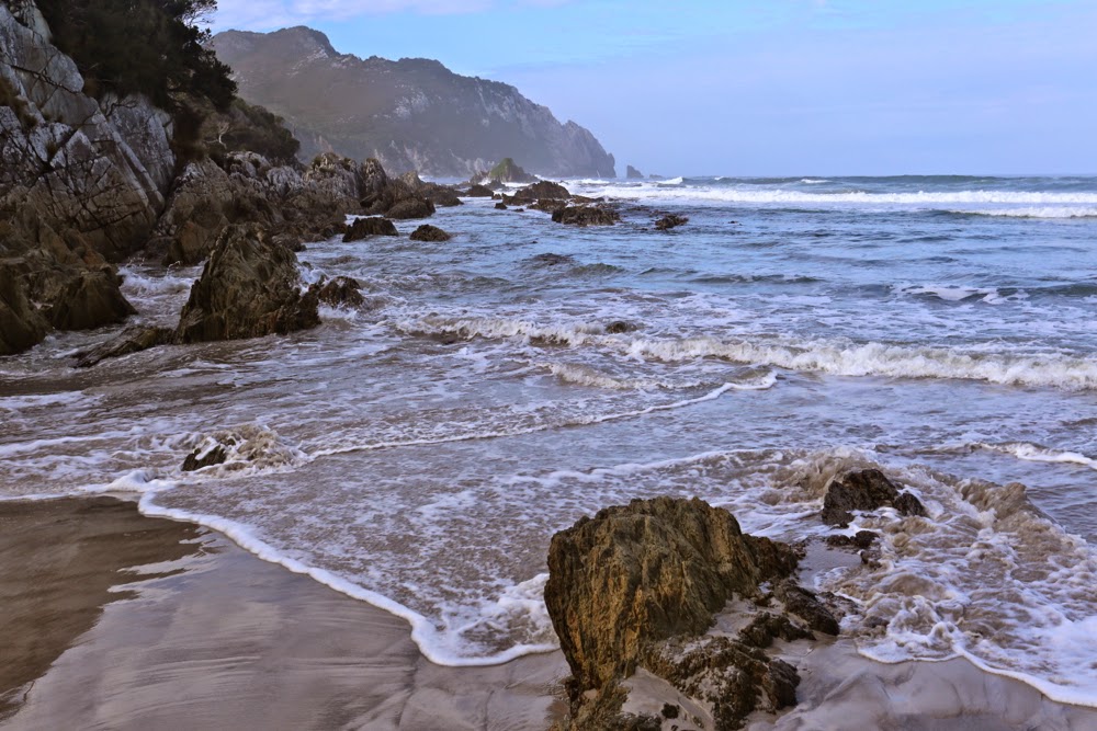
Now this bit was NOT easy. See those rocks there lining the headland to the left? They were the scene for one of the best games of my life: an adult version of musical chairs + What’s the time Mr Wolf? Dinner time, or the moment the music stopped, was the time the next huge wave approached. On cue, you had to rush post haste to the nearest rocky island, usually about 1 metre high and 1.5 long. Perched up there you waited, usually 7 waves long, for the next opportunity to advance a square. If you missed, you got drenched and risked being taken places you didn’t want to go to by the force of the incoming tide. I was pleased to emerge at the end as dry as a bone, but not all my friends had the same happy fate.

I thought about how simple our needs become in the wilderness. Do you want to know what I thought of as other luxuries? Not a glass of champagne on a pontoon with fake palm trees and facile conversation with others whose world revolves around money. No. Here is my list of “negative luxuries” if you will: dry boots at the end of a day; packing up the tent without rain falling on you; putting your hand out the tent flap without having leeches jumping onto it; feeling free to use toilet paper rather than leaves (a self-inflicted hardship I employ to help protect the environment); food that has not been dehydrated; fresh undies each day. “That sounds horrid”, do I hear you say? These little pleasures are so often taken for granted yet they also indicate tiny hardships we take on board for the greater luxury of being there in the midst of such unattenuated beauty, and the beauty is so overwhelming that we just laugh together at what we go through to be there.

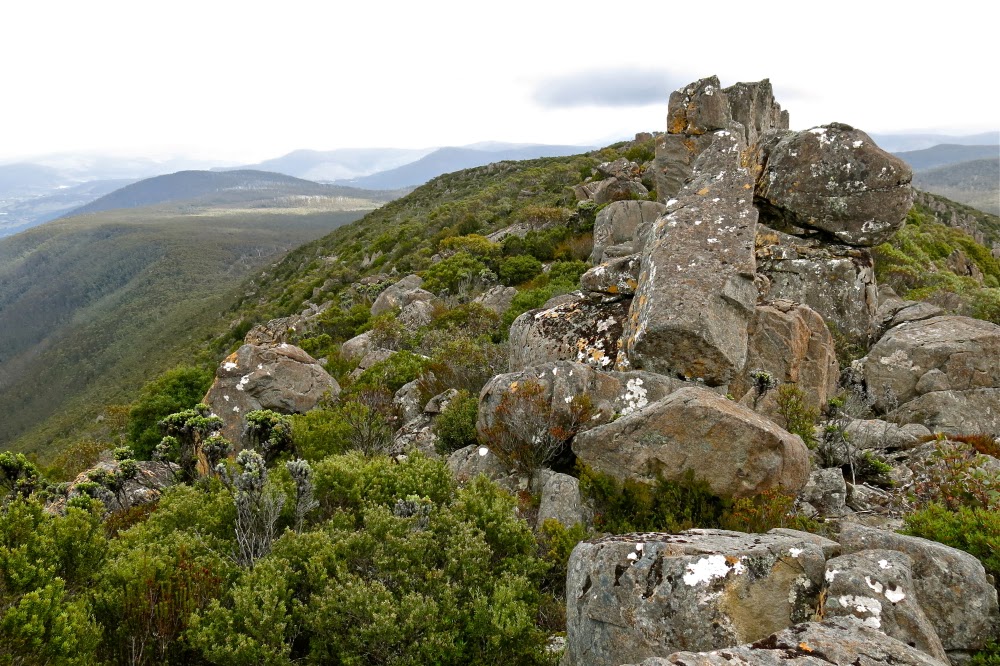
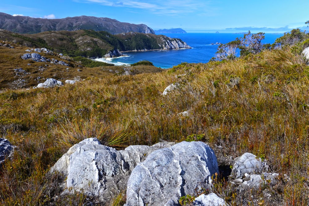
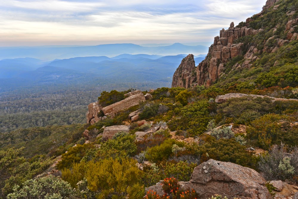
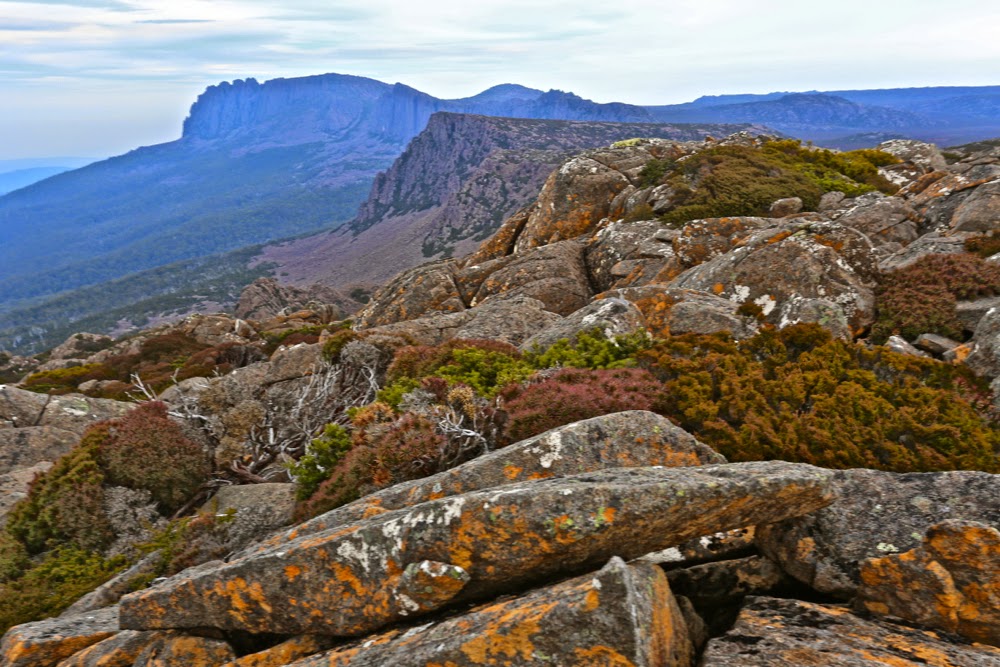
Wilsons Bight far below now. This shot is taken not far in vertical metres from the summit, although in horizontal metres there was still quite a bit of ground to cover, as Karamu has a long ridge leading to its highest point, which is right at its northern tip. Plenty of time to enjoy expansive views to left and right, and to gaze down on SW Cape – obviously, with a name like that, the furthest point to the south west of our island state.
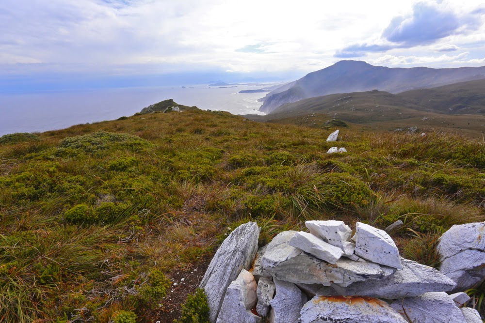
The view to the north from the summit of Karamu
Much as I adore wilderness and was looking forward with eager anticipation to this trip, I was a little worried about the tiny amounts we would be walking each day. I looked at the map, and did my maths, and saw that we would not be advancing up this board with staggering speed. The advantages of this, of course, would be plenty of time to explore each beach and to photograph as the mood took me. The disadvantage for a person with my restless spirit and uncontrolled energy was that I ran the risk of exploding like a saucepan on the boil with the lid kept on. Would I cope? I couldn’t tell in advance. I thought of taking runners, but didn’t want the extra weight. I’d just have to tough it out.

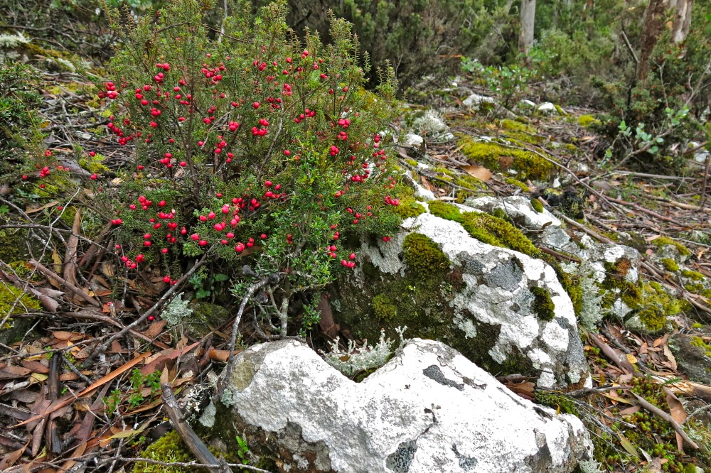
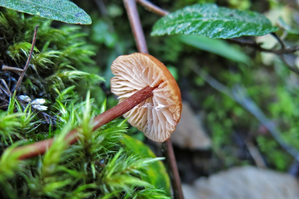
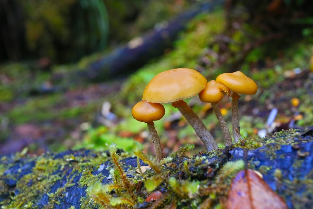
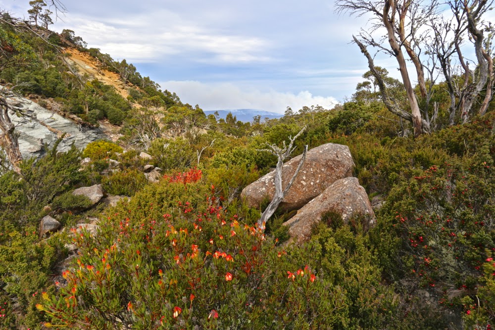
Autumn has only just arrived, but there were young fungi out in many sections of rainforest we walked through.


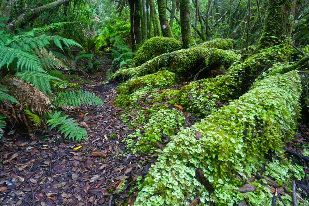
I hadn’t realised how very often we would be walking through glorious rainforest. When not walking along beaches, we were often in fairyland. Here is the forest behind Ketchem Bay where I went to play if I wanted a change from infinite beach. 
This brings me to another issue that interested me this trip: the relativity of how we perceive experiences. It is always so hard to imagine that someone else might dislike what we love. I am still stunned that my neighbours actually hate trees. I don’t mean they don’t love them like I do. I mean they actually hate them. Here on this walk, we had a person who did not relish the experience in the way the rest of us did. The situation reminded me of CS Lewis’s busload of people from hell who go to visit heaven and hate it there, or William Blake’s phrase in his glorious poem about love (The Clod and the Pebble), how one can “build a Hell in Heaven’s despite” (and one can also “build a Heaven in Hell’s despair”).

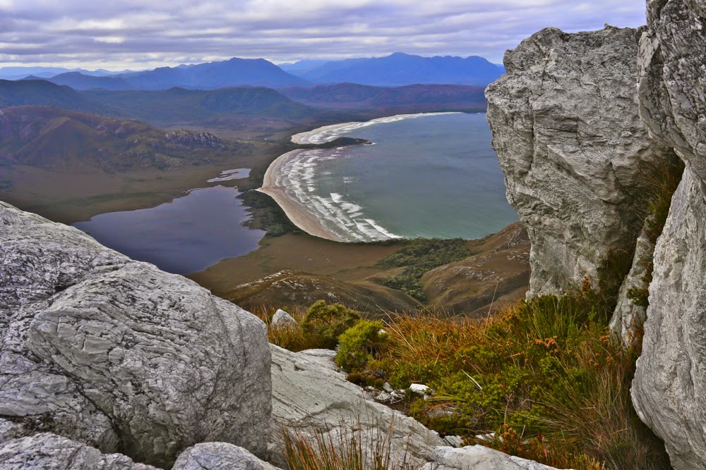
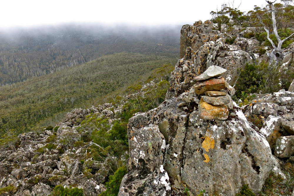
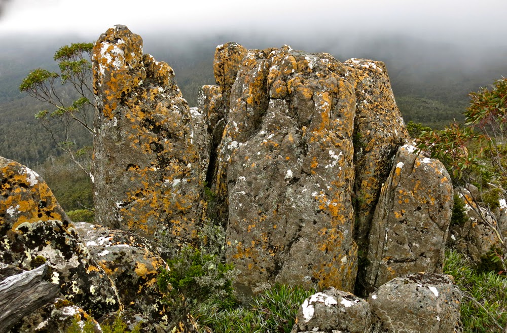
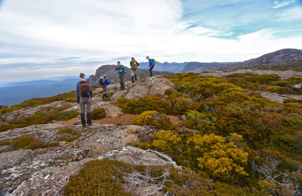
Day 5. The summit of New Harbour Range. For me, the equal highlight of our trip. I preferred its view to that of Mt Karamu, but enjoyed the utter remoteness of the latter. Each had so very much to offer.


New Harbour Range summit, looking north to Melalauca, where the adventure began. We have nearly come full circle.
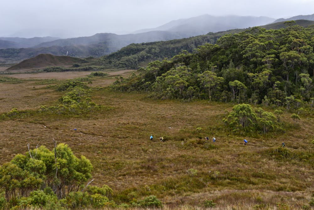
Tut. I have not described our route or what we did, other than gaze at beauty. The route is on the map – a little red line – or in Chapman’s guide. The mountains are mentioned and discussed in my photos above. What did we do other than gaze at wondrous beaches and climb heavenly mountains? We walked some more, pondered much, stared with wonder heaps, chatted, ate dehydrated food, sheltered in our tents from rain or sang glorious songs (well, I did) when the sun came out. We explored the minute detail of the superb wild beaches. I paced up and down, up and down said beaches. K collected bags of rubbish washed ashore by irresponsible and selfish boat people. C also paced the beaches, photographing little marine items that captured her attention. Mary sketched the most exquisite line drawing of Ketchem Island that quite literally took my breath away with its expertise, artistry and beauty; T did crosswords and trotted around the campsite in her new trendy shoes – two left crocs, way too big for her – that we salvaged from debris (she had regretted not brining camp shoes); V manufactured chairs out of other scraps of debris (perhaps her frypan chair was the most innovative), and served up gourmet food to her husband and J and V spent a great deal of time trying to dry their tent fly and sodden clothes on makeshift clotheslines.

Looking back down to New Harbour from Smoke Signal Hill.


Back down at New Harbour.

“Do I want to return to civilisation?”, (odd word when one considers how very uncivilised most humans’ behaviour is, a point teased out superbly in David Malouf’s An Imaginary Life), the caretaker of Melaleuca asked me. “Yes”, I replied. There is a moment for everything. Wilderness is a glorious time out, but I also enjoy the rough and tumble of normal twentieth century life, and enjoy many of the luxuries it has to offer, like long, hot showers, lights to read by, chair backs to make reading comfortable, a fire in my hearth and real food and wine on my table, which nearly always has a candle burning at meal times and a flower from my garden to decorate it. If we keep technology as our slave rather than becoming enslaved to it, it has much to offer us, and I embrace many of those opportunities. Next week I’m off to Sydney to see Aida on the Harbour and the ballet, Giselle, at the Opera House. Many philosophers regard culture as the antithesis of nature. I love both.

My room with a view and all my worldly needs for six days.


Bent Bluff, Knuckle, Storys Bluff 2015 Apr

Bent Bluff, The Knuckle, Storys Bluff Apr 2015

Misty Fingal valley near the top of the track
My bags were all packed for my Easter six-day expedition when an invitation to go climbing arrived in my Inbox. Could I honestly squeeze this in – and do it without using any of the gear I’d so carefully packed for the weekend? Was I organised enough to go off gallivanting for a day? I decided I was.

The group arrives at Bent Bluff

The climb was located at the southern end of the Ben Lomond massif, to three peaks east of Stacks Bluff (that I had already climbed), and we would use the Bent Bluff track that I had never seen before, which meant that everything would be new for me. It’s fun to explore unfamiliar territory.

The Knuckle summit, looking at Sphinx Bluff. Stacks Bluff off to the right.

We met in the dark in Launceston and were ready to start walking by 9. I wore gym shoes and no gaiters, courtesy of my self-made limitations mentioned above. I didn’t want to dirty or wet anything important. I really enjoyed returning to the footwear I wore pre-2012. Boots often feel slow and restrictive, even if they do keep the feet drier and warmer in the wet conditions Tassie so often gives us. Boots ensure I don’t run, but I love to run. Today I was free.

From The Knuckle to Storys Bluff (our next destination) with Stacks Bluff’s coxcomb visible. Wilmot Bluff is also hiding there off to the right.

I love climbing, so enjoyed the rise of 700 odd metres, popping out onto the plateau into a blast of wind that worsened as the day progressed. Hearing and feeling its presence as we neared the top, we opted to have morning tea in a bowl before we braved the worst of it.

Another from the Knuckle (with Sphinx Bluff stealing the limelight).

Before the top, Pamela and I had sat together on a rock waiting for the rest to join us, gazing out at the Fingal Valley spread before us, filled with mist and smoke from burn offs. The haze added a very atmospheric look to the scene that I enjoyed. The scene was framed by impressive dolerite pillars, whilst lipstick-red berries on the abundant Leptecophylla juniperina and the seed heads of Bellendena montana provided beautiful dots of colour.

The summit of Storys Bluff

Bent Bluff, our first peak, was just an easy stroll to the left once we’d emerged into the open. I was glad of the time we’d spent just below the plateau gazing at beauty, as by the time we were at the actual summit, the wind was unpleasant enough to discourage lingering.

Leaving Storys to begin our descent

Our next destination was The Knuckle. It was good to keep moving. Stopping was as cold as it was boring. It really was not sit around-type weather. In no time, we’d added this peak to our collection and were progressing on to our next goal, Storys Crag. It was, technically speaking, a little early for lunch, but we’d breakfasted early, and had found a spot that was protected, so dined before the summit. By the time we were near the cairn, the wind had picked up to such an extent that I didn’t dare walk along the ridge line, which is what I wanted to do, but attacked the cairn from the more boring north,  just for safety. It’s a one-way trip and no chance to talk about the voyage if you get blown one metre to the south if walking the ridge.

Colour near Storys Creek, having already dropped hundreds of metres.

It had taken two hours’ walking to get to the summit; the trip back would take three and a half (and the elapsed time with stops added in would be 9 hours), as we opted to return to the cars via a different gully. It had an old track marked on the map, but the actual track only has a presence very occasionally. It was kind of handy to walk where the gps said a track should be, presuming that gave a good line through the boulders, but there were no cairns at all until we’d dropped hundreds of metres. Obviously, returning the way we’d come would have been faster, but speed was not the aim of the exercise. One would have arrived home sooner if one had not walked at all if a short trip is the aim of the game.

The creek bed that we followed, which felt more like the Northern Tablelands (NSW) than Tasmania.
Walking in the creek bed once we’d dropped a bit was glorious. You will see on the map where we leave the creek: here there were sawn stumps with scattered cairns on top indicating the presence of a former road which could just be discerned if you concentrated. We thought it might continue long enough to connect us to our original track, but it died suddenly and unexpectedly, so we dropped another swag of contours to eventually pick up an old pad that ultimately took us to a magnificent old road (built up from below), not on the map, and this road led us to our cars. It was a wonderful way to spend a Wednesday, free for me because of its proximity to Easter so my normal debating duties had been cancelled.