QLD 2014 The Daintree

Daintree sunset 
Queensland’s Daintree Forest is an area that simultaneously fills me with delight and frustrates me beyond belief. It is unique and wonderfully beautiful and yet, whilst it offers the possibility of great enjoyment on the one hand, it steals it away peremptorily with the other.

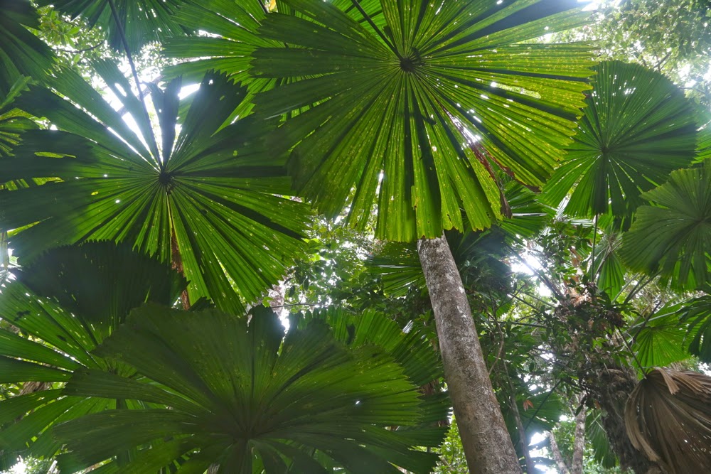
There it is: there are beautiful tracts of cool, soothing, primaeval forest, but may you walk through it? No. You may drive in your polluting motorised vehicle, but you may not walk on a narrow forest trail, having prolonged contact with the forest, soaking in its atmosphere. You may walk on an assortment of boardwalks that seem to range from about 400 to 1200ms long. These walks are very wide (I guess two wheelchairs might want to pass each other) and very, very smooth so you don’t trip, and very, very safe so your brain goes to sleep due to lack of stimulation and variety in the terrain.

Daintree rainforest

In the first half of last century, the Austrian painter and architect who chose to be called Hundertwasser (1923-1994) knew that natural curves and lumps and bumps are far more stimulating than smoothed out regularity, and designed his houses accordingly. Running on the longest of the boardwalks on offer, doing mindless reps of the circle, and then walking it more times later as there was nowhere else I was allowed to walk, I got bored, not by the magic rainforest (of course), but by the fact that the flatness and smoothness stole the variety I need, as I am an edacious gobbler of complexity. There is a very good reason why in my former life I chose to be a mountain runner and to do orienteering.

Daintree forest – near the boardwalk
The denizens of the area take great pride in being “eco conscious”, so a brochure beside our bed told us. However, the sound of the cafe man over the road motor-blowing his leaves away, killing birdcalls with his ramming drone and forest delights with the smell of the petrol fumes did not strike me as overwhelmingly “eco”. Luckily we’d already photographed the dawn and had a walk along the beach and were eating breakfast at 6.50 when he got underway. I’m glad I’m not a ‘sleep-in on my holiday’ type. The same cafe bombarded us with stadium-strength lights all night, so that we either had to endure the intrusion or close all curtains, occluding rainforest sights and sounds and locking ourselves in a dark cave. I opted for two sleepless, light-filled nights rather than placing myself in an enclosed dungeon. I had plenty of time in the night to ponder the issue of how burning megawatts of electricity to light a closed cafe was in any way eco friendly.

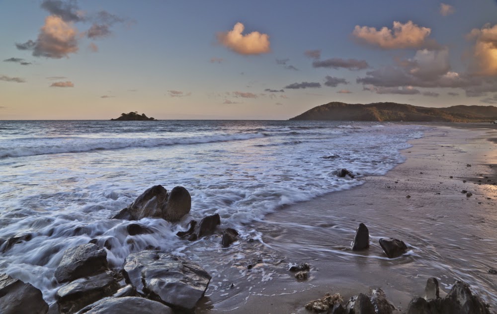
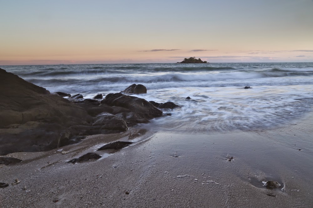
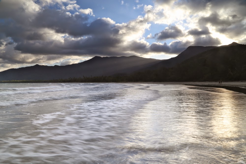
The other disappointing feature of Thornton Beach was that cars could zoom up and down the beach, and did so, doing whirlies in the sand. I felt very glad indeed that I was not playing on the beach with my little toddler grandson when the giant white 4WD utes dashed by. I don’t like tyre marks in my photos of a beach that claims to offer pristine beauty – but you can see from my photos that it is a stunning beach, which is why I have this love-hate relationship with the marred and sullied could-be-perfect-if-managed-more-thoughtfully Daintree.

Daintree forest – the part that draws me to it
The approach-avoidance conflict was to continue at Cape Tribulation (quite apart from the blaring lights issue). Everywhere I wanted to go was prohibited, and “Private. Keep Out” signs were far more numerous than native animals; every path I saw was forbidden. I felt like the narrator of William Blake’s poem, “The Garden of Love“.
I went to the Garden of Love,
And saw what I never had seen:
A Chapel was built in the midst,

Where I used to play on the green.

And the gates of this Chapel were shut,
And “Thou shalt not” writ over the door;
So I turn’d to the Garden of Love,

That so many sweet flowers bore.

And I saw it was filled with graves,
And tomb-stones where flowers should be:
And Priests in black gowns, were walking their rounds,
And binding with briars, my joys & desires.

Blake is objecting to the way that the rules of organised religion effectively kill the joy that should be present in a movement whose two summarising commandments contain the word “love”. But the principle of what he writes applies equally to the situation where you allow bureaucratic rules, set up to allow ease of management, to override the experience of the wonders of nature. It is a very attenuated, sterilised nature you are mostly offered in Queensland. I am left frustrated and wanting more. When you feel obliged to begin each day in a national park smoothing and cleaning each of the small number of paths on offer so that someone doesn’t trip and sue you, then I think you’ve lost the plot.

sunset number two

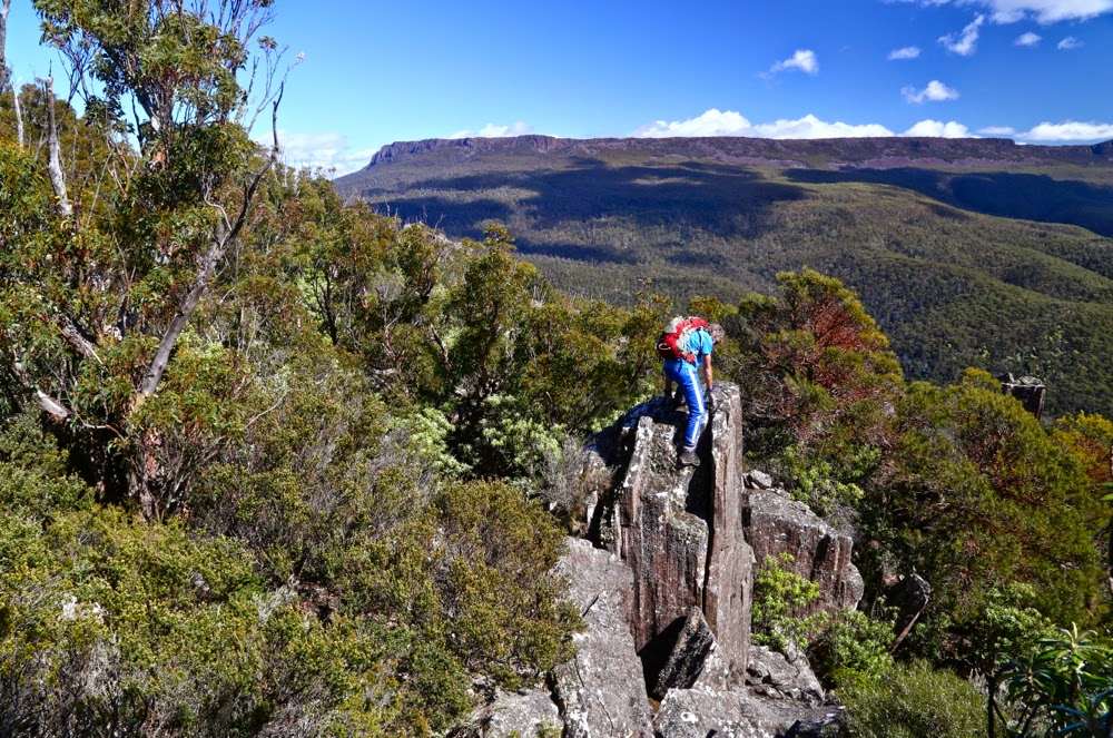
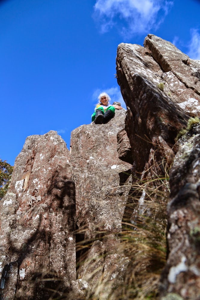
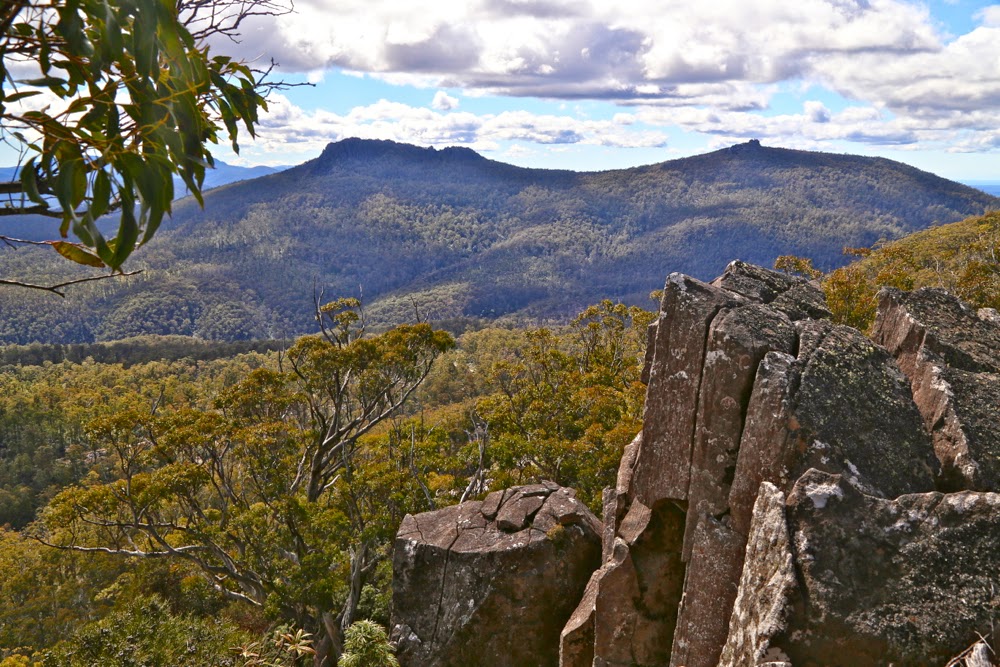
We’ve walked the Thorsborne Trail four times, climbed Mt Sorrow three, Walshs Pyramid two, Bartle Frere as well – so you can see that we adore what there is on offer. What one is allowed to do is wonderful, but the run-out factor kicks in far too quickly. I don’t mind repeating paths of beauty, but one hungers for something different as well. We tried to do Thornton Peak, but did not bring our full bushwalking gear with us on our Queensland holiday, and neither did we have secateurs, and both would be needed. I will come prepared one year – I was told by locals the only way to the top was by helicopter, but I managed to find one person who told me of an old track, so at least we now know how to get to the start (for details, go into my posting on the “bushwalk australia” website). We drove there, walking past the “Keep out” signs and did the first part, but lawyer vines are ferocious things.

Emmagen Ck waterhole.

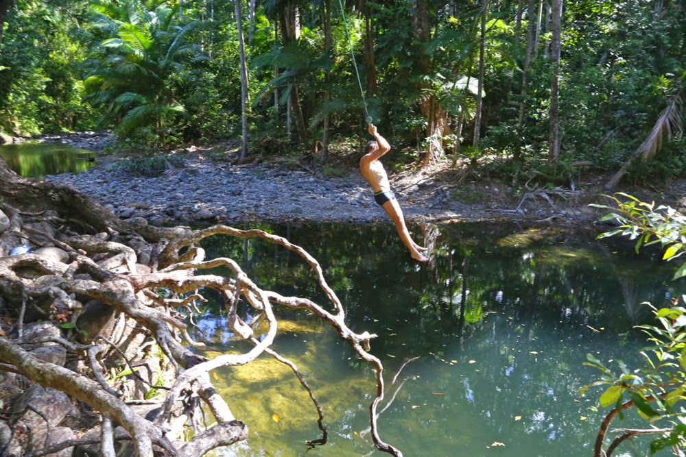
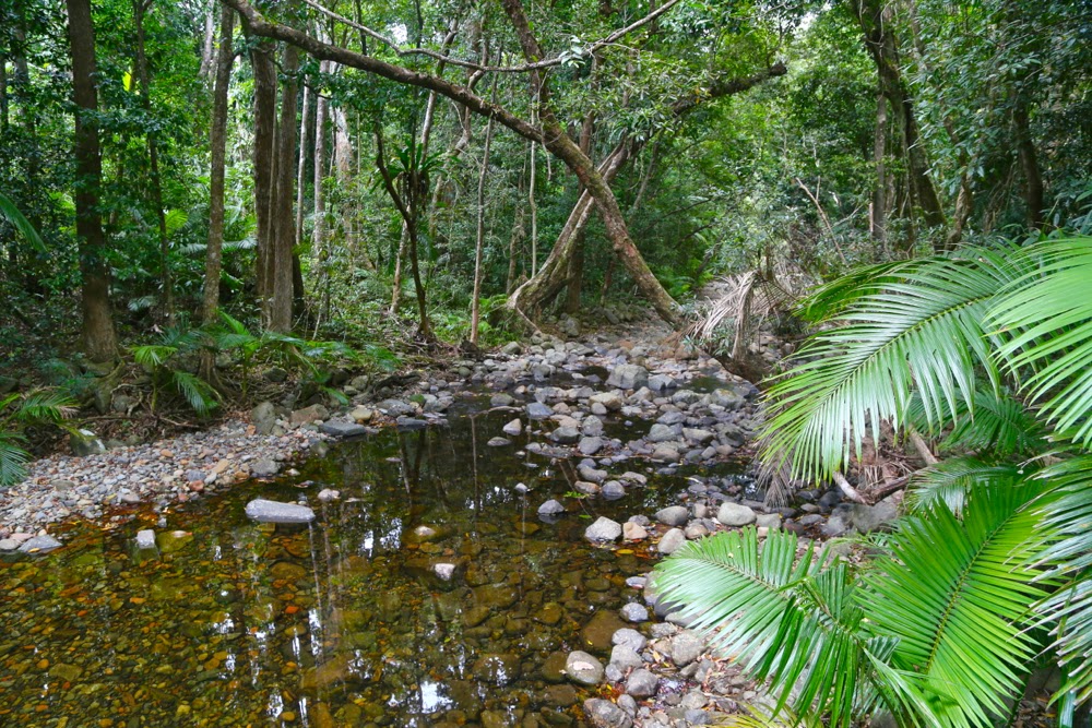
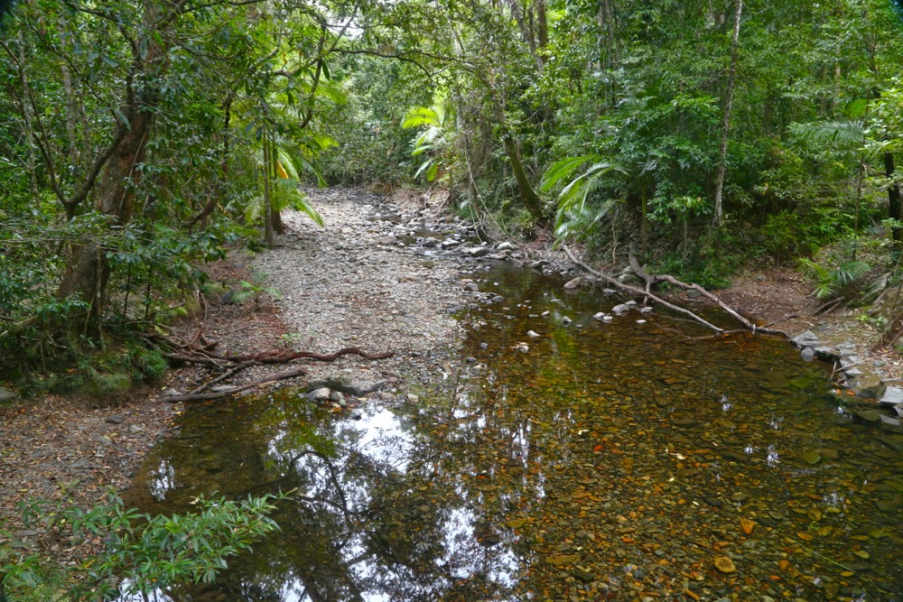
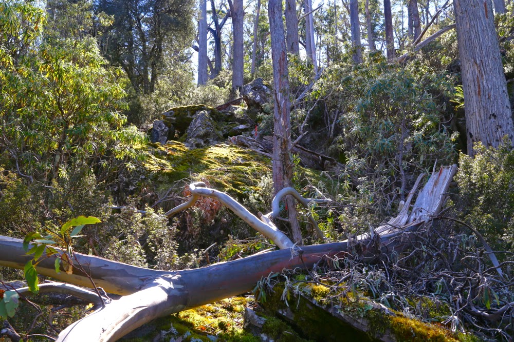
Here is what you find at the end of the Emmagen Waterhole track, which is a daring 400 ms long, but  you do get to tread over root mounds and stones; no one rakes or blows the path and it is narrow and windy and you can be tickled by the bushes which only just allow you passageway. It was really lovely, but needed to be a good 10 kms longer (or more). It was also very popular, suggesting the need for more such tracks.

Close of the day on Myall Beach, Cape Tribulation.
Mt Sorrow is a fabulous mountain, with an enticing narrow, uneven path that is extremely steep – so steep that you are climbing on all fours to hoist yourself up on occasions, and one quite long section even has a rope so you don’t tumble backwards as you negotiate the almost vertical slope. The forest is thick and green and juicy and beguiling. Strangler figs, buttress roots, thick vines, rubbery leaves and a variety of ferns adorn your journey. You climb a quite narrow ridge, but the forest obscures that fact if you don’t pay attention to what the land underneath is doing: it’s not immediately obvious. To left and right you sense the cerulean ocean beneath you, even though it only gives you tantalising hints until you get to the lookout. This mountain offers me a fantastic workout. I take a bit over an hour in each direction, but that is achieved by going right up to my anaerobic threshold and pushing pretty hard. You don’t do that kind of workout every day, or even every second day. My legs are pretty trashed when I’m finished. I thus only do that mountain once each trip north.

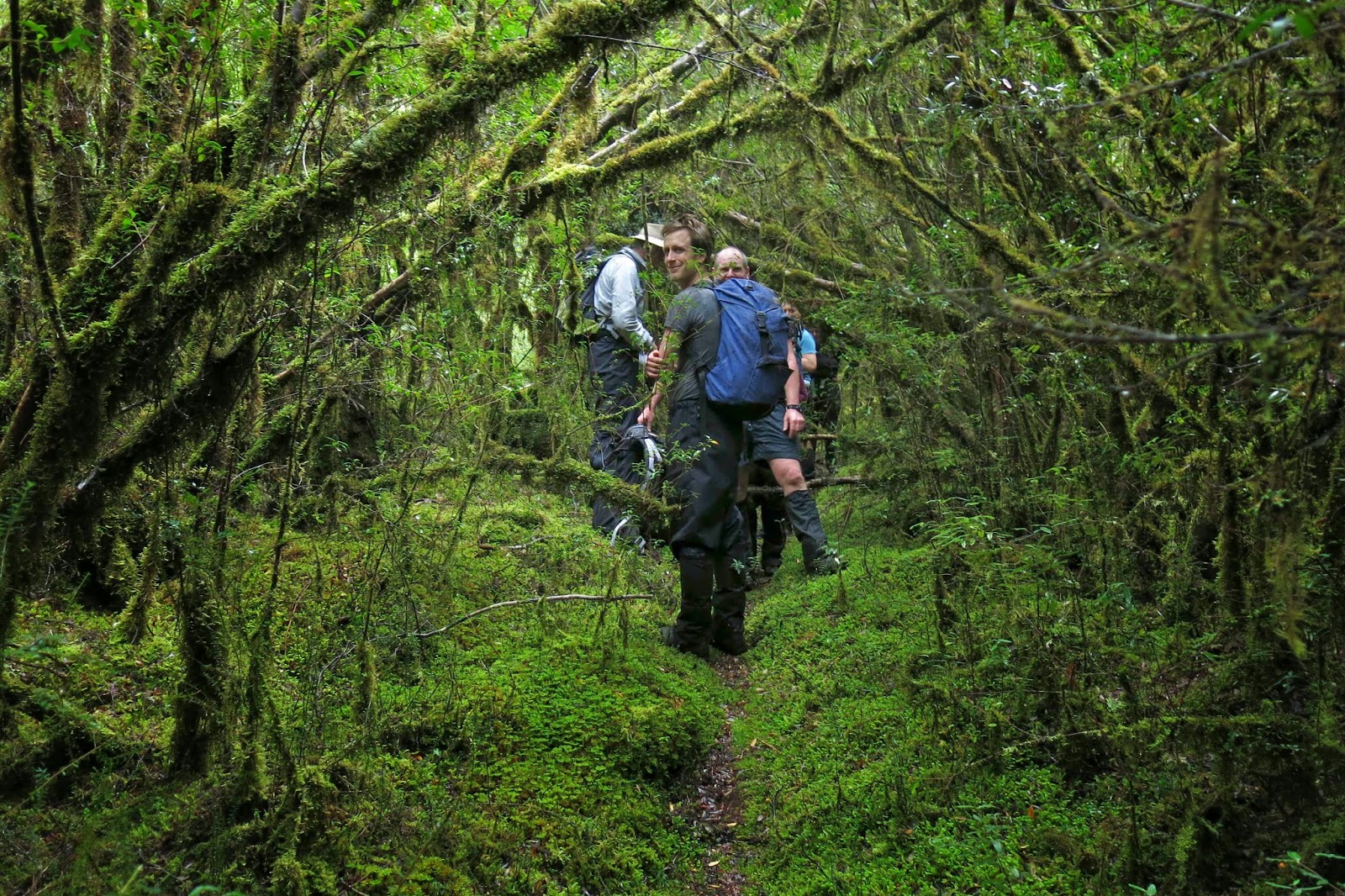
Because there is nowhere else to walk if you want to go for more than 15 minutes, this mountain is surprisingly popular considering how challenging its slope is. In the (bit over) two hours we were on it, we counted fourteen couples and eight solo walkers – all in very cheerful spirits despite the puffing and panting. The official bumph says it’s a five hour journey, and some of them looked as if they’d be there that long. That’s a day’s commitment to that mountain from people who are essentially travelling around sightseeing, and yet they’re all prepared to give it that time as they want to do exactly what they’re doing: experiencing the rainforest right up close in as near to its natural state as you can get without travelling with proper body cover. There are so many mountains in the area. What a pity all but one are inaccessible if you don’t want to fight the jungle to get to the top.

The start of the trail is another area that has you weep for the Daintree if you’re that way inclined. There used to be a walking track from Cape Tribulation to Bloomfield – can you imagine how wonderful that would be??? – but they came in with bulldozers and knocked down a mass of trees so that the 4WDs could hoon up and down the road, stirring up truckloads of off-white dust that cakes all the leaves at the side of the road as a result. The trees look as if they’re statue-trees made out of concrete in a museum of scanty imagination. I have no idea how they manage to get oxygen through their presumably blocked stomata. I had coughing fits when near the roadside.
Time to move on – to pick up the family from Cairns and to move south to Mission Beach where we didn’t have lights invading us all night. Our ecolodge has bungalows with verandahs in the rainforest and a pool with tropical trees and ferns drooping into it, and a path down to the beach for walking or kayaking or swimming, of course. There I can run up my favourite little mountain in Clump Mt NP each day (twice) and can walk along the long beach if I’m not swimming or reading (or playing with Gus or talking or having coffee and cake with my family).

Byatts Razorback 2014 Sept

Sphinx Bluff, Broken Bluff and Pavement Bluff from below

The mountain I selected for today (Byatts Razorback) was perfect for a day like this. It was not too far away (about 1.5 hrs in each direction), and not too long a walk (about 30 mins each way). I am unwell again – they’re calling my virus the “hundred day flu”, and that seems right from what I’ve observed of self and others – and I have heaps to do before I fly with my debaters to Brisbane tomorrow. Just a little excursion was all I wanted. I was, however, expecting this “little excursion” to be unpleasantly scrubby: it is, after all, on the east coast, near West Tower and a raft of other rather bushy mounds.

Denison Crag from near Rossarden
We had never taken the road north of Avoca before. I’m not a fan of driving, but this road was a delight. Without a peak baggers’ list prodding me to explore and climb a stack of mountains I’d never even heard of before, I probably would have lived my life without ever going up this road. I’m thankful for the list and the number of new places it’s tempted us to see. The wattles (acacia dealbata) were in full bloom, and Stacks Bluff, which I’ve never inspected at close range, loomed large and perfectly delineated in the morning light, with crisp edges and shadows. It’s a great shape. It moved up the “to do” list, but not for today. My goals today were small.

We then swung right, to change our gaze to Broken Bluff and The Knuckle (yes, yes, I did watch the road as well), and eventually came to the quaint settlement of Rossarden, where someone has transformed the old wooden church into a very attractive house with daffodils. Not far to go now.

Typical bush on the way up.

My plan was to park just south, and a little west, of the summit, and walk north to the razorback of its name, and then east to the high point. One hardly needed a map for that, but we had packed one anyway, as we always do – along with a compass. As I’m approaching the spot in the car, I see a little side track. I consult my gps and decide it can do no harm, and could do a lot of good, so, even though it’s not on the map (what road ever is, you may well ask), I take it. Unfortunately, it stopped after about a hundred metres. Oh well, it was worth a try. Might as well climb from here now we’ve stopped.

No, he didn’t think it was the summit, but it did look a fun thing to climb. There were lots of little beckoning columns like this up there.

Framboisiennes fresh from our Harvest Markets in our stomachs, off we set. Well, well, look at that. That tree has an orange streamer. Look, so has that one up there. These streamers weren’t quite connected, in that I couldn’t see from one to the next, but by keeping the line of least resistance in the forest, I kept finding them. It was fun. And the bush was delightfully easy – a long cry from the fight with prickles and tangles I was expecting. We were loving it. Boulders were mossy and a soothing green. Up we went, enjoying the route, onto the ridge line. We climbed something that looked nice and high (and it was, actually, the black dot on the map), but a boulder cluster further over looked higher, and the pink ribbon continued, so (having climbed the black dot) we headed further east, actually dropping a bit on some scree in order to climb the next section with less resistance from bush. The pink ribbons, having led us down the other side, then disappeared. There were several scrambling routes possible, all of which appealed. I selected mine and up I went. On top of this one was a summit cairn, and, as far as the eye is any indication of anything, I was now on the highest point. My gps confirmed that I was at the summit height (actually, it said I was 1 metre higher).

The summit rocks. There is a cairn just behind me, to the left.

Even so, we still went a bit further east just for the heck of it, and because I had seen a good vantage point off that way where we could sit and snack and stare out at West Tower and its eastern mate.

West Tower (L) and East Tower (R) from our snack rock
Back at Avoca we shared a pie, lettuce and sparkling apple juice down by the river in the company of ducks to fend off the pangs of hunger until real lunch.

How wonderful it is to be welcomed home by dogs. As the car neared our internal gate, I could see them bouncing with excitement as they raced to meet us. I find it hilarious that they don’t seem to think that they can have fun without us. We all did a turn around the perimeter of the home paddock together, they, rushing and dashing; we, sniffing and sighing at the beauty of sun through petals, before at last heading into the kitchen for lunch.

Bowes 2014 May

Mt Bowes May 2014
Entoloma rodwayii.

Mt Bowes is in the south-west, so it must, by definition, be a good mountain. As soon as I saw it on the programme I signed up.

Possibly Cortinarius levendulensis
The forecast was for a pretty dismal day – and yet fourteen of us turned up to brave it; I packed more layers and coats than for a summer’s multi-day expedition, and heaps of food in case the 4.30 a.m. start that I’d need to meet the others in Hobart at 7 would leave me more peckish than usual during the day. (It did. I was craving lunch by 10 a.m.)

Our track – not always as easy to see as this bit here! 

My mental image of what lay in store was, I guess, informed by trips to the nearby Western Arthurs: I imagined a lengthy phase of muddy button-grass plain ceding to alpine vegetation once we’d gained height. Wrong.

Having parked at the locked boom gate (en route to Mt Mueller) and swallowed the 500 ms or so of road to the cairn that marks the start of the pad, we entered the domain of melaleuca and leptospermum scrub, complete with requisite muddy pools of unknown depth to dirty our boots and gaiters. This section, however, was short – perhaps a kilometre  long – after which we entered quintessential Tolkien country, with sentinel Ents in every direction, fabulous guardians of the sylvan domains. The forest was very different to that of my normal bushwalking diet, which features huge myrtles and fatter trees; here the trees had quite narrow trunks. The bark underneath was invisible, as all wood seemed covered in a rich coating of vibrant green moss, with hairy lichen-beards hanging from horizontal surfaces. Colourful and abundant fungi were, of course, a distraction – so much so that we hardly saw our leader at all on the outward journey: he was too busy bowing obeisance to the fungi, his camera held in a suspicious position. Tannin-stained creeks, pure and gently flowing, were crossed by natural bridges made from fallen trunks.

I learned that this pad was originally the path cut by Edward Alexander Marsden in 1898, and is part of the original and much larger track going from Port Davey all the way to Fitzgerald – a very long distance – intended as an escape route for shipwrecked sailors. Snooping around the web, I have since picked up that the Port Davey track was used in 1914 to check out a rumour that a German submarine was lurking in Bathurst Harbour, intent on destroying troop ships as they rounded the coast. At that date, the track hadn’t been used since a 1905 shipwreck.

After many wonderful kilometres of this rainforested beauty, we were in a position to diverge from this path and begin the climb proper (still adorned with pink tape [mostly], but it was quite hard to find evidence of human wear on the ground). The quite steep rise was made more taxing by the presence of waist-high bauera and other bushes to keep us honest in our efforts. It took longer than I expected to reach the summit. Once up, we found a small depression out of the wind, which was necessary, as most of us had become wet from the morning of pushing through wet bushes plus the sweat generated by a healthy workout on the way up. Like a magician pulling rabbits from a hat, I seemed to amuse some by the number of coats and layers that I extracted from my pack to cope with the fact that we now had to stop moving. Like little Michelin men, we sat on top eating and looking at our hard-won view of half-disclosed mountains and a grey, moody Lake Pedder way below. The vista was tantalisingly full of promises that would not be kept on this day.

There she is at last: our mountain.
I must return when there’s a better forecast, as, even on a dull day with light sprinkle and smudged, detail-less mountains, it was magic. Just imagine what it could be if the sun shone and the mountains were well defined. I will be back!

Summit view

Beautiful quartzite on top


Inglis 2014 May

Mt Inglis. 6 May 2014

This is where I feel the start of the route to Mt Inglis begins – at the rocky part of Barn Bluff, where you first leave the track up to the Bluff, and start contouring around its belly instead.
Summit day for Mt Inglis delivered thick mist, but no rain, so off the seven of us set, some with more enthusiasm than others on what promised to be a very demanding day, and one that would be more of an endurance test than a pleasure if it began to rain again. Group momentum prevailed. I think I heard Rupert later report that his gps data indicated that we covered 23 kilometres with 1200 metres total climb – giving us a 35 ‘kilometre equivalent’ day. It was certainly a long one, beginning at 8.10 a.m. and finishing at 5 p.m. (later for some; I rushed the last bit to get out of the icy wind on the Cirque – and because I felt like a stride-out after all that goose-stepping).

The first (and last on the rebound) part of the route is on the track, firstly up to the Cirque and then part way up Barn Bluff until one hits the rocky face, when it’s time to contour, either on the rocks or a bit lower in the scrub. We began on the rocks, and everyone was following me on my route, so I stayed there until the rocks finished, and a scrubby spur led down to another cirque. The others voted for the scrub on the return journey, however. It actually took a fraction (just a couple of minutes) longer, but they preferred it to the slip factor of rock rubble covered in slime that was growing moist again, and were very happy with their choice. In the mist, we could see little, and I hadn’t had a good look at the map. I was silly enough to think that the next thing we climbed was Inglis. Ha ha. There was still a very long way to go and we were not yet half way there. We had been underway (not counting morning tea and waiting breaks) one and a half hours at this stage.

Pelion West dominates this particular view. Achilles lies to the far right.

Ahead of us lay not only our hill, but also a large moor area that looked fine from above, albeit rather expansive in its proportions, but which was a bit tiring in reality, as it required high lifting of the legs. The others were moving well, and when I stopped to fill my husband’s drinking bottle for him and then carry two packs, it took me at least ten minutes to catch them. I was sweating when I at last joined onto the tail end, just as we all began to negotiate the next patch of over-headhigh scrub that offered stirling resistance to our best efforts. Relief came when we happened on a beautiful patch of myrtle forest that was not only delightfully green but also open enough to allow easy passage.

Fury Gorge and the backside of Barn Bluff and Cradle as seen from the summit.

Up until this point in time, Mt Inglis had kept running away from us, and remained a matter of faith based on a belief in map accuracy. At last as we emerged from the myrtles onto an open table top, we could see the summit, although we were now too close to see the overall shape of our beasty. I never did see it as a whole mountain.

The group strides out; no loitering on this day!

Our turn-around time was now a mere 45 minutes away. Not seeing the height of the scrub that lay ahead and thinking the green was nice ankle-high alpine vegetation, I guessed at 20 minutes to the top from there. Another fast walker reckoned 30. Either way, we could do it if we hurried. Off we set as quickly as we could so as not to be timed out of our mountain. Neither of us was quite correct in our guesswork, but four of us were on the top in 24 minutes, and everyone was at the top before we all turned into pumpkins. We even got time to sit up there and photograph, survey the view and appreciate the sense that we had the whole world laid out before us while we took a rather hurried lunch break. The mist even obligingly cleared. It was truly beautiful up there, and, due to the vast stretches of low moorland separating us from the other mountains of our purview, it seemed as if we could see forever.

Looking down on Lake Will from the Fury Cirque on the rebound.

Again on the descent, everyone worked hard and well, and we made the rocky section below Barn Bluff in good time considering the terrain. It was getting dark quickly, so it seemed much later than it was, but the darkness rising was in fact due to the louring mist rather than the lateness of the day. Despite the freezing conditions, I think all of us were sweating from the toil. The wind was really beginning to rip up a frenzy and the temperature was dropping, but we also knew we were on target to be back before night fell. The wind was so strong as we hit the final tracked section that I started to get a headache, so dashed ahead to get myself out of it (with permission). As I cleaned my teeth by the tank after dinner, light sleet was falling: white drifting sago against the blackness of the night.

Icy path on the final day.
The underside of Hygrocybe schistophila

Next morning, the first words I heard were: “Be careful going to the toilet that you don’t slip on the snow.” That got me out of my warm sleeping bag; I wanted to see the sight of Waterfall Valley with a light dusting of icing sugar. Beautiful.

Ice floats on Kathleen’s Pool
I was lucky enough to go up the track first and thus got to follow the pristine line of white ice and snow crystals as I walked and photographed. I was amazed at how many animals make use of the Overland Track boardwalk! The only indentations offsetting the neat white grains were the quaint paw prints of quolls, wombats and wallabies. Fungi and fagus provided colour. What a great trip.

Emmett 2014 May

Mt Emmett

We had not set out intending to climb Mt Emmett on this trip: instead, Mts Inglis and Proteus were on our agenda. However, the dismal weather forecast had us altering our plans. The worst day was to be our second one, so it was decided that we’d only go as far as Scott-Kilvert hut, behind Cradle Mountain, on the first day (instead of to the tarn on the moorland past the belly of Barn Bluff), and see just how much rain was going to fall thereafter before we finalised Plan B.

Approaching Hanson’s Peak, day 1

Day two was as bad as predicted, so the new plan was to climb Mt Emmett on this day, and then move to a better location for attacking Inglis the next one. 

 
En route, day 1

To the average person, Mt Emmett is not a name that means a lot. If you get out the appropriate map, you’ll find it sitting beside Cradle Mountain, minding its own business, looking nice and harmless as a bunch of smooth brown elliptical lines. When seen from the Cirque between Cradle and Waterfall Valley hut, it looks like a nicely rounded and gentle scree slope, much like many of the English Fells that you can dash up at a run. Before I knew better, I had once planned on sleeping on the top. 

A beautiful autumn bonsai Fagus plant on Hanson’s Peak

 Cradle from Hanson’s Peak
Unfortunately, the reality of this cozening deluder is that this is a mountain of angular boulder rubble, which could have been part of some story of angry gods throwing fridge-sized stone missiles at enemies and then cursing them so that they became covered in slimy black moss to destroy any approach efforts of hapless humans.

Twisted Lakes in autumn glory

We had already had one failed attempt on this mountain, admittedly due to snow (see my other Emmett entry: http://www.natureloverswalks.com/mt-emmett/ ) and I had not entertained the notion of taking my husband with Parkinson’s disease back there. My plan was to do it in summer on a nice dry day (without him), probably solo as this is not a popular mountain that anyone I know volunteers to do twice. However, the group was doing it in the rain, and my husband said he could do it too. Should a wife tell her husband he’s mistaken and make him stay behind for his own safety and the good of the group? (He laughed and said “Yes” when I read him that sentence.) “Not this time; not yet,” was the equivocating conclusion I came to after long reflection during the night as I listened to the insistent rain.


The moist mist swirled around as we left the hut the next day. We had elected to camp the previous night rather than stay in the hut, so were lugging a wet tent up the slope, but we love our tent, so that’s OK. I stayed at the back of the train, observing my husband’s progress, trying to read from his movement whether I should exercise some power of veto here. I was genuinely worried about this mountain – but again I let him have the call, not wanting to cramp his style with my own anxieties for his safety. 

Laccaria sp near our tent

Even highly competent and experienced walkers find Emmett with a water film over the slime to be a challenge (see rockmonkey’s blog) but we nonetheless set out over the slippery rocks that presented a line rather than a flat plane as their uppermost surface. I hoped that if Bruce ran into trouble, it would be in the first hundred metres to enable an easy exit. He seemed to be coping as well as some of the others in the group, and as he often goes much better if I’m not there as a backstop, I went on ahead, having fun crabbing my way on all fours across the slippery obstacle course, whilst checking behind at regular intervals to make sure he was coming, though the thick mist meant that, at best, I could see people who could see people who could report that he was progressing steadily.

Deceptive Mt Emmett from the Cradle Cirque next day

There were no commanding views to be had in the fog that day, but the best view for me was that of my husband approaching the summit of what I thought was his most challenging mountain yet. Bravo B. It snowed lightly (sleet really) before we began our descent. The weather was so bad I had not even bothered to bring my camera to the top; I have plenty enough photos of people in a grey, obnubilating veil labelled as this or that peak. 

Ramaria ochraceosalmonicolor beside the track

The trip down was as careful as the ascent had been and we all got there uninjured, picked up the heavy packs that we’d deposited in the Cradle-Emmett saddle, and made our way further on to Waterfall Valley hut where we could attempt to dry out our sodden gear before the next day’s demanding adventure (see natureloverswalks.com/mt-inglis/).