VIC Wilsons Promontory 2014 Granite gorging.

Gussy paddles with his mum
Wilsons Promontory April 2014.
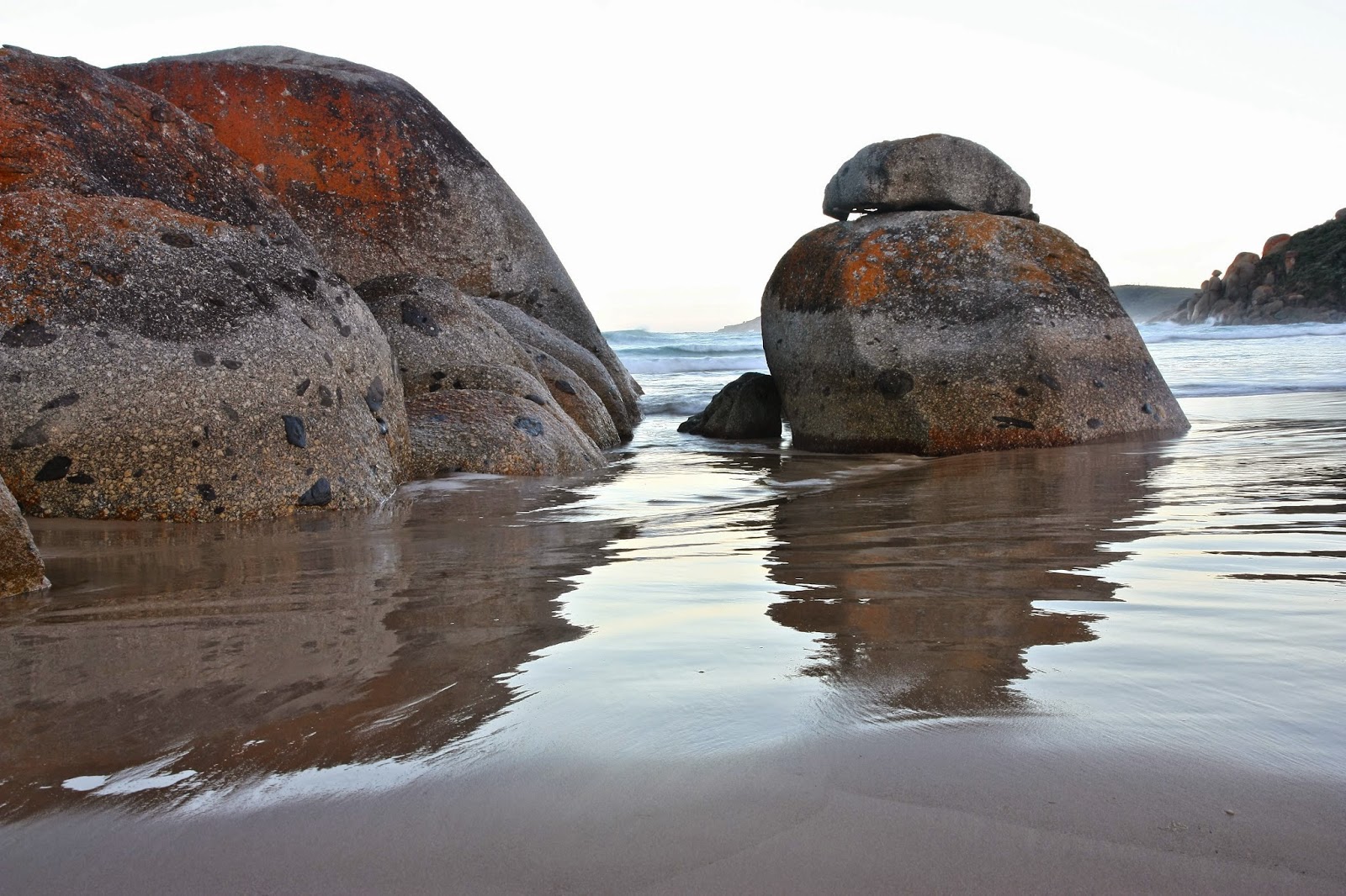
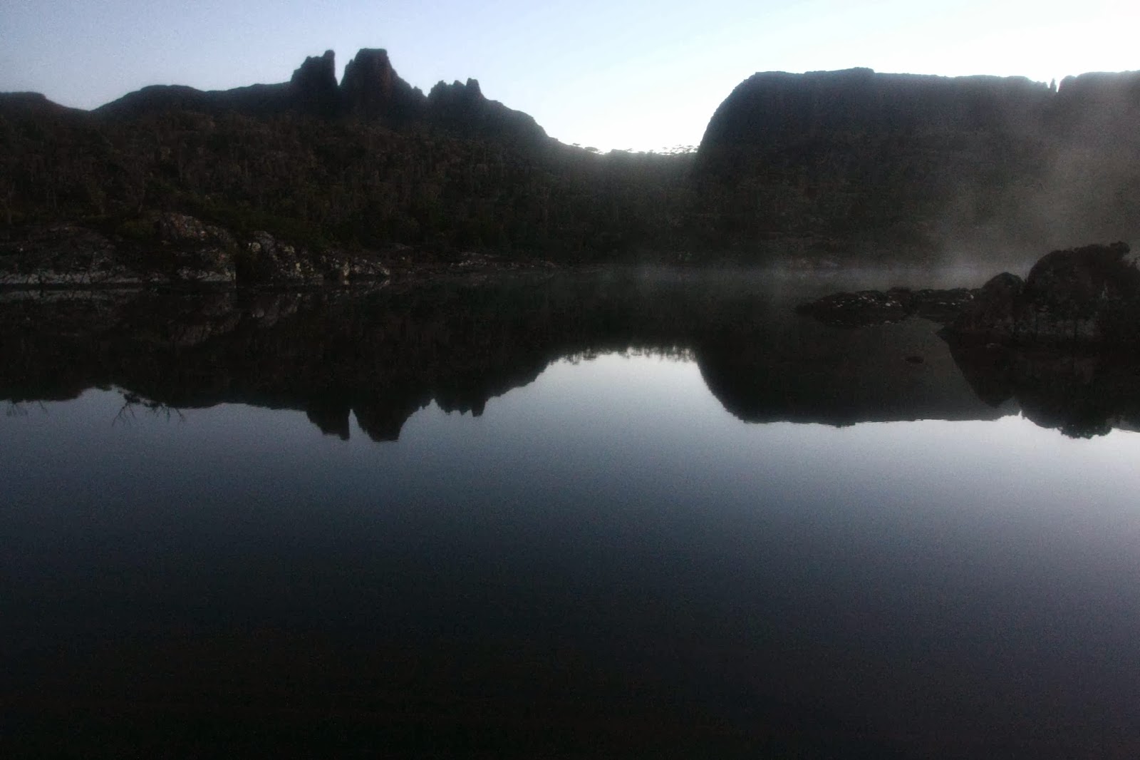
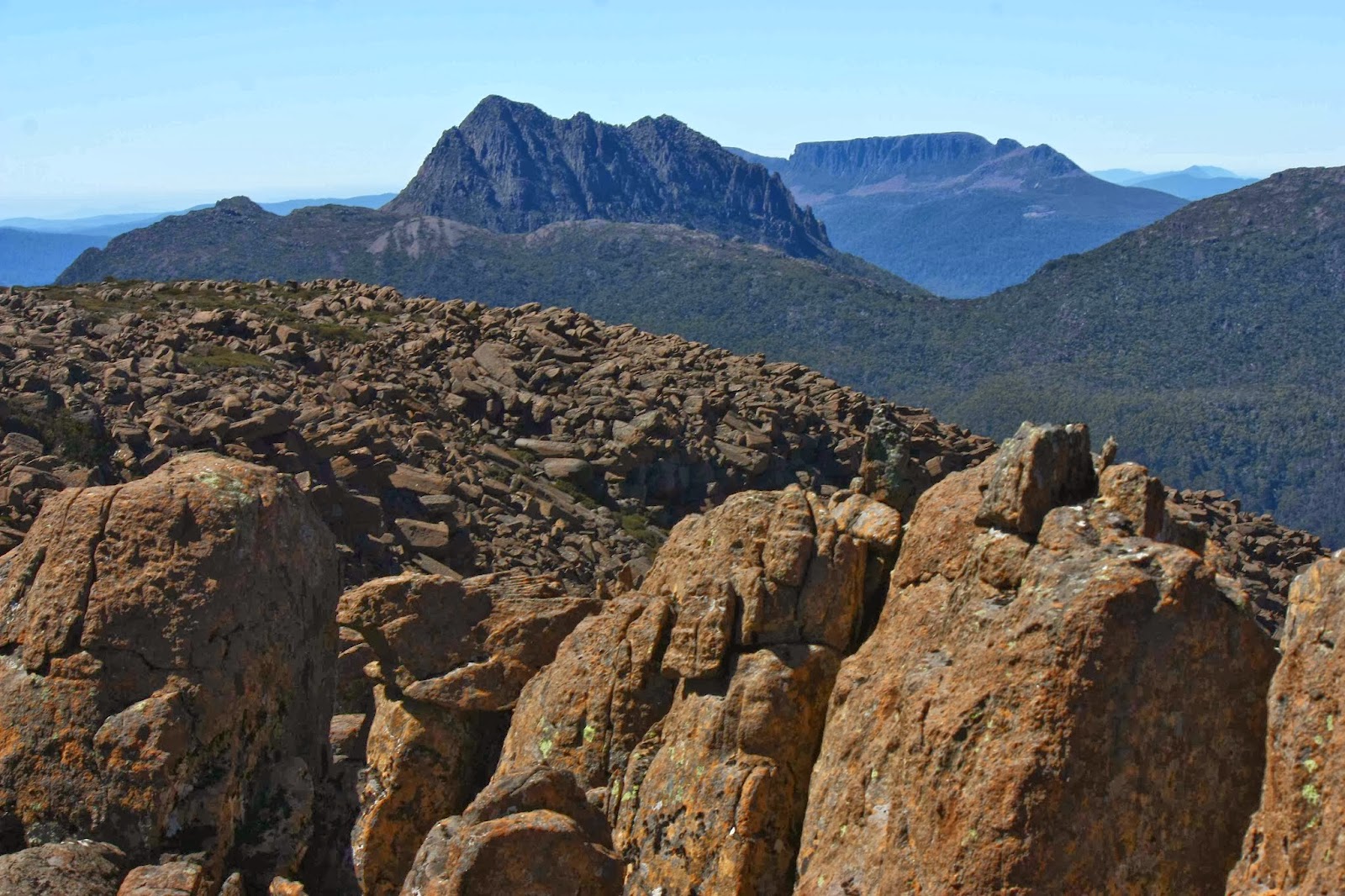
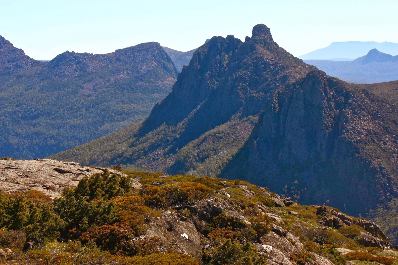
I have a love affair with granite. When my girls were babies, we frequently did daywalks in Cathedral Rocks National Park (NSW) with its granite tors the size of large buildings. As youngsters, they cut their orienteering teeth on the granite country surrounding Stanthorpe (QLD), Namadgi National Park (ACT) and Kooyoora State Park (VIC) … and then we moved to Tasmania, where the orienteering north of St Helens is characterised by more wonderful granite. We all dearly love this rock, primarily because of the shapely tors that greet you as you move through the forest – round bulges, sentinels of the bushland. They’re also fun to navigate around, or to climb up and over, or to jump from one to another.
 

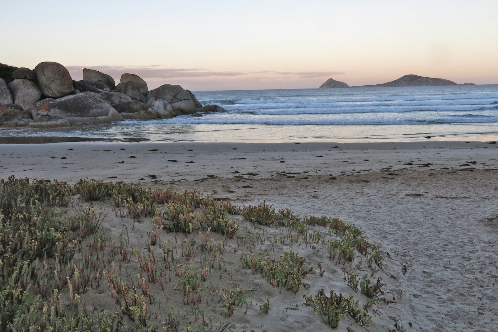
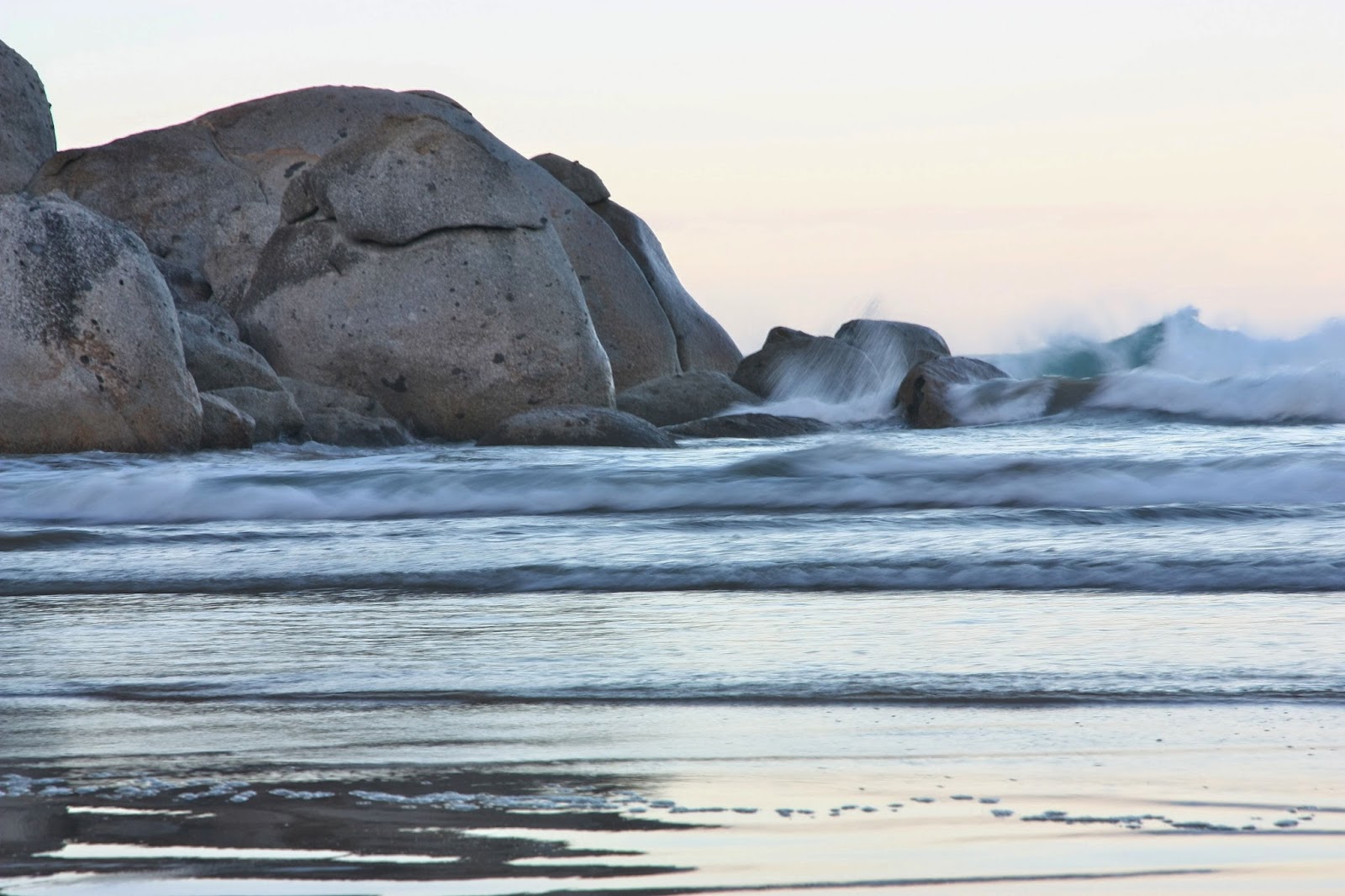
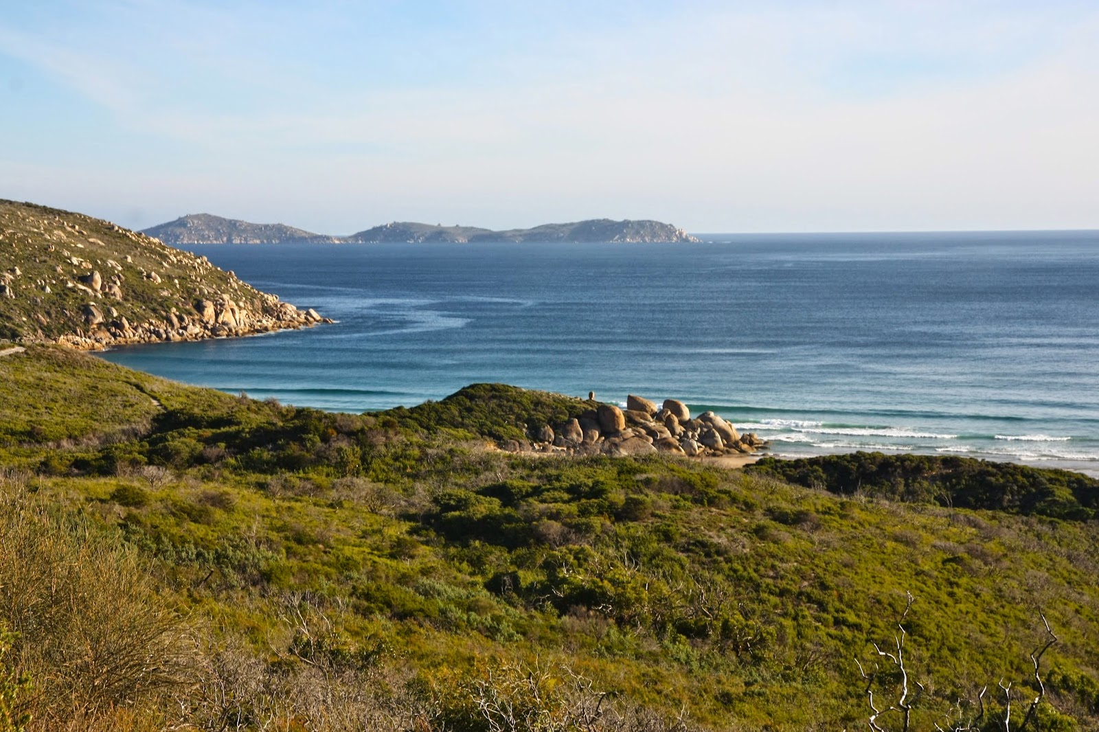
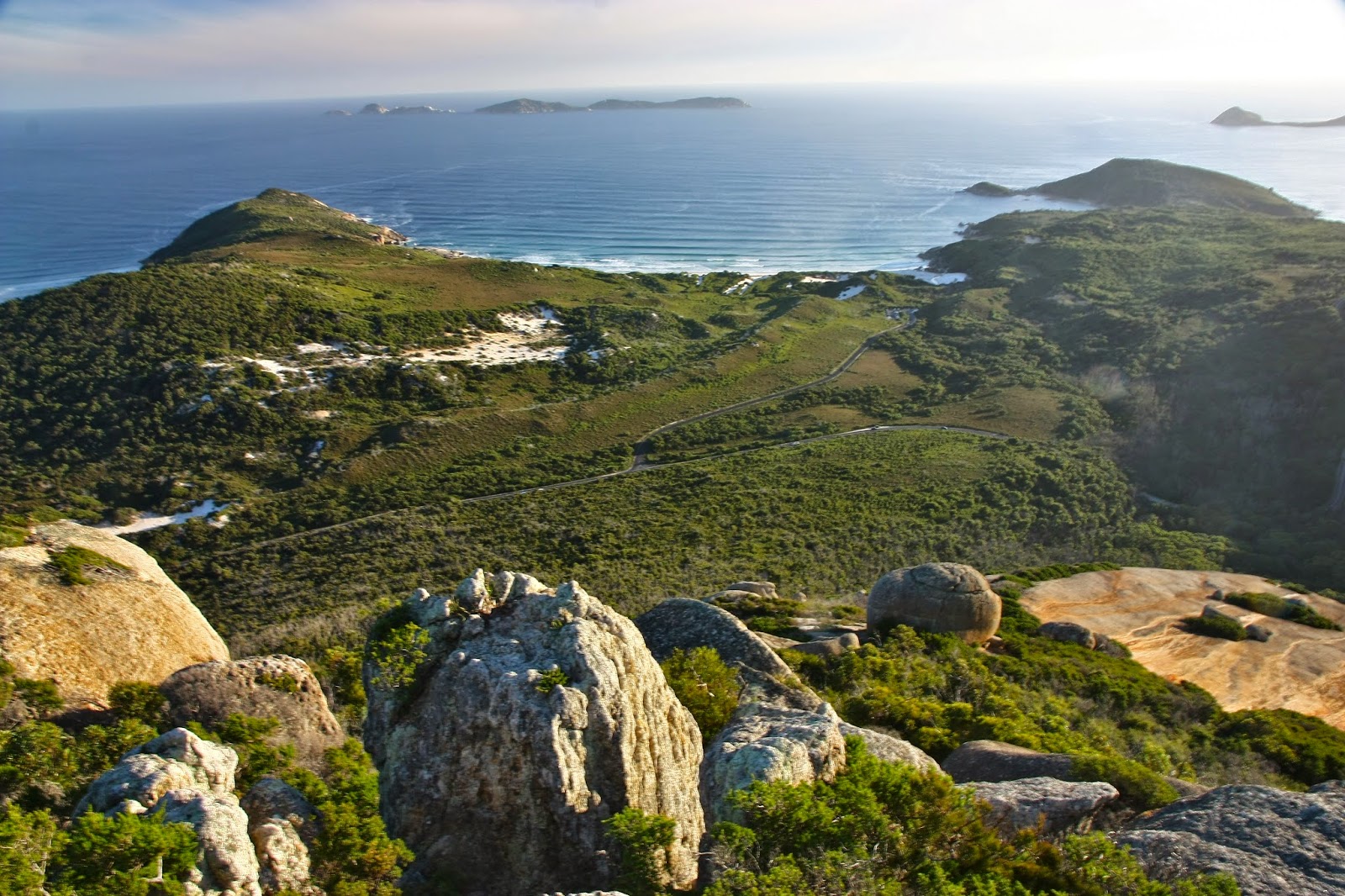
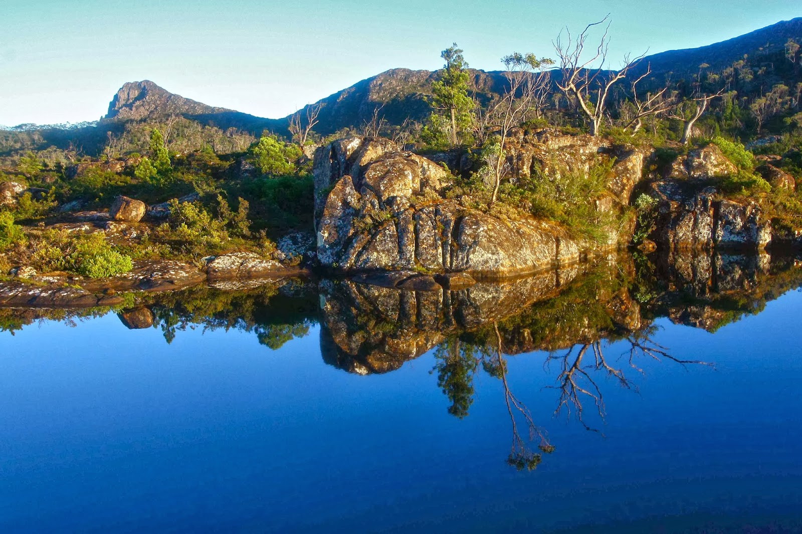
Coastal granite is particularly marvellous, as the white sand it generates produces beaches of a magic colour, whether one is thinking of the sand itself, or of the special blue of the translucent water that accompanies it. We adore Magnetic Island, Wilsons Promontory and, closer to home, the Bay of Fires and Freycinet Peninsula – all for the same reason.

My daughters seem to share my passion, so we were all very happy when my first born asked if we could spend our family Easter at Wilsons Promontory this year. We’d stay at a nearby beach, and walk and swim during the day. Who says “No” to such a request? Not us. Toddler Gussy could play on the beach while the adults in relay combinations could run up mountains and along the tracks of the Prom.

 
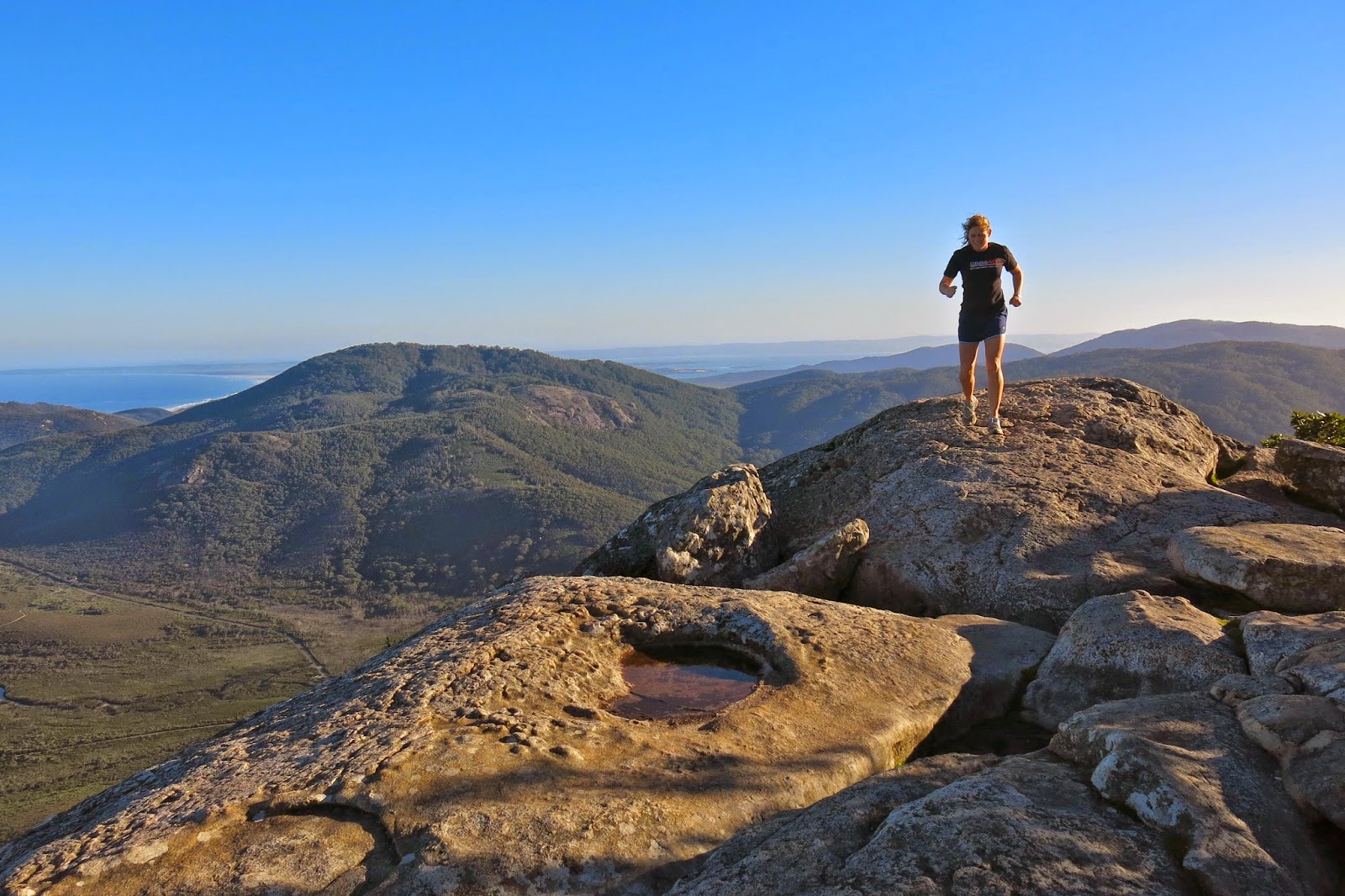
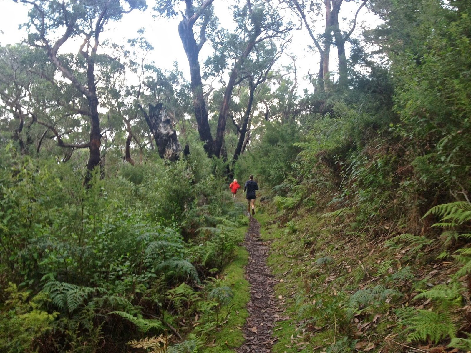
Kirsten on Mt Oberon
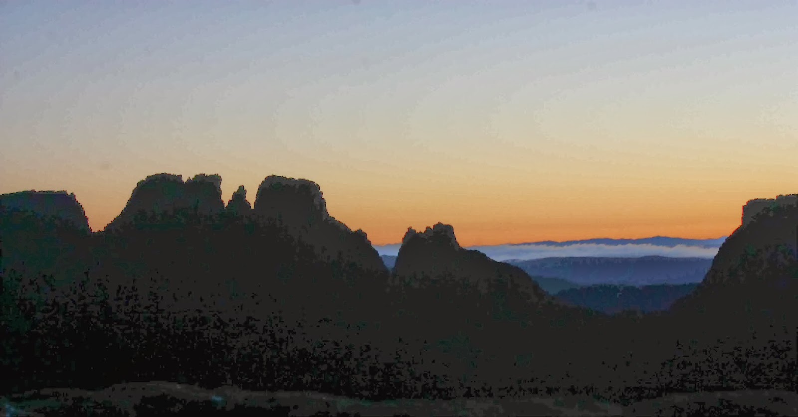
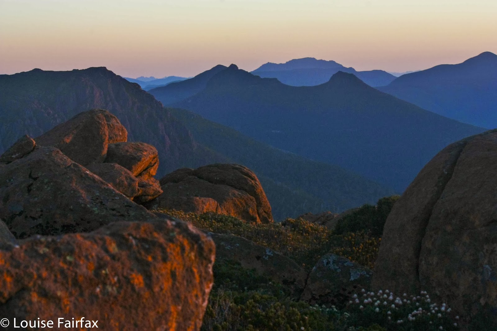
The forecast for Friday (Anzac day) was excellent, so Kirsten and I got up in the dark and drove to the Prom for dawn photography, and then had a wonderful run up and down Mt Oberon. I really, really love running up mountains, and don’t get much opportunity to do it these days, so revelled in the chances this holiday gave me to pursue my old ways. The mountains of Europe that were my competing arena in bygone days are, of course, much steeper and longer, but these ones are still fun and pose a pleasant challenge. There is something very liberating about running up a mountain. We had set out nice and early, so enjoyed wonderful lighting from the top, and had the whole mountain to ourselves.
 
Coastal view, Oberon.
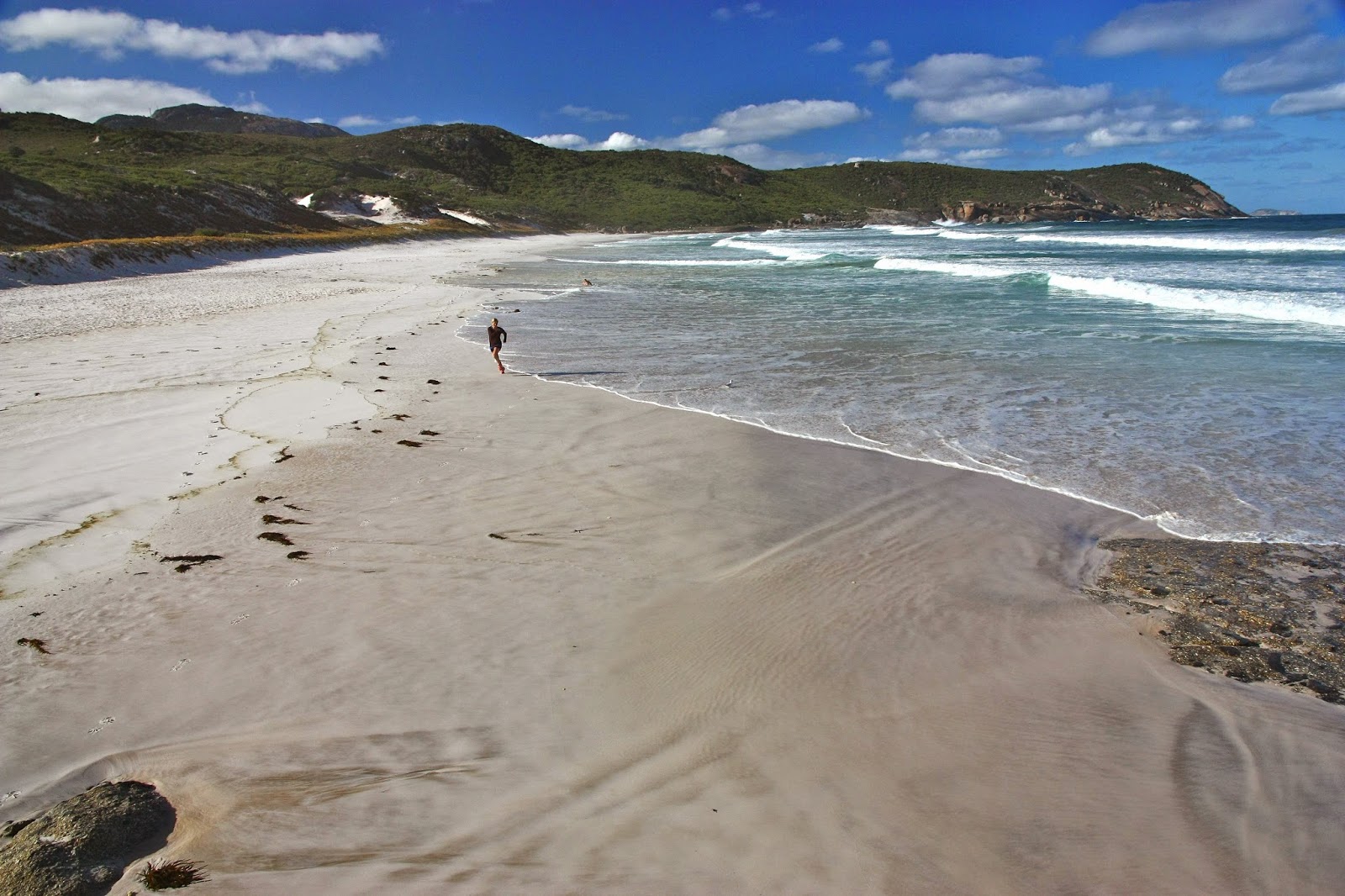
Back at Sandy Point, while Gussy was playing with his mum and the others were surfing, I went for another run, this time on the beach, as it had only taken 25 mins to run up Mt Oberon, and much less down, so I was feeling under-exercised. As I turned around on the return journey I saw a little dot in the distance that grew rapidly as I ran towards it. It was two-year-old Gussy (pursued by his Poppa) running towards me in that quaint style toddlers have, his little legs whirring, his arms flapping for balance. We calculated he ran about two kilometres that day. His face was aglow with excitement as he ran into my arms. Now he was doing what all the adults do, and he was very happy.
 
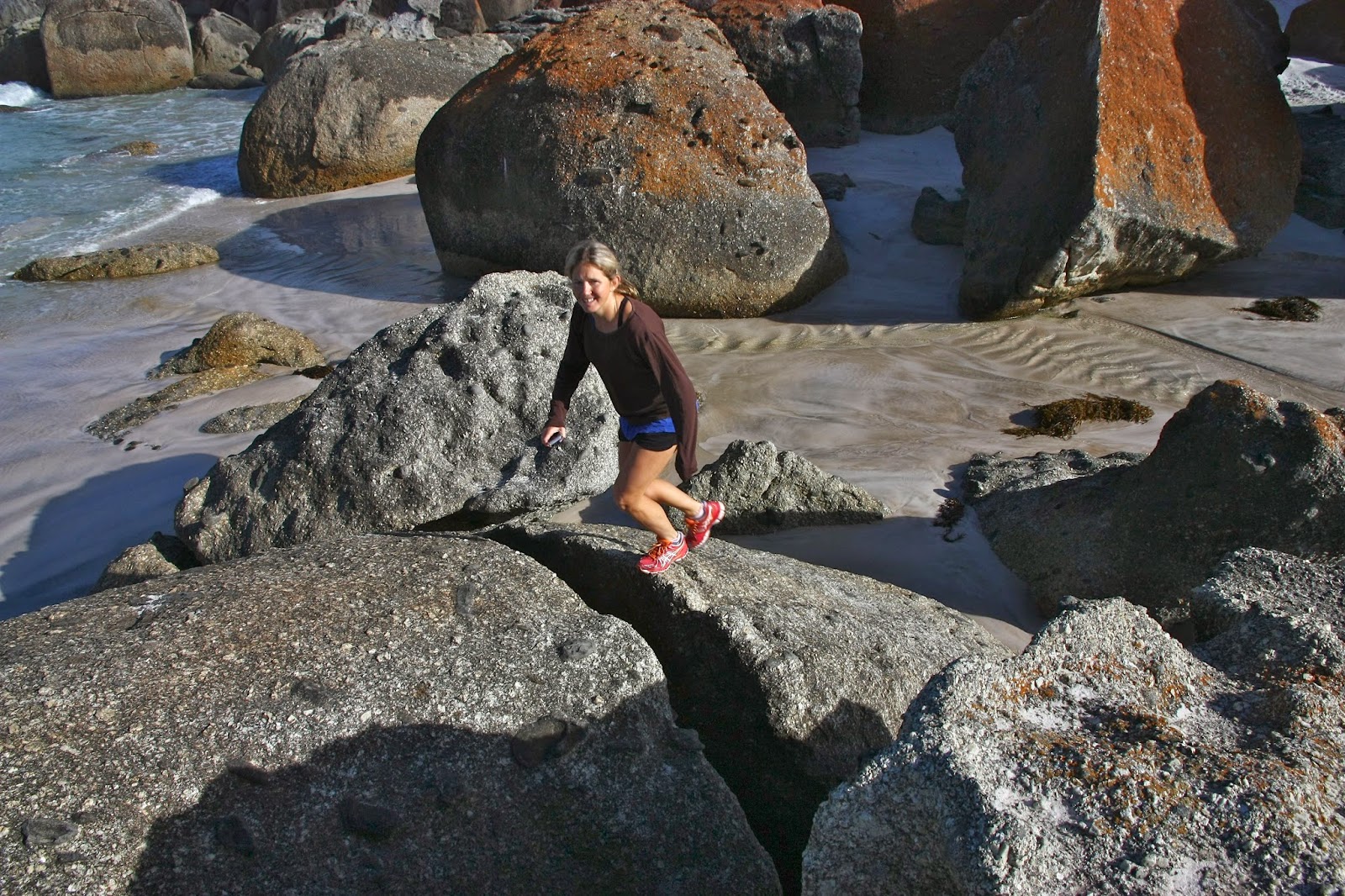
K, back down on Squeaky Beach
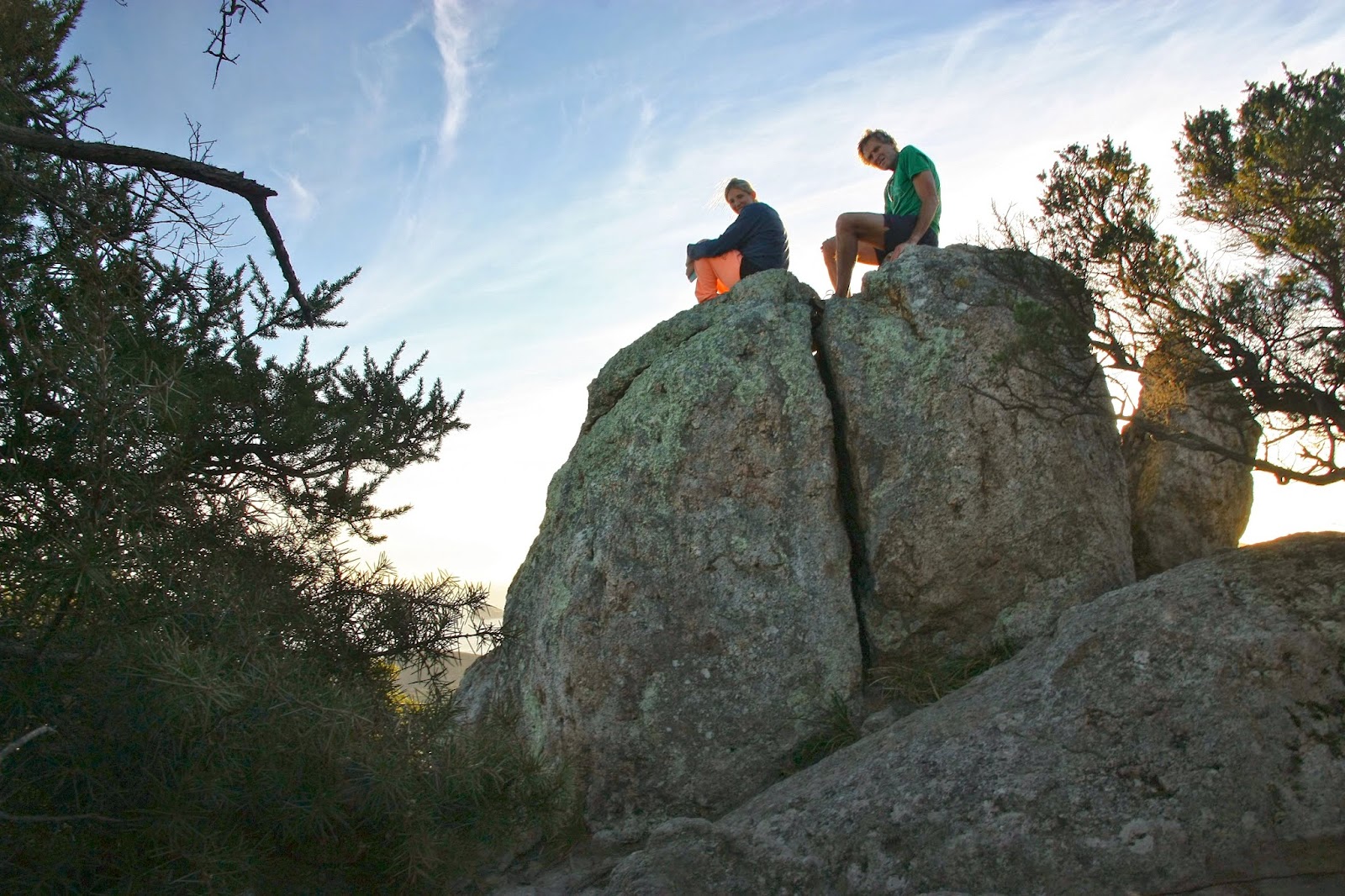
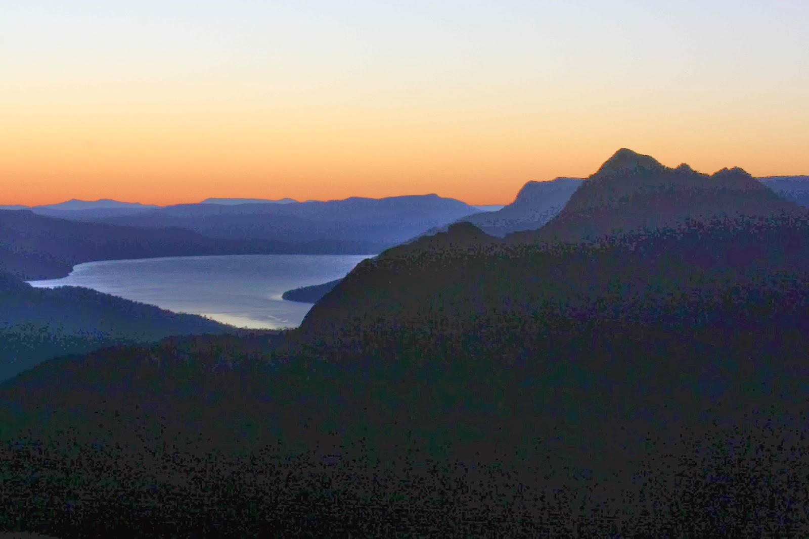
That afternoon my other daughter and my husband wanted some exercise, so we went back into the Prom and did a fast stride out up Mt Bishop. Again, the lighting was magic, as we’d waited until nearly sunset to do it. It was great to clamber up the summit tor and sit on top and gaze at the beaches below.
 
Whisky Bay and Picnic Bay, on the way to Mt Bishop

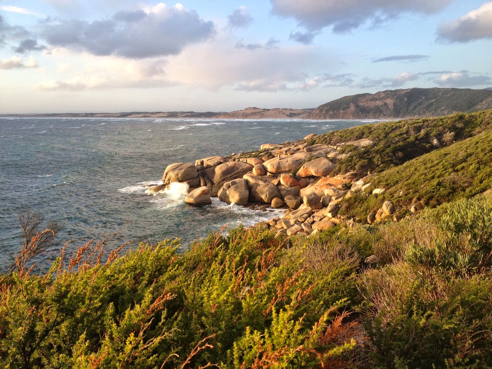
The next day the weather had turned, so my second daughter and I just did a flat run parrallel to the beach: 40 mins in howling gale-force winds and rain. In the afternoon, I persuaded the other adults to run along a track on the coast in the Prom while Yelena minded a sleeping Gus (who, of course, woke up to find us gone yet again). This was a ‘rest day’ as we were to run up another mountain on the morrow. Out we set into the punishing winds on the 12 km coastal track. It was exhilarating.
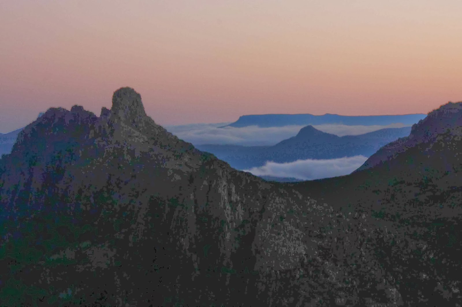
View from Mt Bishop
My husband and our second daughter on top of Mt Bishop.

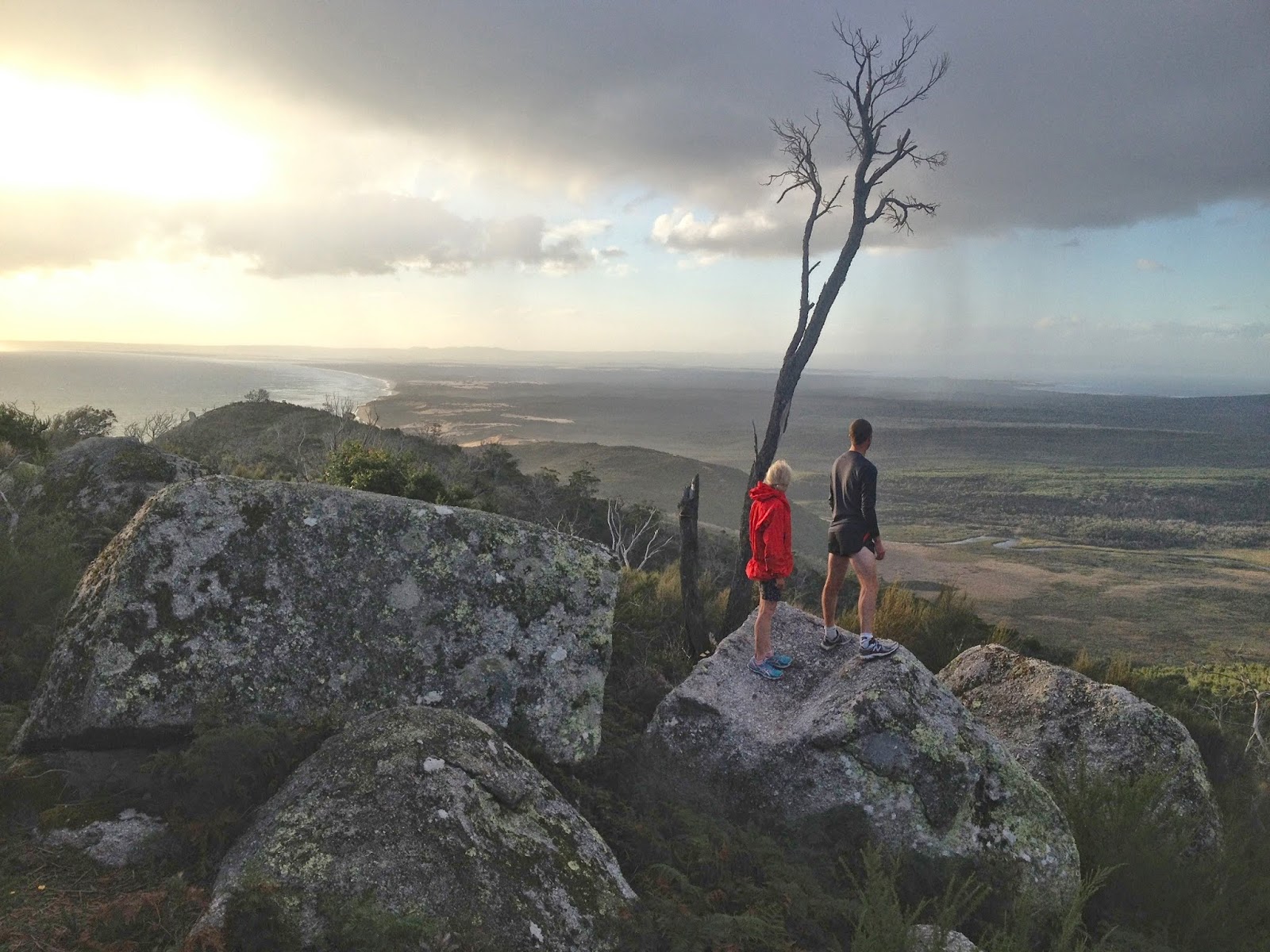
The track was pretty protected up until a high point called Lookout Rocks, from where we could gaze out at an expansive purview. I didn’t like what I saw of the continuation of our route: a nose dive down to sea level and along to the point … which meant we’d need to run back up the slippery dip on the return journey. I feared it was too steep to run, given the amount I’d already done in the last couple of days. On we went in the magnificently moody weather. It reminded me of running on the headlands of Emerald Beach in the cyclone last year. The sea below was surging in giant hillocks of water, all churned white from the wind. The lighting was a yellowy-grey. Surprisingly, I did manage to run the return journey, as did my daughter and her husband, so we were all happy.

Keith and I on the track

Keith and I stop to take a look at the view below. It seemed a long way to go down and then back up again at the end of a full day.
The sun came out for about 5 seconds – just long enough for me to grab Kirsten’s camera and take this


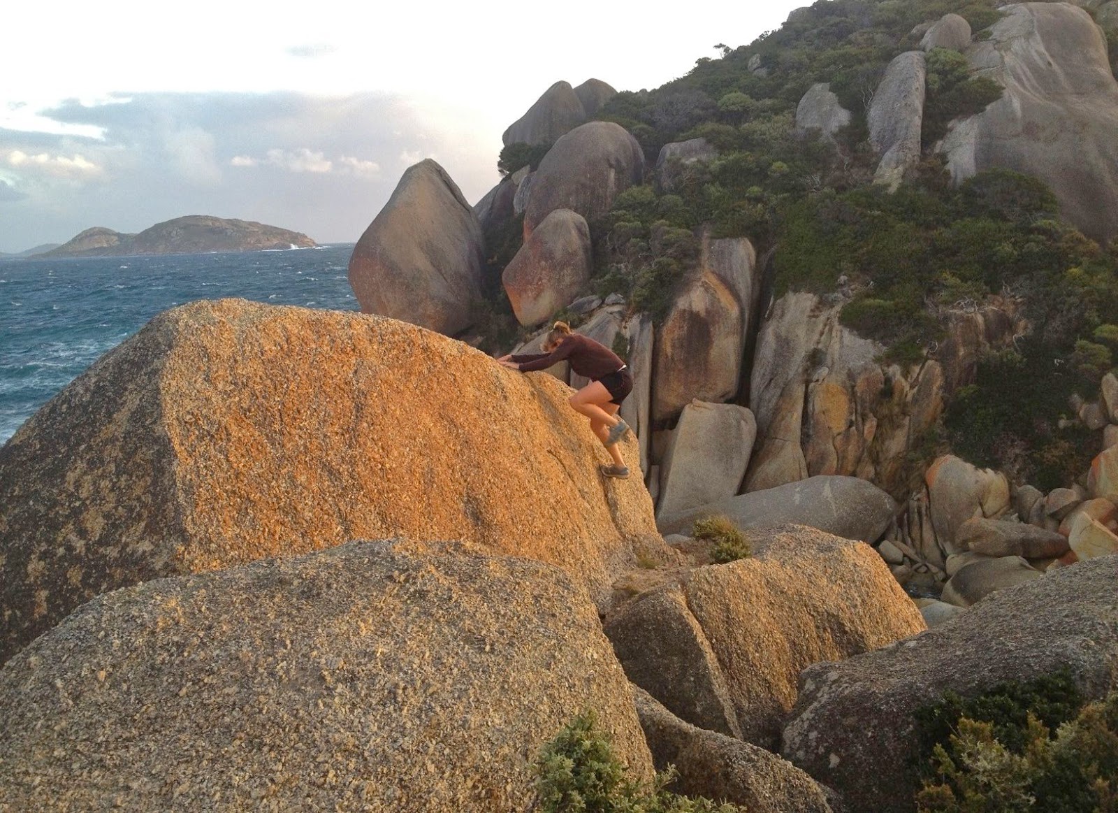
Kirsten running up boulders at Tongue Pt
The next morning we decided not to get up in the dark. Poor Gussy had woken up from every sleep to find that some of the people he loves (and always his Nanna) had gone running. This day we ‘d have breakfast together and then run while he played on the beach. He appeared in my bed in the dark at 6 a.m., fully expecting me to be getting on my running clothes. “I’m VERY, very fast, Nanna,” he announced. He was obviously angling for inclusion in today’s expedition. He whirred his tiny legs around to demonstrate. I said I’d run up mountains with him when he gets bigger, and he was happy enough with that, although not entirely appeased.
Yelena back down on Squeaky beach after the mountain. The sun has now come back out.

On this day, it was my second daughter who was going to run skywards with me, and we’d chosen Mt Bishop to be our mountain, as we’d only walked up it so far. The weather was murky, and we already had photos from the top, so for the first time we ran without the burden of cameras. Nice!

… and then we did some beach and headland running while Bruce surfed
As with Mt Oberon, we were at the top in under half an hour, so made up the ullage on a track down below, between Squeaky Beach and Picnic Bay, the perfect ending to a granite beach extravaganza. My husband ran part way up and down the mountain, and had a final surf while we did the track. Farewell Prom.

Black Bluff Range 2014 Feb

Black Bluff and Black Bluff Range, 15 Feb, 2014

Banks of the Leven River near Taylors Flats, below Black Bluff.
Surprised by Joy is the title of a book by C.S. Lewis, but I’ll steal his words to use as a summary to describe our walk to Black Bluff and the Black Bluff Range on Saturday.
 
Paddys Lake

First, we were surprised by the beauty of scenery, which far surpassed any expectations, and second, surprised by the weather, which went nowhere near the grim predictions of the Bureau of Meteorology. I was also surprised by the appealing banks of the Leven River from Taylors Flats to the start of the climb proper. The only thing that didn’t surprise was fun of the climb. I once received the double-entendre cognomen “Mountain Maid”, and that journalist really did get it right. I am always high in more than one way when on top of a mountain, and I invariably adore the actual activity of climbing to get up there.

Near the summit
Taylors Flats – a location seemingly in the middle of nowhere – turned out to be a grassy oasis with bright green banks leading down to a tranquil, delightfully clear and inviting Leven River. One parks there and follows the peaceful banks along for a short while before climbing. I noted that the depth was probably just right in places for a dip at the far end of the day. Pity the forecast was for plenty of rain.
We startled a wedge-tailed eagle munching a morning tea (of possum) as we went along. He didn’t enjoy our interruption, actually, so did not fly away or even ascend to giddy heights, but just moved along to perch in a tree only slightly out of reach so he could resume his gastronomic pleasures once we’d departed. This gave us a good view of him!
Up we went into the clouds, stopping at Paddys Lake for our first proper stop with drink and snacks.
Fun rocks on the range

The only photos I had seen of this lake had not been taken in advantageous lighting, and were rather flat. Now we were at the real thing, we were further surprised by joy. She had on a silk clouded mantel that suited her complexion perfectly, with diamond studded jewellery that offset the soft greys of the cloak. The form of the Bluff behind was completely obscured, but hints of shapely rocks and King Billy pines teased us from their hiding places in the mist.

Climbing the last rocks on the range summit
Many photos later, we were off, higher up into thicker mist and our first objective, the Bluff hiding up there. We saw nothing from the top, but we were fine with that, and ready to press on to the highest point of the range, about two kilometres further on. We wanted to finish our climbing before lunch, and, more importantly, before the heavy rain fell. As visibility was often down to about 50 metres or less, we agreed on a route before setting off, making good use of my phone gps, which has a lovely big screen and offers fully contoured maps. We marked a couple of way points that we wanted to go through en route. Off we set down the rocks into the thick grey soup.

Paddys Lake from above, on the way back down.
We had arrived at the first saddle separating the two goals, which is only a very short distance from Black Bluff itself, when all of a sudden the mist cleared, revealing an alpine moor of magnificent walking through ankle-high vegetation – mostly pineapple grass – over the hills and far away. We were excited by the beauty and by the sense of wide open space with vistas appearing and disappearing as the mist swirled around, playing games with us and the rocks around. I sang with joy. It was totally wonderful up there.

Same (but lower)
All too soon we were on the second summit, high point of the range itself, and then it was time for lunch. Thanks to the mist, the view was not static, but changed by the moment as we watched the actors in our private drama – well known, academy-award winning ones like Cradle and Barn, Murchison, Pelion West and more – make their entry, and then leave the stage.
Mycoacia subceracea: Colourful strip of fungi
Back down the bottom, there was time and warmth for a swim in the river before going to have a look at the Leven Gorge, not too far away. I’m glad BoM gets it wrong sometimes.

Macs Mountain and Walled 2014 Jan

Macs Mountain, Walled Mountain and more

Mt Eros from Lake Elysia, dawn.

It might surprise many readers to hear that I gave up bushwalking on Saturday evening. The problem wasn’t that I’d been wet for two days – I’m used enough to that. And it wasn’t that I hate my little tent that gives me the freedom to sleep wherever I want in the wilderness, or that I was bored in its confines with my husband, cooped in there from 3pm after we’d given up ploughing through wet scrub in the rain. I’d brought a great book that he read aloud so we could share it (Max Frisch’s Blaubart / Bluebeard). No; I was frustrated by my own ineptitude that had landed us so often that day in cul de sacs of impenetrable scrub. I decided I was a lousy bushwoman, and incompetent leader – a race horse that should now be sent to the knackers. Time to drop out.


Mt Geryon and the Acropolis, dawn. (Labyrinth)
I took up bushwalking again at 5.30 next morning. My husband woke me and told me to hurry outside. I grumpily looked out of the flap, still too sleepy to be easily impressed. That quickly changed. The air was crisply, wonderfully clear. The tarn that poses as a lake (Elysia) beside our tent was a perfect mirror reflecting Geryon and the Acropolis to our north, each of which was a dark silhouette in a sky that was only just beginning to lighten. A soft layer of mist wove around the surface of the water. Who cares about one’s own ineptitude when greeted with a sight like that? We watched in wonder as the sky lightened to roseate hues, changing position every now and then to climb little hillocks or go out on a rocky lead that took us into the lake a bit so we could see around the corner to Walled Mountain which began to turn red as the sun gained in intensity.
 
Walled Mountain
We were hoping to meet friends and climb Macs Mountain with them this day, but it was so lovely where we were we were disinclined to move; we had no idea where our friends might be, given that their plans had also probably changed due to the previous day’s rain; and our tent was so sopping that packing it up before the sun had had time to dry it out a bit had no appeal. We lingered longer. I was also not looking forward to the scrub I had had to negotiate to get us where we were. Eventually we set out, and I made speedy, almost scrubless progress straight to our destination, covering in 11 minutes what it had taken us 26 minutes to do the day before. At last I could navigate again.
 
Acropolis
Mt Geryon

My husband, who has Parkinson’s disease, was in fine form. We made it with fully loaded packs from Lake Ophion to the summit of Walled Mountain in under an hour, and there on the top were our friends, who had spent the night at Lake Eurynome. At a tarn just a bit below the summit, we looked up and saw them arriving at the top and taking the obligatory summit group photo. We had not even held them up. Hoorah. We pitched our tents by a tarn near the summit (their tents were still sopping as they had set out before the sun had had a chance to dry them, so we all pitched before we left) and we were all ready soon enough to tackle Macs Mountain to the west, in blissful ignorance of what lay ahead.


Mt Eros and the Du Cane Range
On the map, Macs looks a lovely little scamper – dash over the smooth, contourless plateau behind the cliffs of Walled, over a tiny hump, through a bit of a saddle, and up the side of Macs. Fun. Ha, ha. The plateau section was as expected. The “bit of a hump” was a ridge line of dolerite lego pieces turned on their sides with spaces between that would kill if you missed when jumping from one to another. I was happy on such rocks, but knew my husband would be hesitant. I didn’t dare to even look, but he was fine, so I was greatly relieved. 
Then we came to a drop that was so sheer you couldn’t see beyond the plunge. I thought my husband had reached his turn-around point, but no, down he went, very early in the queue so that if he sent rocks flying, there would be minimal damage done below him. I chose the bushes to the side of the chute, and had fun on a steep slippery slide to the base.
 
Gentianella diemensis plantaginea 
And at that point, the hard stuff began. I gave up trying to time what we were doing (I normally time everything), as we spent so long staring at painful walls of nasty stabbing scoparia or blockages of melaleuca that demanded a password we were not in possession of that I decided we weren’t going to make our destination. Time was running out. We needed light to safely negotiate the rocky ramparts on the Walled ridge line, and time was hurrying on – but we weren’t. We had set out at around midday, and had enjoyed lunch on the way, but everyone was now getting low on water – the day had been so hot we had been drinking regularly and plentifully from our finite sources – and the general pace was slowing in response to fatigue and thirst. The scoparia was not abating. The wall of scree that actually represented Macs Mountain looked at the same time both daunting and still tantalisingly far away. Would we ever make it in time? 
 
 Minotaur, Gould, Olympus, Byron and more en route to Macs.

Things improved. We found a lead of pineapple grass that helped the pace, and eventually arrived at the wall of medium-sized boulders that formed the face of our mountain. They looked as if they’d all tumble down at the first response to a footfall. You couldn’t see the top, so I wondered if the pile of rubble in fact lead to an impassable cliff just out of eyesight. Pessimist. Others started up. No rocks fell. They disappeared into the blue yonder. Time to give chase. What a super fun climb! On all fours I scaled up the height in no time. This was the easiest part of the whole day, and highly enjoyable. I revel in climbs like that. And there was the summit cairn at last. Unbelievably we had made it. And perhaps more unbelievably, so had my husband, whose doctors had told him many years ago to stick to even surfaces, flat and with handrails. HA.


Hyperion from Walled ridge
The return route was much better, as we followed pineapple grass and a gully (that even had some drinking water in it) down to the left of the saddle between Macs and Walled. We chose the largest boulder chute to climb back up and that climb (rejected on the way down) was quick and painless. The bulwark ridge line protecting Walled from invaders provided no protection from our bunch, and as the mountains turned to soft blue silhouettes in the fading light we reached our tents in sufficient time to quickly cook dinner and eat it whilst watching the effects of sunset on the vista around.

Dawn from the summit of Walled (to Geryon)


Dawn over Lake St Clair (Gould)

Dawn looking towards Hyperion

Dawn looking towards Macs

The next day we had a busy agenda. After witnessing (and photographing the dawn, we had to pack, get down our mountain, and cover the distance to the afternoon ferry before it left without us. Some of us wanted to climb the Parthenon as well (which we did), and others wanted to play chasings with their runaway tent across the mountainside, which was a fun sport and source of much mirth. 


The pace was hot to reach our destination, and the waters of Lake St Clair deliciously cool in contrast. Unfortunately, the afternoon ferry arrives after the Hungry Wombat kitchen has closed, and before the Derwent Pub is prepared to give you food. Starving for a burger with the lot, I drove home trying not to fall asleep.

Elephant 2014 Jan

Mt Elephant 5 Jan 2014

Head high in cutting grass
I was in a defiant mood today. Not only had the weather forecast cheated me of yesterday’s walk (quite rightly – the wind predictions were grim), but I used the day to line up my intended walks for the summer, only to be told that every single walk I wanted was full. Another summer of doing our own thing zu zweit. Boo.

So, that mood had me announce that we would ignore the unalluring weather forecast for today with its silly bright colours indicating rain all over the state and go climb a mountain anyway – the best antidote to sulking. We hadn’t done Mt Elephant yet, and it was in the east, which had the least dramatic BoM colours for rain, so we downed a hurried breakfast and got out on the road. This time I packed gear for blizzards, just in case.

Summit cairn perched on a rock
Driving along, the weather was magnificent, and we both revelled in the play of light on the mustard-coloured grasses waving in the light breeze. The outline of the Lomond massif to our left as we progressed along the valley was clear and cheering, even if the air was not as crisp and fresh as in winter. It was a beautiful trip.

We tried to eye up our elephant as we approached, but I decided you needed as much imagination for that one as is required to see a Boa who has swallowed a pachyderm rather than a hat at the start of Antoine de St Exupery’s The Little Prince.

Victory salute

We looked for the spot described in my friend’s blog where the Pandani club had started, but were unsure as to its exact location, and we had no coordinates to help, so chose our own start, basically opposite the pancake parlour. Could come in handy at the end. A ridge came to meet the road there, so that suited me. We found a little track that got us maybe two hundred metres – away from the ridge, but what the heck – before we had to start earnestly uphill in a bush bashing spree. We both barked in two separate cough sonatas, our lungs objecting to the pollen we sent flying as we pushed through bushes that offered quite a bit of resistance. And then it got even thicker. No matter, we were on the ridge, so just had to be patient and, logically, if we kept putting one foot in front of the other, we must get there. Next came cutting grass that was over our heads high, and a forest of thick ferns.


A friendlier patch of smaller cutting grass
Visibility was not good, either in terms of vistas, or of the ground. I started getting a little unnerved about the fact that I never knew what I was treading on down there. I know what it is to be bitten by a tiger snake, and don’t wish to repeat the experience. This seemed like exactly the kind of country and undergrowth where i had my first encounter and I decided I was verging on tigriphobia (or serpentiphobia) today.
 
Na ja. Soon enough we were on the flat top of the mountain and I navigated us towards the dot on the map that marked the summit at the far end, still quite some way away. With visibility negligible, I was hoping I’d be accurate enough to see the tiny cairn that announced victory. 1 hr 27 mins after leaving our car, we touched it. Olay. The skies were getting decidedly darker and the wind was moaning. I was not looking forward to the return journey, so, in order to give some passing helicopter a chance to float by and offer us a lift – which we would accept – I decided we should eat, as I hate eating in the rain, and we might get hungry later, even though lunch time was still nearly two hours away.
We both felt that we made much better progress on the way down, firstly being further east than our ridge route up, and then swinging to be further west of our ascent. Admittedly, we did end up in some pretty stern dead ends of barricaded branches that brooked no arguments, but we also minimised the tall cutting grass, and we were going downhill. Our time of 1 hr 24 to get back to the car surprised us in that it barely bettered our time up. Going up, we were heading for a point feature, so I was careful about navigation; coming down we were heading for a line feature (road) so I decided to just go with whatever leads were easiest and walk along the road to the car at the end. This tactic brought us out in someone’s backyard about 300 metres west of the pass. The owner came onto his verandah to tell us we were trespassing, but was very nice in the presence of our humble apologies, so all was forgiven …. and now it was time for a pancake lunch. Hoorah.

It rained on the way home, and poured as we entered our driveway.

(Sorry the cyan line is broken. I was new to this toy and accidentally turned it off during the descent).

Billopp Bluff 2013 Nov

Billopp Bluff 2013 Nov

The top part of Billopp Bluff from below
I had never heard of Billopp Bluff until I read it on the club programme. That’s one of the things I love about being in a club: it introduces us to new peaks. I assumed it would be a bit like nearby Drys Bluff – along, then up a bit, maybe a bit of real climbing, and then vast views out over the plains below to the north and east. Fine. One point. Put our names on the list.
Only in the bus did I start to hear horror reports of thick bush and nasty scree – one club member said he’d prefer to be at work, and he hates his job. Oh oh.  My mental image switched to a long unpleasant day fighting thick, prickly scrub, then dancing interminably on scree as the summit ran away from us in the distance. We had an older member with us (73) so I feared we would not get to summit at all. Oh well, here we were.

Up they come

Medium-density scrub
The leader didn’t mind my choosing the route, and the former orienteer / wild animal in me enjoys that kind of thing. I love reading the bush for the best line through it. Up the spur we went – bush not too thick, lines made going pretty easy. The older member was keeping up famously. Life was good.

The knob-cliffline saddle
The first time we hit thick scrub was just near the cliff line, when really we were nearly there, so it was pretty short lived. The route we had been advised to take was to go left via a saddle between a bump and the cliffline (see photo), and then hang a right up the gully leading to the top. Follow your nose and common sense to the summit.

On the top. Vast views as expected
Fine, but my good friend and I were smitten with curiosity when we eyed up a different gully, and we both felt like experimenting and trying our luck in it – it looked so tempting. The leader trusted us, so off we went. It was more exciting than the real route, and we enjoyed trying to lever ourselves up the steep ledges; however, in the interests of safety and group harmony we eventually backed out of it and gave chase after the others. An added bonus of our exploits was that we found the only running water on offer for the day – and it was a very hot one.

some great rocks seen on the way down

So, up the real gully and along the tiniest bit and there was the summit waiting for us (and not running away at all). There was nothing at all that I call real scree at the top. In fact, there was no ‘real scree’ to play with the whole day. There were some stones in places. I have no idea where these horror stories came from. Of course, it was not a walk in the park, and should not be attempted unless you can navigate and are very comfortable off track, as you do have to find your own way there, but given those things as prerequisites it is NOT a mountain to avoid by devising new work at the office. The 73-year old made it, which was especially good as this was his third attempt. 

Olearia argophylla
We took nearly as long on the way down as we took to ascend, which says a lot to people who know about mountains.