Ben Lomond 2017 Sleeping on a summit

Ben Lomond 2017. Sleeping on a summit.


Ben Lomond is a perfect place to go if you live in Launceston, want to sleep in the wilderness, and don’t have a lot of time for driving – or for walking, for that matter. My dear friend Gracey and her fiancé wanted to sleep on a summit with me (well, within five minutes of one), so I decided that we should start simple, seeing’s she doesn’t have a great deal of bush experience, and I wasn’t sure how she’d go with an overnight pack. Start short and work it up is my motto.
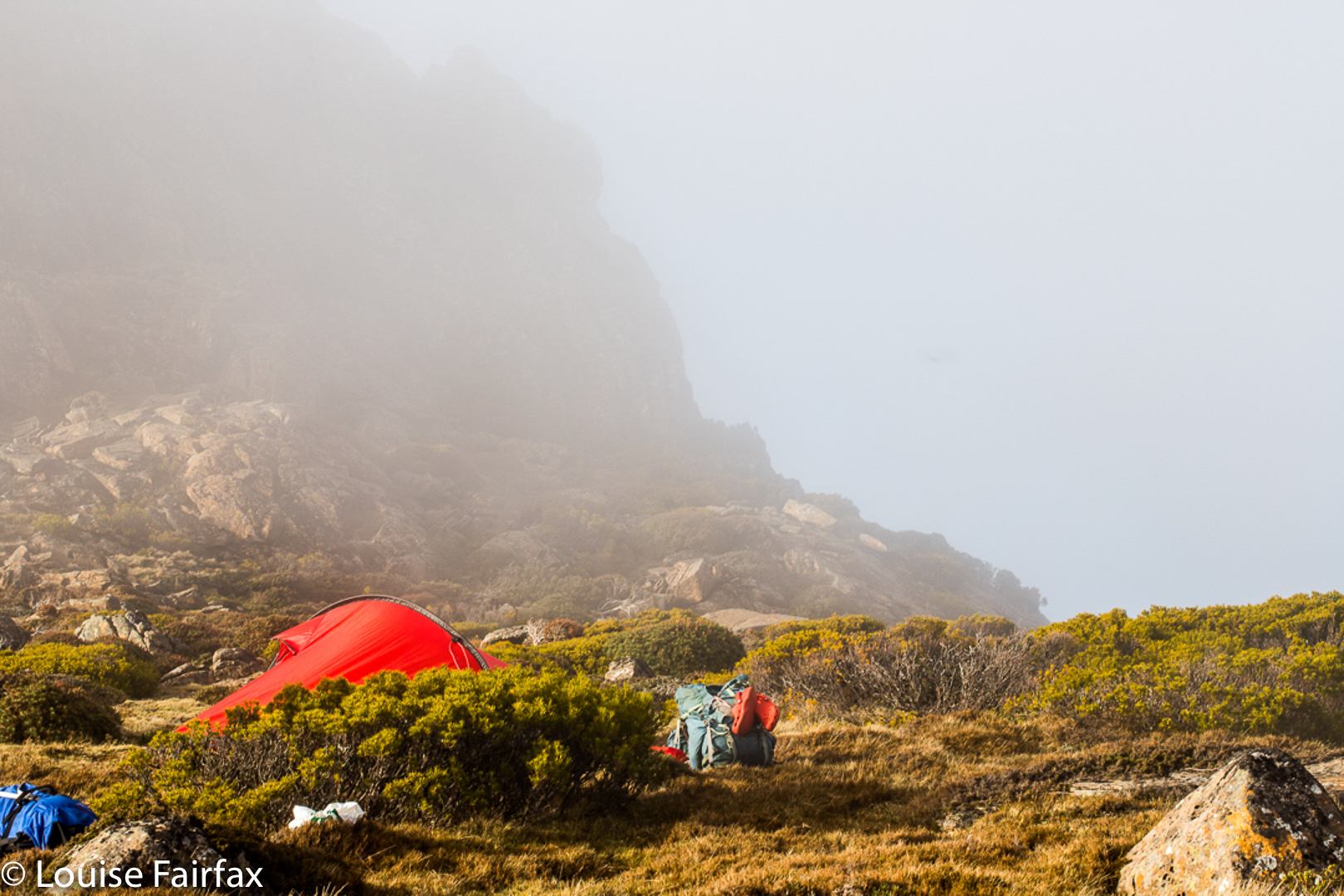
Pitching
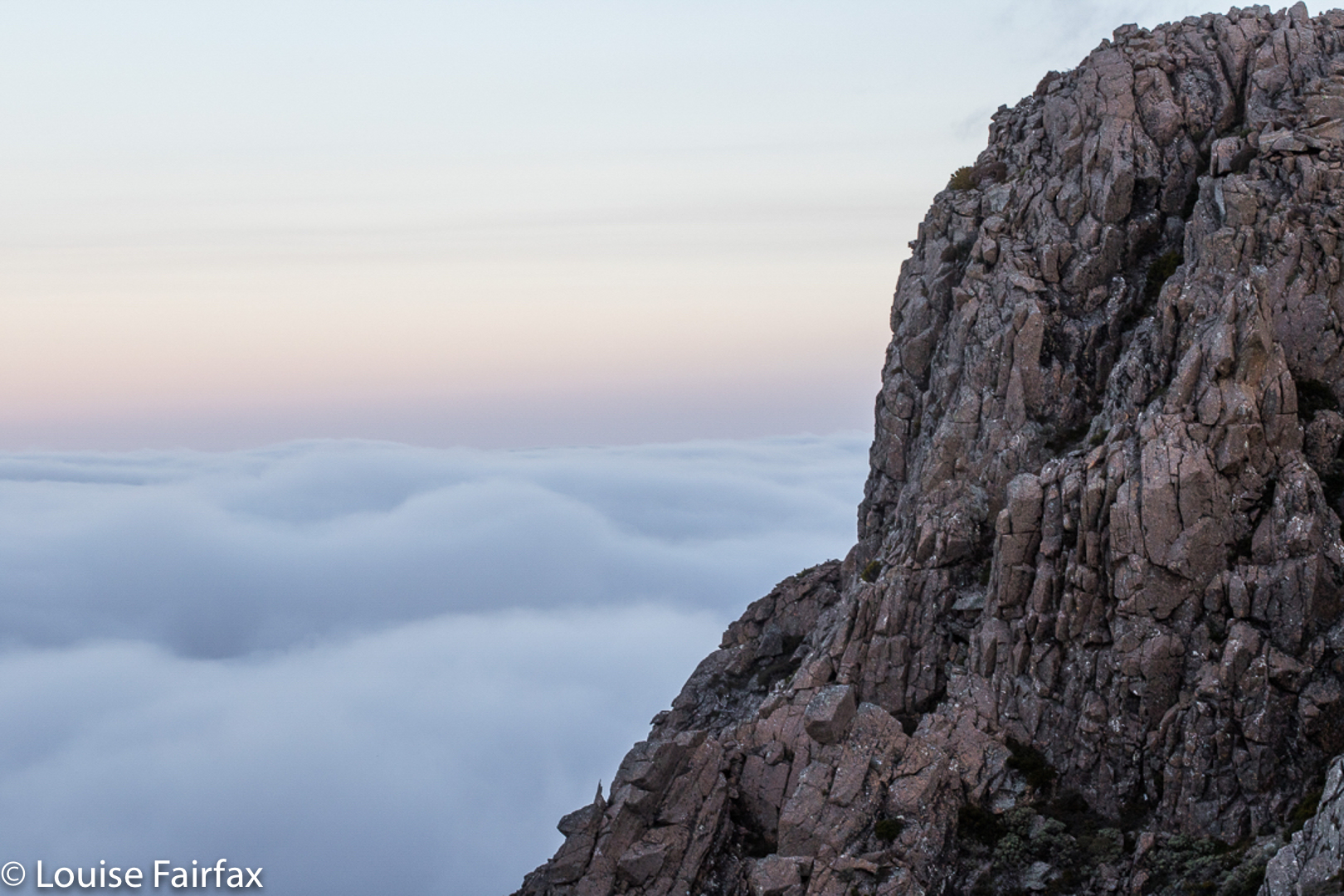
She and Alex drove up from Hobart after lunch, and then we took a while arranging things (I was lending them quite a bit of equipment, which we needed to sort out – it’s nice owning “too much” stuff [but when it’s useful, how can it be “too much”??]). No doubt we needed to eat a little something before we left … but Ben Lomond is close, so it didn’t matter. Off we finally set up the mountain, into the clouds, arriving up the top at maybe 5 pm. And from where we parked, it really was up and into the clouds, which seemed very romantic and exciting for one’s first sleep on a summit, and Gracey’s tone of voice certainly betrayed that emotion.

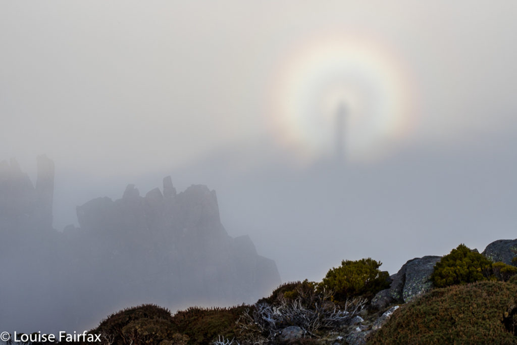
Two weeks in a row, I strike a Brocken Spectre. Amazing!
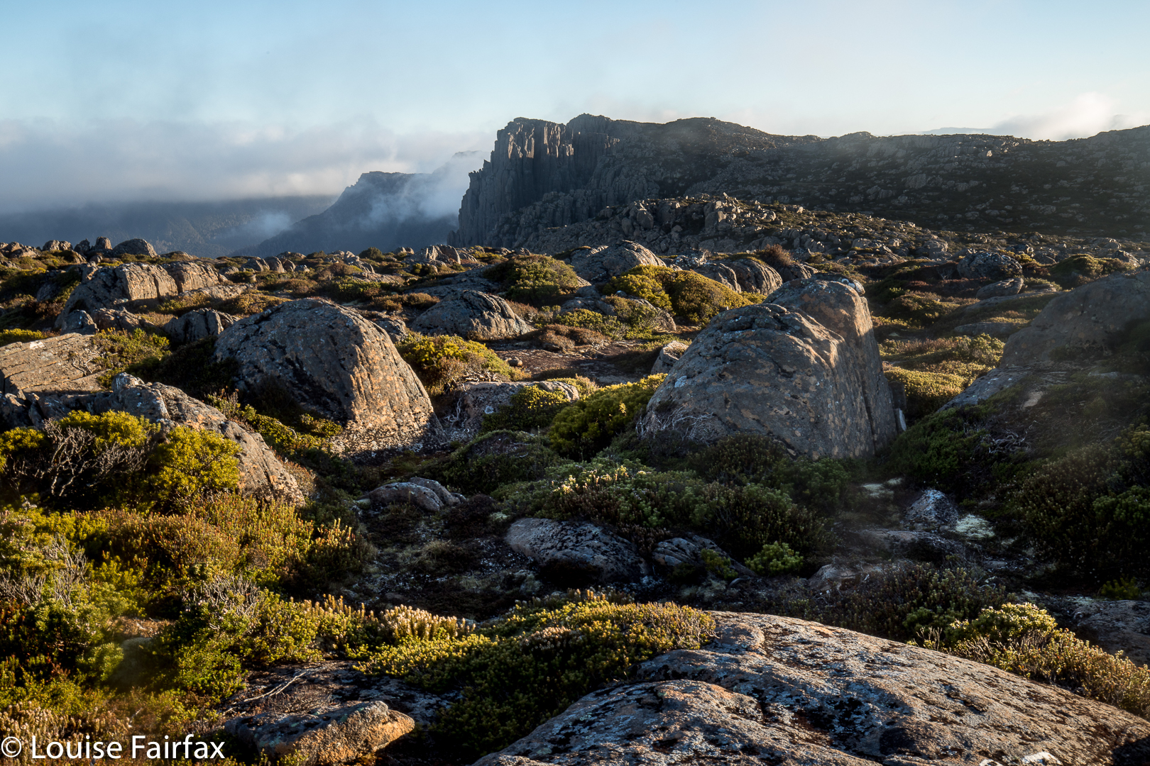
I was a bit nervous as we neared where I wanted to camp, as I hadn’t done a recce, so wasn’t actually sure if we could find two tent spots (or even one) in that rocky terrain. I also didn’t know for sure that we’d find water, and wasn’t carrying any. There was time to get back to the car if all this didn’t work, but I sure hoped we weren’t going to have to go back down and sleep somewhere less exciting. This was looking like fun, and offered glorious views. The other two needed a rest, so I went on ahead to suss out the area and reassure myself that I wasn’t leading them into a rocky jumble of yuk. Hoorah, I found alpine grass, beautiful tarns and space for at least two tents – more if we’d wanted. This was the life. I hurried back to them to tell of our success.

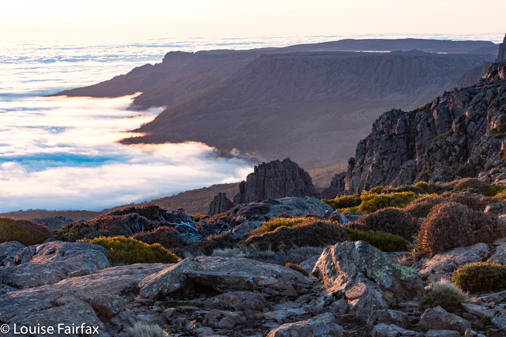
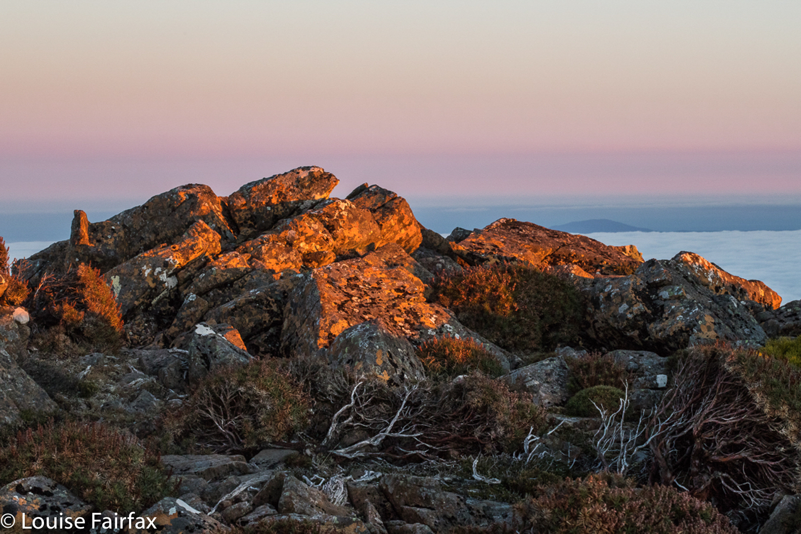
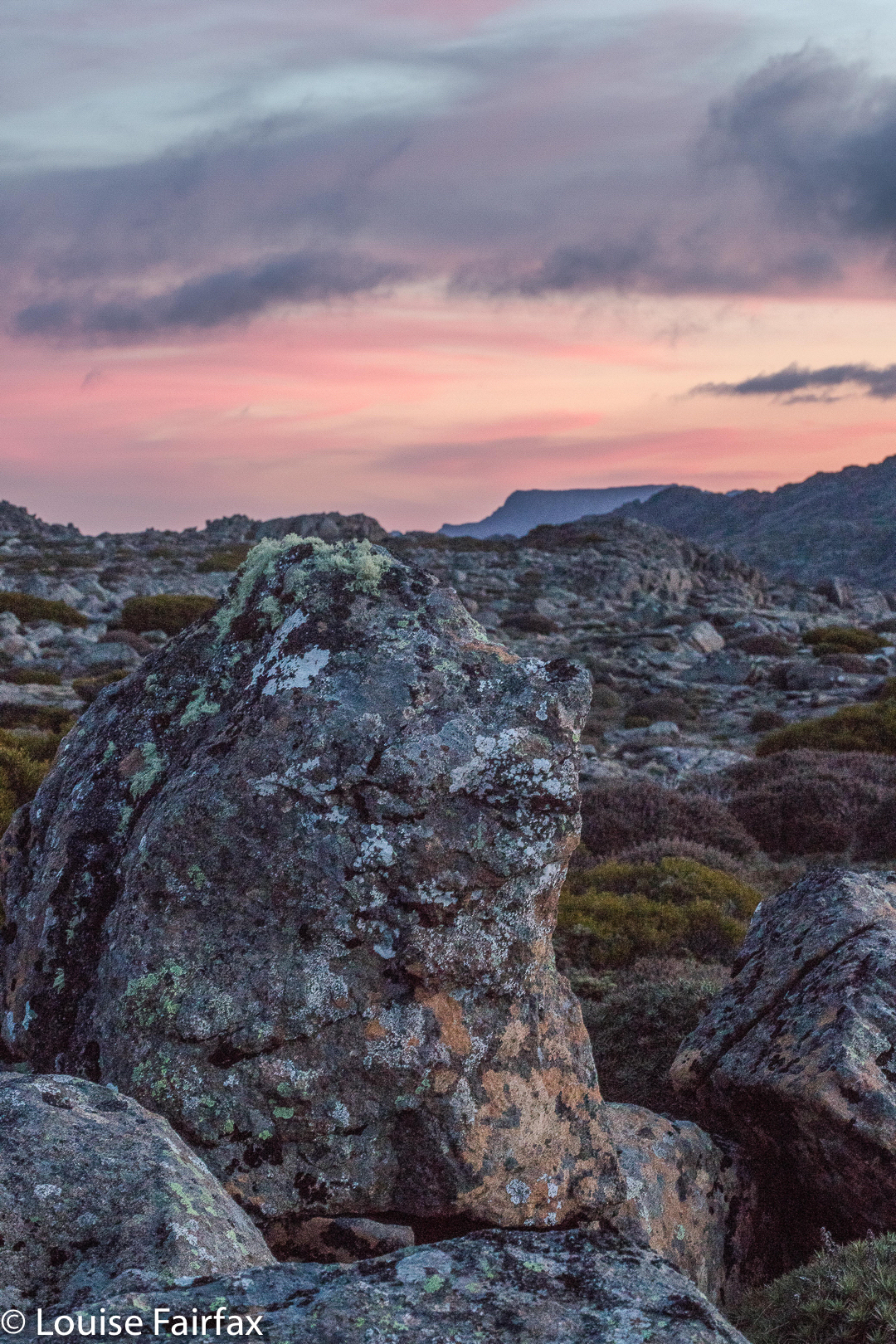
At dinnertime, we carted our gear to the cliff’s edge to eat perched there, staring out at a beautiful sunset unfolding while we chatted.


Sunrise.
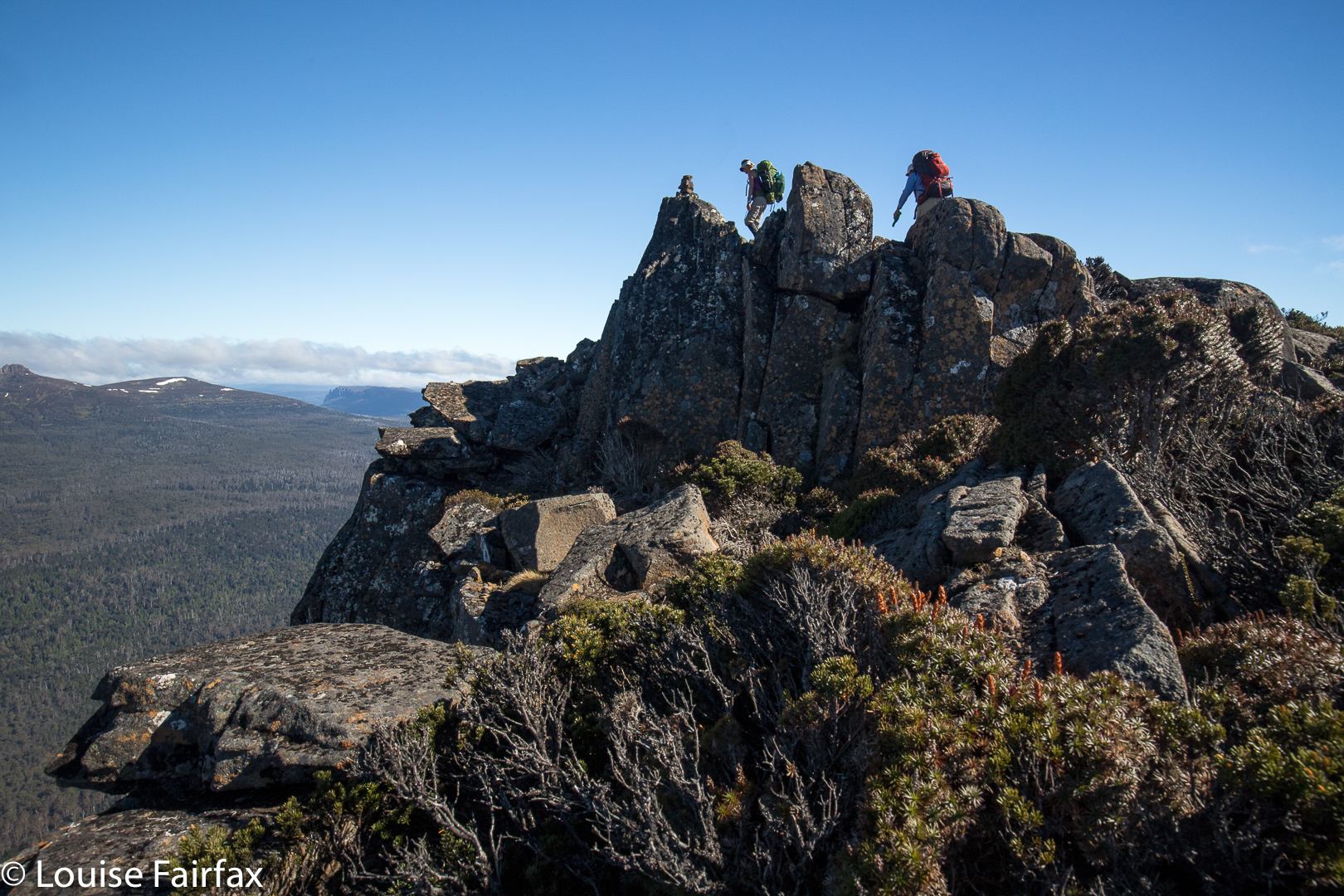
In the morning, we scampered over rocks to get a series of excellent vantage points as the sun rose. We had breakfast number one high on the mountain, before driving back to my place for breakfast number two.


We’d had two days’ worth of adventure before most people had had their morning tea break. We’re all excited about the next one, which will be longer, but not too long. One leap at a time, and only a doable one at that. Alex and I have to curb Gracey’s excitement and desire to throw herself at the deep end. If one does that too soon, one can end up hating it, as it becomes too tough to enjoy. We need to build up bush muscles gradually, as with everything.

Twin Spires 2017 Nov

Twin Spires Nov 2017


Twin Spires as seen from Cathedral Mountain.
The mountain called Twin Spires is right next door to Cathedral Mountain, and it would thus be pretty odd to climb one without the other. Twin Spires is the Abel, so I guess if you only had time for one, it would be the one you’d do. I am biased, as I camped on Cathedral and enjoyed the golden hours of sunrise and sunset there, so prefer those views, but Twin Spires was still a very wonderful peak. It is just a fraction less in the thick of the drama than its friend. It does have a tarn very near the summit, so would be worth seeing if it had great views for sunrise at some later date.

For general directions on how to get here, see the post on Cathedral Mountain (www.natureloverswalks.com/cathedral-mountain/). I have reposted the map below.

Creekton Falls 2017 Oct

Creekton Falls 14th October 2017


And so, by the chronological presentationI have been following of the falls we visited on this holiday, I now arrive at Creekton Falls. These glorious falls would be momentous in their own right, even if nothing else happened that day: because of their sheer beauty, and the attendant beauty of all the cascades that can be found if you wander downstream. Even the lower demesne of the Creekton Rivulet, with no falls or cascades, just gentle burbles, is  captivating due to its tannin colour set in deep rainforest green.

I have written in the blog titled “Bruce’s Final Footsteps” about the tragic turn events took that day. Most people reading this blog are coming to this post to find out information about the Creekton Falls, as such, (or to see my photos of it) so I will write about their beauty, even though, for me and for all of us who searched for six days for Bruce, that beauty is couched within the context of events as they emerged once I got back to the car and discovered that my husband wasn’t there.

After I left him (at the start, to do his own, easier walk), I was off in my private little world, dreaming to the rhythm of my footsteps in my purposeful stride, and transported to a different realm of enormous beauty, hating rushing past it, and planning to go backwards with Bruce after our rendez-vous to shoot some sweet pools with appealing flow lines. I got to the lake, which had mirror reflections, but didn’t stop, as I wanted to allow any extra time in my estimation to be spent photographing the falls themselves.

The path was less clear after the lake, but there were pink ribbons, and nothing was tricky if you’re experienced – there was even a rope on the steep bit that was muddy enough to pose possible problems if it was very wet. Up I climbed, reaching the falls in one hour fifteen minutes. Good. I had plenty of time for photography. I chose several different angles, and had a wonderful time, singing as I shot. Tessie behaved beautifully for a change, not worrying me too much by going near edges, and sitting very still when I perched in dangerous positions to get my angles.

On the way back, I looked longingly at the pink ribbon that lead to Adamsons Falls. I had deliberately chosen – before I ever set out – not to do them, as I thought the expected three hours was long enough to leave Bruce by himself. People say the Adamsons-Creekton loop is seven hours – much too long. I’d do Adamsons another time. I don’t like eating all my chocolates at once anyway. (I actually did this loop on day 6 and was back well before lunchtime. I’ll write that blog soon). The return trip from the falls to the car only took one hour for the walking part, a pleasant morning’s outing …. except that there was no Bruce at the end.

There never was a Bruce again, but, as I said earlier, that is another story, particular to Bruce rather than these falls. For you, they’ll “just” be the magic Creekton Falls. For Bruce’s family and the thousands of people who have been touched by him – by his patience, his kindness, his gentillesse and his power to inspire others to be and do their best – it will be the special place of his final walk. We all call the forest “Brucey Forest”, and it will always be the place where I feel a very special connection to my soulmate and husband.

Cam Falls 2017 Aug

Cam Falls and Owen Brook Falls. 24 Aug 2017.
Being somewhat new to the waterfall bagging business, I was really confused about whether the Cam Falls and the Upper Cam Falls were the same thing. Many web sites depict a waterfall and name it the Cam Falls, but the picture is actually of the Upper Cam Falls, which is confusing if you’ve come in from the outside. The Waterfalls of Tasmania website does not list the Cam Falls as either a documented or an undocumented feature of our environment. Wikipedia kindly has them both, and the wiki-map cleared up for me the confusion about where each one was. See the map at the end of this article.
We had a free day on Thursday. It seemed like a nice waterfall sort of day. Off we set. I decided to tackle the easy one first (Upper Cam Falls), so that we didn’t return from the drive empty handed. Good idea. What a delightful waterfall this is! For directions, see
www.natureloverswalks.com/upper-cam-falls/


These are the Cam Falls (without an “Upper” prefix). I cannot find another web image of these falls.
To get to the Cam Falls, we travelled along the C103 until its intersection with the C101. Where they met, we turned left and went to the end of the bitumen.
We parked by a green, corrugated shack (which I knew about from a different useful post), and I went to ask permission to see the Owen Brook Falls, which are in a paddock behind the house. My web source said this person was friendly and granted permission. However, there was no person, and the shack was broken down and vandalised. I decided to see the Cam Falls first, as these were also in walking distance from the dwelling, on the other side. This took a very long time, as I was super cautious descending the excessively steep and not-necessarily stable slope, choosing trees that might take my weight, finding footholds that wouldn’t give way. What an impressively steep gorge!! There is a railing up the top to allow you to view and lean a bit without killing yourself, but I would not take children near this place unless they were on a lead. I would also not descend unless really competent and experienced in this kind of untracked steep terrain. If you do, please remember that you do so at your very own risk and don’t think it is someone else’s responsibility to keep you safe. My husband did not attempt either descent.

The Cam Falls were on the East Cam River. The Owen Brook Falls are on Owen Brook, which joins the East Cam just below both falls. The gorge area was fantastic and I would have loved to have explored for longer, but we hadn’t brought our lunch, and I was (as usual) starving by now, so we left, contented, and eagerly headed for our next treat – savoury food at ETC, and dessert at the Raspberry Farm. We love this post-walk ritual. Tessa considers herself to have bagged three more falls.

Gads Falls 2017 (Lower)

Gads Falls 19 August 2017
Gads Falls truly intrigue me. I first read about them in a website that made them sound simple, although it said they’d been destroyed by fire, so wait a while. However, following the recent reopening of the Mersey Forest Road, I saw web shots  depicting images of what could now be seen.


Meanwhile, I heard an old-timer from LWC talking about them as we passed nearby last weekend, and he commented: “It depends what you mean by Gads Falls. There are many falls. The first few are easy. They get harder as you go along, and the final one (here he sighed), that one is very, very hard and only for the brave.” He shook his head. Hm. Now I was curious, to say the least, although, as I don’t see myself as being very brave, this wasn’t like a dare or goad. He implied it was very steep and that the scree was loose. A different old-timer pointed out the real ones to me, much higher up than any short walk would be; you could just see them peeping out very high above.


On Sunday, my husband and I happened to be passing by the base with time on our hands, so I decided to pop in and do a recce. As I had no idea what to expect – wasn’t sure how to interpret what I’d heard – and as this was therefore only a recce, I didn’t bother with a tripod. Thas quite good, for what I encountered just getting to some of the lower cascades, was very, very steep and loose, with slopes plummeting down into the various little falls (if you wanted to reach their base, and I did). River crossings needed two hands for balance. No single tumble would kill you, but it could easily break a bone or two, and I wasn’t in the mood for that on Sunday. Also, I didn’t know exactly what would happen if a landslide began, and my curiosity didn’t extend as far as wanting to test that one out. I was very cautious indeed, which meant that the short time indicated for each direction was way under what I took, especially as I did indulge in a few photos of each cascade. Meanwhile, I plotted my attack for what is called Gads Falls on the map, the ones indicated by my second old timer, and which are much higher than any web photos I have seen. A third knowledgable person told me the only photo he’s ever seen was taken with a drone. I’ll let you know if I get to the top ones. Don’t hold your breath waiting.


Re the spelling: Gads Falls seems to be favoured by Tourism Tasmania, whilst Forestry confused people by writing Gadds Falls on a signpost (not for the first time have sign posts in Tasmania confused people by having a cavalier attitude to spelling. Poor google has enough trouble trying to find our little island without that!). As ever, I let the map have the final say, and my map, having not consulted Forestry, spells it Gads Falls, so, Gads it is.
To go to the easier, lower cascades, park in the quarry to the north of Gads Creek. You can do as I did and bushbash to the creek and cross over, which is tricky in these winter high flows, or do yourself a favour, as I did on the way back, and cross the creek on the road, and proceed upstream from there. You will come across the odd marker that has survived the fire, and see bits of remnant track, but the distance is only a few hundred metres, so just work your way upwards. You can usually see where other humans have trodden. The moss has been mostly burned, but the cascades and stream are still very attractive.