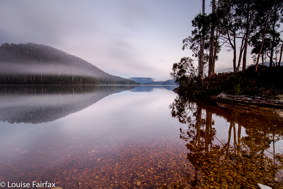
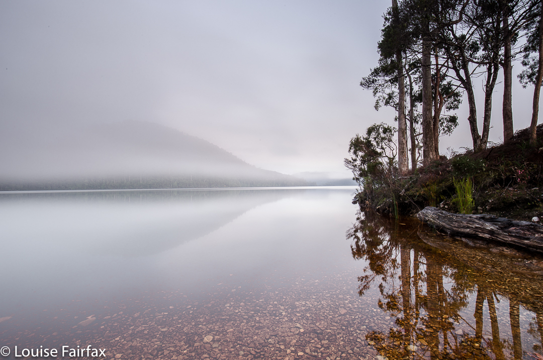
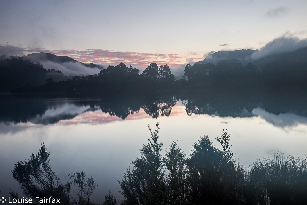
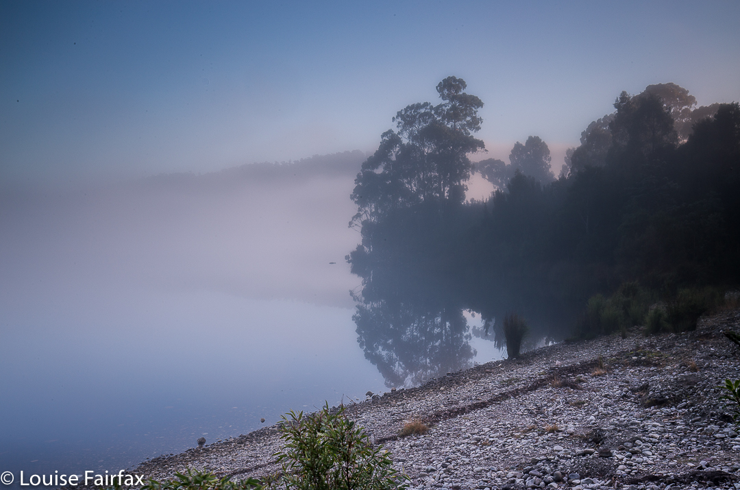
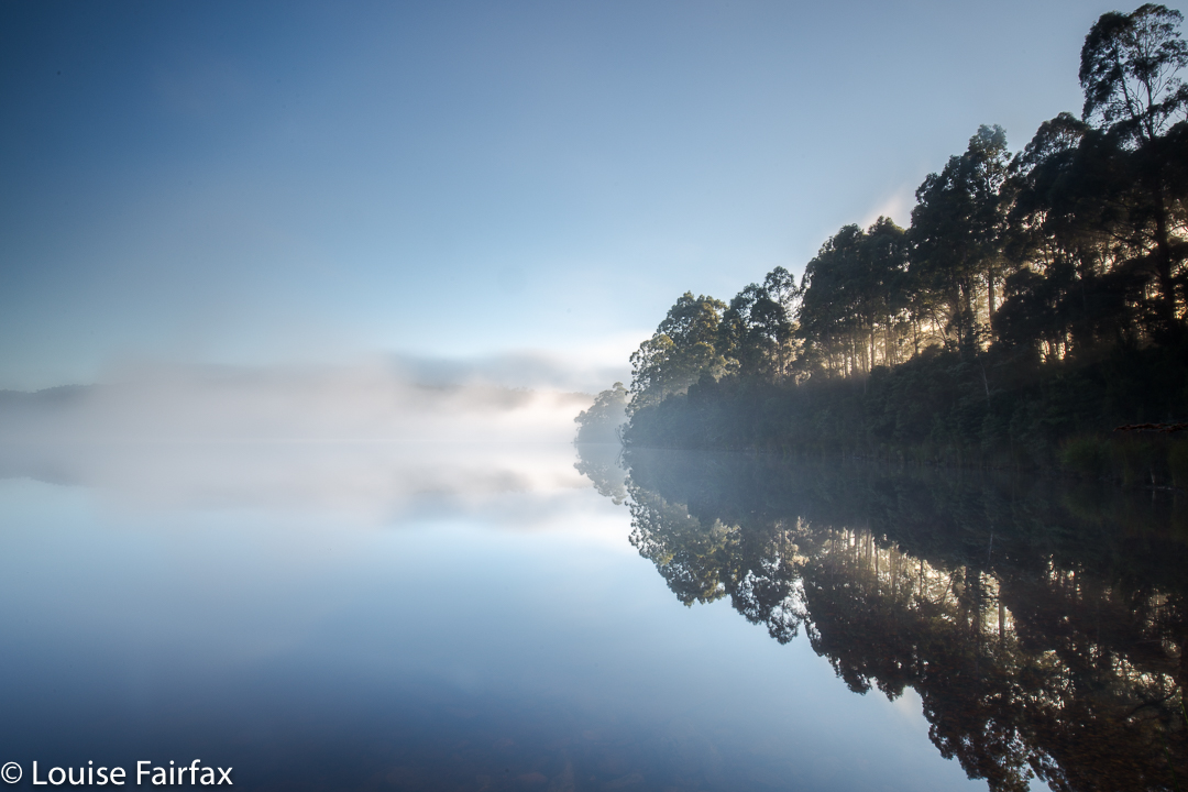
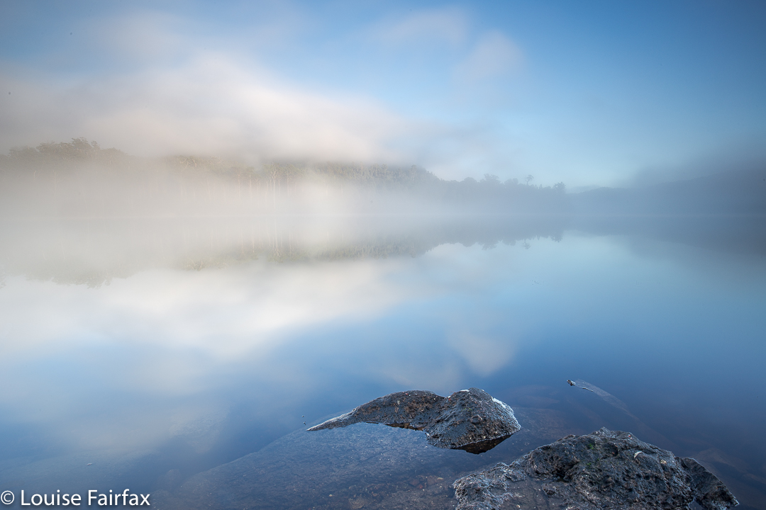
Although Lake Rosebery was “only” used as our base while fungi and waterfall hunting last weekend, I am giving it its own photo blog here, as the sunrise was so moody and beautiful it’s worth sharing in its own right. I hope you agree.

Bushwalks and hikes in Tasmania and the world
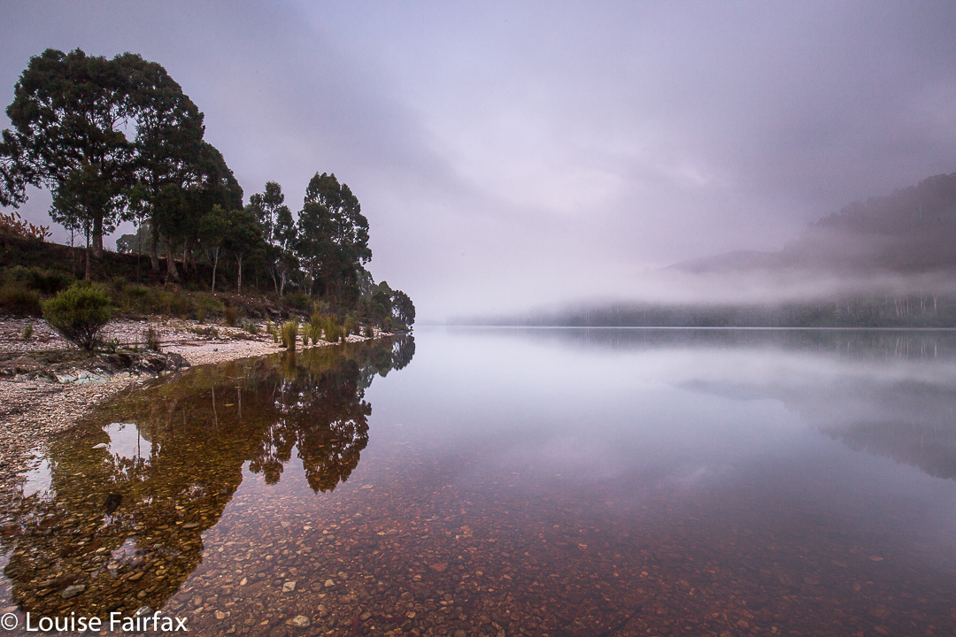
Although Lake Rosebery was “only” used as our base while fungi and waterfall hunting last weekend, I am giving it its own photo blog here, as the sunrise was so moody and beautiful it’s worth sharing in its own right. I hope you agree.
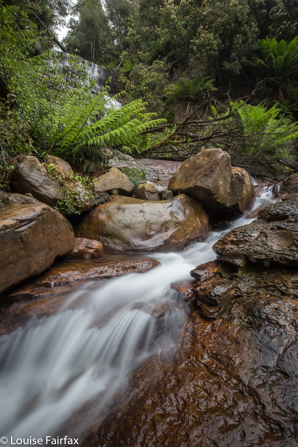
Westmorland Falls 7 May 2017.
It has been several years since I last visited Westmorland Falls, and I have wanted to return to take better photos. But then we had the big flood and the track was closed. At last this weekend I had my chance to return.
We drove along happily, delighting in the autumn scenery of rural landscape dotted with red and orange and yellow trees, and of the fresh snow on the Western Tiers. It had been nice and warm at home with our fire in the kitchen, so, in the comfort of the car, we did not translate that delectable white into the inevitable chill in the air that wind passing over it can bring. Brrr. We very quickly did our maths when alighting from the car.
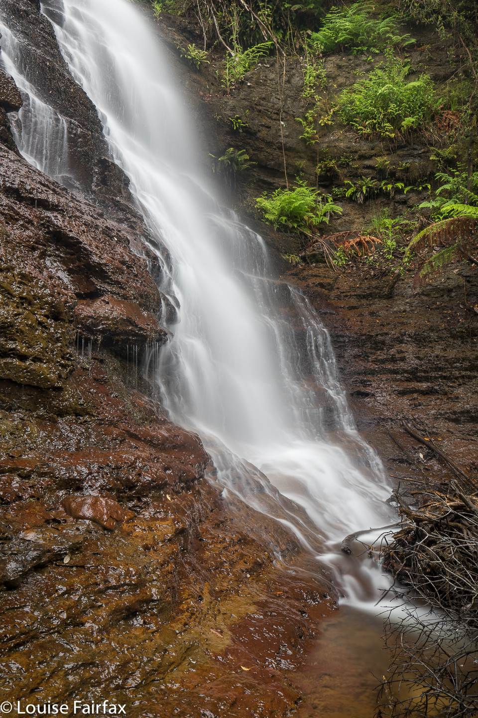
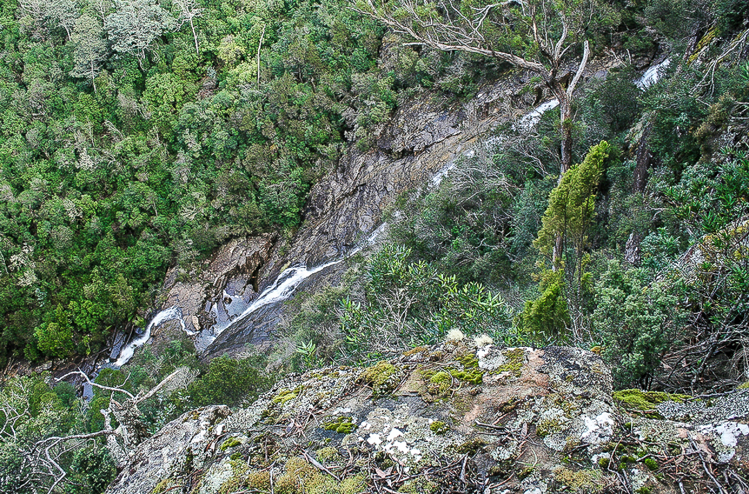
Westmorland Falls; picture from Dec 2018 when the flow was better
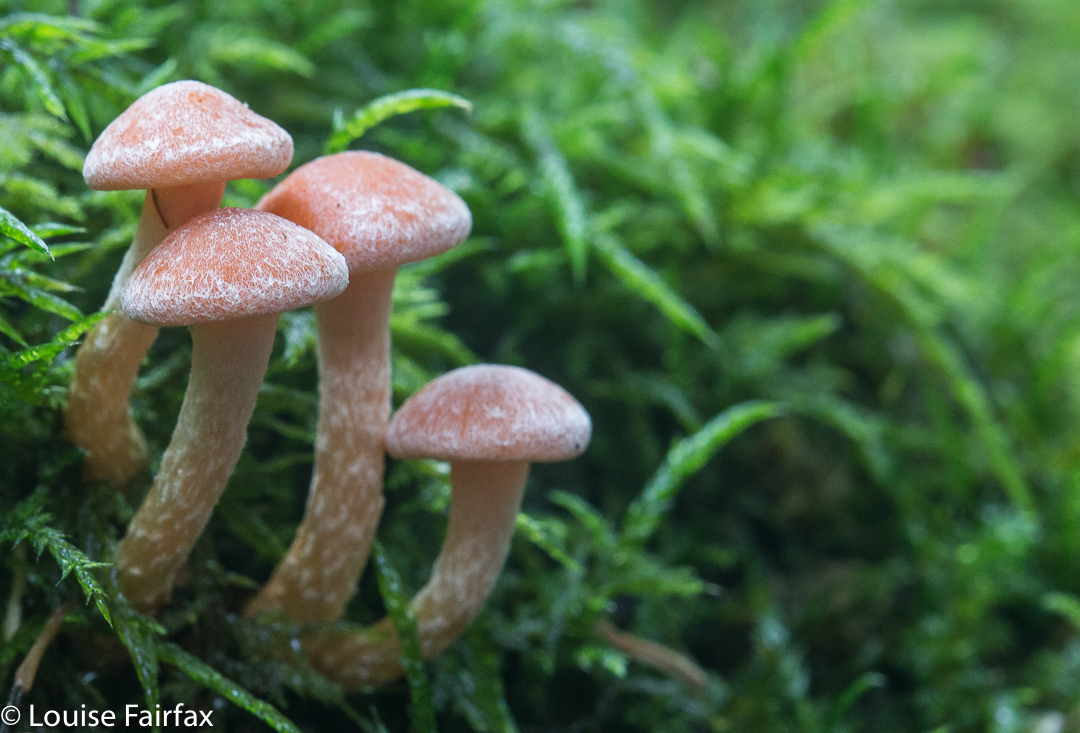
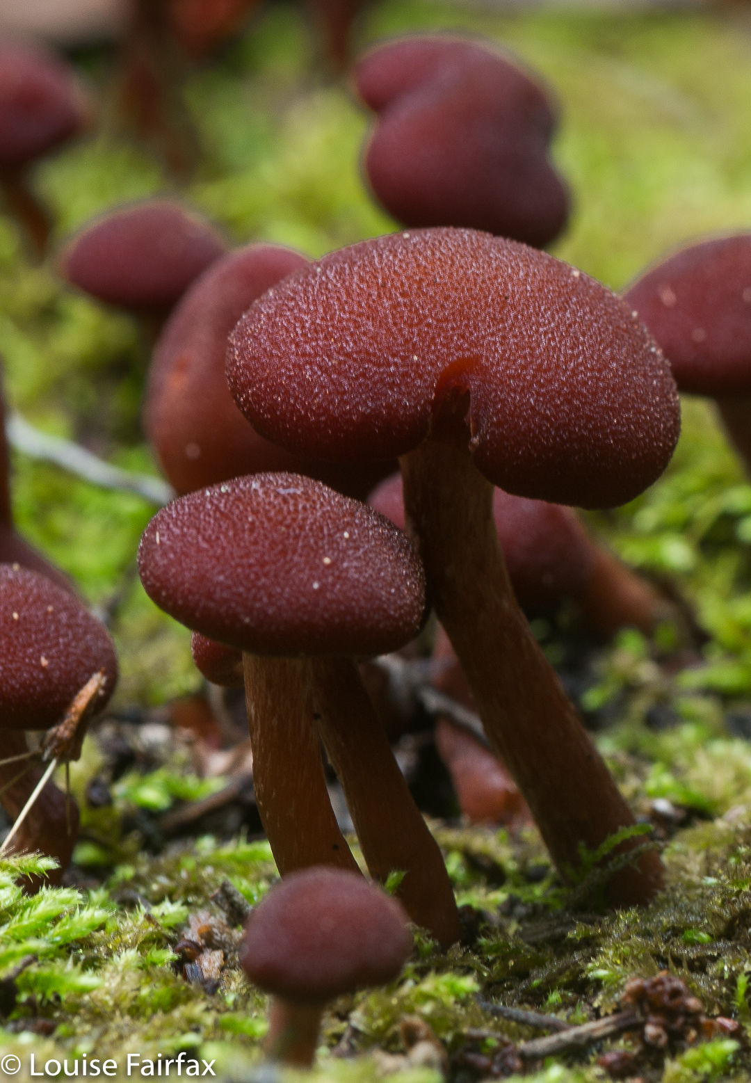
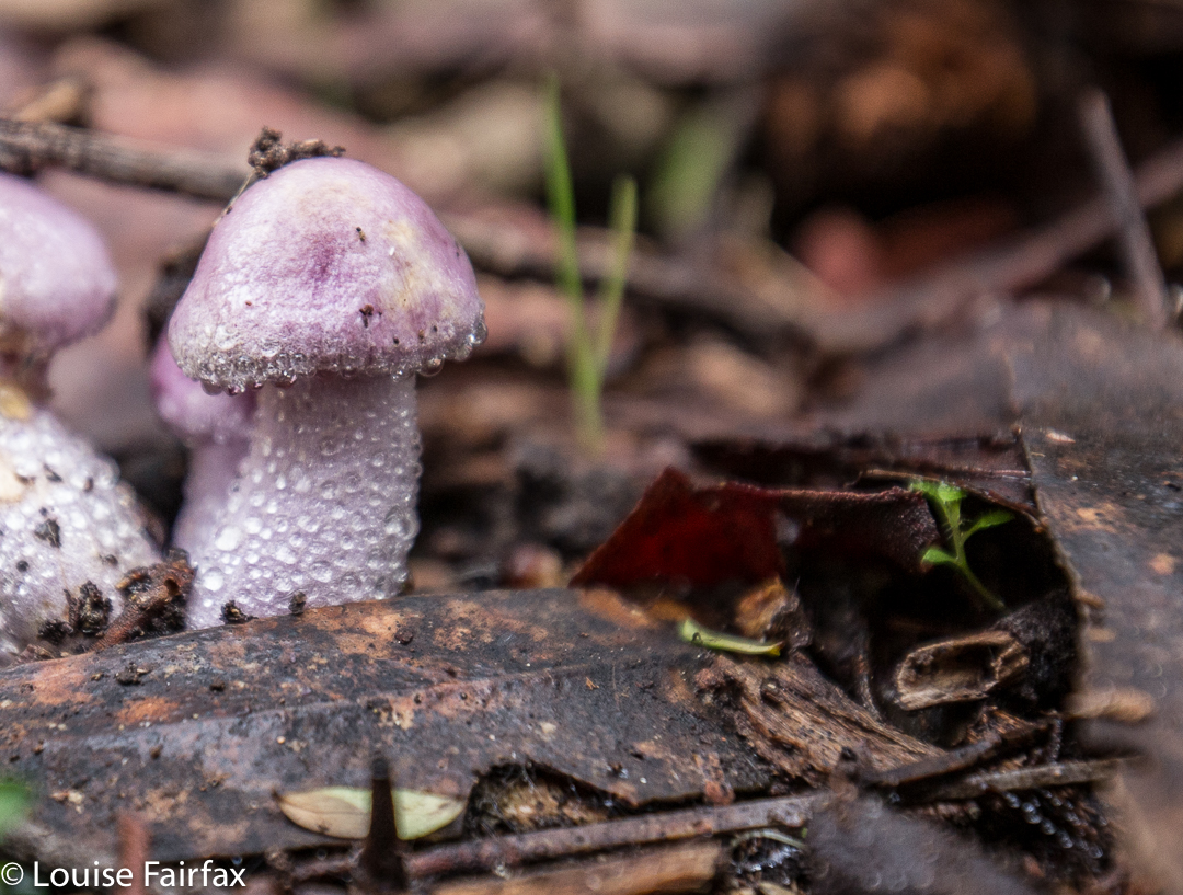
Luckily, my happy memories of Westmorland extend to glowing images of all the fungi we found on the previous visit. These did not disappoint. The falls, however, were another matter. The devastation of that area is still all too visible, and the falls themselves seemed shockingly barren, stripped of the framing ferns. Fallen trees were all too abundant at the base. But at least they have been opened back up and heaps of repair of repair has been done – even if they have left, seemingly forever, two gigantic, unsightly and utterly unphotogenic bags at the base of the whopping viewing platform that has been built.
Repair was a smart move. We met about ten other people who were there to see the falls, including Japanese tourists. I hope all of them supported the local shops by buying food in Mole Creek or Chudleigh. If you want money from tourists, you have to give them something to do to keep them in your area – and something to spend their money on. By repairing flood damage so that tourists (and Taswegians) can reach attractions like waterfalls, you are hopefully supporting the local businesses.
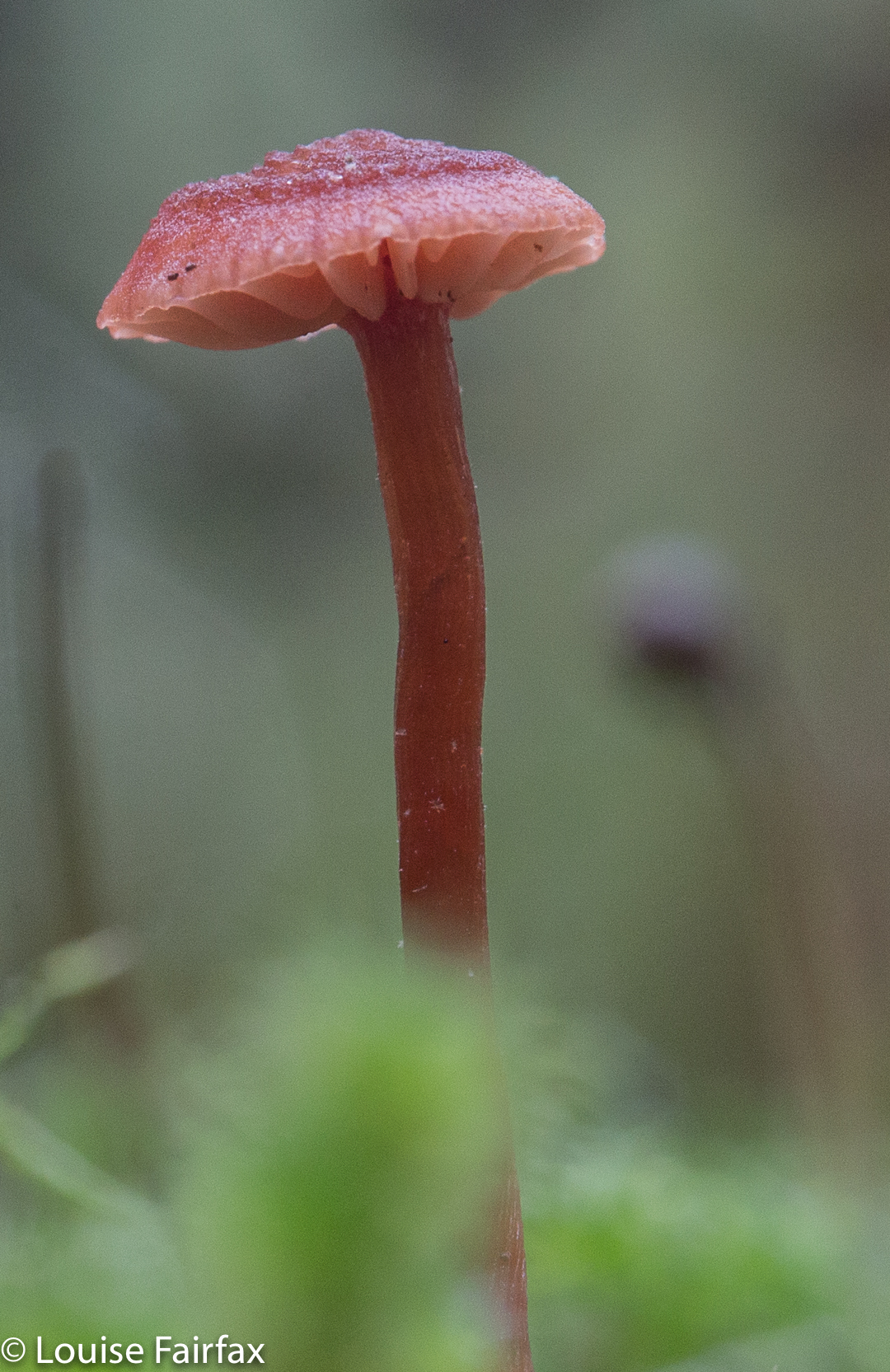
The sign said two hours return. How do they know how long you want to spend photographing, or whether you want to have lunch there or not? I hope it is more helpful to tell you that I took 26 minutes in each direction, and maybe an hour photographing on top of that. As it was pelting with rain, I ate in the car after I’d finished. In 2017, I took nearly three hours, spending all the extra time lying in mud trying to fit under delicate mycena. Luckily the leeches weren’t out, or I would have been covered in them. (2018, Dec, they made up for it. I flicked off leeches the whole trip home. It made driving a challenge).
In 2018, I chose these falls on a day when it was due to rain all day. They were perfect for that, involving not too long a walk, and on a track that doesn’t have too many overhanging shrubs to drench you as you go past.
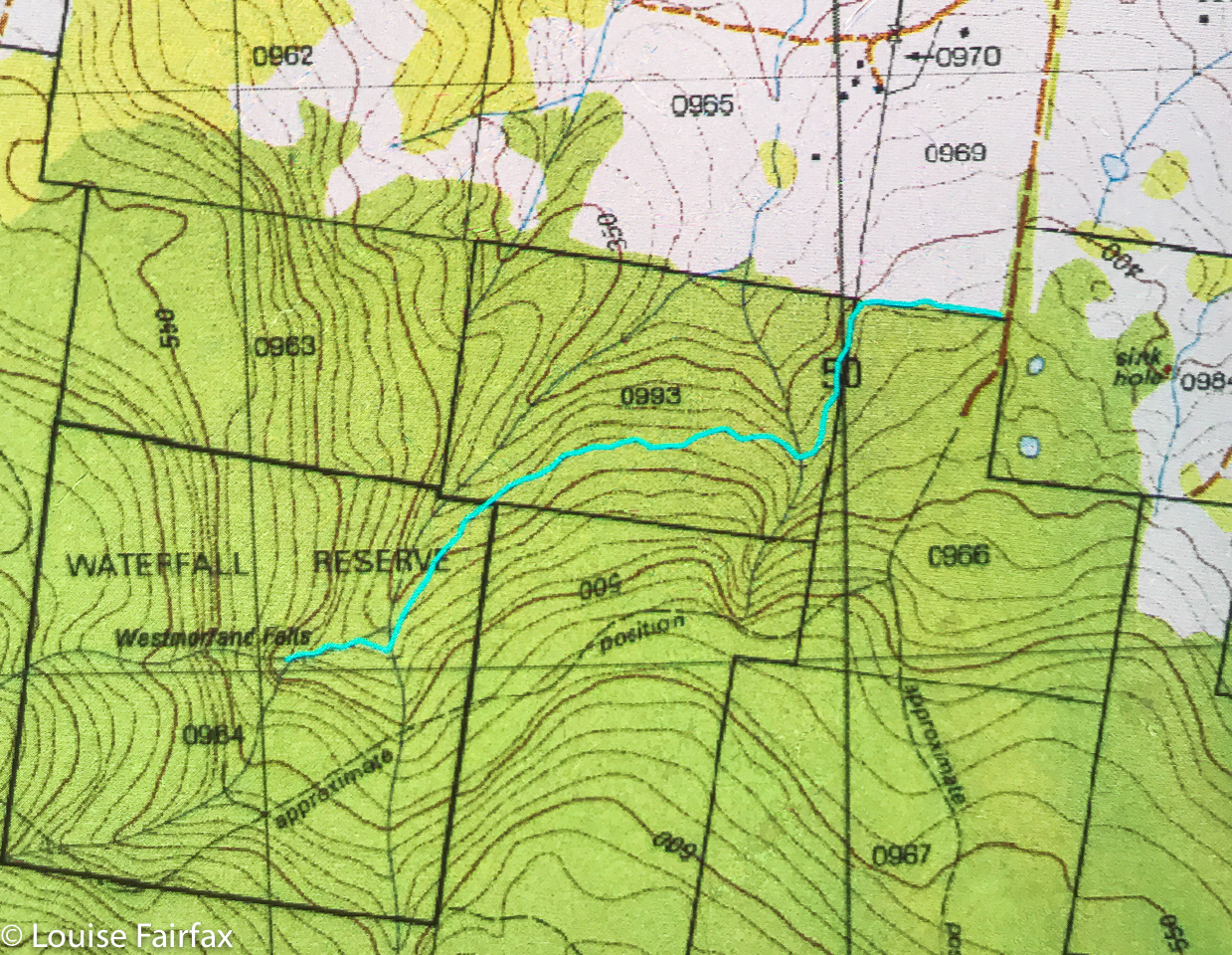
To reach the falls, head south from Mole Creek along Caveside Road for 5.9 kms. Turn right at a road signed Wet Cave Road, which the lady on google maps will tell you incorrectly is West Caveside Road. At the T-intersection of this point, there is your first sign to the falls you are wanting (spelled incorrectly). From here on, every turn has a sign. The sign that says you’ve arrived is spelled as per the map. (2018, I came straight in from Chudleigh instead of going via Mole Creek. Bad idea. The signs to Caveside dump you, abandoning you in the middle of beautiful countryside. It’s much clearer if you come via the Mole.)
As hinted above, there seems to be a great deal of confusion about the spelling of these waterfalls. I am using the spelling that is on both the 1:100,000 and the 1:25,000 maps. They get the call. Surely they are careful enough to spell the beastie properly. Not so the Meander council, which has some road signs directing you with the spelling having and e (as in Westmoreland Falls) and some without, as I have used consistently here, in line with the maps. I note that Waterfalls of Tasmania uses the other spelling. Google is rightly confused, and lumps all references in together – very wise. Official government map departments use the correct Westmorland spelling, but I note that the Touring Tasmania site uses the incorrect spelling. Mole Creek information uses it correctly. Whatever spelling you use, Google maps will tell you it doesn’t exist, and will try to direct you to some place in America, no doubt selling stuff that will last a short time. The falls are not what they used to be, but they are still worth seeing, and the fungi on the way are terrific.
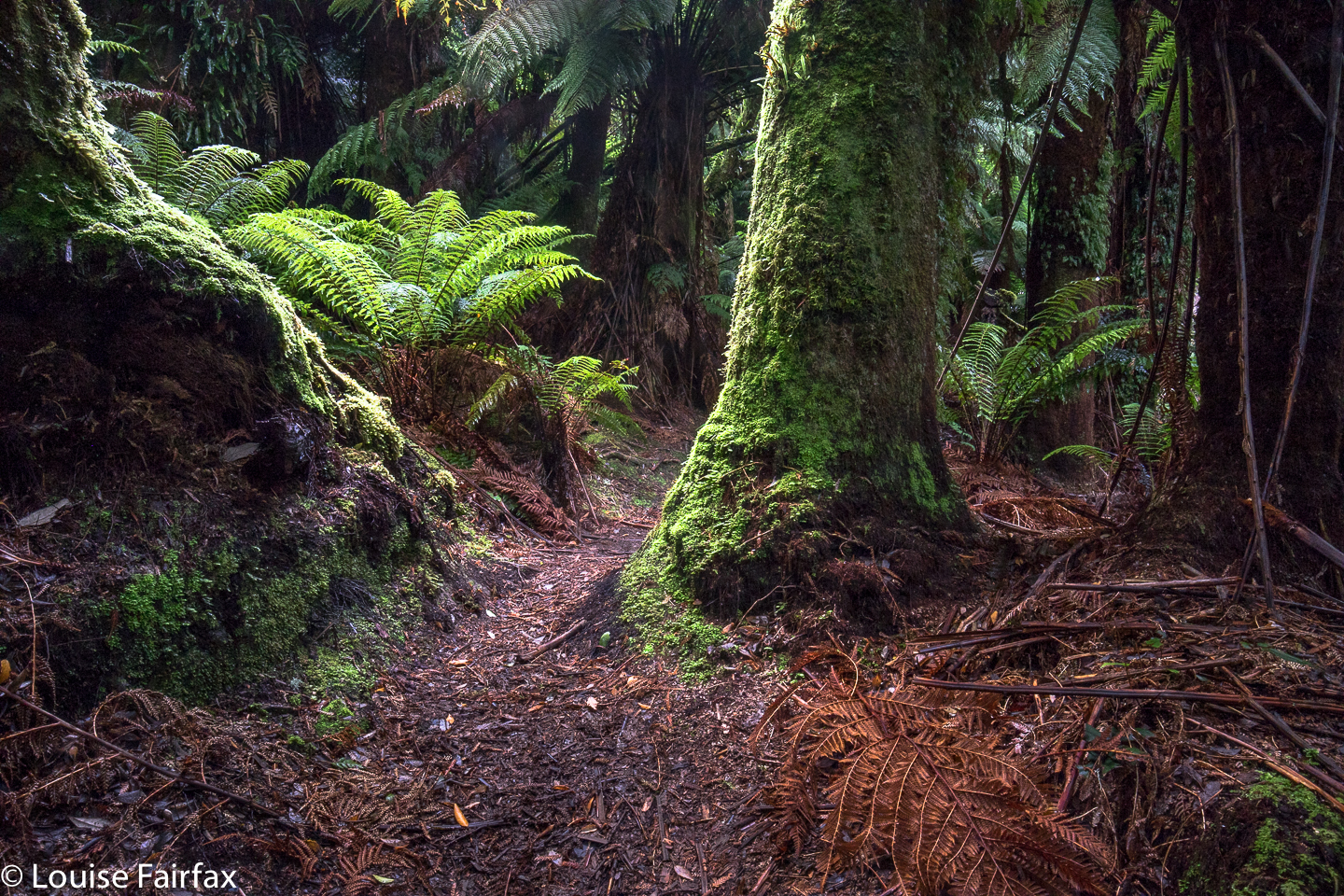
Westmorland Falls Fairy Forest.
Route data: 1.75 kms in each direction, with over a hundred metres climb (and some climb on the return journey as well):
Lost Falls 16 Aug 2017.
The Lost Falls have lost their water and probably lost all hope that I will return to them, for, if a waterfall can’t produce water when the state is drowning and all the other waterfalls are pumping away furiously, what hope does it have?
This is not my photo, although it is my edit. Cadence Kueper, and excellent photographer, had far more luck than I did when he visited. This is his shot and his copyright. I wanted to show you what you were looking for if you got a good day.
As we approached, the sun was shining to ruin my chance of a nice long exposure of the flow, and yet it was raining so as to destroy my beautiful lens, and spoil the photo with droplet smudges. Yes, yes; it was pretty silly to come out in this weather without an umbrella for my camera, but I have a lot to organise, like a dog and a husband. This was not going well. It was freezing at this location, with a strong wind blasting us as we made our hopeful way to the viewing point. Luckily, it was only five minutes from the car. The gorge is very impressive, but the lack of water was not. I didn’t bother to photograph such emptiness. I hadn’t brought my arctic gear, so we retreated quickly, and hoped the Meetus Falls would be better. They did not disappoint.
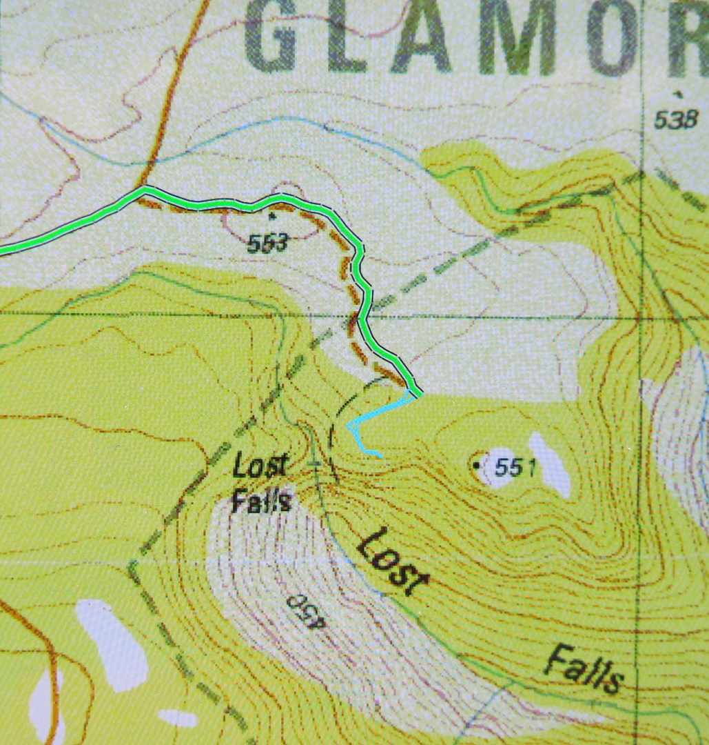
To see this Lost Gorge (I refuse to talk of Falls), drive to Campbell Town, turn east to Lake Leake Road and continue to drive past Lake Leake, and past Kalangadoo (the petrol station cum general store on the right after Lake Leake as you head east) until you reach a rather major intersection with two traffic islands to attract your attention. They’re possibly there to suggest you don’t turn at 100 kph, and that you watch for incoming trucks. For Lost Falls, turn right (South) and drive “4 kms” as the sign directs you (Lost Falls Reserve, it calls your destination). You will, after 3.3 kms, turn left and go 2.6 kms along this road until you reach the parking area which also has a shelter should you want to eat there. Just before you reach your destination, there is an unsigned fork in the road. The right hand fork will get you there (see map below). You’ve nearly arrived.

On the enclosed map, the magenta section of 3.3 kms is the first part after you’ve turned right; the green part of 2.6 kms is the next bit after you’ve been turned left by a sign (you’ll see the fork I’m talking about near the end there); the tiny cyan bit is the section where you get to stretch your legs and see the view.
If you then want to find a waterfall that has water, go back north to the big intersection, and continue north on the same dirt road for another 11 kms until directed to Meetus Falls ( http://www.natureloverswalks.com/meetus-falls/).
Mt Maria, 11 June 2017.
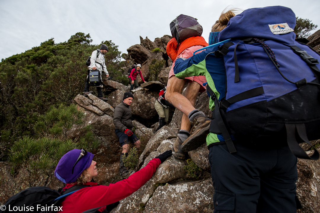
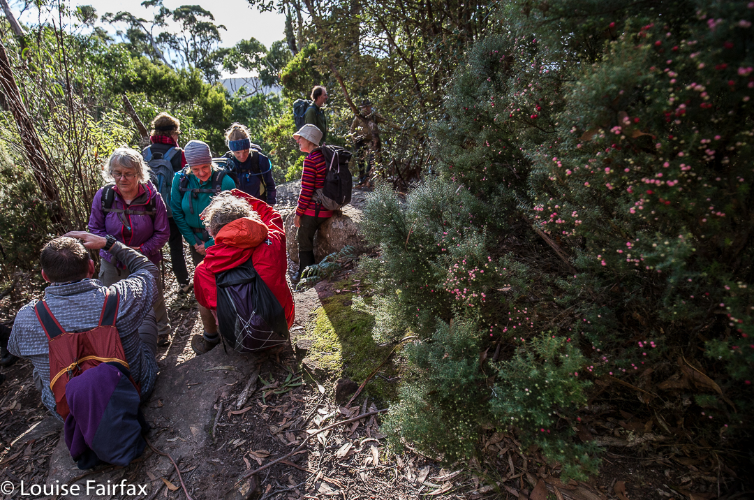
On Sunday, Bruce and I joined in the LWC climb of Mt Maria, mainly for sociability reasons, but, as is often the case, subsidiary benefits followed. Now, there are some vocal members within bushwalking circles who are disdainful of walking clubs and people who climb mountains in such groups. Certainly, Sunday’s LWC ascent of Mt Maria could be taken as an example of what happens in a club that seems to rankle these people. Oh. Goss. What happened? Do tell.
Well, what happened was that a guy who has advanced Parkinson’s disease, who could never get up such a mountain unaided (or even with just the help of his wife), stood on the summit; so did a different fellow, aged 74, who has had two hip replacements; and so did a lady rather new to bushwalking who thought she lacked the fitness.
Oh dear. Are clubs full of people like that? No. These people are the beneficiaries of other able-bodied, strong, agile, knowledgeable and extremely helpful and selfless people who see them through moments of difficulty, who also make up the numbers of a club. Without the strong and talented bushpeople in clubs, the less experienced or gifted (in bushcraft) members would not have the opportunity to learn and grow, and to experience for themselves the thrill of a summit, and the sense of achievement gained by standing on the highest point. In a club, a summit is often (although by no means always) a team effort. And the recipients in this context can often be the donors in another.
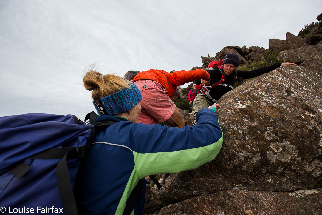
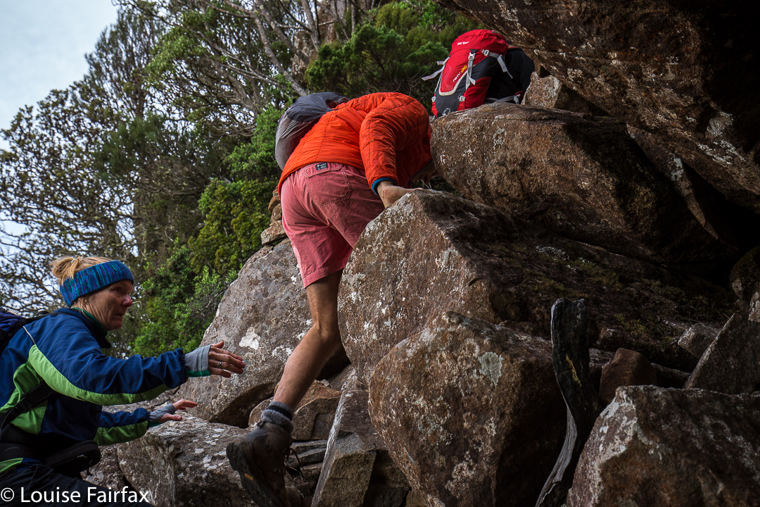
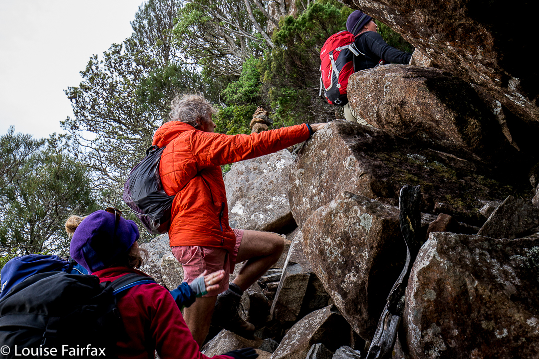
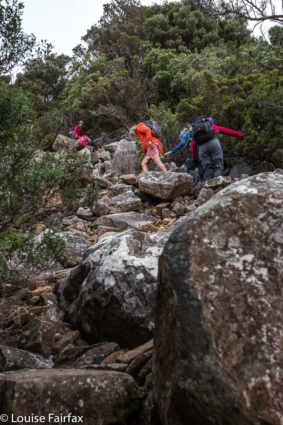
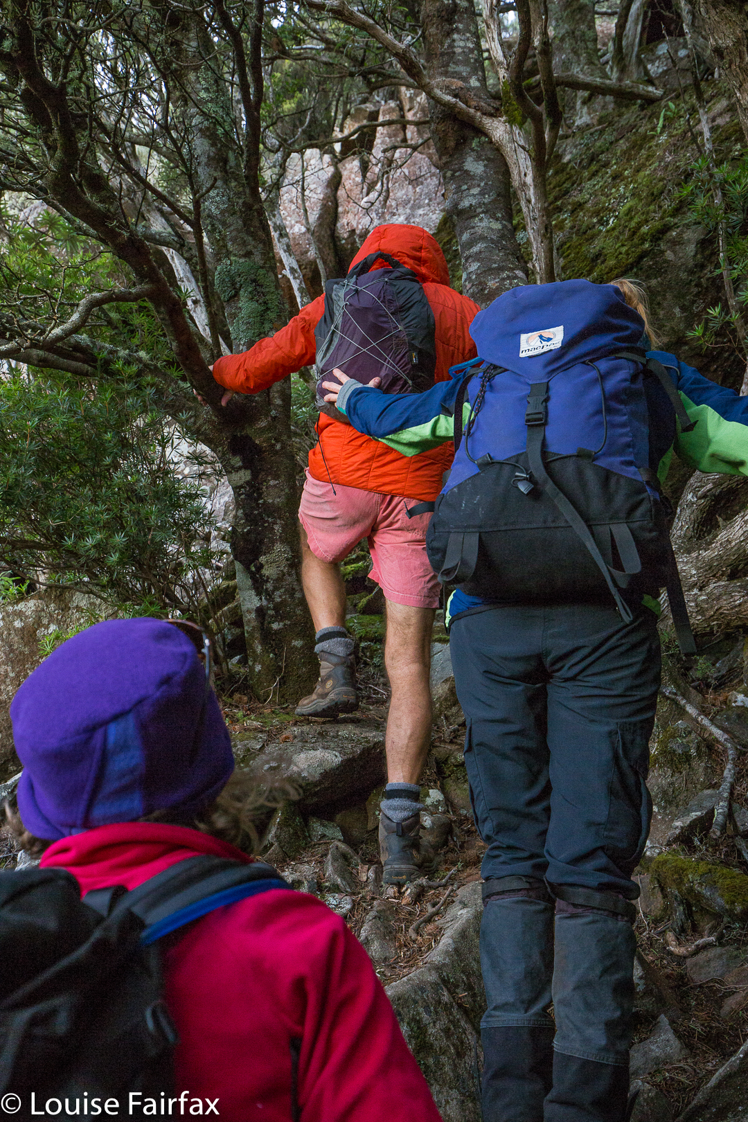
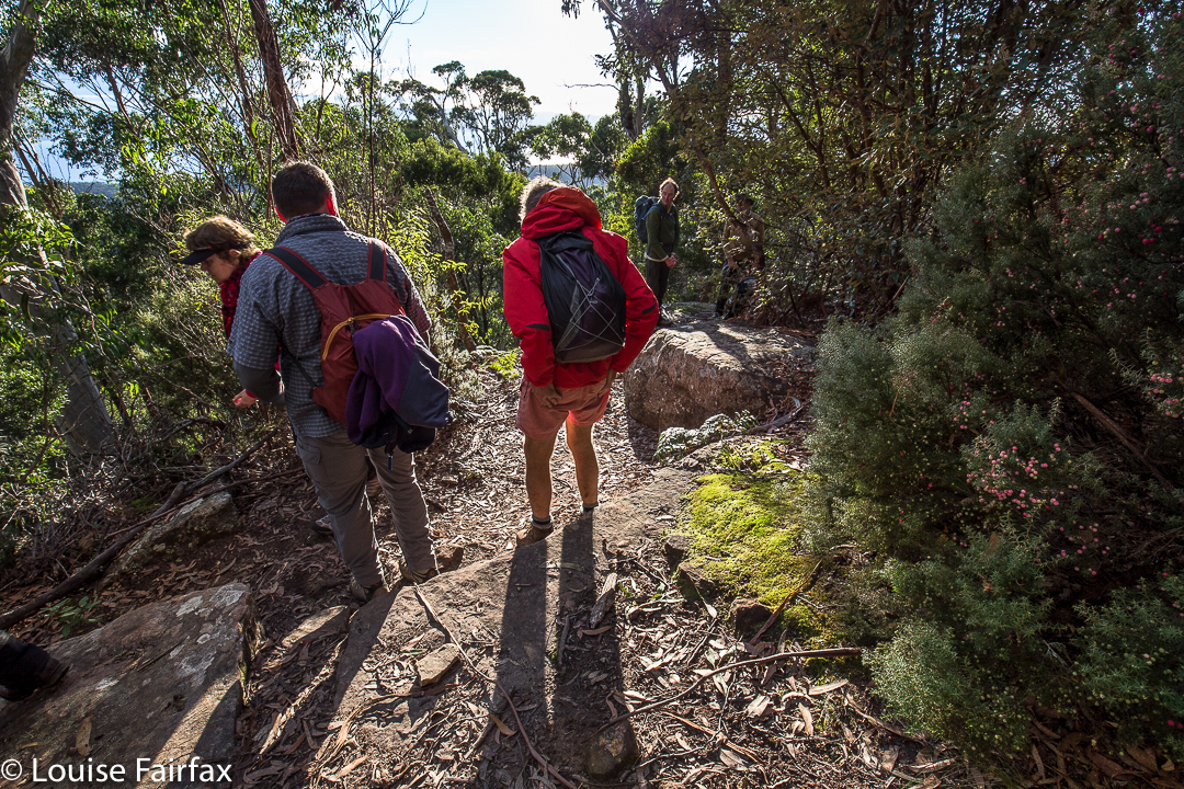
This is definitely a pull and push job
My husband is the one with Parkinson’s disease. He took every step up the mountain himself; no one carried him as such, and he can say to himself that he climbed this mountain, and feel justifiably proud. However, my pictures of his ascent nearly all have images of other people’s hands: hands from in front in case he needed steadying or a pull; hands from behind or the side to guard against him falling. Mostly, he was unaware of these hands, but I was not. Elitists, is it so very shocking that this man can say he has climbed Mt Maria? (In fact, he is not a peak bagger and wouldn’t bother saying it, but you know the principle I am adumbrating here. )
If Bruce were doomed to only summit what he could get to solo, or what I could get him up, his options would be severely limited, and his life greatly reduced in quality. He used to be a man who could summit all manner of mountains, and to be a leader in bushwalking circles, but then a chemical aberration in his brain changed everything, and now he is reliant on the help of others. I cannot really imagine how it must feel to have once been a proficient and daring mountain man – a teacher of bushcraft – yet now be dependent. Surely the shame is not that he gets up only thanks to the help of others in a club, but that he needs help now at all. He is quite possibly braver now than he ever was when his brain and muscles functioned to their full capacity. How astonishing that he still dares to get up mountains and to “give it a go”. Thanks to the generosity of club members, both in LWC and HWC, he can still sometimes enjoy the activity that once played a prominent role in his life.
Is it not a little selfish to think that the beautiful wild places of this earth are only for a particular kind of elite bush person, who, like a recluse or hermit, does not share his /her skills with those who are learning, or who prefer to climb in company, or who are beyond the age where they are comfortable being alone in the bush?
Clubs are like microcosms of society and, like society at large, are far from perfect. But also like society at large, they teach us to mix with all types, with those more, and those less, capable than we are, and that is good for us. We learn to tolerate and be tolerated, for however wonderful we may think we are, others may find things in us that demand understanding and forbearance. We have things that we bring to the group, but also things that we take from it. If we have stopped learning from others, then we are in a sorry state, and have begun our decline.
Elias Canetti in Masse und Macht wrote about the special power and energy that comes to individuals when they are part of a crowd. This can also operate at club level, where an individual will climb something difficult that they would never climb alone, precisely and only because they gain psychological and physical impetus that comes from the group dynamics. “Crowd energy” can help us to the top of challenging peaks. The presence of others can give us courage that we might not have if alone.
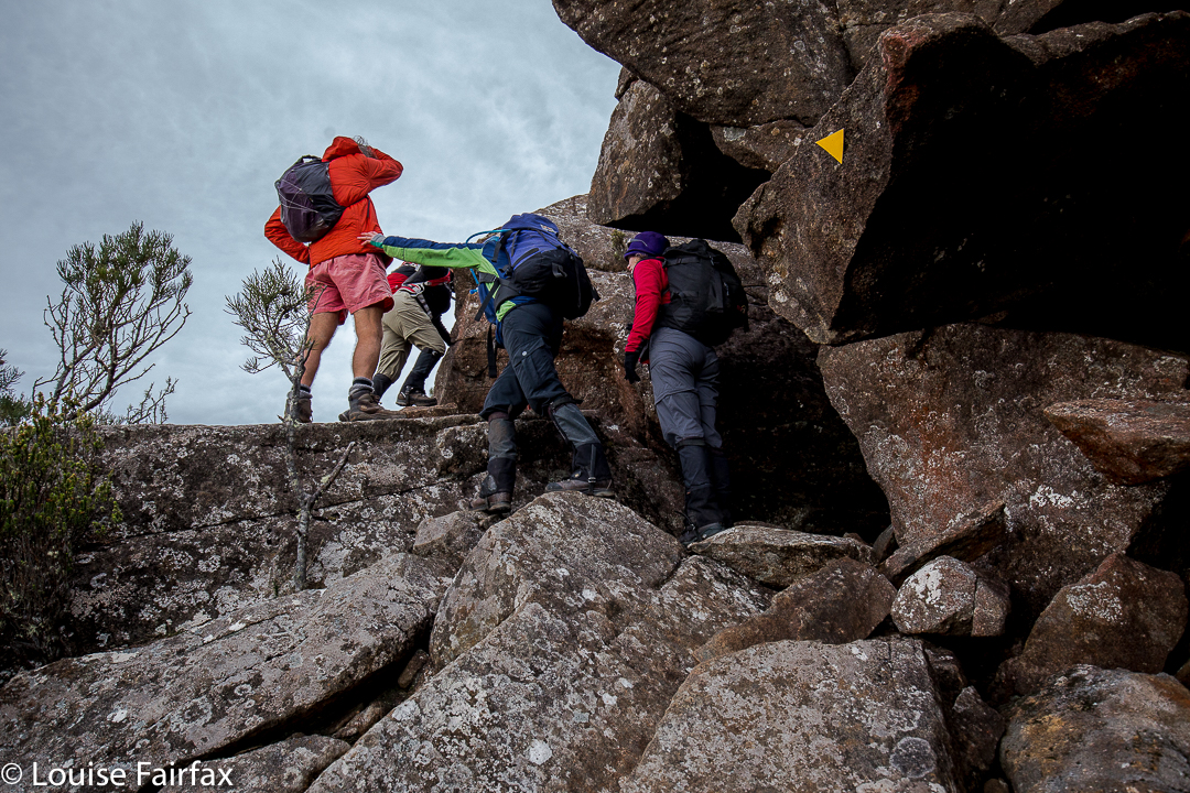
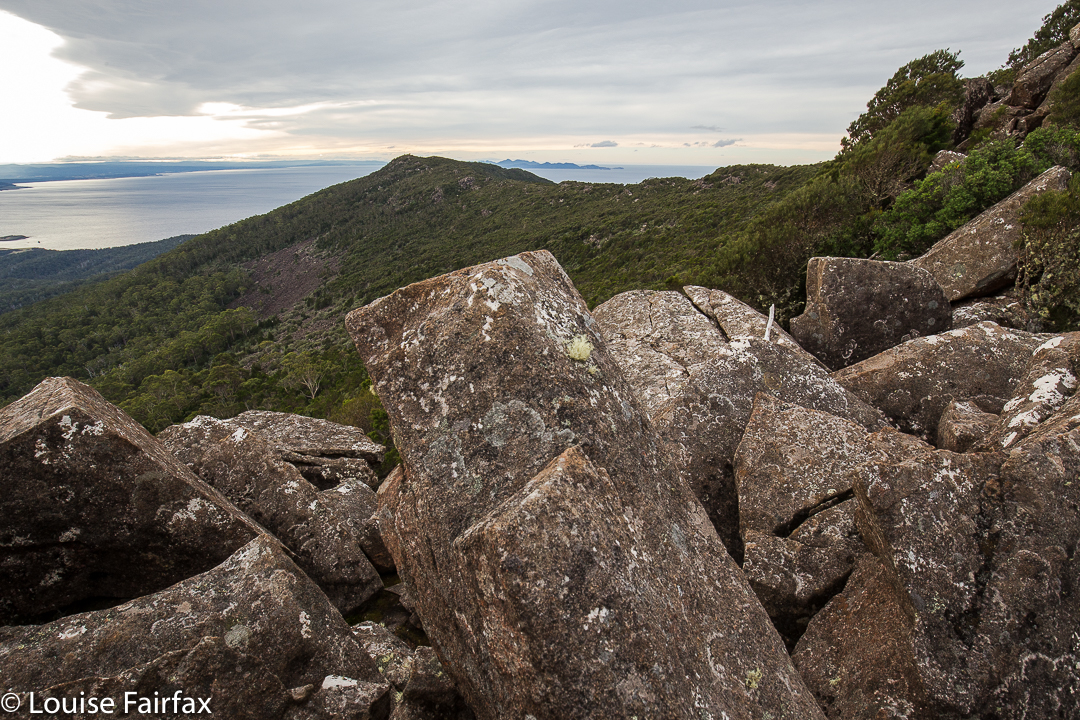
The way back down
And so, I leave you with your own mental image of Bruce in the tricky sections, climbing with a hand outstretched before, and another in readiness behind, yet in a different sense, climbing “all by himself”, just as the trapeze artist performs tricks by herself thanks to the safety net below. I leave you with a beaming man at the end of the day (something very rare for Parkinson’s sufferers), for surely you are never too old or ill to fail to enjoy a sense of accomplishment when you overcome odds and achieve something different. He enjoyed being one of the group, doing what everyone else was doing. I haven’t seen him so content and satisfied in ages, and that feeling came precisely because the mountain was, for him, a demanding challenge, so he was left with the feeling, unusual for a person with his illness, that “I can do”.
Cortinarius tasmamamphoratus. I have never seen these before this trip
He knows the others helped him; he is not arrogant, but he is still allowed, thanks to the group, to feel successful and affirmed. I love solo climbing, duo or trio with friends even better, but I also enjoy being part of a club; I love learning from those more experienced than I am, I enjoy giving back by leading walks in the two clubs where I have that role, and I really love the camaraderie of being with others who share my hobby. I have met some fabulous people in the club context, as it draws those who love my love together so we can meet each other. I enjoy the little custom of “high-fives” when a club group reaches the summit. No matter how many hands were outstretched, the person still had to do it propelled by his or her own power, but the victory is also a shared one. There are others there with whom we can celebrate the occasion. Mt Maria is not a particularly special mountain for me: it has a track up it, and offers no particular challenges for me, but doing it with Bruce lets me see the mountain in a different way, and to appreciate it from a different perspective, which is healthy.
Bishop and Clerk. 10 June 2017.
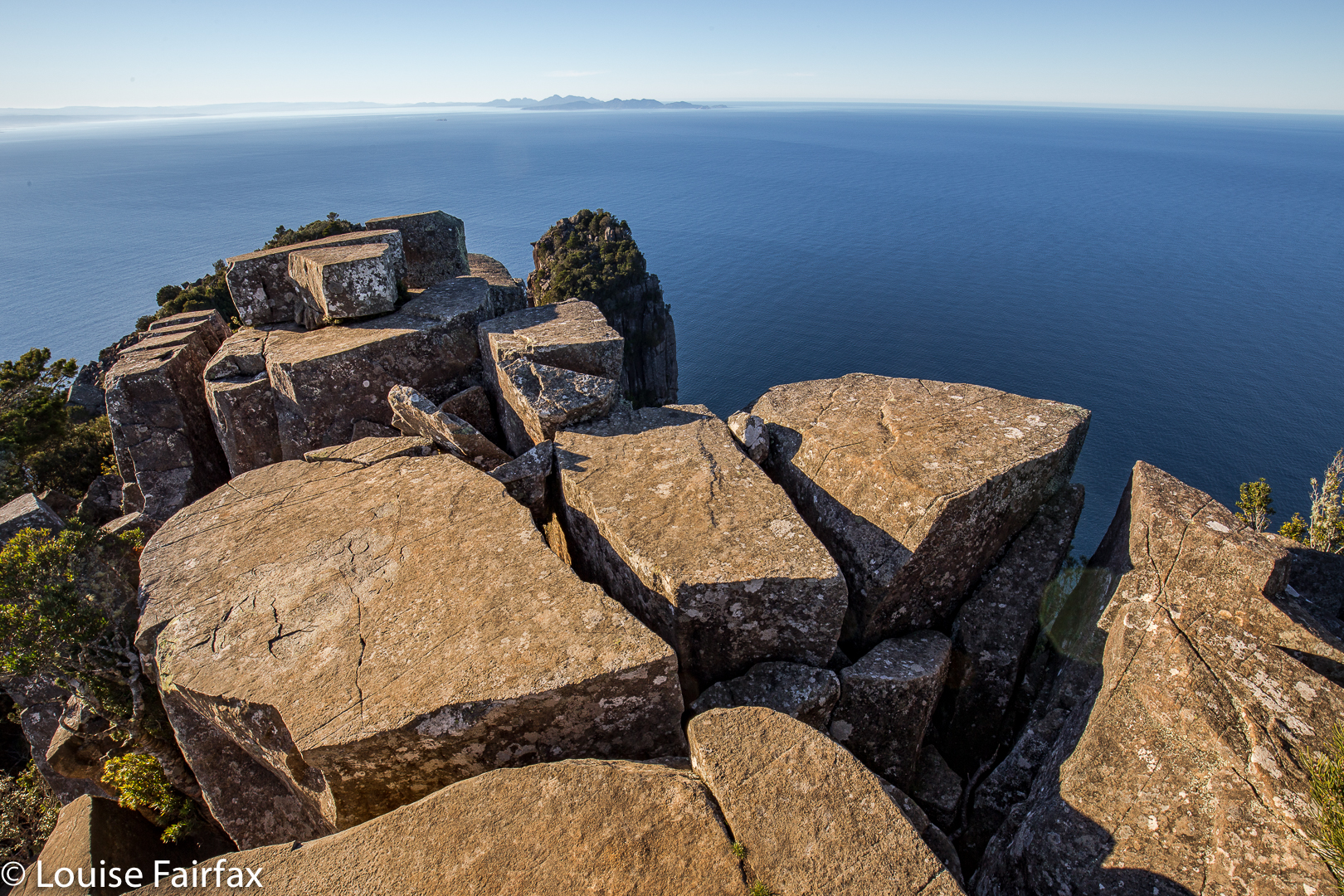
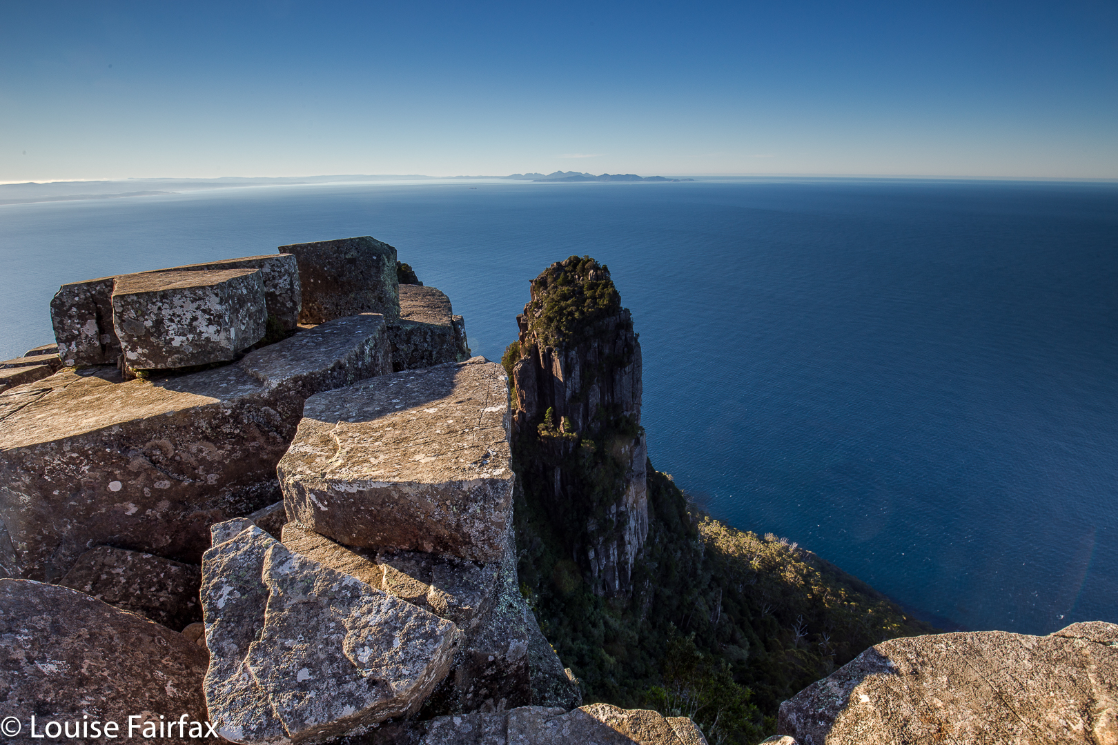
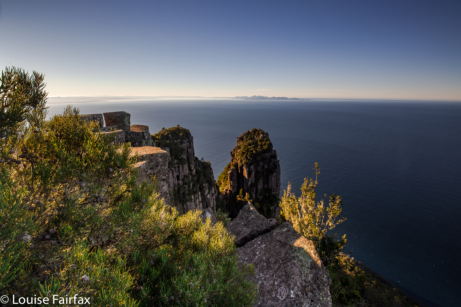
I have waited all this long time of my life to visit Maria Island and climb its famous Bishop and Clerk. I hadn’t been in a rush; I knew it would wait for me, and the the right moment would eventually come. This June Long Weekend, it finally arrived. Anne-Marie put Maria Island on the club programme of LWC, and I thought that trip would be perfect for my husband, so we signed up.
The trip to the ferry terminal at Triabunna was serenely beautiful, with sheep in pink, icy paddocks, swathed in roseate swathes of light mist. We even got in a tiny climb en route as we passed Lake Leake (see naturloverswalks.com/mt-morriston/). One peak bagger point more. One funny little mountain to add to our wealth of Tassie riches. On we drove.
The ferry ride was also wonderful, made even more so by a pod of dolphins playing around the boat as we nudged our way towards an ever-growing Bishop and Clerk which, for me, dominated the approaching island. The others teased me that they could feel me pawing the floor in my eagerness to get going. First, of course, however, we need to do mundane things like choose the perfect camping spot, have some lunch, set up the tent and other domestic chores. Then, at last, copious photographic equipment assembled, I was ready to go.
Although this was a club trip, it was a delightfully free, relaxed one, so Bruce and I set out as a duo to do this climb. The others who wanted to do it (no compulsion anywhere here) would do so on day three. Bruce would accompany me as far as he could, after which I would be solo and have the mountain to myself. I like sitting alone on top, contemplating sublimity and being peaceful up there without noise or distractions. I also, of course, like summiting with friends – a mixture is perfect. I’d climb with the club next day (Mt Maria).
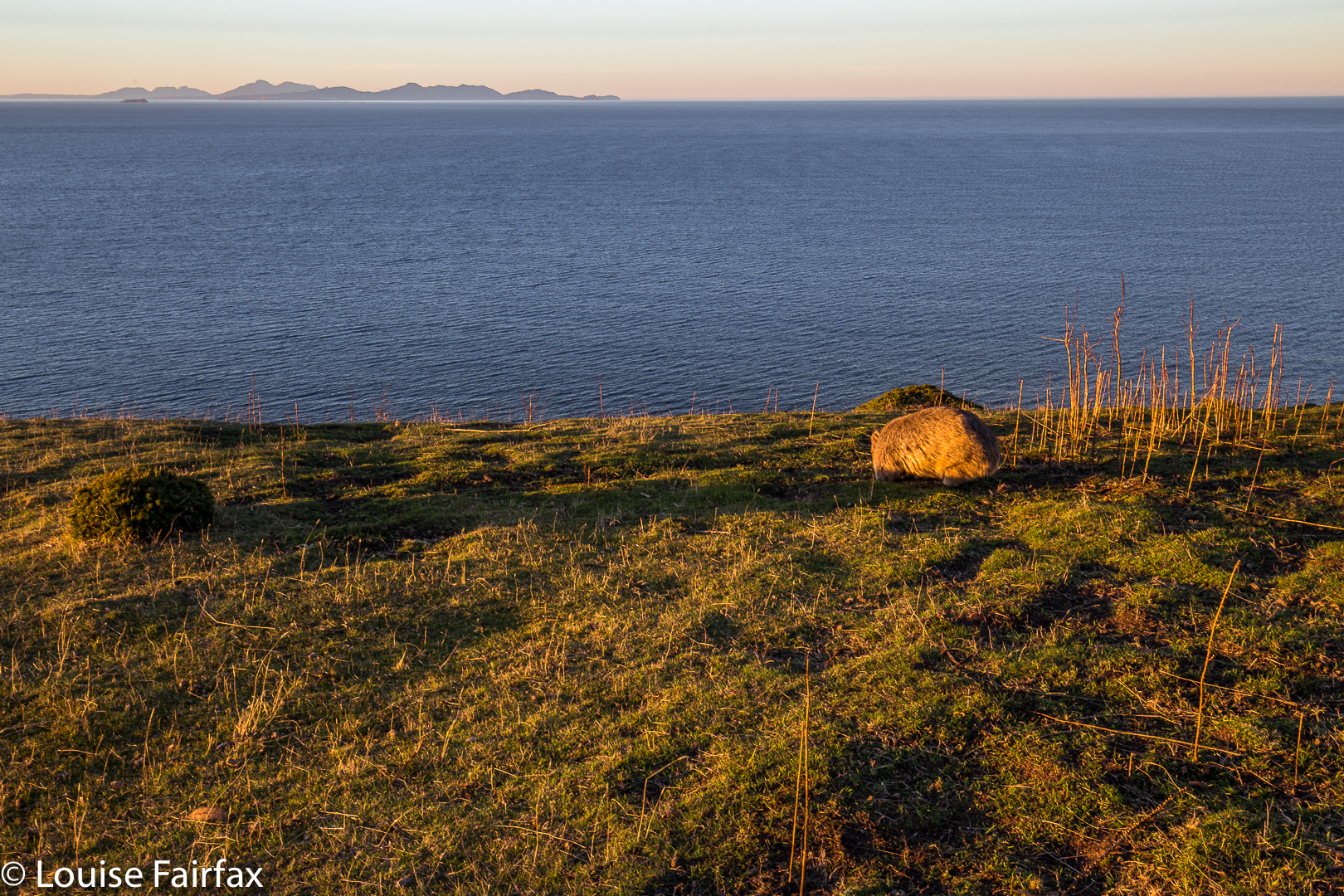
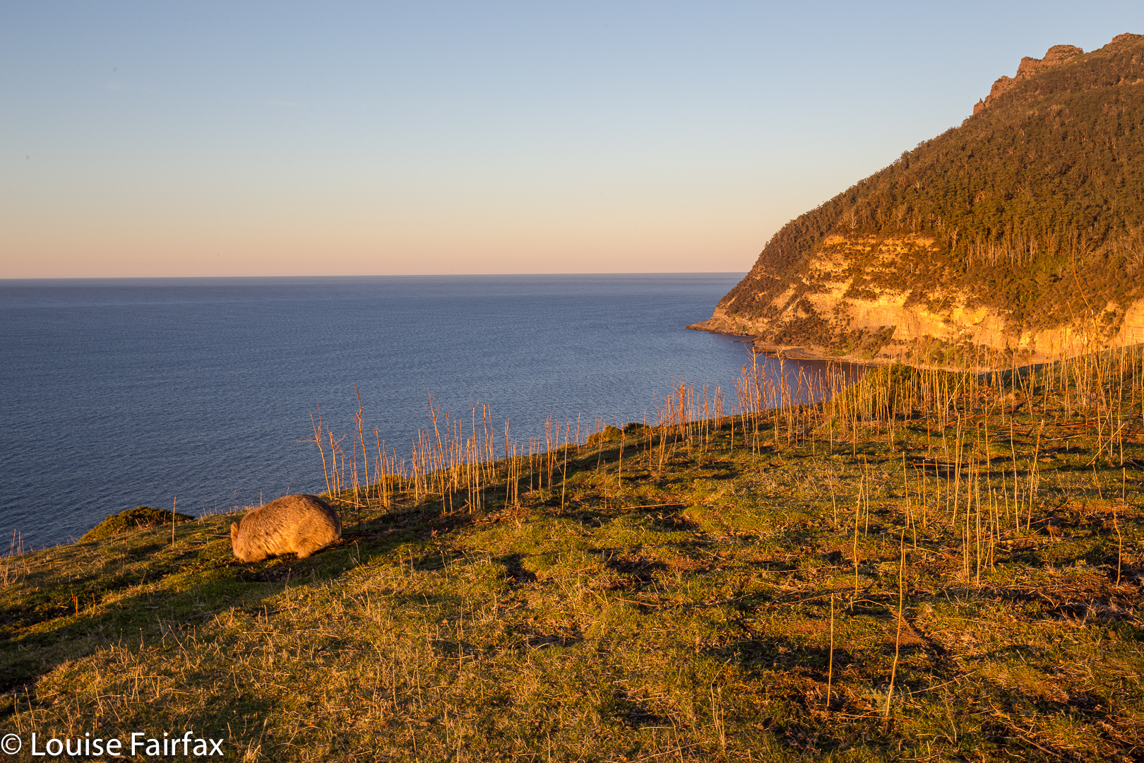
Wombat living life on the edge.
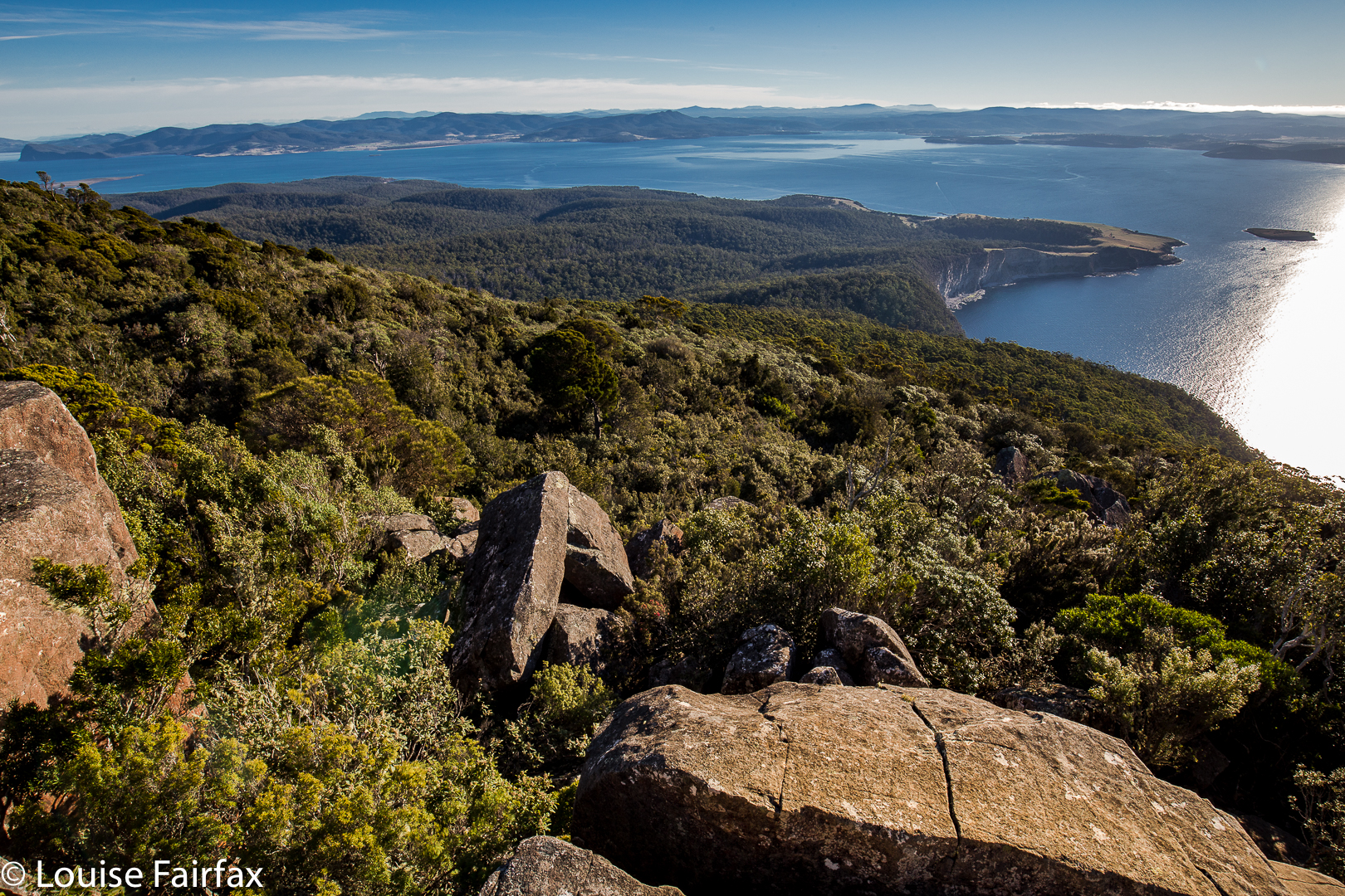
I am struggling to find words that describe the feel of this wonderful island. I loved its unpretentiousness. It is remote and there is history all around you – ruins; intact, antiquated little cottages popping up like lonely toadstools in the forest or on hillsides, just every now and then, tiny treasures to be discovered; fossils. There are discreet signs sometimes, but you’re free to just discover things without brazen hoopla and huge billboard-type signs noisily advertising every treasure. You have the pleasure of serendipitous findings. Self-directed wandering is the norm. There is no “historical tour route” that regiments visitors into a single direction or “must see” line. Meanwhile, roos casually and gracefully hop by, paddymelons hop too, but with less grace and more flurry; fat wombats wobble along, but mostly they’re too busy grazing to be bothered moving. The landscape was peppered with wild animals who were only half wary of the humans.
The land is open in a lot of places, making undirected wandering particularly easy. Children could ride mountain bikes about the place without their parents having to worry about traffic. The worst accident would be a bike-wombat collision, and neither child nor wombat would come to grief in the soft landing.
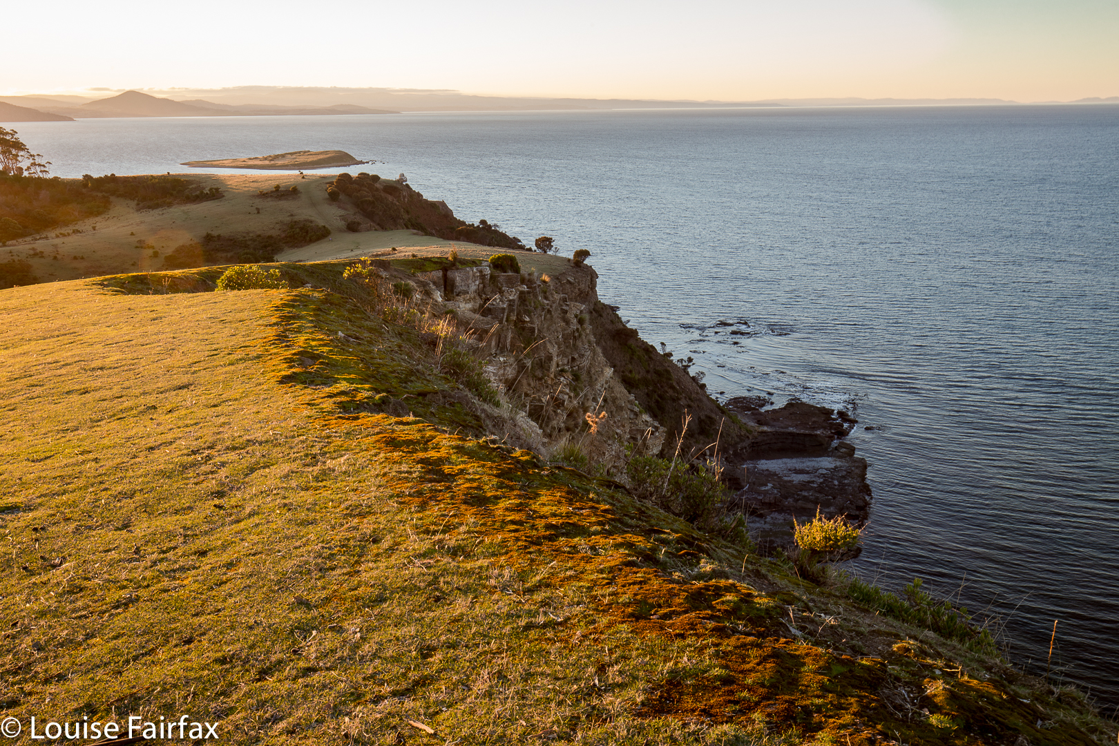
But Bruce and I headed purposefully east, to the cliffs on that side of the island (where, indeed, someone could fall to his or her death) but, oh joy, no huge notices telling you the obvious. The place felt fantastic. (Don’t worry parents: no small child would wander that far alone. It took me over twenty minutes – carrying a lot of gear – to reach that side of the island).
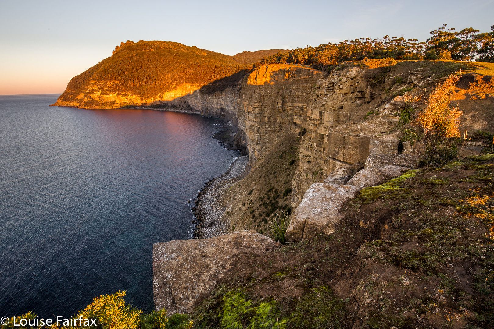
After the cliffs, the real work begins, at first very gently, through open bush with teasing vistas, and finally the big haul. When we reached the loose scree, Bruce called it a day and returned along the clear track to camp. I continued solo, I was glad he was not there, as higher up there were some airy moments and tricky manoeuvres that were not for him. I was free from worry, and free to relate to the mountain on my own terms. Up the top, I had blissful solitude as I gazed out to infinity. There are very many ways you can tumble up to 600 ms to your death up there, so I didn’t cavort in the manner I may have liked to. It was so windy on top I didn’t even trust my sturdy tripod to indulge in a tiny selfie. I followed a tiny pad higher behind the rocks, but then returned to the most spectacular and interesting spot. The forceful wind and the vertiginous nature of where I was combined to be a little unsettling, so I actually sat to do some of my photographing. I began my descent in time to have good vision on the slightly tricky parts (I had been contemplating staying on top for sunset, but wasn’t comfortable doing some of the manoeuvres solo and in the dark, so had sunset itself lower down, where, in fact, the views were more photogenic anyway). I returned to see the club members had lit a dancing fire, and were convivially enjoying its warmth, having wine, cheese and bickies in the large shelter there. Bruce was safely with the group, enjoying other people’s goodies that they had generously offered him.