
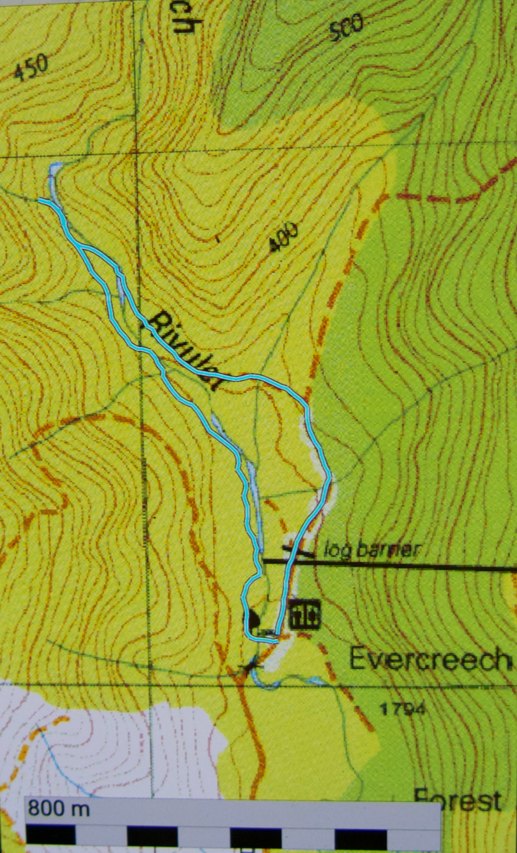
Evercreech Falls REAL 2019 Feb
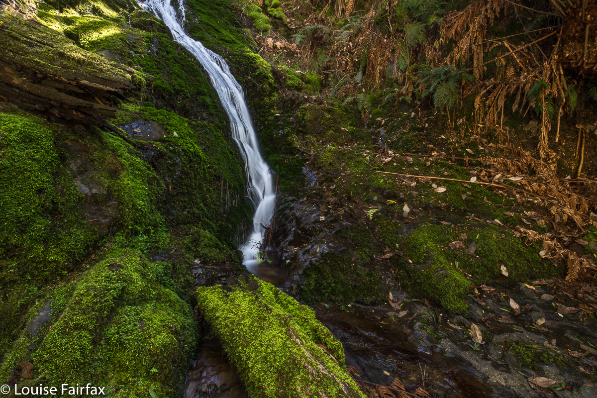
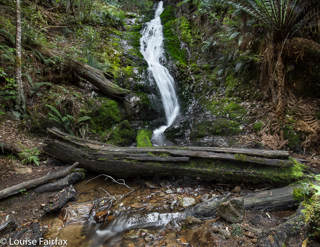
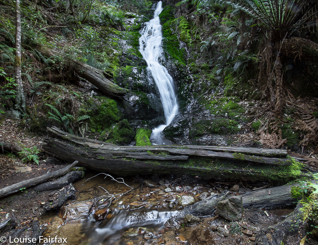
Visitors to the Falls named “Evercreech Falls” (on the map, and in the web), must, surely, have wondered at the ‘much ado about nothing’ of what they found. The labelled tumble is a tiny trickle of a thing, moseying its way quietly and with no shape down a fault in a cliff. It has no form, no substance, and is not particularly photogenic.
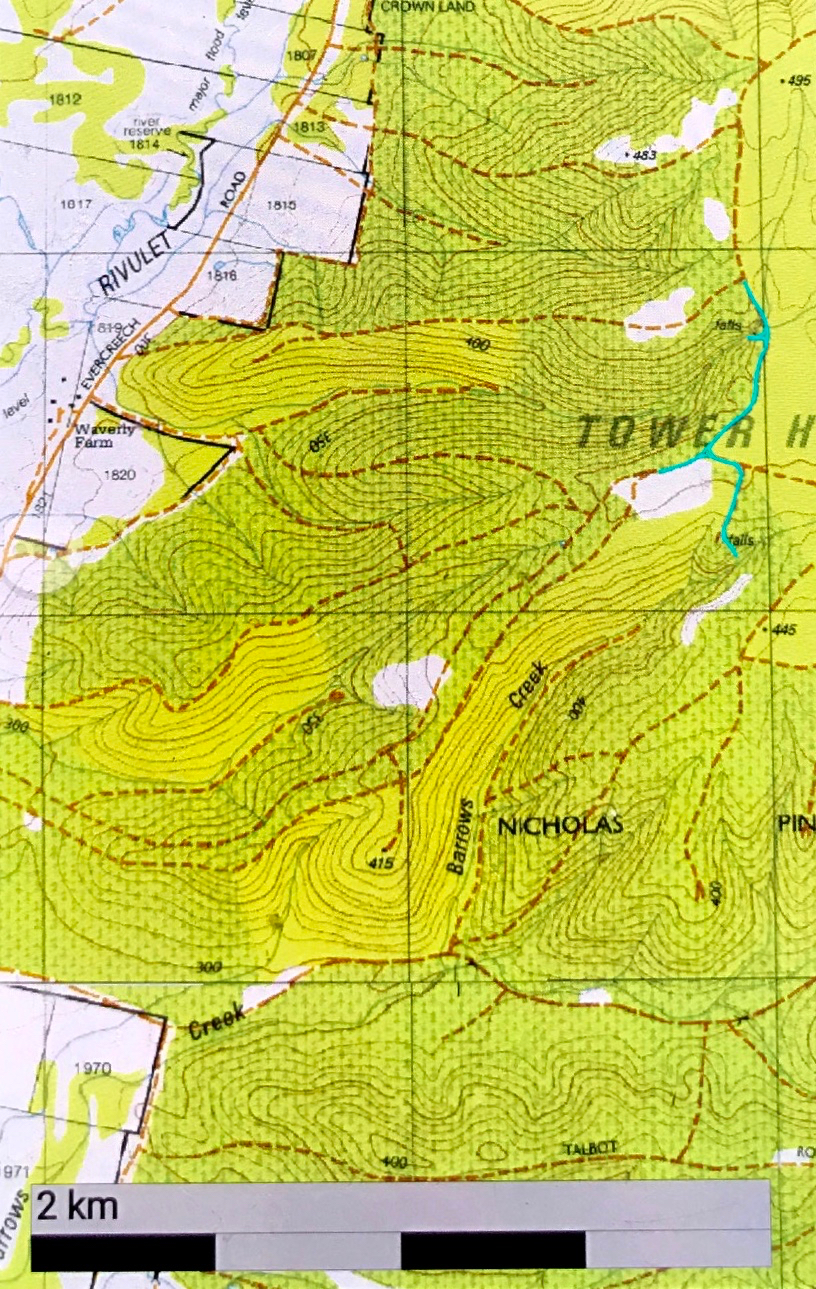
But, just around the corner, and not connected by a track, and with no hype, signage or anything other than a little blue line on some maps to signify its existence, lies another waterfall, which HAS to be the REAL Evercreech Falls. How and why did that little trickle get to take on the name of the master lies hidden in the mystery of history. (A clerk’s error? A transcription folly? A deliberate ploy to keep the almighty tourist safe as the real one is too tricky? Who knows?)
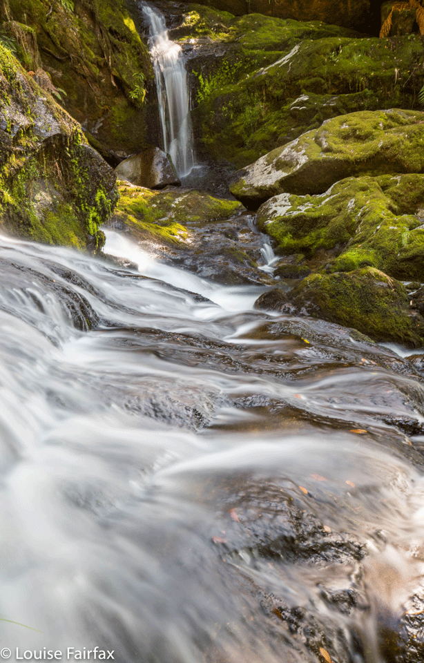
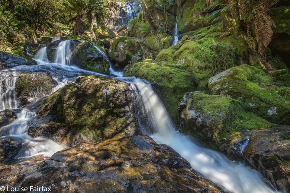
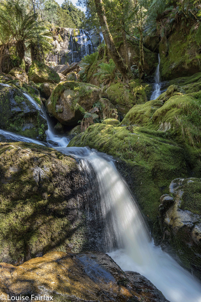
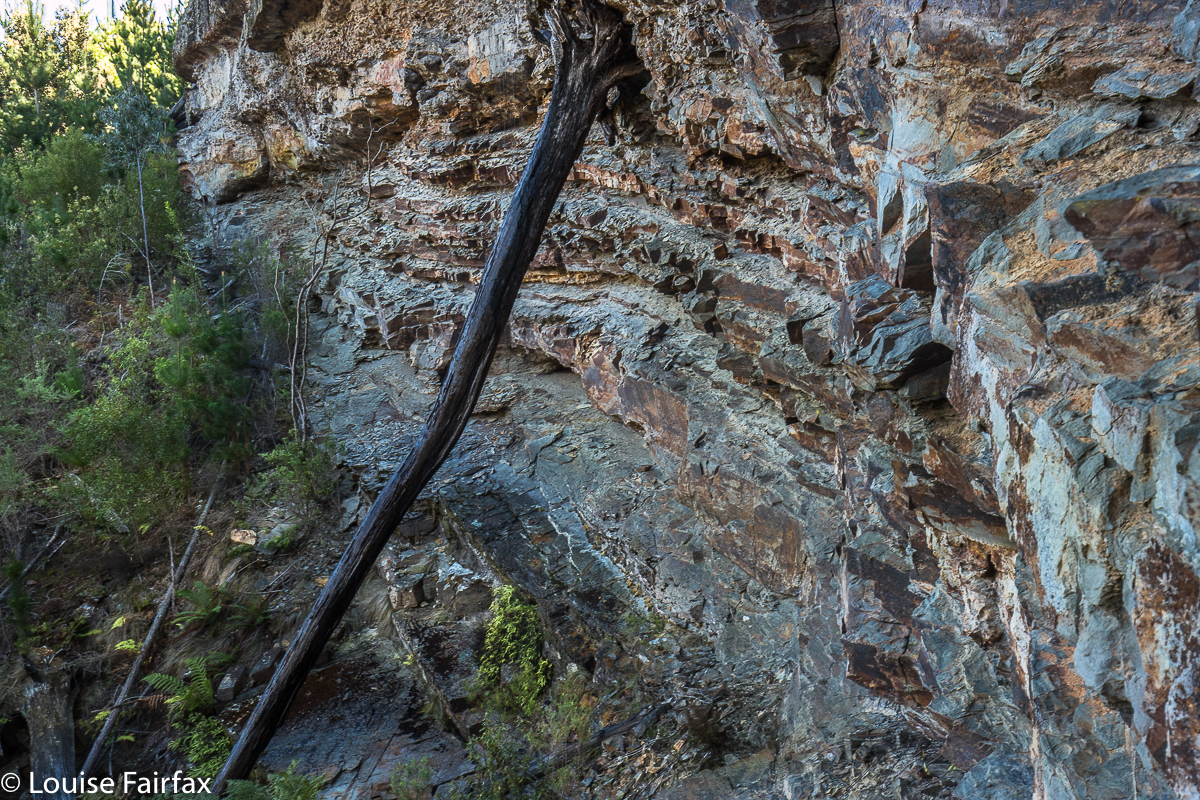
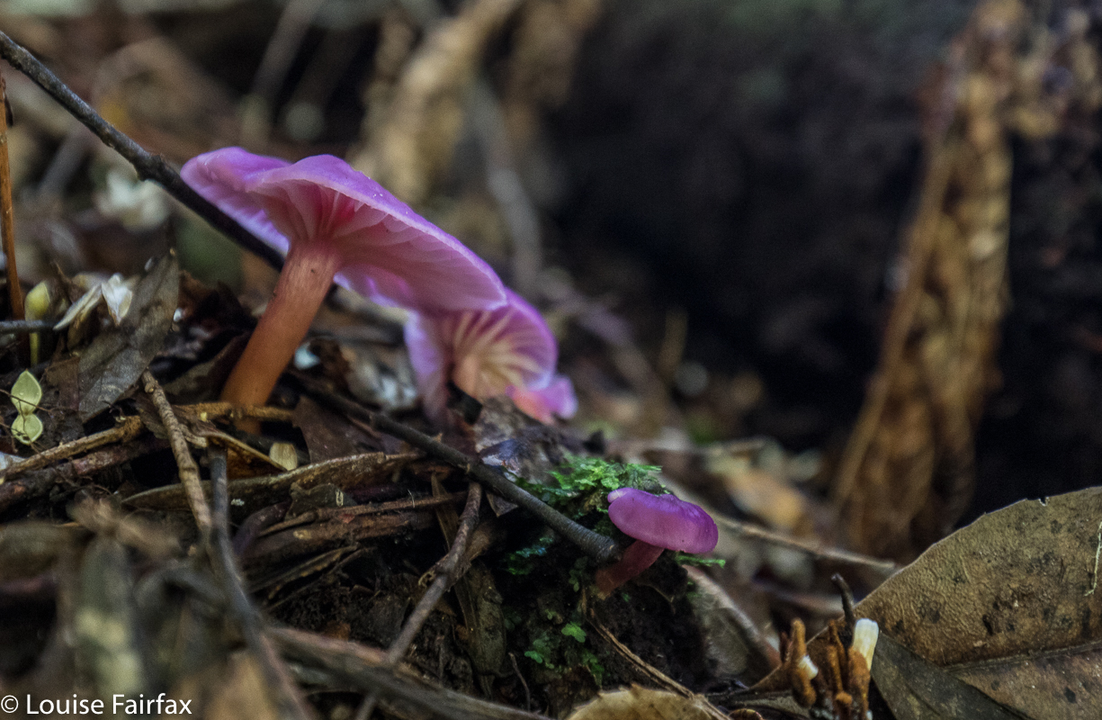
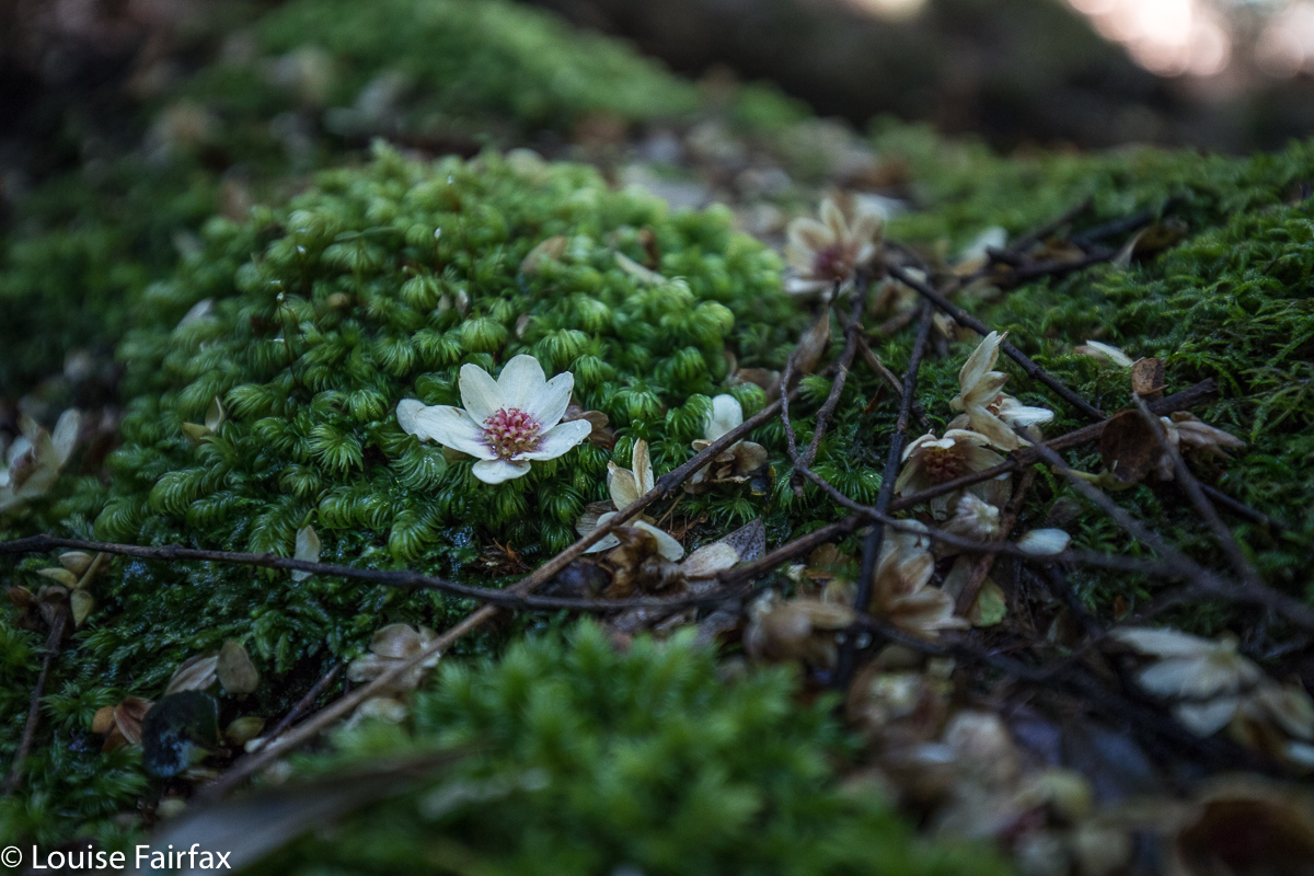
But, as the Ugly Duckling is to the Real Beauty, so is that prelude of a thing called officially Evercreech Falls (which does not even lie on the Evercreech Rivulet) to the one I am calling Evercreech Falls REAL, to emphasise the false claims of the imposter. Last year, I investigated several other blue lines on the map in that area, and came up with not much for my reward. But this one … this one is a beauty. There is no track to it, and you are bound to fall in the drink as you boulder hop and slide your way upstream (many boulders are decked with slippery black moss. I felt myself sliding quietly backwards and didn’t put up a fight. To fall slowly was better than to fight and crash and break a bone).
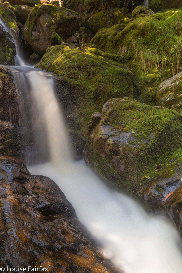
My photos are – sorry – sub-standard. The capricious sun is entirely to blame. I was only here by accident, passing by with time on my hands, so decided to do a recce to see if I could actually reach them. I began at 9 a.m., and took an hour to arrive at the base from the car, by which time there was far too much contrast on the rocks and a greater dynamic range than my camera could handle. My shots are hints of what is to come when I return on a better day.
PS Be careful of Tigers. A resident sunning himself did NOT appreciate my visit, and rose to attack me. I crossed the river rather than sort out which of us could win that battle.
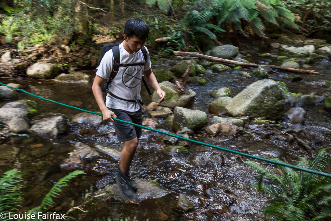
On my return, I stayed high and out of the river for as long as possible, just to see if, in winter when the water is stronger and colder, it would be possible to keep my tootsies dry. I stayed mostly out, but I would not count on dry feet if you are going to do this one.
At the end, with feet already wet, I just marched down the stream rather than pick my way. That was quicker and easier. As I approached the actual track going to the labelled falls, a group of Asian tourists saw me and thought I must be hopelessly lost, trying to find the falls they were about to reach – but, hey, they had a guide and so knew the way. Magnanimously, they all wanted to help me out of the water (which, surely, I did not want or mean to be in), and a mass of sweet, generous hands reached down to aid me. I kind of swung and hopped out, earning their surprise and laughter. We came from very different worlds, but it was a fun intersection at that moment.