Blackboy-Mathinna circuit.

Having once climbed Mt Blackboy by the easy route, I was not all that interested in a repeat, but today we took it head on and did a traverse along the high rocks, and that made it a totally different and really fun experience.

Fingal Valley

Not only did we attack the boulders from their most challenging angle, we also began way, way down at Mathinna Falls, giving us a climb of over 500 ms in the process, and not from the nearest road access as is normally done if you only have bagging in mind.

Hypholoma australe – these were near the carpark, before the real fun began.

The actual climby bit was probably only about 2kms horizontally. Do your maths: that’s STEEP. People from our small group were falling and slipping the whole time. It only counted as a fall if you landed on your bum or worse. I was relatively unscathed with only three falls. Several of my friends got into double figures. One specialised in quite spectacular landings.

Delvin Ck track to falls

Even just standing talking waiting for the rear to catch up, you kind of slid down the slope unless you grabbed a sapling to prevent the descent. I was sure I spotted a flat bit of ground somewhere down below (and John backed me up); this became a source of many jokes as we tumbled our way downwards.

Russula viridis – very pleased to find this one! You don’t see them often.

Sorry for the lack of photos of rocks and forest: when you are above your head in ferns, it’s hard to get a shot, and the rocks were reached in midday glare, which I don’t find conducive to pleasing photography. I leave the massive and alluring boulders to your imagination. Meanwhile, if you know me, you know I love fungi.

Dermocybe canaria. I have also not seen very many of these in my hunting.

I was quite proud of how clean my pants still were at the finish – ripped and muddy pants were the norm by the end of the day – until I got home and discovered a huge red patch base right, courtesy of a hitchhiking leech.

Blackboy Falls from above. We could see them, even if you can’t. This was as good as it got today. Work in progress!

We also visited the top of a waterfall en route, which, given its location and in order to be able to talk about it, I have dubbed Blackboy Falls. (It is an unnamed blue line on the map). We lacked time to visit the base, but at least we have now seen it, and have also (of course?) plotted our route for a more extensive, close-and-personal visit some other time. As it was, we didn’t get back to the cars before 5 pm, and it was more than dinner hour by the time we returned to Launceston. It’s worth being hungry to have had such a fun day. Very little beats real bushbashing, with its engagement with nature, and its total workout value. Keep Tassie Wild.

Traversing the ferns back near the bottom. Thanks for the photo Phil Andrew, who, being taller than I am, had a little less trouble taking a shot in the jumble.

Trickle Falls and Dry Falls 2018

Trickle Falls and Dry Falls 2018 Sept


With an inauspicious name like “Trickle Falls”, don’t expect too much. If you use a powerful magnifier, you might find the trickle that elevated its name from “Nothing Falls”.
Trickle Falls and Dry Falls. Do these names excite you in a waterfall? No? Well, I guess the falls didn’t excite us much either, but one visits waterfalls for many reasons. I think all three modes of waterfall visiting have their place, either to please three different kinds of people and capabilities and desires, or even one person in three different moods. Sometimes you go just to see something beautiful to photograph, but that involves no adventure at all (Russell, Nelson, Horseshoe, Liffey, Lillydale and more). Sometimes, you visit something that has a little bit of an adventure, and a beautiful waterfall at the end as well, like Machinery Creek Falls, or Tin Spur Falls or McGowan Falls, to name just a few of Tasmania’s many treasures in this realm. These falls usually have a pad of sorts, so the adventure aspect is minimal, but you still feel a certain sense of reward for having got there, despite the prevalence of seemingly ubiquitous pink tape that you possibly try to avoid in order to have the adventure you feel like having that day. Other days you don’t feel like thinking, you are in zombie mode, and the pink tape means you can zone out for a while.


Hygrocybe cheerli, I believe (near the later visited, Evercreech Falls.
But if you are up for a real adventure – if you wish to satisfy that primaeval spirit of ‘the explorer’  that still lurks inside some of us, and which, being the lucky, lucky denizens of a place like Tasmania that still has places that remain essentially wild (whether called wilderness or not), then you can get a map, spot a little line on it, and navigate yourself off to that waterfall, not having a clue what you will find. Such was the case for Carrie and me – and Tessa – on Sunday, when I decided our waterfalls for the day (well, the first two of our seven) would be two marks on the map in between Mathinna Falls and Evercreech Falls, up on a ridge to the east of Evercreech Road (and Evercreech Rivulet).


And of course, to be dubbed Dry Falls gives you no chance, ever.
We both imagined beautiful rainforest like the forest surrounding the two falls of the big names. Not so. This forest was as dry as a bone, with fallen timber everywhere, and not at all appealing. Oh well, luck of the draw. We also expected falling water at such a mark on the map. Wrong again. As you can tell by the names we have given these falls so we can talk about them, the first had barely enough to get wet if you needed a wash, and the second would leave you utterly parched if you were thirsty.


The consolation prize for the morning: Evercreech Falls.
But we are not sad. We took photos for the heck of it, but rejoiced in the adventure we’d had playing at being explorers. It’s a fun adventure, a fun life. However, we then moved on to our consolation prizes of Evercreech Falls and Mathinna Falls, which Carrie, living as she does way to the west on the NW coast, hadn’t yet seen. Evercreech and the first three tiers of Mathinna were repeats for me, but I never mind that.


Fallen sassafras blossoms litered the ground and settled on the moss, like confetti at a wedding. It was wonderful.
The real adventure of the day turned out to be waterfall number seven, which was Mathinna Tier 4, a fun climb – a little scary – and a real feeling of triumph when we looked across at them. Omg, they are absolutely HUGE. We had that wonderulfly spooky feeling that very few humans on the planet today can have – the feeling that perhaps you are standing where maybe no humans have ever stood. The bush was very thick; the climb had been very steep on quite loose ground; we had pushed through rubbish to be where we were (with me breaking down several dead shrubs to enable our progress), and the view was not utterly brilliant, but we were seeing something very special, and it thrilled us. (For photos and report, see the blog on this that will be posted within the next day or so).


To get there, we hung a right (east) off Evercreech Road, climbing up to the left of the ridge of the knobble there. The road was dodgy. I was grateful that we were in my Subaru Forester and not in a 2WD. … And then the road became even dodgier, but we pressed on, and parked up the top. The cyan route is the walking part. You can see where we dropped down to the two falls concerned. They are “waterfall baggers only” type falls.

St Pauls Dome 2014 Aug

St Pauls Dome, Fungal Valley, Tasmania. 2014. Aug

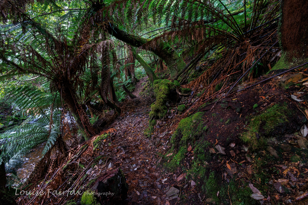
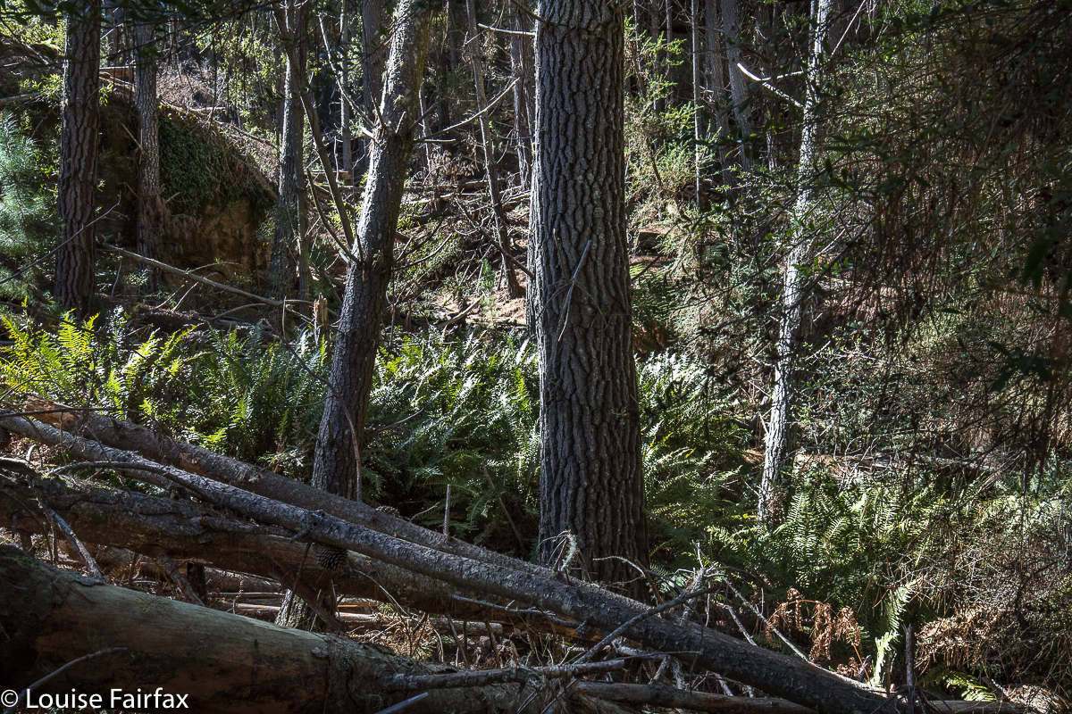
The bush in the first eight minutes
The minute you turn east off the highway to Hobart and begin heading to the coast along the Fingal Valley, there is St Pauls Dome, dominating the skyline slightly to the right of straight ahead. If you climb a mountain like Mt Henry, nearby, there it is again, looming larger than the mountain you’re on and telling you you should be on it instead. The trouble was, I wasn’t sure how to gain access, as private land separates the highway from the mountain.

A few postings to and fro on bushwalk.com and I had a telephone number, and soon after that, permission from the friendly owner, Jamie, to cross his land. My husband finished work at 1.30 today. It was on. We met in town and set out.

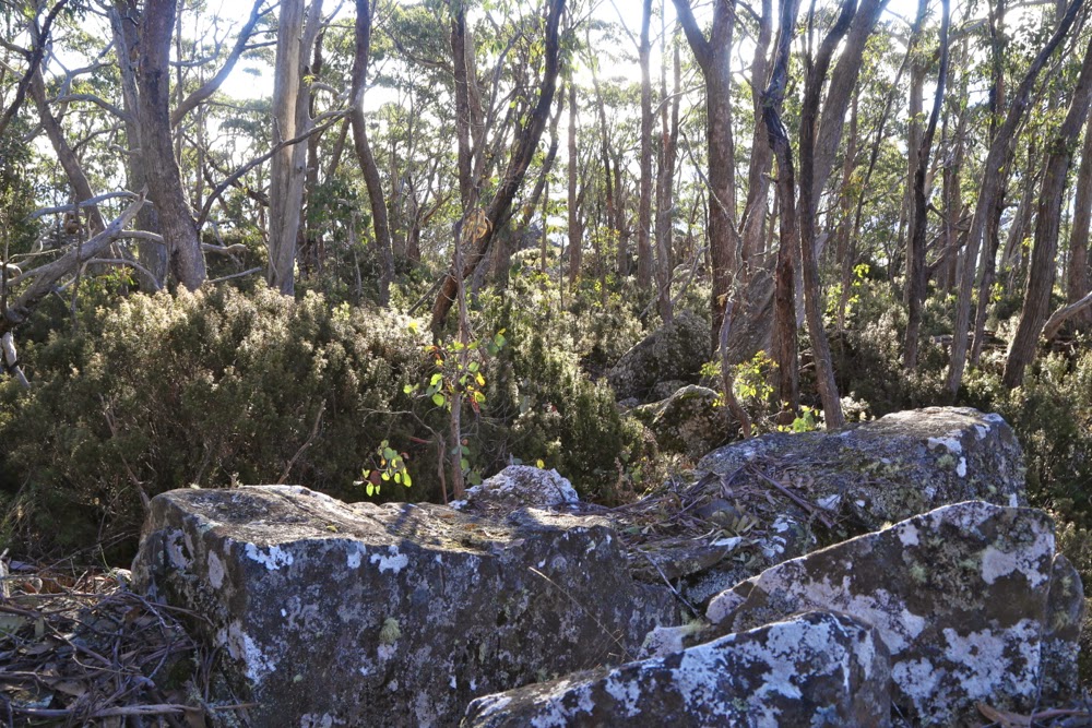
The bush with 100 ms of height gain left.
We found the sign that said this was property 3710, so turned in the gate with its sign about alpacas, crossed the railway line, and headed through the fields for the mountain. I had feared that we’d have to park at the start of the bush, but Jamie assured me I could get further than that despite my only having a 2WD, so up I continued. I was pleased to be doing this at last, not just because I’ve ignored the gauntlet tossed in my direction each time I pass, but also because there’s a big orienteering event near here in January, and I wanted to know whether this mountain was worth recommending to some of the interstate visitors who’ll be staying with us.
My judgement now I’ve climbed it and seen the “view” is that I’ll send them up St Patricks Head instead.
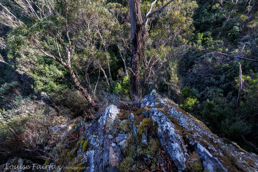
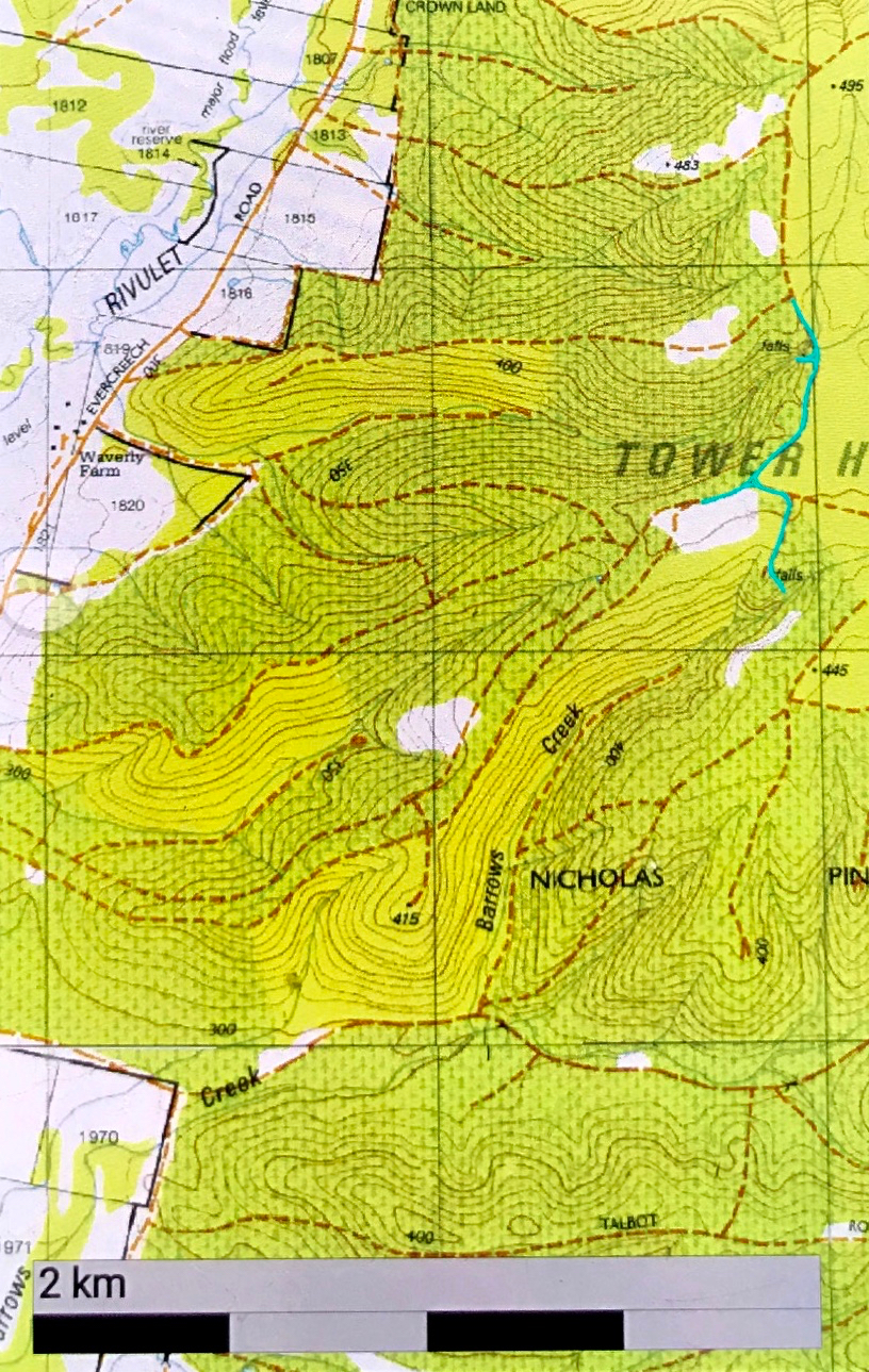
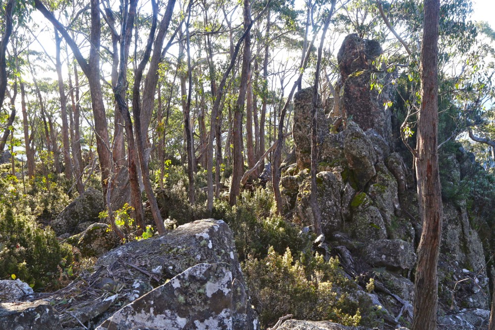
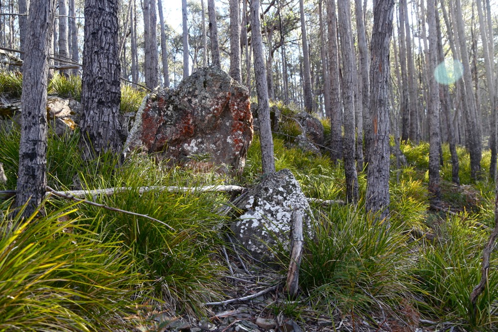
Not too far from the summit now
 
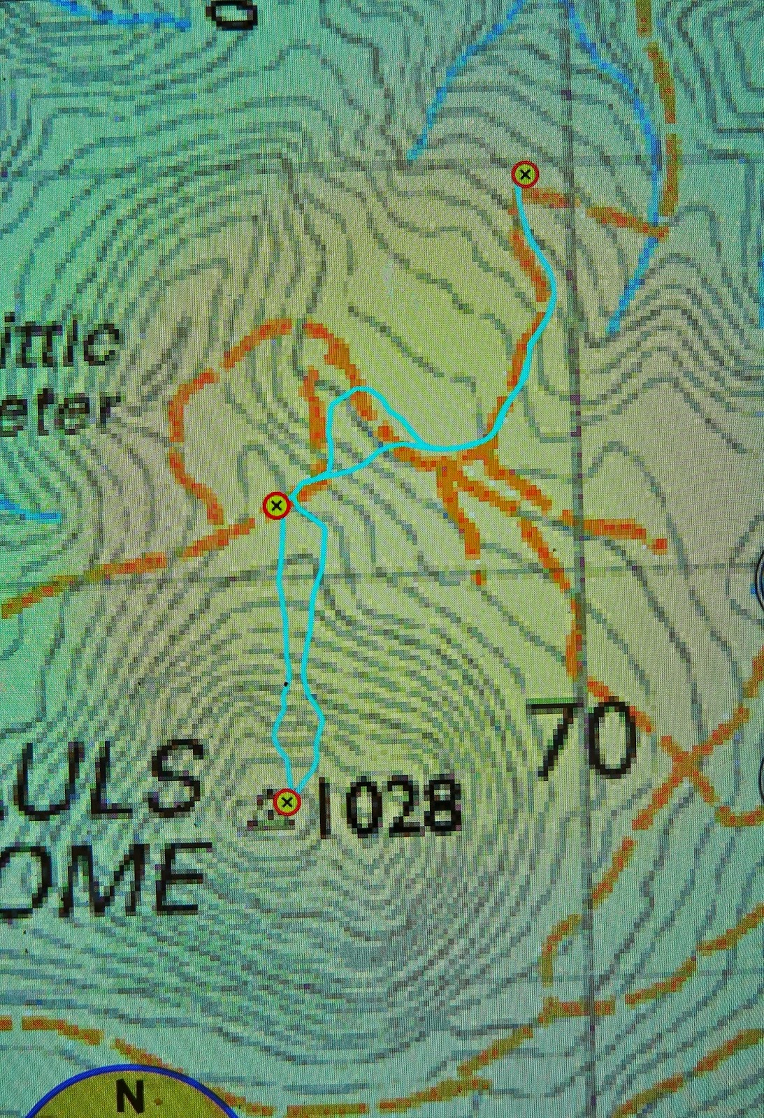
Directions: Looking at the map above (scale 1:50,000), you can see where I parked just below a corner that swings left (as you drive south towards the mount), not far from crossing a creek (most northerly waymarker). The section from the creek to that corner was a little hairy in our 2WD and if you love your car or are nervous, it’s probably better to stop just before the creek, where there are numerous places to turn the car and pleasant, green, flat sections just to sit and enjoy the bush while you don boots and gaiters. Continuing to drive to where we did saved us a bit of time which, given how low the sun was now in the sky, was necessary for us on this occasion. Turning the car around where I did was about a 7-point turn (but out car is very long). There is NO way I would have driven any further.
We then followed the road that would have even tested a 4WD up, as per the map, cutting off a corner in the road by taking the hypotenuse through the bush to meet it again higher up. The second waymarker is where a Pandani group (who did have a 4WD) parked when they did it last year. It took us 30 mins to walk from the first to the second waymarker.
As you can see, I left the road where the spur comes down to meet it, and just headed straight up. The bush at first looked like the bush in the first photo above, and was very easy to negotiate. After 7 minutes, the bush type changed completely, and short prickly shrubs predominated. However, these were very easily avoided, as the ground became very rocky, and I just steered us along rocky leads that took us to a mere 100 vertical metres of the top (another 7 minutes since leaving that second waymarker).
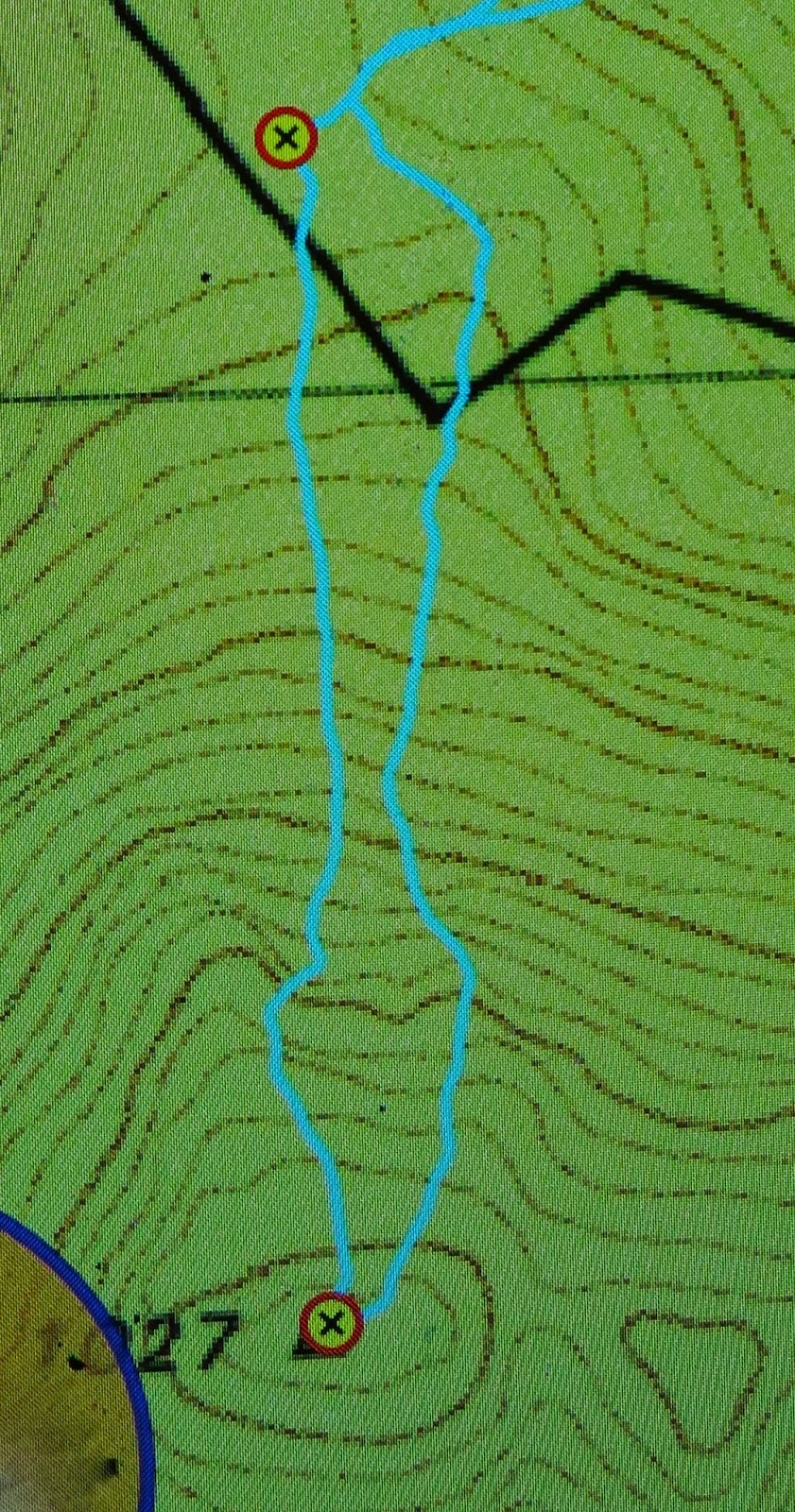
On the map below (1:25,000), you can see a kink in our direction partly onto a spur. That’s because there were some very interesting rocks there that I wanted to climb …. trouble is, you can just see in the contours the hint of a shallow gully, and the moisture it contained meant that the scrub was now over my head and very thick and our progress was pretty slow from that kink to the top (scrub gloves came in handy) – a further 14 mins. Therefore, on the way back, you can see I chose a more easterly route, and we both felt it was way faster, except that the ascent time was faster than the way down – but that’s pretty standard for me. I’m a girl on a mission on the way up if left to my own devices. In total, the time from that second waymarker where a 4WD can park to the top took us 28 mins. Even with the extra 50 mins’ walking that parking where we did added to the return journey, it was still less than a two hours’ walk (plus sitting at the top), and a very pleasant way to spend one of the last afternoons of official winter.
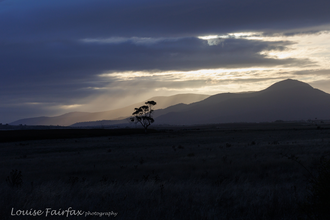
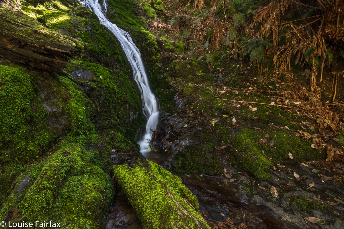
That said, don’t do it for the view. People talk enthusiastically about it, so I was expecting something glorious, and most definitely expecting to see the sea (Wildtiger says you can see the Tasman sea, but we couldn’t). We perched on the trig rock to eat before descending, and looked at leaves and trunks and, yes, some hazy distant mountains if we craned our necks, but I didn’t even take one photo!! Afterwards, I explored a different mound that looked promising, but it wasn’t brilliant (but was better than “trig rock”). I climbed the trig itself, thinking that perhaps the problem was my diminutive height – and that gave me perhaps the best view – but I wouldn’t rave. The scene we both enjoyed the most was after we’d joined the road and were walking along it to get to the car. The light was now beginning to change colour and the water-laden air was taking on golden hues tinged with grey that made that section very peasant. We could actually see further there than we could from the summit.
I have now checked with Jamie, and he’s cool about having his number here. If you want to call him about climbing the Dome, his number is 0419 394 572