Bruny Island 2021 Mar

In my family, we value time – and in particular, time together – far more than things, and, although I was given some very nice “things”, my most treasured gift of my recent birthday was the time that my Tassie family was able to give me: three days, although, in fact, it kind of became a birthday week.

Adventure Bay, Bruny Island

And what extravagant thing did we do with this time together? A luxury cruise? A flight somewhere? No. We rented an AirBnb at Adventure Bay on Bruny Island and had bushwalks, fungi hunts, beach races and a mountain climb. Here is our itinerary:
Day 0. Arrive

Adventure Bay, Bruny Island

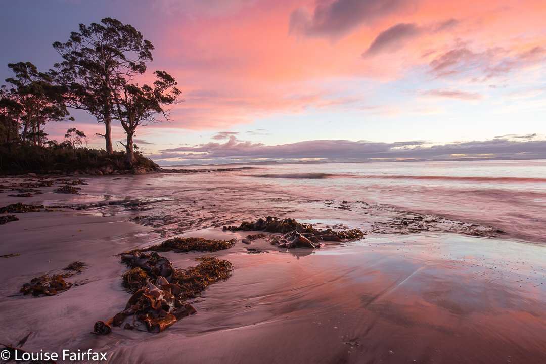
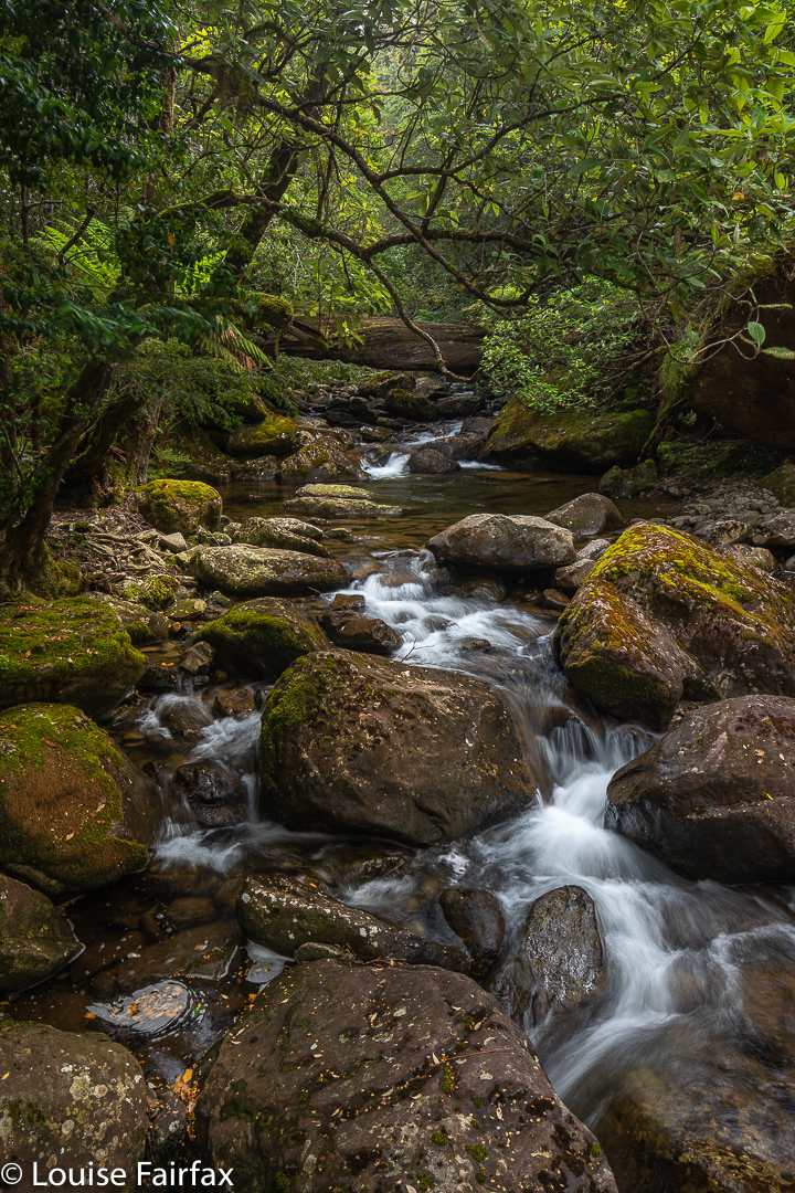
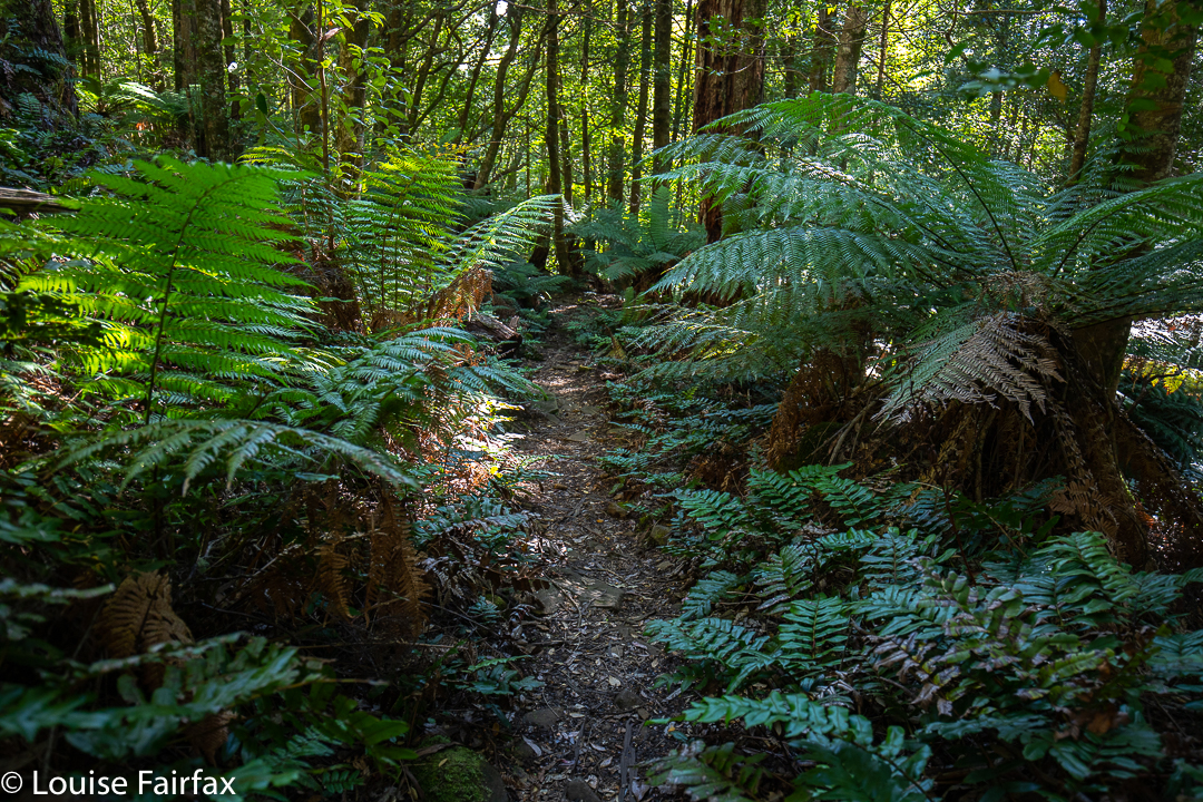
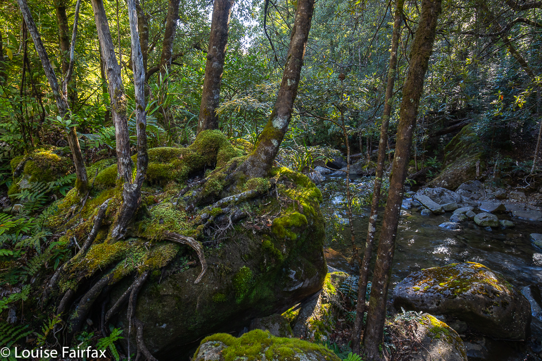
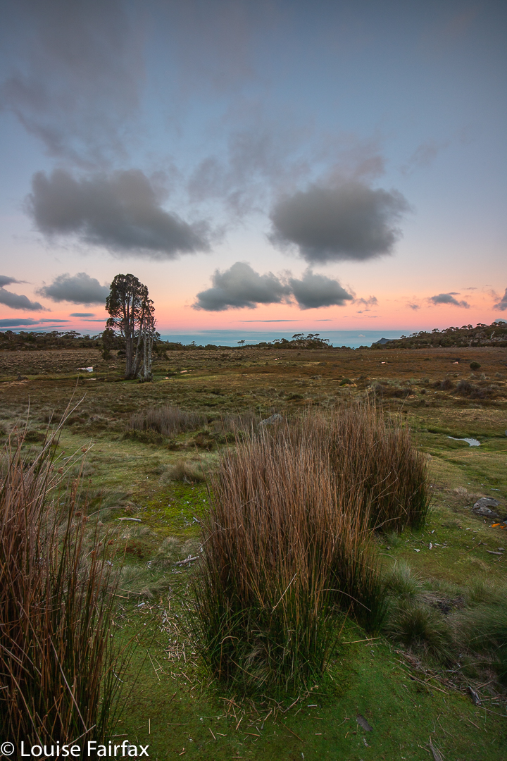
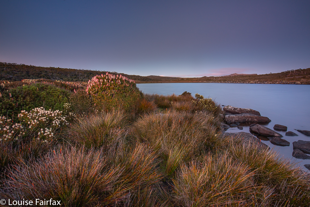
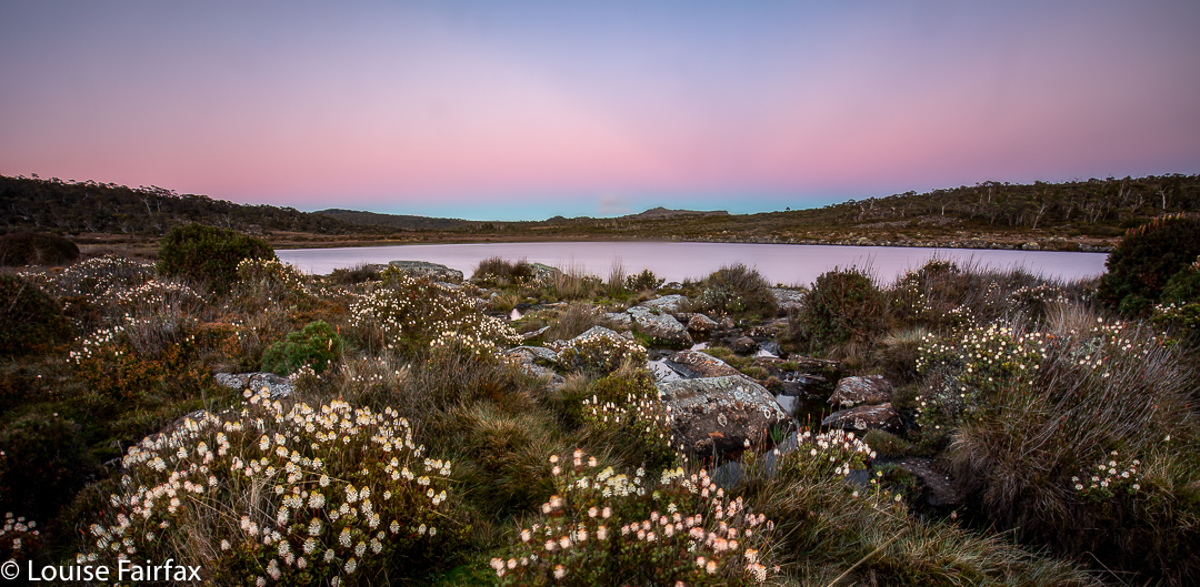
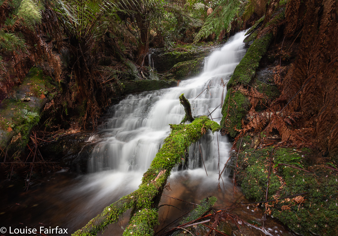
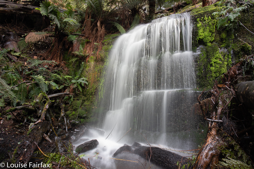
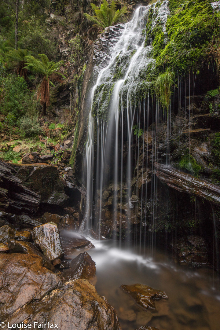
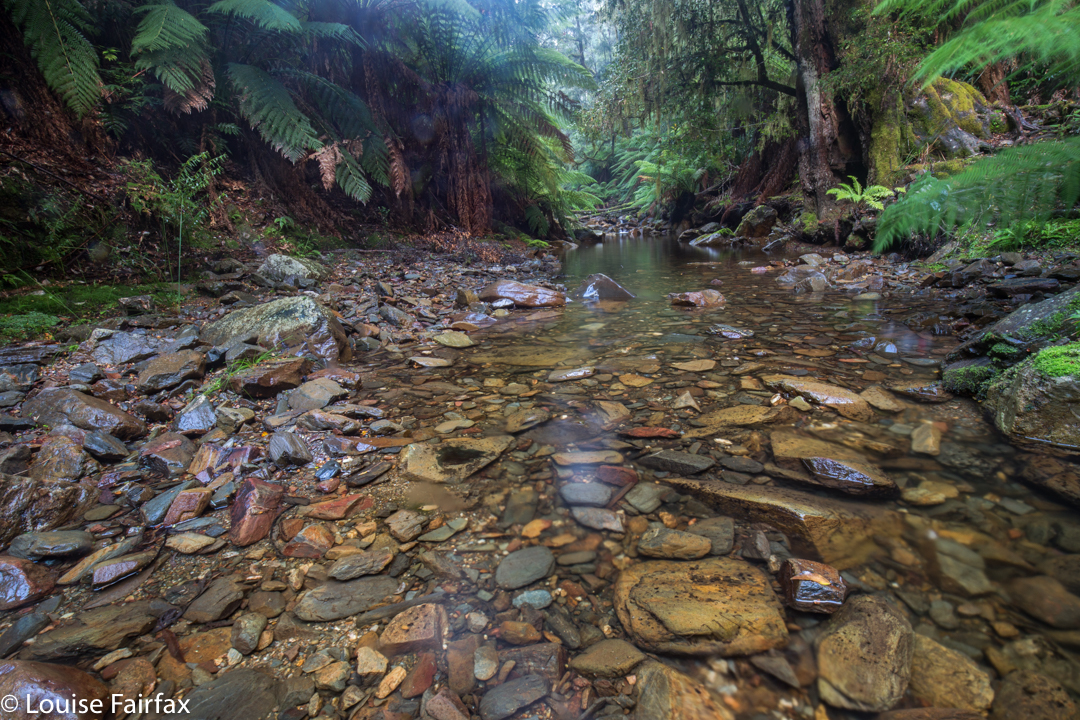
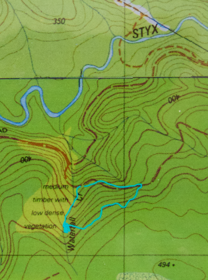
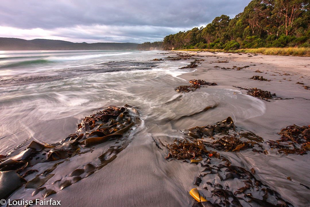
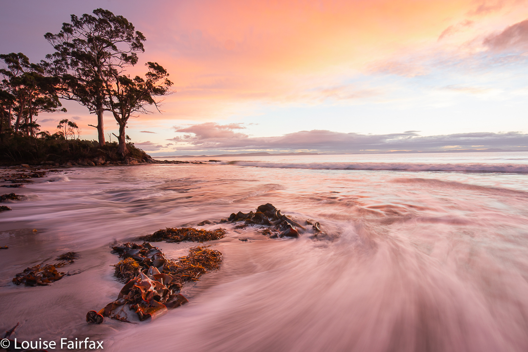
Day 1. Photograph the dawn. A.m.: Fungi hunt in the Mavista Reserve (5 kms). Picnic lunch on an unnamed beach. And in the afternoon, my daughter and I walked the Labillardiere Track while Keith minded the children. This was 25 km equivalents, done at a talking march in 3 hrs 30. We both enjoy a good workout, and walking quickly meant the time we were gone was less. Our route was clockwise, and we really loved the second half of this route, along the coast with myriad beaches and the water beside us. The sign says 6 – 6.5 hours, which would be more realistic as a meander pace.

Adventure Bay, Bruny Island
Hatching Aseroa rubra Mavista Reserve

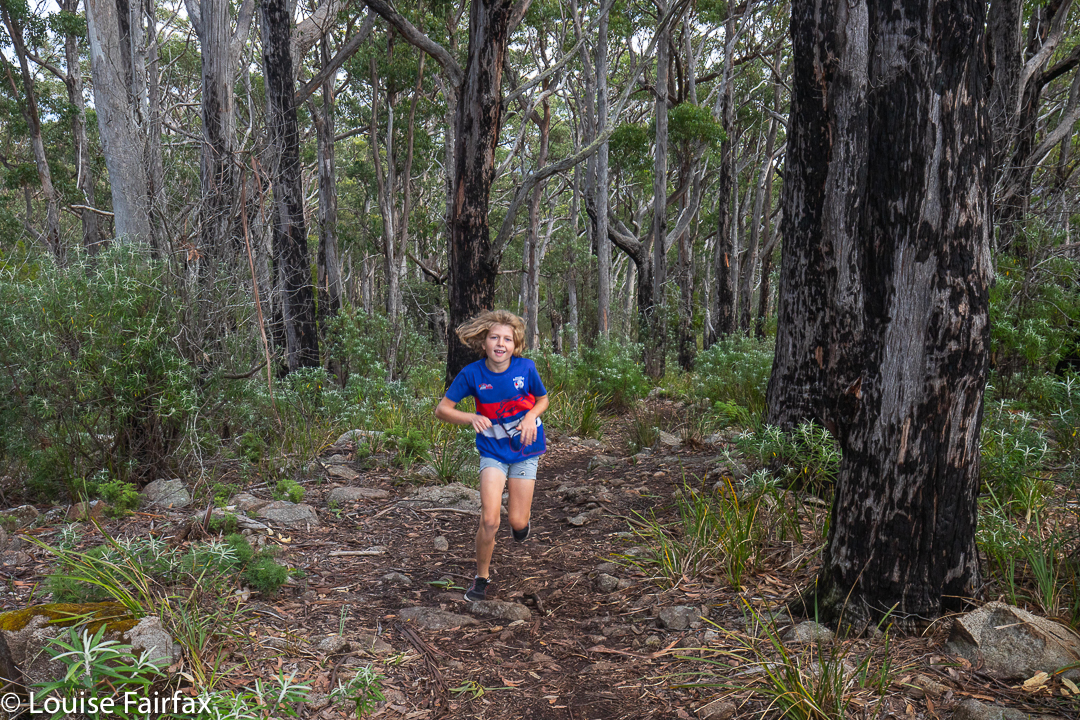
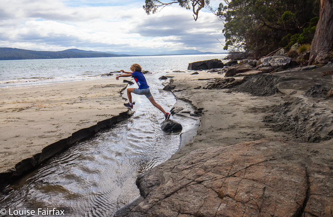
Day 2. Lucky I didn’t run that 25 kms yesterday, as the children chose beach racing as the morning’s activity, and I was about to need all my legs could offer, which wasn’t quite enough. The beach is 1.7 kms long. Based on his speed when he joined me on a training run last year, I gave Gus 30 seconds’ start. He shot out on “Go” like a bullet. I thought: “There’s no way he’ll keep that up; I’ll catch him shortly after half way.”

Waves, Adventure Bay

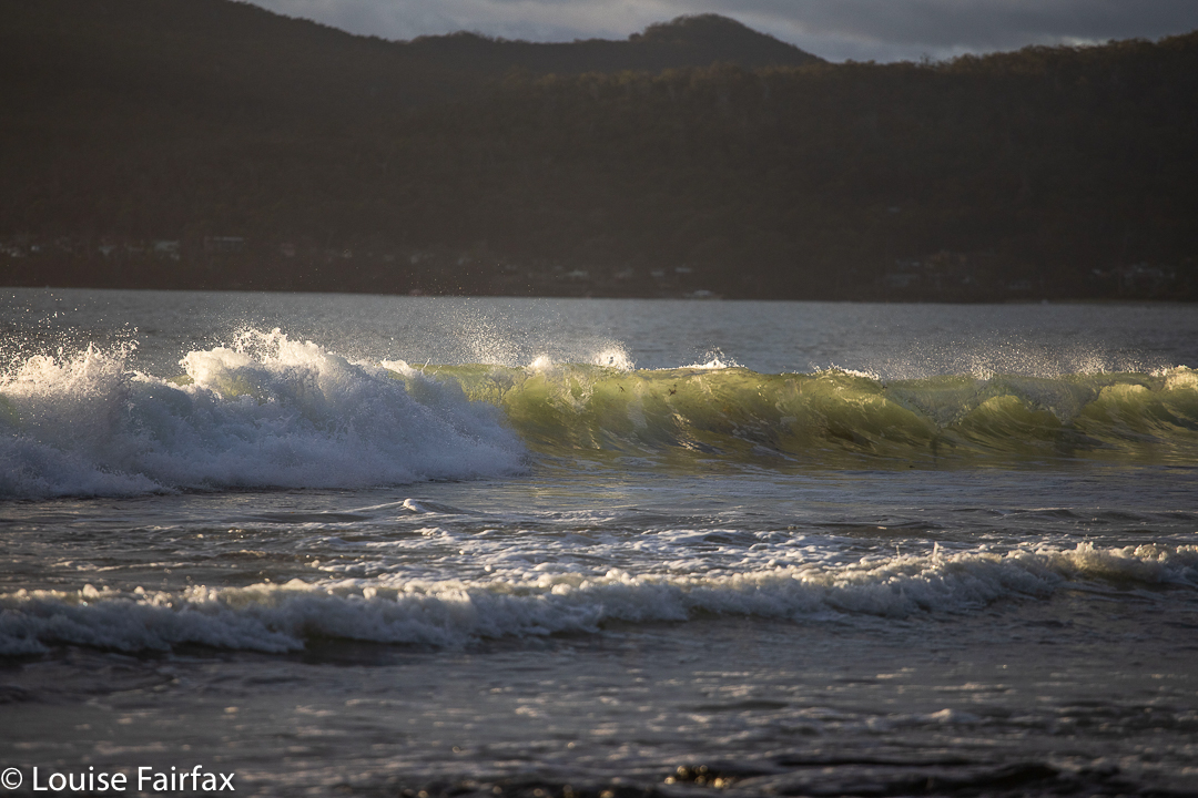
He covered a lot of ground in his thirty seconds! Off I set in hot pursuit, but appeared to be gaining absolutely nothing. Somewhere in the halfway region, I thought maybe I had reined in a single metre, but he pulled ahead again, and once he sniffed the finish approaching, was off like a chasing cheetah to the line, making distance on me with every stride. This is the first time he has legitimately beaten me, and he did it with style. We celebrated his win with an ice cream. I am proud of him. Good distance running is the reflection of a good lifestyle, not just good genes.

The thrill of the chase, Adventure Bay
Making dad feel slow
Adventure Bay. Beach running is such fun.

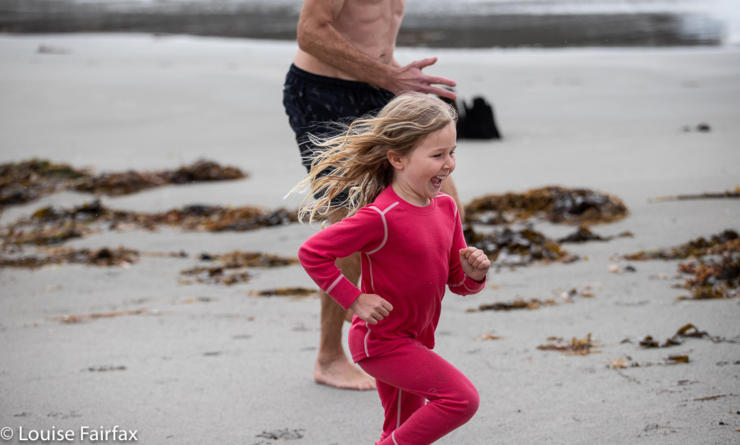
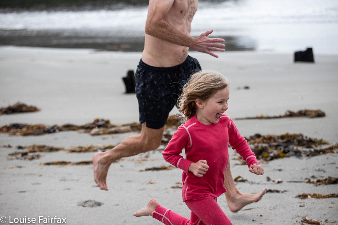
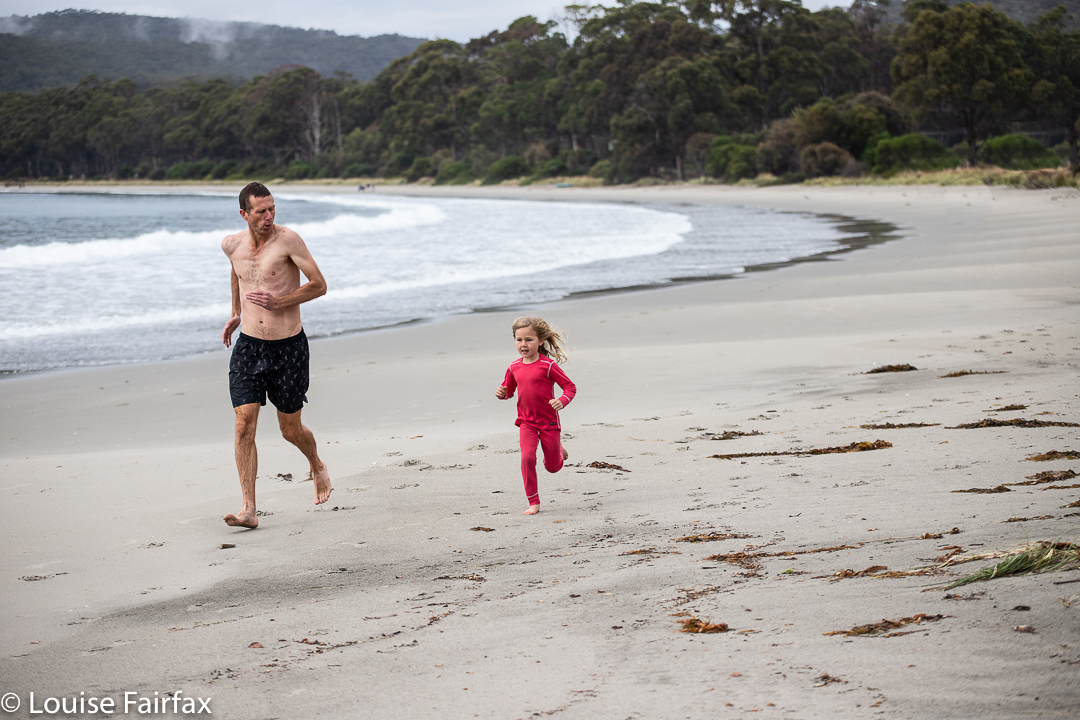
Meanwhile, and not to be totally outdone by big brother, little Abby made dad look slow, even if he wasn’t on full throttle. She just can’t wait to be old enough to do school races like Gussy does. At five she will be offered a Teddybear  race and Egg and spoon. I’m not sure if she’ll be allowed a straight sprint.

Hypholoma australe

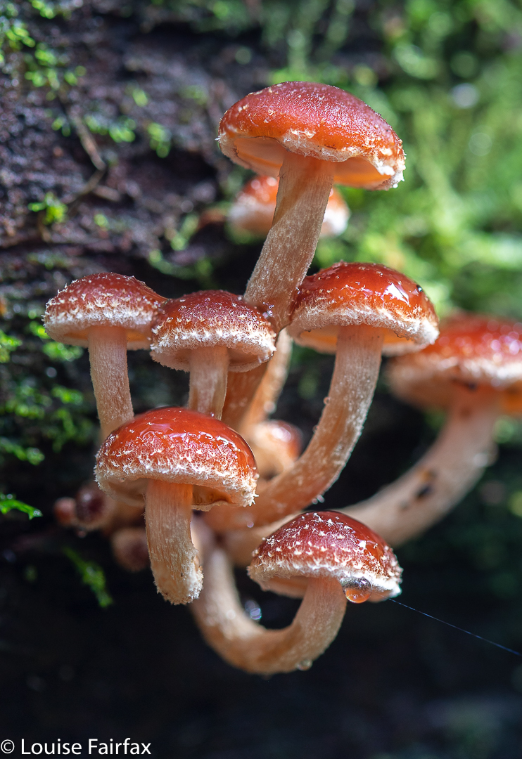
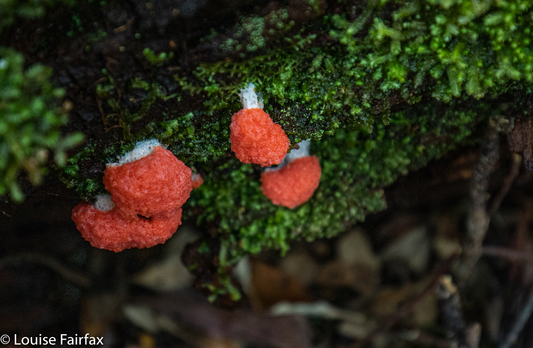
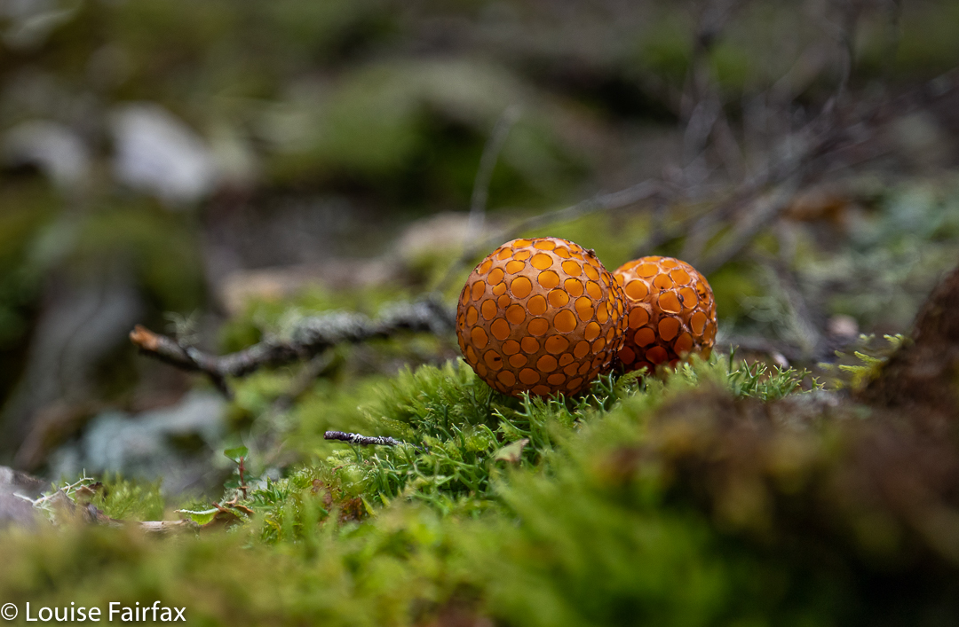
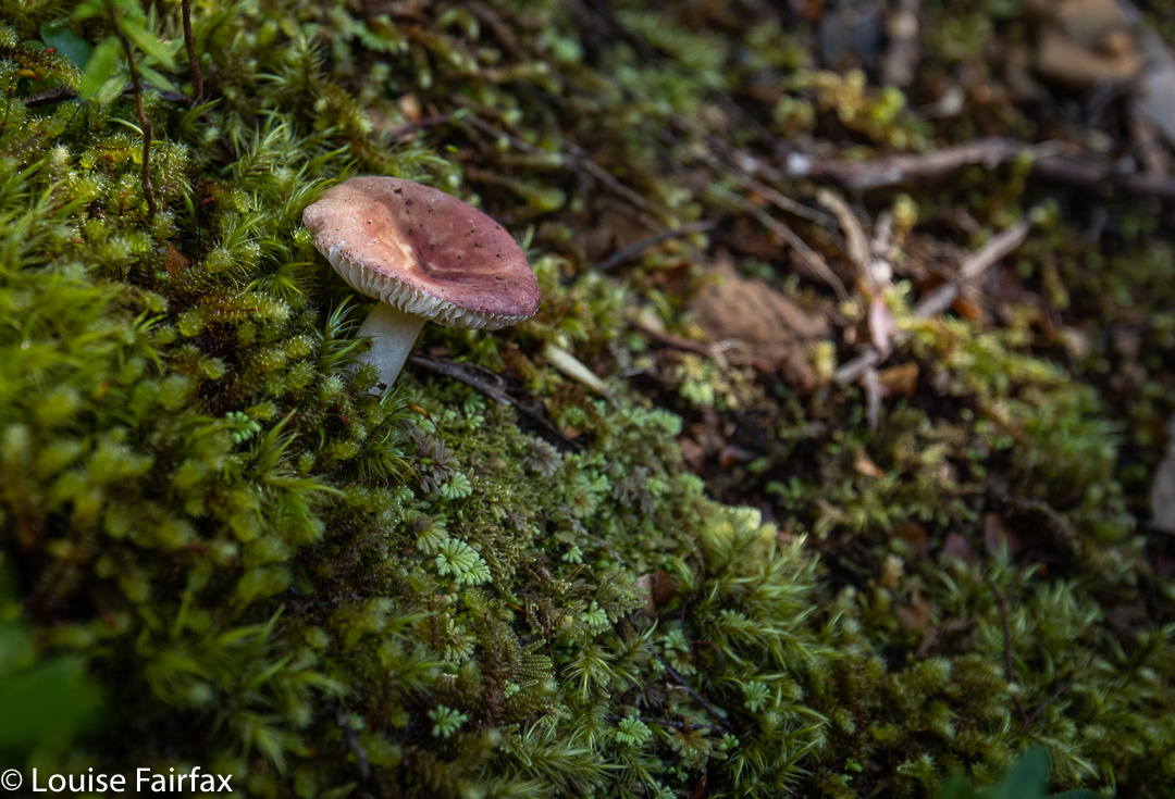
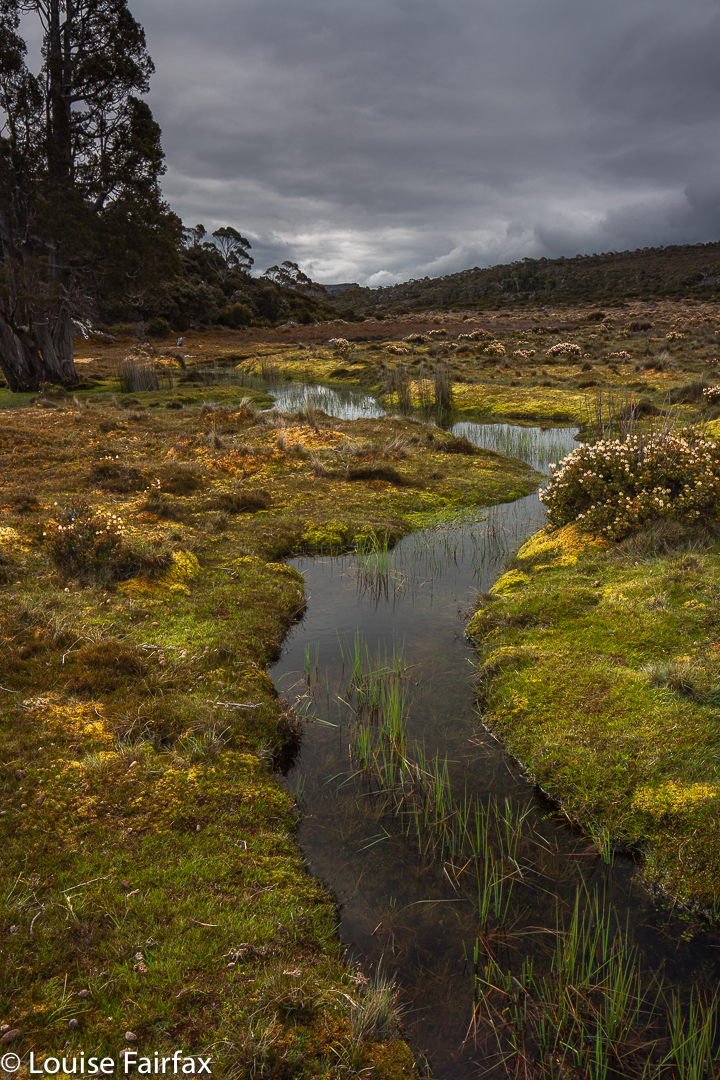
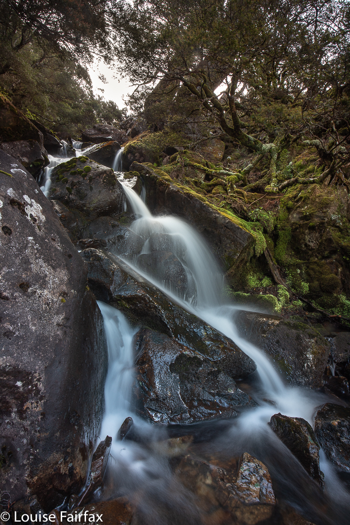
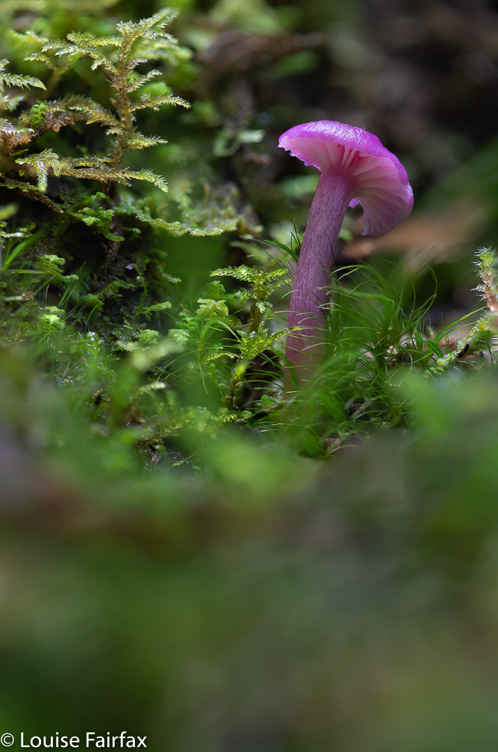
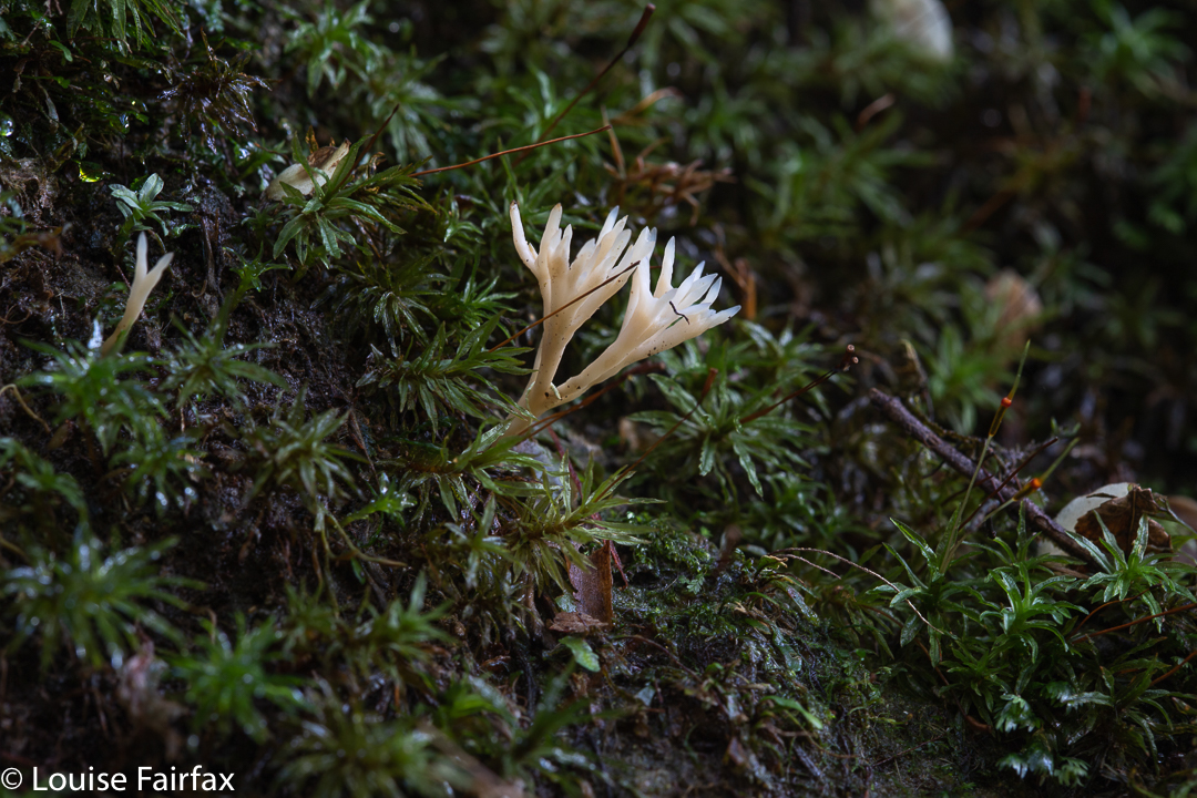
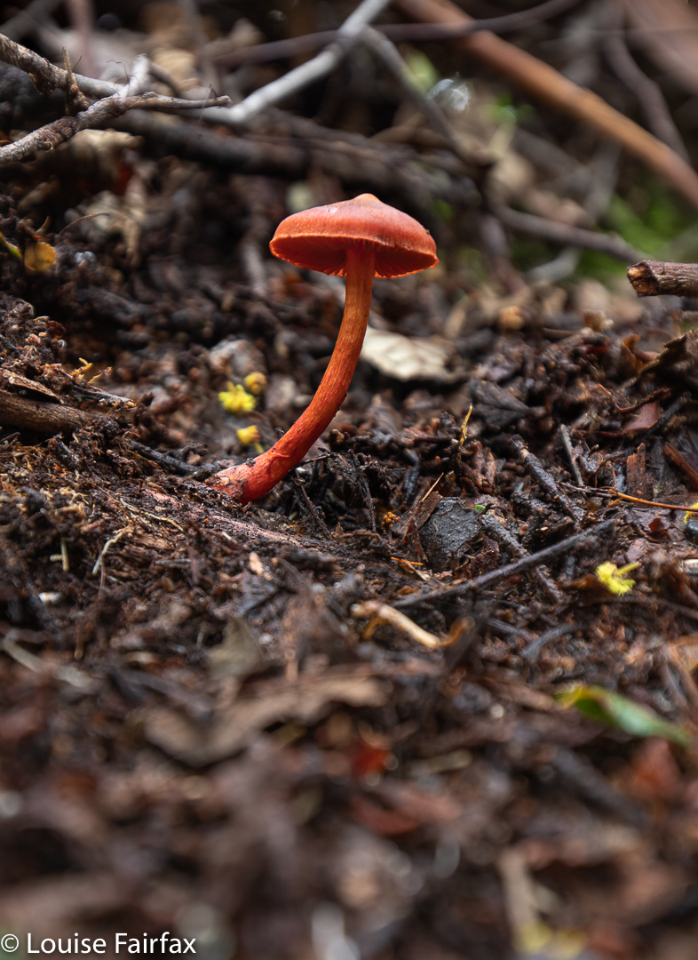
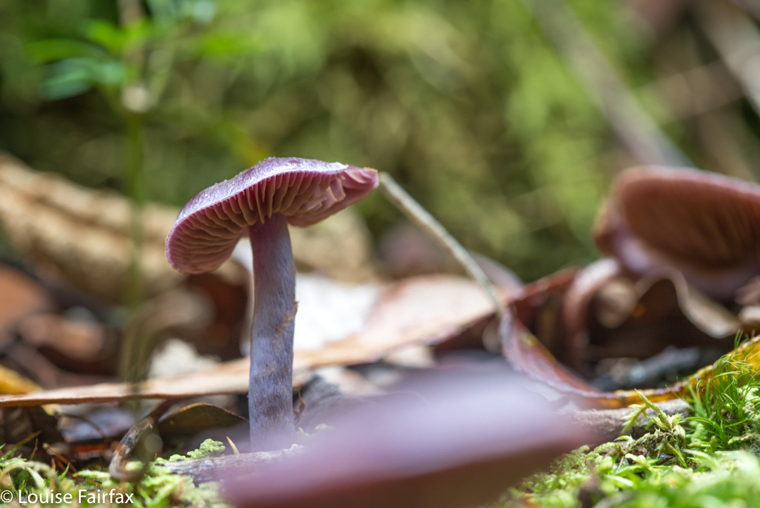
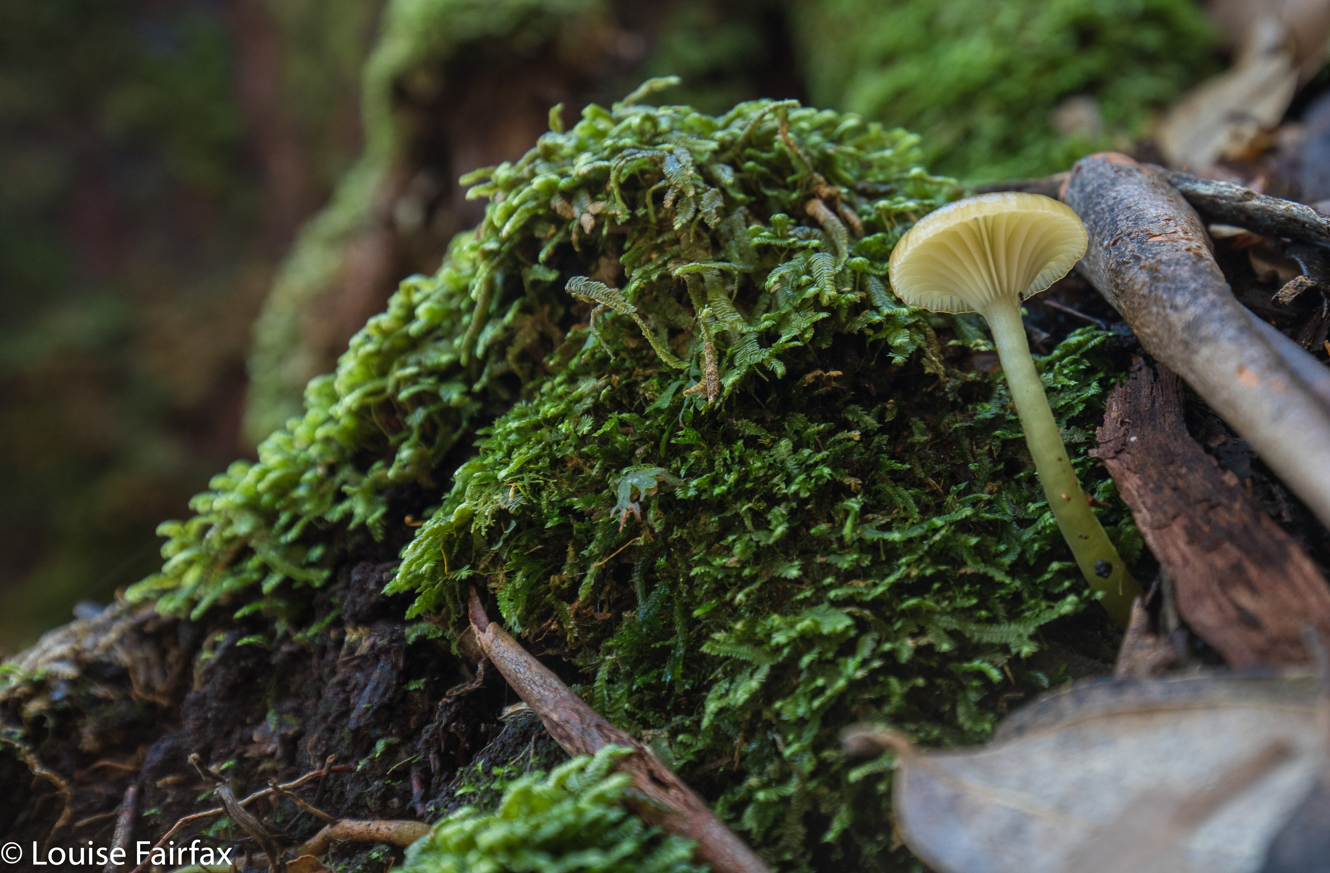
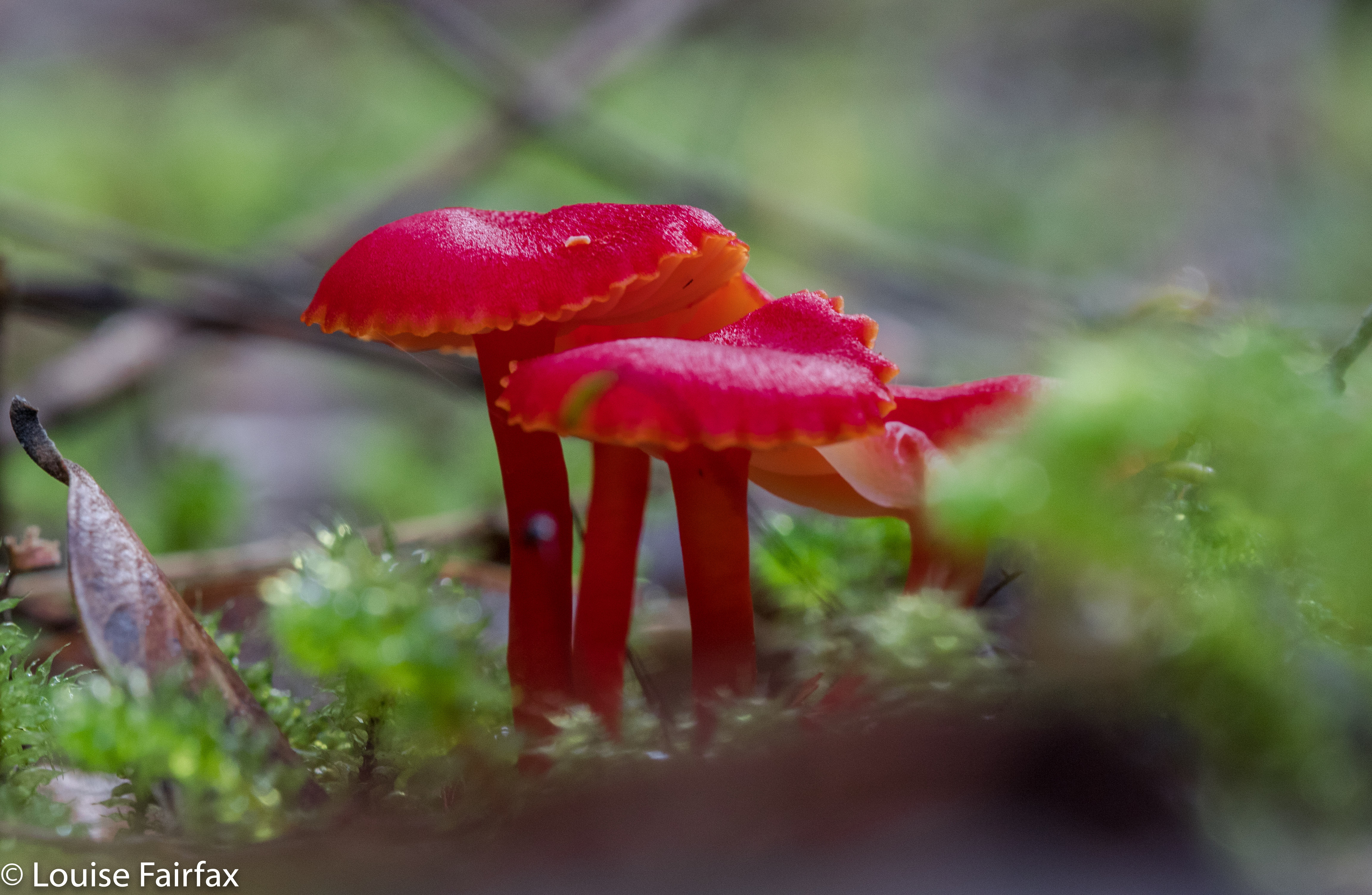
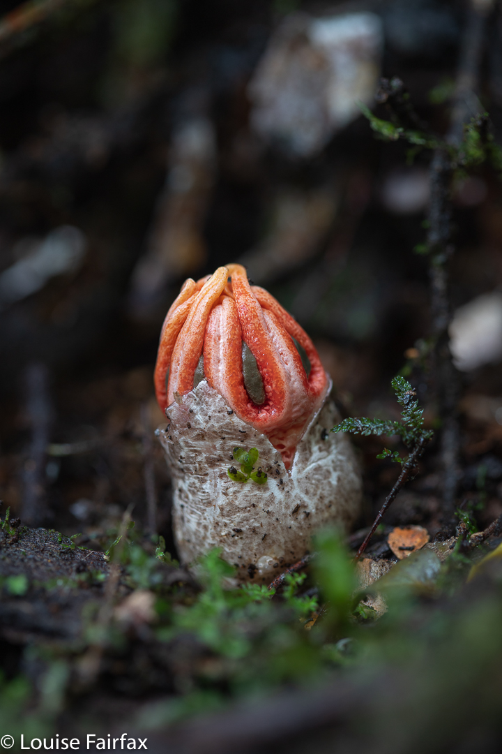
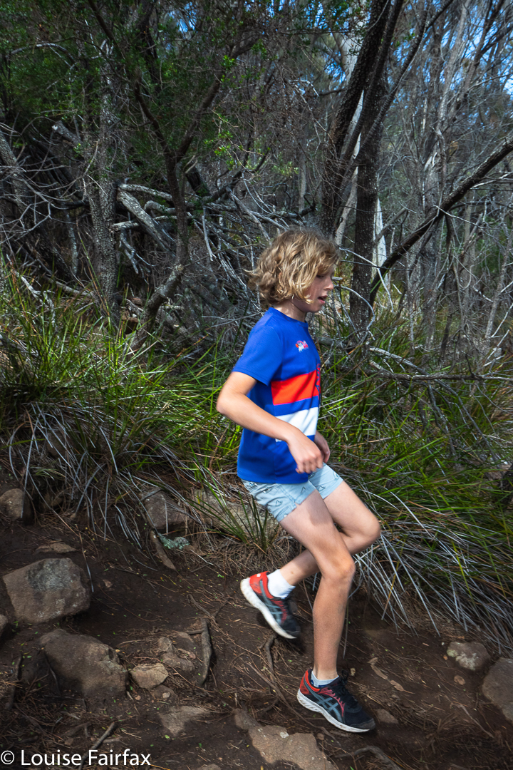
In the afternoon, we all climbed Mt Mangana, with many, many colourful fungi to be cheered about along the way. Gussy helped me photograph a selection on our way back down.

Fluted Cape walk. Gussy about to reach the highest point on the track
Fluted Cape Track highpoint.

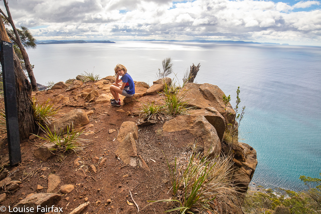
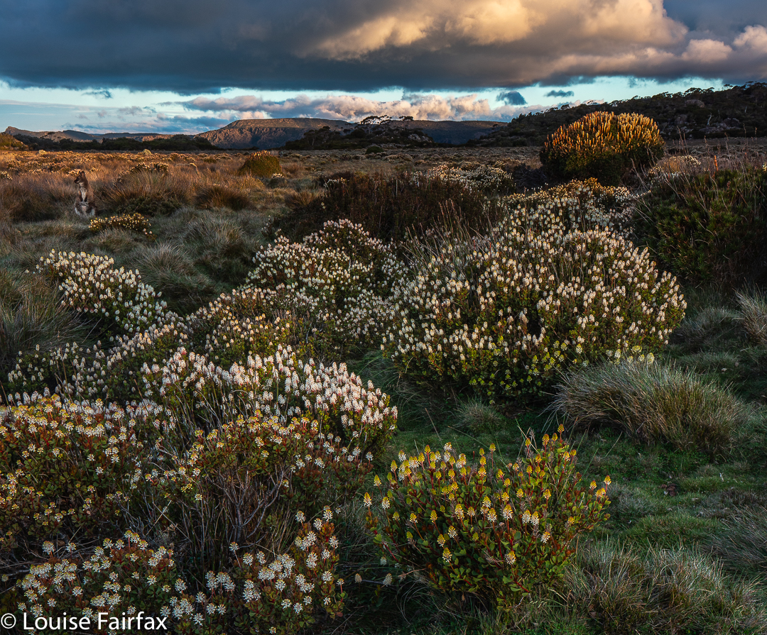
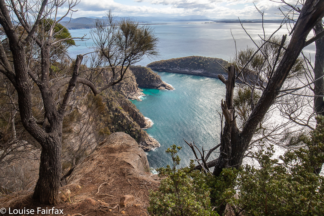
Day 3. Unfortunately, we had to pack up for the first part of the morning, but were then able to squeeze in the Fluted Cape walk before lunch. Gussy and I took about fifty minutes in each direction; Abby, a bit longer. This time we did the route anti-clockwise. I have now done it in both directions, and am really hard pressed to say which one I prefer: each offers different advantages.

Fluted Cape walk. By the cliffs
Fluted Cape walk. Looking to Penguin Island
Fluted Cape walk. Gussy in action

And sadly, after lunch it was time to drive home. I could happily live on Bruny!

Higgs Track to Lady Lake 2021 Jan

Back in the early 1990s (when I was an athlete), I used to run up Higgs Track for training. The times I did, from the vantage point of my current age, seem daunting. I must try running it again some time to see exactly what damage age has done to me. But that is for some later date. Today I decided to take my tent and camera gear and go up for my first overnighter in the region.

Slime mould Dale Brook. Tubifera ferruginosa.
Dale Brook, Higgs Track

Running is very different from walking with a heavy pack! The pack forces slowness upon you, and you have extra time to notice more of the tiny aspects of the bush – like fungi. I was not expecting fungi in summer, but photographed eight different genera, which greatly surprised me. (I found more than that, but they were mostly too big and bulky for my tastes; there were also other plain-coloured, middle-sized ones I couldn’t name, and, as no one ever seems able to help me identify that sort of fungus, I left them.)

Cyttaria gunnii Higgs Track. There were literally hundreds of these, lying all over the ground, having fallen from the myrtles above.
Russula serpillifolia, or a faded persanguinea? Not sure. I will correct this if someone helps me ID.

I had forgotten most of what Higgs Track was like. My single dominating memory was that of trying to cross Dale Brook at the start, crawling along a disconcertingly high and usually very slippery log before the climb began. Nowadays, I discovered today, there is a problem-free bridge, so my hesitant anticipation was unnecessary. Meanwhile, the track itself – and the surrounding area in general – was very beautiful indeed, with masses of ferns and moss and rich brown tree trunks. Dale Brook could be heard for most of the trip.

Higgs Track
Higgs Track

Walking with a pack may well take significantly more than double my running time, but I had still finished the climbing part to the flat plateau at the top in under an hour, so was pleased. This gave me plenty of time to check out the hut, meet its inhabitants and have some soup and dinner before I would set out with my camera gear to see what I could see as the sun got lower.

Lady Lake Plains
Wallaby in Lady Lake Plains enjoying the twilight. (The flower is mostly Bellendena montana with a Richea scoparia taller behind). Believe it or not, this is a thirty second exposure. What a cooperative model!!

The hut inhabitants were friendly and welcoming, so I decided not to pitch my tent, which would mean I didn’t have a wet mess to pack up in the morning. Rain still looked likely. The dark clouds were very attractive, and I was able to enjoy them all the more for the knowledge that they were not going to wet the fabric of my tent, making it heavy next day.

Alpenglow on the Great Western Tiers near Lady Lake
Richea scoparia greets the dawn at Lady Lake

Off I set, exploring channels, finding a waterfall, and then going to the lake where I found wallabies and colourful wildflowers. During the final splash of colour at Alpenglow, I shared the last of the beauty with the others from the hut out on the verandah. Next day, I enjoyed a kind of repeat of wildlife, wildflowers and lake in beautiful pre-dawn colours by setting my alarm for five in the morning and braving the bracing temperatures to experience pink-hour beauty.

Pink hour, pre-dawn at Lady Lake
Dale Brook Falls, the waterfall I found. According to a strict reading of the map, this waterfall is actually on a tributary of the main Dale Brook, but I decided including that in the name was too much of a mouthful, so have just named them (unofficially) as what you read here.
For winter views, see www.natureloverswalks.com/lady-lake-snow/

Liffey: unnamed falls and fungi 2020 Sept

Liffey Falls are totally gorgeous, and are justifiably popular with tourists and waterfall aficionados, especially at this time of year when the water is pumping. I actually prefer a more delicate look for photography, and I prefer my nature uncrowded, so, although I visited LIffey, I didn’t bother with more than a cursory glance at the main attraction, and kept away from the madding crowds.

Liffey unnamed trib Falls 2

On Saturday, I photographed fungi in the lower reaches of the river, and today I climbed up much higher, in the direction of Liffey Bluff, exploring some pink ribbons I found. They went up and up, so I decided they were going to the Bluff. I climbed up to 800ms (it was very steep), which was all I felt like for today, found two new waterfalls and several new fungi, and so was happy.

Hygrocybe cheelii
Tremeliodendropsis pusio

Yesterday the perfume of sassafras flowers suffused the whole forest, filling it with delicate sweetness; meanwhile, the acacia dealbata trees were blooming so fulsomely that yellow dominated over green down in the valley. The sun was shining: it was a balmy 14 degrees, and the world was wonderful.

Cortinarius eartoxicus Liffey

Included are some images of the two new falls I found: “Liffey unnamed tributary Falls 1 and 2” (such exciting names) and some of the fungi.

Holwell Gorge Falls 2018 May

Holwell Gorge Falls. May 2018


Why would I choose to “attack” the Holwell Gorge Falls from the distant northern end, rather than the closer, easier, southern option? Because I am not interested in “efficiency”, but in beauty, and in “bang for my buck”, or, perhaps more nicely put, a good drive to walk ratio, which tips the scales as much as possible in the direction of walking. I love exercise and walking through magic, lush forests full of fungi beside streams of astonishing clarity. Why on earth would I go for the quick option? In addition, the one time I visited the southern end (just to above the falls), I found that the greater height meant that the forest was dry sclerophyll, and the mosses and fungi I so love down lower were not present.


I have wanted to visit the Holwell Gorge Falls for a year now, having visited their northern brother, the Holwell Falls, a year ago. I have been impatiently waiting for enough rain to engender some flow, and for the right opportunity.  At last, today, it came. Or, I thought I had a sporting chance, let us say. I knew the early section very well, so marched through it in 11 minutes. Now came a sign that told me the upper falls, the Howell Gorge Falls, were 40 minutes return. DO NOT believe this sign. If you read my blog regularly, you will know that I am not a slow walker. I took 41 mins ONE WAY to reach the upper falls. This sign is very misleading, and it meant that I got very hungry, as I wasn’t expecting to take so long, and if you read this blog, the other thing you will know about me is that I get hungry often and quickly, and get quite desperate for food once hunger hits.


All the dire warnings about needing experience should be reserved for this second section. Once you are past the Holwell Falls, you lose your manicured highway, and encounter a track that can be, at times, downright dangerous. I was climbing over logs that were fat and slippery, and that didn’t always have anything to stop me should I start sliding downwards. I’m sure if you were taller, with longer legs than mine, it might be easier, but I was uncomfortable about being solo on one or two occasions when straddling an overweight, sloping log with nothing to hold on to.  There was one section where I even feared for my continued existence, where I had to sidle along a ledge with nothing to hold. The ground under this ledge … did not exist. It was like a tooth with a gaping cavity. I hoped against hope that the unsupported earth wouldn’t collapse under my weight. Whew. I got to the other side; however, on the way back, if you look at my map, I chose to stay in the creek bed rather than trust fate twice running. The odds were too heavily stacked against me.


The sign said 40 mins return. Elementary pre-school maths says that means roughly 20 mins in each direction if you walk at “sign speed”, which translates to about 15 or so for me. 15 went by. 20, 25, 30. Had I missed something? I got out the map to check. Na. I still had at least 600 ms to go. Hm. I’d be lucky to do one way in 40, let alone there and back! Panic hunger began. Lunchtime would find me at the waterfall, not at my car. Anyway, the scenery was superb, and the gymnastics needed to make progress, somewhat diverting, so on I pressed. Hundreds of fungi and countless moss and lichen specimens later, I finally arrived. I loved the end result, and took a long time enjoying the area.


The way back was faster than the way out – a neat, round 40 minutes – as I was rushing, and I knew more what I was doing now I had a modicum of familiarity. I avoided the deadly ledge by staying in the creek, thereby, unfortunately, missing my very favourite fungi that I had saved for the return journey. Oh well. I got back to the car before I fainted from hunger, and drove home in 34 minutes. That makes this the closest waterfall to my house, I believe. I’m so glad it’s so very well worth visiting. Lillydale Falls are possibly not much further, but with only a five-minute walk, they hardly justify the drive.

Tolkien Falls 2018 Apr

Tolkien Falls, Apr 2018.


I came upon the Tolkien Falls quite by chance. Perhaps it’s embarrassing to admit it, but I was trying to find Regnans Falls at the time. I was following instructions that said to go to a Big Bend, so I went to the biggest bendiest thing on the map past the Big Tree walk on the Styx Rd, parked and walked my way through beautiful forest up the stream. The instructions said the falls should be twenty-five minutes away. At twelve minutes, I found a waterfall. I’m normally fast, so was only vaguely perplexed. The falls were smaller than those in photos I’d seen, but they were taken in winter, and lots of waterways are not pumping at present, despite recent rain.


I did find footprints once there AND a pink tape. The instructions had mentioned pink tape, but I found none until I was at the falls. As with Regnans, you could climb up the right hand side (others had done so), and there was more tape there. In fact, I could see a line of tapes, so, being a curious person, I decided to follow them. They took me past “Gandalf’s Staff” and lots of fungi, and eventually, back to the road six minutes’ walk from where my car was. This return forest section took me fifteen and a half minutes (plus the six along the road). It made for a thirty-four minute circuit before you add in an hour for photography (falls and fungi).


The last thing I saw before joining the road was a sign that said “Tolkien Track”, so I have dubbed these the Tolkien Falls. I then tested the only other bend on offer, you know, just in case, and found the falls I had been looking for in the first place, but am very happy to have added these serendipitous falls to my growing collection of photos and Tasmanian waterfalls. Unlike the case with Regnans Falls, the map does inform you that there is a waterfall on this nameless (but now called by me Tolkien) creek.


If you continue along Styx Rd past the Big Tree Reserve Walk, past the sign that tells you there will be a boom gate and you’re to go back to Maydena without collecting $200, and past where the road splits (take the upper fork), then the next bend, a very short way (100 metres?) further on is yours. Walk up the road for six minutes until you see a cairn and pink tapes on the right, and a path leading into the forest. A little sign in the forest will tell you it’s the Tolkien Track. Enjoy. (Then you can do the Big Tree Walk, and the Styx River meander, by which time you’ll be needing some food.) (To get to the Styx Rd, turn right a few kms past Maydena. There’s a big sign.)