Pyramid Mountain 2017 May

Pyramid Mountain 14-16 May 2017.
(For Day one of this three-day hike, see natureloverswalks.com/Rocky-Hill/).


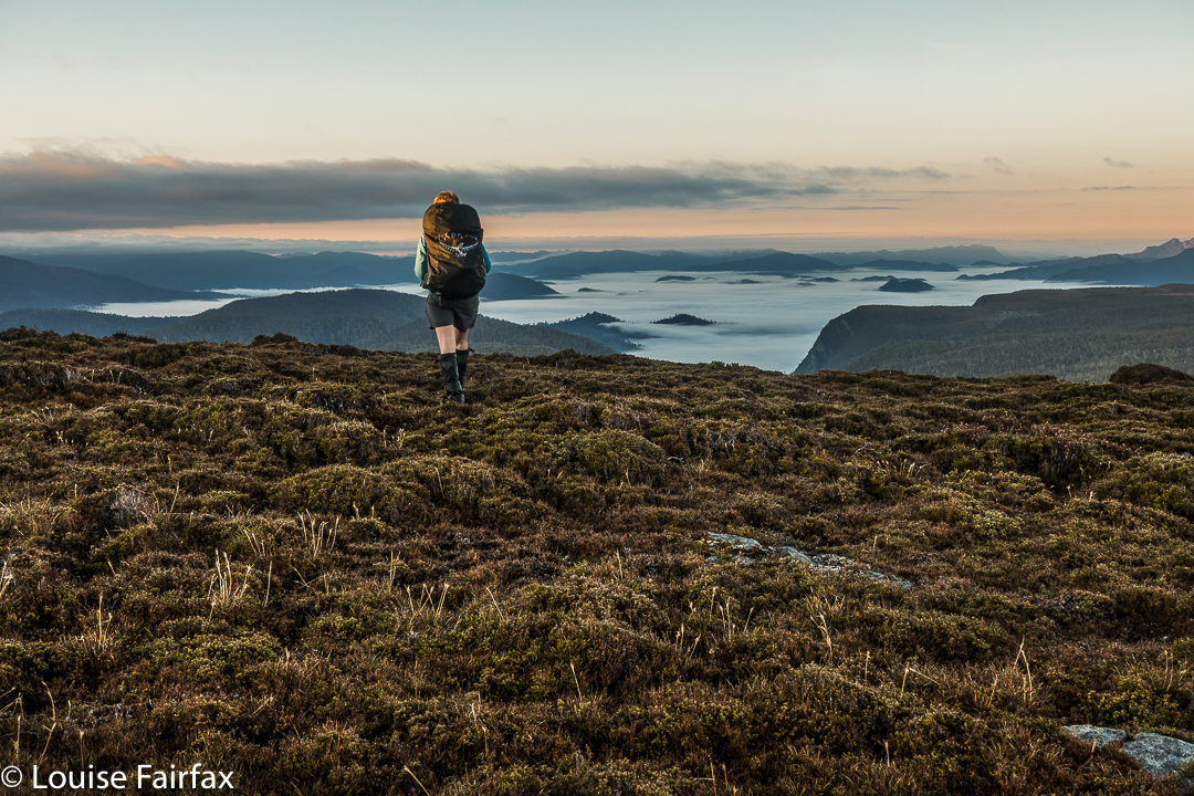
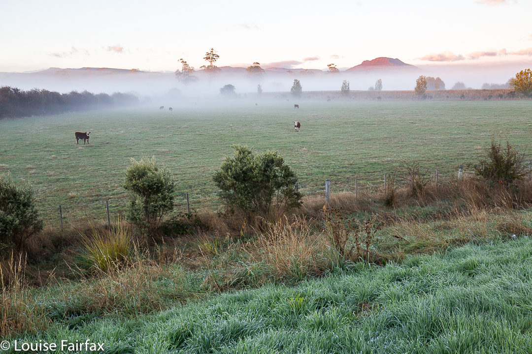
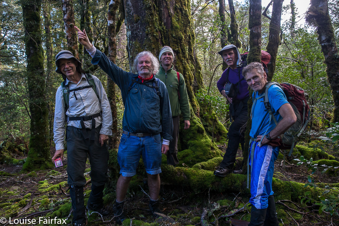
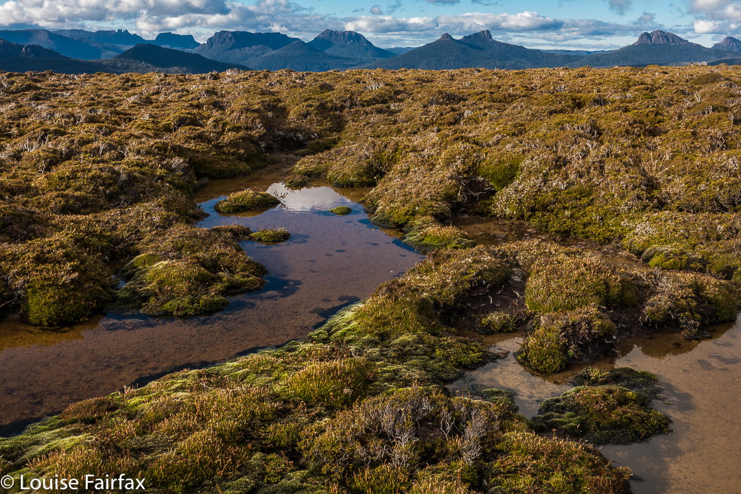
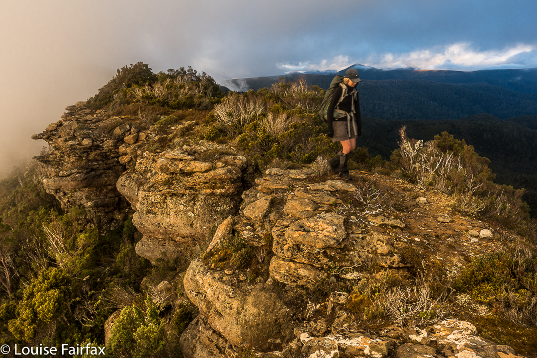
Summit day for climbing Pyramid Mountain dawned. A light fog surrounded us; the grass, of course, was icy, as were our tents. The sun was a kind of dispersed yellow glow to the east. Mountains like High Dome, Pyramid and Goulds Sugarloaf were beautiful silhouettes as we ate breakfast and prepared ourselves for our adventure. How would things play out? Could we do this in a day at this time of year?


We set a turnaround time of 12.30, given the now early time of sunset, which didn’t give us much room for hold-ups or errors should we land in highly-resistant scrub. Off we set, both curious and hopeful.


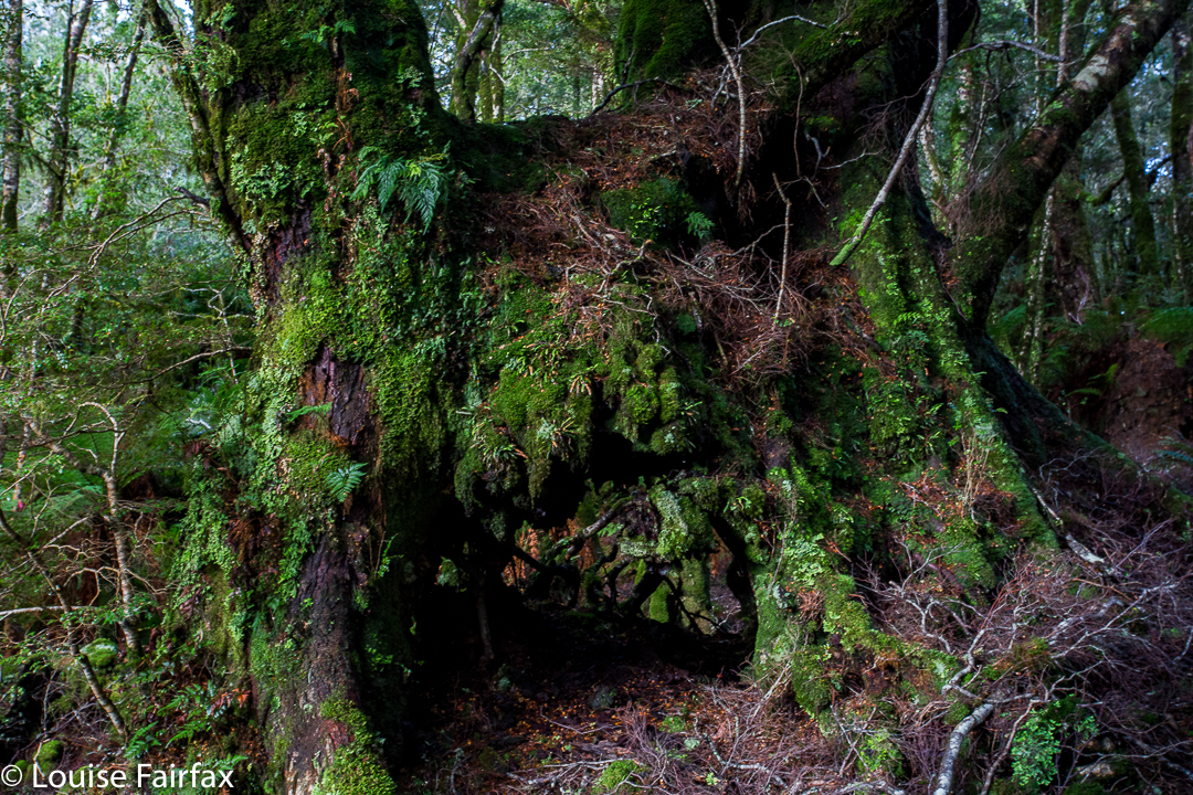
We were at “hill 1173” within 45 minutes; passing Mediation Hill in another 45; and topping the next hill after leaving the main Eldon Range route (Hill 1129) in a further 25 minutes. Things were going well so far. Pyramid looked pretty close by now, and we’d not quite been going two hours. And then the rot set in. After this hill that was a bit of a bulldog in lamb’s clothing, came a route that went first SE and then swung along a ridge that looked fine from a distance, but was like a duplicitous politician at close quarters: deceitful, barbing, and best avoided. Trouble is, we needed to traverse it all the way along its mean and nasty length until it started climbing to the next hill that was so uninspiring it didn’t even have a name or a height number. At least we didn’t need to go all the way to the top of this one, as there was a saving patch of rainforest if you contoured around to the next saddle, the (whew) last saddle before the bitch of a climb up Pyramid.


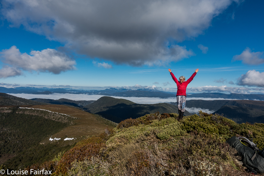
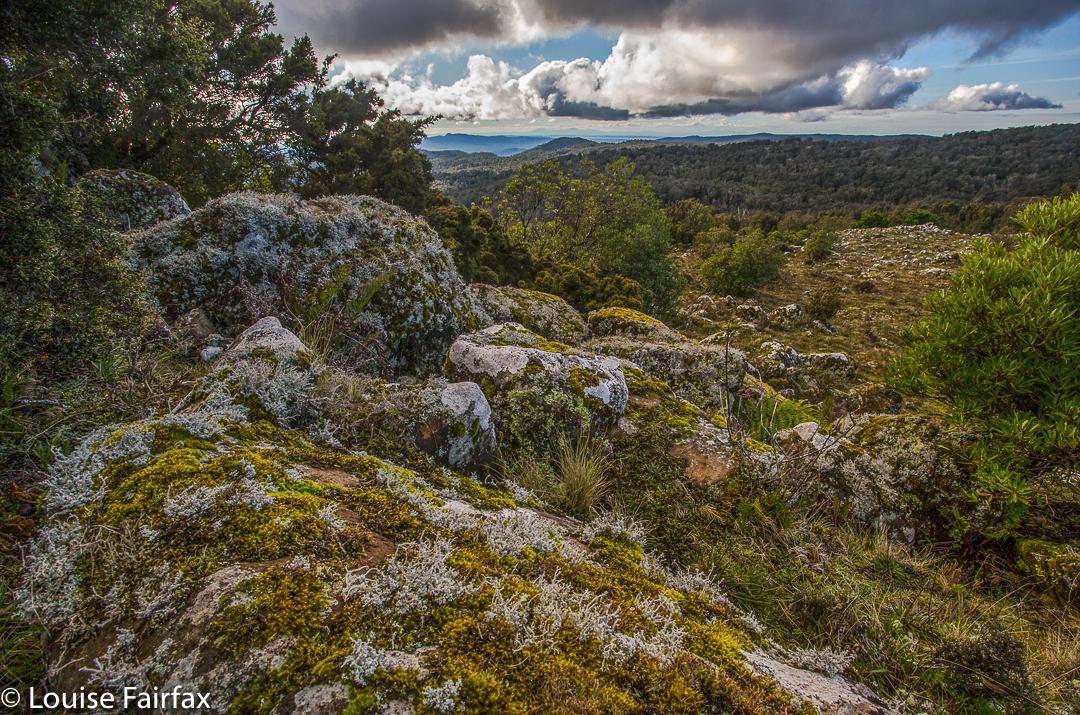
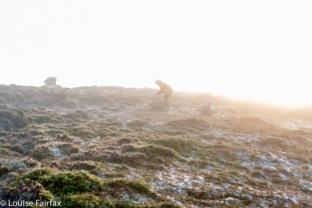
“I thought you liked climbing, Louise!” you say. Yes, you’re right. I love it, but not when the climb is in thick, dense, impenetrable, energy-sapping, defeating scrub, where you work and work and then look at a your map and realise you haven’t even covered a hundred horizontal metres and you can’t see the mountain, and you can’t even see a way of going forwards. You try left and right and retreat a bit, telling yourself retreat is often the best way to advance … but when you retreat all the way back to the start triangle it isn’t (well, bit of hyperbole there). After what seemed ages, we came to a spot where we could glimpse something. Ahead lay a gulch. Beyond that, cliffs and more bushy climb. We decided we needed to drop down and get on the spur above the cliffs. Somehow that went quite well (face-in-the-dirt steep), which is good as I was becoming increasingly despondent, fearing we’d come all this way to be locked out of the summit at the last minute. Once we were above those cliffs, we could see paths of erosion ahead that would lead us the rest of the small distance to the top without any hindrance other than good old gravity, and who cares about it? Not I. Well, not normally. I was feeling tired and hungry by this stage. One hour after leaving the saddle (a distressingly small distance below us), we were standing on the summit. I didn’t stand for long. It was 11.30 and I wanted lunch. NOW.


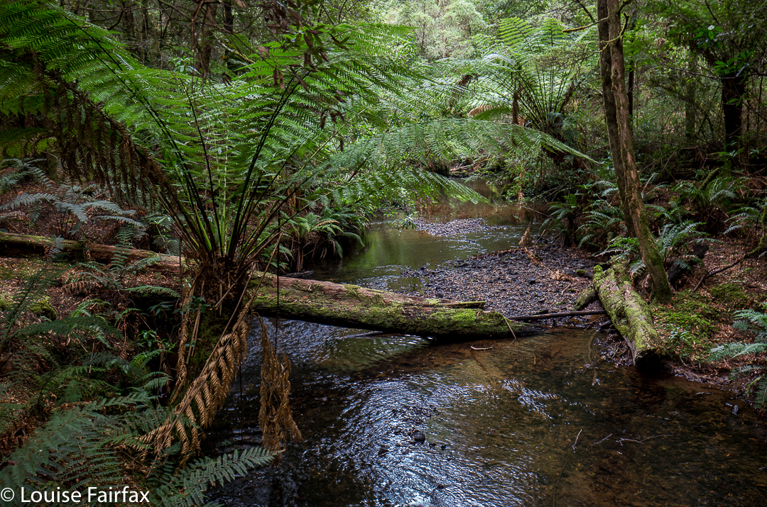
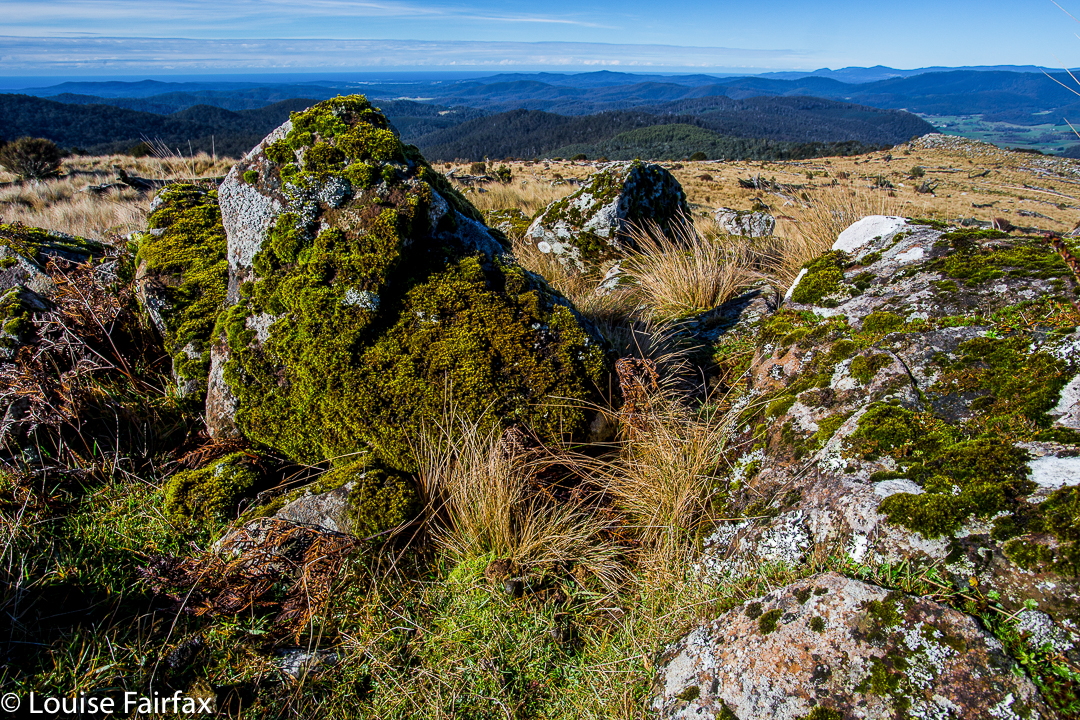
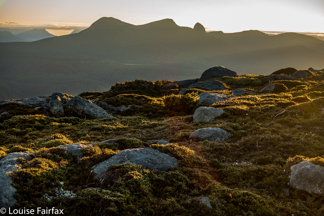
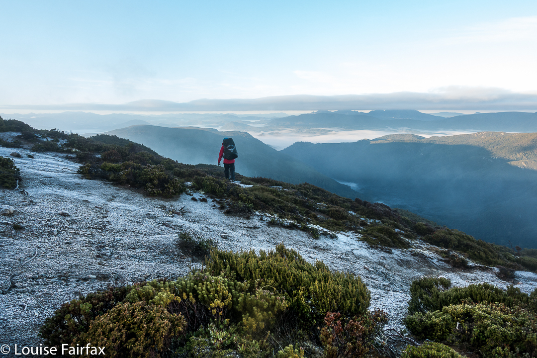
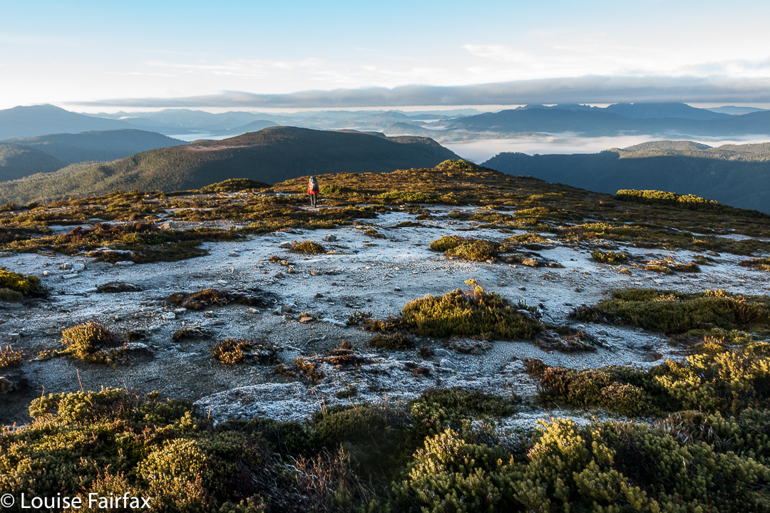
The return was faster, much faster. From above, a better line was easier to find, and what took us an hour up, only took thirty-three minutes down (and not just because down is faster than up). The ridge didn’t seem quite so inhospitable now we were in a buoyant mood, and we had a much better route from it to the summit of hill 1129. It was so great to curve around the summit of Mediation Hill and know that our bushbashing for the day was over. We just had to follow the ridge back to our waiting tents. There was no way we would not be there before dark. We even had time to have a drink or two and photograph the dramatic cliffs below our camp. Drinking was unpleasant, as the water was so cold it hurt.


It was a freezing night. Temperature-wise, it was by no means the coldest night I’ve had in a tent (it was probably about minus four; I’ve experienced minus ten and worse), and yet I swear this night holds my personal record for condensation. My sleeping bag became saturated, and ineffectual along with it. Everything got wet. I suspect it might have been because my utterly drenched socks (wrung out, but there was still a large amount of water left in) were inside the tent, along with my somewhat damp coat and long pants. These things were inside, as they might have turned to ice if left in the vestibule. I feared my boots would freeze, but only the laces did.


In the morning, the ice layer on the tent was a thick and heavy sheet that I had to prise off using my tent peg, it being the only implement I could think of that could do the job. Normally my ice is in cute white crystals. I took ages to pack up in the morning, probably because I was dreading the moment when I would have to put those frozen socks back on, and the pants and coat that were still damp from the moist bushes the previous day. There was no point in putting dry socks in sodden boots, and carrying wet, heavy ones in the pack. It had to be done, but was not a pleasure.


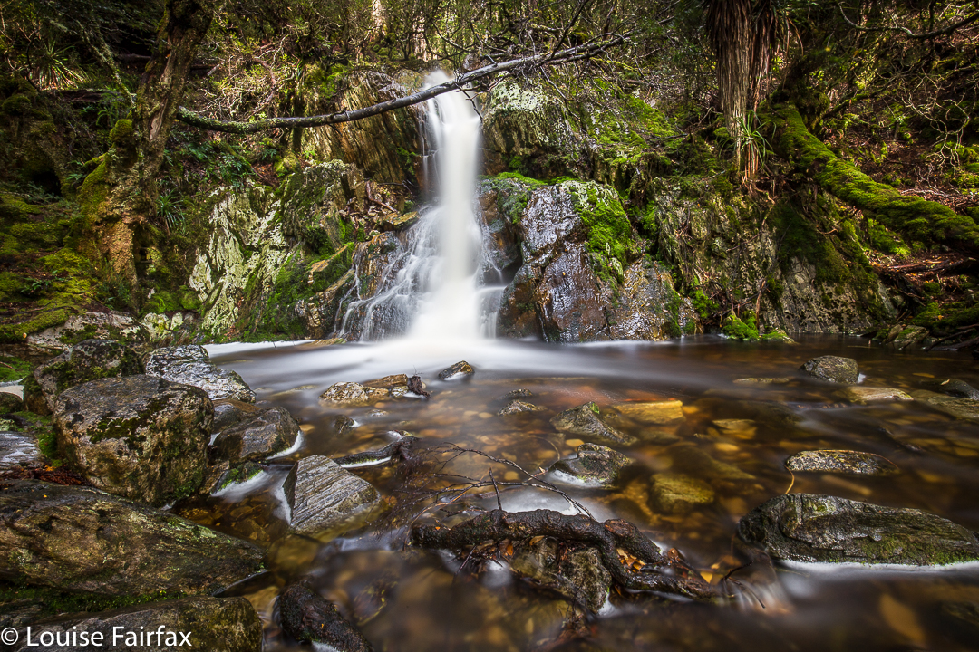
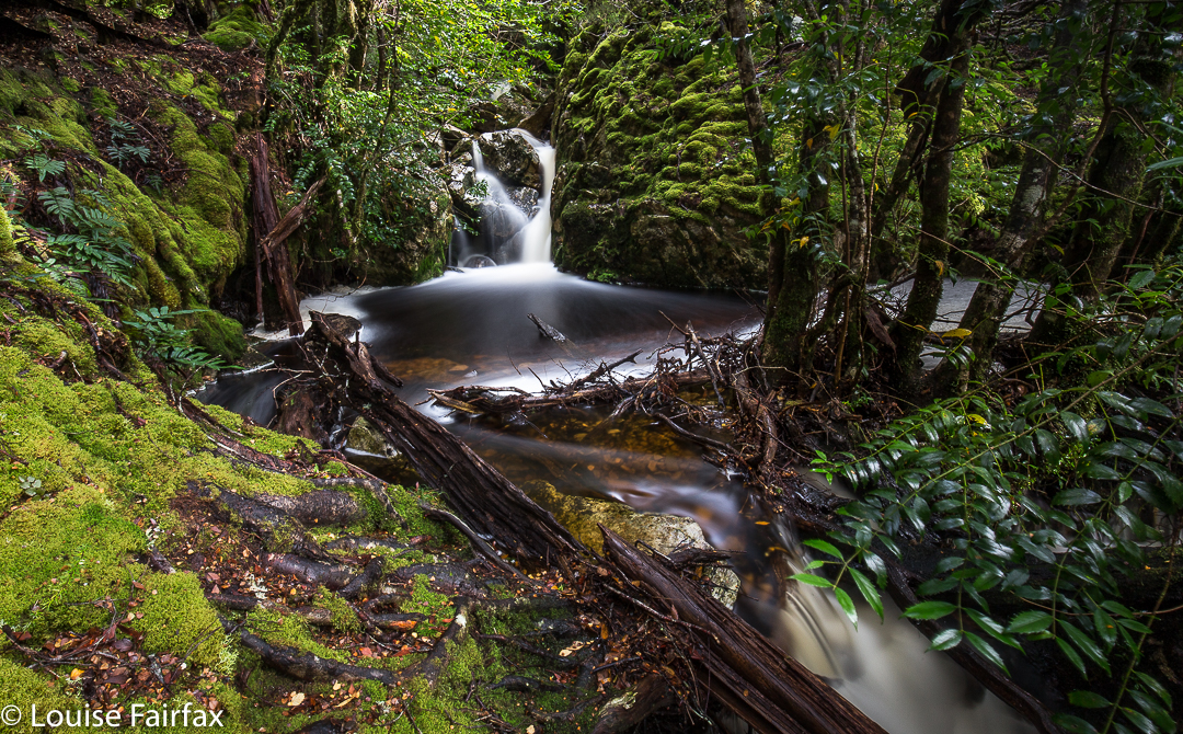
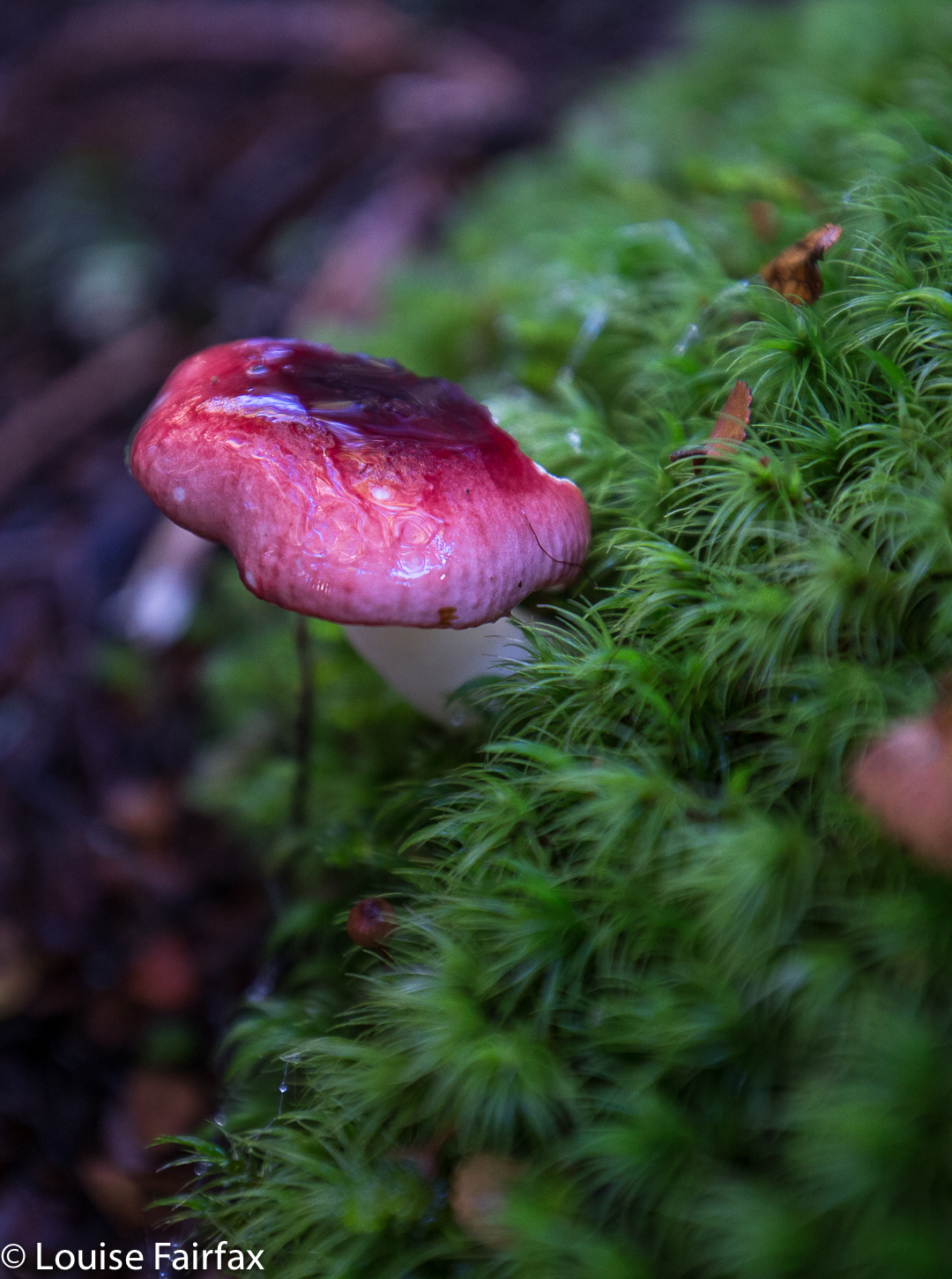
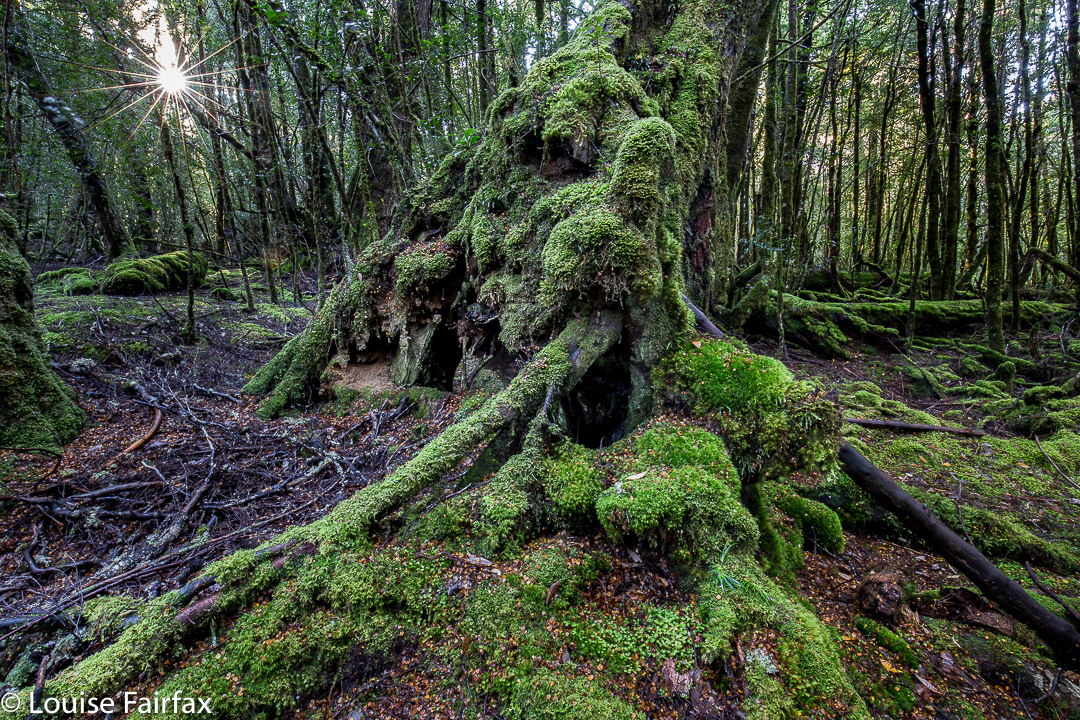
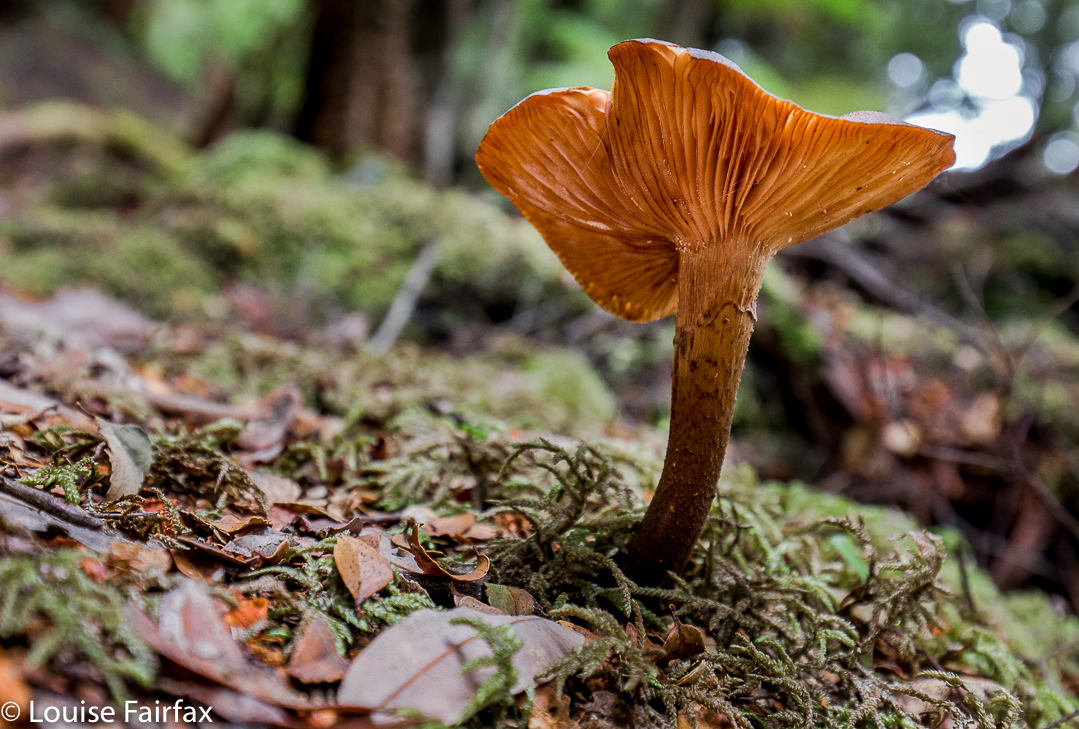
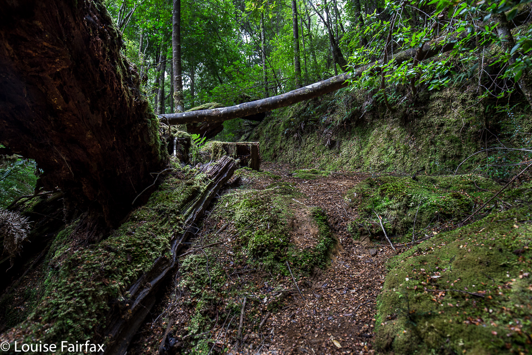
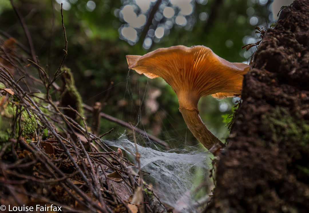
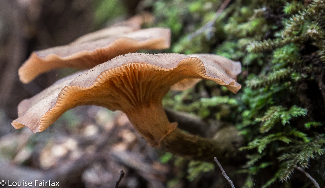
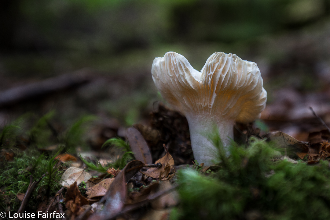
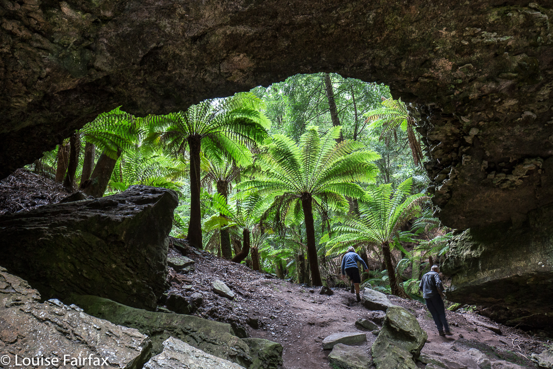
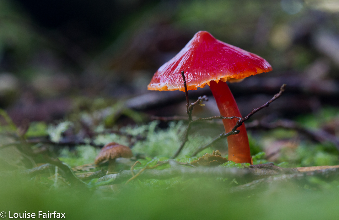
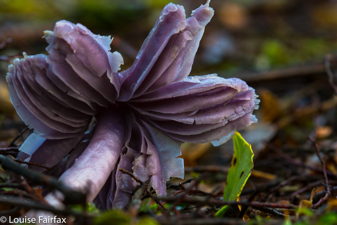
We stopped at “Stu-slept-here” Hill (1111) for a drink, but, as with other days, drinking hurt. By the time we reached the glorious rainforest section of Pigeon House Hill, we knew we would easily make it to the car in the light – it was not yet mid-afternoon, so we relaxed and started to examine and photograph darling fungi on the way along that section. They were there in their hundreds, so many delicate beauties.


I made sure the camera and phone were well sealed before the final river crossing. At least if I landed in the drink so close to the car I’d be freezing, but would not hurt my electronic gear or get hypothermia. The world was good. We’d done it.
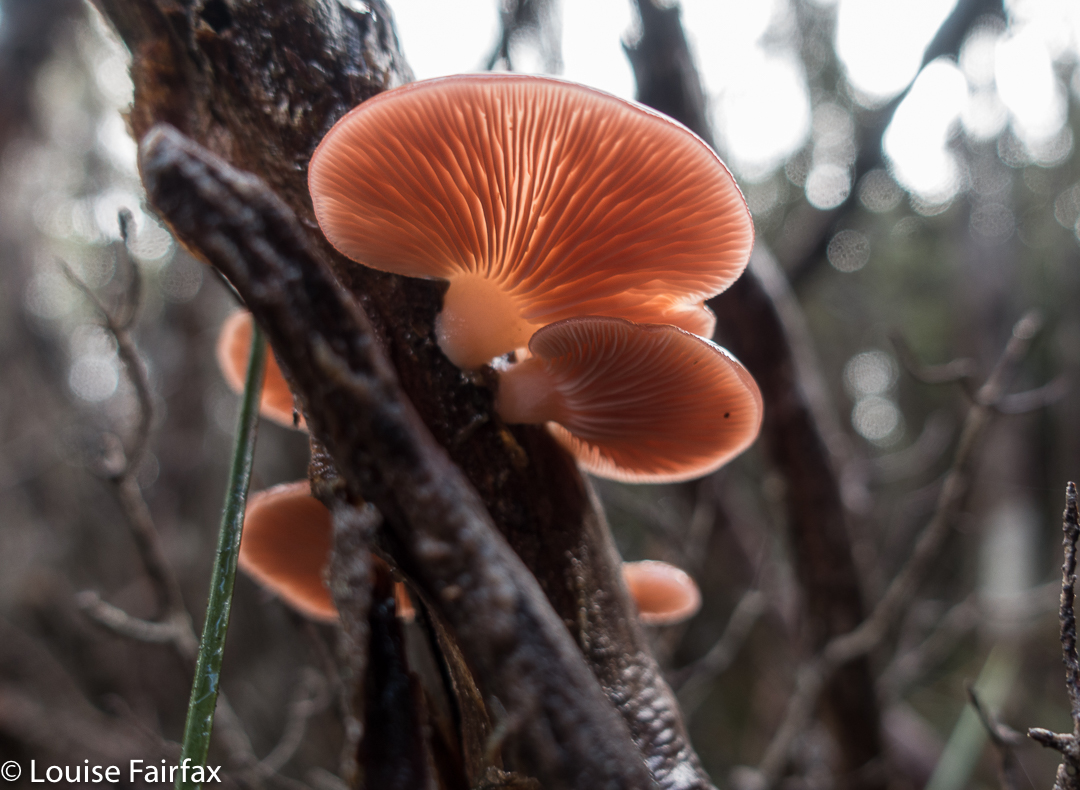

crepidotus sp


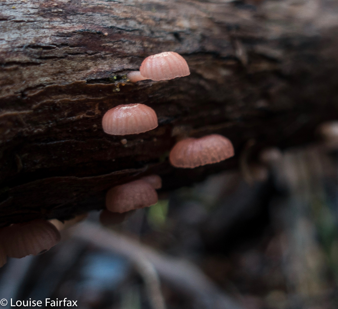
Mycena clarkeana I think


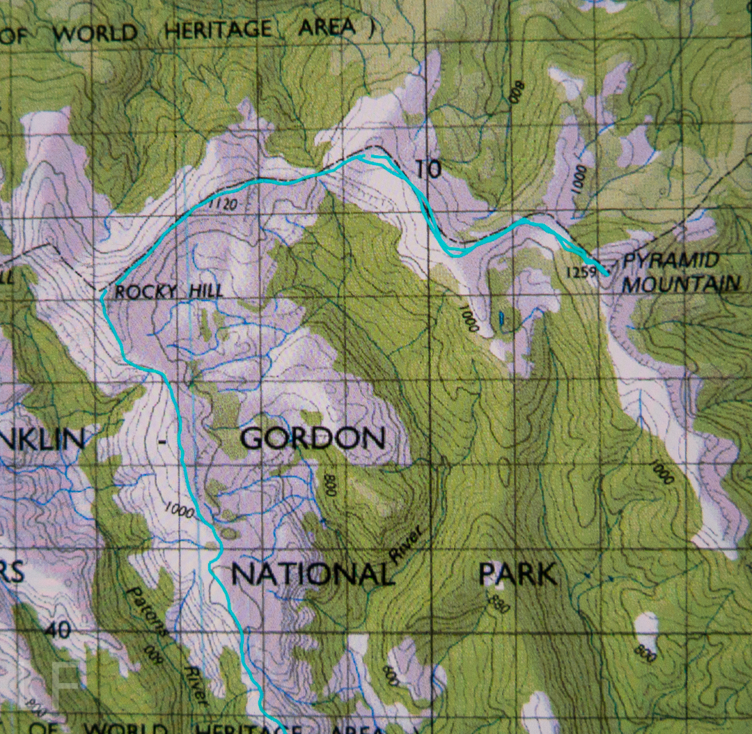
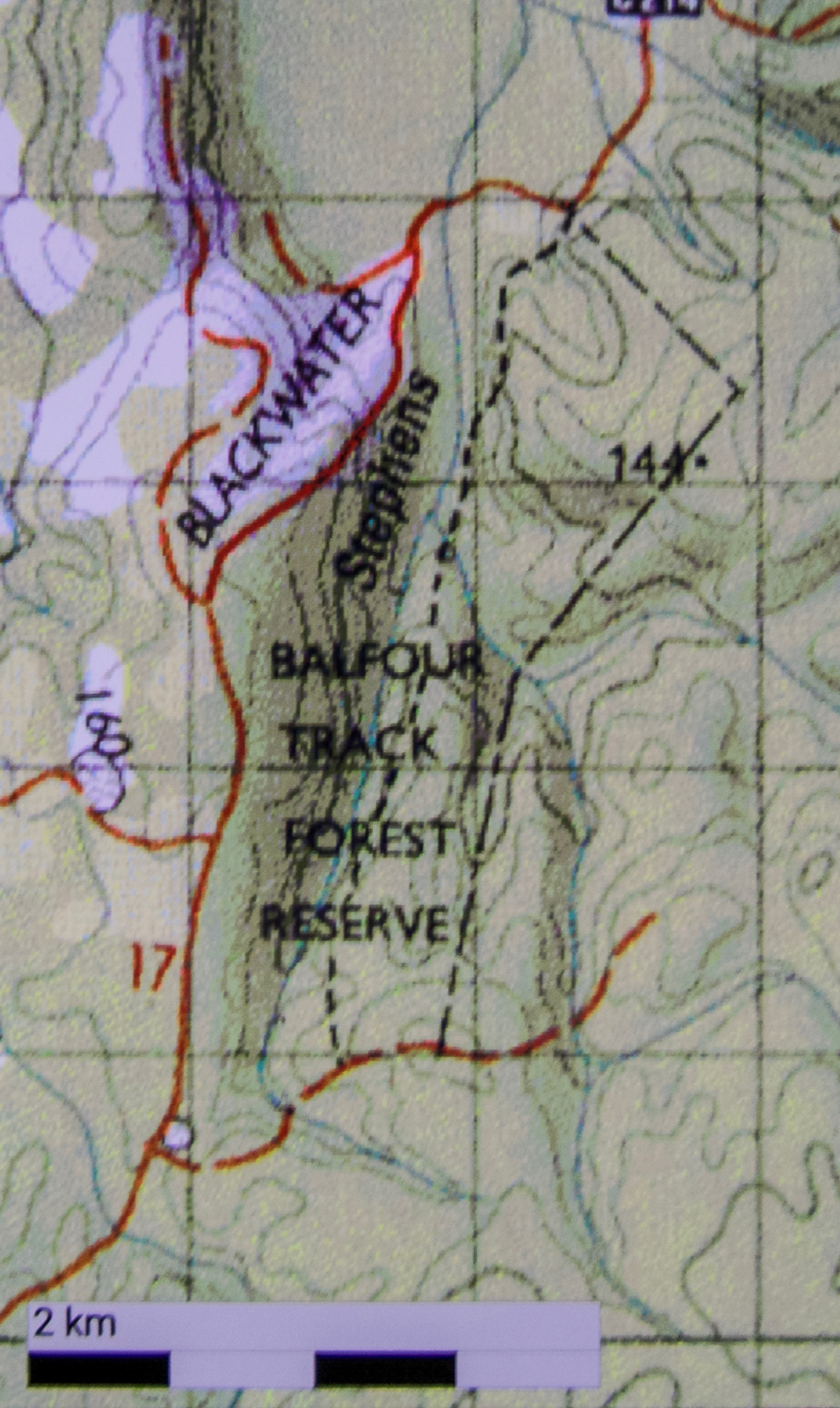
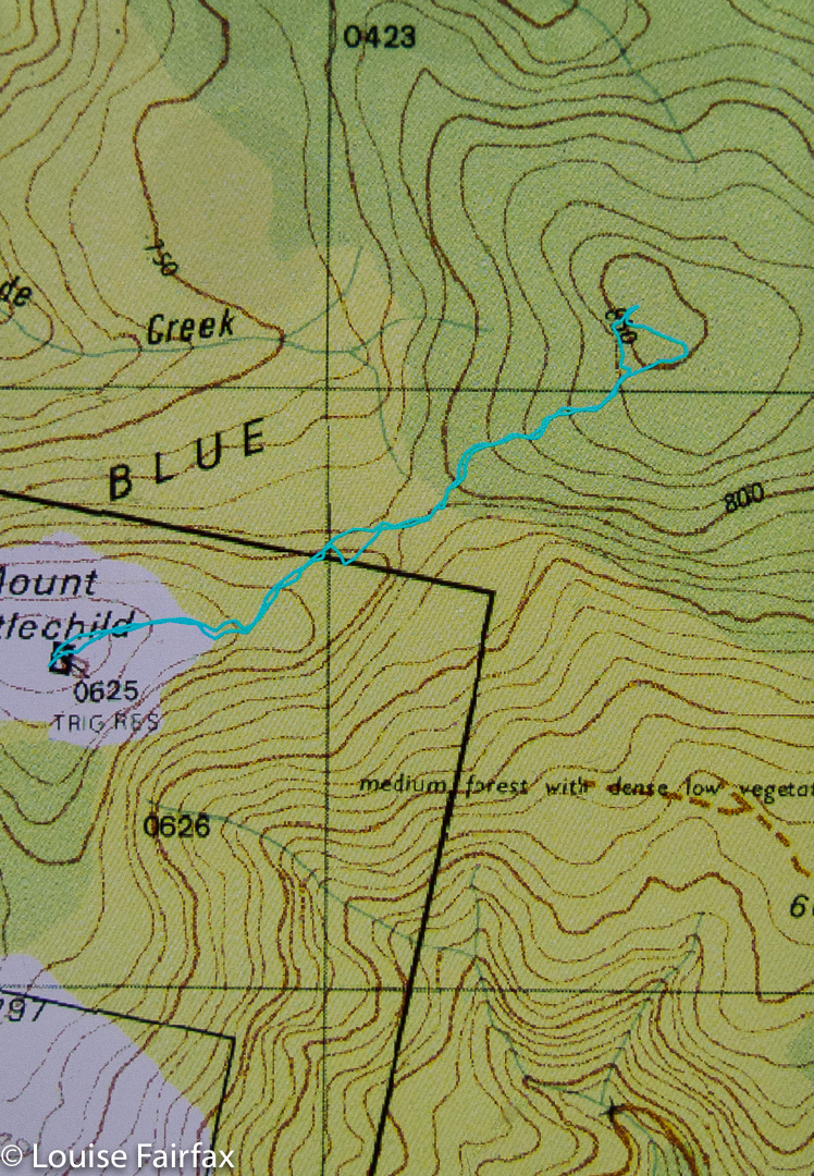
Please don’t be fooled by the dark lines there into thinking they denote a track: they’re depicting National Park boundaries. The boundaries, and our route, follow the ridgeline. Please also note that I refer to Hill 1173″. It is that height on the 1:25,000 map that we used for the greater detail. Oddly, the 1:100,000 map, used here for greater clarity, it is marked as 1120. I guess more modern methods have resulted in a height revision. Not sure.

Cradle Mountain 2017 autumn

Quamby Bluff in the early light. I so love a dawn start to my jaunts. 
Whilst everyone else seemed to be dashing to Cradle Mountain for the fagus season, my interest lay in the fungi that usually appear at this time of the year, and in the waterfalls that should be flowing after our recent rains. I was impatient to get there and see what I could see.


I had a wonderful day – by myself, so I had head space, and yet not by any means alone, as everywhere I went I met new lovely people who wanted to chat to me, so had a delightfully companionable day as well. It was a perfect mix of solitude and sociability. Many, many of these people helped me in one way or another: one cleaned my car camera (for reversing) for me, one helped me adjust the stiff legs of my new tripod and taught me how to use it as a monopod as well. When I lost my black gloves at late dusk, people assisted in trying to locate them for me. On every trail I walked, I met people who wanted to discuss ‘fungi success’ on other trails, or camera gear, or to relate stories to me of this or that walk they’d done elsewhere. The mountains were full of nature addicts. It was so lovely to be helped rather than be the eternal helper, which my role as carer of my ill husband dictates. With every breath the air felt so fresh and clean: two lungfuls for the price of one, it seemed.
What follows is more of a photo essay than a verbal one. It is the story of my love of light, of nature, and of this beautiful, peaceful spot that I am privileged to call home.


Russula persanguinea 


And now we come to sunset. My battery is running dangerously low. I get into place, reckoning I’ll shoot until it runs out and then head for home. Shortly afterwards, a seeming crowd of photographers appeared. It got quite crowded, with tripod legs being intertwined with mine (but not spoiling my image). I was sure glad I’d arrived early.


I would have loved to stay at the party and shoot the stars. It would have been a freezing party, but jovial, I’m sure. Maybe next time I’ll be a little more careful when I pack my bag!!!

Balfour Track, Trowutta Arch 2017 Mar

Balfour Track and Trowutta Arch, Tarkine Day 4.


Sadly, we turned our back on the coast – but not before I’d got up in the dark and wended my way down to the ocean to capture moonset, long before the sun had risen. The shot here is a very long exposure.


To reach our goal, we headed from the coast on the road running east from Couta Rocks – the C214 – until signs directed us to our destination. The track runs parallel to the road, rejoining it after about an hour’s walking (plus any stops you might have). Our group did an out and back route, probably taking us the three hours recommended. The extra half hour in each direction beyond walking was used in taking copious photos of fungi and forest, and in snack time beside the beautiful Stephens Rivulet.


Of all the tracks we walked this trip, this one was my favourite. The path was narrow and non-invasive; the forest was lush and green with plentiful tree ferns and moss. I thought it would be way too dry and warm for fungi, and that there would not be much to photograph, but I was mistaken. The quaint, tiny ones were not yet out, but there were still plenty of others. Luckily for me, the other walkers had gone on ahead, so I was supposedly giving chase. However, I ended up rolling in dirt every ten paces or so at the discovery of each new delightful specimen. The fact that the others were ahead meant I didn’t have to feel guilty about holding anyone up. If and when all these marvellous sights stopped, I could keep my promise about giving chase, and if not, I’d just meet them on the rebound. I rolled in a little more humus and thoroughly enjoyed myself. (Map at end of this page)


In the afternoon, we visited the Trowutta Arch. The arch itself was spectacular, but the way to it quite ruined it for me. I hated the hard, wide, unnatural path that has been built that scars the landscape. The forest also appears to be most suspiciously “tidy”. If the bureaucrats who designed this have wheelchairs in mind, I am most curious to know how they intend getting such chairs down the steep drop to the actual arch. Are they going to pop in a lift? Stairs will hardly help. The only section I enjoyed was the part they haven’t yet attacked. I hope this is the only route they decide to tame and manicure for tourists. I wonder why it is assumed that visitors are incapable of walking on any surface other than the artificially even one they normally use for shopping. This is a sad reflection on our society if it is correct. It contradicts what is actually good for our brains – a little challenge – a matter pursued by the excellent Austrian architect, Hundertwasser, in his deliberate planning of crooked, uneven paths and walls in anything he designed. I seemed to be the only one in the group who felt this way, but for me, the sight and feel of that city-style pavement in what had once been pristine rainforest, completely jarred, and detracted markedly from any delight I might have felt in the beauty that was there. Significantly, with the forest so “clean”, there were no fungi to be seen. There was nothing much for them to decompose.


Balfour Track instructions: The orange road to the left with 17 beside it is the C214. As you can see, you turn right off it (if going up from the coast) and travel 700 ms to the start. After your one hour (plus stops) walking, you will reach the C214 again, where you either retrace your steps (NOT boring at all) or, if you have arranged a car shuffle, a car will return you to the start. As the forest is always new in a different direction, the former method is both easier and more enjoyable. The track itself is the dashed line that basically follows the Stephens Rivulet. The other dashed, very straight line to the right (east) is presumably a boundary of some sort.

Step Falls, Castra Falls, Silver Falls 2016 Jun

Castro Circuit: Step Falls, Castra Falls, Silver Falls and more. Jun 2016

First Falls on the list: Step Falls. Very steep and slippery. 
The forecast was for developing rain. My friends had all reneged on climbing a mountain: time for a waterfall walk with the last brave man left standing, my husband. There are so many amazing and wonderful waterfalls in the north of Tasmania, it’s rather hard to choose, but I selected the Castra Falls circuit, as what I had read suggested it would take about three hours, and that seemed a good walk to drive ratio. As it was, we only did one and a half hours’ walking – but used up that amount again taking photos :-). I could have taken a whole lot more (requiring even more time), but felt guilty at forcing my husband to watch the less than interesting activity of his wife motionless behind her tripod going click, or lying in the mud adoring tiny fungi – possibly more amusing than the tripod option, but still lacking in spectator excitement.

From our very first steps, we loved this walk. Fungi were everywhere, but this was a waterfall walk, so I tried to ignore these delicate beauties, and left my macro lens in the bottom of the pack so as to not be even more boring by changing lenses the whole time. Oh the shame of it all, but I did admire them anyway as I walked past.

There were masses of fungi – best catch this year.

Well, I did say I admired them en passant. I decided I could photograph them with my wide-angle lens and that would not take up so much time.

My husband using the safety rope on the way down to Castra Falls, the second Falls on the circuit
We both got a bit of a shock going to, and being at, Step Falls. The notes we read said it was very steep. I usually assume such advice will be overstated, but in this case, it was right, and I was glad there were saplings to brake downward progress a little. At the bottom, the rocks were the slimiest, slipperiest rocks imaginable, and I felt clumsy on them with precious camera around my neck, bag of filters on my shoulder, tripod in hand … whoops, slide. Balancing on them was hopeless. I don’t know if they’re always like that, but in today’s conditions, I didn’t attempt any fancy angles; survival was the key.

The second falls on the list, the Castra Falls, had a rope to hold, which Bruce greatly appreciated. (All these Falls are done as side routes from the main circuit, as I hope my map at the end makes clear.)

Castra Falls, the second falls on the circuit.

Climbing back up from the Castra Falls


More beautiful fungi

The Castra Cascades were pleasant enough, but not as beautiful as the many river scenes along the way, … and very shortly after that, we were at the junction of the Castra Rivulet we had been following, and Nietta Creek, which we were about to pursue. We’d been exercising for a total of 45 minutes at this stage (which included side trips, but not photos). This was a really pretty spot with a kind of beach – perfect for lunch. I ate hurriedly, as I wanted to explore a track that went off to the right here, to what was called a “Secret place”. I was unsure about where it went and what it was, as, unlike the other side routes, it gave no time estimation. I left Bruce quietly eating and set off along the steep banks on my mystery journey. After 16 minutes, the tapes seemed to have run out, and even if they hadn’t, I felt my time had. The scene below was what I found. I photographed just with hand-held camera on 1/10th second, as I feared Bruce might be getting cold and wondering what on earth his wife was up to. No longer wondering the whole time if this was the secret place, or this, I moved more quickly, and was back at the junction in 11 minutes.

I have thus called these the “Secret Place Cascades”. If someone wants to tell me their real name, I’d be most grateful. 

From the junction, the beautiful Nietta Creek is followed upstream until Silver Falls are reached. This part of the route is wonderful, as you are right beside the stream the whole way.

Nietta Creek

The side track to Silver Falls is the tiniest deviation from the circuit, and this was my favourite of the Falls. Another short but steep push and the top was reached.

Silver Falls, falls number three


signage

 We had parked the car at the second entrance to the forest, maybe two hundred metres from the first, but the other side of the rivulet, in case the stream was flooded. As you can see from the photo below, it wasn’t, so we completed the circuit in the forest and were soon back at the car. (If the water is high, you can do this tiny stretch on the road.)
Apparently this beautiful circuit was destroyed in a huge storm a few years back, but has now been repaired by local volunteers, to whom go my heartfelt thanks. The tapes and path are clear, signage is fantastic, but, better than that, it remains a real bushwalk and not one of these wretched manicured tourist highways. You do have to concentrate a little; you can fall over or trip, you need to look for the next tape and use your brain a tiny bit. The freedom to fall or to make a slight error is a marvellous manumission in this over-cosseted, litigation-terrified age.

We had parked our car at the second forest entrance, and so finished with this creek crossing (over the Castra Rivulet) to end a perfect walk. (If you park at the first one, then this is about two minutes from the start).

Our route. Hopefully you can see that there is a main circuit, with Falls off to the side, usually involving a climb down. Tasmaps, being their usual inefficient selves, have not only omitted the path, but have misnamed and misplaced the position of the falls in their habitual cavalier attitude to the needs of walkers and tourists who might want to use the maps for something purposeful. I have blocked out the incorrect names. We walked anti-clockwise. The narrative (combined with map reading) should make it clear which falls are which. Step Falls are correctly named and placed.


Just for fun, here is a graph of our altitude. Did I happen to mention there was a bit of up and down? Nice workout for the legs.

Littlechild 2016 May

Mt Littlechild revisited May 2016.


Handley Peak, en route (this is Mt Littlechild on the map – or, on the map I was using)


Hygrocybe saltorivula
Because so many people insisted that the black dot called Mt Littlechild on the map was not the “real” Mt Littlechild in some other essential manner, on this weekend, I led a group to go and visit the black dot, which, whatever its name might be, is  the highest point on the Blue Tier. And a rather insignificant high point it is too. Even when there, with gps devices in abundance, we could not agree on the location of the summit, so purists (me included) dashed about the place, touching all suspect-rocks that might be a smidgeon higher than their friends and the true black dot. Everyone was happy at the end of the day that they’d had an encounter with this important dark smudge on the map. The ground was pretty level up there, and views were not on offer. Gorgeous fungi were a-plenty, and the highlight for me. We’d definitely had a lovely bushwalk in this wonderful area of Tasmania worth saving from destruction at the hands of chainsaws and myopic politicians.


Hygrocybe lewellinae


Happy troupers on one of the many black dot contenders (but not the most-favoured one).


For the route from the car to the peak here labelled Mt Littlechild (HandleyPeak in disguise, apparently) see  natureloverswalks.com/blue-tier/