Gable Hill, Bawleys Peak, Bellevue Tier 2018 May

Bellevue Tier, Bawleys Peak and Gable HillĀ 2018 May
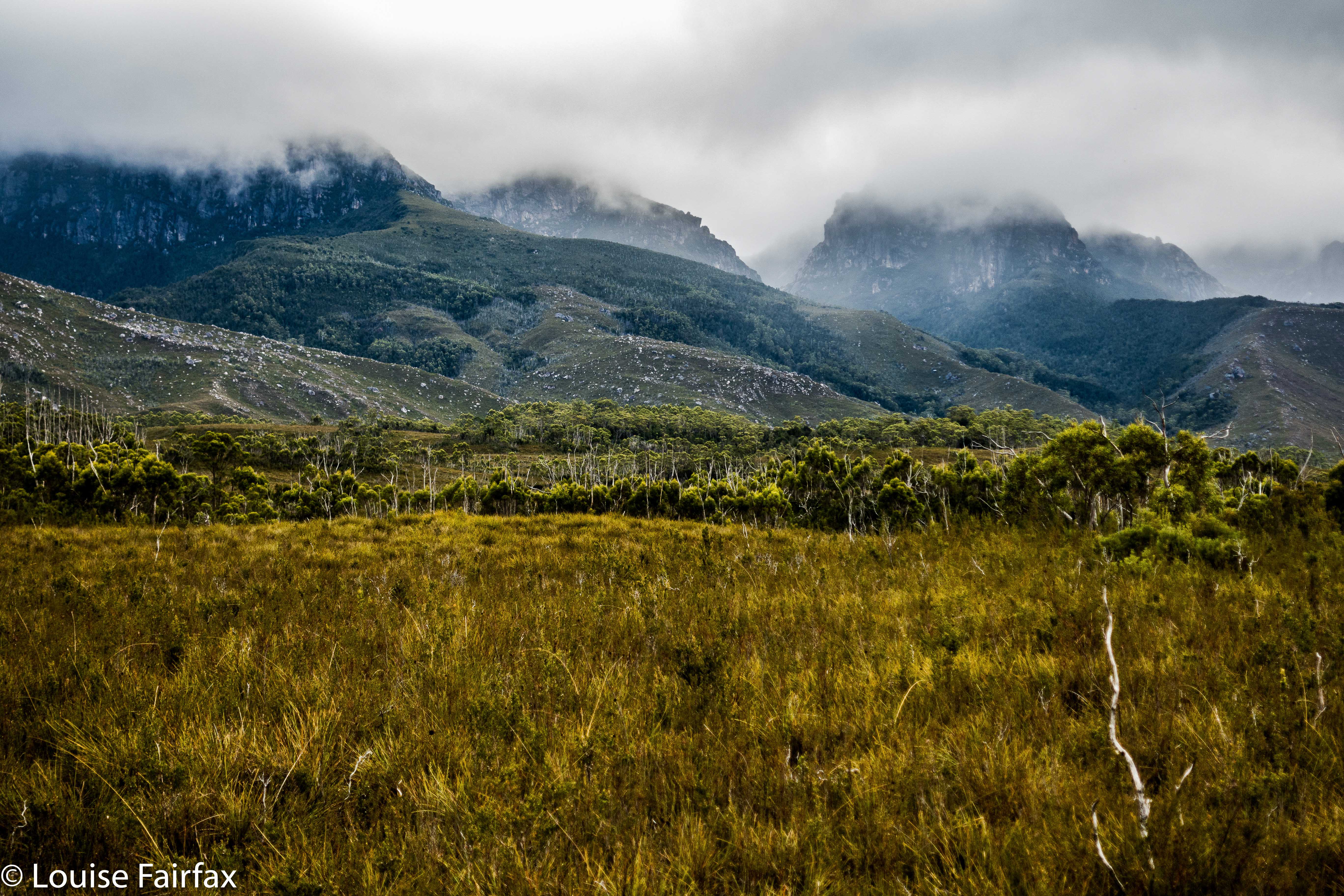
On Wednesday, a small band of us who all enjoy being in the bush and some of whom enjoy ticking lists of High Places went off together to climb four bumps, namely: Bellevue Tier, Bawleys Peak and Gable Hill, which all have in common, not only that they are on a List of High Places but also that they are near Bronte Park, so can be attained in a single day. (We also ‘summitted’ a fourth thing, but it was such a non-event I don’t even know its name. It overlooked the London Lakes, but the view was hazy.) If I am in the bush for collection purposes and to tick boxes, then I prefer to amass Abels or waterfalls, but decided to forego adding another waterfall to my increasing list of beauties in favour of being sociable for a change. A lot of my walks are solo these days, to the extent that I am becoming rather reclusive; I thought climbing a few bits and pieces with friends would be a fun change. It was.

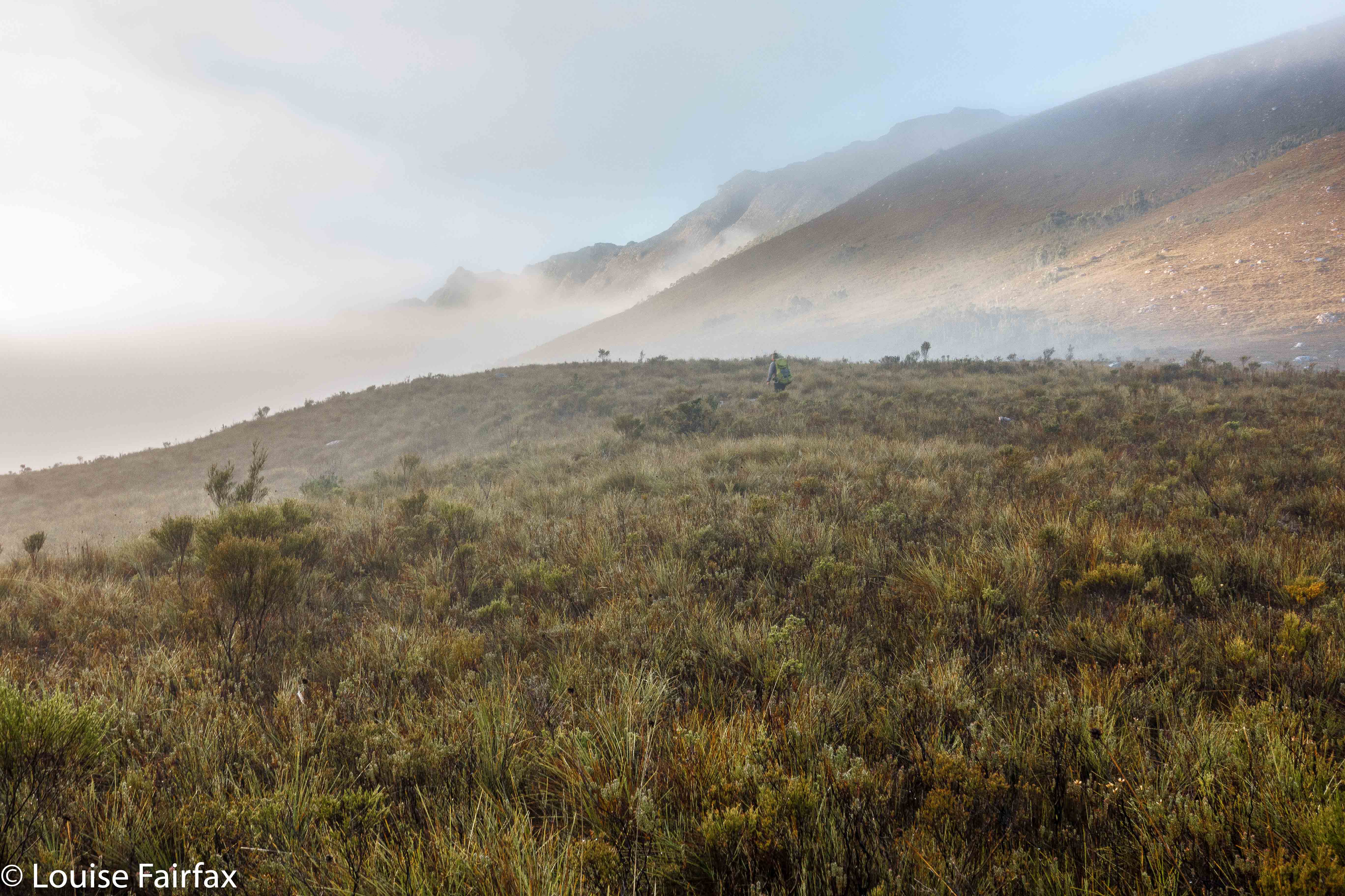
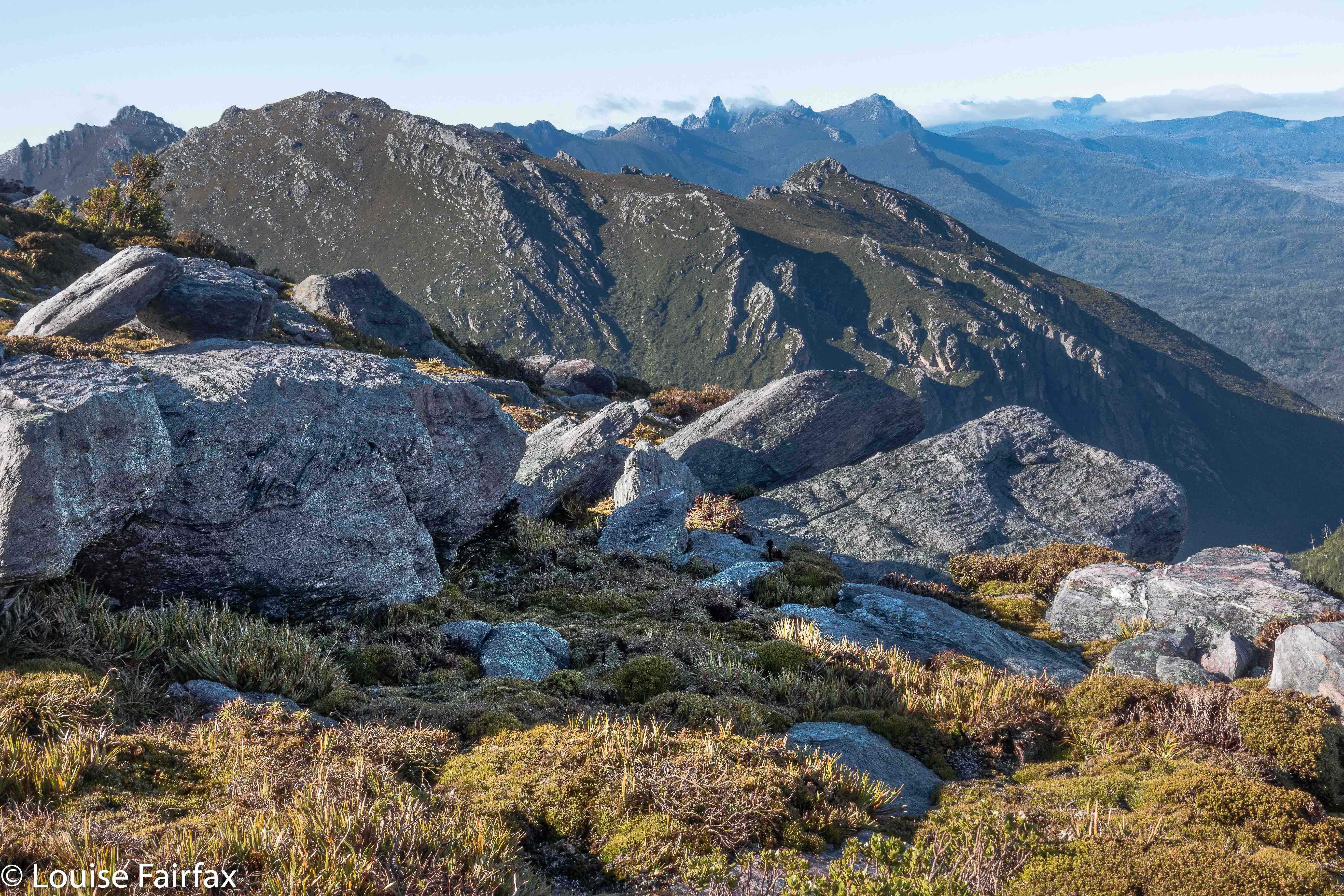
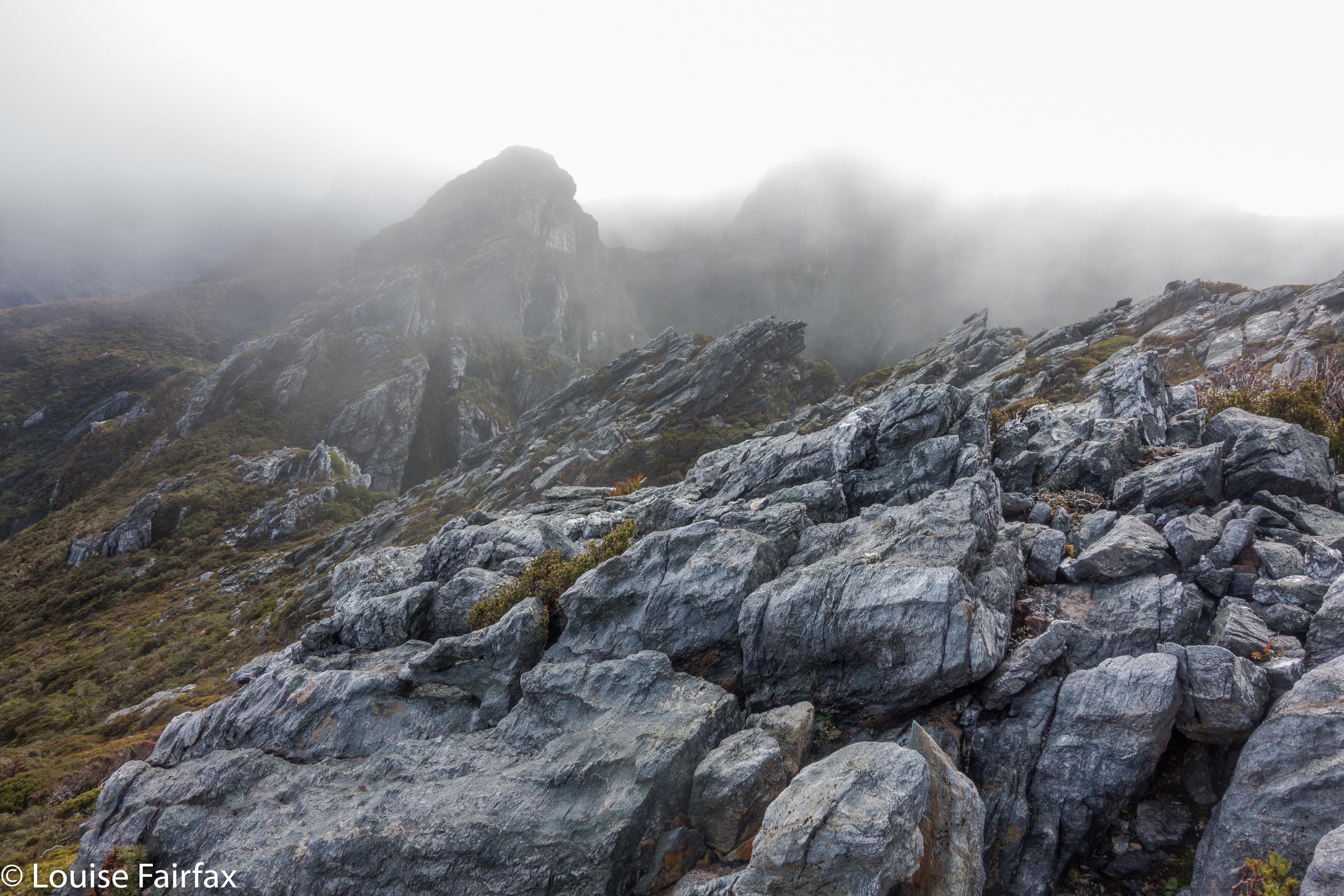
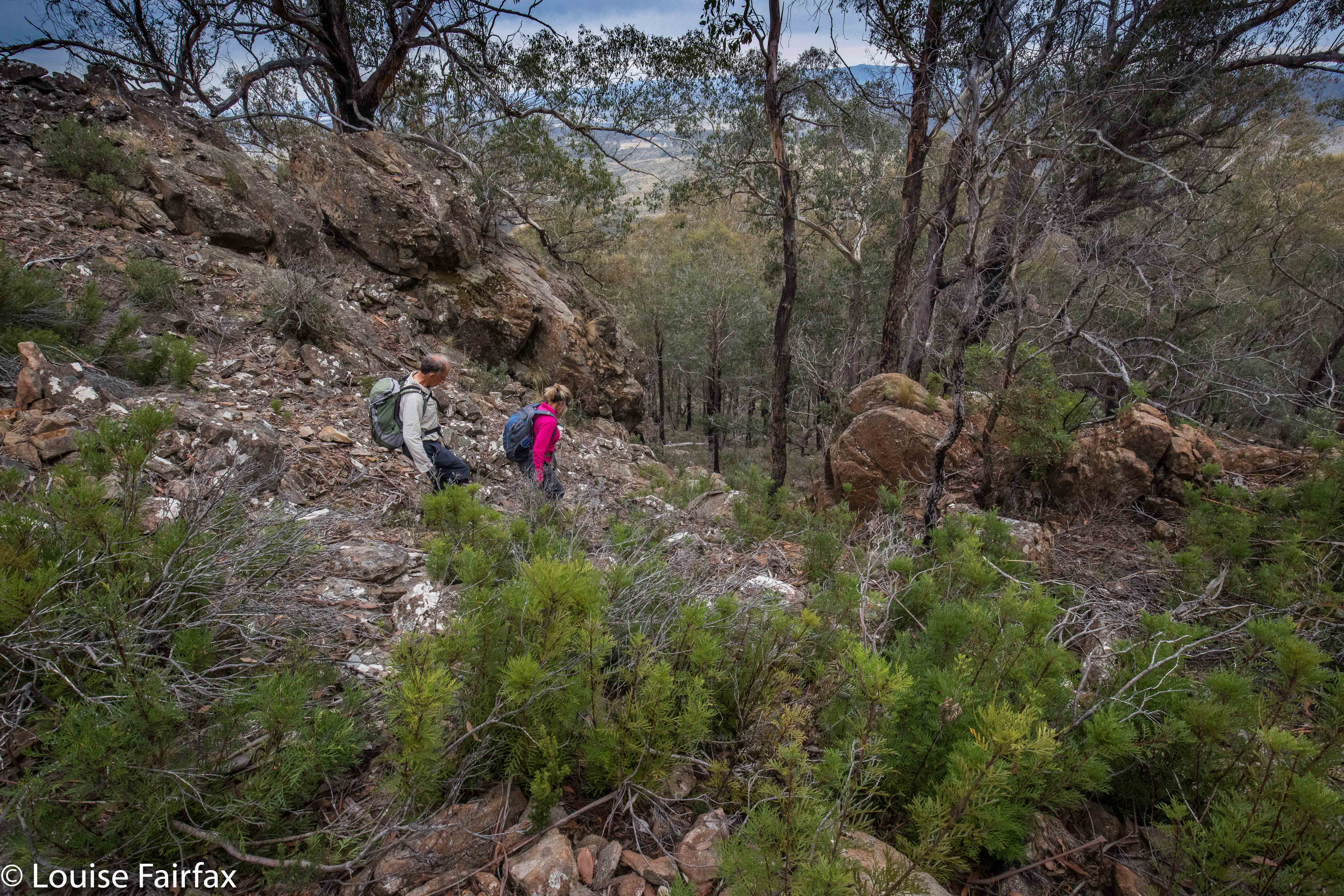
Descending from Bawleys Peak.
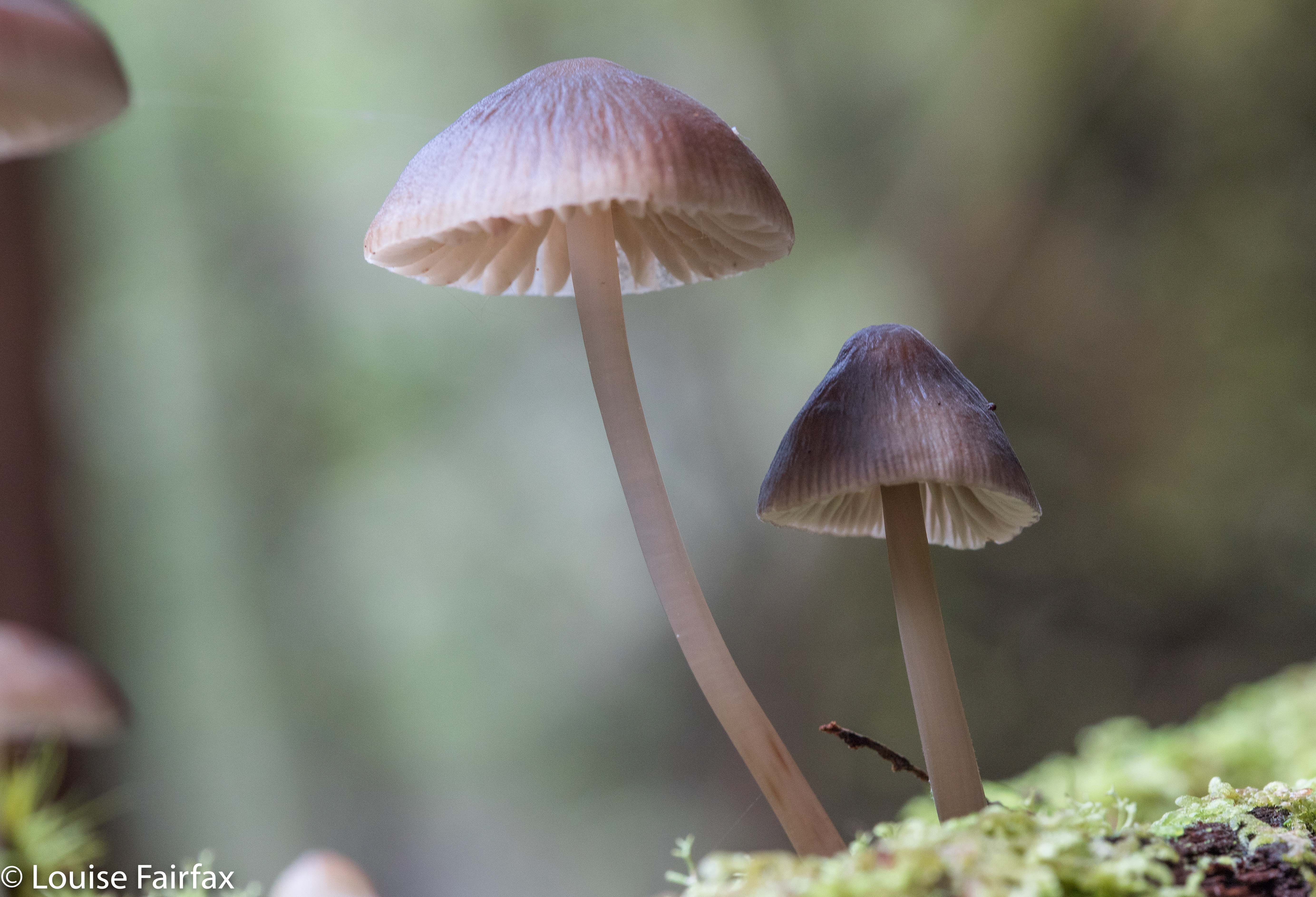
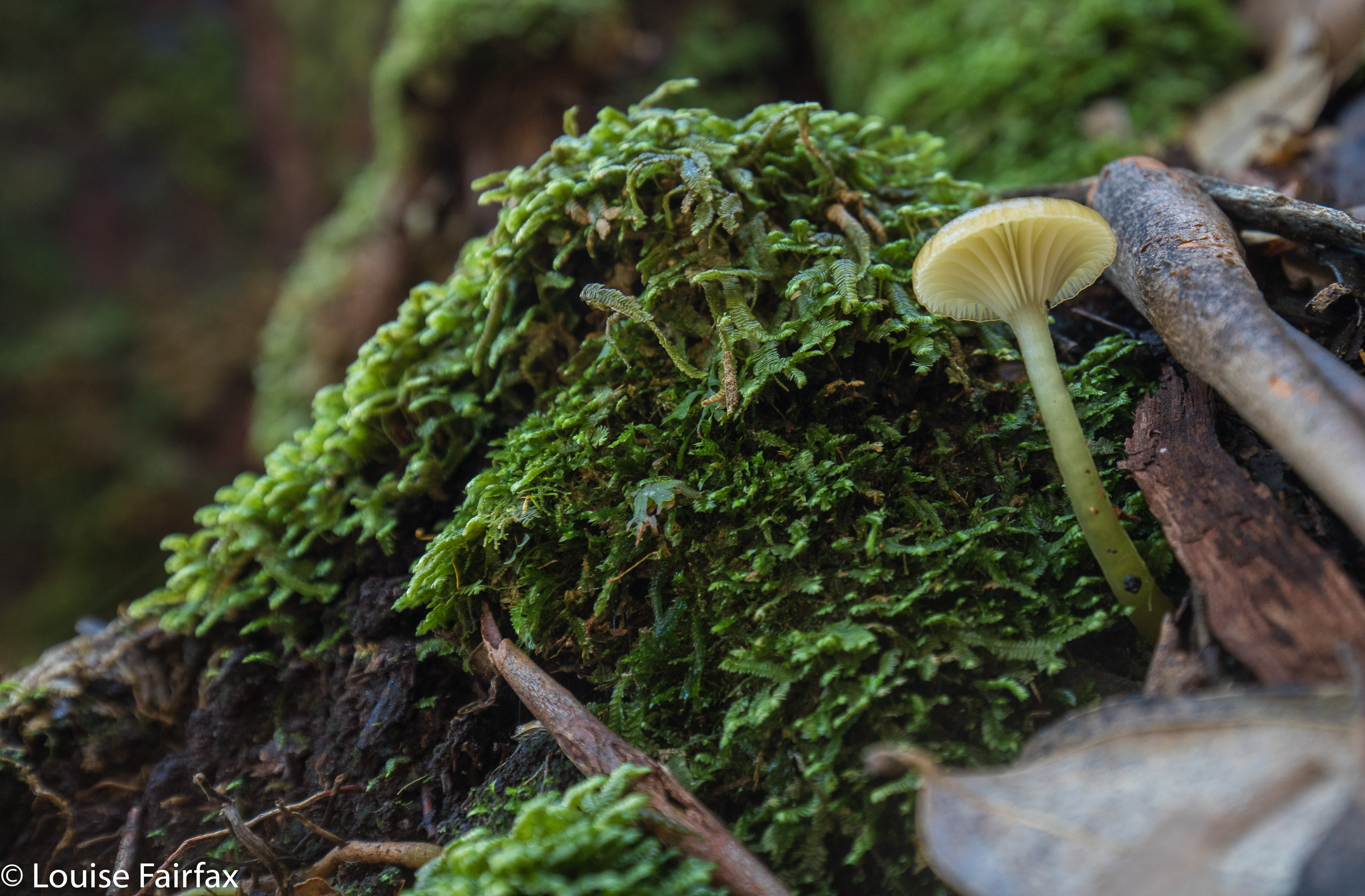
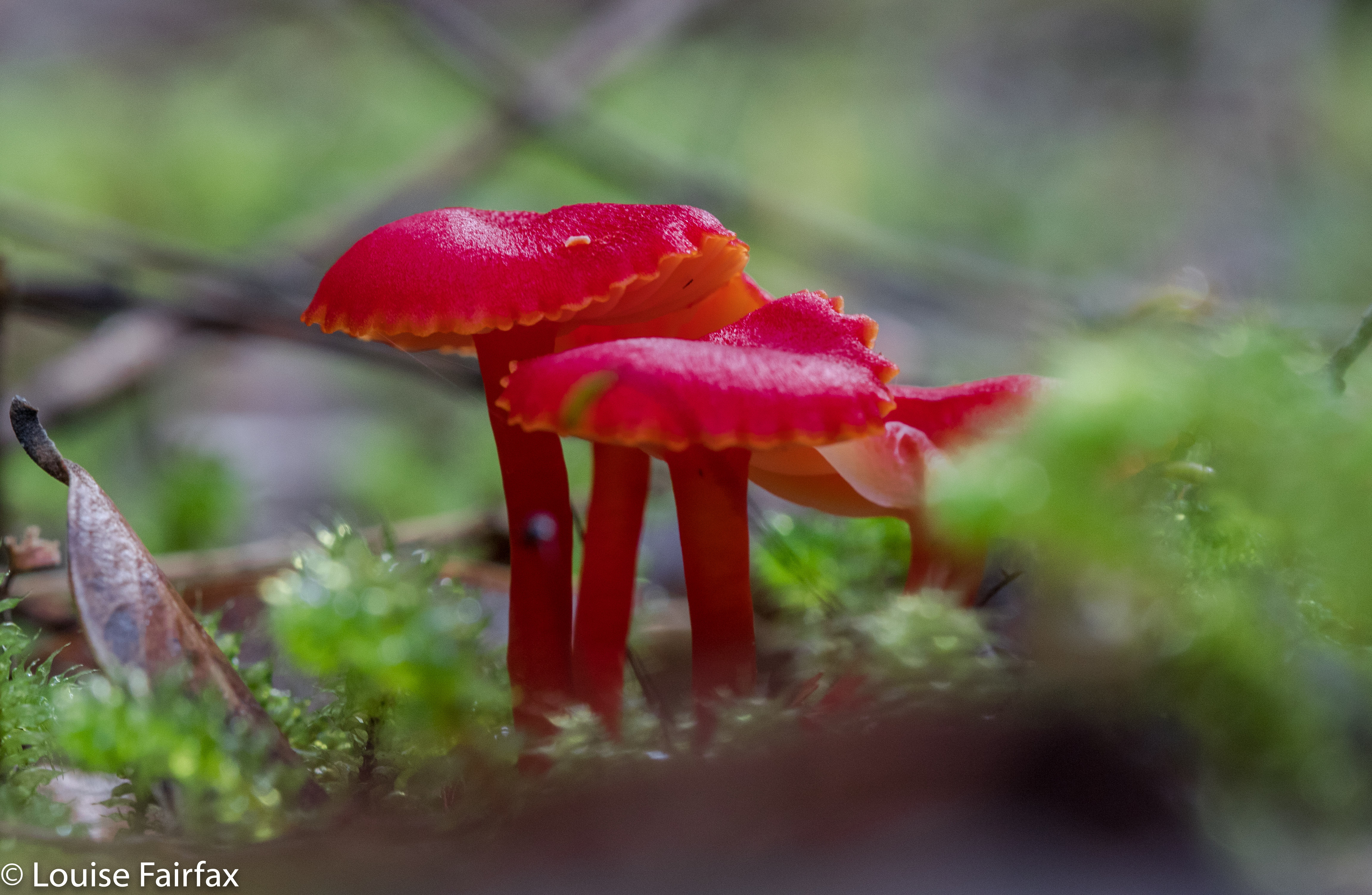
I am not at all in love with the Central Plateau, finding it far too dry for my liking, and devoid of fungi, ferns, shade and the things I love about ‘good’ forests. So, I hope my friends are flattered that I opted for their company despite the fact that I wouldn’t be on top of a shapely mountain, I wouldn’t be in the forest I like, and I wouldn’t be beside flowing water. In a group, you don’t even have the fun of doing your own navigation – although I have to confess I did slip off once or twice to choose my own route and meet the others at the top. I can’t play sheep the whole day and remain happy. But I did meet some great folk, and have fun and interesting conversations, and I enjoyed the camaraderie of being with likeminded people.

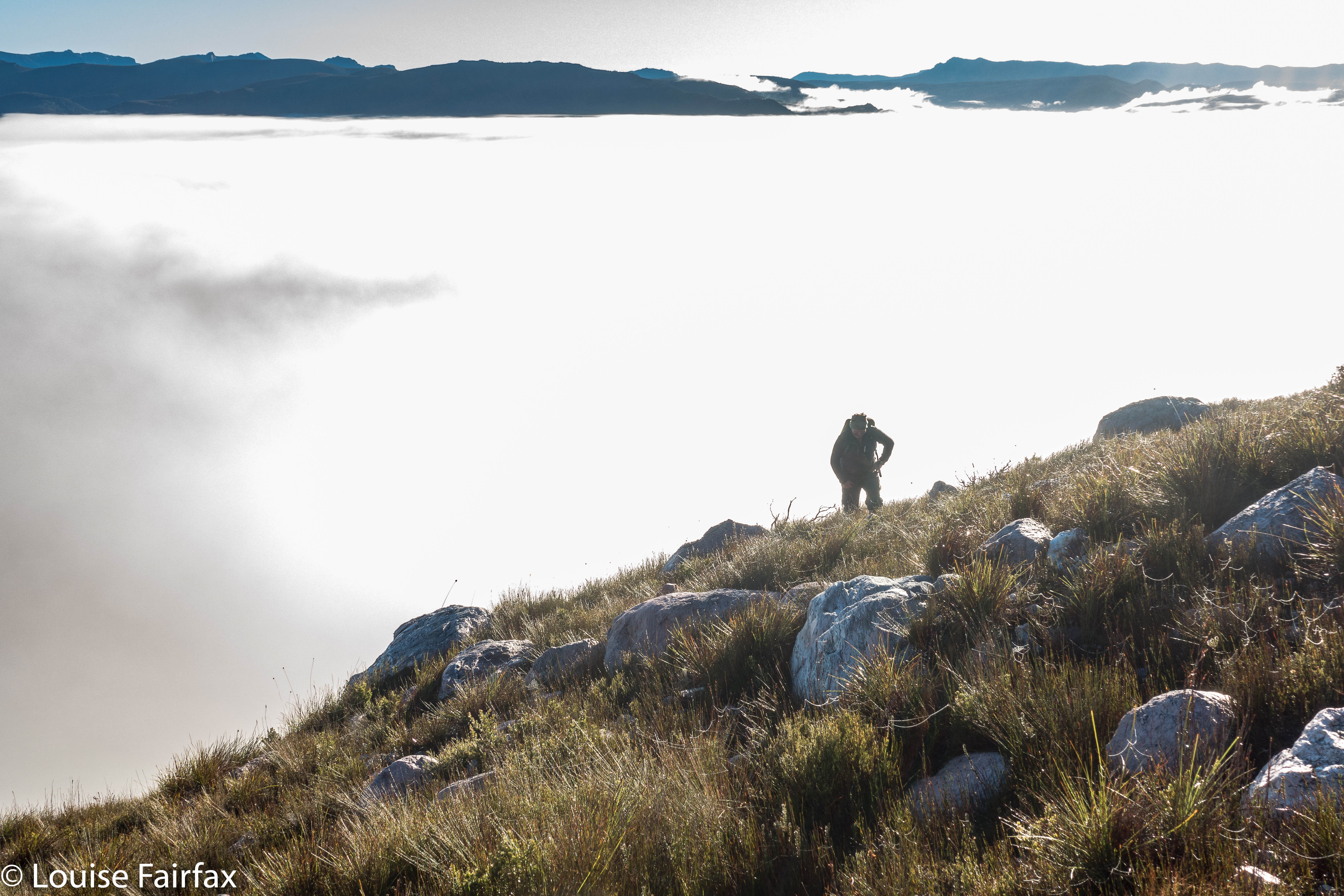
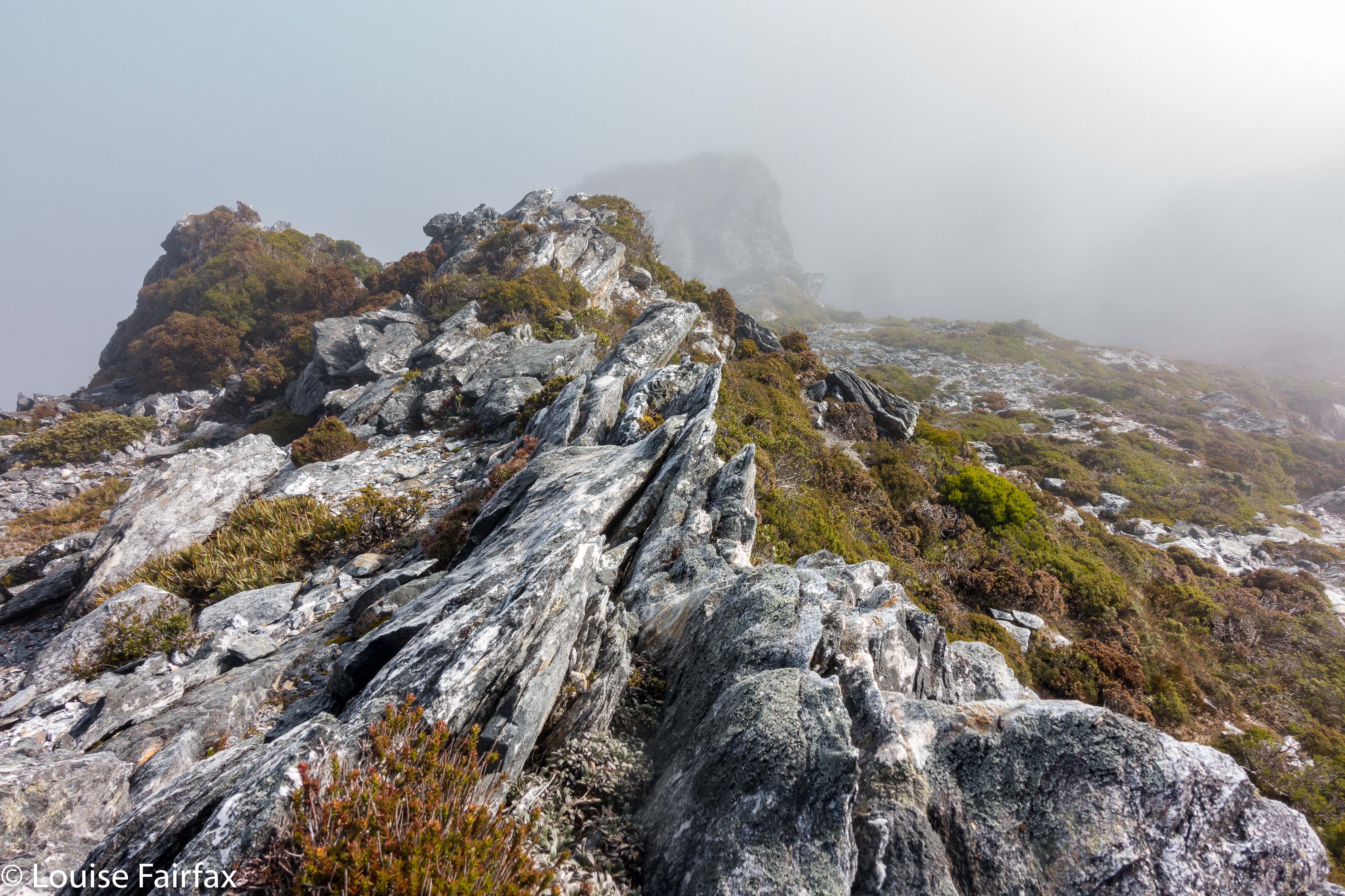
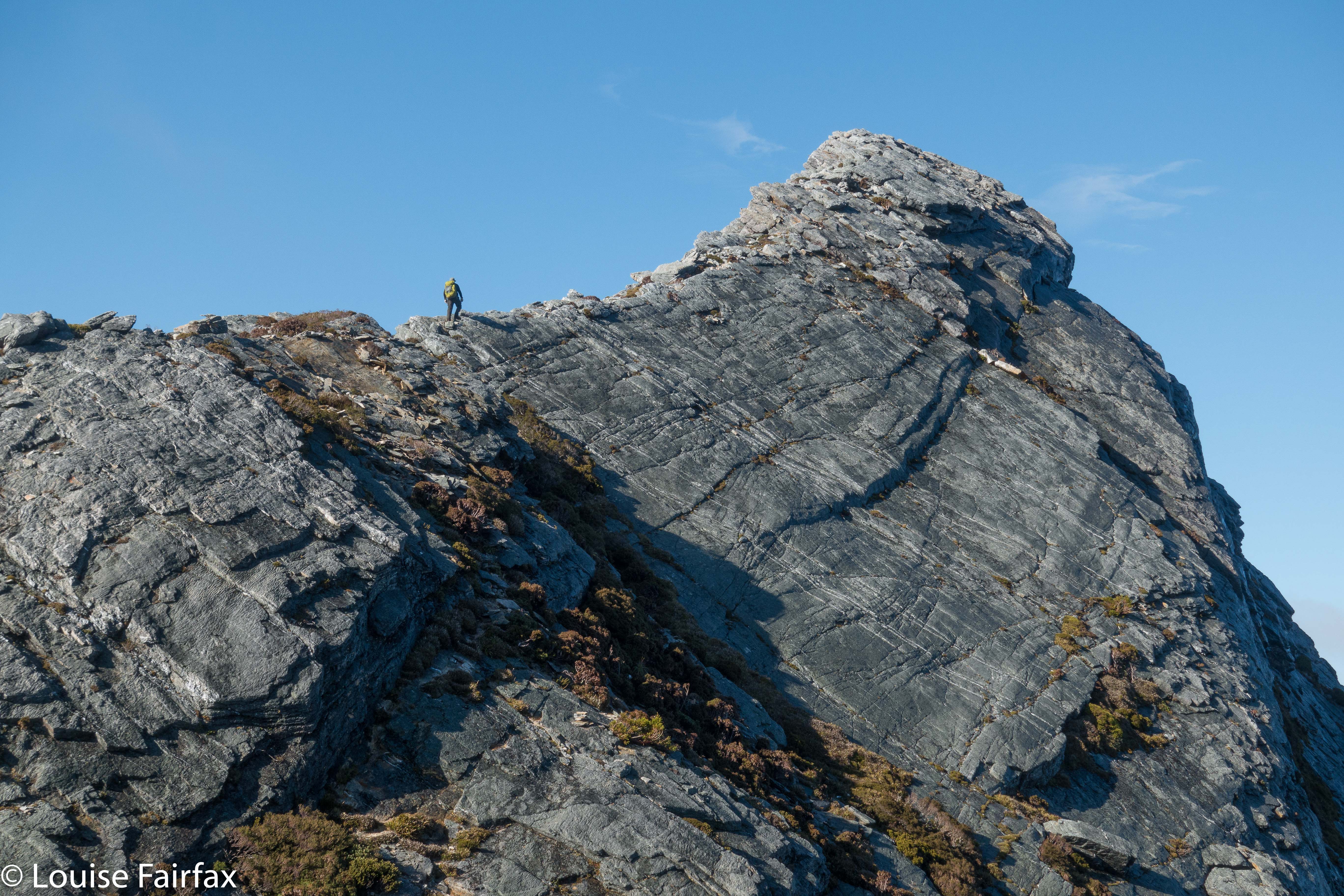
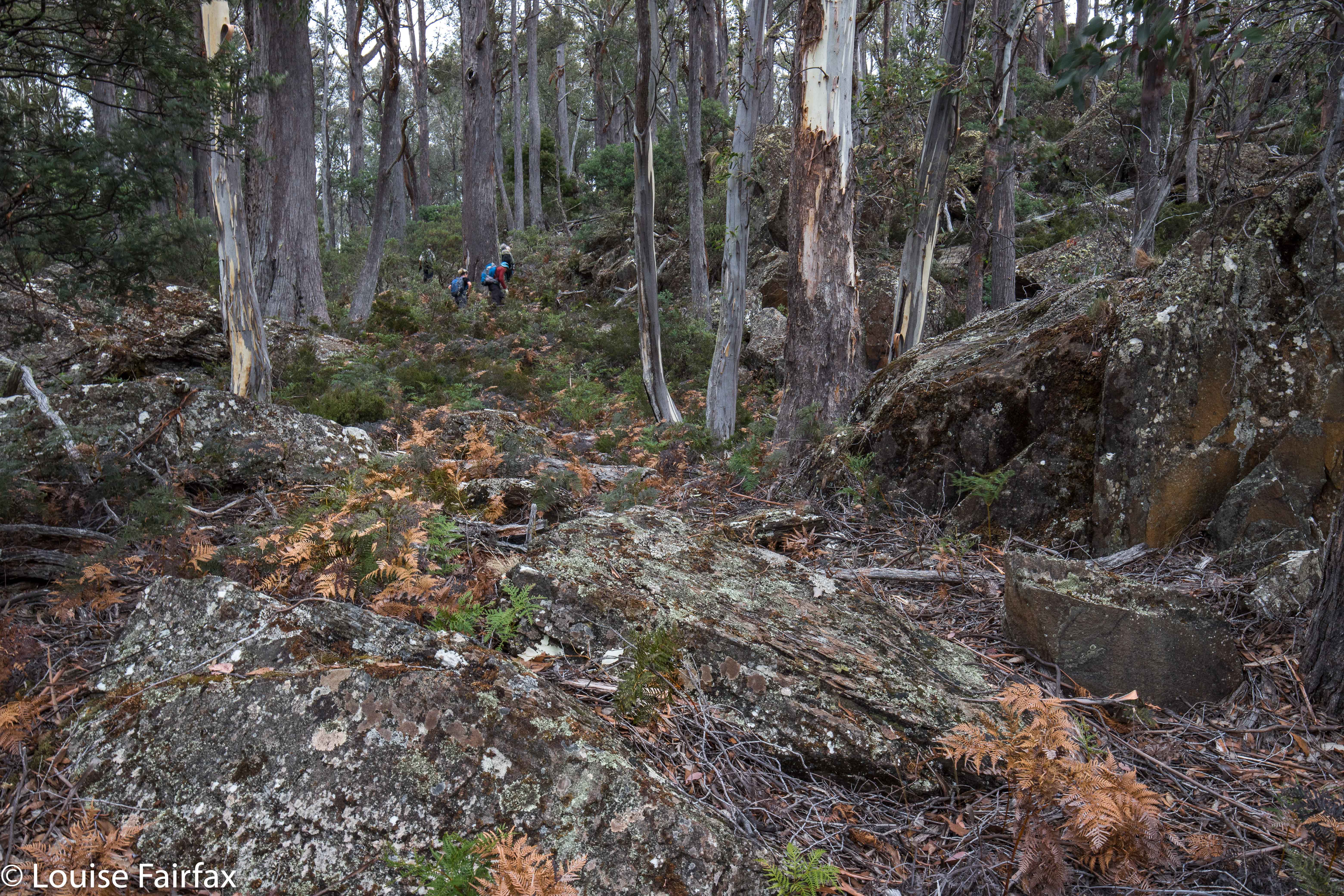
Ascending Gable Hill
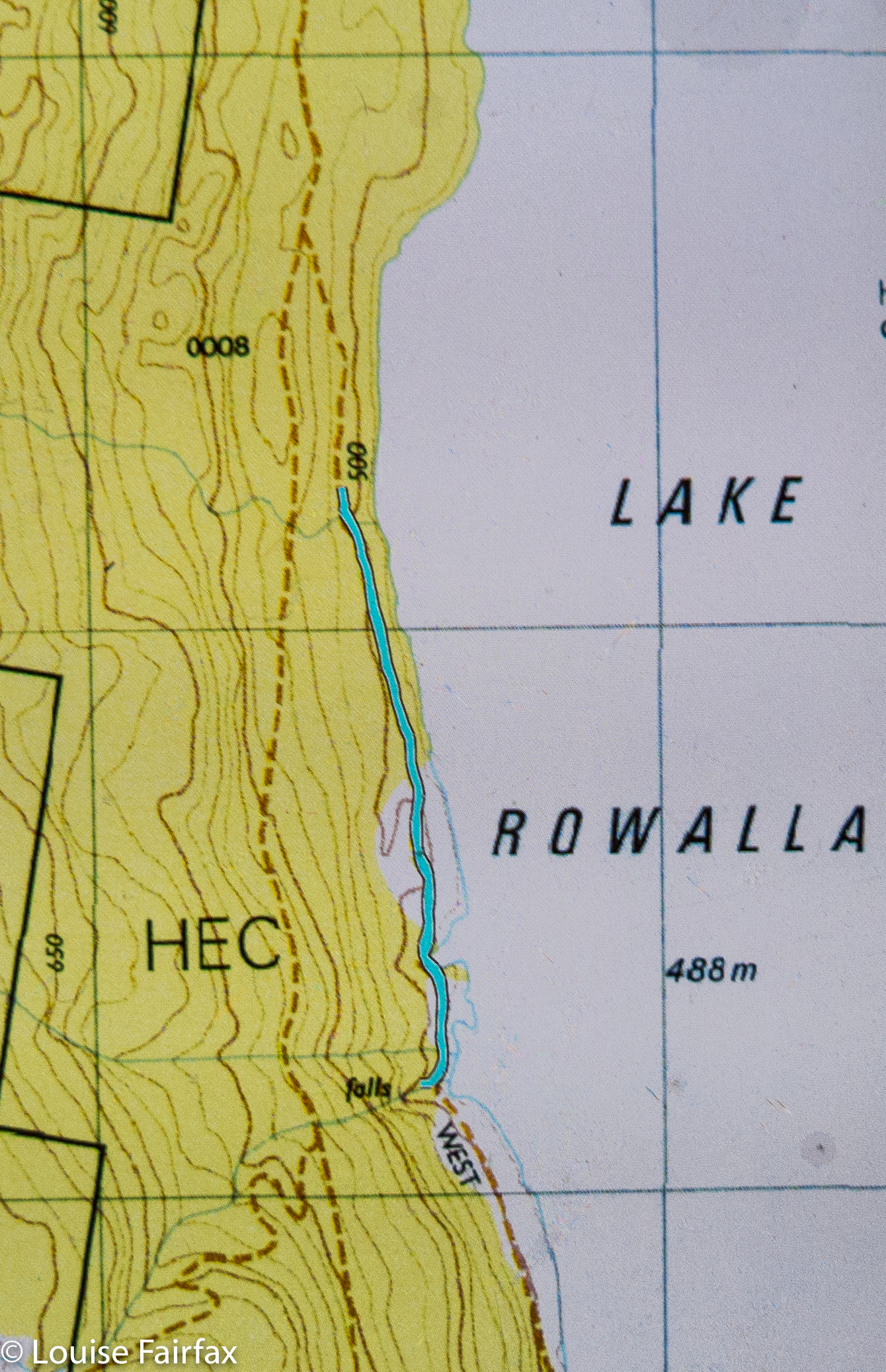
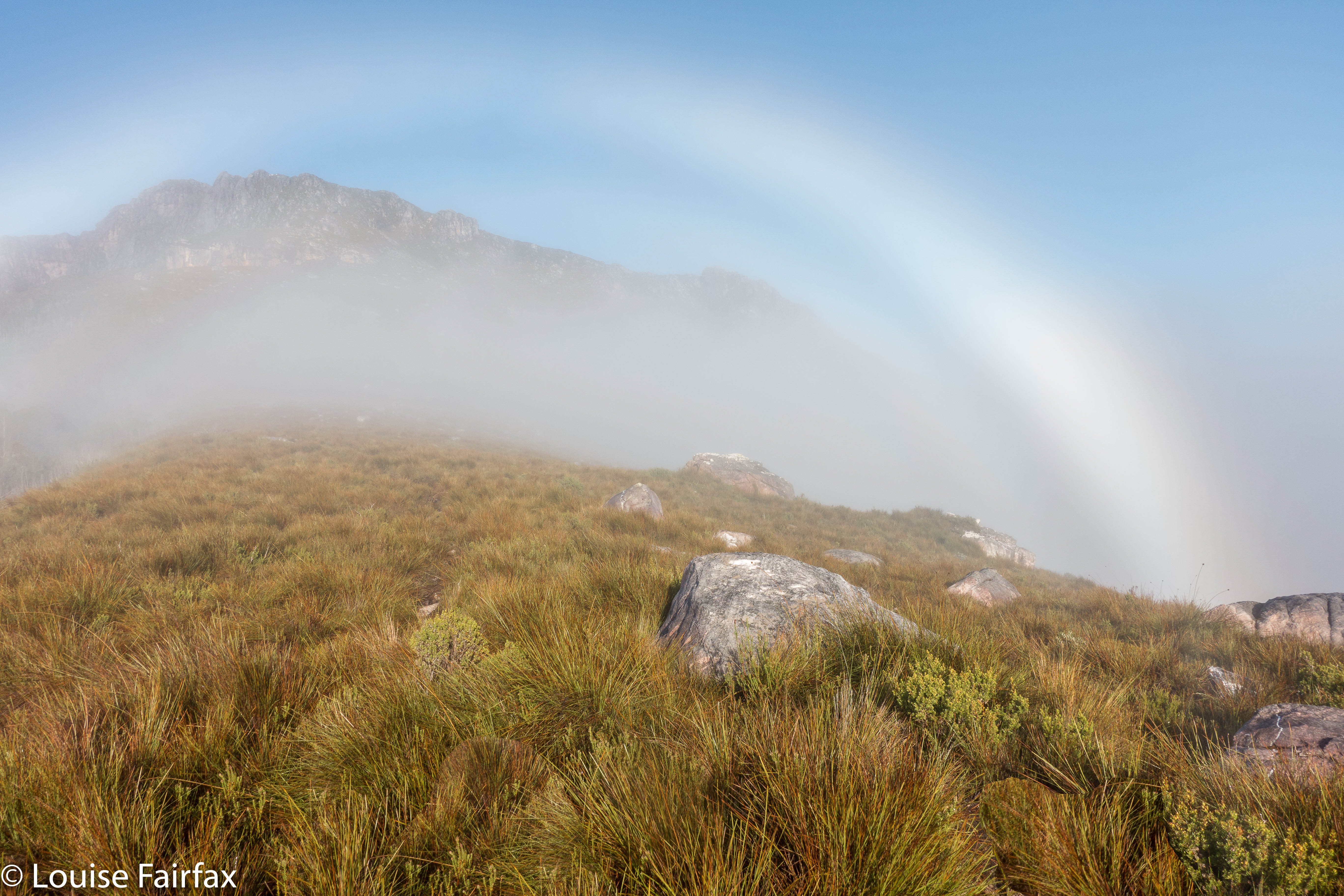
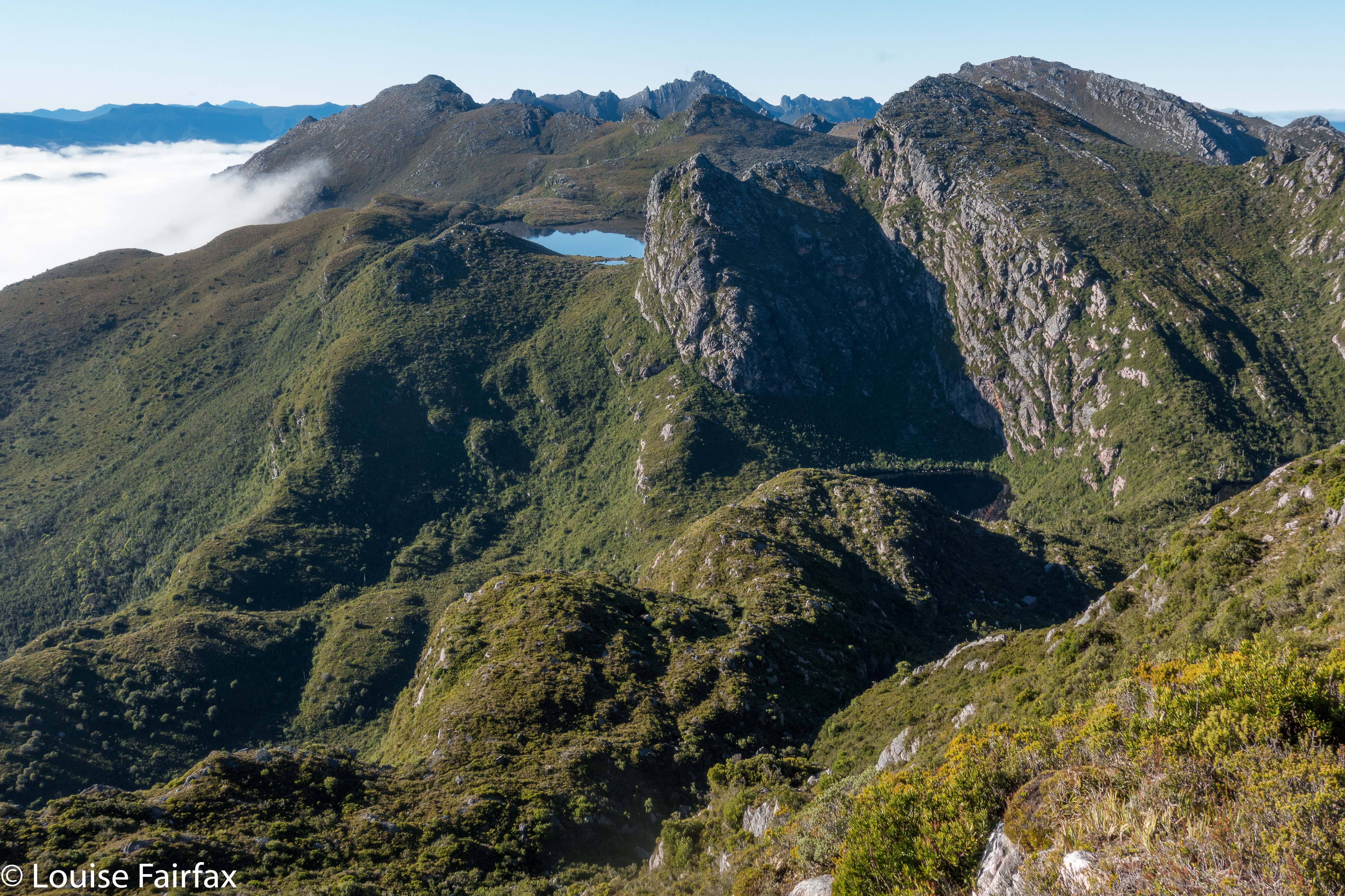
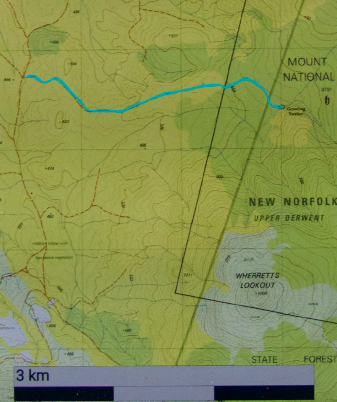
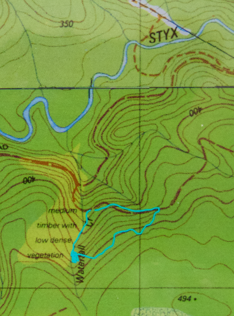
Bellevue Tier seems rather shapeless and viewless, despite being 1126 ms a.s.l.. Its merit lay in the exercise value (4 kms in each direction) and the walk-and-talk combo that took place. Bawleys Peak, our second high point, a fair bit lower but far steeper, was much more fun (See contour map below). I took it head on while the others went around to the right, and my route gave me a good adrenalin rush, with quite a few rather narrow ledges and iffy patches of climbing. Therein lay my first of two climbing thrills for the day. We sat on a beautiful mossy ledge looking out at the very hazy scene and whopping drop below while we had lunch.
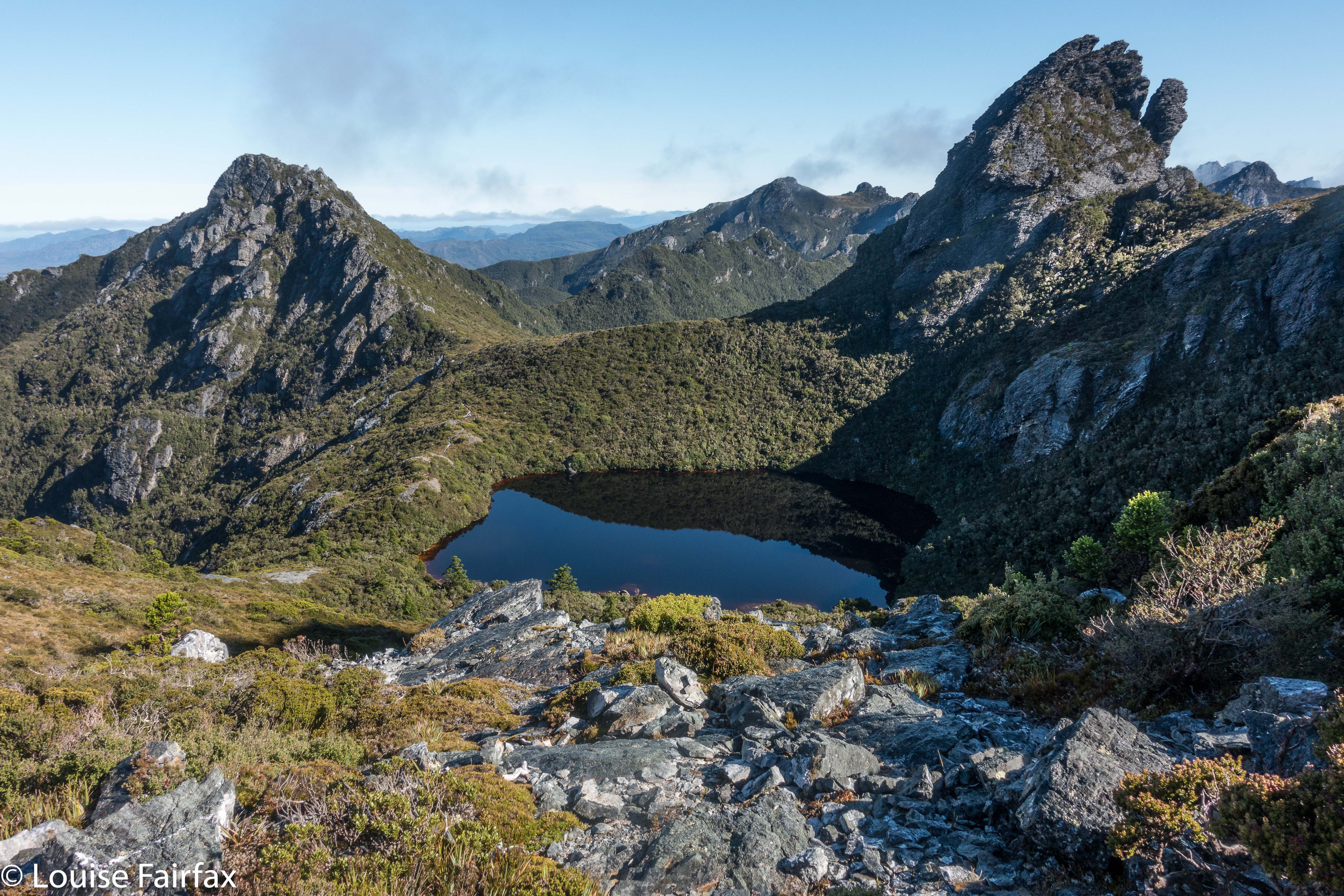
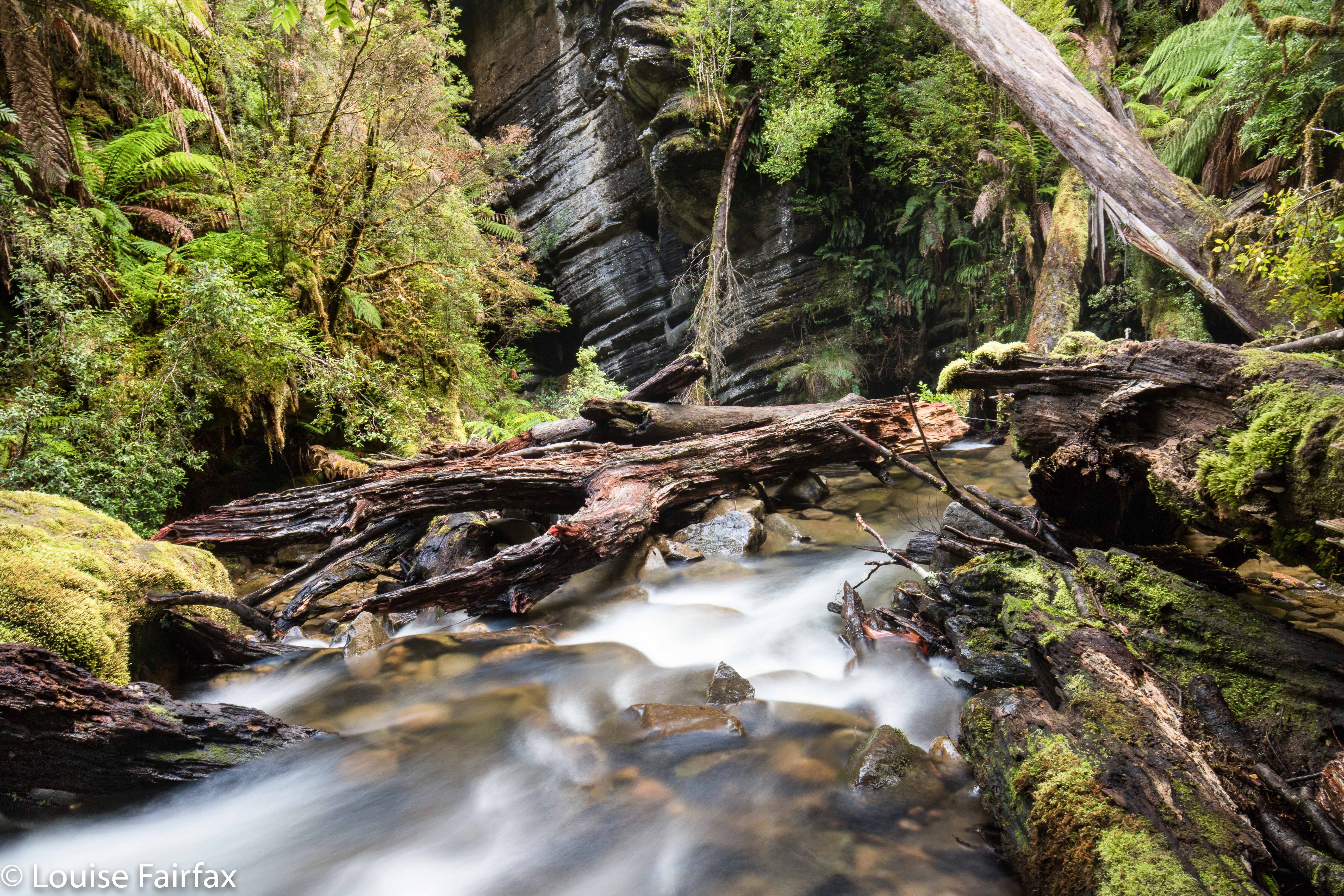
Gable Hill
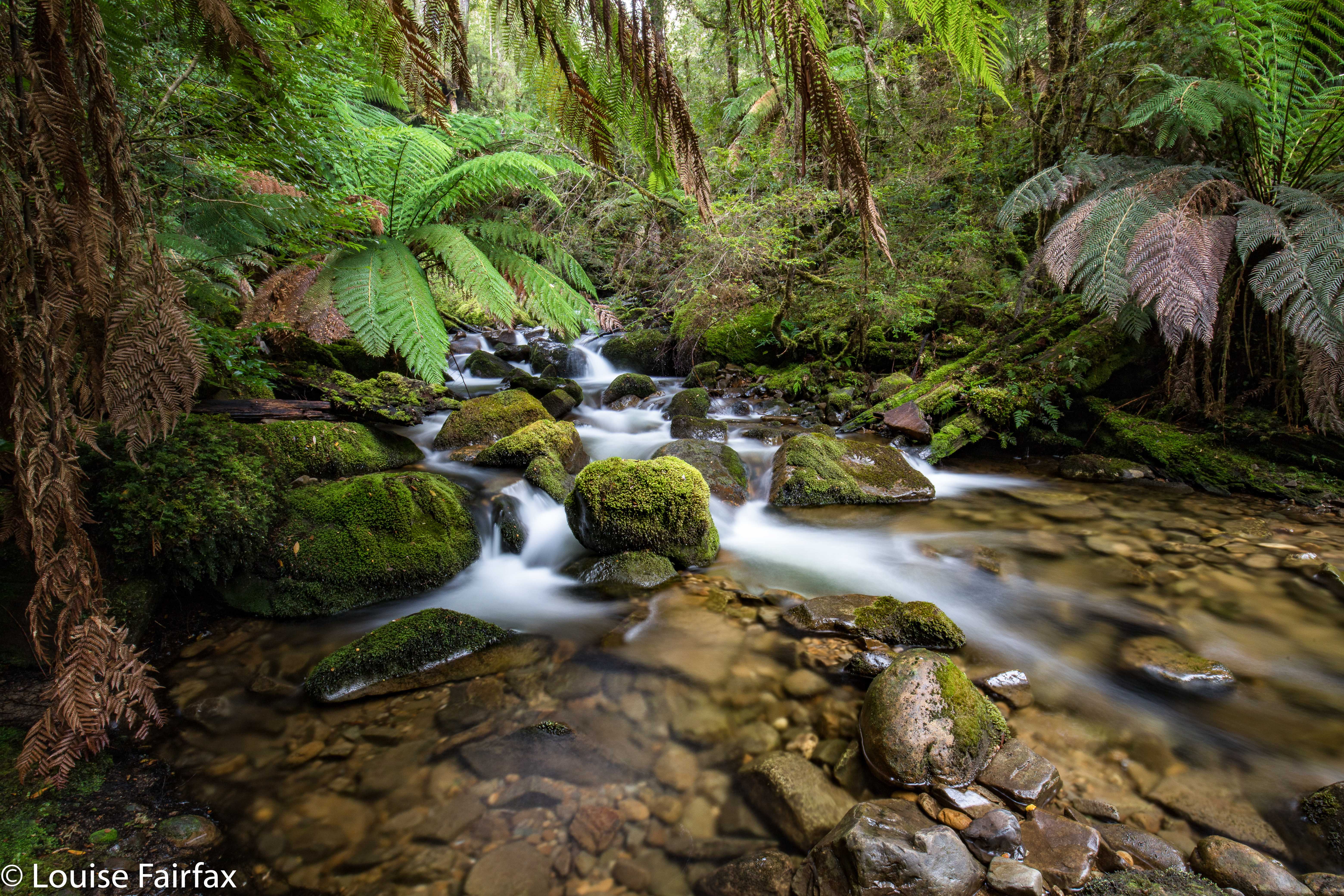
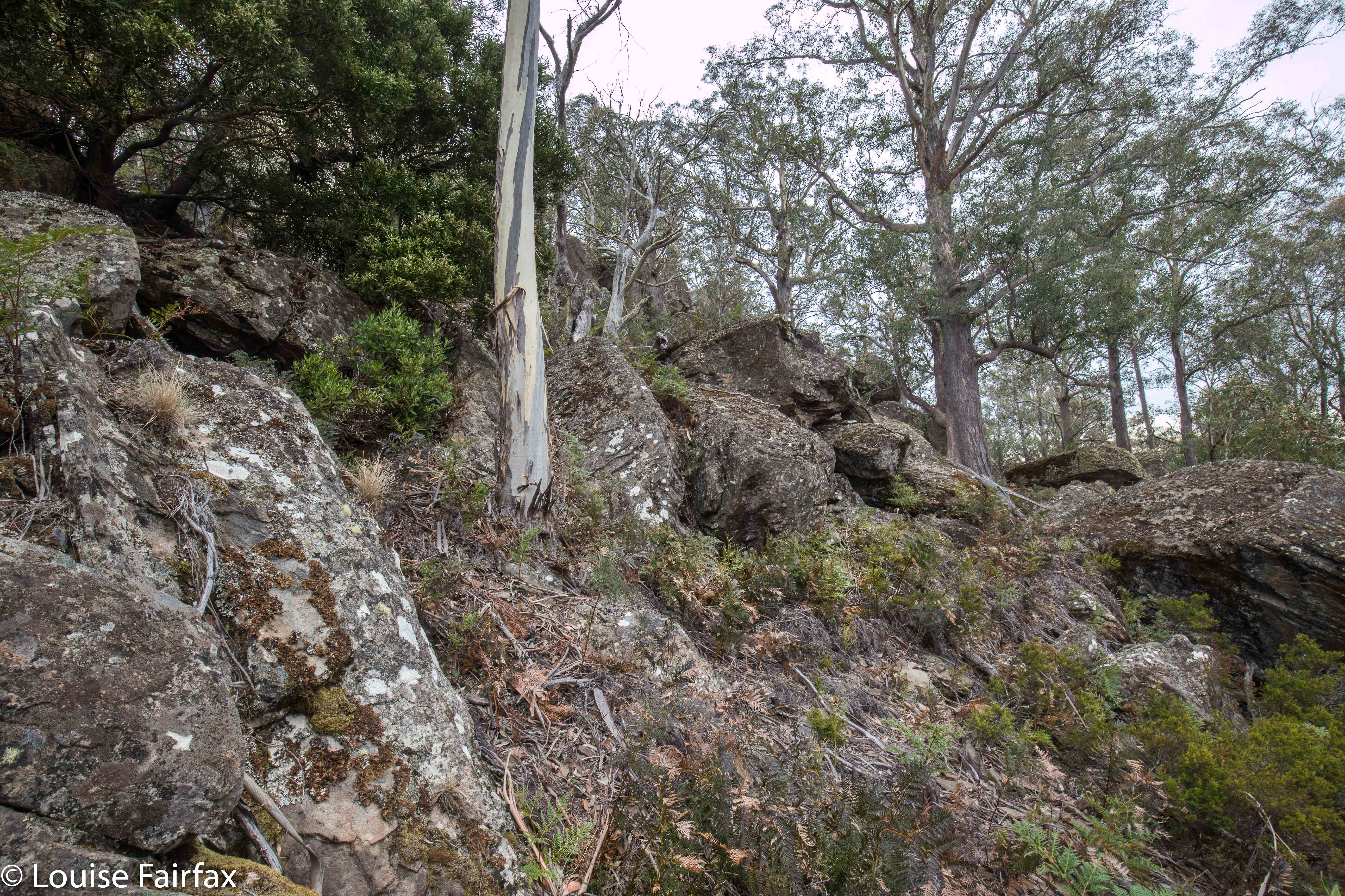
Our final fling for the day was the best: Gable Hill, on the other side of the rivulet we could see. This hill had very interesting boulder clusters that I liked, and some boulders at the summit that goaded me by appearing impossible towers to mount. I wanted to photograph someone else on top, but nobody expressed even remote interest in answering the taunt of the rocks, so, I set about climbing them while the others ate afternoon tea. I was very nearly too fat to get up the narrow chimney I was using for leverage, feeling like Pooh bear after too much honey, and rather fearing that any second I could tumble backwards and splatter on the rocks below like a tin of strawberry jam, but with a bit of breathing in and shoving, I managed not to cause deep distress to my daughters, and to get to the top of the obstacle. The others very sweetly played paparazzi to record the success. By that stage I was more interested in the fact that I was still alive and uninjured than that I had got to the spot on top. From the safety of my bedroom now, and thus in retrospect, I can report it was a fun climb. As I posed, however, I was pondering how on earth I was going to get back down, and was wondering if the gents would mind catching me. Not necessary, as it turned out.


Gable Hill
Unfortunately, the Central Highlands area also lacks the kind of coffee I like buying. Oh well. I am waterfall bagging on Saturday, and can have cappuccino in a cafe then.


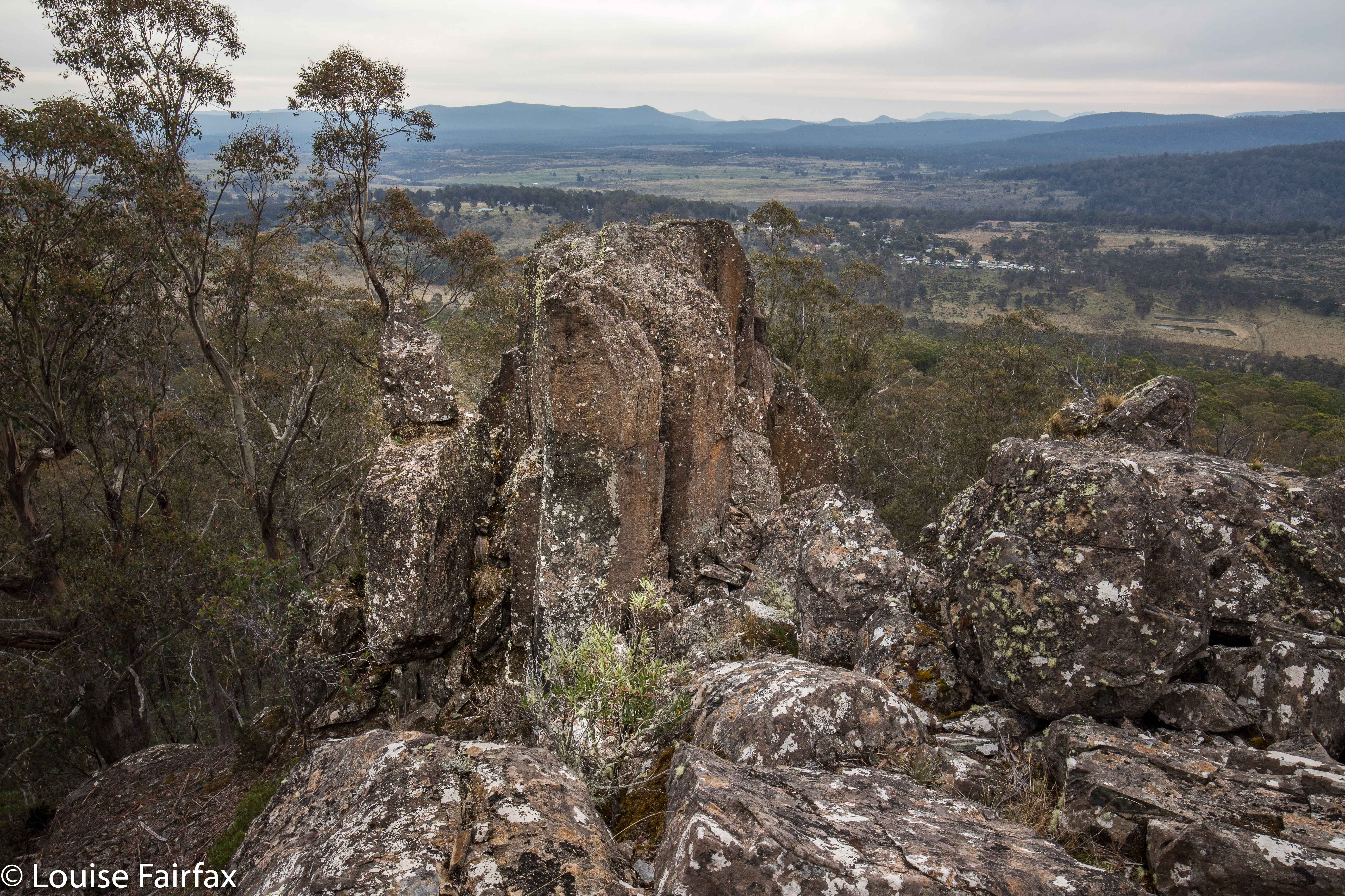
The rock tower that I climbed (using a chimney to the right).


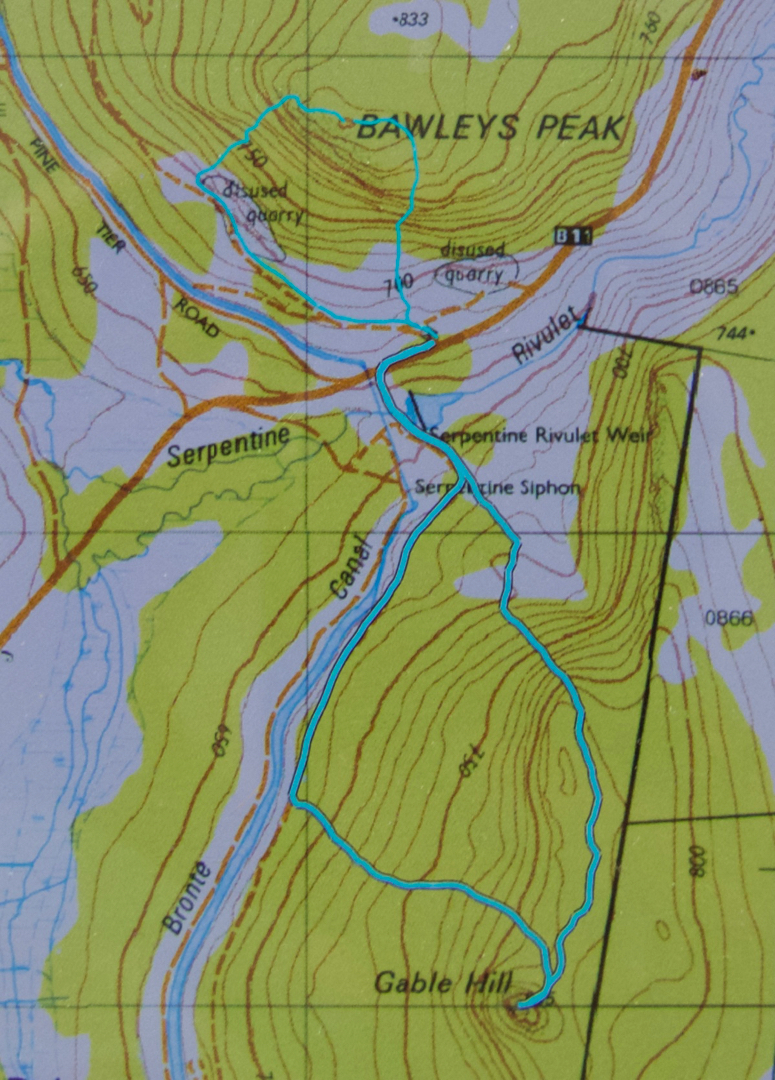
For both peaks, the ascending route was the more easterly, the descent, more westerly.

Old House Falls 2018 Apr

Old House Falls (by Lake Rowallan), Apr 2018.
Old House Falls looked nice and simple on the map. I checked with a guy who’d been there the day before as to whether I could get my car along this road, and he said there’d be no problems. Blissfully ignorant, off I set, along the usual Mersey Forest Road I know so well from bushwalking. But, instead of crossing the Mersey and going down the normal, eastern side of the lake, I continued on the western shore, as per the map I had: on and on and on and on. Like a kid who keeps asking its parents: “Is it time yet?”, I kept consulting my map as the road got worse and worse. Is it time yet? SURELY it’s time by now. Na, came the inevitable answer each time. Not warm yet.


The pot holes got deeper, the stony bits rougher, the mud sections slipperier, the ponds I drove through murkier. How deep were they? I almost closed my eyes so I wouldn’t see my own accident as I drove through, hoping I wasn’t going to drown myself or my engine. I have a Subaru AWD, not a huge 4WD. This was nauseatingly scary. I was by now miles and miles and miles from any help should I need it, and it looked like I would need it very soon. Lucky I can run long distances. I could see a very long training run for help coming up. Tessa was pleased. She likes that.


Eventually, I came to a creek I was supposed to drive through with steep banks (for me) each side. Enough was enough. My adrenalin levels were now through the roof. I managed to execute a hundred-point turn, and, convinced NO person in a quarter of a right mind would come this way, decided a skinny car could get by, parked, and off I set. I had 1.6 kms to walk until the creek I wanted, Old House Creek. The Falls would then be about 60 metres to my right up the hill (west). The foot bit was glorious. I began to relax and enjoy the view. Why hadn’t I abandoned my car and given myself peace of mind earlier?


Just before the falls, I saw a claret coloured ute. Amazing!! Someone had got that car all the way there. It must be an abandoned car, its owners too scared to drive it out, I figured. On I went to the beautiful falls and photographed them. Just as I approached the area where the claret ute had been, I saw it leaving. Oh no. It was too fat to get past me. I waved and called. They drove slowly but continued on. Had they heard me? Oh well. The walk had taken thirteen minutes. If they took four to drive it, they wouldn’t have to wait ALL that long. On I pressed.


As I neared my car, I saw two guys, brandishing axes. Luckily I am not suspicious or paranoid, and so did not think the axes were intended for retribution delivered to my car, or, worse, to be used to punish me for being an inconsiderate twod preventing a normal citizen his right of passage. They assumed I’d broken down (how generous and kind of them) and were just going to cut their way out. Instead, I drove, with them as my backstops, until the danger was over. They, too, were waterfall baggers, so we all sat by the lake once we’d finished with mud-slides and driving through lakes of unknown depth and over fallen trees, and had a lovely time eating and chatting whilst staring at Clumner Bluff perfectly reflected in the waters of Lake Rowallan. You’ve no idea how unscary the road was when I had a backstop. Thanks to Shane and Ed, I even like these falls, and now I’ve got over my “beginner’s angst”, I may even go back one day to check them out when the flow is bigger.

Aldebaran 2018 Apr

Mt Aldebaran, Apr 2018


Somewhere up there Mt Aldebaran is hiding. Looks inviting, huh?
I really wanted to climb Mt Aldebaran before the super cold set in, having missed my chance over the summer. I decided it needed to be a solo venture, but thought I’d like to do it in the school holidays, as maybe I’d accidentally meet someone up on the range, and that would feel nicer. I had my plan: early start on day one, use the Kappa moraine shortcut and continue up to Lake Sirona to sleep. I’d looked at my stats for what I’d done in the area before, and this seemed feasible. Day 2 would be a shorter, easier day, just climbing Aldebaran from Sirona and enjoying being high for what was left of the day. Day 3, I would begin my descent and climb Carina Peak, dropping just as far as Promontory Lake. Day 4, out. But then I got an email from a friend saying he’d like to join in. He lives in Hobart, so starting Thursday morning suited him (rather than sleeping in the carpark Wednesday night, as I had envisaged). That was fine, although it did make reaching Sirona unlikely, but having his company – a mud buddy – would be lovely, so I agreed.

If you look carefully you can find my friend heading off into the mist.
Day 1 did not go brilliantly. Our later start ended up very late indeed, and the track was very muddy and slow, We only made it to just past Seven Mile Creek before dark set in. I squandered half and hour at the tail end of the day trying to find a suitable crossing point for the creek that had now reached fast-river proportions. I kept going upstream until I found a fallen tree that I could hold on to. I didn’t trust myself not to be swept away otherwise. And now it was dark. Time to pitch the tents, collect water, eat and sleep. Boom. No mucking around at this end of the day. I reckon my eyes were closed by 8 pm, having got up at 4.30 to drive down to Hobart.

Up above the clouds already.
All night, it seemed, I pondered the dilemma of what to do with our shortened camping spot. My friend had struggled in the afternoon, and I thought getting his tent up the steep climb could take so long that we would be timetabled out of climbing Aldebaran, which would mean we had to do it on day 3, making day 4 too long. But, leaving the tents where they were and climbing up and down in a day was risky, as it would be a long day, and if we failed, then the trip failed, as there would not be enough time to then get the tents higher and start again. In the end, and with huge reservations, I decided to risk a long packless day, thinking that that would give the best chance of a summit.


A fog bow
Off we set at 7 a.m. Unfortunately, once we started on the steep section, our differences in speed became very noticeable. It was too early in the day to worry. At 9 a.m., my friend suggested I go on without him; he was not having a good day. I said I thought the worst of the climb was over, so let’s stay together longer, but at 10.40 a.m., I had to admit defeat. If we didn’t separate, I wouldn’t get my mountain, so, during the climb up out of Lake Sirona, we parted company, agreeing that I would catch him somewhere on my rebound. I hoped that’d work out.

From on Kappa moraine, looking towards Lake Promontory.
Now I had two big lumps to negotiate before the climb proper began. I was so time stressed by this stage that my memory of these bumps is a blur. My whole focus was on hurrying so as to get to the summit before my turnaround time. My haste meant I didn’t make considered choices, so lost time trying to get off a cliff that was too high to leap from, but had no way around. I gave up, but on the rebound, noted wear marks leading over the edge of a different cliff. Aha. A way down around the obstacle so the climb could continue. On I went, hoping I could remember all this on the way back, when I would be equally stressed for time so as to avoid being up there in the dark.

Weee. I can see Federation Peak – that fabulous fang in tiger distance.
Aldebaran has, it seems, four summits. Excitedly I climbed the first one, ready for jubilation, only to find two more bumps ahead, both of which seemed higher than this one. Grr. More wild dashing. At last, and getting tired now with all this frenzy, I crested the bump. It was 11.50. Oh NO. There was another, bigger bump up ahead, previously hidden behind other rocky mini-mounts. How long would it take to get there? My absolute latest turning around time was 12.30. More rushing. Hoorah. At 12.10 I stood on the summit and there were no more summits. I touched, took a few photos and thought I’d better go. To my horror, clouds, were now floating with a frenzy equal to my own, rising faster than I did up from the valley below and circling around me. I was about to lose my visibility. This was a complex mountain: i.e., this was very disconcerting news indeed. Meanwhile, it was very pretty, so I took a few more photos. Might as well die with attractive shots in the camera for my family to enjoy.

Still climbing. Looking down over Haven Lake to Mt Taurus.


Mist closing in on top.
On I went, over bumps and through more saddles, hoping I’d remember my route. At the last of the bumps, I found my friend, so we descended to Sirona together. I’d made OK time back, so the pressure was easing, although A wanted to climb Scorpio. Fair enough, He hadn’t got to climb Aldebaran. He set off while I did some eating, saying I’d give chase. I caught him at the saddle before the final climb, and had great fun photographing his ascent (see below).


The route ahead. Ahem.
It had been pretty quick, and we were making good progress, so we now had what I felt were heaps of breaks, and lovely long ones, sitting on rocks watching the shadows lengthen and the atmosphere take on aureate hues as the sun dropped. Next day my friend said he would have liked more, and longer, so I guess all things are relative. At least with my being a task-master and time bossy-boot, we got back to the tents with just enough light to gather water before we lost all visibility. It was a beautiful mild night, and we both enjoyed the light and the slivered moon before falling asleep. I closed my eyes even earlier that night. I heard my friend call something about the moon from his tent, but I was too tired to even answer. It had been a long day, and I was finished.

Climbing Scorpio. The mist cleared back again by Lake Sirona.
We were both exhausted on the third and final day, and the mud seemed even sloppier and deeper. Several times we were wallowing in it thigh deep. We both became covered in its ooze, but were at the cars by 2.30, which was great, although still, by the time we’d changed out of our black, smelly gear and got going, it was too late for our favourite food places. I drove my friend to Hobart, and decided I’d go back to Maydena and use day four for waterfall and fungi bagging and shooting. I might as well use being south while I was here, and had a doggy sitter for Tessa all lined up, so I should use the opportunity while it was available. It was a good decision, and next day I would visit Tolkien Falls, Regnans Falls and Growling Swallet before the big drive home.

Growling Swallet 2018 Apr

Growling Swallet, Apr 2018


That’s the Growling Swallet right there, swallowing this helpless river rushing to its gaping mouth.
Growling Swallet: don’t you just find that the most wonderfully descriptive name – a mountain growling as it swallows a river? This guzzler of a mountain swallows this beautiful watercourse, as if in some magic fairytale (which is fitting if you could just see the forest!) and spends thirty kilometres digesting it in its large intestine before excreting it at the Junee Caves in Maydena. After being thus digested, it is called the Junee River. I only first heard this name less than a month ago, but was smitten with curiosity. I had a chance to see it on Sunday when returning from a climb in the South West, so grabbed the opportunity (along with a visit to kind of nearby Tolkien and Regnans Falls, which each have their separate blogs).


I have only recently finished reading Kazuo Ishiguro’s The Buried Giant, and am now reading a story set in Iceland, so I was in the mood for magic and fairytales. And it’s fungi season. I was expecting a lot of this place, and I got it.


To reach this area, turn right if coming from Maydena onto the dirt road that goes under the main road after you’ve turned and after it sub-divides into Styx and Florentine Roads. You want the Florentine Road, which you’ll follow for quite a while as it rises ever so gently to a saddle with Tim Shea, and begins a descent just as gradual over the other side. The drive will take 25-30 mins, depending on how comfortable you are with dirt road driving. Ultimately you will arrive at a road on the right called F8 EAST. This is yours. It has a locked gate. You can pay $300 for a key (refundable if you’re not swallowed), or you can try your luck at driving in, or you can do what I did, and just park and walk the lot. This involves walking an extra four kilometres.. Big deal. At the minute, there’s a fallen tree right at the start of the road, so if you love your car, walking is the go.


The road bit is quickly dispensed with, and then you’re into the gorgeous rainforest, which is totally distracting with its many and varied fungi. Depending on your level of concentration in the presence of such tantalising beauty, you will, after a short walk, hear the sound of rushing water. You have arrived. Some, fearing the monster’s appetite, are content to stay high. Others like me, opining that we’re too bony to be an enjoyable dinner, venture down into the water. Play it safe and keep in your comfort zone. The small-track walking part took me eleven minutes, but with the extra photography of fungi, perhaps an hour.


The track to the area is clear, but once there, if you go around in a lot of circles chasing fungi and mossy giants, the part at the end seems to have tapes everywhere, but not in a way that helps. I had to get out my gps and compass to see which general direction I needed, as I had become so immersed in fungi and moss that I lost my sense of direction, and I seemed surrounded by pink tapes. I could have spent another hour here, easily, but I noticed that the sun had lost its warmth, and the sky was getting rather dark. Whoops. I’d stayed here far, far longer than anticipated. I now had a big drive back to Launceston, and all the nearby food outlets were shut for the night. I just made the cut for Zeps at Campbelltown (closes 8 pm) for a cappuccino to keep me awake for the last leg home.


Tolkien Falls 2018 Apr

Tolkien Falls, Apr 2018.


I came upon the Tolkien Falls quite by chance. Perhaps it’s embarrassing to admit it, but I was trying to find Regnans Falls at the time. I was following instructions that said to go to a Big Bend, so I went to the biggest bendiest thing on the map past the Big Tree walk on the Styx Rd, parked and walked my way through beautiful forest up the stream. The instructions said the falls should be twenty-five minutes away. At twelve minutes, I found a waterfall. I’m normally fast, so was only vaguely perplexed. The falls were smaller than those in photos I’d seen, but they were taken in winter, and lots of waterways are not pumping at present, despite recent rain.


I did find footprints once there AND a pink tape. The instructions had mentioned pink tape, but I found none until I was at the falls. As with Regnans, you could climb up the right hand side (others had done so), and there was more tape there. In fact, I could see a line of tapes, so, being a curious person, I decided to follow them. They took me past “Gandalf’s Staff” and lots of fungi, and eventually, back to the road six minutes’ walk from where my car was. This return forest section took me fifteen and a half minutes (plus the six along the road). It made for a thirty-four minute circuit before you add in an hour for photography (falls and fungi).


The last thing I saw before joining the road was a sign that said “Tolkien Track”, so I have dubbed these the Tolkien Falls. I then tested the only other bend on offer, you know, just in case, and found the falls I had been looking for in the first place, but am very happy to have added these serendipitous falls to my growing collection of photos and Tasmanian waterfalls. Unlike the case with Regnans Falls, the map does inform you that there is a waterfall on this nameless (but now called by me Tolkien) creek.


If you continue along Styx Rd past the Big Tree Reserve Walk, past the sign that tells you there will be a boom gate and you’re to go back to Maydena without collecting $200, and past where the road splits (take the upper fork), then the next bend, a very short way (100 metres?) further on is yours. Walk up the road for six minutes until you see a cairn and pink tapes on the right, and a path leading into the forest. A little sign in the forest will tell you it’s the Tolkien Track. Enjoy. (Then you can do the Big Tree Walk, and the Styx River meander, by which time you’ll be needing some food.) (To get to the Styx Rd, turn right a few kms past Maydena. There’s a big sign.)