King William 1 2014 Jun

Mt King William 1  Jun 2014.
The weather looked as if it would clear, as promised and then rescinded by BoM, so I took a punt on climbing Mt King William 1, another peak not yet summited, but one continually beckoning me. I would also take in Mulligan’s Peak and Mt Pitt if the weather cleared. It didn’t.

The route began along a “road”, but as it was a heavily potholed, trickling-streamed, fungi-growing and boom-gated way, I did not feel threatened by the prospect of traffic. Instead, I enjoyed the feast of white and soft-grey trunked eucalypts set against mustard-coloured button grass and mossy green rocks. My mountain was not yet in sight. Mist was. There was plenty of beauty to entertain.

Up I climbed (almost imperceptibly; this was not a steep path). After 35 mins, I came to a flat, open section, and gained my first view of the elusive object of my quest, dressed for now in a diaphanous negligee that was being slowly cast off. Dolerite columns were visible yet also obscured, floating in the soft lace. It was a pleasing view.

A bit further on, I found and signed the logbook, wondered why you’d stick a book nearly an hour along the track and not at the start, and kept climbing. The top still seemed a long way off – maybe an hour, I thought from there. I was totally shocked when after 23 minutes I took the next step to come almost face to face with moon equipment. There must be some mistake. Was this another false summit like yesterday? No. It was the real thing, and the rocks up there were covered in a sheet of “black ice”, an unofficial skating rink with heavy penalties for misjudgement. Crystals of ice adorned all shrubbery and shone startlingly white against the darker rock or sky. I clutched sharper sections to stabilise myself, but they were too slippery even for hands. I resorted to virtually crawling around up there for safety.

The clouds were rising, thickly this time. Mulligan’s Peak came and went, but in the brief period of visibility, she looked to be a perilous route at this distance. Certainly straight ahead you seemed to be required to nose dive over an ice cliff. I didn’t like the idea of climbing in these conditions, so had a little snack and began a reluctant descent, back to my car. That night I would spend an amazingly cold night on Mt Rufus (see separate post)

Owen 2014 Jun

Mt Owen June  2014

The glorious Franklin
I did not intend to climb Mt Owen this weekend – that is, I did not leave home with that intention – but I snapped my tooth, and had some of it sticking into the roof of my mouth just before our group set out on the venture I had been intending, so had to quickly form a plan B). (This goes to show you shouldn’t eat home-made cherry muffins with the seeds left in when about to go walking). Rather than get into the middle of nowhere and then discover that I urgently needed dental attention, thus ruining the walk for the others, I opted to forego this trip. Sadly, I waved them farewell.

Franklin River

But what should I do now? I’d driven all this way (2 1/2 hours). I wasn’t just going to turn around and drive home, and my husband had already gone bush with other people, so no one would even be pleased at an early return. Well, I’d never seen Nelson Falls. Let’s start with that and see how the tooth was then.

(This is a later photo. The 2017 Louise hates the 2014 Louise’s photo).
As I drove in that direction, I came to a sign advertising a walk in the rainforest, so I pulled over. Might as well do all the tourist things. It was beside the Franklin River. Great. This river holds a special place in my heart. I was one of the multitudes who voted for Bob Hawke on the strength of the fact that he promised to save this wild river AND he kept his promise. I wanted to walk its banks here, even if only for a short distance, and immerse myself in a little history.

However, there was a sign there warning against entry, and informing us that dangerous trees lurked behind the barricade. I was fascinated. I know of dangerous fungi that poison, and dangerous snakes that bite; of lawyer vines that grab you and won’t let you out of their clutches, but dangerous trees! I must see and photograph them, so I climbed around the warning sign and went seeking. I found a magnificent, beer-coloured river gurgling intently as it urgently rushed downstream, lots of soothing green mosses and lichens, but no dangerous trees lying maliciously in wait for me were to be seen anywhere.

At Nelson Falls, I found a different sign. This one warned me that in nature I might slip. NO. How dare nature be natural ! That’s surely not what I came to see. Anyway, I managed to see the falls without slipping or finding cause to sue someone who has somehow become responsible for my behaviour if something goes wrong. The falls had so much water you could barely see them for the white spume-blur.

Climbing Mt Owen
I haven’t climbed Mt Owen yet, so in Queenstown I decided that would be a good mountain to do when in doubt about your teeth, so off I set for the base of Owen.

Having not planned on day walking, I lacked a day pack, so just set out hoping the rain wouldn’t return, carrying only gps, camera and compass. Halfway up, the sky changed from benign to threatening. On I strode, hoping I wouldn’t get too wet. The anorak I’d chosen was windproof, but no longer useful protection against rain, being about as old as the Franklin Dam issue. In rolled more clouds. As a rule, I loathe being made to stop on my way up a mountain, and one of the enormous blessings of going solo is that there’s no one there to ask me to stop. However, I hit a view that I feared might have vanished by my return the way the weather was changing, so stopped long enough for a couple of quick shots before continuing on, staring at what appeared to be a cross at the top of the summit still visible. Unlike Australia to be religious, I thought. However, the ‘cross’, I discovered when I drew nearer, was indeed something religious, but was nothing about the God of Christianity; rather it was about our sacrifice to technology. I should have known.

Not only was I disabused as to the nature of the object on top, but  also to the site of the summit. My tower, I could see once there, was unfortunately not the summit. There was something bigger and better (and with a trig on) in the distance through the mist … and then it vanished. While it was visible, I took a compass bearing on it, more so that I could get back to where I was now standing than to reach it in the first place, as I was pretty confident I could maintain direction having once spotted it, but turning around is often tricky. It’s easy to get confused.
 
The view from the top was hardly exotic in such mist, but I still had enough sense of its promise from the few tachistoscopic glimpses I did get, to know I want to return – preferably on a long summer’s evening to watch the light gently fade. Right now, the clouds were getting increasingly darker and it was time to head back down, having only just arrived. Considering the mining operations on Mt Lyell facing this mountain, perhaps the mist was a bigger bonus than I knew. It looks as if the entire mountain will be eaten by the machines in the near future. I quitted the scene of mass destruction and headed back to Lake St Clair, and, for the first time in my life, slept at the Derwent Bridge end.
Do I need to tell you I had been officially trespassing the whole time I climbed my mountain? This was a grand day of warnings and disobedience.

Recondite Knob 2014 Mar

Recondite Knob Mar 2014.

My husband cleared himself from work for the day so I could have a(n early) birthday wish. I chose for us to spend the day climbing Recondite Knob. Web reports had it as being a very long day indeed, so this time I warned the dogs we’d be quite late. Probably because I’d taken that precaution, we were back in time for dinner, surprising them by being early for a change.

This reticent, elusive Knob sat there quietly, just a brown ellipse on the map, one of many nameless shapes, until Bill Wilkinson, editor of the Abels book, did his research and found that it satisfied the requirements to be what he called an Abel (inter alia, a peak over 1100 metres) and in 1994 presented a submission for his chosen name to the Nomenclature Board. He dubbed her Recondite because of her property of being something that only those with specialised knowledge would know about – a mountain for the cognoscenti. And indeed, only those in the know would be aware she existed or desire to go out that way to climb her. She is still unnamed on maps, and her paucity of visitors is indicated by the very few names in the log book at the start of the track. We were the second visitors for the year, and it is now pushing April. Even the wombats seemed surprised to find humans in their otherwise undisturbed territory.

Drink spot.
We delighted in the sense of space and room as we wandered freely along the broad ridge tops with their views to many mountains of the Cradle Valley, and in the totally different perspective of Cradle and Barn gained from this new angle. We could see as far as Pelion West to the south, to Murchison and Farrell more to the west, and to St Valentines Peak in a more northerly direction – and that’s despite its being a pretty murky day. Not a sound was to be heard. It felt like we were the only people on earth today, increasing the sense of wilderness.

The summit – most appealing!
Our route began just out the back of Cradle Lodge where blue signs at the bottom of the dam point you to Speelers Track and Reynolds Falls (and more). At this stage you are on board walk, and are on the delightful King Billy Track which leads through an enchanted forest of ancient myrtles and King Billy Pines, with thick moss and lichen adorning the trees.
After a short distance (and after the narrow track crosses a small road, part of the lodge) the track we needed to follow hives off from the main King Billy track, and points still to Speelers Track, staying closer to the river than the King Billy one. It is the next sign that causes confusion among most bloggers (perhaps 10-12 minutes after leaving the lodge). One piece of information we read said to turn right here. The map agreed, but indicated we should turn left pretty quickly after that to connect with an E-W route. This route never appeared so we backtracked to the junction and this time noticed that three directions were possible, not just two as seemed the case at first. The middle one, which we took, was not represented on the map, but was going roughly where I wanted it to go, so we followed it. After 600 metres, it joined the E-W route that I had been trying for earlier. After this, it was plain sailing for the rest of the day.
I never tire of this forest.

We had to leave the magic forest, but climbed onto golden moorland with views described earlier and an exhilarating vastness. We wandered wild and free across the tops. 35 minutes after leaving the lodge, this track intersected very clearly with a N-S old mining exploration route, clearly visible on map and ground. Walking along this was very easy, but after 7 minutes, it dumped us into the button grass, after which we had to fend for ourselves for many kilometres.

An obliging fungus colours the forest (Austropaxillus muelleri)
My husband doesn’t cope very well with button grass bogs, so I made no attempt to follow the remains of the route and chose instead a path that minimised button grass mounds and ditches and maximised lines of pineapple grass and low coral vegetation. After nearly an hour from the lodge, I headed us down to a flowing creek with pencil pine grove, perfect place for a drink of cool mountain water and a muesli bar (where my blue path intersects with the creek).
 

The next kilometre was the slowest, as my husband struggled with the combination of gaining height and long, flourishing button grass with deep, hidden channels beneath. (He has Parkinson’s disease, so these conditions are particularly bad for him). After we passed the one contour knob to the left of our line, things picked up for him, as the vegetation changed, and meanwhile the old route reappeared. It was especially easy travelling once we’d climbed around the base of Back Peak. 2 hrs 30 walking time after leaving the lodge we were on the summit and eating our lunch, enjoying the plentiful mountains in our vista, even if the view was grey, hazy and unclear, with flat lighting.
Looking towards Recondite from Back Peak, but what you see here is not quite Recondite – it’s hiding behind this lump. You go up what you can see here, and then down and then up again and you’re there.
I was a bit worried about the weather, and the fact that the return journey would perhaps take longer, both due to my husband’s fatigue and the fact that I wanted to go up Back Peak. I hurried us away from this spot, promising my husband a rest while I climbed the peak. It was a fun little climb, but took me only a few minutes in each direction, so the promised rest was rather short. I called out from the top to make contact, and woke the poor guy up.

Summit cairn, Back Peak
Nonetheless, he went really well on the downhill journey, only faltering when we had a few rises to do. The good progress meant we could relax a bit more at the lovely drinking spot of the way out and just sit back in the grass, drink, snack on treats and listen to the sounds of nature, admiring little things like the lichen on the pines and the different shades of green.
 
Austropaxillus muelleri
What a perfect ending to that walk the last bit of forest is with its cool, refreshing, intense greenness. I even found some wonderful fungi to thrill me. And then it was off to ETC for a delicious afternoon tea, and home to Launceston to surprise the dogs with unusual punctuality for dinner.
(Warning, if you are planning to do this mountain, consult the Abels book and google the other bloggers who report on this peak to get an overall view of times. I was in a fast mood, part of my own expression of freedom and independence, and my times are probably not what you would fancy for yourself. They suggest one of many possibilities.)

Nicholas 2014 Mar

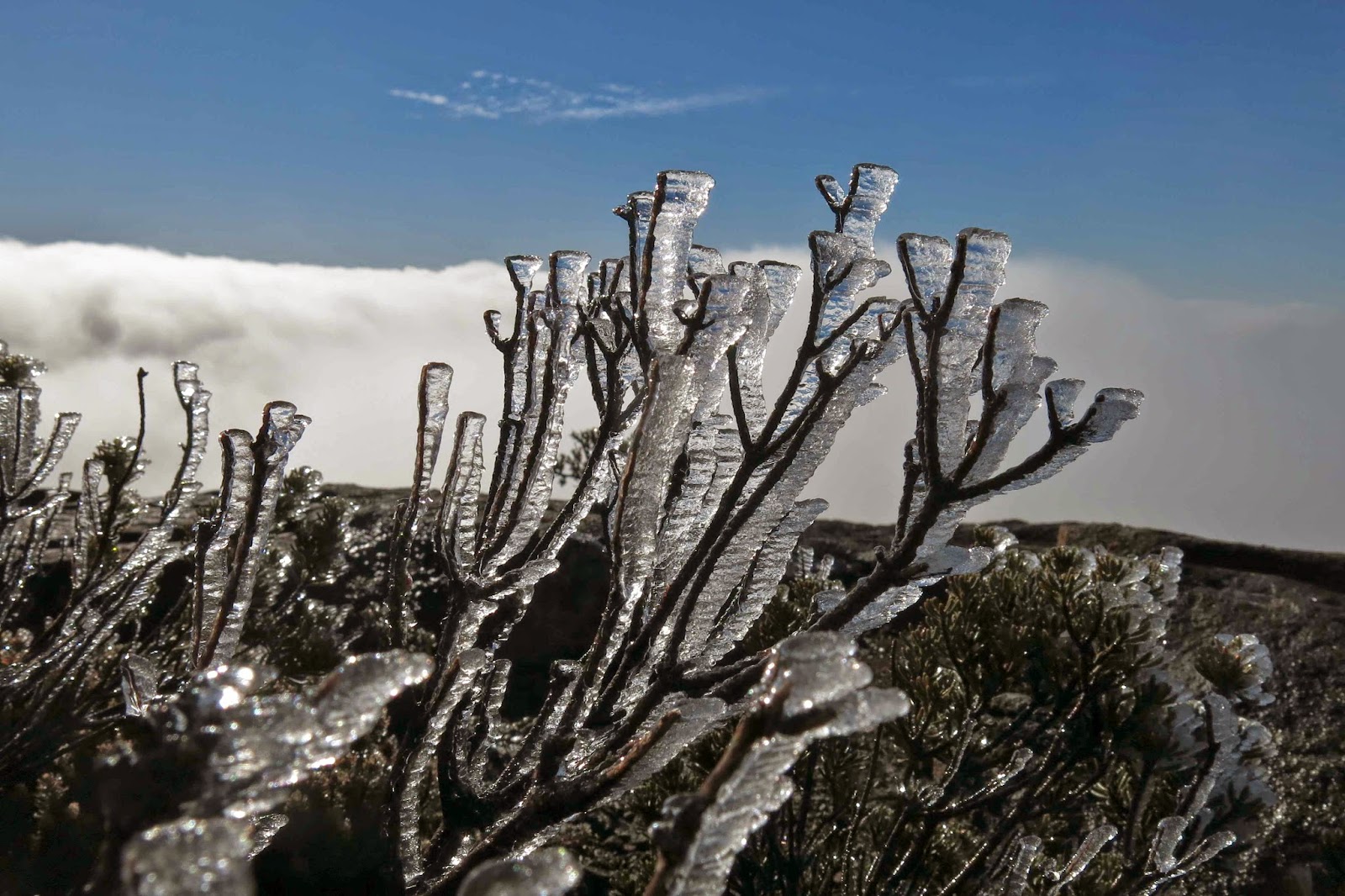
Mt Nicholas, March 2014


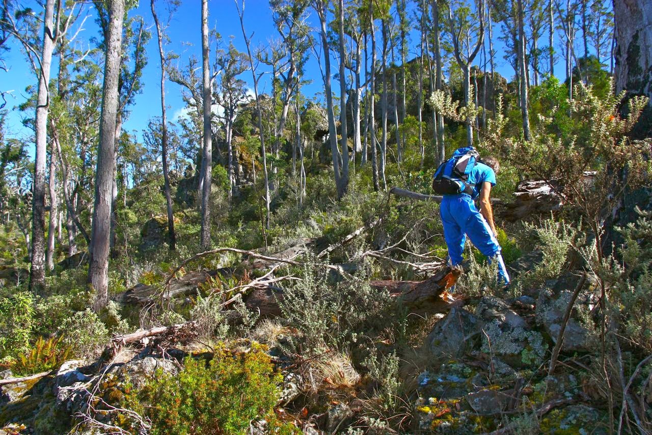
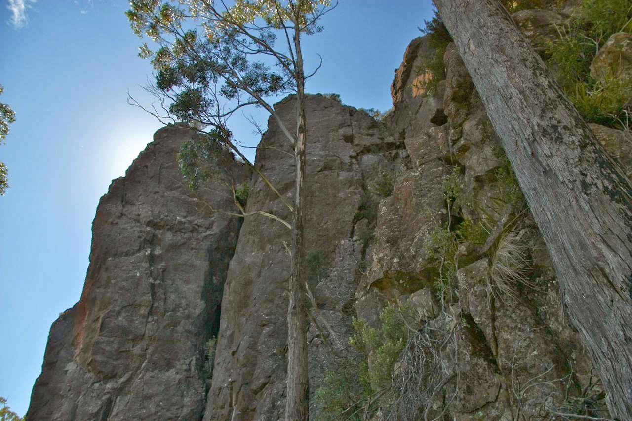
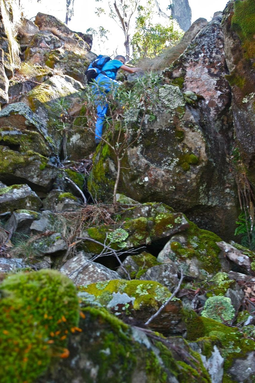
Bruce in action on the climb.
We have just had a marvellous day trying to climb Mt Nicholas – but failing.

One of the things I adore about the peak bagging list is that it entices us to try totally different mountains and explore new areas. My husband and I feel that the list serves as an inspiration or stimulus, rather than a compulsion to collect points (although I do love collecting them, but that is a side benefit and not the purpose). Our motto is: “Das Gehen ist das Ziel” (literally: the going is the purpose) and so, as long as we have had a grand adventure, which indeed was the case today, we have satisfied the purpose of the exercise. Summiting would have been nice, but is not necessary – or even sufficient, for that matter.
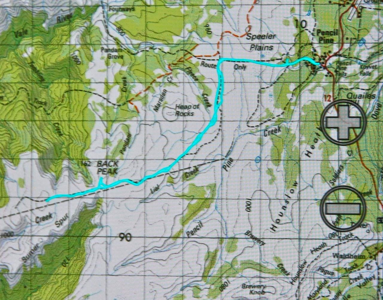
Off we set this morning after breakfast, assuring the dogs we’d be home for lunch (ridiculously, they nodded wisely, trusting us to keep our word). Hardly for the first time, we enjoyed the not-as-early-as-it-should-have-been light in the Fingal valley, and just before St Mary’s (about 10 kms before), turned off to the north on the Mt Nicholas Rd, stopping at the first intersection – which happened to have a nice-looking spur from the mountain coming down to meet it. As there was also a fire-trail kind of thing, we decided to follow it for a while, to see where it was leading, even though it was heading more east and on contour. We needed to correct at some time or other and head due north and climb to hit the ridge, but I didn’t see the timing as being crucial, and it was giving us a free lift east while it lasted. The minute it began a slight descent (10 mins), we thanked it for its help and departed northwards, over stony, progressively steepening ground that was fun to climb, sometimes involving all fours to get there. The steepness was something we weren’t quite expecting, even though we were greatly enjoying it. I was already ruing giving my boots a rest this weekend and choosing absurd, soft soled, slippery runners. I had underestimated the demands of this journey rather badly, but then, I had looked for, but failed to find, information, so didn’t feel guilty as such.
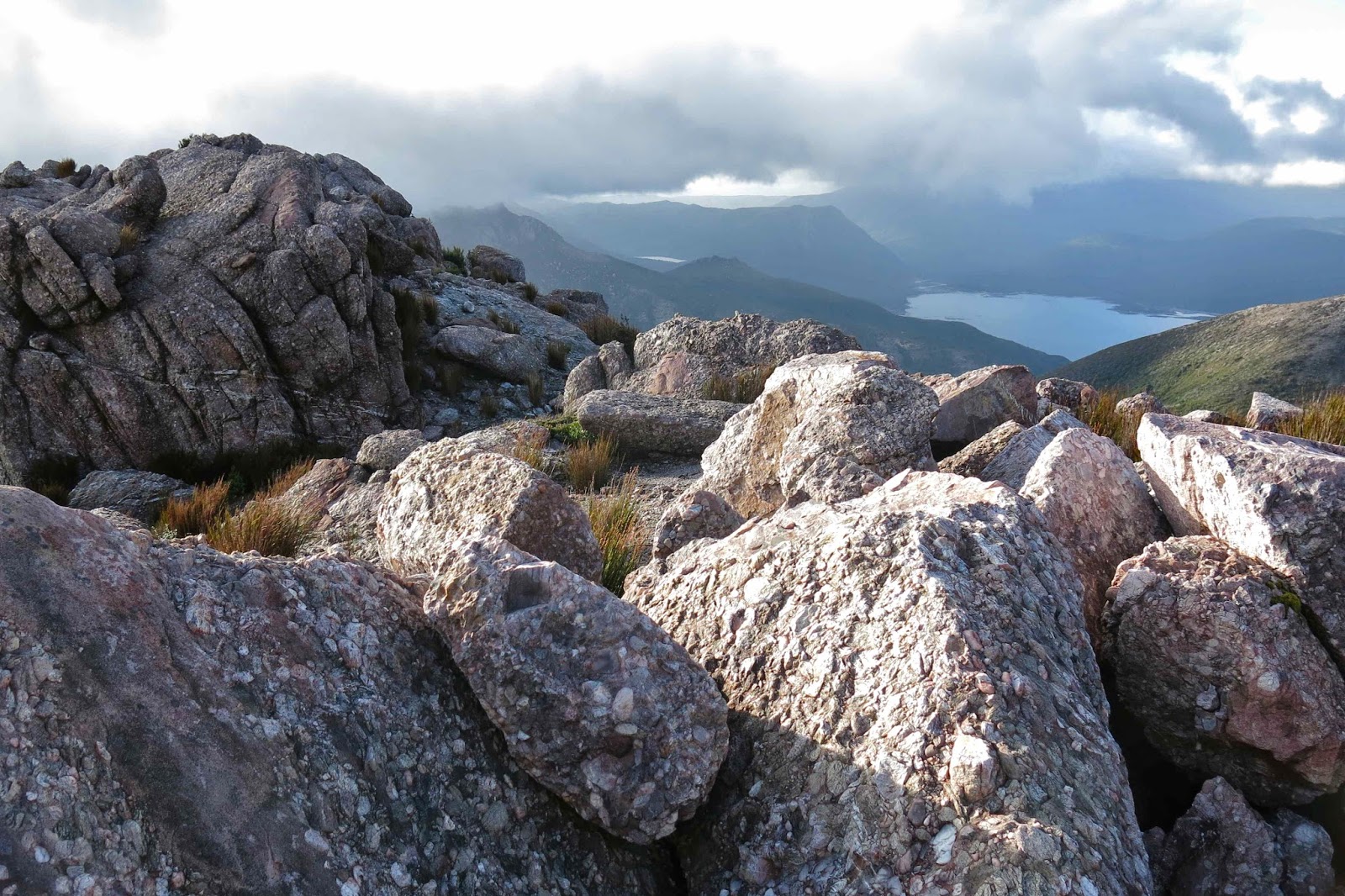
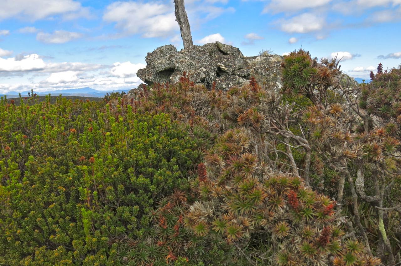
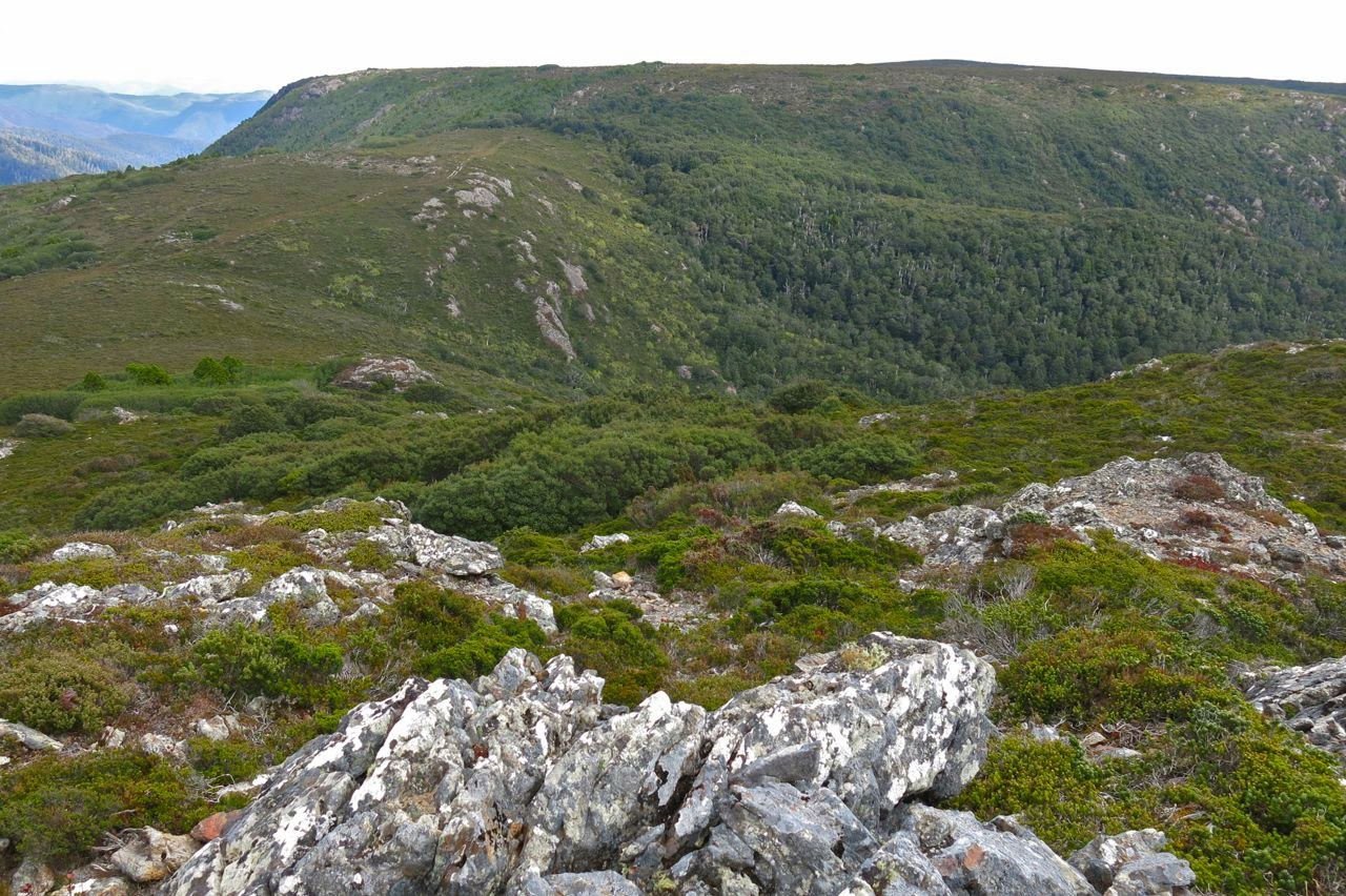
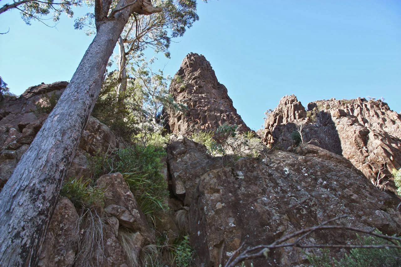
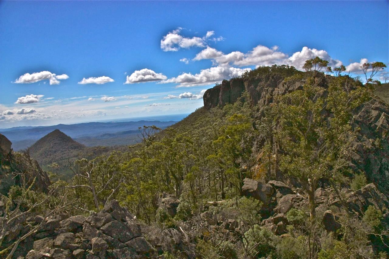
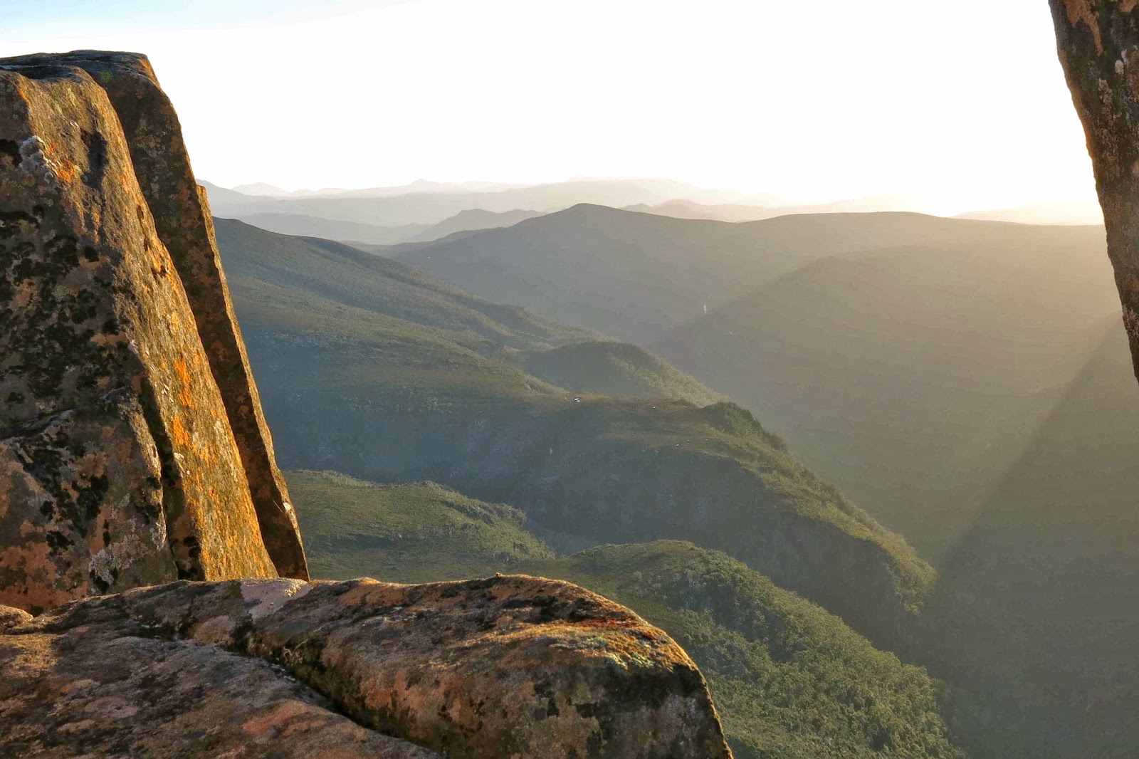
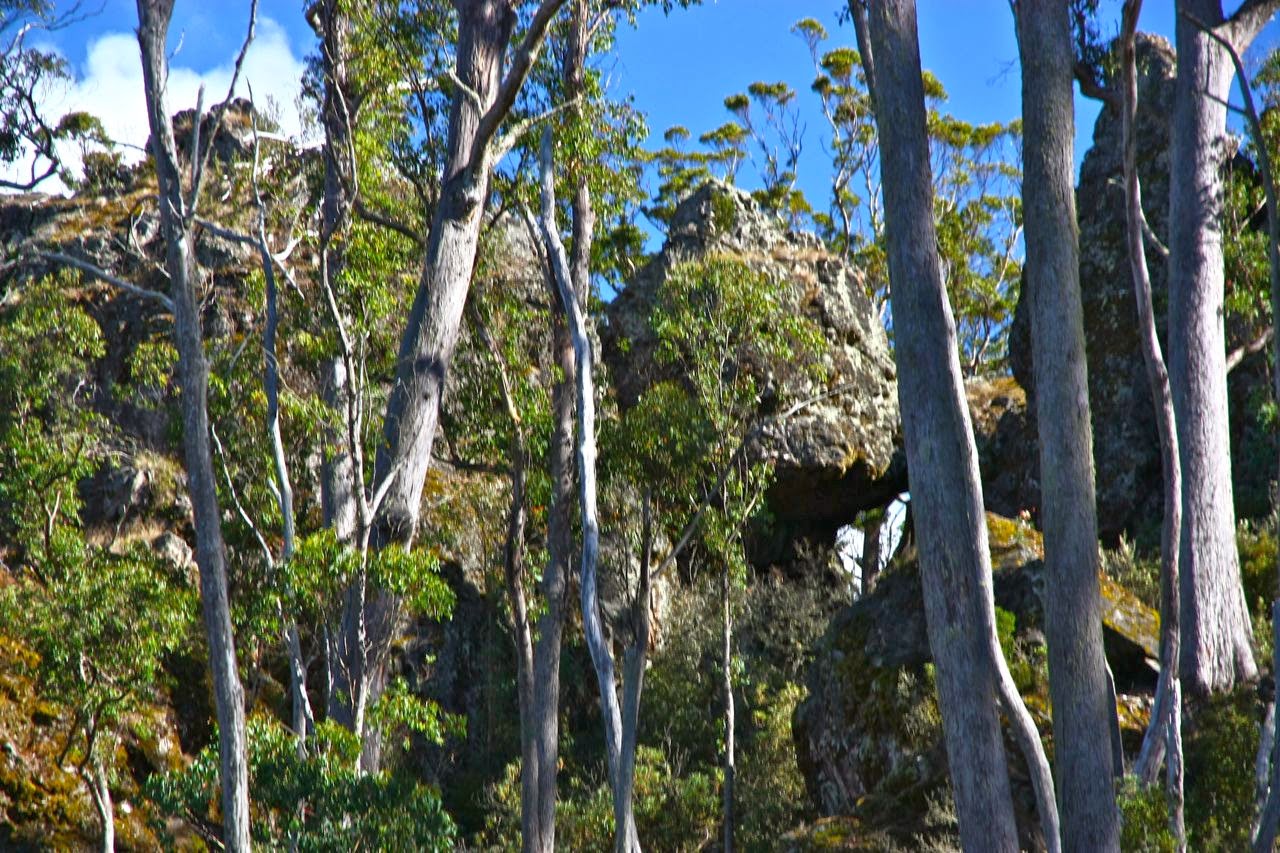
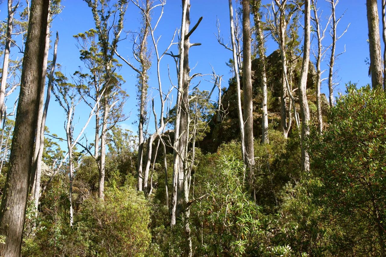
This lump is typical of the monsters that guard the ridgeline
The nearer we got to the ridge, the more it appeared crowded out with huge hulks of monsters standing guard over the actual summit. Giant, giant forms lurking, louring over those who dare trespass on the magic mountain. (I read Beowulf yesterday, a story set in 5th century Denmark. My mind is full of mead halls and giants, monsters, dragons and caves with dangers and loot, and something to be overcome or conquered. I am no strong viking giant called Beowulf, but I love that world of valour and honour, so let it baptise my imagination and play itself out a little today).
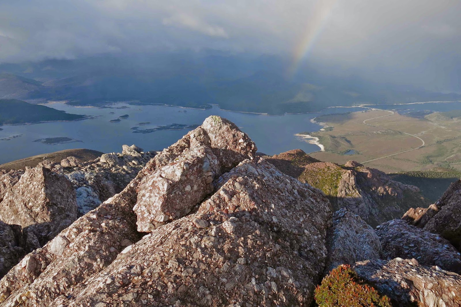
Fifteen minutes after leaving the track, we found ourselves on the ridge proper, and up ahead we saw the summit. Yes, this was going to be another quickie. Excitedly, I dashed ahead, enchanted once more by the thrill of the climb, and this was a good one. Tiny holds, but enough. Difficulty increased by having the sun directly in my eyes and a very strong, gusty wind blasting me, sometimes dangerously, considering my precarious hold and unsuitable shoes. How was my husband going? I couldn’t see in these conditions and would hunt for him at the top. Ta da. Summit. No, not summit. Not even nearly summit. Where was Bruce? Ah yes, excitedly climbing a different “summit”.

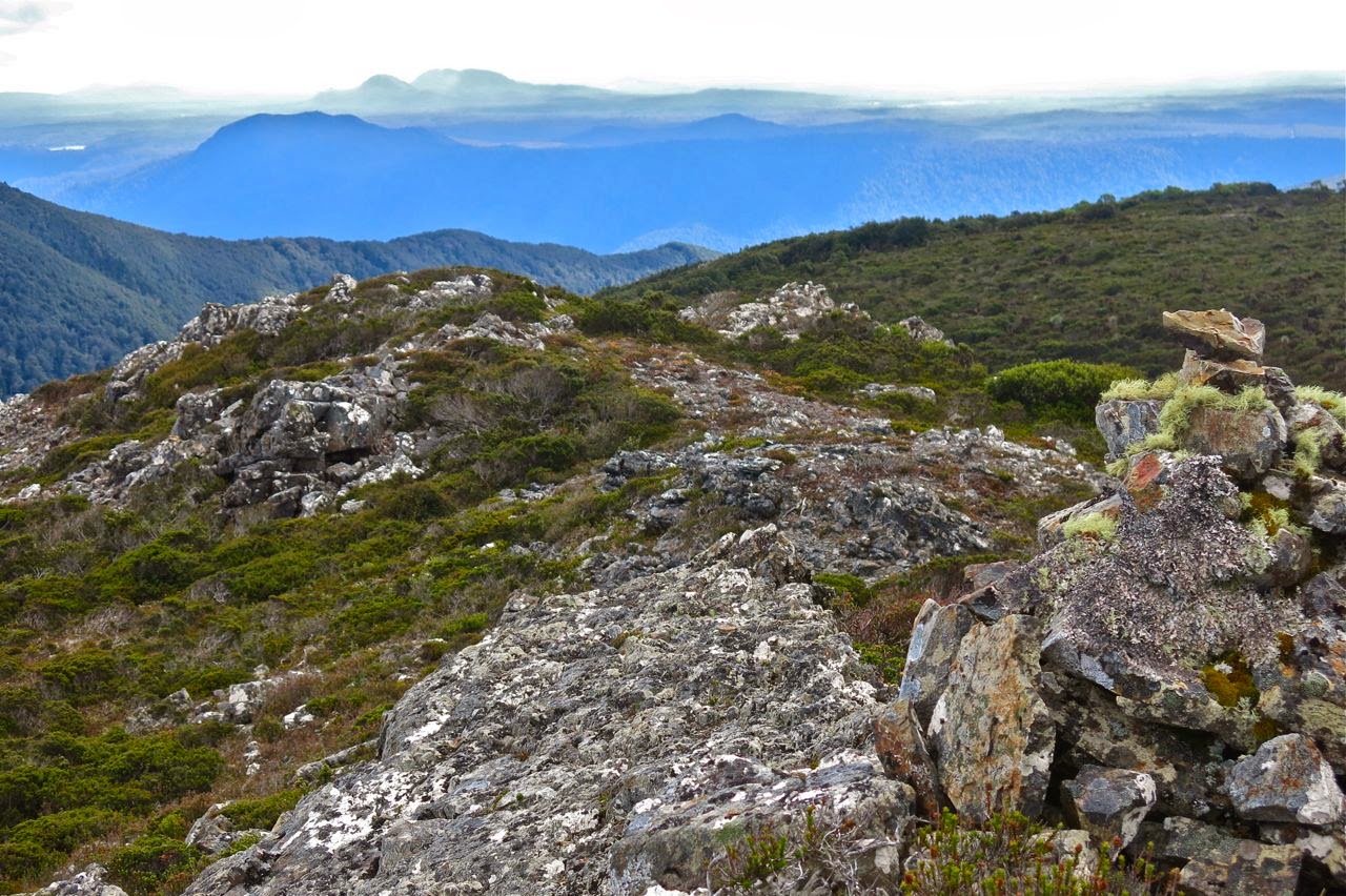
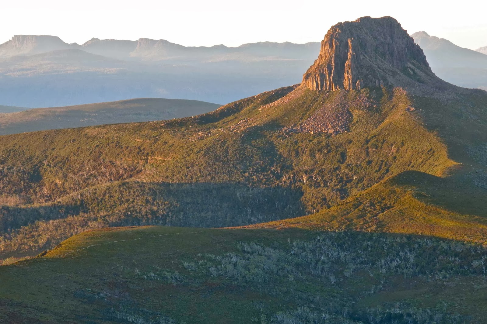
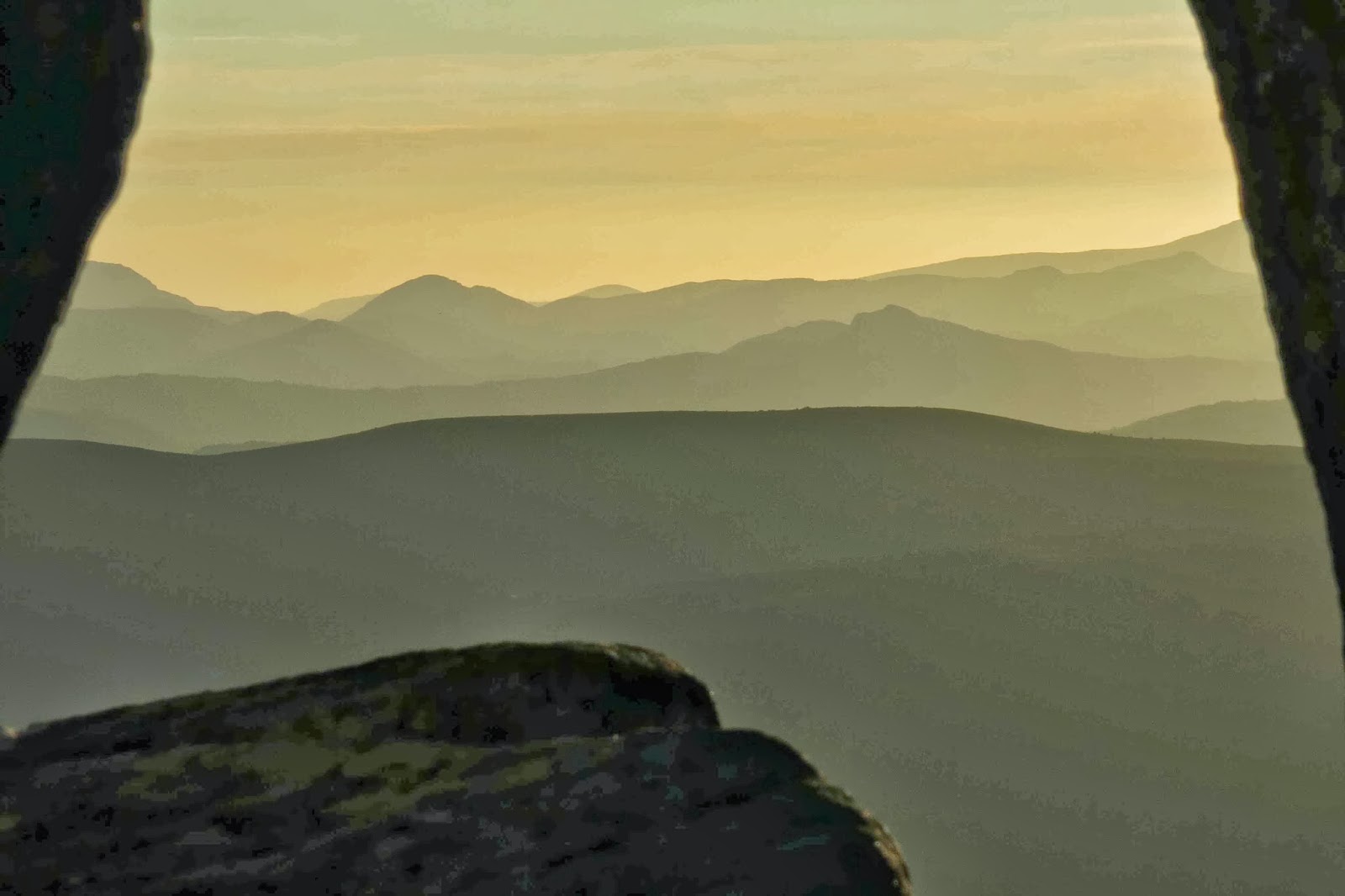
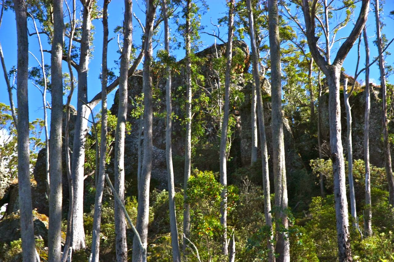
 Along the ridge line ahead of us lay a marvellous maze of rock towers, each one humpy bumpy and monstrously high. (Perhaps this area could be touted as Tasmania’s version of the Czech paradise, Adršpašské skály). The summit was on one of them, and was well protected by its friends. It was not a matter of gaining height and then going to the summit. You had to guess from below which one was going to be the tallest before you began your climb. If you were wrong, you landed in a dead end – or, no, better than that, on top of yet another false summit. We tried a few false summits, and several gullies that were going well until they ended in a cul de sac. We really loved doing what we were doing, and did not regret the absence of the actual summit trig. I did regret my shoes, and I sure wouldn’t have minded a bit of rope for security on some of the things I did.

We had been at the top of false summit number 1 and in the rough area of the summit after 30 mins. My watch said we had now been going 1 hr 15, and my gps said we were at the black dot of the summit. The trouble is, we were at the base of a cliff and were 40 meters in height lower than the summit. We tried several gullies, but I was not comfortable with Bruce going up any of them, and I did not want us separated. I could not see any way of doing it today. The only way would be to come back with boots, a bit of rope just in case, and a friend who doesn’t have Parkinson’s disease. We gave it our best shot and failed, but we sure had a fantastic day. On the way back we reclimbed one of the false summits to have a snack and take in the view before plummeting down the gully (luckily all watercourses were dry, even though mossy, or the going would have been even more challenging).

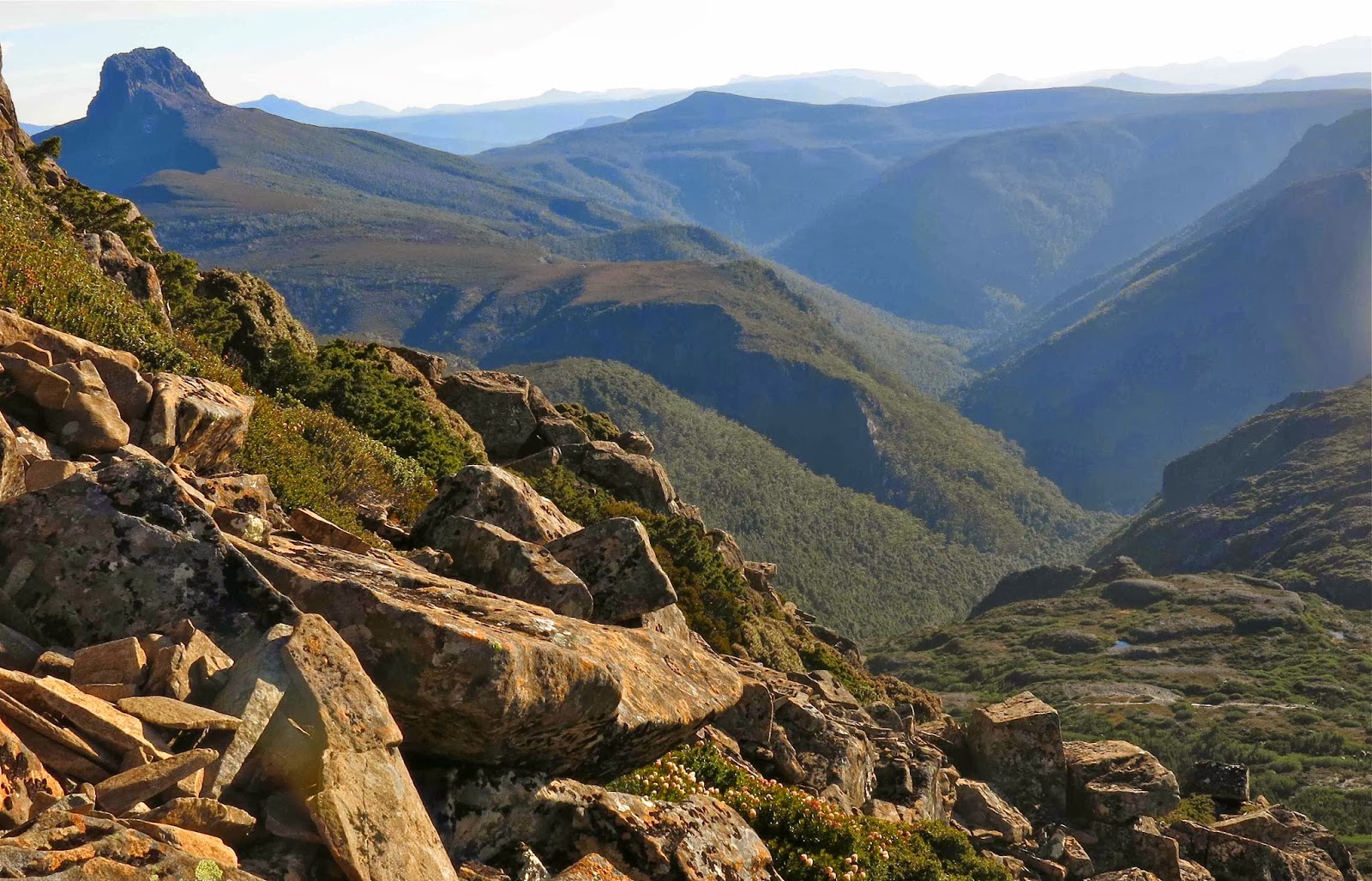
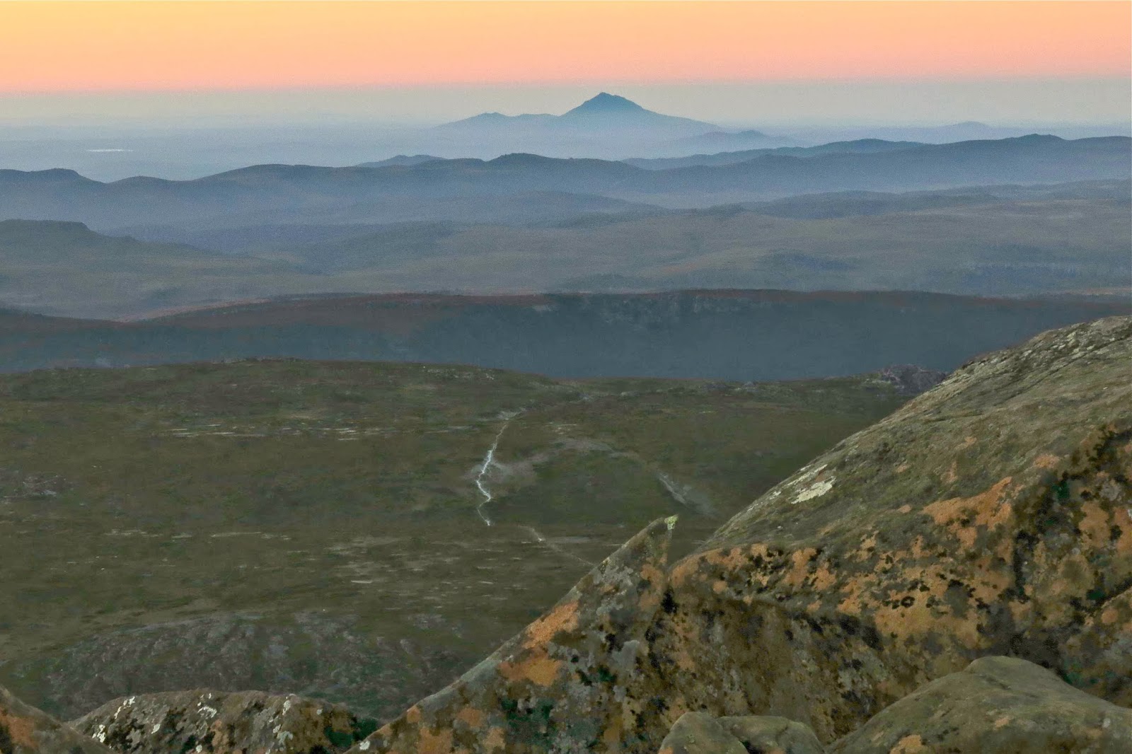
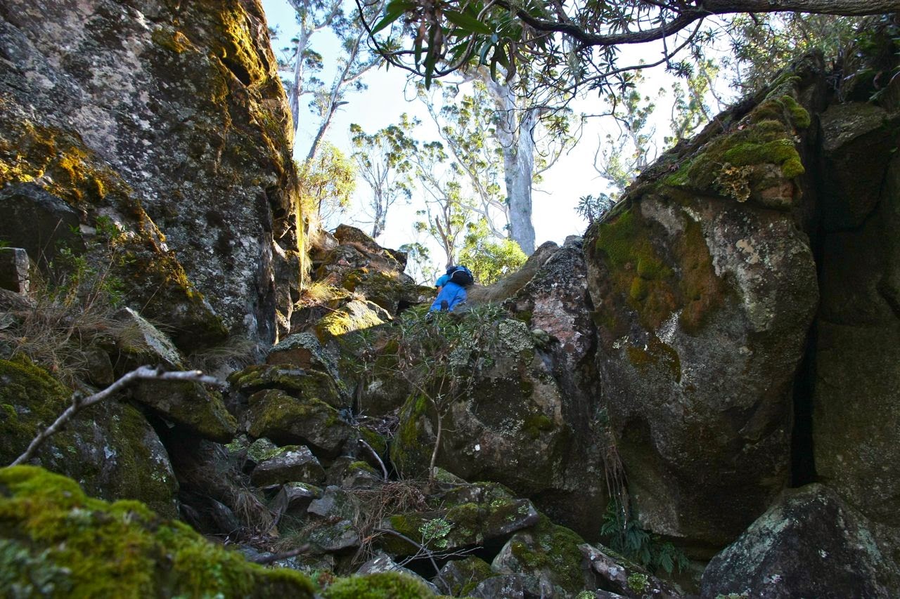
Our view from underneath. One of these MUST be the summit. 

We treated ourselves to a burger with the lot by detouring to Zep’s in Campbeltown (I really wanted one of those on Monday after the Western Arthurs, but we went through too late. This was my “make up” burger).

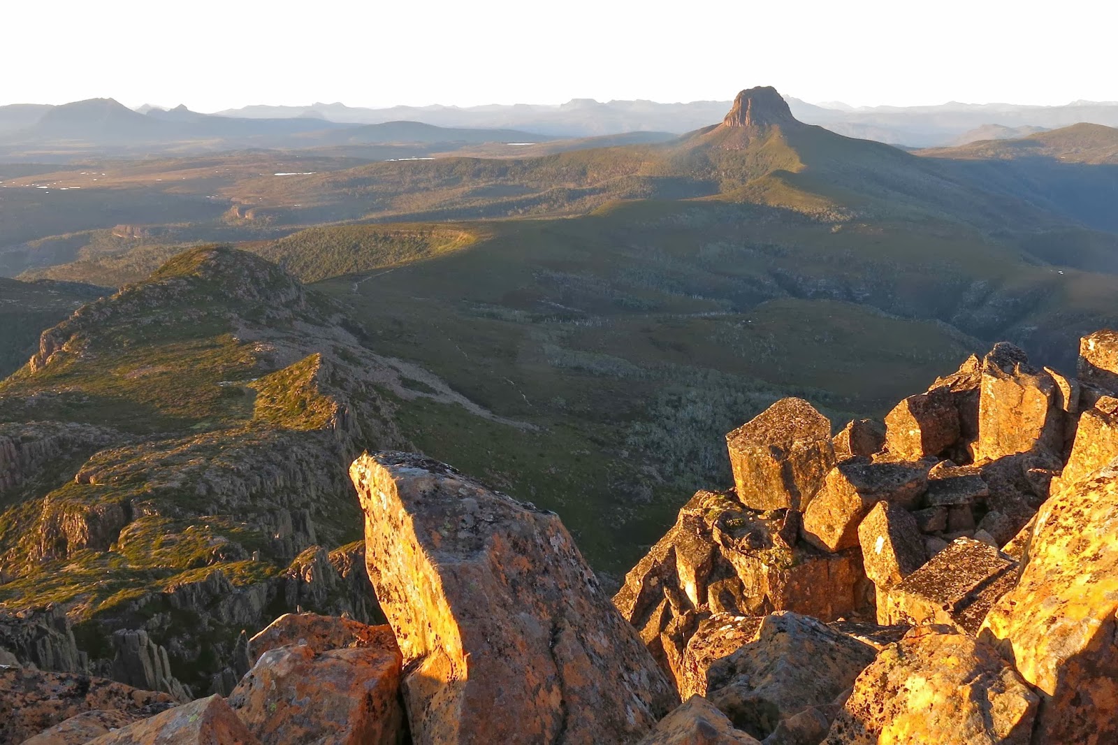
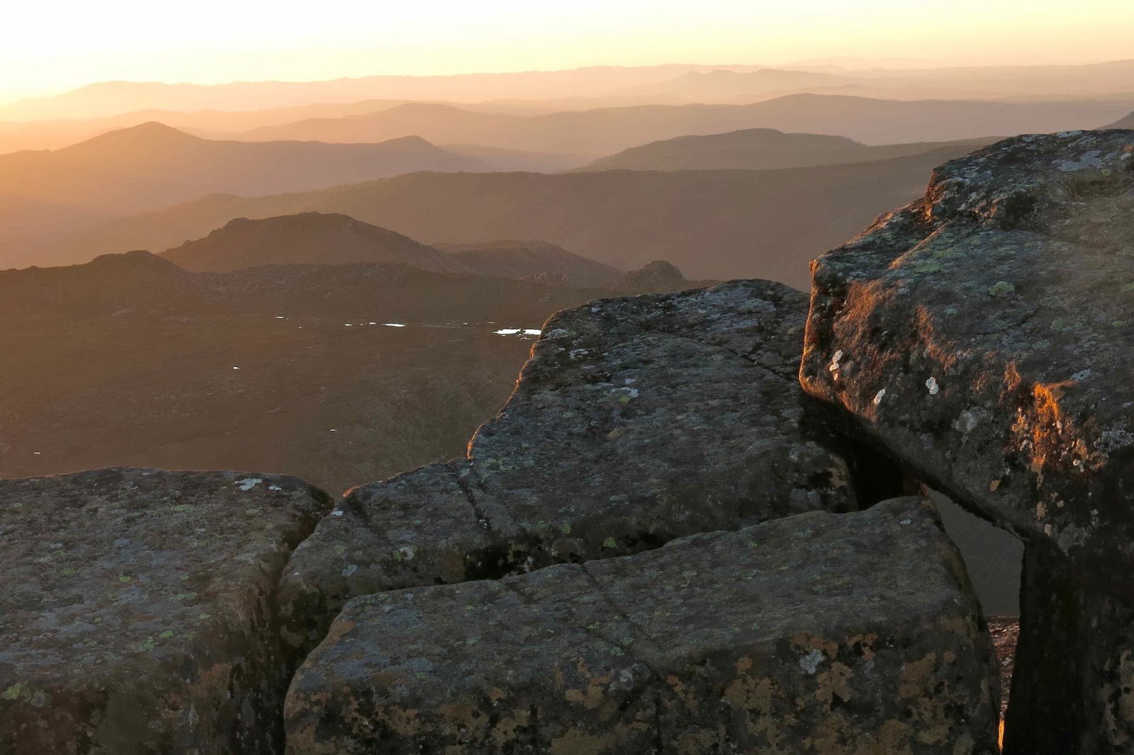
Then again, one of these could be it ….

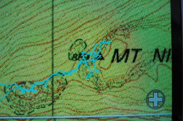
A screen shot of the gps record of our attempts on the summit. According to this we were there, but, alas, I cannot lie. We were very near yet a little too far. But you can see from the squiggles, we had fun.
What has kept this wonderful mountain off the radar for so long? It’s absolutely brilliant, with or without your summit points. I will be back to conquer it later.

(I did touch the parts of a trig, but it was one some angry giant had hurled to the valley below in his wrath.)
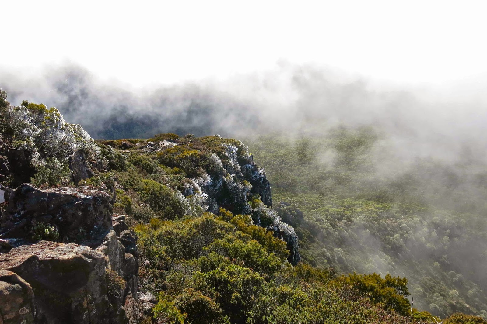
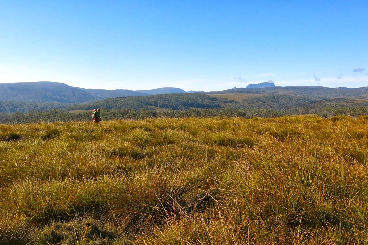
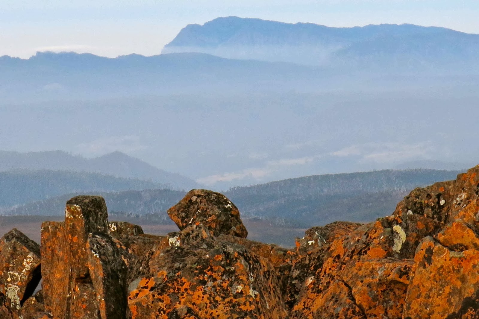
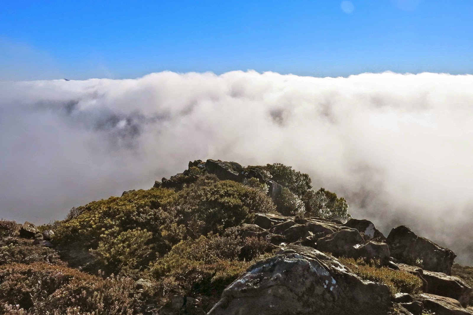
Cradle Mountain 2014 Feb. Sleeping on.

Sleeping on Cradle

Barn Bluff and the Du Cane Range in evening light
I have been planning to sleep on Cradle Mt for a very long time – so much so that I’d even bought a second little solo tent for the expedition. My plan was that I would go with my husband as far as Kitchen hut, and that we would then have to separate, because there’s no way that a man with Parkinson’s disease could get up that rocky jumble with a heavy overnight pack and lots of water needed for eating at the top. I’d watched too many tourists without packs struggling with the slopes to imagine that he could conquer them weighed down with overnight gear. I had no qualms for myself, as the one point where i had had to summon a special oomph push to get up a rock that was a bit too big for me (after the saddle) I thought I could evade. Otherwise, I’d push my pack up the slope ahead of me and do that single effort packless. I hoped I could get around it by climbing to the right. Time would tell.
Fury Gorge
My husband, however, had other thoughts on this matter, and told me he reckoned he could do it. I believed him. Saturday was to be the day. Sunday was going to be much too hot for climbing anything, so I suggested leaving Launceston mid-afternoon Saturday, climbing after five, sleeping at the top and coming straight home after breakfast, before the day got uncomfortably hot. It was a deal. 
Because it was latish when we arrived at the park, there was no trouble getting through the boom gates and right in to Dove Lake. We were ready to roll in mountains already emptied of the madding crowds. 
As I feared, water was low. I’ve never seen it so dry up there, actually; every tarn was empty, every stream but one, dry. We drank at the one stream and filled our bottles up, taking 3.2 litres for two, which turned out to be more than we needed, but better more than not enough. Perhaps the climb would be thirsty work. We tipped some out before descending next morning. 


Rock curtains unveiling a scene of beauty
So much for my misgivings about my husband’s ability to cope. I was the one who had to take her pack off to do some manoeuvres – three times on the way up and twice coming down. I think this was partly because when my pack is on, I stare too much downwards rather than outwards, so failed to choose the kind of routes that I choose when unencumbered. My taller husband passed my pack up to me, and then did the same trick with no help at all. I hadn’t even noticed that these potential problems existed when prancing around packless, but it’s surprising the difference a weight like that makes to a climb.
 
Celmisia saxifraga providing extra colour on top 
I love the way that Cradle, like so many of Tassie’s peaks, hides its summit until the last second. You climb and climb (having huge fun while you’re at it) with your face into the rock. If you do stop to look around (which I am loath to do, as I love climbing too much, but I do stop to make sure my husband is fine somewhere down there) then you only see at best a partial view. Mostly you see shapely and colourful rocks, which are marvellous in their own right, but the view itself remains hidden. Up you go, wondering exactly where the summit is, and suddenly you’re there, and the whole world of view opens magically out before you. When you’ve climbed in the evening light, this opening of the curtains to a land of wonder is all the more special. 
 
We didn’t just have that glorious mountain to ourselves: it felt as if we had the whole world. Everything felt especially spacious and grand as we perched ourselves on a rock and gazed out to an infinitude of mountains, most of which are now old friends. 


Somehow or other we took our eyes off the scenery long enough to pitch our tent between rocks and cook dinner, but mostly we just sat and watched nature’s performance.
Valentine’s Peak rising out of the mist 
There is really not much in life that beats sleeping on the summit of a mountain. I just never become inured to the pleasure of being up high at the close and opening of a day, of dining on high as the sky changes colour and the stars come out and the mountains become a series of mystical silhouettes enhanced with the warm colours of the setting sun. 
Dawn. Mt Arthur can be seen swimming above the low mist centre back. Western Bluff is nearer, and to the right. 

Later, as dark advanced and the stars made their appearances and the last pink of the sky faded, we sang together, as is our habit on mountains.

Dawn arrives at Mt Roland

The cliffs that were around us offered nasty plunges to the valley way below, offering certain death to anyone accidentally stepping over an edge. My husband was on strict instructions not to go out of reach of the tent if he needed to get up during the night. We both got up around 3 a.m., actually. It was a moonless night and the stars were particularly wonderful. For me, seeing the stars in the middle of the night is one of the many pleasures of tenting.

The same gazing in wonder procedure was on the programme from 5.45 next morning to watch the day begin, and then it was time for breakfast, descent, and a swim in the lake for my husband.