Gould, Minotaur, Guardians 2013 Mar

Mt Gould, Minotaur and The Guardians  9-11 March 2013

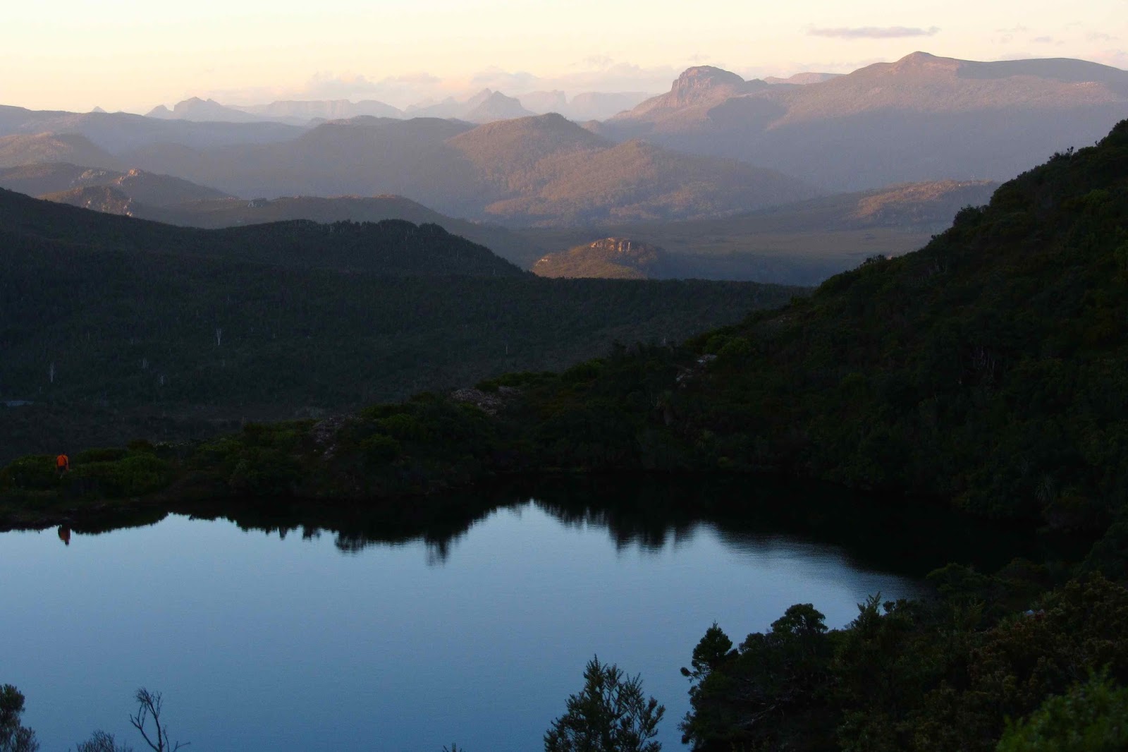
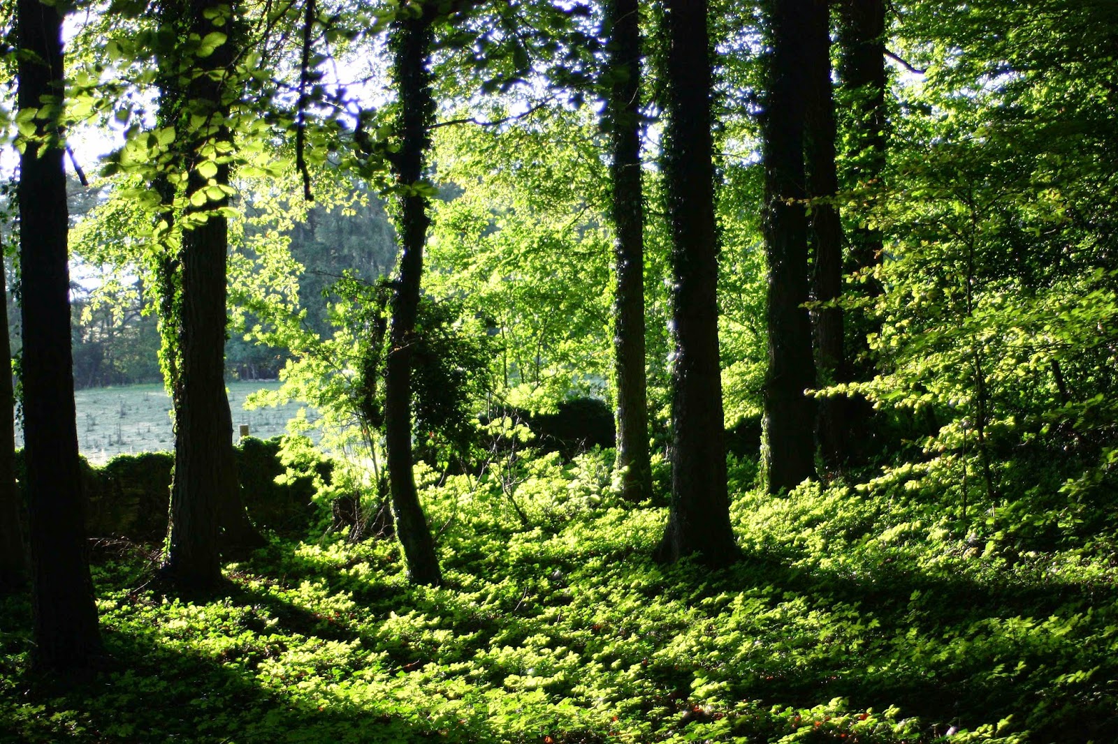
Gould as seen form the Labyrinth
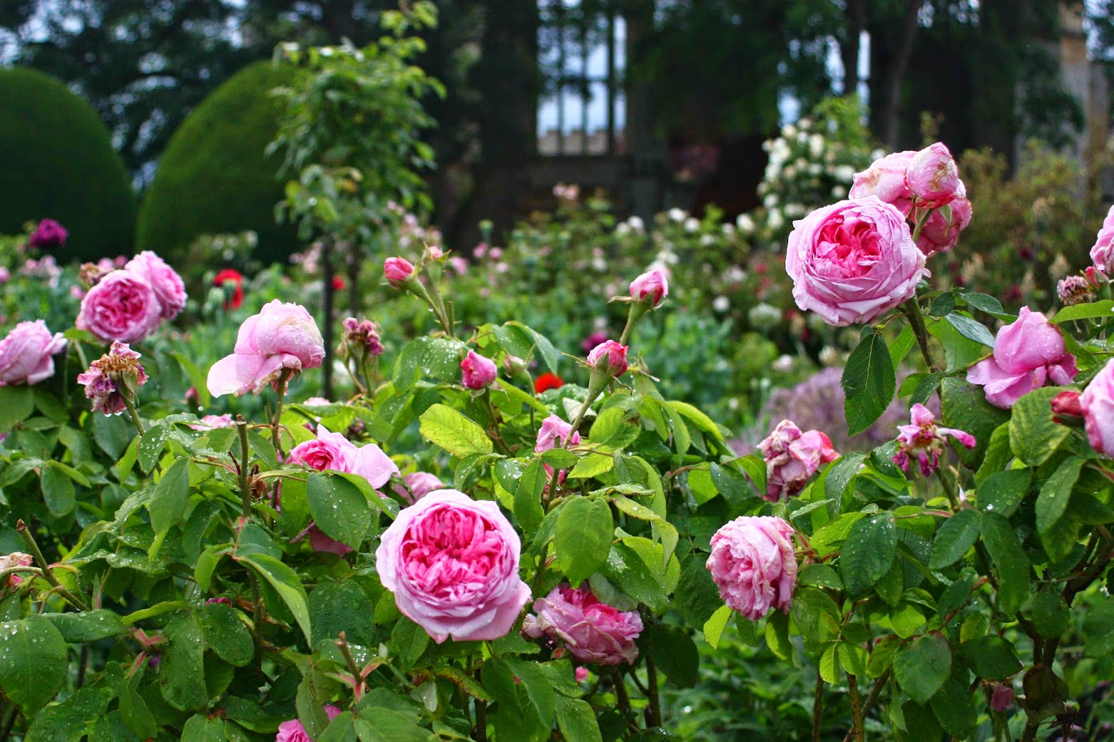
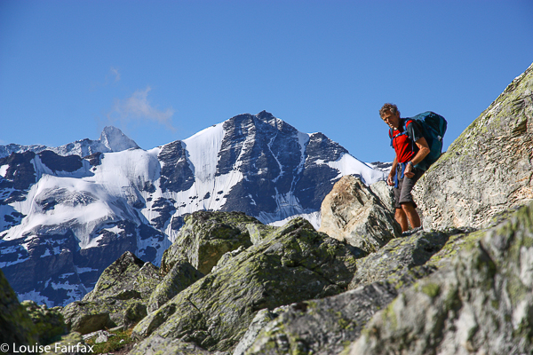
This was a trip with many highs and lows, but a definite high point, in both senses of the word, was summitting Mt Gould on the first day. This is a mountain I have long admired for its shapely triangulated peak, distinctive from many vantage points. It is the subject of many of my photos, but I had never been onto its bulk. I adored the view from the top, and stayed there a while, soaking it all in.

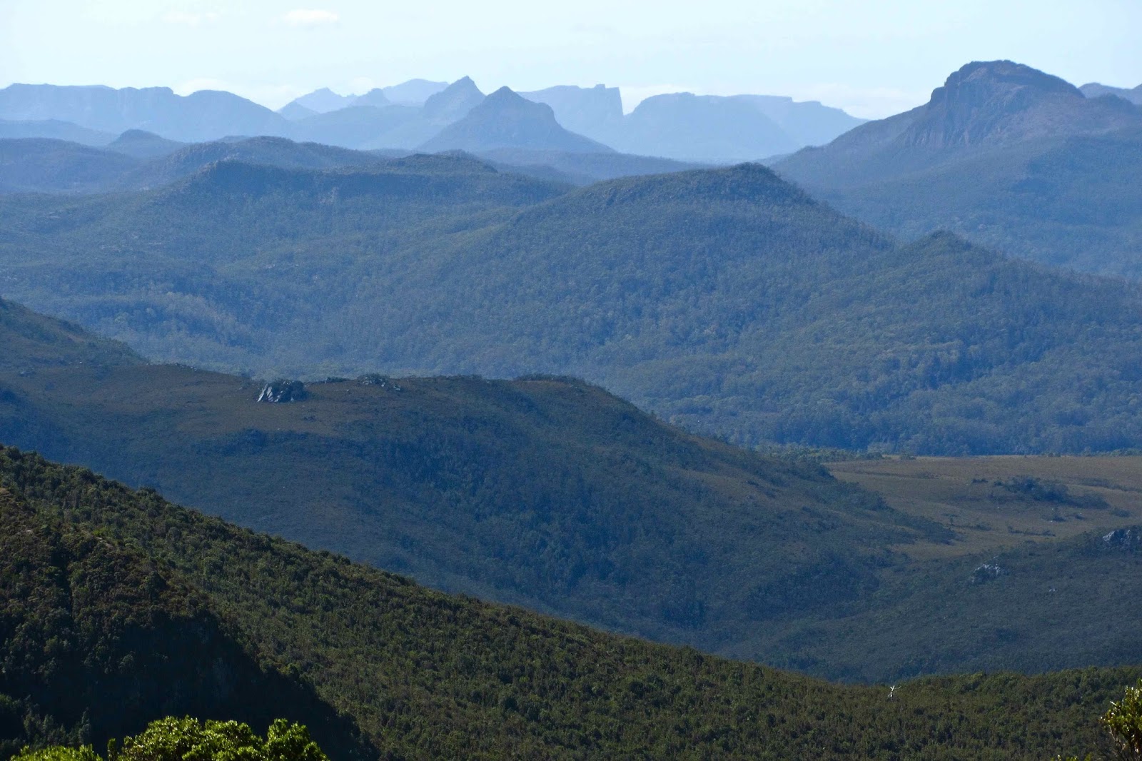
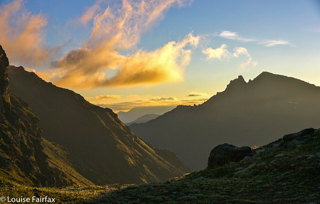
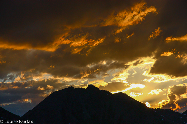
From Gould summit, looking towards Minotaur, Parthenon, Acropolis, Geryon At the end of the day, a campsite was chosen near the summit of the Minotaur. Sunset and sunrise yielded photos that were pretty nice, although not perfect. There were a few too many clouds for the sky to go pink, or rocks to go red as they sometimes do. The silhouettes were nonetheless grand, and we enjoyed eating and watching evening close in around us.


From Gould summit.
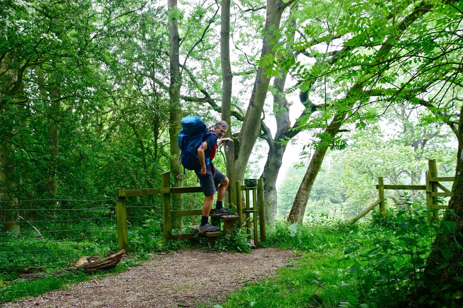
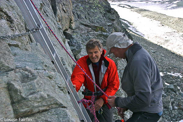
Day 2. The next day promised to be very hot, even though the clouds were building up, and it kept its promise. Sweat poured down our faces as we climbed The Guardians with their magnificent panorama. We were tiny ants on gargantuan cliffs dropping perilously several hundred metres to Lake Marion below.

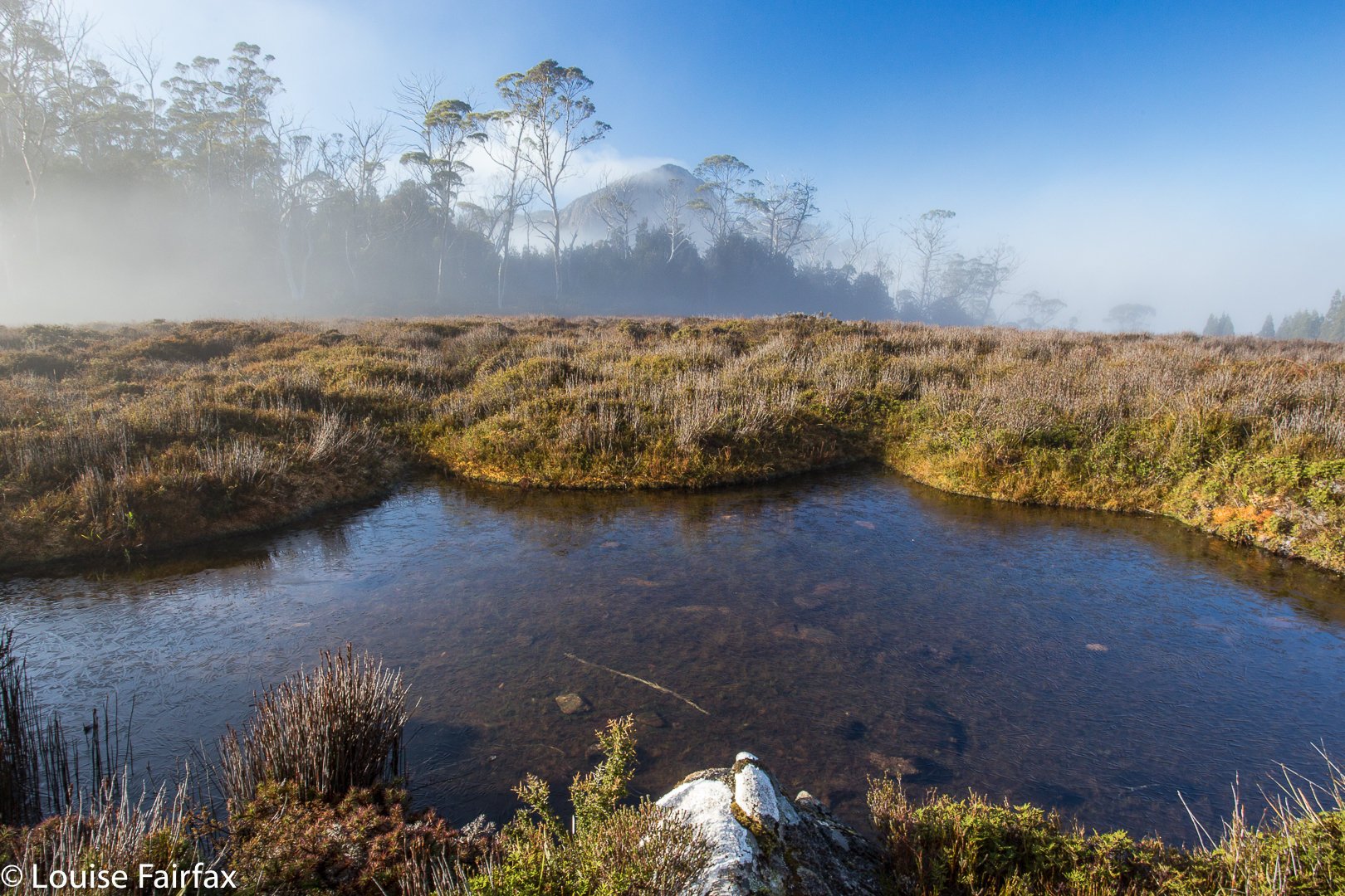
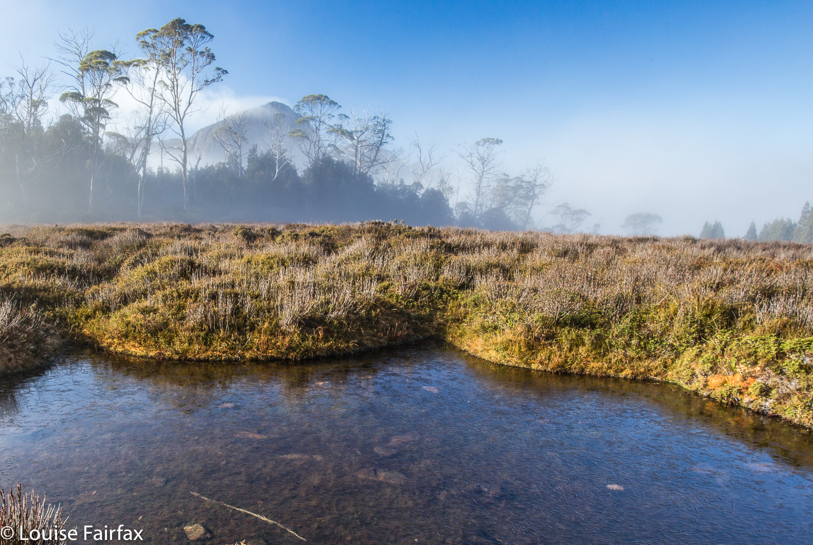
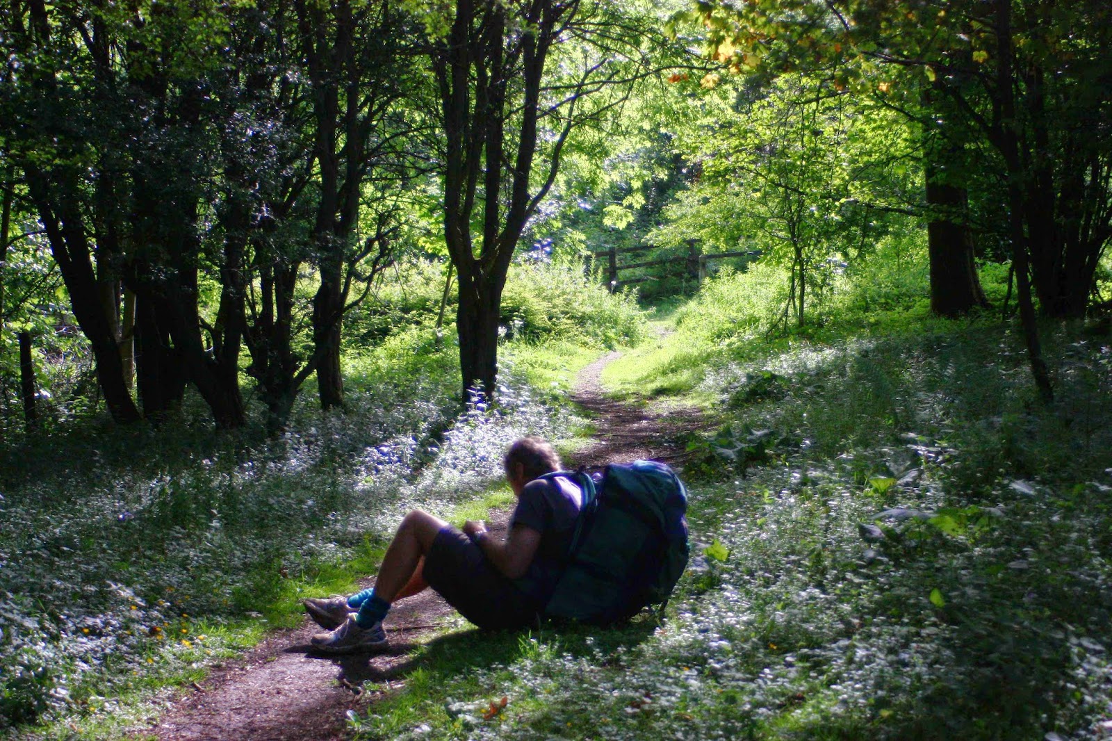
 Photo from the Gould-Minotaur saddle
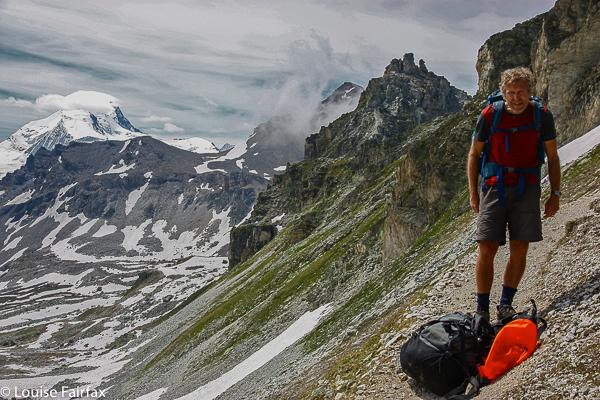
All around us were famous mountains, many of which we’d climbed, but were now seen from a new angle. It would be lovely to camp by the tarn rather than see the glory in the midday glare, but one can’t do everything, and Gould had won out this time. Everyone stripped off and had a swim. Some swims lasted longer than others. Being a wuss, mine was a stripped-down body wash, but I enjoyed having the cool water on my skin. It was just a bit too cold for me to dive in.

View of the campsite under Minotaur
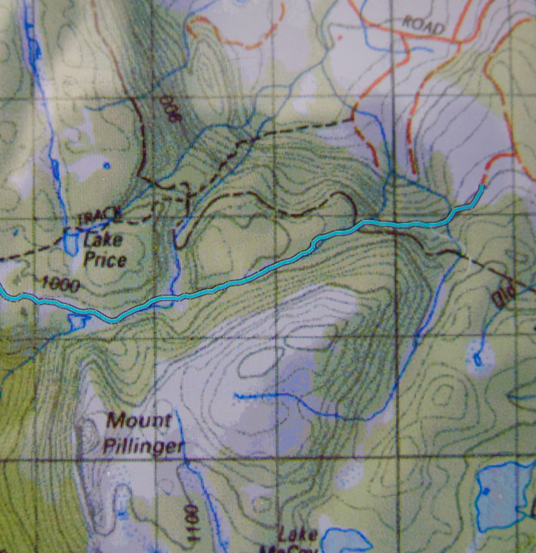
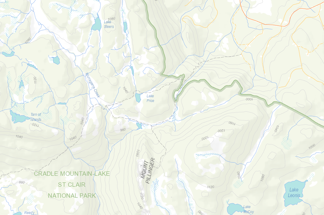
We were back at our tents in time for an early lunch, and were soon off, over the summit of the Minotaur (marvellous views again, but these were not new to me, as I had been up when we first got there, and again at dawn), down to the saddle between it and the Parthenon, and thus into the Labyrinth.
 
Dawn from the flanks of the Minotaur, looking at Gould and Lake St Clair

On we went to Lake Eurynome, via a detour. Just as we arrived, the heavens opened with a bang. Gone was our much-desired swim. I didn’t know droplets of water could be so big and heavy. They were truly amazing, and I admired them while I tried to mix efficiency with speed in erecting our tent, trying to be calm but fast.

Bushwalker on Minotaur enjoys sunrise
There wasn’t much time for choosing, and not much space either, so most of us camped in a kind of yobs’ ghetto on top of each other, ropes overlapping, in a little flattish spot further along the shore from the leader’s spot (room for one tent only). We all pitched with a future view of lake and mountains in mind. As the storm continued, we disappeared one by one into our hastily erected cocoons to wait out the worst of it.
Climbing the Guardians, looking towards Geryon and Acropolis
What does one do in a situation like this? Somehow, one feels too antsy to read. What we always do when forced to wait impatiently for something (like the end of a storm) is sing. We sang all the tunes we know where we can harmonise together. Then we went through our repertoire of rounds and canons. Still the storm raged. Next I moved onto English folksongs to be sung in unison, and traversed from there to Gaelic tunes, German folk, through student drinking songs and on to old campfire tunes like “Michael row the boat ashore” and “Kumbaya”.
Tarn on the Guardians

The storm furied still. Thunder and lightning were separated by only a second at one point. (I grabbed Bruce, probably bruising him, as it crashed above us). Somewhere in all of that I did check on the state of play out the tent window, and I did notice at that time that a river was forming and running beneath the midpoint of our tent, but in such a storm, what could one do? Bruce in the background suggested I start bailing, so I got a pot and bailed and bailed but the river kept flowing, and I got tired, so gave up. We’d see what was what when the lightning stopped. The rain continued to plummet down.

View from Minotaur campsite
 After Kumbaya, and possibly because I was running out of songs in the next category, although we hadn’t begun on tunes from musicals yet, I decided to check on the view out the tent opening again and see how things were faring in our vestibule. I unzipped. My squeal was heard wide and far, although misinterpreted. C thought it was a squeal of terror, but actually it was one of surprise and a loud noise made in response to an absolutely hilarious situation.

Lake Marion from above (Lake St Clair in background)
Unbeknown to me, the others had all been sitting there watching the water rising, but felt immobilised by the deluge, and thought that if we were singing, then it must be OK. But we were singing because we didn’t know what was happening. I now saw that we were entirely surrounded by lake. We were a little Tent Island in the middle of the lake that had risen up 30 cms and swallowed us, and so were our friends. Luckily, unlike the victims of the floods in QLD etc, we could pick up our houses and move them whilst the waters rose into our bedrooms.
Tent Island, Lake Eurynome

 The storm had not stopped, but the lightning had eased and the thunder was less booming as I left our tent and began moving it to higher ground – of which, actually, there was none. That is, there was higher ground, but it was covered in sharp bushes. We tried to find enough bush-free area to make a bit of a go of it. I left Bruce to try to put pegs in the tent in the new spot and went off to help C who had no one to help her. First, I helped ferry her remaining dry gear into the dry spot enabled by our re-erected tent (thanks to B), and then C and I dug elbow deep in the water to retrieve her pegs, pull them out, and then four of us – C, B, Mike and I – picked up her tent and went wandering with it, in search of free space. I found her a tiny bit, but it had a stone in the middle. It was a choice between a stone and prickly scrub, so she chose stone.

Tent Island, Lake Eurynome 
Then it was back to help Mike, who was busy trying to bail massive quantities of water out of his tent … and then off to our own, where I also had a considerable bailing job to do. Somehow the process of moving had allowed water to enter (hardly surprising). At least all our gear – and most importantly, clothes and sleeping bags – were dry, so we were in a good position. Mike kept bailing, now helped by Rolfe, who had successfully moved. Mike was finished with bucketing, and was now ready to try the next stage, in which he used Rolfe’s towel to soak up water, passed it outside where Rolfe rang it out, and received it back inside to have another round of the same.
While I did the last of the above process on our tent, Bruce got the stove going on a rock, and boiled water both for our dinner, and for Mike, so that once he finished bailing he could get some warm food before the light completely went.
The next day, considering one thing and another, was fairly humdrum, almost boring. We didn’t get lost; we climbed no mountains; we made the ferry and we got home. And, believe it or not, I guess I’m just a weirdo, I enjoyed the walk immensely. Not only have I climbed several new peaks with brilliant views, not only has Bruce done an amazing job of traversing quite a wild part of Tasmania, but we have experienced a huge adventure, and one that we’ll laugh about together for years to come.


Loddon Range 2013 Feb

Loddon Range: Loddon Bluff, Ronald Cross and Church Peak  23-4 Feb, 2013

The Loddon Range that we were to climb, as seen from the highway.
One of the advantages of being in a club is that you get to go to places that you would not have gone to if someone hadn’t indirectly (by putting the name on the programme) said: “Come here with me”. I read the name “Loddon Bluff”. I hadn’t been there, so signed up for the two day expedition that would see us climb every highpoint on the Loddon Range over two days.

The bush was thick. Very, very thick. The distances we covered were hilariously minimal given the time we took to do it, but with impenetrable walls of well-armed scrub, that’s what happens. I’m delighted to have done it.

We began with a descent – very short – a creek crossing, and then a long climb up onto the ridge. The going was not too bad in the rainforest, but awesomely shocking once we emerged from it, and from there to the top of the first of the peaks on the range (Ronald Cross). From that point on, however, the scrub – still thick – did not do as much damage to our progress (which was now ‘slow’ rather than ‘armoured fight’ stuff), and the views became extensive and impressive.
We could see Frenchmans Cap just across the Loddon valley below, had a new view of Slatters Peak, Diamond Peak, Mt Anne and more.
 It was fabulous being up so high with the world stretched out below. Most of us followed the ridge line over each high point until we were directly above Needle Tarn, which we dropped down to once we’d regrouped. Two took a shortcut – less scenic, but also, of course, less fighting – as one of them was suffering a bit from heat exhaustion. We all met at the tarn where almost everyone (not this wuss) went for a dip.

Needle Tarn in the evening.
The evening light after dinner was wonderful. I went off and climbed a bit around the place, sometimes photographing, sometimes just sitting on something and singing, enjoying the atmosphere. The others had retired so I had the known (or visible) world to myself.

Here is the evening light on Mt Gell 

Mt  Gell a bit earlier in the day
Here was our view back to the Acropolis, Geryon, Byron and more.
The grand Mt Anne was a pimple on the horizon, but a lovely one.
 The next day we got a very early start (in which I discovered, or rather re-discovered, that I am a slow eater).  This was good, as the day was a very hot one, and we went about twelve hours without water (other than what we carried). At least we got in some work before the sun began attacking. It wasn’t far to go to get to the end of the range, but it took a very long time thanks to the rugged nature of the various lumps and bumps. We climbed Church Peak and Loddon Bluff before turning around. Already by about ten o’clock, we were hot and bothered. We dropped down to a tarn, but it was merely a mud slosh, and utterly uninviting as a source of drinking water. The leader didn’t want to drop four contours to return to our overnight tarn, so we stayed high. I hid behind small bushes in the breaks to keep the sun away. We all husbanded our water very carefully – except one person who drank his supply early and then wanted to “borrow”.
The route yet to be undertaken, stretched out towards the bluff
The others approaching the Bluff itself, endpoint of this excursion


Looking back along our travels
Despite needing to guard our water and hide from the worst of the sun, the trip was wonderful. How lucky we were to have two days so clear and views so grand. We fought the scrub some more until we at last reached the respite of the rainforest below the other end of the ridge. We all enjoyed the refreshing creek at the bottom, of course, trying not to drink it completely dry.

Pillinger 2012 Nov

Mt Pillinger    5 Nov 2012

Mt Pillinger peeping shyly from mist. Photo from a later trip.
I am reworking my old posts, and see that this original one on Mt Pillinger told you nothing.  So. I must go on memory, which has it that we went in on a nameless track that I duly dubbed the “Mt Pillinger Track”, which  came off Maggs Spur 17.2, which is to the south of the Arm River Track (2 tracks earlier than its better known friend. See map below). It does not climb nearly as much as the Arm River one does, and deposits you closer to this goal. That said, I cannot vouch that, after the floods of two winters ago, it is still drivable. If not, use the Arm River Track, and just take a bit longer. If anyone has more recent information on the state of this approach road, I would love to hear.


We followed this track (which eventually joins the Arm River one – again, see map below) until we were at the base of Pillinger (to its north). When the big gully of that map was to our left (i.e., due south), we climbed up to that gully, although slightly on its eastern side (if my memory serves me correctly) to the flat area between two highpoints. From there, I definitely remember seeing cairns. They may have been present earlier – or perhaps we followed tapes.  I need to reclimb this mountain. There is a track marked on the List map, which I have also included below. It seems to follow what my memory has just described.

Mt Pillinger as seen from the saddle below the Twin Spires, further south again. Those are Lees Paddocks below left. The Mersey River and beautiful waterfalls are hidden in there.

 View from Mt Pillinger, looking towards Pelion West and Mt Achilles. That would be Lake Ayr below.

Descending

The rainforest down lower was magnificent
… with many beautiful cascades

 Bassion thrush


Here is a gpx of a route I did a year later, which shows the track we took in. The Arm River track is the dashed line to the north. You can see that it commences at a higher contour than the Arm River one. I found our track to be quite pleasant.
Below is the List Map version of the area.

ENGLAND Cotswold Way 2011-2

Cotswold Way (+Heart of England, Monarch’s, Diamond, Gloucestershire, Macmillan, Windrush, and Wardens’ Ways).


The first time my husband got me onto British soil, he was virtually dragging me, kicking and struggling (well, a bit of hyperbole there). My image of this island was that it had wall-to-wall buildings, that you would never get away from the madding crowds and that the food would be egregious. And, to add insult to injury, the denizens spoke English. How boring is that!

I changed my mind very quickly, about nearly everything. England has never ceased to amaze me in that it can have the population that it does, yet still retain endless tracts of houseless land. Not only that, but the system of ancient rights of way means that you can walk on far more of that land than often seems the case here in Australia, where “Thou shalt not” seems written on every door and fence. Following these dotted lines on the map, you can spend whole days without encountering a single other soul if that’s what you choose.
Tonight I have gone through my Cotswold Way photos with a view to writing this article, and feel the most astonishing homesickness for that path that we enjoyed so much. It is not wilderness like our national parks might aspire to, but it is certainly not urbanised, and almost all of every day we wandered at our leisure through woods and fields, past domesticated and wild animals and magnificent gardens, monstrous trees that reeked of history, their beer-bellied girths and gigantically spreading canopies telling their own tale of longevity. Meanwhile, when we chose to, we could interact with friendly country people who seemed to share none of the rapacious ways of the twenty first century. We loved them.

Our route was utterly unorthodox, and designed by me to fit our needs. The first part was done in 2011, and followed the traditional Bath to Winchcombe part of the route as per the map. At this beautiful village (town?) we unfortunately had to stop as our time was finished and we had to fly home. But we were in love, and couldn’t wait to be back (2012) to complete what we had begun – except, because we love it so much, we didn’t want to finish it as soon as the map said we should (we had a mere two days left). In addition, we would leave a bag of weighty stuff at our second starting point (Winchcombe), so needed to finish where we started in order to pick it back up. I thus designed a big circle that continued on past the end of that route, and went clockwise in a huge loop that returned us eventually to Winchcombe. This joined up sections of all the Ways mentioned in the title, in the order in which they occur.

There is something pretty amazing about wandering along, and happening on an ancient fort 5500 years old (Crickley Hill); reading a sign that says the beech trees you’re passing through are some of the oldest in the UK. Meanwhile, Painswick’s churchyard dated to 1377, and the post office there was the oldest in the UK (1428). Belas Knap had a burial ground dated 2500BC. All this history thrilled us.

And then we come to the wonderful Sudeley Castle, which originally dates back to Ethelred, in the tenth Century. The present structure, however, is much newer – built in 1442. In 1535, Henry VIII visited the castle with Anne Boleyn. Of lesser interest to me was the fact that Katherine Parr (another of Henry’s wives) is buried there; at Sudeley Queen Elizabeth I was entertained 3 times, and in 1592 was given a spectacular three-day feast to celebrate the anniversary of the defeat of the Spanish Armada. You just roam around, absorbing all this history along with the heavenly smells and sights being emitted by the old world roses – Albas, Gallicas, Portlands and more – thinking yourself back to those ancient times and somehow becoming part of them while you are there.

Tiny villages with caramel-coloured dolls’ houses and roses growing up the walls, spilling over the gates, sneaking through gaps in the walls; clear streams with ducks that quack hello as you pass; lush pastures with inquisitive bovines that chew and moo to pass the time of day; little V, a lamb I took a particular fancy to – all these and more are the delights of the Cotswold Way.

And as for the food! Wow. We were fed like kings. Breakfasts where bowls of fresh berries and homemade yoghurt accompanied the cereal were perhaps my favourites. At lunch we usually just had some soup, as we’d eaten so well at the start of the day. Dinner we had fun trying out various pubs.
Unfortunately something that can’t be repeated is the fact that – totally by fluke – we were there for the Queen’s Diamond Jubilee. We didn’t even know it was on until all of a sudden we couldn’t get in anywhere. We never make bookings. For me walking and holidays mean you are FREE, and freedom means no arrangements, no deadlines, no script, no constraints. I’d prefer to sleep under a tree in the drizzle than be a puppet, dictated to by a rigid plan. This is all very nice, except that when the people who actually rule England decide that since the queen has been on the throne for sixty years the people should rejoice. That means the Brits are going to party big time, and there is NO room at the inn – or anywhere else. We walked from village to village trying to find a free place to sleep. It was really tricky, but we always turned up lucky in the end, and had some absolutely fabulous experiences along the way, but I don’t want to turn this blog into a thesis, so I’m going to tantalise you and leave it right here. I will only say that if they declare another party for her 65th, we’ll be there!!!!

SWITZERLAND 2012 haute route July

SWITZERLAND haute route 2012
This route has been filed under the FRANCE section of the BLOG, as it began there, but as almost all of it took place in Switzerland, I am also just putting in a brief note here alerting you to where the proper blog is. Here are just a few photos to whet your appetite for the real thing.
http://www.natureloverswalks.com/haute-route-chamonix-zermatt/


Sunsets like this in the mountains are always a treat.


He is my husband, the closest person to me on earth – my soulmate and, of course, best friend – and yet I cannot for a single second imagine what it must be like to have a sentence like Parkinson’s Disease hanging over your every move, or to try to courageously do a route like this, negotiating terrain like this with all the fears and frailties that come with his disease. He fought his destination and his biology so valiantly. He never wanted to introspect about what was going on; he preferred to just get out and live as best he could for as long as he could, and I had to honour that.


He looks like an excited schoolboy, but he is being roped up to do a death-defying climb up a ladder that climbs to eternity. If he let go (and hence the ropes) instantaneous death would be a certainty. The guy helping him is a random British climber met in the hut. Such was the generosity of other climbers and walkers we encountered.

 Talk about a room with a view, eh? You should have tried the cakes: nearly as good as the view, and every bit as welcome. I had found it rather scary getting us both to this place, and was even more terrified of getting us out of it on the morrow. I nearly killed myself making sure that Bruce stayed alive.


Another moody sunset to close off the day.

Track life: a narrow path, mountains and eternity. Just how we’ve always liked it.