Regnans Falls 2018 Apr

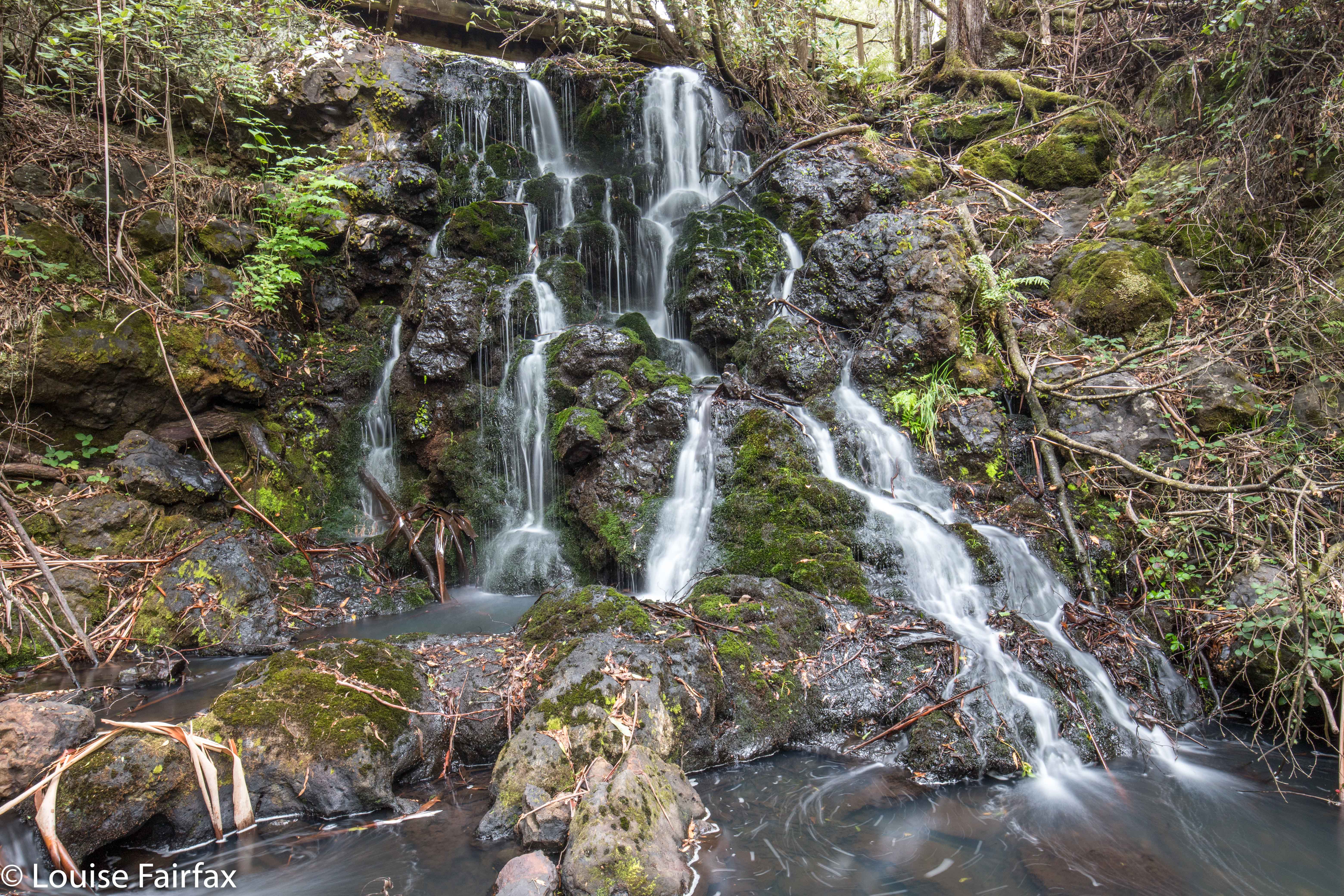
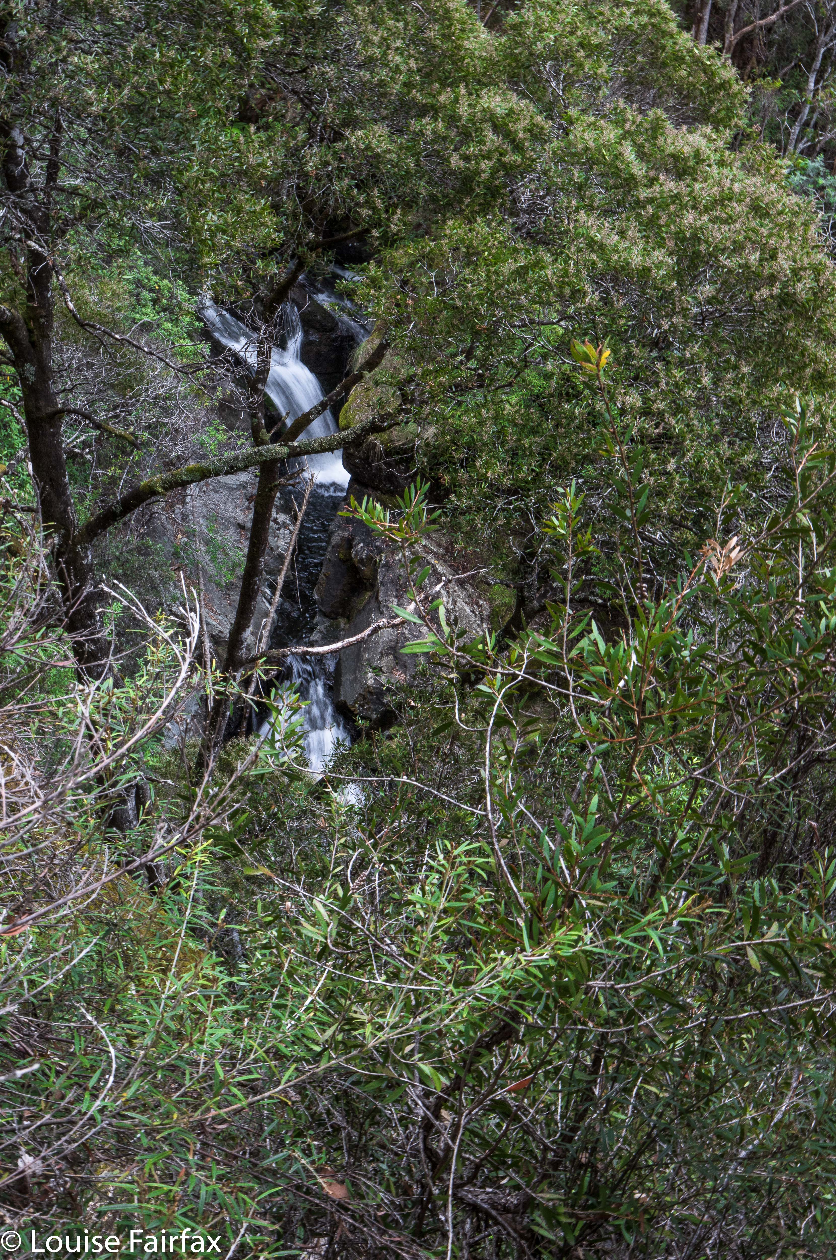
Regnans Falls, Apr 2018
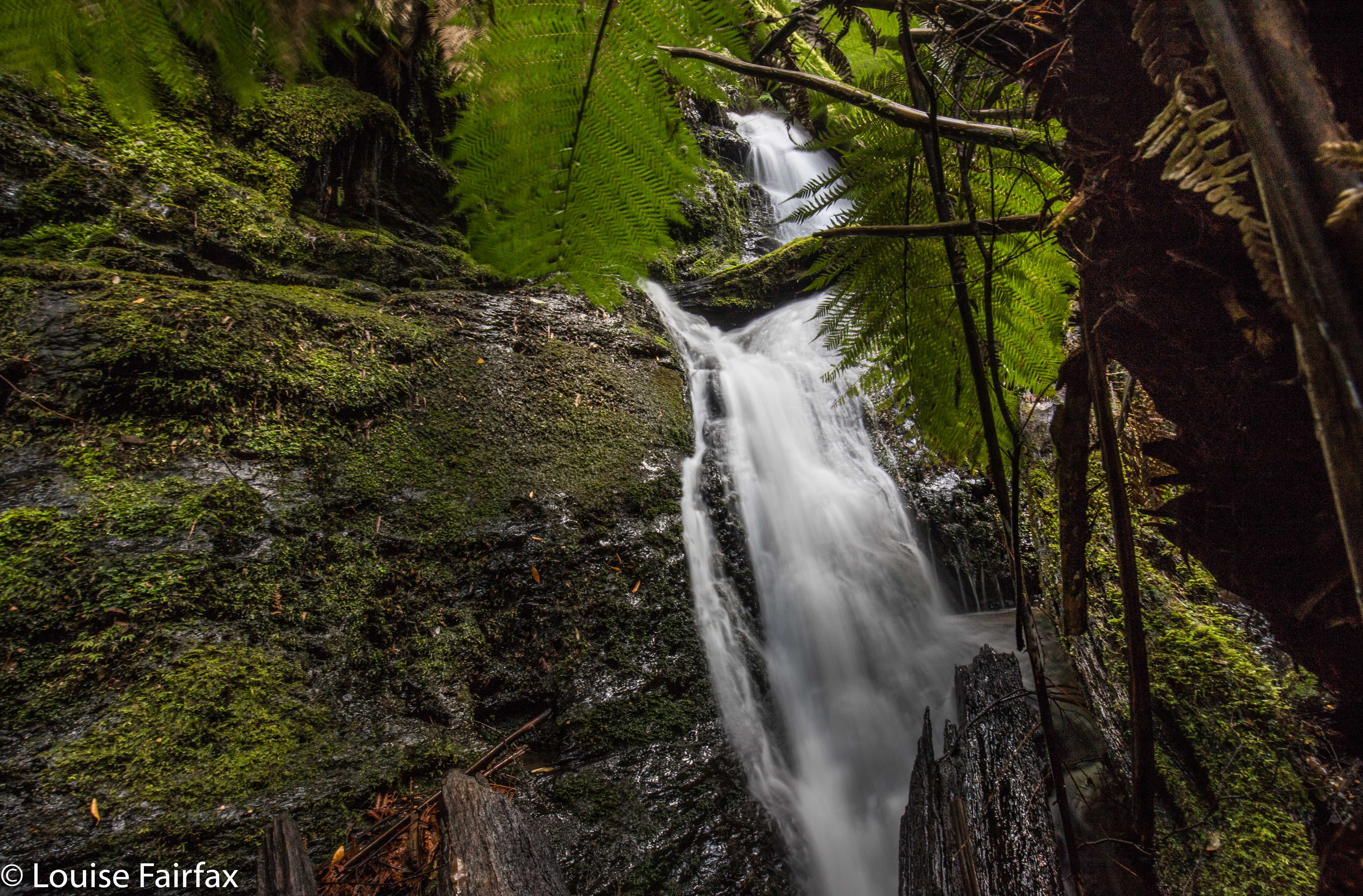
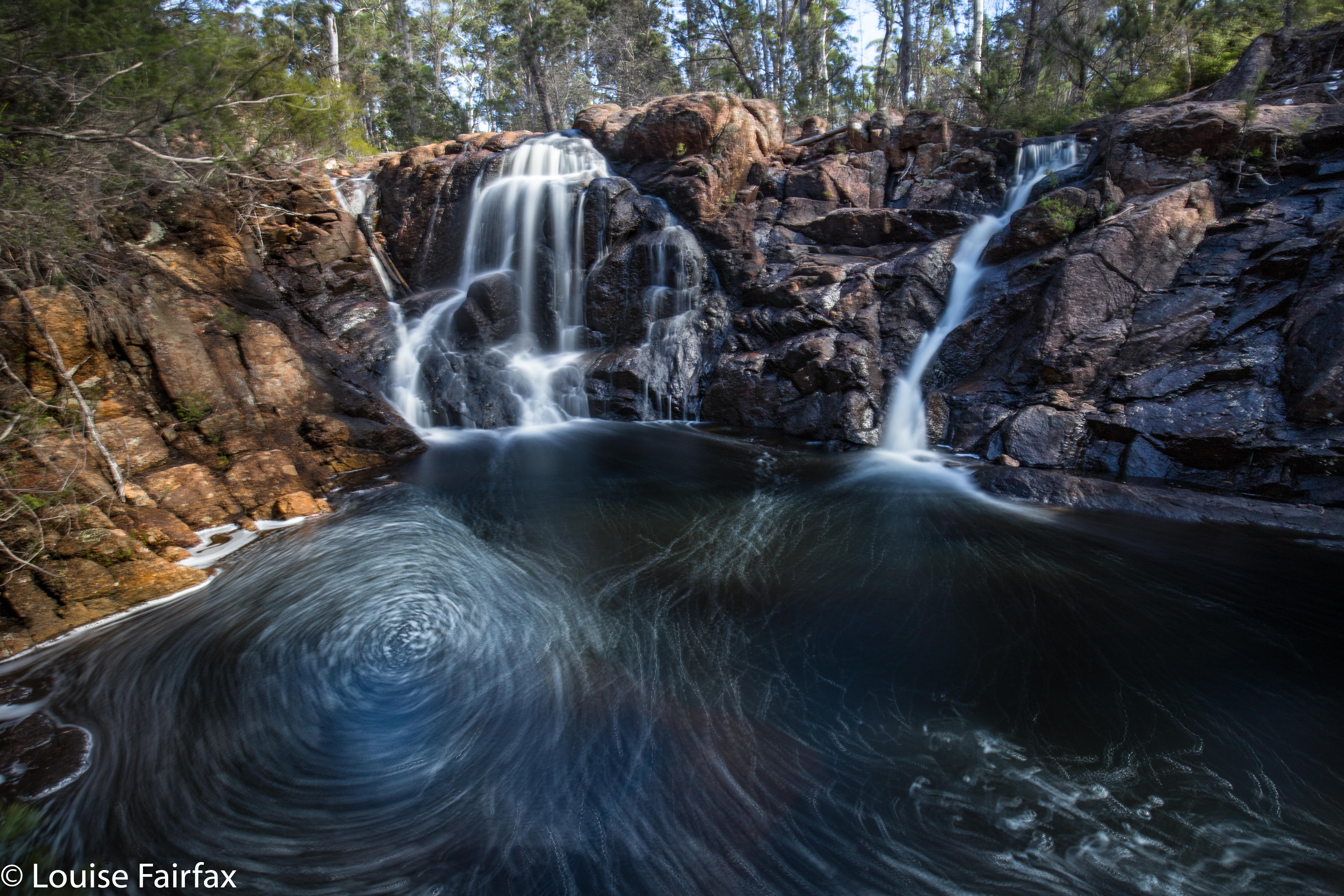
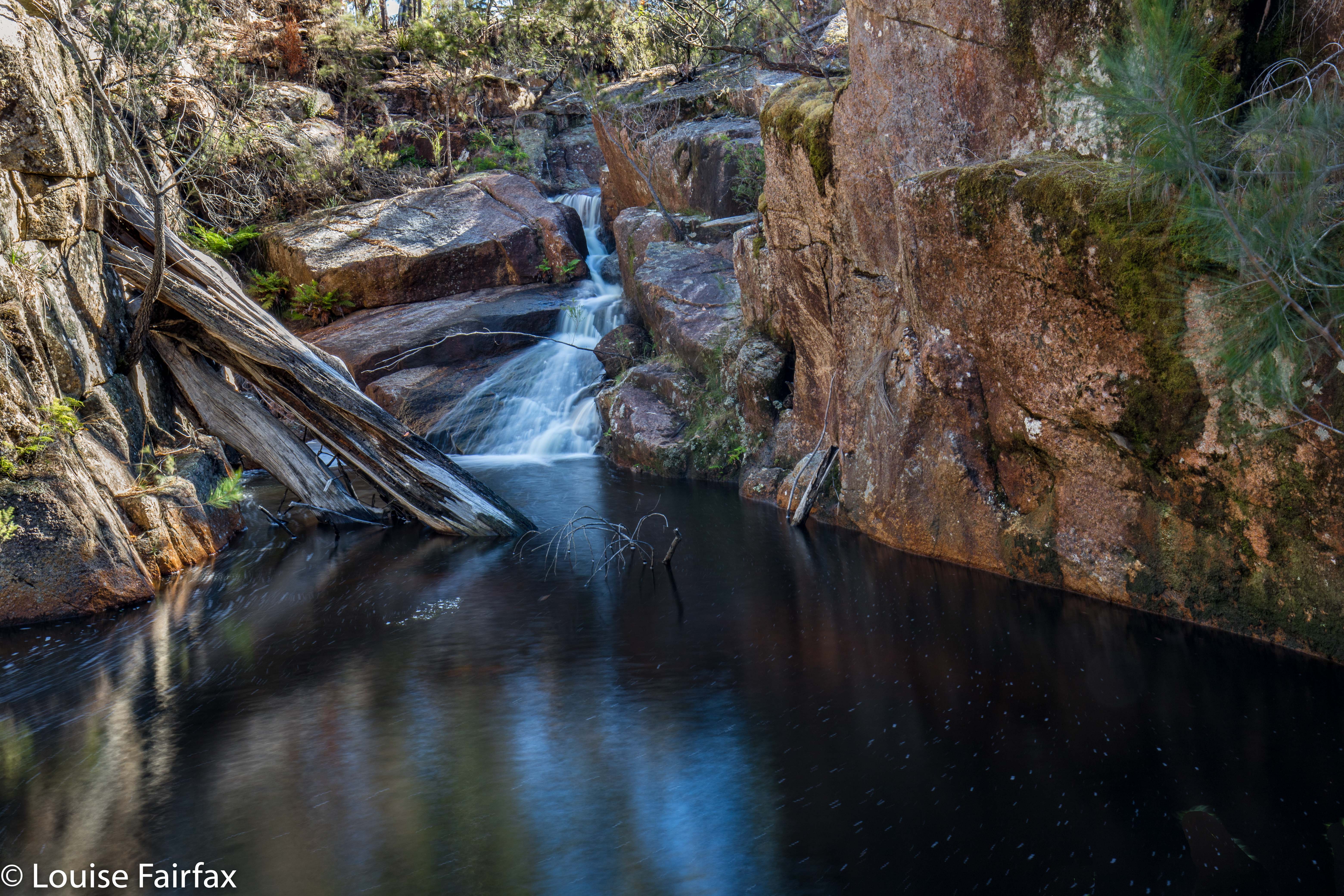
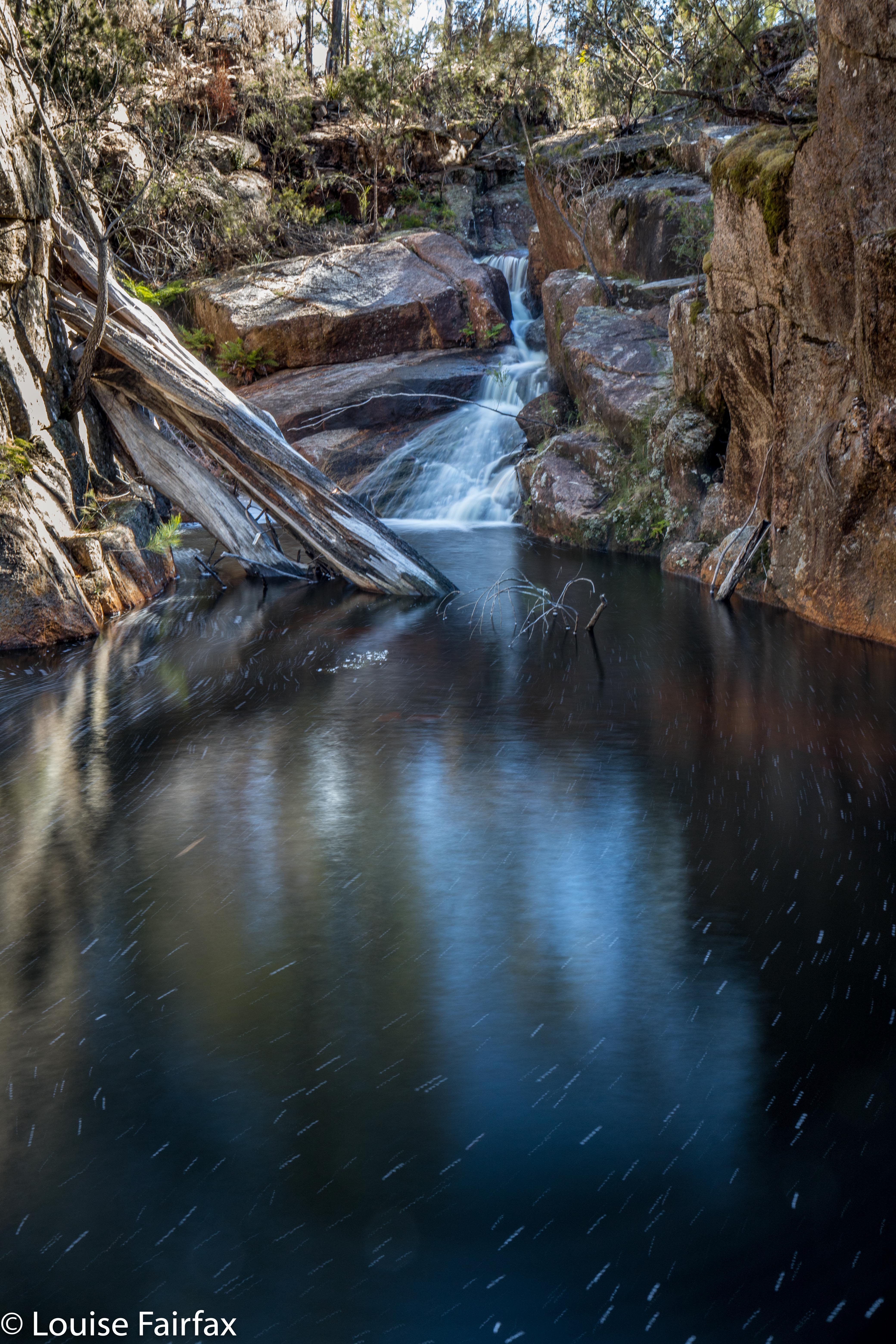
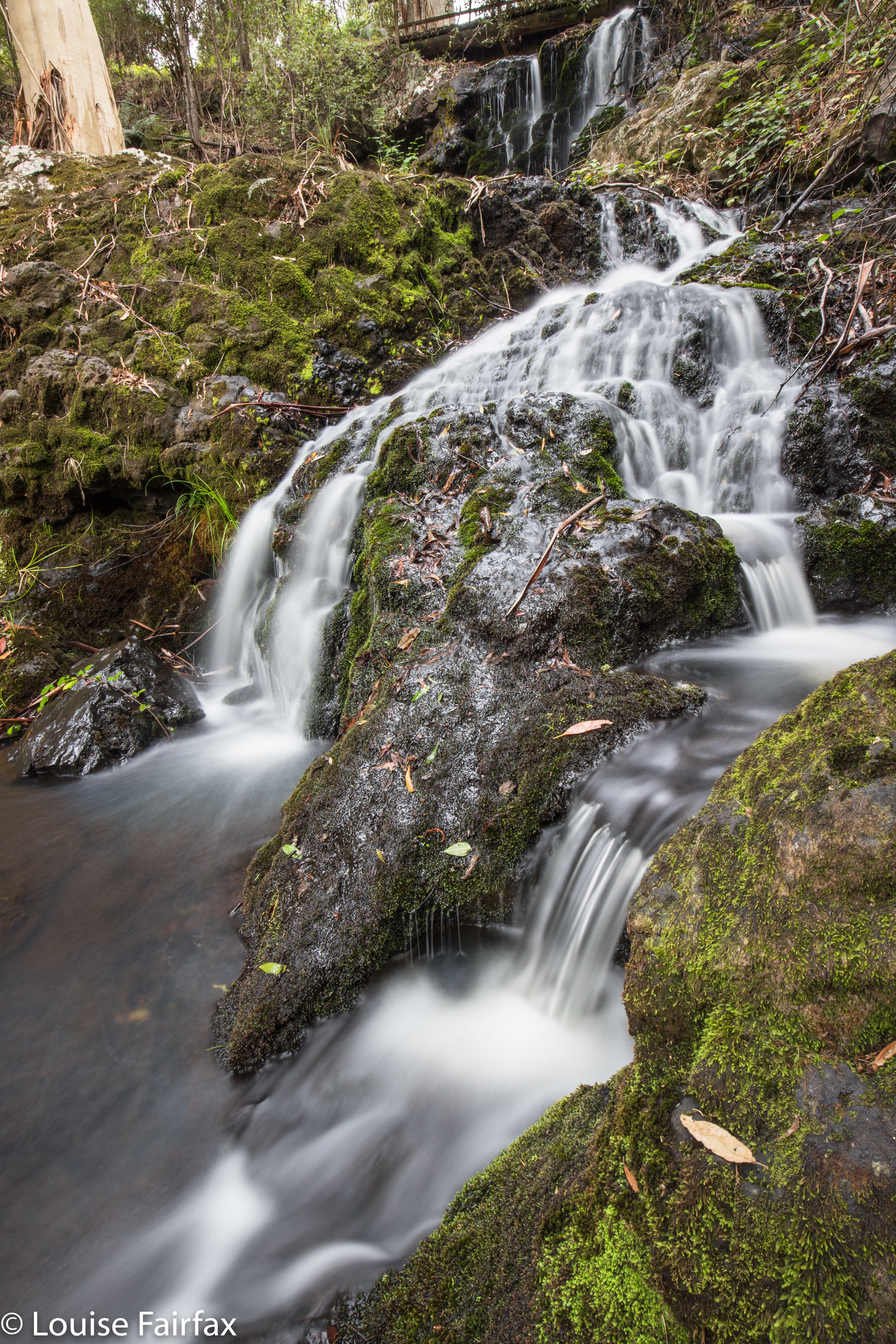

Main Regnans Falls
Regnans Falls could well be dubbed Mystery Falls, for although they occur near many specimens of Eucalyptus regnans, the mystery surrounding them is even greater than the giant trees. So much are they a mystery to Google, that every time you type Regnans, google corrects you to Regnant. The Waterfalls of Tasmania site doesn’t list them; the wikipedia site of all the waterfalls on Tasmania’s maps doesn’t list them. Why? Because they’re not on any maps. So how does one know they’re “there” (wherever “there” might be) and how on earth does one find them?? Good question. Nobody can even tell you the name of the creek they’re on, as that doesn’t have a name either!

One knows they are there, as a little book published quite a while ago (Thirty Five Walks to Waterfalls in Tasmania by Raelene and Rod Newell) lists them, along with instructions on how to get there, and Caedence Kueper, grand explorer (and good photographer), decided to get there and video his findings.

My problem was that he said to go to the Big Bend in the Styx Valley, and begin from there. Google and List Maps both fail to acknowledge the existence of this Big Bend. Drew a blank. OK, then; he says it’s just past the Big Tree Walk. Ah. Easy? No. Where is that? More googling, but to no avail. The first Big Tree walk listed in google is in the Blue Tier. The second is at Tarraleah. The “Big Tree Walk”, as such (and the one I was looking for) does not occur on googles’s first page of listings, and I gave up that method of attack at one page deep. List Maps says the Big Tree Walk does not exist at all. One gathers it is on the Styx Road (in his video, Caedence says he is in the Styx Valley, so I took a punt), but where? How far along? More web silence. Unless you actually know what Caedence is talking about, you remain mystified. Coming from the north, I am not really familiar with this area, so didn’t feel violently confident. I did, however, feel violently curious, so off I set. Better pack the PLB in case I come a cropper. I was expecting no helpful sign posts, and was hoping I could sort out where to stop my car. If you follow this blog, you’ll know that I actually landed at the Tolkien Falls instead, when trying to follow the instructions. However, in the end and with perseverance, I got there.
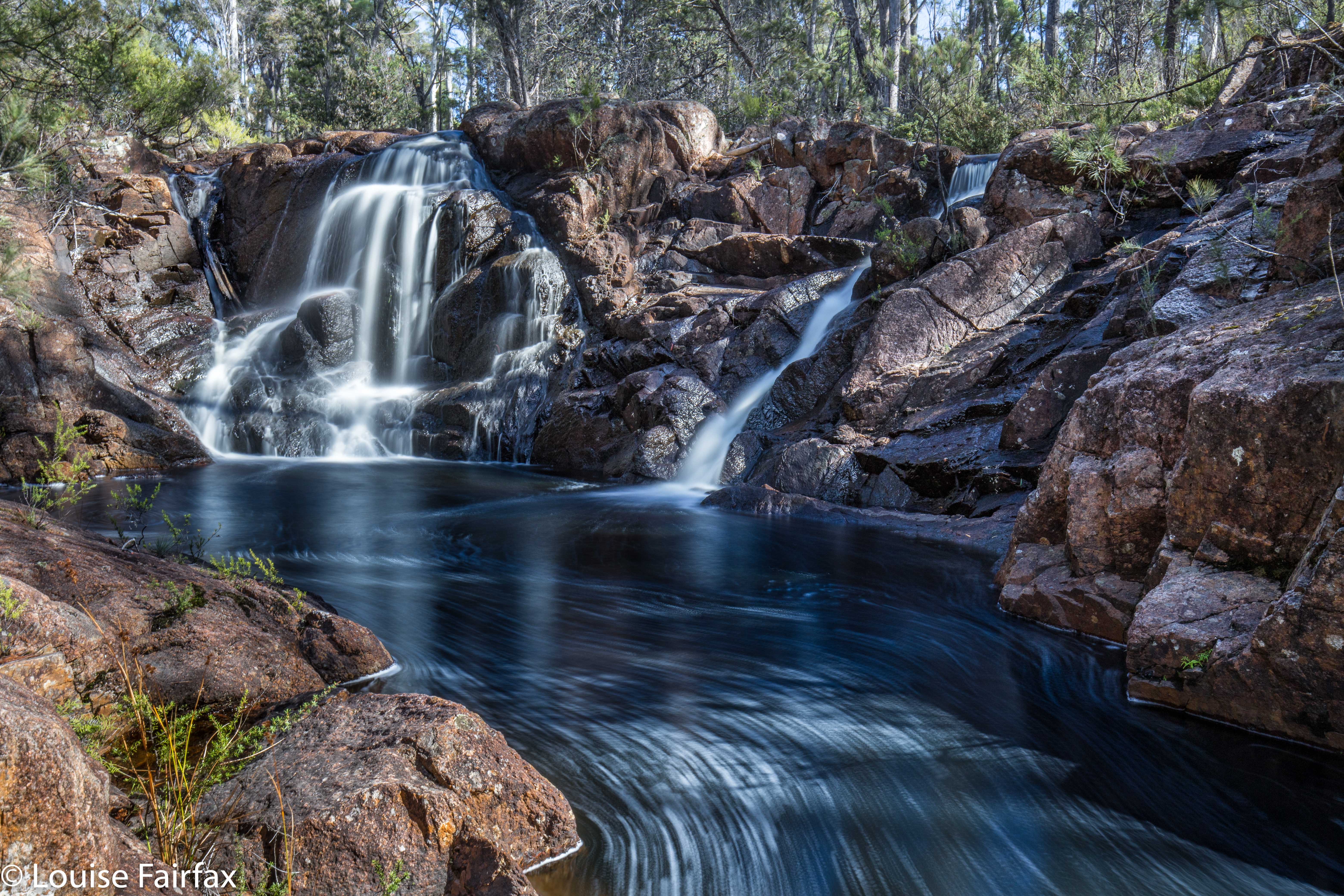
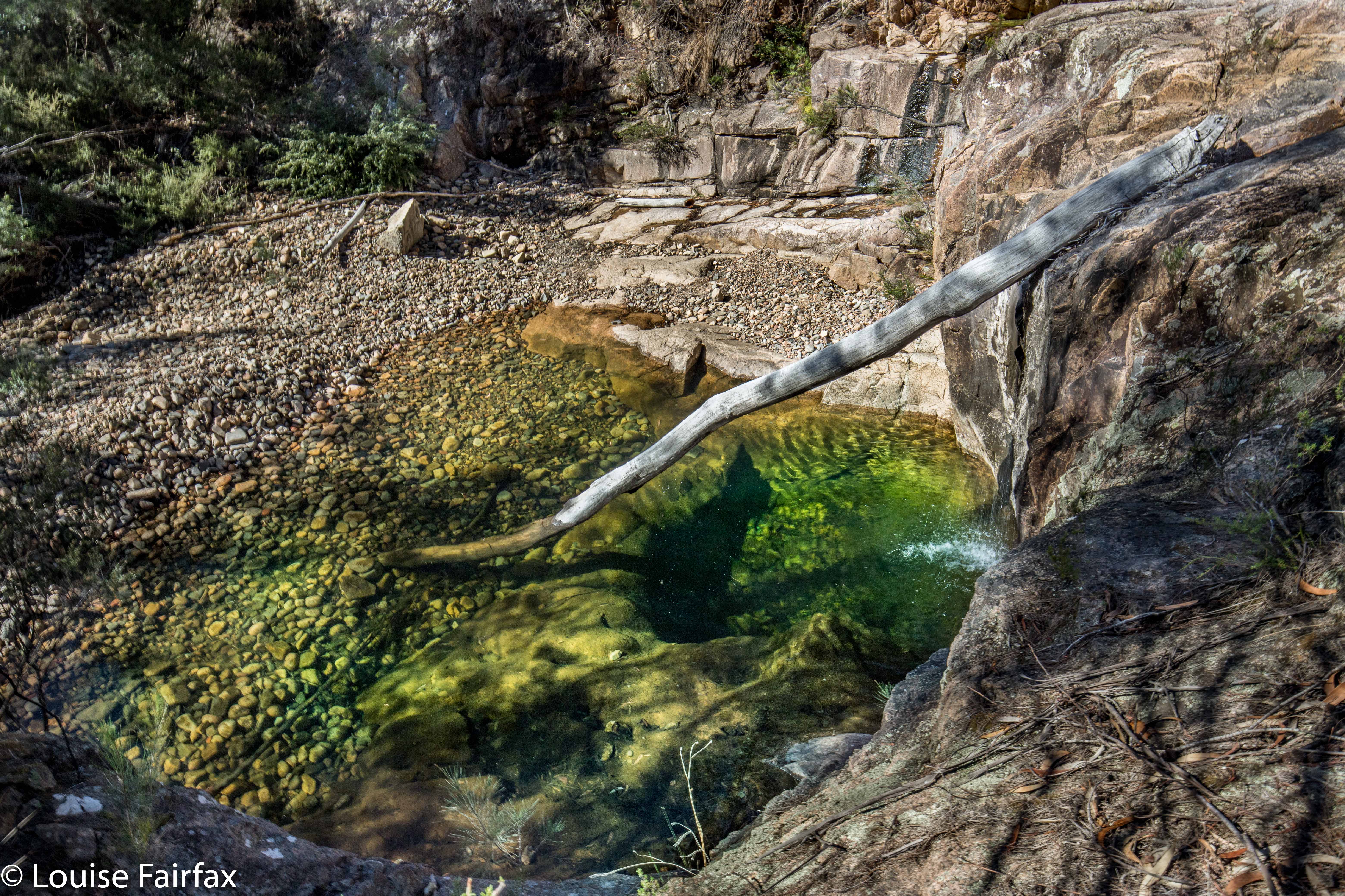
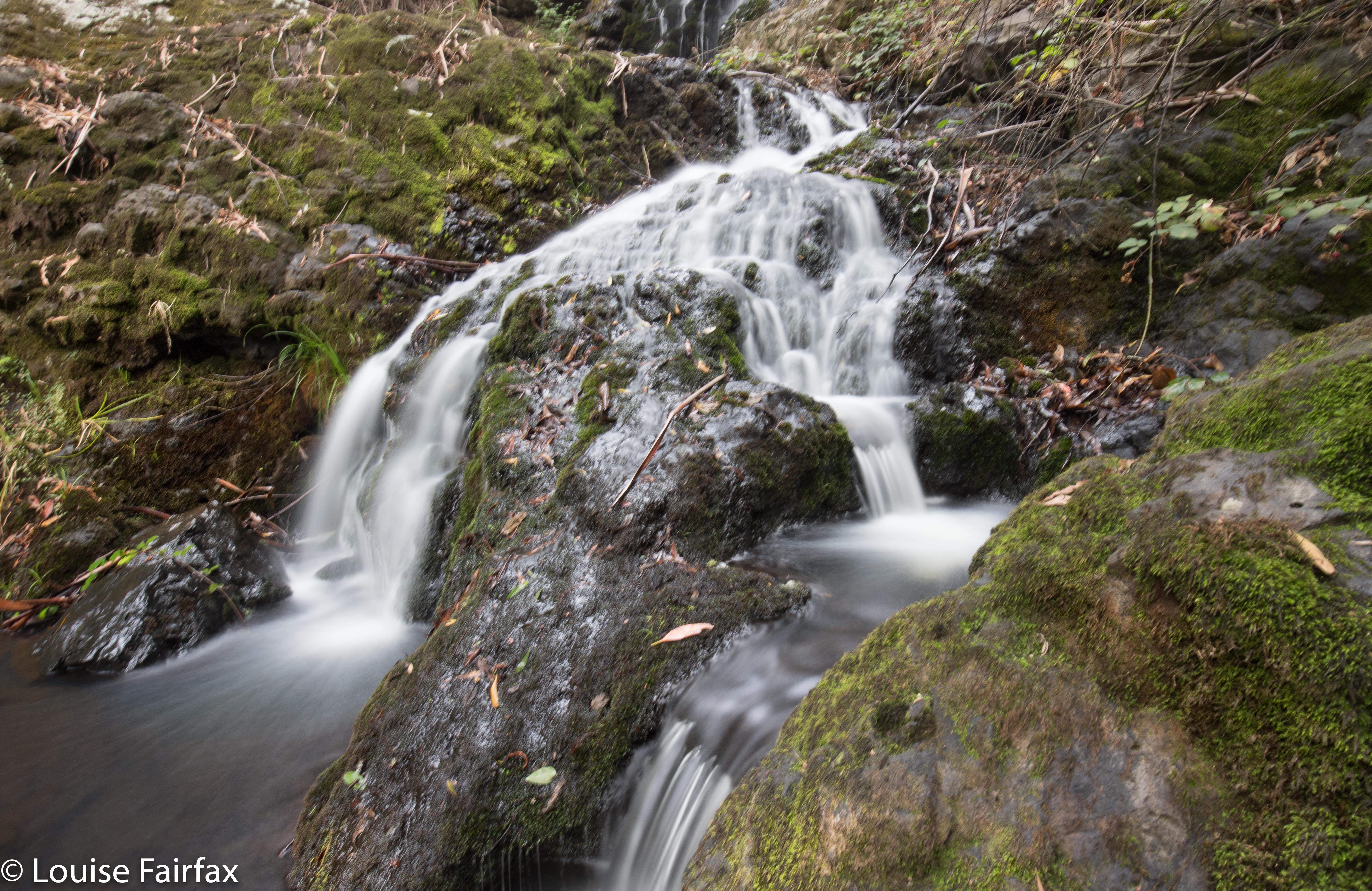
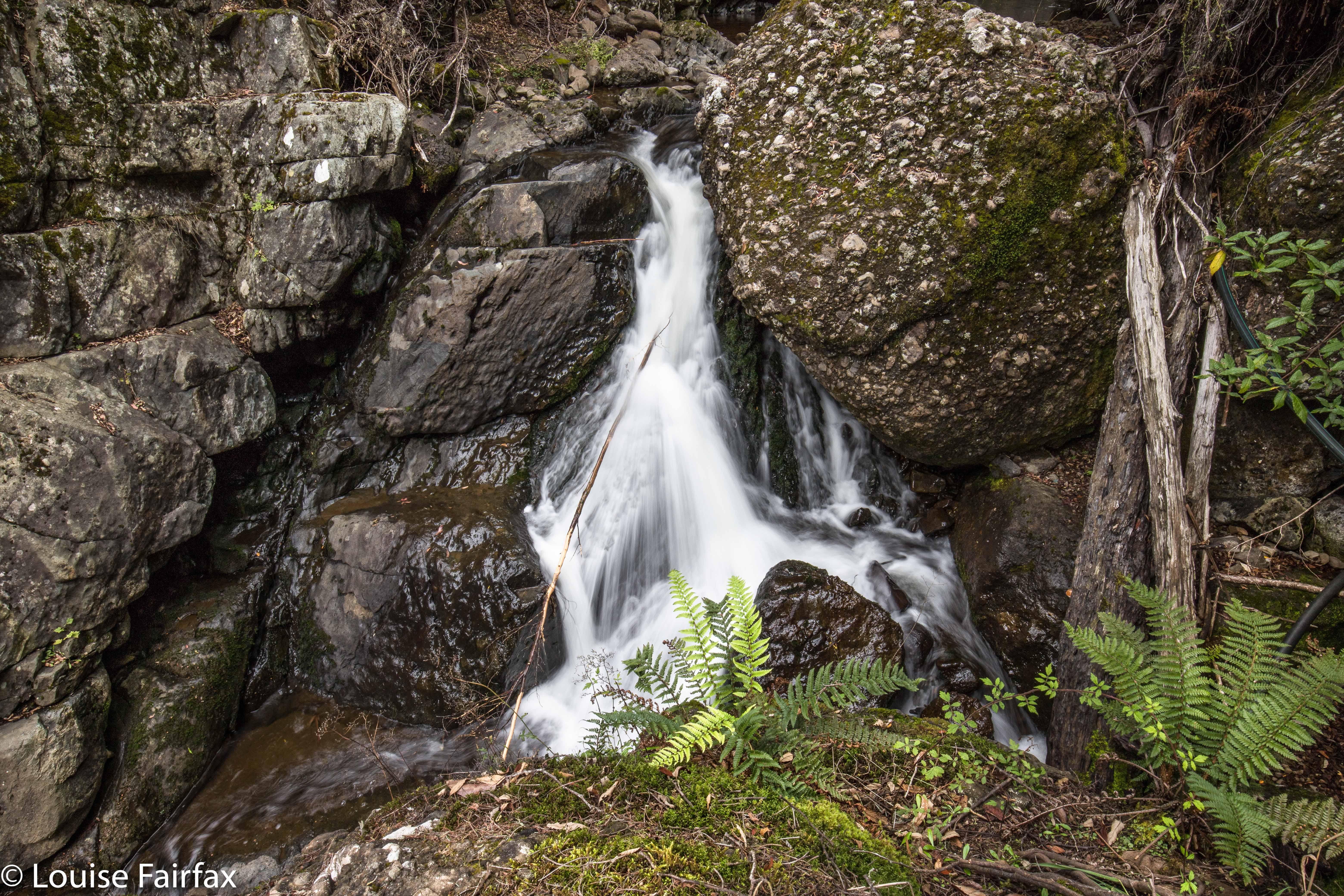
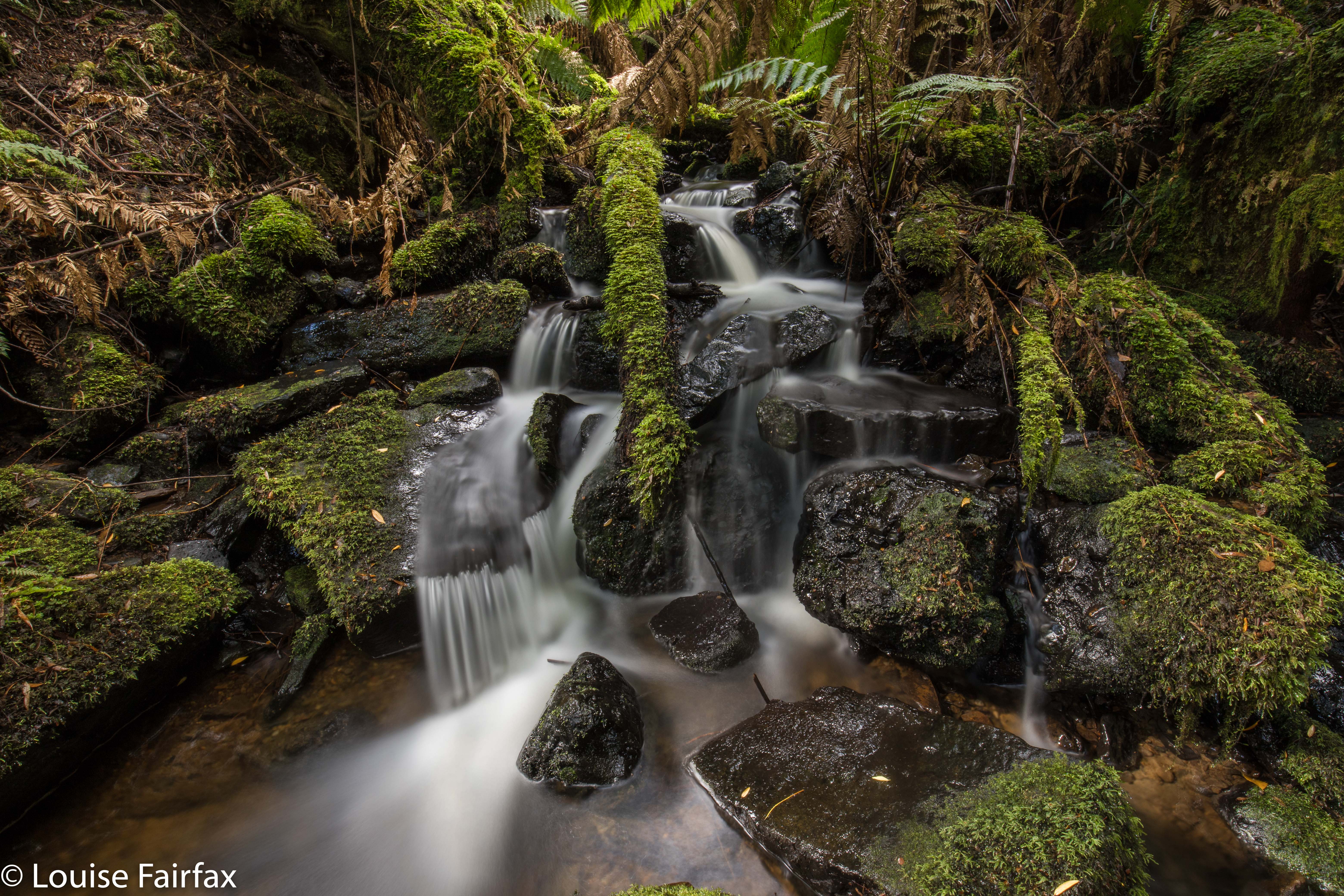
(Below the falls)
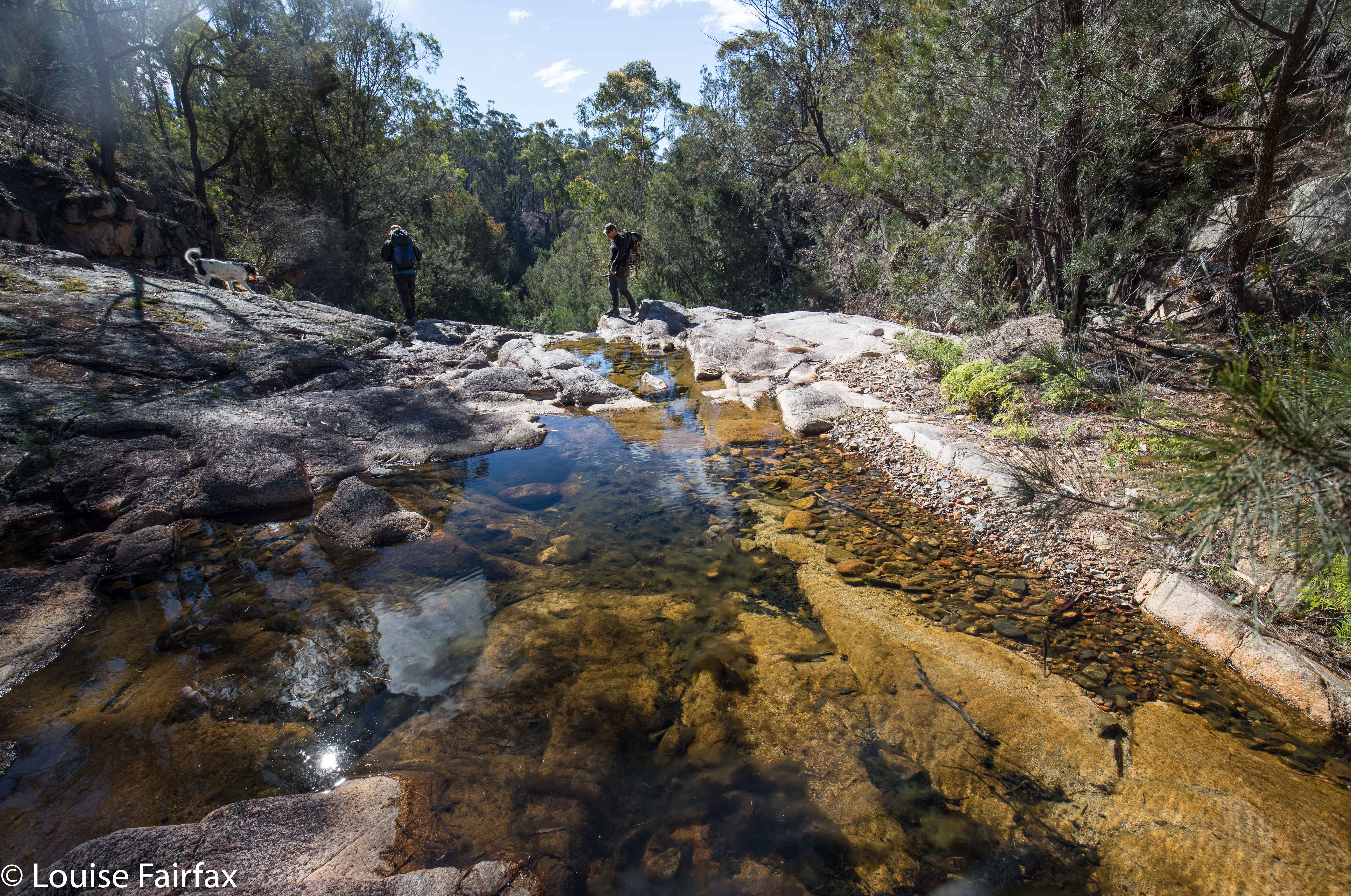
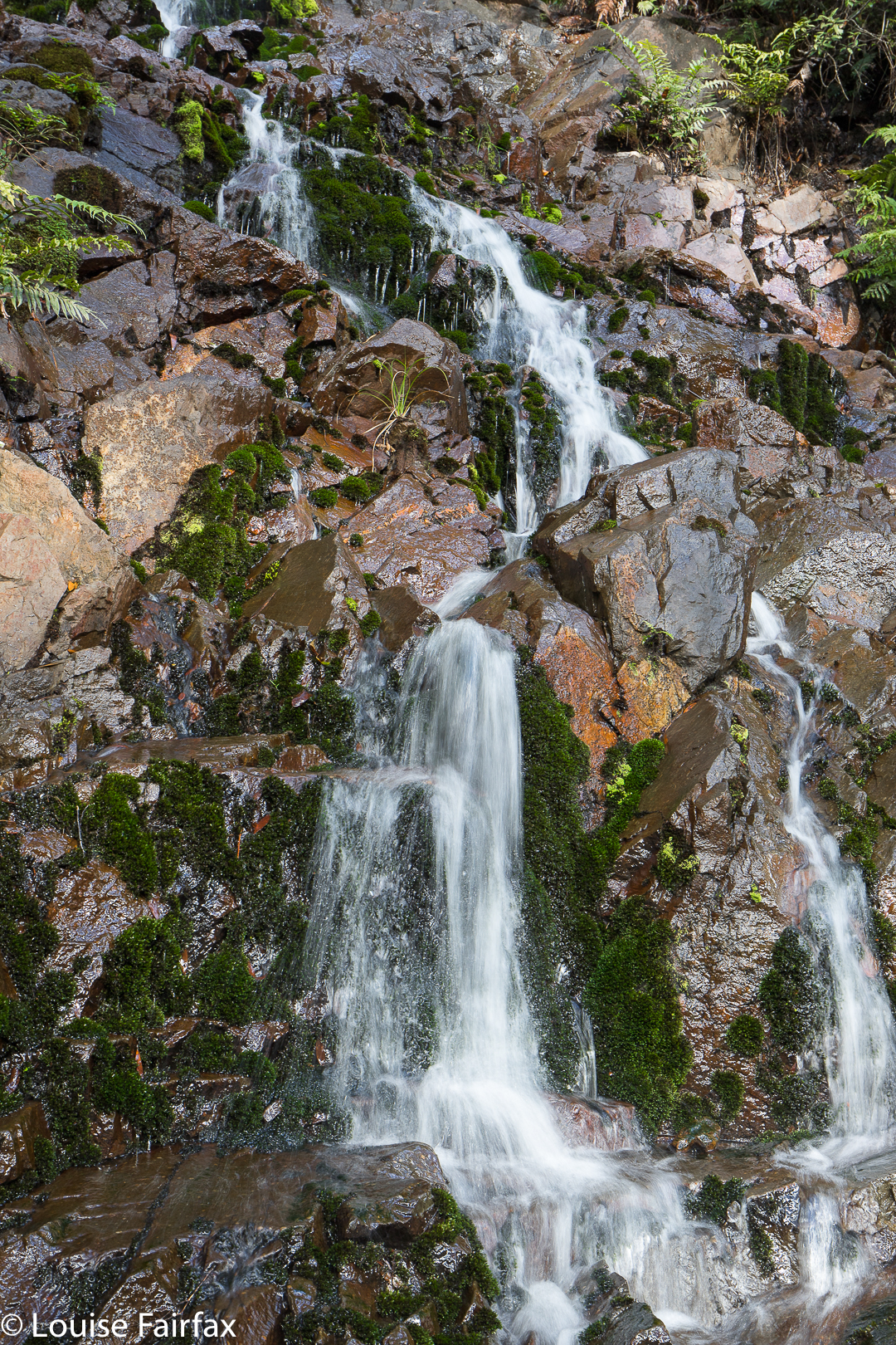
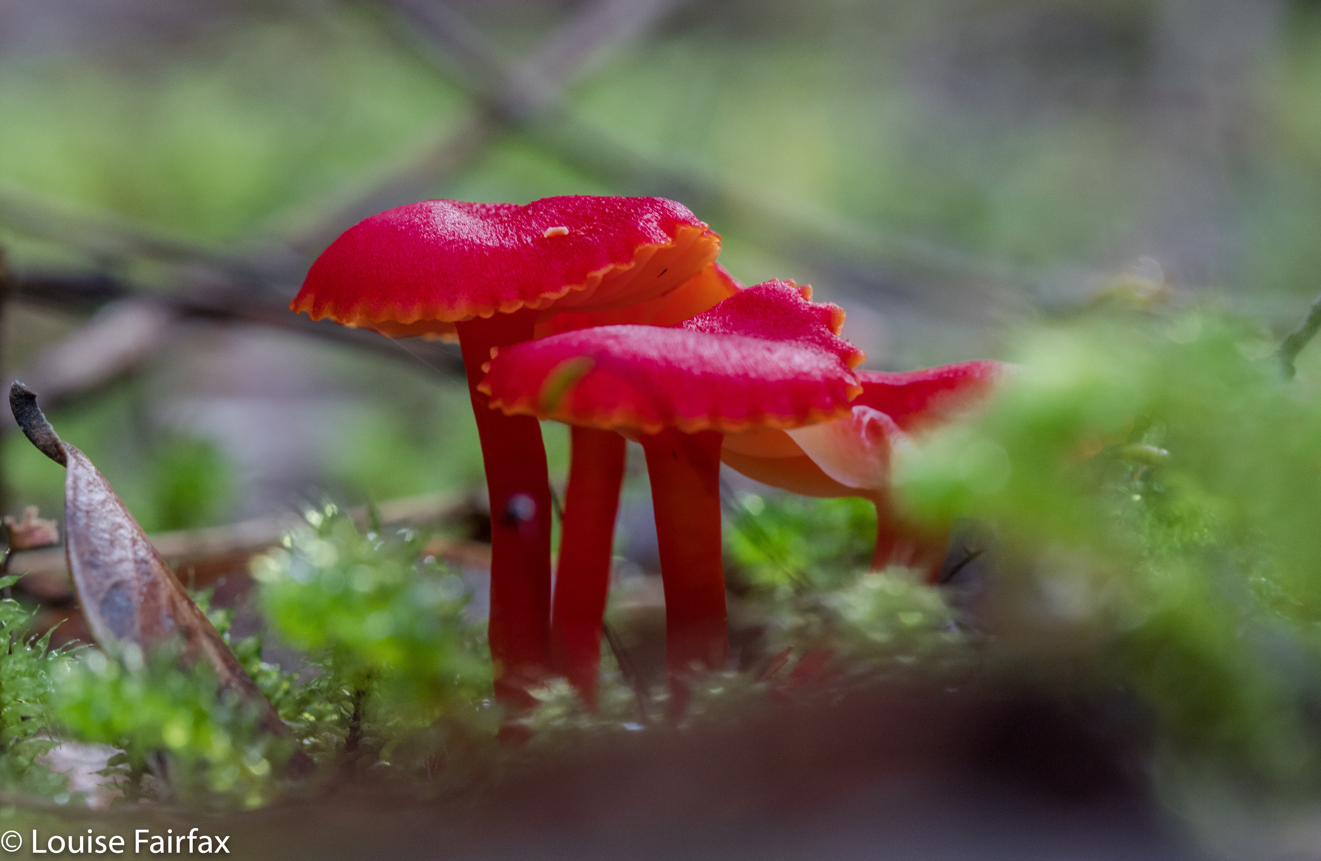
One has to go right on the main road heading west from Maydena in order to actually go left (south); one goes under the road, and is then offered the Styx Road as one of the two alternatives. Drive along this for quite a way (about half an hour). The Big Tree Forest Reserve becomes visible. Beyond that is a bend and beyond that, another. The second will get you (if you walk up the road for six minutes) to a well-taped track to the beautiful Tolkien Falls). The first one will have you do a bushbash through very fragile forest with only occasional ribbons leading through a maze of fallen timber in one spot to Regnans. If you don’t know how to bushbash AND tread incredibly lightly at the same time, leaving no trace, please do not visit Regnans. It is holy territory and needs to remain so. Everything crumbles in there it is so untrampled, so you need excellent balance or you’ll topple. Also, it has no human rubbish from selfish tourists. Long may this remain the case.


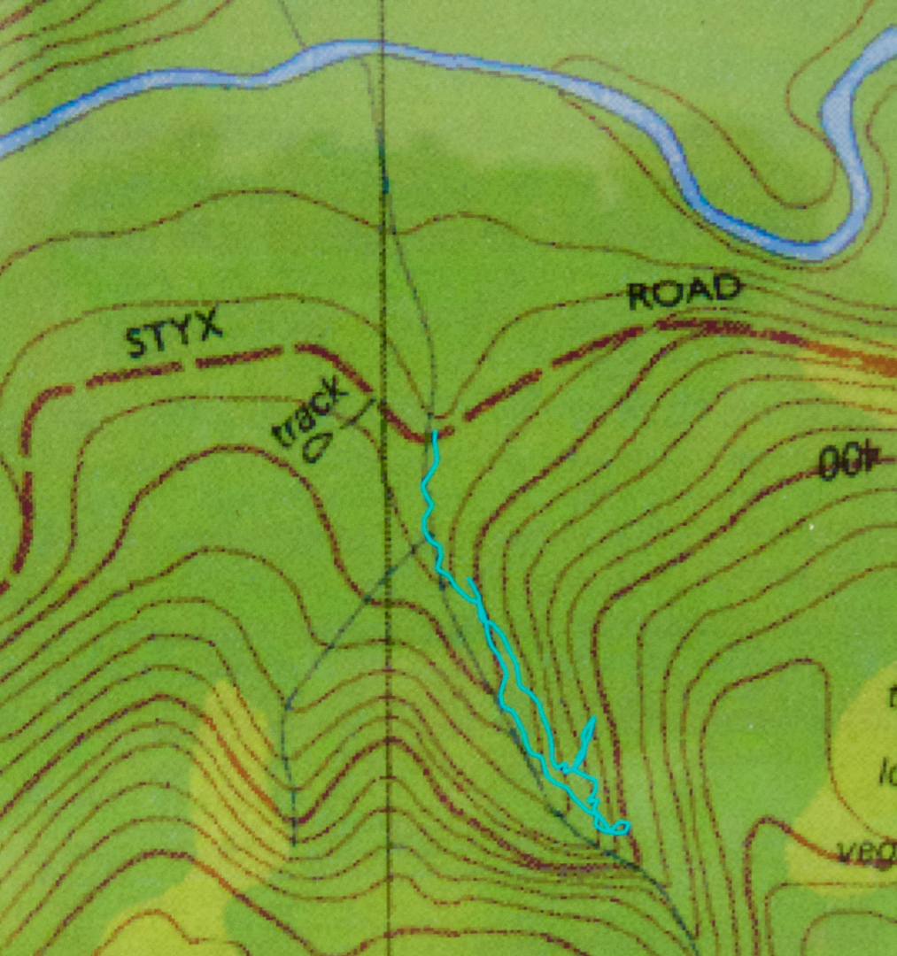
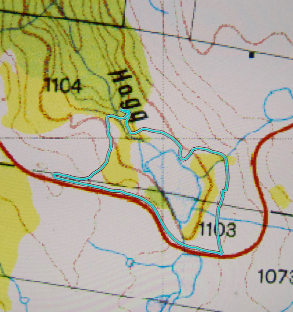
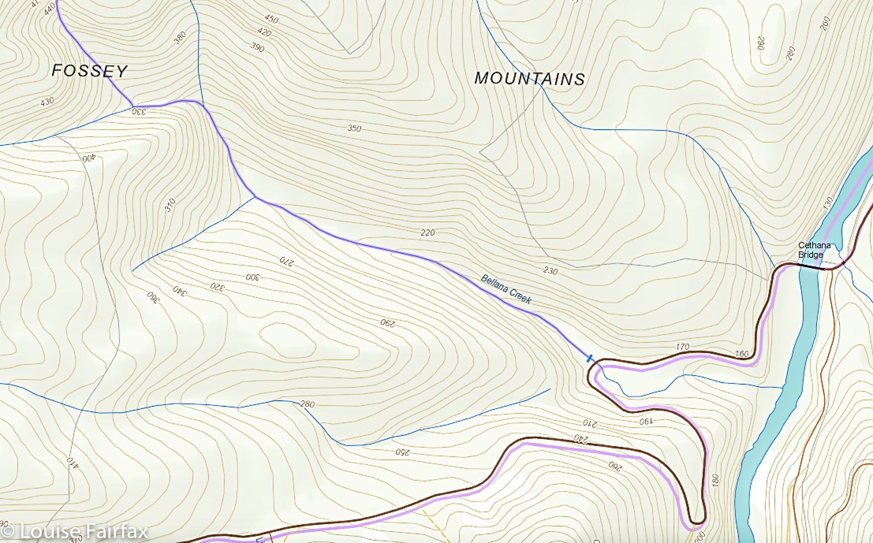
No, I did not do an odd squiggle up the spur. I guess the canopy is so dense the signals got confused.

Ironbark Falls, Nevada Creek Falls, Constable Ck Falls 2018

Ironbark Falls, Nevada Creek Falls and Constable Creek Falls. Apr 2018.


Ironbark Falls
After my huge waterfall bagging spree of Friday, it seemed rather greedy to be back at it again on Sunday, but Craig and I had agreed to go a-bagging again this weekend: the question was, where? We had our goal all worked out, but the weather was so utterly appalling there that I suggested we do the dry thing and explore falls on the east coast instead (Ironbark Falls, Nevada Creek Falls and Constable Falls). Craig seemed to be perfectly content with the idea of getting muddy and saturated, possibly freezing, and having continual droplets on his lens, but, in deference to my wussiness and weakness, agreed to forego these pleasures and travel to where the sun was. I hope he didn’t regret this consent too much. While everyone else was huddling from snow squalls by the fire, we were calling on clouds to come to our aid and cover the sun for a moment or two. While others were worried about hypothermia this weekend, we got sunburnt.


To add to the pleasure of the day, Bec (Craig’s wife) and Tessa (the faithful and fancy dog waterfall bagger) were going to join us. Waterfalls, here we come. The first on our list was Ironbark Falls, that being the only one of the three to be given the glory of an official name. I drove down Argonaut Rd, forked left onto Trafalgar, and continued along it past its official end onto what is then called Transit Rd. We had no idea how this road would be, but were all prepared to walk the whole way if necessary. There were a few ruts to negotiate, but nothing to overly tax my Subaru Forester, and we arrived safely at the spot we wanted.


The walk from the car to the falls was sheer delight, the forest being as open as could possibly be, with attractive tors piled on top of each other adding heaps of interest. This type of coastal granite has been the site of many orienteering competitions in my past life, and just being there made me very happy. The walk to the falls did not take long, but was long enough to be pleasing (a bit under twenty minutes). On the list map, the creek looks like a lake at this point, so I was curious to see what it would look like. There is a very wide area of rock, with gently flowing water over it. It was lovely, and had a real “northern territory” feel to it. If you can’t afford the NT, then just go to St Helens. After photographing, we had lunch on the rocks (hoping for a cloud or two to come our way). Tessa had multiple swims, and made up for the lack of rain on the coast by shaking herself regularly near Craig and Bec.


Nevada Creek Falls
The next item on the agenda was a nameless fall marked on the maps, situated on a neighbouring creek, which Craig thus dubbed Nevada Creek Falls. We took less than ten minutes to go up over the spur and down to these beauties. These falls had a kind of cascade above, and then a bigger fall below. Both cascade and fall had a pool at the base of the most magnificent green, and perfect clarity. These pools were very inviting for a swim.


Our final goal was another nameless falls on the map, which, again using a practical, descriptive name, we called Constable Creek Falls. These were also attractive, and had a quite fascinating mini-gorge above the falls.


Constable Creek Falls
On the way home, we once more found an excellent place to have coffee (in St Helens) – a tiny little place opposite Banjos. It was too late for caffein: I tested them out with a small but strong decaf cappuccino with almond milk, and they came to the full party. Delicious. The raspberry muffins were moist and delicious. I’ll be back.


Our route. We parked at the mine workings far west (which was as far as I was comfy taking the car). We went directly to Ironbark, then to the falls east of there on neighbouring Nevada Creek. From there, we followed the spur back southish, then west along the road until it was time to head bush and proceed to the third and final falls on Constable creek, the most westerly ones there, NE of the mine workings where the car was. It was then a short amble SW back to the car. This is a gorgeous circuit: highly recommended.

Hogg Creek Falls

Hogg Creek Falls 2018 Apr


Hogg Creek Falls were the final falls on what I have retrospectively dubbed the Sheffield Falls Circuit, in which I took in Phillips, Cethana, Narrawa, Hullablaloo, Upper Hullabaloo and now Hoggs Creek Falls. I would love to say I carefully designed this route from home after a great deal of thought, but the truth is, it just kind of evolved as it rolled along, with each new falls attracting my attention from the periphery of the map of the previous falls, A kind of adventitious circuit. I like surprises.

Coming from Lemonthyme, which is adjacent to where the Hullabaloo two were, I headed back through Moina, Wilmot, Lower Wilmot, and Lake Paloona dam; shortly thereafter, along the road to Lower Barrington, was the first part of my final goal: Hoggs Creek. Hm. Where are the falls? My map didn’t rightly say … or was that black smudge there a waterfall? I couldn’t see any other possibilities, so thought I might as well try in that (downstream) direction. I can’t say it looked particularly promising, with lakes rather than waterfalls in abundance (very attractive they were, too, especially in the light drizzle that was now falling), but then, upstream looked every bit as unlikely so I opted for down. I also didn’t have a clue if one side of the invisible creek was better than the other, but the eastern side seemed fine, and had a parking possibility, so I settled for it. I’d set out and, if I failed, then try a different tack. I still had lots of time before dark, and am rather careless where distance is concerned: a tiny bit of extra exercise is a pleasure, not a problem. I was getting hungry, despite my hearty lunch, so thought it would have been nice to have a route description for a change, but, well, I didn’t, so that was the way it went.

It needed a bit of dedication to push through the blackberries that obstructed my path using this approach. You, lucky reader, can learn from my blunderings, and not take this route (I did not get cut or scratched, so it’s not a violent drama, but my return route was faster and much more comfortable). After maybe about ten minutes, things started looking more promising, and a creek started forming, and tracks showing that some animal or other had walked here began to appear. And then, just as before, right when I was on top of the falls, a pink ribbon materialised. I crossed the stream to where it was, and could now see the bridge that is just above the falls. It’s a cute little footbridge, not a car bridge, as I had imagined. I had read not to walk on it, but when you weigh what I weigh, you can walk on rotten bridges with equanimity, so I did to save time. I was not scared. But if you weigh more than I do, perhaps you’d better heed the warning. At last I could see my falls. Six falls for the day, and all reached. Hoorah.

Just for kicks, because my life is obviously so dull that this constitutes a kick, I returned via the other side, and went up the grassy spur. It was quick and easy. At the end was an electric fence. Having once been electrocuted by one of these, I was not enthusiastic about going through, and I could see a gate higher up, so went back on myself to go through the gate. If you’re not wearing a huge backpack full of copious camera gear, then you could probably get through the gap between wires, but I was too large with my 9kg pack on my back, so chose the gate. The trip back was a lot faster than the trip out, and, once more, I had done a little circle.

Perhaps the biggest find of the day was not a waterfall, but another piece of writing that caught my eye as I drove through Sheffield, that announced Italian coffee and sweet treats (Fudge ‘n’ Good Coffee). Now you’re talking. I slammed on the brakes. No police heard me. That was one of the best cappuccinos I have ever had, and the guy who owns the shop, Chris, is a fabulous photographer, so I enjoyed viewing his work on the walls while I waited for the caffein. What a great end to the day.

Hullabaloo Falls 2018 Apr

Hullabaloo Falls and Upper Hullabaloo Falls, Apr 2018
If you have turned to this blog having come from my post on Narrawa Falls, you will know that the only reason I was at the start line for Hullabaloo Falls was that the name caught my eye when I was map gazing, and, noting that I was nearby, I answered the call. It seemed to me that the closest point to where the falls were was where my map indicates I parked, and, not having any information to hand, that seemed as good a place as any to start.
I have since found out that this is on private property, and, with waterfall bagging being so popular, the owner is worried about his liability. I’m afraid the shots posted can merely satisfy your curiosity. Sorry folks.

Hiding shyly out of obscurity: Hullabaloo Falls

Here are the “Upper Hullabaloo Falls” (unnamed on the map, but marked by a blue line as existing). They are actually nicer.
I decided to head for home via one last falls, viz., Hogg Creek Falls, which also had a location but no information as to how to best approach them. Oh well, if you don’t try you can’t succeed. Off I set. Hogg Creek is in between the Lake Paloona Dam and Lower Barrington, which seemed quite a long drive from Lemonthyme, but a very pretty one. Tasmania is looking ravishing in its autumn clothing.

Cethana Falls (or Bellana Ck Falls?) 2018

Cethana Falls (or Bellana Ck Falls?) 2018
What’s in a name? Well actually, quite a bit if we want to actually communicate with each other. When I order a cappuccino, I have something very definite in mind, a something that I expect the person serving me to also have in mind, and if they give me instant coffee with milk from the fridge, I consider myself cheated, and I know that we have two different things in mind when we use the word “cappuccino”. (Yes, that used to happen in yesteryear). And when it comes to waterfalls, it is also kind of handy if we want to discuss them with each other that we have the same name in mind – or, in the case of aboriginal naming, two accepted names, but we all know it’s those two.


Now, to my point: I saw a photo in the web of falls that were called “Cethana Falls”. This seemed an appropriate name, as they were on Cethana Road, just past Cethana Bridge, and quite near Cethana dam. I called them that too, and went to photograph and “bag” them yesterday. But this morning, I have discovered that people sitting in an office in America have dubbed these (with an air of authority, calling themselves the World Waterfall database) “Bellana Creek Falls”. Are we all to name things whatever we feel like? This name they have given it is intriguing to say the least. If you look at the map I have included below, you will see that List Maps has these falls on the Bellana Creek, which, if you visit the falls, and minutely inspect Bellana Creek at precisely this spot as I did yesterday, you will discover that there are no falls at all in that astonishingly flat stretch of creek bed (given the general terrain in which it is situated). The falls are on the creek which is unnamed right beside this to the left as you face them, and which , on violently sloping ground, according to the map, stops and disappears into thin air. Note the two blue lines do not join. Creeks on big slopes do not do this unless they go underground. This unnamed creek does not go underground. It falls over the edge in a fall that is very attractive after rain. Less so when dry. Locals call it Cethana Falls. I would greatly appreciate hearing any further comments on this.

(The same website also reports as confirmed an ‘Upper Narrawa Creek Falls’. My map has nothing of the sort on it, and neither does the List Map. Does anyone know what these people are talking about? Please contact me if you have any information. I am most curious.