Shower Falls, Camp Falls 2018 TAS Peninsula Apr

Shower Falls and Camp Falls, TAS Peninsula, Apr 2018


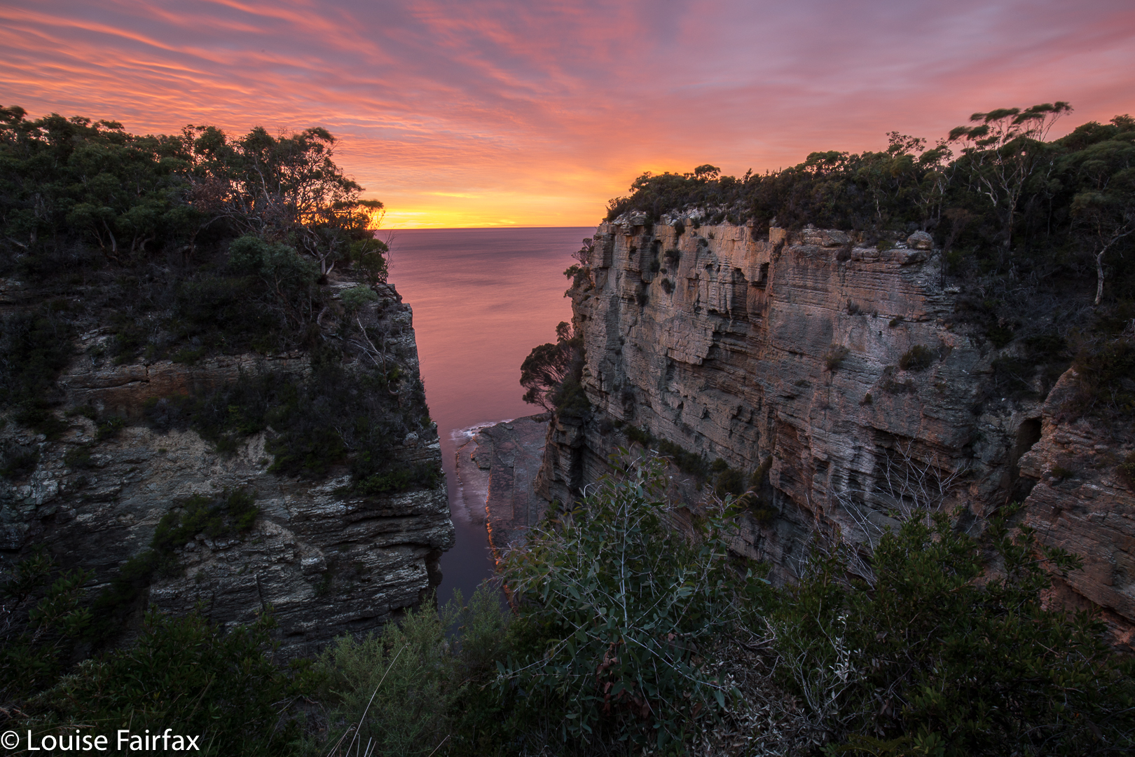
My family had hired a shack at Eaglehawk Neck on the Tas Peninsula for Easter, so I decided to use my close proximity to the Shower and Camp Falls to do a quick bag. I set my alarm for 6 a.m. to catch sunrise on my way (plenty of time, as sunrise was not until 7.17, so I thought), and fell happily asleep. Trouble was, my relatives had mislead me and I hadn’t double-checked. I awoke to a sky already pink (it was supposed to be black at that hour): daylight savings had begun in the morning, and not in the evening as they maintained. Of course, it is my fault too for not doing my own investigation on when the clocks changed. Meanwhile, I had all but missed dawn. Pity, as it was a nice one.


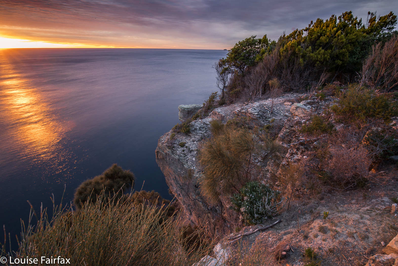
As you can see, I did at least catch the tail end of it, but had to use the huge railings as a tripod, as I didn’t have time to set up. The railings make my life rather tricky, actually, as they are so tall that when my camera is resting on them, I can’t see through the eyepiece: it’s too high. My camera doesn’t fit in the narrow strips between rails that they allow. In order to get a good photo, I need to actually climb over the railings, which I didn’t have time for on this morning. (I did the next day). They say they are interested in safety. It would actually be a lot safer if their railings were not so high so that those who want to see don’t have to climb to be able to do so. Don’t scoff you men until you’ve tried feeling what it’s like to be forced to look at nature from behind wretched bars.


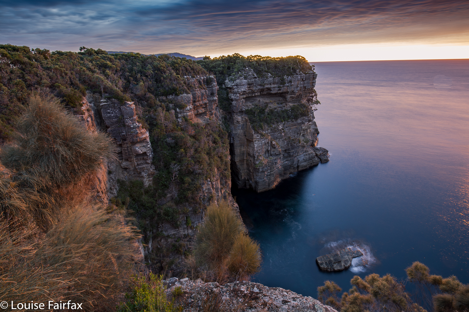
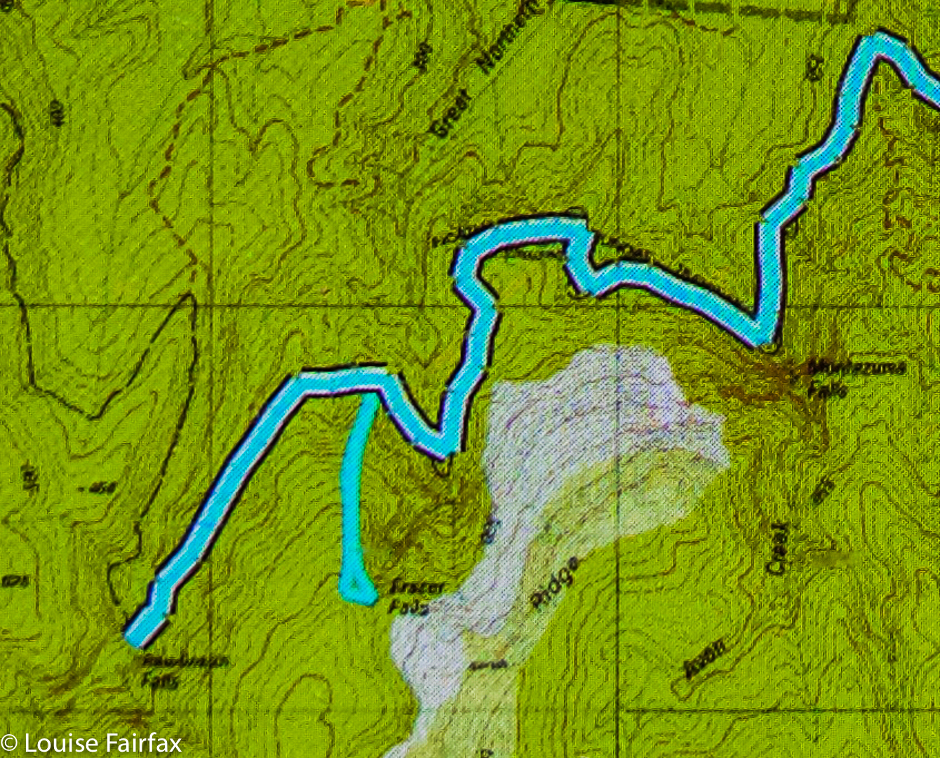
Anyway, dawn duly photographed, I set off to find my waterfalls. I really hated the highway I now had to walk on in order to reach Waterfall Bay. It was wide, smooth, glary, manicured, totally unnatural and utterly boring. My feet dragged with the monotony of the smoothed-out, unchallenging surface. I felt like Shakespeare’s reluctant schoolboy drudging his way to the day’s orchestrated boredom. Twenty minutes later, I was at Waterfall Bay carpark. Oh joy and bliss. Here they haven’t “improved” on nature, and I was allowed to walk on an appealing narrow, unpredictable dirt path. No doubt they have plans to ruin it at some future date, and call that ruination “improvement”. On this little path, you could actually get to the edge and peep over if you wanted to. You got to think about where you placed your feet instead of going into robot mode, a brain-dead automaton. This section, alas, only lasted fifteen minutes, but it was a relief after the wide cousin that preceded it.
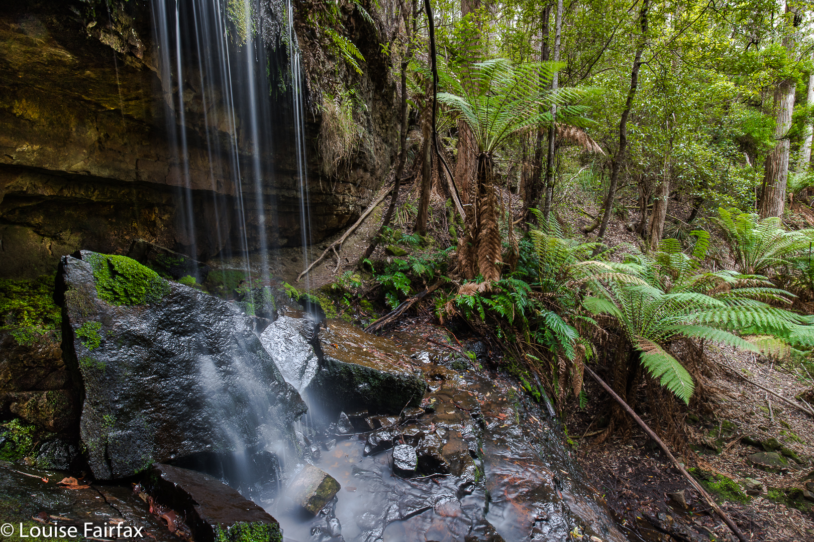
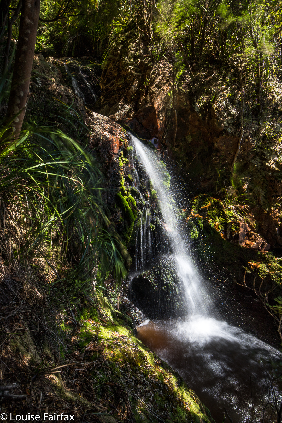
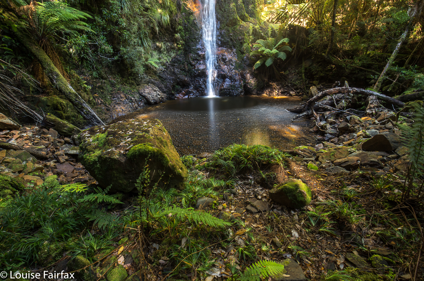
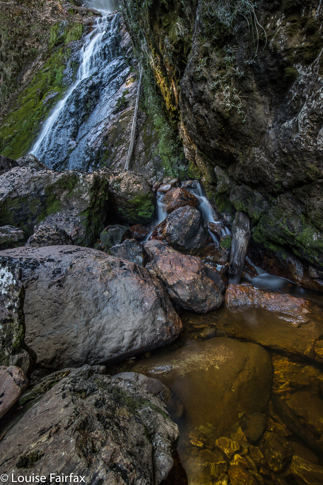

Shower Falls
“Camp Creek”, as I have dubbed it (nameless on my map), was running, so I knew I would get something at the falls. As there was a nice little track leading to the lower Shower Falls, I took it first and photographed them before heading upstream to Camp Falls, which were just a tiny bit lower than the track.
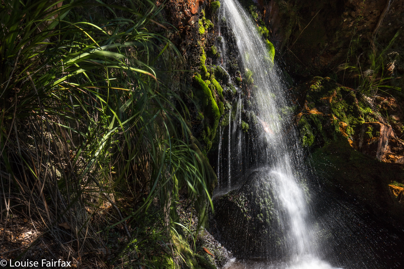
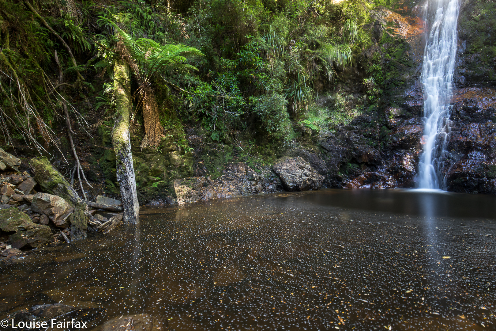

Shower Falls
I definitely preferred Shower Falls. The way back was just a reversal of the way out, except that it was, for me, full of guilt, as I had taken longer than anticipated, and I knew the children would be eager for Easter Eggs. I was holding things up.
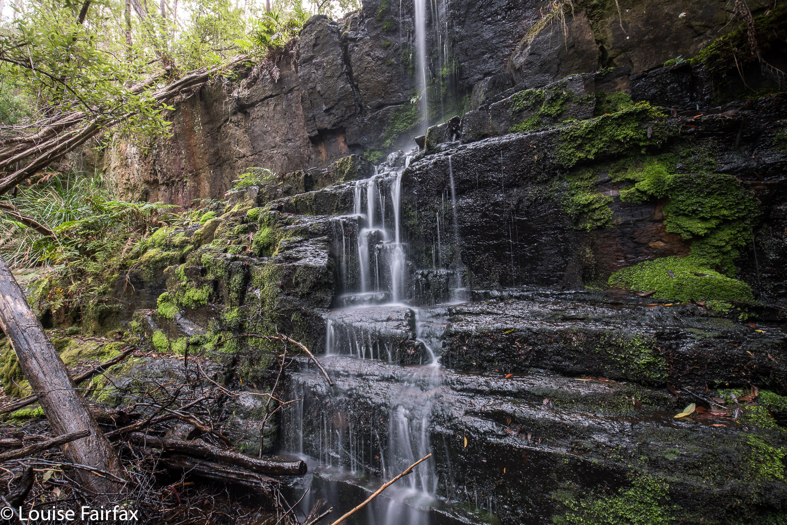
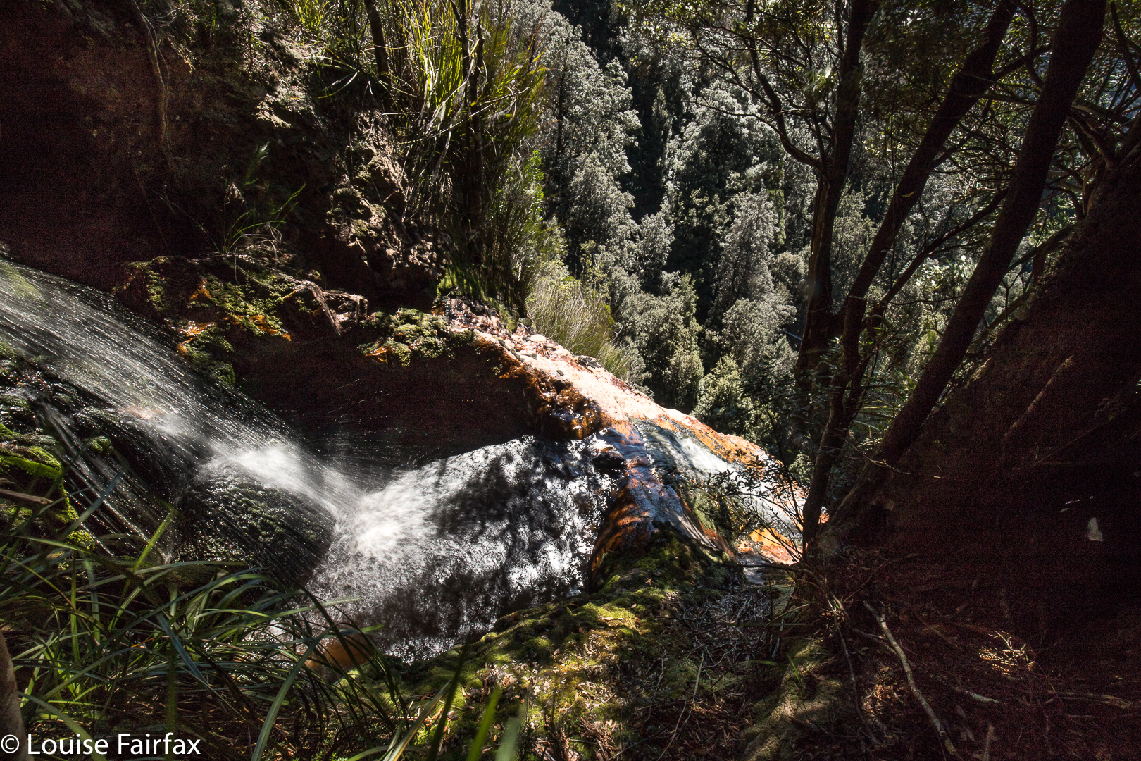
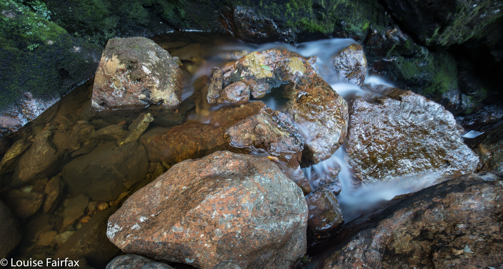
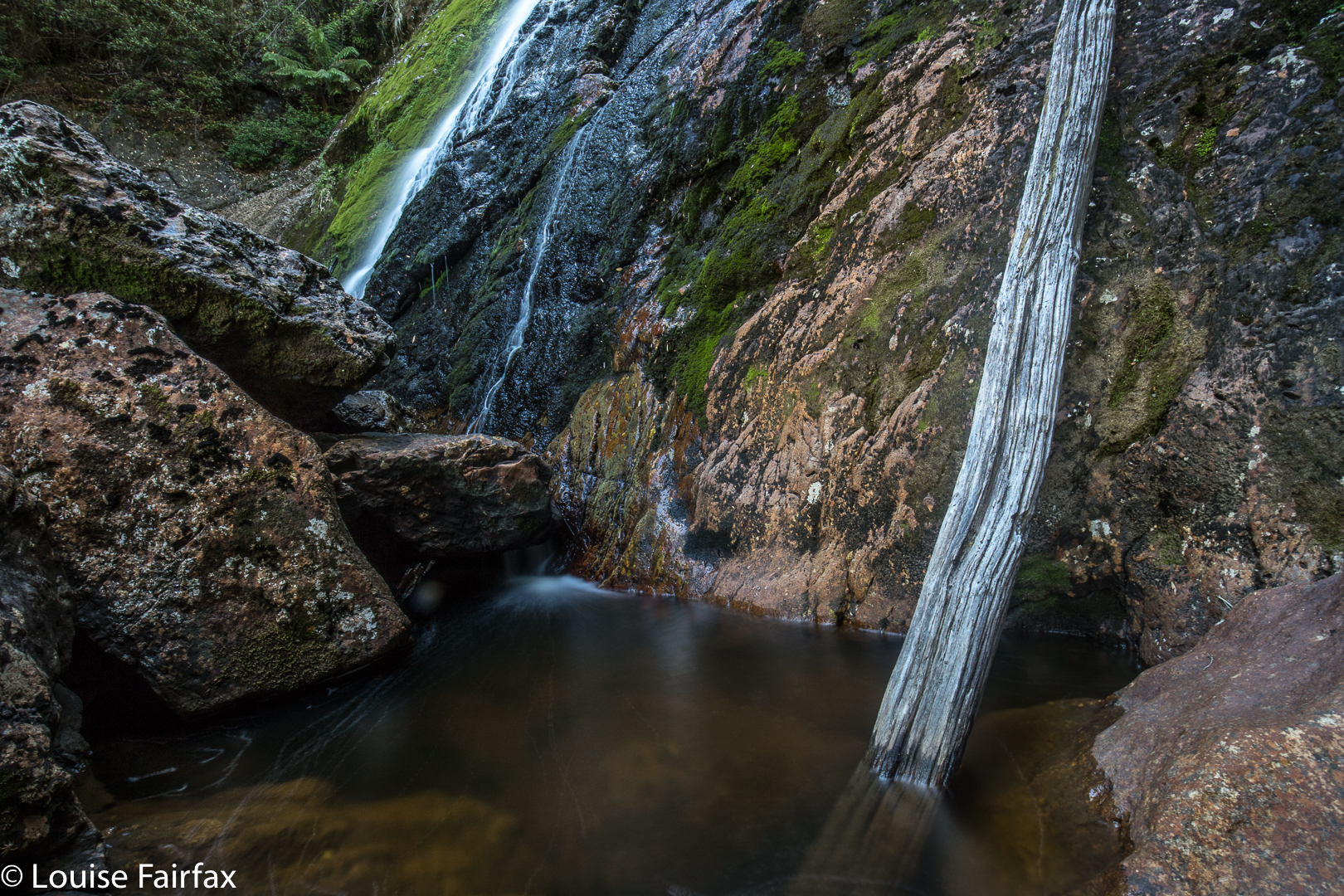

Camp Falls

Phillips Falls (i) and Lake Rosebery 2018 Mar

Phillips Falls and Lake Rosebery. Mar, 2018.


Phillips Falls as seen from above. Isn’t that beautiful?
My visit to Phillips Falls occurred the day after my Montezuma, Rawlinson and Frazer Falls extravaganza, and was not on my schedule at all. I had stopped for the night at the beautiful Lake Rosebery, as I planned to climb a mountain this day, but it had clouded in during the night, and, more importantly, I was starving. I had left my foodbox at home, and the West Coast did not do it for me for comestibles at all. There was nowhere I could think of nearby that would give me anything other than prefabricated cereal and even worse bread. The coffee I had had the night before (milk scalded, coffee weak) did not excite me about my prospects there. Queenstown has a decent cafe, but that was a long way away, and in the wrong direction. And what would I buy for lunch? That had my stomach in cramps and depression. Not for the first time, I fled the West Coast out of necessity for my kind of food. I am a fussy eater.

My tent spot at Lake Rosebery
So I ate fruit with coconut yoghurt, staring out at my beautiful redoubt for the previous night, happily remembering my 12.30 a.m. exit from the tent to a clear sky full of stars above Mt Murchison, packed up coffeeless, drove through a still-sleeping Tullah, and headed north, appeasing my hunger somewhat at Moina with a microwaved scone, cheap jam and pretend cream (how are they allowed to call that stuff ‘cream’?) and another weak coffee with scalded milk. Sigh. At least I now had some caffein in me, so that as I approached Mt Claude, I decided I might as well pop in and suss out Phillips Falls while I was in the area. I turned right up the C138 and drove over the saddle, taking the first turn to the right after dropping down (Cockatoo Rd – unsigned as such).

Evening settles. I watch it from my tent, pretty exhausted.
As I wasn’t expecting to be here, I hadn’t done any research, so parked the car and made my own way to the top, as with Frazer Falls, noting the huge drop to the bottom. The water wasn’t flowing, but I thought the pools with their reflections, and the hint of what would be if I came back after rain, were well worth the visit. I don’t think you’d normally get that lovely mirror effect were the water not so still. When I returned to the car, I saw that I had reception, so could then read that I should approach the falls from the Eastern side, and not hug the water as I had been doing. Then I would reach the bottom. However, as the water was not flowing at all, I was pleased with my recce, as I now know exactly where I want to go, so ended my visit and drove home.


Another  LE shot of approaching night
As I drove past the Raspberry Farm, I popped in (ah, real food at last), and now had a couple of kilos of berries, which have been filling my pancakes and accompanying my croissants since. The aim of my game is to eat with enough speed and big enough helpings to beat the growth of mould. So far so good. Pity I was greedy and bought 4.5 kgs. I have a lot of homework to do. Perhaps my blog should be called ‘diary of a famished photographer’.

Frazer Falls 2018 Mar

Frazer Falls, Mar 2018.
The third falls on my list for this day were Frazer Falls, which I was going to attack by following the stream uphill. However, on my way to Rawlinson Falls, I saw some tapes leading up the spur beyond, and on checking my map, I decided this would be a fine way of reaching the falls: follow the spur up and then contour in. OK. That would be my new mode of approach on the rebound. The country up to my left as I walked on was incredibly steep, so it was good to have a plan in place that seemed feasible. I felt that quite a bit of trial and error could be involved here (and I was right).


These are little falls, above the big ones. The sign saying “Frazer Falls” is here, and not below, but here is the top. To my right, right now, is a humungous drop.
On the return leg, I turned uphill at the tape. If it didn’t work, I could then try following the creek (Frazer Creek). Up and up I climbed, on a lovely pad rather than track, that surely went to the falls … or did it? Perhaps it just went to a hut I’ve heard about. However, I reasoned, the hut would be a fun thing to see, and I could catch the falls on the way back down, if that’s the way things worked out. I looked at my map again, and decided this pad should swing to my left once the contours got more gentle. Just when I was thinking things were wrong and it really should be swinging left, it swung, so all was well.


My biggest problem was the two areas of fallen timber, where regrowth had taken place so that the ground was no longer visible, and obscuring shrubs and cutting grass had grown up. It was March, just the time of year when I once got bitten by a tiger snake. I was fearful. This was just the kind of territory I was in when bitten. I held my breath and gulped and got through it as quickly as I could, hating every moment. A second problems was the lack of opportunity to comfortably swing left on contour to avoid these areas. It was steep and full of horizontal scrub – most uninviting. I therefore stayed on the pad to see where it would dump me. I found myself at a lovely little sign, cutely carved in wood, telling me I was at Frazer Falls … but I was at the top. I wanted to be at the bottom. OK, so, I’d explore the top for now.


If I tell you that those trees whose tops you can see are enormous, can you begin to get a sense of the drop in front of me? It was huge.
I climbed the short way down and took photos of the little falls above the real ones, which are here. I have been told of others who have photographed the falls from below, so am peeved that that was not my lot for this day. I felt very, very insecure in the area immediately above the falls, as the drop was huge. I opened my camera backpack and several items tumbled out. I watched with dismay, too scared to chase them. Luckily, they stopped their path to the abyss (oh the joys of friction), and I prodded them with a stick to return them to the bag, marvelling at how much money almost went down the gurgler.  I could see no obvious sign that humans had gone “this way”, and had lost my experimental spirit, so decided to be content for now that I had bagged the falls from above, and saved the below bit for another time. The flow above was minimal, so I don’t think the below view would have been worth the effort on this day – well, that was what I told myself as a consoling fact.
I was hoping to be more efficient through the fallen areas on my way down, thinking I knew my way through the mess now, but got shoved somehow to the right, and found myself mildly stuck in timber that was so rotten I couldn’t just walk on it to get out, as it collapsed under my not-considerable weight. I was nervous about getting a foot wedged in such a collapse, so trod very gently indeed, and rode most logs like a horse until out of the area. I didn’t think our girls would like to lose two parents in the wilderness, possibly from the same cause. I knew I was nearly back at track level when the dulcet tones of 4WD revving reached my ears. Three cars went by as I did the final few metres to the Montezuma track.

Rawlinson Falls 2018 Mar

Rawlinson Falls. Mar 2018


Rawlinson Falls
I was very curious to see what happened to the contoured track after Montezuma Falls as it wended its way west towards, inter alia, Rawlinson Falls. The (beautiful) path is now part of an eighteen-kilometre MTB track, which is a great initiative. This track is also open to 4WDs and quad bikes, with all their noise and petrol fumes. I was pretty worried about being splattered with mud most of the time; however, no one got me. That said, I always felt the onus was on ME to get out of their road, and that they wouldn’t slow down much to give me an opportunity of finding a good spot to get off their turf. I saw four quads and about eight or more 4WDs on my journey. The sound carries, so it seemed like more. I must admit, on the positive side, that all bar one of them thanked me for moving out of their road. I like courtesy.


It took thirty eight minutes from Montezuma to Rawlinson (I wasn’t mucking around), and then the fun began. I thought these ones would be a breeze – hey, they’re just beside the track. No breeze was blowing that day! I followed the creek the short distance from the bridge and … whoah, that’s a huge drop!! How am I to get down there? I knew it was humanly possible, so I opted to go back quite a bit, and angle in (not clear from the map below) to cut the gradient. Do not try this if you are not experienced. It really was very steep. I was travelling solo, and no one knew where I was, so I was a little anxious. For every single step I took, I made sure one arm was around a nice healthy young tree that would not break. I trusted nothing dodgy. Not only can you harm yourself greatly if you don’t know how to handle slopes like this, but you could also cause a landslide that would harm the environment for everyone else. If you photograph from the top, you have still bagged the falls.

I was rewarded for my efforts by the sights in these shots. I took one (not here) from half way down, perched above a sapling, as I never actually believed I’d get to the bottom, so was feeling quite jubilant to reach flat land below. Having not slid at any time, I knew I could easily get up my downward route.

Montezuma Falls 2018 Mar

Montezuma Falls Mar 2018.


Water tumbles quietly over the base of the falls
I feel rather ashamed to write that last weekend was only the second time I have ever visited the renowned Montezuma Falls. This is especially shameful if one considers how very beautiful the area in which they are situated is. And it is perhaps even more so if I add that I only actually visited them as I was on my way to other, more distant waterfalls; they just happened to be the first ones I came to directly on the track.

On  my first visit, they were pumping so wildly it was impossible to keep the spray off one’s lens, and I threw my picture out. This time, the problem was kind of the opposite, in that they were flowing so demurely that I could sit on top of them and not really get wet. As a result, the photos included here are more “details” of the lower outlet of the falls. You could certainly get up close and cuddly this weekend. Meanwhile, however, if you’re not obsessed with seeing massive and unphotogenic gushes of water down your falls, the delicacy of the offering was, for me, quite appealing, and I absolutely adored the lush green forest en route.

And why on earth did I visit these falls on a hot day in March when the water was bound to be undramatic and the forests bereft of fungi and mist? Because, essentially, this trip was a recce to check out Rawlinson, Frazer and Svengali Falls. I would be driving down from Launceston, and then covering about 22 kms over rough ground on foot, some of which would be bushbashing. I wanted to be able to move quickly (not too much mud) and to walk in river beds should I need to, just to suss things out and get a rough time-frame for the expedition. I now know, for example, that it takes about 55 mins to reach Montezuma, another 38 to reach Rawlinson, and 30 mins to climb up to Frazer. Such items of knowledge are handy when planning future trips. I also learned that bringing just one ETC salad roll and florentine plus OJ is not enough to keep me in food for such an expedition. As usual, I was hungry most of the day, and was stealing lunch by 10 a.m.. I got very low on blood sugar by the end.


Loved the cows early on in my trip to the falls, shortly after leaving Launceston.
For reports on the other falls, see www.natureloverswalks.com/rawlinson-falls/ and www.natureloverswalks.com/frazer-falls/. I was too tired and hungry to do any more than a brief exploratory journey in the direction of Svengali. They’re for another time.


The tiny “settlement” in the top right corner is Williamstown, where you park. The road to it begins 2kms south of Rosebery, and is 6kms long. The Falls are marked on the sign that says Williamstown.