Bayeux Bluff 2018 Mar

Bayeux Bluff, Mar 2018


When we set out in thick fog in a general southerly direction, we were not at all committed to reaching Bayeux Bluff. We made our goals simpler, and said we’d at least go to Battle Ridge’s end, perhaps Odo Tarn. We’d probably then run out of time, as the fog had meant our start was later than we’d originally planned for.


Battle Ridge shots
However, from the end of Battle Ridge. with the swirling fog so very alluring, and the going so utterly pleasant, the group decided to reach our earlier goal. I was off photographing to the side when this decision was made, and jokingly abused them for not giving me a vote, but they claimed to know my wishes on this matter without asking, and off we set. Of course, they were right. As said in my earlier blog on this walk, my only regret concerning this day was not having time to also climb Norman Bluff. Doomsday Bluff would have also been a nice addition to the agenda. They’ll be there for my return visit.
(www.ntureloverswalks.com/king-william-circuit/ )


Odo Tarn babies


Bayeux Bluff area to Lake Eva and Guelph Basin
I was glad about the fog: it leant a certain charm to the scenery that one of those sunny days just can’t match. The whole day seems wonderful to me as I look back on it – the whole weekend does. I can’t understand these scoffers of club walking. My credentials are proof that I don’t need a club to help me navigate or get through the bush. Those two factors are only a small part of the whole bushwalking experience. Camaraderie with likeminded people out-trumps (sorry to use that word, which has now taken on very negative connotations) other factors. Yes, I also like the solitude one can have in the wilderness, but you can get that, too. A mixture is great. The scoffers, I note, almost always go bush with friends, so it’s merely a matter of how you define your company. I feel it’s being elitist if you happen to have a group of good and willing friends with whom you can always go bush when you want to, to scoff at those whose circle of friends is somewhat different. Clubs like LWC, HWC and Pandani contribute hugely to the well being of the broader community, in both physical and mental aspects by enriching people’s lives and providing them with access to others who feel the same way as they do about being in the wilderness. I greatly enjoyed the company of my companions on this adventure, and would not have enjoyed it a tenth as much had I been alone. Humans are social creatures, and sharing experience is part of what makes us happy. I love my club friends, and to see them turn out in force to help search for Bruce when it was needed, when we thought we had a chance of saving him, warmed my heart (and our daughters’  hearts) hugely.


On our way back from Bayeux Bluff and Odo Tarn, we laughed together about some of our past shared adventures where things had gone “wrong”. Such is the fodder of tales and merriment for years after the event, and is only possible in a shared context.


The more westerly route is our outward one, as we wanted to follow Battle Ridge. On the return journey, we followed the broad valley up. Both routes were wonderful.

King William circuit 2018

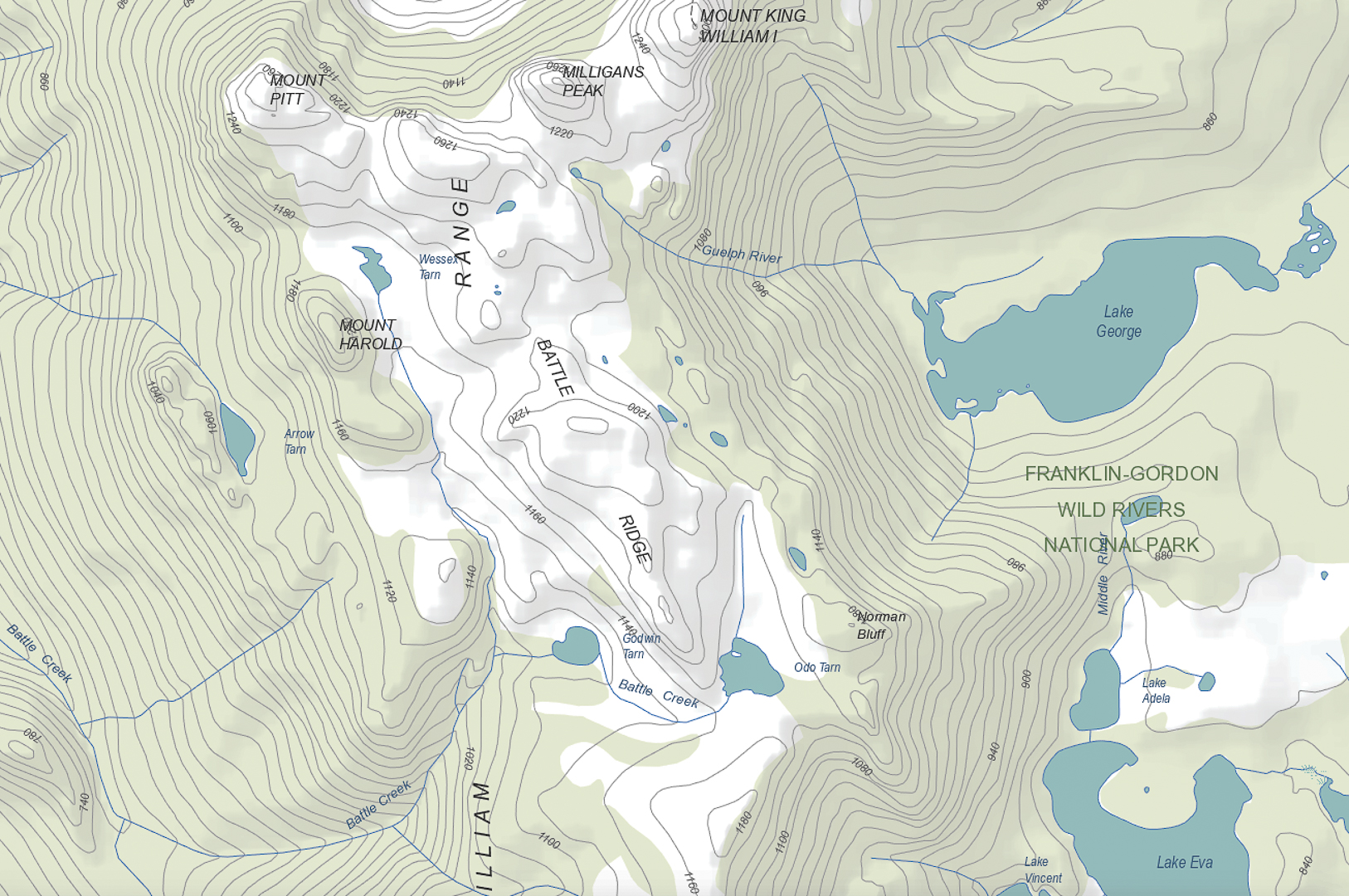
King William Circuit, comprising Mt King William I,  Milligans Peak, Mt Pitt, Mt Harold, Battle Ridge and Bayeux Bluff, and visiting Wessex, Odo and Pitt Tarns. March, 2018.

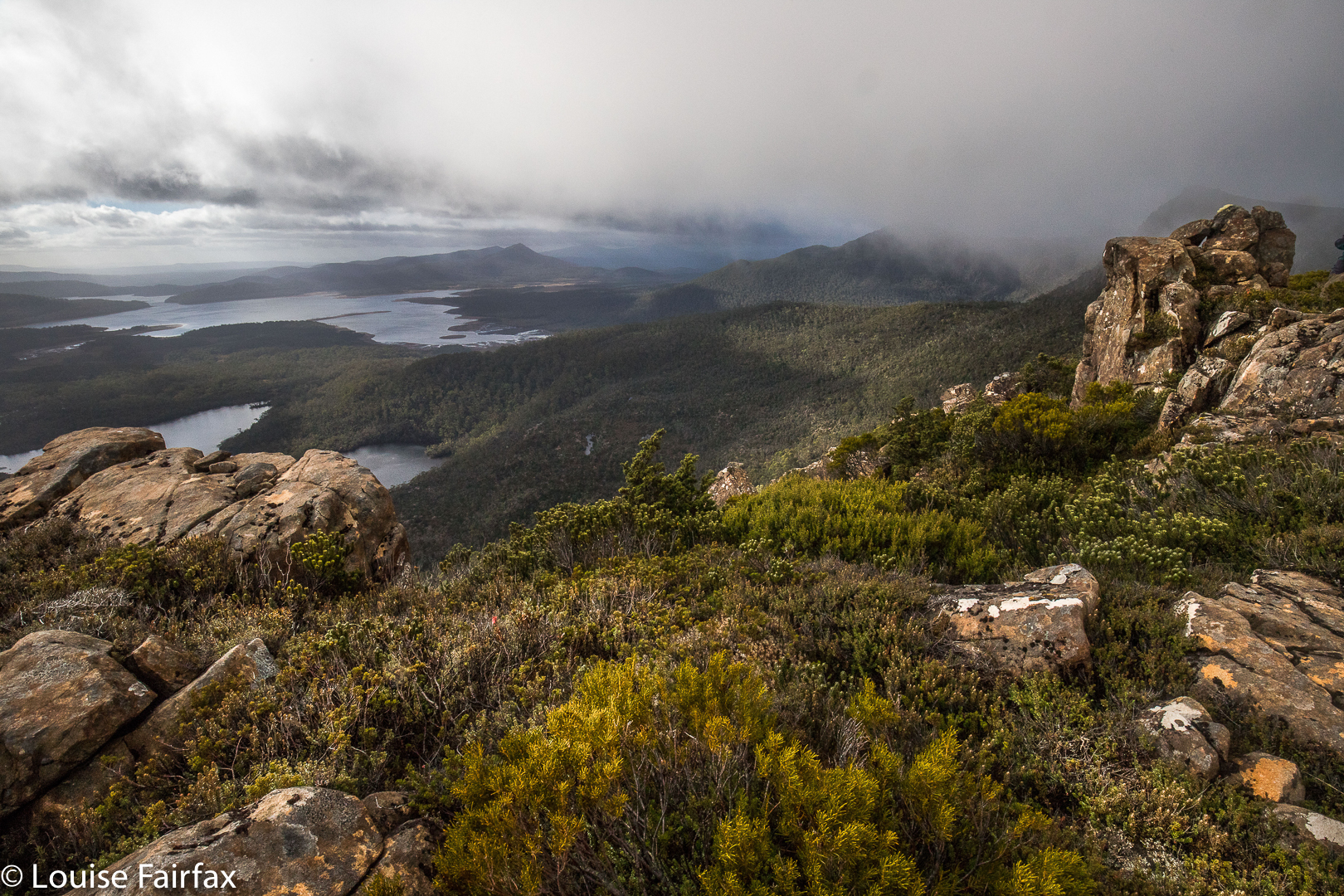
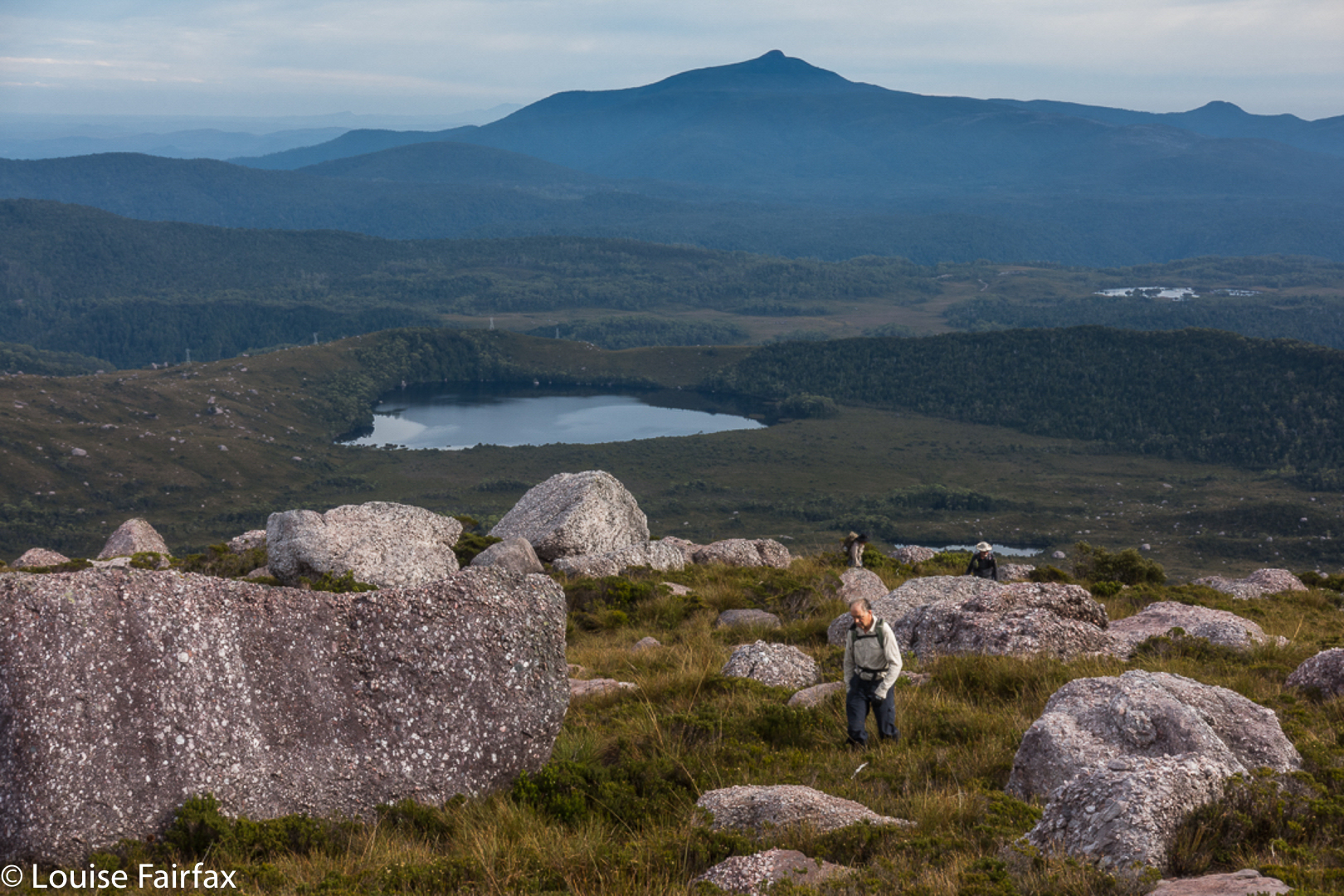
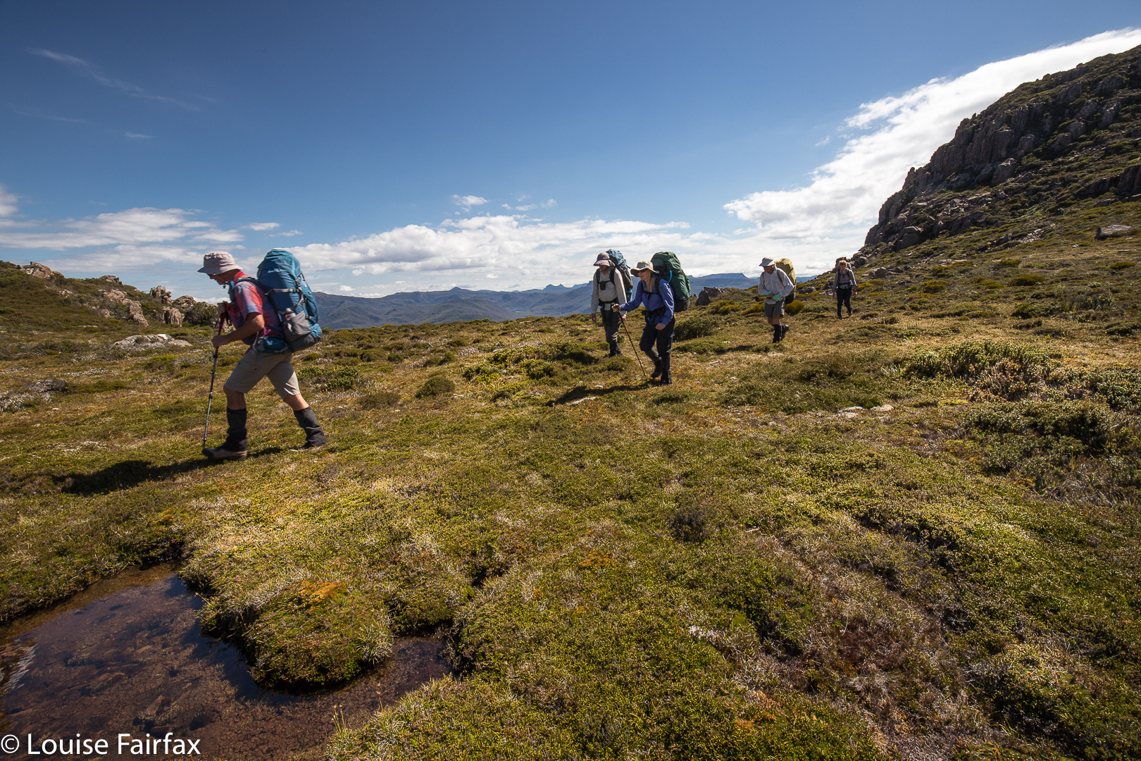
Climbing Mt King William I. Lakes George and King William in the distance.
I had just returned from a fabulous week with friends at the beach near Coffs Harbour, and felt terribly flat to be back home in my now lonely environment. I looked at the approaching weekend: apart from my darling daughters, no one would ring; no one would pop in; no one would invite me anywhere. Life seemed bleak. I could sit at home and sulk and weep some more for Bruce, or I could be proactive and invigorate my life by joining in a club bushwalking trip. I chose the latter, and phoned the coordinator of the LWC trip to King William Circuit. HIs plans sounded great. All of a sudden I had to pack my bags pronto. The expedition was leaving at 5.30 a.m. the next day, which meant a 4.30 awakening. Yawn, but it would be worth it.

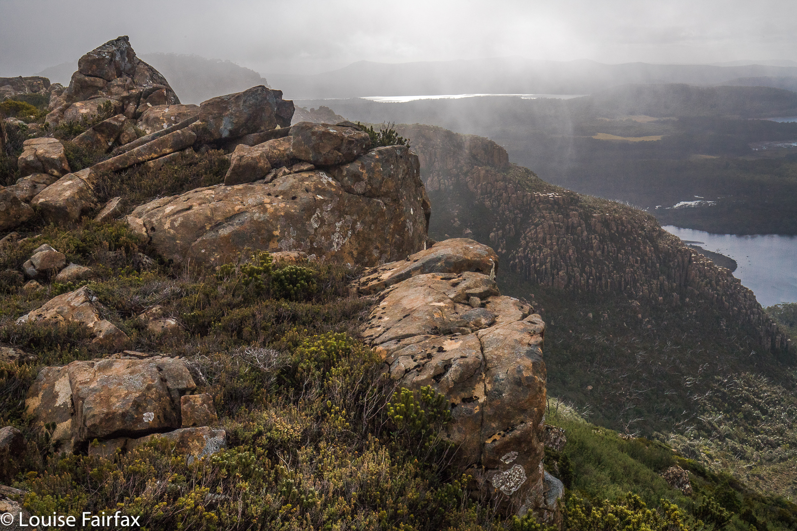
From Mt King William I looking towards Milligans Peak and Mt Pitt. The  Frenchman is in the distance, as usual.
I had already climbed King William I, but in a whiteout, so this time I got to see the expansive views. With our nice early start, the day was not yet too glary. It was, nonetheless, the rest of the expedition that held my attention.

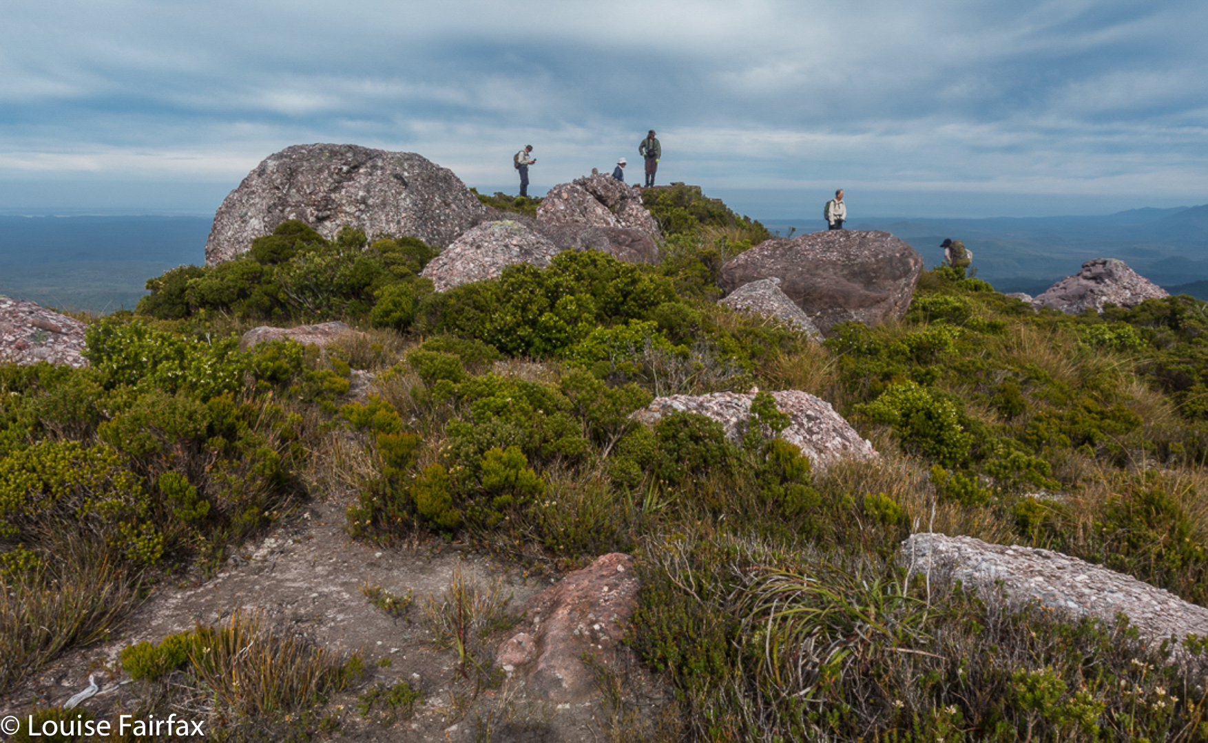
In the saddle between King William I and Milligans Peak.
Once we left King Will I, we were in more interesting and less-frequented off-track territory, moiling our way towards Milligans Peak, which was very quickly reached (12 down, 13 up) from our first peak. (Note please: my times never include stopping to remove packs, take photos, eat or whatever; they are “exercise minutes”, as I am interested only in how much exercise I’ve had. Have I been lazy, or have I had a good workout?)


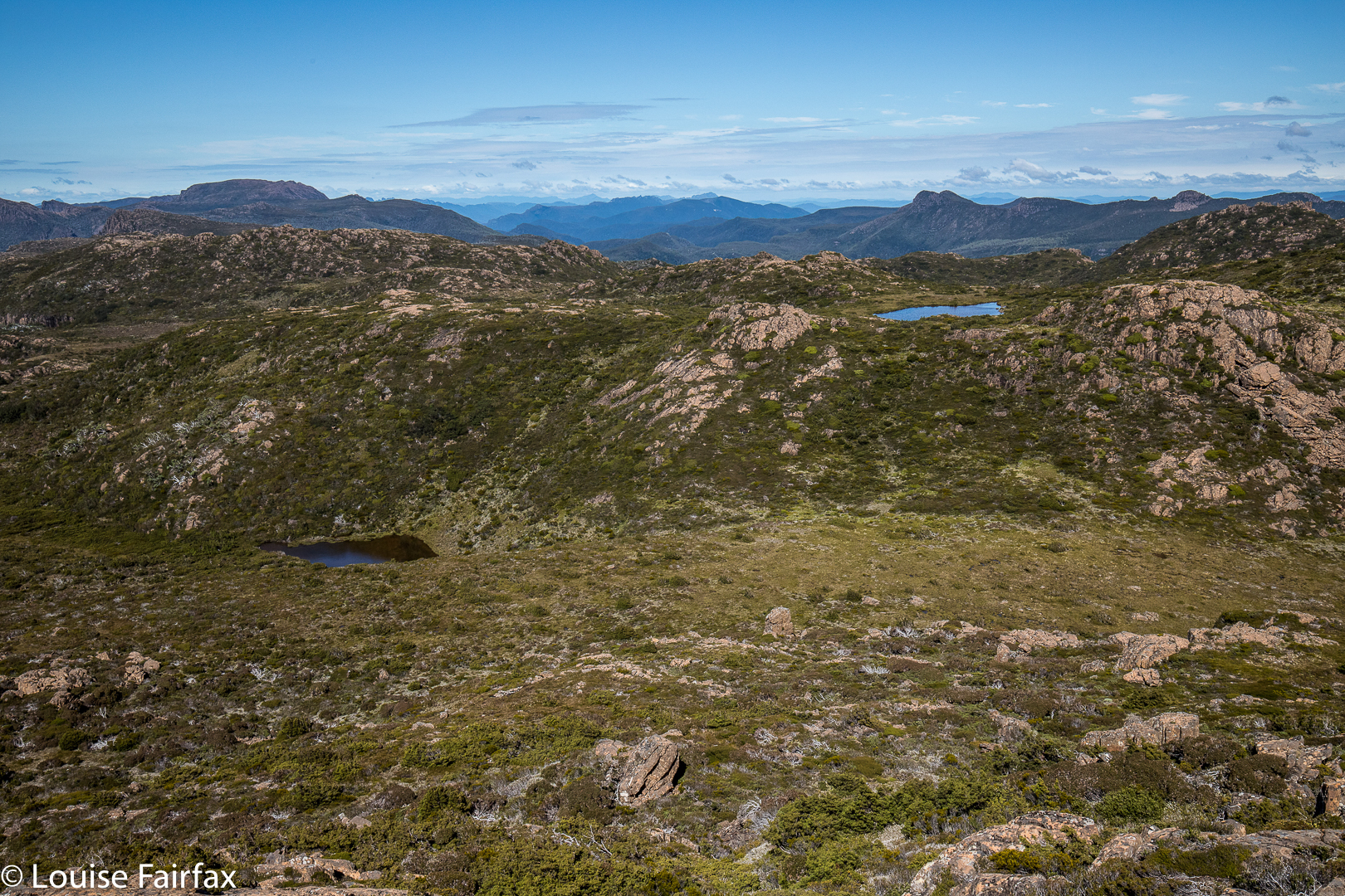
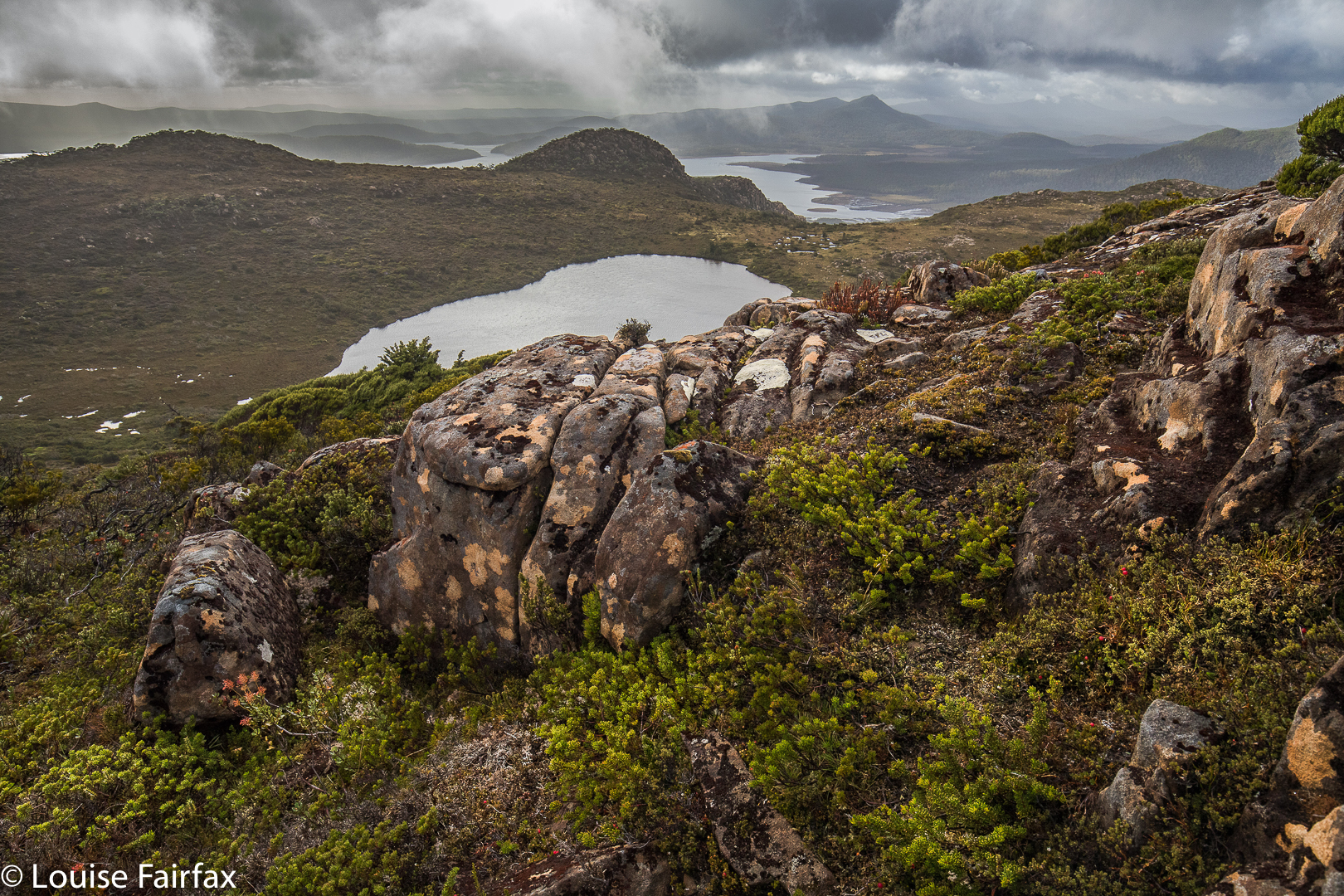
View from Milligans Peak to Guelph Tarn (L) and Pitt Tarn (R).
Milligans Peak offered more great views of old friends such as Slatters Peak and King William II, the Loddon Range, Lake St Clair, Lake King William and our future destinations of Mt Pitt, Mt Harold and Bayeux Bluff. The day was sunny and warm; the weather forecast for rain, a joke. Off we set to be reunited with our packs below, to have lunch by a little pool down there, and to then proceed to our tent tarn underneath our next goal, Mt Pitt.

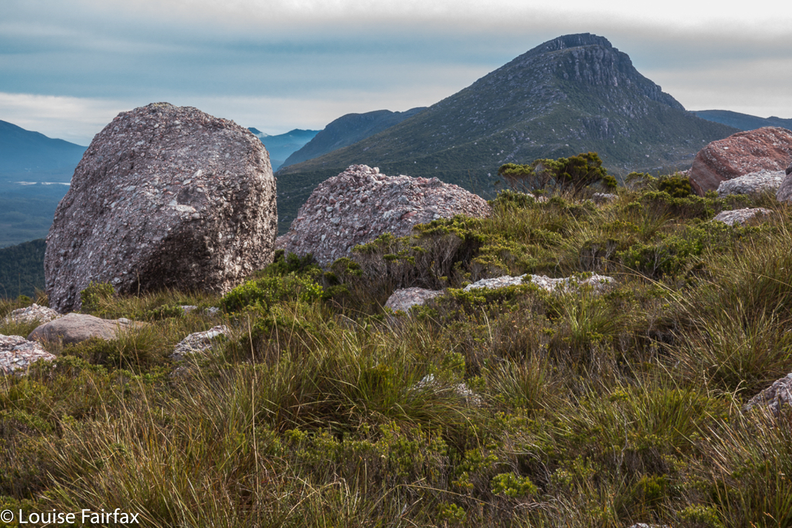
Mt Pitt summit, looking back to Milligans Peak (R) and Mt King William (L)
Tents erected, day packs loaded with goodies and anoraks, we noted the amassing clouds but were unfazed. Off we set to inspect the views of Mt Pitt, quickly reached in 21 minutes from our tents.

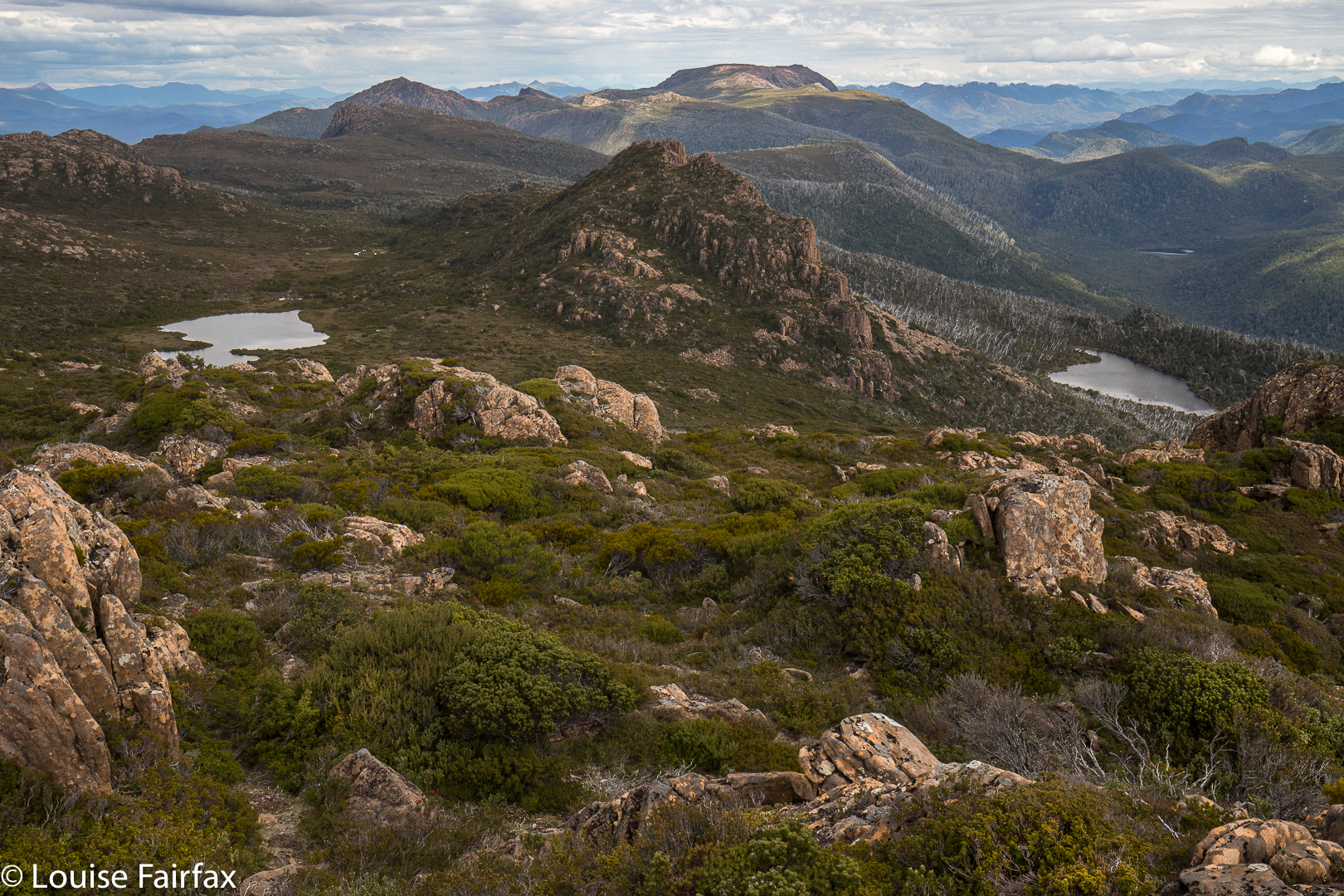
Mt Pitt summit view, looking directly to Mt Harold, which has Wessex Tarn to its L and Arrow Tarn to the R. In the distance, slightly left, is Bayeux Bluff.
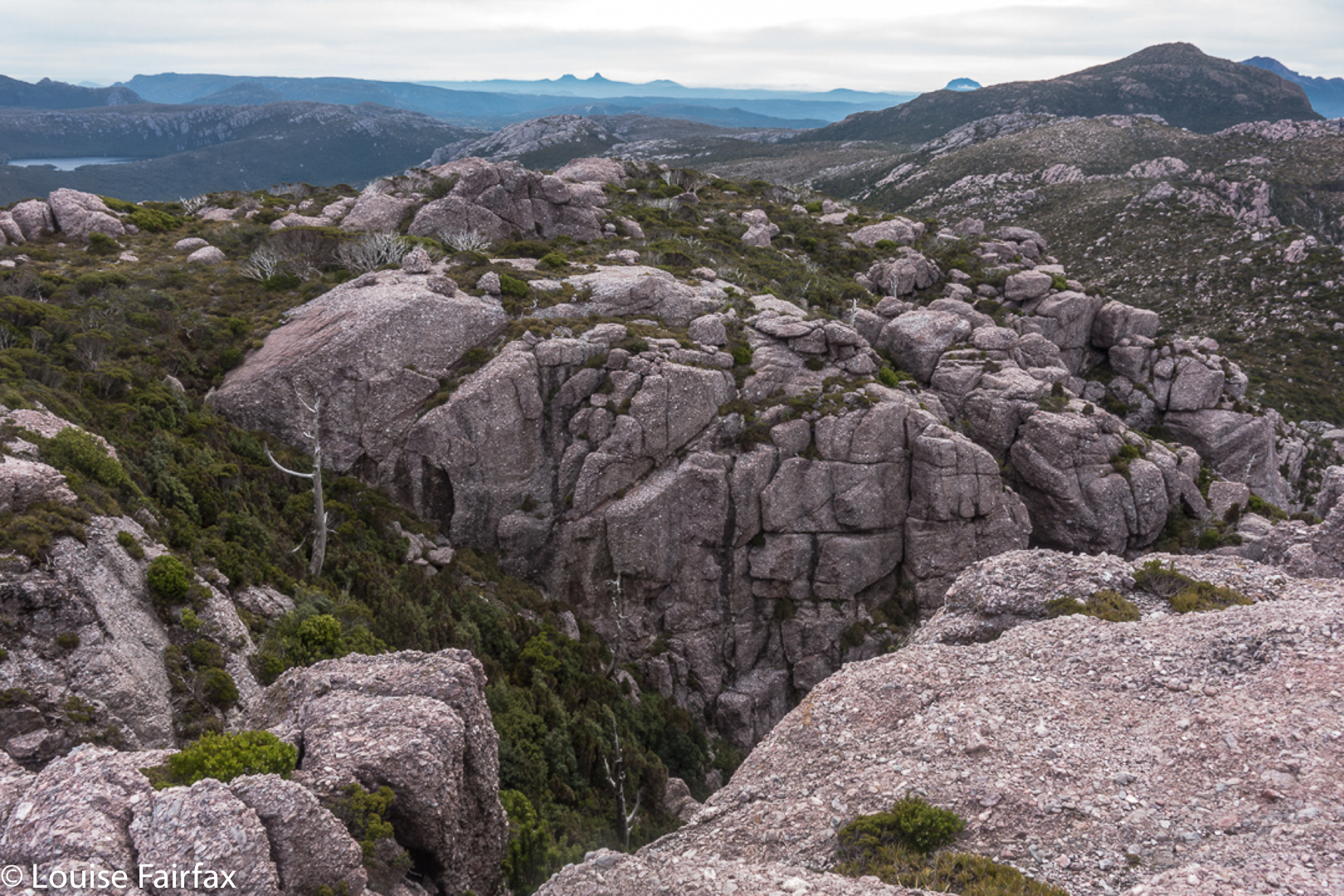
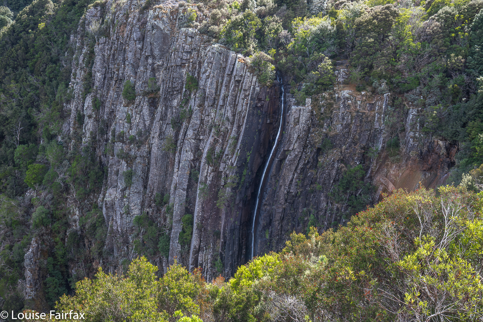
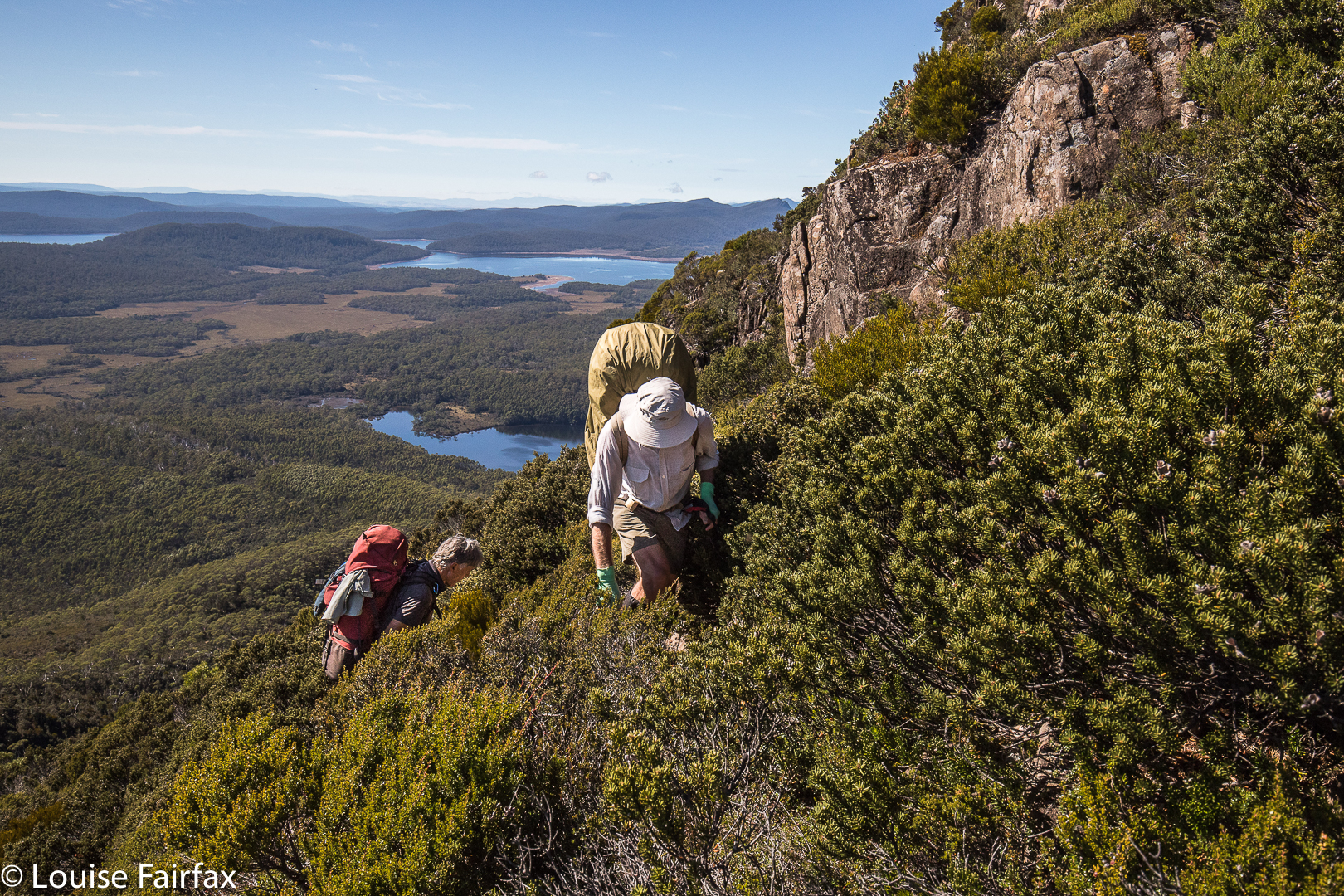
The next mountain was the best one of the trip, and a memorable mountain under any and all circumstances, with its hedgehog spikes all over its spine that caught your attention from afar, and had you wondering how, actually, you were going to touch the high point. I plotted my intended route from Mt Pitt, and carried it out with no problems. Having been initially daunted by the rock spikes, it gave a special feeling of pleasure to be on top of both the false, and the slightly higher, real, summit. Drama was all around.

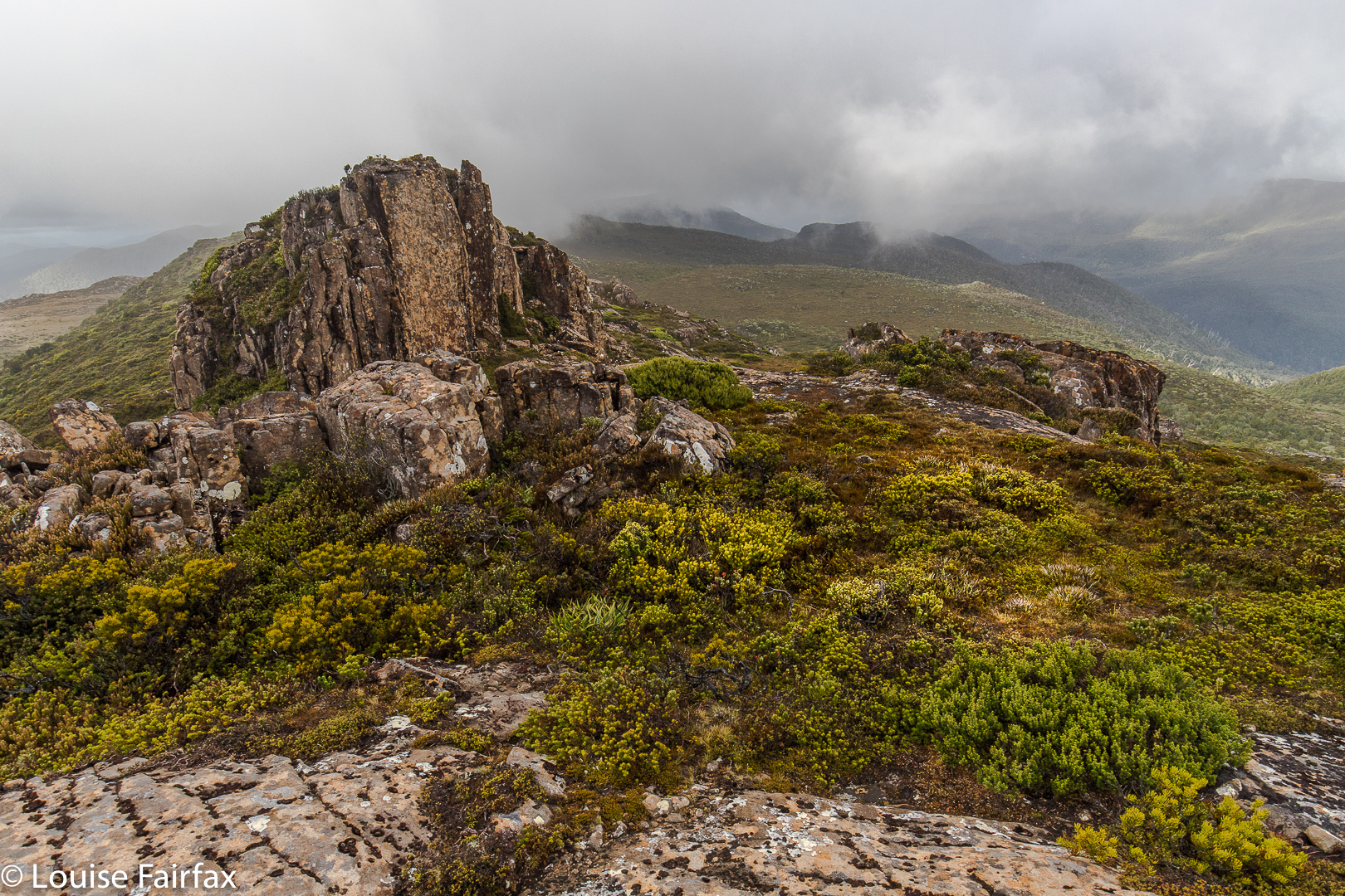
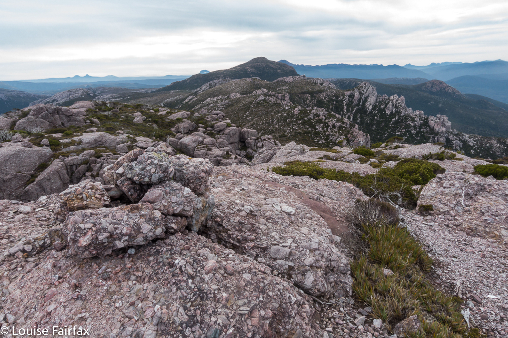
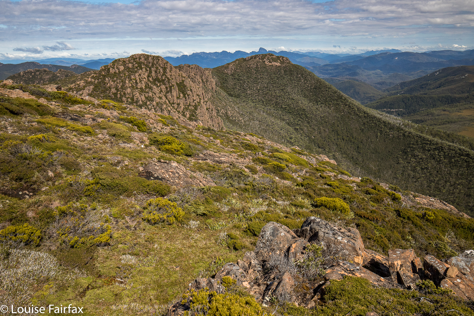
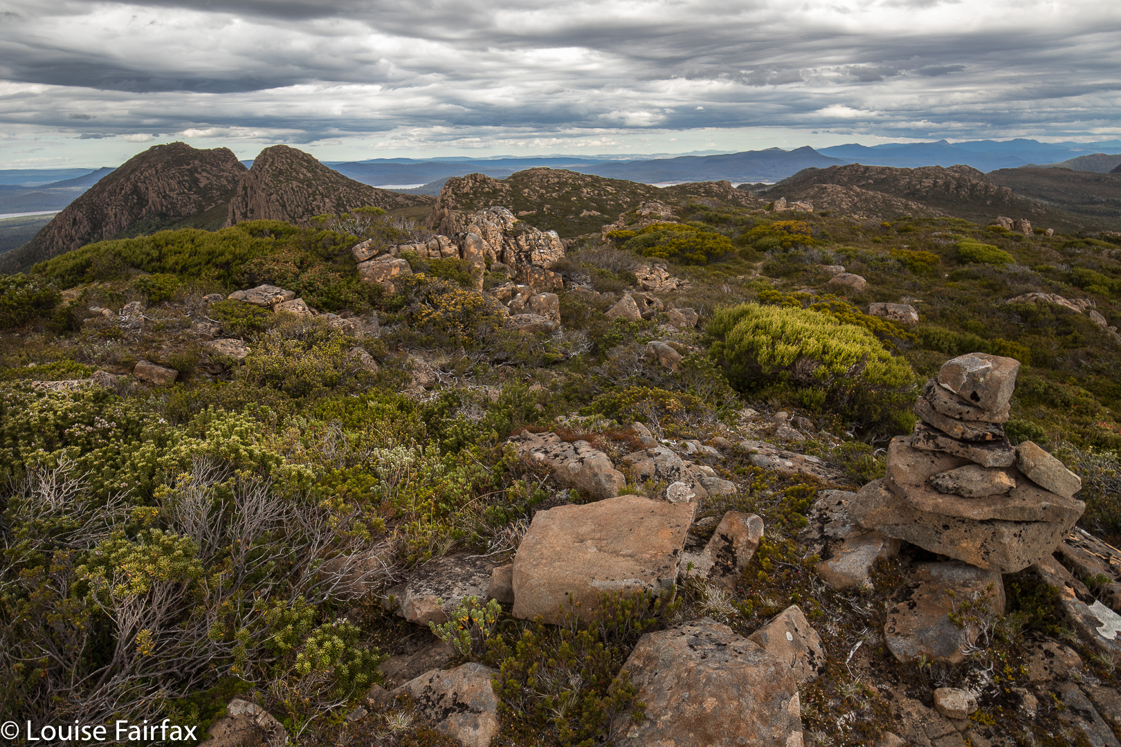
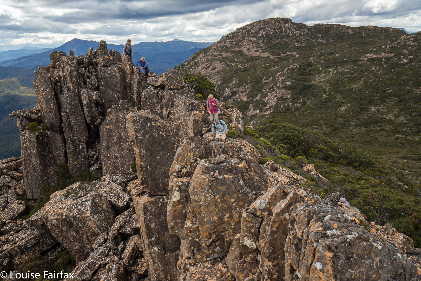
Looking from Mt Harold real summit towards Mt Harold false summit. Mt Pitt is back right.
We all voted it the highlight, and abused the people who haven’t even given it a point. In fact, not only is it not worth a peak baggers’ point; it is neither an Abelette, nor a “Point of Interest”; neither did it get a nod as a “Bob Brown”. It is totally ignored by the people who sit in offices (or, reputedly, at the dining table after a few wines), staring at maps deciding what is “of interest”. We who visited this mountain think it is of extreme interest, and we loved it dearly.

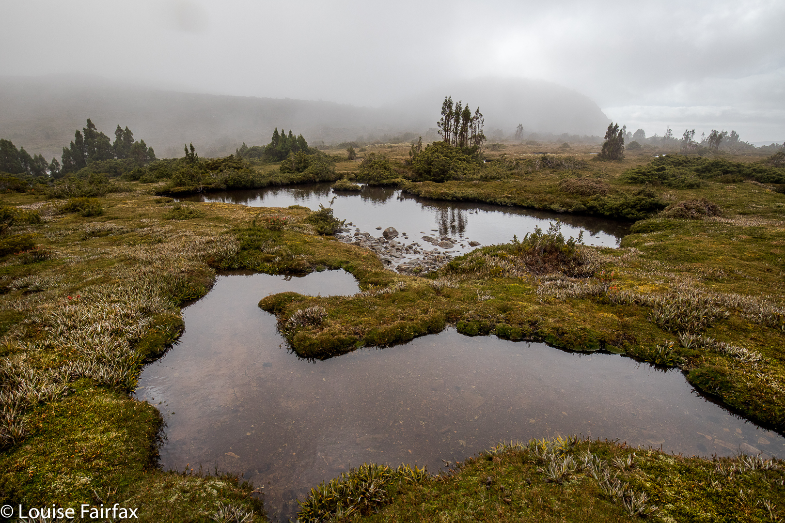
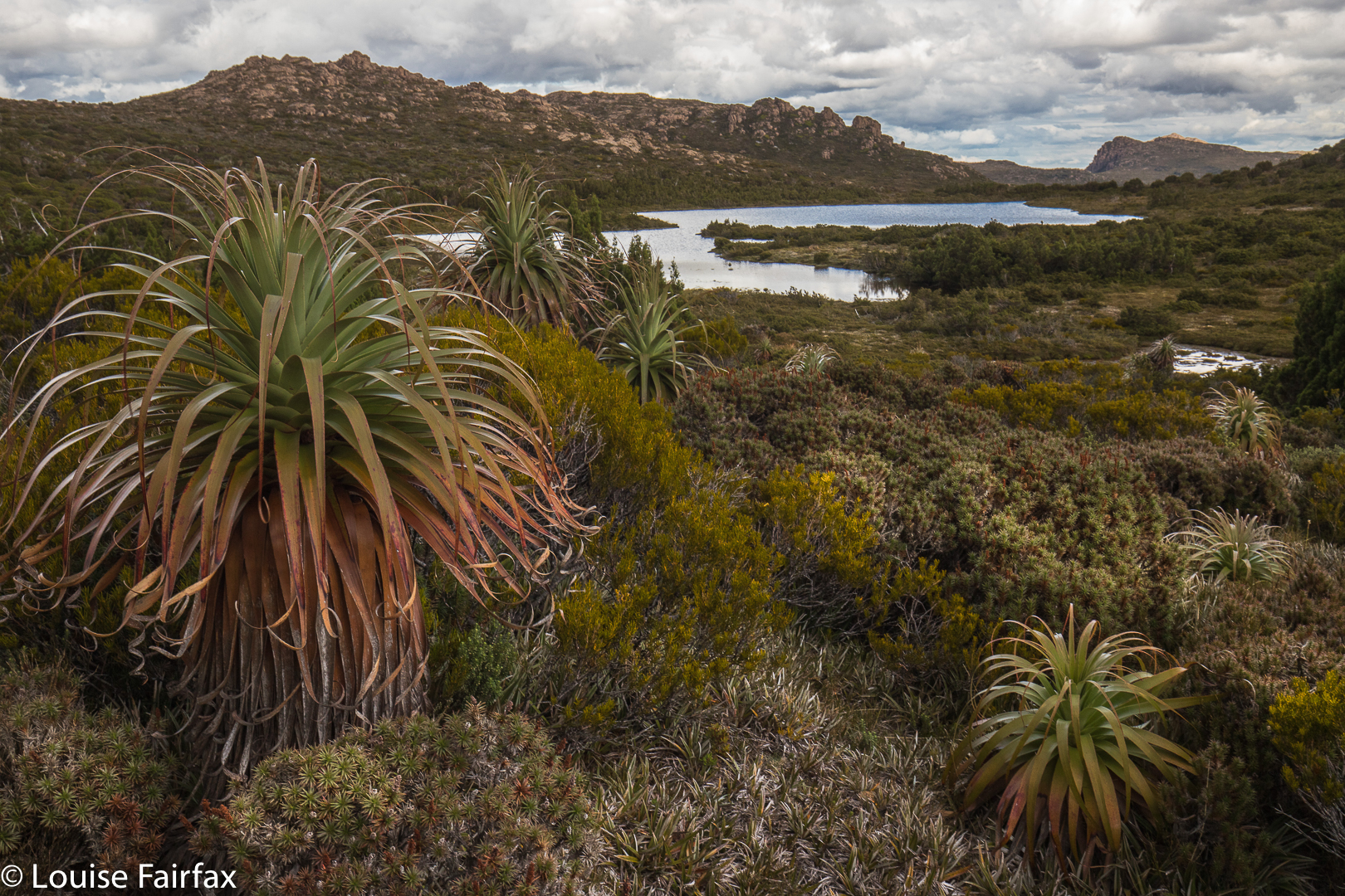
Wessex Tarn. Battle Ridge to the left.
Off the top of Harold, we lowered ourselves through the scrub until we reached the beautiful Wessex Tarn. Now, from even before we climbed Harold, we were in the Battle of Hastings territory, with Arrow and Wessex Tarns on either side of our spiky castle and Battle Ridge in front. Norman and Bayeux Bluffs were up ahead, as were Odo Tarn, Battle Creek which runs from it, and Doomsday Bluff, beyond Bayeux. (To refresh your memory, in case you’d like it, the Bayeux tapestry depicts the Battle of Hastings, in which the Normans, under William the Conquerer, invaded and defeated England – under the leadership of anglo-saxon king, Harold Godwinson, in 1066. The Odo of Odo Tarn refers to Bishop Odo, who is depicted holding a club – presumably not a nice one like LWC, but one with which to bop you off. He was William’s younger, half brother. Later, William, now King William, commissioned the Doomsday Book (1086), an assessment of the land he had conquered and its wealth, so he could raise the taxes). It was fun to be in this territory, and to have as our culmination Bayeux Bluff, which we would reach next day. I am very sad that we didn’t have time to climb Norman Bluff. But then, it’s nice to have a reason for coming back other than just a revisit of old territory.
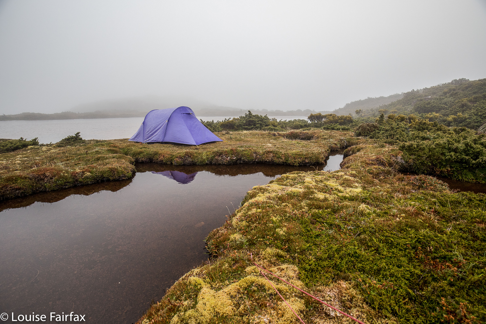
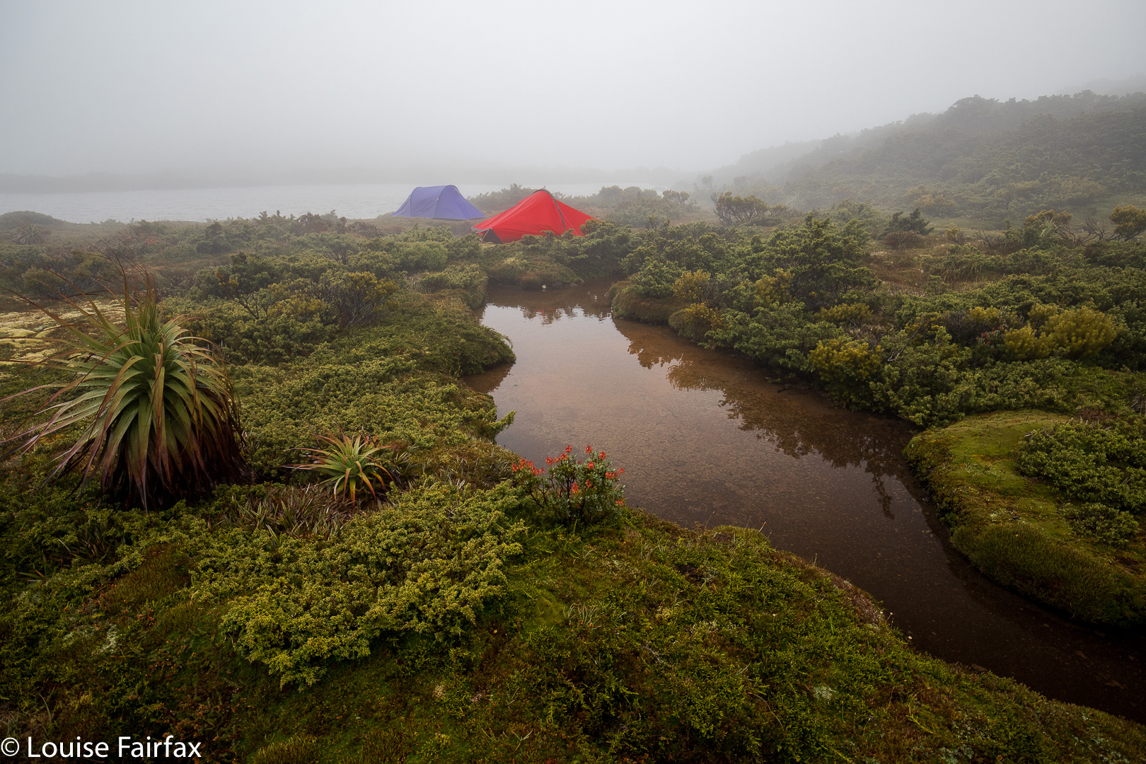
Our trusty tents
Oddly, List Maps has nothing in the area called Hastings. Surely someone could have popped in a creek or tarn or bump … but they didn’t. There are plenty of unnamed features remaining. Adam Guelph, (from Salisbury), who helped William, gets a guernsey (with a tarn and a watercourse), but not Hastings itself. Godwin Tarn presumably stems from Harold’s full name. Of course, from most of our mountains we could see the huge Lake King William; we were on the King William Range. William won. He gets all the big stuff. The victor gets to write history and grab all the best mountains, ranges and lakes.

Meanwhile, with all this history and four mountains under our belts, we retreated to our tents, arriving about five minutes before the clouds that had been slowly accumulating while we checked out battles, decided to dump their contents with a vengeance. We filled in an hour, and then cooked in our vestibules to the sound of wind howling and rain pelting. My flap buffeted most of the night, and we awoke to pea-soup fog. That did not deter us, however. On our agenda were Battle Ridge, Odo Tarn, Battle Creek and, at last, Bayeux Bluff, from which we would gaze at Doomsday Bluff. This blog is already quite big. For day 2, see the blog entitled Bayeux Bluff
www.natureloverswalks.com/bayeux-bluff/
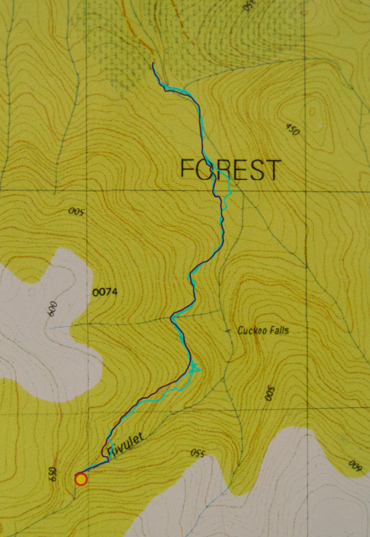
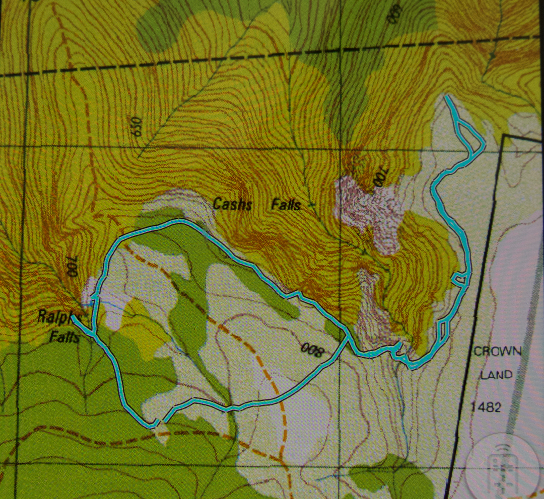
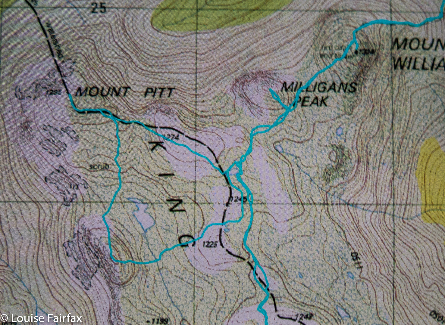
Route Day 1

Sedgwick Bluff as a day walk 2018 Feb

Sedgwick Bluff, Feb 2108.


From the slopes of Sedgwick Bluff, unique views of Mt Geike are offered.
Dear Louise, Would you like to join us climbing Sedgwick Bluff tomorrow? Would I what?? What a silly question. Well, not so very silly. I actually did have a fullish programme on the morrow – like an important appointment, and packing my bag for a holiday in Coffs Harbour beginning the day after, but some things get to push the queue, and Sedgwick Bluff as a day walk is one of those. When would I get another such invitation? Probably never. I “needed” this walk for my healing after Bruce’s death. And I would enjoy the company of these people, and I needed to get out and about and mix with other people more. You can see the “excuses” for impetuosity flowing in. My daughters said it was a great idea. I quickly packed for Coffs, cancelled a few things on the home front, packed for Sedgwick, and, somewhat out of breath, arrived that evening to do most of the car trip down. We were away. Whew.


Having fun before the last amble to the summit.
At 7 o’clock on the day in question, we were at the now-unlocked gate leading to the Lake Margaret Power Station (having gained permission in advance to do so). By 7.30, we were ready to start walking up the exceptionally steep path that runs beside the not-quite-vertical pipes that carry water down from the lake to the powerhouse. We all agreed we would NOT want to drive up that track! In twenty six minutes, nonetheless, we were at the top, looking over the edge at the others approaching not far behind. It was so steep you had to go to the edge to see them. Their heads popped up out of nowhere.


Summit Cairn, Sedgwick Bluff. You can see Barn Bluff, Cradle Mountain, Mt Emmett and Pelion West there to the left of Mt Sedgwick, and the Acropolis and Geryon to the right if you know your shapes. It was a grand view.
The next phase of our journey was a stretch that was on contour, on a kind of disused miniature railway line. This was a beautiful and easy section, and we all knew it was a brief lull before a storm, for, at a point agreed upon by all, we took a deep breath and dived into the thick scrub just before the saddle, figuring things were slightly less thick there than in the saddle itself (or after it). It was so thick that we all took turns of a mere three-minutes at the front, politely calling these five-minute turns, but really, three/five was enough. By the time my second turn came, the scrub was less dense, and soon enough, we made it to the high-point on the ridge just before it dropped to the saddle. The saddle itself was great fun, as it was so steep to left and right, that the merest divergence had one dropping an enormous amount of height. Due to the trees, one couldn’t see this directly; one just noticed that the person in front had dropped out of sight.

One and a half hours of walking after first joining the railway line (with stops for food and thinking and photography added in), we “topped out” of the steep zone, and only had about a half-hour’s gentle “doddle” along the alpine tops to the summit. By 11 a.m., we were sending victory sms’s to doubters who said our trip couldn’t be done in a day.

Yolande River – the first time I had made her acquaintance. Beautiful.
The best part of the trip back was our decision to be different, and come home via a very interesting spur the other side of the saddle from our approach one. Do NOT try to climb by this route! It was hilariously steep, with perhaps the most fun being watching John descend about five or more metres in a single step, but, due to the aid of the thick bush, laughing while he did it and coming to no harm. I gulped and followed. We all knew that we were committed to this route in the fullest sense of the word. There would be no climbing back up. We absolutely had to find a way around all the cliffs we kept meeting and continue downwards. It worked. …. And the next day, early in the morning, I flew out to Coffs Harbour. Life is a good thing.

Cuckoo Falls 2018 Feb

Cuckoo Falls Feb 2018


Bruce and I tried to get to Cuckoo Falls two years ago, but made the mistake of underestimating how much time it would take. We didn’t get started until 3.30 on a winter’s afternoon, and never reached our goal. On that occasion, we spent a lot of time putting out tapes in the forest, pulling in tapes that went  in an entirely misleading direction, and breaking bracken fronds along the old track so that the way would be clearer, and the going faster next time. At last, this weekend that ‘next time’ came by, but Carrie was a to be my companion this attempt.


Now, please don’t get excited when I tell you I put out tapes. My old tapes were still there, indeed, and they had had babies, which is great, as other tapes had joined them, but this does NOT mean that the going is easy or the way is clear.  Like last time, I had a little bag of ribbons of varying colours, grabbed from here and there, and we added even more tape when we thought things weren’t clear, but the trick to adding tape is that you do NOT add it unless you know for sure you’re on the right track, for otherwise you are more of a hindrance than a help. This means that when you need the tape most, you can’t put it out, as you are not confident you’re on track. Once you become sure again, of course, you don’t need tape. Carrie put up with my going backwards on several occasions once we knew we were back on track, and I put tapes where I hoped it would be helpful.


But again, please don’t rejoice and think I have now solved all your problems. Even with the path thus “fixed”, I had to use my gps several times both on the outward and return trips to ensure we hadn’t wandered. There remains ample room for error, and this waterfall must absolutely not be attempted unless you really know what you’re doing. Not only is the path unclear on many occasions, but the way, especially at the end, is rough, violently steep, and challenging, and the rainforest you traverse is old and decayed. Both of us fell now and then when the forest floor gave way under us. This can prove fatal, as Philosopher Smith noted when he was exploring old rainforest further west. I also think that Bruce must have had a fall in the forest (having wandered off track) and got covered by leaf litter: it’s my only explanation as to why we never found him, despite a huge, professional search. Walking in old, decayed rainforest is not to be done without full knowledge of the dangers. I once watched a very experienced bushman break his tibia when a log gave way underneath him, upsetting his balance. I once did a dangerous faceplant down a slope for the same reason. You’re not expecting what’s under you to give way, and so you tumble when it does.


I am putting in my map of our route below to show you its shape. This is nothing new, but merely a shortcut for you, as the shape / route can also be seen on the List Maps, or on old 1:100,000 maps. What is clear on a map is not so arresting on the ground. This is not a track for “tourists” or people who “just” like photography, or even for “track-type” bushwalkers. It’s for experienced, off-track bushwalkers, wearing boots and gaiters, who not only know how to read maps, but also know how to move through potentially dangerous areas, and how to manage steep slopes, as there is an art to negotiating unstable areas and not causing a landslide that would damage the person or the environment. If you are an experienced walker, then this area is pure magic.


So, enough dire warnings. Let the story begin. As hinted above, it begins by negotiating a very unclear path through delightful ferns, alongside a magnificent creek that is soon left behind as you ascend to dryer domains where the undergrowth is not so lush, but the forest is still pleasing. That said, it comes as a relief when you at last once more hear the sound of running water, as, by this time, you are getting impatient for your goal. We took one hour forty to cover the mere three kilometres of the outward journey, and I would not call us slow. One has to be hesitant in such country, or else it is easy to wander off the route. Like a tracker, you are on the alert the whole time for signs that other humans have been this way.

The final hundred or so metres were hilarious. I used to run 100 metres in 12.2 seconds. I think we took over ten minutes to negotiate the final hundred into the falls – or was it even longer? I didn’t time it exactly, We had started to lose our belief in the existence of what the map was promising, as we could neither hear falling water of any magnitude, nor see the telltale white glare up ahead. At last I gave a victory shout. We had done it. Before that, however, there were squeals of joy, like infants when they see the birthday cake. Once we descended from the heights down to the river, we felt we were in fairyland. It was utterly wonderful, and we were yelping in our excitement, lining up pools and cascades we would shoot on our way back. At that stage, we both wanted the final goal first, and these other spots could follow.

The way there took, as said, 1 hr 40 mins (walking). The return, where we spent less time track finding, 1 hr 20. These times do not include tag maintenance, hesitations while route finding, photography or eating. When you add in those things, the trip was 4 hrs 20 minutes long – and that does not include lunch. We had that back at the car. At “lunchtime”, we both grabbed a rushed few bites of chocolate bar, and then set about photographing, which we did for forty five minutes (so my phone’s track data tells me). We probably spent another thirty, at least, photographing pools on the rebound.


There is a curious feature about the photo I have included. Can you see there’s a falls labelled Cuckoo that we didn’t visit? And that we are claiming to have visited Cuckoo Falls at the far end, when it is not labelled such? The far end Cuckoo Falls are the falls of the 1:100,000 map, and also of the List Maps, government site. These falls on this map seem to be a speciality of some 1:25,000 maps. I am still seeking an explanation of this intriguing matter. We were totally happy with the falls we found and the photos we took, and did not have time to explore these other, nearer falls on this occasion. Besides, it’s nice not to exhaust an area of such beauty as this, and to have an excuse (as if one needs it) to return. If you know the story behind the two Cuckoo Falls, please let me know in the comments if you can.
Post script. I have now been told by a very experienced person from Scottsdale that the “lower” falls marked and labelled on this map do not exist. They need to be omitted from List Maps. I guess someone made a transcription error at some stage, and it has been handed down.

Ralphs Falls 2018 Feb

Ralphs Falls, Feb 2018.


I didn’t think that the walk to Ralphs Falls was going to be particularly exciting (being a mere six minutes along a track from the carpark), or that the falls themselves would offer much, being a thin sliver down a brown cliff, but I am one of those thorough types and I like to see everything at least once for myself. I didn’t think Ralphs would be exciting at any time of year, so why not do it in summer? At least we’d had some rain last week. You never know your luck. And if we’d been certain of a big flow somewhere, I can think of much better places to be than a waterfall that has a single narrow line of water dropping into a space that you can’t see below. So, our adventure for this week would be Ralphs Falls, an attempt at Cashs (or at least a viewing of the Cashs Gorge), and then Alberton Falls.
(see http://www.natureloverswalks.com/alberton-falls/ ).

Cascade above Ralphs Falls
Off Carrie and I set. We were both struck by the extreme beauty of the forest. This, for us, outweighed anything the waterfall might or might not bring. The forest was an end in itself. Luckily I had asked Carrie to meet me nice and early, as, even at this early hour, the sun was casting shadows that were a little too bright for good photography. We enjoyed the fairy forest without photographing it. The falls were as ‘exciting’ as we expected,  but we were glad to see the view, and to make the acquaintance of this Fall.

On we continued around the circuit, wondering how long it would take. (Twenty four minutes, actually, which wasn’t a great deal of bang for the driving buck, but don’t worry, I extended it, as you will see). The route remained wonderful, with a sense of space beyond the trees that felt lovely. The forest floor was really open and clear – like a parkland – and we delighted in it. We got to a point where one could go down the steep, unknown spur to try to see the base of Cashs Falls, but we were both filled with curiosity still to discover what could be seen from above. Nine minutes’ walking  after leaving Ralphs Falls, we arrived at the Cashs Gorge viewing platform, where we learned you could see precisely nothing of the actual falls. Hm.


The situation had not been right to go down the first spur that we could have followed (and then traversed in to the base). I had left a few things at home – like suitable clothes if it got any colder, and had forgotten to charge my gps which now read at 8%, bespeaking a crash at any moment. I had had a fire on my property in the late hours of Friday and early hours of Saturday morning, with very little sleep, and was not in a good headspace. Meanwhile, Carrie was wearing sneakers rather than boots, and it looked very steep down there. And, my tripod was sticking out, and would catch on all the bushes. I needed to have a different pack which could protect it if I was going to do THAT kind of bushbashing. However, now that we could see that we couldn’t see, we were disappointed, whilst still rejecting that first route to visibility for the above reasons.


Therefore, I suggested we follow the big spur opposite around to where it might give an opportunity of approach on that side. It was a beautiful route through more surprisingly wonderful forest, and we happened upon a pad, which a handmade sign said belonged to a Rattler Range traverse. We left that though, to do what I wanted. However, my tripod kept getting stuck here, too, once we started to lose contours, so we decided to come back to Cashs on a day where the flow would justify the bash, and on which I had a suitable pack for my tripod. Just in case, it would also be nice to have a gps that wasn’t going to faint. We had no risk of getting lost – I could have drawn a contour map in the dirt had Carrie wanted one – but for knowing whether you are above or below your destination, and other fine points of detail, a gps is of comfort. We went back to the car and fed her before doing the next falls.