De Cane Range 2022

I love the Du Cane Range, and seek any excuse at all to go there. I have been planning a night’s sleep at its high point for a very long time, so when I saw its name on an HWC list, I was excited. It wasn’t the trip I have been mentally planning for myself, but it can wait until summer, and meanwhile, it would be fun to just be there again and climb a few mountains. As it turned out, I ended up going there with only two others, and the snow was so deep we didn’t complete our original plan of three mountains, but we sure did get to see some beauty.

Valley scenes by a sodden track

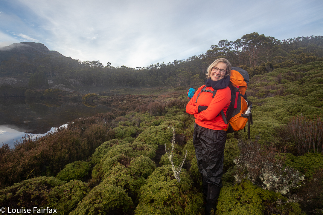
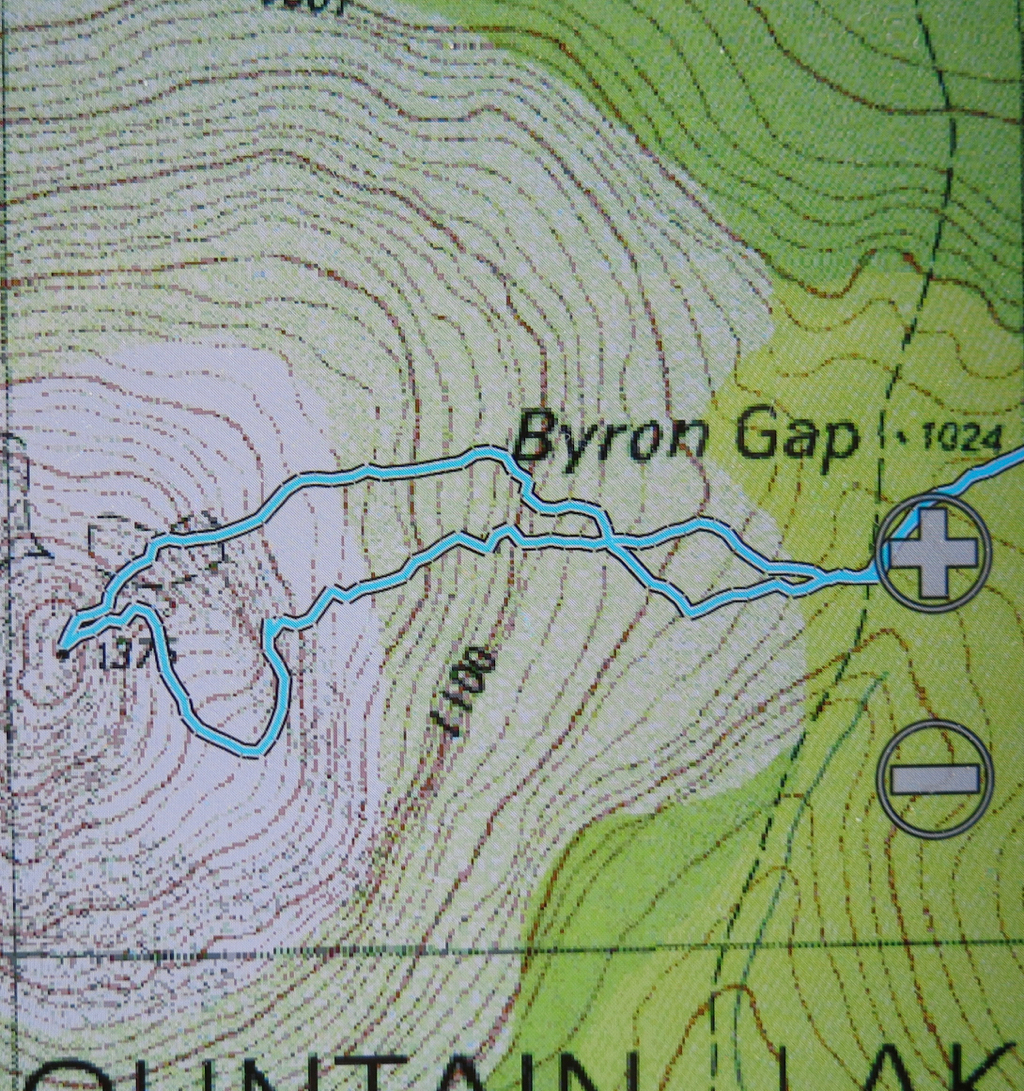
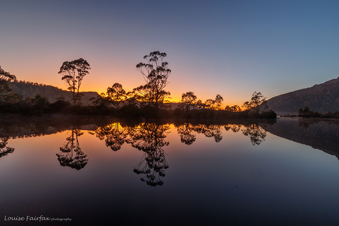
I broke two ribs a couple of weeks ago, and this was my first pack carry since then, so I decided to catch the ferry to Narcissus, and meet the others, who were walking in, at Pine Valley Hut. That would give me plenty of time to see how the ribs were coping with the heavy pack, and the afternoon to do some packless exploring after I’d arrived. The ribs were fine, and in the afternoon I took some shots of the flooded valley and then went up onto the Acropolis plateau where the wind howled and light rain fell. Valley and heights were ankle to calf deep with water from the recent rain. It was going to be an “interesting” trip.

Du Cane Range near Lake Elysia, climbing
Du Cane Range Lower Falls

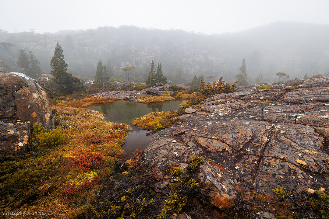
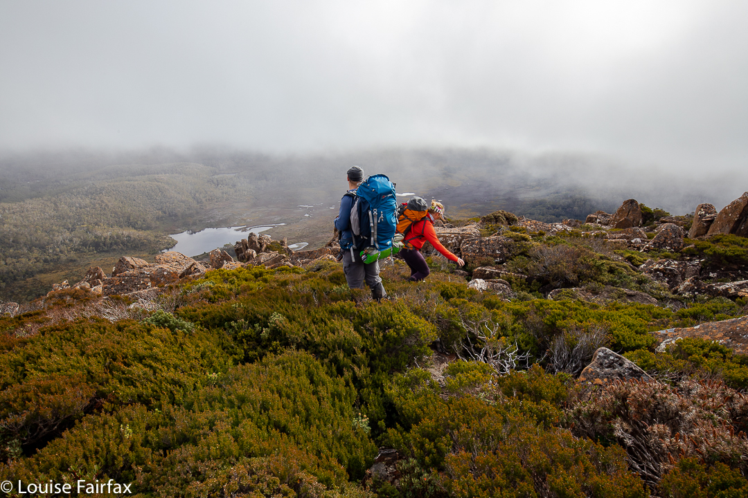
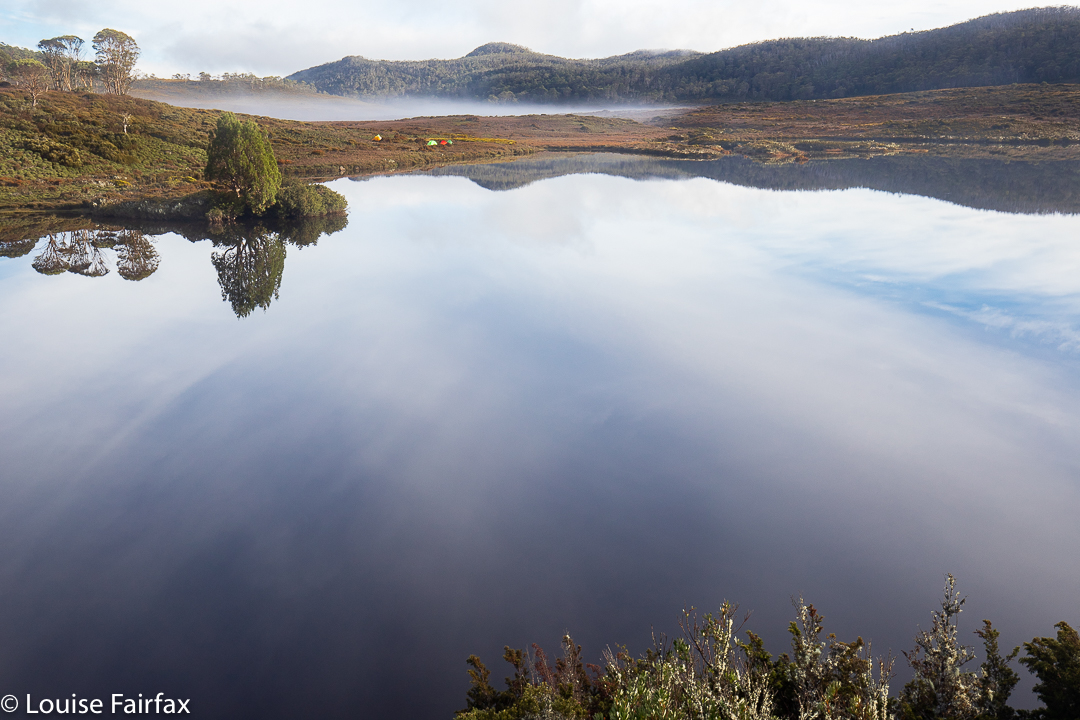
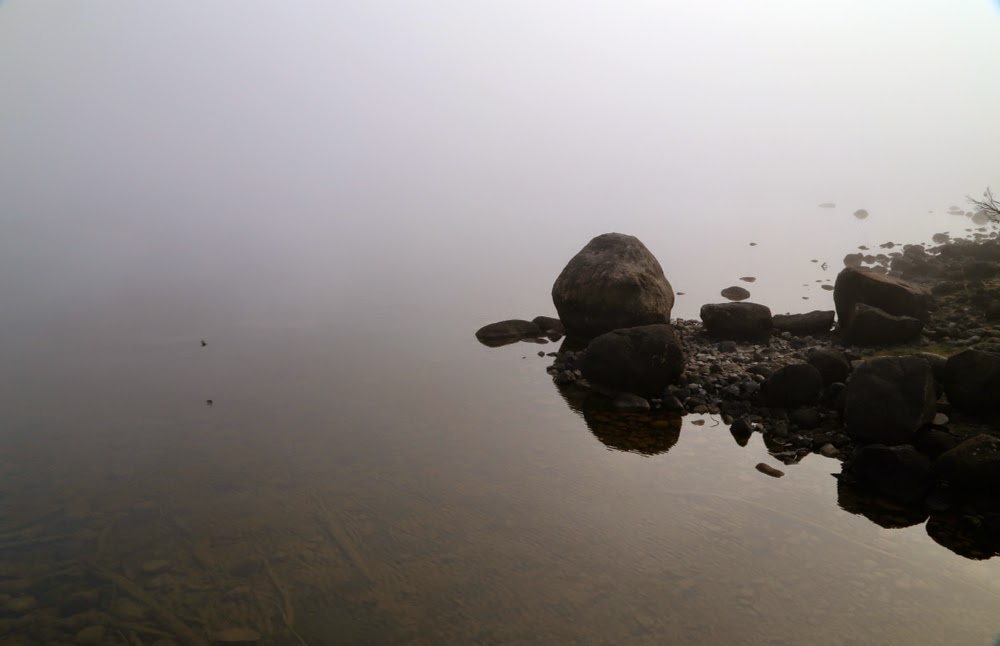
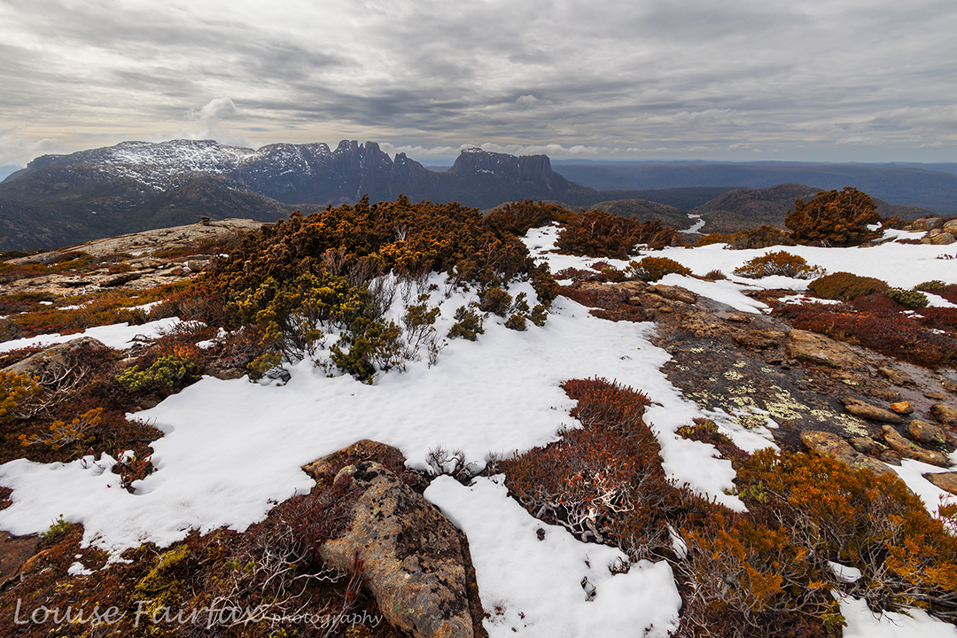
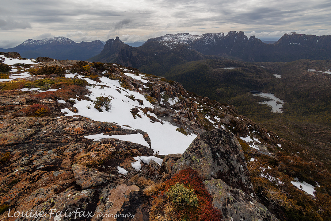
Three of us set out next morning for the heights, and I was excited to see the first snow before we’d topped out at the Parthenon saddle. Flippers would have been better than boots for getting around Lakes Cyane and Ophion, and, despite the forecast for just cloud today, light rain continued to fall, as it had done the day before. Lake Elysia looked magical in the watery mist, alternatively (and tantalisingly) hiding and revealing Geryon and The Acropolis. We stopped there for a snack and some photos before moving on.

Du Cane Range .. getting higher
Du Cane Range snowy scenes. Gould peeps out behind.

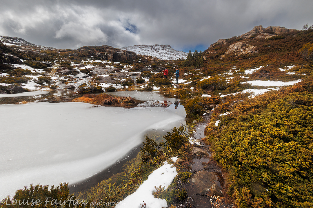
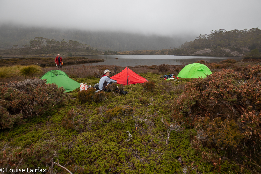
At some point in there, the force of the wind coming in from the west hit us, and I started to wonder about the sense of camping up high in the snow in this wind (our plan). Luckily Paul was thinking the same thing, and Phil agreed. Our new plan would be to camp at the Pool of Memories down lower and in a sheltered spot, and then try for our goal of Hyperion with only daypacks, returning to the gentle harbour before nightfall. We were already thinking that Eros would probably be omitted.

Geryon looking ravishing today. Paul and Phil
Hyperion from the shelf. Ossa behind.

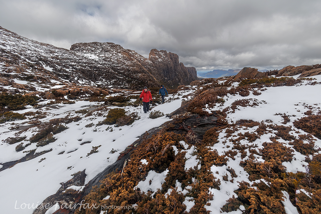
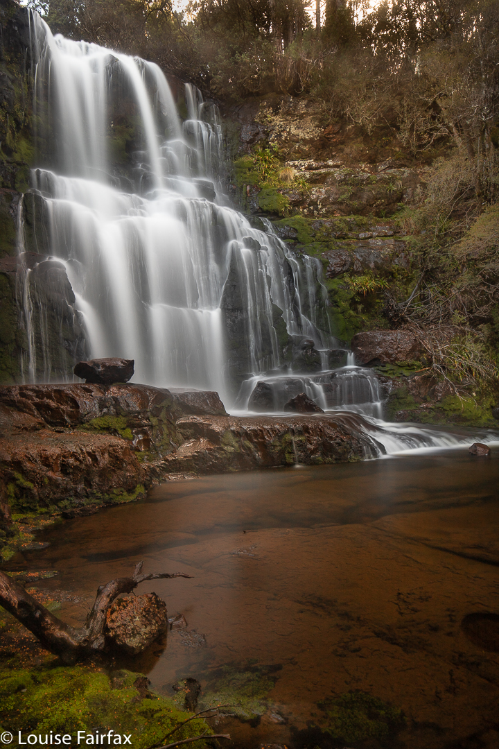
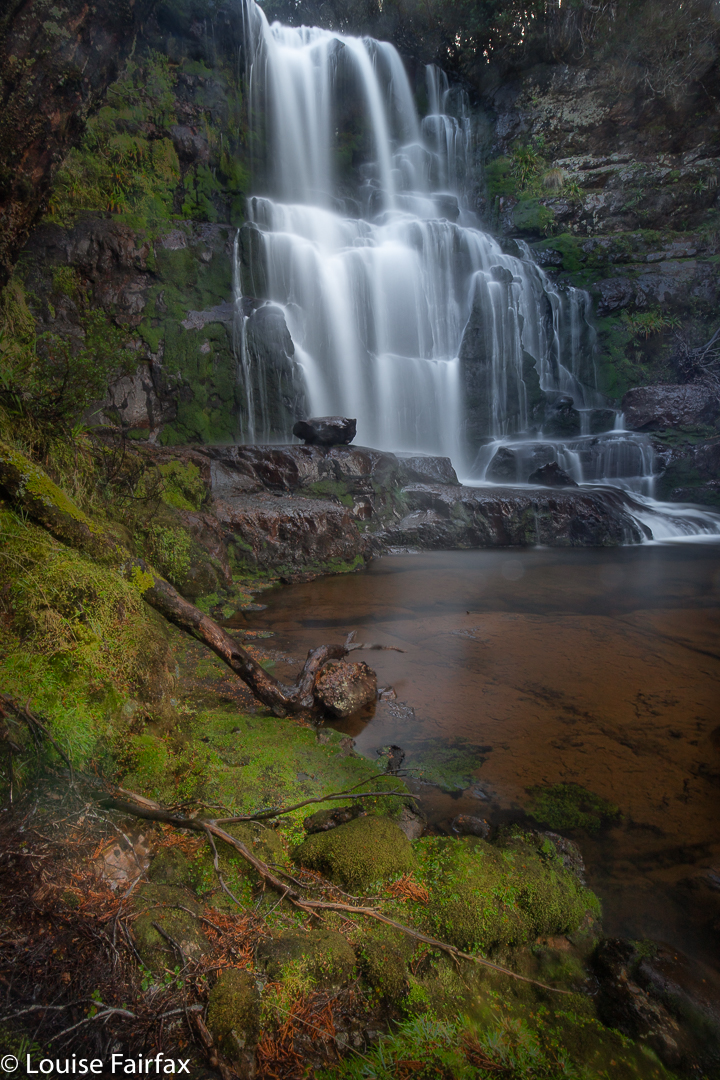
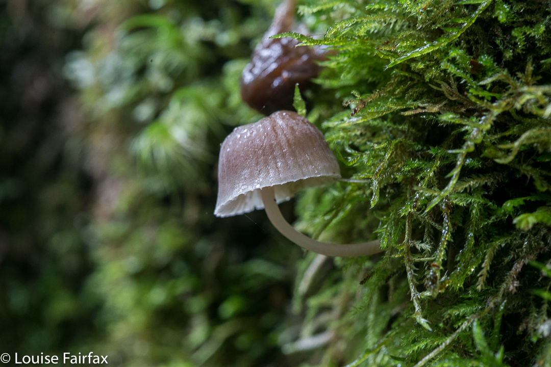
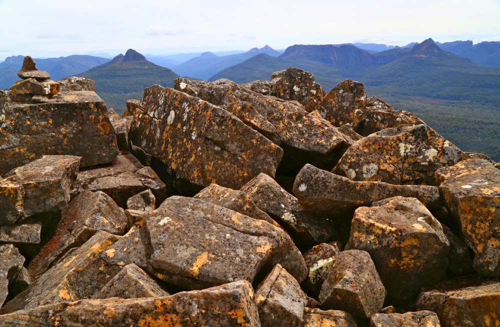
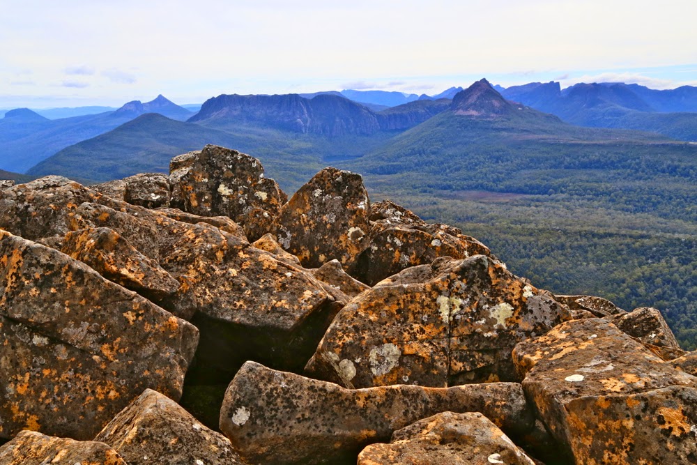
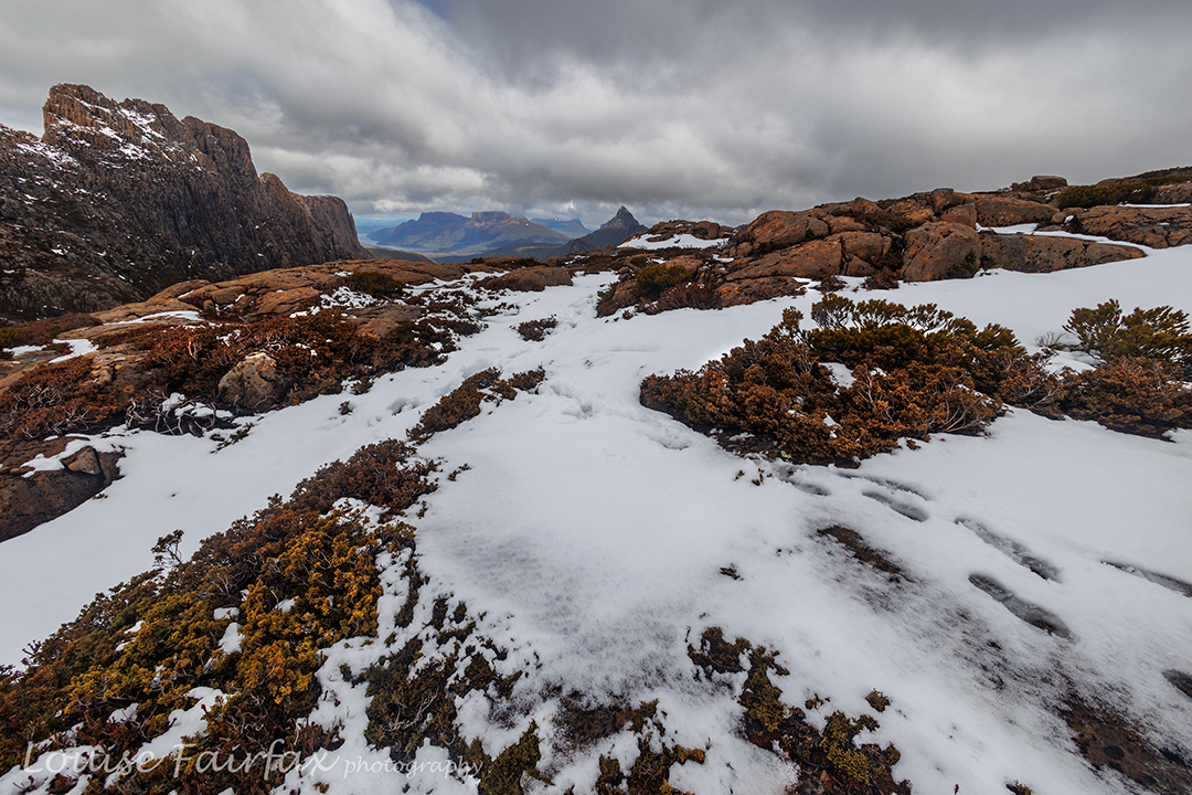
Thus, when we reached the Pool, we dumped the heavy packs, pitched our tents in readiness for our later return, had an early lunch and then began climbing through the snow. This part of the day was absolutely magic. I took heaps of photos: the tale is one of beauty and vistas.

Paul climbing towards Hyoerion, Du Cane Ra
Climbing Walled Mountain

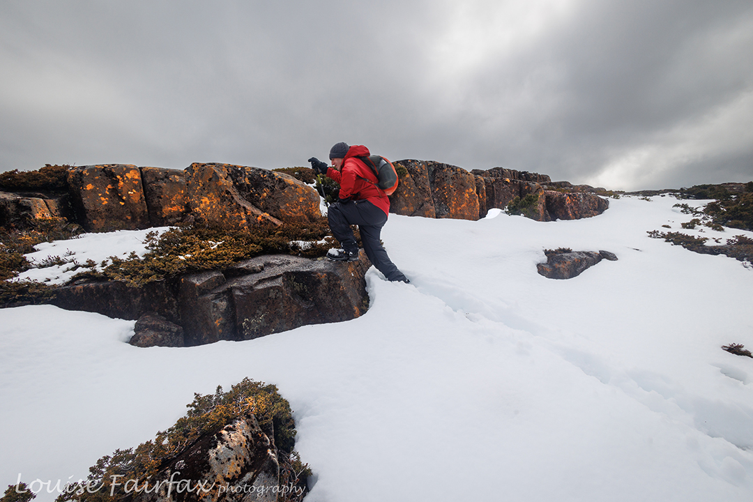
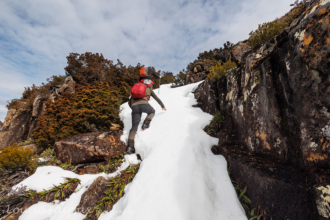
For me as photographer, plenty of action was required, as I had to run to catch up after each shot – kind of interval training – which is fun, but I did note the truth of the words that a photographer of this type needs to be a fit person. I enjoy the challenge: I mostly shot from behind and caught up; every now and then I went up ahead to get a front-on shot.

Walled Mountain near the summit

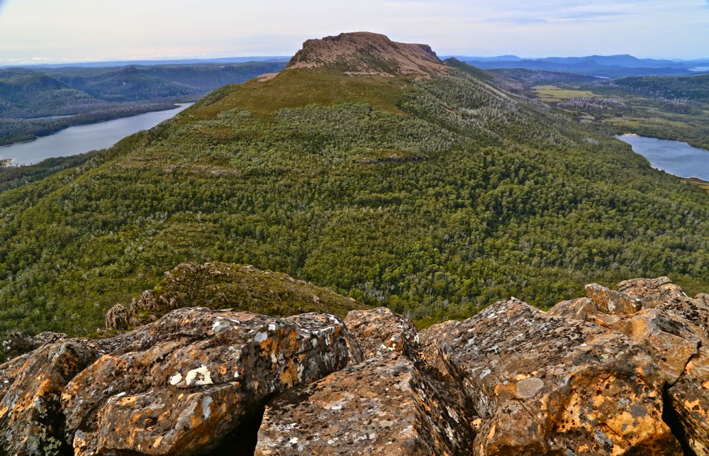
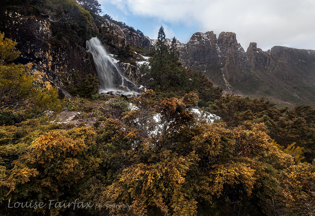
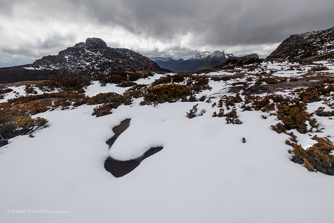
The third day was Walled Mountain day. This would be my ninth summitting of Walled, done this time in boring daylight hours, so I was tempted to skip it and just move on. However, I decided the exercise would be good for my fitness, so stayed with the other two. I am so glad I did!! It was absolutely wonderful up there, and nothing like the boring dull-light summiting I was anticipating. Descending, glissading through the snow, was a blast.

Walled summit to Du Cane HP, Geryon, Acropolis
Walled to Ossa, Hyperion et al

On we went and then down to Pine Valley for a late lunch, and finally on to Narcissus for dinner and to sleep the night. I pitched my tent by the river, and listened to its soft flow as I fell asleep. Already by this stage, my feet, having been pretty soaked for all of every day, were starting to blister up. Day four would be agony.

Leeawuleena dawn; last morning

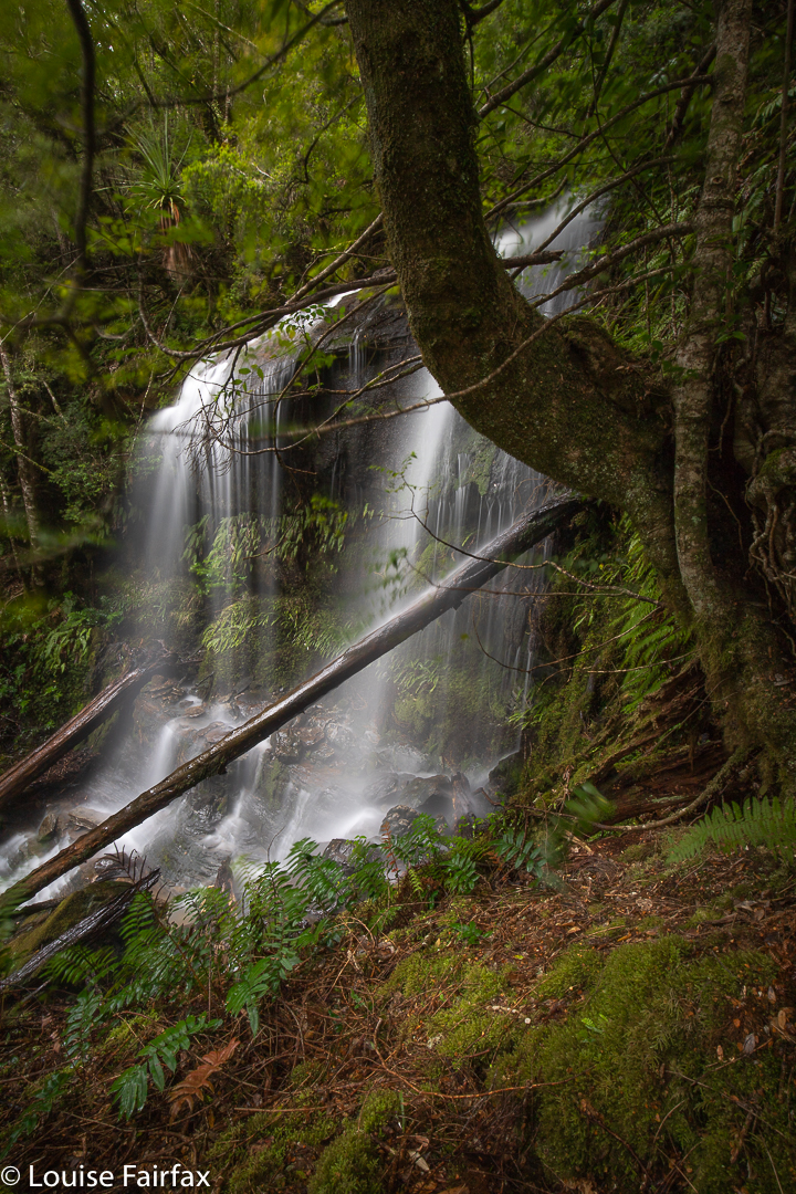
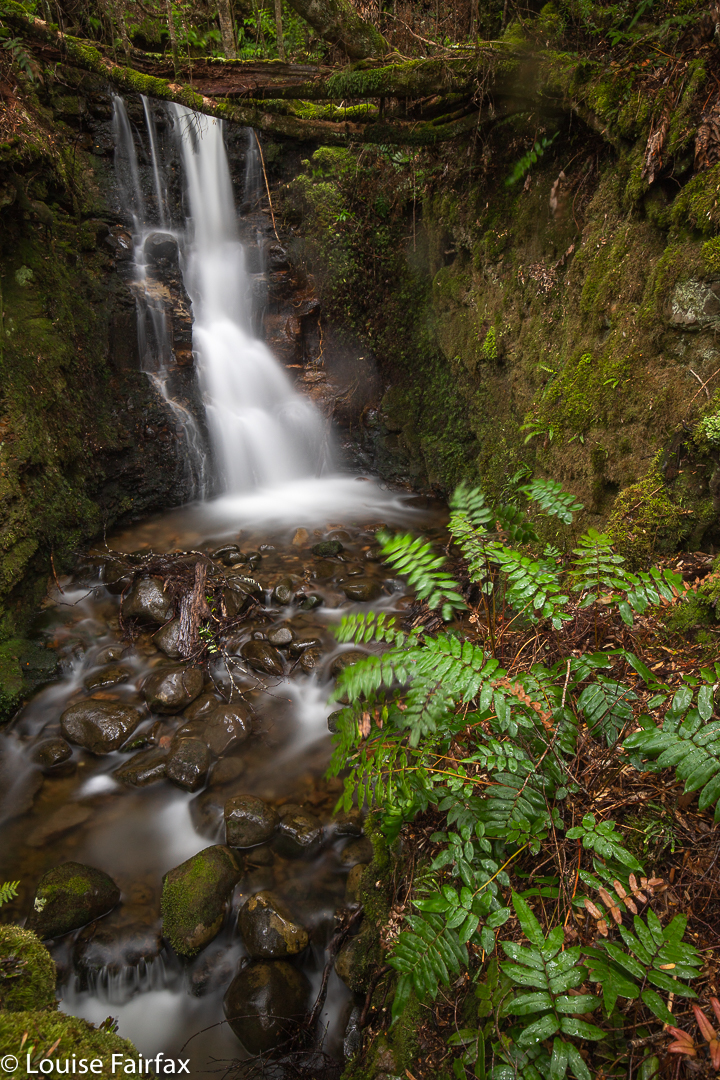
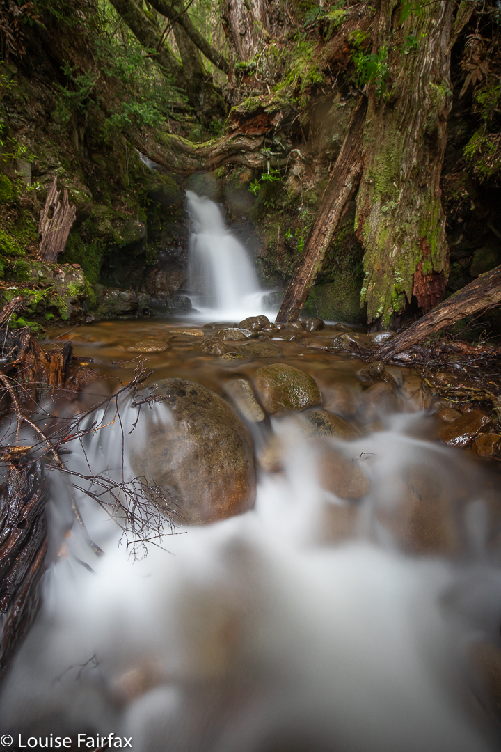
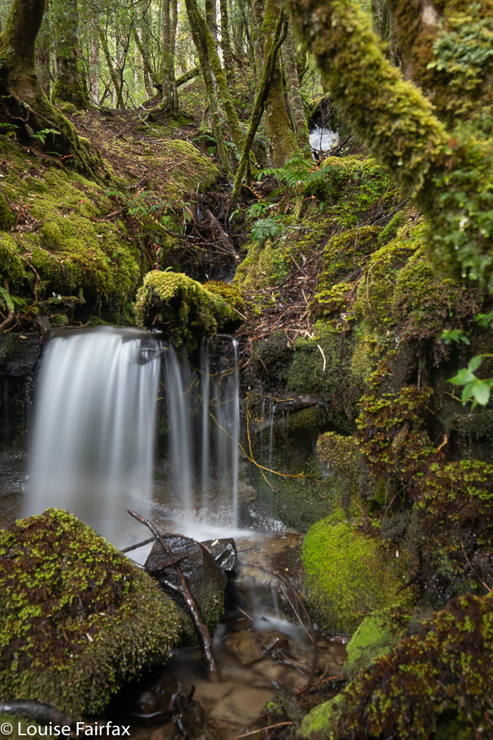
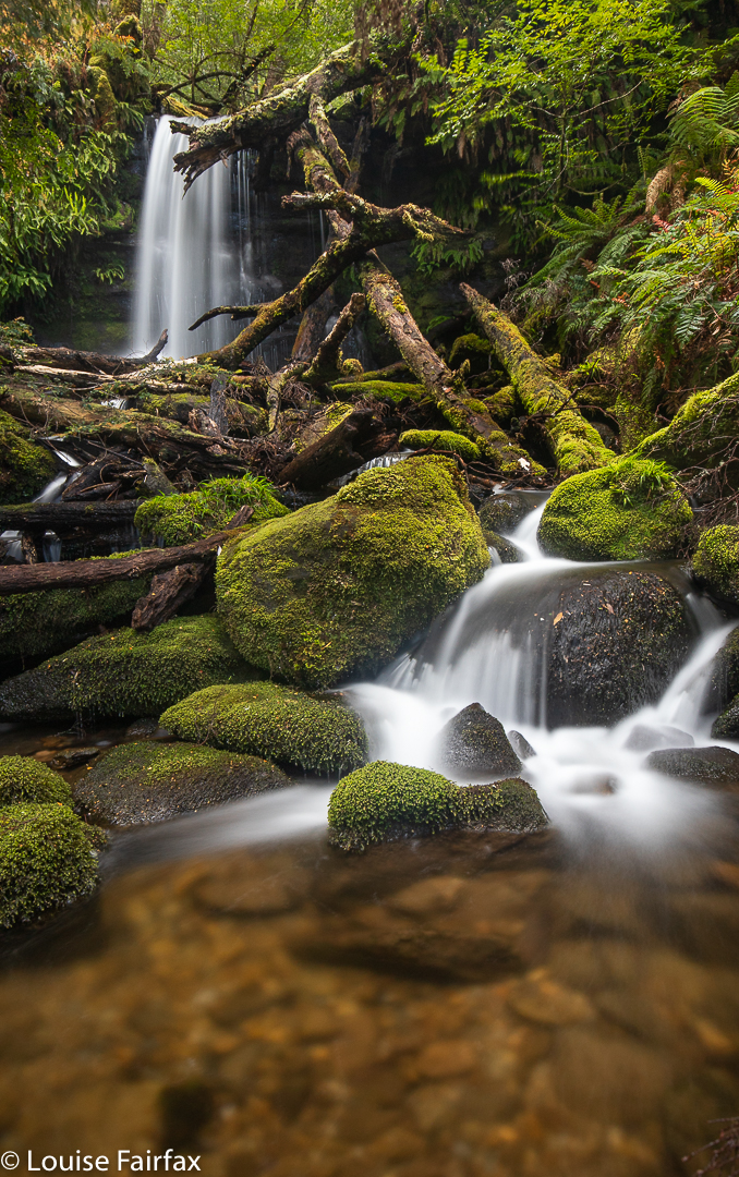
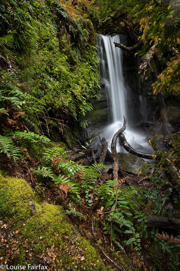
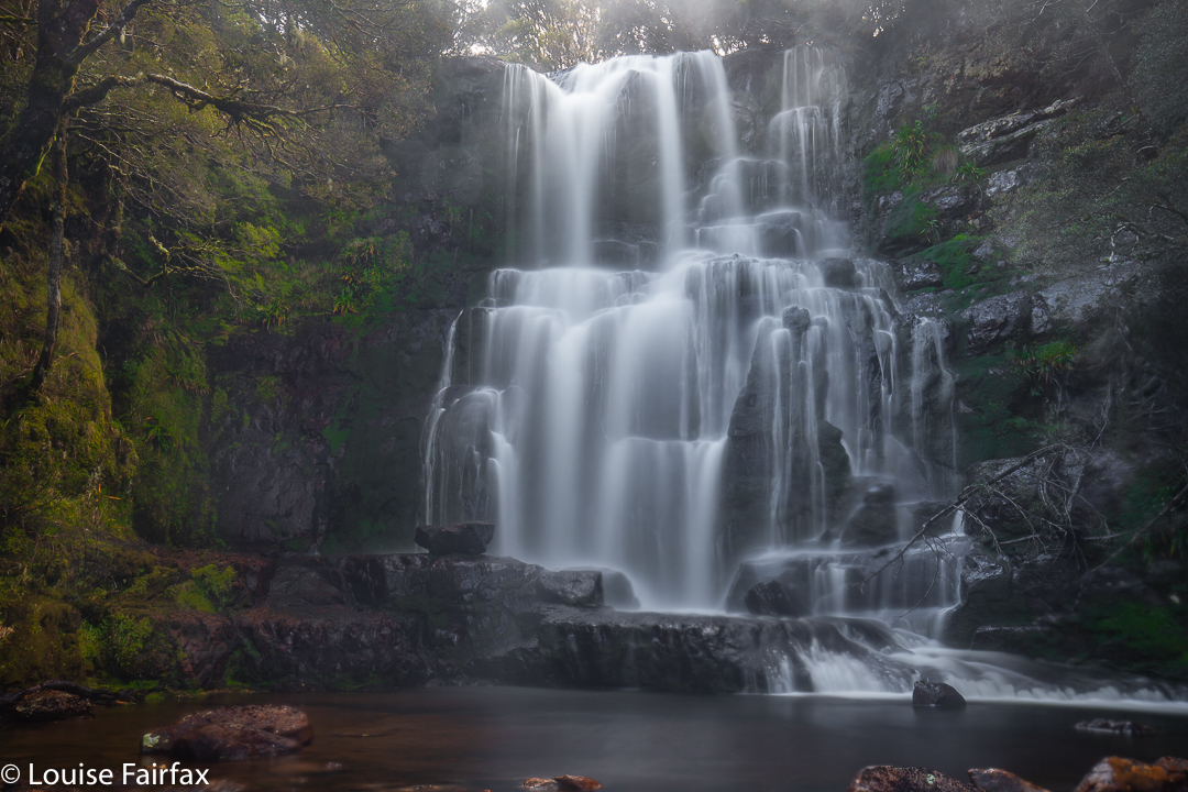
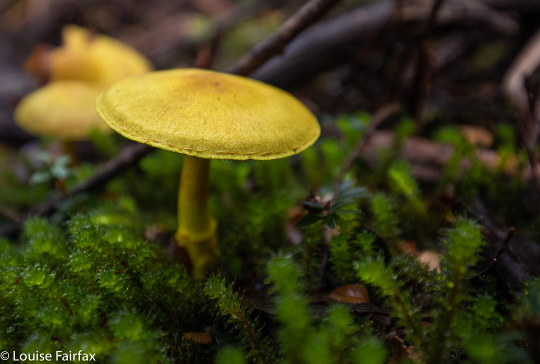
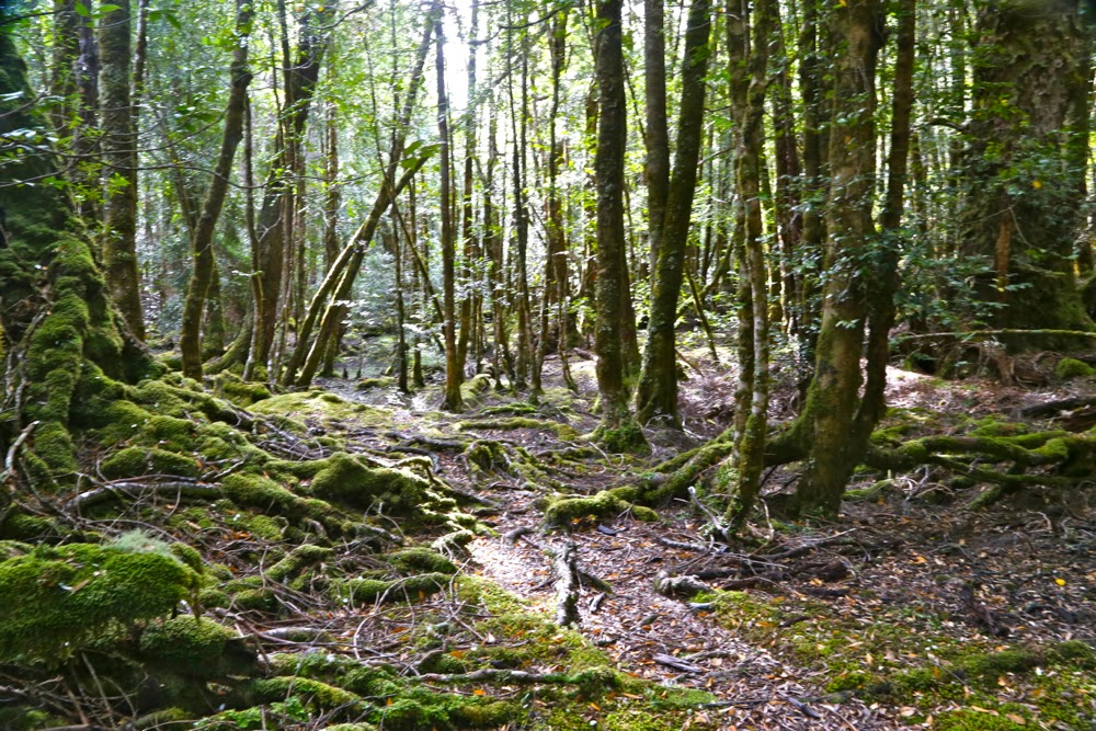
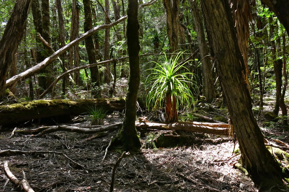
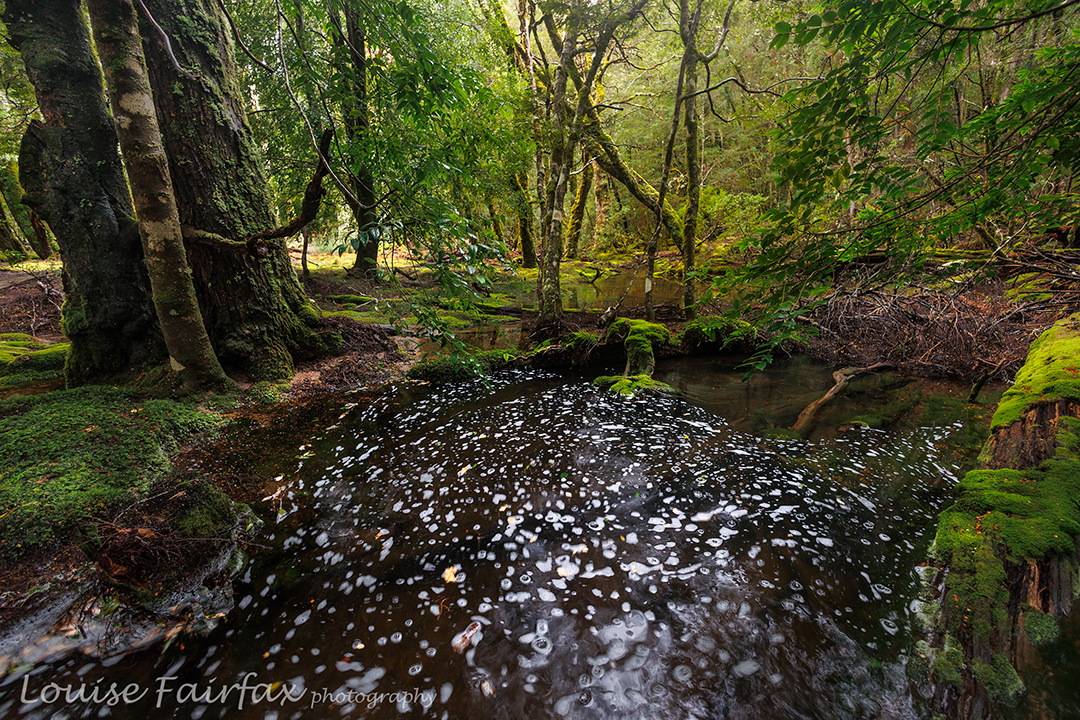
It was. I slowly trudged the distance, taking nearly as long as the advertised time I was so slow, but that pace gave me plenty of time to appreciate the extreme beauty of the forest, clothed in thick layers of moss, with a sparkling blue leeawuleena (Lake St Clair) beside me. I am writing this two days later, and my feet are still red, raw and swollen, although the blisters are starting to form a crust. I hope I can try running today. Putting shoes on my newly huge feet is a bit of a struggle.

Olympus waterfalls 2019

I am not normally an admirer of fat bellies, but the bulging belly of Mt Olympus is an expanse of great glory. In the folds of lurid green rainforest, with rich brown and orange rotting wood, you can find weeping waterfalls in abundance.

I noticed how especially glorious everything was looking on my way back from our Nereus trip last week, when we got snowed out of our deadlines. Because my mission regarding Nereus was the climb, I only had my phone with me, and phone-photos of waterfalls do NOT do it for me. When I look at a waterfall with my naked eye, my brain sees glorious lines of flow, gossamer threads adorning basal rocks. The phone gives me frozen, often blown-out droplets or odd streaks and blotches that fail to give any indication of the magic that attracted me in the first place. I needed to come back with a real camera to do the area justice. Saturday was the day.

I had time to get home, have a tiny bit of rest, attend to my animals and plants, try to patch my very damaged and infected feet and return. My boots were still sopping, and, as it was constantly wet feet that had caused the foot damage from Thursday, I had bandaged my wounds and wore a different pair of boots. I like to have 3 pairs of boots in use at once, so that two pairs can be drying out slowly and I still have something to wear. It’s not good for the leather to force the issue of drying.

On the day I had chosen, the forecast was for rain all day – hoorah; that’s actually why I chose that day – and I set out on the ferry in the middle of a little deluge. By the time I alighted, it was only scattering tiny droplets, most of which the canopy absorbed. You guessed it; the sun came out by the time I had all my gear ready for shooting some time later. That said, I never had to wait more than a few minutes for the sun to hide again, and the heavier falls of rain occurred at times when I was ready to move on … mostly. Other times I had to contend with rain while I was shooting, but it wasn’t too bad.

After the first series of falls, it was raining quite heavily, so I decided it would be good to drop down to Echo Point Hut and have some food inside in the dry before moving on. There were five of us sheltering and snacking in there, three of whom were were landscape photographers. I had fun meeting them (they were from VIC and SA, and were adoring the forest), and stayed far too long considering my goals, but, oh well, that’s the way it was.

It was a very sociable day, as, at the end, when I arrived at the lodge just before kitchen closure, two lovely people invited me to join them at their table, and we had a fun time chatting while I waited for, and then ate, my dinner. Even on the ferry I’d had a great time chatting, as several people on board recognised me, waving enthusiastically as I hopped over the gunnel, so, after I explained to the driver that I was not going to “chuck” my bag containing several thousand dollars worth of glass in the corner, we talked the whole way. I have decided that people who are prepared to get out and climb mountains or explore forests on a day forecast to be sodden all day, must be very nice. The rain is a kind of sieve.

There are no routes for this blog. I didn’t track anything. I just wandered and shot where I found beauty. The falls have names in my files for my own records to distinguish them from one another, but I have not named them here; they are not official. At the official level, these are unnamed and unmapped falls on unnamed and unmapped creeks. Perhaps their shy obscurity is part of their allure.

Orites Falls 2019

My friend Craig called to discuss my route to Orites Falls in 2016, and mentioned in the process that I was welcome to join the small group that was about to go. Would I like to join them? Do children like chocolate? How wonderful to have an excuse to revisit an area that I loved the first time around. The territory at the back of Mt Hugel is wild and somewhat unfriendly to those who would like to pop in for a chat, but it is wonderful once you’ve got past the bristly facade.

Orites Falls trip

It is so lovely to be walking with a handful of likeminded people: fellow bushwalkers and nature lovers, bonded more by that than a passion for waterfalls, but all willing to embrace the beauty of Orites Falls nonetheless. I loved these falls so much that the first time I was there, I couldn’t wait to come back with my tripod and a few filters to slow the water down.

Orites Falls trip. Tentsite.

Of course, the section to Shadow Lake from Lake St Clair Lodge was easy and spent in pleasant chatting through wonderful lush rainforest with heaps of fungi beginning to colour the landscape. Fagus also added colour (nothofagus gunii). We had a snack at a small beach by a giant pencil pine and continued on our way, along past Forgotten Lake and to the rock slide providing the approach up to Little Hugel. Once you’ve gained the ridge, you’re on your own, with occasional pads to help you, but not often, and only while your route intersects with that taken by people climbing “big” Mt Hugel. There are some little tarns under the Hugel ridge (at about 1245 ms asl), and the shelter from the quite strong wind afforded by a little copse of Pencil Pines provided the ideal spot for our lunch. The ground was soggy, so I squatted instead of sat to keep drier.

Orites Falls trip. Lake Hermione dawn

After lunch, we climbed up to 1330 ms to a knob that is unnamed on the map, but which was christened on day 3 “Craigs Curse”. On day 1, however, it was no curse, and offered us lovely cloudy views to Lake Hermione, our destination for the night, about 385 ms below. That is 385 vertical metres. The horizontal measurement is not all that great either, but it took us two and a half hours’ walking to negotiate the protective palisade of bush between us and the water. Eagles have it easy.

The others agreed to my vote for the ridge running NW from the knob, as I had used it before and found it better than a more direct route, especially on the way up, but the others thought it would be good to use it on the way down as well. The clouds rolled in and down we dropped, hopping across boulders with scoparia traps underneath, and down into general scrub and some exceptionally steep rocky bits. But it was a devil I knew, and I knew it would work, so on we pushed. What a glorious moment it was when we burst into the band of rainforest with its relatively easy passage and rich greens, and swung more in the direction of our goal.

Orites Falls trip. Eucalyptus pauciflora.

The final button grass drag was tiresome, as it felt like time to arrive, but arrive we eventually did, and chose our glorious real estate for the night. Dinner at the marvellous al fresco restaurant was a wide choice of dehydrated-now-rehydrated fare with different names on our packets, but not a huge difference au fond. We compared notes on flavours, as one always does bushwalking. By the time we erected our tents, photographed the beautiful lake, collected water and had a general explore, it was getting dark and cold, as is the norm for this time of year.

Day 2.

Orites Falls trip. Underway day 2.

This was the day for the goal of most in the group – those who had a finite, concrete goal rather than the more abstract one of enjoying being in a beautiful wilderness area. We did have a focus, and that was Orites Falls. As I had been there before, I was given the helm again, and led us up to the rainforest band on the other side of the river to follow it along until it was time to drop to the falls. Even though we were camped not far from the general source of the Franklin River (a tiny bit to the NW of our spot), it was still quite tricky to cross, but I knew it was possible near the lake, so we went to where it issues from the wider area in a magic bunch of pencil pines – how old? a thousand years? Who knows?

Orites Falls trip. Lake Hermione

The photos say all that needs to be said about the falls. We loved being there, and stayed a nice long time, only returning in time for lunch. It was about an hour and a half each way and the rest was taken up in photography.

Orites Falls

In the afternoon, we each did our own thing, with the three waterfall-fanatics visiting what I decided to christen the Franklin Tarn Falls (they not having a name on the map, and needing one so we can refer to them). I had also already been to these ones, but they were dry last time. This time, I left my camera accidentally in the tent. HOW does a lover of photography do THAT???

Orites Falls

Craig and Caedence have both promised me a photo to commemorate our visit. On the approach, I took the route I had used last time. While there, I spotted a lead in the forest on the other side of the stream and the others agreed to test it out. This northerly route was a heap more pleasant, even if a bit longer, and three minutes faster: 23 minutes there from our tents; 20 minutes back. Meanwhile, Adrian explored the Franklin source area to the north, and Leandra intended some quiet reading in the tent, but she did mention some quiet involuntary snoozing instead.

Day 3.

Dermocybe canaria

I always think it’s good when you have bad nightmares about something, as the reality can never be as bad, and then you have a pleasant surprise. My worst-case scenario for this day was not a pleasant dream. All night, the wind howled like a demented monster, and the rain lashed at the tent. Some of us didn’t have the right clothes for such weather. Should I really lead them up to the exposed rocks on top? Craig was all for going further around, and I thought the protection that route offered could come in handy. We’d set out and decide later. Meanwhile, I’d done the lion’s share of leading on the past two days and was mentally tired, and was also physically weary as my monstrously heavy camera was now in my pack to protect it from rain, instead of around my neck where the weight wasn’t all placed on my poor shoulders. I needed pain killers to cope. Luckily, Adrian took over the job of leading through the scrub, steered by Craig who had plotted our route from day 1. It was nice and relaxing not to have to make decisions for a while.

Orites Falls trip. Leandra looks happy

At one particularly difficult spot on the way up, which challenged one of our group with the exposure involved, I thought we weren’t going to make it, but my worst fears were faced, defanged, and then not realised anyway. At lunch by the same tarn we’d dined at on our way up, I was, apparently, grinning like the proverbial cheshire cat. Now we were in the land of easy walking, and there was no way we wouldn’t make it out. We were a happy group. I even allowed myself time for a little fungi photography on the final leg of the journey.

Fungi fest Lake St Clair 2017 May

Fungi fest Lake St Clair: round two. 2017


Cortinarius apricosa
Ever since our first highly successful venture in 2014, I have always wanted to return to Leeawuleena (Lake St Clair) to see the fungi. At last, this year, we succeeded, checking out the little darlings both at the lakeside, and also at the Franklin River reserve. Both spots yielded wonderful specimens to photograph. Oh, I get so frustrated trying to identify them. So many don’t seem to quite match any of the images on the wonderful FungiFlip (A pictorial guide to Tasmanian Fungi) or in the more comprehensive and excellent book on Fungi of Tasmania by Genevieve Gates and David Ratkowsky. The problem lies in me and not in their book or Flip. I fear I inconsistently sometimes want nature to be a lot simpler than it is for my convenience, but then it wouldn’t be nature, and I wouldn’t love it so much. Part of her allure is that she eludes our best efforts to tame her, or to comprehend fully her manifold secrets, or to reduce her to a simple set of rules or equations. There is always a complexity that lies beyond us.


Hygrocybe lewellinae
I don’t photograph anything for scientific purposes, or even as a record of “what I’ve seen” or “where I’ve been”. My photography is my creative interaction with the beauty I see around me, and my attempt to portray that beauty in my way. I love light, and the fungi I love are specimens that themselves play with light and allow me to represent my perspective on their play. Here is a small selection of what I saw last weekend.


Mycena interrupta playing cancan girl and showing us what’s under her skirt – nice gills, that’s what.


Alas, no idea


Mycena epipterygia


Mycena kuurkacea I presume


I would sure love to know this!!!


Yet another that has to go in my files as “unidentified”. Perhaps it’s a cute little coprinellus, or yet another mycena. If anyone can help me, please do in the comments. I’d be MOST appreciative.

Byron 2015 Mar

Mt Byron Mar 2015 
The reason I climb mountains is because I love being up high (I also love climbing trees); I adore the physical act of climbing, and my soul delights in being with nature and gazing at sublime infinitude.

I am also, however, a task-oriented person, who likes to achieve the goal for the day. After two failed attempts at the summit of Byron in as many tries on club walks, it was time to be my own boss. I wanted success this time. I’d look up how many points I got some time or other. The summit was my goal.

First official day of autumn. Frost says “Good”.
The trip to the ferry “threatened” to be the highlight of the day. Sunrise was magnificent as I drove up the Poatina Rd to the central highland; on top, autumn announced its arrival with glorious patches of sparkling frost. Lake St Clair (Leeawuleena – magnificent name) was shrouded in mist. It was going to be a gorgeous day. A temporary dampener, however, was put on matters when Steve, the cheery, affable ferry driver, informed me that he was finishing up at the end of the week. I wonder if his employers understand what an amazing asset they’re losing. Steve’s friendly and knowledgeable trips have come to be a grand entree to every expedition in the area, aiding in the excitement of each venture.
You don’t replace someone like that easily: a new ferry driver, sure, but an asset like Steve … ever?

Leeawuleena (Lake St Clair).
I love the forest lining Leeawuleena – always so rich, lush and vivid in its greenness. Happily I strode out, staring intermittently up at my mountain, and at all the old friends that surrounded my journey. Unfortunately the atmospheric mist had already evaporated. It took 17 mins to the turn off; and 59 more up to the top of the Byron gap, where the real work would begin. This is the third time I have walked this “track”, yet I managed to dream my way off it twice on this trip. Fortunately, the first time was right near the start, so I turned on my gps tracker in case I should need it on the way back down. The black dashed line for track on the map bore no resemblance whatsoever to the track I was marking. I was glad that I wasn’t trying to navigate myself to the line on the map for safety.

Paths like this require constant attention to stay on them.
After the gap, I had to make my own way to the top. There was talk of a cairned route if you happened upon it. I didn’t, so nosed my way to my left through pretty thick scrub and along a rather precipitous cliff-ledge until I came to a promising looking gully leading upwards. Happily, my map indicated that this could be followed to the final summit mound (which would hopefully not be fortified by more unmapped cliffs. One never knows on maps that don’t back up photogrammetry with cartography). The map certainly didn’t tell me that the rocks comprising this backdoor entrance were wash-machine size, with some heaving needed sometimes to get to the next layer. I began to worry about the return journey and the still existing possibility of getting trapped with no retreat reasonable. I hankered after a nice easy cairned route. I sensed the effects of adrenalin.

Byron’s pandani forests are a delight
The mound ahead looked as if it could contain the summit, but I didn’t dare invest too much hope in this. Too often such mounds lead to a view of the next, higher one. This one, however, offered my approaching form a sighting of three little rocks perched atop one another. I had made it.

Looking at Manfred, Horizontal Hill, Guardians, Gould, Geryon et al
I actually felt nauseous with anxiety, as the descent still lay before me. I didn’t linger on top like I normally do, just in case I needed lots of time to find a way down. Besides, lunchtime hadn’t quite arrived yet. I took photos and then set out to try my luck on the return journey. This time was different. I happened on a cairn on my chosen early section, and one cairn led to another. Eureka. This route was SO easy. It was 30 mins faster than my way up – most unusual for me. I usually ascend faster than I drop, due to my eagerness to see the top and my hatred of stopping before I’m there. I am not normally happy to leave, so dawdle a bit.

View to Horizontal Hill, Guardians, Gould, Geryon and more
In the safety of the saddle, all work behind me, I enjoyed my lunch, looking out at Frenchmans Cap.  I was easily in time for the afternoon ferry, except that it had been cancelled. I was the only customer. Now began the long walk home. No matter. The forest is wonderful. I slotted into my rhythm, walking and singing my way through fairyland back to the visitor centre, where I enjoyed a delicious veggie curry before embarking on the drive home in the fading light, shooing countless conferences of wallabies, all sitting erect in the middle of the road chatting, unwilling to have their colloquies interrupted by a mere vehicle. I stopped to let each group finish its important discussion. My speed ranged from 0 to 50 km.p.h in deference to their need to converse on dirt road.

An unusual perspective on Olympus, with Leeawuleena and Lale Petrarch balanced on its outstretched arms.
The challenges of the day, apart from driving, climbing, and avoiding garrulous marsupials, involved walking 36.5 “kilometre equivalents” (where 100 ms climbed = 1 km equiv). Quite an active day.

The more southerly route is me fumbling my way to the top, edging around cliffs. The northern one is the cairned route. which I happened upon up the top.