Lost Falls 16 Aug 2017.
The Lost Falls have lost their water and probably lost all hope that I will return to them, for, if a waterfall can’t produce water when the state is drowning and all the other waterfalls are pumping away furiously, what hope does it have?

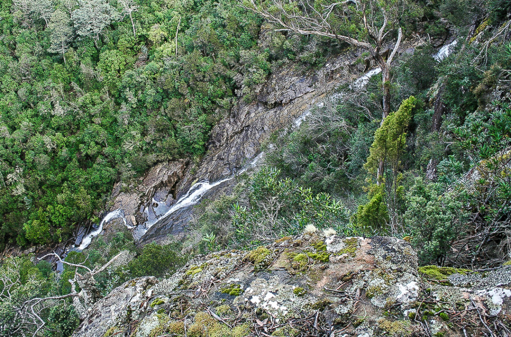
This is not my photo, although it is my edit. Cadence Kueper, and excellent photographer, had far more luck than I did when he visited. This is his shot and his copyright. I wanted to show you what you were looking for if you got a good day.
As we approached, the sun was shining to ruin my chance of a nice long exposure of the flow, and yet it was raining so as to destroy my beautiful lens, and spoil the photo with droplet smudges. Yes, yes; it was pretty silly to come out in this weather without an umbrella for my camera, but I have a lot to organise, like a dog and a husband. This was not going well. It was freezing at this location, with a strong wind blasting us as we made our hopeful way to the viewing point. Luckily, it was only five minutes from the car. The gorge is very impressive, but the lack of water was not. I didn’t bother to photograph such emptiness. I hadn’t brought my arctic gear, so we retreated quickly, and hoped the Meetus Falls would be better. They did not disappoint.

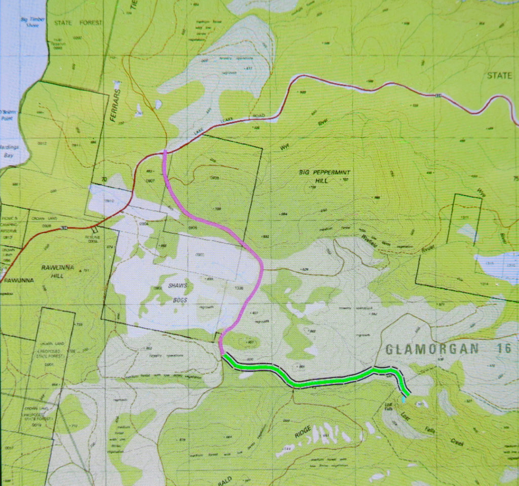
To see this Lost Gorge (I refuse to talk of Falls), drive to Campbell Town, turn east to Lake Leake Road and continue to drive past Lake Leake, and past Kalangadoo (the petrol station cum general store on the right after Lake Leake as you head east) until you reach a rather major intersection with two traffic islands to attract your attention. They’re possibly there to suggest you don’t turn at 100 kph, and that you watch for incoming trucks. For Lost Falls, turn right (South) and drive “4 kms” as the sign directs you (Lost Falls Reserve, it calls your destination). You will, after 3.3 kms, turn left and go 2.6 kms along this road until you reach the parking area which also has a shelter should you want to eat there. Just before you reach your destination, there is an unsigned fork in the road. The right hand fork will get you there (see map below). You’ve nearly arrived.

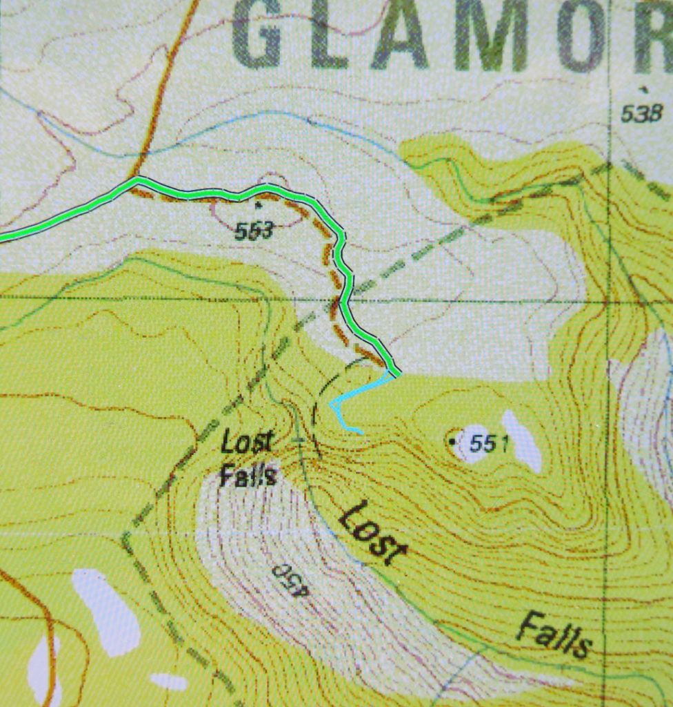
On the enclosed map, the magenta section of 3.3 kms is the first part after you’ve turned right; the green part of 2.6 kms is the next bit after you’ve been turned left by a sign (you’ll see the fork I’m talking about near the end there); the tiny cyan bit is the section where you get to stretch your legs and see the view.
If you then want to find a waterfall that has water, go back north to the big intersection, and continue north on the same dirt road for another 11 kms until directed to Meetus Falls ( http://www.natureloverswalks.com/meetus-falls/).
