Russell Falls

Russell Falls.


It is very beautiful, although waterfalls set in the context of viewing platforms and highway paths don’t really do it for me. It’s here for completion. I am aware you have to sacrifice some waterfalls for the tourists – although, when I look at Iceland, I’m not so sure. There, there were parking areas that were full of spiky stones (i.e., not sealed), few or no amenities, and only very, very infrequently did you get railings. It was terribly refreshing to see an attitude of: “Well, if you want to see it here it is, but we’re not doing anything to change nature from being natural.” And that’s why I love Iceland so much. And that’s why I’d prefer to see nature there than in my own Tasmania, as Tassie is ruining her beautiful nature by dumbing it down, taming and defanging it for what bureaucrats sitting in offices think that tourists want. I did not hear one person in Iceland complaining that the roads to the waterfalls were not sealed, or that the carparks looked like a farmer’s paddock. We all relished it.

Growling Swallet 2018 Apr

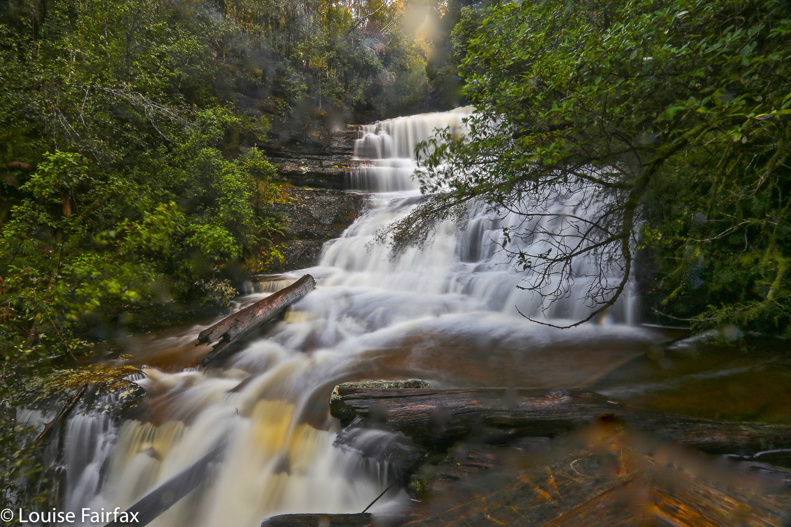
Growling Swallet, Apr 2018


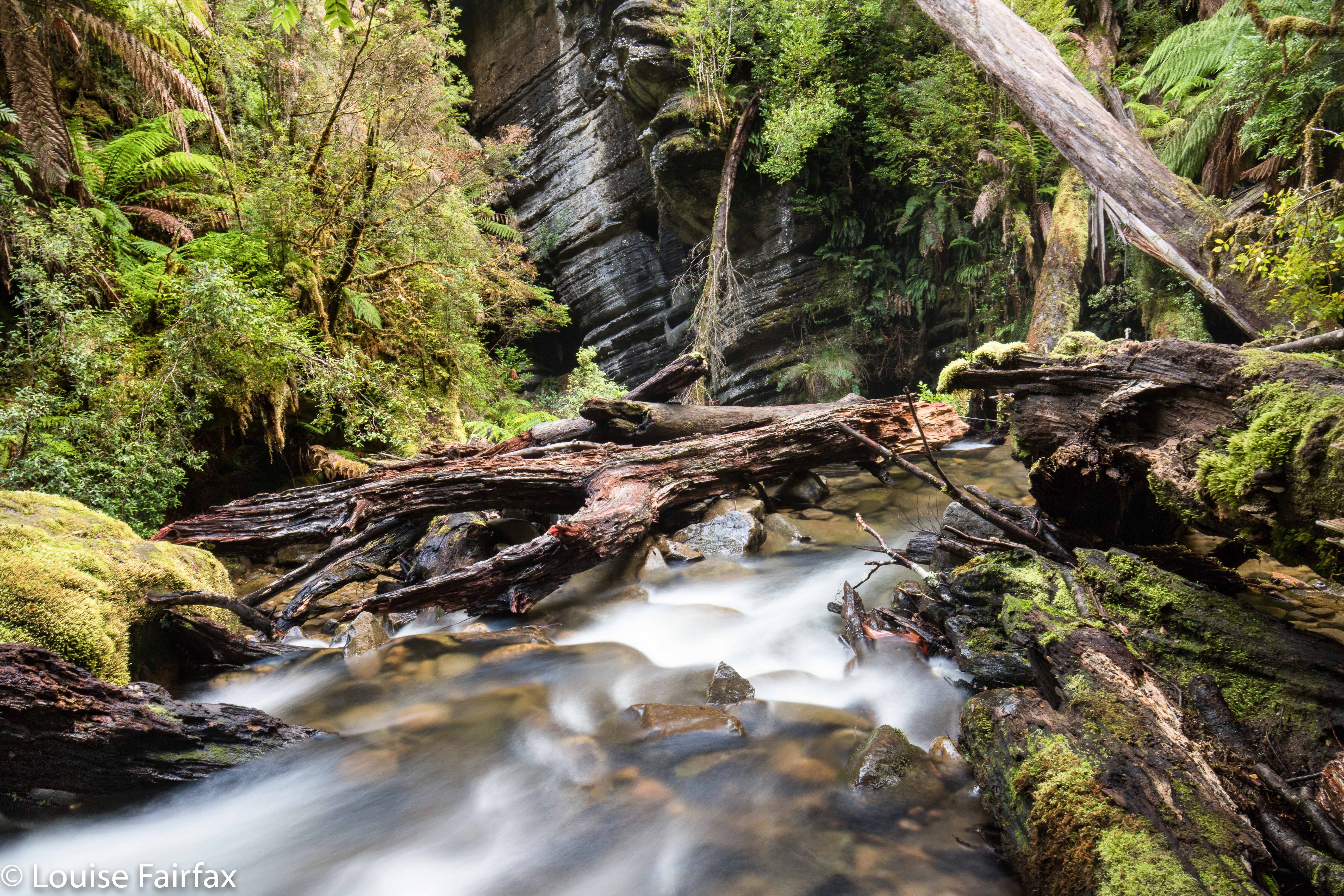
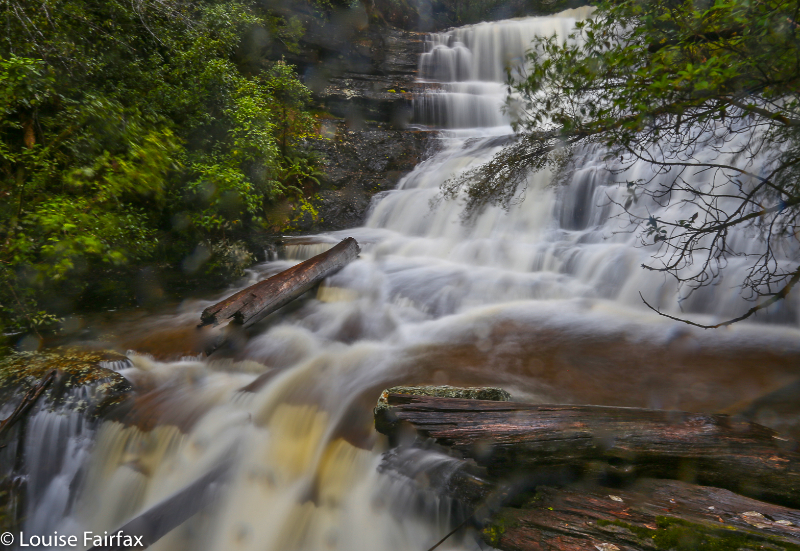
That’s the Growling Swallet right there, swallowing this helpless river rushing to its gaping mouth.
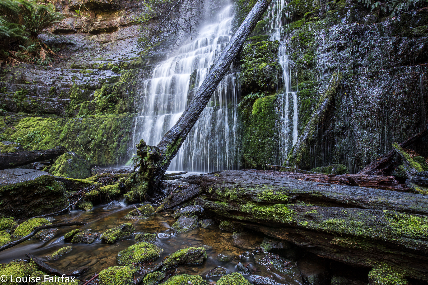
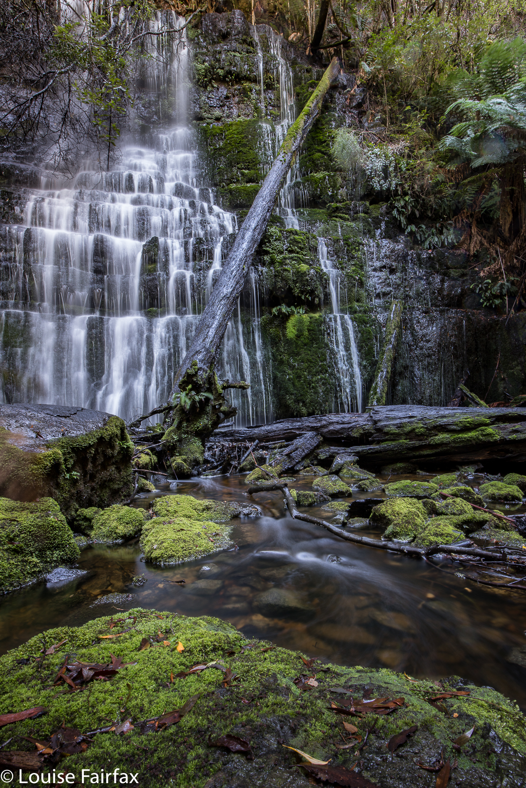
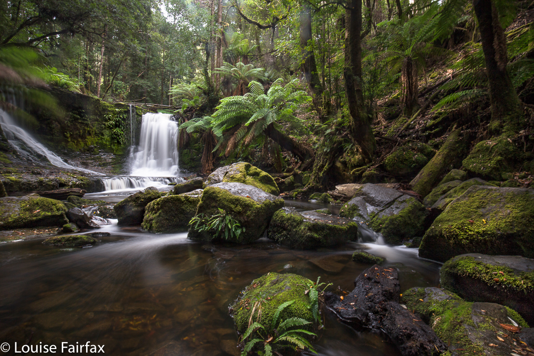
Growling Swallet: don’t you just find that the most wonderfully descriptive name – a mountain growling as it swallows a river? This guzzler of a mountain swallows this beautiful watercourse, as if in some magic fairytale (which is fitting if you could just see the forest!) and spends thirty kilometres digesting it in its large intestine before excreting it at the Junee Caves in Maydena. After being thus digested, it is called the Junee River. I only first heard this name less than a month ago, but was smitten with curiosity. I had a chance to see it on Sunday when returning from a climb in the South West, so grabbed the opportunity (along with a visit to kind of nearby Tolkien and Regnans Falls, which each have their separate blogs).


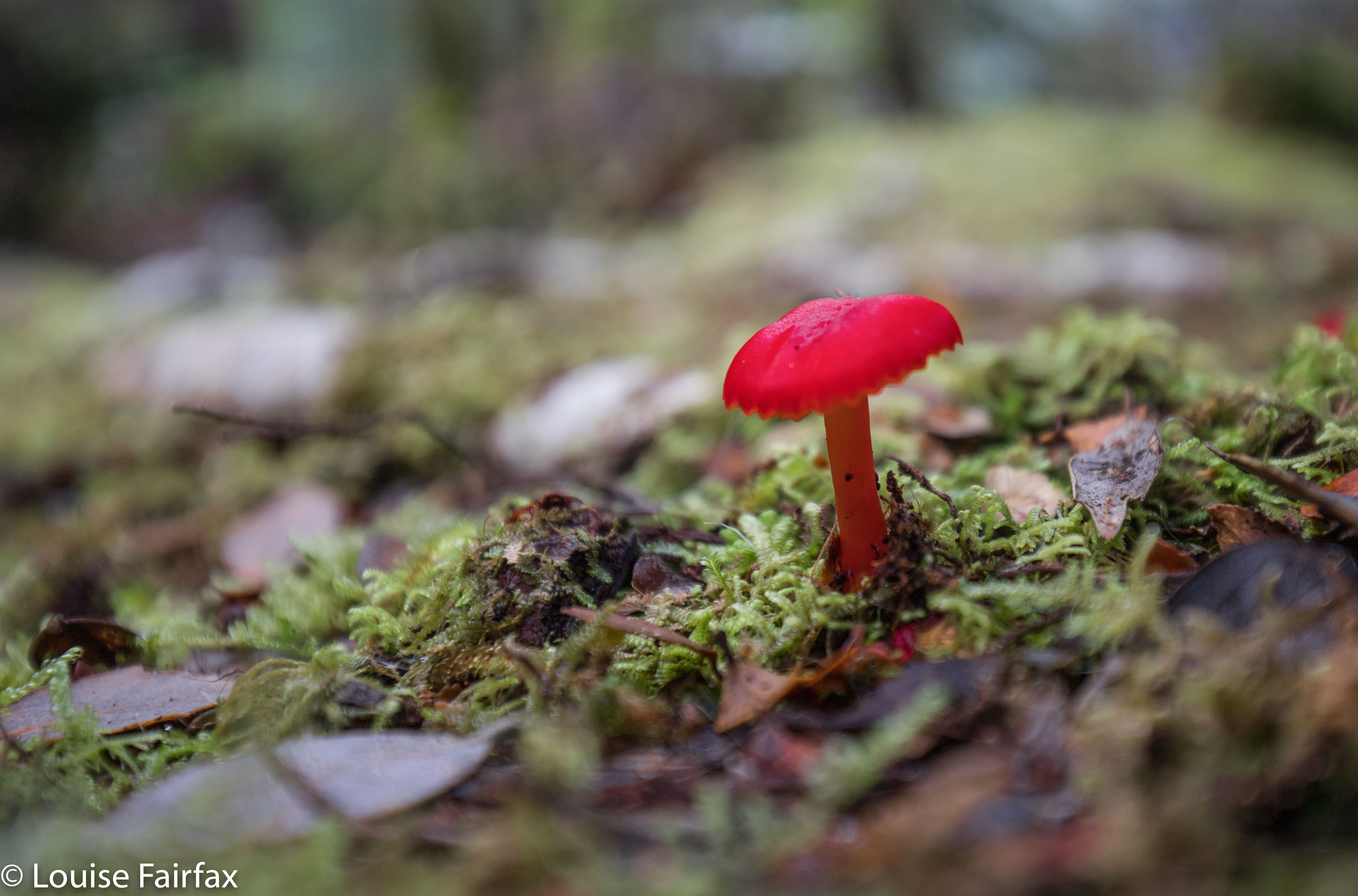
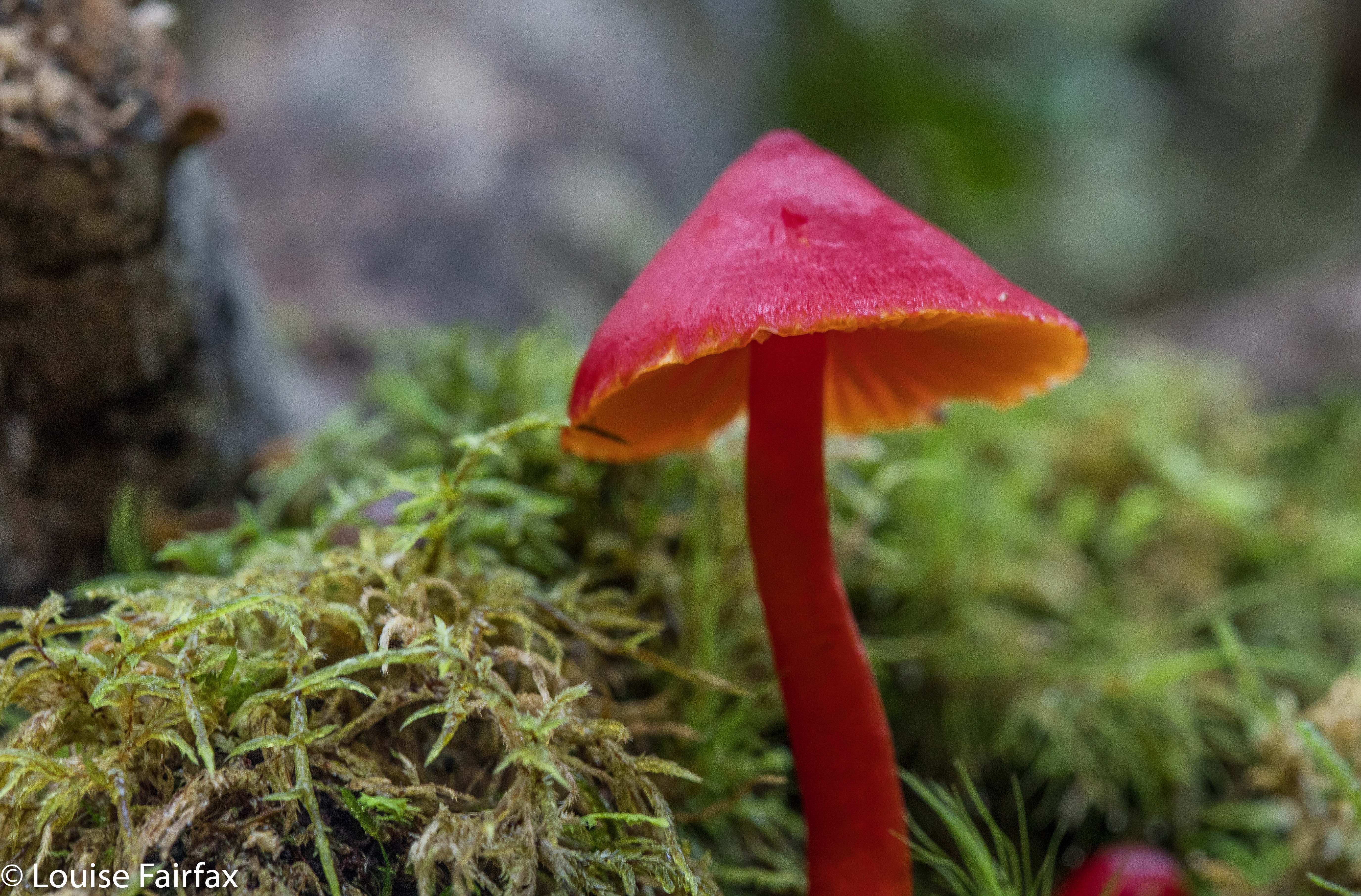
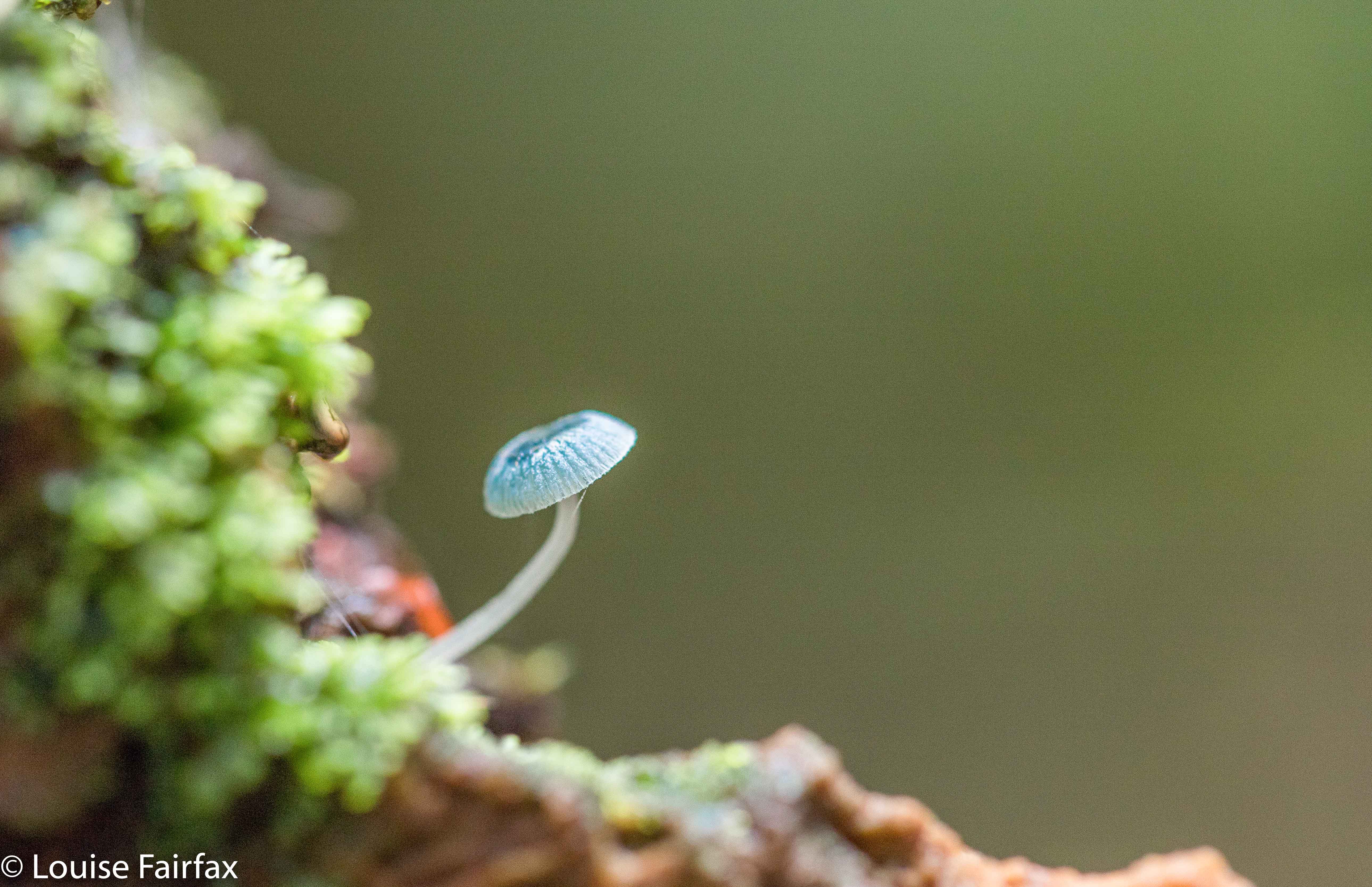
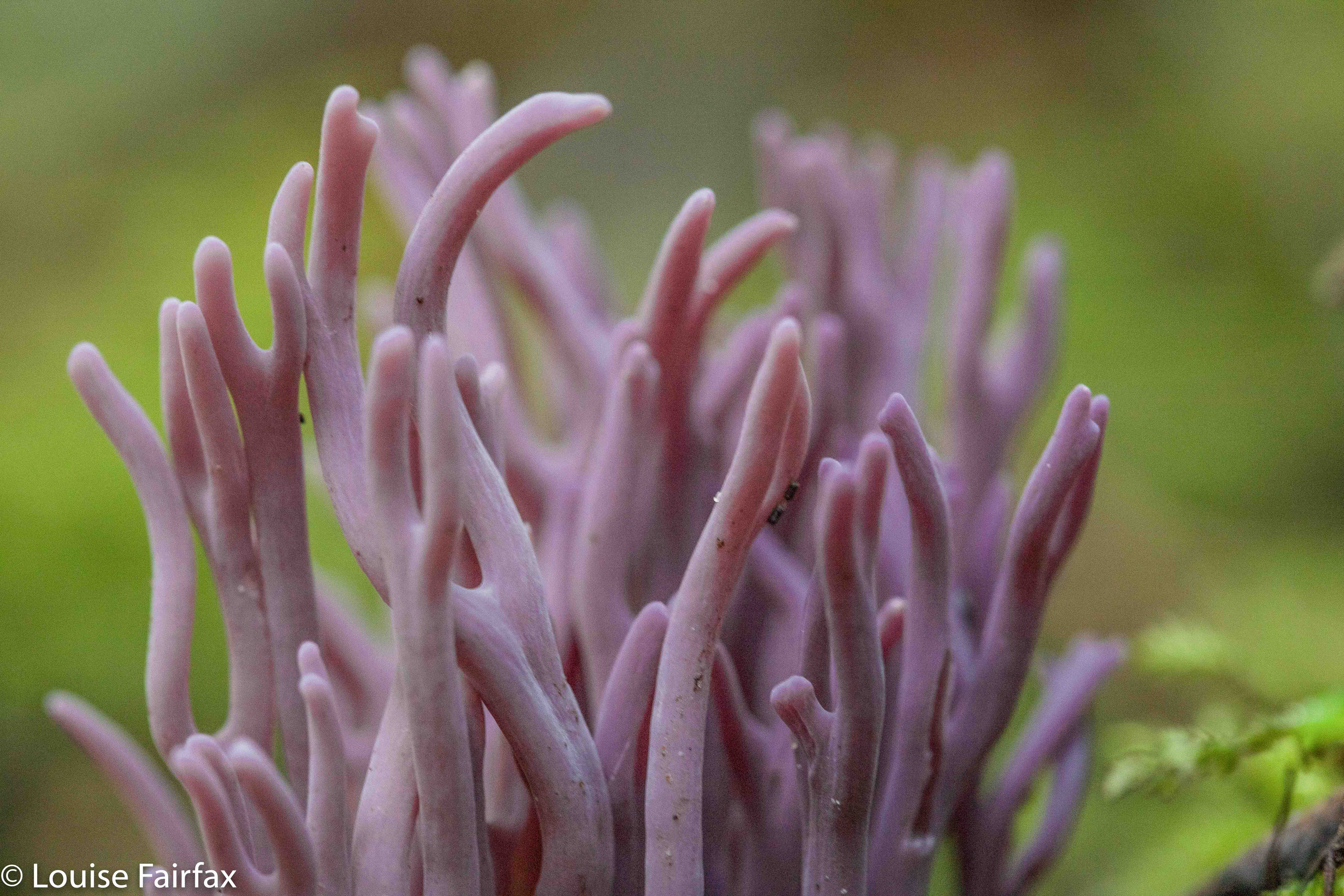
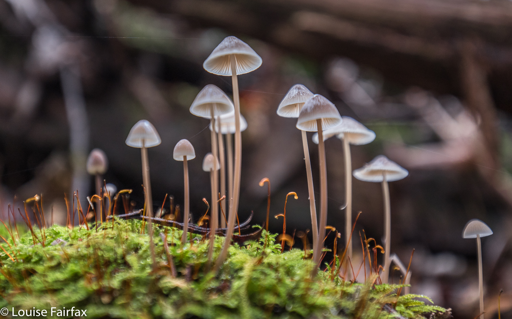
I have only recently finished reading Kazuo Ishiguro’s The Buried Giant, and am now reading a story set in Iceland, so I was in the mood for magic and fairytales. And it’s fungi season. I was expecting a lot of this place, and I got it.


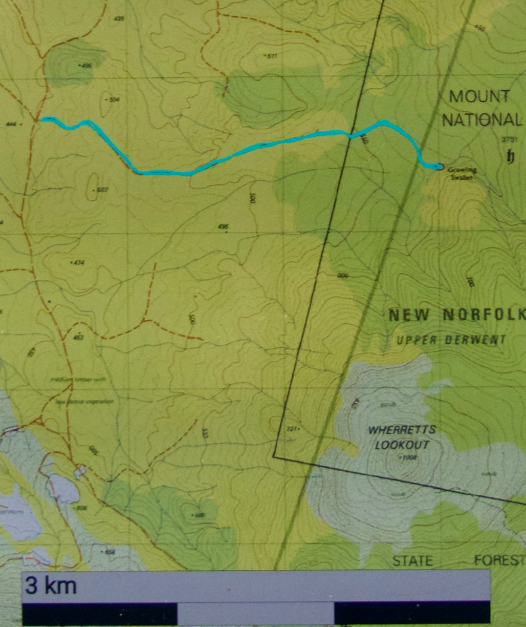
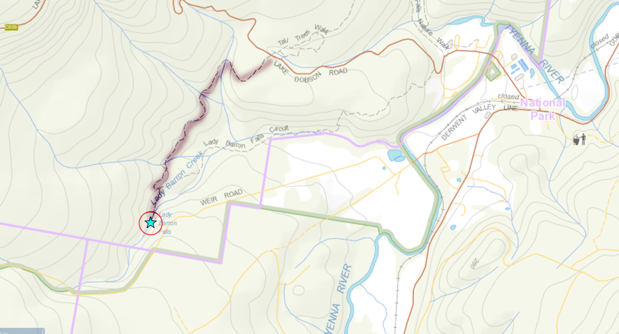
To reach this area, turn right if coming from Maydena onto the dirt road that goes under the main road after you’ve turned and after it sub-divides into Styx and Florentine Roads. You want the Florentine Road, which you’ll follow for quite a while as it rises ever so gently to a saddle with Tim Shea, and begins a descent just as gradual over the other side. The drive will take 25-30 mins, depending on how comfortable you are with dirt road driving. Ultimately you will arrive at a road on the right called F8 EAST. This is yours. It has a locked gate. You can pay $300 for a key (refundable if you’re not swallowed), or you can try your luck at driving in, or you can do what I did, and just park and walk the lot. This involves walking an extra four kilometres.. Big deal. At the minute, there’s a fallen tree right at the start of the road, so if you love your car, walking is the go.


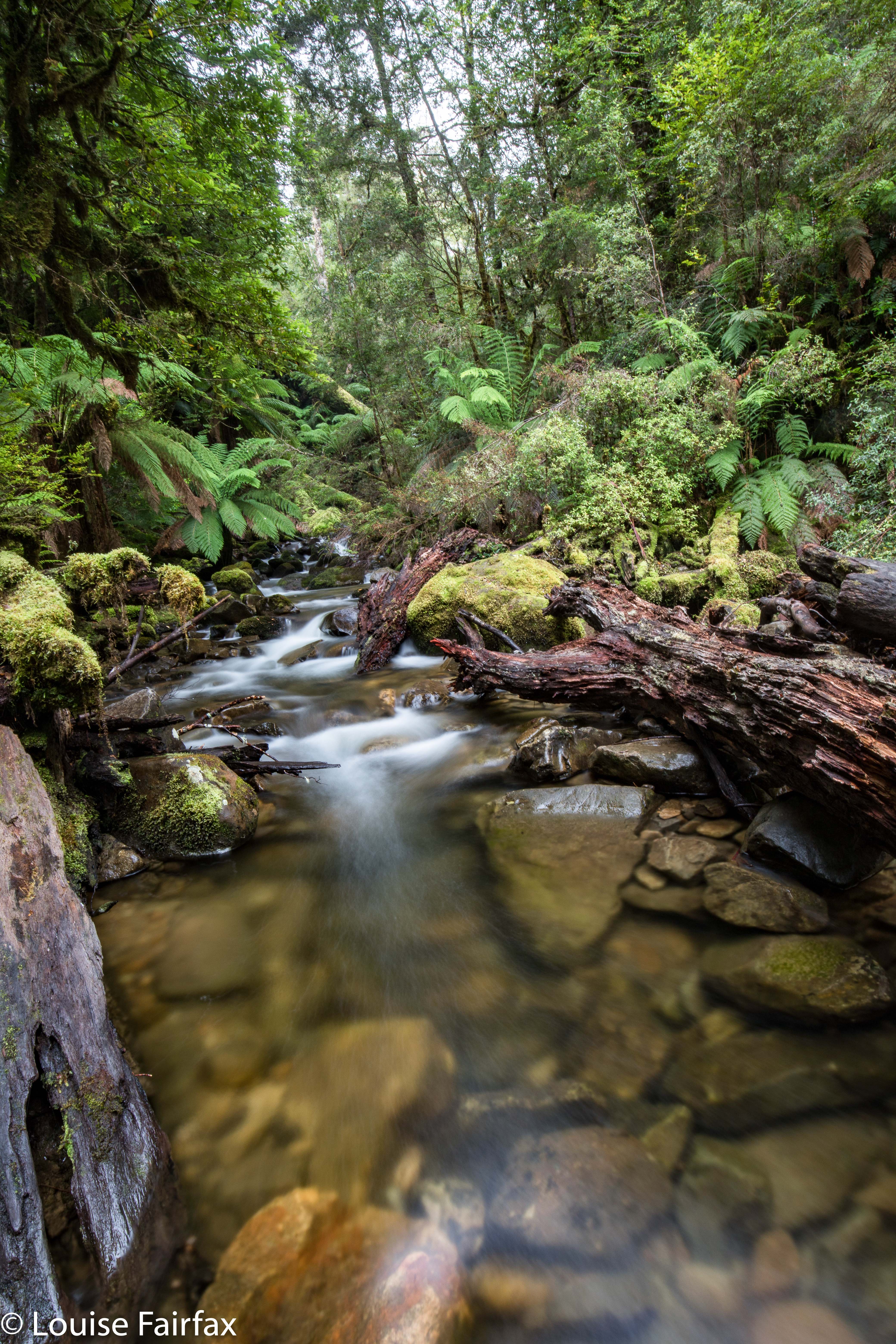
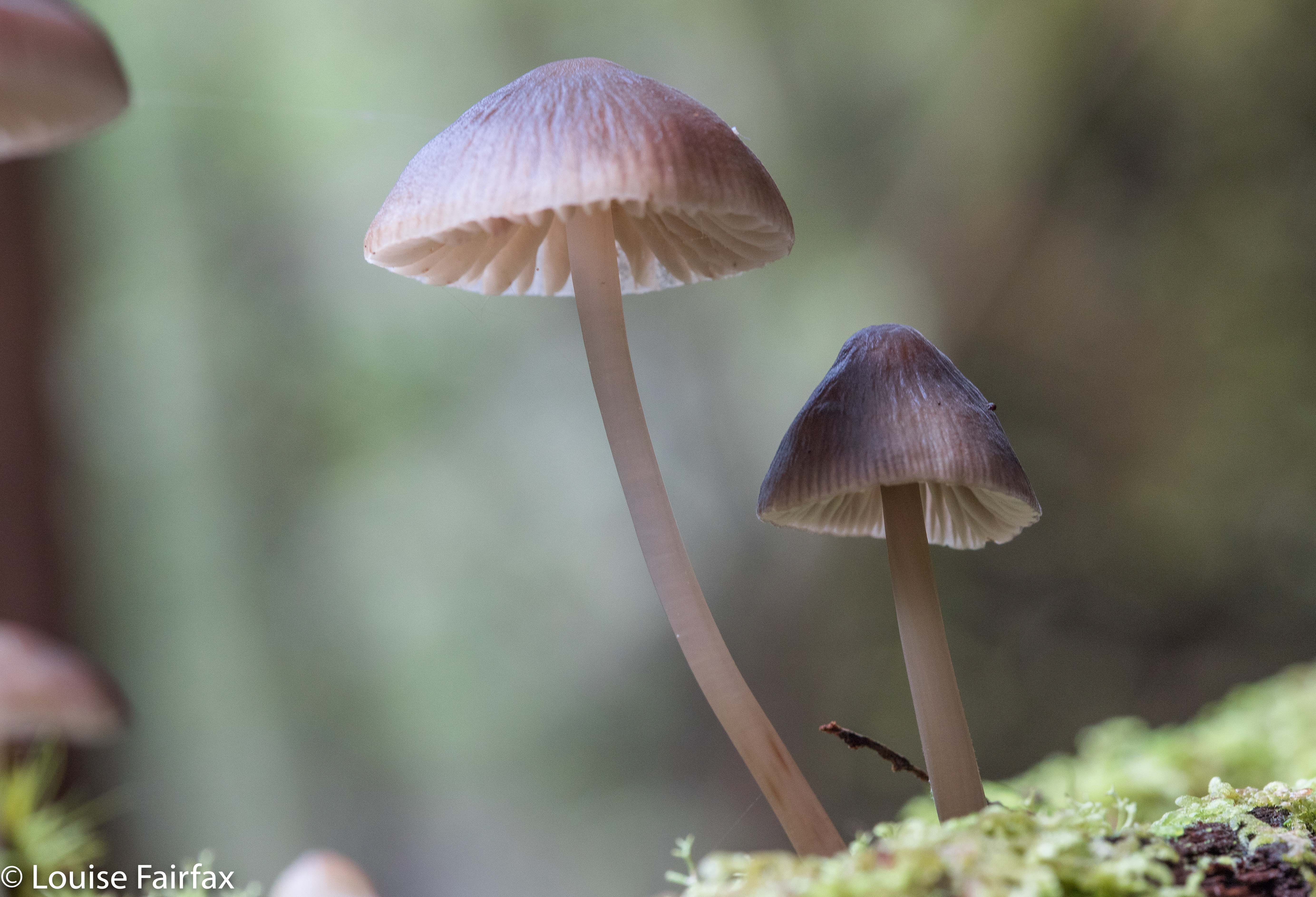
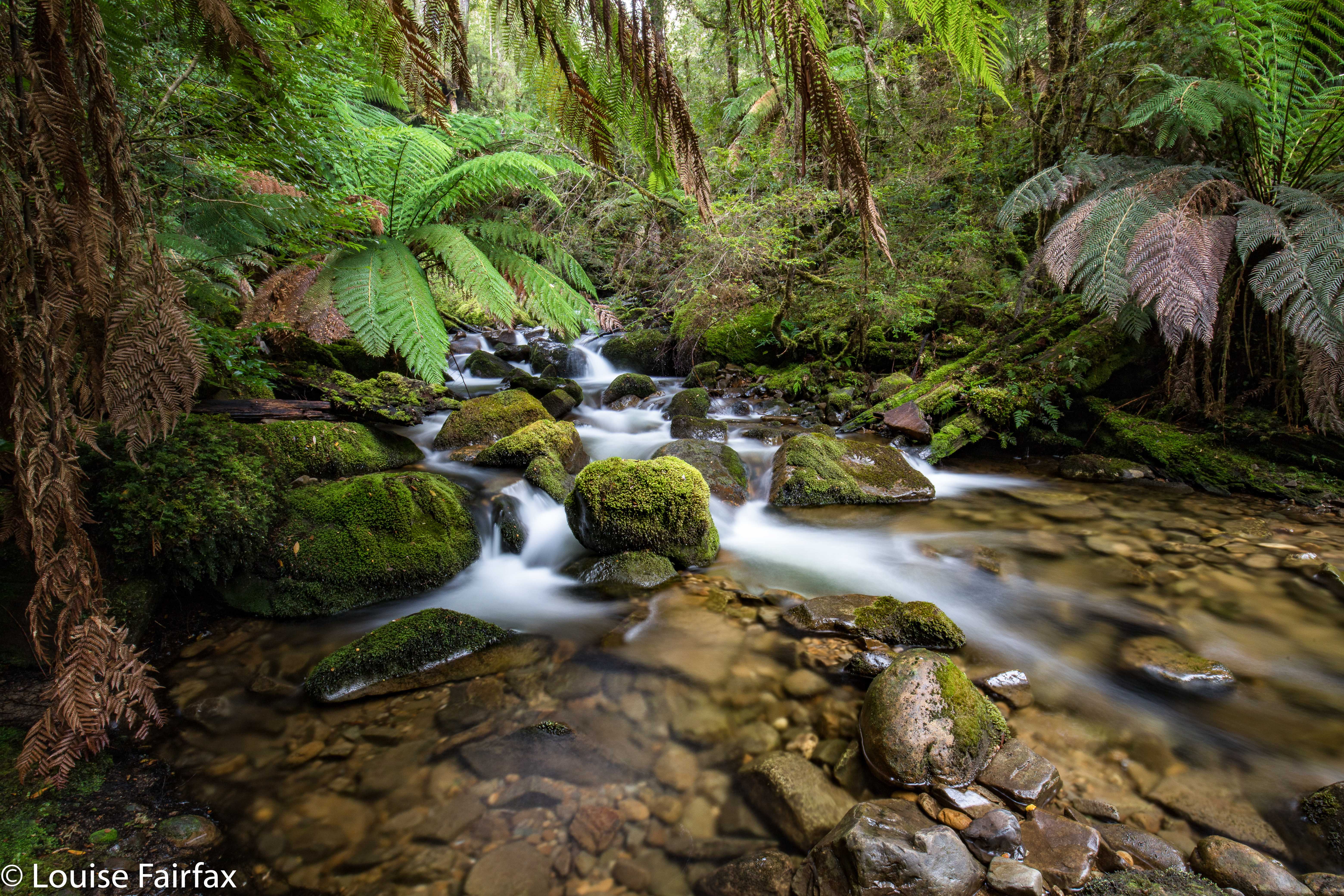
The road bit is quickly dispensed with, and then you’re into the gorgeous rainforest, which is totally distracting with its many and varied fungi. Depending on your level of concentration in the presence of such tantalising beauty, you will, after a short walk, hear the sound of rushing water. You have arrived. Some, fearing the monster’s appetite, are content to stay high. Others like me, opining that we’re too bony to be an enjoyable dinner, venture down into the water. Play it safe and keep in your comfort zone. The small-track walking part took me eleven minutes, but with the extra photography of fungi, perhaps an hour.


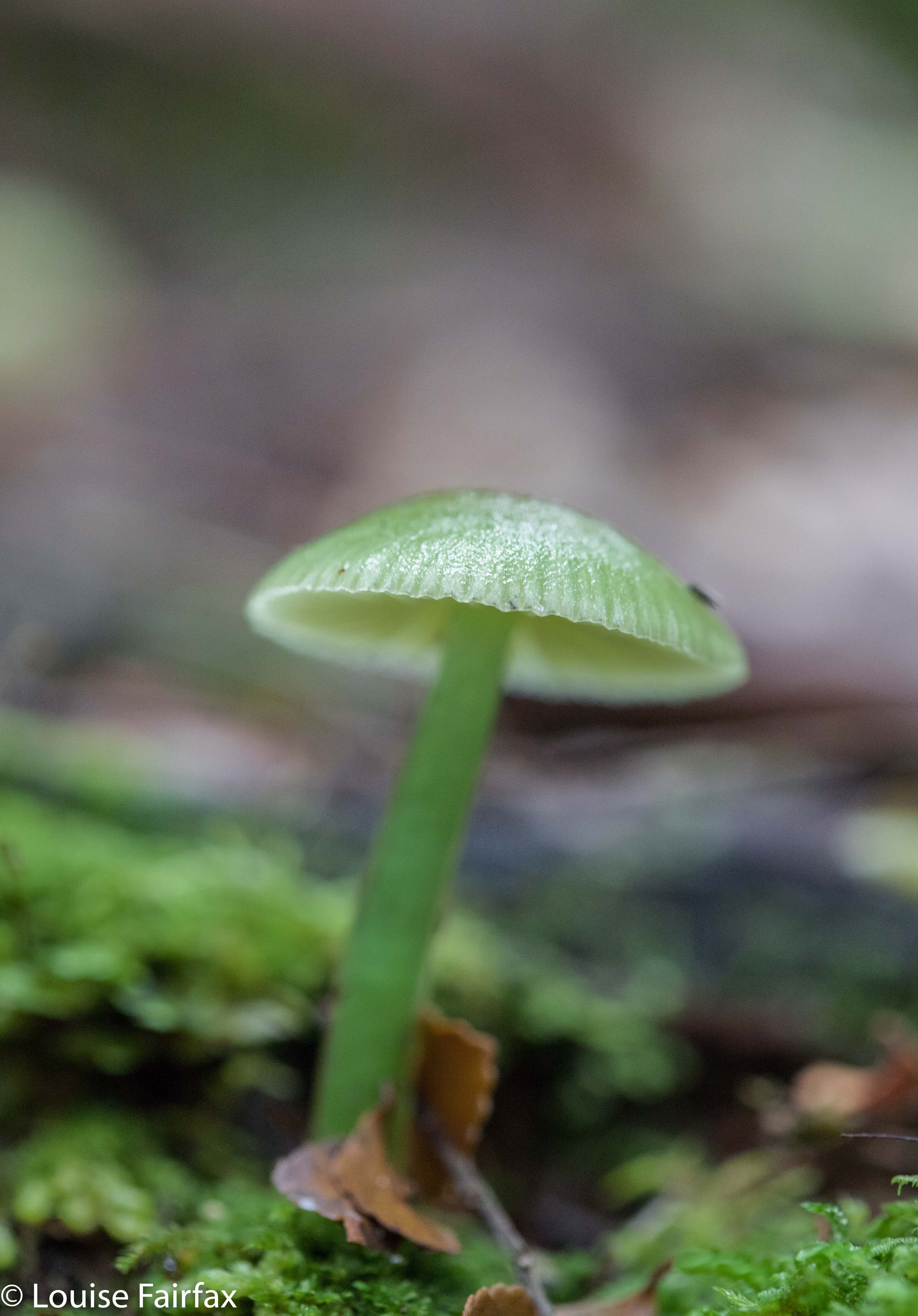
The track to the area is clear, but once there, if you go around in a lot of circles chasing fungi and mossy giants, the part at the end seems to have tapes everywhere, but not in a way that helps. I had to get out my gps and compass to see which general direction I needed, as I had become so immersed in fungi and moss that I lost my sense of direction, and I seemed surrounded by pink tapes. I could have spent another hour here, easily, but I noticed that the sun had lost its warmth, and the sky was getting rather dark. Whoops. I’d stayed here far, far longer than anticipated. I now had a big drive back to Launceston, and all the nearby food outlets were shut for the night. I just made the cut for Zeps at Campbelltown (closes 8 pm) for a cappuccino to keep me awake for the last leg home.


Sharpes Falls 2018 Apr

Sharpes Falls 31 Mar 2018.


My daughter and I had just had a glorious time climbing Mt Sprent in the South West and sleeping on the Wilmot Range, but, being greedy, I also wanted to bag a waterfall with her – to share that side of what I love – so we decided to take in Sharpes Falls, just short of the Mt Field National Park, on our way home from Strathgordon. I knew she’d love waterfall bagging in general, it’s so like orienteering – except that there’s a beautiful waterfall to greet you when you’ve navigated well, rather than an orange and white flag: hey, much more fun. As for whether she’d like Sharpes Falls in particular, I couldn’t say until we’d seen it, but you have to see it to know, so off we set.


We’d parked at the boom gate at Newbury Rd (the turn to the west beyond the National Park. If you get to Sharpes Rd, you’ve gone too far west). We assiduously ignored all the signs that told us we were embarking on a very dangerous mission (everything one does in modern Australia is very dangerous; the words have lost their sting as councils yell “danger” at the sight of a caterpillar). Up the hill we progressed, past the quarry on the right (doubtless full of life-threatening horrors) and continued on, at first through a pine plantation that made us happy by reminding us of all the orienteering events we’ve done in forest smelling just like that, and further, to an ugly felled area. Neither of us likes felled trees – although felled pines are perfectly justifiable, they’re still not pleasant to observe – so elected to turn into the forest that contained our falls earlier than planned, just to create pretty scenery for ourselves.


The going was thus slower, but that’s fine by us, as we were not on a mission of efficiency. Our intent was beauty, so we enjoyed wending our way in lush forest above the creek that contained our falls (Sharpes Creek). We even found some early fungi, and lost of lush moss to excite us. The falls were definitely worth the walk of about twenty minutes in each direction.


On the way out, we decided to go the way that most people would probably want to come if efficiency was part of their game, just to test it out for this blog. Heading straight out of the falls to the east, we came upon some orange tapes. However, if you are not comfortable navigating, do not count on these tapes, as they can not be relied upon, especially near the logged area. This is not a waterfall for tourists.

Horseshoe Falls 2017 Feb


The location for this photo is perhaps a tad less than original, but there’s a very good reason visitors love to photograph the three main falls in the Mt Field National Park. Of course, one of those reasons is that people don’t have to go too far from their cars, and that there’s a big, smooth path with sign posts: not everyone relishes a good bushbash.  But the other, and the reason for carparks and smooth tracks and signs, is that the falls are just plain gorgeous. Here is my take on what captured my attention. I stayed here the night, as we were to leave for the Western Arthurs in the morning at a time that would have necessitated a 3.30 a.m. departure from my home in Launceston, had I left from there. Much nicer to camp in a National Park with the sound of the Tyenna River passing by and the feeling of deep nature all around me. A 7 a.m. meeting time also seemed highly preferable.
One of the reasons I particularly wanted to photograph these falls on this visit was that in tidying up my files, I realised I didn’t have one single shot of my own of these particular ones. I must have had a grand deleting session some other time, or just never labelled my other efforts. The omission is now rectified.

Lady Barron Falls 2015 Aug

Lady Barron Falls 2015 August.


The day we visited Lady Barron Falls, the river was in flood, so the flow was monstrous – almost too big, as its enormity obliterated many of the interesting rock details one normally sees (and its volume created a spray that hard to keep away from the camera lens.


If you want to read the rest of what we did that weekend, turn to http://www.natureloverswalks.com/collins-cap/

My diary records that my husband and I took twenty minutes in each direction. We parked the car at the topmost intersection between the track and the road (centre top below), and just walked in, almost on contour, from there, as we were in a bit of a hurry, having “wasted” a lot of time playing in the snow, and darkness was approaching. (Since when is playing in the snow a waste of time? You know what I mean.)