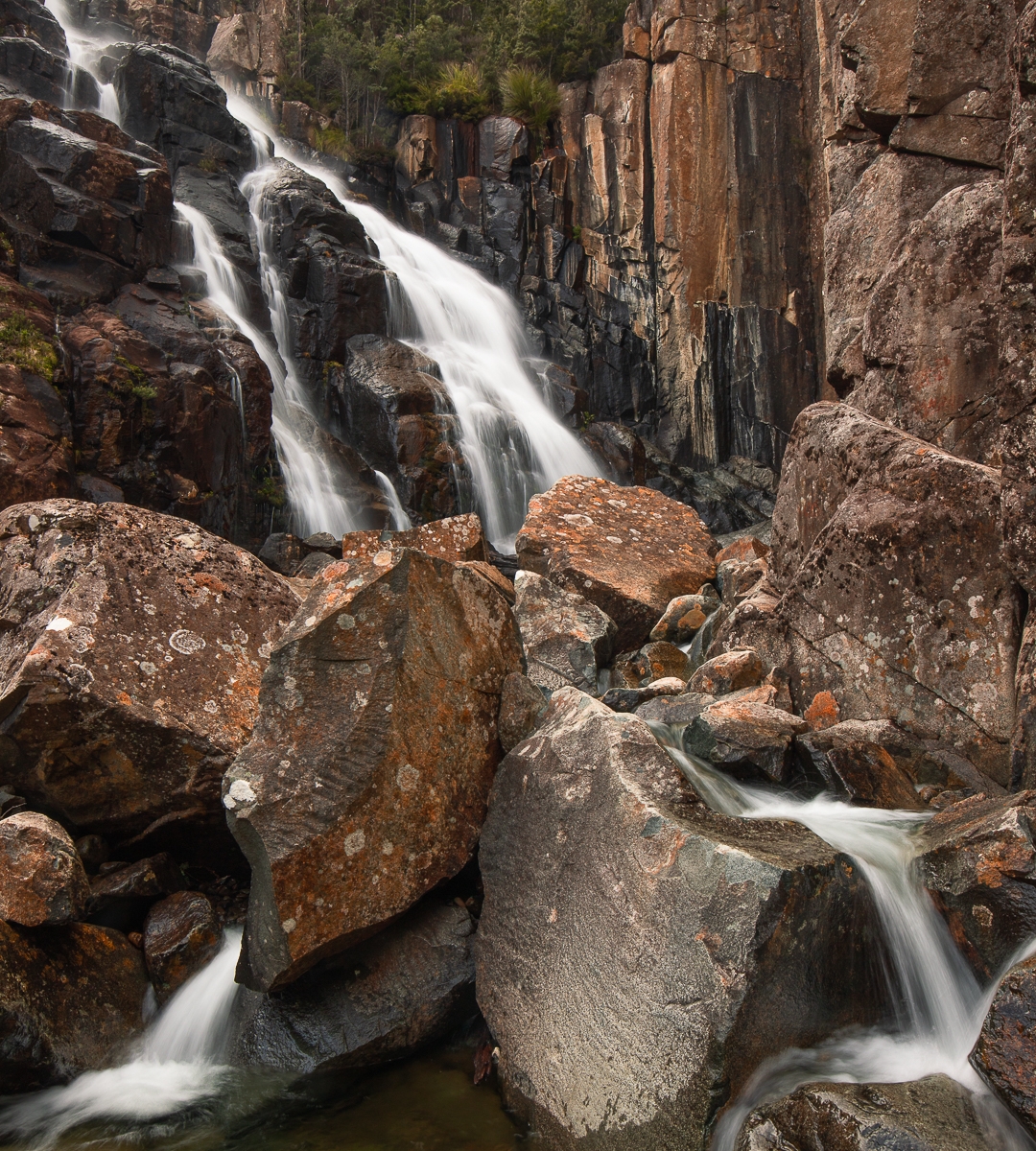
I have called this blog Cherry Falls, but this is actually a “work in progress”, as I have found three lovely Cascades on the Humphreys Rivulet (as well as Bear Falls higher up), but I didn’t go far enough to reach Cherry Falls. So, I will show you the three Cascades I got this time, as I rather like them, and once I have been back and reached the actual Cherry Falls, I will update the blog.
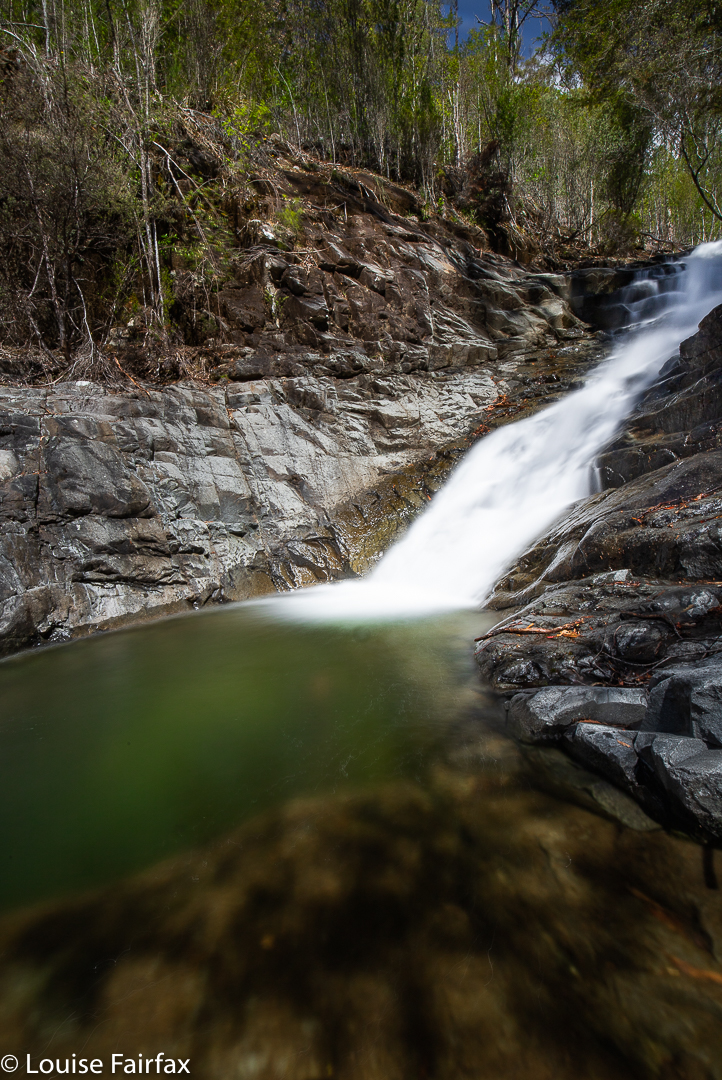
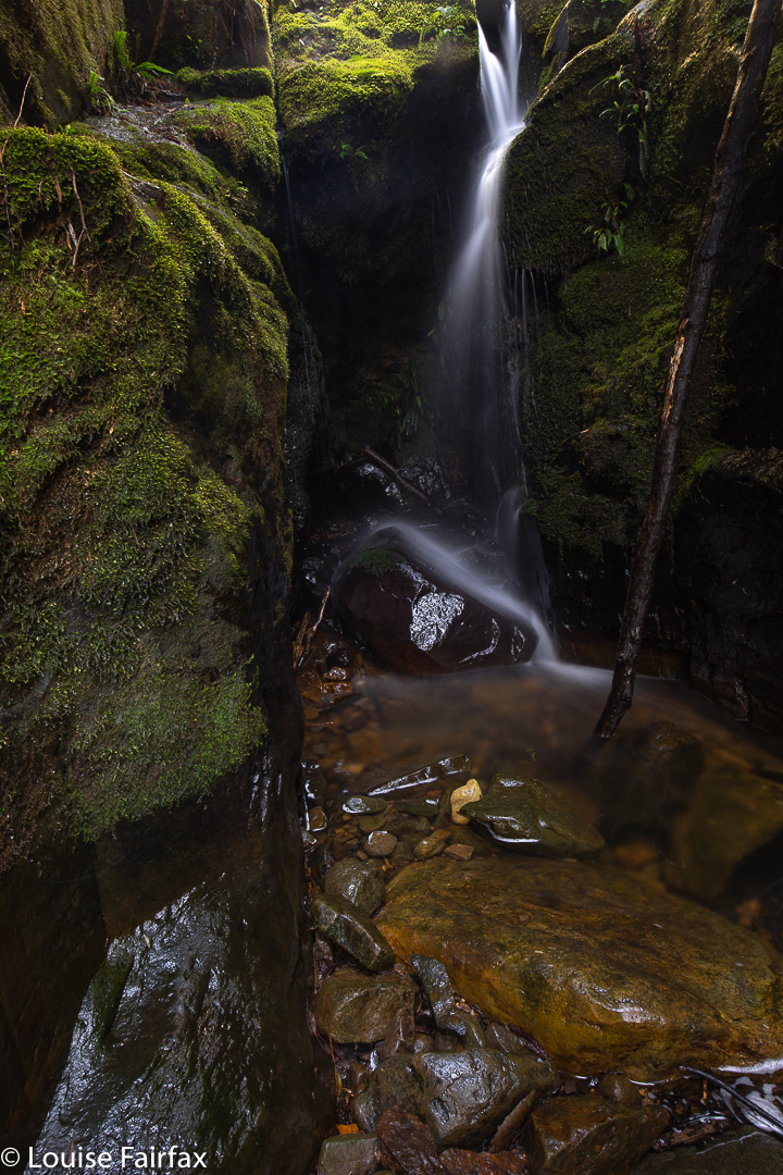
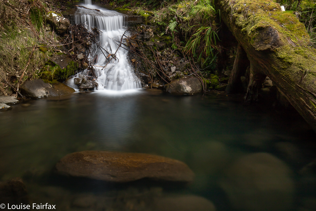
Humphrey middle Cascades
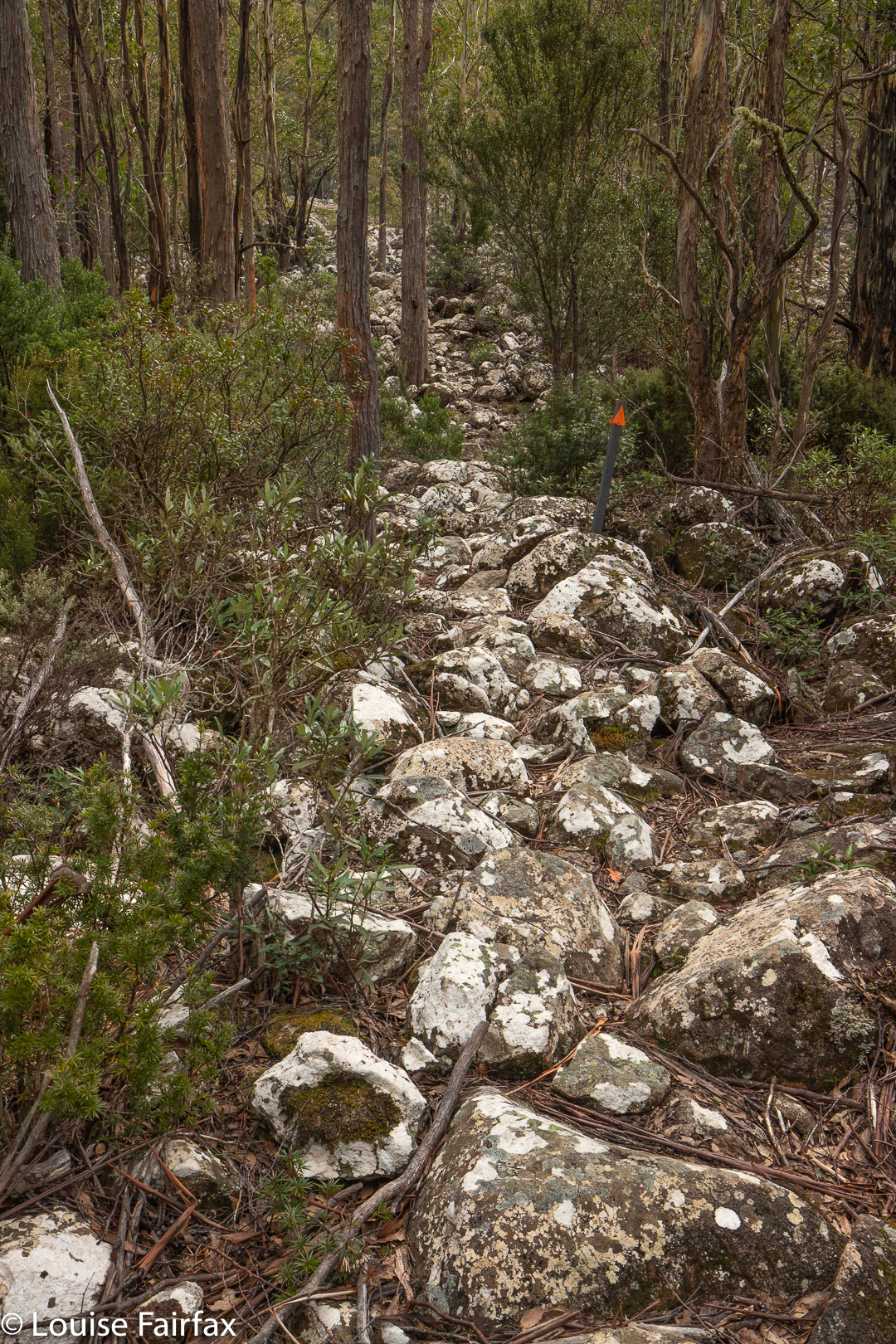
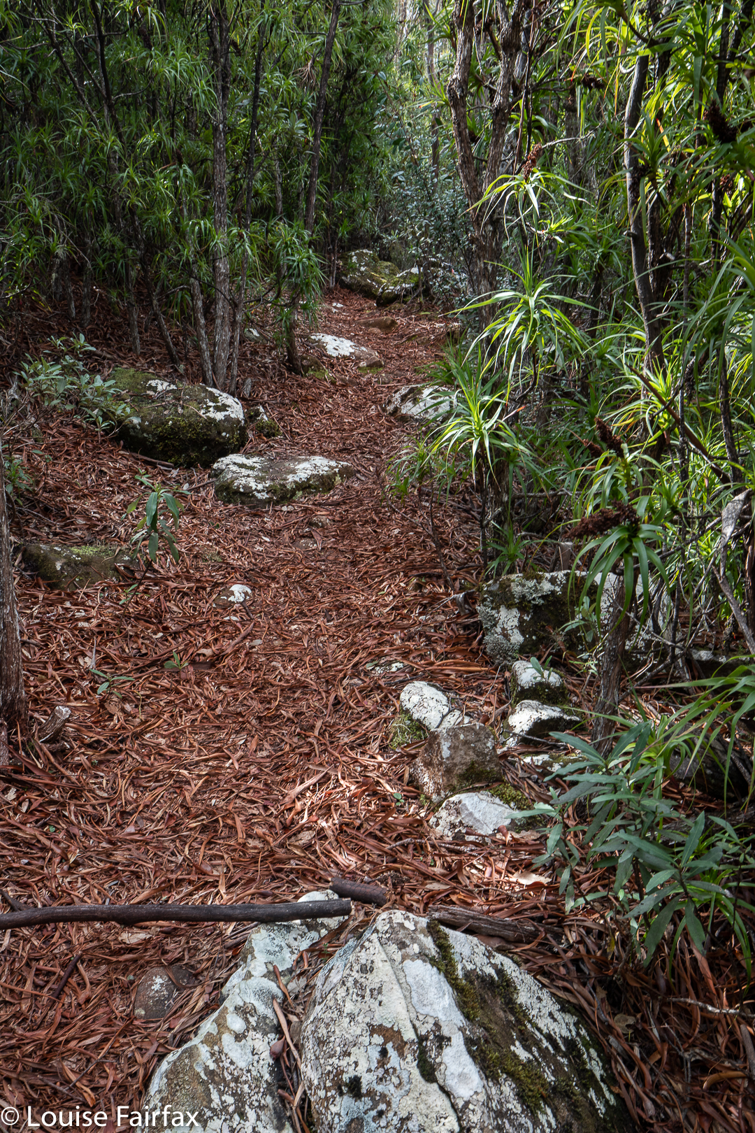
I parked the car at Tolosa Mountain Bike Track parking area, and followed the trail now called Tolosa Fire Trail for a while (that’s what the signs say. My map calls it Native Cherry Fire Trail). After that, you go down to the Rivulet, and bushbash your way up it. There are some lovely sections, but there are also some rather horrid stretches, crammed with cutting grass, so it required some perseverance.
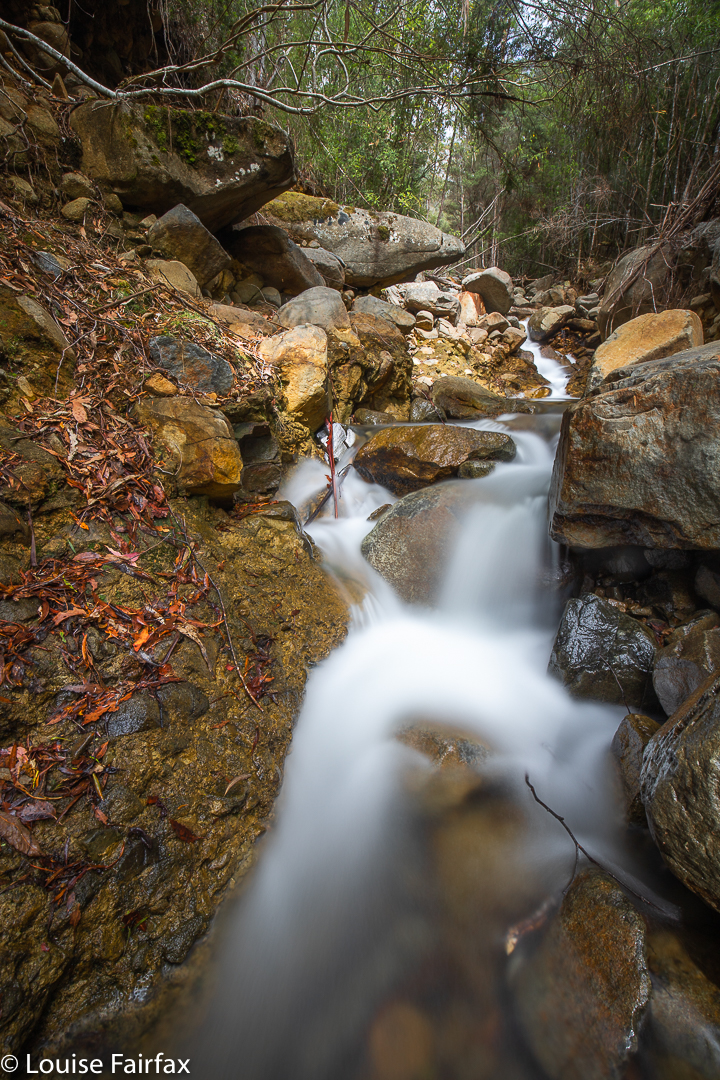
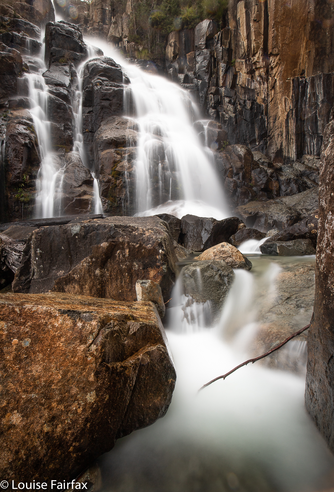
Humphreys Rivulet highest Cascades
I had started later than intended, and was, as usual, worried about being on time to pick up little Abby after pre-school, so needed to be out by 2pm to ensure no mishaps there. I had enjoyed being beside the creek and unhurriedly photographing, so stopped at the highest of the cascades on this occasion. I will take in the Falls themselves next time. The excursion is a nice blend of brisk track walking and concerted bushbashing.
See also http://www.natureloverswalks.com/bear-falls/
The descent to, and then climb back out from, Bear Falls is exceptionally steep. The first 700 ms are flat, on a fire trail (Mt Wellington), after which you dive head first down a landslide (which I presume is the shocking 1872 “Glenorchy landslide”). In this plummet, you drop 440 ms in about a kilometre. That is whopping!!! Not only is it steep, but also, much of it is of dubious stability, that being the nature of a landslide. I personally treat landslide rocks with a great deal of respect. Sometimes the whole land can feel like it’s running away from you.
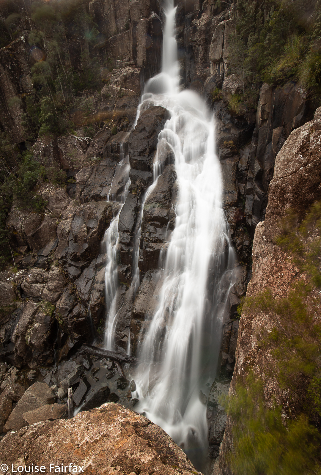
Bear Falls
As a result, I took far longer to descend (1 hr 38 mins) than I took to come back up again (1 hr 20 mins). I love climbing, and if you stumble going up, you don’t do nearly as much damage, so I feel free to exercise less care. On the way down, I tested every single rock before committing to it, and had three points of contact the whole way. Coming back up, I climbed like a bear on all fours, as required by the slope, and had fun and went as fast as I wished, which was actually pretty fast, as I was under time pressure: I wanted to get changed and have lunch before picking Abby up from Kindy. Relaxing before the onslaught of an exhausted four-year-old just released from the rigours of newly-imposed educational demands was also appealing. A tantrum is far more demanding than a steep slope.
Bear Falls are not marked on the map, let alone named. The tributary they are on is also not named – or not up that high, before it has amassed all its tributaries to become a rivulet. There are two mapped, and many unmapped tributaries. As most people don’t like ascending at the rate I do, I would allow far more time for this excursion, should you attempt it, than I did. I was squeezing it in between other demands on my life.
Our visit to Deception Falls on the Hobart Rivulet had not endured a long planning period. It was school holidays, and I offered 8-year-old Gussy an open choice of activities: whatever he wanted to do that day, we would do together. He chose to go waterfall bagging. This is also what he chose the previous day, on which we’d had a lovely time visiting O’Gradys and Betts Vale Falls, with a steep off-track descent to the top of Strickland Falls for a snack before finishing.
O’Grady’s Falls the day before
Towards the end of our time the day before, we saw, out of the corner of our combined eyes, the hint of a waterfall. We gazed at it from above, but I couldn’t see a ready way down, especially not with an eight year old in tow (and one merely wearing sneakers at that). The slopes leading into the Hobart Rivulet can be extraordinarily steep, and our angle of view was not promising. I told him I’d find a way of getting down to that waterfall, and then take him once I’d worked out a doable route.
Hobart Rivulet below Deception Falls
On this day, however, he said he wanted to do the exploratory work with me. I explained we might fail to get there, but he wanted to be part of the trying. On this day, he did the waterfall the courtesy of wearing proper boots. I think he’d been a little jealous the day before, when I stomped around the creek without problems, while he had to pick his way so as not to get his sneakers wet.
We parked below where the falls would be, and dropped steeply to the water level, Gussy leading the way for most of it. He selected good routes. Once in the creek bed, he was very happy with his choice of boots, and proudly walked up the creek itself. We didn’t have exactly the same path, even though, of course, we stuck together. That’s part of the fun of real bushwalking: freedom of choice. You are not a puppet fulfilling some role designed by someone else. This was a real adventure, and he was loving it. We still had no idea at this stage whether we would reach the waterfall we’d had our glimpse of the day before. There was still plenty of time for nature to win this game’s episode. That uncertainty is part of the fun, and makes success so much more enjoyable than just marching on a track, knowing you’d reach the goal even if you were a blind, lame nonagenarian walking backwards. You don’t need to be a million miles from home to have an adventure, but you do need “wild” bush.
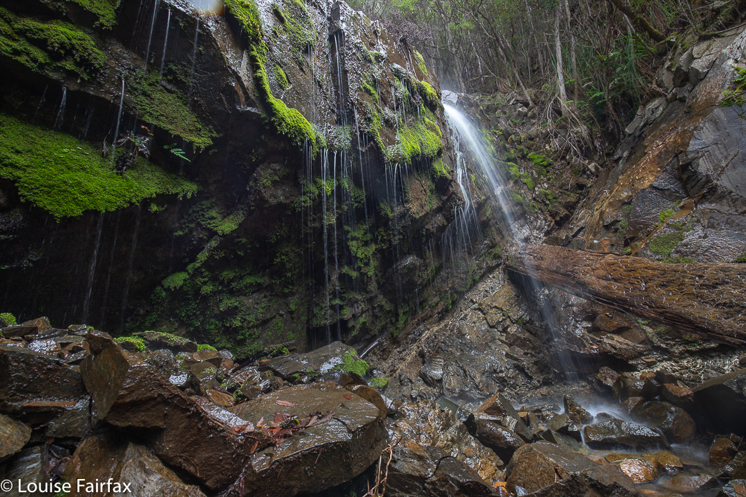
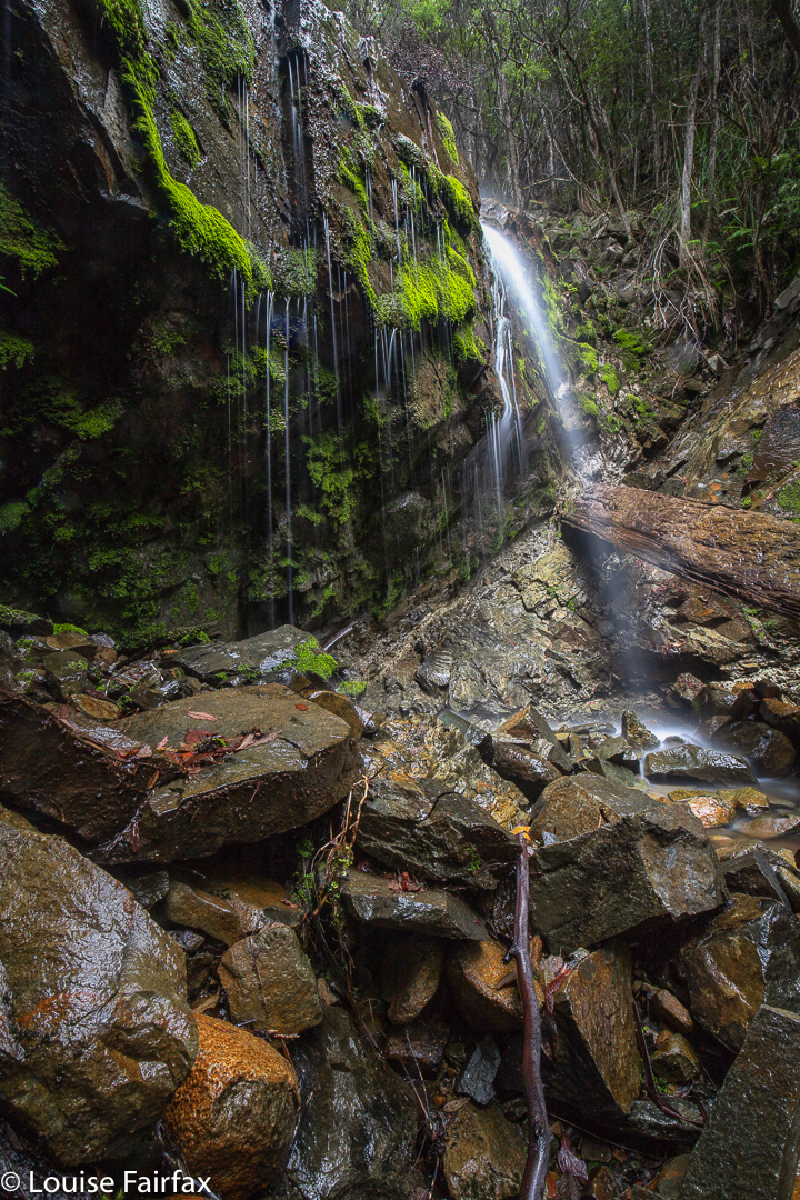
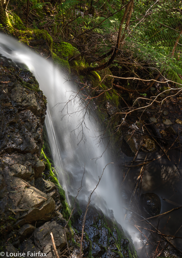
Deception Falls
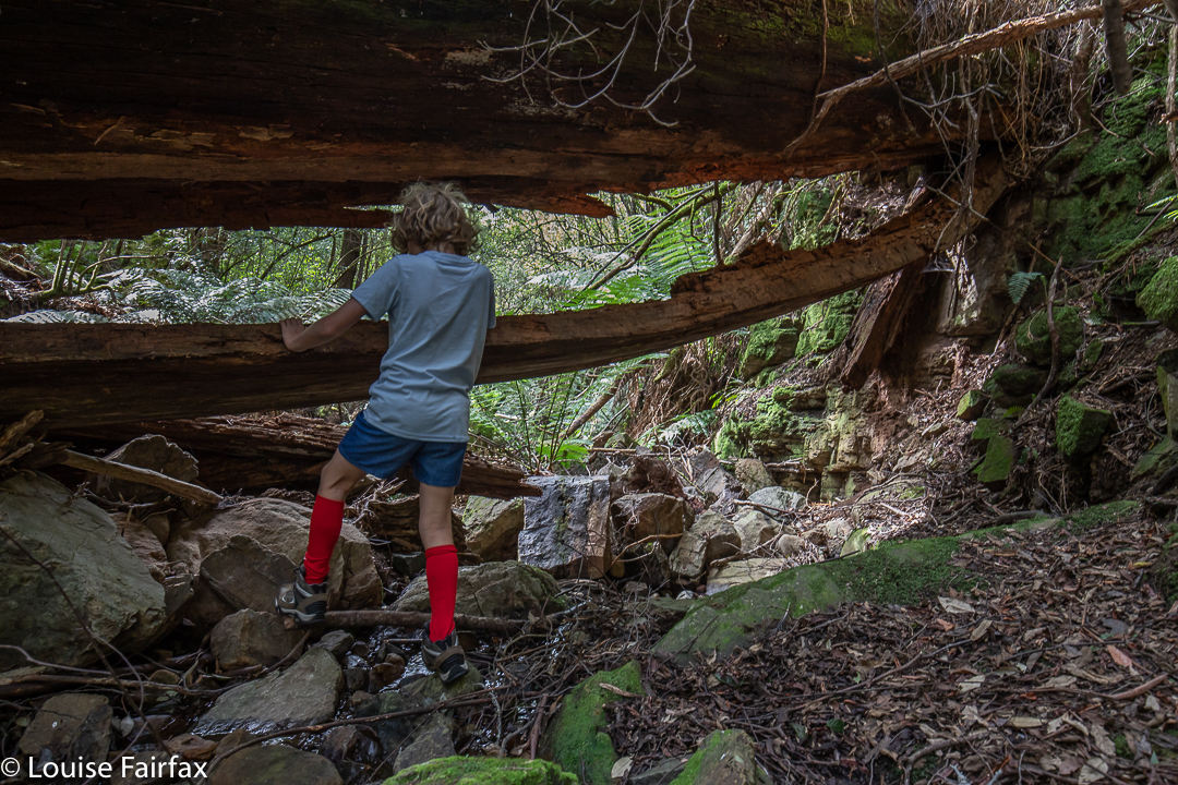
On we forged along our obstacle course, climbing over, under and around what came on our path. At one stage, we arrived in a huge kind of tree cave: a truly gigantic tree had fallen across the creek, and being under it felt as if we were in a cave, such were its dimensions.
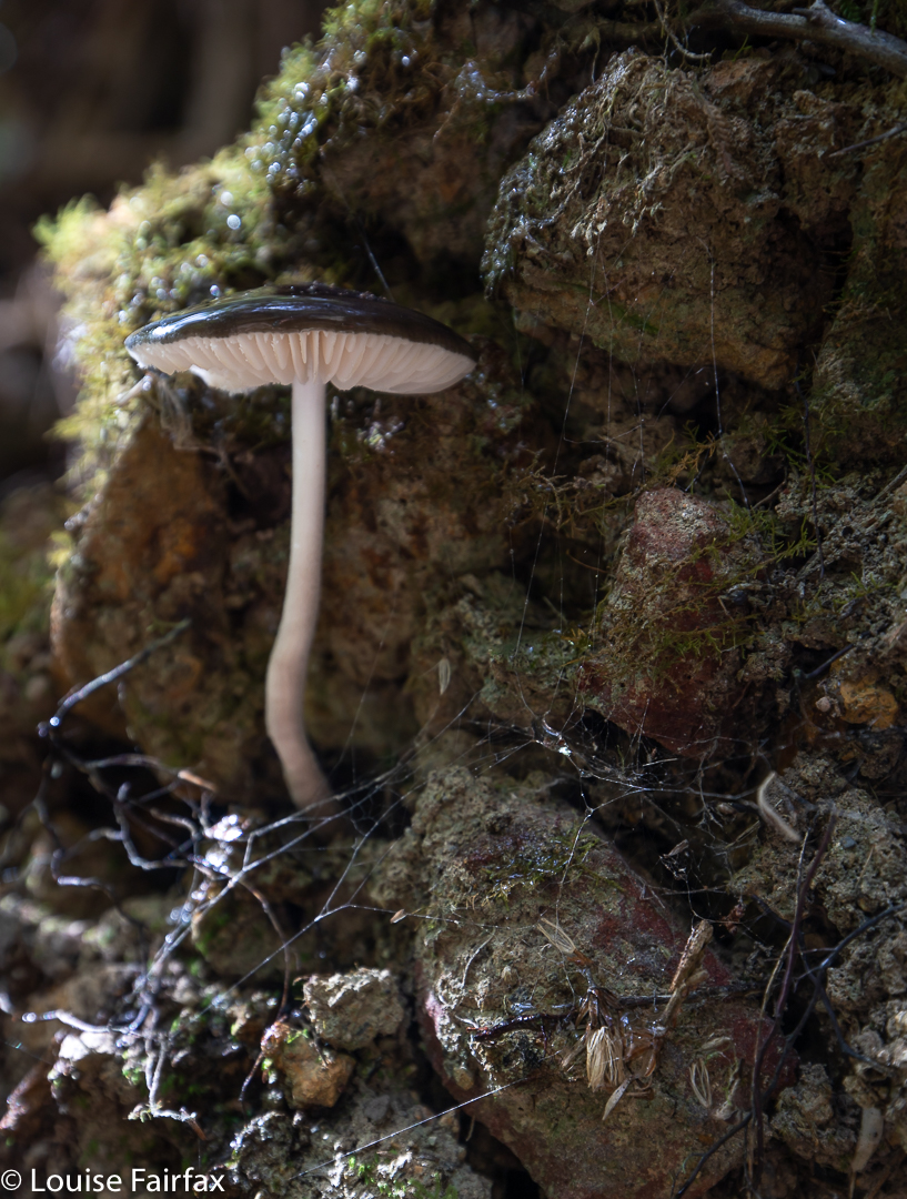
Once we reached our goal, we could see that it could have been a lot faster and easier if we had chosen a different starting point, but I had chosen the one I did so as to create a proper adventure. The aim is to enjoy, not to break some speed record reaching the falls. The long way was the fun way. We enjoyed being there, and found some shell fossils and a marvellous specimen of Oudemansiella gigaspora (which I mistakenly thought was an Entoloma panniculum, not noticing the white stipe at first. Thanks to Herman Anderson from the Tasmanian Fungi group for the identification). There were also some wizened tiny fungi, perhaps mycena sp. As the pool at the falls’ base is chest deep, we agreed it would be a great swimming hole in summer.
Oudemansiella gigaspora
The road was now visible, but Gussy did not want the easy way of going there. Instead, we turned our back on the road, and chose the hardest way out: the approach route that we had rejected the day before, only this time, we were climbing up not down, which is safer. I stayed directly underneath him, watching his choices, which greatly pleased me. If he slipped, I could catch him and arrest his fall. This did mean that the odd rock came my way, but I knew the dangers. He is more important than I am. Meanwhile, he was learning great lessons about what you can and can’t rely on in the bush: what might give way, and what is sure to be stable. I watched with satisfaction while he chose living branches or roots and tested them before committing to them.
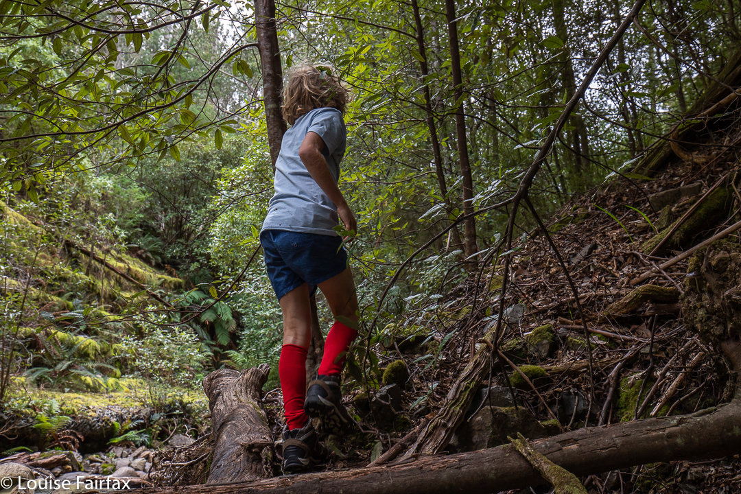
adventuring
We called this waterfall Deception Falls, as we felt it was somewhat deceitful, hiding itself away from view of its many passers by. We had never even noticed its existence before.
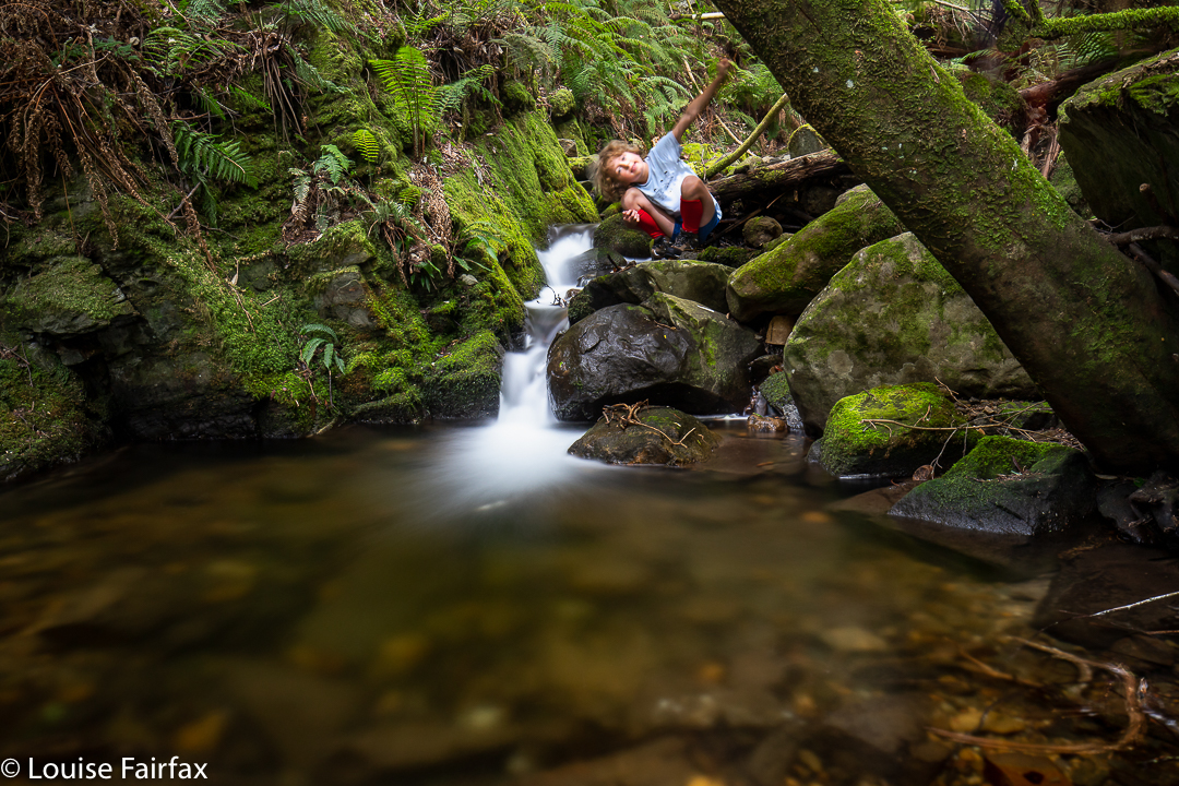
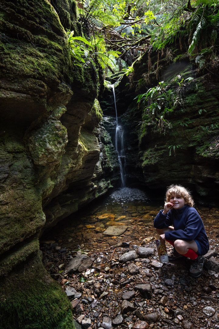
Secret Falls snacking
We hadn’t finished having fun, so I said I’d take him to Secret Falls. Off we set, walking and talking. Once we were there, I pointed out to him the beautiful moss, but also the fact that much of this wonderful lushness had been replaced by mud due to other people’s carelessness, selfishness and disregard for nature. He trod very carefully, and avoided all moss. Wearing the right shoes really helps in this regard. If you’re wearing boots, you can walk on the stones in the water a lot more easily. In the little canyon, we talked in hushed voices, as we could hear other people walking along the track above, and didn’t want to attract attention to this secret place. I think he found it very special to have been somewhere “not on general display”, even if it did bear, all too noticeably, the marks of the carelessness of others. Experiences like this help reinforce his growing respect for nature, and for its fragility if not protected against stupidity. That sentence read to me as contradictory in a sense, as nature is, in other ways, tough, very tough, and will outlive us stupid homo non-spapiens; however, in the face of the forces of destruction from the average tourist or greedy bureaucrat, desecrated features of nature’s beauty can take longer than a human lifetime to regenerate, and some beauty can be lost forever. How much of this glorious world that I am showing Gussy will still be here at the end of his life?
“The vision of a dying world is vast before our eyes; We feel the heartbeat of its need, we hear its feeble cries …” (Hymn. 1966).
Prior to a few months ago, I had not seen or heard anything to tempt me to make the long and not-very-comfortable trip to Wellington Falls, on the “rear” slopes of Mt Wellington. However, a few months ago, I saw a lovely image by Bjorn Baklien that showed me the falls could look appealing. I awaited the opportunity for a day when I had a lot of time and felt like a very long walk, as I took into consideration the fact that the advertised signage indicates that this is a 7-hour trek. The distance looked big on the map, and I knew from my visit to Disappearing Tarn (en route) that the footy-sized and shaped boulders that litter the way are not “marching” territory, and have to be treated with respect if one doesn’t want to twist an ankle.
Wellington Falls
Luckily, the reality was way, way better than my expectations. Firstly, I took a shade less than 1 hr 45 in each direction, thus halving the time I had allocated. Secondly, I didn’t know in advance, but by Disappearing Tarn, I had essentially done all the footy-stones bit. The actual Potato Fields, which I was NOT looking forward to, were easy in comparison, as the rocks were larger, and very stable. In fact, today everything was easy, as the rocks were dry, and none of them moved under me. Possibly the worst aspect was that I saw my first snake of the season, underfoot where I was about to tread. I informed Mr Snake that it was only September and he should go back into hibernation. I guess he had come up from Snake Plains, as he was just after that turn off.
Wellington Falls Track
So, here’s how it all took shape: Having driven down from Launceston that morning, I went straight to The Springs, and parked at the “higher” carpark, the one just after the road divides in that area. I walked on the Pinnacle Track steeply uphill for a mere 2 minutes, after which it was time to turn onto the pretty flat Milles Track, which I followed to the left (initially SSW but then swinging nearer west) for 28 minutes, when the Snake Plain track joined the path from the left (south). Along that Milles Track section, I enjoyed fabulous views (although a little hazy, so not worth photographing, but definitely worth imbibing) out over Hobart City far below to the expansive blue waters and hills beyond.
Wellington Falls Track after the Potato Fields
A further 26 minutes of the worst part of the track – through dry forest with the footy stones underneath – saw me arrive at Disappearing Tarn, from whence the track climbed upwards through the equally dry Potato Fields (but totally firm and easy underfoot), and then entered a delightful grove of Richea dracophylla, with masses of rich brown leaves underfoot and mossy rocks. The final few minutes involved a steep descent to an intersection below, above Wellington falls with tracks coming in from other directions (one from the Pipeline Track, well below on that side, and the other from the Cathedral Rock area in that circuit, across the river). Not far from there is a side track to a lookout over the falls. I stopped my watch (1 hr 44), and then just took my time, descending to the very base of the falls, and inspecting various rocky outcrops for photographic possibilities.
Wellington Falls – half way down
The way back took in total the same amount of time as the way there, although the splits had different values due to different inclinations in the opposite direction. I had lunch in the Tavern at Fern Tree, coffee down lower at Ginger Brown, and was finished everything (i.e., all the eating) by exactly 3pm, school pick up time.