Hobart Rivulet 2

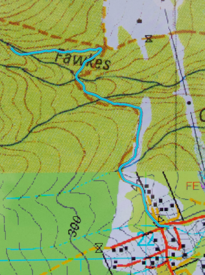
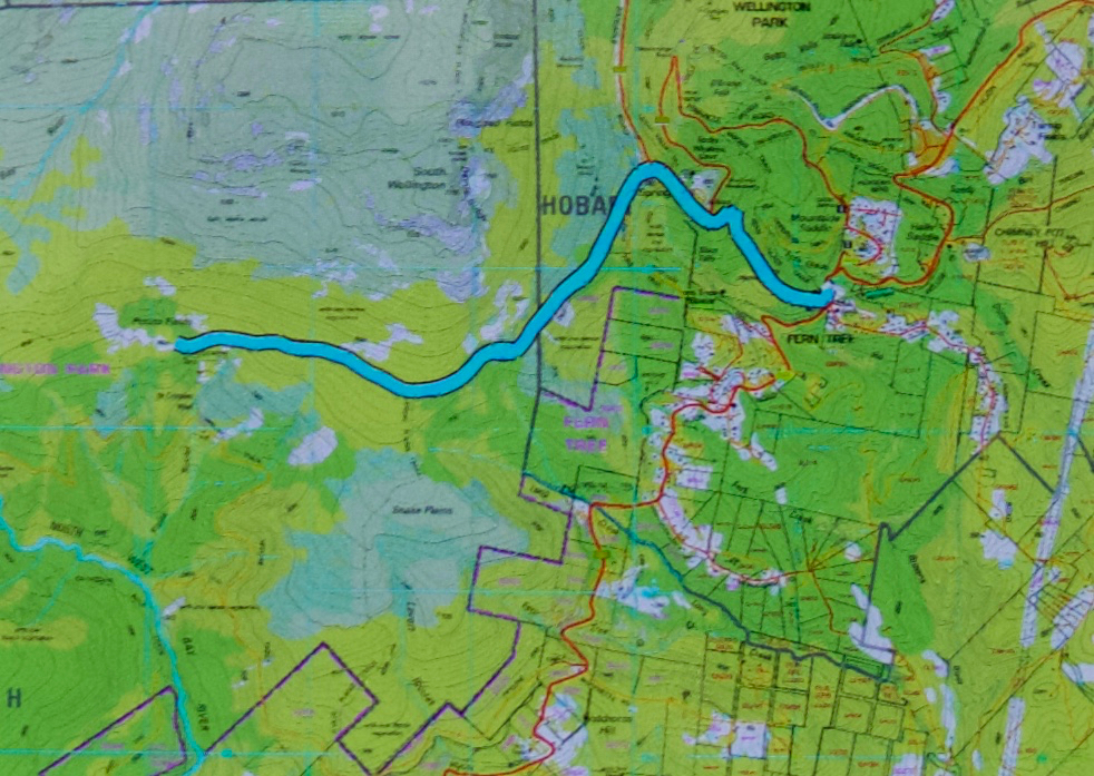
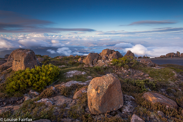
I still had unfinished business on the Hobart Rivulet, despite my recent adventure’s additions to my waterfall collection
(http://www.natureloverswalks.com/hobart-rivulet/) , so, on the afternoon after my Flora Falls escapade (also in my blog), I set out to follow the Rivulet upstream and see what else I could find. I knew some waterfalls were missing from what I had so far found.

Pineapple Falls

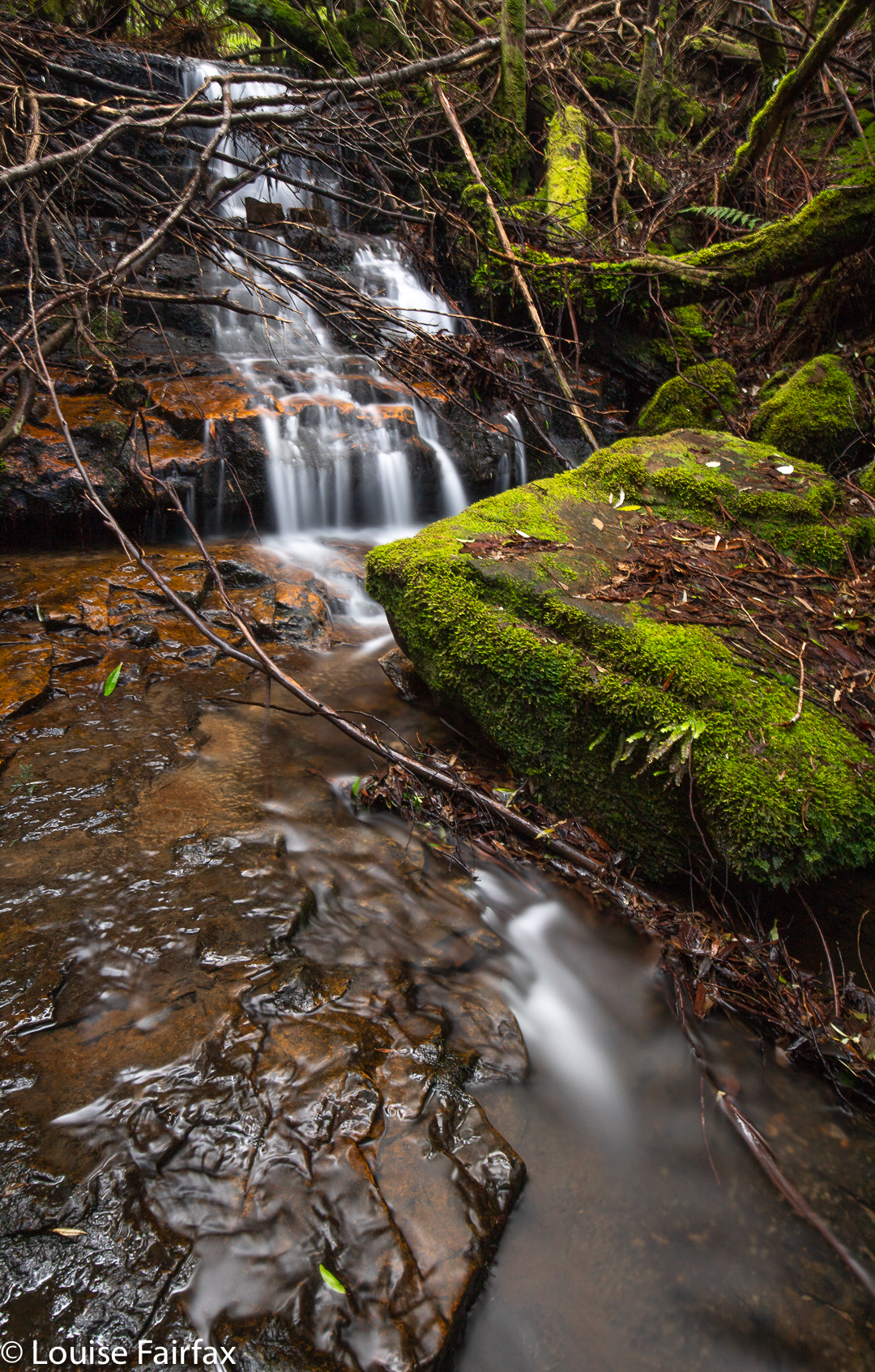
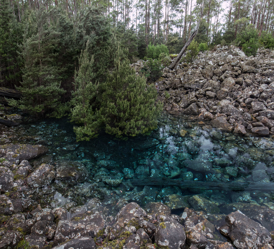
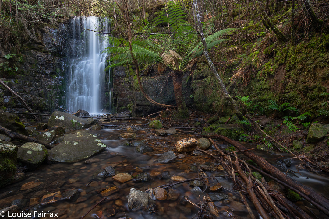
I had already explored the stream for a bit of a way north of the Strickland Falls (and seen Champers and Disappearing Falls in the process), so didn’t dive into the forest straight away. However, once my height seemed right, I left the Rivulet track and entered the thickish, and rather uninviting, bush filled with cutting grass and made my way to the water. My guess was good. Just upstream, I could see white foam, and it was the Pineapple Falls.

Gentlemens Cascades

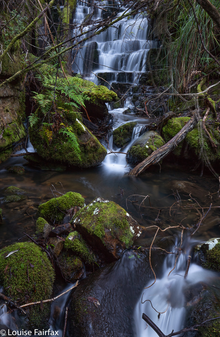
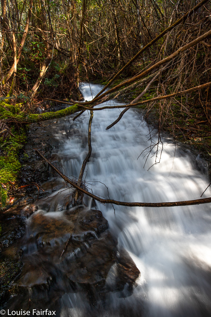
Right next door was another pretty sight, more a cascade than a waterfall, so I photographed it, too, much later learning that this was Gentlemens Cascades.

Pretty Falls

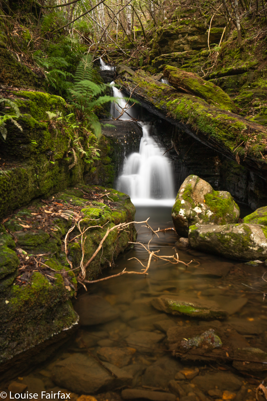
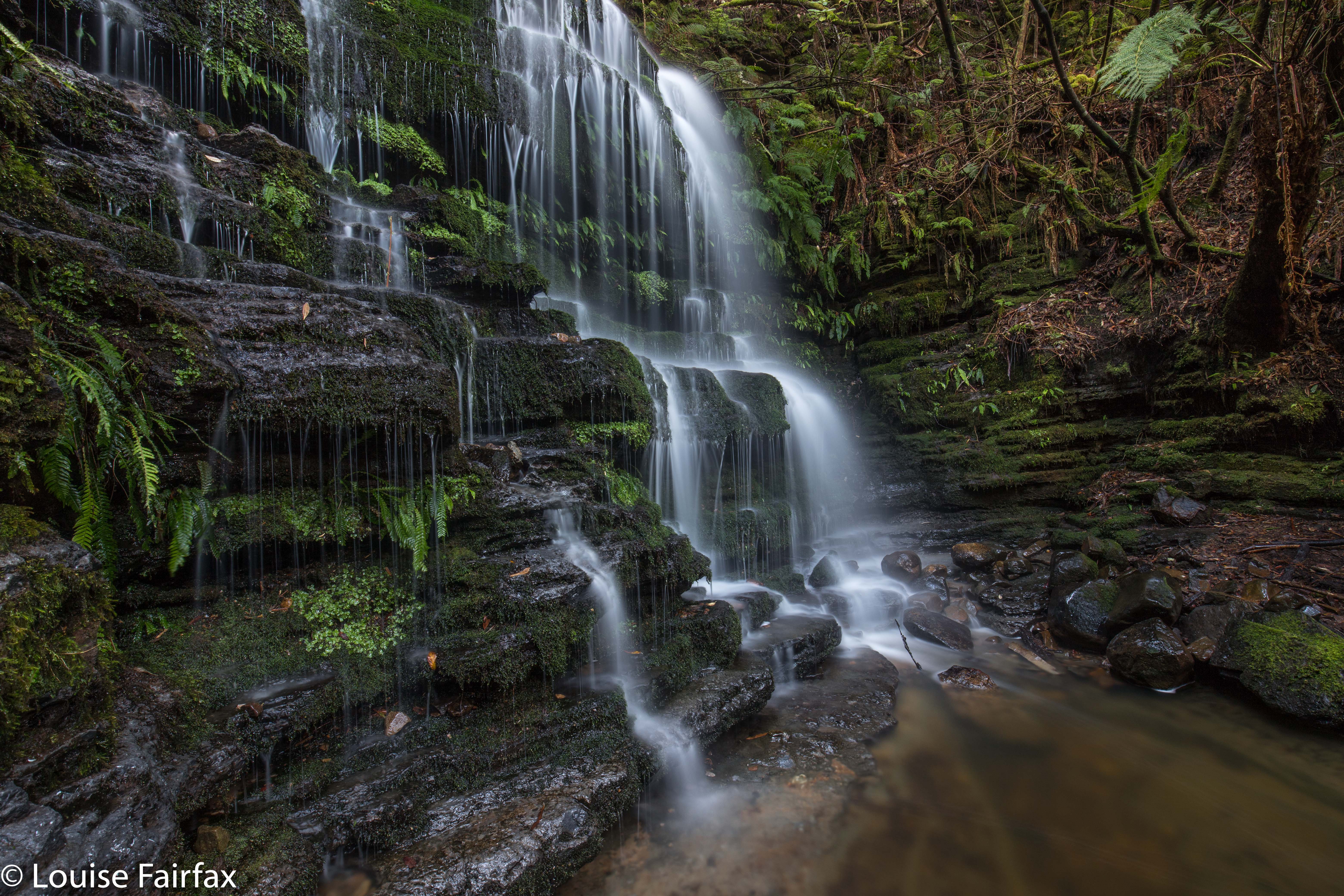
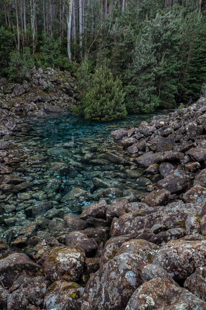
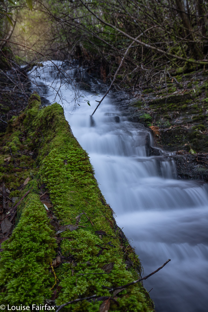
I was in an exploratory mood, so decided to keep climbing, and came to what, in the absence of any known name, I have (at least temporarily) dubbed Pretty Falls.

Ladies Cascades

Above them lay some Cascades worth photographing, and later, feeling miffed that Gentlemen had Cascades but we didn’t, I called this Ladies Cascades to equalise matters. Gentlemen and Ladies are rather hard to find these days, so it is appropriate that these cascades are well hidden and are rare collectors’ items.

Fairy Falls

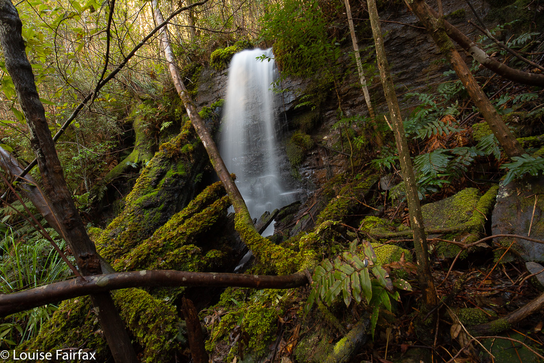
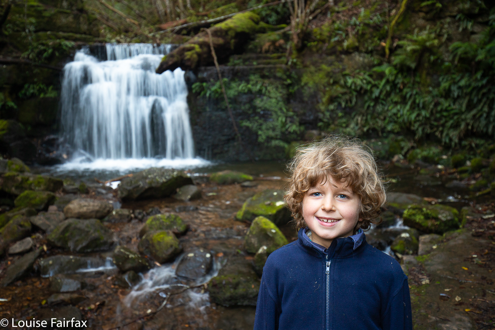
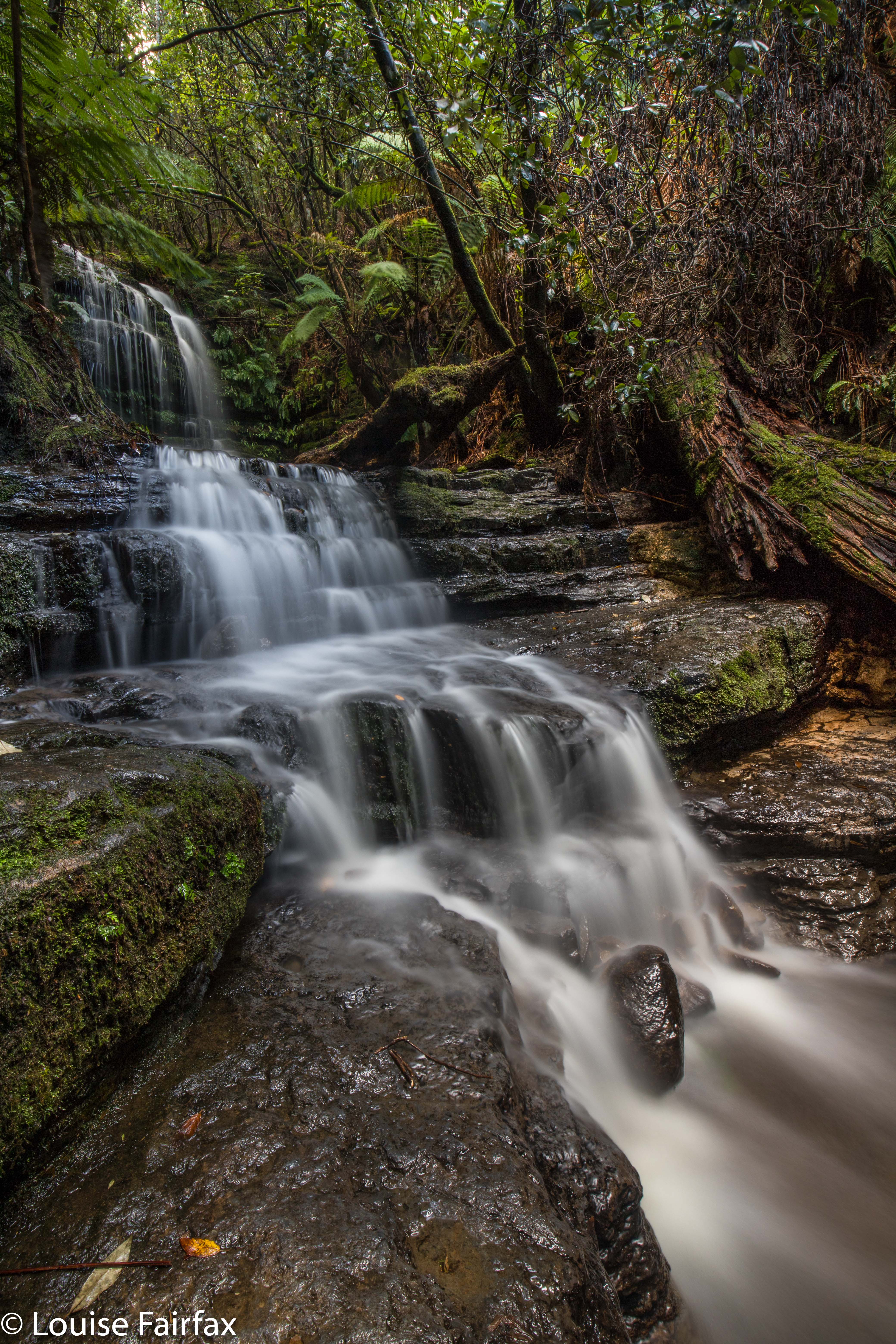
More hunches and guesswork had me arriving at one that I had definitely been seeking: namely, what is known as Fairy Falls. Charming.
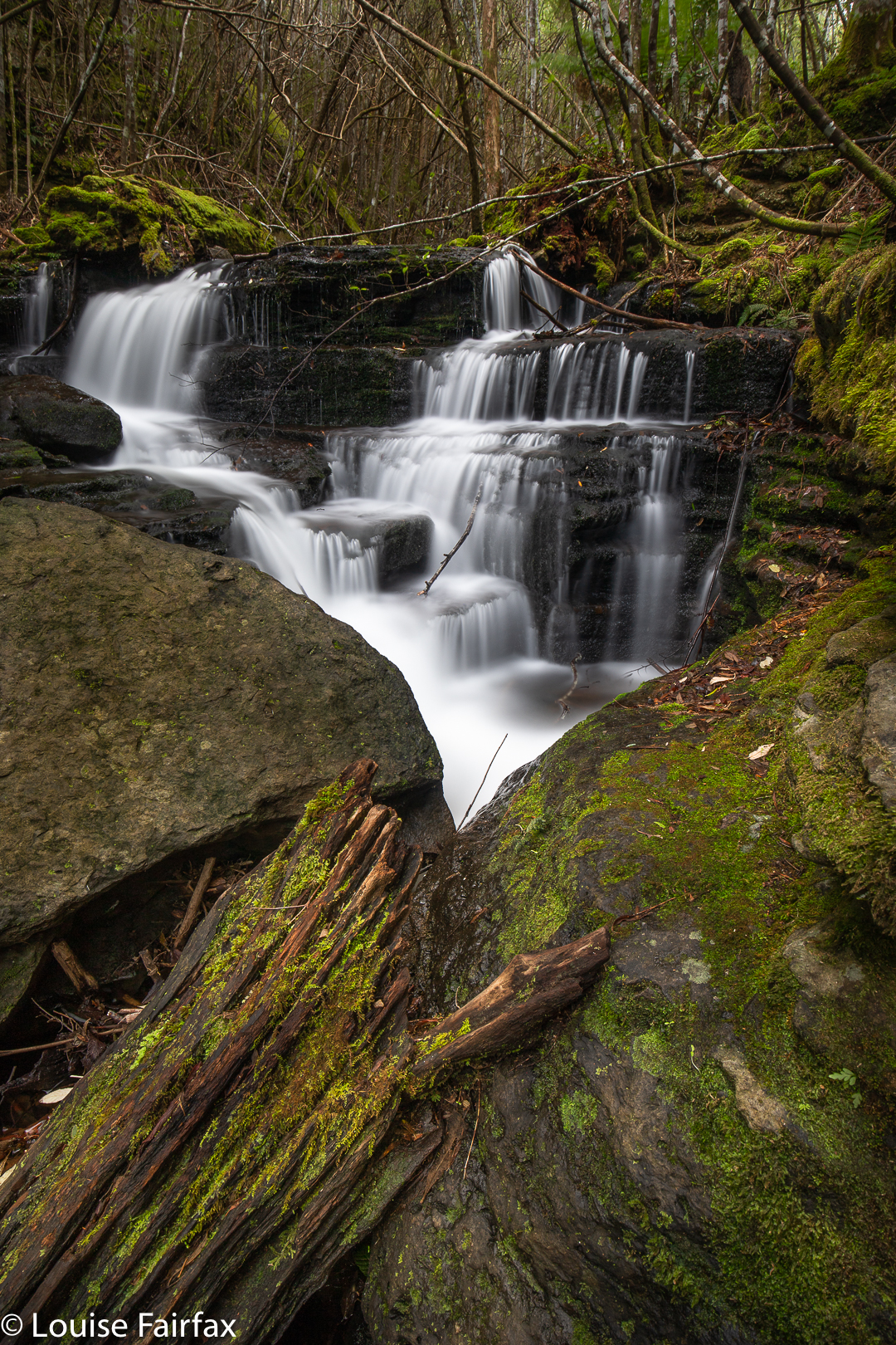
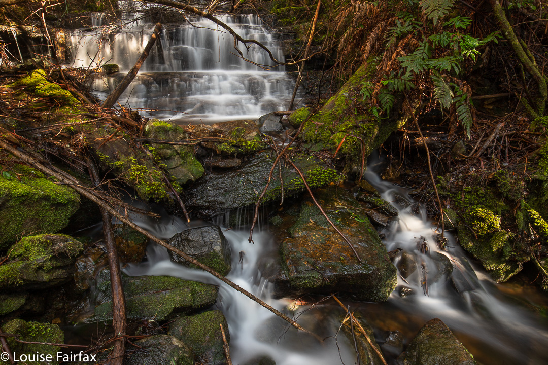
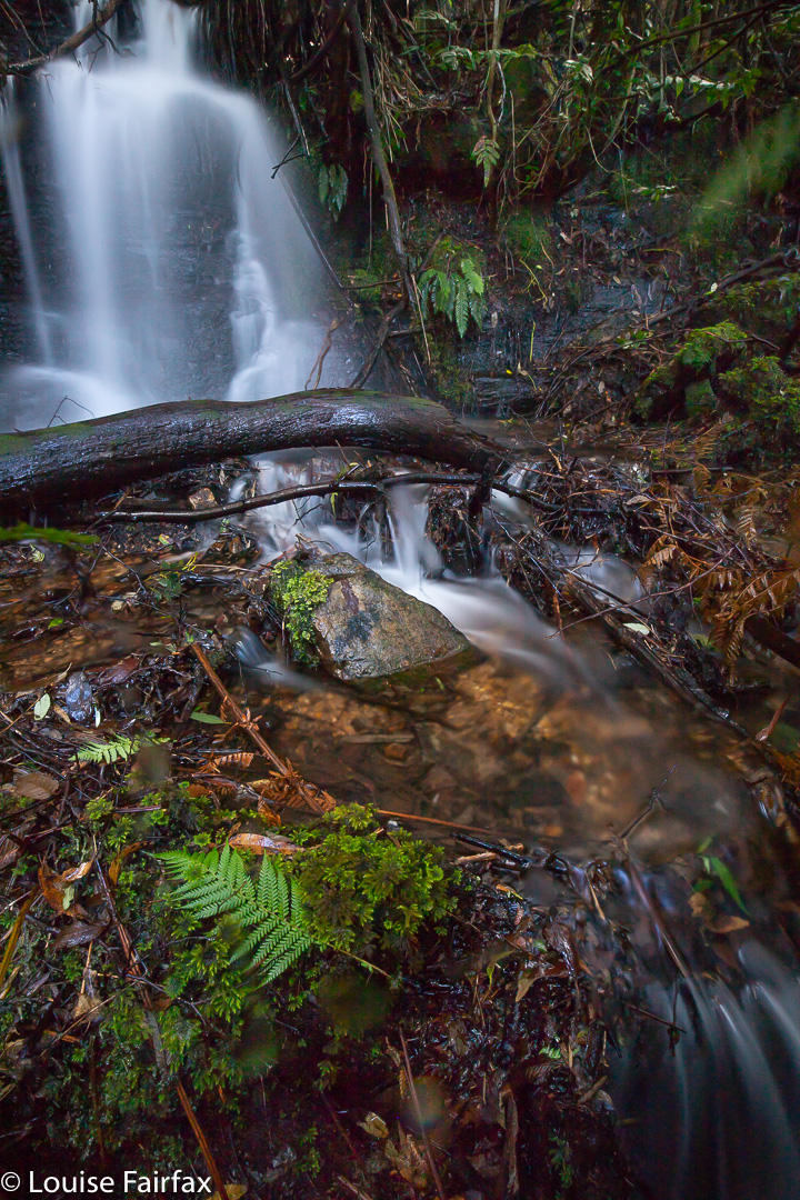
For my homeward bound route, and it now seemed appropriate to call it a day, I decided to make a kind of circle, and in doing so, I found yet another sight worth photographing, and decided Pixie Falls would be in keeping with the going theme.

Pixie Falls

I’m sure there are more waterfalls to be found in there, but I had done quite enough bush battling by then, especially considering the fact that I had had a big morning, so contented myself with this magnificent booty. It was time to eat.

Hobart Rivulet

After the previous day’s successful adventuring, Gussy and I (despite the sad reduction in the number of garlic chick peas left in the packet) decided to go and explore the Hobart Rivulet on Mt Wellington and follow the watercourse along in search of some waterfalls I hadn’t yet visited.

Champers Falls

For a seven year old, this is very hard work, and I was so proud to hear Gussy breathing very deeply and making noises of exertion as he hauled himself up various almost vertical slopes. Like me, he loved the ducking under, climbing over, and skirting around of obstacles that went on. On our way back, he asked if he could lead, and did a great job.

Disappearing Falls

We found some falls, and some beautiful spots where the river gurgled in a picturesque way over rocks in a ferny glade. Best of all, Gussy found a great burnt-red, sandpapery-textured gilled fungus, which he wanted me to photograph. Sadly, I said I would do so on the way back, assuming we would retrace our steps pretty exactly, but, alas, we didn’t quite, so didn’t get the shot he wanted. I’m annoyed with myself, as I don’t have any images of this specimen, but I thought I did. The russet cap was 4-5 kms in diameter. The nearest I can see in the web is Gymnopilus moabus. Gussy is convinced we can get it next time, but I rather think it will be dead by then. Hopefully it has friends or relatives to continue the line. Meanwhile, we did photograph a beautiful metallic blue Cortinarius.

Happy little waterfall bagger at Strickland Falls

Next day, I went back while he was at school and got better photos of some of the falls, and added Betts Vale Falls to the collection (on roughly the same contour as O’Gradys, next tributary to the east, at the track-creek intersection). We have now photographed five waterfalls on the Hobart Rivulet. I have no idea how many more possibilities there are. Thanks to Peter Podolak for his instructions in locating two new ones I have just called Hobart Rivulet Falls A and B. HIs names are Champers Falls and Disappearing Falls. (He did call Champers Champagne, but I pointed out that that particular name was already taken, so he agreed to change it to Champers to avoid confusion – just names so we can all refer to things and each know what we are talking about – nothing official, of course). They are between Strickland and O’Gradys if you follow the watercourse up.

Cortinarius sp
Betts Vale Falls

(Pity about the rubbish obscuring this otherwise lovely waterfall.)

Myrtle Gully Falls 2018 May

Myrtle Gully Falls 2018 May


This was my third visit to Myrtle Gully Falls, but the first time that I have found any water worth finding, and thus the first time I have seen them looking like a waterfall rather than a dainty and elegant trickle. I loved them today. Thank goodness I was scheduled to be in Hobart on a “good water day” (much better than a “good hair day”).


The walk is not long at all, so barely constitutes exercise, but is a nice little hike, nonetheless, even if the duration is rather short (I took eighteen minutes in each direction). I began at a right-angled bend on Strickland Road (the main road curves left going up the hill; I went through a gate, and followed a dirt road slightly uphill). It is signed as “Main Fire Trail” and leads up and down three times until it intersects with another trail that you see coming in from below right before you see that it continues up the hill (Guy Fawkes Track). Head left up the hill, and soon enough, this small path through lush green forest with moss and tree ferns swings back towards the creek that contains the Myrtle Gully Falls (Guy Fawkes Creek). The path crosses the creek at the falls. It is lush and peaceful, and a lovely place too spend an hour or so.


Apparently this waterfall is about to get a new, aboriginal, name. When it does, I will add it in here, but as web information and local lingo both use the traditional name of Myrtle Gully Falls, I will not be deleting the old name. It may not be on the LIST map, but it is the name by which the falls are known at present. We can’t communicate with each other if we don’t call things by the same name as each other. We will enter a period of transition when the new name comes into being, as people will still continue to use the name they have always known, even if DPIPWE has not chosen to bless it by putting it on the map.

Disappearing Tarn 2018 May

Disappearing Tarn on Kunanyi / Mt Wellington. May 2018.


Why were so many people gathered at Disappearing Tarn on Friday morning, when Kunanyi / Mt Wellington had been declared closed, and when bulldogs were guarding the road that gave the easiest approach (the one to The Springs), just to make sure the citizens didn’t get to enjoy this intriguing and beautiful natural phenomenon? Why were we so very rebellious? And why was everyone I spoke to so particularly antipathetic towards their local politicians? Being a resident of Launceston, I don’t hold the particular gripes ailing the Hobartians at present, but I do utterly loath the fact that my country has become a Nannyland, where people in local and regional power opine that they have the right to think for me, and where I am thus reduced to the lowest possible common denominator of intellectual and physical capabilities; when I am disallowed from activities or sights (and sites) because they would harm Jo Blogs, who can neither walk nor think, and who has utterly no discretion, judgement, or personal responsibility. If I want a nanny or a mother, I’ll go get one of my choice. Such a person would be wise, informed and intelligent. I do not want to be told how to be human by a bunch of pretenders who have risen to power because the indolent population voted for free beer on Sundays.


The worthy citizens of all ages, shapes, abilities and sizes had made the monstrous effort of getting there not just to be rebellious, however (I am sure). I presume that lying beneath that refusal to be told what is and isn’t dangerous or worth their attention, lay a genuine desire to see something amazing and beautiful. The very ephemerality of this tarn – its cute disappearing trick – no doubt kindled our desire not to delay in the slightest. And, of course, it isn’t just that a tarn materialises for a while and then vanishes, but we wanted to see the wonderful colour of this tarn, lying innocently up there amongst the rocks, supporting a dainty grove of trees. What do we call this blue? If you research shades of blue in the web, no two sites seem to agree on the shade of any particular name. I am hoping that cobalt or lapis do the trick. You can see my photos and name the colour for yourself. Any offerings in the comment section will be appreciated.


In terms of getting there, by the time this is published, the mountain will probably be opened again, and the tarn may well have also vanished. I will publish my route so that if conditions repeat, you can use the same one if you sneak past watchful cerberus characters down below. It begins with a very steep walk straight up the spur from Fern Tree to The Springs (which took me 27 mins with my camera gear). One then follows the Milles Track, roughly on contour – but don’t get excited; it  makes up for being flat by being very, very hazardous underfoot, with sockerball, football and potato mini-boulders to work around or trip on – heading for signs that say “Wellington Falls”. After 52 minutes, the tarn was just above me. I couldn’t see it, but I could see a depression in the rocks, suggestive of a tarn, and, perhaps luckily, two people heading down that way, so that clinched the deal. I didn’t bother checking my gps; I just followed them. I had driven down from Launceston, and refuelled at Daci and daci to compensate for the early breakfast,  so didn’t get started until 10 a.m. This meant that, as usual, I got very hungry, as the place begged you to stay a while, and the people there were friendly, and had plenty to discuss (politics).


Wellington 2016 Jan

Mt Wellington 2016 Jan


I had been feeling guilty for a while that I had never turned my photographic attention to Mt Wellington. It is an Abel, after all. All I’d ever done was run up her, endlessly, in wondrous dreamlike runs where the world and all that is in it was temporarily forgotten while I floated to her summit. I loved my training runs on Wellington (or anywhere. I was always in a trance while I ran, and was in some very far off place. I still am, for that matter. Running is my “time out” from the world, where I can refresh my should for the next round).


However, now it was time to come to the top by car, and to bring my tripod, filters and lenses to see what this evening could give  me and my camera. This is what I got.


At first, it was pretty nice, but then it seemed that it was just going to be a grey fizzer. I actually packed up and was in the car when all this pink came out. I had to do the most hasty set-up imaginable and chase the syun and the pink across the mountain. It was rather fun.