Champagne Falls, Bridal Veil Falls and No Name Falls 2017 Feb

Champagne Falls. First on the circuit.
It seemed to me a travesty worth rectifying, that I have lived here in Launceston for as long as I have, yet have never visited the Champagne, Bridal Veil or No Name Falls, all of which are accessed from the rustic Lemonthyme Lodge. What makes the matter worse, is that I have stayed at Lemonthyme quite often (they used to sponsor the Triple Tops Race, offering a holiday there as the female prize), and yet we stayed there and did things in the Cradle area, using it as a base rather than exploring its immediate environs. In those days, I was a total mountain freak, and hadn’t quite discovered the joys of a beautiful waterfall. I always wanted to be up things.


Bridal Veil Falls.
Meanwhile, I saw some photos of these falls taken at the end of January, so decided we should go and explore them while the water was still flowing. It seemed like a good-lengthed excursion for my husband (who has Parkinson’s disease), although, to be honest, I wasn’t quite sure how long it would take.  Basically, the circuit that encompassed the two falls pictured here took us just under one hour and a quarter walking time, to which, of course, you need to add time for photography and gazing.


Bridal Veil Falls.
We got back to the car, had a snack, and then set out for the No Name, very-little-information Falls. We came to a broken bridge, and had a spot of trouble finding the continuation of the track on the other side (there is quite a bit of flood damage in this area). However, we just didn’t look carefully enough, as, once found, it seemed terribly obvious. On we continued for a further seventeen minutes until the falls. There was a sign leading off to the right to make a circuit, but the level of desuetude of the track was such that I didn’t trust markers to continue, so we returned the way we’d come, which was longer and prettier, I suspected from a brief map stare. This route took us half an hour in each direction. There are no photos here, as there is a good reason why no one has bothered to name these falls in a more interesting manner. I guess they’re a “visit only in very wet weather” kind of falls. The trickle coming down the conglomerate slope didn’t make for thrilling photography. I took a record shot, but left it at that – unless you, dear readers, absolutely insist I publish it, just so you can see what you’re missing.
Now it was time to drive to our favourite Raspberry Farm for lunch, the best part of which was a luscious strawberry cream tart with fresh fruit glaze on top. Yum. I like walks to have a gastronomic reward.

Lobster Falls 2016 Nov

Lobster Falls near Chudleigh / Mole Creek.
Olearia linata
Perhaps you don’t think a visit to the Lobster Falls is an adequate – or even likely – substitute for a multiday trek in the South West connecting glorious mountains, but, alas, there are some days when you have to admit defeat, and today was one of them. Unfortunately, the combination of my bronchitis, which has now been keeping me company for five weeks, and the forecast of heavy rain, driving winds and gelid temperatures on high didn’t seem like a happy marriage. I backed out before walking down the aisle, deciding that a little run, some Pilates and a walk to these as yet unvisited falls would be a healthier option.

Oxylobium arborescens

 To get to the start, we drove along out of Deloraine in the direction of Chudleigh. After seeing a sign to the Needles on the left, I knew to look out for a blue and white sign to the Lobster Falls (which are on the Lobster Rivulet) to the right. Near that sign is another one which says no cars should proceed beyond that point. I ignored it for 50 ms to get the car away from the main road. There was a clearing there for parking.

Lobster Falls

Something VERY heavy has been down the road that formed the early part of the walk, making the ground exceptionally soft and causing huge indentation. There was a particularly gooey section – which lasted a mere 70 ms – where going through the bush was more pleasant than being on the road. When Tessa (dog) sank in up to her stomach (portly) she, too, took the firm bush option. Don’t be put off by this. it is short lived, and the bush is quite open at this point to allow easy passage.

Bauera rubiodes
 At twelve minutes from the car, we came to a metallic white arrow with pink and blue ribbons attached, pointing to a track to the right leading off this “road”. Now, a very pleasant route became an exceptionally beautiful one. In four minutes from the arrow, we rounded a corner and found ourselves looking down on the Lobster Rivulet which we now followed to the falls. Overhanging the path were myriad wildflowers in yellow, mauve, rose, light pink and white – bauera, boronia, olearia, acacia, oxylobium and more. There were even plenty of orchids (caladenia alpina).

The path (taken on the way back)
 In sixteen minutes from that corner (and thus, about half an hour from the car), in a pace that was neither rushed nor a saunter – just a nice steady walk – Tessie was having a dip and I was setting up my tripod. Bruce has Parkinson’s disease, so elected not to come all the way down to the water’s edge, but the section that was narrow with a drop had plenty enough bushes to take away the scare factor for him (well, he was probably taken to his limit, but did not go over it). He could see the falls perfectly well from where he waited, so was not denied much by not doing the final twenty metres steep descent.

 I was now starving. Time for an ice-cream at the Honey Farm to tide us over so we could get all the way to the Raspberry Farm for lunch. Humans and dog enjoyed the outing.

Parmeener 2016 Aug

Mt Parmeener is neither pretty nor dramatic. Perhaps worse for its popularity, nobody has allocated it a point, and despite its offical 1286 ms above sea level elevation (peak baggers’ master sheet incorrectly says 1280; other websites incorrectly say 1270) it fails on other criteria to be an Abel. Lots of people and things are neither pretty nor dramatic, nor worth a point in some random system, but they are still interesting for other reasons, and well worth our engagement. Mt Parmeener is one such.

The view west
Its altitude, if nothing else, should hint at its expansive views. Being right on the edge of the escarpment, it looks out north over the Mole Creek region far, far below. Looking west, we could see snow on Ossa and Pelion East. To our south, the Walls covered in snow were visible, and to the east, Quamby Bluff’s distinctive shape called to us, as well as sharp bluffs along the escarpment’s piped edge. It felt airy and wild up there. The wind was cold, but we were not blasted out of existence, and enjoyed the feeling of space along the top.

Lake Mackenzie, not too far away below there

We drove south from Mole Creek, on a road imaginatively named South Mole Creek Rd. Road names are a little confusing, as different maps call the roads a variety of names, but one thing stands firm: you want Blairs Road, and it is correctly named on all the maps I’ve consulted. We headed south from Mole Creek, as said, and after about two kilometres, turned right (west) onto a road that ran into Blairs Rd at a left hand turn that had us heading south again (named on the map). We followed Blairs Rd for several kms, through what appeared to be a farm, and on, into the forest … and up. Had there not been a big flood recently, it would have been possible to have driven to a boom gate. Now you have to stop short of that, but not too far short; fallen trees and soft ground made further driving impossible. For walkers, however, they just add a bit of fun and challenge.

The track takes you up through beautiful myrtle forest.
Beyond the boom gate (which informs you that dangerous fires are raging ahead and you should not enter), the road morphs into an old stock route – South Mole Creek Track – where cattle could have walked three abreast in some places, only single file in others. This route takes you on the gentlest of inclines up onto the escarpment. I was stunned to read we had climbed over 500ms (to the escarpment; 660 ms in total). We took around 2 hours from the car to the end of the steep climb, and a further 30 minutes from breasting the rise to our actual summit, further to the east of our emergence point on the tops. Once up onto the escarpment, the climb to the summit is minimal. Spaces were open, the air was fresh; it was great wandering along deciding which gully we’d use to attack the final rise.

My husband, with ever-worsening Parkinson’s disease, made it to the summit without any problems, so I would classify this as a very pleasant and doable family walk. At this time of year there was abundant water on top (flippers were more necessary than a water bottle). Given the many access problems posed by this winter’s floods, I recommend this track as something that remains reachable when so much else is closed off.

Mt Parmeener, route.

FRANCE GR5 2016 Modane to Briancon

FRANCE GR5 2016 Modane to Briancon

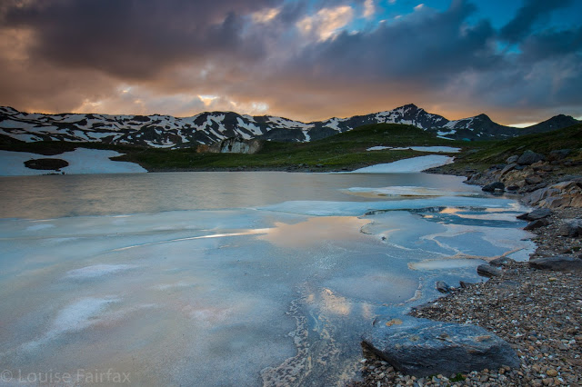
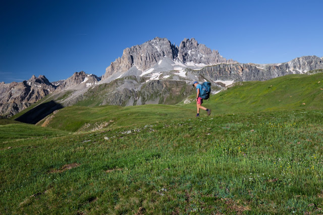
South of Modane, high in the mountains near Col du Thabor

The tale of the GR5 this year is one of goals abandoned rather than mission achieved. I am not sad about this. I had only ever said I wanted to make Nice if Bruce was happy about the venture and if the scenery remained beautiful. I could see no point in continuing if we didn’t appreciate the landscape around us, and if Bruce wasn’t happy, it would not be right to inflict torture.

He began well enough, after a more than shaky start in England. I always use the week in England as a kind of acclimatisation period for him, in which he supposedly increases his amount of exercise each day as the fatigue and stress of work are gradually shed. This year, there was no shedding, and no increase of exercise. The only thing that grew was his anxiety about being away from the place where things are familiar – an unfortunately frequent symptom in his illness that has not invaded him up to this point but which is mushrooming now. He slept a lot in England, so I just kind of hoped that the resulting rest would mean he’d be nice and fresh for the task of France.

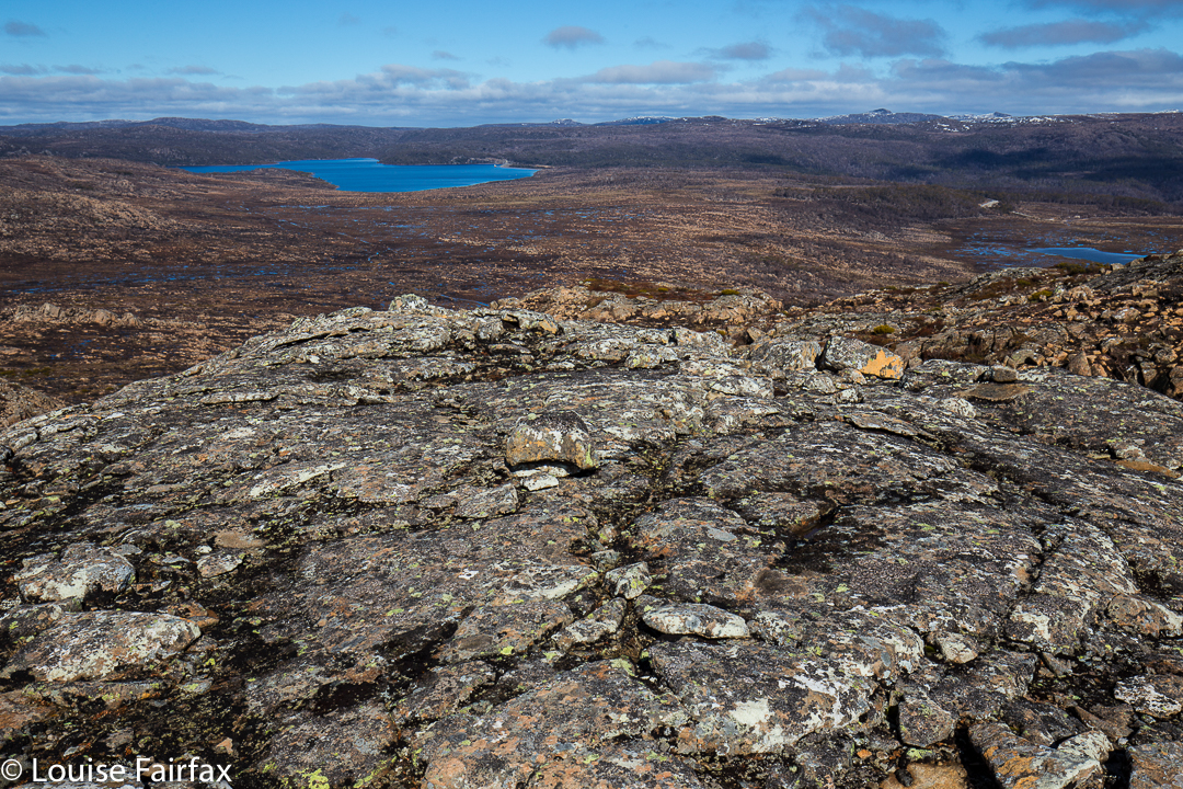
 He started very well for the first hour, but then began asking: “How far now?”, a bad sign that many parents of young children will recognise immediately. I encouraged and cajoled and eventually he made it. As you can see from my images, this was a very beautiful place, with heaps of wonderfully photogenic snow. He was not happy walking on snow, and after dinner went straight to sleep while I explored and took the above photos.

In the morning he slept through my dawn shoot (in all other trips, he has accompanied me, to share the beauty even if not to photograph it). He said at breakfast, however, that he wanted to walk the route I had planned – my Plan A of many – so off we set after we’d eaten (hut breakfasts are not to die for), dropping down sharply before climbing up very steeply indeed to another col, and finally descending to Plampinet, where we arrived for a mildly late lunch, our day’s work done. Apart from a single incident where he was obviously geographically confused, he appeared to be going very well, ate his delicious omelette with gusto and joined me exploring the two churches (two of about ten buildings in this whole quaint place built of stone), one of which dated back to 1450 and was having its bell repaired : Chapelle Notre-Dame-des-Grâces de Plampinet.
Later on, he said he was exhausted, so I arranged for him to catch a bus to my next destination, Briancon, while I went high into the mountains and over three cols to drop down and join him. He was happy with this. I took him to the bus stop, wrote notes for him about where to go, what to ask for, and everything was fine. All the other walkers had meanwhile changed plans and abandoned going high, as they were frightened of the thunderstorms that had been predicted for this day.  They would walk along the valley floor, following the beautiful river to Briancon and avoid all climb. However, I was here to be in the mountains, not to make destinations per se, so I set off into the mist alone. For me, seeing the kind of scenery I wanted was more important than saying: “I have walked from Lac Leman to Nice”. The others kindly said Bruce could go with them, but he doesn’t deal well with changes of plans, and was happy with the one we’d set in motion. He carried it all out well, and at the end of a truly wonderful long morning where a storm did surround me but didn’t drench me, and certainly didn’t kill me, I met him at the Gîte d’etape in Briancon. This was a fascinating town with dried out moat, old cobbled streets about the width of two donkeys and a great feel to it.

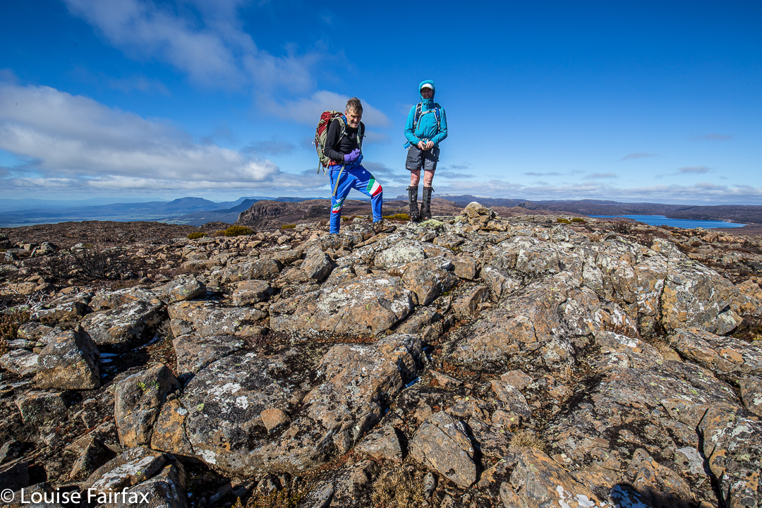
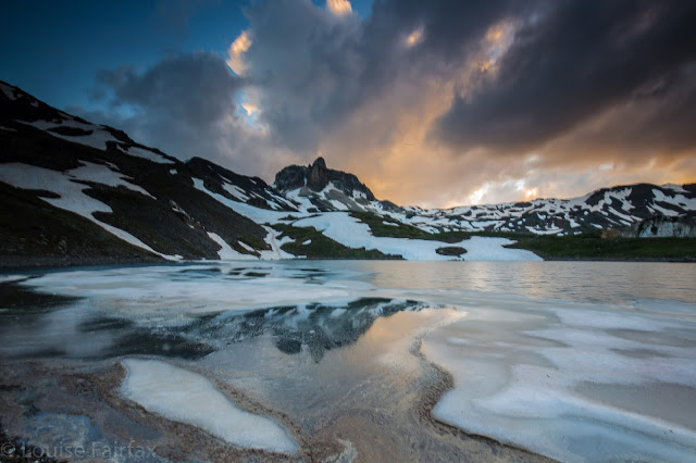
Bruce underway on day 2.
When there, I discussed with the Tourist Bureau how Bruce could get to my end point for the following day, Brunicard. He nodded with approval at our plan, but half an hour later said he had never heard that conversation and knew nothing about what we’d agreed to. Meanwhile, he couldn’t walk. I could tell he’d been sleeping for much of the morning, which was not an encouraging sign. He was obviously not comfortable with what I’d planned for him this next day, despite my offer to go with him to the starting point of his vehicular journey. 
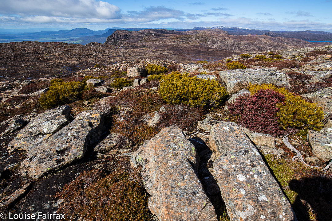
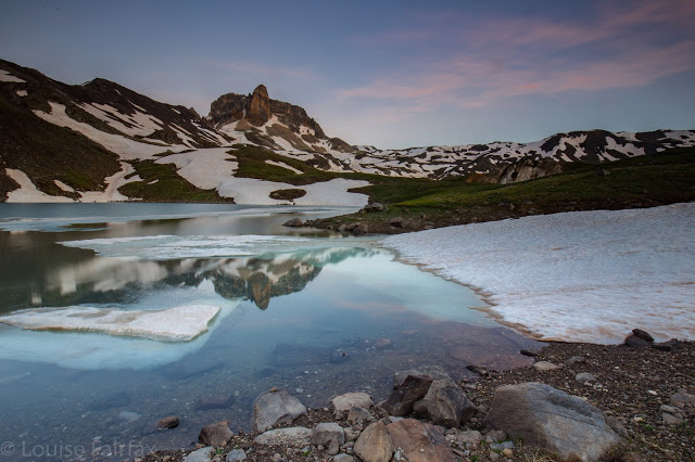
One of my cols on day 3

I asked was there anything we could do that would please him, anywhere where we could go – even if far away from here. No to both. Would he like to go home? Yes. So while he slept during the night, I typed away to my amazing travel agent, Gary Woodland from Andrew Jones Travel. Meanwhile, the gardien from our refuge (Gîte Le petit Phoque) had driven us down to the bus stop so we could check everything out and make sure we had the timetable right, an incredibly kind gesture. By 5 a.m. there was an email from Gary. Please confirm quickly. I have Bruce on a plane out of Geneva in two days’ time. Cost for change, $85. How amazing is that? Confirmed immediately, of course. By the time Bruce woke up, I could tell him the new plan. We’d catch a bus to Chamonix and he would be nice and near Geneva to fly out.

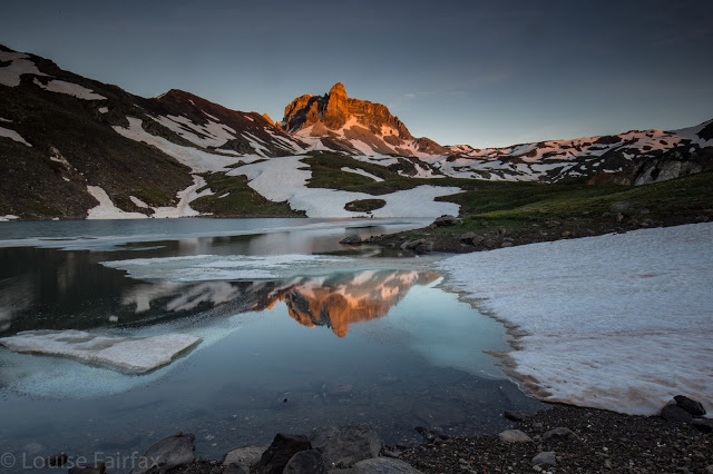
It was a bit stormy up top.
Thus, next morning off we set on his homeward journey. Sad to change my goals? Only a little. As said at the start, they were always subservient to other, higher ones. The really sad part is that I presume that is it, our last ever trip. He was ill at ease the whole time, even in England, and his is a degenerative illness, so that is the end of a chapter in our lives: travelling together. We have travelled the world together since we were teenagers. He was always a great adventurer, keen to see new places, discover new things, and fit and strong enough to carry out the most bizarre of plans. Now this disease has corroded his spirit and left him in a state where travel no longer pleases.
Another sad part of abandoning the GR5 (as opposed to abandoning travelling with my husband) was saying ‘Goodbye’ to all the lovely new friends I’d made already along the track, people who would continue on without me. We said our fond farewells, and, funnily, they thanked me for what I do for my husband. This is excessively rare for me – so rare it made me cry. Living with us for three days, they could see how things were.
The next stage of my journey, and your next lot of photos, will be from Chamonix.
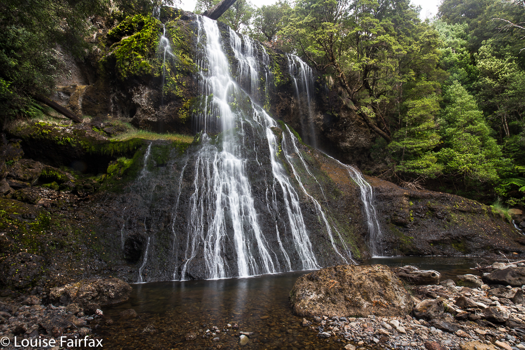
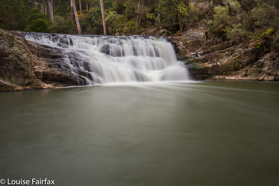
Geikie 2016 Mar

Getting near sunset at our camp spot, day 1

Mt Geikie at last.
If you would like a little shot of adrenalin, then borrow someone who’s had Parkinson’s Disease for fourteen years, and take him up Mt Geikie alone on a misty day on which the way is a point at the end of a compass needle and the route, an uncertain traipse through small and large cliffs and patches of scrub. The mist was so thick at times that the mountain was not even a dark shape in the gloom. It just wasn’t there. And if you’d like a bigger dose, then take said gent through the thick band of tanglefoot (Nothofagus gunnii) and scoparia that runs from The Bastion, due west.

Sunset approaches. The light was eerie – and beautiful

The watery sunset arrives (long exposure)
Last time I attempted to take my husband up this mountain, we got as far as The Bastion, but in the thick mist and with darkness rapidly approaching, I pulled the plug. We had already exceeded my predetermined turnaround time, and I could see no ready way of getting down to the saddle that lay between where we were and our goal. There was no time to search, and certainly no time to try and fail. The mist was ominously dark. I do not regret what I still see as a wise move that day (you can read about it on:
http://natureloverswalks.blogspot.com.au/2014/11/mt-tyndall-and-bastion-89th-nov-2014.html), but Geikie still remained, so here we were, having another go … on a similar day, but with more time up our sleeves to play with. Although we set out after breakfast, I packed my head torch, so pessimistic was I after last time. Don’t be fooled by my photos: they were taken in brief interludes of visibility. The theme for the day was thick mist.

 Day 2. Off we set across a water filled landscape to our goal
Rocks and tarns: what a great combination

As we had all day to do this, I took us on a scenic Tour des Lacs, ever working our way south. It was glorious. However, even with this stalling tactic, we eventually neared The Bastion – the blockade from last time. I decided to be super-smart and outwit this recalcitrant mountain, and not go near the “summit” that had turned us around, but save my husband a climb by traversing directly to the saddle on contour. Smart, eh? Trouble is, the map doesn’t tell you that the band of green oozing out of The Bastion to the west is a very nasty brand of dark green. It is also lavishly replete with boulders about four metres high with vertical walls and no cracks to get a hold. I lost count of the number of culs-de-sac we landed in. Each time, we had to back out and try again elsewhere, yet elsewhere presented us with an impenetrable wall of bush or more rock. By climbing on top of scoparia bushes – wondering if they would snap and dump us two or three metres below in a pile of prickles and tangles from which we could not be extricated – or doing likewise over the tanglefoot (both treacherously slippery when wet), we managed to inch our way southwards. I was stunned that Bruce managed to keep progressing. I was trying to choose a Bruceable route, but there was not much on offer.


Here a tarn, there a tarn, everywhere a tarn, tarn
When we finally burst out into ground you could walk on, it was a moment of great joy. The actual climb of the mountain was a snack and quickly dispensed with. It took my husband only twenty minutes up, thirteen down to do the bit we’d come for, once he could begin.
Out into the clear, hooray
And we even get to see our mountain for a second or two before she runs away and hides again

If you assume you’re going to bag a summit with no problems, there is only moderate joy in the dubious accomplishment. You have invested only a little emotional energy in the exercise. Taking Bruce to Geikie, however, nothing was taken for granted, and so we both felt elation sitting up there under that trig. Bruce had done the unexpected (I had thought he’d choose to read a book at camp while I summitted solo), and we were alive to the momentous nature of what he had just done.

Once on top, the clouds did part for long enough for us to get a partial glimpse of our surroundings.

Our best view. We found it quite exciting

On the return, we did not opt to save contours, but headed straight for The Bastion, skirting only the initial rampart by hugging (literally) the cliffs to the east, eventually going up a chute to the top. I enjoyed this route, but Bruce found it tested his vertigo. This was 45 minutes faster than the outward journey! The rest was Sound of Music walking over glorious alpine gardens, decorated with pink rocky stripes and more fabulous tarns. It had been a day of great (landscape) drama and subtle beauty. As we sat back in camp eating our lunch, the sun came out. We leant back and basked in its warmth, in no hurry to pack up and leave.

Me on The Bastion on the way back, taking a peak over the edge at the cliffs we’d been hugging

I made sure the trip back was filled with water too 🙂

We had approached the Tyndalls via the north (Burnie), so I decided to leave via the south, so drove to Queenstown, and then east along the beautiful Lyell Highway to Derwent Bridge, waving hello to my many mountain friends as I went. I have on many occasions spoken about delicious meals had here at the end of expeditions. It was time to let Bruce have this fun too. He was not disappointed. Sated and satisfied, I had to blast us both with opera and sing at the top of my voice the whole way home to prevent falling asleep at the wheel. I am dangerous on a full stomach.

Maps will be added by Thursday