West Portal in Three Days 2015 Oct

“West Portal in three days Mark? You’ve got to be kidding.”
“Oh well, we’ll pack for four, but hope for three. I reckon we can do it.”
I’m glad he was confident. I’d try my best. Let the tale begin …….
Day One.
“We’re here,” I heard Mark say up ahead. Apart from hearing my husband or daughters say “I love you”, these felt like some of the best words I have ever heard in my life. Electric shock tingles were coursing across my left shoulder from the weight of my pack; the ball of my right foot felt bruised; my socks had bunched up at the front of both my boots causing discomfort; my hips felt very tender and I was, quite frankly, tired.
We’d walked 27.4 muddy kilometres in 8 hrs 52 mins, within a total ten hour timespan. That’s a lot of work and not much rest; but at last Mark’s words meant it was over for the day. It was still nice and light. It actually hurt to remove my pack from my aching shoulders, I was so stiff. Like wooden dolls we tottered down to the Cracroft River at the crossing where we were camped to admire its beauty and collect water for the next few meals. It was time to relax.
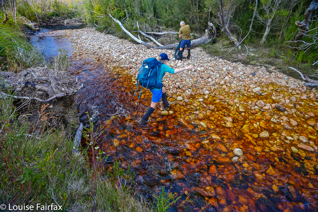
West Portal trip Day 2. Crossing Strike Ck

I pitched my tent, slowly, partly because I could barely move, and partly to try to accustom myself to its little ways (it’s relatively new), before joining the other two for soup. Oddly enough, at a mere 8.15 pm I thought the idea of turning in for sleep was exceptionally appealing. You don’t often find me in bed at that hour. I impressed the other two with the size of the two large pink swollen lumps I had – one for each hip bone – before I disappeared. Sleep would be like a divine ambrosia.

Day Two.
This was to be the day on which we attempted the summit. I wasn’t confident of my own ability to do this, but it made me feel better to hear the other two say they were tired too. At least we’d be in a similar situation. However each of us felt as individuals, we were there to give this our best shot. I set small goals: it would be great to see Lake Rosanne; marvellous to reach the high point on Lucifer Ridge; amazing to walk across the Crags of Andromeda; and, well, let’s not get disappointed by thinking about that far-off, hideously high summit, buried in the clouds right now. One step at a time.
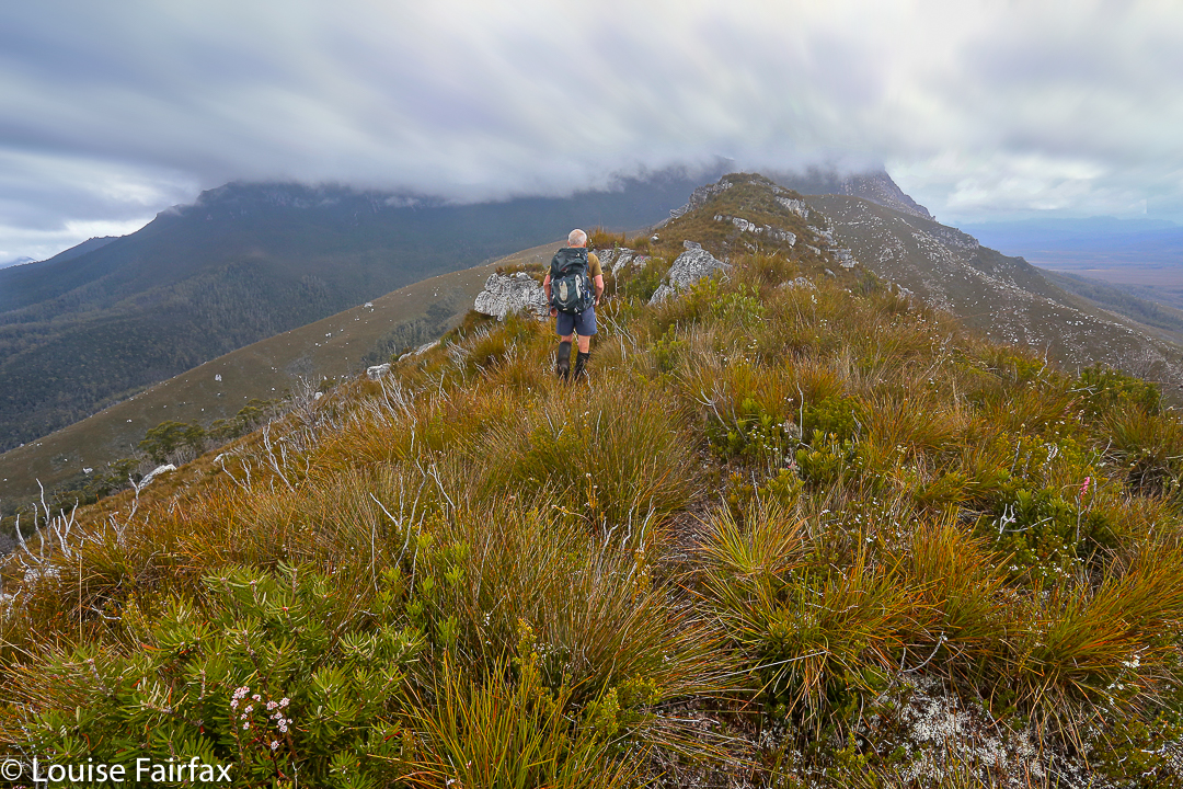
Lucifer Ridge is gained

We still had another hour and a half along the flats before we began our climb proper. Over the Razorback Range we went, dropping into the squelching, muddy Arthur Plains, which we followed until beyond Strike Creek. We took the hypotenuse shortly after crossing it, heading up to the first high bump on the Lucifer Ridge, which jeered at us from above, as its namesake would also no doubt do. The gradient was so steep that the land was almost in our faces. We pulled on tufts of grass to yank ourselves up. Once my body started screaming, I led us on a kind of slaloming zigzag to lessen the severity a bit.
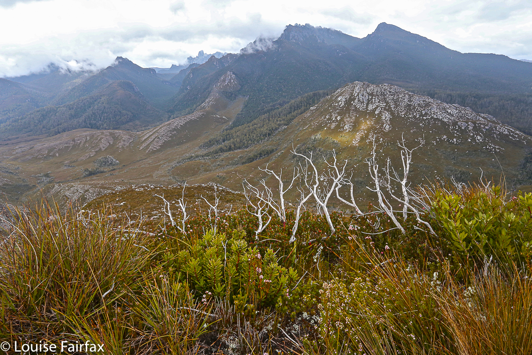
Lucifer Ridge view

With relief we crested a mini bump on the way to the one we wanted – some rocky wart – and took a two-minute breather before continuing on to meet the point where the vague pad from the longer ridge rose up to meet us. Every down was resented as it meant a loss of hard-earned altitude; every up endured with pain until we gave ourselves another tiny break to enjoy the view. We couldn’t rest for long, however, as our goal, although getting easier to see, was still a long way off. However, when the delightful Lake Rosanne appeared below us, we had to stop and admire her. We had a drink and muesli bar and took a time split at this point, as a pad came in on our right, coming to us from the lake. We’d done nearly two hours’ climbing since leaving Strike Ck.
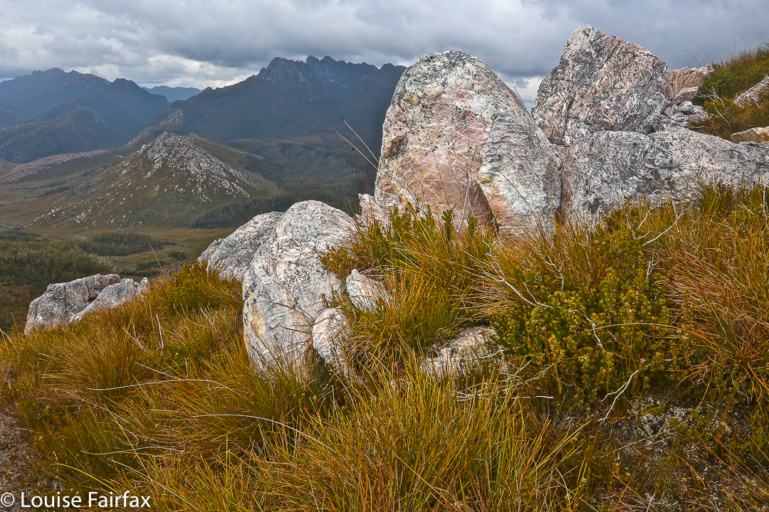
On Lucifer Ridge

For yet another hour we climbed steadily (except when the wretched pad dropped to get around cliff lines) and steeply. We were nearly at the top, but we found a puddle of water, and I was starving, so we called another break and had a drink and snack before continuing. I stole some savoury food from my lunch rations, as muesli bars were not doing it for me. All of a sudden I had energy again. Let’s go!
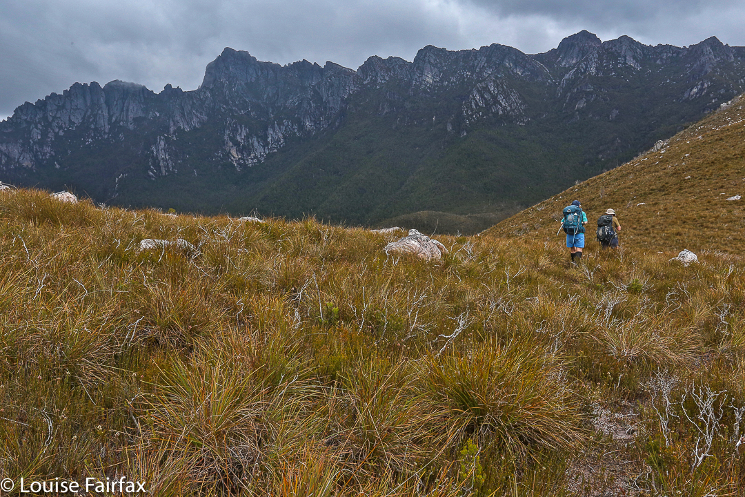
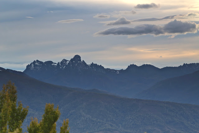
West Portal from Lucifer Ridge. Oh dear. It still looks a long way away and we have already been working for hours.

We “topped out” a mere eight minutes later, entering delightful “sound of music country”: a wide, open ridge with short grass and expansive vistas in all directions. We could see the Western and Eastern Arthurs, the Mt Anne Range, Lake Pedder, Mt Picton and more. It felt like we could see everything. I dropped momentarily behind to take a few photos and hastened to catch up. Today was about the summit, not about photography, and too much of the latter could scupper our chances of the former.
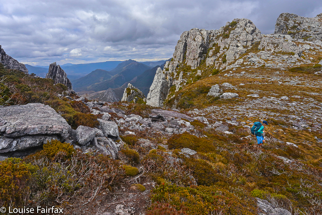
Topping out at the Crags of Andromeda

On we hastened – if rushing snails can ‘hasten’ – for another hour and a half (nearly), travelling over the Crags of Andromeda and via the first, false summit (excitedly assuming it was “the one” until we saw the challenger to the throne a bit further on) to that glorious cairn that was ours. At some point in there as I traversed the Crags, chasing the others as I’d been indulging in a little more photography, I realised we were actually going to make it. A tear trickled down my cheek, I was so overwhelmed. The only other two mountains I’ve cried on have been Ossa because the view was so beautiful at sunset, and Mont Blanc, which I’d circumambulated, because I was – and still am – madly in love with her huge white magnificence, and I was grieved to leave her.
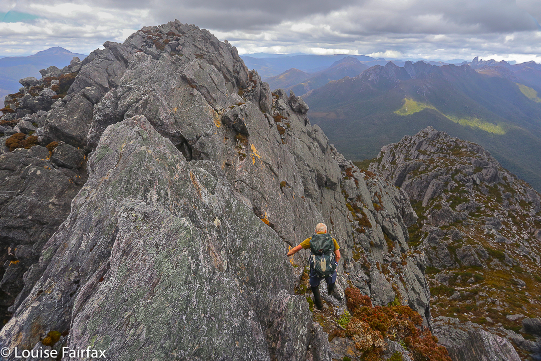
That’s her, the summit of West Portal: the highest thing you can see ahead. At last we’re closing in – but there’s an impassable gulch between summit B that we’ve just visited and the one we want. We need to go down to get up.

This mountain here has a special aura for me, and I had not conceived of success. People who have climbed her have always seemed to me to be “real” bush people: accomplished traversers of the challenging Tasmanian wilderness, and mostly (but not always) males. I couldn’t believe that I was going to stand on such a summit. I know there are much harder mountains to climb that lie in wait for me (they seem to me right now to be impossible), and I am not trying to claim anything for myself here; I am just saying the effect this particular icon had on me.
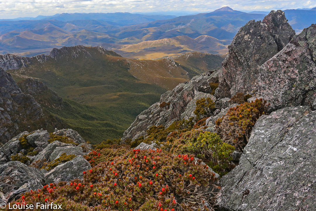
West Portal Summit. Richea scoparia enjoys some of the best views scoparia can have anywhere.

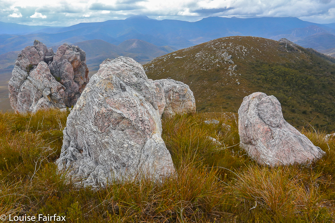
We ate our lunch on top, oggling at the wonderful view in every direction around us. This is the highest peak in the Western Arthurs, and it commands a vista commensurate with its title. I particularly loved the rugged Crags of Andromeda with their dramatic weathering patterns; of course, we delighted in the cornucopia of peaks with jagged edges bespeaking nature’s infinite power and fury. It had taken us 6 hours (and four minutes) to summit. We’d now relaxed on top whilst eating. Mathematics said it was time to turn our heads concertedly for home.
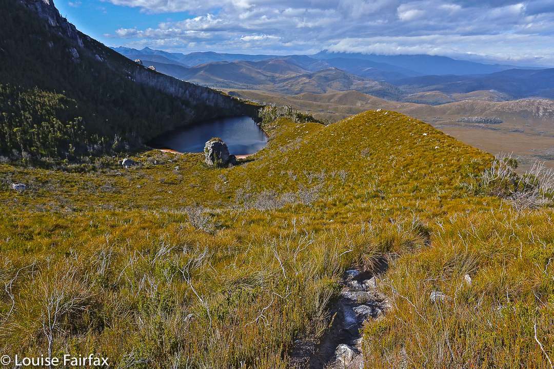
Lake Rosanne seen from the way down

Luckily, we descended more quickly than we had climbed, having ironed out a few of the glitches in our approach. Angela had brought her jetboil, so once the pressure was off – near Razorback saddle – we all had a cup of soup to fortify us for the last leg home. We arrived at the tents as darkness fell. Any later and we would have needed those headlamps we’d been carrying all day. The climb had taken us a total of 11 hours 40 mins’ walking plus food breaks added on. We’d covered 27 kms again, only this day we’d also climbed 1,000 ms (= 37 km equivalents) in tough terrain. Three exceptionally satisfied friends sat in a circle cooking and eating dinner. We were not looking forward to the long day on the morrow, but we all had four days’ gear with us, so if we couldn’t manage, it didn’t matter; we’d just camp at one of the many creeks along our 27.4 km path.
Day Three.
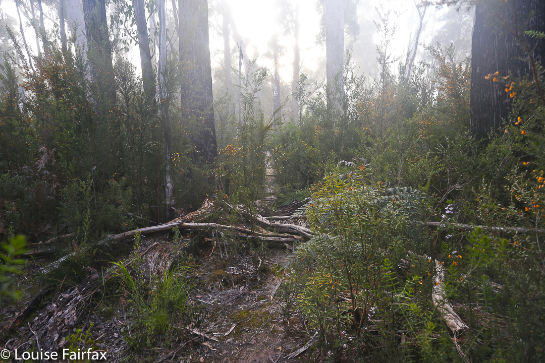
Cracroft Crossing campsite on the morning of day three. A nice misty day to begin with, but it became clear and hot later.

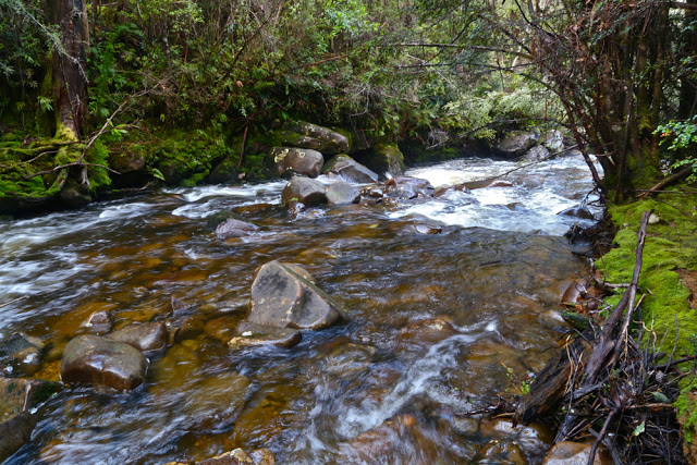
We didn’t need the extra day. We took fifteen minutes more walking time to reach the car on the rebound, and our breaks were longer, mostly to please me. My shoulders would not have gone the distance otherwise. We cooked soup to make lunch more interesting and relaxing, and had a cup of tea before the final long leg from Junction Creek to the car. I even went wading. It was wonderful sitting beside amber creeks in green groves with the friends with whom I’d just shared so much, soaking in the bush with the satisfaction of having achieved our goal. This is the life.
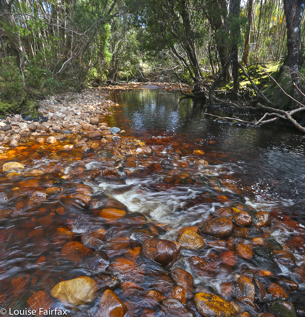
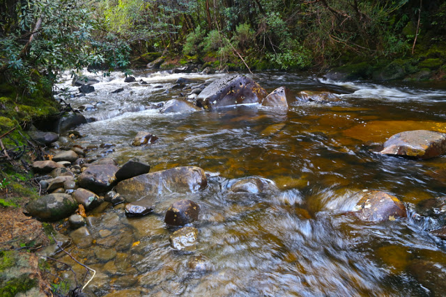
Seven Mile Creek, a refreshing food stop place

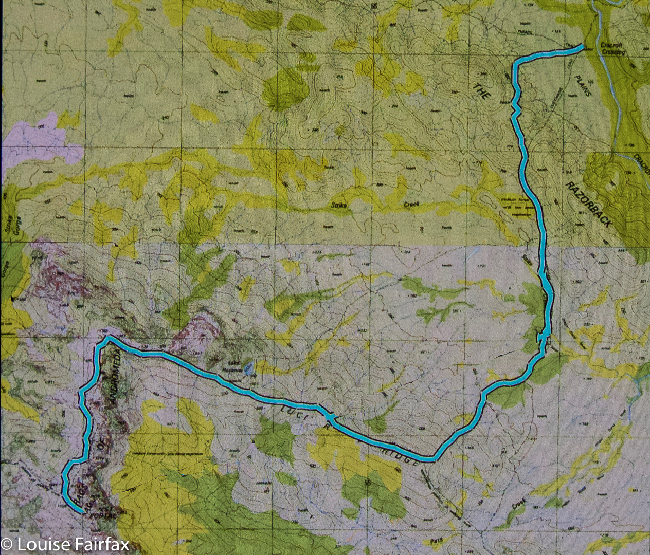
The route. Overall,  we covered 91.8 km equivalents, in three very tough days.

Bobs 2015 i Sept

Mt Bobs and the Boomerang. Neither, and in two days.

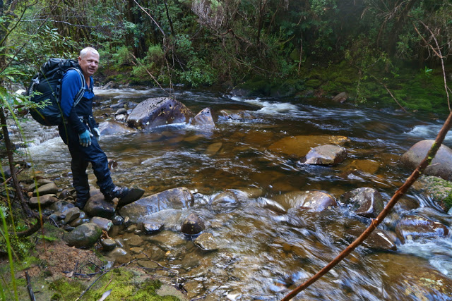
Farmhouse Creek, the famous.
“BOBS?? THIS weekend?” queried our amazed and knowledgeable friends when my husband explained my absence from the gym. They knew the full implications of an immediately post-winter attempt on Bobs, especially having just returned from sludging their way around their own, lower and less southerly mountain, where they had found the going slow and hard. They were right. Bobs was pretty bad – and they had retreated from their mountain before the rains began.Day one was not a booming success. Unfortunately Friday morning was the earliest I could get away, which was one day too late for the window of opportunity that gave three dry days for Bobs. And it certainly didn’t help that, with one thing and another, we didn’t leave the carpark at Farmhouse Creek until 10.45. If these suggest to you a lack of respect for the worthy Bobs, you are probably right. We have learned due respect now. Perhaps we also needed more deference for the amount of water that must have accumulated after the kind of snow dumps we’ve had these last few months. However, my climbing partner has personal reasons for trying to collect as many Abels as he can before Christmas, and we both enjoy giving things a go, so there we were. Our third accomplice in mischief would have also given it a try had she not been required to be at work on Saturday. She was at home consoling herself with wine. Perhaps this was not a bad idea.

It was very exciting for me to see the famous Farmhouse Creek up close. A frisson of delight coursed through me just thinking of the many connotations this stream holds in its compass. The pad to the right, immediately after crossing the bridge, was clear enough most of the time. We were delighted to be underway and chatted furiously, making up for several months of not seeing each other, exchanging news and stories, enjoying the pellucid, whisky-coloured gurgling mass beside us and the almost lurid green forest as we made our way to the crossing of this now mighty river – swollen as it was – before we began our actual climb. Apparently one rises about 250 ms in this section, but it is not noticeable.

It’s quite a long way; I had had breakfast at 4.50 a.m.. On the dot of 12 I begged for lunch, and Mark was cool with that. There was a nice stream flowing, but I was told it was not Farmhouse creek, even though it seemed pretty big. There were quite a few mud puddles, which increased in number and size as we went along, but – and now I can speak in hindsight – the going was pretty good in this section: just a few fallen logs and trees to climb or attempt to skirt; what you’d expect on a longstanding, unmaintained track.

The creek at the crossing point

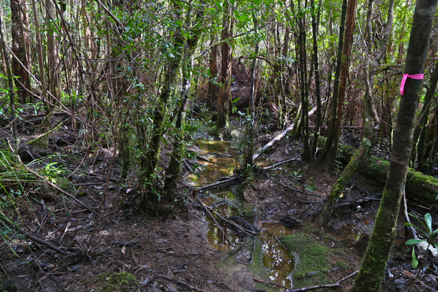
The real fun began at the mud plain called by some “track junction”. Now, to have a track junction, you actually need at least two tracks, so I question this terminology. We did see a stick with two tapes on it, but we assumed it was just to announce “You are still on the track”. We did make explorations off to the left to make sure, but the slight suggestion of a pad was really too minor to be promoted to this status; the stick with tape was a stick and not a tree as the Abels book said, and we hadn’t been going long enough. This was a wily false pad. We were not fooled. On we went, chatting merrily. However, after some time (and the gps says about 700ms) we were climbing more contours than seemed reasonable amongst friends, so we did the gps the courtesy of a check (I had been trying to save battery by not overusing the screen). Alas it confirmed that the stick must have been the junction. My watch said this was not good news with respect to our broader hopes for the day. Back we went. When I visited the stick the second time and looked up high in the air, I saw that giants had indeed put more tapes there than either of us had noticed, focussed as we were on how deep our feet were sinking and other suchlike matters. The tapes were well above my eye level. We put a bright pink one just above where my eyes look for good measure, one that people like us could see.
There’s a creek crossing a bit on from there, so we stopped for a quick drink and to refill our bottles, and on we went, worried now about the time. The book Mark had said 3 – 3.5 hours to the campsite from here. It was exactly 3.5 hours until dark. Pitch dark, that is. Unfortunately, due to problems locating the vague thing glorified by the term “pad” in forest thick with newly fallen trees, branches and leaves following a winter that has been rather active in weather events, we spent more time in a game of ‘Pooh finds hephalumps’ than in making forward progress. There were also many mud ponds of unknown depth that we tried to evade down lower that prevented us breaking the world record on this occasion. Unless people document startling PWs.

Down low, beside Farmhouse Ck, where the way was clear. The track is the shiny bit, and there is visible tape. Higher up I think someone ran out. Tiny, tight bits of blue are what you mostly find, if you’re lucky. They’re sure better than nothing!!

Darkness – of the proper, pitch variety – set in as we were descending to what Chapman describes as a button grass valley. We found no button grass by dark or by day. Just more thick forest and deep, deep mud. When it’s very dark, sinking in deep mud is not a nice thought. Our pace slowed even further. The compass was now needed as the land gave us no clues. We were supposed to be in a valley heading SW. We could find SW on the compass, but no particular valley on the ground. Nothing that yelled: “I am a valley. Just stick to the lowest point and follow me up.” The pad, being now full of mud, was shinier than the non-pad, so we made a little cautious progress, but once we reentered the forest, the shine lost its sparkle and we were back playing Pooh and hephalumps again, circling tapes to try to find where the pad went from that point and making footprints to later get excited about. Simply heading SW was an even slower option in forest that tangled, so we only resorted to it when desperate (which we became at about 8.30).

We never did get to see the sinkhole, but we did see where one would lie were it not drowned. We retreated and found two tolerable spots for tents. It was now 8.45. As I was boiling water for dinner, Mark yelled out: “Hey Louise, I just found a tape in the tree above my tent. We’re on the track.” The rain began soon after that. I enjoyed listening to it beating on the tent as I very easily drifted into sleep.

There is a knoll where you get a view of the famous Federation Peak. What a thrill to be so near the Great One.

“Wake up, Louise.” The rude sound penetrated my dreams. But we had agreed on a 6 a.m. start. Outside, Mark was standing in the rain, offering me three alternatives: climb, wait a bit, or bail out.
“Bail out?” I almost yelled (well, actually, I think the volume was “yell”) in shock.
“Yes, the book says it’s four hours to the summit from here. That’s eight hours in the rain and mist with no view and hypothermic conditions.”
“And no line of sight on the helpful cliffs,” I chipped in. With each passing moment, this “bail out” notion was seeming like a fantastic idea. What an ingenious guy Mark is. Within two seconds I’d agreed to it.
“Can we sleep in ’til 7?” I asked hopefully. Affirmative. Life is good.
I rolled over to listen to the rain and just enjoy the state of being in a forest this wondrous with its trunks heavily laden in deep spongy layers of the best green. The scene out my vestibule was a wonderfully Tolkienish vista. (Alas, it was too dark and wet to photograph).

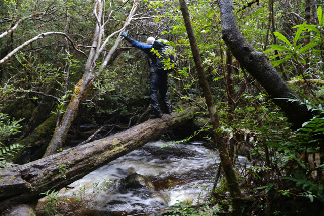
We had thought the trip back would be way faster than the trip in, with the wonders of vision added to the mix, and it was certainly quicker than our way there, but lighting-fast does not describe our speed. The amount of water that had fallen in a single night was truly astonishing. The mud puddles were now mud tarns. Divergences were extravagant to avoid a soaking. Why not just go through and get wet and be done with it? Because the depth of these puddles is unknown, and falling in up to your throat or high chest is actually a frightening experience. It requires great strength to get out again, and is rather cold and dirty to boot. Besides, I had my camera to protect, and my brand new (expensive) Anorak. I pussyfooted around cutting grass and scoparia in an attempt to have it last more than a single expedition.

Our lunch was had in the campsite just before the intersection – a nice clear place to put down the packs. It was a nice clear place for snakes, too. I have never before seen two snakes curled up together. I wanted to poke one with a stick, just to see what would happen, but decided against it. We both did go quite close, however, curious about this daring pair who appeared long before snake season was due to start. (The rain had now stopped). They seemed a little curious about us, too. We parted on good terms.


All up, we carried our packs for 16 hours, which includes all the errors – circling, prancing around puddles, swinging from trees, having several attempts at sliding up logs that were as high as my eyes but offered no way around or under, and other suchlike games. The time does not include eating or photos – the only time we gave our shoulders a break. We had three rests going up, two coming back – just long enough to throw a quick bit of food down and some water, and we were away again. We got to the car, dreaming of hamburgers or better, only to look at the watch and know that even Banjos would be closed by the time we got there. It was quarter to five. No hope.
32.5 kms. 800 ms climb (which does not include any of the climbing on the way back, or the climbing we did in error. Real climbing is more likely to be 1100ms).I was very tired driving home. Ironically, I kept awake by blasting out (and singing along with) Bellini’s opera, La Sonnambula (The Sleepwalker).
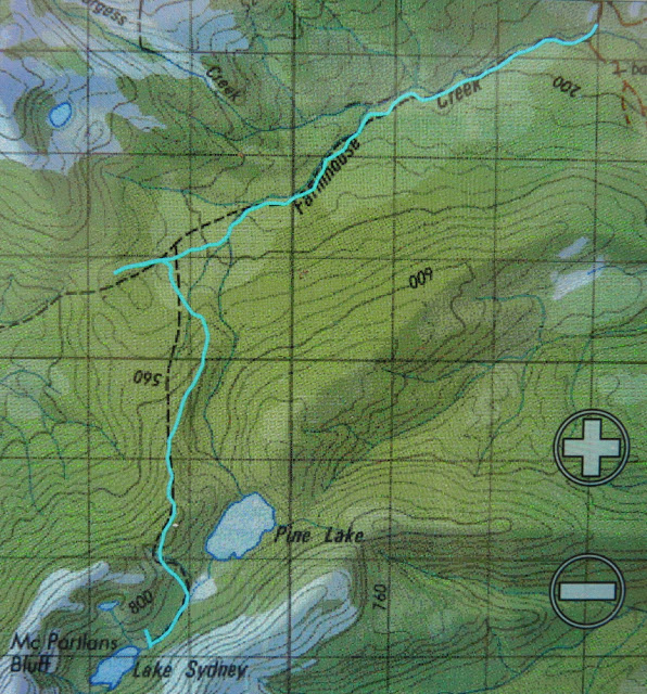
A 1:100,000 image of our route.

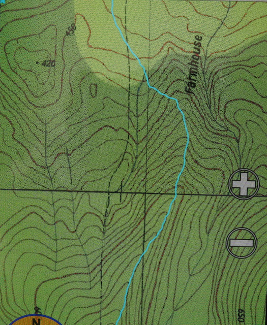
A 1:25,000 version. Note the huge discrepancy between the blue line of the pad, and the black of the map track. It is absolutely impossible to use the mapped black line of the track to determine the whereabouts of the track. If you can’t find the pad, there is no point in getting a gps reading of where you are and saying: “The track is to our right”, as the “track” (word used very loosely) could be absolutely anywhere. The bush is thick. It’s worthwhile trying to find the pad, if possible! We added a few more tapes when, and only when, we were certain we were on the official pad. 


Clumner Bluff 2015 Sept

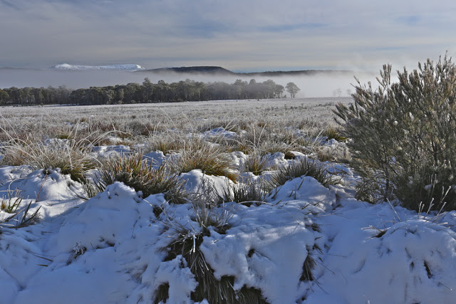
Not my photo. Neither is it my view (seeing’s I didn’t get one). This is a photo kindly sent to me by my friend David, taken from a snowy “summit B” under somewhat more ideal conditions than my own.

Clumnar Bluff. Hoorah. Sixth time lucky – if “luck” is what you call it. I have at last climbed you. Both summits. And what happened on the failed attempts? Is it a hard mountain? No, it is not hard at all, although I was starting to feel that it must be. So, what’s the story?
Time 1) It was frosty with icicles on the rock, so it was called off before we began, and we climbed a slippery, icy Mt Victoria instead. (It’s not as high).
Time 2) We got started, but didn’t even get half way. It was raining and cold, and our organiser was still recovering from an operation. We were obviously not going to make it, so we all opted for the comfort of the car and to the business of pulling leeches off ourselves while we drove back. The count was 42 leeches thrown out the window on the return trip.
Time 3) This trip was called off because of rain before we left our homes.
Time 4) I put my name on the list, but then discovered I had a clash and a trip organised up a more important mountain. That group made the top, but without me.
Trip 5) I was told we were skiing to Clumner Bluff. HOW exciting is that? I was thrilled. However, in the car on the way, I was told we were not going to Clumner at all.

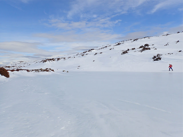
This is also not my photo, but one offered to me by another friend, Catherine, showing me walking around a different lake on Wednesday. This is very similar to what we could have been seeing had we been able to see, or had the luxury of time to stop and take it.
Enough was enough. Obviously it seems, if you want a mountain dearly enough, you need to take matters into your own hands. I studied the weather and decided Friday was good enough for a try, despite the fact that either snow or rain was predicted for the afternoon (depending on the temperature). An early frost would at least mean that the snow would be firm for the way out. It would be several kilometres across the top once I’d climbed up to the snow, so I wanted to make sure of being out by midday, just in case it got slushy and slow, and in case sinking with every step became a possibility. It thus needed to be a trip with a nice early start, and one done on the march with very, very few stops, if any. Who would be up for such a trip? My friend Angela, of course. I was so annoyed with five failed attempts that I was prepared to go solo if she couldn’t come, but luckily for me, she could, so when the sky closed in and even the ground became difficult to see, I had the warmth of company.

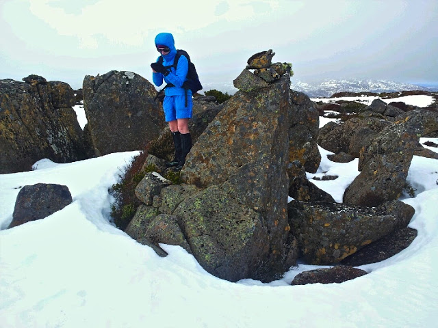
Angela checking the summit. Sorry, it’s just a phone image. Beggars can’t be choosers. Having forgotten my camera, I had to learn to use my Galaxy, which won’t let me download onto my computer, so this got texted to my daughter and then emailed to me. Quality has been lost somewhere in all of that. Don’t be fooled by the shorts. It was COLD. Angela is tough!

Angela and I, as a duo, now have, by default, a very good – yea, pure – record of summitting success in the snow, and this mountain was no exception. I say “by default” as we don’t always set out intending to snow climb. It just happens to be the case. This time, however, the snow was sought out and courted. I thought it would be great fun to have my first summitting of this elusive mountain in winter white. The fact that it was also in a grey-out, done half-blind, just added spice.
At first the day seemed benign. I thought it would be another glorious one, like Wednesday. However, once we gained a contour or two and were exposed to winds coming from the west, we were hit with an icy blast, and quickly donned another layer to cope with the freeze. We were not deterred. It was chilling, but we also both had many more layers in our daypacks in case. To the west, the sky began to look dark and ominous. I checked my compass to note our bearing, as the land was almost featureless. The clouds were rolling in, and yet it was still so bright because of the snow that we both found our gps screens very hard to read; I was glad of the paper map and compass we were each also carrying. Somewhere in the clouds, Clumner Bluff was hiding, but it was a matter of belief, not of seeing – a belief based on the accuracy of map and compass, for the eyes told us nothing.

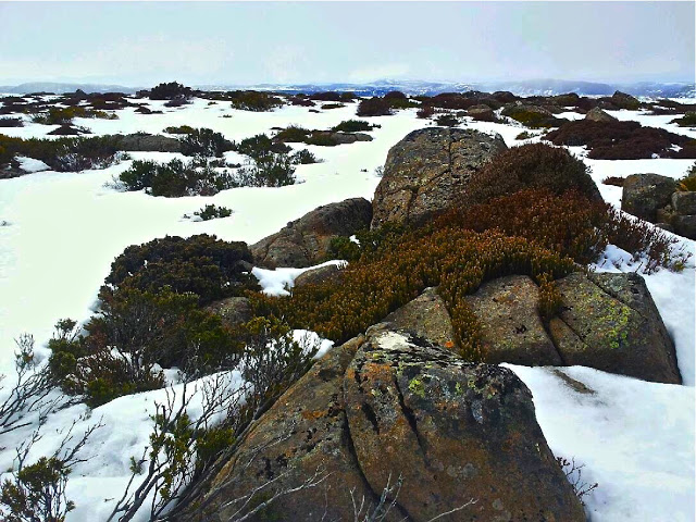
The wildness of the tops

The ground became exceptionally hard to discern. I changed from sunglasses to red-tinted ones, but I still couldn’t detect any helpful patterns in the snow that indicated where the ground was. Like a little old lady, I walked bending low to try to make out the ground. We crossed something we decided was a lake, treading very gently indeed as we crossed it. We had no idea how deep it was, or how stable the ice covering on top. I was so glad to have Angela’s company!!! On the return journey, we evaded that bit by doing a wide arc.
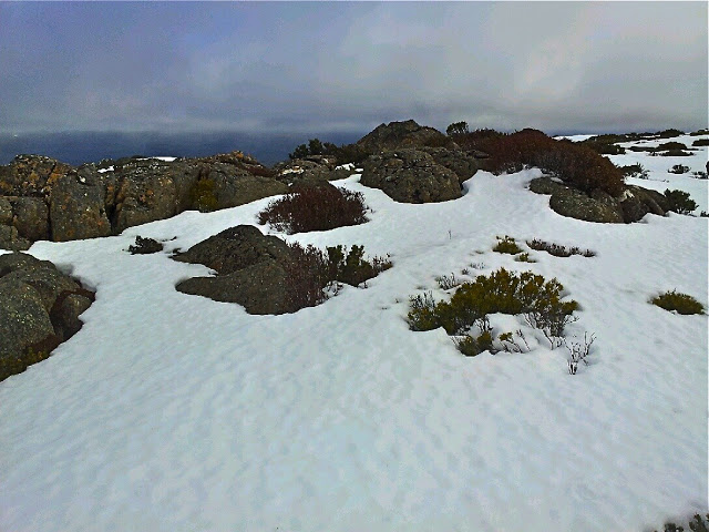
After maybe 50 minutes across the snow, a shadowy lump loomed up ahead. This must be Clumner Bluff. At last we come face to face. ‘Odyssea’ meets her giant. Up we climbed and exactly 60 minutes after cresting the snowy tops, we were standing on what we supposed was “summit B”. I assume this is the “historical summit”. However, even in the grey misty gloom, our eyes said there were higher things to our left (south). My old map told me nothing, as it lacked a black dot of any description for the summit, but Angela’s more modern map had a summit where our eyes said one should lie – apparently 10 meters higher than the one we were on. I really don’t know, and never will, if I would have had the courage to go even further into the dark mist and visually unknown without the company of a friend. I don’t need to know right now, as Angela agreed that we’d go on to touch the highest point, and not just this cairn and summit. It took us a further 15 minutes to reach it, but they were glorious minutes where we felt even wilder and freer than that first hour across the snowy plateau. Somehow or other this was the ultimate: wild and free on rugged eerie tops with wind so noisy we couldn’t hear each other speak; the only marks in the snow were wind waves and the tracks of wombats and wallabies. It was fabulous. And oh was it good to breast that summit rock and know we had at last got to the top of the runaway mount.

This was the clearest it got during a two hour period, which happened to coincide with when we were on the summit, and when we stopped for five minutes to celebrate before hastening away.

Here, after 2 hrs 15 mins walking from the car, we had our first break, if you call it that. I took four photos. Angela similar, and then we were away again. No food; no drink. We were still both in a hurry, as the weather really was quite nasty, and we both wanted to reach this nice thing called safety before we ate or drank or wasted any time. We had our first break from earnest progress, and I had my first drink and food of any description after 3 hrs 45 (12.15 pm), when we were successfully out of the snow, and about a quarter of the way back down the mountain. I had been right to think we needed to be out by midday. The snow had been a little sludgy towards the end. It started raining lightly as we tightened our seat belts to drive away, both feeling quite excited by the day’s adventure, and very, very satisfied with all that had happened.

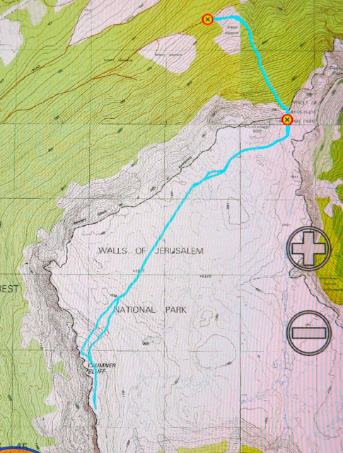
Our walking route in blue. For instructions on how to get to the start, see the post before this one on XC skiing. We parked the 2WD just before the puddle, as suggested, 4.3 kms from the turn. At the puddle, you turn right, head up a steep section that 4WD cars with courageous drivers can do, until the tapes indicating the start. The additional walking resulting from parking that bit early meant we had to walk an extra 6 mins 45 to reach the carpark for the brave and well equipped.

For the first time in my very long life, I forgot to take my camera with me!!! It was in the car, but I thought it was in my pack. I realised 10 minutes into the walk that this was the case, but was not prepared to lose 20 mins getting it, given that I had calculated that we needed to be out by midday. As it was, our progress was so purposeful that I would possibly not have had time to use it apart from at the summit anyway. Wednesday was about photography; today was about business – if you call feeling the wondrous expanse of infinitude in nature’s wildness “business”.

16 kms; 500 ms climb = 21 km equivalents. 4 hrs 45 walking (plus lunch and four photos).

Alma 2015 Jun

Mt Alma. 4 June 2015

The lookout towards King William I, Pitt and Miligan as seen from the highway, not too far from where we started.

 Dark shapes appeared out of the mist as I drove towards the Western Tiers, heading for my render-vous with my HWC friends at Derwent Bridge. The skeletal forms of wintry trees floating in the mist were very beautiful, but I had no time to stop for them. As I expected, the bends on the Poatina road would rob me of the extra minutes I had allowed. 10 kms/hr was all I dared as I negotiated sharp turns of pure ice. The land up top was white and perfect, but again, I had no time to spare. I just had to admire it as I continued on my way. I’d left half an hour early, but was perhaps now running a little late.

Looking towards Mt Rufus as we drove to our destination.

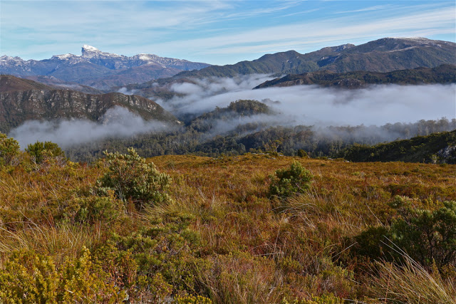
Phew. There they were waiting for me. Now we could proceed further towards our goal, Mt Alma, on the other (northern) side of the road to Frenchmans Cap and along past the car park to where the main southern spur from Alma intersects the highway. Our mountain from the road was, as is often the case, a matter of belief in maps rather than something we could see for certain. She lay back there, up there somewhere.

Part way up the first rise

Up we climbed in good spirits brought on by a new adventure, through the frozen grass that melted and saturated when it came into contact with our warmer bodies. The views back towards Frenchmans were splendid, especially as we were lucky enough to have wisps of clouds below us and a snowy white beret on the famous French gentleman.

The white-bereted gentleman himself

After morning tea at the first hilltop, we dropped, past fascinating rock formations to a saddle, from whence the final climb began. The going was slow, as the bush in this section became quite dense. It seemed odd to climb up from grassy slopes into thick forest. On this particular day, every time you bumped a bush, it threw snow at you.

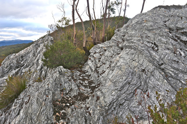
One of many fascinating rock formations on the first section of the climb (before we dropped to the saddle).

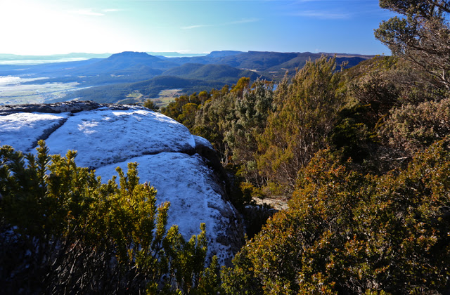
Already we could see and feel the day changing and clouds were rolling in. Unfortunately, by the time we reached the summit and got to picnic and enjoy the fruits of our labour, the interesting detail in the landscape had all but vanished and outlines were smudged; pleasing lighting effects were nonexistent. I didn’t even bother to photograph the summit, and stood for lunch, preferring not to eat sitting in snow. The trip down was very quick indeed. I think everyone wanted to finish the mountain’s work before the rain began. The views on the way up were definitely the climax of this mountain.

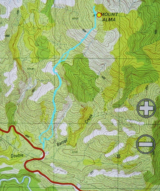
That bend where we parked the car is the second bend after the Frenchmans Carpark, but if you can’t read maps well enough to locate it, please don’t climb this mountain unless you are with a club. There is no path to guide you. You’ll see that we went beyond the “black dot” marking the mountain on the map. That’s because where we went was the highest point on the mountain, but we visited the black dot as well, so as to say “hello” to both points. Quite frankly, the lower black dot was a more interesting place than the highest point, and offered what I thought was a better view.

Mother Cummings Peak 2015 Jun

Quamby, Drys and Projection Bluffs from the top of the climb
Mother Cummings Peak. I have a friend who believes that disappointments come in threes. Unfortunately, I’d used up four before I’d even reached the plateau at the top of the Western Tiers, but that’s OK. Surely it meant the rest of the day would be fantastic – which it nearly did, except that disappointment number five was awaiting me at the end of the journey. Here are the early ones:
(1) My car bounced like a kangaroo up the southern outlet, most unwilling to participate in a day’s jaunt in the mountains. This boded ill. Once up, however, she took off, so I picked up hope.
(2) She then stalled three times in the Deloraine carpark after I’d stopped, and a fourth time about a hundred metres down the road. I limped quietly back, abandoned the unfaithful beast, and climbed into a friend’s car. My Kia could remain a problem for the end of the day.
(3) And maybe you think this shouldn’t count, but the scenery was absolutely magic as we sped along the route west out of Deloriaine: white, heavily-frosted grass; a magnificent pure white mist rising above it; photogenic, dark cows peppered here and there to give foreground interest; an indigo Quamby Bluff rising out of all this for grandeur and contrast behind. It was perfect, but I was no longer in my own car, so had to let it go. I still mourn the loss of that “photo that got away”.
(4) I had come armed with my macro lens and was even carrying a light tripod, but it was so cold there were no fungi at all, so my disappointments mounted. Up the track though the rainforest we went, having fun despite all these setbacks.

Admiring the view

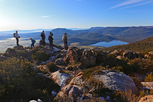
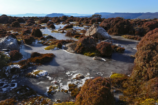
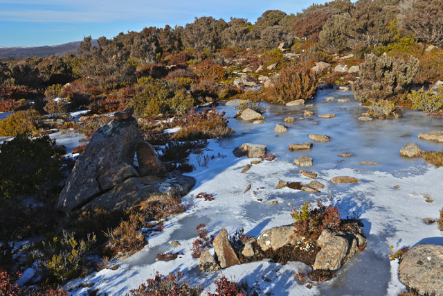
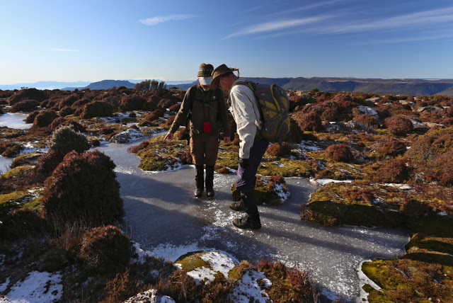
As we crested the plateau at the end of most of the climb, we were treated to a delight, so I decided I needed to do some sort of subtraction on the list above. In that crisp, clear air, all outlines were sharp and beautiful. You could see countless surrounding bluffs and peaks with wonderful clarity. Perhaps even better was the cornucopia of artistically frozen tarns with white rings and stripes, all sparkling in the beautiful sunlight. Changed by the sun fairy into tiny children, we played on the tarns, seeing which ones would take our weight (fortunately, all of them). I changed macro to wide angle, and played away with my camera as well, always happy to be going “click”. The Scotts Road had been an excellent starting point: we were at the top in less than an hour’s walking time (not counting play time). If you count the distractions of beauty, who knows how long it takes? It was so early we couldn’t even have lunch on the summit, and had to wait until the next peak, alas.

One of many icy tarns

Dining on said next lump, listening to banter flying to and fro and enjoying the dramatic drops and cliff lines, soaking up the fugacious rays of warmth piercing bravely through the sharper ambient temperatures, I felt deeply contented. I looked at my watch. The time was good. We were now at the furthest point from the car. The rest of the route looked easy. I would get to work on time despite not having my own car for a quick getaway.

Unfortunately, disappointment number (5) reared its ugly head as the journey continued and continued, the party making slow progress through the glorious rainforest in the final kilometres of our journey. There was nothing I could do about it, but I became quite distressed, knowing my students would be waiting for me and that I was letting them down. I hate letting anyone down, but especially my students. At least when I finally reached my abandoned car, it started without a murmur (or jump) and bravely sped me to my destination. I dashed into the room of nicely dressed people in my muddy boots, filthy gaiters and torn pants. My students didn’t bat an eyelid, being used to seeing me in odd attire, no doubt. Instead, they greeted me with a hug, glad that I had managed to get there at last, albeit late. I love them all.

Phil on the northern hump, with Ironstone behind

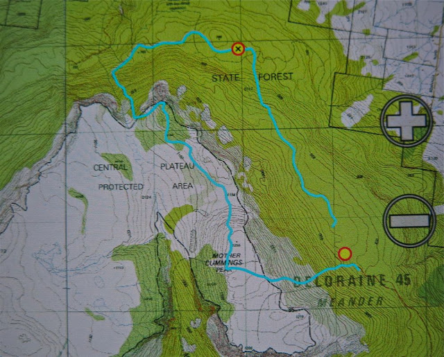
Route notes: via Scotts Rd. From Meander, head south along the Meander Falls Rd until you come to a right hand fork labelled “Scotts Rd”. This leads to the Scotts Rd Lookout (fine view). The end of the road and the start of the track is just beyond that. The bushwalking forum does not discuss this route (not that I could find), and the Tastracks’ offered routes (two of them) do not present this as an alternative: they suggest coming via Smoko Ck (beautiful) or Western Ck – also nice – but this route is fast and efficient, if getting to the top quickly is your intent. Very old maps call the southern, bigger lump “Cummings Head” and the lower, more dramatic northern one “Mother Cummings Peak”. In fact, if you want to say you’ve climbed Mother Cummings Peak and you’re talking to a pedantic peak bagger, then you need to have climbed the southern (higher) one. We climbed both for good measure, but the northern one was for fun – well, they both were, but the northern peak was a “pointless” and “Abel-less” peak, done purely because climbing things is enjoyable, whether or not they’re on someone’s list or worth a point in some motile and relative list of points to be accumulated.

So, we parked at the (Scotts) road’s end and ascended by a clear path to the peak. From there, as you can see, we headed north. There is a path that goes via the valley, but our intent was to avoid dropping that far, and to head cross country and north over higher ground to a point where we eventually joined the valley track as it ascended once more to go to the former summit, now “pointless” (but dramatic and photogenic) hump.

Boys playing on ice

From that northern hump, we descended on a clear track to the east of a stream, as per map, until we hit a road, which we followed to the east, until the waypoint, which is the point at which it stopped. From here, we made our way cross country, consciously gaining contours to reach the obvious shelf, but not climbing it straight up. This was not hard going. If you are doing this route, my advice is to stick near to the steep ground on the right when on this shelf, using it as a navigational handrail, until you intersect the track and follow it left to your car. My route was outvoted by the others, and we spent a lot of time floundering around in flat swamp, knee deep in muck. We saved a bit of distance but lost a lot of time. (My blue lines don’t meet to make it clearer where the car was.)