Blue Tier, Handley Peak, Mt Littlechild 2015 May

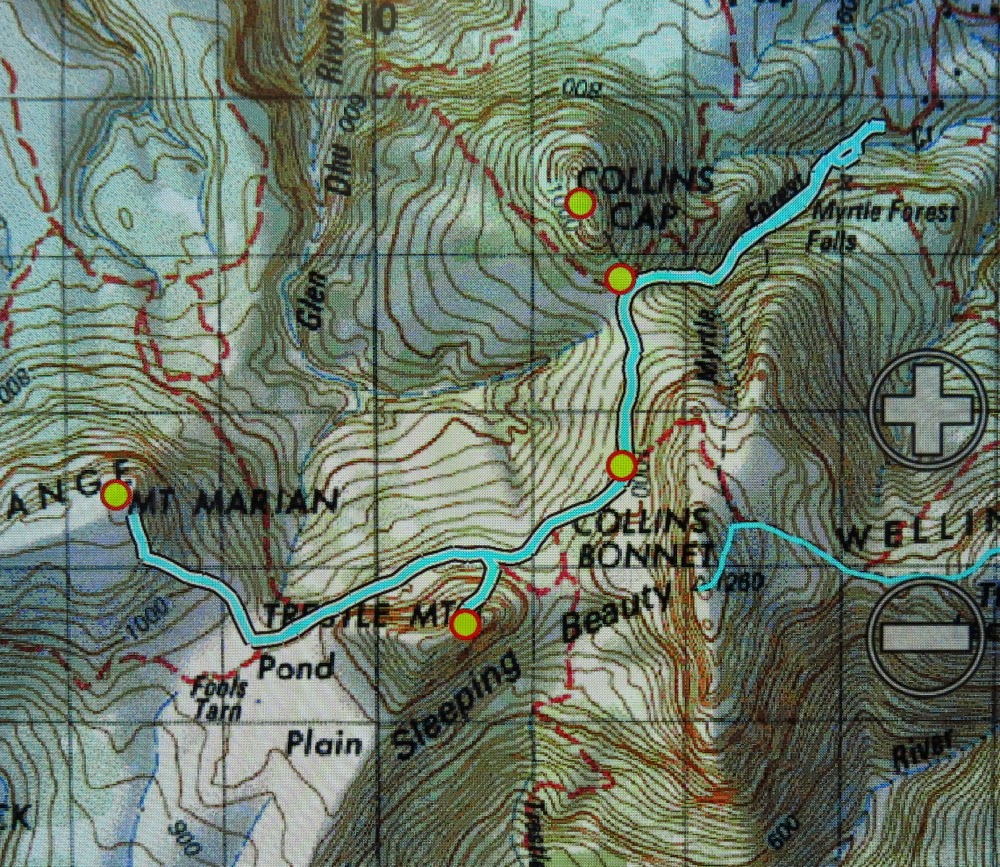
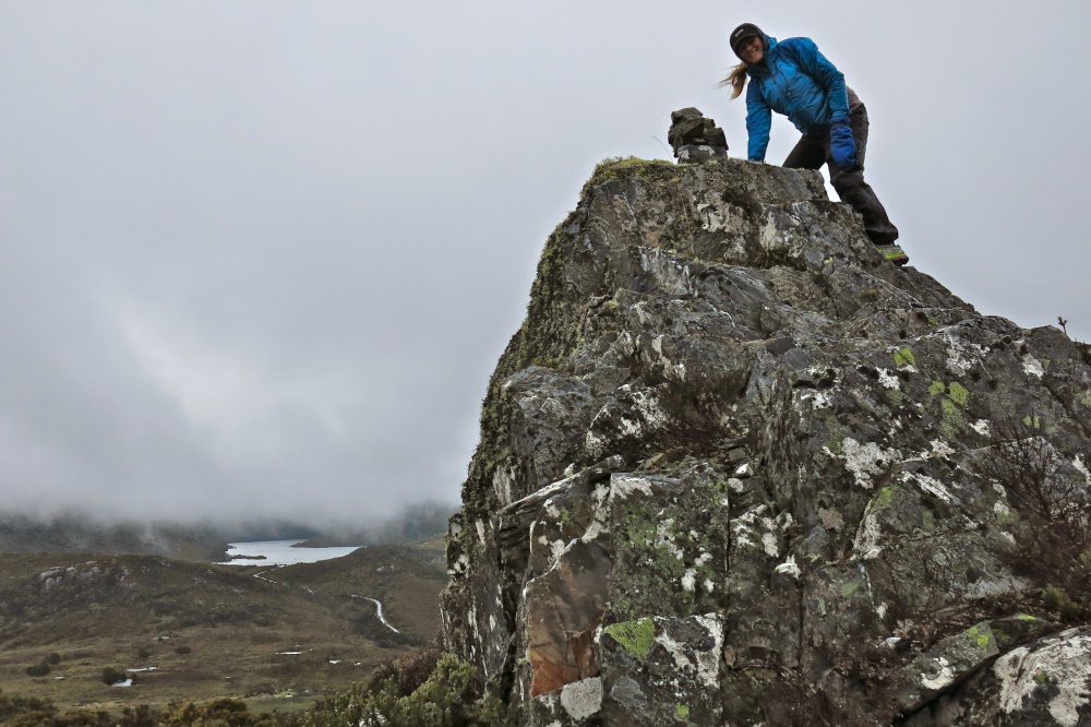
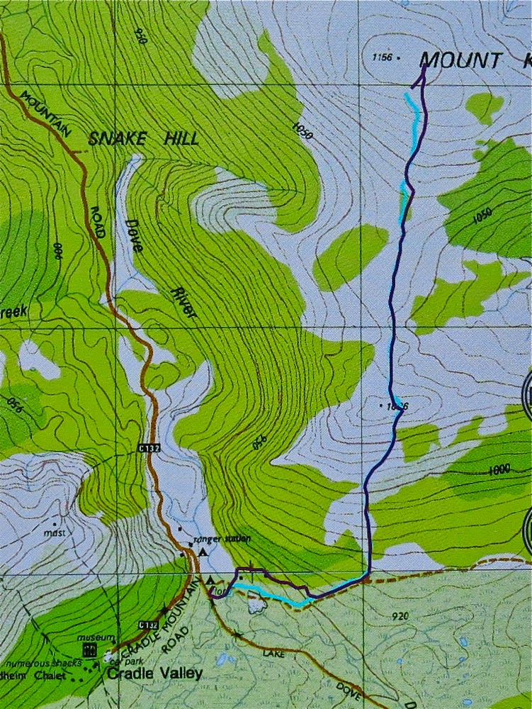
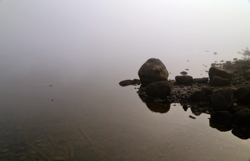
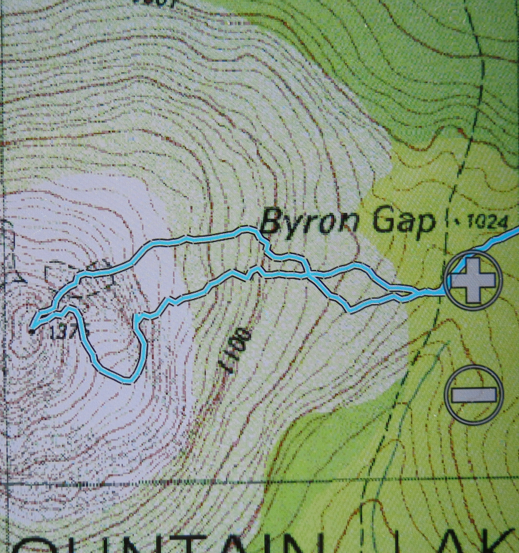
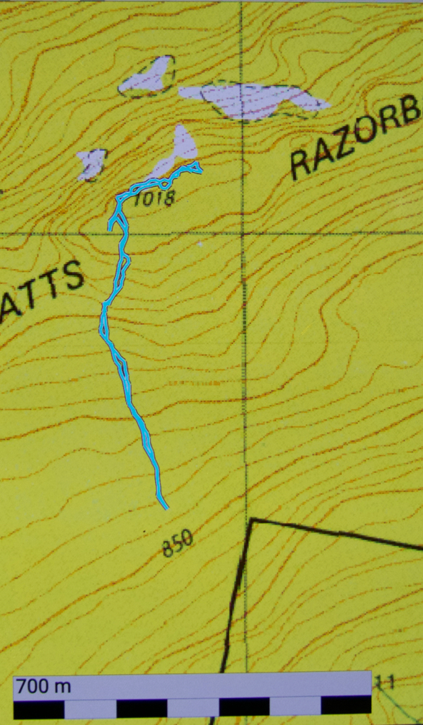
Blue Tier, otherwise known in some circles as Handley Peak, and in others, as Mt Littlechild (if you listen to the locals or read the old maps) is obviously a mountain with an identity crisis. Well, I think it’s fine: it’s the humans naming it who seem to have the problems. The peak I climbed is called Mt Littlechild on the map (see below), but there is another black dot on the map without a name, and peak baggers insist that it is called Mt Littlechild.  If you go to natureloverswalks.com/mt-littlechild/ you will find the extension of this walk that encompasses that black dot.

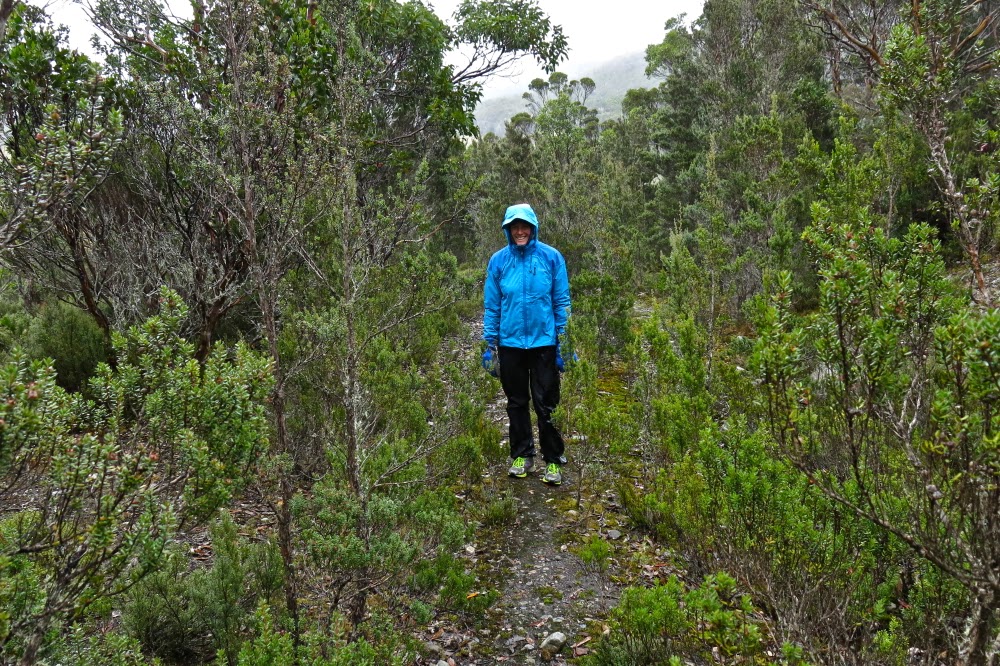
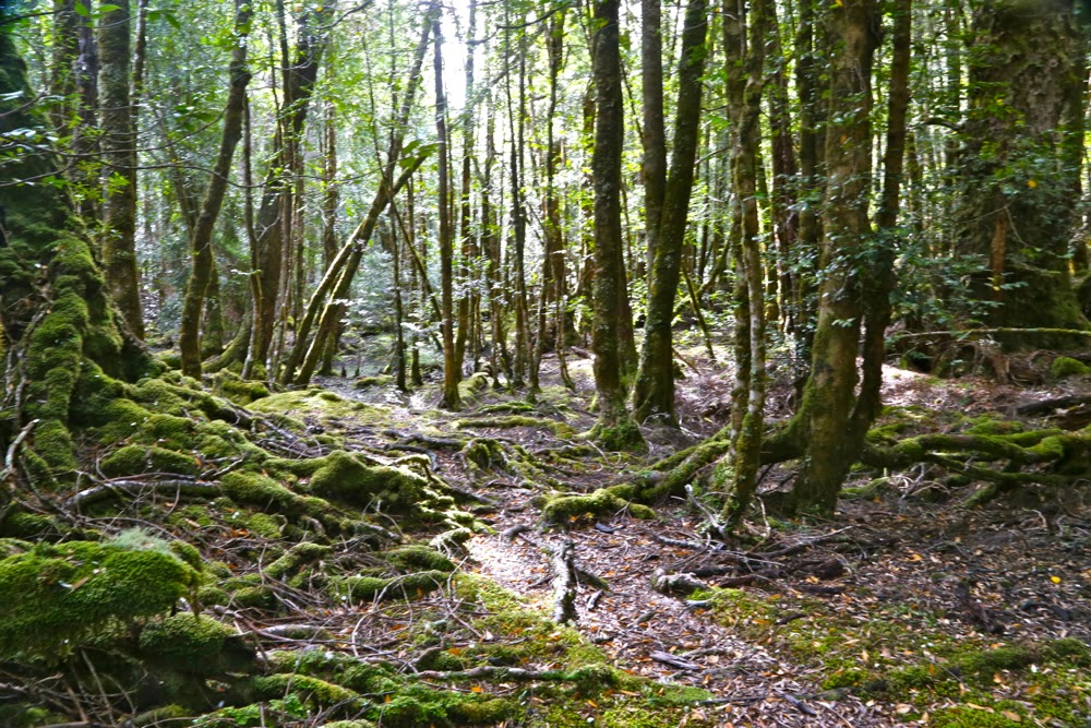
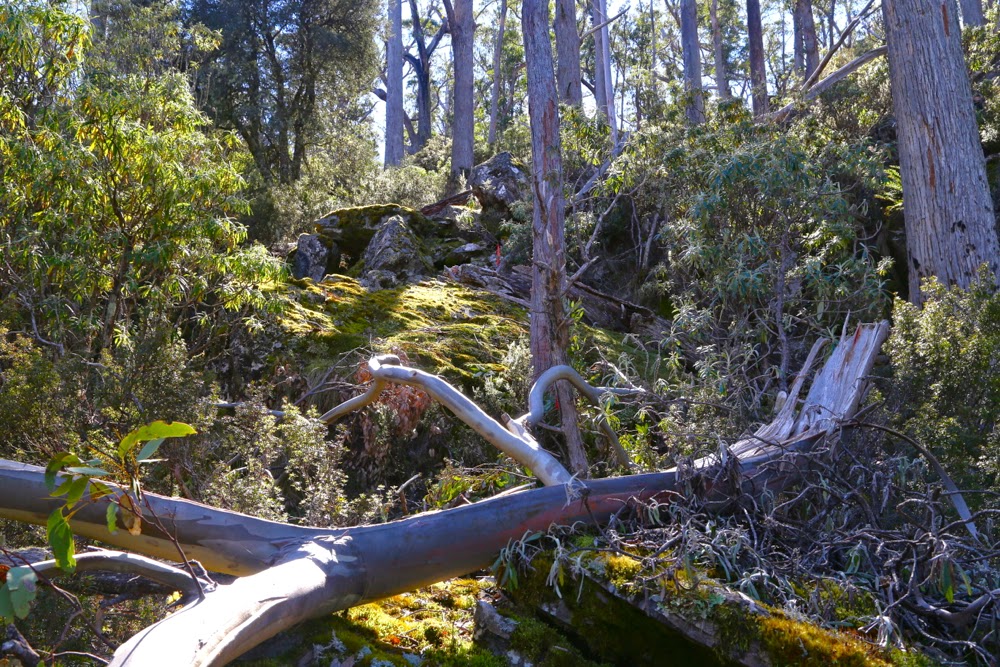
The first part of the “false route” – delightful fern forest.
It’s ridiculous, how excited I was as we packed for Mt Littlechild. You’d think I hadn’t been out climbing a mountain for weeks – and yet the pleasant memories of Mt Weld were still resonating happily around my core. There were two reasons for this possibly absurd excitement: (i) my normal love of being in the forest and up a mountain, and (ii) this was to be my husband’s first walk since he got injured in December. Some eras are good to end, and this was one of them.

But then we landed in this. Time to retreat.

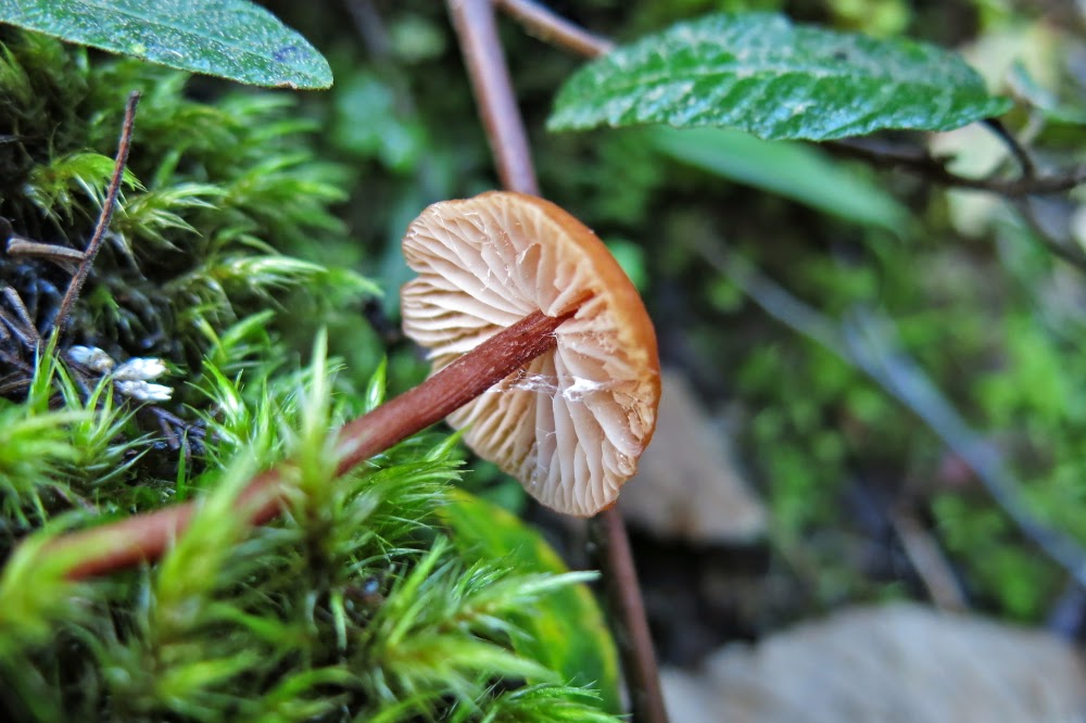
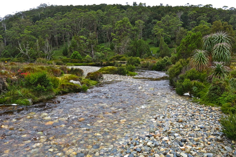
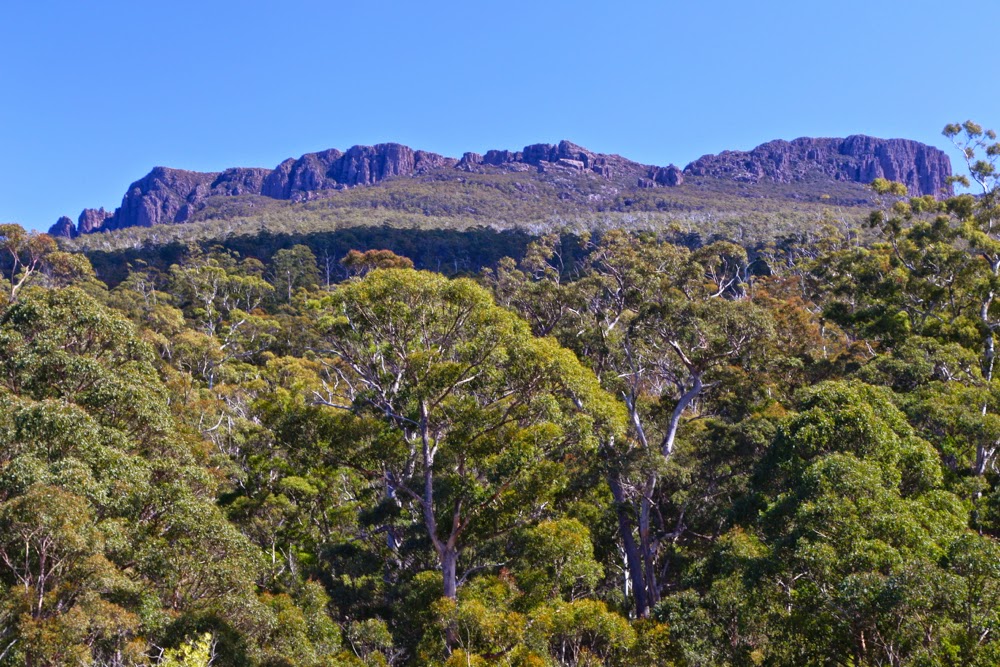
Mt Littlechild also had its own excitement. For a long time I had been wanting to see the Blue Tier, the preservation of which was fought for so thoroughly by those who know and love it. I have also seen many images of the fungi that can be found there, and hoped to be a happy hunter myself. In addition, I was curious to see the much-feted Welbdborough Pub, which was to be our post-walk reward.

The “good route” – wonderful forest, complete with goblins.

Being a diligent little researcher, I had done my homework and written to a member of the Save the Blue Tier society, asking about the best way up this mountain, as there is no track on the map. Perhaps a new one had been created, and if so, I should use it. She kindly wrote back giving me instructions and confirming that there is still no track, but told me to start at the junction of the A3 and Little Plain roads. However, when we got there, what we saw was a farmer’s paddock, and the map showed that this was in no way the shortest distance between road and summit. I decided to try and straight line it from further on; no need to prolong the fight if the forest was thick.

Hygrocybe mavis, White splitting waxcap.
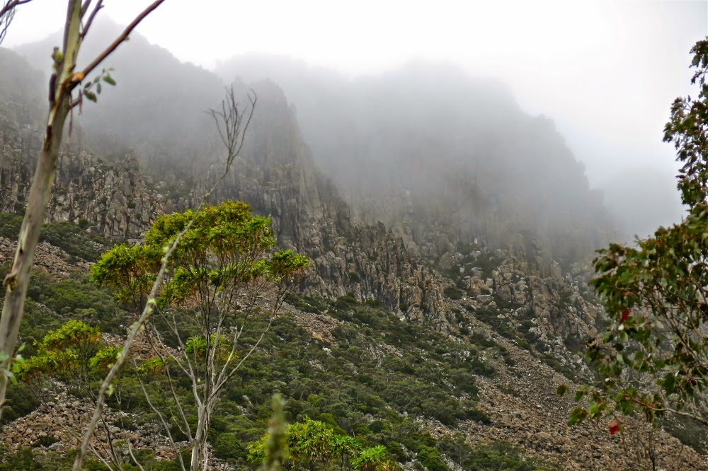
The sides were so steep that our first opportunity for going “straight up” came further along the road than we wanted but it seemed, with respect to contours, a reasonable route. So it was. We climbed quickly and easily to the 600ms asl mark, after which we landed in a tangled and impenetrable wall of muck. My map said “dense low scrub”. Maps don’t often oblige with this information. I hadn’t noticed it before setting out. We reasoned that there must be a nicer way up this mountain, and descended, deciding to actually obey the instructions we had so kindly been furnished with, park where our informant had suggested, and stop the fancy shortcuts.  Good move.

I adore tiny mycena interrupta

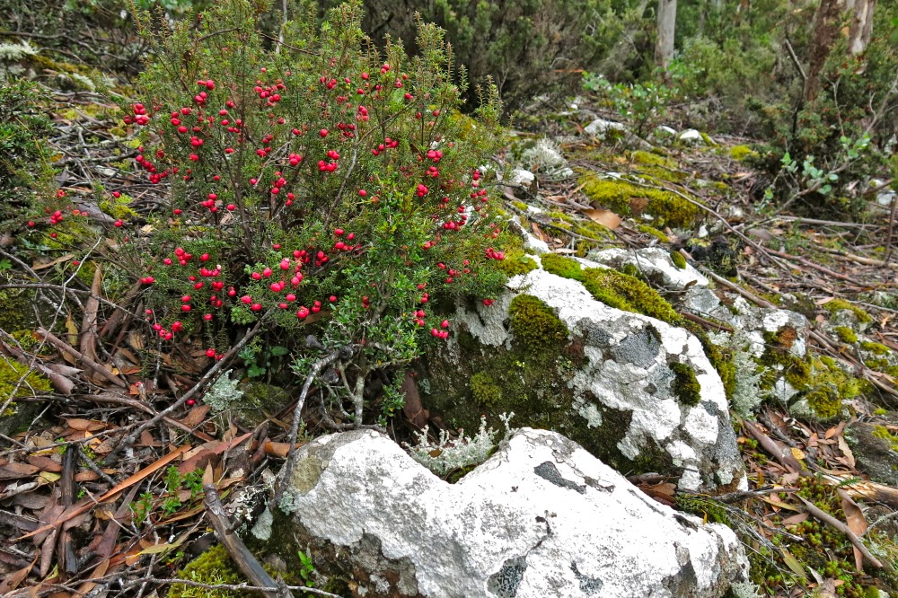
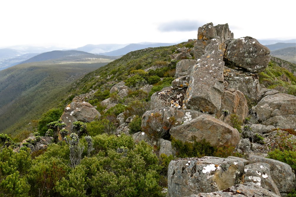
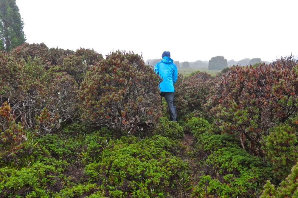
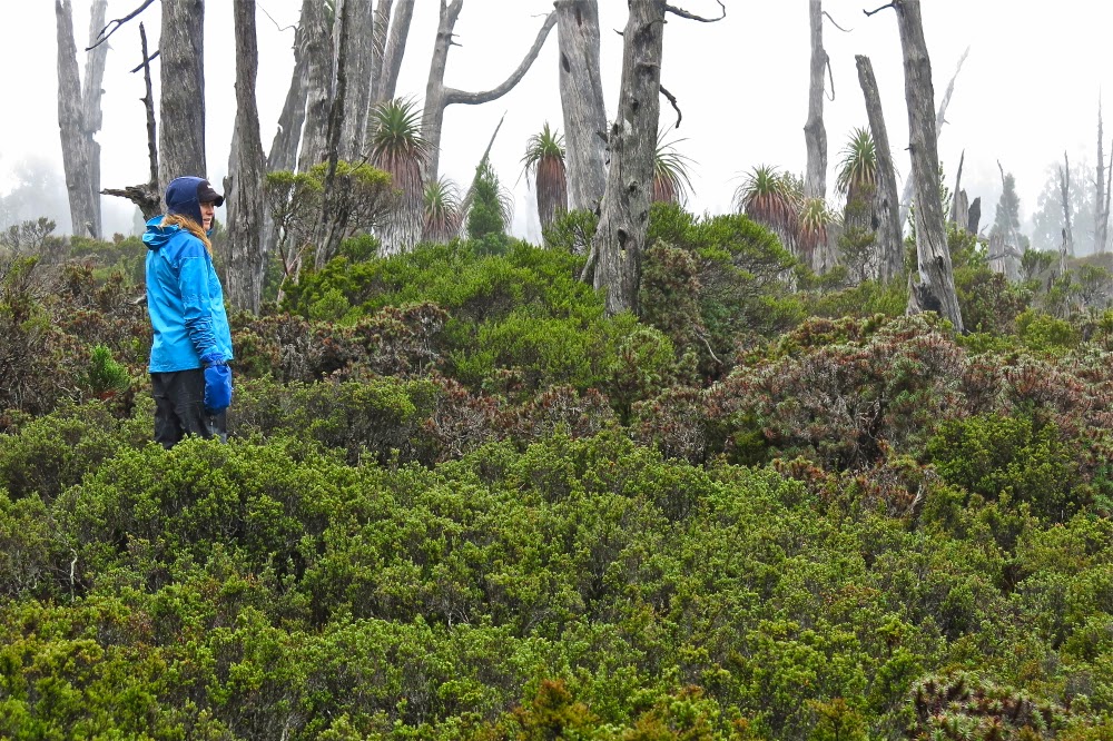
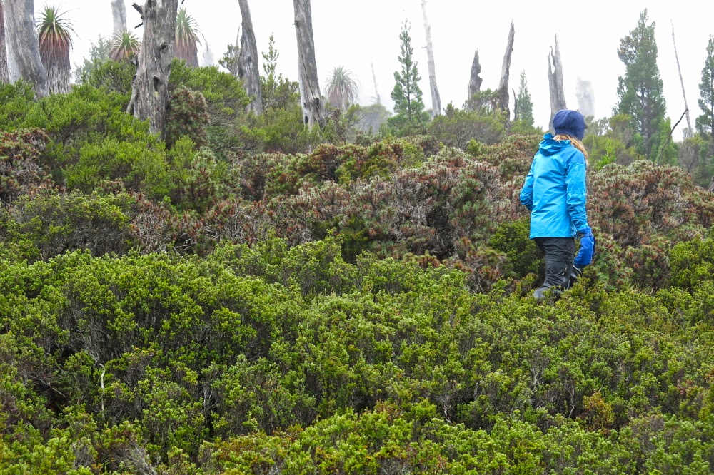
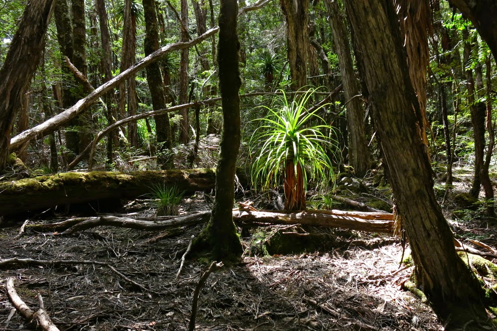
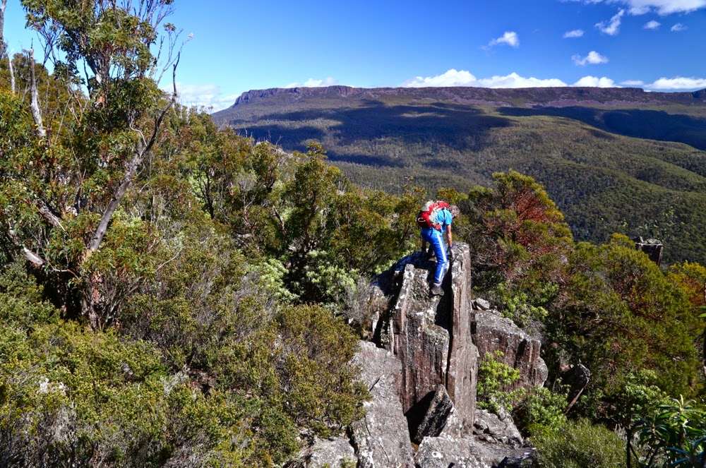
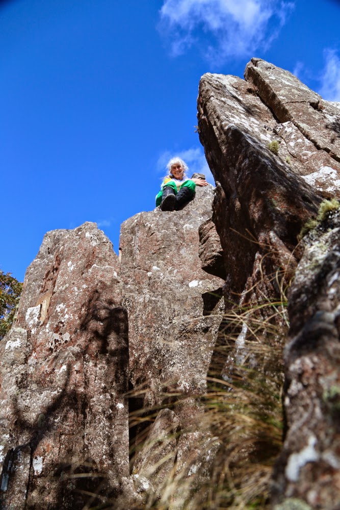
We entered the paddock that had at first looked somehow foreboding and walked up the indentations made by a heavy farm vehicle. Up, up we easily climbed, following the tyre marks past the first broad flat section of the spur and up the next steeper spur towards a rocky outcrop which had a height mark (787 ms) on the map. The whole thing felt more like a Lake District ramble than a Tassie bushwalk. This is a very cheap way of travelling to England. We loved it. The tyre marks had petered out by this stage but the contours were perfectly clear. On we went to the saddle that now separated us from our Littlechild goal, and then, for the final climb, we entered a patch of myrtle forest. After the experience of earlier in the morning, I was wondering how much of a fight this would be. It was a magic fairyland with no fight at all. Just pure moss and beauty (and fungi).


Panellus longinquus
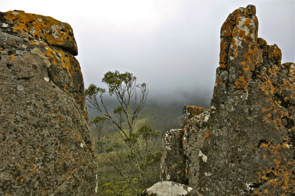
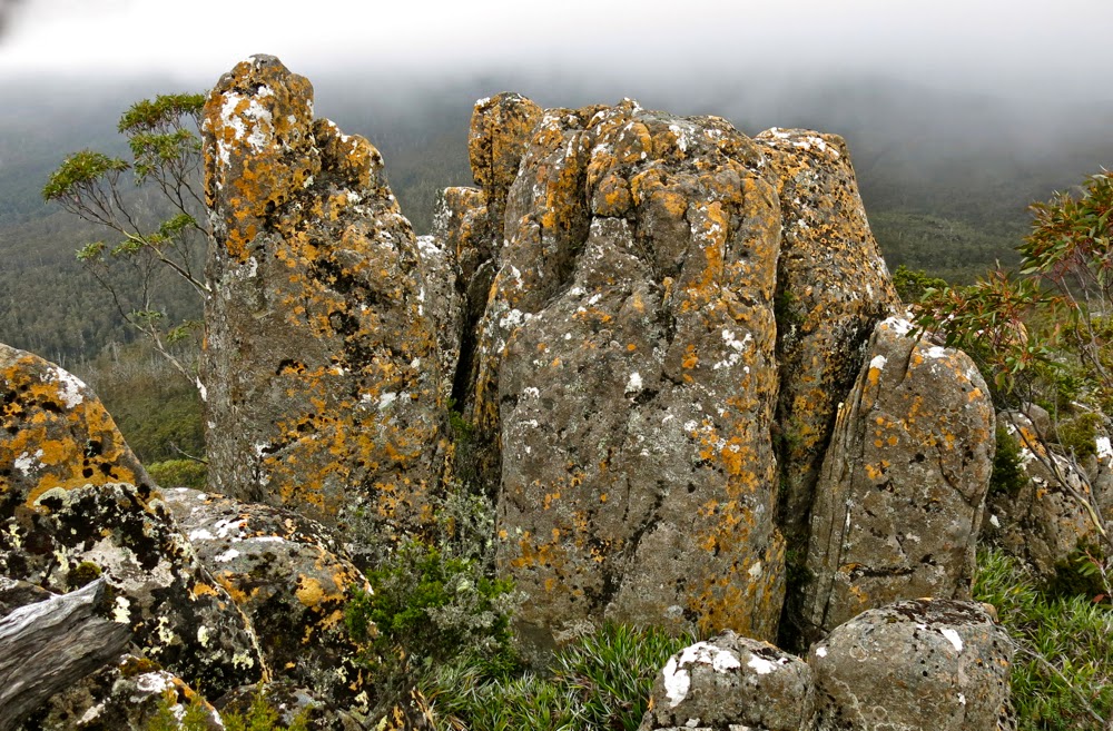
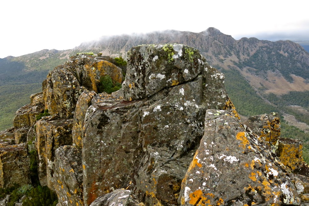
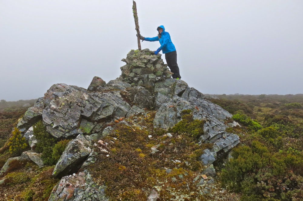
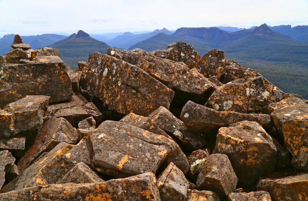
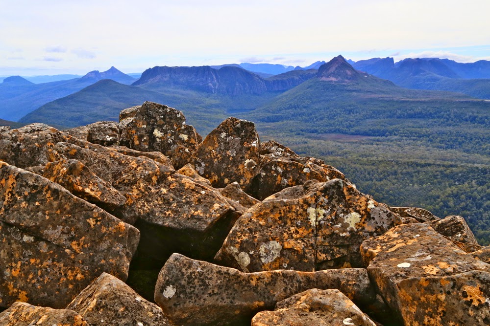
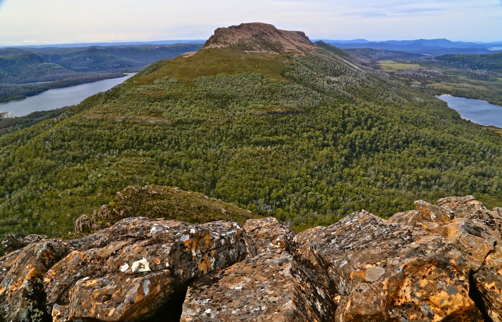
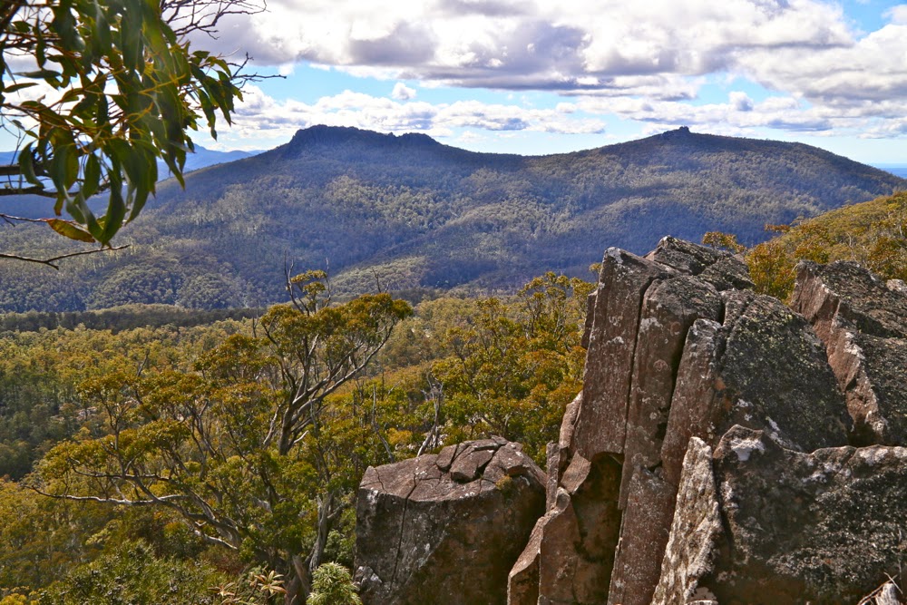
The summit itself was clear enough to give us a view, and I was excited to be able to see the sea, as well as many other mountain friends around. The exercise was amazingly short. We took 26 minutes to reach the myrtle forest, and 12 more to reach the summit. The splits were the same on the way down. There was nothing taxing or arduous in this walk (we only climbed 276 ms) and I can thus thoroughly recommend our final route to families. As we walked 5.4 kms, I guess the youngest child should be four or five, as the advised daily kilometres are supposed to be no more than the child’s age, and I think that’s a good rule of thumb for tiny growing bones and muscles.

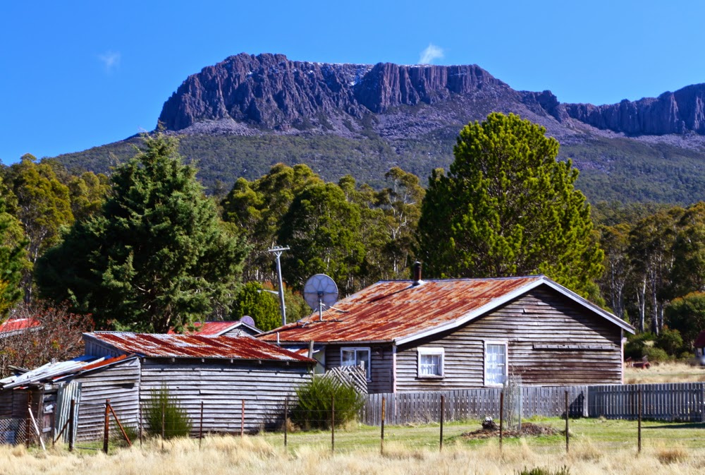
 For the second week in a row, the forecasted rain began just as we reached the car. We watched it falling, once more snug and warm, while we ate our lunch at the famous Weldborough pub.  It is my personal belief that if we don’t want people destroying forests of beauty in order to make a living, we need to support them in their endeavours to earn money in a less destructive manner. We always try to eat at pubs and cafes in places like this, to support local alternative initiatives. This one did not disappoint. Unfortunately the beers and ciders for which they are famous were not tried, as they do not suit the fact that I had to drive home, but don’t worry: there was still plenty left on the menu.

Why the odd blotches? Because there are numbers on the map that correspond to trig numbers and not to the heights. They make matters confusing.
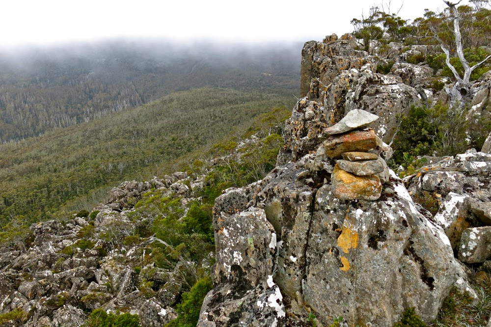
Please also note that although the map says this is Mt Littlechild, it apparently is not, and if you search Littlechild in my alphabetical index, you’ll see the story of the real one and not this imposter. The real one, the highest point on the Blue Tier, lies just off this map, past the saddle to the E-NE of this summit. There are tapes to lead you into that summit, after which you need a compass. It is not hard.

Marian and Trestle Mountain 2015 Apr

Mt Marian and Trestle Mountain  April 2015.

I rather liked this view of Collins Bonnet that presented itself to me as I passed by – an old friend.

People climb mountains for many reasons. Some climbers, when asked why they did it, merely respond: “Because it was there”, which is not altogether helpful. Perhaps if I may attempt to articulate the unarticulated, I think they probably mean that the very presence of the mountain issues a challenge that they just couldn’t resist. Possibly at the other extreme are people who maintain that they only ever go up a mountain to have “a lovely day out” and that they don’t care which mountain it is, or whether or not they reach the summit. My first born daughter used to refuse to stop climbing anything until she had reached the top – and that was when she was still in nappies. I decided watching her that a drive to the summit was a genetic thing, as I had never taught her to behave like that.

Leptecophylla juniperina adds colour, especially when doing combat with the white snowberries of Gaultheria hispida 
I like to think I have a huge mixture of reasons for climbing, and that different ones may dominate on different days. Sure, on some days, like yesterday, I can be happy just to be there on the mountain, enjoying things from on high. On other days, I slip back into athlete mode, and am very business-like about getting to the top. Today was such a day. I had decided that I wanted to summit Mt Marian and Trestle Mountain (both Abels), and that I wanted it to be more of a workout than a pleasure jaunt (except that, for me, workouts are highly pleasurable). That’s probably because (i) I don’t like fire trails and (ii) I am feeling guilty that the dogs haven’t had enough of my company of late, so was in a rush to get home. This was to be a no fuss trip, and as fast as possible.

I set out after breakfast, and was ready to roll at Myrtle Forest Picnic area by 10. (For those from the north and foreign visitors, if you head for Collinsvale, there is very clear signposting after that.)

Exciting vistas opened up as I neared the summit of Mt Marian

The first part of the track was glorious, beside a ferny creek with, hardly surprisingly, myrtles here and there. However, my eyes were decidedly groundwards, as there were many colourful fungi popping their cute umbrella heads out from wood and moss, and I was enjoying them. All too soon the track split, and my route, the right hand one, turned away from the creek and the forest became drier until, 35 minutes after leaving the car, I bumped rather unexpectedly into the Collins Cap track start. However, this was like the sirens tempting Odysseus. My goal was Mt Marian, not this one, and I would not be turned off my course. On I marched, happy with the unexpectedly short time for this section. Business-mode was working well.

Summit cairn (Mt Marian)

Mist started gathering as I approached the under girth of Trestle Mountain. Should I do this one first whilst there was still maybe the possibility of a view? No. If I do, I might not do the further one. Hardest, furthest first was my self-made rule. All my eggs were now in the Marian basket. If the weather closed right in and it poured with rain maybe I would get no mountains for my drive. “No”, I told myself, “You’re summiting two mountains today, whatever the weather”, and on I went. No wussing allowed for people in business-mode.

I loved the rocks on Mt Marian
In not much over an hour I was at the turn-off to Mt Marian, very pleased. I was going to get a mountain today after all. A shade under half an hour more saw me on the top. As I had met a Belgian in the carpark who told me my intentions could take 7 hours and asked me if I had a torch, I was pleased. This was my furthest point. I would not need a head torch. Given the scant time this had taken, I may not even need lunch – which was good, as it was absolutely freezing, and I had no intention of sitting still for a long while yet. I had only done half the job I had set out to do, and didn’t even stop for morning tea.
Summit rock of trestle Mountain – defended by sneaky patches of treacherous black moss. I was very careful up there.

Back down I went , through the glorious patches of pineapple grass, and past countless bushes of  berries (Leptecophylla juniperina – red – and snowberries: Gaultheria hispida – white). We could have had a modern-day Aussie-variety House of Lancaster vs York up there. The road was festooned in red and white. On I strode, continuing on 100 ms past where I had originally joined this East-West highway to the narrow path that said it led to Trestle Mountain. Up I climbed, still making excellent time. By now I was a bit peckish, but it wasn’t quite lunchtime, and besides, the wind was nasty up there, and my hands were aching with the cold, despite my relatively fast movement. I retreated back to the fire trail and began my return trip to the car, my work intentions satisfied.

Looking along the spine of Trestle Mountain from the summit

Because I had now completed my mission, I was more relaxed, so when I spotted a nice creek on the descent, I plopped down beside it, and got out my food, enjoying the little grove of richea dracophylla that surrounded me. It’s good that the nearby minutiae pleased, as there had been no grand vistas on offer today (even minor vistas were absent).

A fungus posing as a cancan dancer revealing its petticoats.
I was tempted enough by Collins Cap on the way back to even begin on that trail, but decided that it could wait. It was only just after 2pm at this stage. If I ignored it, I would be home in the light, in time to play a bit with the dogs in the garden, even if I indulged in cake and coffee at Zeps in Campbelltown for afternoon tea on the way through, which I fully intended doing.

Perhaps that kind of “efficiency” in mountain climbing is some people’s idea of hell, but I enjoyed myself greatly. I like both kinds of climbing. The former athlete in me still delights in a good workout; it’s a hard habit to break.

Note, there is no track on the map underneath all those blue lines, but there is a path or road (dirt) underneath all. Neither the gps nor the paper map has all of the roads marked. I felt pretty cheated having bought the paper map of Wellington Ranges especially for the purpose of not getting lost, only to find it hadn’t done me the courtesy of putting the useful information on the map, yet feeling quite at home with charging me money for it. If you want to go there, I suggest you print off a larger version of this and have it in your pocket.
Total climb, 1000 ms. horizontal distance 18.4 kms. Km equivalents: 28.4 kms.
Another useful source of information in helping me work out what was feasible given my timeframe, and providing a map similar to this one with his route on it was at http://hikinginsetasmania.blogspot.com.au/

Kate 2015 Mar

Mt Kate Mar 2015

The current Abels Vol 1 book claims that Mt Kate is “uninspiring”, but I’m afraid I find that an insult. For sure, Mt Kate is no Matterhorn or Cradle Mountain with distinctive shape; she is no Lightning Ridge or Striding Edge with high drama; no north face of the Eiger offering to kill you if you slip, but if you don’t need your life filled with histrionics, then Mt Kate’s quiet beauty has enormous appeal at a different, subtler level. Possibly it helped that we climbed her in the mist and drizzle, but my daughter and I delighted in the variety of greens, the contrasting red seedpods of the Bellendena montana (mountain rocket), the shy Bennets wallabies having a peep at us from the security of a Bauera bush behind which they could retreat if needed, and the plethora of pencil pines in the area, the highlight of which was a grove in the saddle before the final collection of contours leading to the summit.

This is what the early part of the track looks like

We were rather thrilled to be climbing Kate in misty moisty gloom. The lack of visibility added to our sense of adventure. It’s fun climbing mountains with either of my daughters. Today Auntie Lena was minding Gussy; Kirsten came with me. We found the directions at the start to be a little ambiguous, and it didn’t help that I was, as usual, in a hurry to be climbing. It seemed counter-intuitive to head east when the summit was north, and to be on contour when we were there for the express purpose of climbing, an activity that we both delight in. I thus made two false moves, each time following wombat pads that headed to where we wanted to go, but which petered out after 50 or so metres. It also does not help that there is a sign that says “Mt Kate” pointing to the incorrect path, whilst the path you need says “Track closed”. Disobey all these instructions provided by the signage and you’ll get there.

First cairn on the rocky outcrop


This is how it looked traversing north. Mt Kate is somewhere up ahead in the mist

So, cross the river using the car bridge. Cross it again using a footbridge and then, having taken the path that says it’s closed, you’ll cross water again – this time a small tributary. Continue on the boards until stairs appear, leading up to the second of the wooden cabins above. Turn right (east), heading more or less for a small mound. If you’re on a pad and keep your eyes open, you’ll pick up tapes soon after the mound, and then you’re on your way.

In the pine grove

After walking for maybe ten minutes, you’ll find a 30 cm high cairn and, although the old road you’re on continues east, you depart on the ribboned route heading now north and climbing up through lovely myrtle forest until you see a huge cairn on a rocky outcrop above, which announces that you’ve now finished part one of the climb.

The cairns (of which there are three) are rather fun, and even in mist with no visibility, are worth exploring. However, if you’re intent on the summit, then resist the temptation to visit the other two (or, do as I did and go there but then return to the first one). A pink ribbon assures you that the way forward is not via the other cairns, but through the shrubbery, heading north to the broad saddle through wombat-sized paths of lesser resistance.


Once in the saddle, the alpine vegetation becomes ankle high and is delightful to walk on. Wombat scats in abundance suggest this would be a great place to bring children in an evening for wombat spotting. Enjoy it while it lasts, for soon enough the bush returns to thigh high. However, a treat lies ahead, in the form of a magic fairyland grove of pencil pines, one of which had the widest girth I have ever seen: grandpa pencil pine, standing tall and proud, surrounded by lesser minions. Sadly, off to the right skeletal forms reaching for the sky suggest larger, former dimensions to the grove.

 Approaching the summit cairn

The end of the pines marks the start of the final collection of contours that lead to the summit. The dark shape of Kate was there for us, just visible through the mist, but the summit cairn took us a bit by surprise, coming earlier than we expected, but then, time flies when you’re having fun, and we were both enjoying our little adventure in our own private world, made so by the thick mist.

Returning home after the summit photos, we were aware of the potential for error. Mt Kate is so flat at the top that it would be very, very easy in the mist to be lured into the wrong direction. Don’t venture up here without map and compass, or gps. Tasmanian weather can be dangerously unpredictable. We needed to check direction several times on the way home to make sure we didn’t veer off path. There are so many wombat pads that the path you are on is not necessarily the human one heading home.


Beautiful Ronny Creek, at the end, looking up one of the ridges that leads to the summit of Kate.

I had worn old waterproofs that I’d ripped to shreds the week before on the Mt Anne Circuit. We both arrived back at our cabin pretty sodden, but very pleased to have made the acquaintance of a new mountain. I’ll be back sometime within the next year to check her out on a day with visibility, but I have the feeling that seeing views will add little to my first impressions of a happy outing on Mt Kate.

The purple track is our outward route, with errors. The cyan track is the correct route, and the way we returned – see notes above. Note, the highest point (and thus the summit cairn) is not the black dot on the map which I suspect is as random as many of the tracks are.


Byron 2015 Mar

Mt Byron Mar 2015 
The reason I climb mountains is because I love being up high (I also love climbing trees); I adore the physical act of climbing, and my soul delights in being with nature and gazing at sublime infinitude.

I am also, however, a task-oriented person, who likes to achieve the goal for the day. After two failed attempts at the summit of Byron in as many tries on club walks, it was time to be my own boss. I wanted success this time. I’d look up how many points I got some time or other. The summit was my goal.

First official day of autumn. Frost says “Good”.
The trip to the ferry “threatened” to be the highlight of the day. Sunrise was magnificent as I drove up the Poatina Rd to the central highland; on top, autumn announced its arrival with glorious patches of sparkling frost. Lake St Clair (Leeawuleena – magnificent name) was shrouded in mist. It was going to be a gorgeous day. A temporary dampener, however, was put on matters when Steve, the cheery, affable ferry driver, informed me that he was finishing up at the end of the week. I wonder if his employers understand what an amazing asset they’re losing. Steve’s friendly and knowledgeable trips have come to be a grand entree to every expedition in the area, aiding in the excitement of each venture.
You don’t replace someone like that easily: a new ferry driver, sure, but an asset like Steve … ever?

Leeawuleena (Lake St Clair).
I love the forest lining Leeawuleena – always so rich, lush and vivid in its greenness. Happily I strode out, staring intermittently up at my mountain, and at all the old friends that surrounded my journey. Unfortunately the atmospheric mist had already evaporated. It took 17 mins to the turn off; and 59 more up to the top of the Byron gap, where the real work would begin. This is the third time I have walked this “track”, yet I managed to dream my way off it twice on this trip. Fortunately, the first time was right near the start, so I turned on my gps tracker in case I should need it on the way back down. The black dashed line for track on the map bore no resemblance whatsoever to the track I was marking. I was glad that I wasn’t trying to navigate myself to the line on the map for safety.

Paths like this require constant attention to stay on them.
After the gap, I had to make my own way to the top. There was talk of a cairned route if you happened upon it. I didn’t, so nosed my way to my left through pretty thick scrub and along a rather precipitous cliff-ledge until I came to a promising looking gully leading upwards. Happily, my map indicated that this could be followed to the final summit mound (which would hopefully not be fortified by more unmapped cliffs. One never knows on maps that don’t back up photogrammetry with cartography). The map certainly didn’t tell me that the rocks comprising this backdoor entrance were wash-machine size, with some heaving needed sometimes to get to the next layer. I began to worry about the return journey and the still existing possibility of getting trapped with no retreat reasonable. I hankered after a nice easy cairned route. I sensed the effects of adrenalin.

Byron’s pandani forests are a delight
The mound ahead looked as if it could contain the summit, but I didn’t dare invest too much hope in this. Too often such mounds lead to a view of the next, higher one. This one, however, offered my approaching form a sighting of three little rocks perched atop one another. I had made it.

Looking at Manfred, Horizontal Hill, Guardians, Gould, Geryon et al
I actually felt nauseous with anxiety, as the descent still lay before me. I didn’t linger on top like I normally do, just in case I needed lots of time to find a way down. Besides, lunchtime hadn’t quite arrived yet. I took photos and then set out to try my luck on the return journey. This time was different. I happened on a cairn on my chosen early section, and one cairn led to another. Eureka. This route was SO easy. It was 30 mins faster than my way up – most unusual for me. I usually ascend faster than I drop, due to my eagerness to see the top and my hatred of stopping before I’m there. I am not normally happy to leave, so dawdle a bit.

View to Horizontal Hill, Guardians, Gould, Geryon and more
In the safety of the saddle, all work behind me, I enjoyed my lunch, looking out at Frenchmans Cap.  I was easily in time for the afternoon ferry, except that it had been cancelled. I was the only customer. Now began the long walk home. No matter. The forest is wonderful. I slotted into my rhythm, walking and singing my way through fairyland back to the visitor centre, where I enjoyed a delicious veggie curry before embarking on the drive home in the fading light, shooing countless conferences of wallabies, all sitting erect in the middle of the road chatting, unwilling to have their colloquies interrupted by a mere vehicle. I stopped to let each group finish its important discussion. My speed ranged from 0 to 50 km.p.h in deference to their need to converse on dirt road.

An unusual perspective on Olympus, with Leeawuleena and Lale Petrarch balanced on its outstretched arms.
The challenges of the day, apart from driving, climbing, and avoiding garrulous marsupials, involved walking 36.5 “kilometre equivalents” (where 100 ms climbed = 1 km equiv). Quite an active day.

The more southerly route is me fumbling my way to the top, edging around cliffs. The northern one is the cairned route. which I happened upon up the top.

Byatts Razorback 2014 Sept

Sphinx Bluff, Broken Bluff and Pavement Bluff from below

The mountain I selected for today (Byatts Razorback) was perfect for a day like this. It was not too far away (about 1.5 hrs in each direction), and not too long a walk (about 30 mins each way). I am unwell again – they’re calling my virus the “hundred day flu”, and that seems right from what I’ve observed of self and others – and I have heaps to do before I fly with my debaters to Brisbane tomorrow. Just a little excursion was all I wanted. I was, however, expecting this “little excursion” to be unpleasantly scrubby: it is, after all, on the east coast, near West Tower and a raft of other rather bushy mounds.

Denison Crag from near Rossarden
We had never taken the road north of Avoca before. I’m not a fan of driving, but this road was a delight. Without a peak baggers’ list prodding me to explore and climb a stack of mountains I’d never even heard of before, I probably would have lived my life without ever going up this road. I’m thankful for the list and the number of new places it’s tempted us to see. The wattles (acacia dealbata) were in full bloom, and Stacks Bluff, which I’ve never inspected at close range, loomed large and perfectly delineated in the morning light, with crisp edges and shadows. It’s a great shape. It moved up the “to do” list, but not for today. My goals today were small.

We then swung right, to change our gaze to Broken Bluff and The Knuckle (yes, yes, I did watch the road as well), and eventually came to the quaint settlement of Rossarden, where someone has transformed the old wooden church into a very attractive house with daffodils. Not far to go now.

Typical bush on the way up.

My plan was to park just south, and a little west, of the summit, and walk north to the razorback of its name, and then east to the high point. One hardly needed a map for that, but we had packed one anyway, as we always do – along with a compass. As I’m approaching the spot in the car, I see a little side track. I consult my gps and decide it can do no harm, and could do a lot of good, so, even though it’s not on the map (what road ever is, you may well ask), I take it. Unfortunately, it stopped after about a hundred metres. Oh well, it was worth a try. Might as well climb from here now we’ve stopped.

No, he didn’t think it was the summit, but it did look a fun thing to climb. There were lots of little beckoning columns like this up there.

Framboisiennes fresh from our Harvest Markets in our stomachs, off we set. Well, well, look at that. That tree has an orange streamer. Look, so has that one up there. These streamers weren’t quite connected, in that I couldn’t see from one to the next, but by keeping the line of least resistance in the forest, I kept finding them. It was fun. And the bush was delightfully easy – a long cry from the fight with prickles and tangles I was expecting. We were loving it. Boulders were mossy and a soothing green. Up we went, enjoying the route, onto the ridge line. We climbed something that looked nice and high (and it was, actually, the black dot on the map), but a boulder cluster further over looked higher, and the pink ribbon continued, so (having climbed the black dot) we headed further east, actually dropping a bit on some scree in order to climb the next section with less resistance from bush. The pink ribbons, having led us down the other side, then disappeared. There were several scrambling routes possible, all of which appealed. I selected mine and up I went. On top of this one was a summit cairn, and, as far as the eye is any indication of anything, I was now on the highest point. My gps confirmed that I was at the summit height (actually, it said I was 1 metre higher).

The summit rocks. There is a cairn just behind me, to the left.

Even so, we still went a bit further east just for the heck of it, and because I had seen a good vantage point off that way where we could sit and snack and stare out at West Tower and its eastern mate.

West Tower (L) and East Tower (R) from our snack rock
Back at Avoca we shared a pie, lettuce and sparkling apple juice down by the river in the company of ducks to fend off the pangs of hunger until real lunch.

How wonderful it is to be welcomed home by dogs. As the car neared our internal gate, I could see them bouncing with excitement as they raced to meet us. I find it hilarious that they don’t seem to think that they can have fun without us. We all did a turn around the perimeter of the home paddock together, they, rushing and dashing; we, sniffing and sighing at the beauty of sun through petals, before at last heading into the kitchen for lunch.