Sprent 2018 Mar

Mt Sprent, Mar 2018.


Mt Sprent was not actually my first choice for Easter, nor even my second, but, … well, let me begin at the beginning. My birthday was on Good Friday, and my wonderful (firstborn) daughter said that, as a present, she would fly down and spend the night on a mountain with me. Can you think of a nicer, more special present than that? I certainly can’t. Presence makes the best presents. Time is surely the most marvellous thing we can give each other. But WHAT mountain do you choose when given such a fabulous offer? I wanted it to be new, preferably an Abel, and beautiful. It also needed to be done in two days, as we had to be back for Sunday’s all-important Easter Egg Hunt for the children.


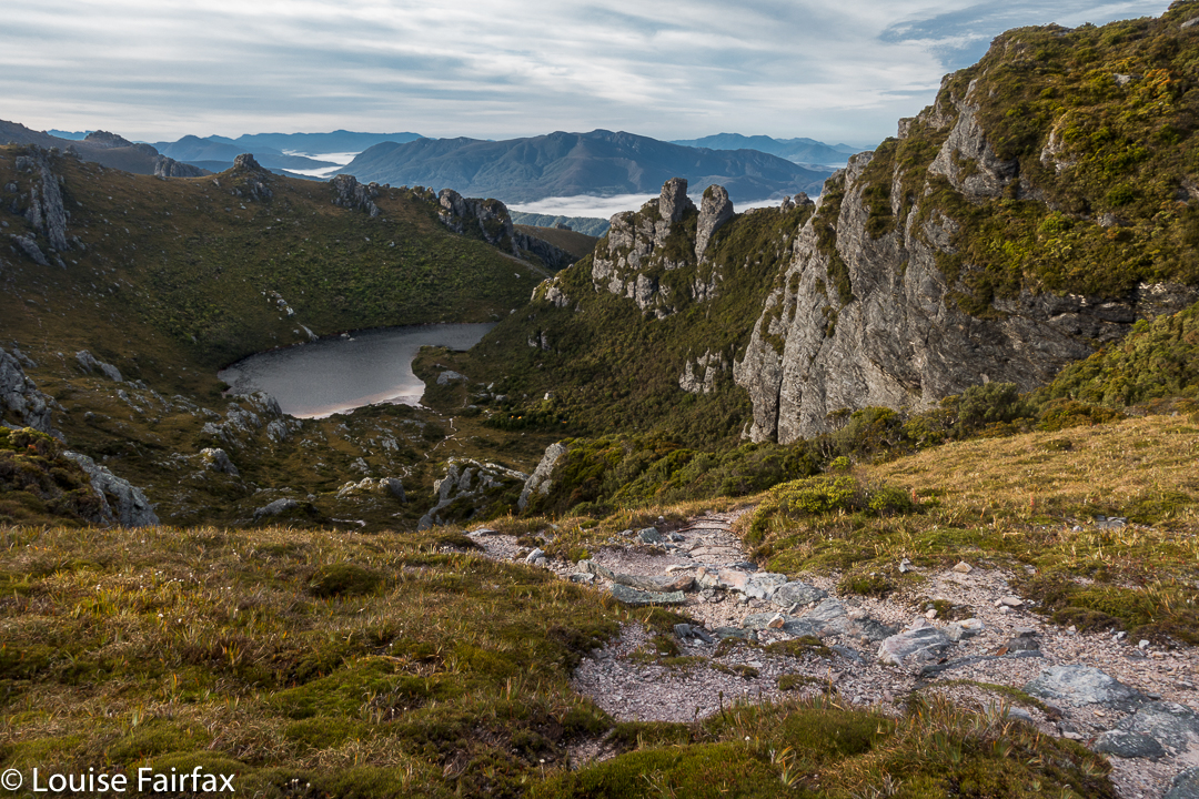
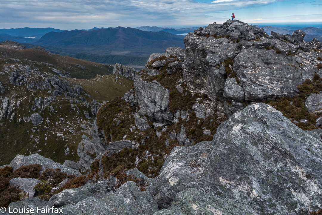
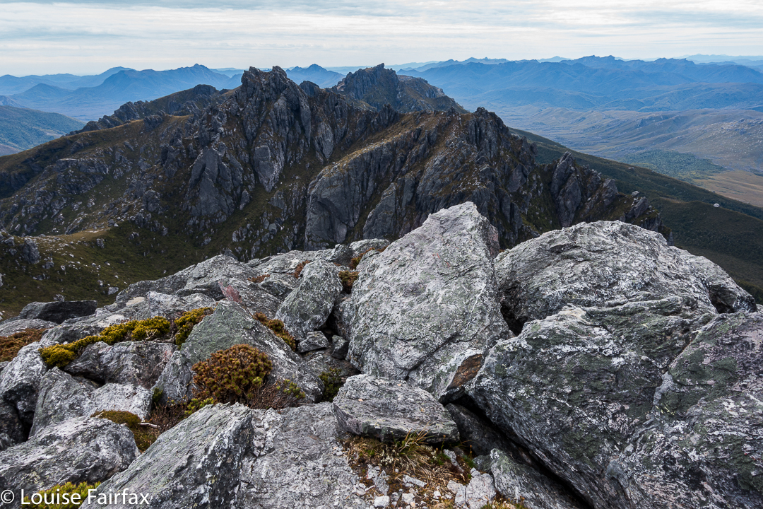
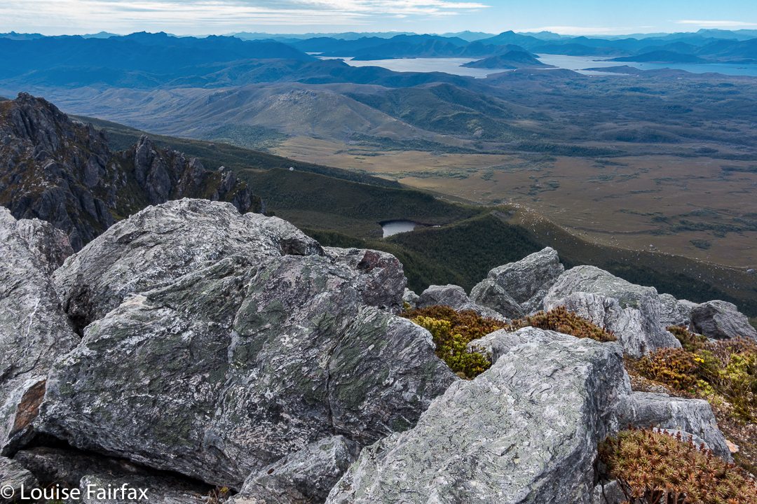
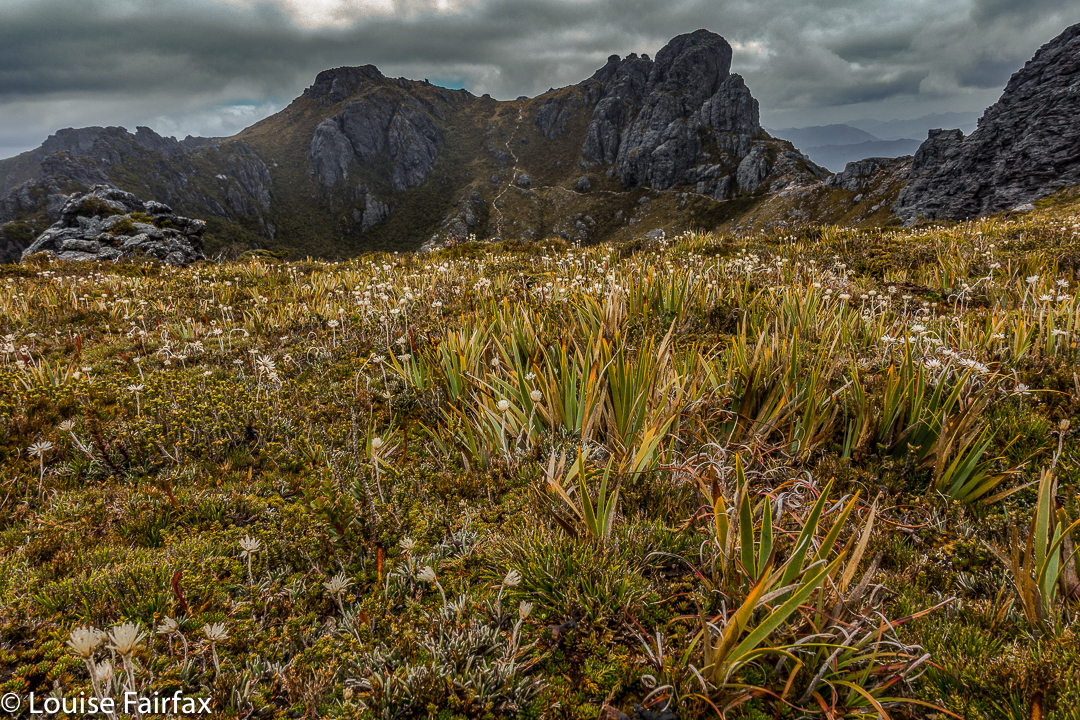
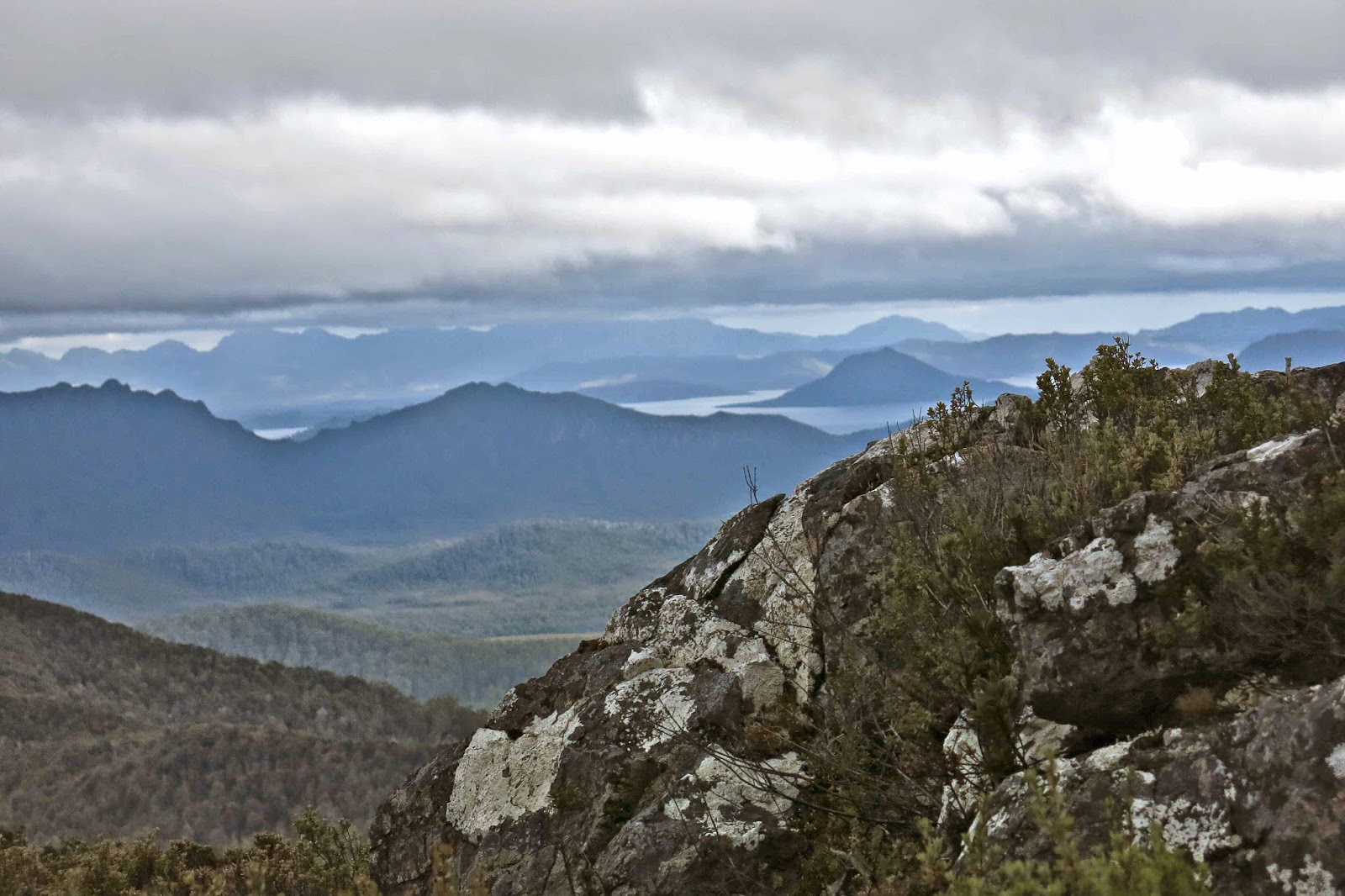
Ambitiously, I chose Bonds Craig. That was before I got a crippling chest infection and before I got news that, given all our recent rain, the Gordon River would be flooded anyway. OK. Plan B. Sharlands Peak. But, with a fever and weakness, I really didn’t think that was possible in two days either. Plan C was Mt Sprent, which I had’t yet climbed. We would hopefully get great views, and it’s just a tiny climb to the top, and even a sick Louise can do a climb that short. I was right. I coughed my way to the top, but had no trouble doing the physical ascending bit.


I picked Kirsten up from the airport on Thursday afternoon, whisked her away while Abby maintained that “Mummy’s NOT going” (how dare we have a girls’ adventure without her), and headed for the south west, with the skies getting increasingly ominous as we drove. At the sign that announced we’d now reached the wilderness area, the rain added its confirmation by bucketing down and the temperature dropped about twenty degrees. We pictured ourselves huddled in some windy shelter having the picnic dinner I’d packed and shivering while at it. Kirsten suggested we check out the Strathgordon Wilderness Lodge. Now, there’s a good idea if ever I heard one. There was room at the inn. In we hopped with glee.


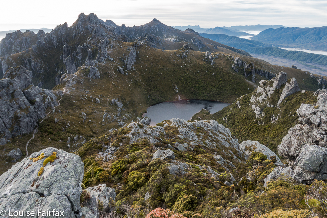
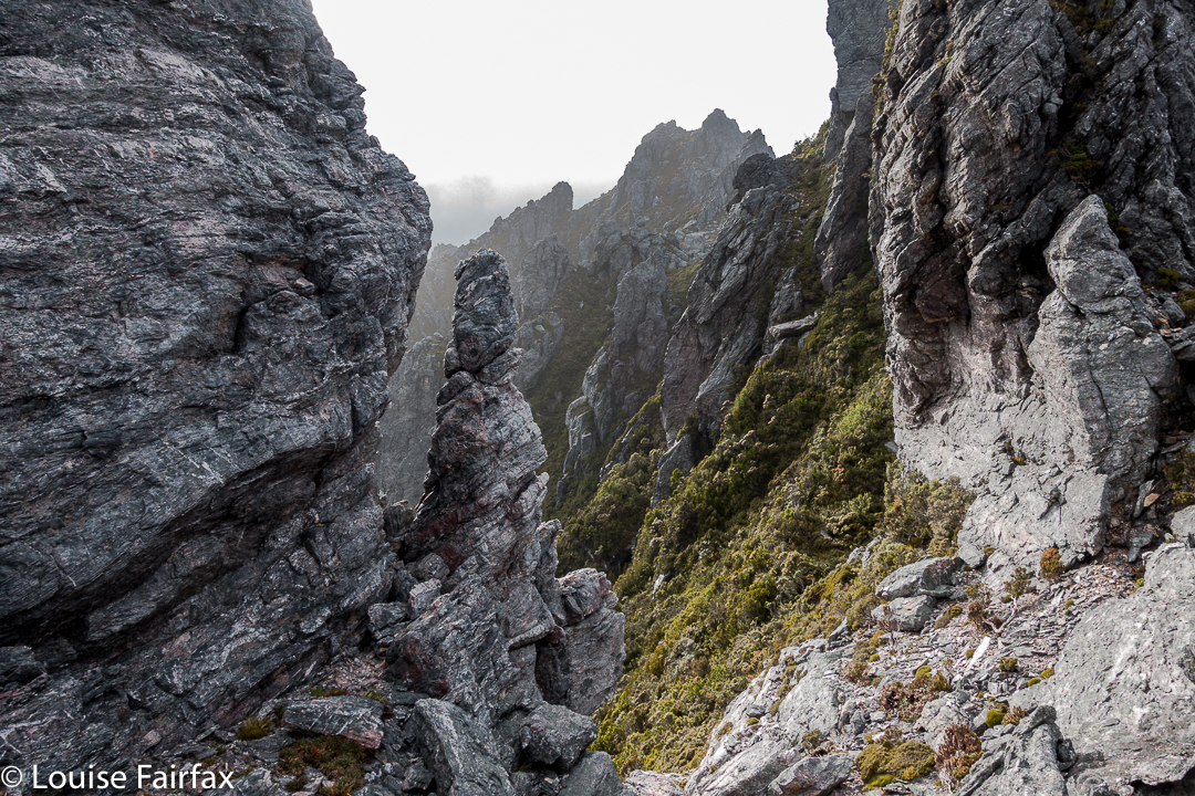
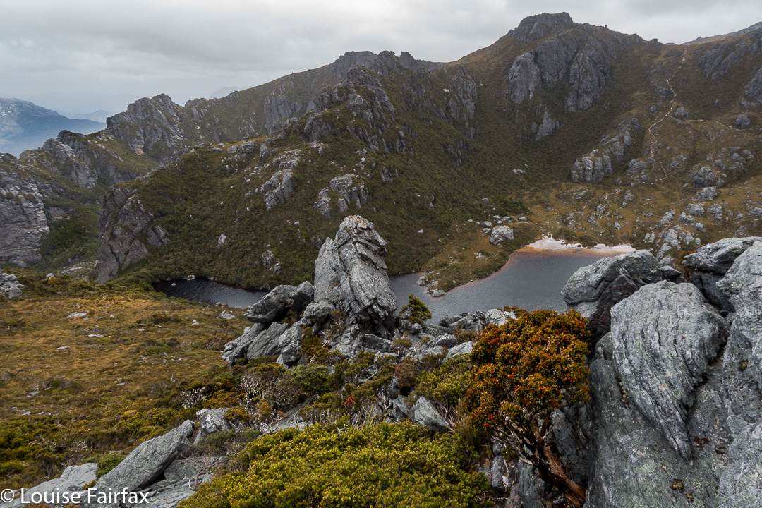
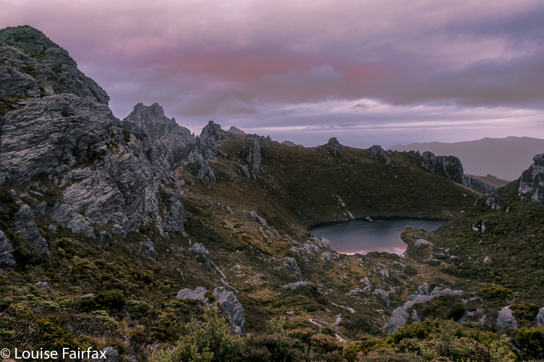
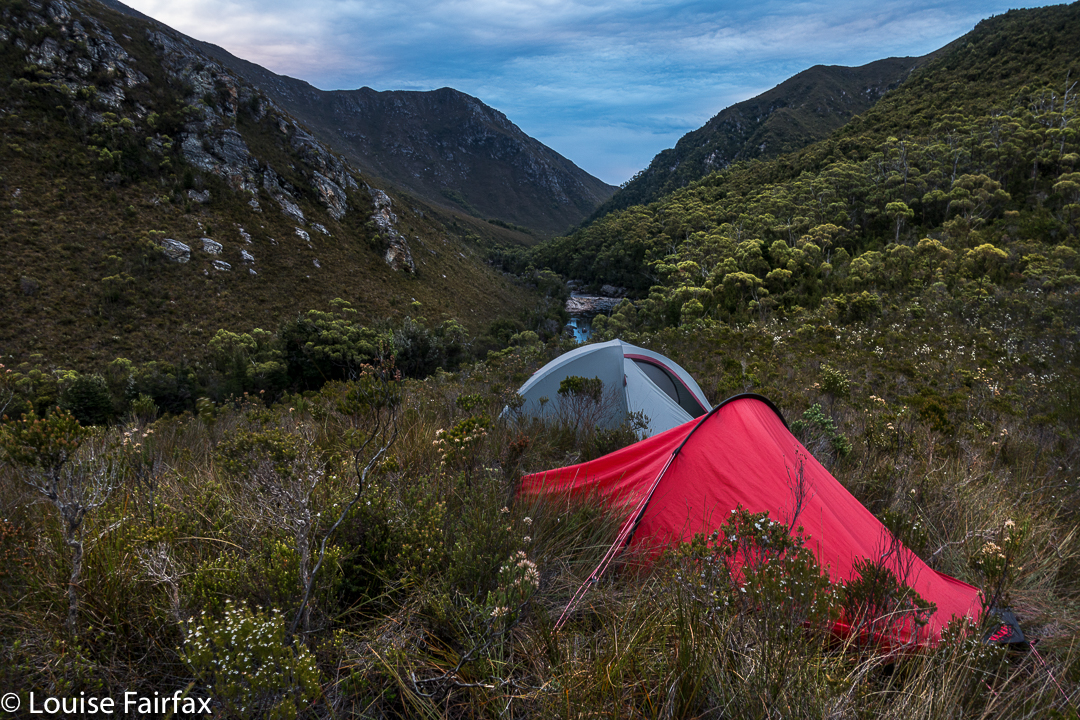
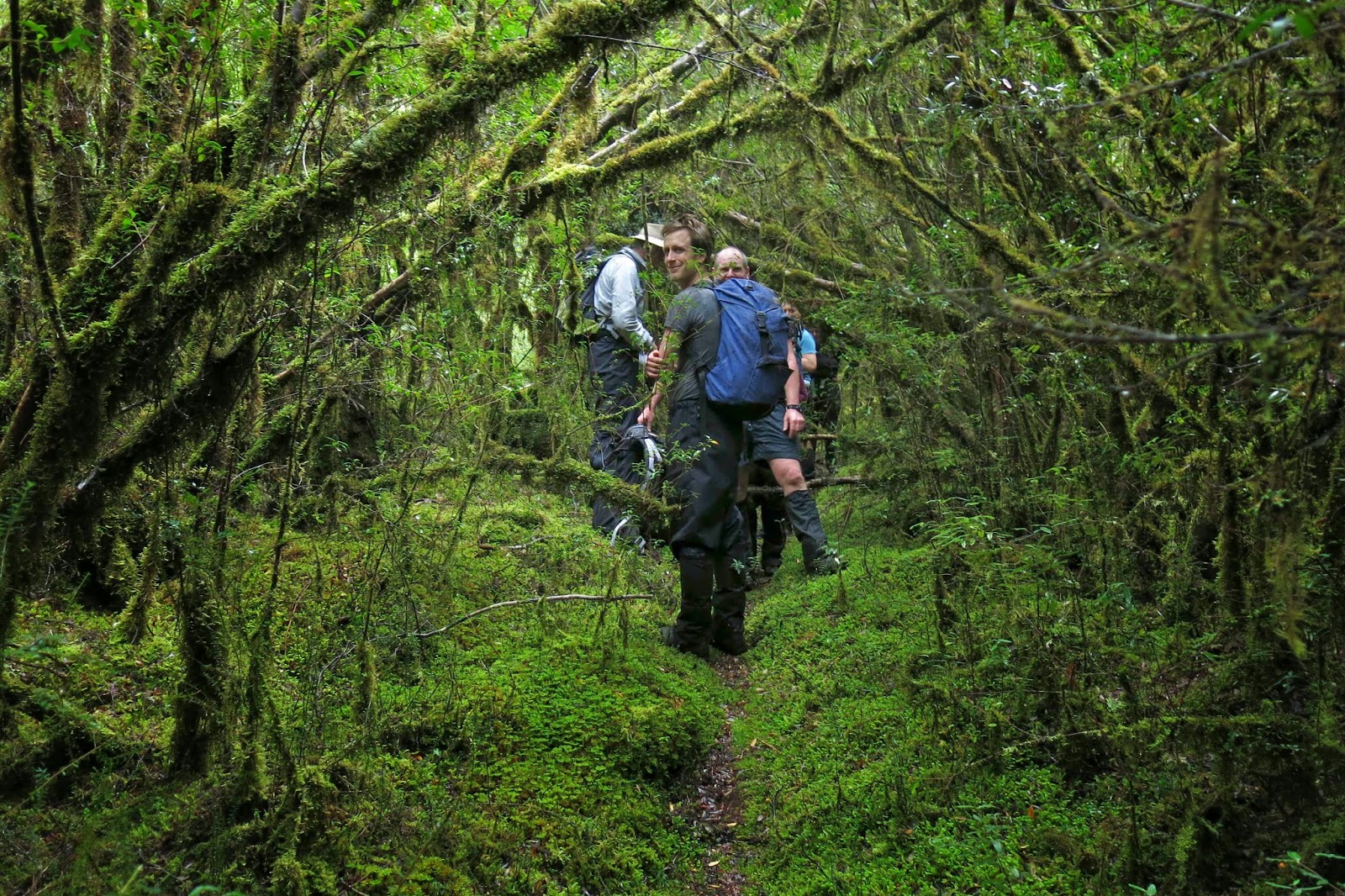
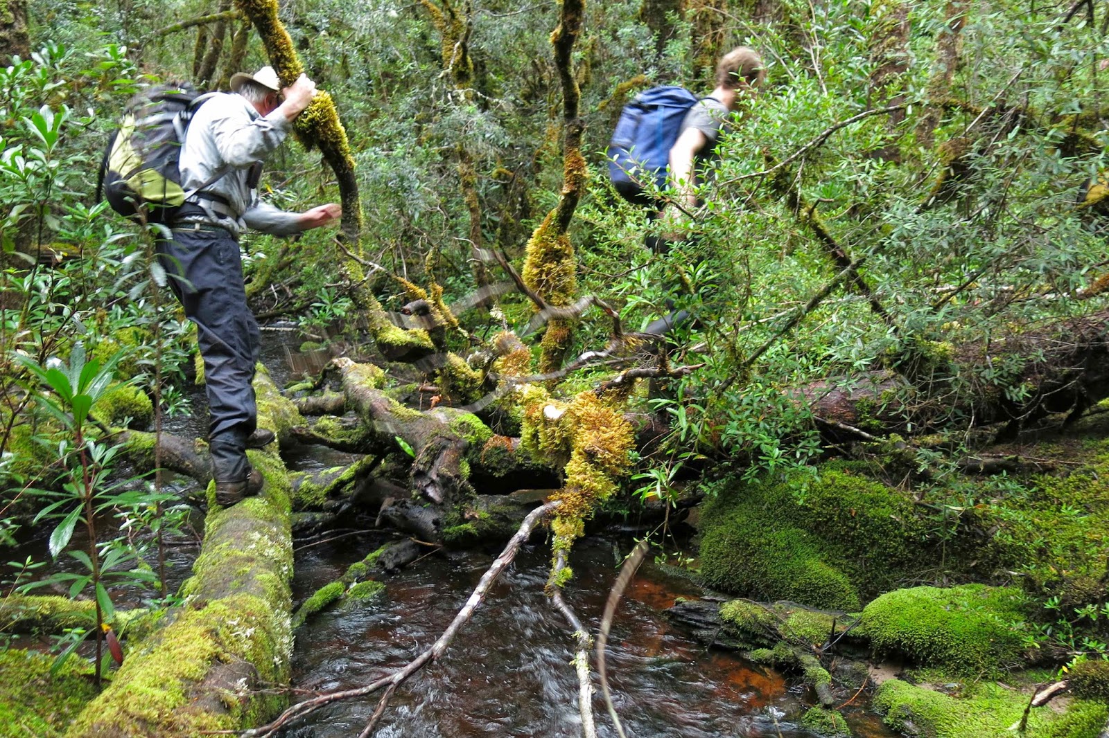
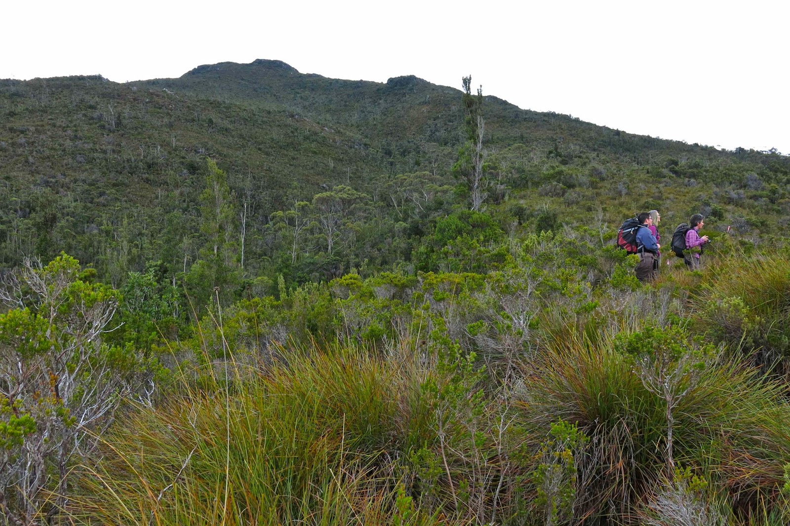
Next morning (Friday, ascent day), it was till bucketing, but the forecast said the water amount would decrease after midday, so we did a rainforest walk and had a picnic lunch so as not to eat in a downpour, and set out in the afternoon. I was right about the shortness of the climb. Even with my illness, we were on the summit in two hours, and had oodles of time to find a spot for our tent on the Wilmot Range before the elements closed back in. Problem: all flat spots were a handspan deep in water, and, of course, all slopey spots were, yes, slopey. We chose the best spot available, which sloped on both the X and Y axes, and practised rolling towards each other and sliding towards the foot end of the tent before thinking about dinner.


We seem to have a bizarre sense of humour, as we found all of this rolling to  be hilarious, and knew we were in for a long night.  Dinner was also a bit of a problem as, since the combination of motherhood and a demanding and fulfilling job has compromised my daughter’s fitness, we were squashing ourselves into my solo Hilleberg which I carried. It’s delightfully spacious for one; for two, well, it is a solo tent. It was cuddly. I found it tricky to cook given the cramped nature of our environs, and the fact that rain was pelting down outside and we had wet gear strewn about the vestibule. I therefore cooked just one dinner which we shared between two, so my special birthday meal was half a dehydrated, rehydrated cottage pie dinner. I thanked my darling daughter for bringing me to a thousand star hotel, and we ate our fare with relish. Pity we couldn’t see any of the thousand stars.
It was, indeed, a long and giggly night. She apologised about the lack of comfort. I explained that I thought that comfort can hardly be considered one of life’s necessities. Given what we, as a family, have experienced and endured over the past few months, I think comfort is a very low priority in life. We had each other and we were happy. Isn’t that all you need?


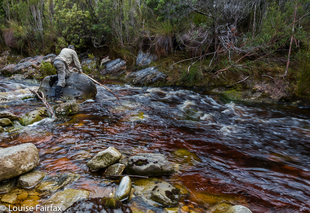
Next morning, we descended, and reappeared at the Strathgordon Lodge in time for some freshly made vanilla slices (YUM) and a hot drink before heading east via some waterfalls to the eagerly awaiting rest of Kirsten’s family. (My second-born daughter was in Africa, so couldn’t join us this year.)

Western Arthurs 2017 Jan. More rain + snow


Most of us who love bushwalking do so because we love nature, and one of the things we love about nature is its ephemerality, and its unpredictability. We can never count on a repetition of a beautiful moment. Its adventitious arrival thrills us precisely because it cannot be arranged or designed by us.


We always feel ourselves particularly blessed to have been allowed to see such a spectacle. But equally, and because we do not get to boss nature around, it sometimes throws weather or events at us that are perhaps not what we would have ordered had we been allowed to do so. We have to accept this aspect of nature as well as the parts we revel in – and, in fact, many of us take a perverse delight in the wild side of nature anyway, knowing it’s part of the whole package that we adore.


Those of us on the recent HWC expedition to the Western Arthurs had to take this on board. Our intention had been to traverse the whole range. For several of us, this was not the first, or even the second, attempt at doing this. First, we had to delay our start by two days because it was snowing and freezing up there, making it unpleasant and even dangerous in spots. And then, while we were up there, new weather reports promised a repetition of this, combined with howling winds. This was not a week to be doing tricky climbing, or to be camping up high. We put our tails between our legs, and retreated, yet again thwarted by the conditions. I don’t mind being out-trumped by nature. I like to think humans are demonstrably not as grand and in control as we presume ourselves to be. Perhaps a little more (and helpful) respect for forces greater than ourselves can emerge from such encounters.


So, what are some results emerging from this weather, other than our turning around and doing yet another descent of Moraine A? Well, all the rain preceding our trip meant that the notoriously muddy Port Davey track was in fine form, with excellent depths of black squelch to be fallen into by the unsuspecting walker, thinking that he or she was stepping onto a piece of ground (wet, black, sodden) like all the other bits of ground. Plomp. In they go. Boots, gaiters, pants all became coated in a thick layer of ooze. I couldn’t pull my overpants off when I got hot as mud filled the zip and it wouldn’t move. Oh well. The positive side of this is that carrying water was unnecessary: it was readily available at almost every step of the journey. (Despite this, tent sites were not too squelchy.)


One had to be very careful about where one pitched one’s tent, as the howling winds announced their presence in rowdy terms. The winds changed direction and force during the night too, catching out certain walkers that we met. Everything became just a little bit more difficult.


It was pretty cold for summer. The lakes did not score swimmers. In fact, my beanie was on my head for almost the whole time – day and night. My coat never came off once, and most of every day I wore both my padded coat and my Event Anorak to keep out the wind. I also wore an icebreaker the entire trip.


I would like to say that a positive aspect of this weather was moody mist and dark, interesting clouds. However, I must say that I found the sky difficult to photograph this trip: it was just a little bit too light, and, as I was on a supposedly long expedition, I hadn’t brought my full frame camera with GND filters to darken things down. I struggled to avoid washed out areas.


I didn’t get to climb any new mountains or tread any new paths, but, hey, a party that only has people you know is not a bad party. I reclimbed things, and explored areas that I knew more thoroughly. I also got to meet new people – both in our group, and amongst the others who happened to be camped near us, or whom we met on the track. Some along the track that I met wanted to complain about the mud, but, really, it is not such a bad thing, as it helps keep the numbers down, and to deter many of the people who couldn’t actually cope with the real Western Arthurs, the high, ferocious, untamed bit “up there”. (The severity of Moraine A also helps in this regard). Take away that mud, attract even larger droves of people in there, and the place will be ruined. It’s already overcrowded to a disturbing degree.


In the course of our trip, we encountered a walker without a map, one without any kind of a rain jacket, people using a kind of tarp-shelter rather than a tent, many people who didn’t own thermal or woollen gear but were relying on cotton garments to keep them warm, people who didn’t own down bags, and many, many people who had no idea of the weather reports. This area is too popular for some of its users’ own good, I fear. If you want to visit the Western Arthurs, do yourself a favour and go to a reputable bushwalking shop to discuss your gear, and please also consult the excellent website run by the Bureau of Meteorology, both before you leave, and in high places when up there, so you can get an update. Knowing what to expect, and reacting appropriately to bad reports, is very important. It goes without saying that a map and compass are essential. This is not continental Europe: there are no cute yellow signs up there, and there are no splashes of red and white paint on rocks. When the mist closes in, it is very easy to get totally disoriented, even with a compass! And once the bad weather arrives, you may not even meet anyone who can help you, as they will be either sheltering in a tent somewhere, or they will have cleared out, to try again another time.

Ripple Mountain 2017 Jan

“What’s your favourite trip?” I heard one of our party being asked. He gave a very similar answer to the one I would have given had I been asked: “Well, it depends on what aspect you’re thinking of. Scenery? Company? Weather? You can have great scenery, for example, but company that’s, well …. “, he gave a dismissive gesture with his hand. “Or, you can have great company, but miss out on the scenery.” I knew exactly what he was getting at. I have been in fabulous scenery, but have not been particularly happy due to the company I was keeping, or, as was the case on Ripple Mountain, I can climb a rotten beast of a hulk, but have great fun as I’ve done it with like-minded crazies who are also prepared to get out there and work hard, defy the elements, and somehow find enjoyment in the whole exercise. The very perversity of climbing something like Ripple Mountain has its own appeal, and when you do it with others, there is a complicit glee, like that had by kids at a midnight feast.


Just to get to the starting line of Ripple Mountain is no easy undertaking: first you have to fly to Melaleuca (South-west Tasmania) by light plane; next, there’s a boat ride through deep wilderness, up the Melaleuca Inlet and across Bathurst Harbour to a landing spot on its north eastern banks. By now, you are in a totally remote and wild area beyond the comprehension of most city dwellers. Finally, you have to walk over some mountains for two days and drop way back down to near sea level on the Old River. Now, you are ready to begin climbing. If it’s raining, what then? You climb anyway. And so, we set out in the mist and light rain, through ultra-thick scrub to climb Ripple Mountain because, well, what else do you do if it’s raining?


If I tell you we took six hours to cover 3.5 kms horizontal distance, with only 700ms vertical climb, that should give you a pretty good indication of the nature of Ripple Mountain, before I even begin to describe the day. Now, I have mentioned the light rain without indicating that the rivers and tributaries in the area were now somewhat flooded. Our first obstacle for the day was an integral part of these conditions: a fast-running creek of unknown depth and strength, which fed into the Old River, beside which we were camped. We found a narrow crossing point. The water looked strong, but not too deep. We took off our socks, put back on the boots and gaiters for protection, found ourselves each a nice long pole for balance, and tried our luck with the waters. They were strong; we inched slowly across (most of us) to make sure we didn’t slip or get bowled over, and were soon enough over the other side. Now began the real work.


We worked hard for 6 hours (up) to get this view
Ripple Mountain is a steep and scrubby affair: it’s a “dirt-in-your-face” kind of steep, where you use all four limbs to haul yourself up for hours … but that’s not all. It protects itself with an ingenious palisade of very thick scrub, the sort of scrub where, if a lightweight like me pushes at it, nothing happens. Even Dale, not a lightweight, could thrust his body energetically against it and have it move only a minute amount. Michael, our tallest member, was thus appointed to take on the worst of it. He did an amazing – an unbelievable – job of pushing away bauera and banksia to let the rest of us through in his wake. There is no way I would or could climb this mountain without the others – and no way I would want to. I was not here for points. On this occasion, given the weather, I was not even here for a summit view. I was here for “fun”, because I am so deficient in understanding that I think that getting myself covered in dirt and scratches, that hauling myself up for hours with friends who are doing the same, constitutes a good time.


We surmised that Ripple Mountain got its name from the seemingly endless waves of scrub that define the final ridge. As Matt pointed out: it did not get it from any ripple of applause.
We had lunch on a knob where the land flattened out a bit, thinking that, with only 1.2 kms to go, and negligible climb left, we’d be about another hour. Wrong. We were still a tad over two hours off our destination. I started to be very glad that we’d packed head torches, and was mentally prepared for a descent in the dark.


The Old River, beside which (nearly) we were camped, and across which we needed to go if we were to climb Harrys Bluff next day. The water, I should add, was very cold. Even on a hot day, no girl went swimming.
You will be thrilled to learn, if anticipating an ascent of this uncouth mongrel, that the final seven minutes are delightful walking, where you get to put one foot in front of the other in an upright stance, fighting nothing to gain the summit. I think from its position, geographically speaking, it must offer fantastic views. I saw a few blades of button grass from the top – and the friends with whom I climbed. The trip down was very speedy, done in only half the ascent time, not only due to the fact that we were no longer fighting gravity, but also to the excellent passage that Mike had made for us on his way up. We named our ridge “Mike’s Ridge”. All up, it was an 11.5 hour day, 8.75 hours of which were spent moiling forwards.

I didn’t track this one, but my friend did. When I get a picture of our route, I’ll post it here for those who love map-staring.

Western Arthurs 2016 Feb (in the rain)

Western Arthurs in the rain: Paddy Pallin once wrote words to the effect that one of the aspects of bushwalking he loved was the way it intensified normal existence (my words) and made him newly appreciative of life’s little pleasures. A glass of wine by an open fire is twice as good after a period of deprivation. A bushwalker never takes the joy of a hot shower for granted. The simple things of life retain their power to delight.

And so it was for Angela and me as we sat in The Possum Shed having lunch yesterday. Once we’d descended Moraine A, Angela looked at her watch and announced we could make it to Westerway for lunch. I agreed. She was away, splashing through all the puddles, not caring about mud holes. Zoom. I trotted behind, somewhat laden with my tripod, glass filters and heavy camera. Our packs were now weighty with all our wet gear, but that did not deter. The thought of real, hot, delicious food, consumed in pleasant surroundings spurred us on. It certainly felt good to be there at last and announce to our husbands that we’d be home early. During the night, I had greatly feared that the river at the track junction would be uncrossable, so much rain had fallen, so was doubly relieved. We might have been there for days; I had saved food accordingly.

This trip marked the end of Angela’s long summer holiday. She’d taken a month off work so as to climb Federation and do the whole Western Arthurs Traverse. Through a series of mishaps – disappointing cancellations, fires, bad weather and injuries – these hopes had been greatly diminished. We had still done a number of great climbs, but not the ones intended, and now the Western Arthurs were being reduced to a mere three-day expedition due to weather and my dubious foot. Angela has not explored this region, so was excited even by the reduced agenda. Now she has been there but seen next to nothing.

Unfortunately on day one, Angela was adding another chapter to her book on Summits to Spew on (it had been very hot climbing), so I killed the hours at my disposal once we had selected our campspots, climbing lumps and bumps and photographing, although the light was very dull and flat. Disappointed, I retired to my tent, and watched the grey, matt landscape as I cooked and ate dinner, before going back out to try my luck – returning with a few shots that didn’t match my expectations. I sat staring at the scenery in a trance, waiting for darkness and bedtime. I had by this time, of course, packed up my tripod and GND filters, and put my camera to bed. Suddenly, a flash of colour penetrated my vague awareness. Mt Hesperus was aglow with the final rays of the day which had somehow (and most unexpectedly) pierced through a hole in the thick amassing cloud.

I had no time to alter settings or do anything. I grabbed my camera and shot and hoped. It lasted. I quickly changed ISO, f-stop, exposure and shot again, a woman possessed. It was still there. I had to get outside. I grabbed my boots, no time for laces, and shuffled outside to face the west. There was no time to set up, so I used a passing rock as a tripod and hoped for the best, sighing at the wasted effort of lugging all my equipment up moraine A to now have it sitting in my tent in my moment of need. The sudden flash of colour had woken Angela, so she joined me to share the beauty, and take pleasure in the fabulous scene that was our gift that evening.

By the second day, the rain had set in, but we donned our gear and headed for mountains to climb. The heavy rain, gusting, strong wind, slippery rocks and dark gloom changed our minds regarding our purpose, and we turned our spree into a walk to Square Lake and back. It was time to enjoy the minutiae of nature. The pinky-grey quartzite, green cushion plants and dislimned shapes that appeared and disappeared as we progressed gave us pleasure. It was nice to be moving. The denizens of the ten tents at Lake Cygnus were all tucked up in bed, but that is not our style. The price we paid for our excursion was to return to the tents drenched. Thoroughly, hideously sopping, I peeled off my disgusting layers, dropped them on the floor of my vestibule, and entered the dry inner sanctum of my aegis. After some effort, I was in dry clothes, snug in my sleeping bag, eating lunch with one hand poked out into the open, hoping that Angela didn’t want to begin our journey out after lunch. She didn’t. We spent the afternoon contemplating the existential pleasure of warmth and dryness.

On the third and final day, it was time to put on those tossed, detested items of clothing, a thought that had plagued me during the night, when I wasn’t practising drowning at the hands of a swollen river. It rained while we depitched, but things couldn’t get any worse. Rain was now, quite literally, water off a duck’s back. The track was a ribbon of water, across the grey-green moor, and two sodden girls went walking, walking, walking, two sodden girls went walking, right to the mountain door.


Bowes 2014 May

Mt Bowes May 2014
Entoloma rodwayii.

Mt Bowes is in the south-west, so it must, by definition, be a good mountain. As soon as I saw it on the programme I signed up.

Possibly Cortinarius levendulensis
The forecast was for a pretty dismal day – and yet fourteen of us turned up to brave it; I packed more layers and coats than for a summer’s multi-day expedition, and heaps of food in case the 4.30 a.m. start that I’d need to meet the others in Hobart at 7 would leave me more peckish than usual during the day. (It did. I was craving lunch by 10 a.m.)

Our track – not always as easy to see as this bit here! 

My mental image of what lay in store was, I guess, informed by trips to the nearby Western Arthurs: I imagined a lengthy phase of muddy button-grass plain ceding to alpine vegetation once we’d gained height. Wrong.

Having parked at the locked boom gate (en route to Mt Mueller) and swallowed the 500 ms or so of road to the cairn that marks the start of the pad, we entered the domain of melaleuca and leptospermum scrub, complete with requisite muddy pools of unknown depth to dirty our boots and gaiters. This section, however, was short – perhaps a kilometre  long – after which we entered quintessential Tolkien country, with sentinel Ents in every direction, fabulous guardians of the sylvan domains. The forest was very different to that of my normal bushwalking diet, which features huge myrtles and fatter trees; here the trees had quite narrow trunks. The bark underneath was invisible, as all wood seemed covered in a rich coating of vibrant green moss, with hairy lichen-beards hanging from horizontal surfaces. Colourful and abundant fungi were, of course, a distraction – so much so that we hardly saw our leader at all on the outward journey: he was too busy bowing obeisance to the fungi, his camera held in a suspicious position. Tannin-stained creeks, pure and gently flowing, were crossed by natural bridges made from fallen trunks.

I learned that this pad was originally the path cut by Edward Alexander Marsden in 1898, and is part of the original and much larger track going from Port Davey all the way to Fitzgerald – a very long distance – intended as an escape route for shipwrecked sailors. Snooping around the web, I have since picked up that the Port Davey track was used in 1914 to check out a rumour that a German submarine was lurking in Bathurst Harbour, intent on destroying troop ships as they rounded the coast. At that date, the track hadn’t been used since a 1905 shipwreck.

After many wonderful kilometres of this rainforested beauty, we were in a position to diverge from this path and begin the climb proper (still adorned with pink tape [mostly], but it was quite hard to find evidence of human wear on the ground). The quite steep rise was made more taxing by the presence of waist-high bauera and other bushes to keep us honest in our efforts. It took longer than I expected to reach the summit. Once up, we found a small depression out of the wind, which was necessary, as most of us had become wet from the morning of pushing through wet bushes plus the sweat generated by a healthy workout on the way up. Like a magician pulling rabbits from a hat, I seemed to amuse some by the number of coats and layers that I extracted from my pack to cope with the fact that we now had to stop moving. Like little Michelin men, we sat on top eating and looking at our hard-won view of half-disclosed mountains and a grey, moody Lake Pedder way below. The vista was tantalisingly full of promises that would not be kept on this day.

There she is at last: our mountain.
I must return when there’s a better forecast, as, even on a dull day with light sprinkle and smudged, detail-less mountains, it was magic. Just imagine what it could be if the sun shone and the mountains were well defined. I will be back!

Summit view

Beautiful quartzite on top