Tarkine: Nelson Bay R Falls, Elver Falls 2021

Tarkine: Nelson Bay Falls, Elver Falls, fungi and flowers.

Sunrise at Stanley, the start of a very long day

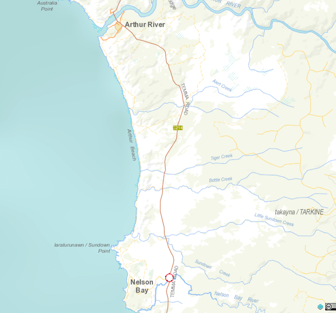
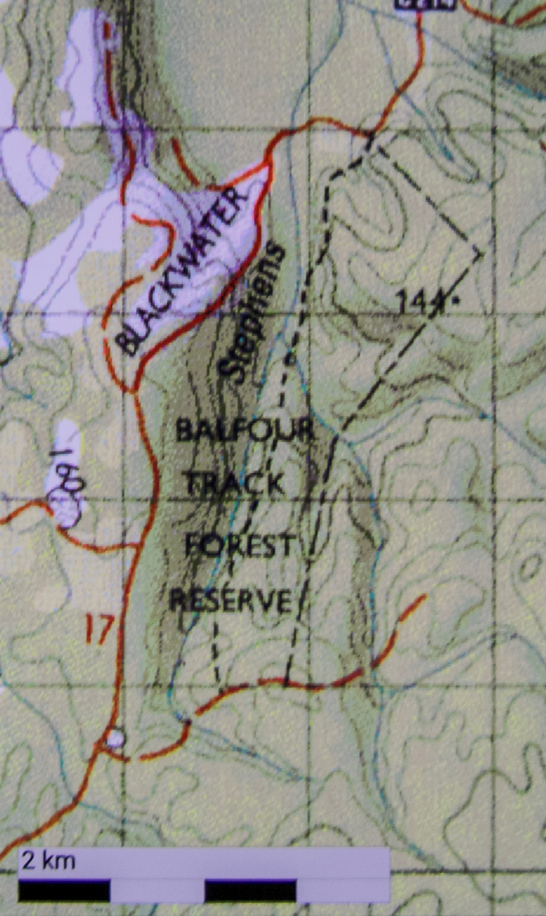
It seems I am a girl who drove a very long way for something that never happened, as the reason I went to the Tarkine was to kayak to the Elver Falls. However, when I got to Arthur River “township”, I couldn’t raise the people who hired out the boats (the river cruise man said they probably hadn’t put their hearing aids in yet). The shed in which the boat was hiding looked as if it needed  a lot more than a hearing aid.

Of course I had to photograph the Nut

The images available around the shed were of very elderly canoes, not of kayaks at all, and they looked a little like tubs. The wind was up and my broken wrist is only just out of its cage. My spirit of adventure was thus not high. I was prepared to kayak but canoeing made me uncertain, and I really felt uneasy in this state about popping my expensive camera gear in such a vessel. I had been very happy at Corinna, where the kayaks had a waterproof hold, and where everything seemed in excellent condition, but Arthur River ‘town’ just wasn’t doing it for me.

First kayak substitute: The Edge of the World, Arthur River

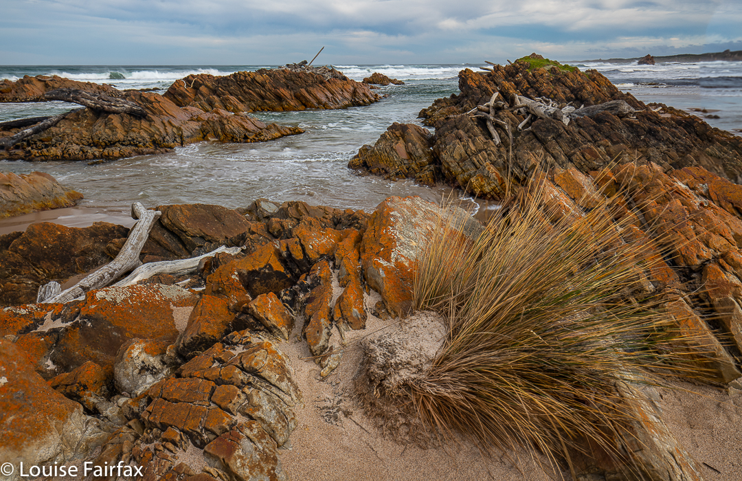
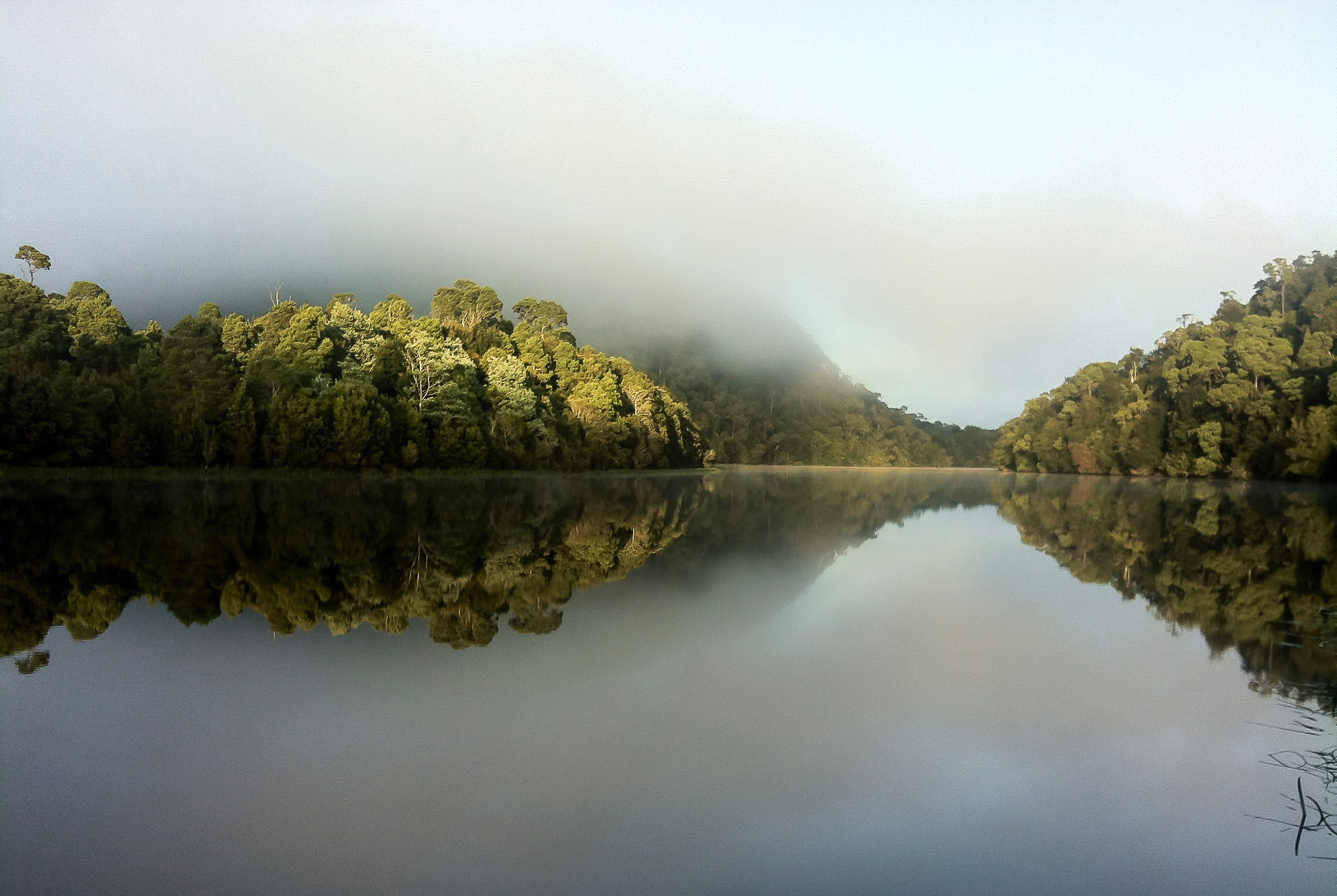
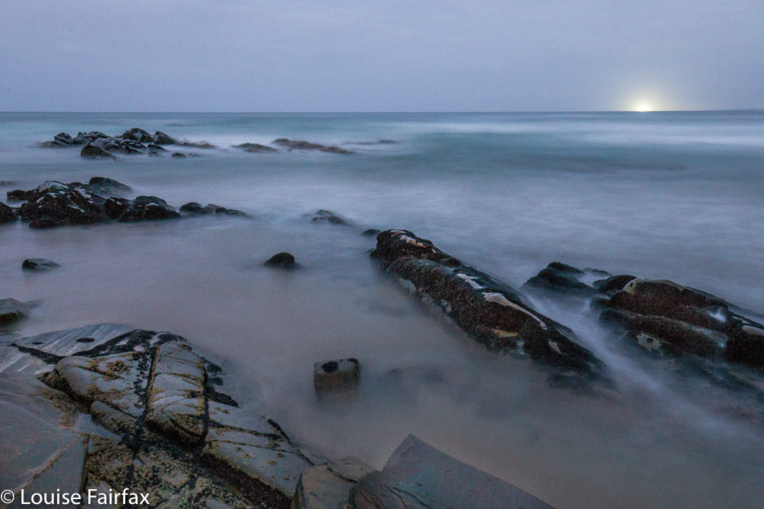
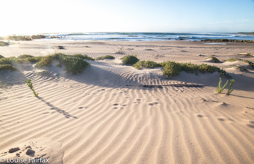
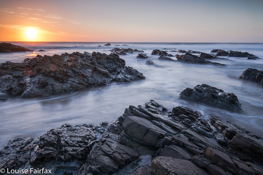
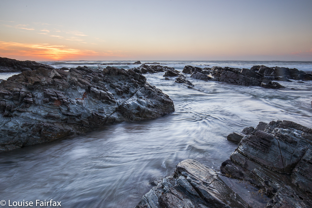
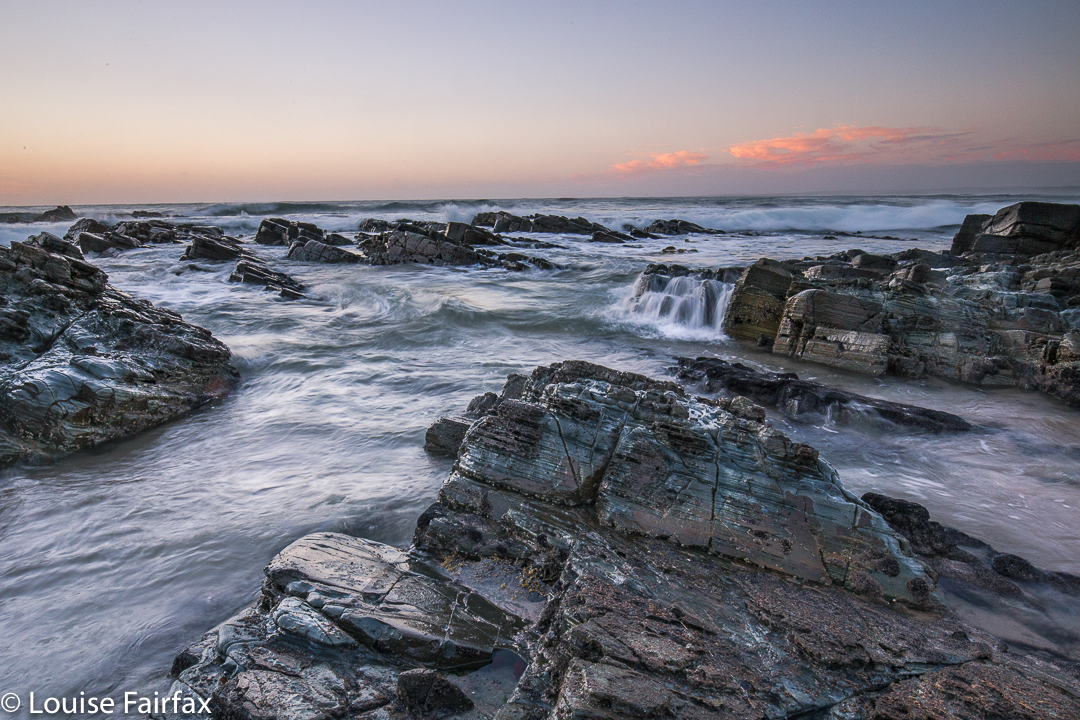
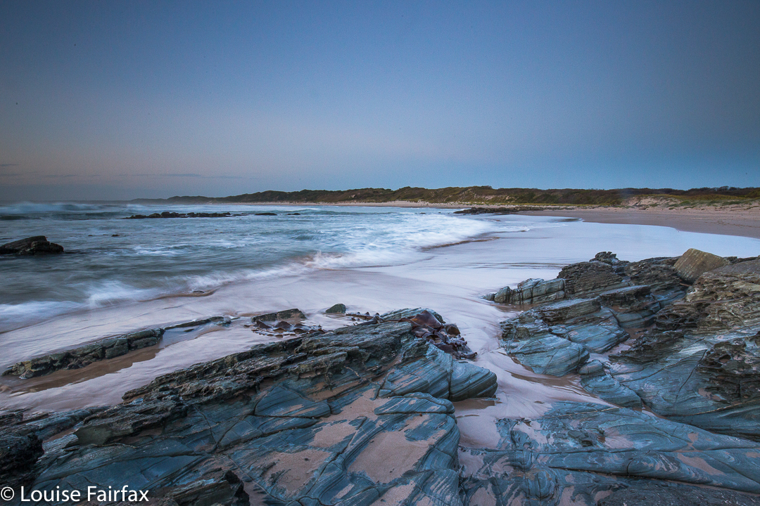
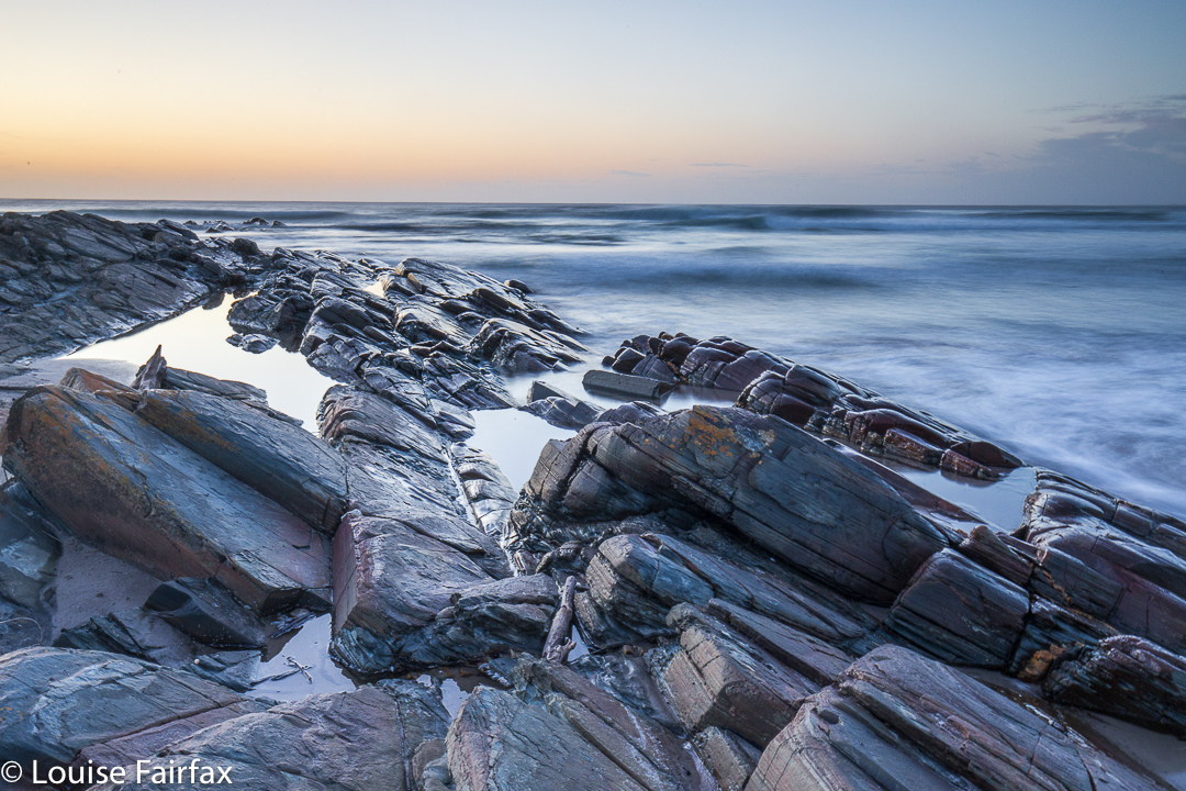
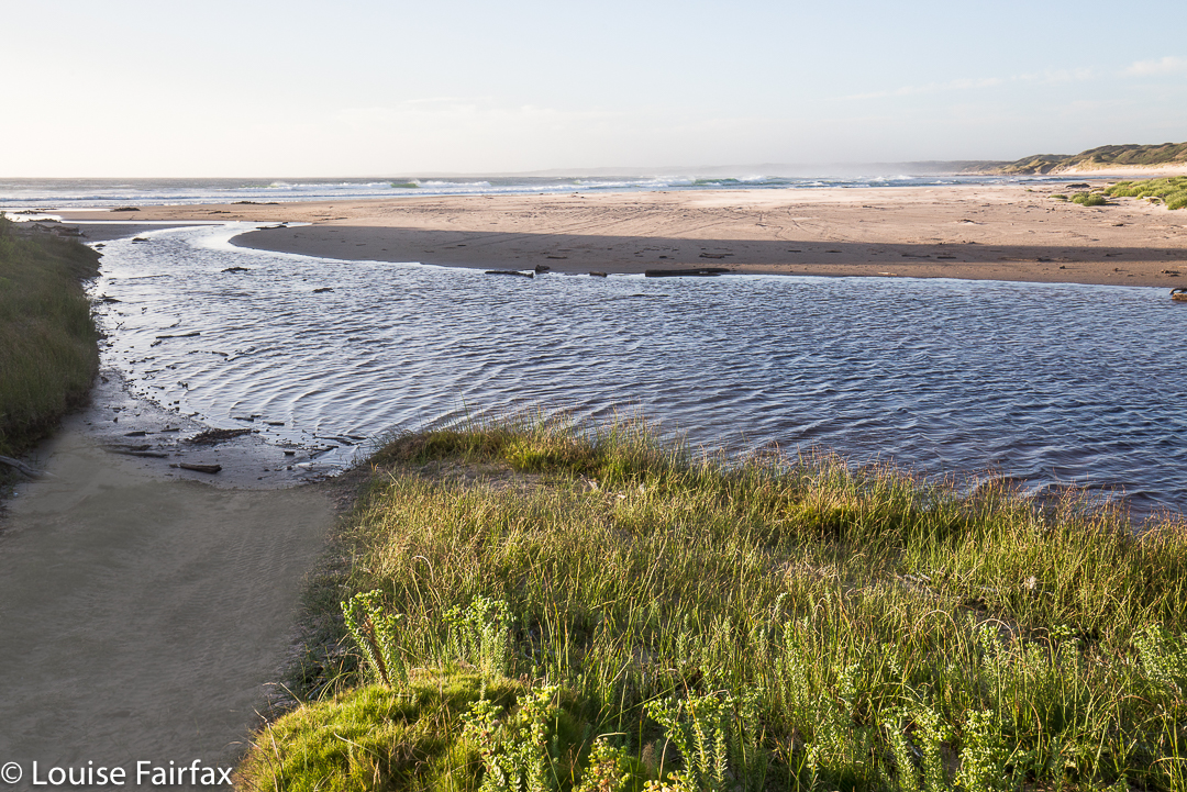
So, instead of kayaking, I went for a walk along a beach possibly more than appropriately dubbed ‘The Edge of the World’. It was remote, windy and atmospheric. The rocks were fabulous colours, and, as I enjoy wild seas, this substitute pleased. As usual for the Tarkine, however, I needed to get moving, as I didn’t want to eat greasies at Arthur River when lunchtime came, so needed to get somewhere that sold something more nutritious and tasty by late lunch.

Nelson Bay River Falls

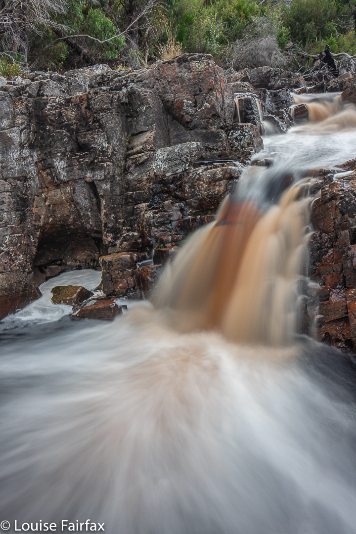
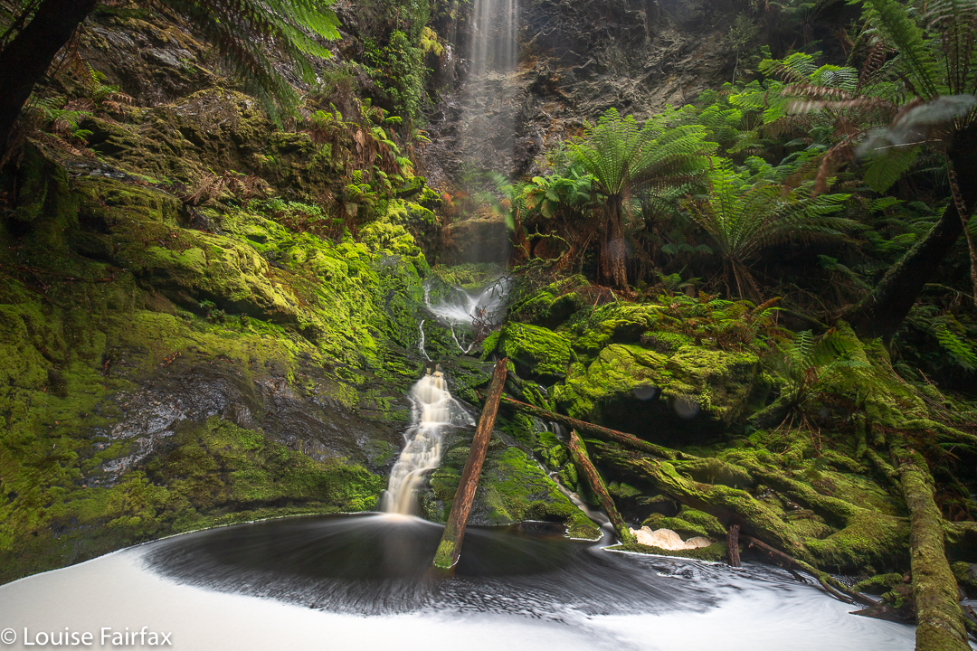
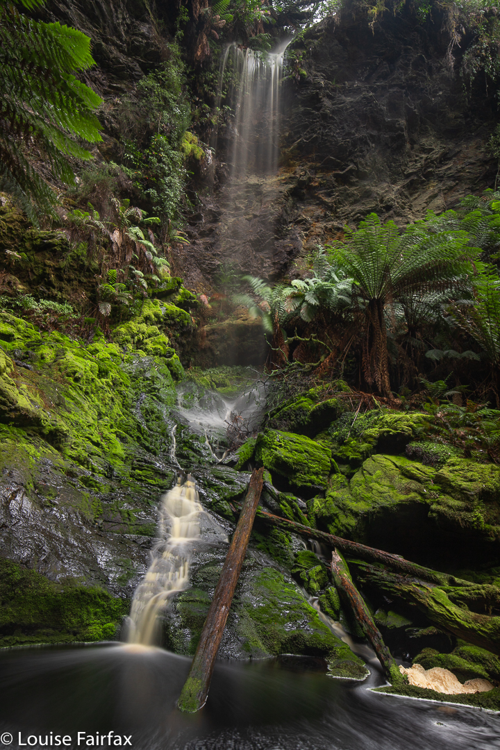
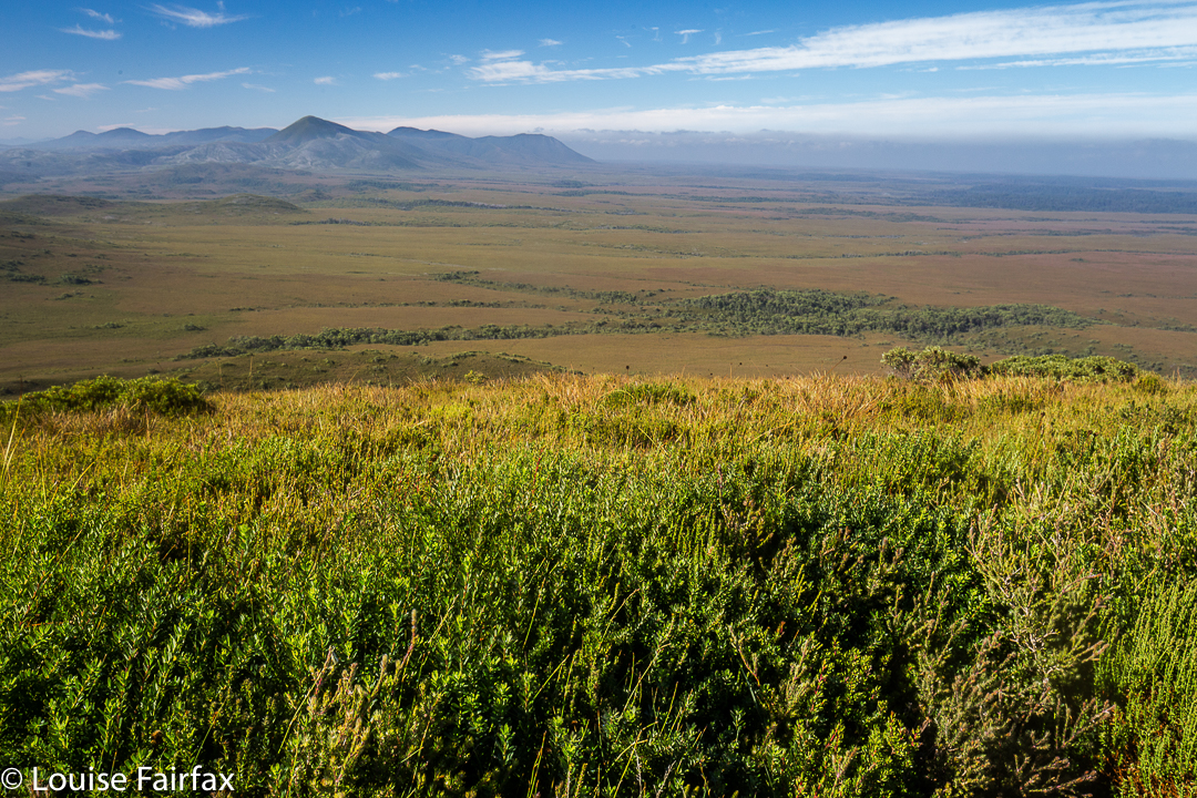
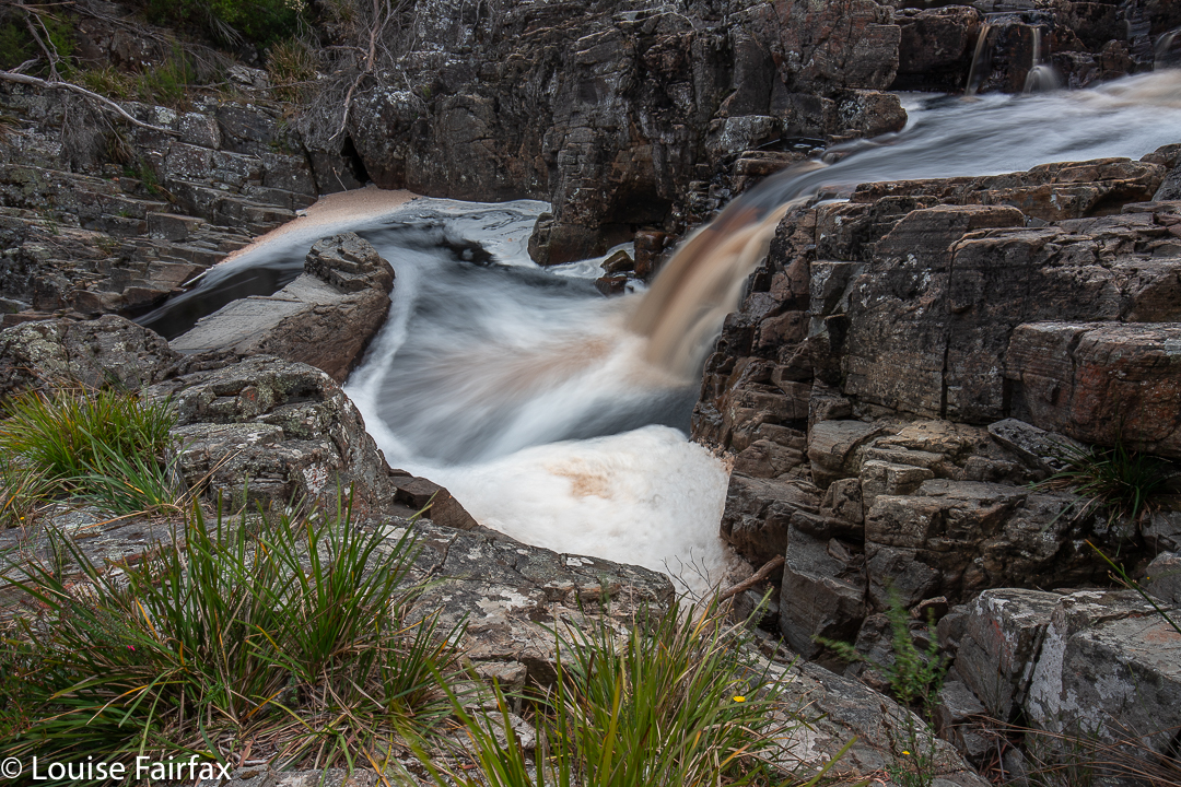
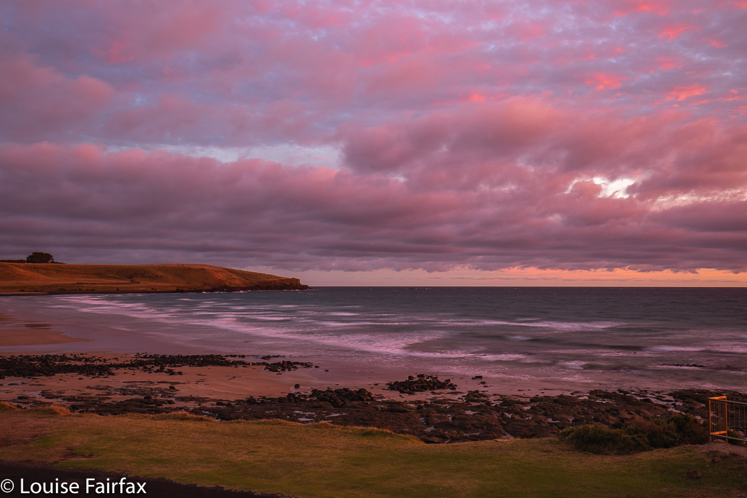
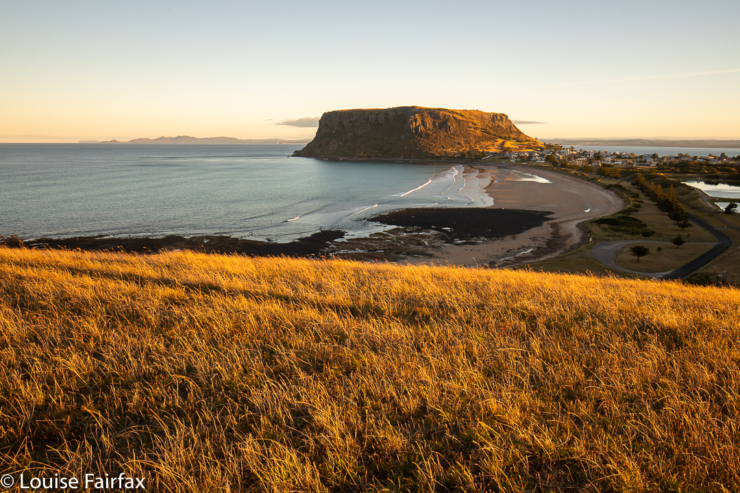
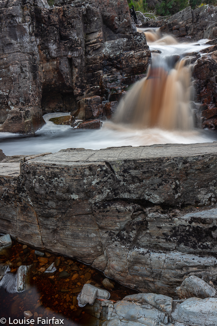
South I drove, lamenting the fact that one seems to do far more driving than walking in the Tarkine, until I reached the Nelson Bay River, which sports a pretty waterfall within a stone’s throw (literally) of the bridge. I got to walk at least twelve paces at this spot. Luckily Tessie and I had had a lovely long walk on the beach at Stanley after breakfast, before leaving, so the day, which didn’t seem to be shaping up too well at this stage, wasn’t entirely devoid of exercise.

Nelson Bay River Falls

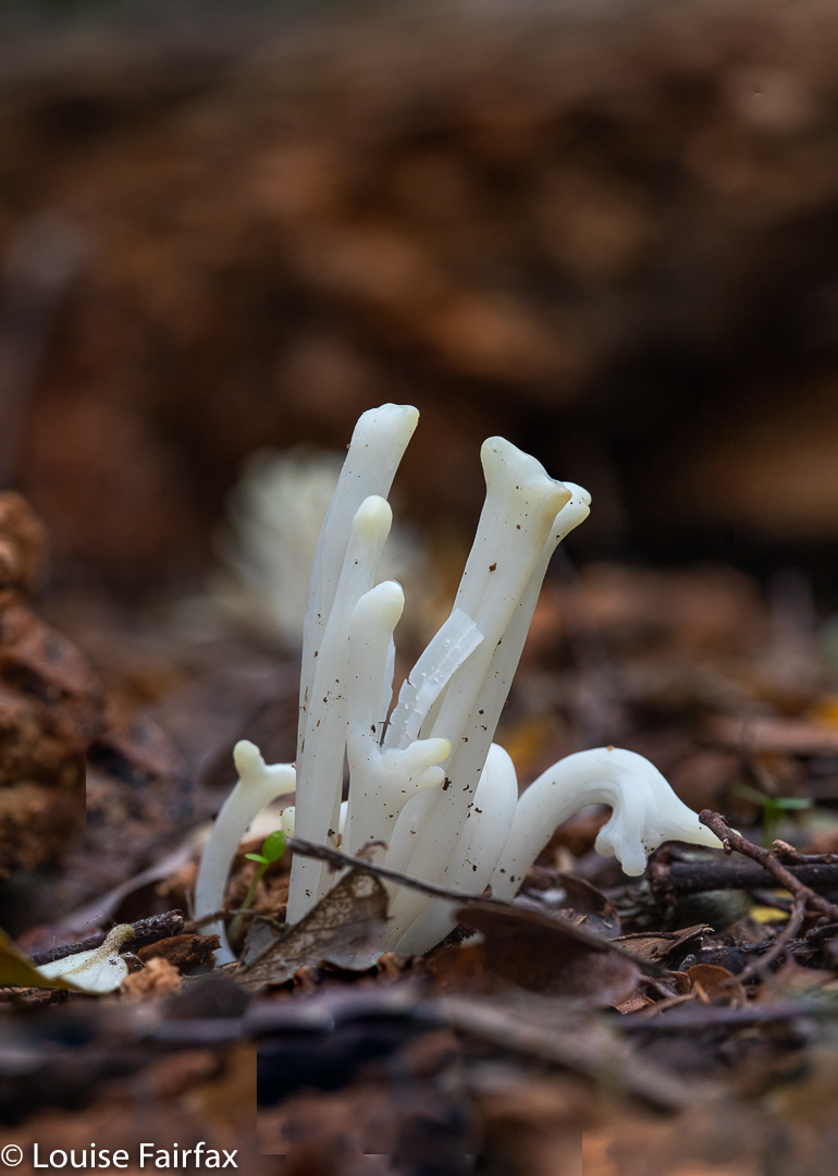
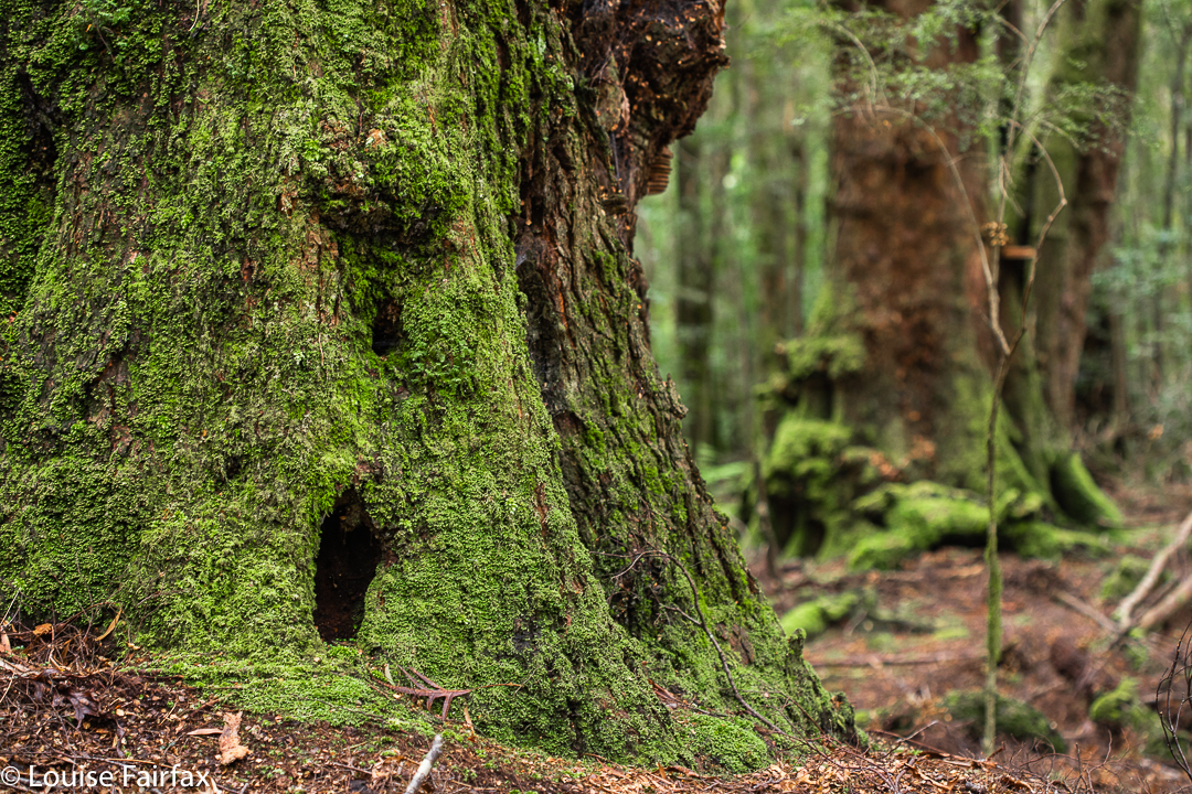
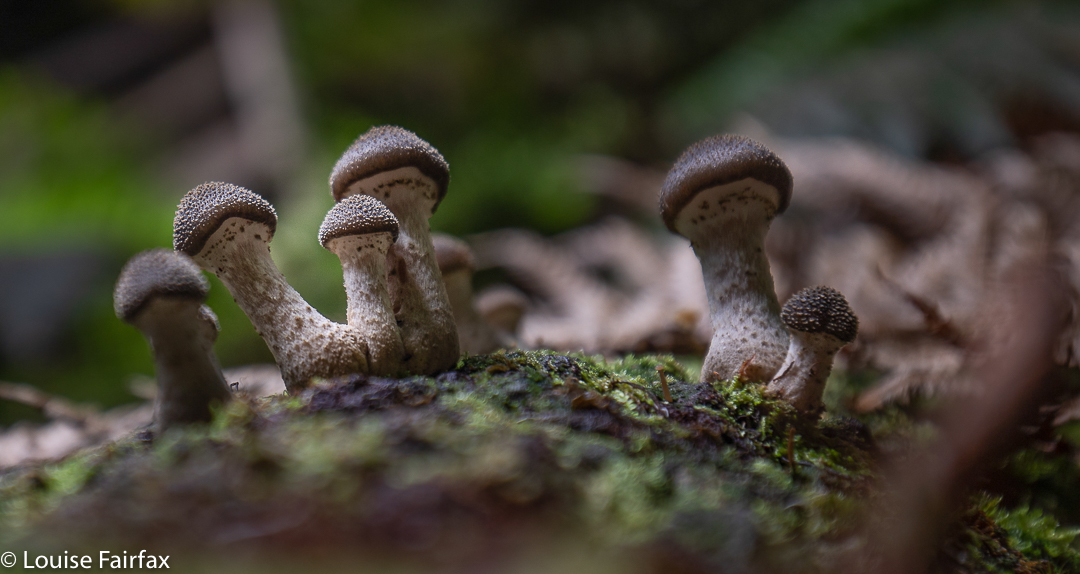
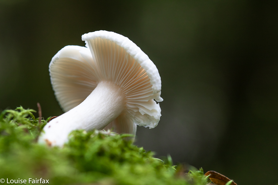
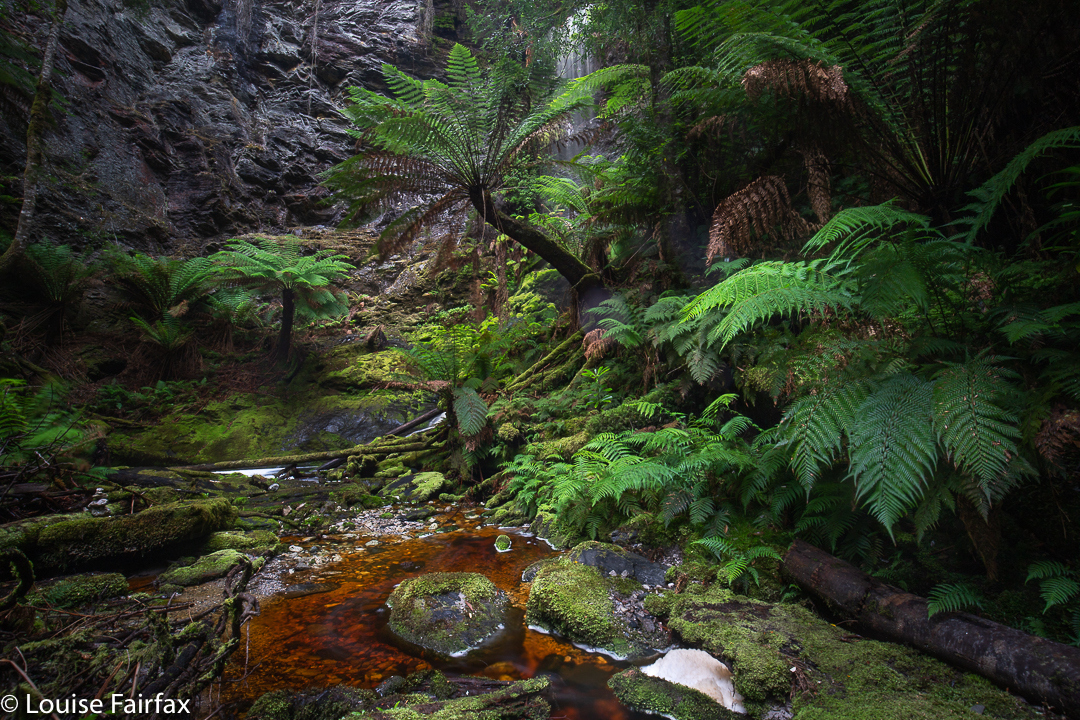
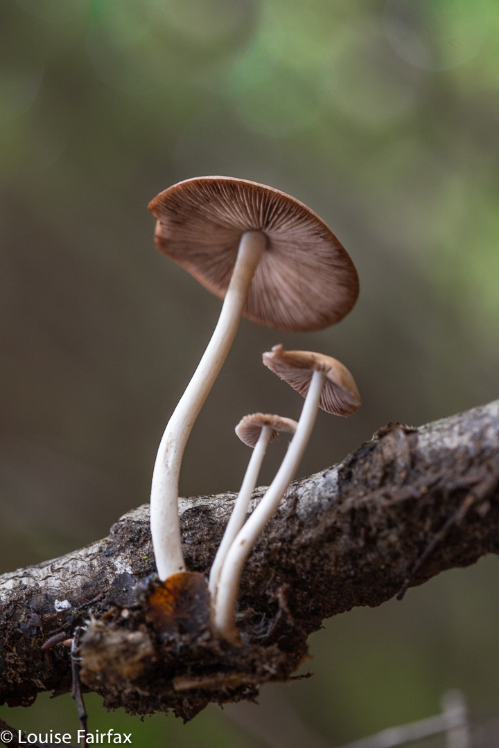
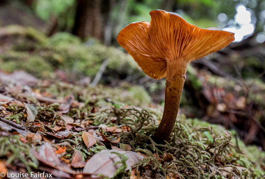
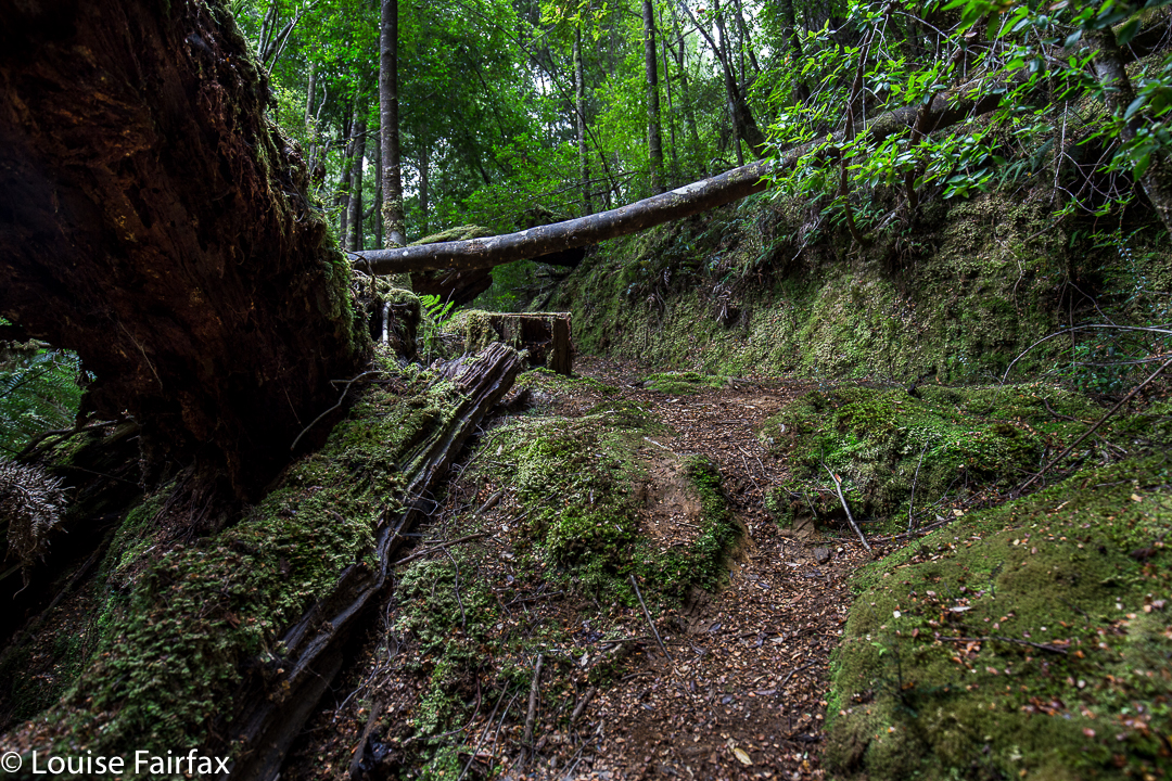
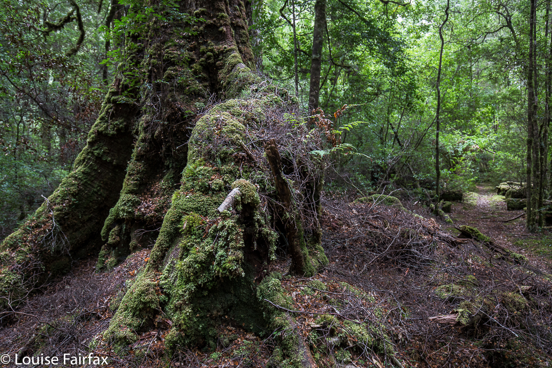
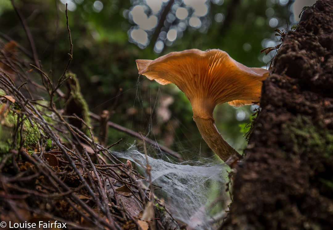
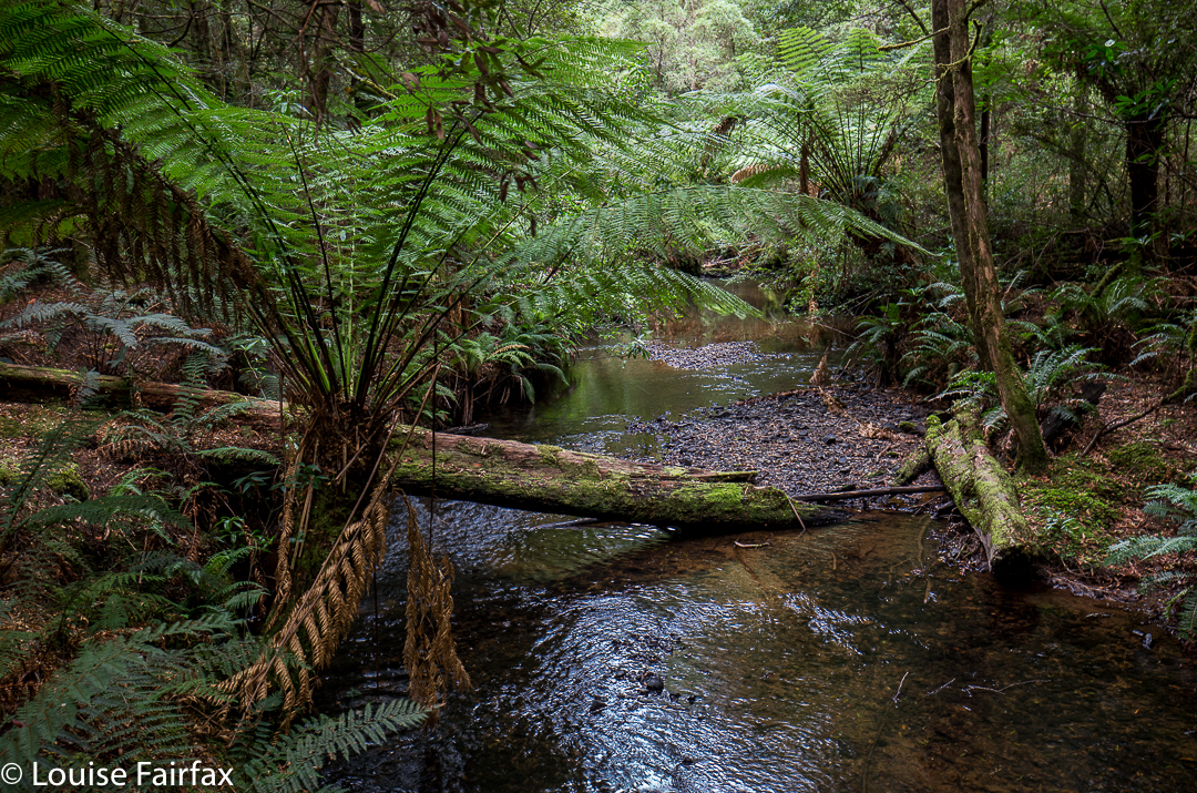
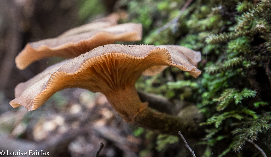
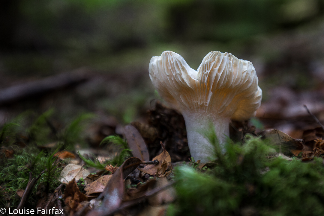
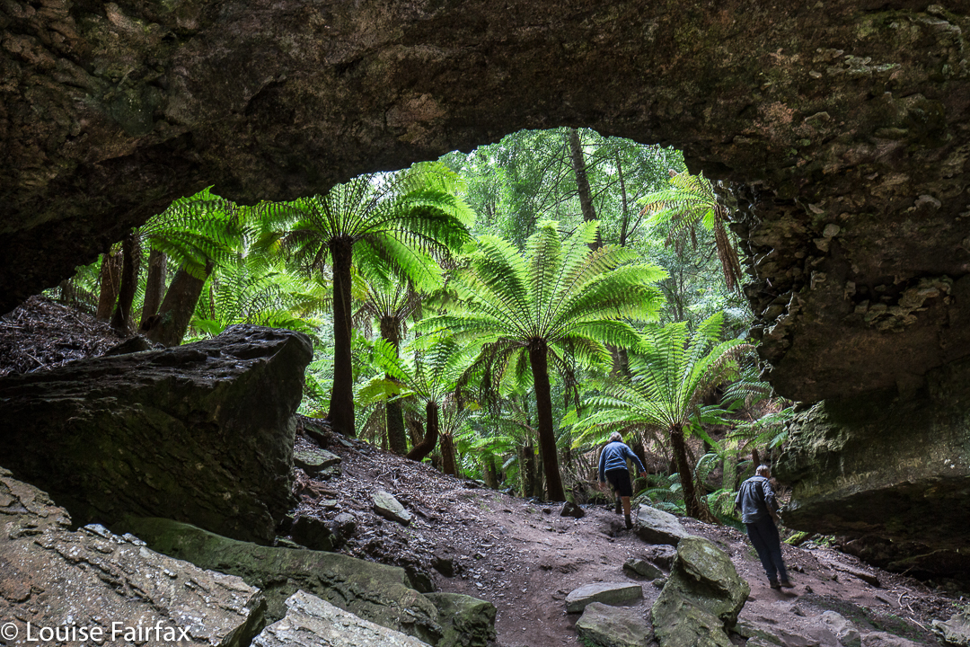
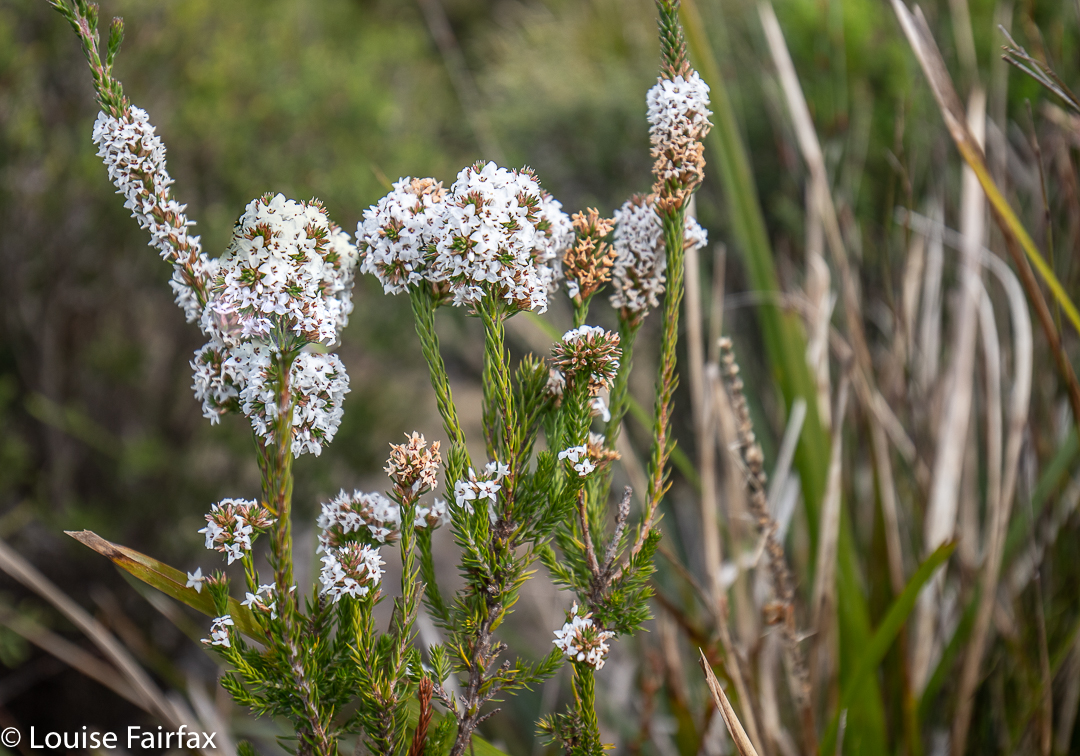
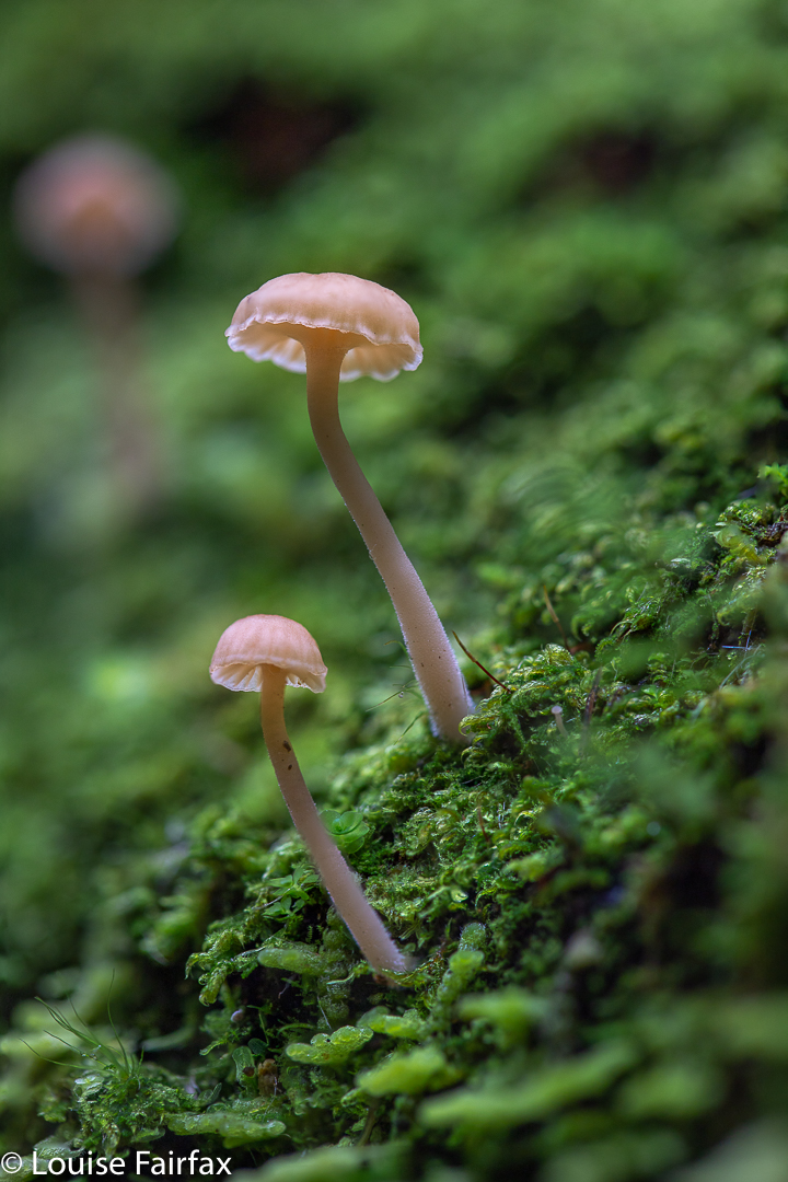
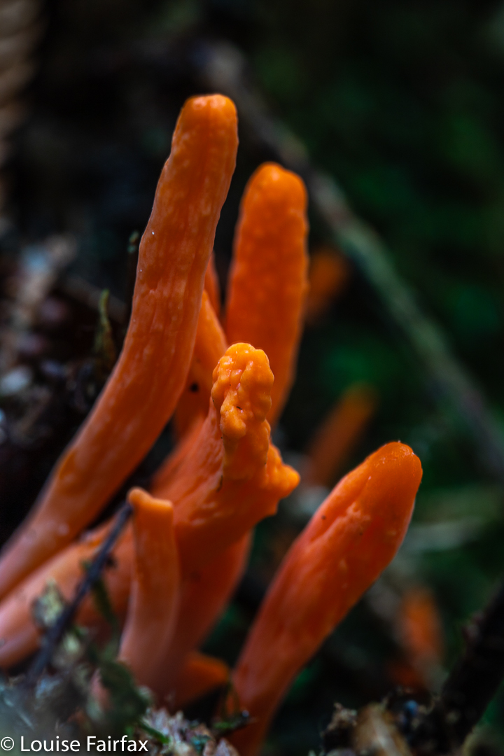
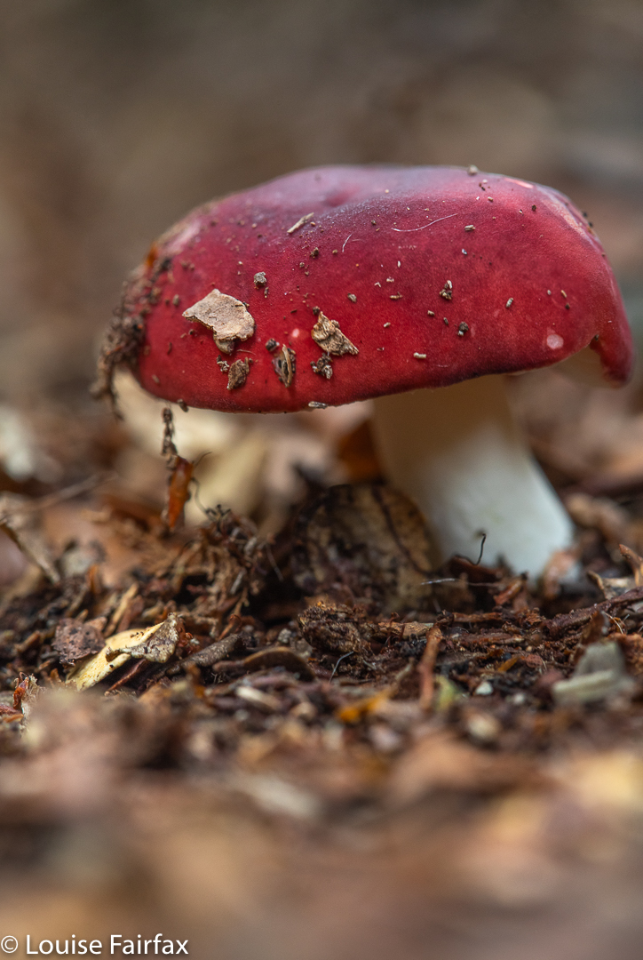
I decided to return to the north coast via the Julius River Reserve, as it offers a tiny little walk, and maybe there would be some fungi. My hunch was rewarded: there were indeed some wonderful fungi, and I found a second little walk, but I was feeling very under-exercised indeed. By the time I had finished with Julius River, however, I had eaten the lasagne I had brought and some snacks, and I really needed more food, so for the third time in three visits, I found myself exiting the Tarkine sooner than I might have, as I was hungry.

Epacris lanuginosa near the falls
Melaleuca squarrosa nearby

Sure, when I’m bushwalking I have my own food, but I am not bushwalking here. If I have to do lots of driving, then I like to reward myself with coffee and cake, and something tasty for lunch. Dehydrated food requires the eater to have exercised all day and be extraordinarily hungry before it even begins to taste tolerable. (After a full day’s walking, you’ll be pleased to learn, it tastes absolutely delicious.)

Camarophyllopsis ‘yellow’
Clavulinosis sulcata Tarkine Julius R reserve

Anyway, on we drove, heading for the shortest route home, which seemed to be via Smithton. By the time I reached the nice cafe above Boat Harbour, it was well after three o’clock and I was ravenous. That cafe fixed that, and on I drove home, arriving a couple of hours later with a whopping headache from too much driving.

Russula persanguinea

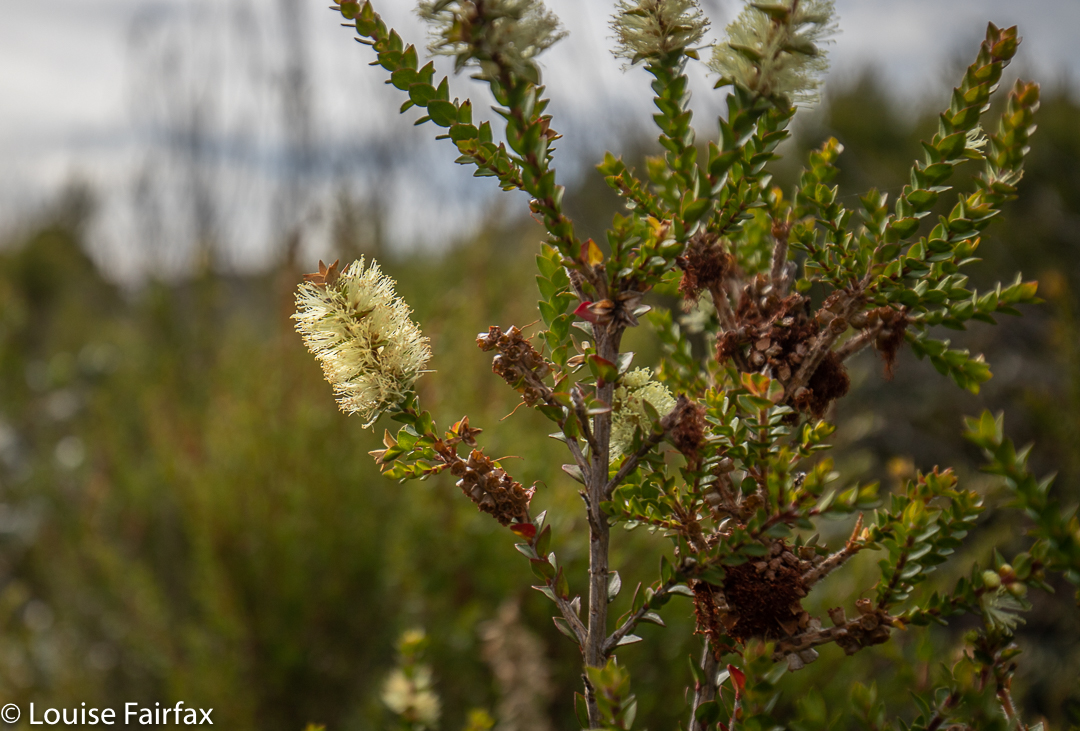
It seems that if I want to see the Elver Falls, I need to find someone with a double kayak who would also like to see them, or hire a light singleton near home and take it there from here.  No matter. It wasn’t to be this time, and now I have recovered from all that driving, I have happy memories of beaches and fungi and a few flowers ….. and of being hungry.

Clavulina subrugosa
Nelson Bay Falls

Lovers Falls Corinna 2020

I have wanted to visit Lovers Falls – on an unnamed tributary of the Pieman River, 5.3 kms downstream from Corinna – for years, but I lacked confidence in my ability to debut kayak 10.6 kms. I also lacked someone to go with and I was reluctant to do it solo.

Mossy myrtle

Why did I phone Corinna and discuss the matter? I’m not quite sure, but I did so in January, and the very nice guy who spoke to me on the phone assured me that it was not a difficult river and that all sorts of people managed to do the kayak. He told me, however, to wait a bit, as the water was not flowing enough at present to justify the effort. I appreciated both his encouragement and his honesty. Here began a saga.

Armillaria novae zelandiae

Two more phone calls followed, one to discuss the problem of my dog, who would more than probably be in the car with me. The guy solved this by saying she could be in the car while I kayaked, as long as I didn’t actually sleep in the Reserve. Brilliant. That was a HUGE load off my mind. I could easily camp near, but not in, the reserve with my faithful adventure buddy who hates me going off without her.

Although it is only March, there were a pleasing number of fungi about

The next two were to line up an actual time. This is a long story, the short of which was that I was told I was on a waiting list for the morning, and confirmed for the afternoon (which I really didn’t want). However, the night before, the guy at the desk encouraged me to try my luck at 9 a.m. prompt, as maybe someone would see my plight and magnanimously elect for a double kayak, leaving me free to have a single. My persistence paid off.

Pieman reflections. This is not my shot, but it is very much what I saw, so I wanted to include it. My camera was carefully sealed in my bag and I was too scared of damaging it to use it en route.

There was a kayak spare. The guy talked me through the safety spiel and helped launch me into the river. I was so relieved. Now I would have de facto company – at least one of the others on the water might observe if I capsized. Also, it was cloudy, which is perfect for photography. Who knows how wretchedly sunny the afternoon might be? I needed to be on the water now. Also, if I was very bad at this, I might need all day. Much better to start early!
Launched on the water, I began paddling downstream. The river had perfect reflections. The silence was palpable. It was utterly peaceful as I sat there, rhythmically going plash, plash with my oars. Surge, surge. It reminded me of the stroke, stroke of swimming in bygone days, except the view was incomparably better. Would I get tired? It seemed a long way to go.

Lovers Falls. My prize

As it turned out, I was not bad at all. I quickly left the other three kayaks behind, and after about thirty minutes, passed another two who had started fifteen minutes ahead. All up, I took forty eight minutes to do the distance, which I had been told would take one and a half hours. (Although this was my first kayak like this, and I was very worried about the boat-handling side of things, I have represented Australia at triathlon, so I guess my swimming arms haven’t forgotten how to exercise.) This was very reassuring, as it would give me oodles of time for photography, so I took fifty minutes shooting. So far, this was an excellent exercise: photography ratio.

Lovers Falls area

I had been ridiculously clumsy trying to exit my kayak on arrival at the landing stairs: I was terrified of accidentally toppling into the water with thousands of dollars’ worth of camera equipment. Now it was time to try to get back in without sinking my precious gear in the process. That ended up easier than getting out. And how would my arms be? Can you go from nothing to one hour forty and still have arms that cooperate? My forearms fatigued a little, but my hands felt the strain the most. I was pushing with one while I pulled with the other. I haven’t a clue if that’s what I was supposed to do, but that’s what came naturally. I was very glad to see Corinna pop up around the corner. I was timing it, so I knew it should be appearing soon if I was maintaining pace. It was nonetheless a relief to know I’d done it.

Myrtle, Savage River

I exited my kayak a drenched rat. Every time I lifted my limbs to stroke, water poured down the raised one, wetting my coat. Splashes meant that my legs and shoes got wet. I was soaked, but so happy to have done it that I couldn’t care at all. I am now hooked on kayaking!!

Psathyrella candolleana

Because I got a morning spot, that left me free to drive home after a forest walk in the early afternoon. Now my only question is: Will my arms function tomorrow, or will I be unbearably stiff????
And I have to say in conclusion, I am very impressed with how patient, friendly and helpful the staff members at Corinna were. I drove home with a very positive feeling.
PS. Arms had no stiffness the next day. It seems that all the offtrack bushwalking I do keeps both upper and lower body nicely fit. Bushwalking is SO much better than doing a gym session!   🙂

Balfour Track, Trowutta Arch 2017 Mar

Balfour Track and Trowutta Arch, Tarkine Day 4.


Sadly, we turned our back on the coast – but not before I’d got up in the dark and wended my way down to the ocean to capture moonset, long before the sun had risen. The shot here is a very long exposure.


To reach our goal, we headed from the coast on the road running east from Couta Rocks – the C214 – until signs directed us to our destination. The track runs parallel to the road, rejoining it after about an hour’s walking (plus any stops you might have). Our group did an out and back route, probably taking us the three hours recommended. The extra half hour in each direction beyond walking was used in taking copious photos of fungi and forest, and in snack time beside the beautiful Stephens Rivulet.


Of all the tracks we walked this trip, this one was my favourite. The path was narrow and non-invasive; the forest was lush and green with plentiful tree ferns and moss. I thought it would be way too dry and warm for fungi, and that there would not be much to photograph, but I was mistaken. The quaint, tiny ones were not yet out, but there were still plenty of others. Luckily for me, the other walkers had gone on ahead, so I was supposedly giving chase. However, I ended up rolling in dirt every ten paces or so at the discovery of each new delightful specimen. The fact that the others were ahead meant I didn’t have to feel guilty about holding anyone up. If and when all these marvellous sights stopped, I could keep my promise about giving chase, and if not, I’d just meet them on the rebound. I rolled in a little more humus and thoroughly enjoyed myself. (Map at end of this page)


In the afternoon, we visited the Trowutta Arch. The arch itself was spectacular, but the way to it quite ruined it for me. I hated the hard, wide, unnatural path that has been built that scars the landscape. The forest also appears to be most suspiciously “tidy”. If the bureaucrats who designed this have wheelchairs in mind, I am most curious to know how they intend getting such chairs down the steep drop to the actual arch. Are they going to pop in a lift? Stairs will hardly help. The only section I enjoyed was the part they haven’t yet attacked. I hope this is the only route they decide to tame and manicure for tourists. I wonder why it is assumed that visitors are incapable of walking on any surface other than the artificially even one they normally use for shopping. This is a sad reflection on our society if it is correct. It contradicts what is actually good for our brains – a little challenge – a matter pursued by the excellent Austrian architect, Hundertwasser, in his deliberate planning of crooked, uneven paths and walls in anything he designed. I seemed to be the only one in the group who felt this way, but for me, the sight and feel of that city-style pavement in what had once been pristine rainforest, completely jarred, and detracted markedly from any delight I might have felt in the beauty that was there. Significantly, with the forest so “clean”, there were no fungi to be seen. There was nothing much for them to decompose.


Balfour Track instructions: The orange road to the left with 17 beside it is the C214. As you can see, you turn right off it (if going up from the coast) and travel 700 ms to the start. After your one hour (plus stops) walking, you will reach the C214 again, where you either retrace your steps (NOT boring at all) or, if you have arranged a car shuffle, a car will return you to the start. As the forest is always new in a different direction, the former method is both easier and more enjoyable. The track itself is the dashed line that basically follows the Stephens Rivulet. The other dashed, very straight line to the right (east) is presumably a boundary of some sort.

Tarkine West Coast 2017 Mar

Tarkine, West Coast, day 3. Mar, 2017


Quoll prints on clean, windswept sand.
At last we arrived at the coast. Although I love mountains and lush, green, mossy paths, fungi, waterfalls and streams, I had been longing for the moment when we would reach the wild west coast and I could photograph some seascapes.


I am captivated by water’s motion, and dearly love every opportunity to attempt to record it with my camera. This coast did not disappoint, although the waters were perhaps a little less frenzied than I had hoped for.


The tide was on its way out, and was rather too calm for my liking. The sky was pretty cloudless, but that’s part of what I love about real photography. You take what nature gives you and do your best with that.


The very notion of being disappointed in what was there and popping in a fake sunball, or some snow or some passing birds in photoshop, just to make your photo more interesting, to me is anathema. I love the serendipitous in nature. I am her servant and not vice versa.


I hope you have enjoyed this small selection of the beauty I witnessed on the evening of day 3 of our Tarkine trip.

Balfour 2017 Mar

Mt Balfour, Balfour Ghost town, and Frankland River Walk.  Tarkine day 3.


After breakfast overlooking the Pieman River with its beautiful reflections at Corinna, we continued on our way north, driving for about an hour and a quarter at moderate pace to reach the foot of Mt Balfour.
This mountain was short and very, very steep – so steep I was wondering how I was going to get my husband back down it. (He has Parkinson’s disease, if you are not used to reading this blog and find that an odd comment). Some sections you had to hang onto the grass to avoid rolling the whole way back down the hill. In fact, I watched a German girl girl doing precisely that as we neared the end on the rebound. She was wearing thongs, and had nothing to keep her foot attached to her shoe, so it slid out backwards. On the way up, I clutched grass and small bushes to avoid rolling backwards, and on the descent, I used the shrubbery rather than the ballbearinged 4WD track, as did my husband. He would have had a bad accident had he tried to stay on the track. The track just goes straight up, with no mucking around.

Steep it certainly was, but, as I said, it was also short, so I only took 27 minutes to the top – but 31 down. When you take longer to descend than to climb, you know this is a really steep slope. On top, we all enjoyed a snack just for the heck of it – because you snack on a mountain, even if it was only a tiny trip up – while some members girded their loins for the feared descent.


Next on our programme was a visit to the rather eerie ghost town of Balfour. Why eerie? For me it was, as apparently there are the graves of four hundred people who died in 1912 from typhoid. The “town” itself only has a few old tin shanties, but to think of such a large number of people living and working there, all quickly dead was rather horrifying. The doctor, whose grave remains, was only thirty when he died; Sylvia was fifteen. Most of the graves are no longer visible – perhaps there was just a mass grave at the height of the epidemic. I enjoyed the leafy tunnel that constituted the bulk of this walk, although the Frankland River, wild though it well may be, was not at its most attractive in midday glare. I didn’t bother photographing it, even though I did enjoy the leisurely stroll.


That night we slept on the West Coast, and that I DID photograph – with a vengeance. So many photos did I take that I’ll give the evening of Day 3 its very own blog (posted tomorrow).