Holwell Gorge Falls 2018 May

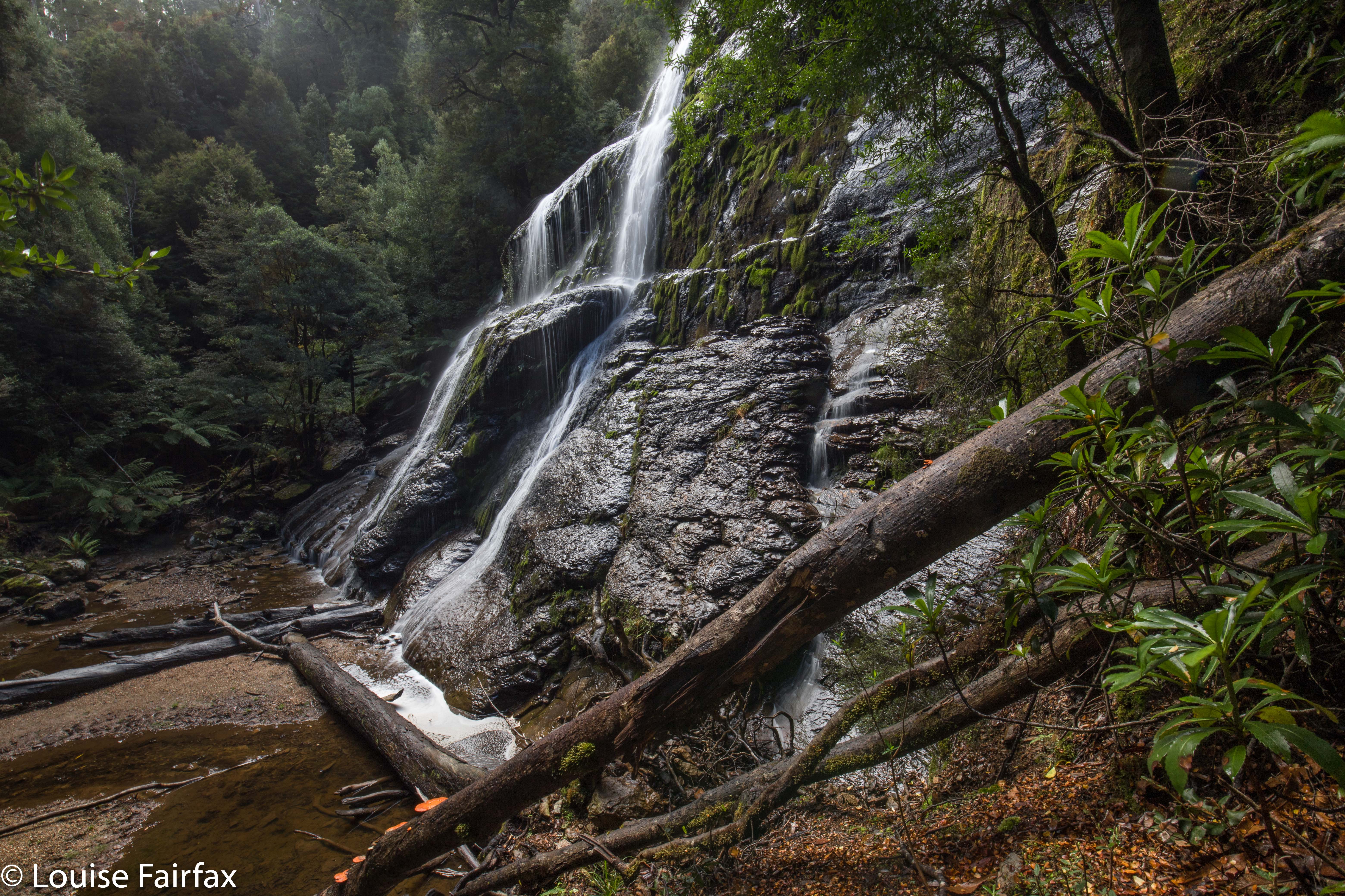
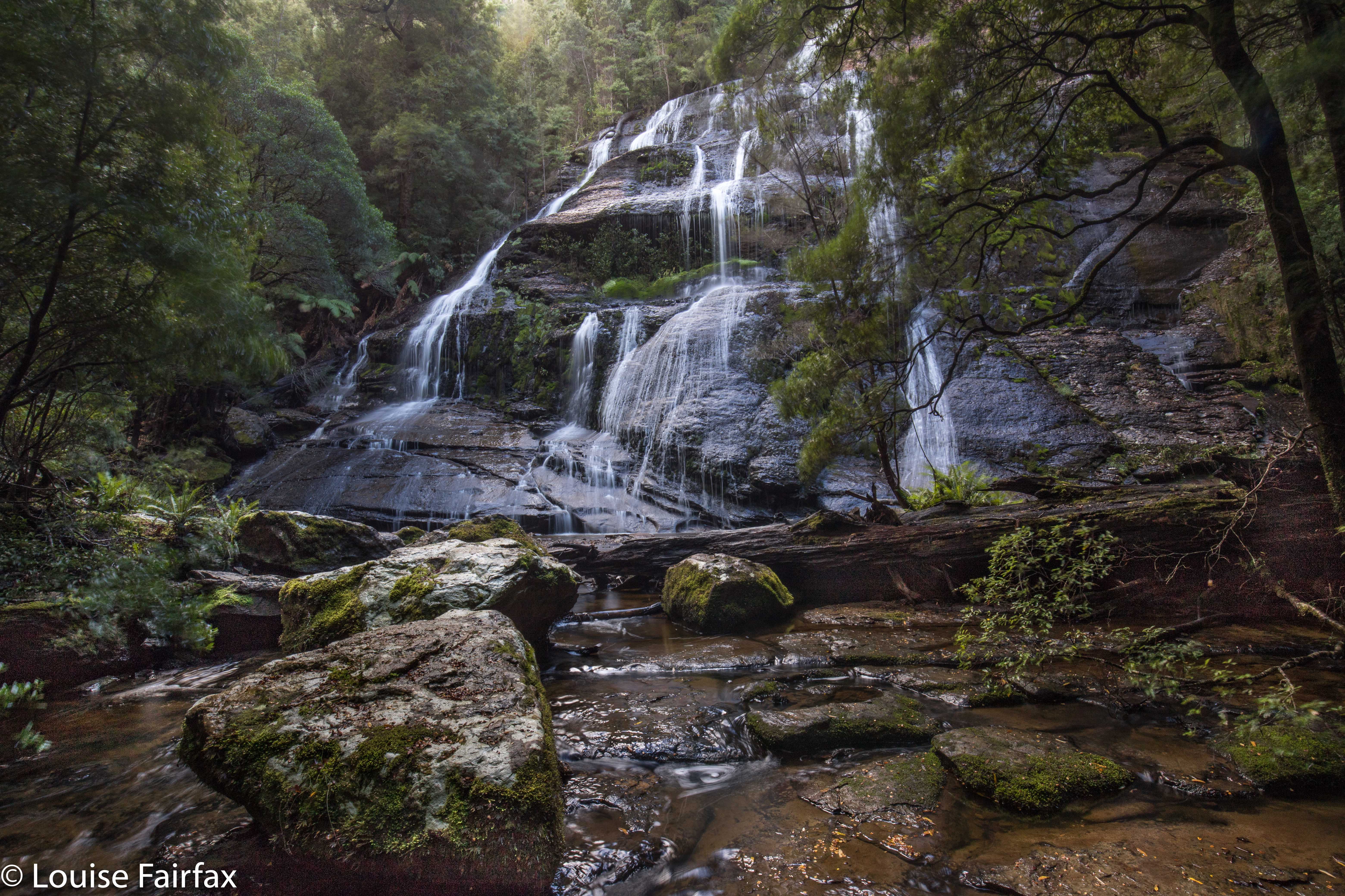
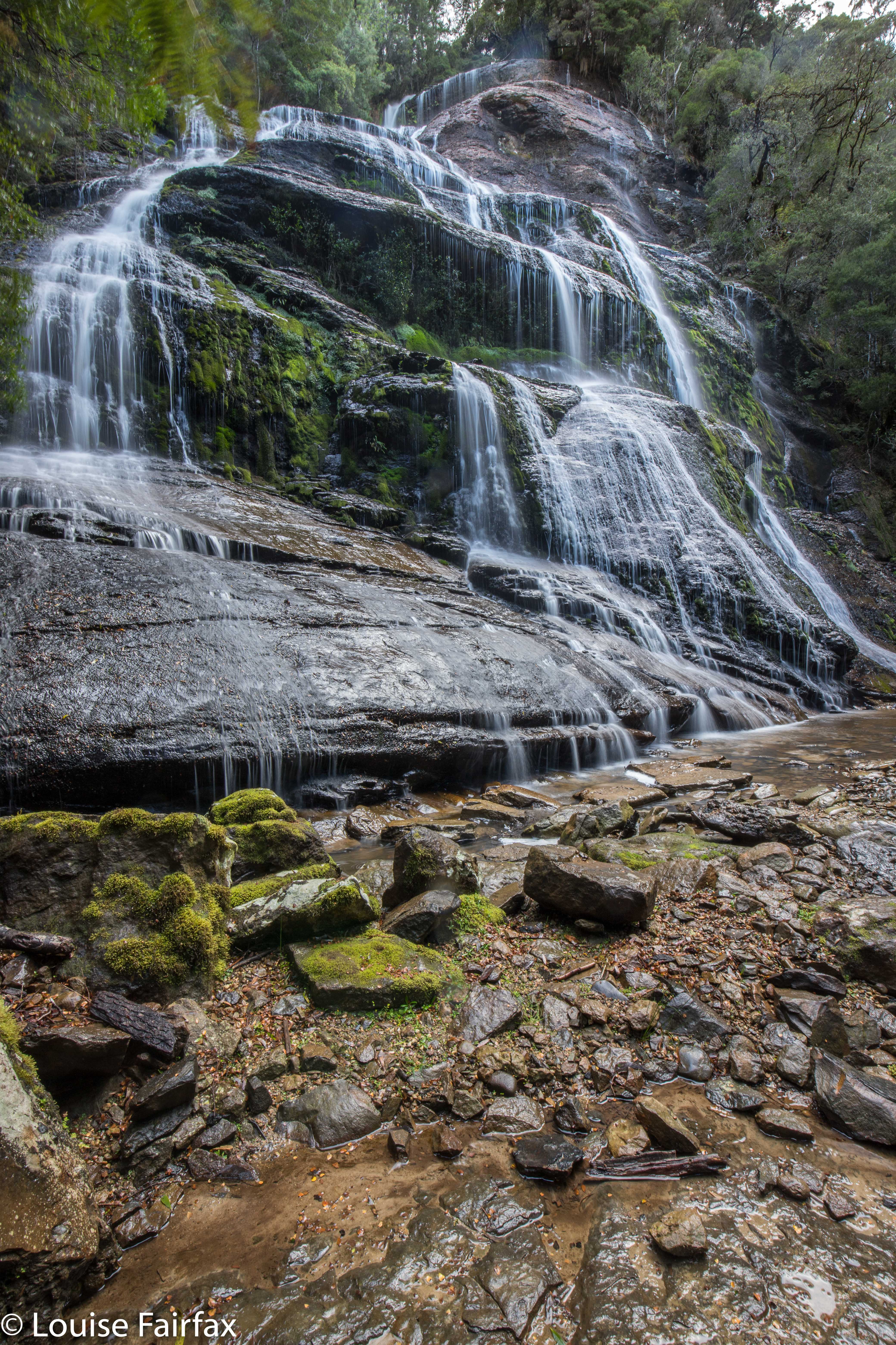
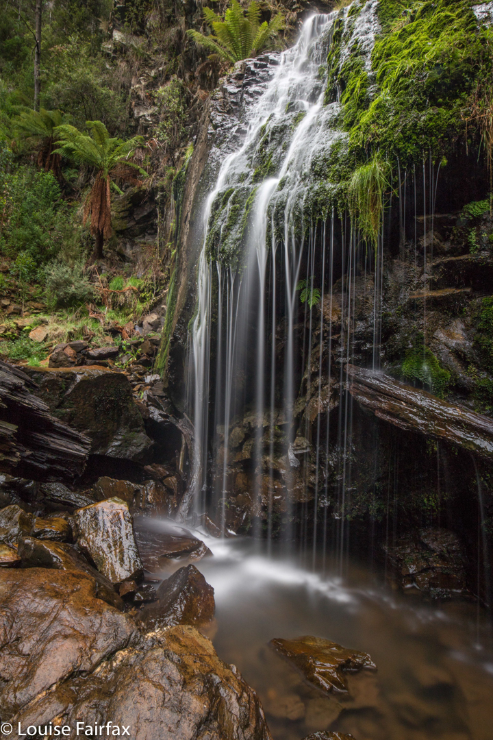
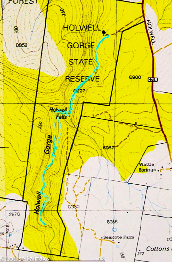
Holwell Gorge Falls. May 2018


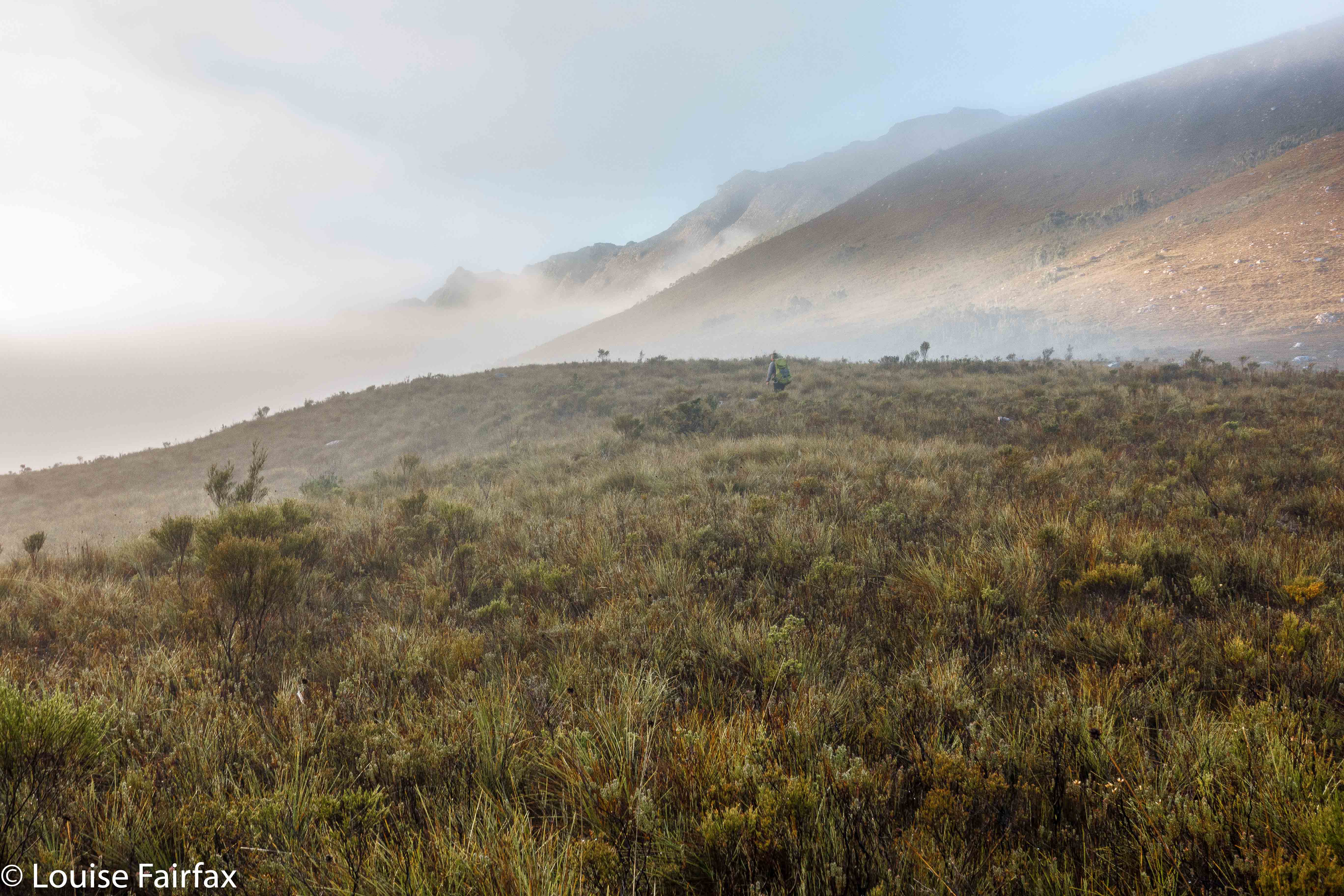
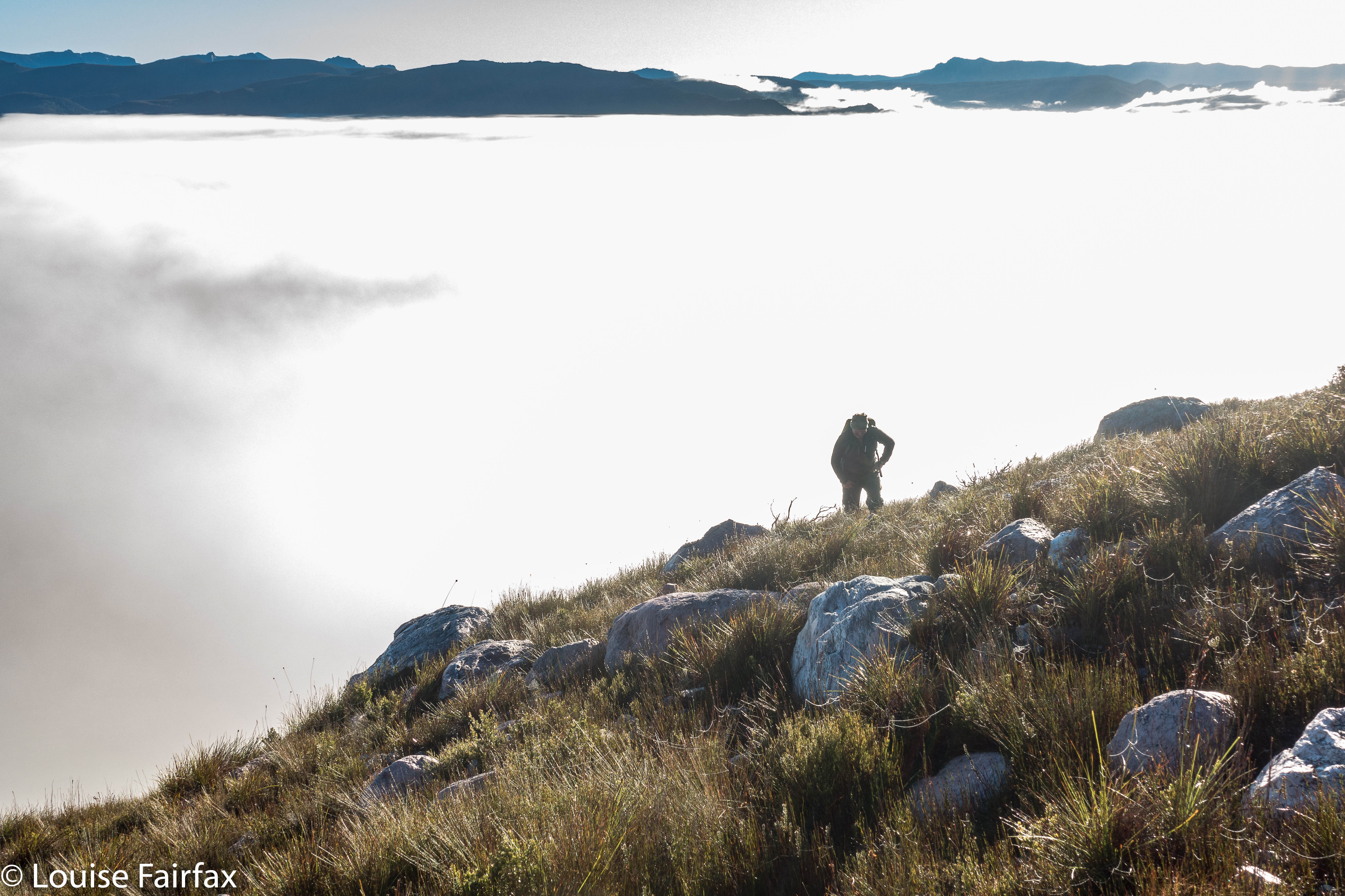
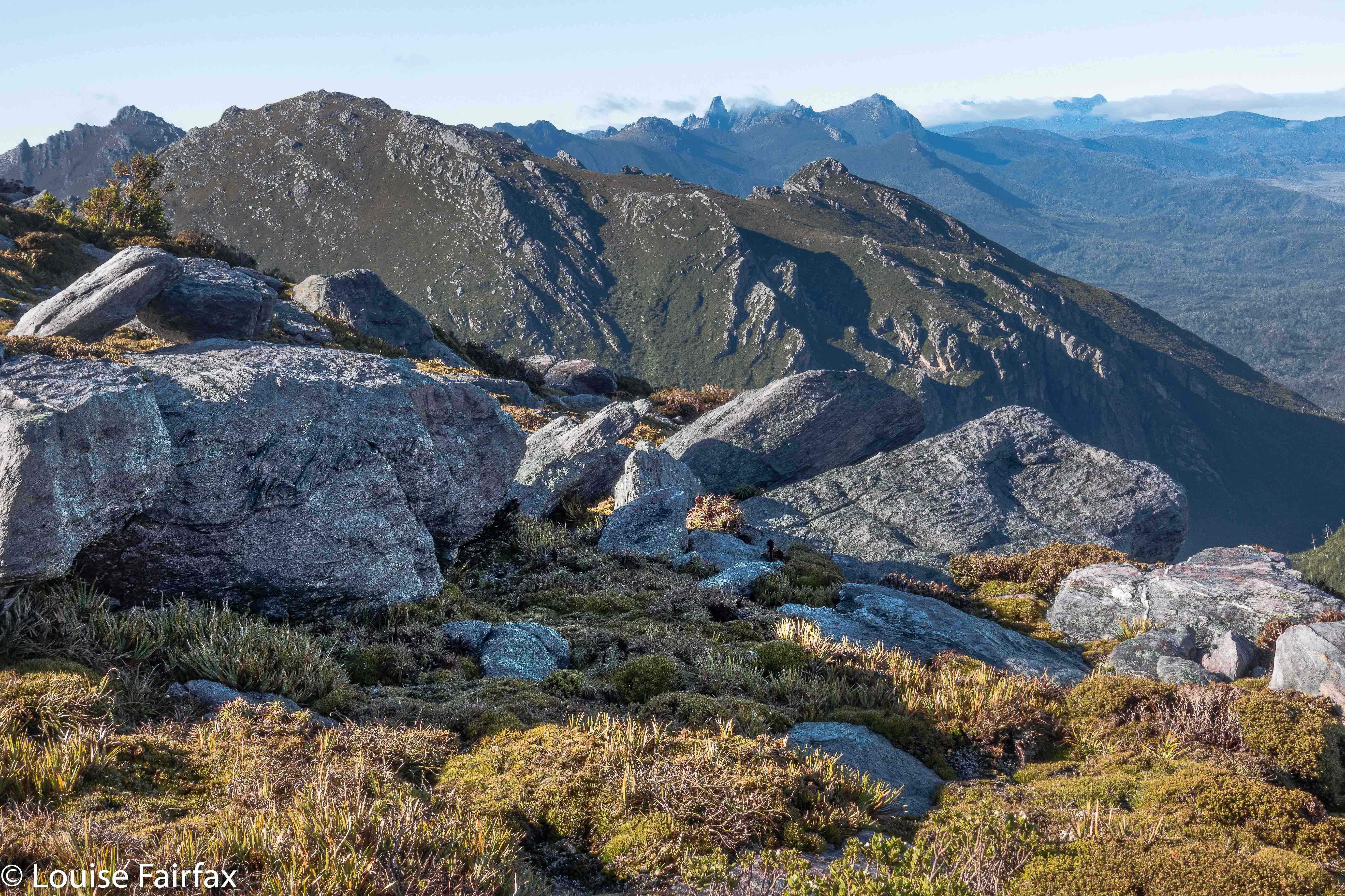
Why would I choose to “attack” the Holwell Gorge Falls from the distant northern end, rather than the closer, easier, southern option? Because I am not interested in “efficiency”, but in beauty, and in “bang for my buck”, or, perhaps more nicely put, a good drive to walk ratio, which tips the scales as much as possible in the direction of walking. I love exercise and walking through magic, lush forests full of fungi beside streams of astonishing clarity. Why on earth would I go for the quick option? In addition, the one time I visited the southern end (just to above the falls), I found that the greater height meant that the forest was dry sclerophyll, and the mosses and fungi I so love down lower were not present.


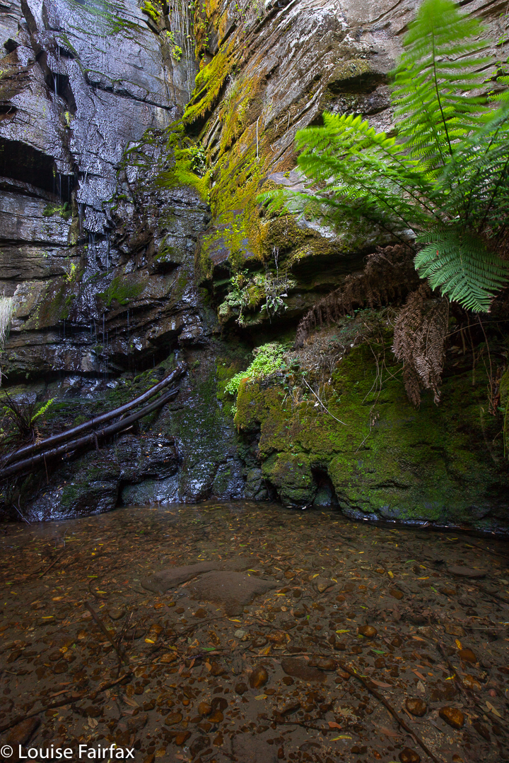
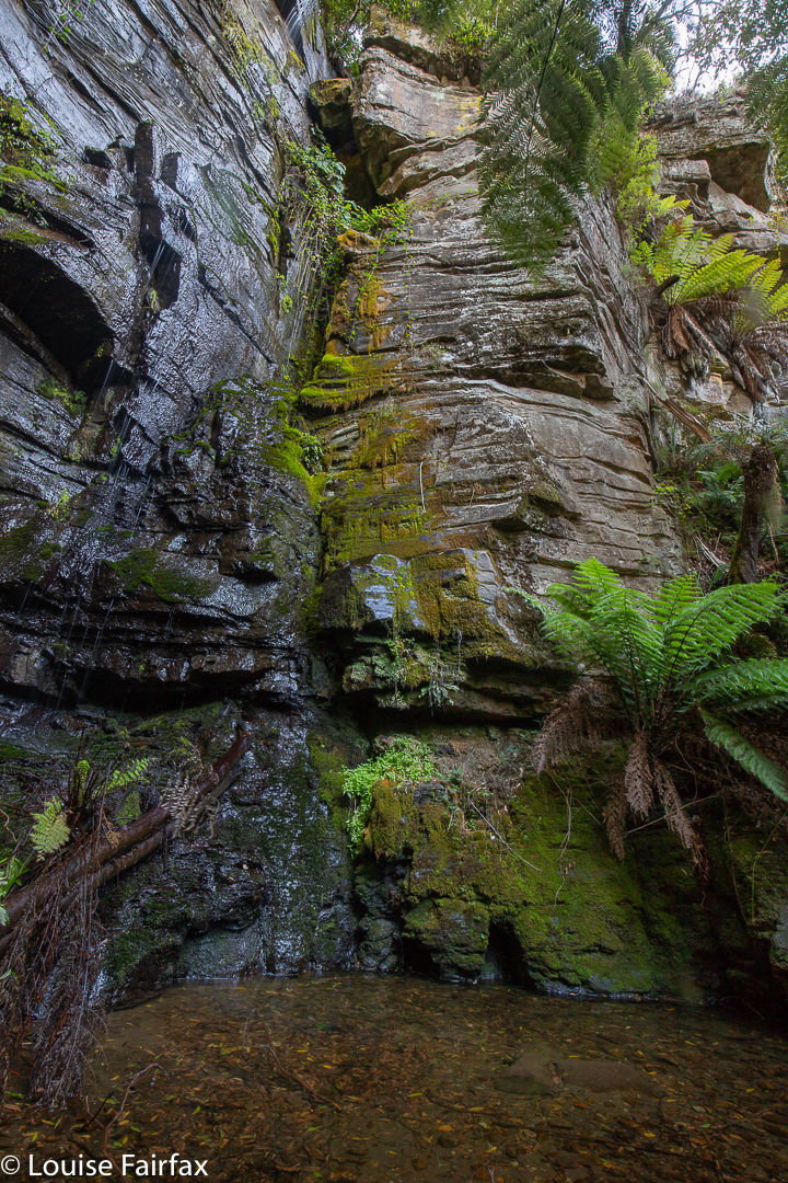
I have wanted to visit the Holwell Gorge Falls for a year now, having visited their northern brother, the Holwell Falls, a year ago. I have been impatiently waiting for enough rain to engender some flow, and for the right opportunity.  At last, today, it came. Or, I thought I had a sporting chance, let us say. I knew the early section very well, so marched through it in 11 minutes. Now came a sign that told me the upper falls, the Howell Gorge Falls, were 40 minutes return. DO NOT believe this sign. If you read my blog regularly, you will know that I am not a slow walker. I took 41 mins ONE WAY to reach the upper falls. This sign is very misleading, and it meant that I got very hungry, as I wasn’t expecting to take so long, and if you read this blog, the other thing you will know about me is that I get hungry often and quickly, and get quite desperate for food once hunger hits.


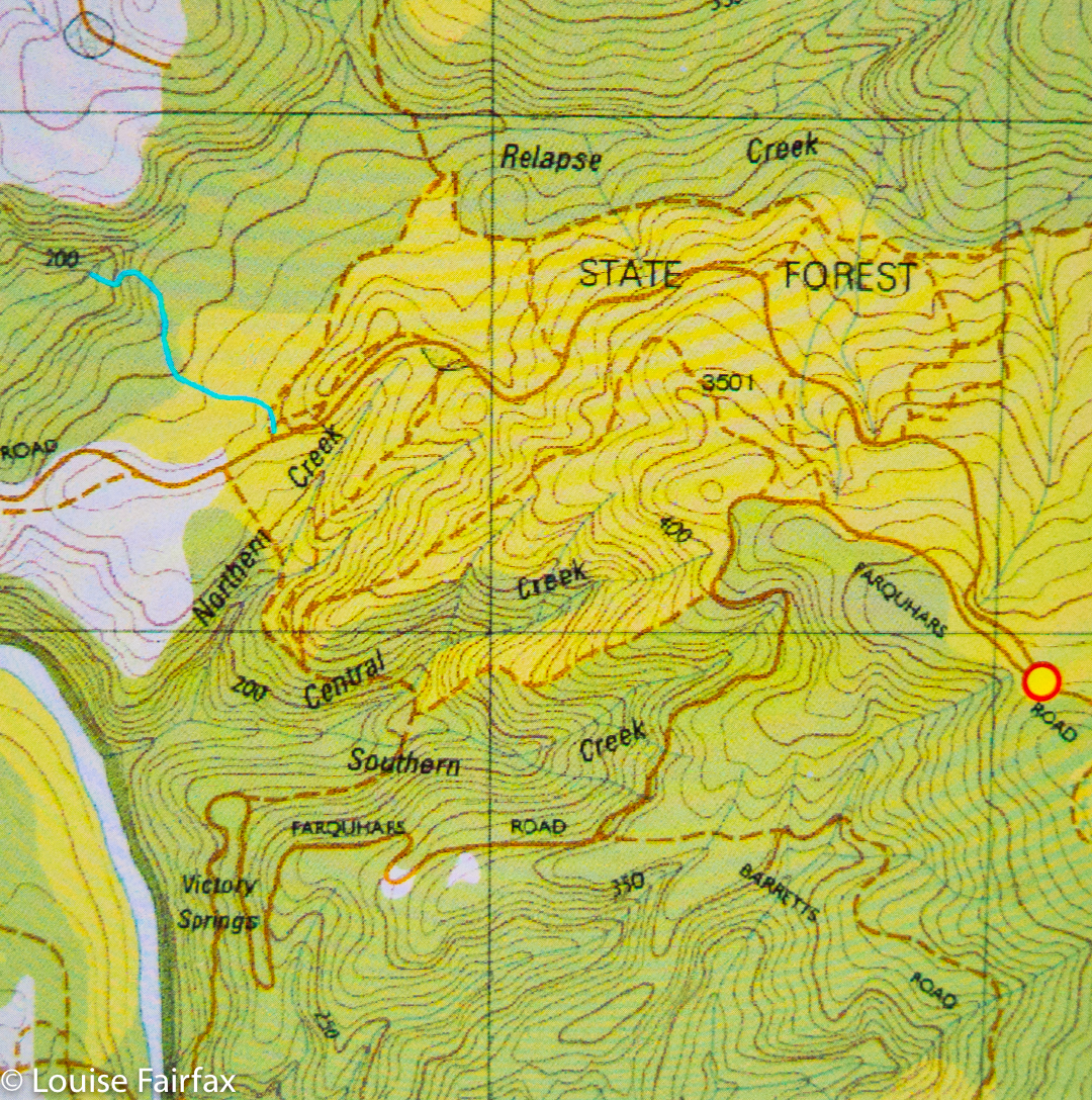
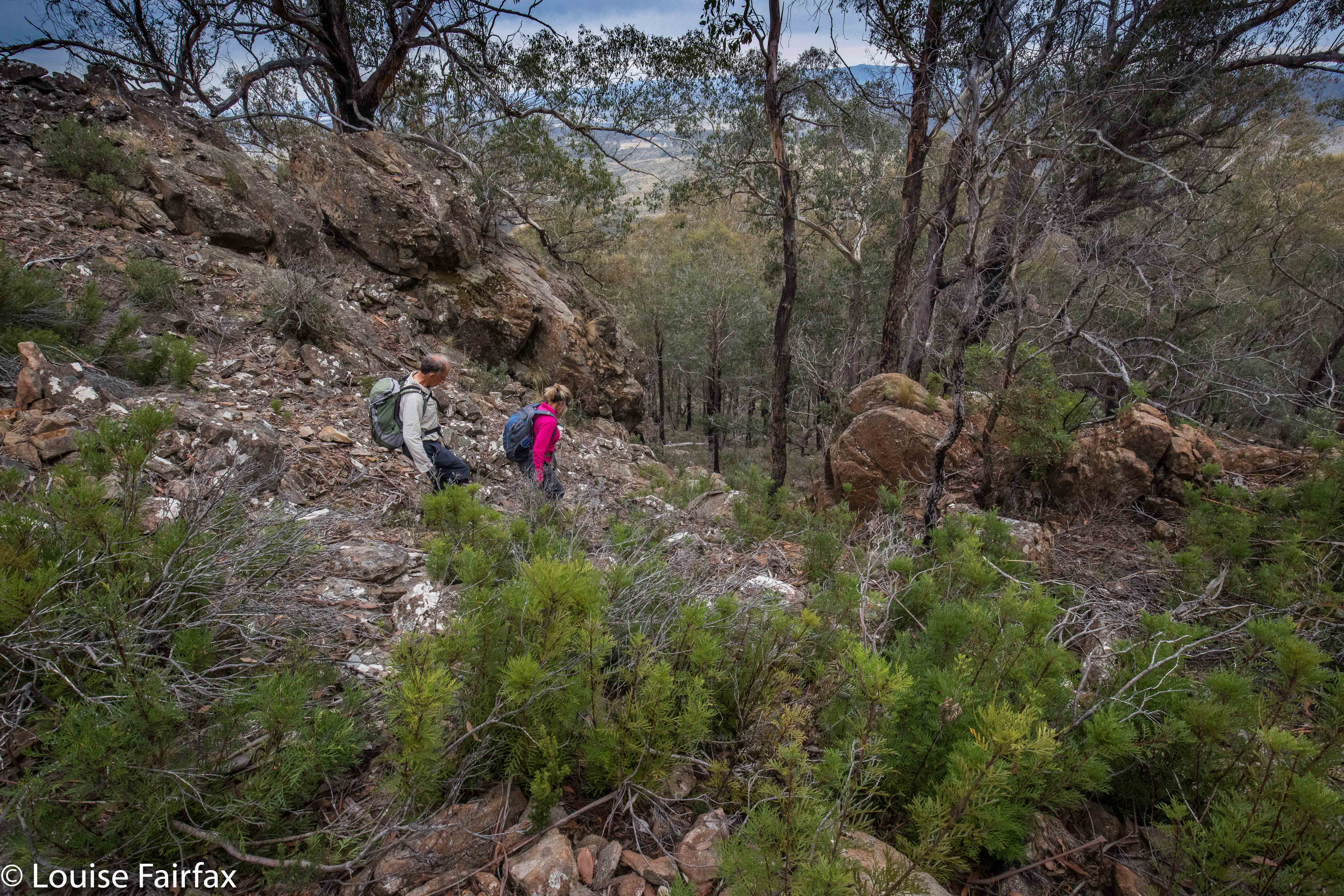
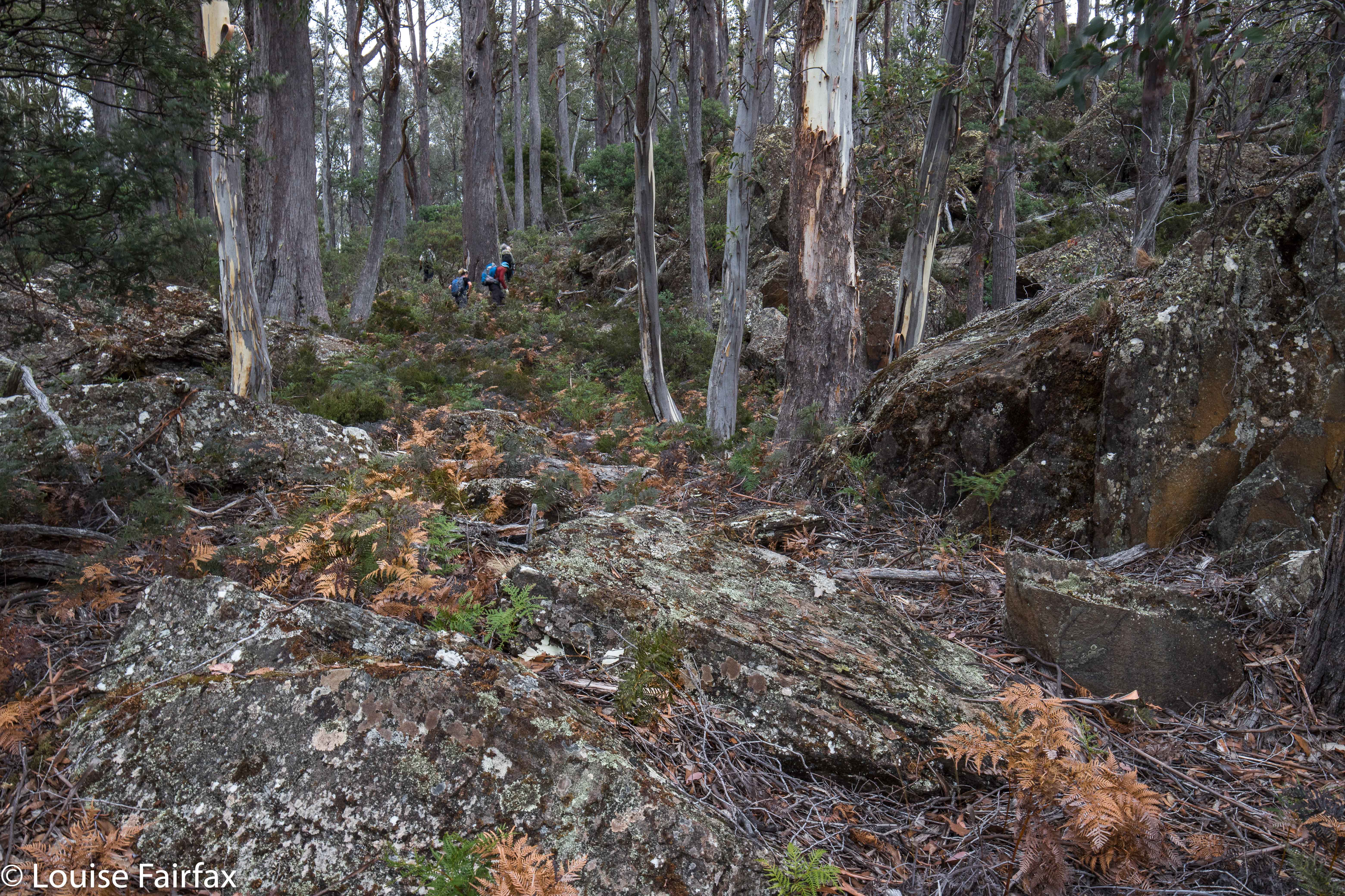
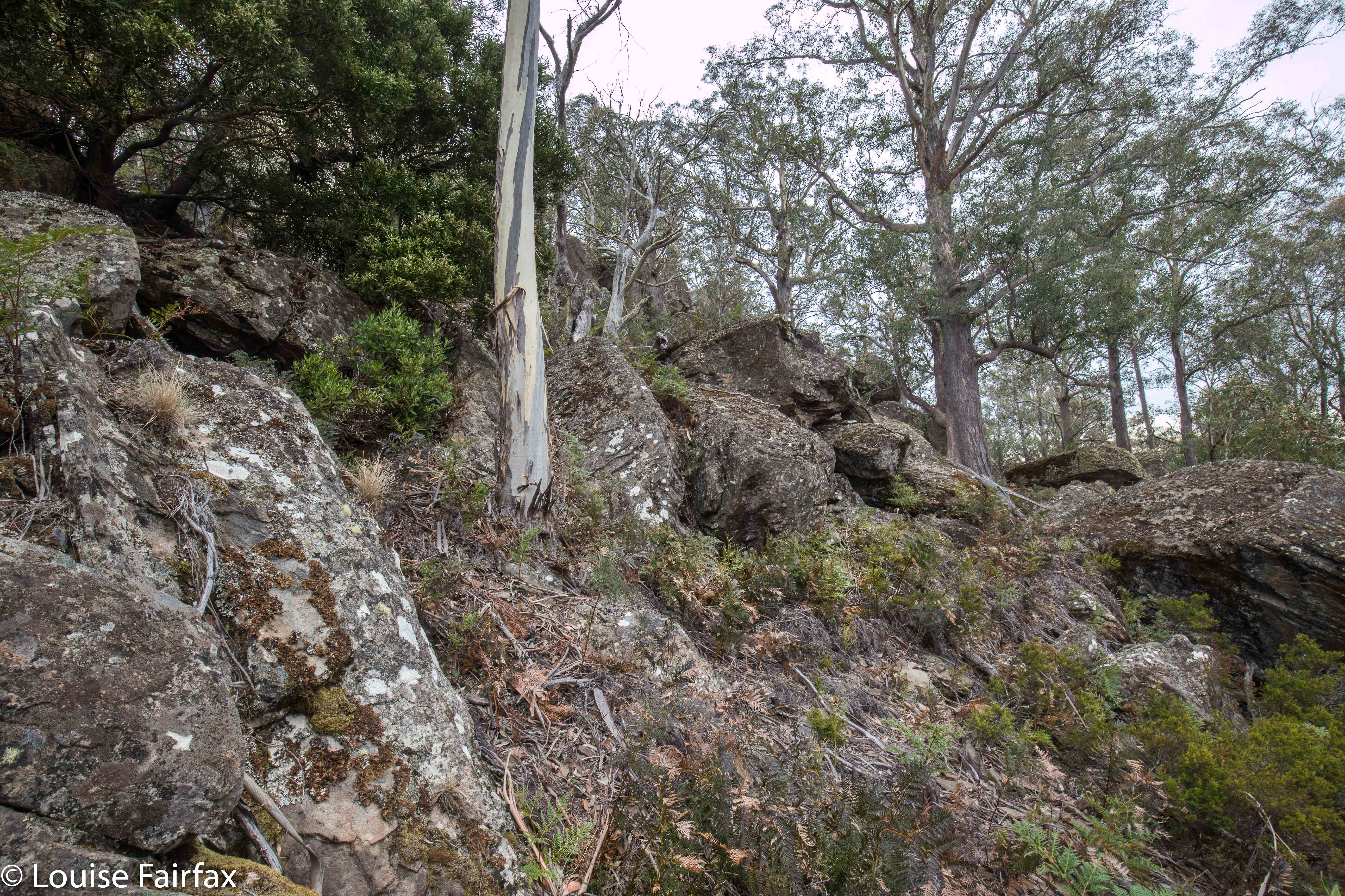
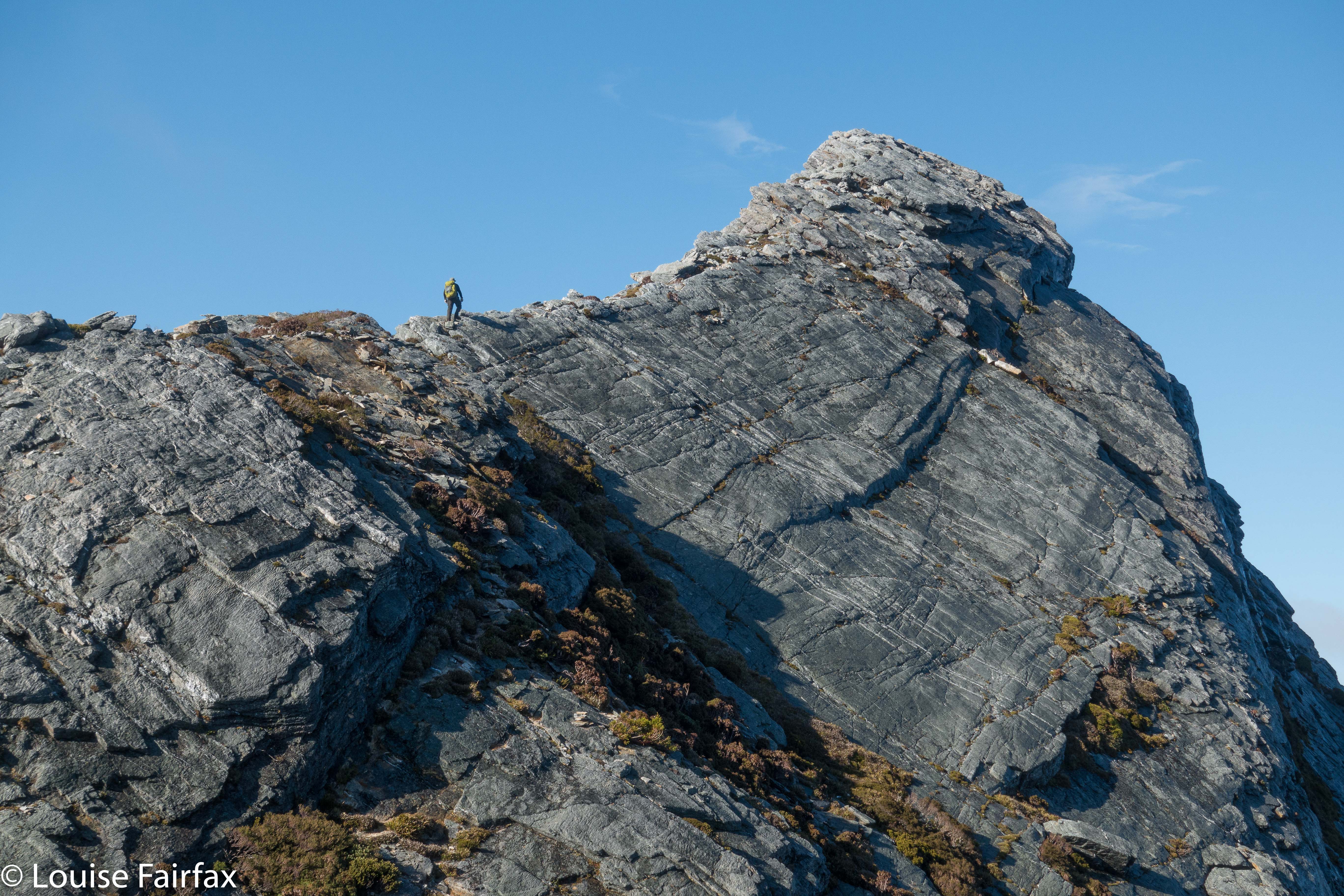
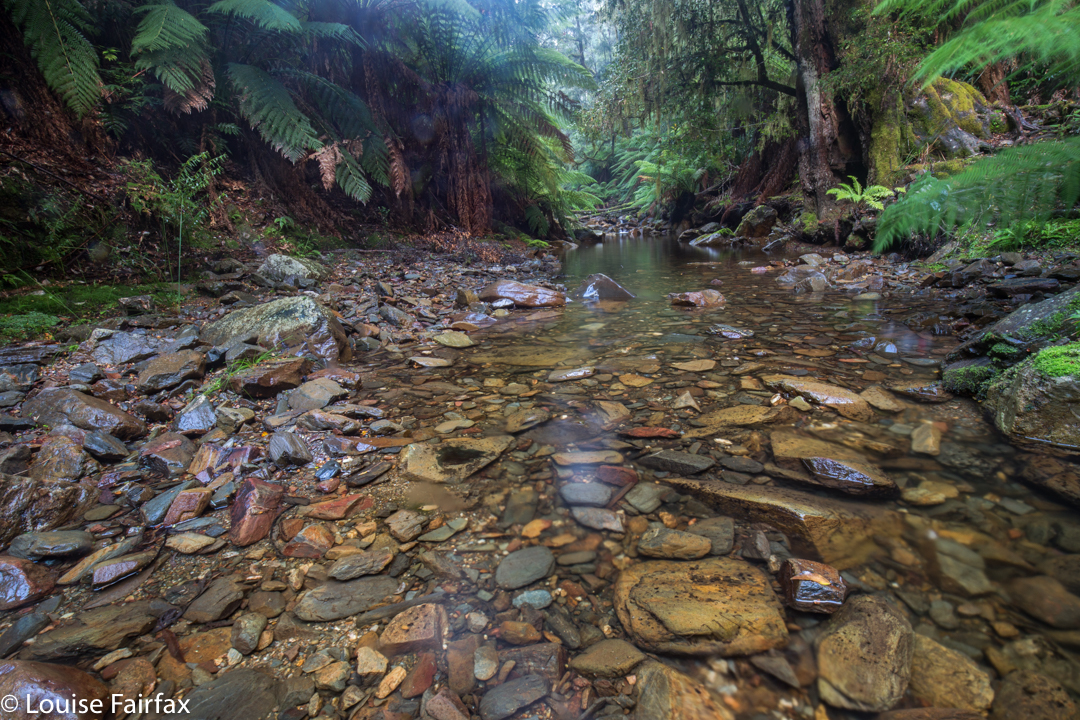
All the dire warnings about needing experience should be reserved for this second section. Once you are past the Holwell Falls, you lose your manicured highway, and encounter a track that can be, at times, downright dangerous. I was climbing over logs that were fat and slippery, and that didn’t always have anything to stop me should I start sliding downwards. I’m sure if you were taller, with longer legs than mine, it might be easier, but I was uncomfortable about being solo on one or two occasions when straddling an overweight, sloping log with nothing to hold on to.  There was one section where I even feared for my continued existence, where I had to sidle along a ledge with nothing to hold. The ground under this ledge … did not exist. It was like a tooth with a gaping cavity. I hoped against hope that the unsupported earth wouldn’t collapse under my weight. Whew. I got to the other side; however, on the way back, if you look at my map, I chose to stay in the creek bed rather than trust fate twice running. The odds were too heavily stacked against me.


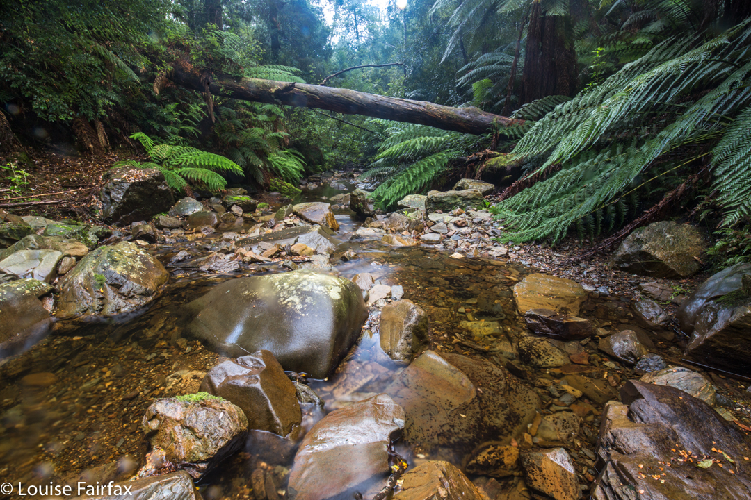
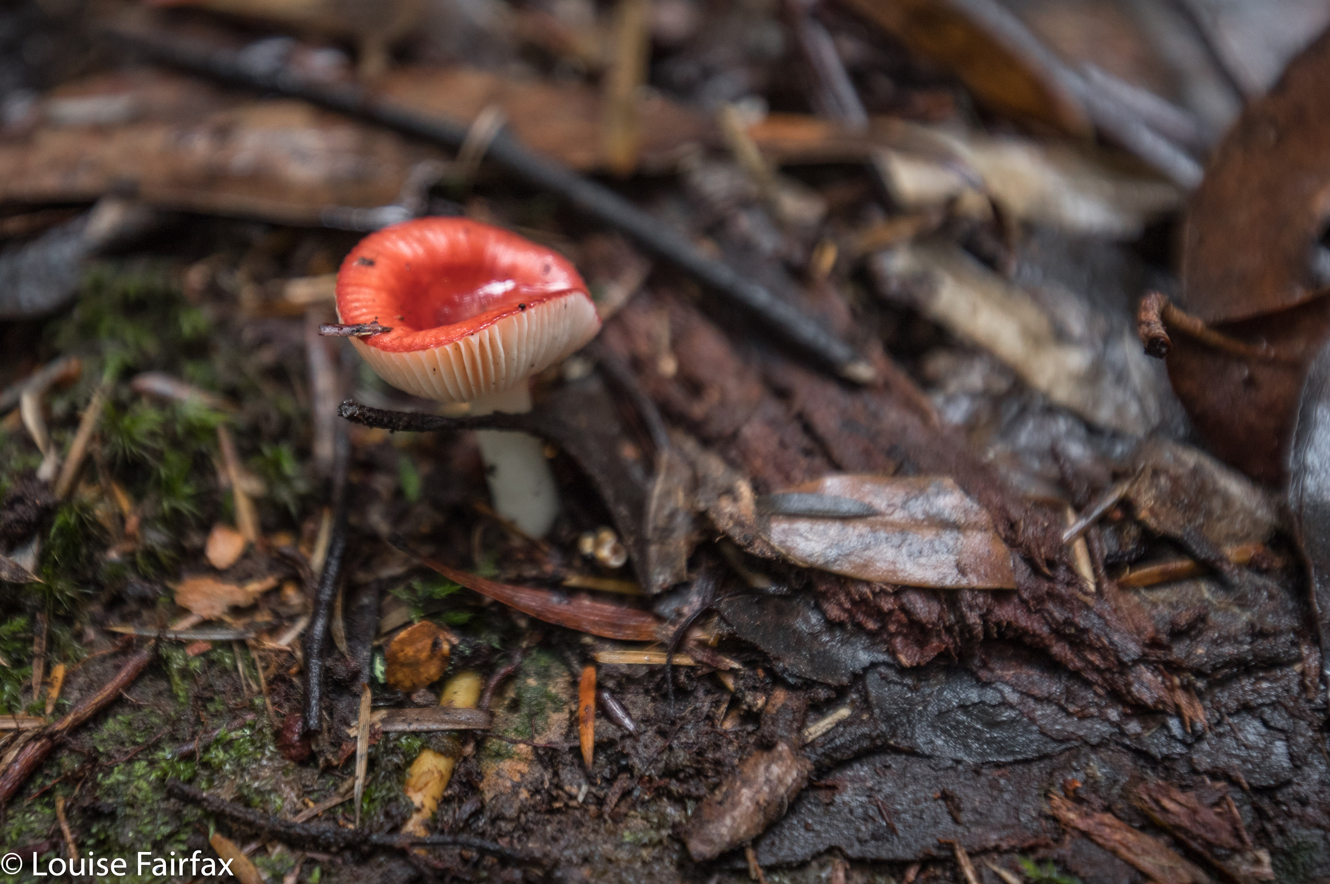
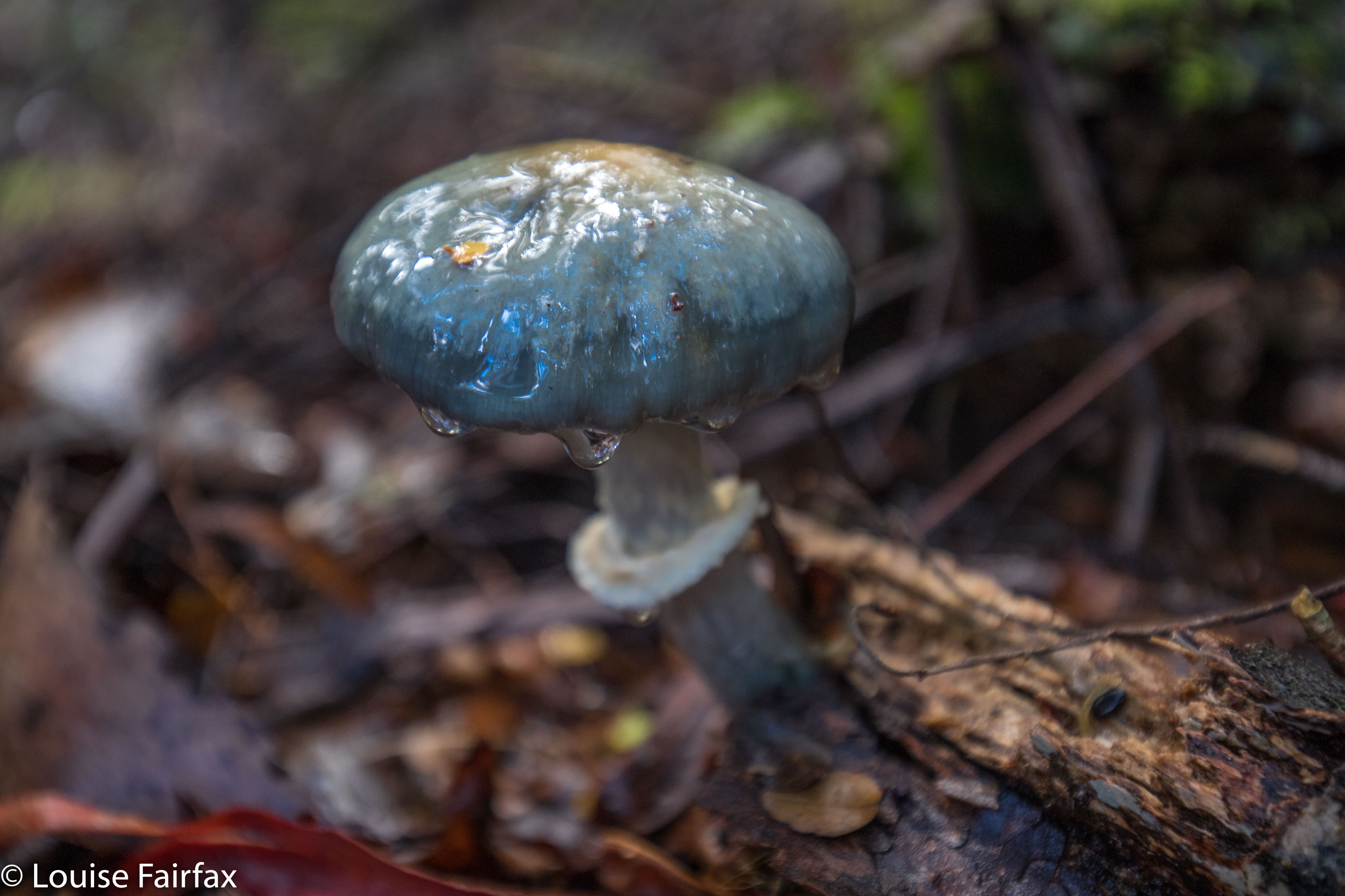
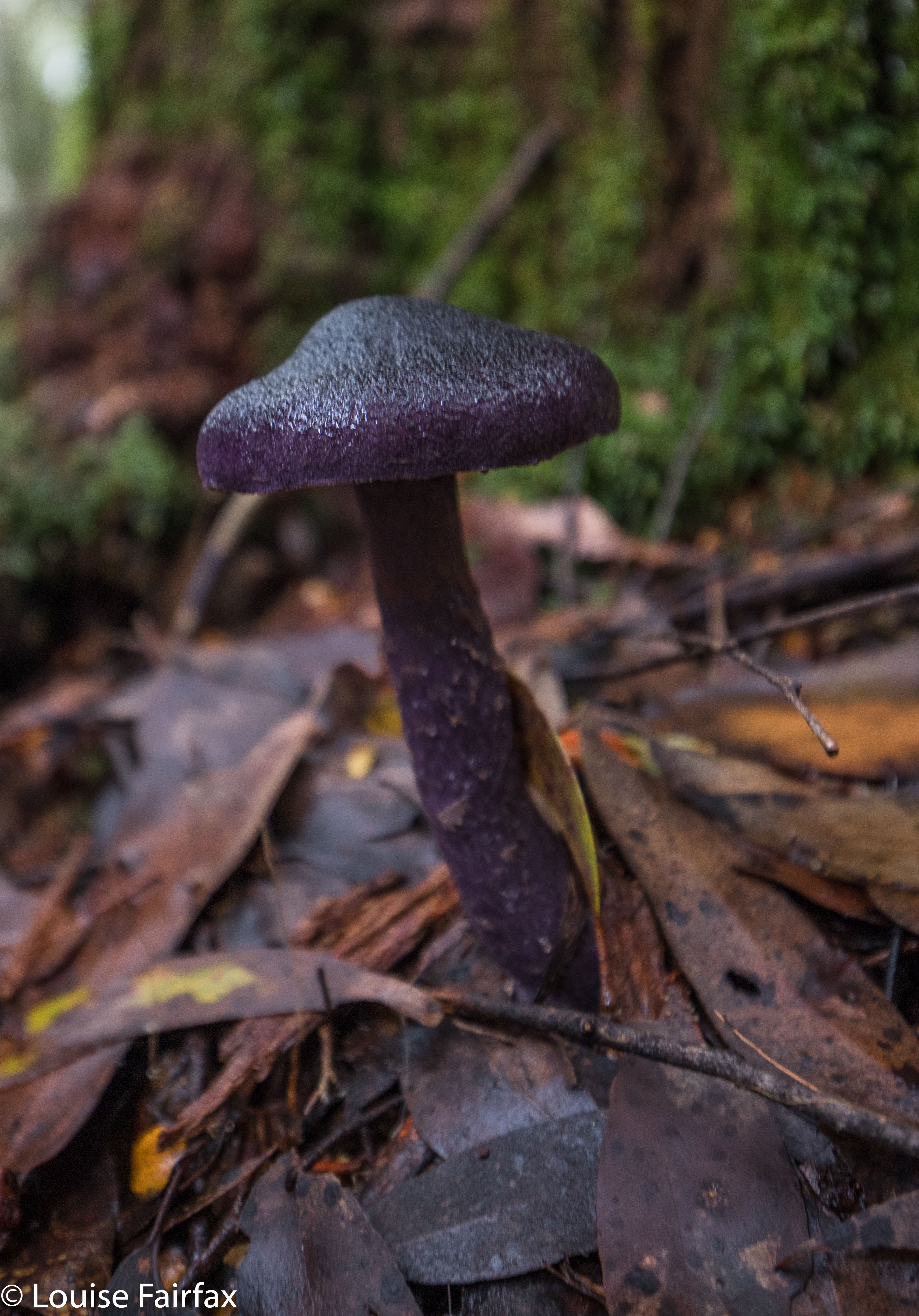
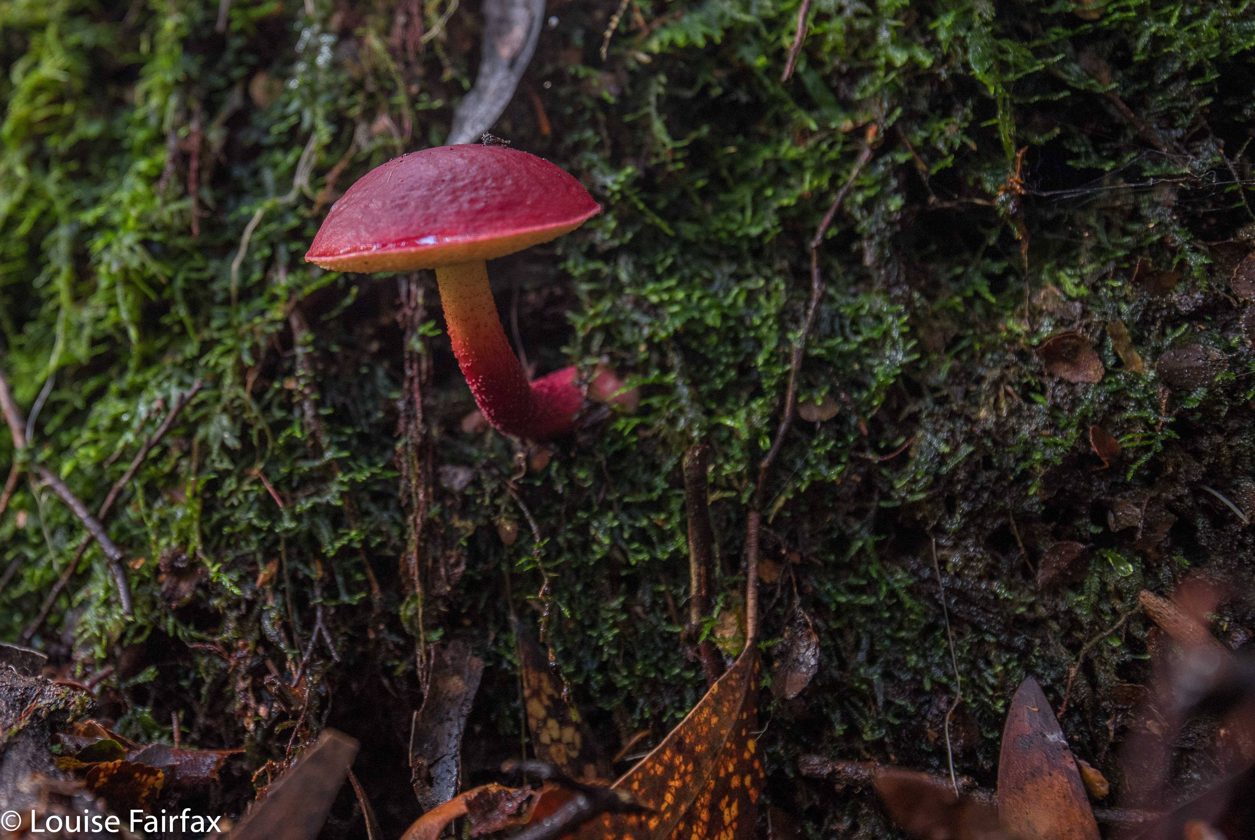
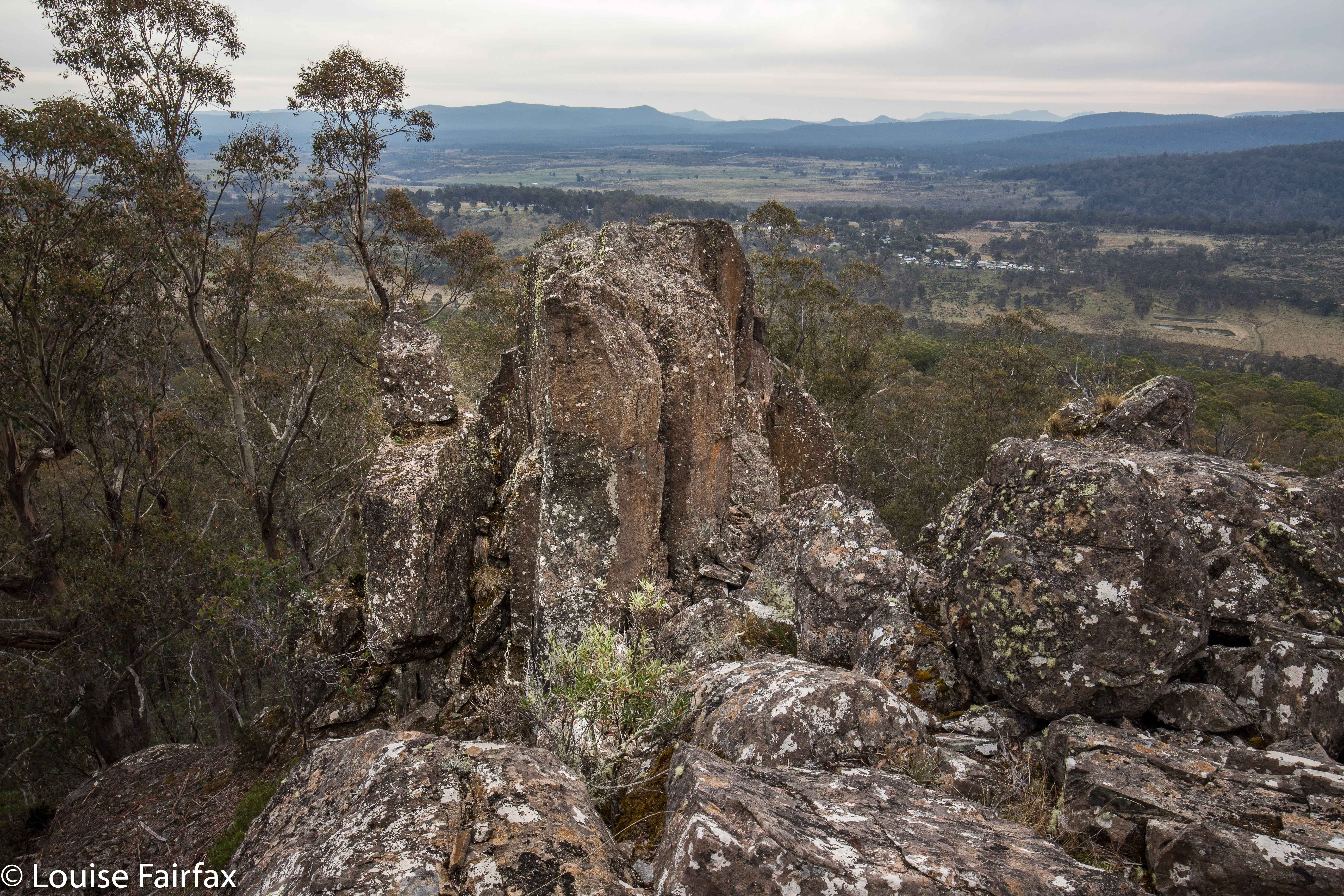
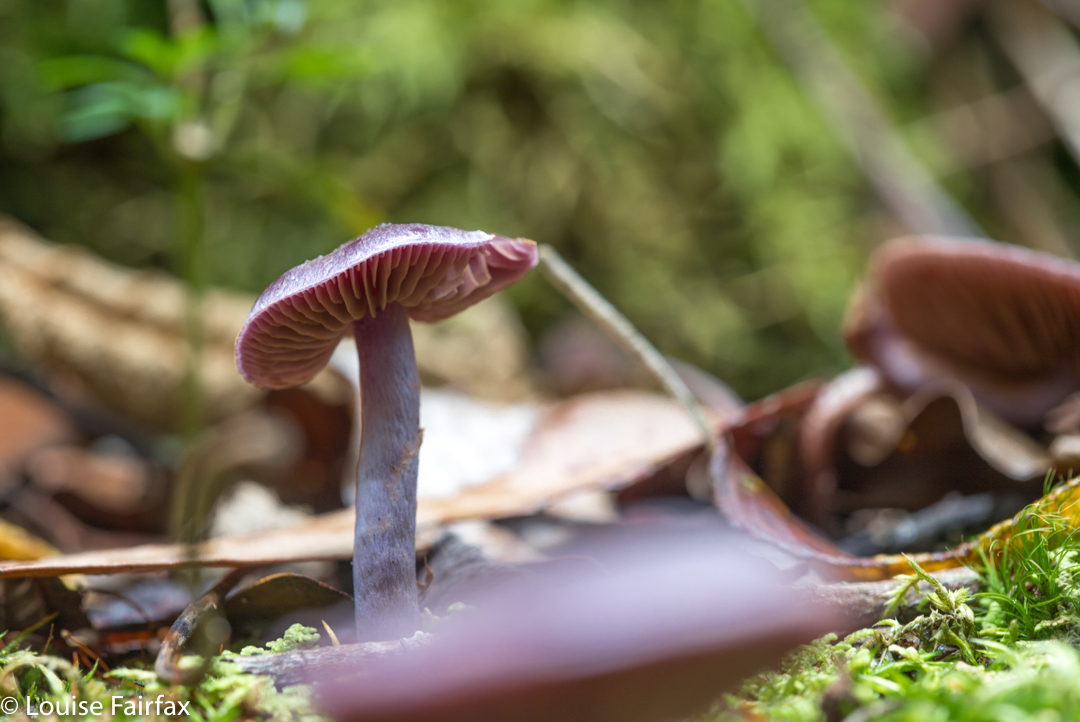
The sign said 40 mins return. Elementary pre-school maths says that means roughly 20 mins in each direction if you walk at “sign speed”, which translates to about 15 or so for me. 15 went by. 20, 25, 30. Had I missed something? I got out the map to check. Na. I still had at least 600 ms to go. Hm. I’d be lucky to do one way in 40, let alone there and back! Panic hunger began. Lunchtime would find me at the waterfall, not at my car. Anyway, the scenery was superb, and the gymnastics needed to make progress, somewhat diverting, so on I pressed. Hundreds of fungi and countless moss and lichen specimens later, I finally arrived. I loved the end result, and took a long time enjoying the area.


The way back was faster than the way out – a neat, round 40 minutes – as I was rushing, and I knew more what I was doing now I had a modicum of familiarity. I avoided the deadly ledge by staying in the creek, thereby, unfortunately, missing my very favourite fungi that I had saved for the return journey. Oh well. I got back to the car before I fainted from hunger, and drove home in 34 minutes. That makes this the closest waterfall to my house, I believe. I’m so glad it’s so very well worth visiting. Lillydale Falls are possibly not much further, but with only a five-minute walk, they hardly justify the drive.

McGowans Falls 2018 May

McGowan Falls, May 2018.

I had for some reason expected McGowans Falls to be a little like Lillydale or Liffey Falls, with signs, paths, picnic tables and so on. I was thus rather  surprised to discover that there was not one single direction post to the falls, no road names to give you a clue where you were, just in case you had doubts, and no “arrival status” save for a little cairn with some adorning pink tape. (Not necessarily complaining: just noting. I neither want nor like infrastructure at my falls). If you look down the track, you can see some orange tapes for variety, and even two discarded beer cans hanging in trees in the first three metres to alert you to the fact that you are there.

Russula persanguinea
The fact that these falls are not “maintained” means that the pad is an aesthetically-pleasing bush route; there are no metre-wide, levelled-out paths of fake material so you don’t slip; no handrails, and, oh joy, no bridges made out of that plastic stuff Parks now favours – and no viewing platforms to ruin the place. There was not even any rubbish. Weee. It had a magic feel to it.

Off you set down a track wide enough for cars for a couple of metres, and then you hang a left (taped) and your track becomes a narrow and appealing route through a rain-forested fairyland along to the top of the falls, and then down a steep climb to the bottom if that’s what you want. It’s not a big walk: it took Carrie and I twelve minutes to get from the car to the base of the falls. It took a LOT longer to come back up – not, as you might think, primarily because we were going upwards, but rather because we had agreed that we would go straight to the falls and then shoot fungi on the way back out. That took a VERY long time.


Cortinarius rotundisporus

Cortinarius austroviolaceus I think. If you know better, please advise.
And how do you find the magic cairn that begins this mini-adventure? Turn down the road immediately to the west of the Cam Bridge (A10. W of Burnie), and travel on it to Yolla. There, turn right heading for Takone on what is, or at least becomes, Farquhar Road (not named as such). Stay on this as it goes through “West Takone” (nothing there) and on for a few more kilometres. Ignore the (right hand), northern-pointing Pruana (unnamed / unsigned) Road, and drive until you reach an intersection that is the shape of a fairly narrow Y. Now you turn right to join Relapse Creek Road, not that there is a sign that informs you that this is the case. I marked this intersection on my gps to be doubly sure that I was where I wanted to be and turning right off Farquhar Rd at the right spot. Once you are on Relapse Creek Road, you don’t have too far to go (maybe about a kilometre) until you see the cairn and tapes on your right. The waterfall is on Relapse Creek, downhill to your right. The route from the top of the falls to the base is not for the faint of heart. There’s one “delicate and interesting” ledge section that should be avoided by people not used to negotiating such things.

Boletellus obscurecoccineus

Gable Hill, Bawleys Peak, Bellevue Tier 2018 May

Bellevue Tier, Bawleys Peak and Gable Hill 2018 May
On Wednesday, a small band of us who all enjoy being in the bush and some of whom enjoy ticking lists of High Places went off together to climb four bumps, namely: Bellevue Tier, Bawleys Peak and Gable Hill, which all have in common, not only that they are on a List of High Places but also that they are near Bronte Park, so can be attained in a single day. (We also ‘summitted’ a fourth thing, but it was such a non-event I don’t even know its name. It overlooked the London Lakes, but the view was hazy.) If I am in the bush for collection purposes and to tick boxes, then I prefer to amass Abels or waterfalls, but decided to forego adding another waterfall to my increasing list of beauties in favour of being sociable for a change. A lot of my walks are solo these days, to the extent that I am becoming rather reclusive; I thought climbing a few bits and pieces with friends would be a fun change. It was.

Descending from Bawleys Peak.
I am not at all in love with the Central Plateau, finding it far too dry for my liking, and devoid of fungi, ferns, shade and the things I love about ‘good’ forests. So, I hope my friends are flattered that I opted for their company despite the fact that I wouldn’t be on top of a shapely mountain, I wouldn’t be in the forest I like, and I wouldn’t be beside flowing water. In a group, you don’t even have the fun of doing your own navigation – although I have to confess I did slip off once or twice to choose my own route and meet the others at the top. I can’t play sheep the whole day and remain happy. But I did meet some great folk, and have fun and interesting conversations, and I enjoyed the camaraderie of being with likeminded people.

Ascending Gable Hill
Bellevue Tier seems rather shapeless and viewless, despite being 1126 ms a.s.l.. Its merit lay in the exercise value (4 kms in each direction) and the walk-and-talk combo that took place. Bawleys Peak, our second high point, a fair bit lower but far steeper, was much more fun (See contour map below). I took it head on while the others went around to the right, and my route gave me a good adrenalin rush, with quite a few rather narrow ledges and iffy patches of climbing. Therein lay my first of two climbing thrills for the day. We sat on a beautiful mossy ledge looking out at the very hazy scene and whopping drop below while we had lunch.

Gable Hill
Our final fling for the day was the best: Gable Hill, on the other side of the rivulet we could see. This hill had very interesting boulder clusters that I liked, and some boulders at the summit that goaded me by appearing impossible towers to mount. I wanted to photograph someone else on top, but nobody expressed even remote interest in answering the taunt of the rocks, so, I set about climbing them while the others ate afternoon tea. I was very nearly too fat to get up the narrow chimney I was using for leverage, feeling like Pooh bear after too much honey, and rather fearing that any second I could tumble backwards and splatter on the rocks below like a tin of strawberry jam, but with a bit of breathing in and shoving, I managed not to cause deep distress to my daughters, and to get to the top of the obstacle. The others very sweetly played paparazzi to record the success. By that stage I was more interested in the fact that I was still alive and uninjured than that I had got to the spot on top. From the safety of my bedroom now, and thus in retrospect, I can report it was a fun climb. As I posed, however, I was pondering how on earth I was going to get back down, and was wondering if the gents would mind catching me. Not necessary, as it turned out.


Gable Hill
Unfortunately, the Central Highlands area also lacks the kind of coffee I like buying. Oh well. I am waterfall bagging on Saturday, and can have cappuccino in a cafe then.


The rock tower that I climbed (using a chimney to the right).


For both peaks, the ascending route was the more easterly, the descent, more westerly.

Coalmine Creek Falls 2018

This blog is here for records’ sake. I got permission to go here while the former owners were in possession. However, a 2019 post script is that the private property has now changed hands. I have no idea at all as to the new owners’ willingness to have people look at the falls. They still have people staying there, and those people can still go to the falls, so theoretically there should be no issue, but Australians live in constant fear of litigation these days, so you never know. When our magistrates and judges stop awarding damages to people who sue totally innocent owners of land or minders of the surf, then we might all live in greater kindness, harmony and generosity. That day has not yet arrived.

Coalmine Creek Falls Liffey

There is a path from the little cabins going up beside the creek. Even in 2017 there were fallen trees over this path from the earlier storm, so there’s a bit of clambering to do. Not a waterfall for the agility-challenged.

Aldebaran 2018 Apr

Mt Aldebaran, Apr 2018


Somewhere up there Mt Aldebaran is hiding. Looks inviting, huh?
I really wanted to climb Mt Aldebaran before the super cold set in, having missed my chance over the summer. I decided it needed to be a solo venture, but thought I’d like to do it in the school holidays, as maybe I’d accidentally meet someone up on the range, and that would feel nicer. I had my plan: early start on day one, use the Kappa moraine shortcut and continue up to Lake Sirona to sleep. I’d looked at my stats for what I’d done in the area before, and this seemed feasible. Day 2 would be a shorter, easier day, just climbing Aldebaran from Sirona and enjoying being high for what was left of the day. Day 3, I would begin my descent and climb Carina Peak, dropping just as far as Promontory Lake. Day 4, out. But then I got an email from a friend saying he’d like to join in. He lives in Hobart, so starting Thursday morning suited him (rather than sleeping in the carpark Wednesday night, as I had envisaged). That was fine, although it did make reaching Sirona unlikely, but having his company – a mud buddy – would be lovely, so I agreed.

If you look carefully you can find my friend heading off into the mist.
Day 1 did not go brilliantly. Our later start ended up very late indeed, and the track was very muddy and slow, We only made it to just past Seven Mile Creek before dark set in. I squandered half and hour at the tail end of the day trying to find a suitable crossing point for the creek that had now reached fast-river proportions. I kept going upstream until I found a fallen tree that I could hold on to. I didn’t trust myself not to be swept away otherwise. And now it was dark. Time to pitch the tents, collect water, eat and sleep. Boom. No mucking around at this end of the day. I reckon my eyes were closed by 8 pm, having got up at 4.30 to drive down to Hobart.

Up above the clouds already.
All night, it seemed, I pondered the dilemma of what to do with our shortened camping spot. My friend had struggled in the afternoon, and I thought getting his tent up the steep climb could take so long that we would be timetabled out of climbing Aldebaran, which would mean we had to do it on day 3, making day 4 too long. But, leaving the tents where they were and climbing up and down in a day was risky, as it would be a long day, and if we failed, then the trip failed, as there would not be enough time to then get the tents higher and start again. In the end, and with huge reservations, I decided to risk a long packless day, thinking that that would give the best chance of a summit.


A fog bow
Off we set at 7 a.m. Unfortunately, once we started on the steep section, our differences in speed became very noticeable. It was too early in the day to worry. At 9 a.m., my friend suggested I go on without him; he was not having a good day. I said I thought the worst of the climb was over, so let’s stay together longer, but at 10.40 a.m., I had to admit defeat. If we didn’t separate, I wouldn’t get my mountain, so, during the climb up out of Lake Sirona, we parted company, agreeing that I would catch him somewhere on my rebound. I hoped that’d work out.

From on Kappa moraine, looking towards Lake Promontory.
Now I had two big lumps to negotiate before the climb proper began. I was so time stressed by this stage that my memory of these bumps is a blur. My whole focus was on hurrying so as to get to the summit before my turnaround time. My haste meant I didn’t make considered choices, so lost time trying to get off a cliff that was too high to leap from, but had no way around. I gave up, but on the rebound, noted wear marks leading over the edge of a different cliff. Aha. A way down around the obstacle so the climb could continue. On I went, hoping I could remember all this on the way back, when I would be equally stressed for time so as to avoid being up there in the dark.

Weee. I can see Federation Peak – that fabulous fang in tiger distance.
Aldebaran has, it seems, four summits. Excitedly I climbed the first one, ready for jubilation, only to find two more bumps ahead, both of which seemed higher than this one. Grr. More wild dashing. At last, and getting tired now with all this frenzy, I crested the bump. It was 11.50. Oh NO. There was another, bigger bump up ahead, previously hidden behind other rocky mini-mounts. How long would it take to get there? My absolute latest turning around time was 12.30. More rushing. Hoorah. At 12.10 I stood on the summit and there were no more summits. I touched, took a few photos and thought I’d better go. To my horror, clouds, were now floating with a frenzy equal to my own, rising faster than I did up from the valley below and circling around me. I was about to lose my visibility. This was a complex mountain: i.e., this was very disconcerting news indeed. Meanwhile, it was very pretty, so I took a few more photos. Might as well die with attractive shots in the camera for my family to enjoy.

Still climbing. Looking down over Haven Lake to Mt Taurus.


Mist closing in on top.
On I went, over bumps and through more saddles, hoping I’d remember my route. At the last of the bumps, I found my friend, so we descended to Sirona together. I’d made OK time back, so the pressure was easing, although A wanted to climb Scorpio. Fair enough, He hadn’t got to climb Aldebaran. He set off while I did some eating, saying I’d give chase. I caught him at the saddle before the final climb, and had great fun photographing his ascent (see below).


The route ahead. Ahem.
It had been pretty quick, and we were making good progress, so we now had what I felt were heaps of breaks, and lovely long ones, sitting on rocks watching the shadows lengthen and the atmosphere take on aureate hues as the sun dropped. Next day my friend said he would have liked more, and longer, so I guess all things are relative. At least with my being a task-master and time bossy-boot, we got back to the tents with just enough light to gather water before we lost all visibility. It was a beautiful mild night, and we both enjoyed the light and the slivered moon before falling asleep. I closed my eyes even earlier that night. I heard my friend call something about the moon from his tent, but I was too tired to even answer. It had been a long day, and I was finished.

Climbing Scorpio. The mist cleared back again by Lake Sirona.
We were both exhausted on the third and final day, and the mud seemed even sloppier and deeper. Several times we were wallowing in it thigh deep. We both became covered in its ooze, but were at the cars by 2.30, which was great, although still, by the time we’d changed out of our black, smelly gear and got going, it was too late for our favourite food places. I drove my friend to Hobart, and decided I’d go back to Maydena and use day four for waterfall and fungi bagging and shooting. I might as well use being south while I was here, and had a doggy sitter for Tessa all lined up, so I should use the opportunity while it was available. It was a good decision, and next day I would visit Tolkien Falls, Regnans Falls and Growling Swallet before the big drive home.