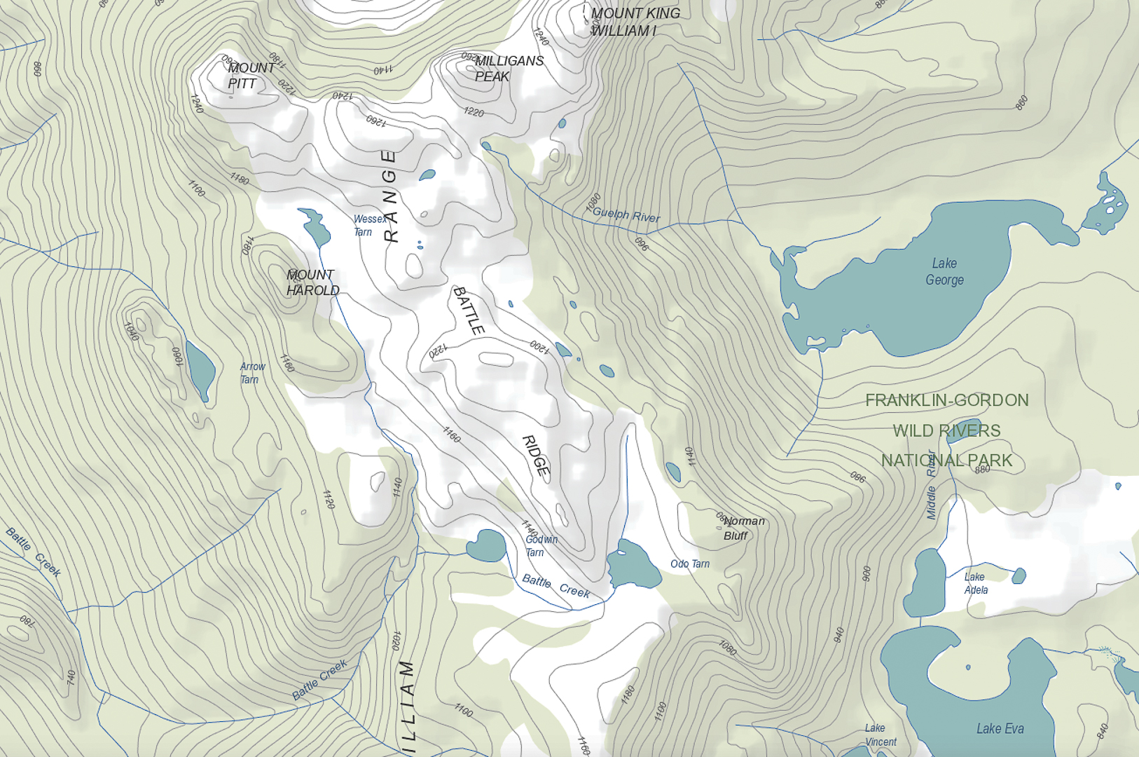
King William Circuit, comprising Mt King William I, Milligans Peak, Mt Pitt, Mt Harold, Battle Ridge and Bayeux Bluff, and visiting Wessex, Odo and Pitt Tarns. March, 2018.
 Climbing Mt King William I. Lakes George and King William in the distance.
I had just returned from a fabulous week with friends at the beach near Coffs Harbour, and felt terribly flat to be back home in my now lonely environment. I looked at the approaching weekend: apart from my darling daughters, no one would ring; no one would pop in; no one would invite me anywhere. Life seemed bleak. I could sit at home and sulk and weep some more for Bruce, or I could be proactive and invigorate my life by joining in a club bushwalking trip. I chose the latter, and phoned the coordinator of the LWC trip to King William Circuit. HIs plans sounded great. All of a sudden I had to pack my bags pronto. The expedition was leaving at 5.30 a.m. the next day, which meant a 4.30 awakening. Yawn, but it would be worth it.
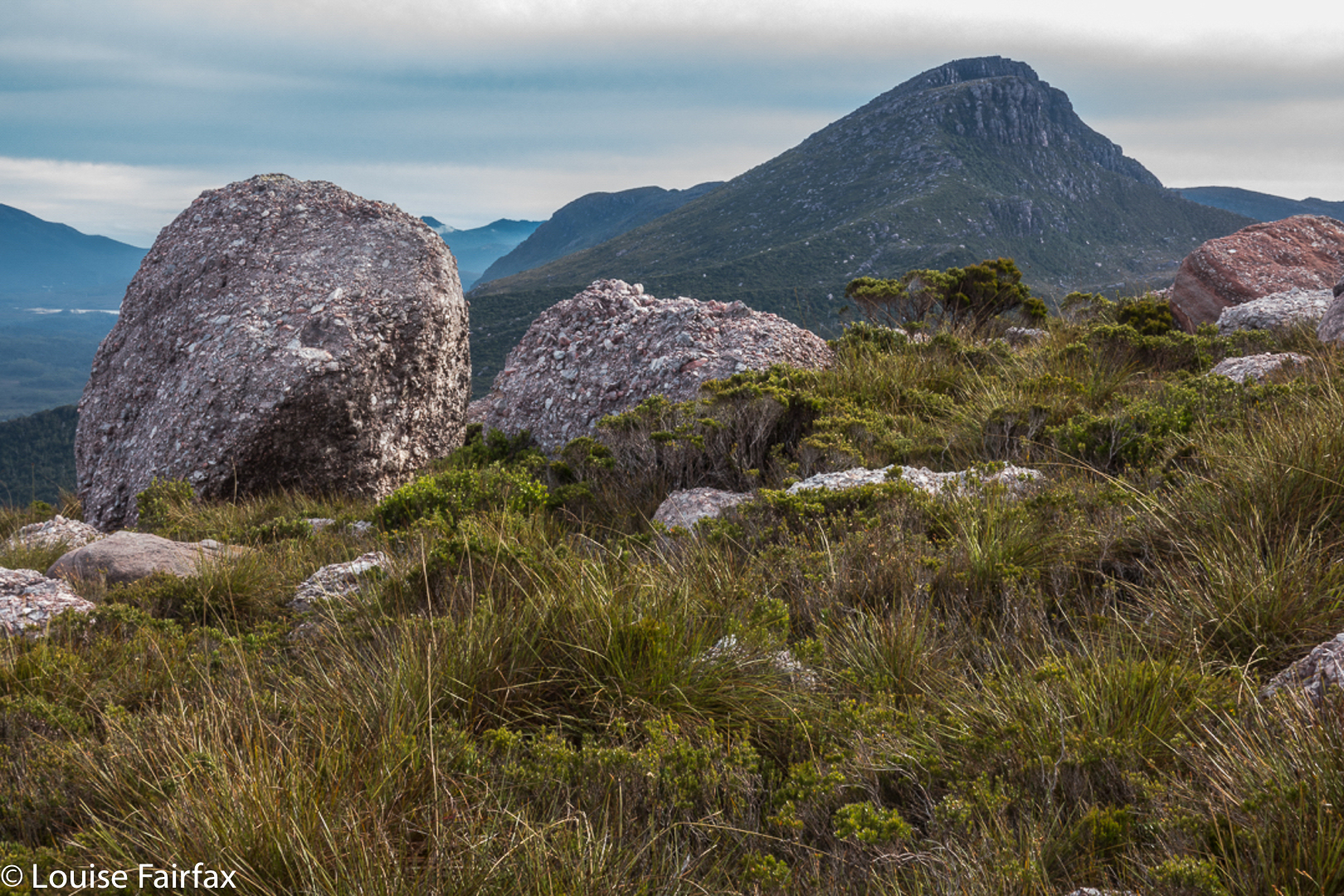
 From Mt King William I looking towards Milligans Peak and Mt Pitt. The Frenchman is in the distance, as usual.
I had already climbed King William I, but in a whiteout, so this time I got to see the expansive views. With our nice early start, the day was not yet too glary. It was, nonetheless, the rest of the expedition that held my attention.
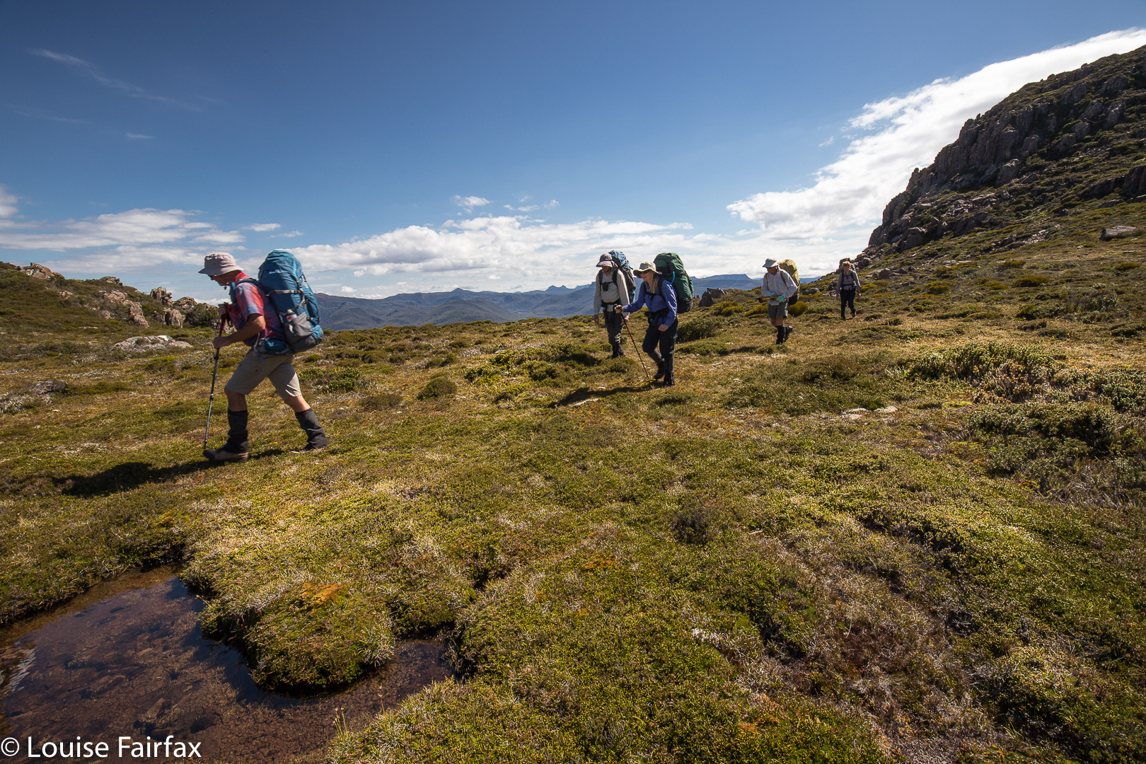 In the saddle between King William I and Milligans Peak.
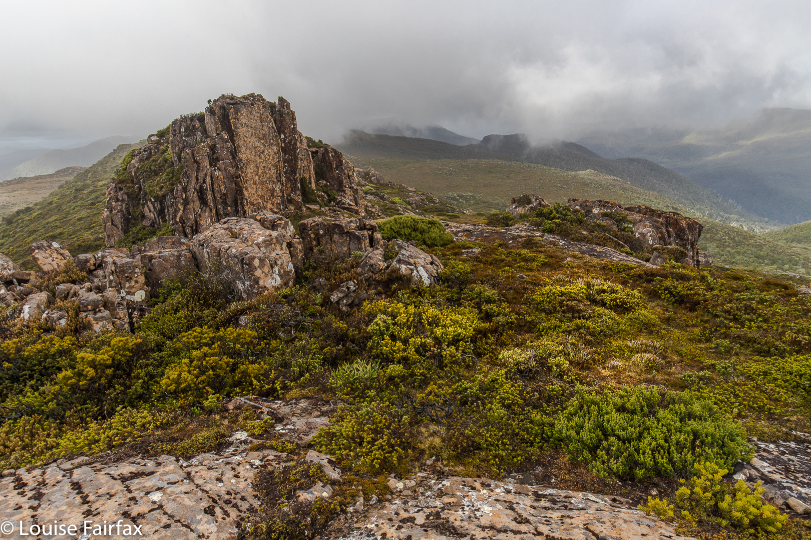
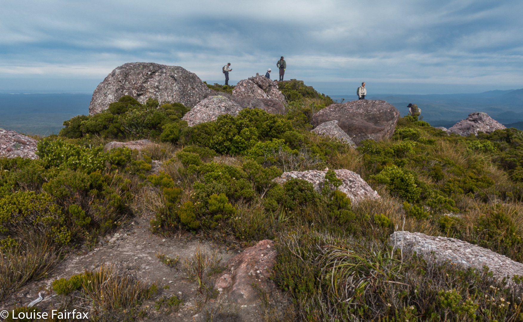
Once we left King Will I, we were in more interesting and less-frequented off-track territory, moiling our way towards Milligans Peak, which was very quickly reached (12 down, 13 up) from our first peak. (Note please: my times never include stopping to remove packs, take photos, eat or whatever; they are “exercise minutes”, as I am interested only in how much exercise I’ve had. Have I been lazy, or have I had a good workout?)
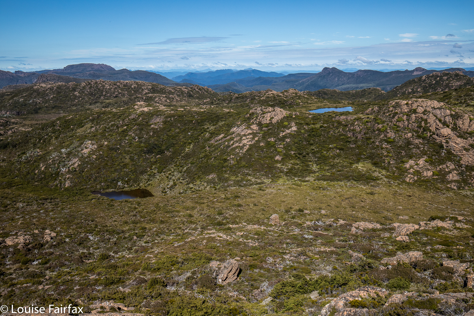
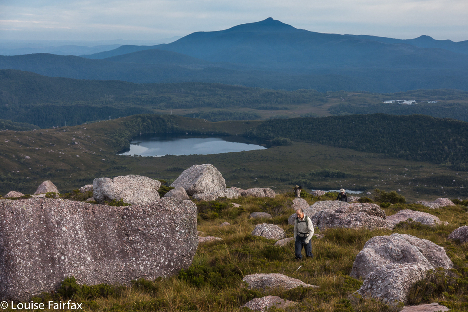
View from Milligans Peak to Guelph Tarn (L) and Pitt Tarn (R).
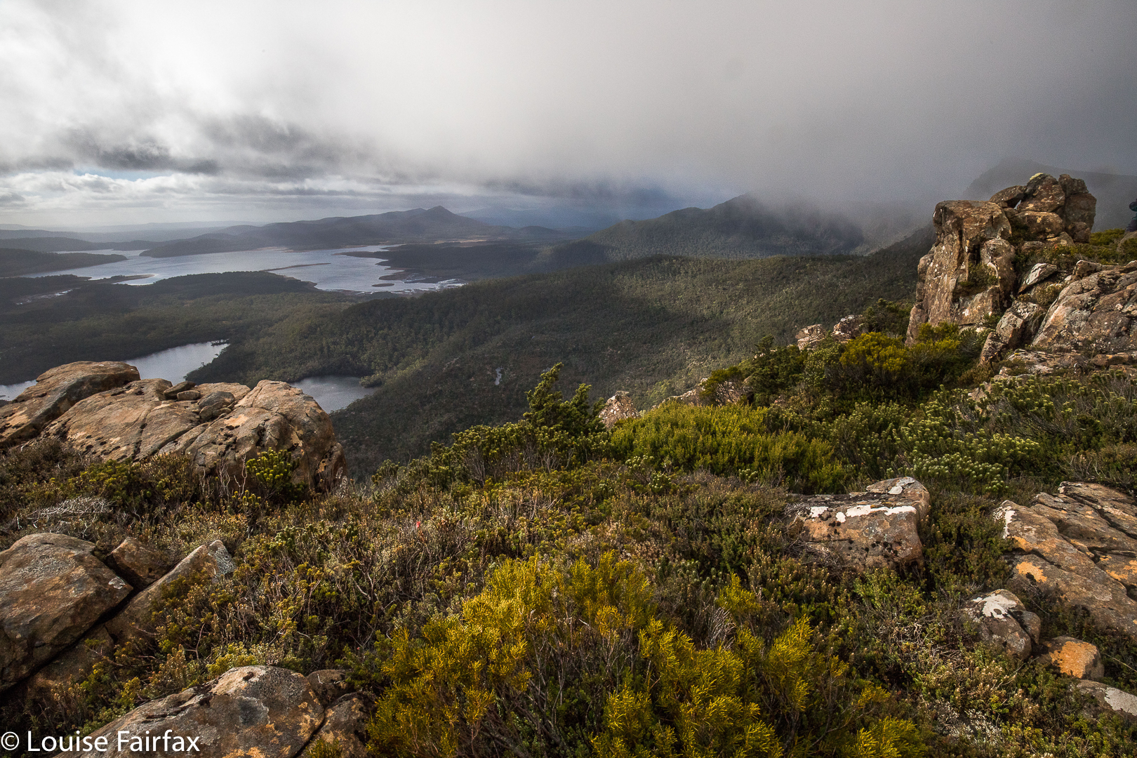
Milligans Peak offered more great views of old friends such as Slatters Peak and King William II, the Loddon Range, Lake St Clair, Lake King William and our future destinations of Mt Pitt, Mt Harold and Bayeux Bluff. The day was sunny and warm; the weather forecast for rain, a joke. Off we set to be reunited with our packs below, to have lunch by a little pool down there, and to then proceed to our tent tarn underneath our next goal, Mt Pitt.
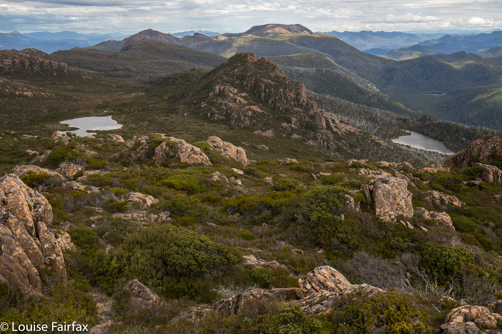
 Mt Pitt summit, looking back to Milligans Peak (R) and Mt King William (L)
Tents erected, day packs loaded with goodies and anoraks, we noted the amassing clouds but were unfazed. Off we set to inspect the views of Mt Pitt, quickly reached in 21 minutes from our tents.
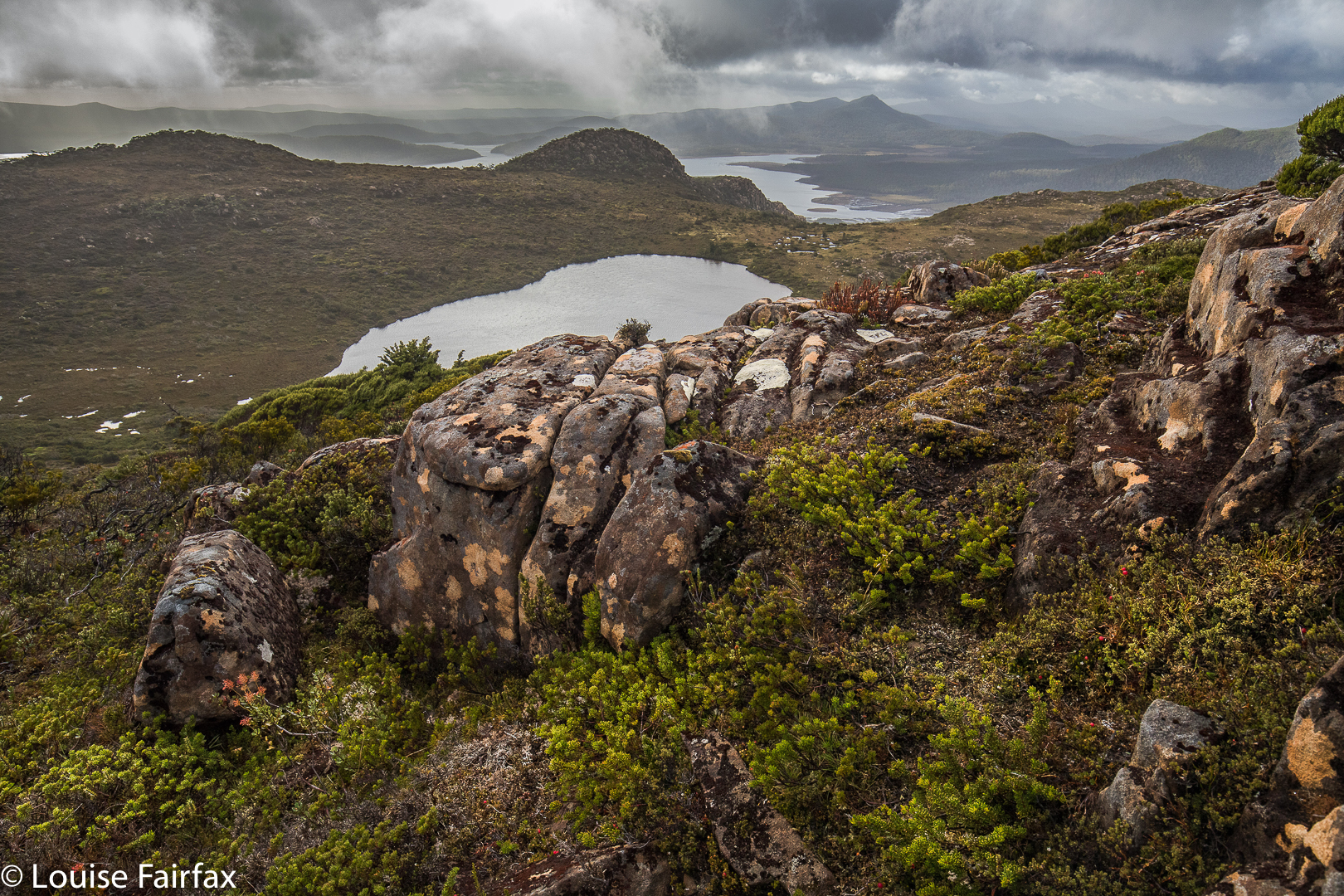
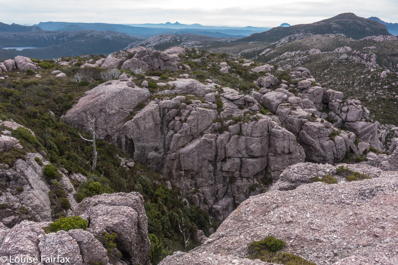
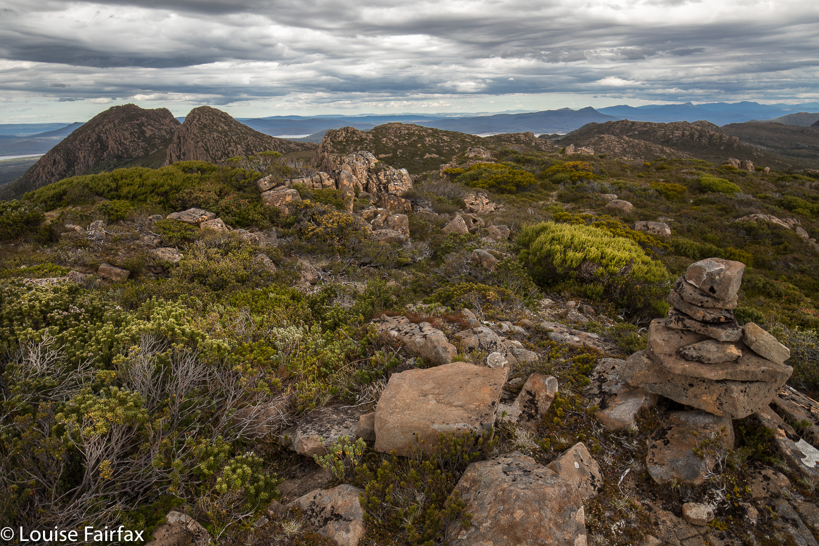
 Mt Pitt summit view, looking directly to Mt Harold, which has Wessex Tarn to its L and Arrow Tarn to the R. In the distance, slightly left, is Bayeux Bluff.
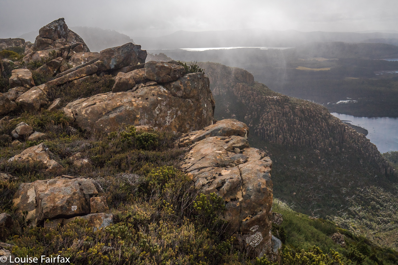
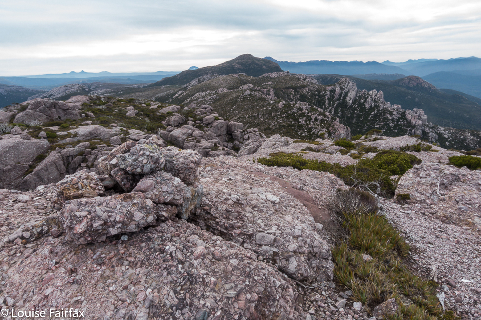
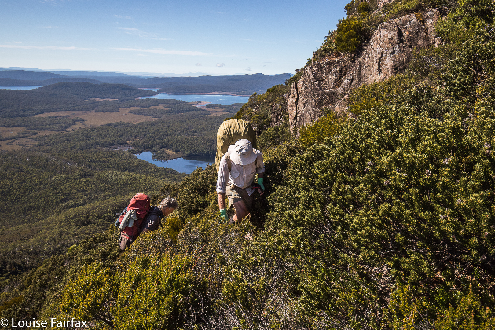
The next mountain was the best one of the trip, and a memorable mountain under any and all circumstances, with its hedgehog spikes all over its spine that caught your attention from afar, and had you wondering how, actually, you were going to touch the high point. I plotted my intended route from Mt Pitt, and carried it out with no problems. Having been initially daunted by the rock spikes, it gave a special feeling of pleasure to be on top of both the false, and the slightly higher, real, summit. Drama was all around.
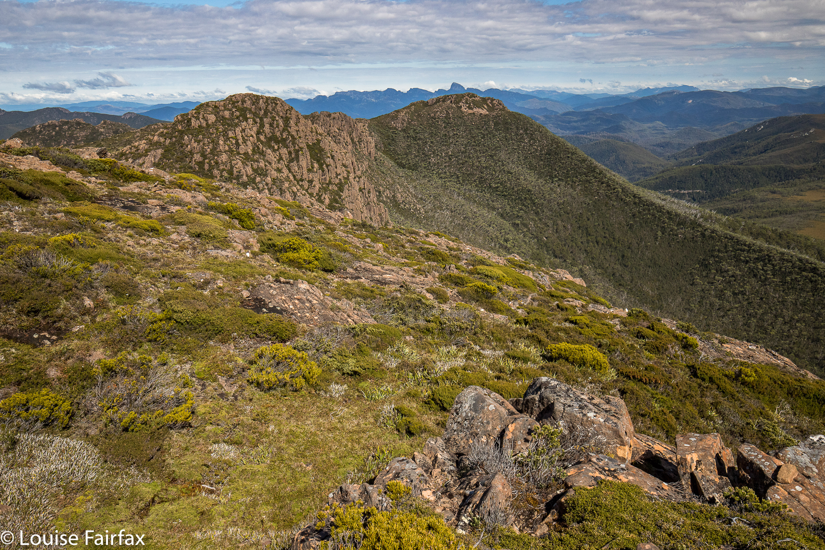
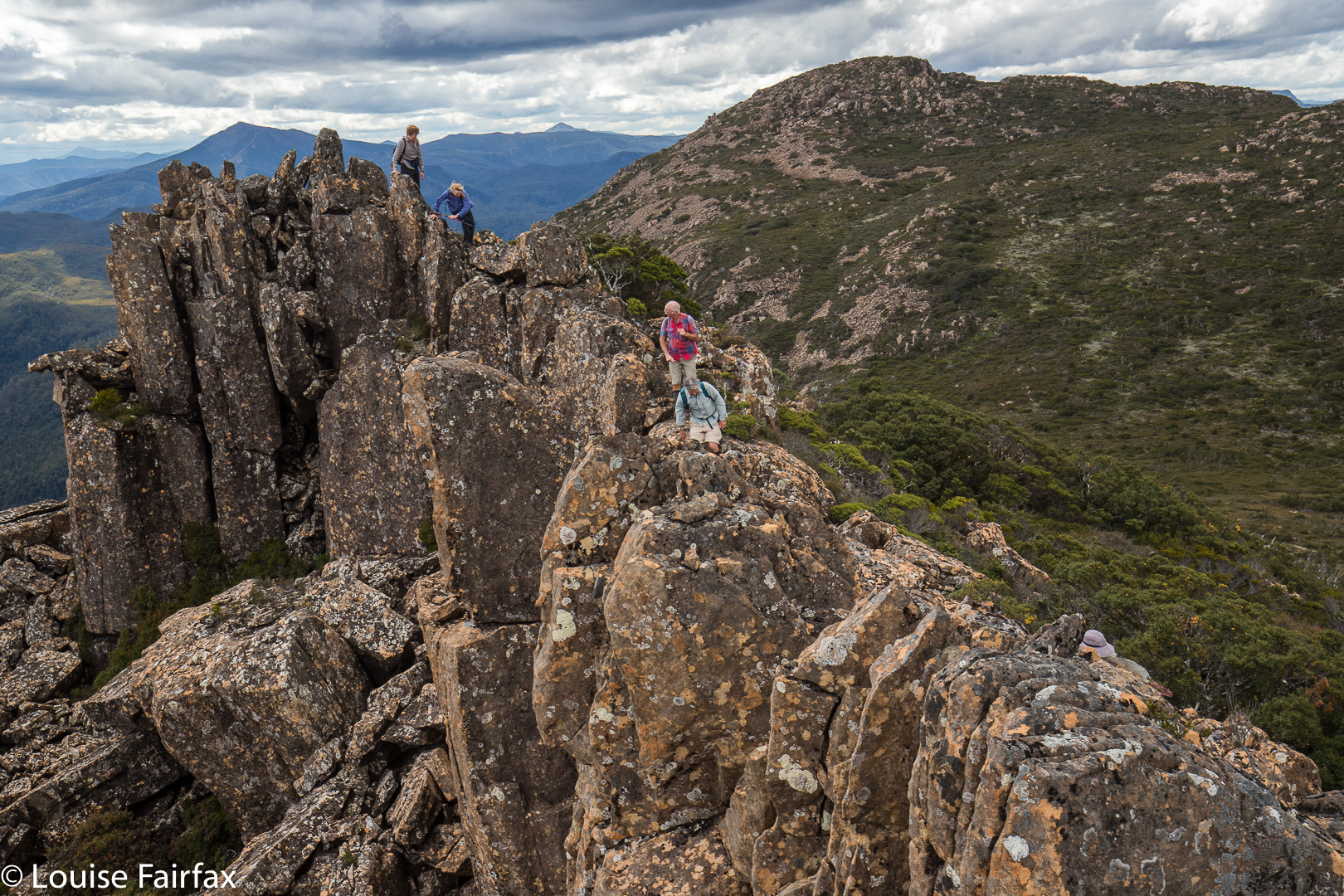 Looking from Mt Harold real summit towards Mt Harold false summit. Mt Pitt is back right.
We all voted it the highlight, and abused the people who haven’t even given it a point. In fact, not only is it not worth a peak baggers’ point; it is neither an Abelette, nor a “Point of Interest”; neither did it get a nod as a “Bob Brown”. It is totally ignored by the people who sit in offices (or, reputedly, at the dining table after a few wines), staring at maps deciding what is “of interest”. We who visited this mountain think it is of extreme interest, and we loved it dearly.
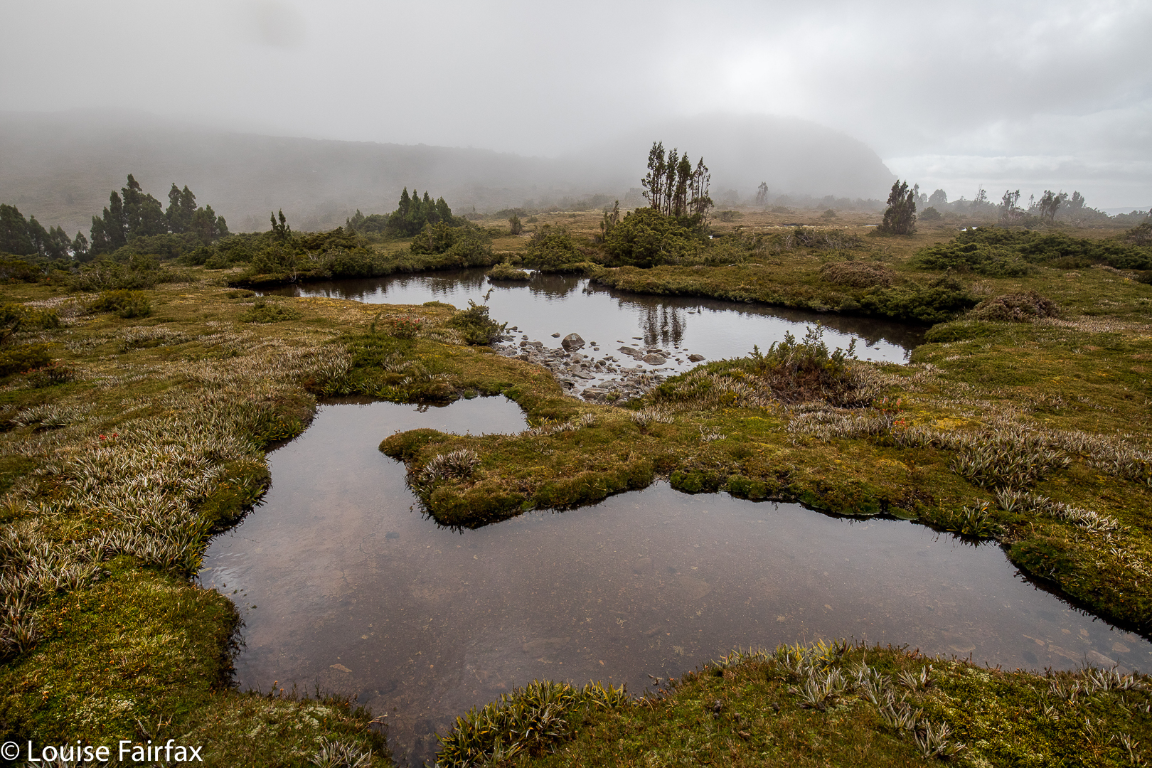
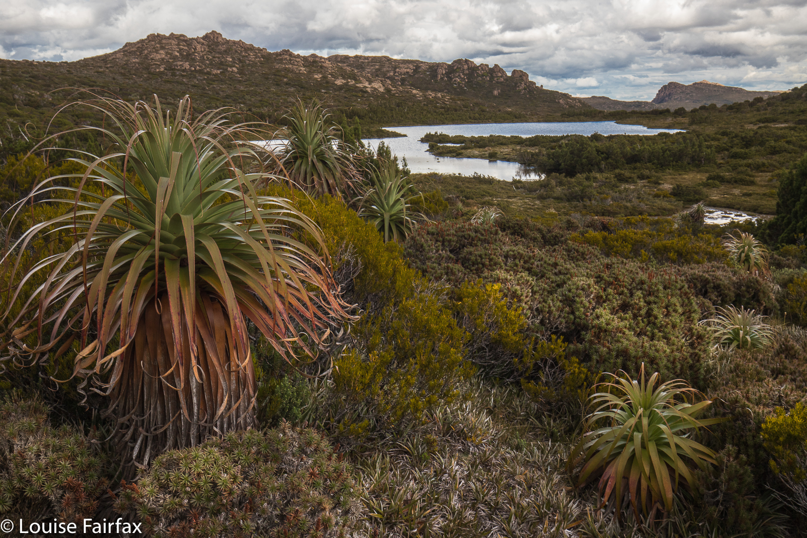 Wessex Tarn. Battle Ridge to the left.
Off the top of Harold, we lowered ourselves through the scrub until we reached the beautiful Wessex Tarn. Now, from even before we climbed Harold, we were in the Battle of Hastings territory, with Arrow and Wessex Tarns on either side of our spiky castle and Battle Ridge in front. Norman and Bayeux Bluffs were up ahead, as were Odo Tarn, Battle Creek which runs from it, and Doomsday Bluff, beyond Bayeux. (To refresh your memory, in case you’d like it, the Bayeux tapestry depicts the Battle of Hastings, in which the Normans, under William the Conquerer, invaded and defeated England – under the leadership of anglo-saxon king, Harold Godwinson, in 1066. The Odo of Odo Tarn refers to Bishop Odo, who is depicted holding a club – presumably not a nice one like LWC, but one with which to bop you off. He was William’s younger, half brother. Later, William, now King William, commissioned the Doomsday Book (1086), an assessment of the land he had conquered and its wealth, so he could raise the taxes). It was fun to be in this territory, and to have as our culmination Bayeux Bluff, which we would reach next day. I am very sad that we didn’t have time to climb Norman Bluff. But then, it’s nice to have a reason for coming back other than just a revisit of old territory.
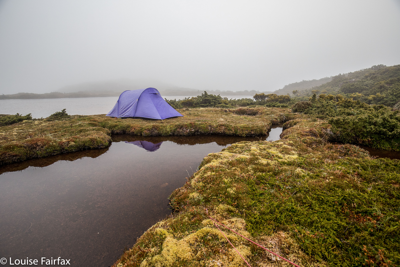
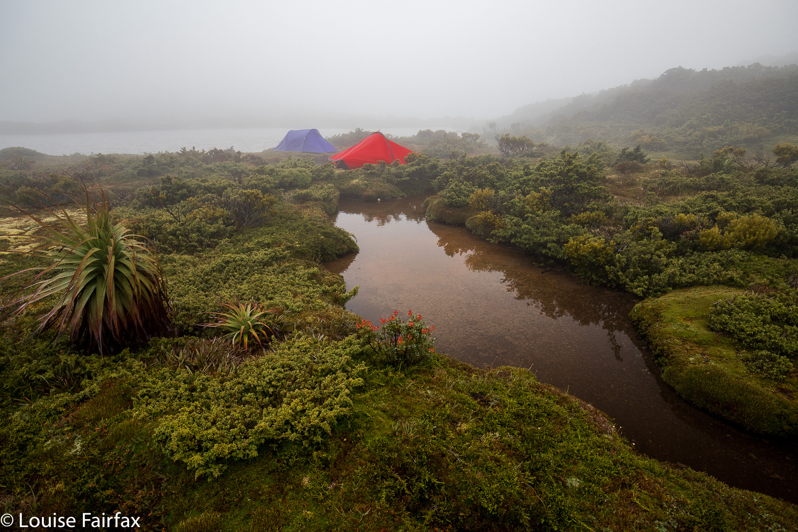 Our trusty tents
Oddly, List Maps has nothing in the area called Hastings. Surely someone could have popped in a creek or tarn or bump … but they didn’t. There are plenty of unnamed features remaining. Adam Guelph, (from Salisbury), who helped William, gets a guernsey (with a tarn and a watercourse), but not Hastings itself. Godwin Tarn presumably stems from Harold’s full name. Of course, from most of our mountains we could see the huge Lake King William; we were on the King William Range. William won. He gets all the big stuff. The victor gets to write history and grab all the best mountains, ranges and lakes.
 Meanwhile, with all this history and four mountains under our belts, we retreated to our tents, arriving about five minutes before the clouds that had been slowly accumulating while we checked out battles, decided to dump their contents with a vengeance. We filled in an hour, and then cooked in our vestibules to the sound of wind howling and rain pelting. My flap buffeted most of the night, and we awoke to pea-soup fog. That did not deter us, however. On our agenda were Battle Ridge, Odo Tarn, Battle Creek and, at last, Bayeux Bluff, from which we would gaze at Doomsday Bluff. This blog is already quite big. For day 2, see the blog entitled Bayeux Bluff
www.natureloverswalks.com/bayeux-bluff/
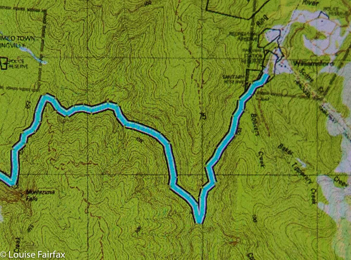
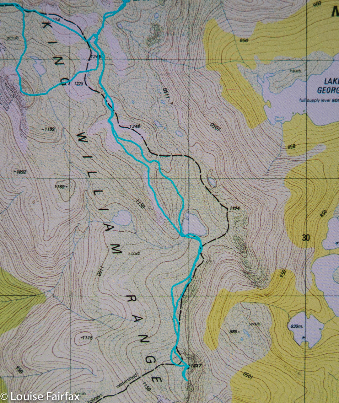
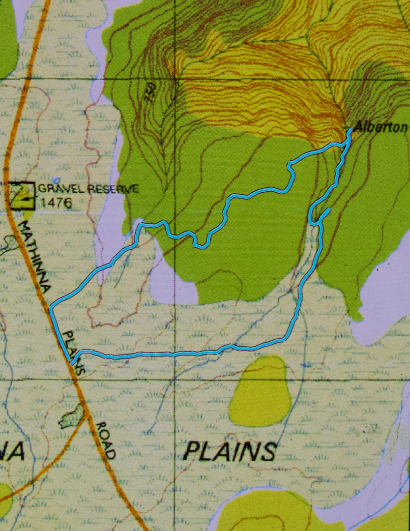
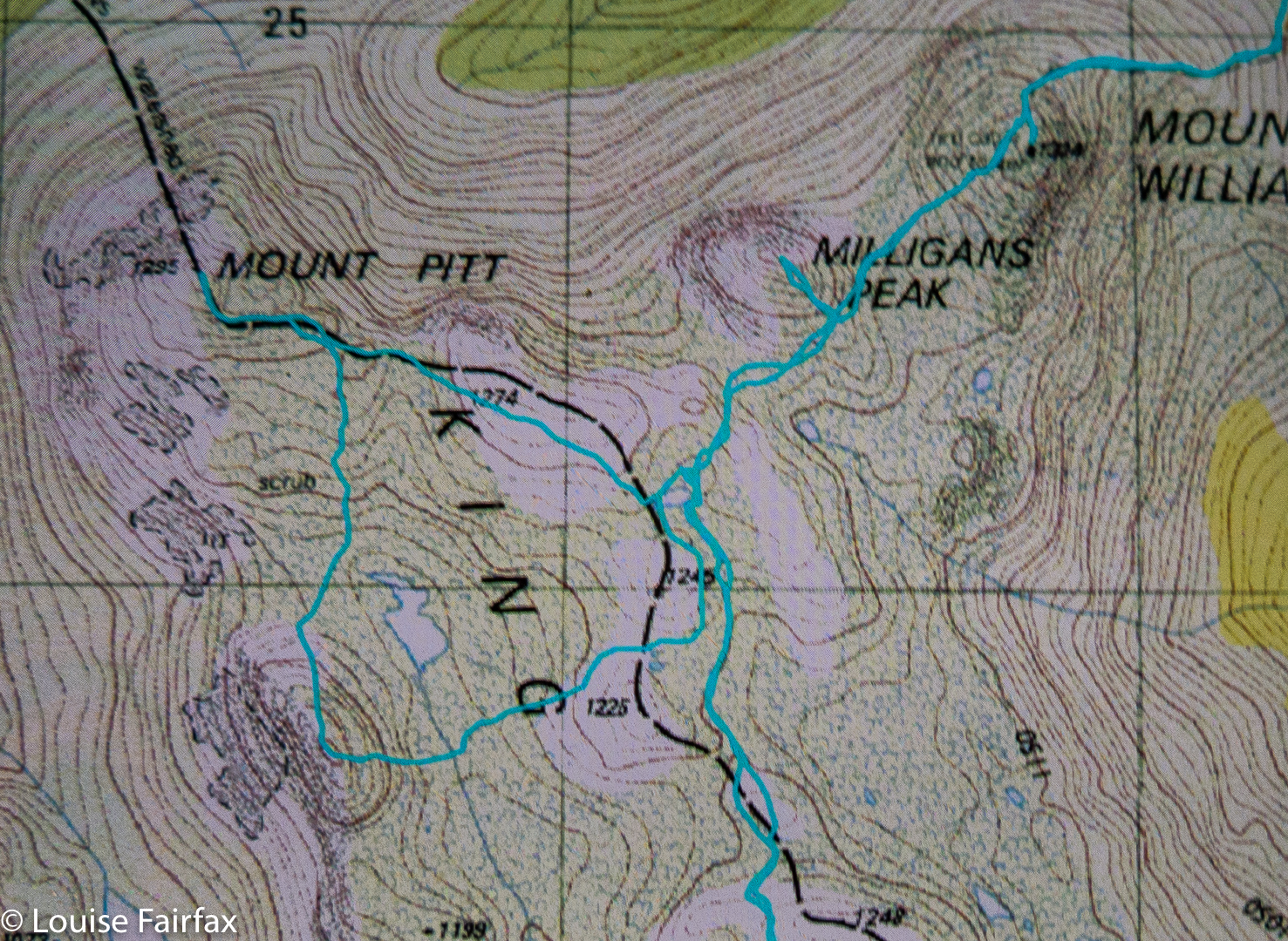 Route Day 1

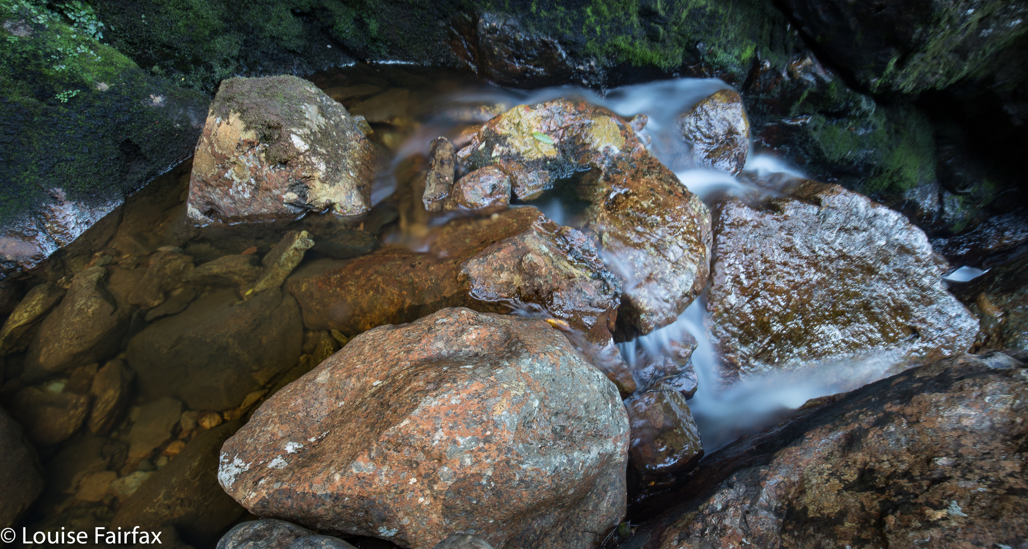
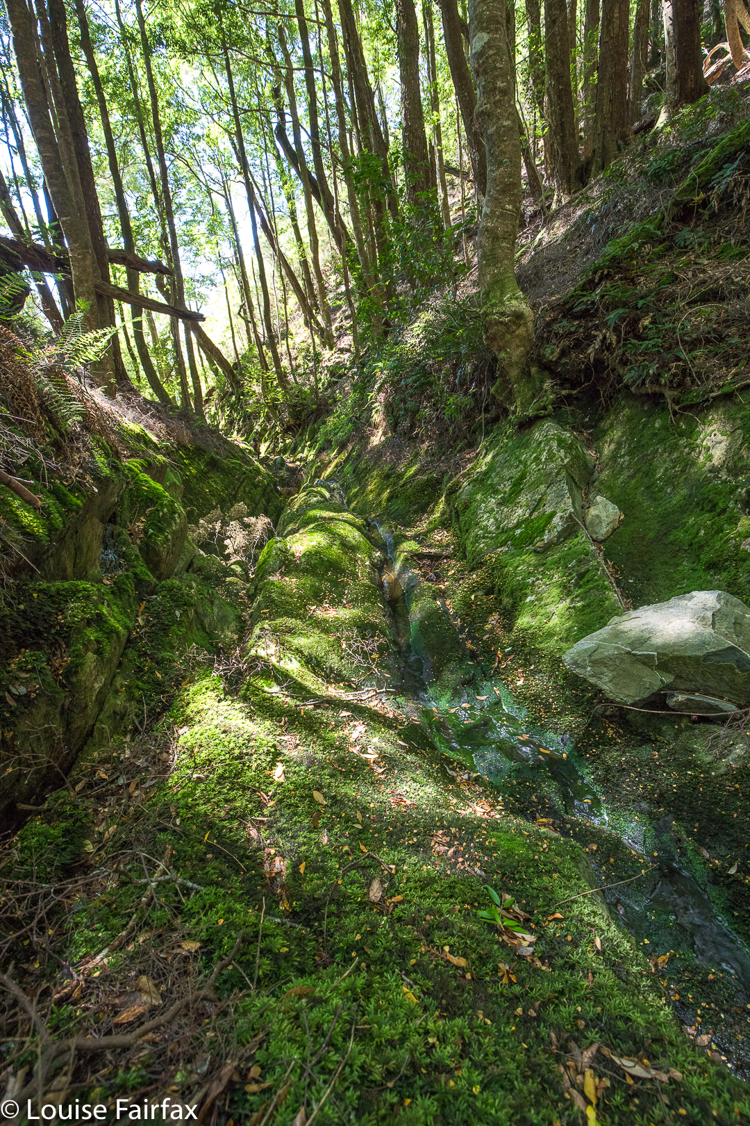
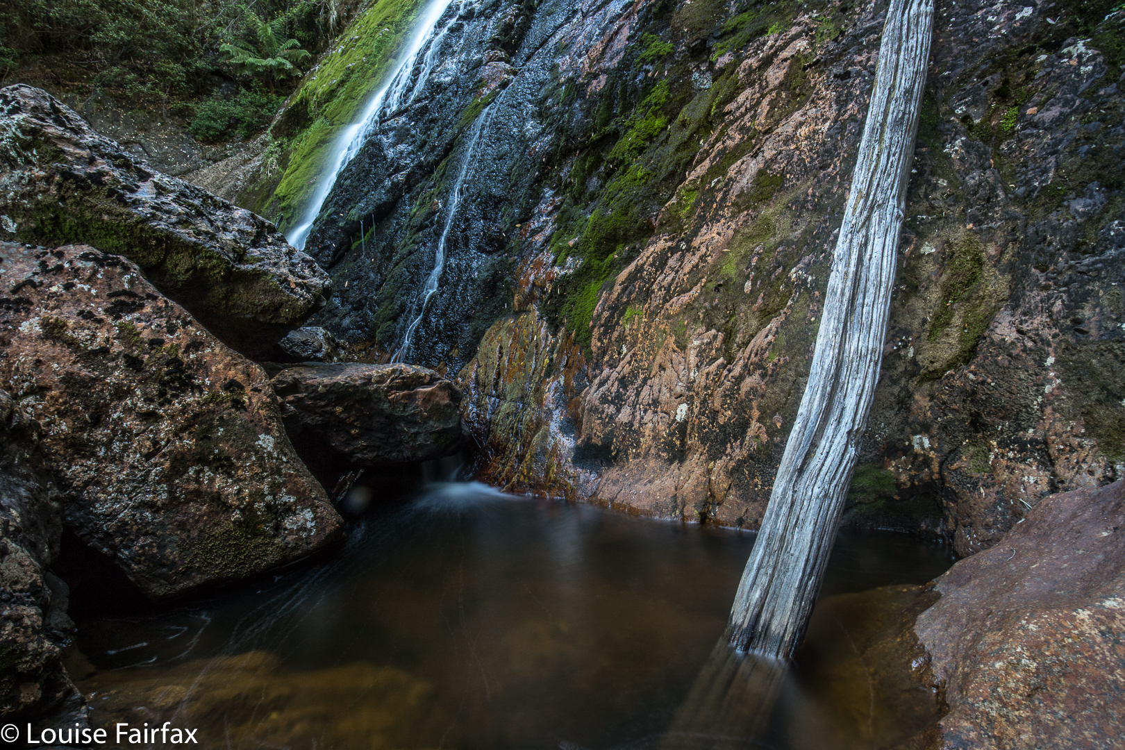 On my first visit, they were pumping so wildly it was impossible to keep the spray off one’s lens, and I threw my picture out. This time, the problem was kind of the opposite, in that they were flowing so demurely that I could sit on top of them and not really get wet. As a result, the photos included here are more “details” of the lower outlet of the falls. You could certainly get up close and cuddly this weekend. Meanwhile, however, if you’re not obsessed with seeing massive and unphotogenic gushes of water down your falls, the delicacy of the offering was, for me, quite appealing, and I absolutely adored the lush green forest en route.
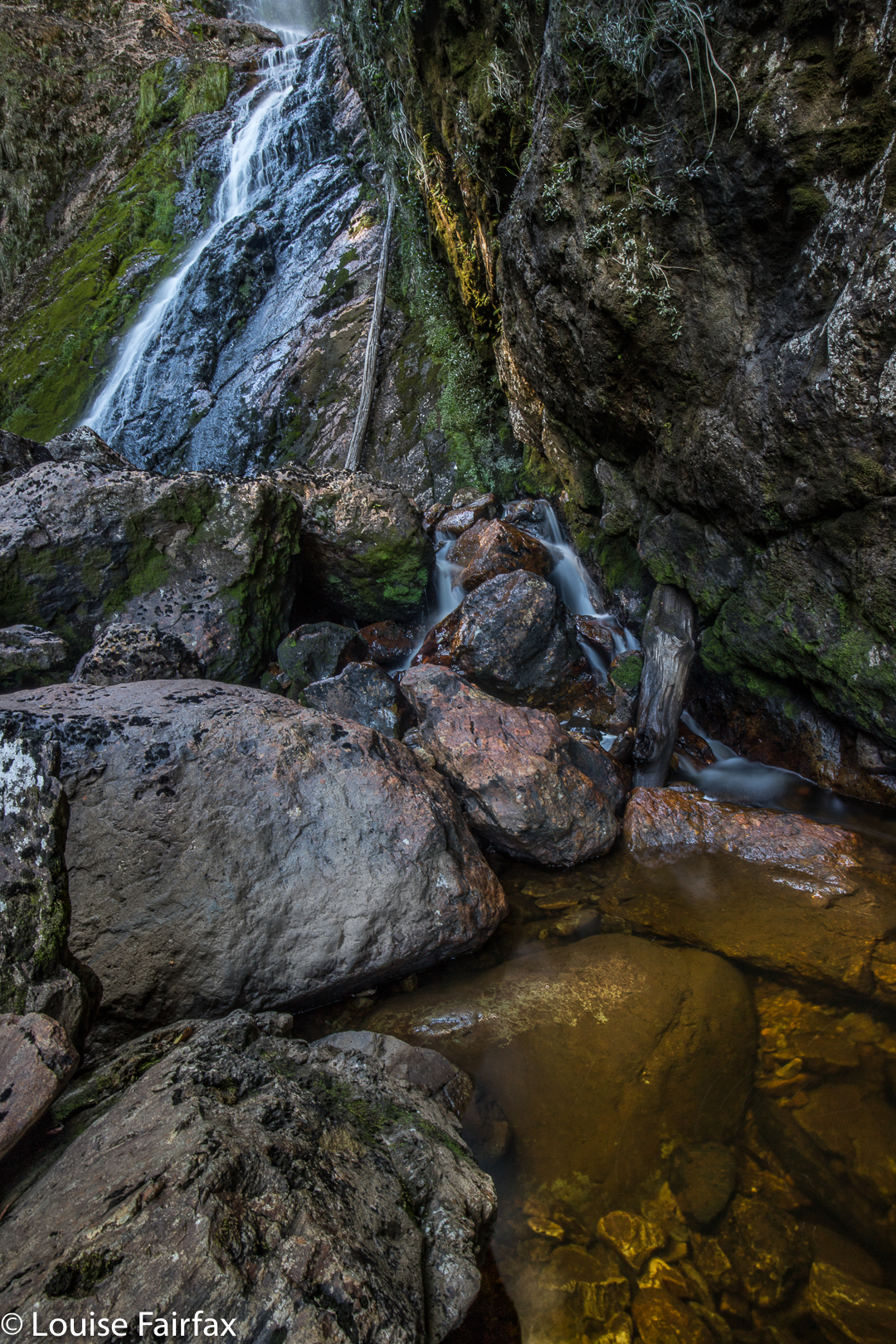 And why on earth did I visit these falls on a hot day in March when the water was bound to be undramatic and the forests bereft of fungi and mist? Because, essentially, this trip was a recce to check out Rawlinson, Frazer and Svengali Falls. I would be driving down from Launceston, and then covering about 22 kms over rough ground on foot, some of which would be bushbashing. I wanted to be able to move quickly (not too much mud) and to walk in river beds should I need to, just to suss things out and get a rough time-frame for the expedition. I now know, for example, that it takes about 55 mins to reach Montezuma, another 38 to reach Rawlinson, and 30 mins to climb up to Frazer. Such items of knowledge are handy when planning future trips. I also learned that bringing just one ETC salad roll and florentine plus OJ is not enough to keep me in food for such an expedition. As usual, I was hungry most of the day, and was stealing lunch by 10 a.m.. I got very low on blood sugar by the end.