Creekton Falls 2017 Oct

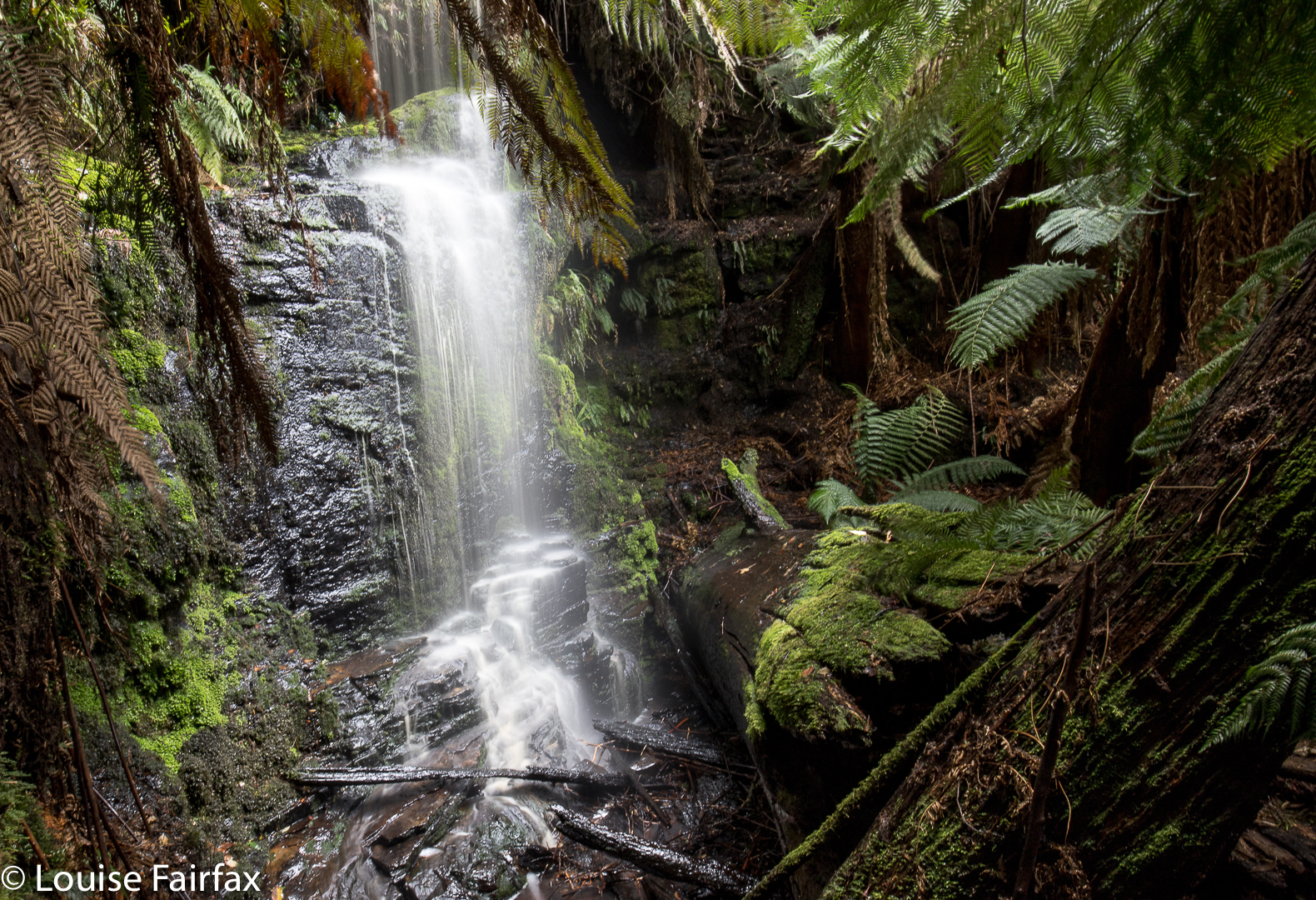
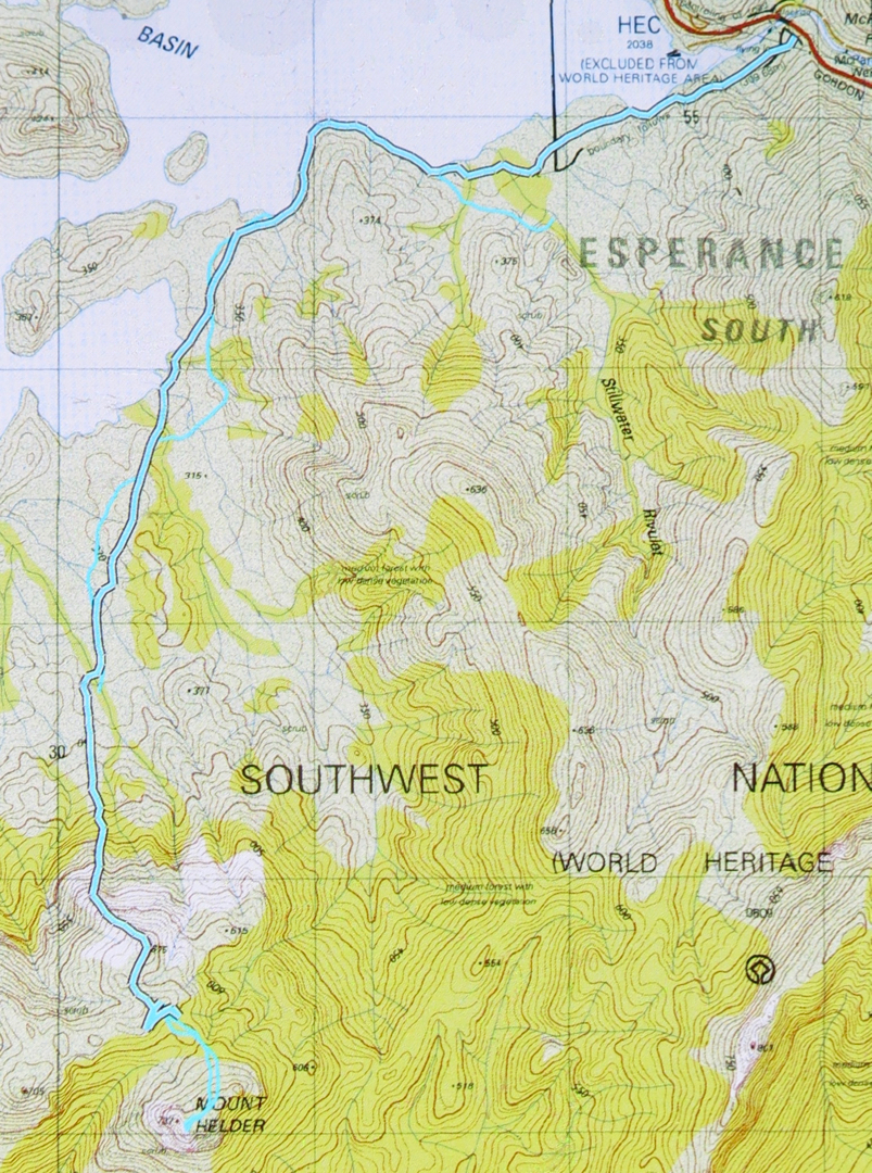
Creekton Falls 14th October 2017


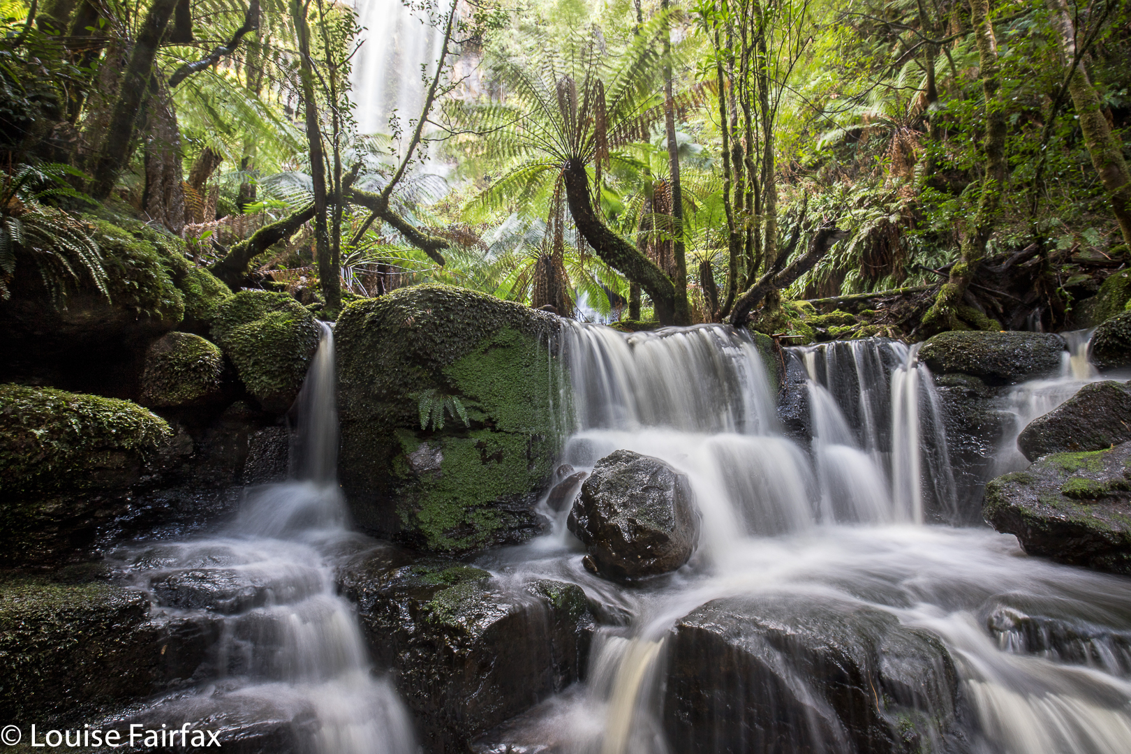
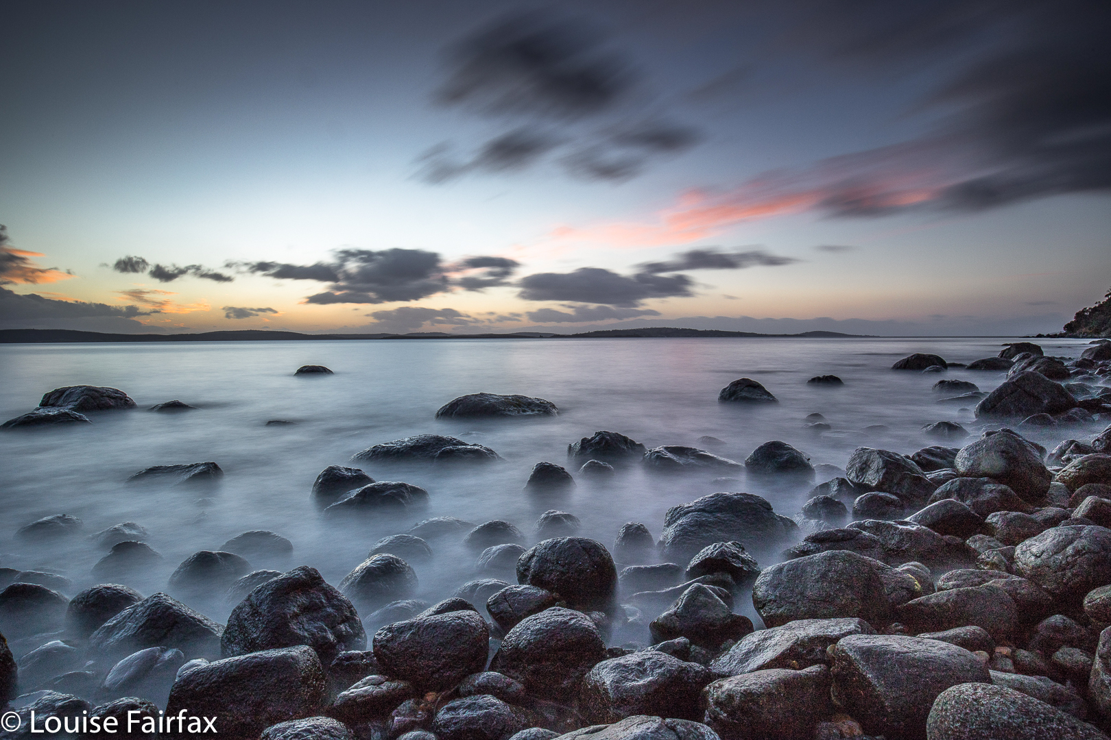
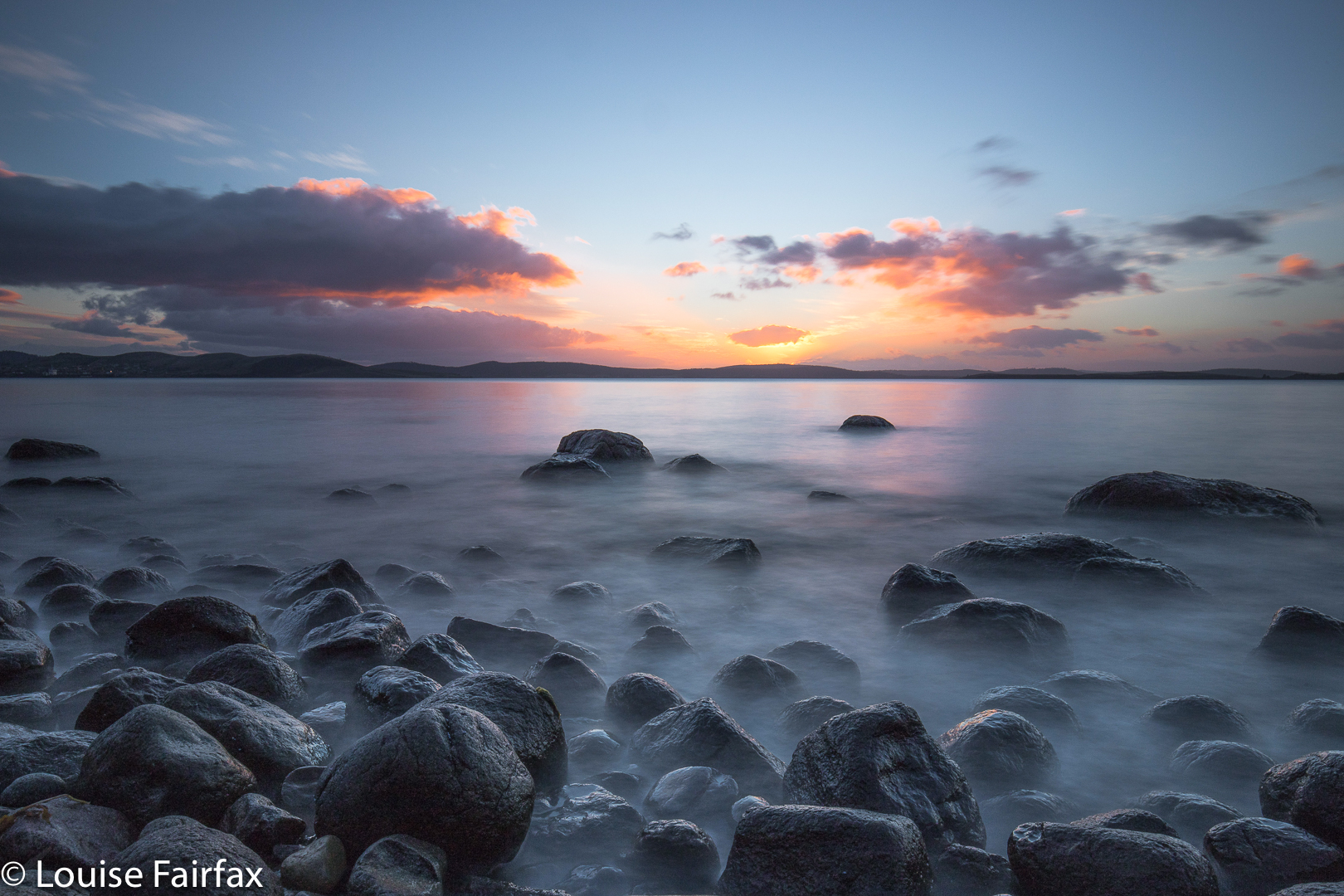
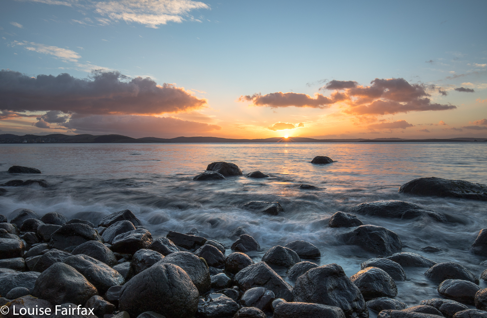
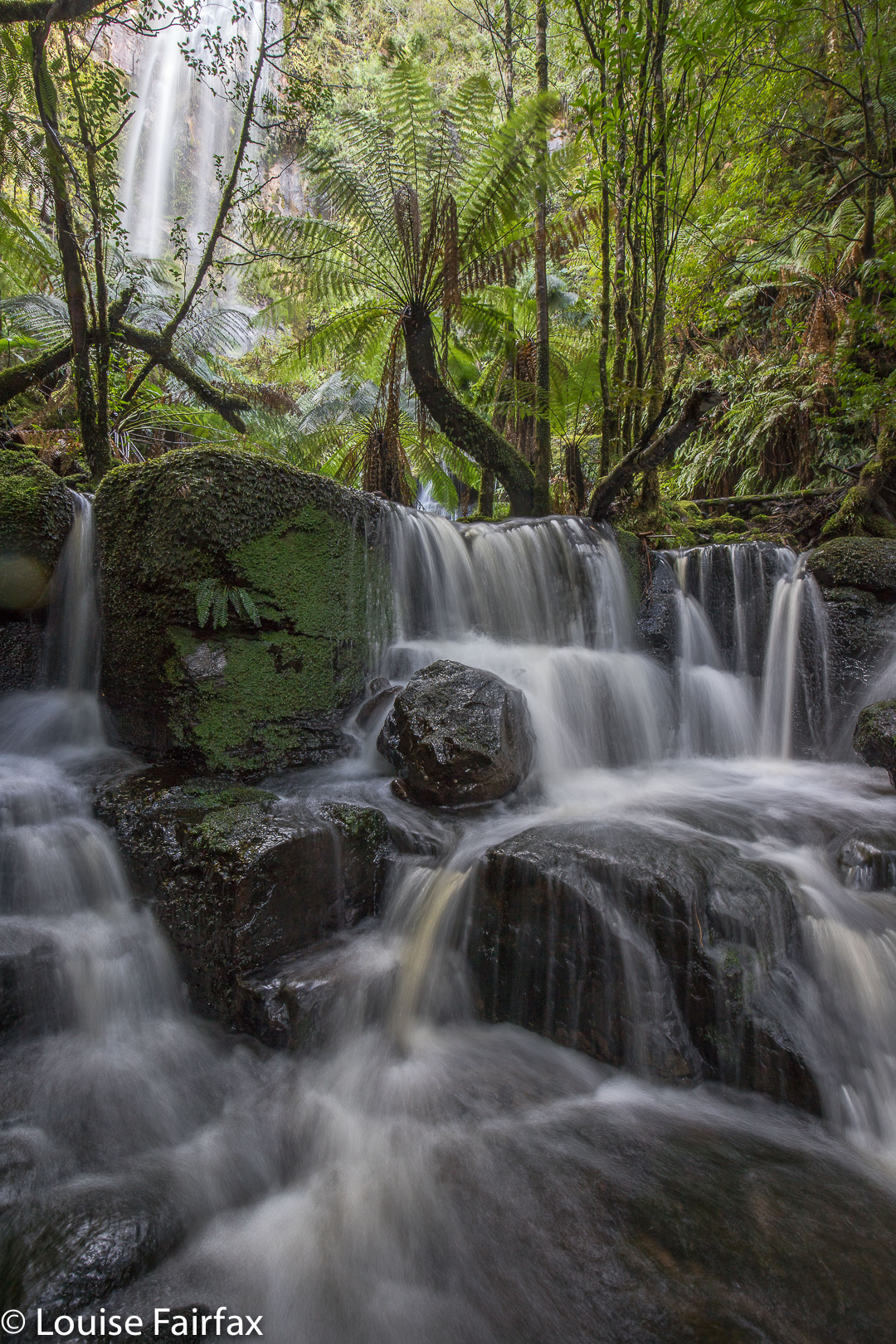
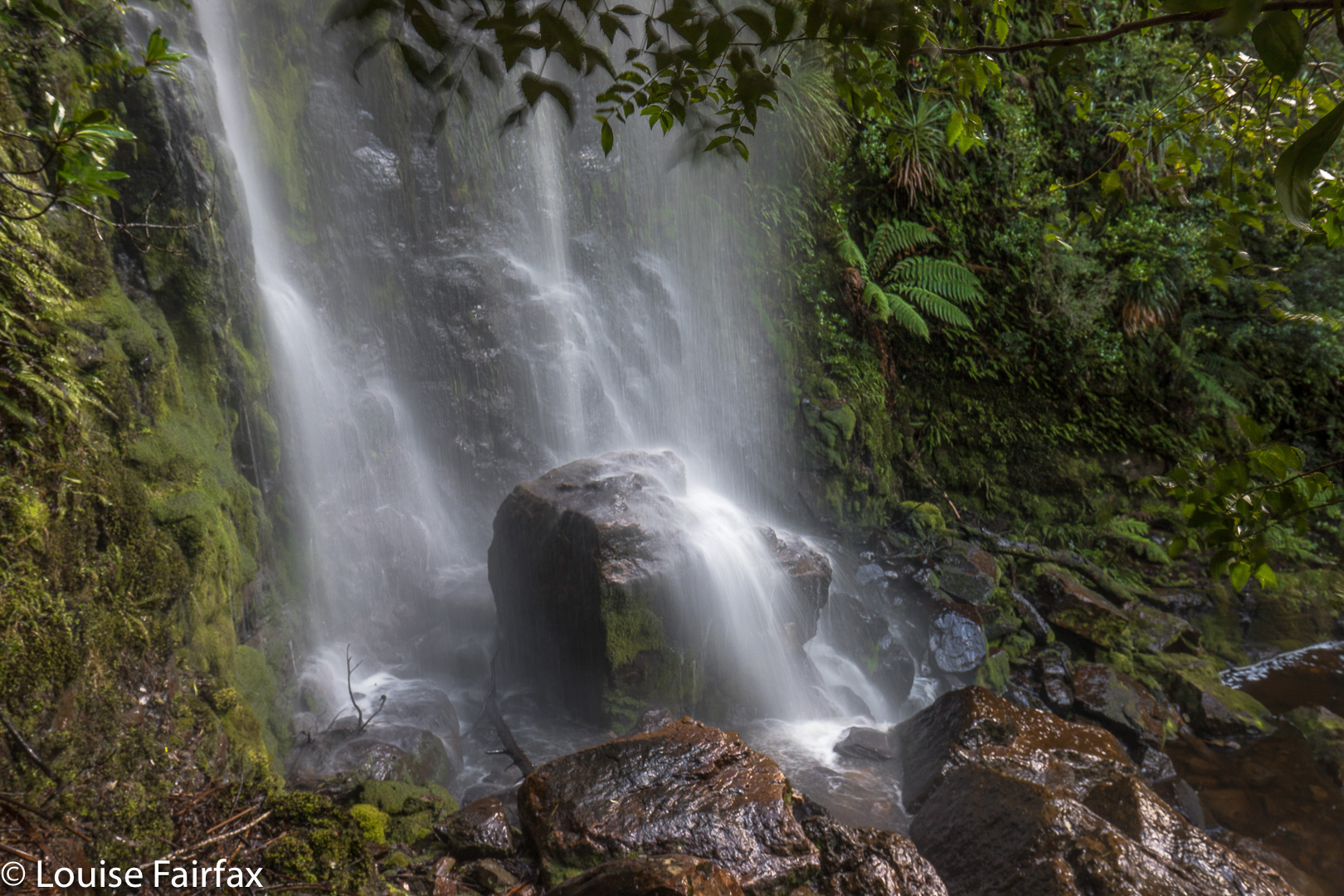
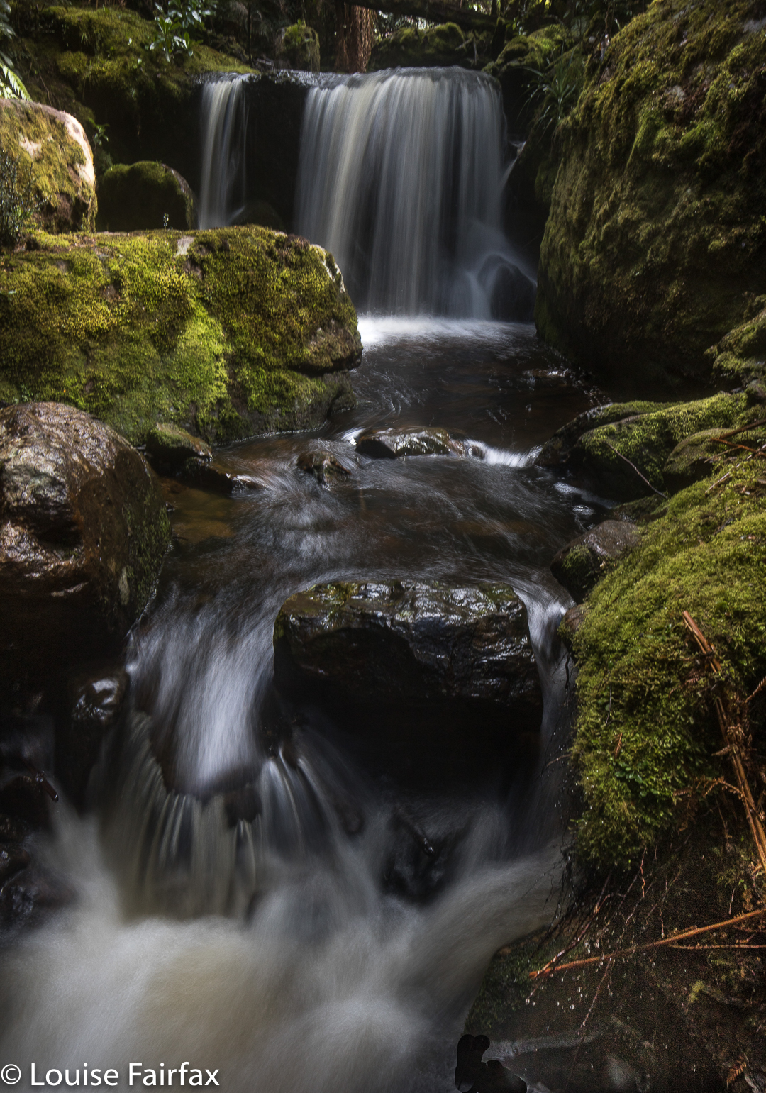
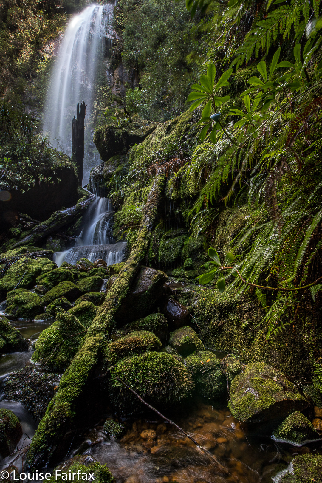
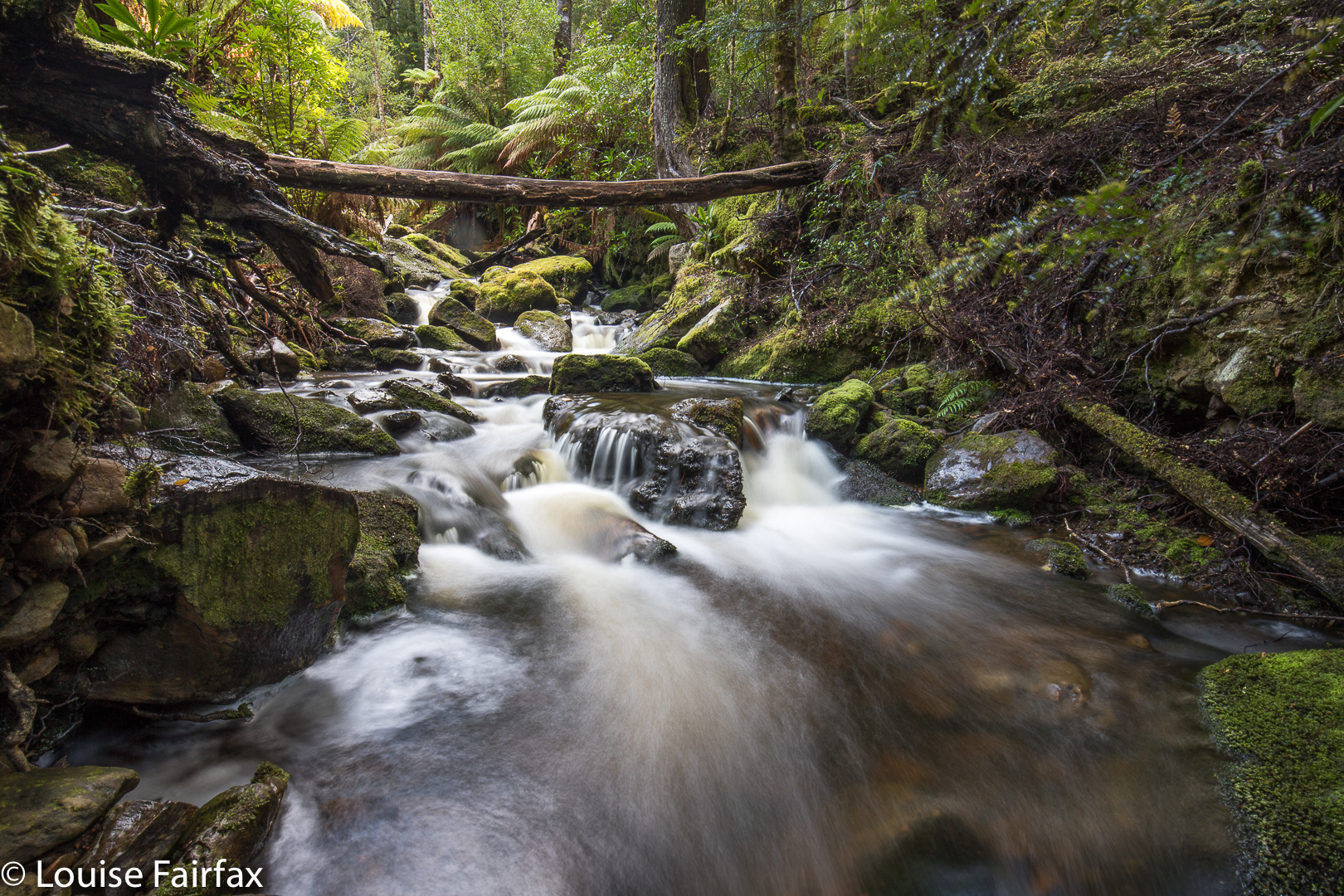
And so, by the chronological presentationI have been following of the falls we visited on this holiday, I now arrive at Creekton Falls. These glorious falls would be momentous in their own right, even if nothing else happened that day: because of their sheer beauty, and the attendant beauty of all the cascades that can be found if you wander downstream. Even the lower demesne of the Creekton Rivulet, with no falls or cascades, just gentle burbles, is  captivating due to its tannin colour set in deep rainforest green.

I have written in the blog titled “Bruce’s Final Footsteps” about the tragic turn events took that day. Most people reading this blog are coming to this post to find out information about the Creekton Falls, as such, (or to see my photos of it) so I will write about their beauty, even though, for me and for all of us who searched for six days for Bruce, that beauty is couched within the context of events as they emerged once I got back to the car and discovered that my husband wasn’t there.

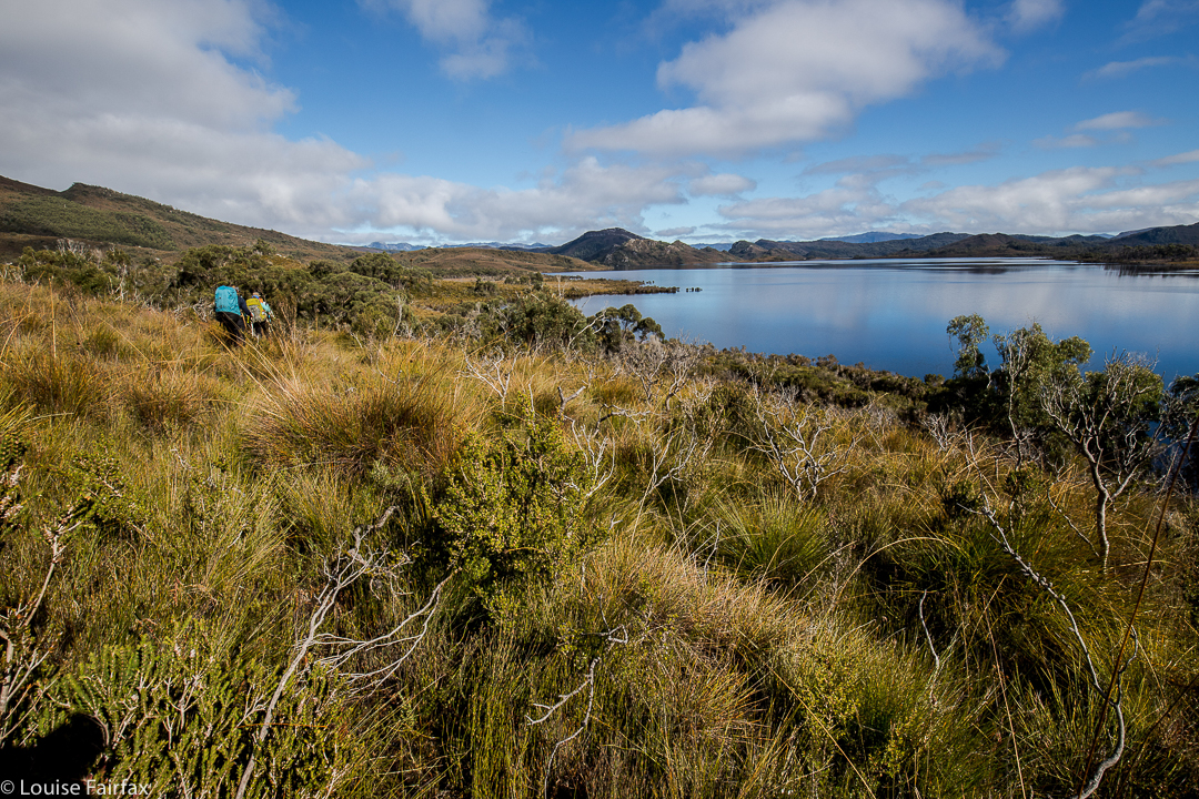
After I left him (at the start, to do his own, easier walk), I was off in my private little world, dreaming to the rhythm of my footsteps in my purposeful stride, and transported to a different realm of enormous beauty, hating rushing past it, and planning to go backwards with Bruce after our rendez-vous to shoot some sweet pools with appealing flow lines. I got to the lake, which had mirror reflections, but didn’t stop, as I wanted to allow any extra time in my estimation to be spent photographing the falls themselves.

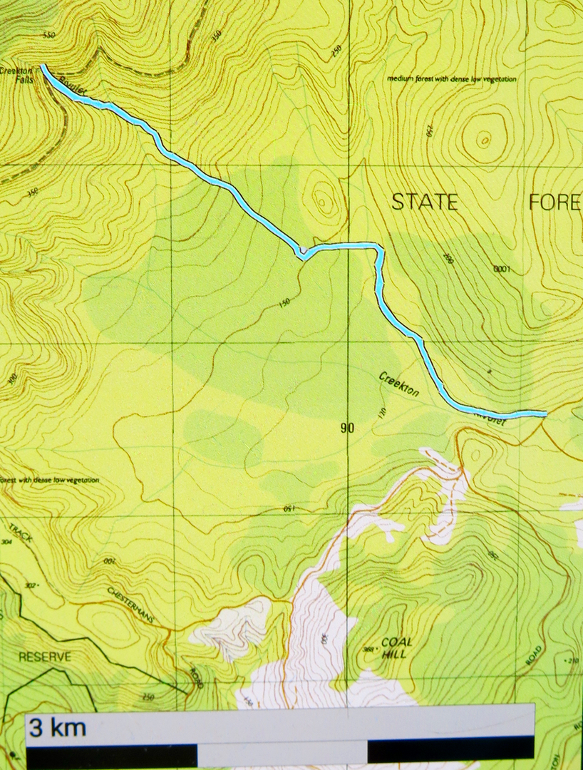
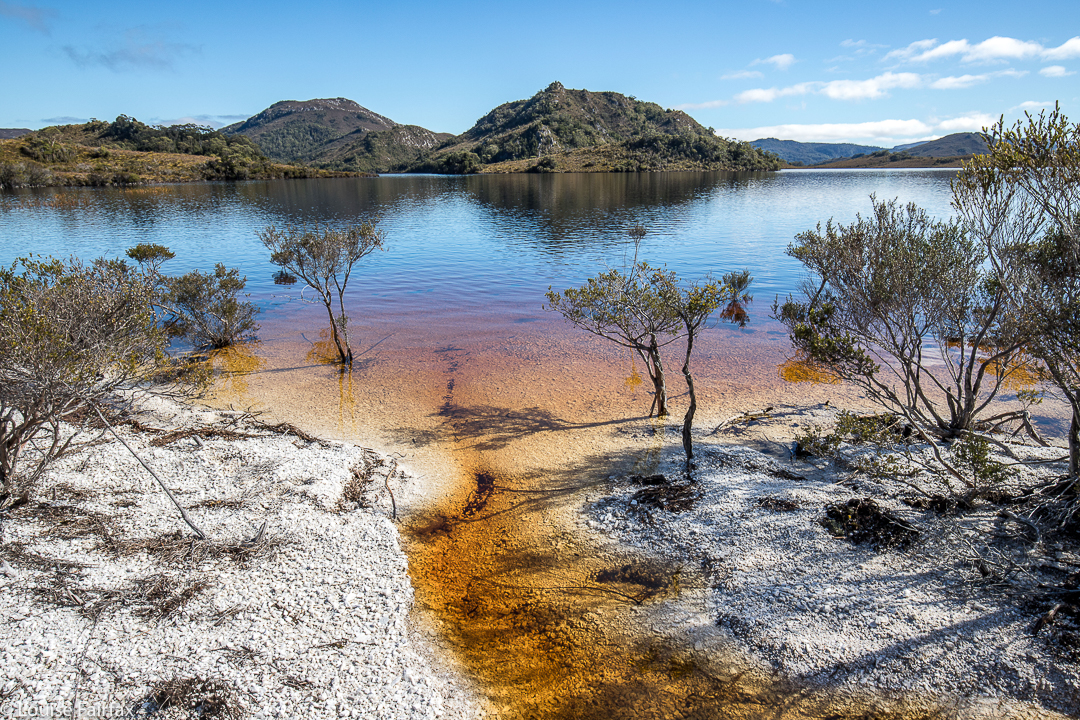
The path was less clear after the lake, but there were pink ribbons, and nothing was tricky if you’re experienced – there was even a rope on the steep bit that was muddy enough to pose possible problems if it was very wet. Up I climbed, reaching the falls in one hour fifteen minutes. Good. I had plenty of time for photography. I chose several different angles, and had a wonderful time, singing as I shot. Tessie behaved beautifully for a change, not worrying me too much by going near edges, and sitting very still when I perched in dangerous positions to get my angles.

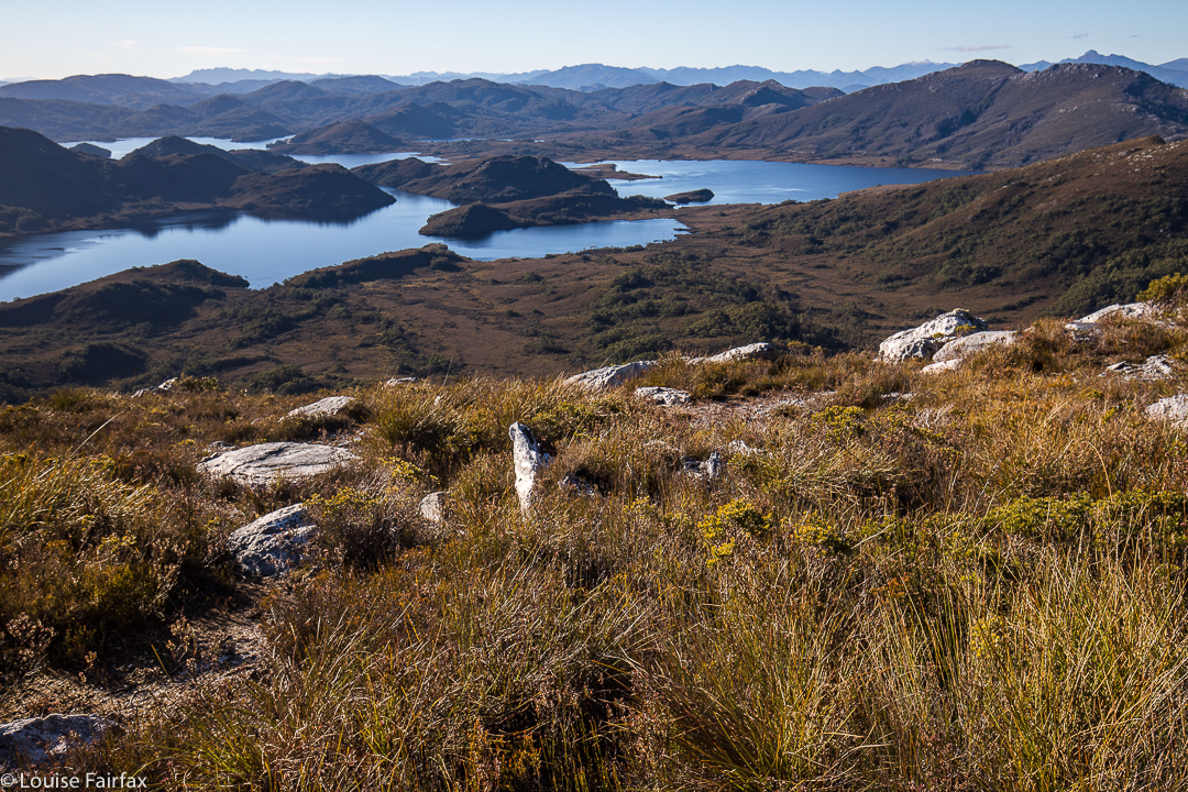
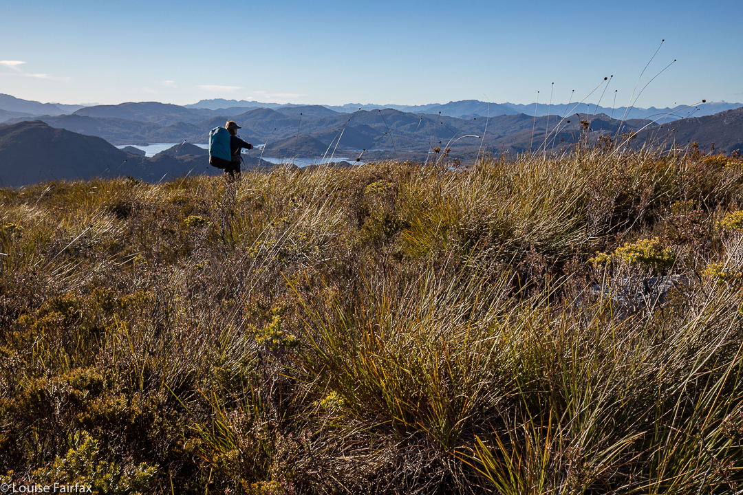
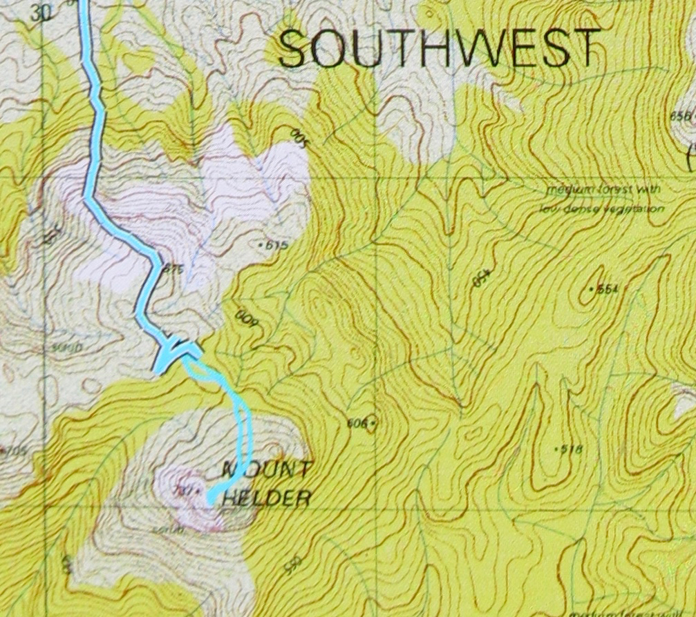
On the way back, I looked longingly at the pink ribbon that lead to Adamsons Falls. I had deliberately chosen – before I ever set out – not to do them, as I thought the expected three hours was long enough to leave Bruce by himself. People say the Adamsons-Creekton loop is seven hours – much too long. I’d do Adamsons another time. I don’t like eating all my chocolates at once anyway. (I actually did this loop on day 6 and was back well before lunchtime. I’ll write that blog soon). The return trip from the falls to the car only took one hour for the walking part, a pleasant morning’s outing …. except that there was no Bruce at the end.

There never was a Bruce again, but, as I said earlier, that is another story, particular to Bruce rather than these falls. For you, they’ll “just” be the magic Creekton Falls. For Bruce’s family and the thousands of people who have been touched by him – by his patience, his kindness, his gentillesse and his power to inspire others to be and do their best – it will be the special place of his final walk. We all call the forest “Brucey Forest”, and it will always be the place where I feel a very special connection to my soulmate and husband.

Taroona 2017 Oct

Taroona sunrise Oct 2017.


On the morning of this sunrise, Bruce and I eyed Taroona up as a possible settling place for some time in the future, as we figured we’d need to move to Hobart one day when our current house would be too much work for me, and, of course, neither of us knew that this would be his last full day on earth. We decided Taroona, with beach walks and sunrise over the ocean, was just the place for us. Who would ever believe what lay ahead of us and that such a conversation was superfluous? It seems surreal to look back on all these tiny events, so incidental at the time, and yet so crammed with importance for me later (like now). Mostly, you only know when something is the “last time” in retrospect.


I guess losing your partner makes you sentimental, as I find myself clinging to all these “last things”, hanging onto them, as if doing so will help me somehow hang on to Bruce. But, meanwhile, his sudden disappearance and death reinforce for me the lesson I have known since I was a child, when my father had a heart attack (I was eight) and my mother got cancer (I was twelve): namely, that I shouldn’t take relationships for granted. What walks and talks today can be gone tomorrow. I learned not to assume that anything I loved would be there for ever. Knowing that helps one live life to the fullest.


Because of my parents, I never wasted time with Bruce, even insisting that he come to Europe for three weeks each year to watch me compete, wanting to use time together wisely while we had it, for you never know what the future holds. We lived life fully right to his end, and so, although I am devastated to lose him, I have lost him without a sense of regret that we could have done better, that we wasted our precious time together, or that we should have done this or that thing while we could. It would have been hard to eek out more than we did from life without dying (even earlier) from exhaustion.  I think it was a marriage well lived.

Fairy Falls 2017 Oct

Fairy Falls. Friday 13th October, 2017

I had read about Fairy Falls near Geeveston in the web and was keen to see them on this southern waterfall-bagging spree. I must say, I found the web instructions a little ambiguous, as one is merely told to follow Fairy Falls Rd, which is cute, but one has to find it. Feeling not entirely confident, we turned out of Geeveston down the road signed to the Tahune Airwalk, and fairly shortly afterwards, took a right turn onto Fourfoot Rd. Fairy Falls Rd forks off this road after a few kilometres. At last we had a quasi sign to the falls.

Once found, Fairy Falls Rd is followed to a big, almost u-bend where it crosses O’Hallorans Creek (unnamed). It is possible to leave one’s car at this bend (I did). Our small adventure was about to begin. Almost unbelievably, the phone rang. We don’t expect that to happen while fall bagging in the wilderness. It was our second-born daughter, full of excited news, so we walked along chatting to her while dodging branches, ducking under and climbing over obstacles until we got to the base of the falls.

Once we’d parked at that corner, we’d followed an unsigned pad going up the hill to the left, next to an electric fence, the other side of which is a clear paddock. To our right, and all too close, were blackberries, but they didn’t bite.  At the first corner, maybe 50 ms up, it was time to leave the fence and follow the creek. Faint pads were present as we weaved our way through beautiful fern trees, a tanin-coloured creek below. Eventually, after maybe a total of ten minutes, the falls were reached, and it was time to stop talking to Lenie and start concentrating on photography.

We had actually made a little error on our way to that u-bend, as O’Halloran’s Creek is not named and we kept going, the map being a bit unclear. We ended up in the back yard of a man who informed us that these falls were misnamed; they were an insult to falldom, and no falls at all but a dribble of a cascade in snake-infested country and not worth the trouble. He added that they were an embarrassment to Geeveston and apologised to us that we had been sent on a wild goose chase. I guess this just goes to prove the relativity of concepts of beauty, as we, like whoever named them “Fairy”, found them idyllic, dainty and wonderful. For sure, they don’t compete in volume with Niagara, but I prefer grace and subtlety to a hammering thump on the head, so Bruce and I were perfectly happy with what we found, and not in need of any apologies from this man to whom, I guess, size is everything.

Story 2017 Schouten Island, Oct

Mt Story, Schouten Island, Oct 2017


Mt Story summit looking to the Freycinet peninsula
Mt Story does not have a path to the top, but it does have a taped route (mostly pink) that is not too difficult to follow. This mountain is a much longer undertaking than Bear Hill, and we took about two hours’ walking to reach the top, with a break for snacks and another just for the heck of it added in.
The start of the walk was where the descending spur meets the track that exists between the two beaches to the north, i.e., between the beach on which the boat drops you (Moreys Bay), and the one where you camp if you want to camp right on the beach under the shade of casuarinas (Crocketts Bay).

If you compare the photos of this mountain worth points and Bear Hill, worth none, you’ll see that getting no points is more photographically pleasing on this occasion.
If you are wondering what the detour (on the map below) to the east after we’d been to the summit is, it was the beginning of a climb of Daedalus, but we soon decided we didn’t have enough time given the general energy levels prevailing in the group. One of our number didn’t think he was up to it, and really, I was not feeling one scrap energetic, and was glad of a pleasant meander back to where we’d come from rather than a desperate race against the clock to complete the circuit. I had a strong feeling that the salmon I’d had the night before, and again, for an early lunch, was not quite in the kind of condition that salmon should be in when meant for human consumption. I think my salmon  pate needs to wait until the cooler weather of next autumn before it’s allowed on any more overnight bushwalks.

Helder 2017 Aug

Mt Helder Aug 2017


Underway to Mt Helder, walking around Hermit Basin at this stage, heading for the Herder Inlet. Stillwater Hill in the background, centre (I think).
Over the years, I have seen a few photos taken from the flanks of Mt Helder, and have wanted to see these sights for myself. For me, this mountain was all about the view rather than attaining the summit, although, of course, I wanted to do that too; however, being in the wilderness and seeing what could be seen from up there were my primary aims.


One of the very few moments when we could walk where we wanted to – on the white “beaches” of Lake Pedder.
We’ve had a lot of rain this winter, so I was not surprised to see that the normal white quartzite border around the lake (wonderful for quick progress) had been swallowed up by the bloated winter waterbody. This was inconvenient, but it sure was nice to see the lake looking so healthy. The repercussions for our little foursome were that instead of a nice lakeshore march to our real starting point, we would have to do battle with resisting scrub for several hours before we could begin the climb proper.


Looking down to two gorgeous unnamed lumps in the Stillwater Passage. Right to Mt Cullen. It took over an hour to get up here from the plains below.
The first hour and a half of our journey was thus embarrassingly slow. As far as the crow flies (pity these birds can’t carry packs for us), we had covered little territory, having wound back around the lake to where we could see our starting point, all too near.  By lunchtime, we had made a more satisfying dent in the work to be done, but still had a way to go before the “starting line”. After three hours’ walking (plus lunch and morning tea breaks), we were sitting near the base of the climb, ready to begin the steep ascent. We sat there drinking and eating a bit more, girding our loins for the work ahead, and chatting while the day was warm and pleasant. I knew we would be too cold to sit around the non-existent campfire at night when the temperature dropped below freezing; it was fun to do it here, just soaking in the wilderness ambience.


As we chatted, I looked up at the first nobble we would head for, and guessed it would take us an hour to reach it, close as it was. I was hoping that was a pessimistic guess (I like to have pessimistic guesses so as not to be disappointed later), but, unfortunately, it was a little optimistic. Not only was the climb “in your face” steep, but the ground was slippery and slimy, making the work more difficult, as sometimes you’d slide backwards, losing precious height gain. Always, you were on your guard against a really big slide back to unknown depths below.


Dawn next day. I woke just in time to catch the roseate sky. I feared I’d missed it, but the eastern section still had a pink tinge.
However, soon enough we’d reached it, and what a great reward for our efforts. I could have stayed there easily, but this spot wasn’t what we needed if we were to complete our stated intension of ascending Mt Helder. On we continued, to a high point looking across at Helder (on the map below, this is where you’ll see a lot of doubling back and forth). The aim here was to dump our packs, summit Helder, collect water on the rebound, and then proceed a tiny bit further in the direction of Mt Cawthorn. Off we set with water-collecting equipment for the way back, and plummeted down into thick, nasty scrub. We climbed back up and tried a different tack. Now, it was 4.30. We took stock of our current situation: (i) it would be dark by 6; (ii) this forest was very, very resistant to our best efforts, (iii) it would definitely be well below freezing overnight, making being caught-out perilous. It seemed we really ought to abandon a summit attempt for today, and do it straight after breakfast in the morning. This was a much safer option. We went down into the depths for a recce and to collect our water (mud, actually), gathered our gear and went to a nearer tent spot, the one in the picture above (and below). Can you see the ice on the tent in both shots? It was a bit chilly up there.


Day 2.
With plenty of time up our sleeves, we summitted without great difficulty (although with a worthy counter-battle by the bush) in a bit over an hour from our spot, and returned in a bit under, meaning that we had nearly an hour to scrape the remaining ice off our tents (alas) and pack up for a ten o’clock departure.


Summit view. We’d earned it – although I did like the tent view better.
We were more efficient on the way back, staying higher to avoid the thickest of the bauera’s web of unrelenting branchlets and the mass of melaleuca trunks that don’t like being budged sideways, and the cutting grass that likes to slit various parts of your anatomy. We only had to lift our legs high each step over the button grass and deal with bands of bush guarding the many creek crossings. Easy. Huh. We were back at the cars by 3.15. Obviously, we had decided to leave Mt Cawthorn for a time that favoured faster movement.


Sue Ellen looking east, while the camera gazes SW at Mt Cawthorn, and the Frankland Range beyond.


The lower route – to our destination – is the cyan route with black outline. The return route can just be made out – cyan with no black border. Unfortunately my battery ran out near the end, but you can see where we’re heading. The dos and from up high before the Helder saddle are (SW) where we pack dumped, and (NE) where we camped. The end of the black line is where we found water of sorts, so long as you like the taste of mud and grit in your drinks. It’s an acquired taste that I don’t mind.


Close up of the final stages to give you a better idea.