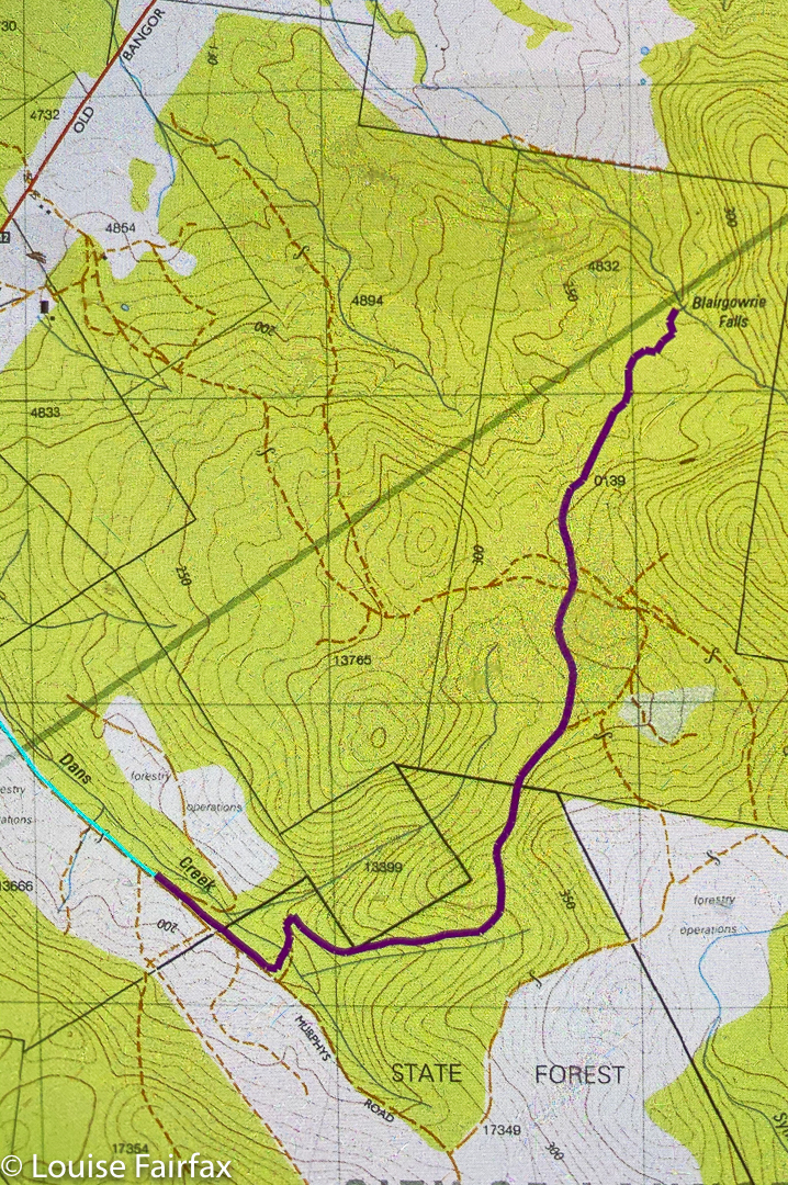
Somehow my route for Blairgowrie Falls was deleted from both my 2017 blog and also my gps. I have no idea how this happened, but several people have asked me about my route, and I didn’t like the 2017 photos, so it was time for a revisit. The forecast was a promising rain then clouds then more rain, but not heavy. Off I set to undo the deletion damage.
I drove from Launceston to near Hillwood, then headed off to the right (Dalrymple Rd C809 ) to Old Bangor Tram Rd C812, from which the road I wanted, Murphys Rd, issued. Siri can get you this far.
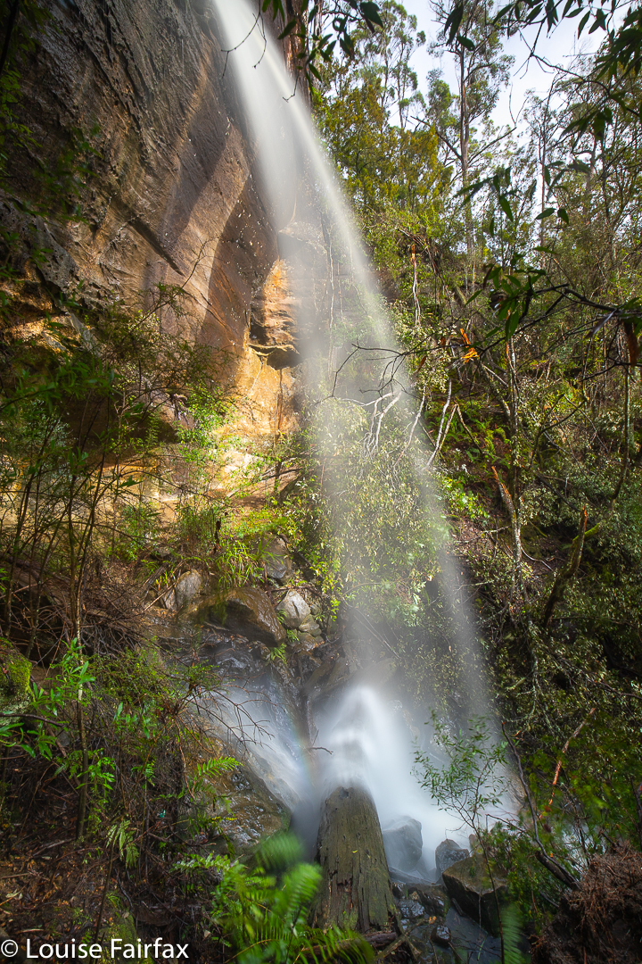
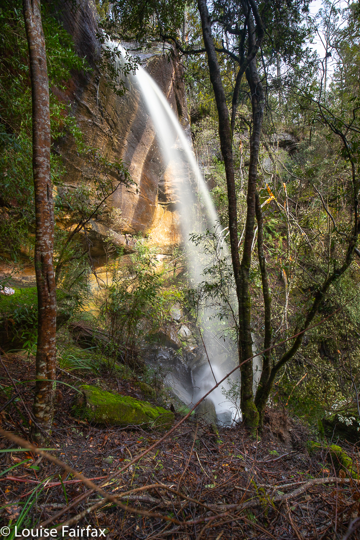
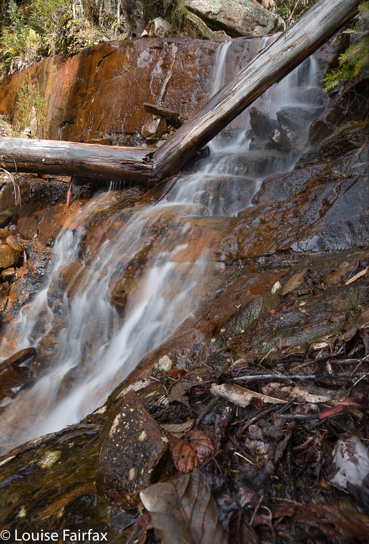
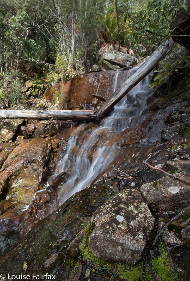
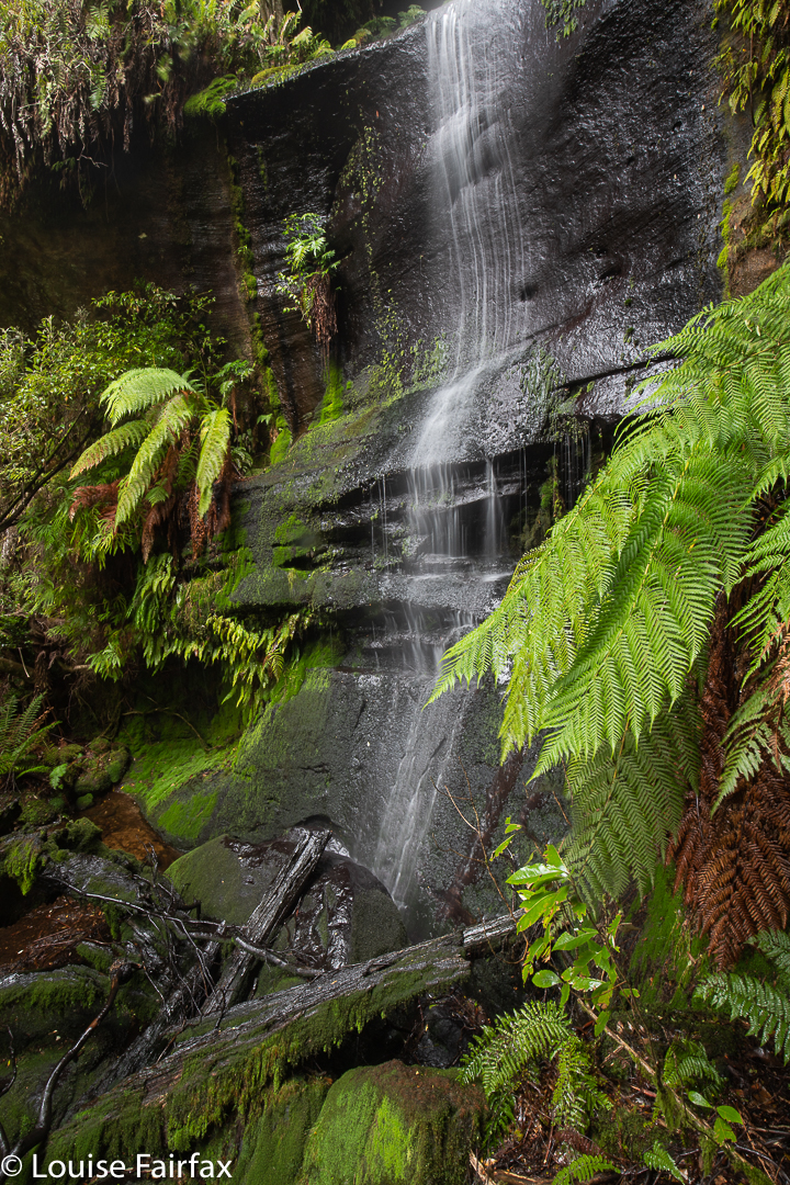
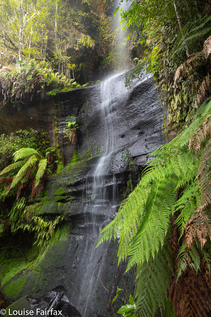
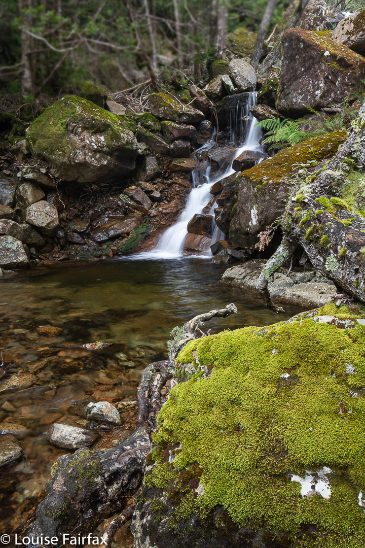
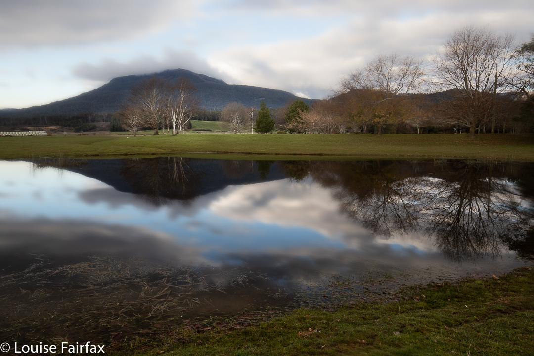
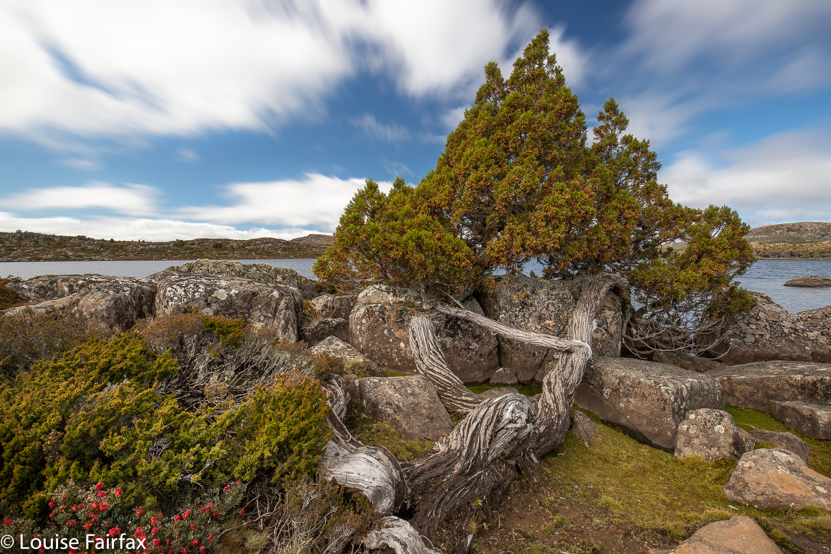
Blairgowrie Falls
I turned into Murphys with confidence, my gps now turned on, ready to repeat my route of 2017, BUT there hadn’t been a huge snow storm in 2017. Murphys Rd was more like a series of swimming pools of unknown (and invisible) depth than a thoroughfare for motorised vehicles. I was VERY glad to have my AWD, that’s for sure. And then the fallen trees began. There was absolutely no way any kind of vehicle could drive on Murphys Rd in its current state. But that’s what legs are made for. I parked and got to walk for longer. I wanted exercise, and the forest was pleasant enough, even though it was too late for fungi and too early for spring flowers (although I did see a few of both).
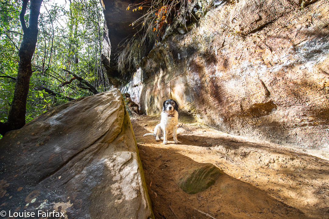
The fallen trees, however, made the going very slow indeed, especially for the first kilometre. My whole time was spent bushbashing along the cluttered road: ducking and weaving, climbing and tunnelling. I had absolutely no assurance I would manage to get anywhere near my goal, and was also not certain that it wouldn’t just be a rubbish dump of branches and debris like the road leading to it … but, nothing ventured, nothing gained, so on I moiled through the fallen junk. Tessa hurdled all the trees with astonishing grace. She floats like a kangaroo. She also ducked under fallen objects with far more ease than her taller mum.
Blairgowrie Falls
The falls were well worth the effort, and I enjoyed the amount of exercise I got, which gave me an excellent drive to walk ratio. I took 58 minutes from the car to the top of the falls, and 55 minutes back. My only complaint about the day is that I began and ended in light rain, but the wretched sun came out while I was at the falls, marring my photos. Ah well …
Blairgowrie Falls route. Cyan is whilst driving. The magenta is the section I walked, roughly 4 kms in each direction.
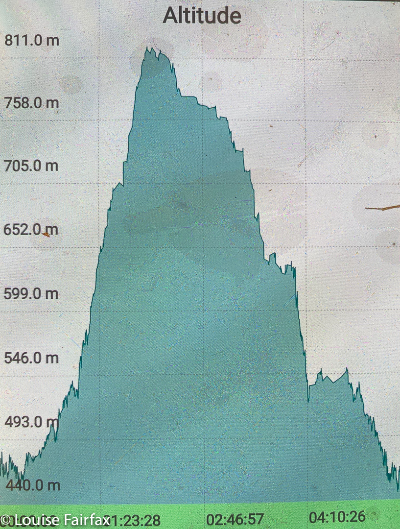
As I approached my waterfall (from above, actually), I gazed out at the facing ridge of what appeared to be loosely assembled scree that rose (or fell, if you will) in a sharp incline between the forest floor and the points of Ritters Crag above. I was reminded of a similar slope I had descended to reach Bear Falls on Mt Wellington, and with Bear Falls in mind, and my own rather foolhardy daring in being where I was on a solo battle with scrub and cliffs, I named my waterfall Dare Falls. It rhymed, and was appropriate. I had scaled nearly 400 vertical metres in a horizontal distance of not much more than a kilometre of untracked, and at times thick, bush. Surely not many people would dare that absurdity. (See the altitude graph below).
Dare Falls Lower
I had not set out to be daring. I have, unfortunately, little respect for contours, and enjoy the act of climbing, and of pulling myself up slopes. It’s my idea of fun. The excursion only became “daring” in my mind when the beautiful rainforest ceded to thick bush that resisted my attempts at progress, and became mentally tiring to push through. I had intended to begin my exploration of this watercourse higher up than I did, but the sight of all that interwoven scrub (taller than I was) made me reconsider. I reminded myself that I was here for FUN, not punishment, and not to prove anything to anyone, so decided that my outward journey had finished. I would descend to the creek and work my way down it.
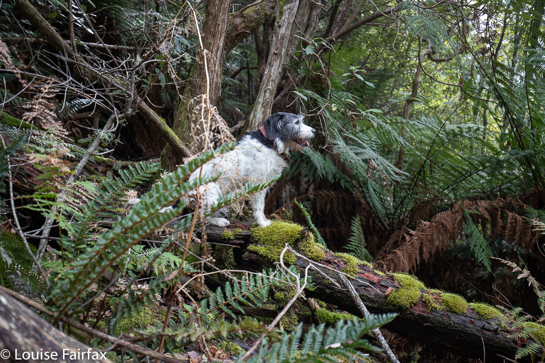
Panellus longinquus. A pleasant interlude in an adrenalin-filled day.My darling bush buddy, waiting patiently. The bush we are about to traverse is off there behind her.
My climb up had been more on the dull nose of a mini sub-spur and, although it was very steep – all fours territory – there were no big cliffs to avoid. Closer to the creek this was not the case, and the watercourse seemed host to a series of 4-5 metre cliffs which I had to skirt as I lowered myself down. These same cliffs meant the existence of many small falls, but you can’t photograph everything, and I just wanted to make sure I actually got out and safely. In fact, I was actually more concerned about the idea of being enmeshed in closely serried dogwoods than falling off anything, but I was concentrating on movement and not photography.
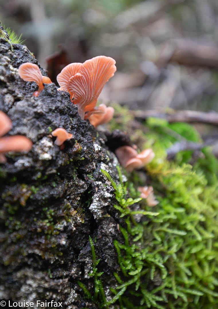
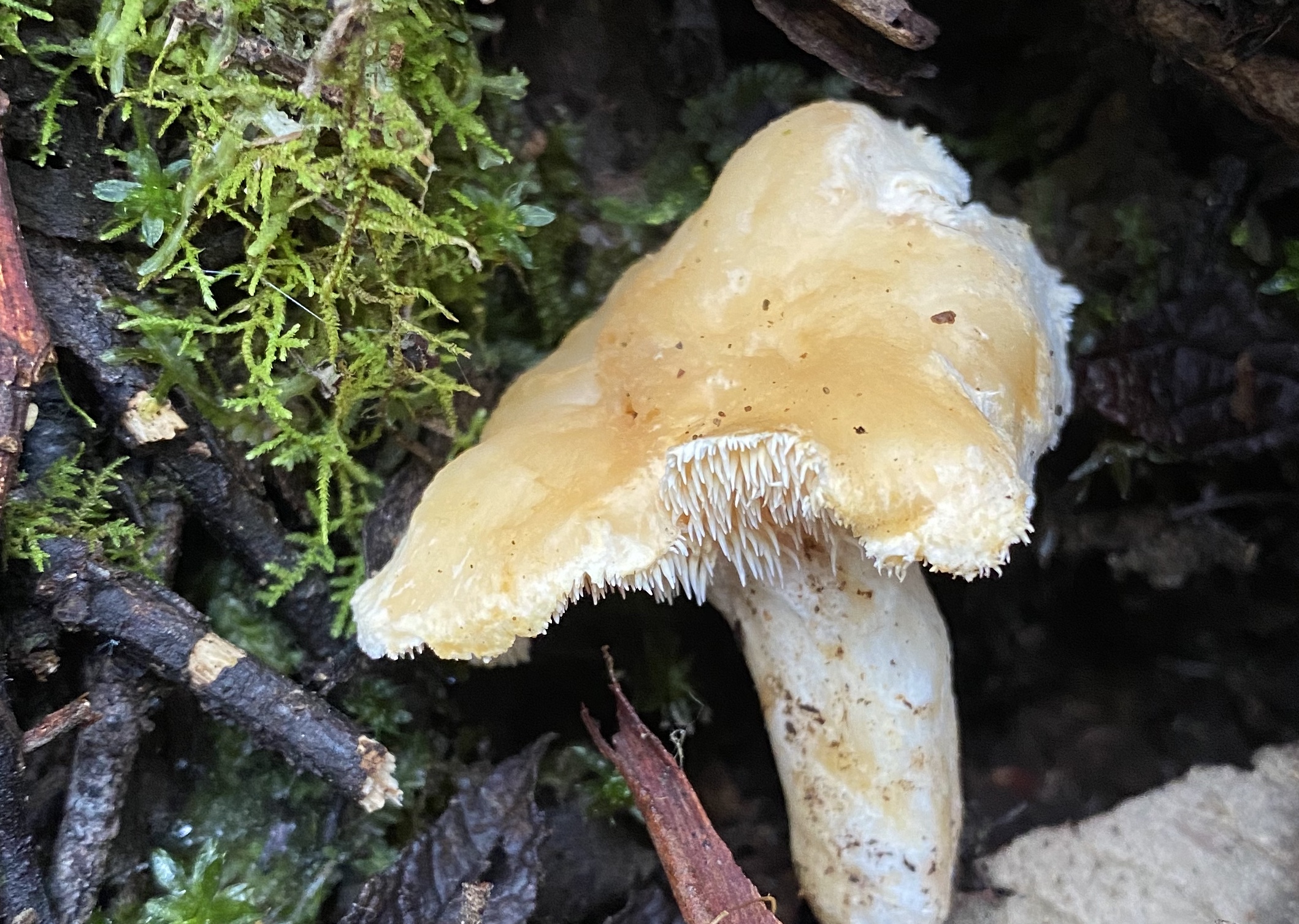
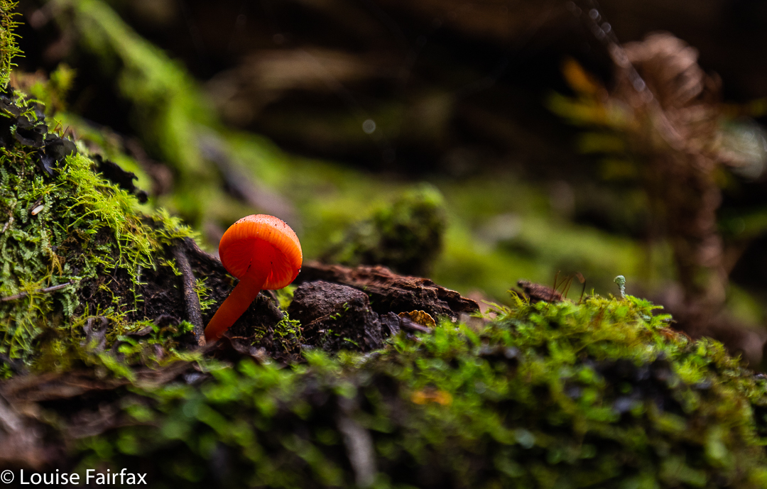
Hydnum repandum with its funny spikes instead of gills.Hygrocybes brighten any day
Down, down I dropped, past Dare Falls and Lower Dare Falls (how very original) to the endless series of drops mentioned above. I lacked the emotional energy to explore any of them by this stage. My brain was now officially tired. It was so fatigued I hardly photographed anything properly. The whole idea of perching precariously on one of my many ledges and parking my heavy rucksack in a way that would allow me to extract my tripod seemed impossible. Something would be overbalanced in the attempt. My gear (or I) would crash down below. Much better to use rocks as makeshift tripods. I didn’t even get out the filters I was carrying. I just used a series of 20 x 1/10 second exposures to combine for a single long exposure later. Even lower, where it became safer, I was just too mentally tired to be bothered – even in the presence of fungi!!
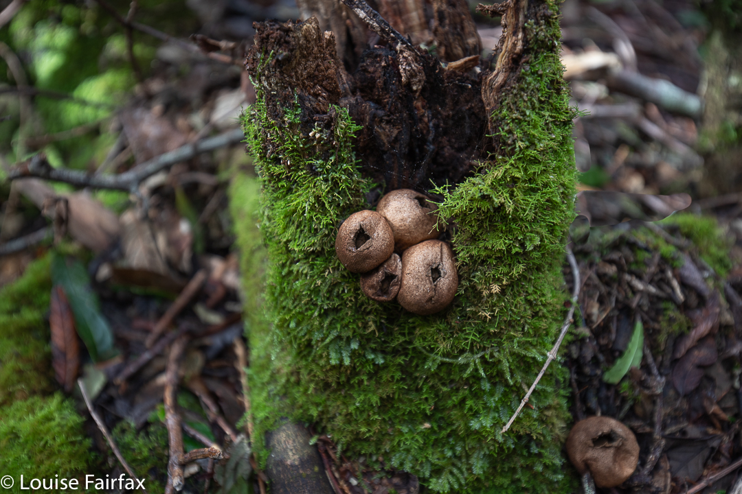
Lycoperdon perlatum
My final obstacle before the easy bit along the bottom was the same as my original one: a crossing of the Duncanson Rivulet. I hauled out anything electronic and made sure it was all in a drysac, grabbed a stick to help with balance and picked my way across the slippery rocks with water flowing over and between, singing as I went an old Seekers song (which dates back to a Scottish folksong of the 1600s): “The Water is Wide, I can’t cross o’er”.
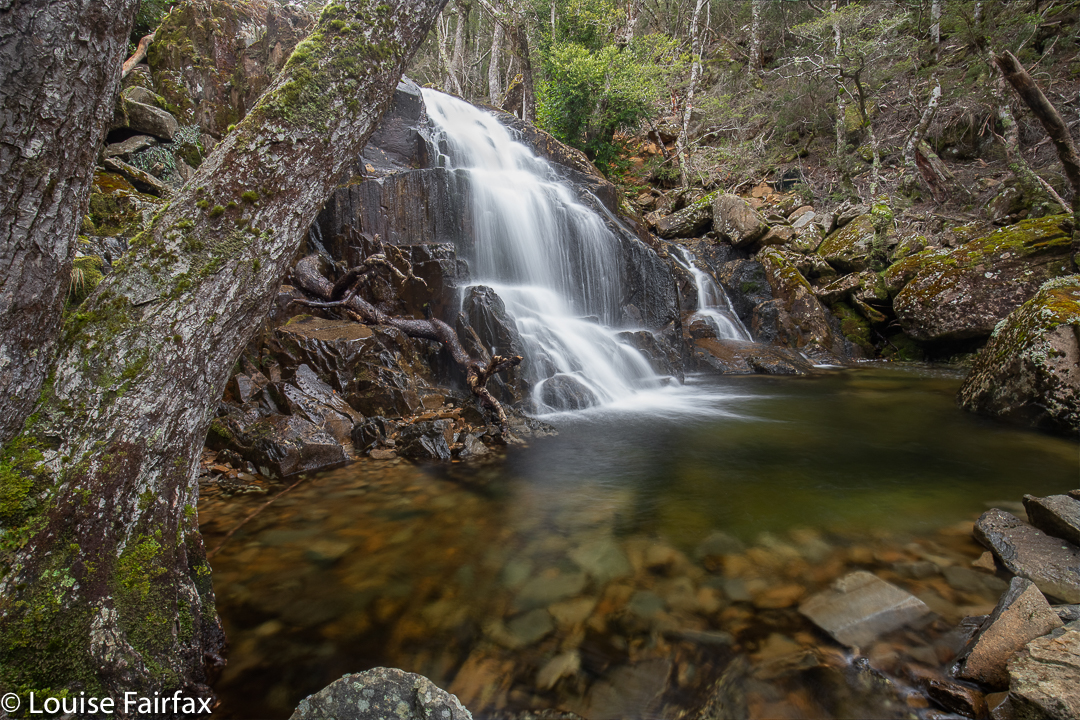
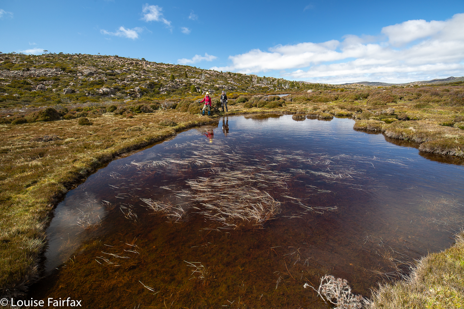
When we were walking Warners Track last week, I noticed a tantalising blue line across a neighbouring creek, and wanted to do a bushbash to see if that line actually represented a real waterfall, and, if yes, whether that waterfall was a worthy one. The contours certainly looked promising. In fact, it could be a huge drop, looking at the map. My friend Penny said she was also interested in this matter, so we agreed to give it a go this weekend.
We parked in the same spot as the week before, but went off in a different direction, up a pretty steep slope, over and under and through numerous fallen logs, around the odd patches of rather thick dogwood and regrowth of some nature, past serried tree ferns, and there was our promising cliff line.
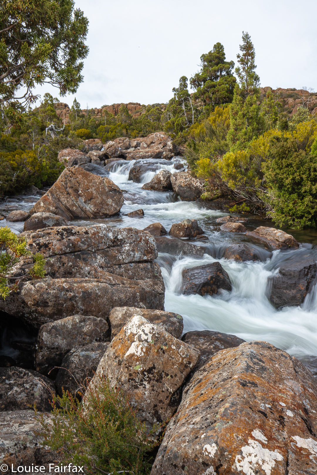
Warners Creek Tributary Falls
My gps said we were closing in on our grail, and sure enough, it soon became visible. We haven’t had much rain lately, so it was a delicate drop today – a fine and flimsy tracery of water, dropping about thirty metres in three close stages.
It’s always very rewarding to find a waterfall that is only a possibility rather than a certainty, and to make our own unaided way there through virgin bush. How lucky we are to live in a place where this is still possible.
We chose to have a slightly different route on the rebound, exploring other areas of forest, to make a kind of circle by the time we arrived back at the car. It always feels good to have been off exploring. I knew I had missed it during lockdown, but today I realised how very much I had. Warners Track had been very nice, but making our own way through unchartered forest is far, far better.
I am the sort of person who is always in a rush, trying to squeeze as much life into every second as is possible, often multitasking and too often running late because of both the above.
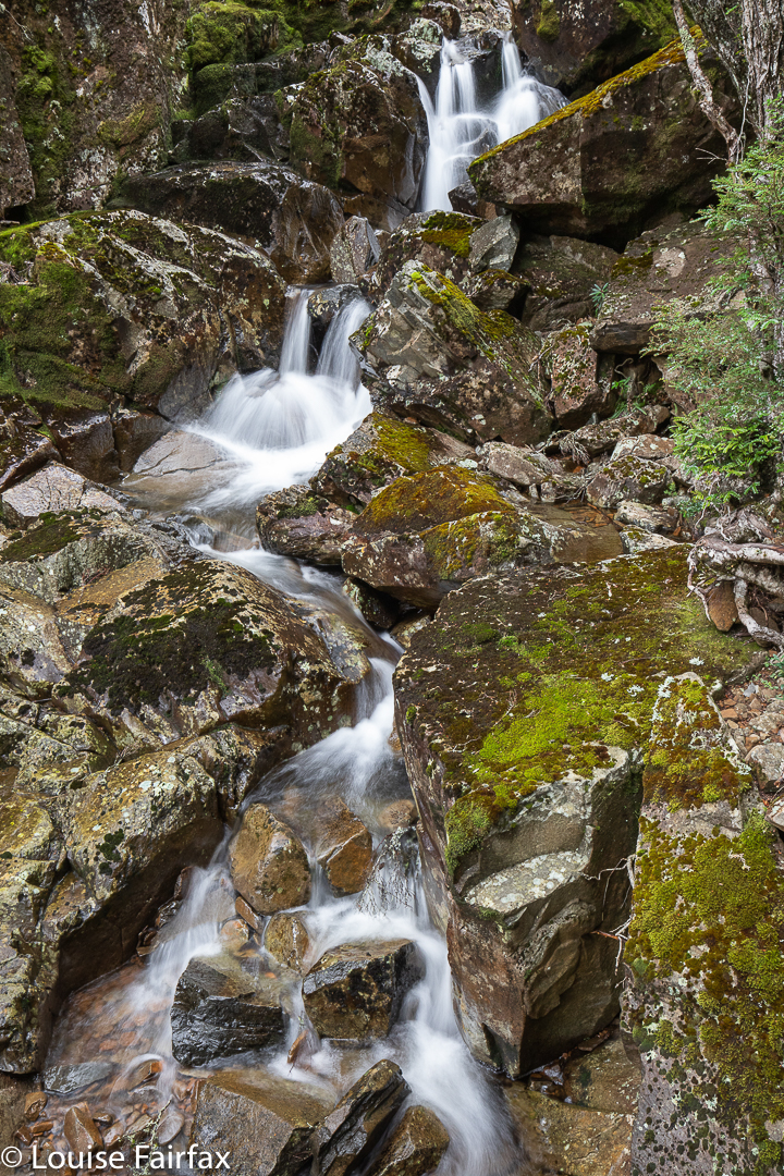
Burnies Creek Falls 1
Now, because of trying to squash five lives into the space of one, I didn’t allow time for research on these falls: I had heard they were below “the” bridge over Burnies Creek, and that was the sum of my knowledge. Sounds easy enough. I parked beside such a bridge, but could find no waterfall. I thought I had to search harder.
I had received an invitation to join others on this day, and do a hike up Warners track to Adams Peak. These others had arrived, so I told them to set out without me; I would find and photograph these falls and give chase up the incline.
Burnies Creek Falls 3
That was a good idea, except that although I found areas of deep and interesting erosion, my search was devoid of waterfalls. I gave up and set out up the beautiful track, sidelined by fungi now and then, but I eventually caught the others.
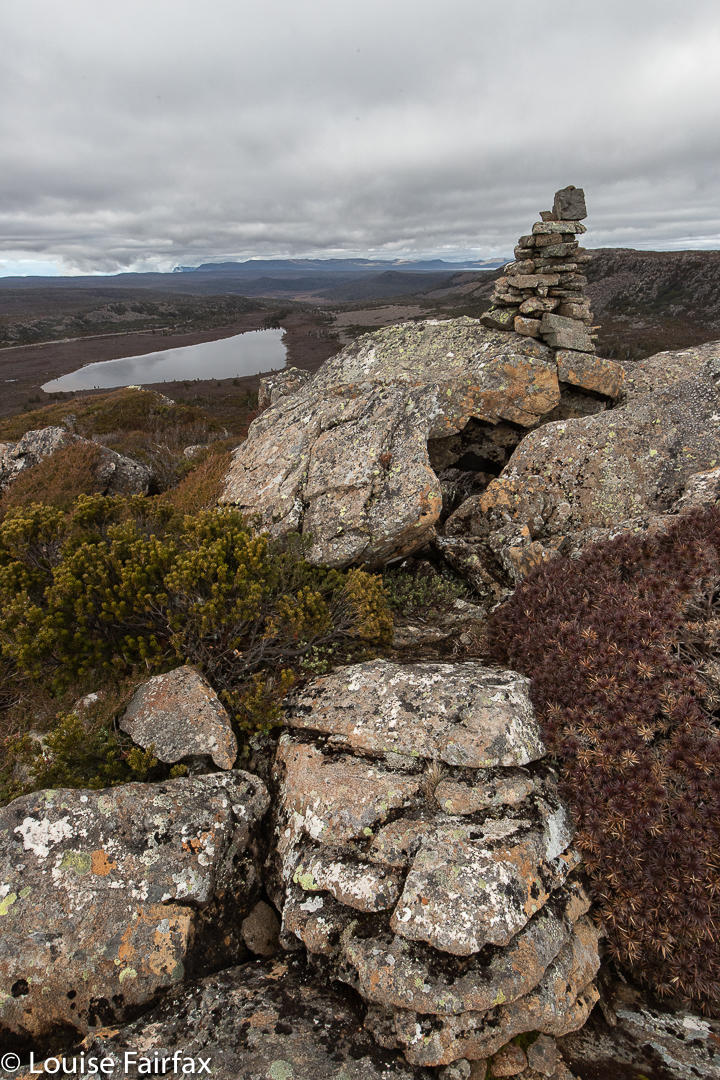
Adams Peak summit
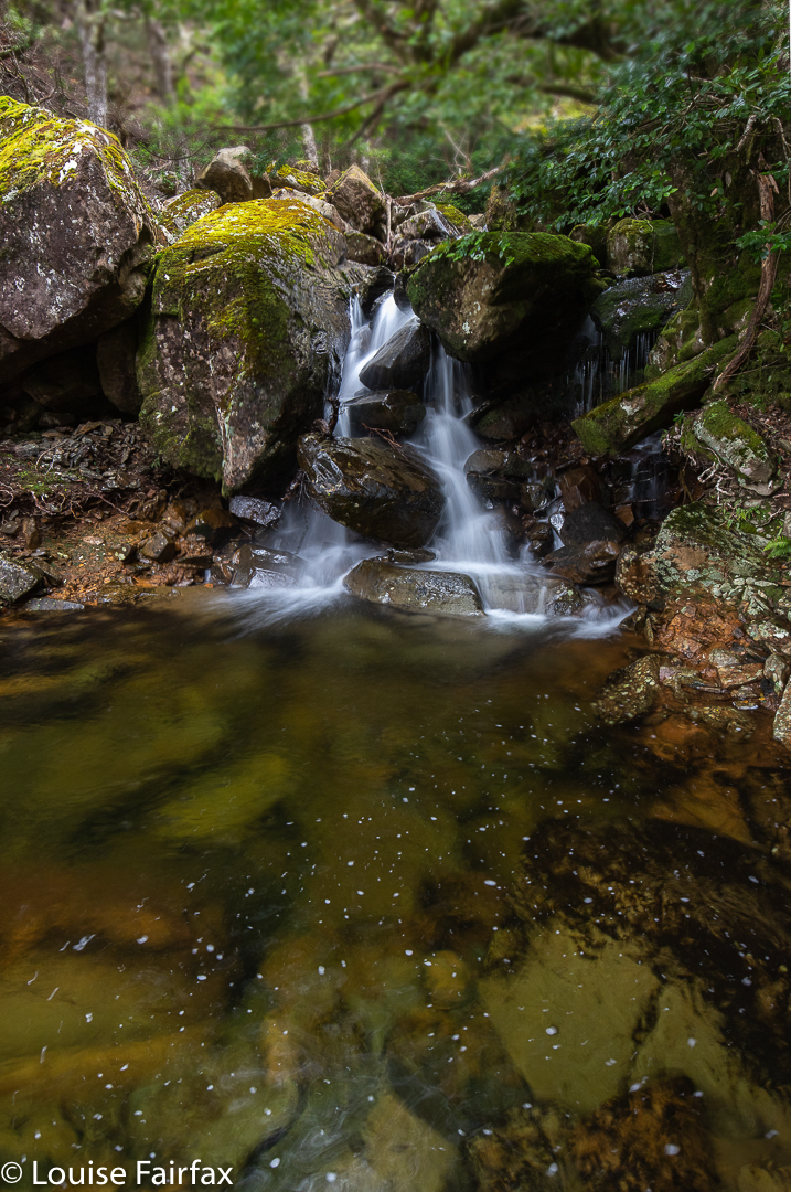
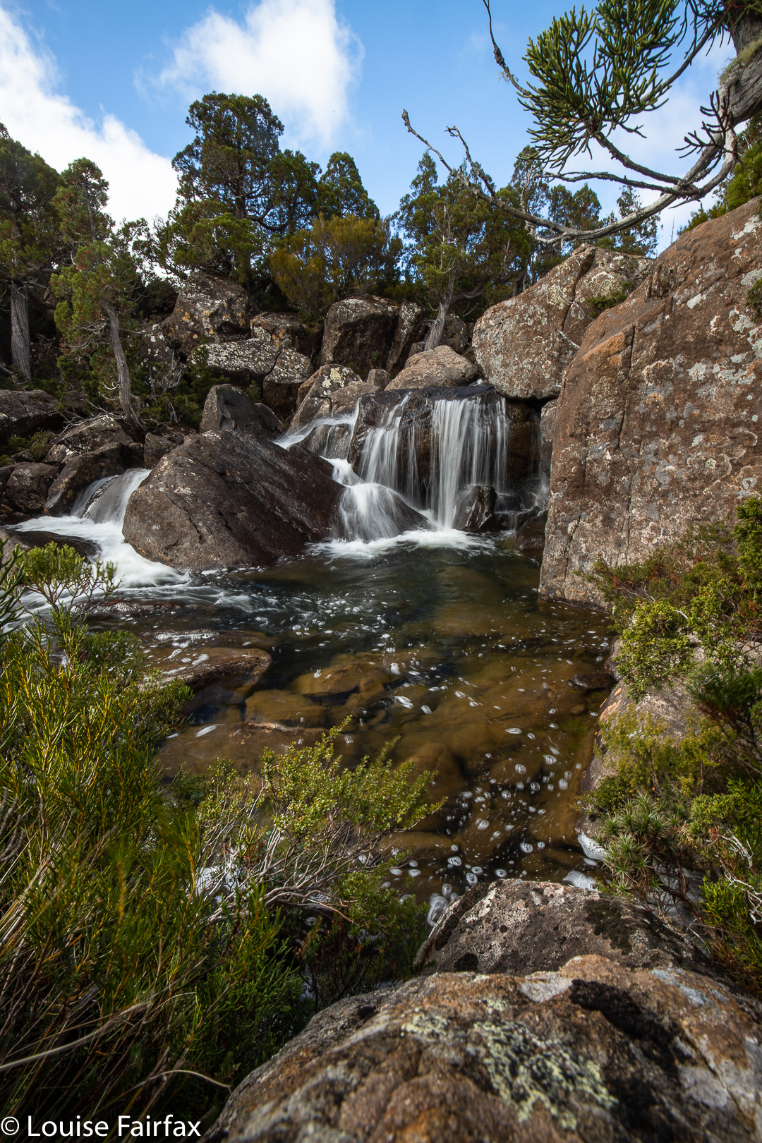
Right near the top, however, there was another bridge, and below it, both waterfalls and a cascade. I photographed three worthy falls plus the cascade.
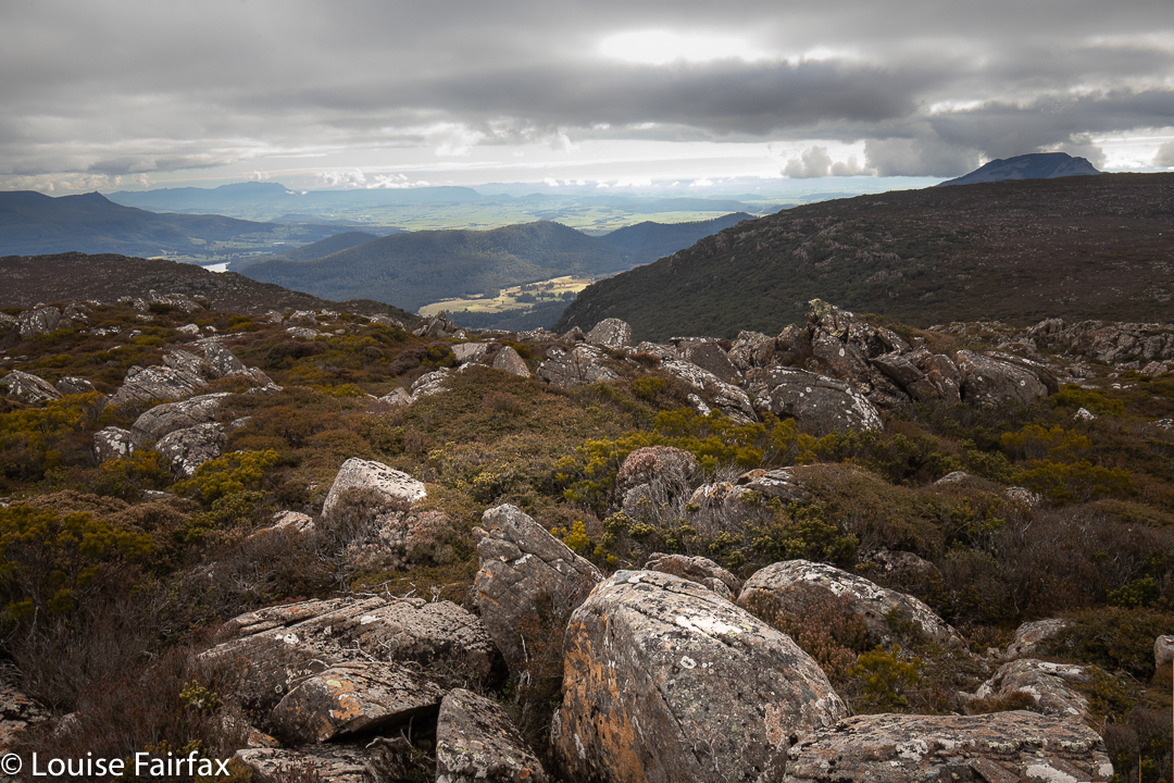
summit views
Once past the top bridge, the track levelled right out, and the beautiful forest ceded to alpine scrub. Our goal of Adams Peak was clearly visible, and not far away. It was a fairly easy scramble up, and we were rewarded with views that were surprisingly vast. It was amazing what we could see from a climb that seemed inconsequential.
Burnies Creek Cascades
As it was winter with short days and a bit of a chill on top, we didn’t linger too long, and were soon rolling our way down the slope to the cars. It was a good length’s walk for a winter’s day; I was home in time to do a couple of outside jobs and collect wood for the fire before night descended.
Explorer Falls. I like that name. It seems an appropriate one considering that the falls are not on the map, and thus, of course, not named, but are there to be found by those who go exploring and who happen to explore in just the right place.
Explorer Cascades. First photo of the day.
I was invited to join some friends who were setting out to enjoy a lovely walk in which they planned to circumnavigate Lake Explorer. We would go in from the Lake Mackenzie carpark, wend our way to the lower reaches of Explorer Creek, cross it (with difficulty: it took us half an hour of vacillating to find the best spot, remove or change our shoes and brave the cold water), follow said creek up on its northern bank until we reached the Lake of its name, and return via the southern bank, after negotiating the outlets from Lake Pitt, Snake Lake and Johnny Lake, in that order.
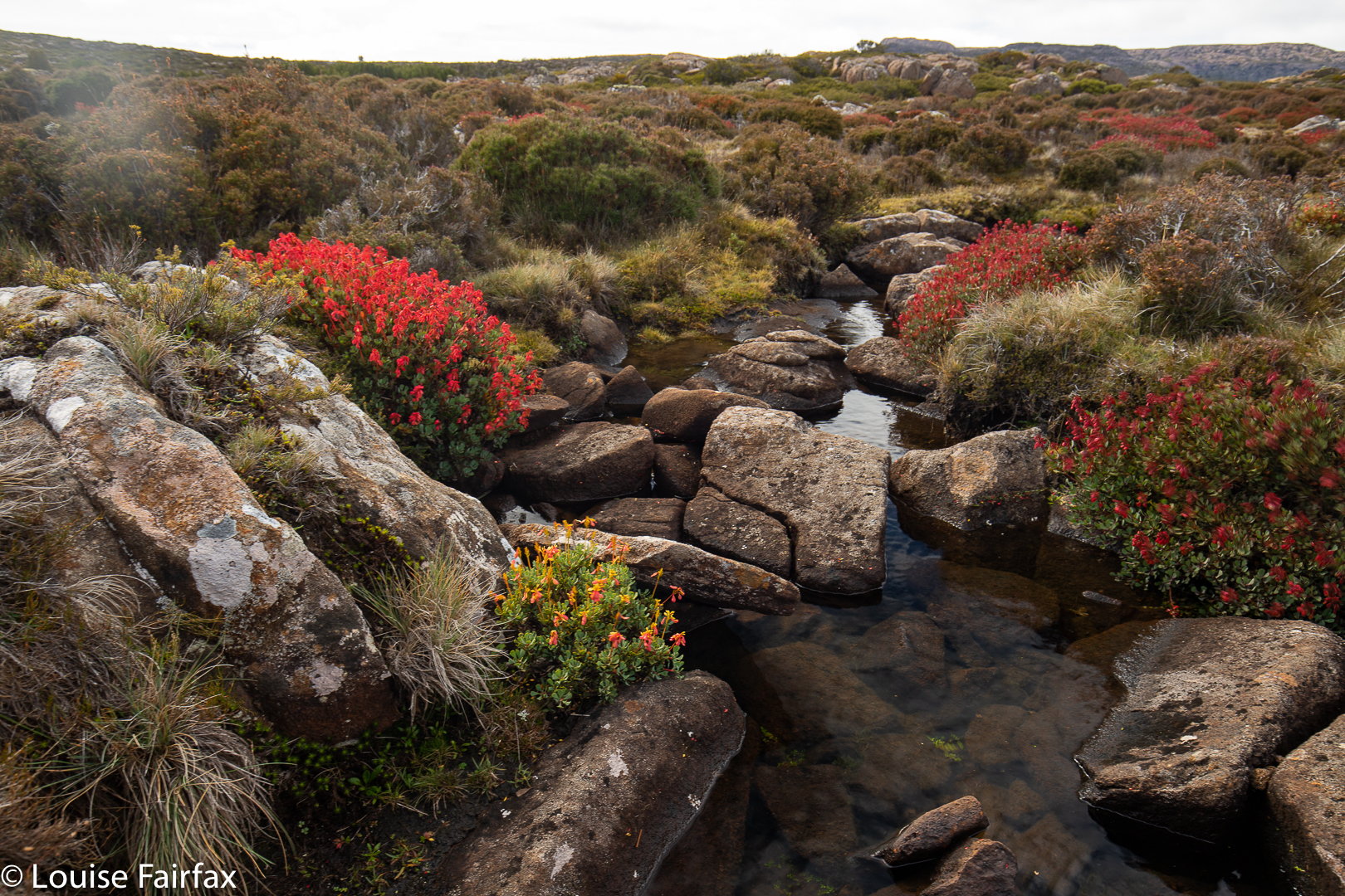
Lake Pitt outlet. Bellendena montana
The first of these outlets was picturesque but more like a series of elongated tarns; the second was a jump (small but deep); and the third was a scattering of quaint, shining ribbons of tannin water. Right near the end, however, the Fisher River needs to be negotiated, and that required a bit more effort, with a double crossing – knee to waist deep (depending on where you went) with fast-moving, forceful water, and a rather slimy base, which conditions are always a bit threatening when you have several thousand dollars’ worth of electrical equipment on your back. The consequences of a slip and unintentional swim are rather large.
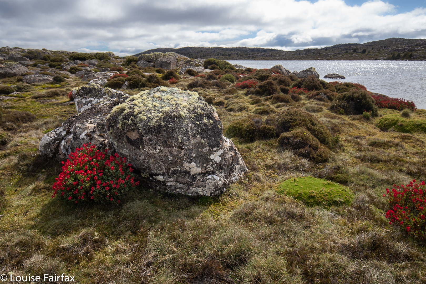
Lake Explorer. Bellendena montana
I thought the vegetation would be rather boring, as we were too late for scoparia and other wildflowers, but too early for autumnal hues should there be any fagus. However, the landscape was aflame with scarlet from the absolute abundance of Bellendena montana seedheads. I have also rarely seen so very many pencil pines – lots of little groves scattered throughout the way. I would love to hear an expert tell me the age of some of the oldest there, whose venerability wrested your attention.
Venerable Pencil Pine
And, we happened upon two lovely water features. On the way up, the sound of flowing water louder than just creek murmurings drew my attention: there was a lovely cascade, which I photographed. On the way back, once more cozened to have a peep by the sound of rushing water, a proper waterfall shyly popped out its head from behind a rock.
Plains beside Lake Explorer
It was a really beautiful day in the wilderness, which gave us all not just a breath of literal fresh air, but a whopping dose of “mental fresh air”, which the wilderness always brings. All the cares of corona virus and its scares and absurdities were left far behind as we soaked in the greater reality of nature (keeping required social distance, of course). It is not one scrap surprising that during the Great Depression of the 1930s, bushwalking as a recreation really took off. The bush has always calmed us down and helped us stay sane in times of trial. We need wilderness for mental health as well as for the air, as fresh here as anywhere on this planet. I also had a welcome day’s rest from hayfever. I am not allergic to the bush, but I am very allergic to the Tamar valley where I live.
Explorer Falls
Astonishingly, this expedition took us nine hours of elapsed time (which includes all food stops, photography and creek negotiations). It was “only” 16 km-equivalents; however, there was quite a bit of low scrub to negotiate, and creek crossings took quite a while. My watch says we were moving productively for 4 hrs 45; my gps says we were moving for 6. Believe whichever you will. A case can be made for either measurement.
No case can be made, however, for locking us out of this recuperative beauty and preventing us from being in the most healthy environment available to us. Luckily we did it before our stunningly smart NP decided that keeping people away from fresh air, decent exercise, beauty and the prerequisites for good mental health is the best way to keep them “healthy”. Maybe a bit like stealing children from their parents is a great way to keep them healthy. There is a lot more to being “healthy” than the presence or absence of this or that disease.
Back in yesteryear, I raced up the Empire State building in the World Stair Running Championships. As the leading world mountain runner in the field, I was favourite for the race. On the day, however, I had a fever and my resting pulse was double its normal, but I raced because they had paid a lot of money to have me there. At the end, I coughed blood into the bin, and was temporarily very ill, fainting several times in the next two days. The organiser, the famous and wonderful Fred Lebow, asked to meet me. I was ostensibly the sick one, but I looked at him and knew with horrid certainty that I was looking at a terminally ill man. In a week, I had recovered from that illness; Fred was in hospital, dying of cancer. Who was actually the healthier person on that day? Health has many facets, some of which are not readily obvious to an eye unable or unwilling to see. Having or not having a positive test result to covid-19 is one small aspect of our overall health. Let me be healthy in the wilderness.