Redwater Creek Falls, Upper and Lower, Sheffield area. 2016
Redwater Creek Falls Upper
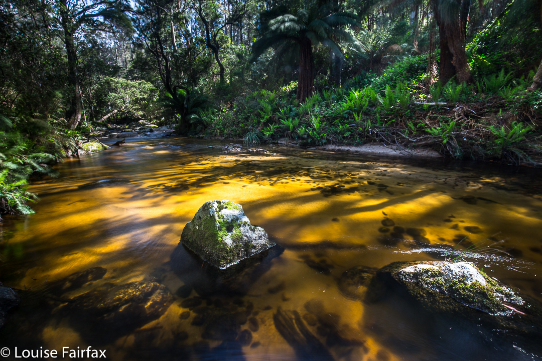
I had set this weekend aside for snow camping. I have lost count of how many times I have now tried to do this, but something always interferes, and on this occasion, I was thwarted yet again. The webcam at Cradle, which would give me the general idea for anywhere I wanted, showed a dismal, bleak, grey scene that I did not feel like being part of. We opted to make our garden more beautiful by removing weeds on Saturday and to go waterfall chasing and bagging on Sunday. Tessa, our dog, had four votes on this and was happy with the outcome.
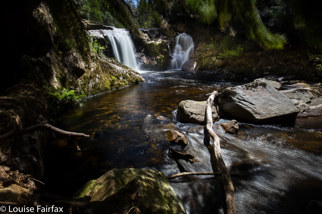
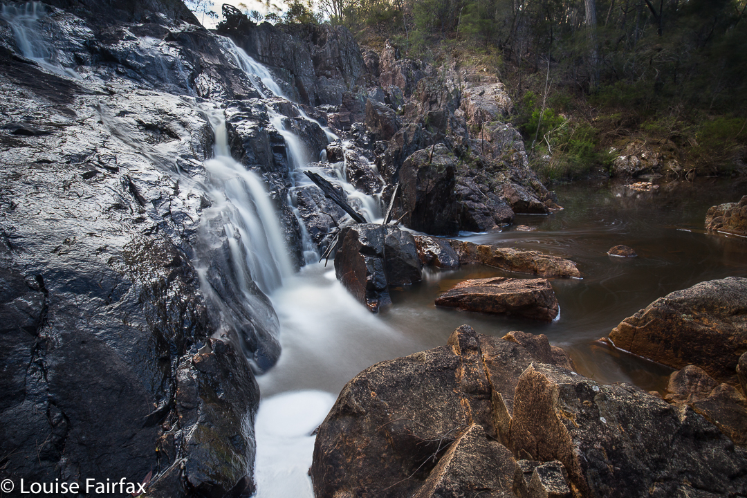
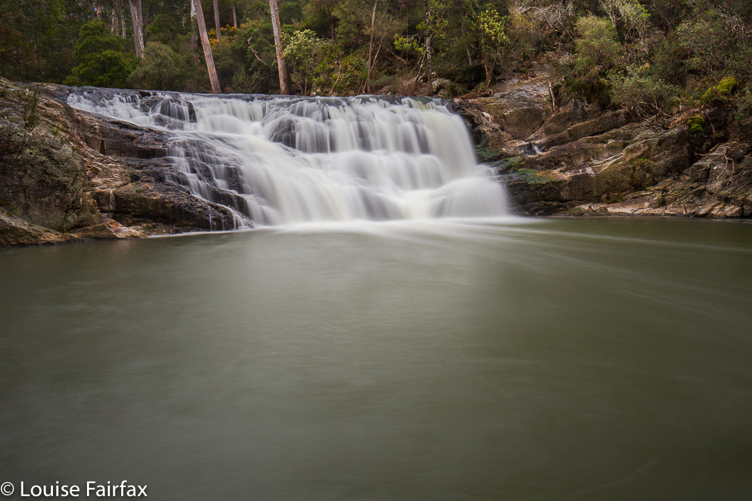
The first glimpse of Redwater Creek Falls Lower.
Tessa enthusiastically took her place in the boot of our new 4WD car, thus spreading dirt and hair in a single move and spoiling that beautiful look that we knew all along would be fugacious. Off we set.
The first glimpse of Redwater Creek Falls Lower.
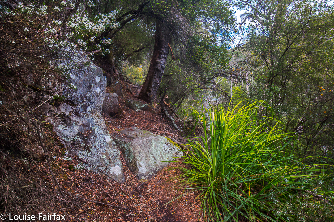
The Tasmania Trail that we followed to the falls is a 460 km long fabulous trail from Devonport (north) to Dover (south), open to equestrians, hikers, bikers but, gloriously, not cars. We decided to do less than the whole length today, but we sure enjoyed the bit that we did. Tessa says we’re allowed to do a lot more next time if we wish.
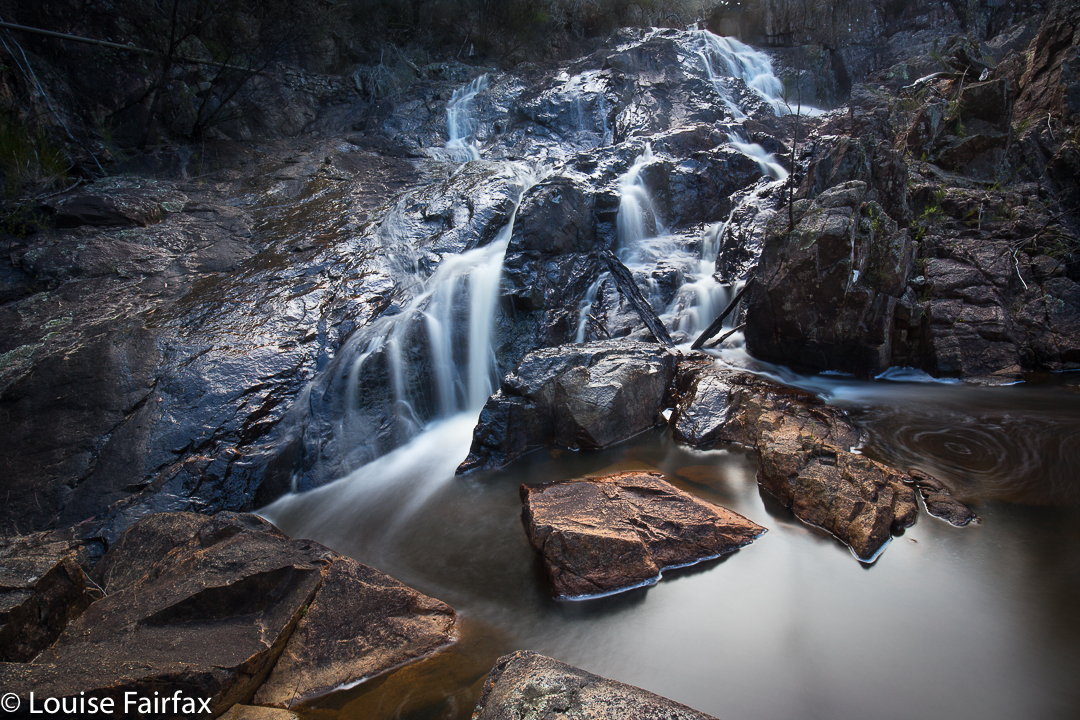
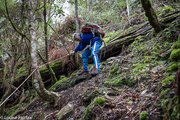
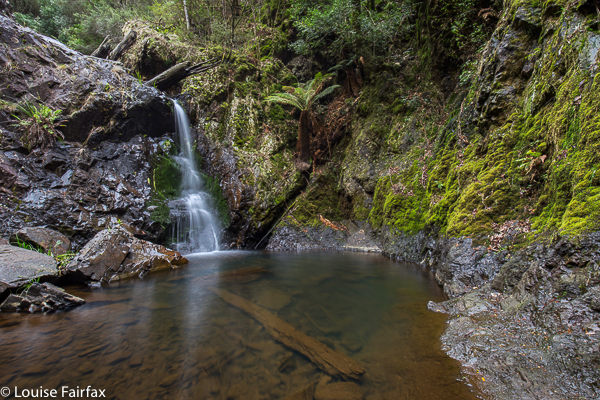
After walking and photographing here, we then drove back the way we had come until we were 3 kms from Lower Beulah, when we visited the falls below, the Dasher Falls (for directions, see further below). Bruce feared that Tessa might pull on her lead and drag the two of them down the very, very precipitous slope into the cauldron below, so I was the only one who got to see these dramatic falls. I think I saw them under pretty special conditions. They are really worth a winter visit – but not with children.
How to get there: If coming from Launceston,turn left at Elizabeth Town, just before ETC coming, and then turn right to Railton. After a couple of kilometres, there is a dirt road to right and left. On the right hand side it says it is the Tasman Rail Rd – the former site of a railway line. Turn left up this dirt track and follow it to a gate, where you’ll need to park (plenty of room for that). You then walk along the main track (ignoring alluring side options when they occur). After a kilometre or so, there is a farm-type gate with a walking gate beside. go through the walking gate and continue with a stranded electric fence to your right until, shortly before the next farm gate, you will see another walkers’ gate to your right (the electric cords go overhead). You can see the falls from there. The lower falls are a very short distance indeed from the upper (maybe 20 secs).
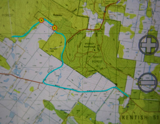
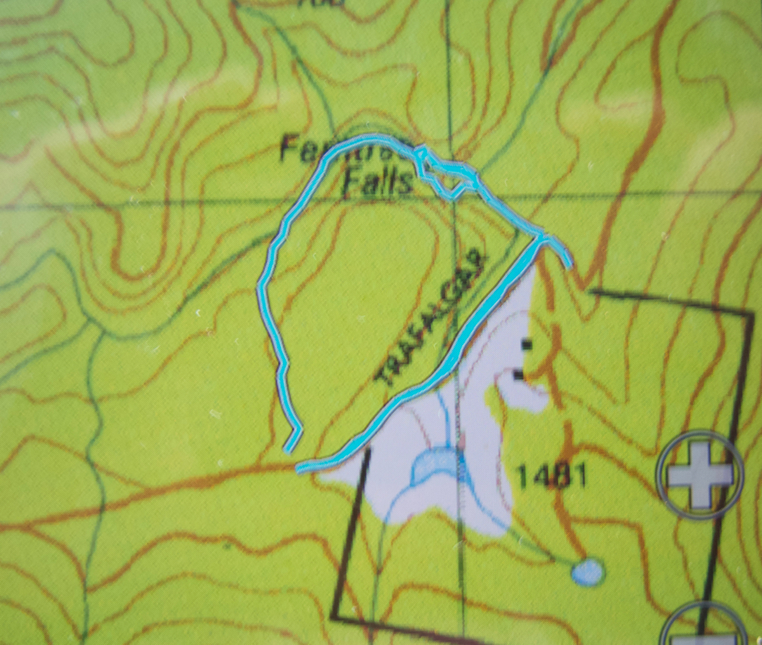
Car route and then walking route to Redwater Creek Falls. Starting on the cyan track bottom right, we are driving west in the direction of Sheffield, having set out from Elizabeth Town. When we see the sign to Railton, we head NE along that road. After nearly 2 kms, and on the first possibility, we turn left onto the Tasmanian Trail dirt track.The first waypoint is where we parked at a locked gate. The second waypoint is at the second closed gate. The line actually continues past the falls to the third gate because we just felt like walking there to see what could be seen. Curiosity didn’t kill humans or dog. As said above, the falls are down the only gate in the electric fence off to the right. You can see and hear them from that gate. Hope that helps. These falls are seasonal, so go after rain.