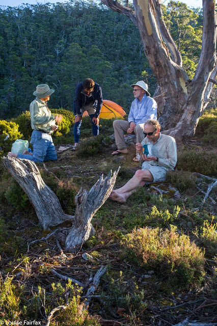
Cheyne Range High Point Mar 2016
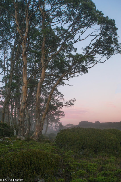
Sunsets here were beautiful
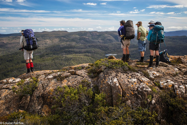 The group looks down from the Hugel ridge to our eventual destination
As I described my trip to the Cheyne Range to a friend at Pilates, I saw in her eyes that she was transported away from our concrete room to a beautiful world described by my tale of a wilderness unseen. I saw her longing to be camped by a wild lake with reflections of sunsets and morning mists, and detected joy at the notion of seeing a remote waterfall, high near the source of the famous Franklin River, set deep in a rainforested gorge: I saw my trip with different eyes. My friend’s rapture helped me not to take the joy of my journeys to the wilderness for granted. I already knew it had been a fabulous expedition before I spoke to her, but her delight in my tale of things she cannot see gave it a new dimension. This friend has a handicap that prevents her from going to places like this, although she is only in her twenties. I feel very privileged to see what I see. How lucky we are in Tasmania to still have wilderness worth describing.
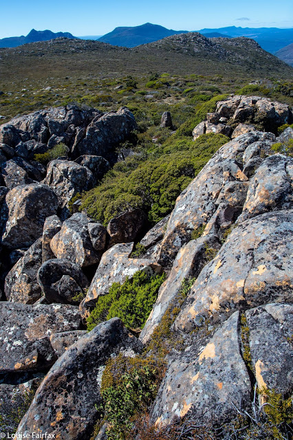
Summit view
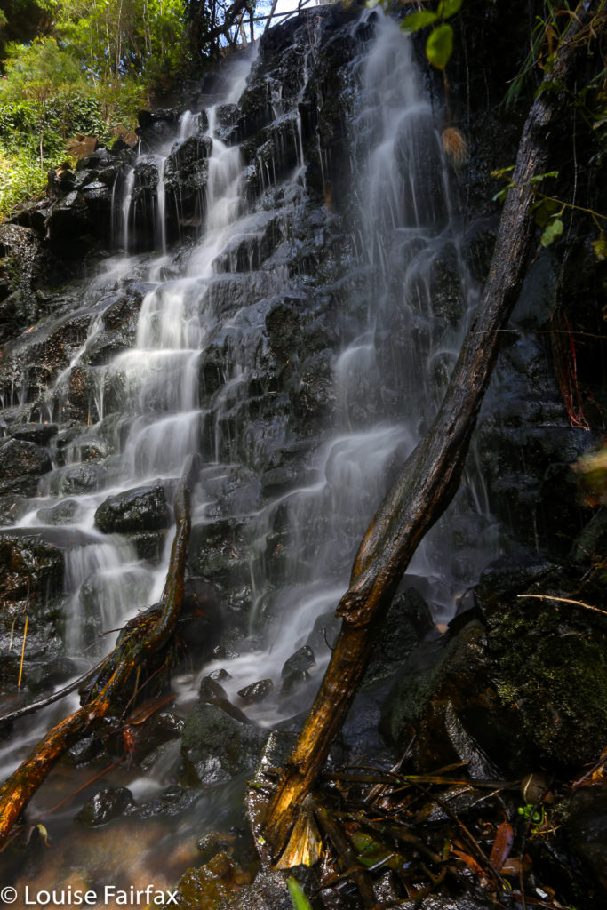
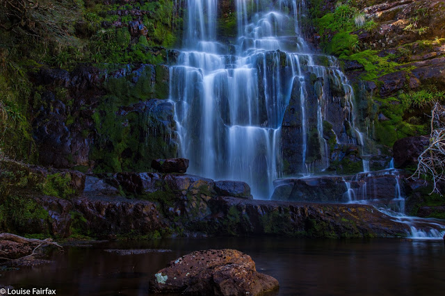 Orites Falls
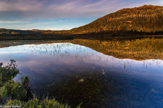
This was an expedition filled with water but, unlike last week, this was not in the form of rain. We had lunch by Shadow Lake, walked past Forgotten Lake, drank from a nameless tarn on the Hugel ridge, and camped by Lake Hermione. Hermione was the daughter of the much feted Helen of Troy. This lake is not an insult to the name. That evening, after most had swum, we dined in the warmth of the last remnants of sun, sitting on a little knoll-cum-isthmus jutting into the lake.
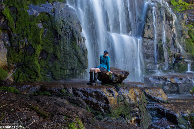 Angela, happy at Orites Falls
 The second day had more lakes and tarns than I could name – which is especially so as few of them actually had been given the courtesy of a moniker. We photographed the first, walked happily past the second to fifth, had morning tea at the sixth and waved at a few more on our way to the summit with its grand views to so many of my mountain friends. I said “hello” to them in my mind and remembered happy times on their slopes and summits. However, I was rather solemn on top, as I had just lost my phone which, as an object, is easily replaced, but it has a wealth of map data in it that is of great sentimental value, so I was morose. An emu parade and Chris Rathbone’s sharp eyes returned it to me and I was glum no more.
Sunset, second night
After lunch at “Refreshment Tarn”, we discussed dividing into two. Some chose to return straight to camp, while five of us opted to see Orites Falls, which meant parting ways at the next (nameless) tarn. For us waterfall hunters, the next hour was spent fighting scoparia, and I began to regret my decision to come. However, all scratchy things come to an end, and at last we entered a cool and beautiful rainforest and bid Richea Scratch-ouch-aria farewell.
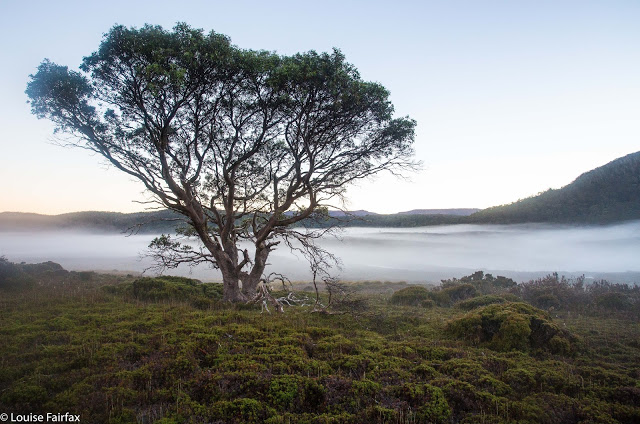
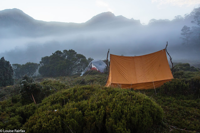
Mist, morning number three
 Now came the glorious descent of over a hundred metres straight down a slope so steep the contour lines just ran into each other. The pitch was so extreme that sliding down was the only sensible option. My chosen method was to select a tree three to five metres away as my stopping wall, slide on my bum to it, land against it feet first, recollect myself, choose the next tree and repeat. This spree was not without a dose of adrenalin, which meant I was quite exhilarated by the time my feet actually landed by the river below.
This was not any old river. It was the Franklin whose very name connotes wilderness and beauty. We had seen its source from our summit, and here we were, not much lower than that. The water was clear and beautiful; the forest lush and green. We drank from the magic waters in refreshing gulps and chatted, ate and laughed, thrilled to be there. The beauty quickly erased almost all memories of scrub above, and this was even more so as we eventually began our journey upstream to the falls, sometimes walking in the river, and at others, along the banks.
Orites Falls are a jewel sparkling in an already glorious crown. We were all shocked at how very beautiful they were, especially after some disappointing cascades earlier in the day. The remoteness from any hint of tracks, or signs warning us that nature might lead us to slip or drop trunks on our heads – the sheer improbability that another human would come that way – all helped to increase the special feeling of the place. Needless to say, there were no bits of toilet paper left by tourists of the bush, no plastic detritus that the tourists couldn’t be bothered taking out. Just nature, pure, simple, magnificent. Here was perfect escape.
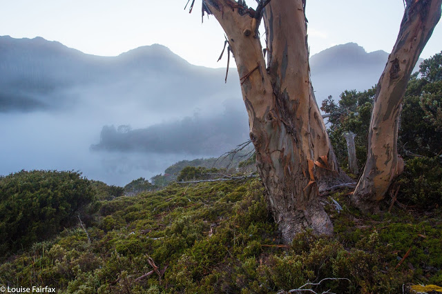
Back at camp, almost everyone except wuss here went swimming. I was starving and ate an entire packet of Kooee beef jerky, made from Cape Grim beef. I must have sweated a bit this day, as the idea of anything sweet was anathema, and I really craved something savoury like the jerky. I followed it with salty veggie broth and felt ready to join the others for dinner had on our knoll. Next morning the valley farewelled us with a treat of a sunrise – very little colour, but subtle hues and a mist to die for. I love this place.
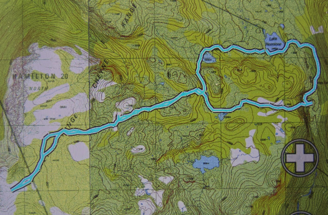
Route Day 2. That odd blip to the SE is just an aberration, probably caused by the dense rainforest confusing signals. You can see exactly where I lost my phone (gps), in the SW corner. The summit is about 70 ms from the spot, yet the phone took over half an hour to find (after summitting). Pity about flight mode :-(. It was generally agreed that if doing it again, we would do that southern section of the loop higher (i.e., a bit further to the south) to avoid the scrub.
Chris’s excellent route out on day 3.

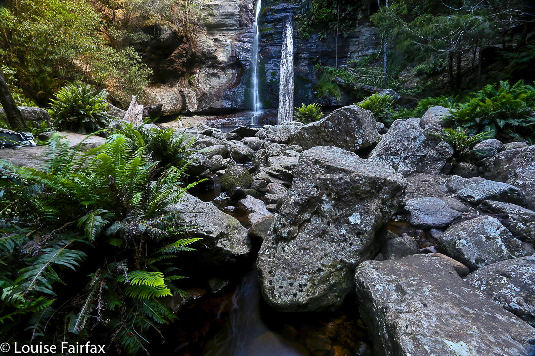
 The beautiful path to the falls